Another hiking day! The weather was, as usual, looking uncertain, but in the mountains, that could mean misery or an absolutely beautiful day. If we waited for everything to look perfect, we’d never go anywhere. So, we packed lots of snacks and clothes for any possibility, and off we went.
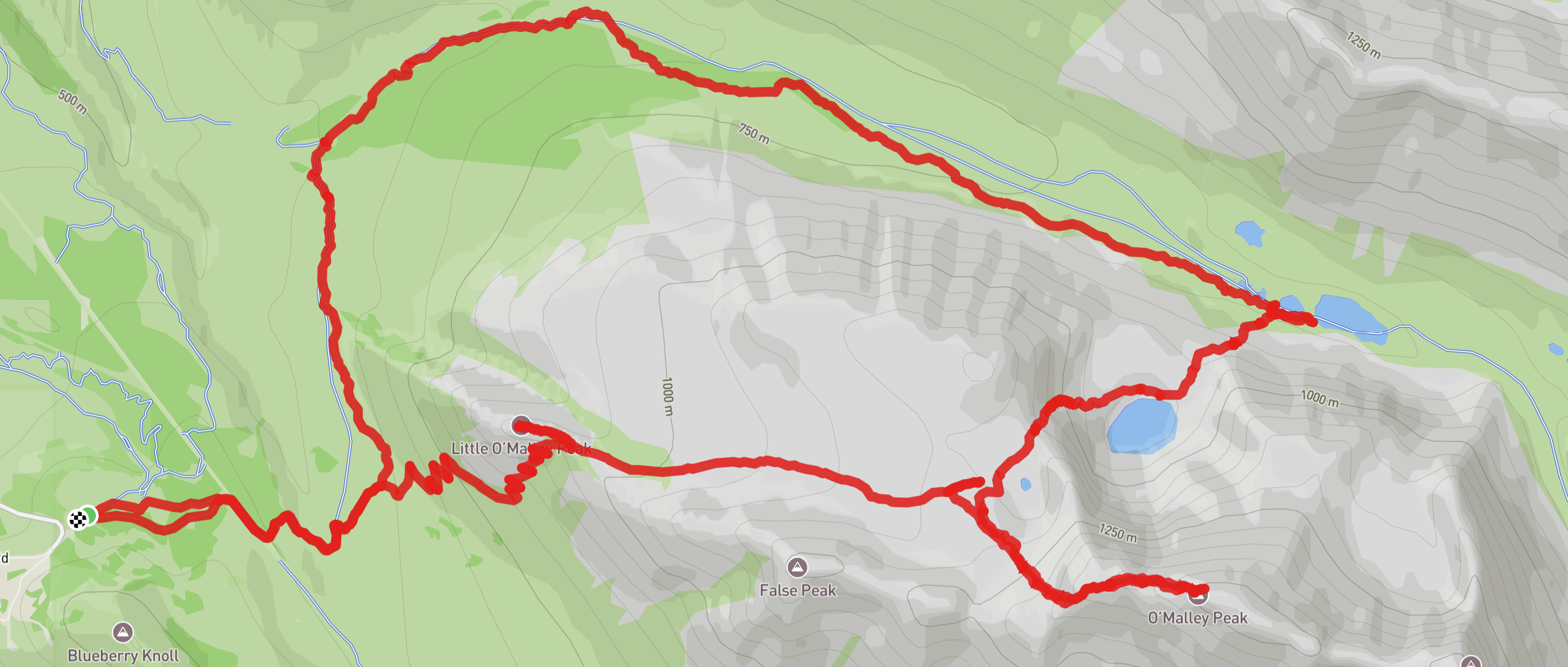
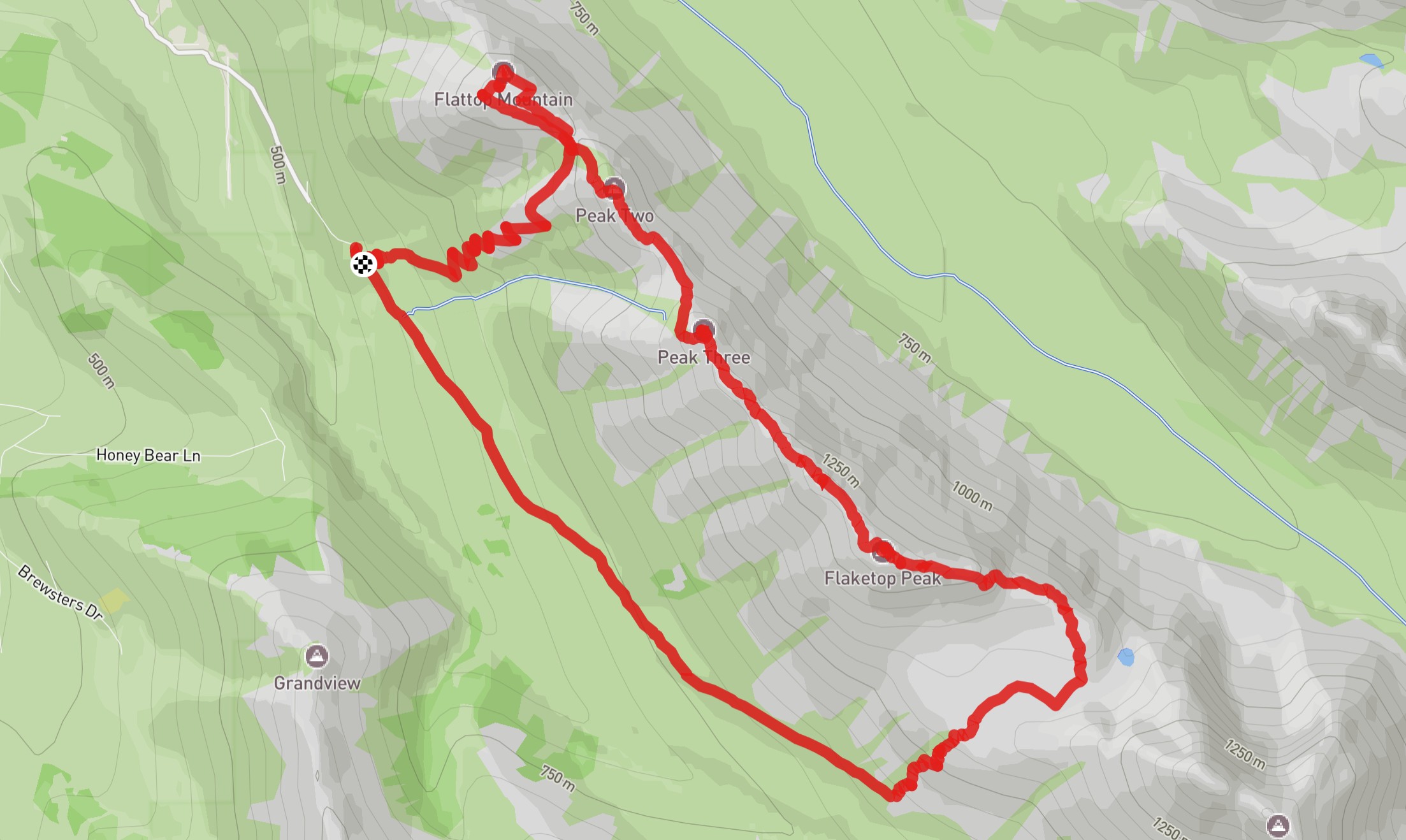
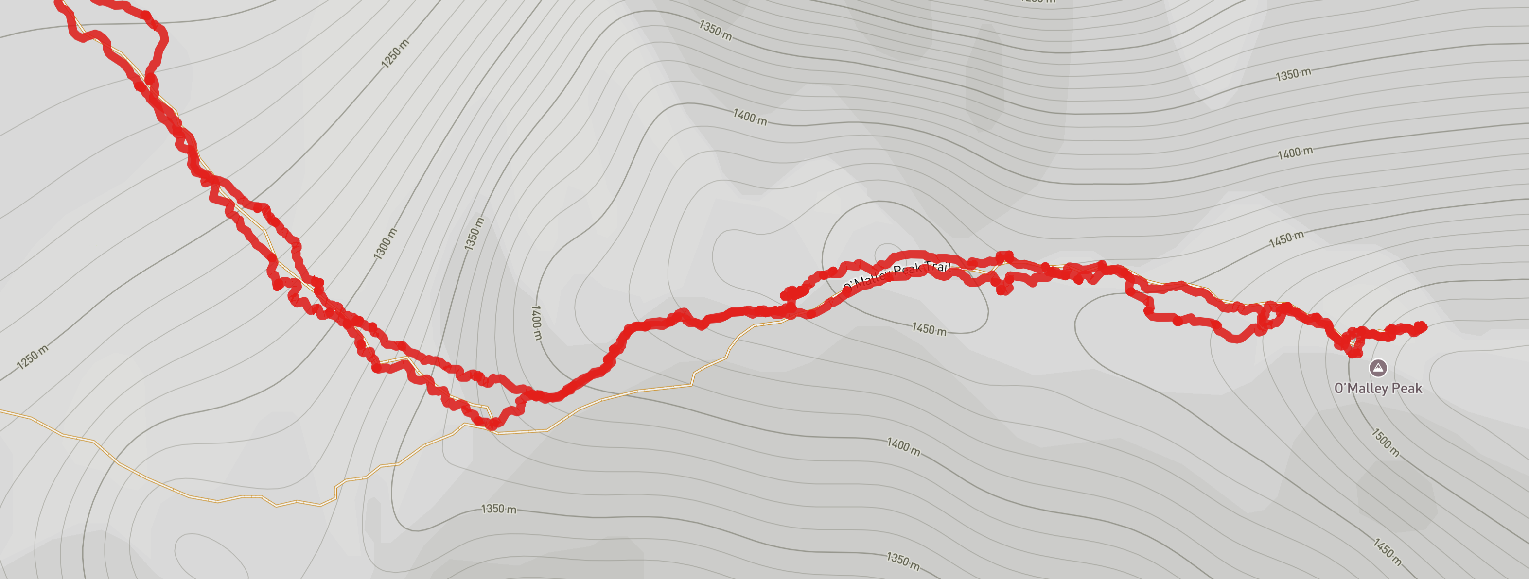
Our planned hike had a few possible variations built in. We were headed back to Chugach State Park, just one ridge over from where we were for Flattop and Flaketop. This ridge started with Little O’Malley, another peak Olivia had hiked a million times, but after that, we hoped to continue on to Big O’Malley (actually just called O’Malley). After O’Malley, we could turn around or, better yet, continue on past a couple of lakes and turn our hike into a loop, rather than an out-and-back (always more interesting). Later, there was one more opportunity for an add-on, an out-and-back trail off the loop that led to more lake views. We definitely couldn’t do that entire trail, but we figured we’d wait to decide how far to go once we were there and had a better sense of the weather and the timing. We expected the whole thing to be around maybe 12-15 miles (19-24 km), depending on some of those decisions.
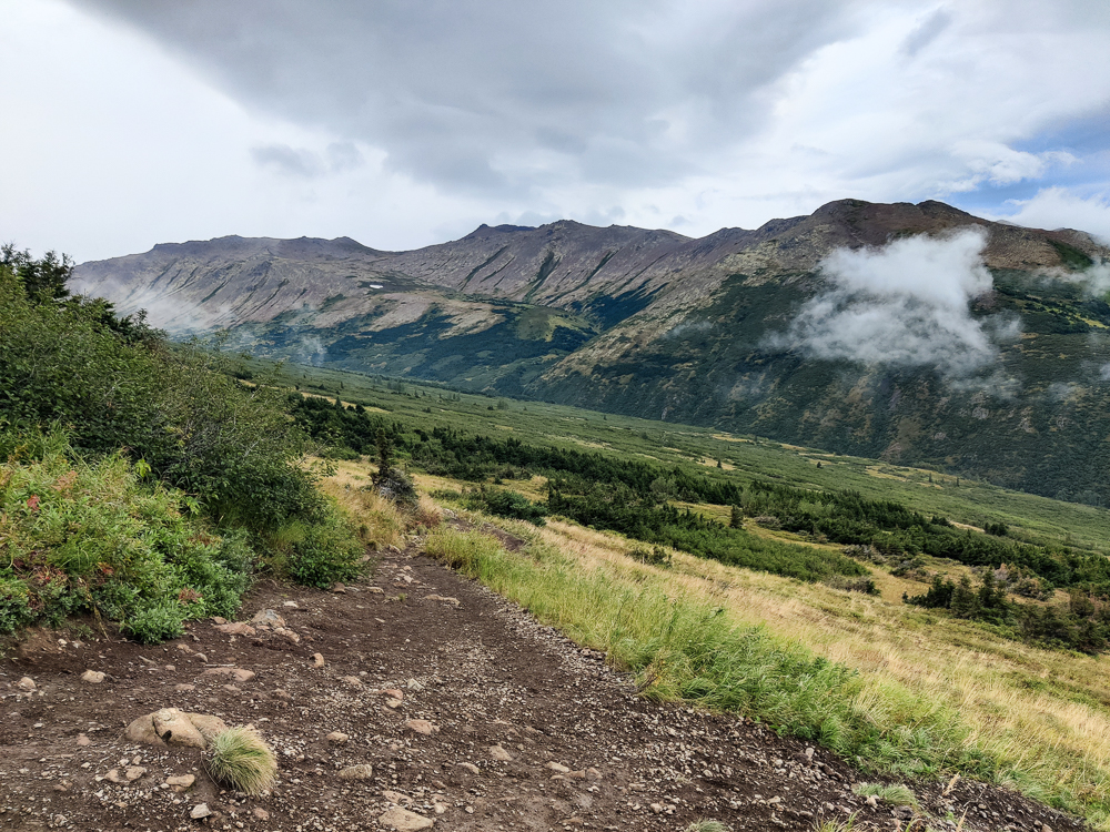
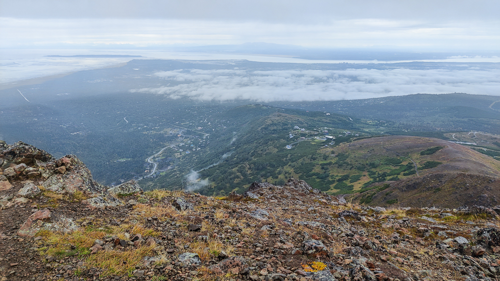
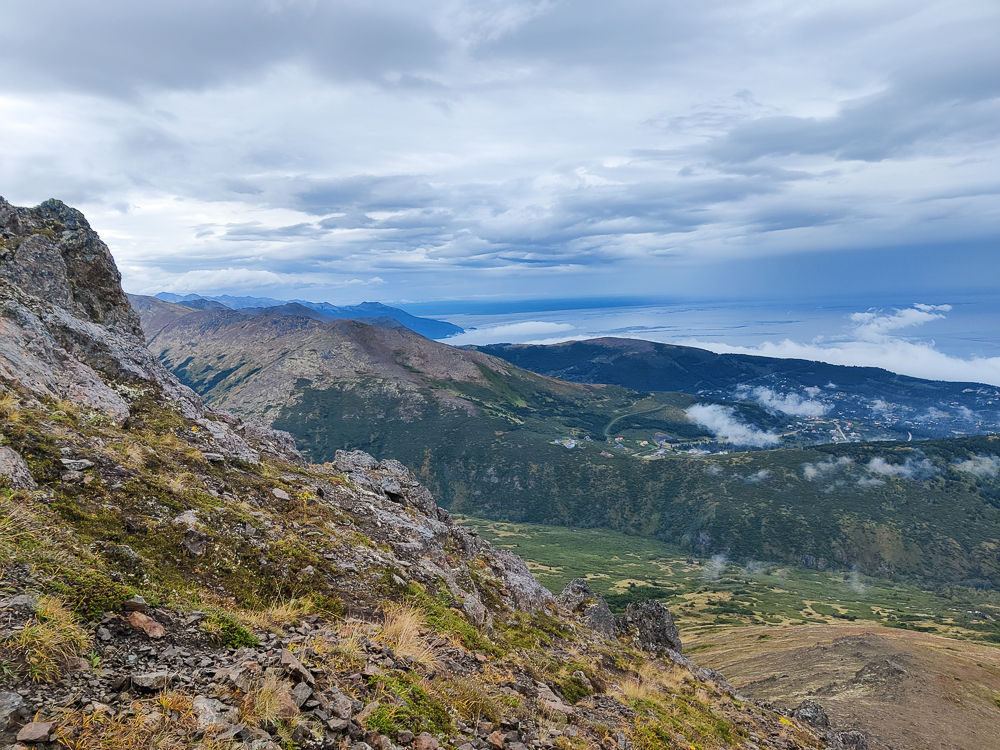
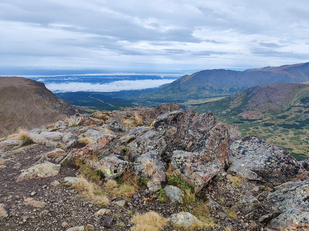
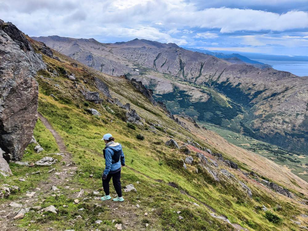
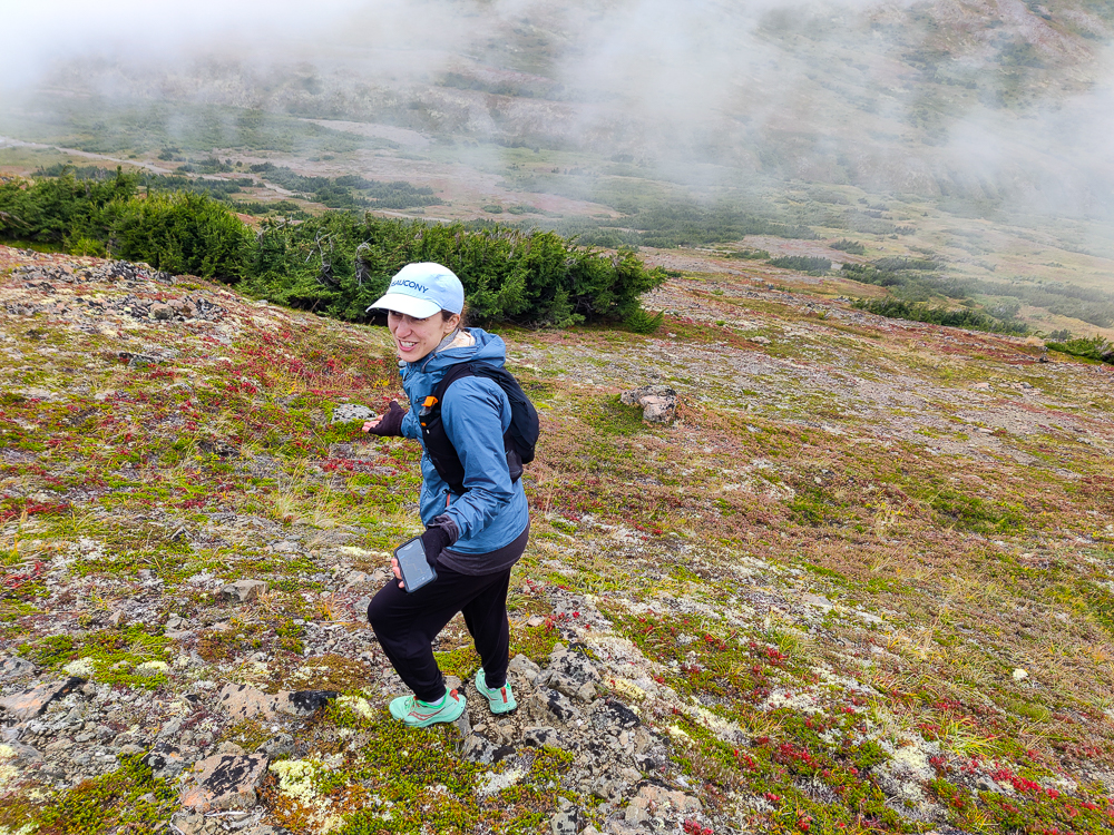
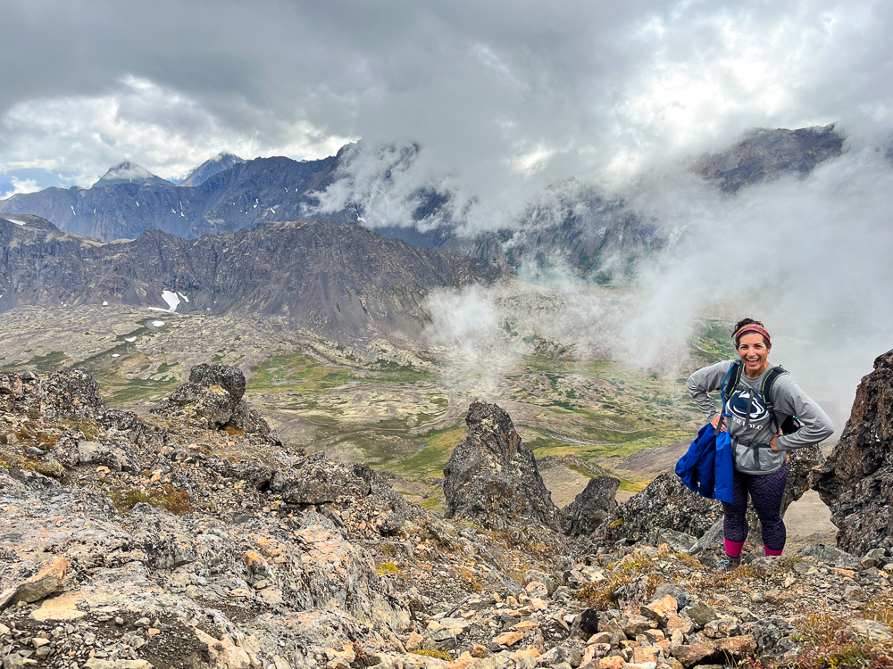
The hike up to Little O’Malley wasn’t bad at all. There was definitely some good elevation gain, but there were nice switchbacks that made it reasonably gradual which was nice. The view from there was… obscured. There was a lot of fog/cloud cover surrounding us. Thankfully, it was moving fast so we did see SOMETHING, but it was moving fast, so you had to keep your eyes peeled and be ready.
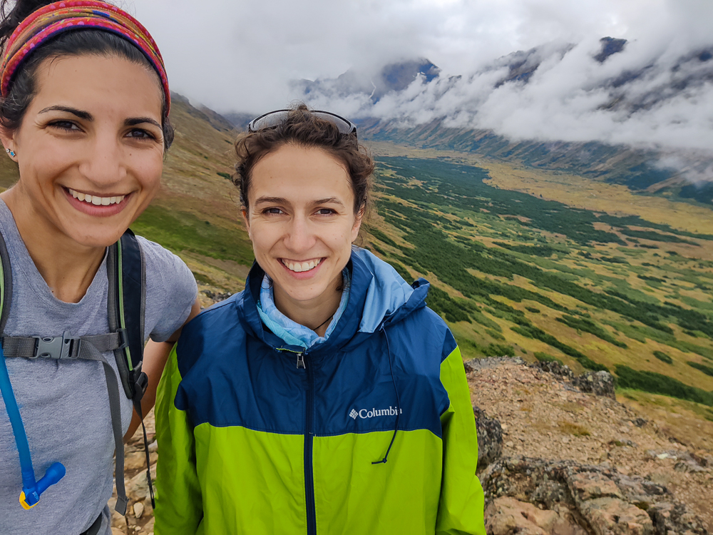
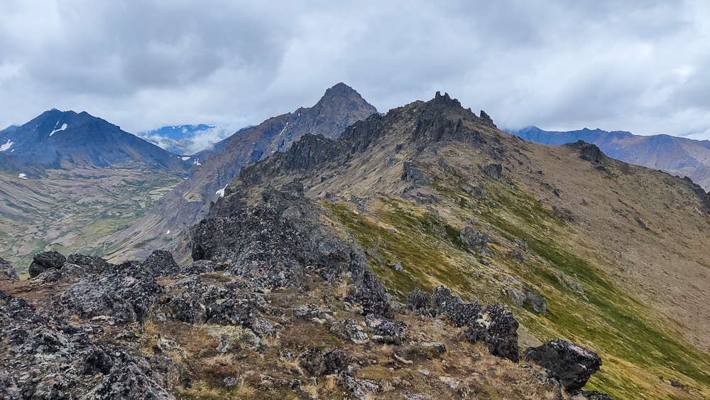
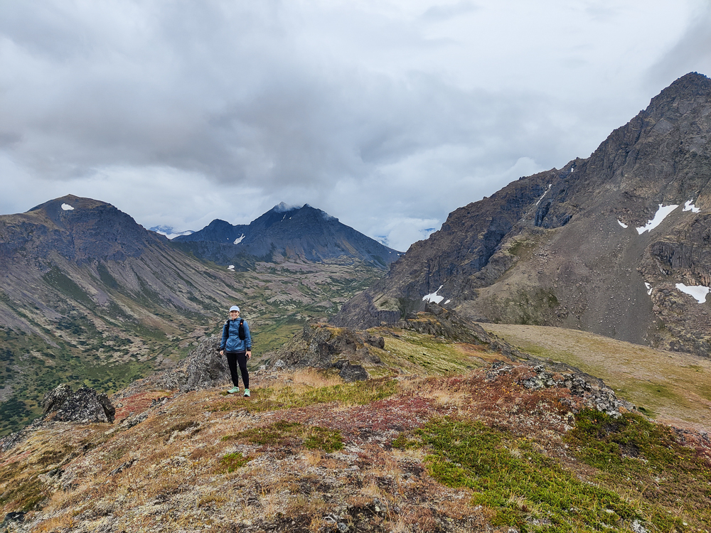
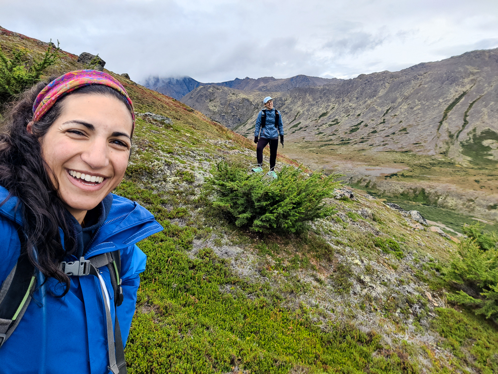
From there, we continued on to O’Malley. Just like with Flattop and Flaketop, once we got past the first peak, we saw very few other people. There were maybe 5 human sightings over the rest of the hike. It felt like we had the place to ourselves. Crazy!
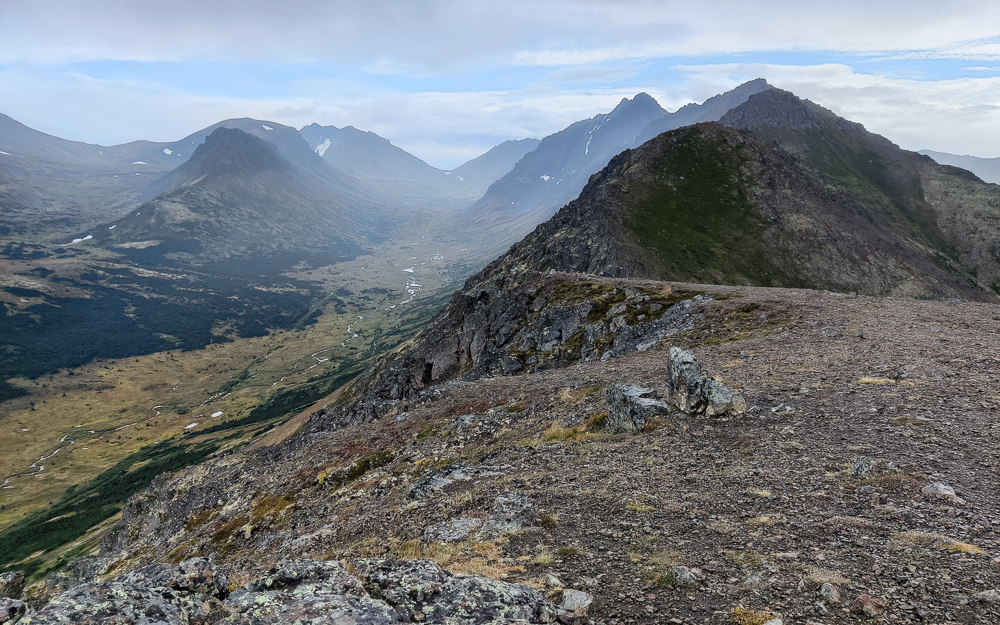
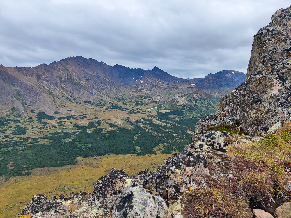
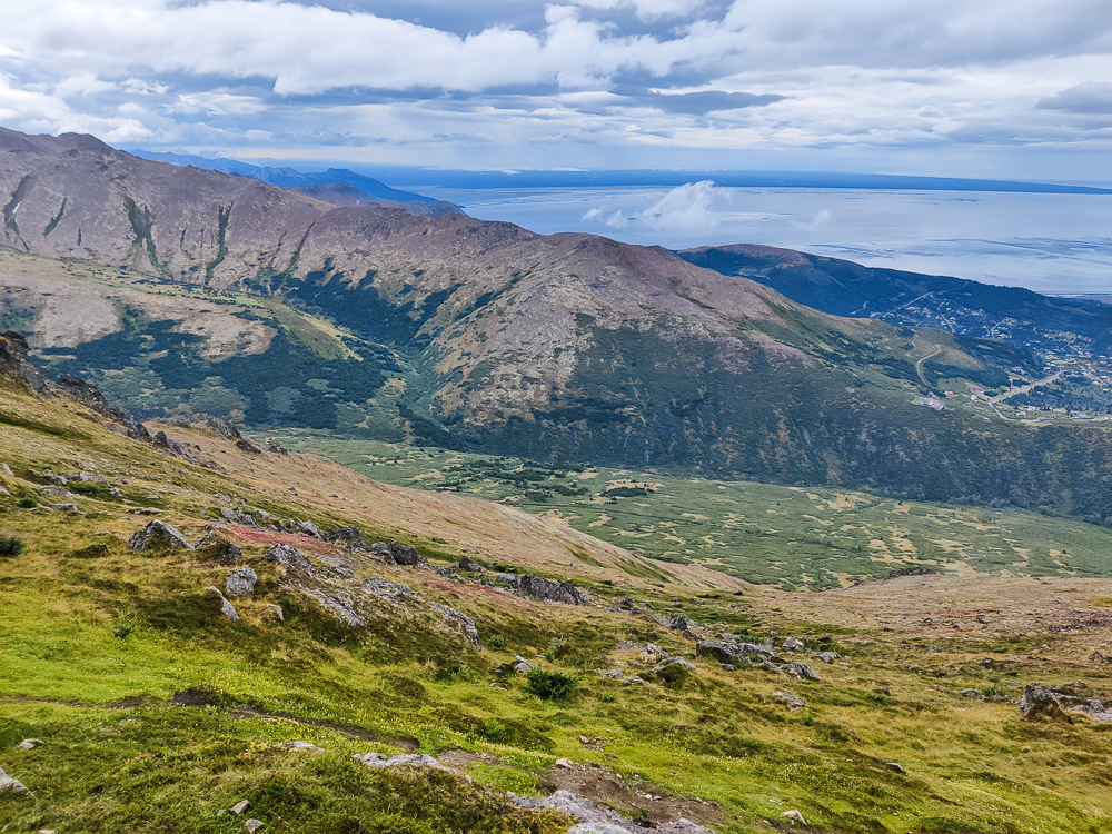
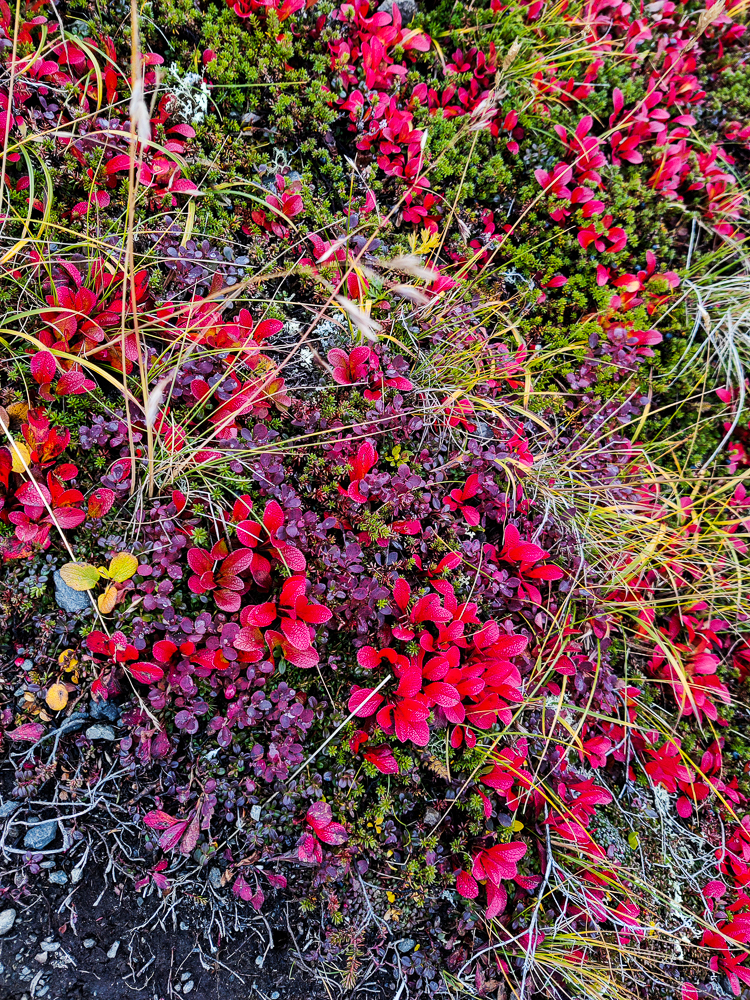
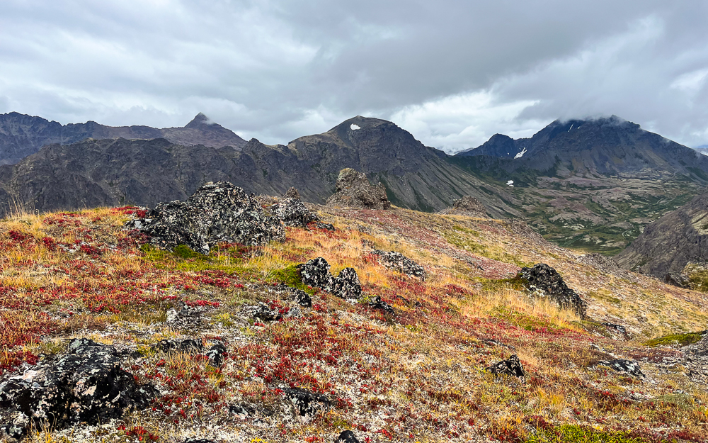
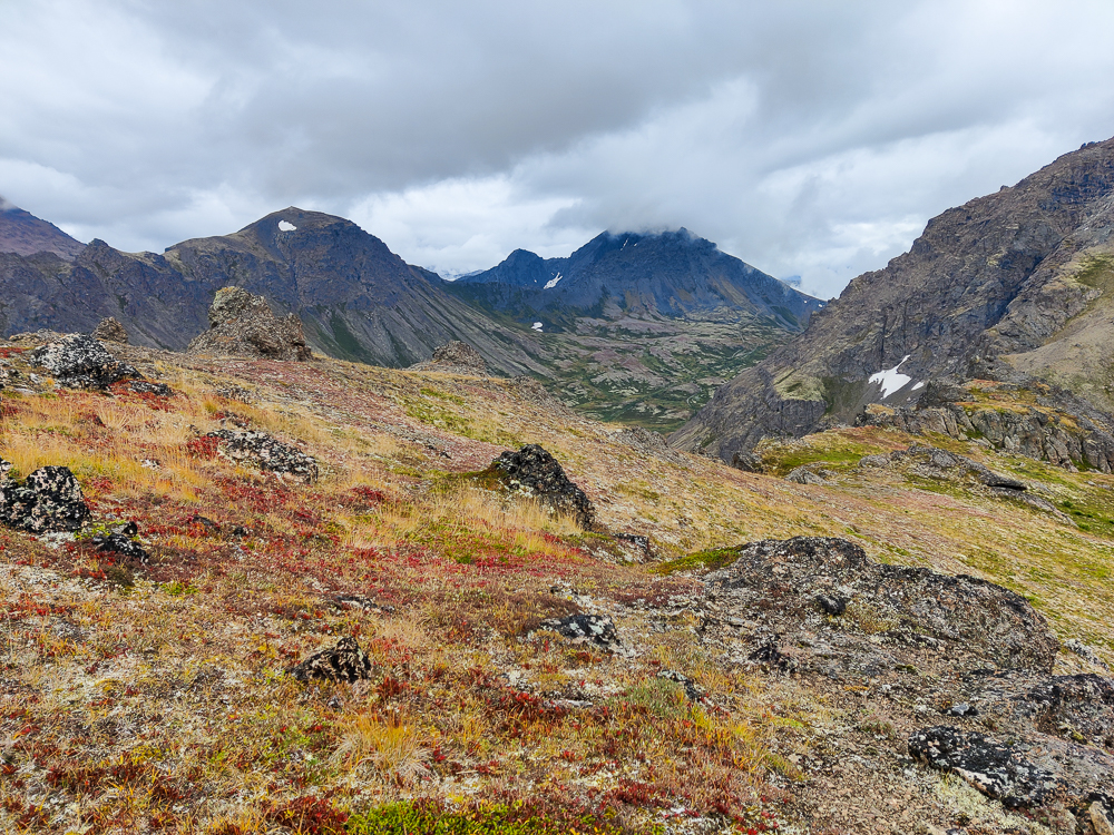
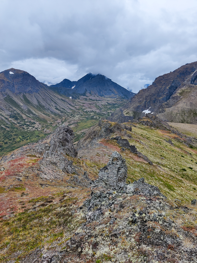
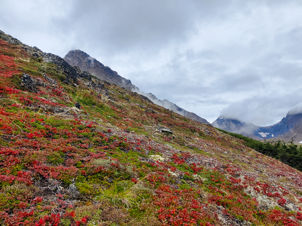
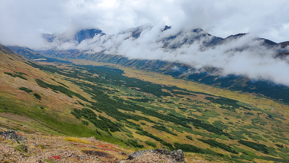
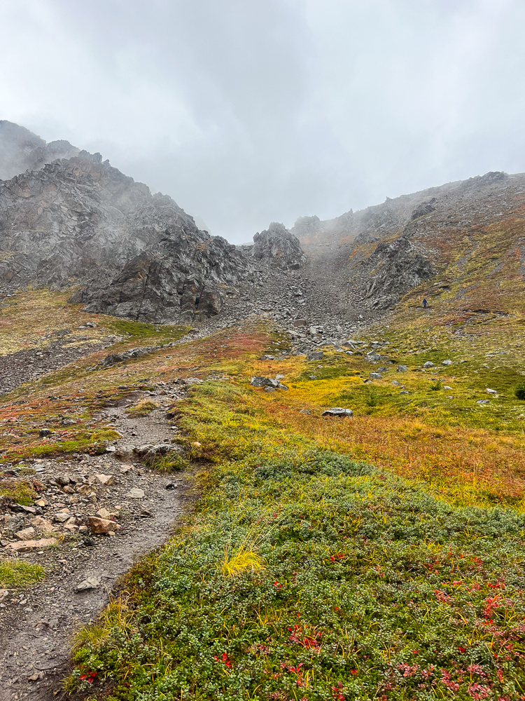
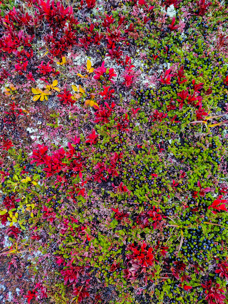
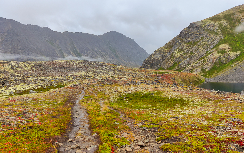
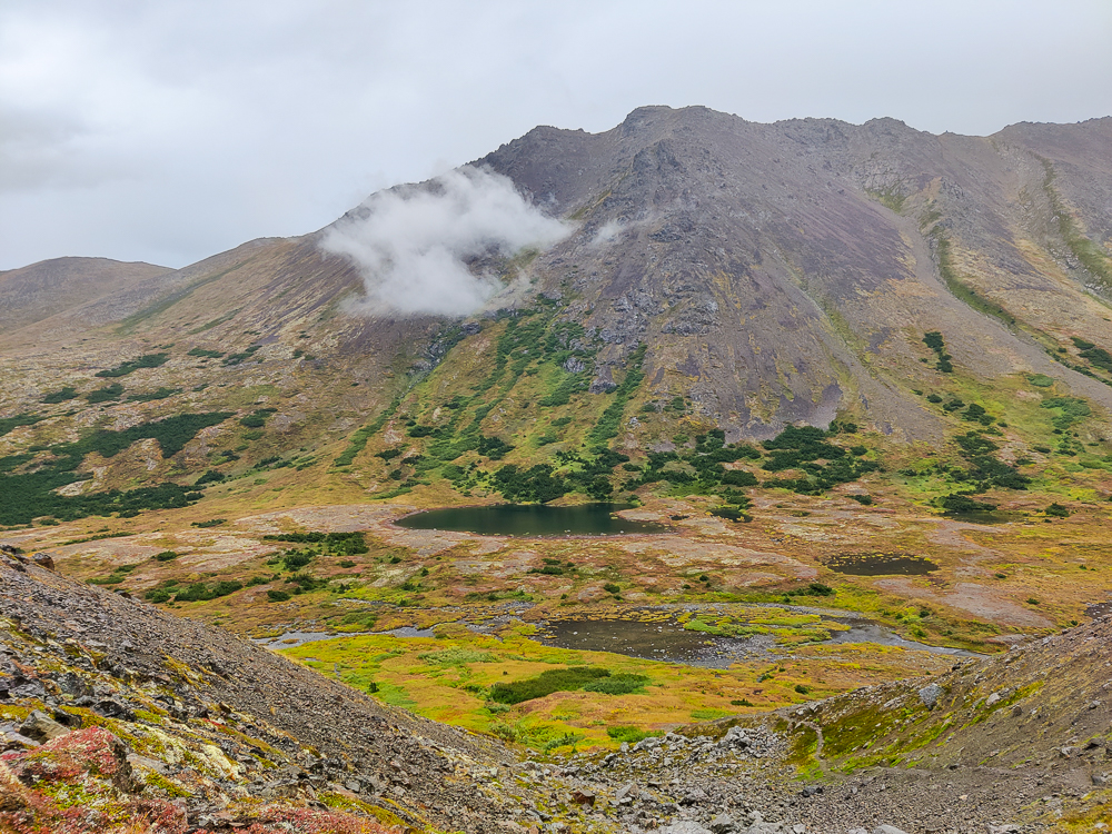
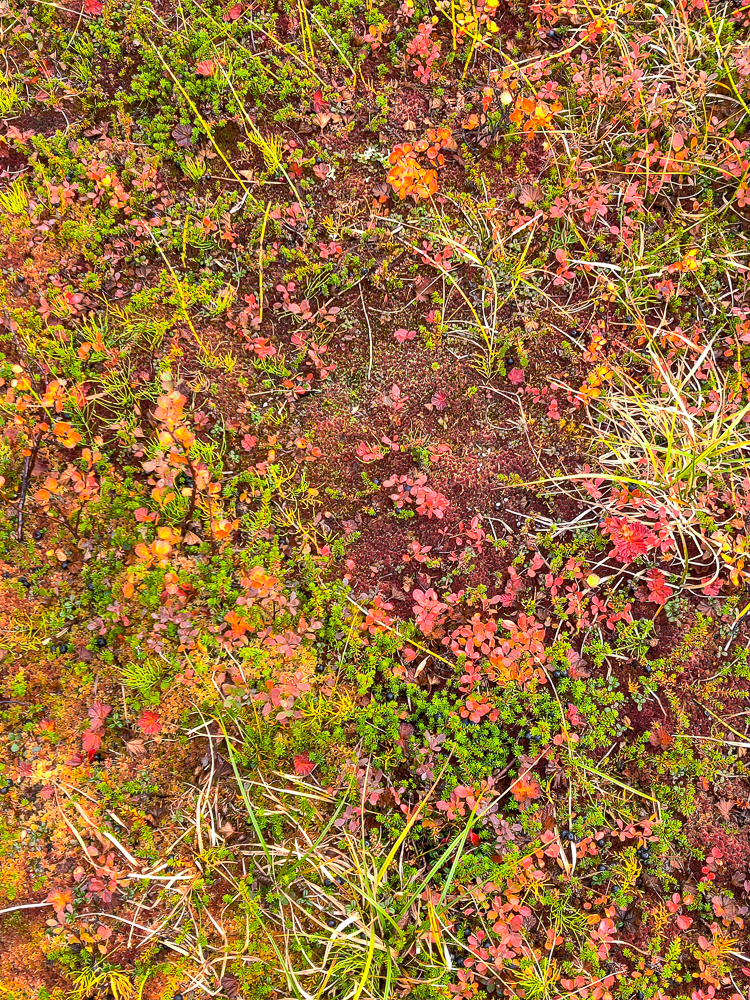
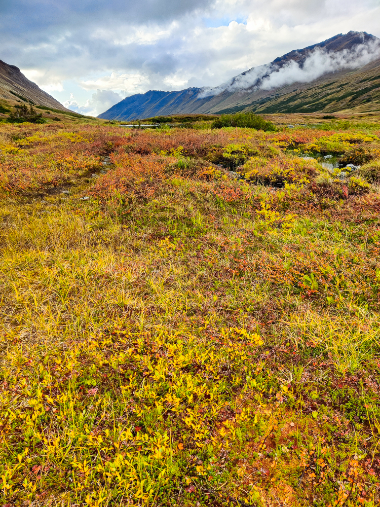
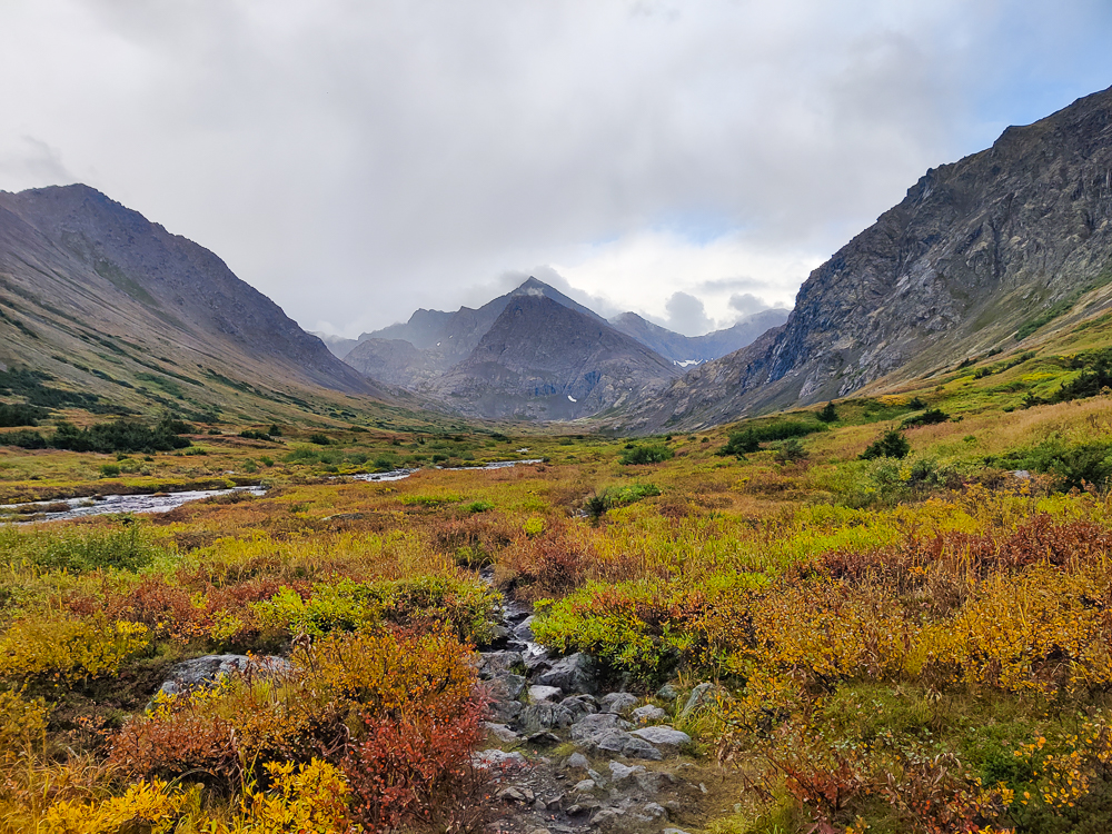
This was also where things got much more challenging. Well, not getting from Little to regular O’Malley. That was pretty flat, and it was very beautiful because of the colors of the valley and the dramatic mountains surrounding us (on the rare occasion when you could actually see them through the clouds… ha).
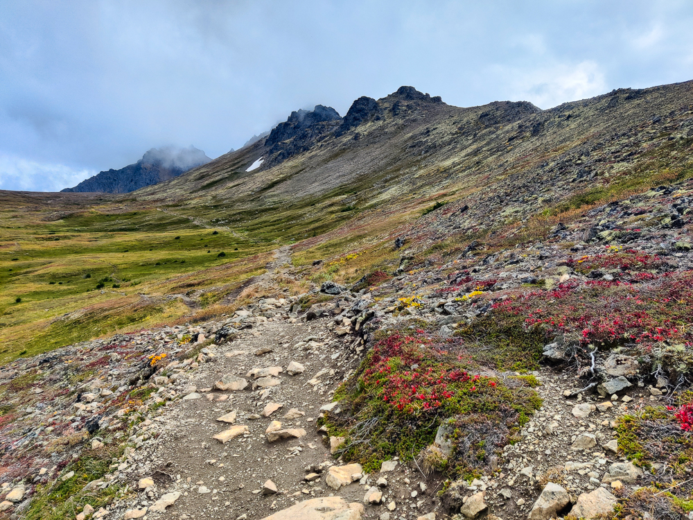
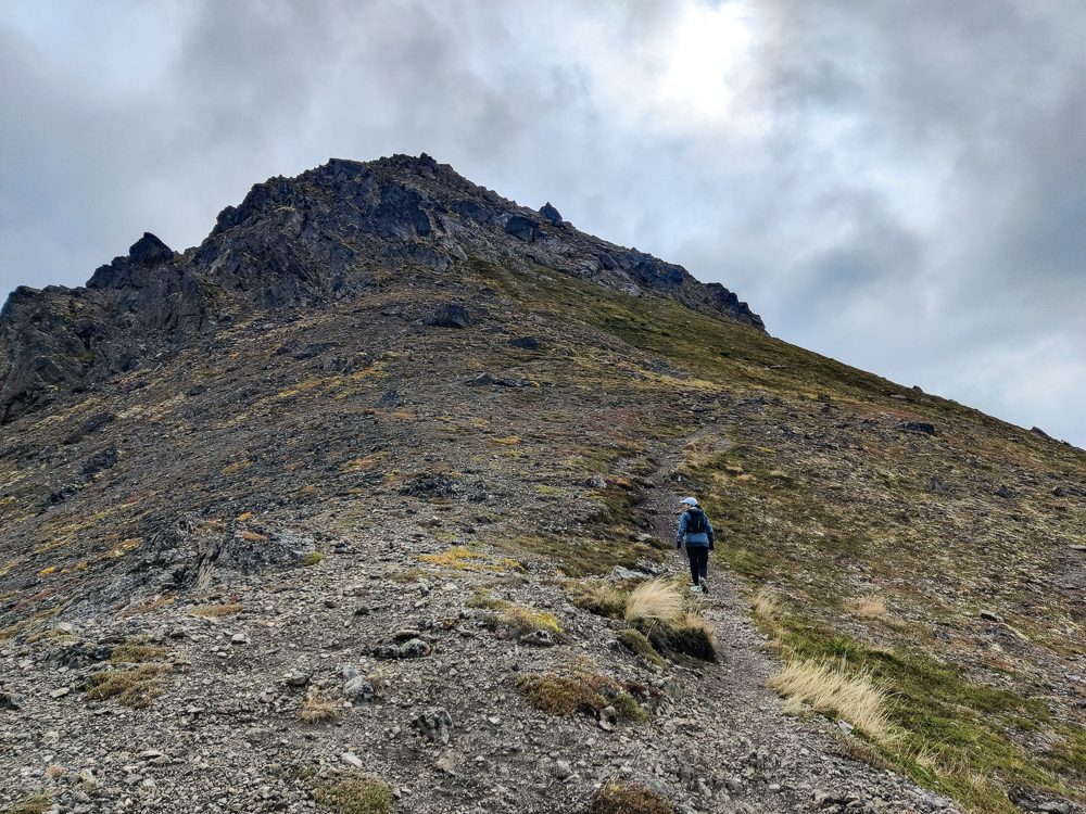
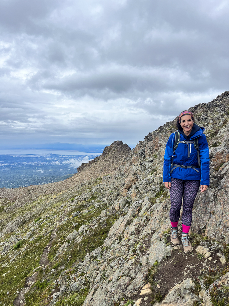
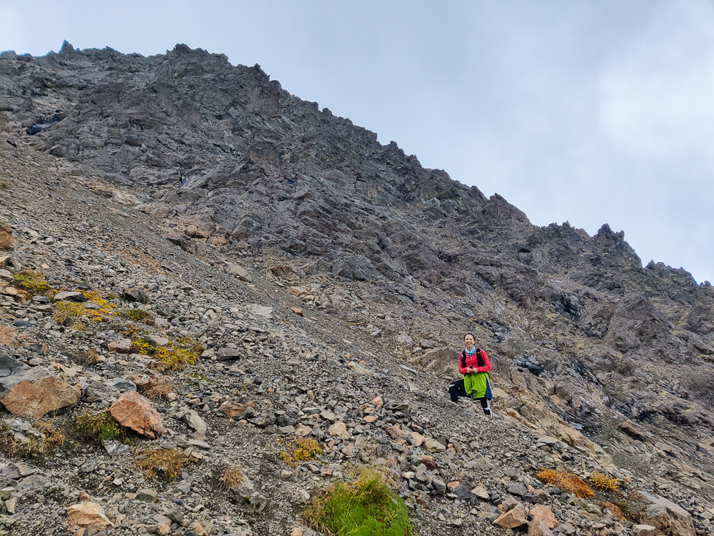
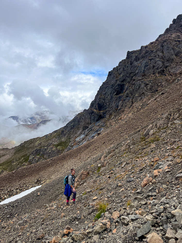
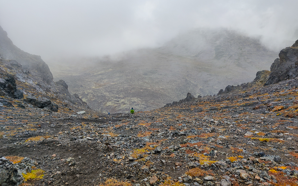
When we got to O’Malley, we knew it was going to be a different story. No more easy, flat ground. Our upward trek started out with what felt like an endless scree field. That’s where it’s all shifting and sliding little rocks, and you have to either not care about slipping or take extra time to be sure of your footing. I’m definitely a “take extra time” person. It takes me forever to go up those things because I’m checking and double checking my footing on every step before I commit. I hate the feeling of sliding. There wasn’t a particularly defined path for the up, so Olivia and I each decided for ourselves what seemed least terrible and ended up taking completely different routes.
This was the worst part of the whole hike, but thankfully, despite the slow going, I still felt good, both physically and mentally. There was never a point where I wasn’t sure I would make it. I knew I would be fine; I was just moving slowly. I also didn’t worry about Olivia. I knew she could handle herself, and we’d meet up at the top.
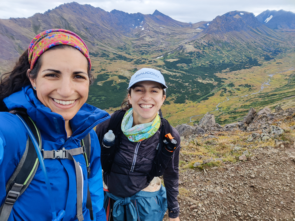
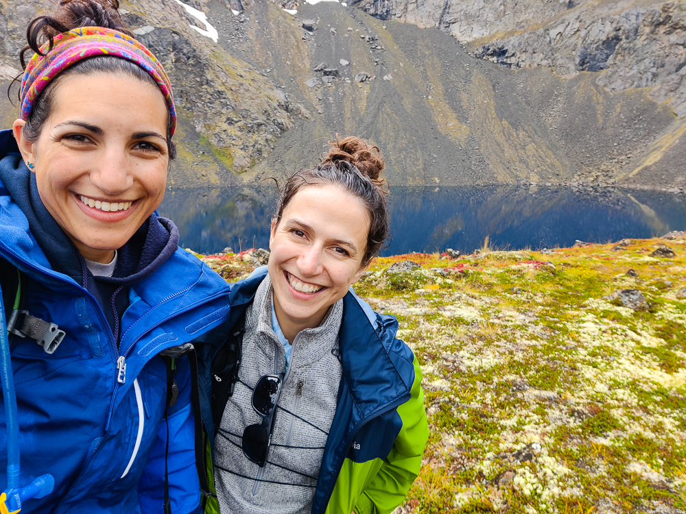
As we wait for slowpoke Lara to crest the scree field, I’d like to pause for a moment of Olivia appreciation. There are MANY things I appreciate about Olivia. She’s fun and interesting and thoughtful. When we met in Armenia, I knew immediately that I wanted to be her friend. I thought she was the coolest (still do). We’d never hiked together before this trip, but I had a good feeling about it. Turns out, we make great hiking buddies because 1. We will never run out of things to talk about, 2. We’re on a similar level, fitness-wise, and have a good sense of our capabilities, 3. We love adventures, 4. We’re up for a challenge, and 5. We’re determined.
I feel pretty confident that if I’m up for something, Olivia will be too. My adventurous side feeds off of that… knowing that she’ll likely say yes makes me push myself a little more (and it’s probably the same for her). It’s not like I would do something I didn’t want to do, but having her as backup lets me say yes to things that my voice of reason would talk me out of I was alone. Like this – doing an unfamiliar, challenging hike with basically no cell service and no other people around. Everyone evaluates these things differently, but for me, doing such a hike solo would have felt like a silly risk. Would I probably be fine? Sure. But there are too many things that can go wrong, and an extra person increases the chance that at least one of you will be able to get help if needed.
Anyway. In conclusion, Olivia is the best. Okay, slowpoke Lara has to be getting close by now…
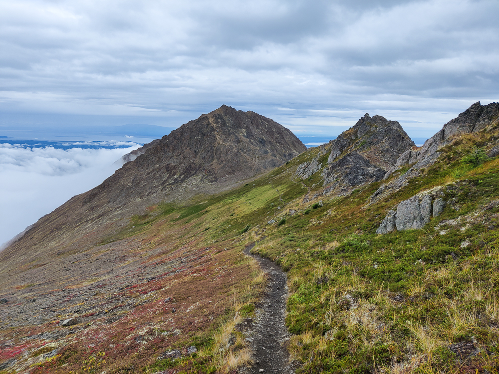
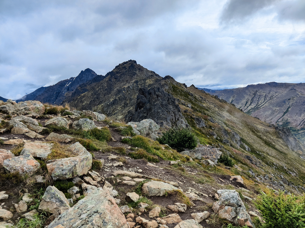
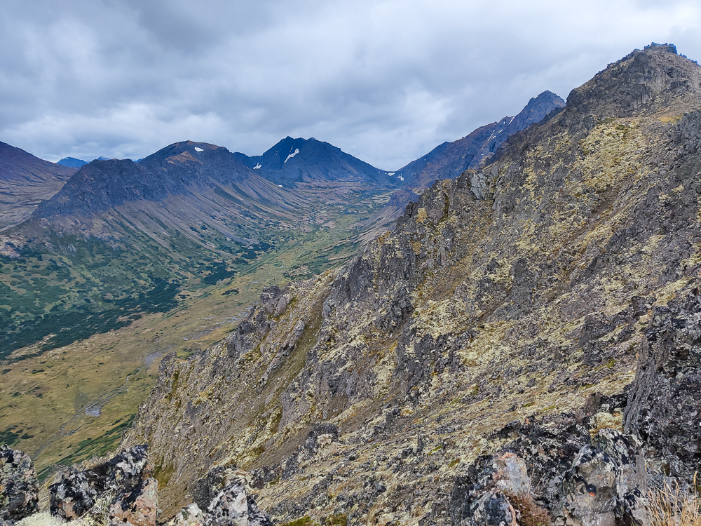
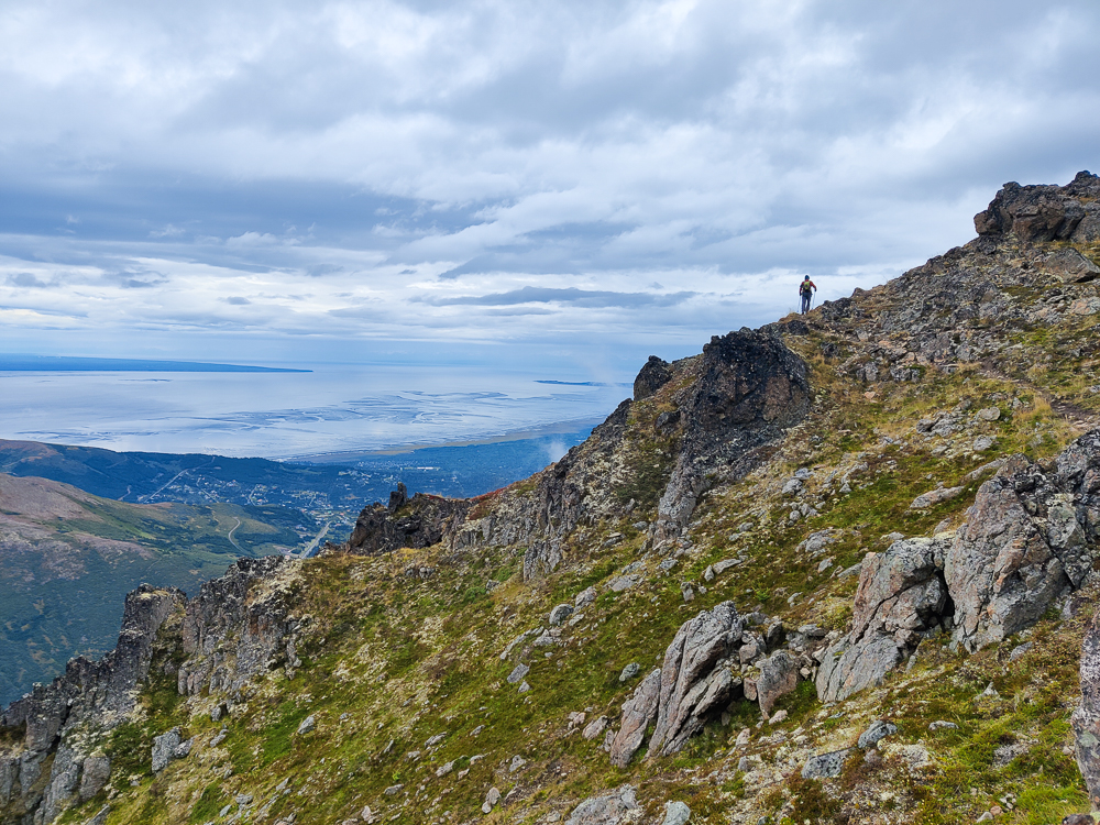
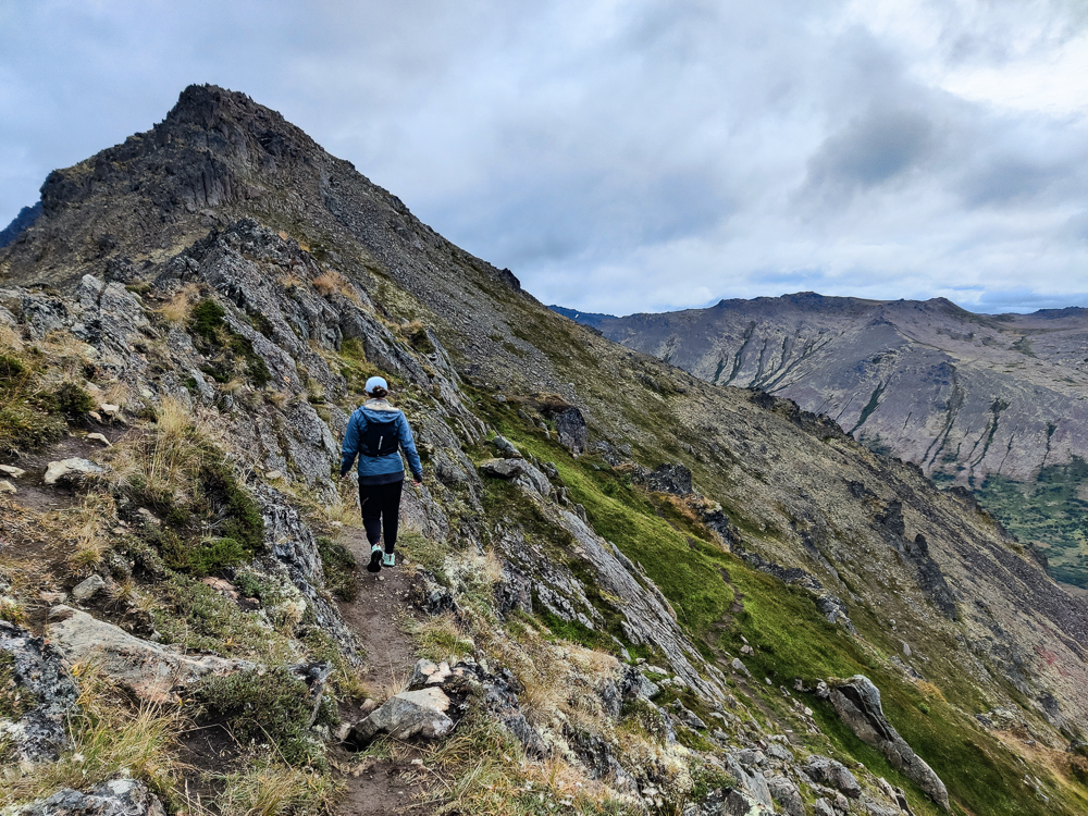
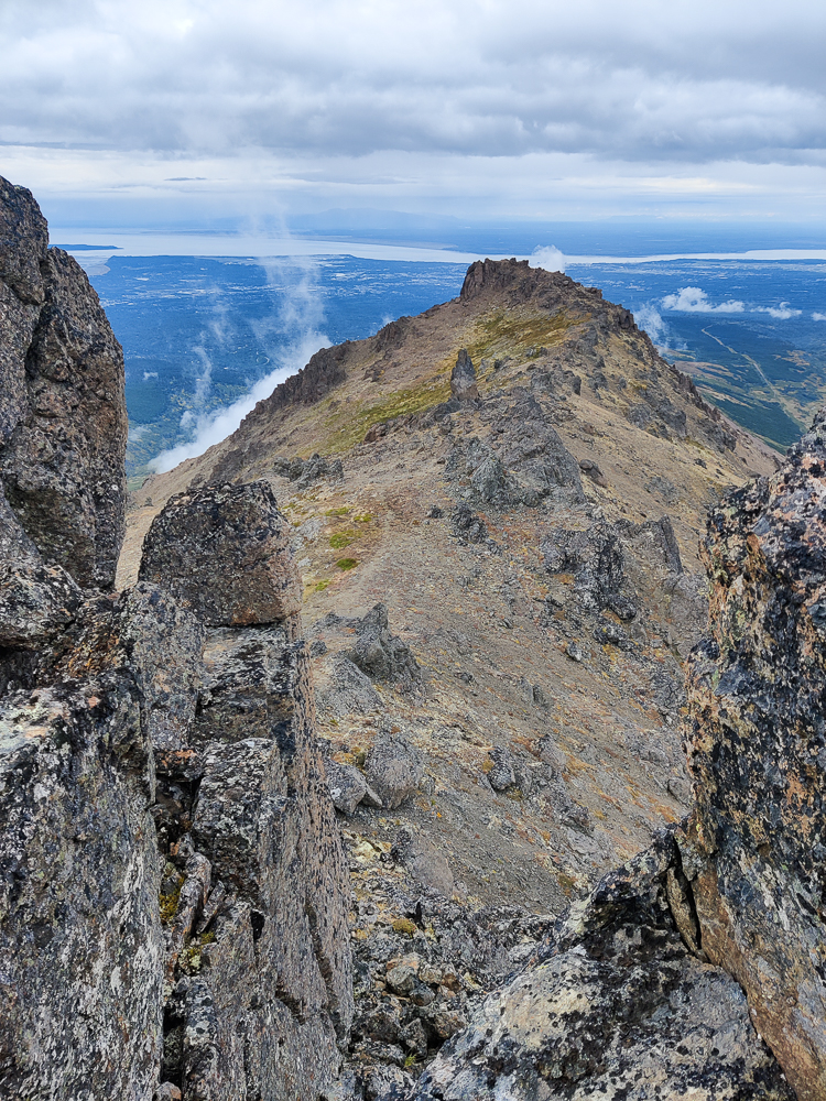
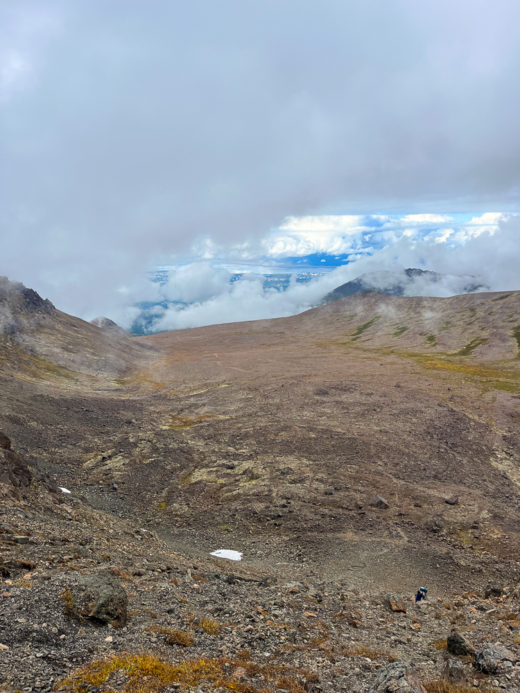
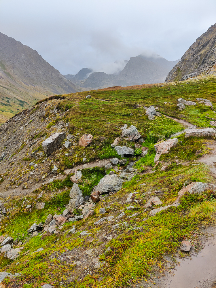
Once I finally tortoised my way to the top of the scree, Olivia and I reunited and continued our trek. From there, we still had about another half mile to the peak with 800 feet of elevation gain, but after what we’d just done, it felt easy. The path was hard to track, but having learned our lesson from the last hike, we were much more diligent with checking the map whenever it seemed like we were getting off course. There were also MANY false peaks. These are high points that look like they’re the summit, but they aren’t. Usually, you get there and then see that the true summit is still ahead. As you might imagine, that can be discouraging. We called them deception peaks because it made us laugh and was also more fun to say when we were yelling at them. Luckily, since we were looking at our maps, we were undeceived. (In case you’re wondering what one yells at a deception peak, it’s just things like, “NICE TRY, deception peak! I’M ON TO YOU!” Um. Anyway. Just trust me when I say it feels therapeutic in the moment.)
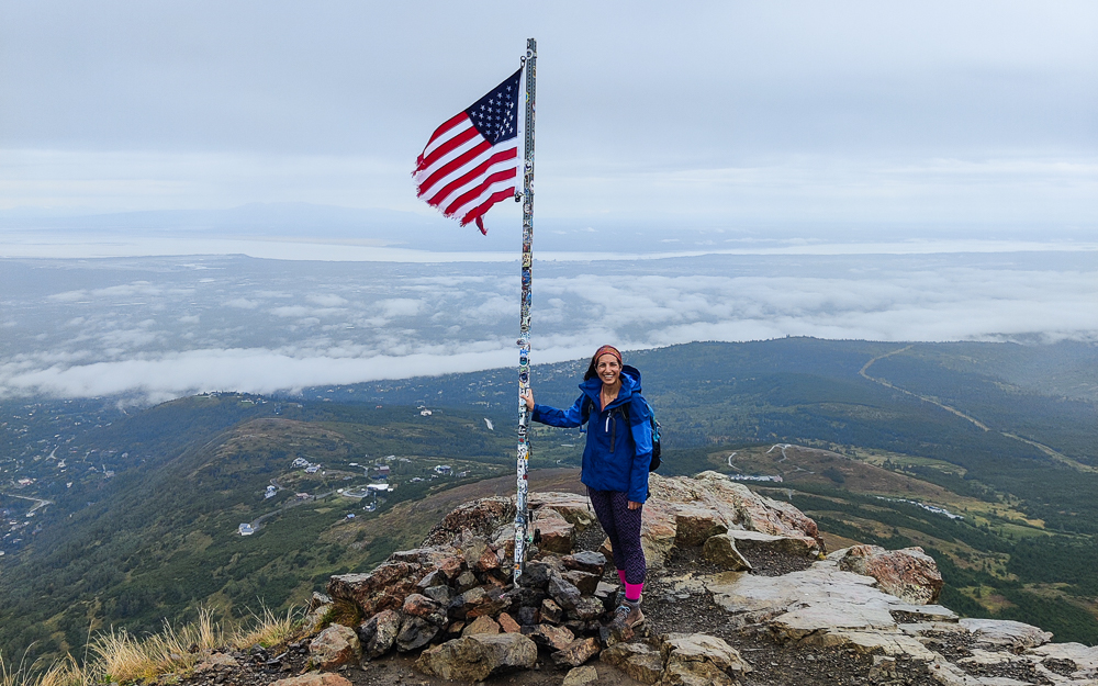
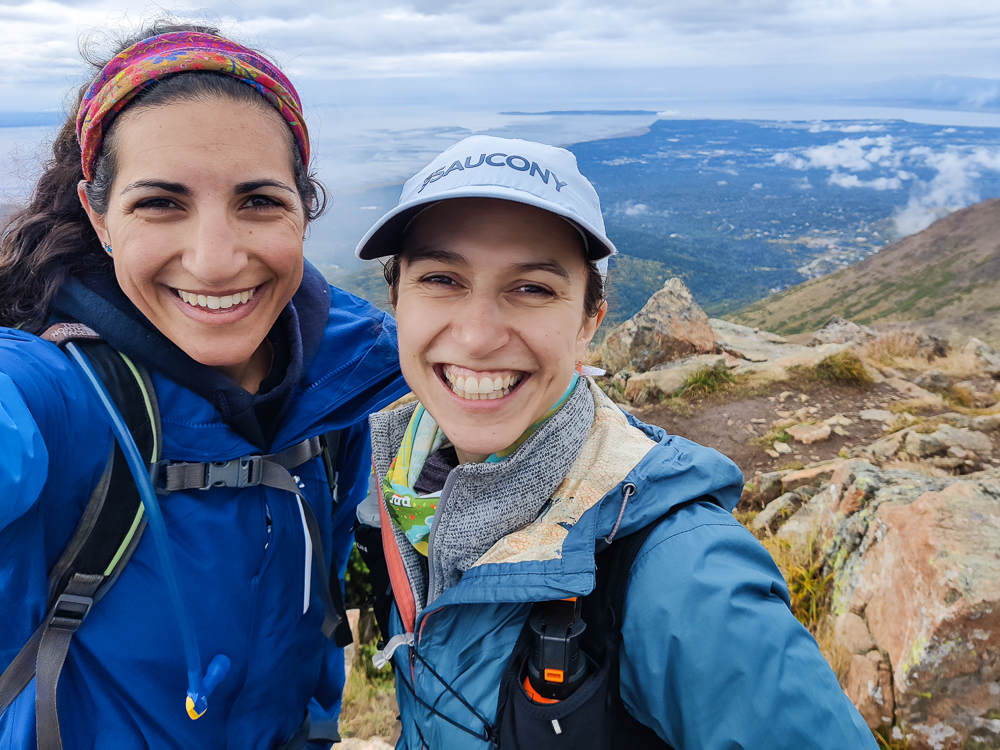
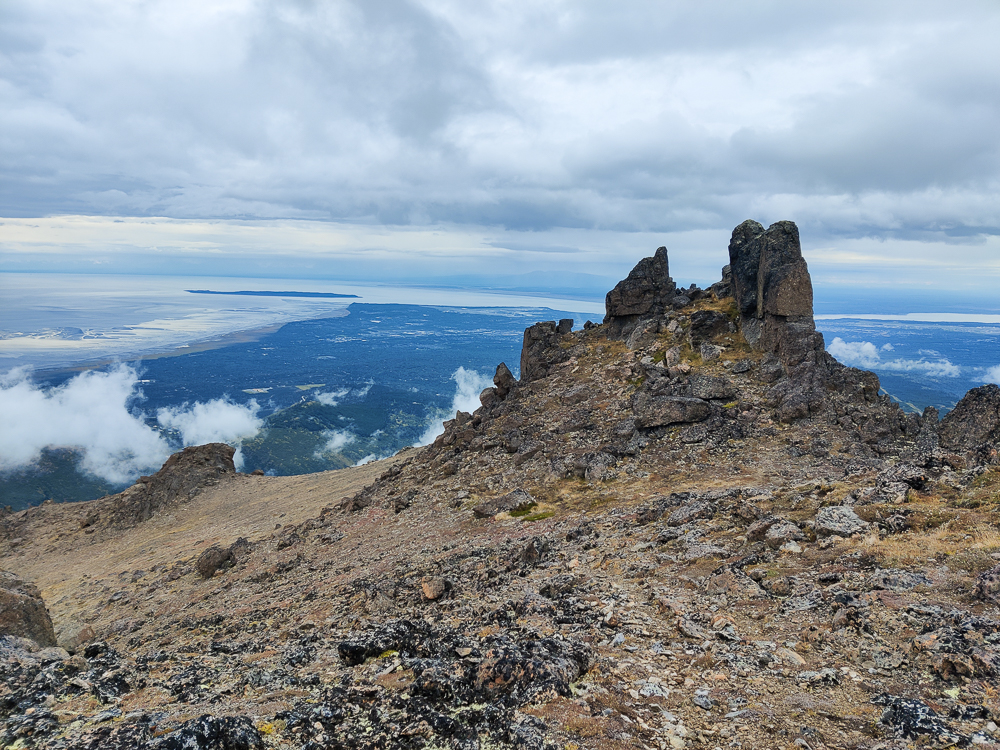
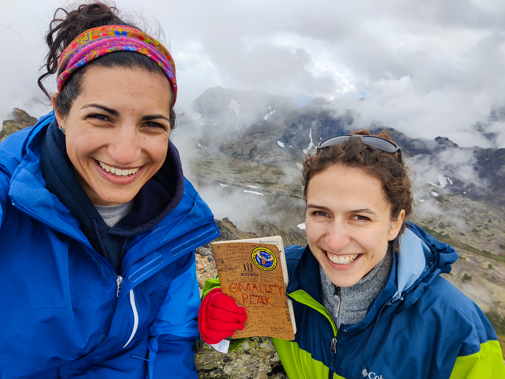
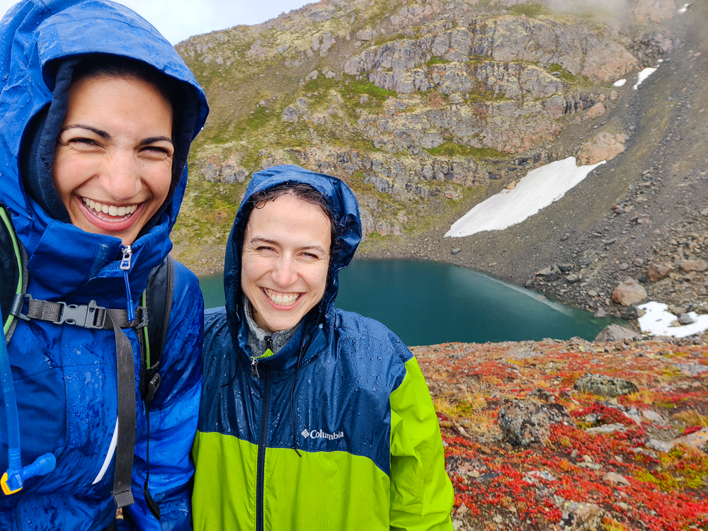
Olivia made it to the actual peak before me, and she popped up holding a metal case. I wasn’t sure what it was… random geocache at the top of the mountain? It contained some random objects and a book where you could sign your name!! That was cool. It made us feel like we’d accomplished something significant.
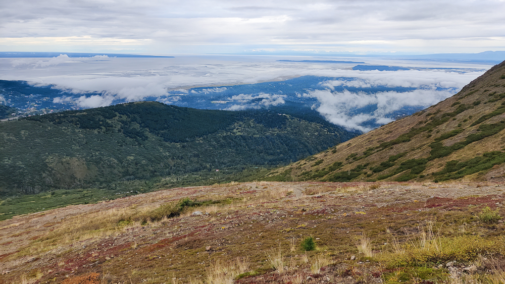
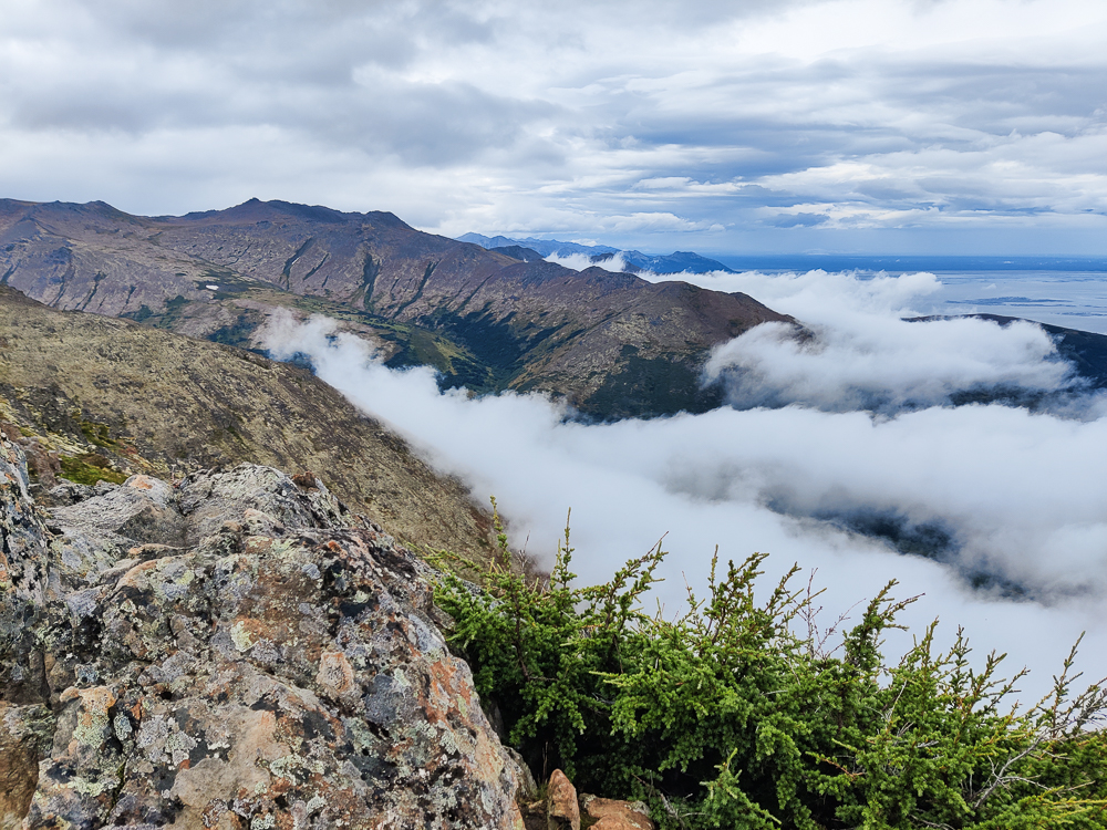
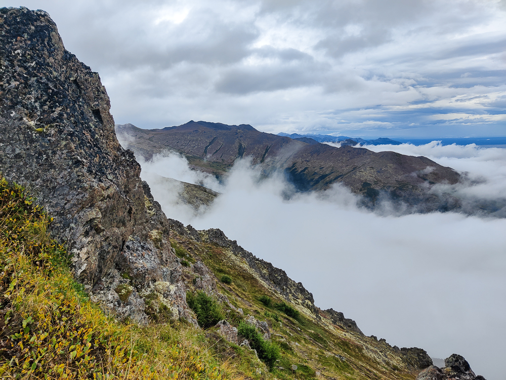
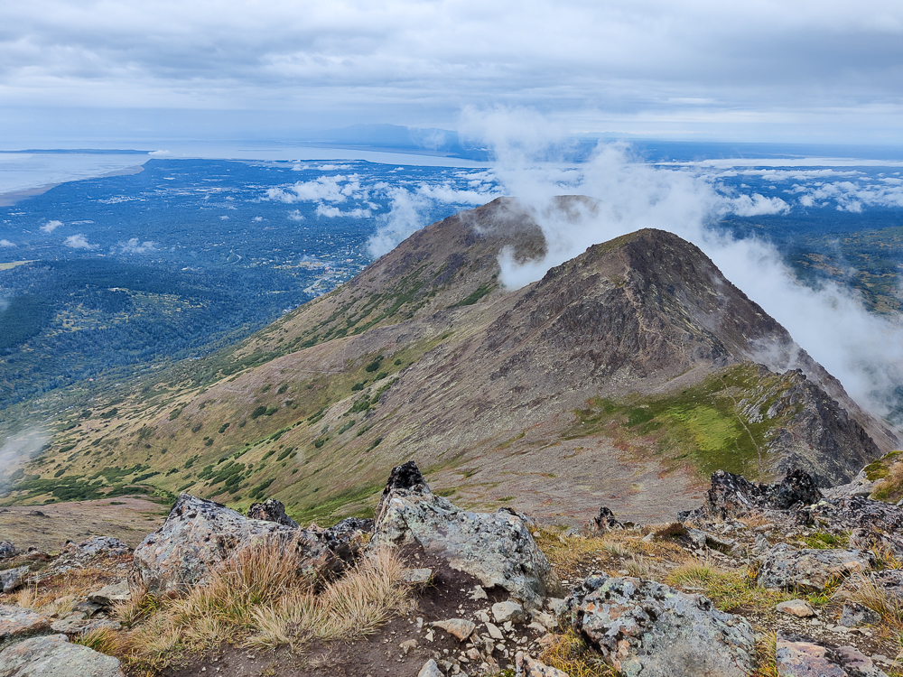
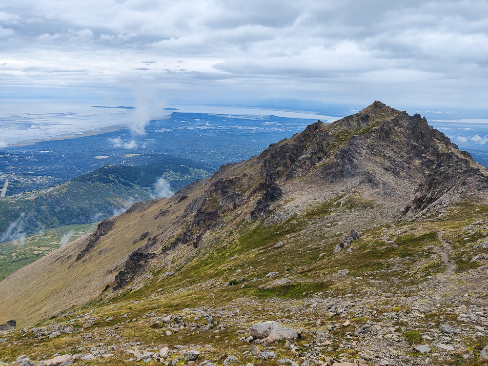
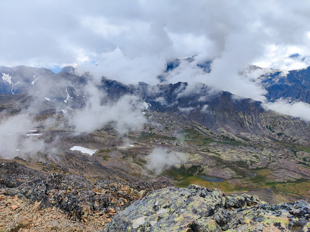
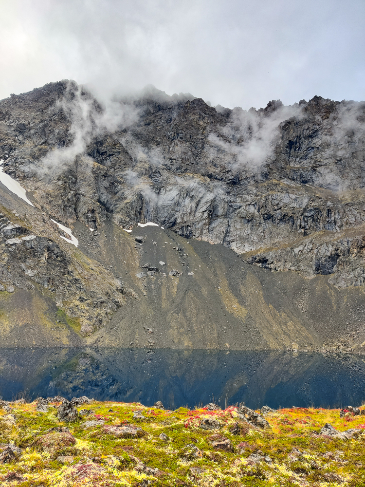
It was fairly cloudy when we reached the top, but since the clouds were still moving so quickly, we decided to stick around, eat a snack, and see if the view cleared up at all. Eventually, we got a decent view of the valley on the Flattop side of the mountain, but the other side stayed covered. Of course, that was the way we were headed. We just hoped that there was no rain associated with those clouds.
Once we were thoroughly chilled, we got moving again. We trekked down across the ridge and then were back at the scree field. In case you don’t have a lot of scree experience, let me tell you. Going down a scree field is way easier than going up. I still don’t love doing it, but if you get into the right rhythm, it feels like magic. All you have to do is turn off the part of your brain that thinks sliding = falling = bad. You take long, gliding steps and ride little self-created rockslides down the mountain while also steering yourself around immovable rocks and any scree-free areas. Oh, and remember to keep your weight on your heels so that you don’t tumble down the mountain. And bend your knees. And sit down to reset if you start feeling out of control. And keep a good distance between you and anyone else so that you don’t send any surprises hurtling their way (either a rock or your body). Got it? Easy peasy!
Like I said, when you get into a good groove, it’s kind of awesome. I feel like I’m flying or moonwalking or I don’t know. Floating. Weightless. Like I said, it’s magic. Then, a split second later, that euphoria turns to terror because I’m moving too fast and losing control and there’s a big rock ahead and it’s coming on WAY too quickly. Sit down. Breathe… 1, 2, 3. Recalibrate. Restart. Maybe I lied a little bit when I said I don’t love going down scree fields… I kind of do, but the feelings of terror and euphoria are so interwoven that it’s hard to isolate the joy when thinking about the experience. And the faster you go, the higher the high but also the higher the risk. It’s a fine balance. I took three recalibration breaks, aka panic sits, on the way down.
We took another time out at the bottom, stopping to clean out our shoes which were, shockingly, full of little rocks. I also needed a mental break… you have to stay focused the entire time you’re scree sliding, spotting your path and always having the next few steps planned. It’s exhausting.
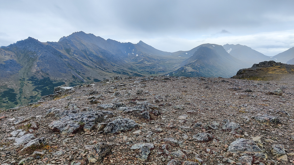
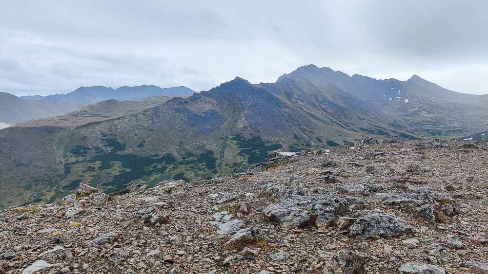
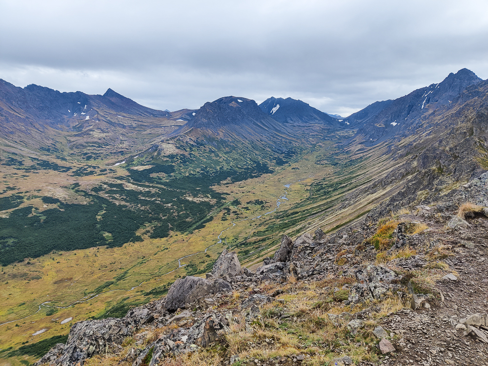
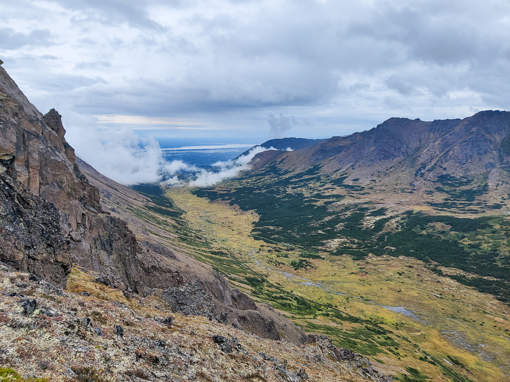
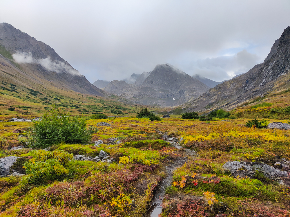
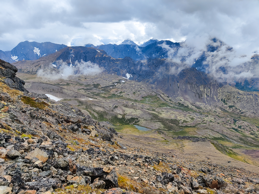
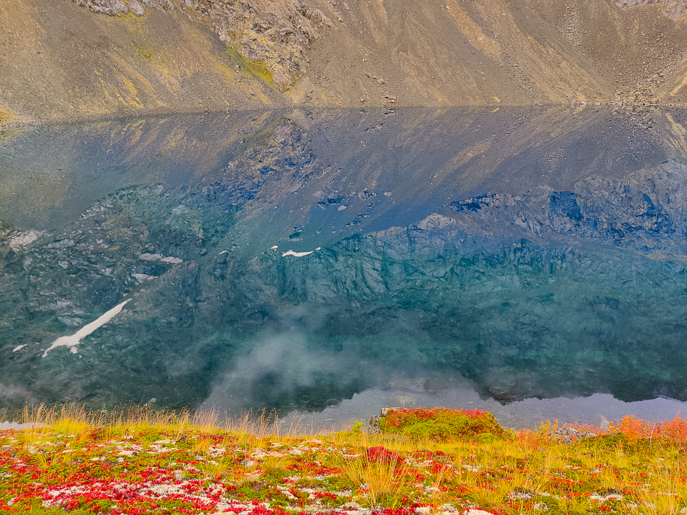
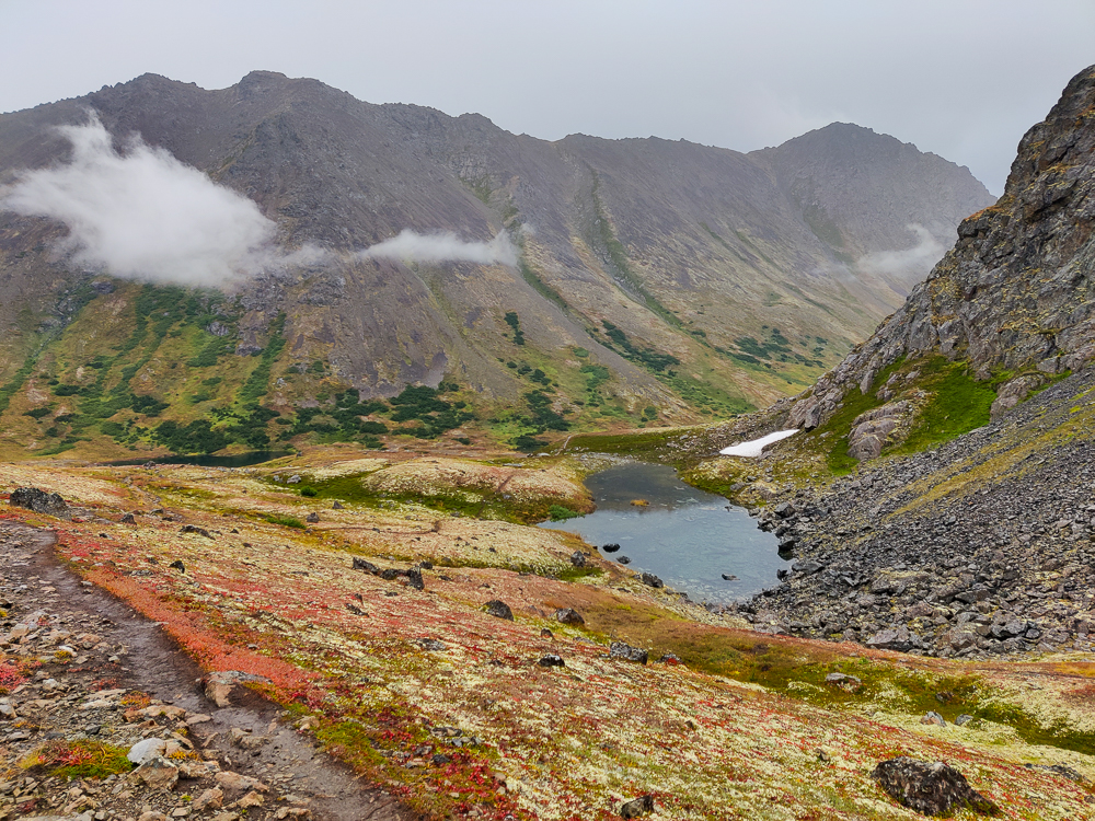
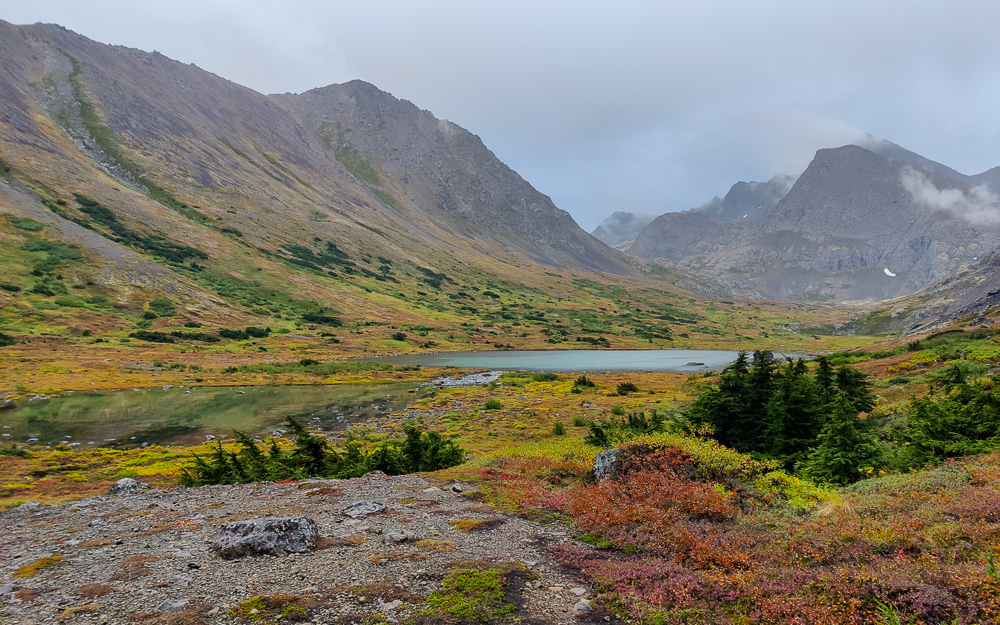
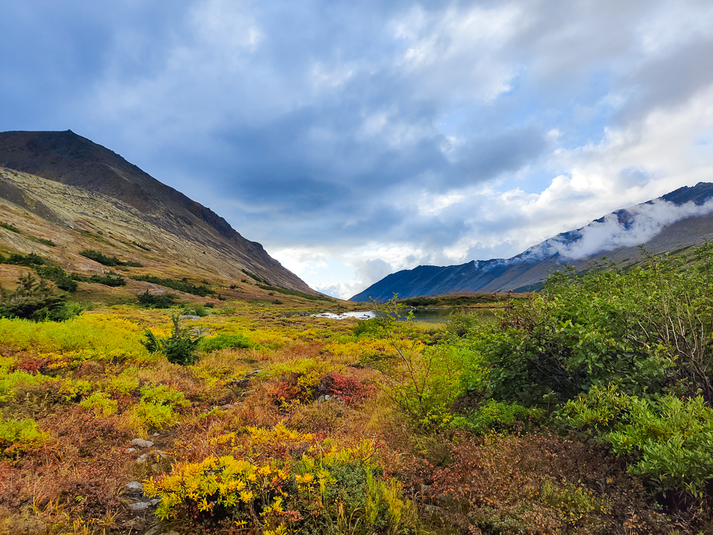
With O’Malley behind us, we reached our first decision point. Keep going, or turn back? We both felt fine physically, and the weather was drizzly but not terrible. We decided to continue on to the lakes. This involved another relatively steep downhill, but it was dirt/mud rather than scree. That’s its own challenge, but slightly less terrifying and also way slower to descend. We didn’t mind, though. The whole way down, there was a beautiful view of the valley and one of the lakes. We kept yelling about how it didn’t even seem real. (If it seems like we did a lot of yelling, well, yes. There was no one else around, so why not?)
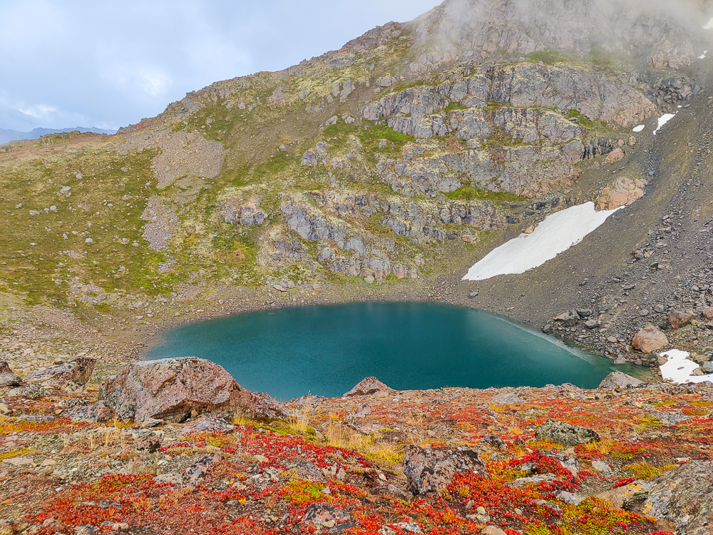
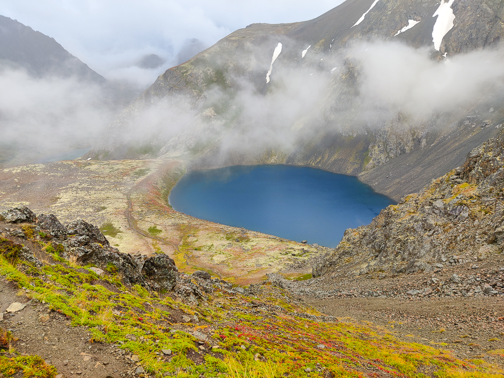
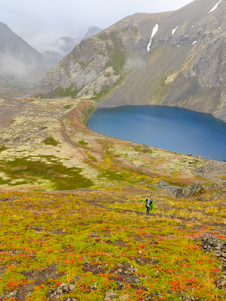
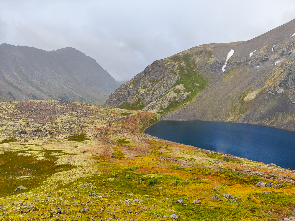
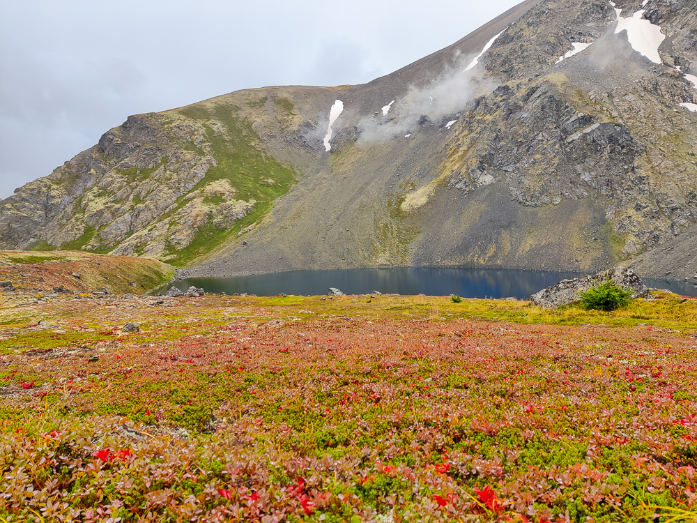
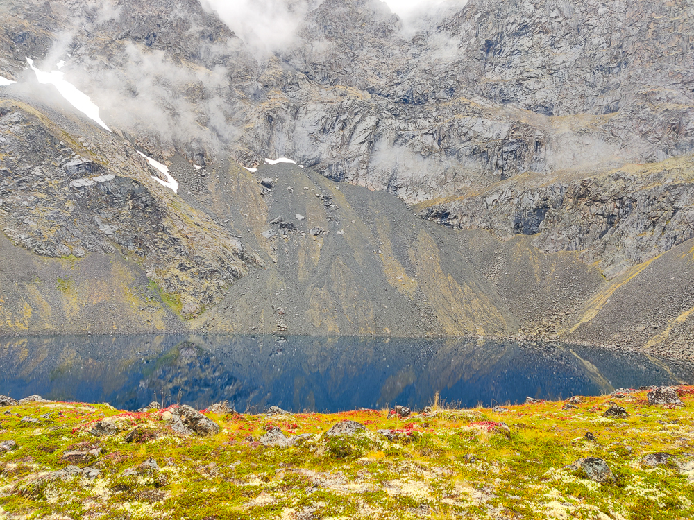
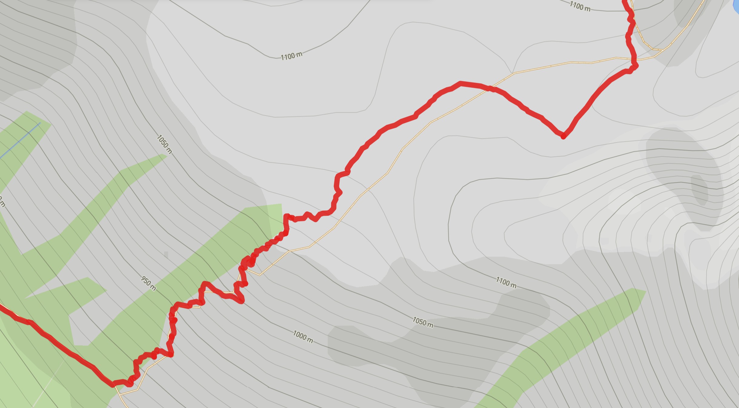
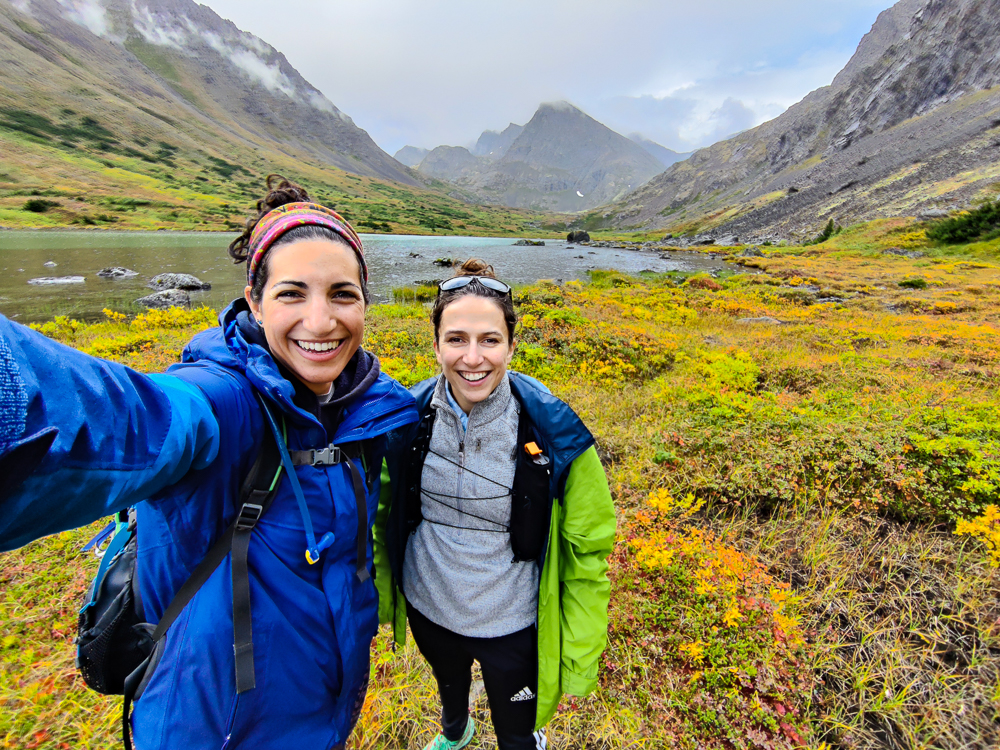
Eventually, we made it down to the bottom of the valley, and our trail dead-ended into the trail that we planned to follow out. This was our next fork… we could either turn left to go back to the car or turn right for more adventure before turning around. We decided to go right for a bit, just to see where it led, but we quickly hit a river crossing that was definitely too much for Olivia to do without waterproof shoes and probably too much for either of us to do without hiking poles. We settled on a short detour to get a better view of the nearest lake and then turned around and started heading back towards the car. We had about 8 miles to go and only a few more hours of sunlight, so turning around was probably the right choice anyway.
Before we go, though, we should enjoy a few more pictures…
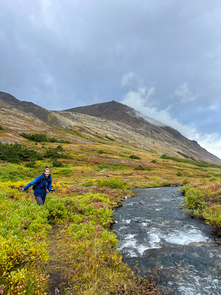
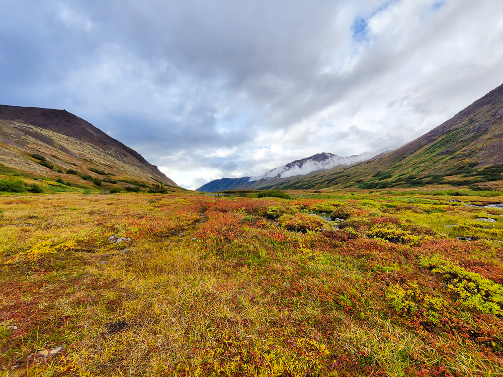
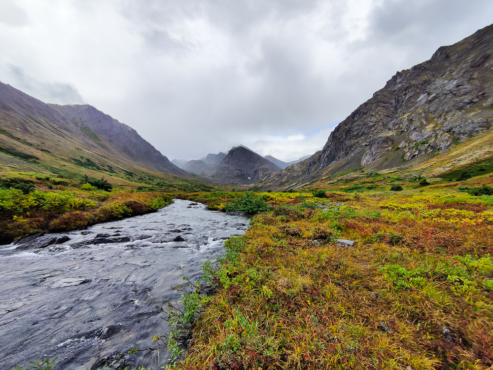

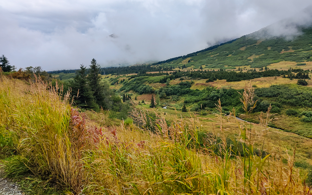
The way back was so much more terrible than I expected. I didn’t expect it to be terrible at all! The maps said that it was mostly flat, and that was good enough for me. And to be fair, at the beginning, it was great! We were in a beautiful valley. We could hear the sounds of the river rushing past. There were some bear-den shrubberies around (aka plants large enough to theoretically conceal a bear), so we made up silly songs about bears and sang them loudly to scare away any potential lurkers. Life was good!
Unfortunately, what we couldn’t see from the elevation profile was that most of the trail was overgrown with tall grasses, AND it was muddy and sometimes completely underwater. Our feet got wet very quickly, and that’s guaranteed misery on a hike. Olivia’s shoes weren’t waterproof, so she had no chance. Mine were once waterproof, but there are some weak spots. So maybe the infiltration took a little longer for me, but barely. Even if our shoes HAD been 100% waterproof, it wouldn’t have mattered. We were walking through waist-height plants that were covered in water and overhanging the path. As we brushed past, it felt like water was pouring down our legs and into our shoes. It was awful. Also, it started raining again. It’s not like it made us much wetter than we already were, but it felt like adding insult to injury. Like really?
I could tell that Olivia was feeling similarly terrible. Neither of us said anything about it because what would that help? But also, neither of us was talking any more than necessary. The creative bear songs faded into Olivia yelling, “Heeeeey, bear,” whenever passing a potential bear den and me just hoping she was making enough noise for the both of us.
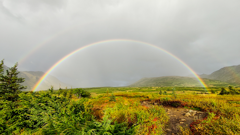
I was singularly focused on keeping a good pace, both to end our misery and because we were a little concerned about sunset. That meant I was zero percent focused on the map… if there hadn’t been a couple standing at our crossroads, I would have blown right past our turn. Eek. That would have been very good for morale. But, thankfully, we were saved from that fate, we made our turn, and BAM! There was an insanely vivid rainbow right in front of us! A double, actually! A tiny little boost to keep us going. And man, we needed it. I was holding myself together until we made that turn, but then there were just 2 miles to go and we were so close and I was so over being wet and cold and the end just couldn’t come fast enough.
I practically collapsed from joy when we got back to the car. We both took our shoes off for the drive home, and back at the house, I took a glorious hot shower. Olivia’s mom made pasta for us, and it was the best thing I’ve ever eaten. She also gathered up our wet clothes and shoes and set them up to dry, and I was so thankful to have nothing to do but eat and vegetate and stretch. Moms are the best.
Our final stats for the hike were: 14 miles (22.5 km), 4,000 feet of elevation (1,200 meters), and 8 hours and 40 minutes (total time, not just moving time). Even with the grumpy final miles, it was a good hike.