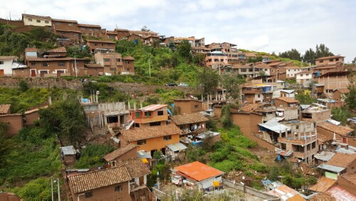
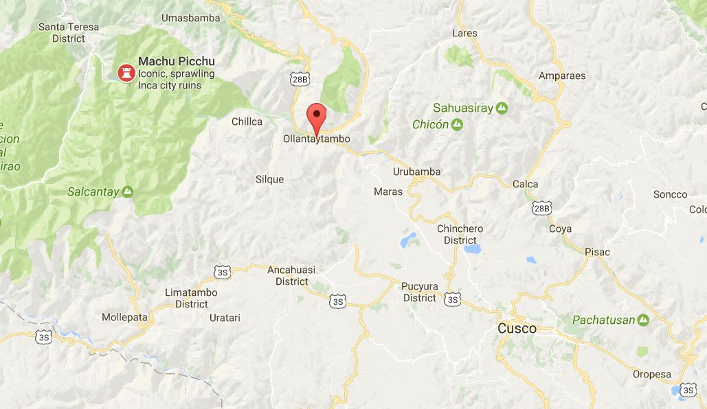
After my day of visiting ruins, I decided to spend the next day… visiting ruins. I had a train to catch to the town at the base of the mountain where Machu Picchu is located (Aguas Calientes), but the train didn’t leave from Cusco. I had to find my way to Ollantaytambo, a town about two hours away, and get the train from there. At this point, I was a colectivo expert, so I wasn’t worried about it. I asked at the hostel where to find colectivos to Ollantaytambo, and off I went! If you even manage to get close, you’re golden. Once you find the right street, there are a bunch of people calling out to you, trying to get you to get in their van. You just pick one, confirm a million times that they’re going to the place you want, and then decide to trust them and get on.

I just thought this was funny… This person is unloading crates of eggs from this truck – and is standing on a layer of them! I never really think of eggs as something you can stand on.

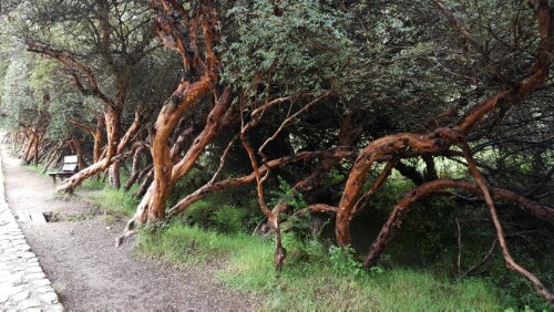
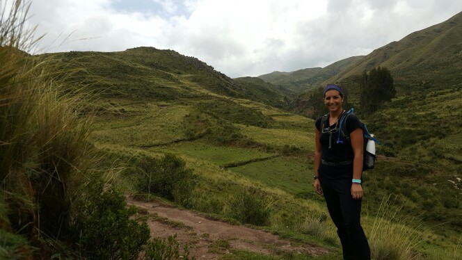
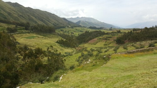
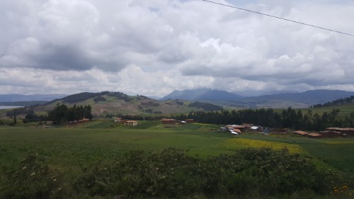
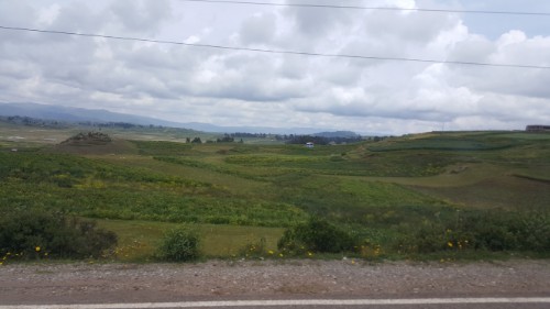
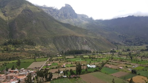
The ride from Cusco to Ollantaytambo is beautiful but also somewhat vomit inducing if you have any issues with carsickness. The road winds up and down, back and forth through the mountains and valley, and view after view was like nothing I’d ever seen before. I was trying to play it cool so that I wouldn’t give myself away as a tourist, but on the inside, I wanted nothing more than to press my face up against the window, unblinking for the entire 2-hour ride so that I didn’t miss a second.

You can see Cusco to the southeast of Ollantaytambo and Machu Picchu to the northwest.
Some views from the drive

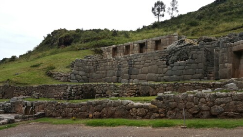
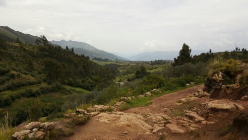
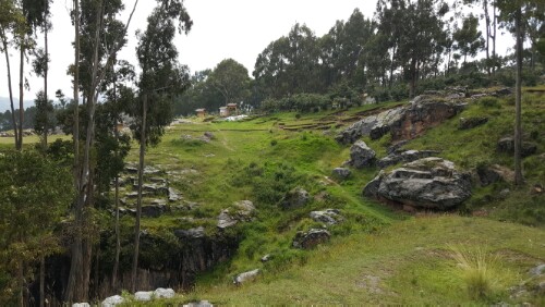
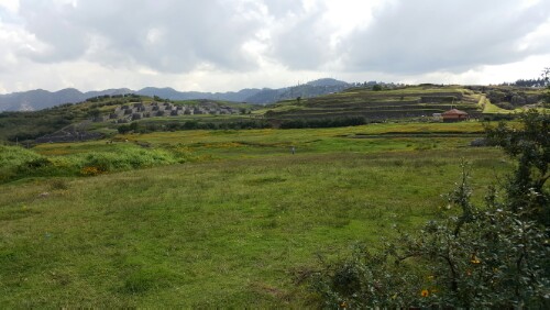
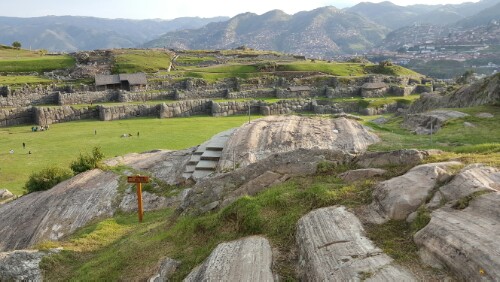
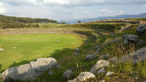
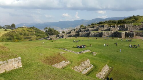
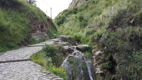
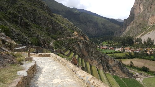
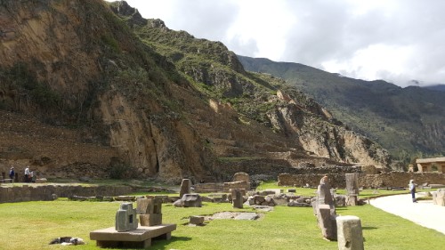
I got to Ollantaytambo about 2 hours before my train left, so I decided to check out the ruins in town. There are, of course, a million different ruins that you can visit in and around town, but I went to the biggest one that used to be an Inca fortress/temple. It’s one of the only sites where the Incas actually won a battle against the Spanish invaders.

Terraces!

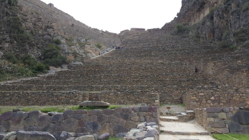
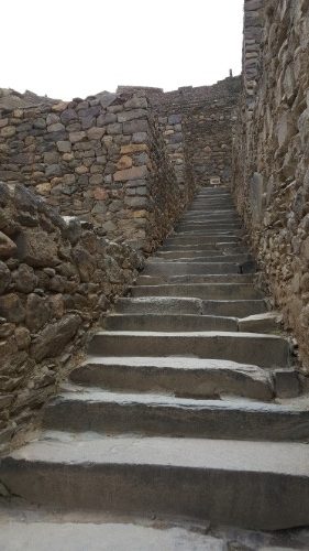
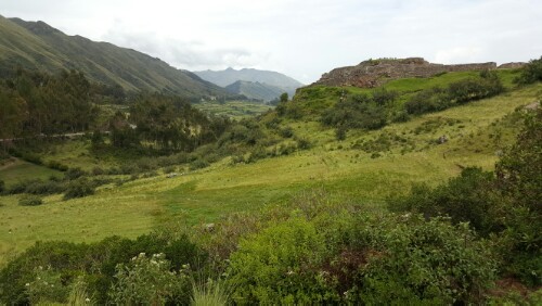
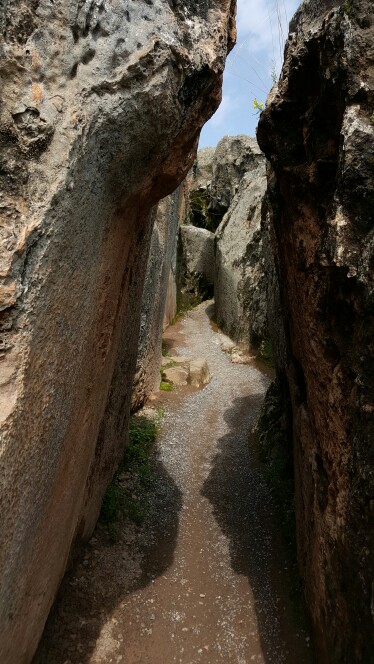
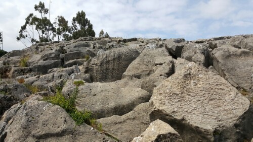
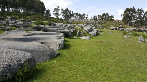
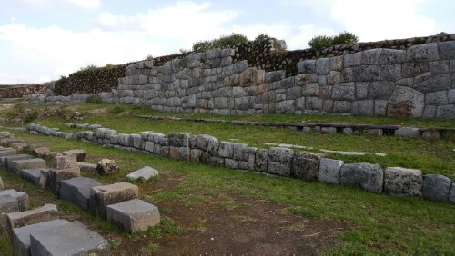
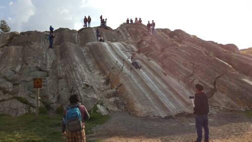
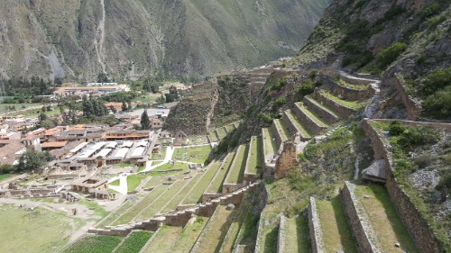
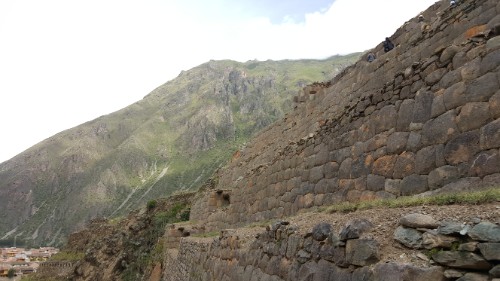
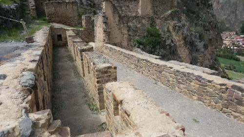
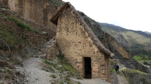
My first thought when I got inside was, “UGH… stairs.” The whole thing is just terrace after terrace, leading up the mountain to where there used to be enclosed structures. The roofs were all thatch, so there’s obviously nothing remaining of those. They’ve been restored in some locations, but for the most part, you’re left to imagine the ruins in their former glory for yourself. There are also some giant stones (I read somewhere that they’re 50 tons, but I can’t vouch for the accuracy of that) that were used in the unfinished temple construction. They were brought over from a “nearby” (5km away…) quarry, and the trip to the site includes a river crossing. You can use your imagination to try to figure out how they managed to move them on dry ground, but to cross the river, the stones were brought to the edge and then the water was diverted around them! That’s crazy!

Those big rocks in the distance behind me are the (maybe?) 50-ton ones that had to get moved here somehow from the quarry.

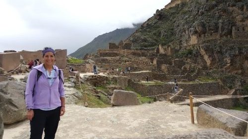
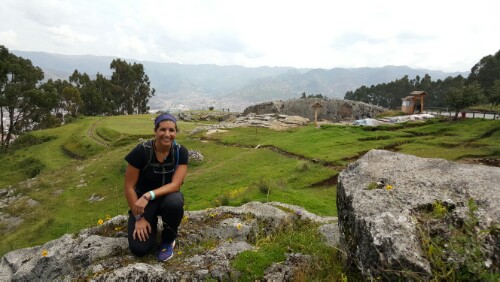
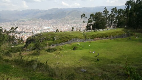
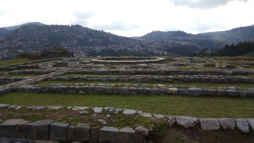
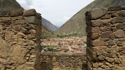
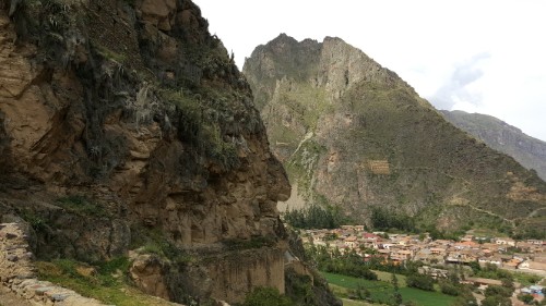
It only took a couple ruin visits for me to realize that the Incas were masters of beautiful and hard-to-reach sites. This fortress is no exception. When I finally managed to wheeze my way up the stairs (remember that this is at high altitude! I’m not just completely pathetic), I was treated to an incredible view of the town, the valley, and the surrounding mountains. The best way to view the mountains is from another mountain!

I’m sure I’ve said this before, and I’m sure I’ll say it again… but I love the Inca stonework! I think it’s so pretty

Looking over the town

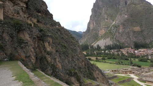
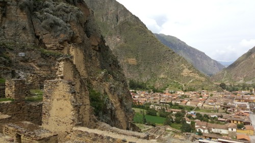
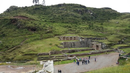
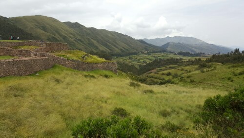
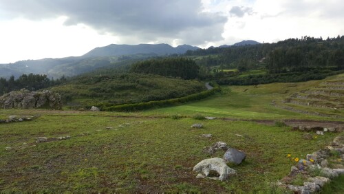
I had plenty of time to check out the main part of the ruins, even with my “stop and take the same picture 100 times” breaks. I still wish I’d had longer though. From the fort, there’s a hike you can do to a temple nestled up higher in the mountain, and I’m sure that it would have been worth the extra climb (if you consider another pile of rocks, another view of the same mountains, and some solitude worth it… which I totally do). Plus, it would have been cool to have a time to see some of the other ruins around town.

This is the view at the beginning of the hike up to the temple that I didn’t have time to do. Looks like it would have been a pretty awesome view, huh?
Some formerly roofed structures
Not bad…

Casual stroll along a path that wraps around the mountain
This is a good view of the terracing
Here’s a building with a recreated roof, so keep this in mind when visualizing how the rest of the ruins must have looked

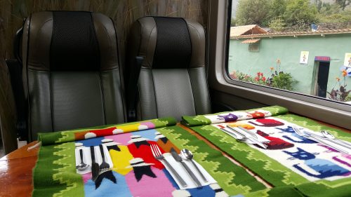
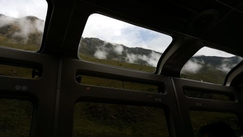
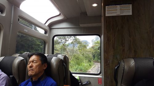
Oh well, I had a train to catch, and there was no way that I was going to miss it. There are a few different ways that you can get to Machu Picchu with the most common being either trekking (aka walking A LOT through the mountains) or taking the train. I think a trek would be awesome, but with my limited time in Cusco, I decided to spend it doing other things. Despite requiring far less effort, the train ride was still incredible. It was like something straight out of the movie “Avatar”. I’ve said that about other places in my life, but I’ve never meant it more than I do right now.

Let me try to set the scene. There are cloud-topped mountains towering over the train on either side, plus a river running beside the tracks (the water is very brown but no matter). Everywhere you look is green and full of life. You pass from the low highlands ecosystem at the beginning of the ride into the cloud forest ecosystem. I didn’t even know that was a thing, but can you think of a more mystical name than “cloud forest”? In reality, it was just as mystical as in theory. I’ve never been on a shorter 2-hour train ride. Seriously I could have stayed on that train for another 10 hours and been totally okay with it.

Serious train situation
Cloud forest… mystical, right?
I want to know who you have to bribe to get assigned the front seats!

But alas, we arrived in Aguas Calientes, and I set off to find my hostel. It’s the off-season at Machu Picchu right now, so I lucked out and got my own room, complete with all-natural “raging water” white noise from the river outside. Perfect for getting lots of sleep!

[Check out my other post about Ollantaytambo HERE.]

After visiting Qorikancha, my adventure really began. I wanted to see the four major ruins outside of the city. They’re all within about 16 km of the city center (road distance, not direct distance), so it’s not crazy far but definitely enough to not want to walk it both ways (plus it’s uphill). I heard through the grapevine that it’s possible to take a bus there, even though the ruins aren’t an official stop. (I don’t even know why they bother having official stops because you can usually get off wherever you want.)

I considered this my first true Spanish test, and I was determined to pass. The girl at the desk in my hostel said I should just rent a cab for the day, but why should I when there’s another perfectly good way of getting there? Plus I would feel rushed if I knew a cab was waiting for me, and I like to take my sweet time wandering around.

I found my way to what looked like a bus stop after a taxi man tried to convince me to hire him and I told him I was fine taking the bus. I tried to look like I knew what I was doing, but apparently the bus stop isn’t at the little hut with a bench and is actually like 50 feet away. Silly me. The taxi man sassily filled me in while trying to use that as proof that I should really just take a cab. Thankfully, after about 8 minutes of waiting at the random piece of sidewalk he pointed me to, a woman asked me if I was going to Pisac (the bus I needed to get to the first ruin), I nodded, and she directed me onto a bus that didn’t say Pisac anywhere on it. How is anyone supposed to figure these things out??

Well, luckily for me, it all worked out. I told the driver as I got on that I wanted to get off at Tambomachay and headed to the front of the bus when we got close. He let me off right in front, and I only had to pay 2 soles (about 60 cents)!

Tambomachay

Let me start off by saying that when it comes to Incan ruins, everything is pure speculation. 95% of the time, no one knows for certain what something is, why it’s there, what it was used for, etc. For example, Tambomachay. All that’s certain is that there are aqueducts and canals that feed water into a pile of rocks that looks like a fountain. Maybe it’s an ancient bath, maybe it’s a water temple. The name is Quechua and means “resting place”.

Cool trees on the way up to the fountains
The fountains. You can see water still running in the bottom left of the picture
The full extent of the ruins

The ruins were fine, but I was more interested in the scenery. I’m a fan of taking random paths and seeing where they lead. There was one that went up behind the fountain, and I followed it up into some terraced gardens and around the mountain (hill?) to a secret view of the valley. I say secret because I didn’t see another person ANYWHERE, and at a tourist-filled site, that’s an extra special treat. For a few moments, it was just me, peaceful green-ness, and a herd of alpacas grazing in the far distance.


My secret valley


Looking towards Puka-Pukara
Once I managed to drag myself away from the view, I headed across the street to ruin #2…


Puka-Pukara

Puka-Pukara is in the upper right

One guess is that this was a military base, but maybe it was a hunting lodge, guard post, and stop for travelers. The name means “red fort” because the stones look red in some lighting. It’s another “the ruins are kind of cool but the thing that makes the stop worth it is the view” situation. Some people had guides who I assume told them more information than that, but like I said, it’s probably 95% made up. I’m more than happy to just embrace the mystery and be impressed by the Incas’ site selection skills. They sure knew how to pick a site with a view.


View from the “fort”

There’s an almost 5 km walk between Puka-Pukara and the next ruin, and I was not interested in walking if it could be avoided. Lucky me, a colectivo (mini-bus) was driving by right as I left the site, and I flagged it down and hopped in for a 1 sol ride to…

Q’enqo (ken-koh)

Q’enqo means “labyrinth”, and they think (“they” being whoever it is that comes up with these theories) that it was a religious something. It’s a huge rock with passageways and channels carved into it.  I wish I could have gotten a bird’s eye view because it’s way more interesting from the top.

One of the passageways through the rock
Q’enqo is that giant rock in the upper right with the rounded top
Q’enqo from the outside

I used my same “follow whatever random path you see” strategy and ended up on a huge rock overlooking the town of Qenqo. I could also see Cusco in the distance, and no matter how many times I do, I still am amazed by the view. This and my other detour were probably my two favorite parts of the day. Hooray for exploration!

View from the favorite perch
The town of Q’enko

I walked from Qenqo to the next ruin, passing through “Qenqo Chico” (small Qenqo), which I didn’t even know existed. This was my third favorite part of the day… another unplanned detour. There’s another overlook of the city and plenty of big rocks to sit on. I stopped for a minute to eat a snack and soak in the view.

Q’enko chico
How cool are these rocks?!

Saqsayhuaman

Saqsayhuaman from a distance

The pronunciation guide for this ruin is that it sounds a bit like “sexy woman” (sack-sai-WHA-man). It means “satisfied falcon” and was a big military fort. It was one of the last Incan strongholds during the Spanish invasions. After the Spaniards conquered the fort, they took many of the stones build houses for themselves. The biggest stones are still left.


There are alpacas grazing all over the place
View from Saqsayhuaman
A wall. Check out that awesome Inca stonework


Fun fact: there’s a big zig-zag wall on the fort because the ninth Inca ruler saw Cusco as having the shape of a puma with the zig-zag walls as its teeth. Also, there’s a rock slide there. As in, smooth rock that can function as a slide… and people are allowed to slide down it. I think it’s hilarious. I also apparently have very good slide pants because I flew down with literally no way of slowing myself. My hands did nothing and my sneakers were worthless.

Good view of the zig zag wall
Rock slide!

After wandering Saqsayhuaman for a couple hours, I was wiped and ready to get back to my hostel. I walked down the path to Cusco (which they say that you can walk up to the ruins if you want… only if you’re crazy, in my opinion) and felt like I teleported into the middle of a forest. The walk was beautiful, but if I was going up, my thoughts would have been focused on not passing out.

The path back to Cusco

By the time I reached the bottom, my head was pounding. I’m not sure if it was an altitude-related problem or just a dehydration problem, but I downed some electrolytes and painkillers and flopped on my bed until I felt functional again. Altitude sickness can be a big problem for people going to Cusco from lower altitudes. Cusco is at 11,152 feet of elevation. For comparison’s sake, Denver is at 5,690 feet. People all react to the altitude differently and can range from no symptoms to headaches, dizziness, and vomiting. I thought I was superhuman because I felt fine on my first day. I guess this means there’s a chance that I am only human.