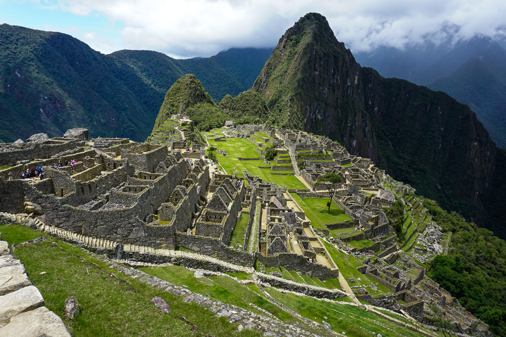
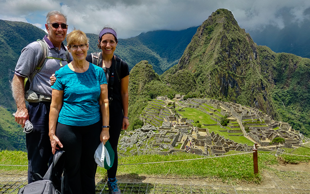
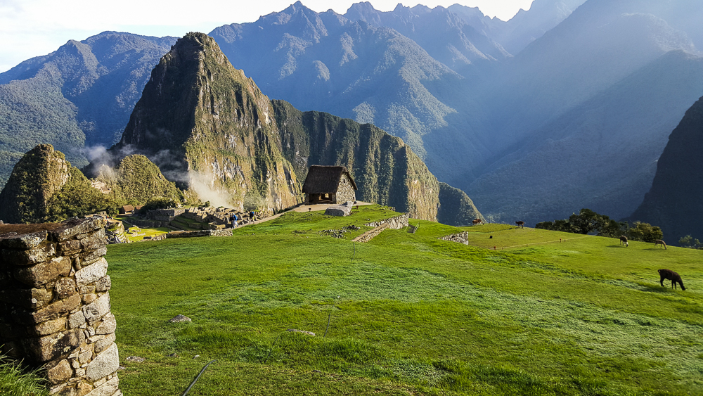
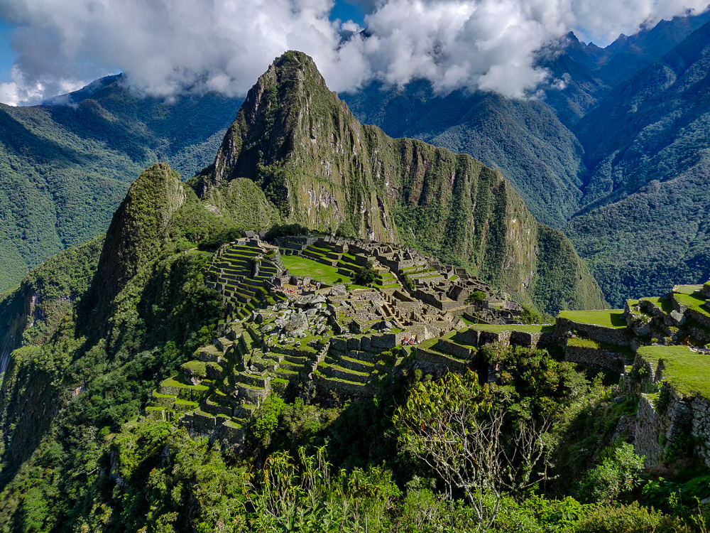
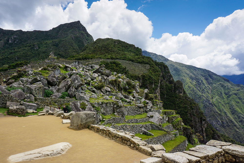
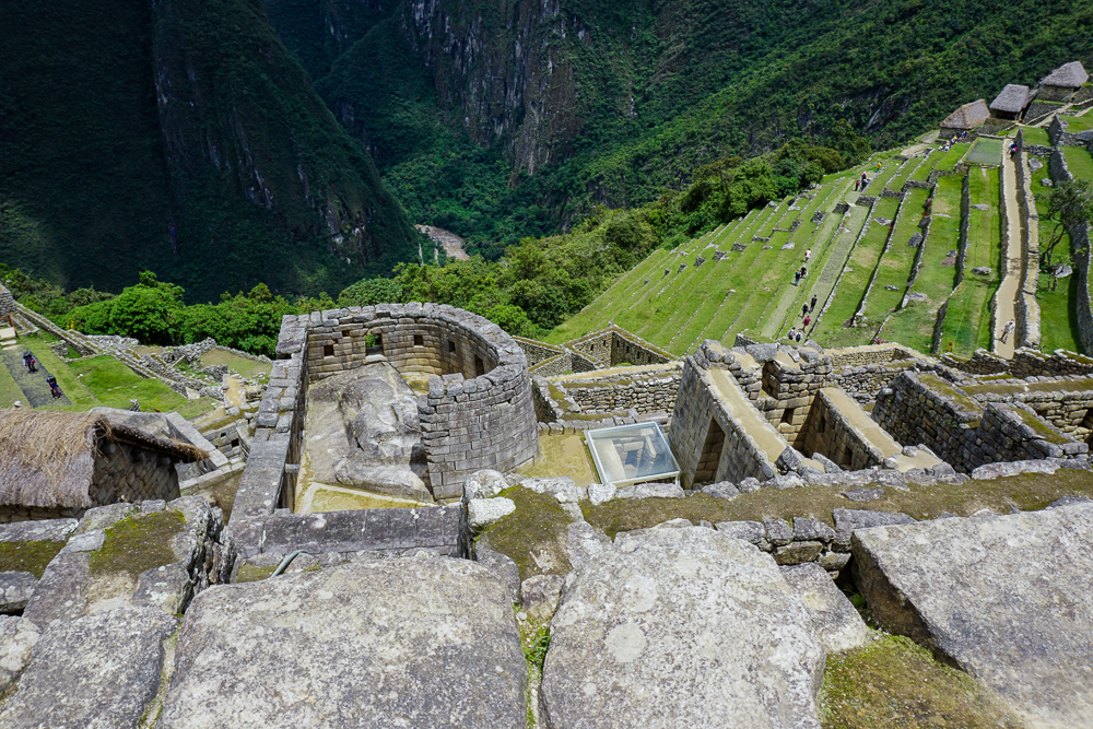
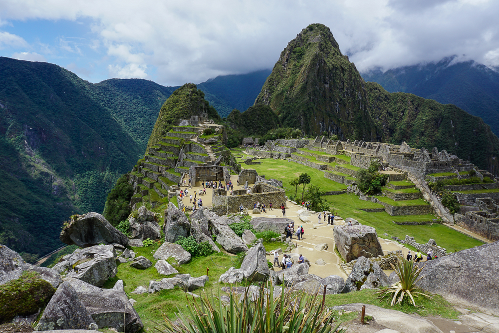
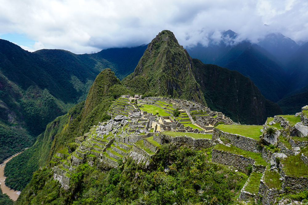
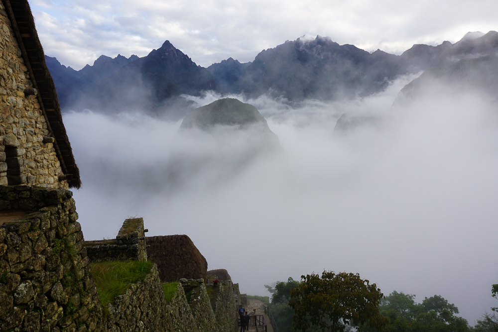
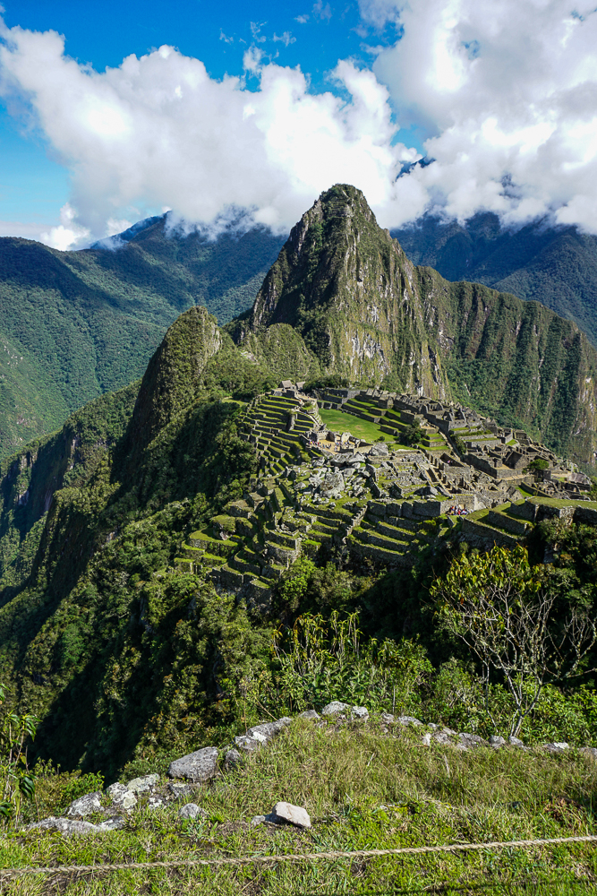
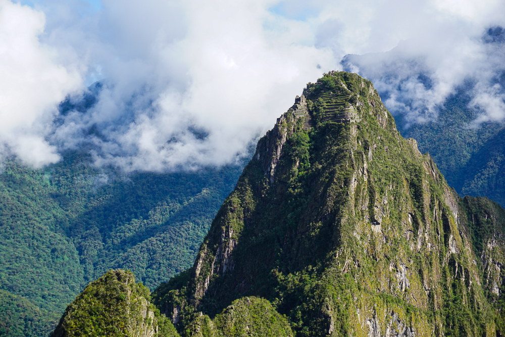
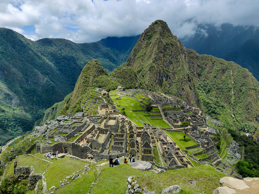
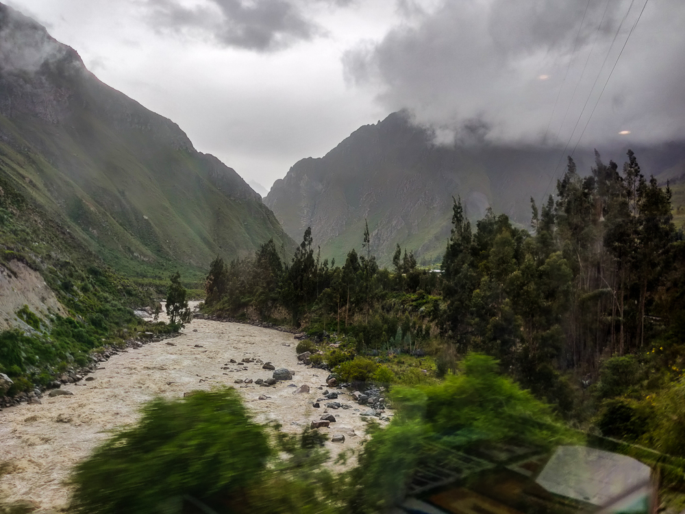
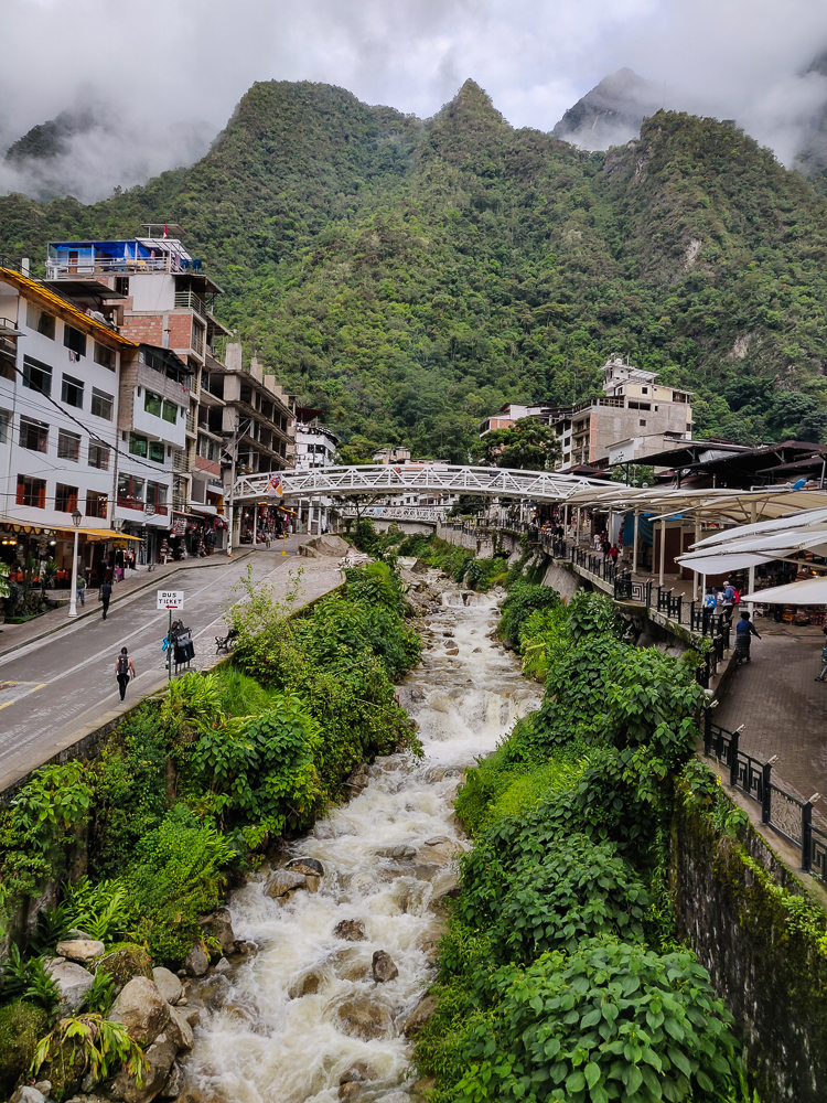
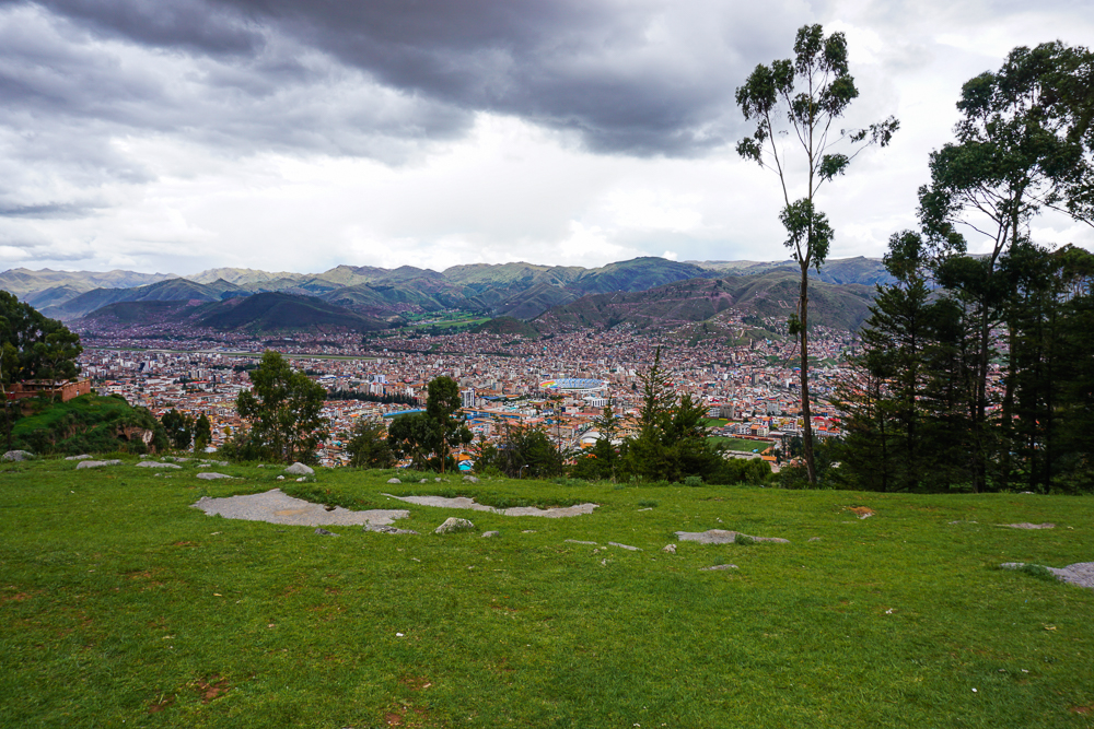
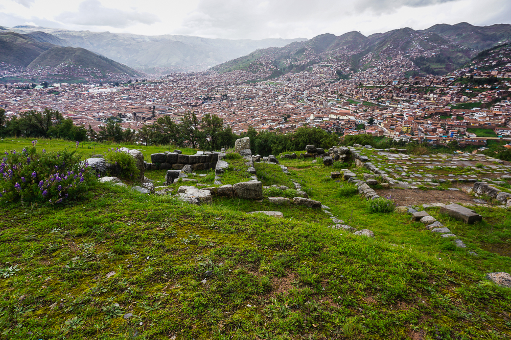
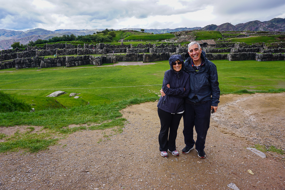
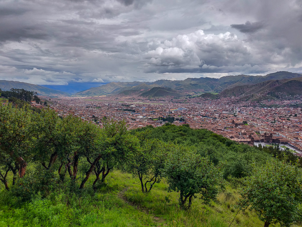
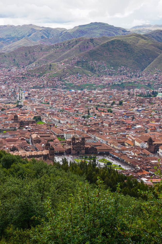
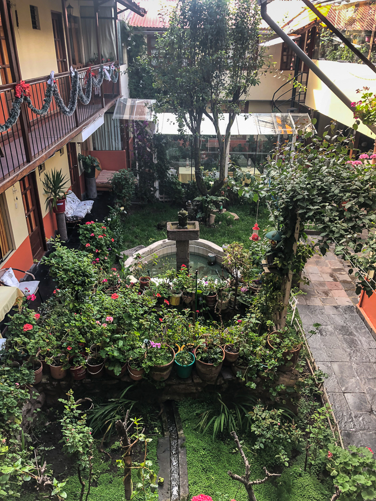
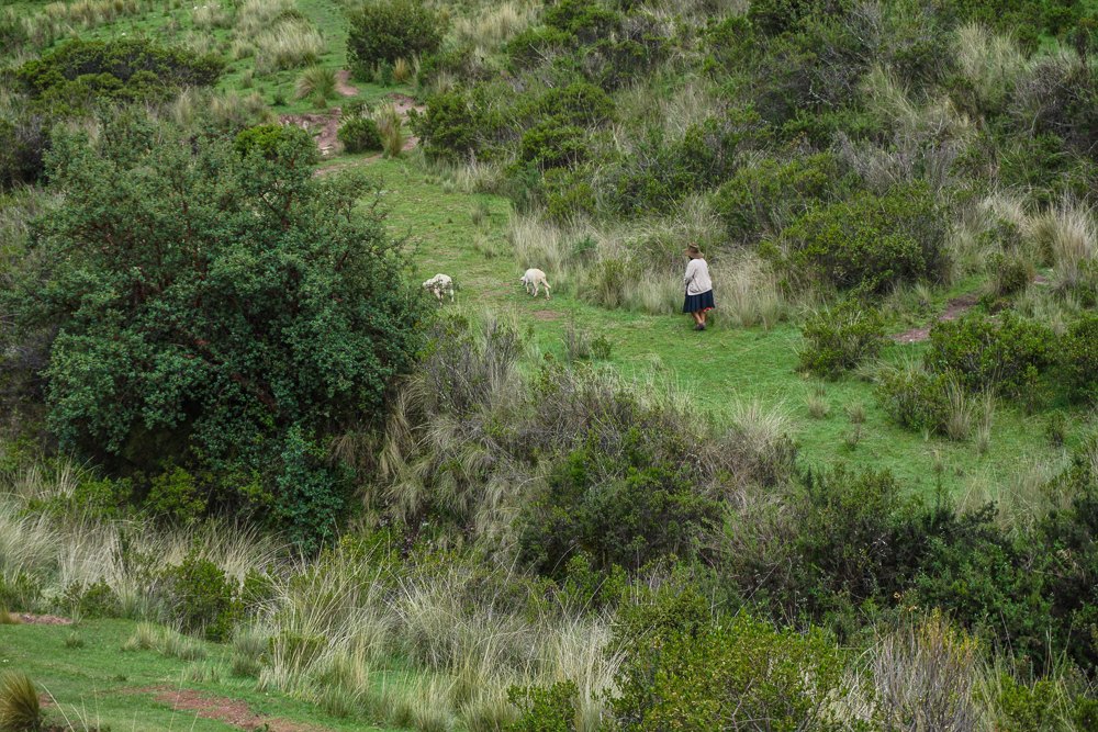
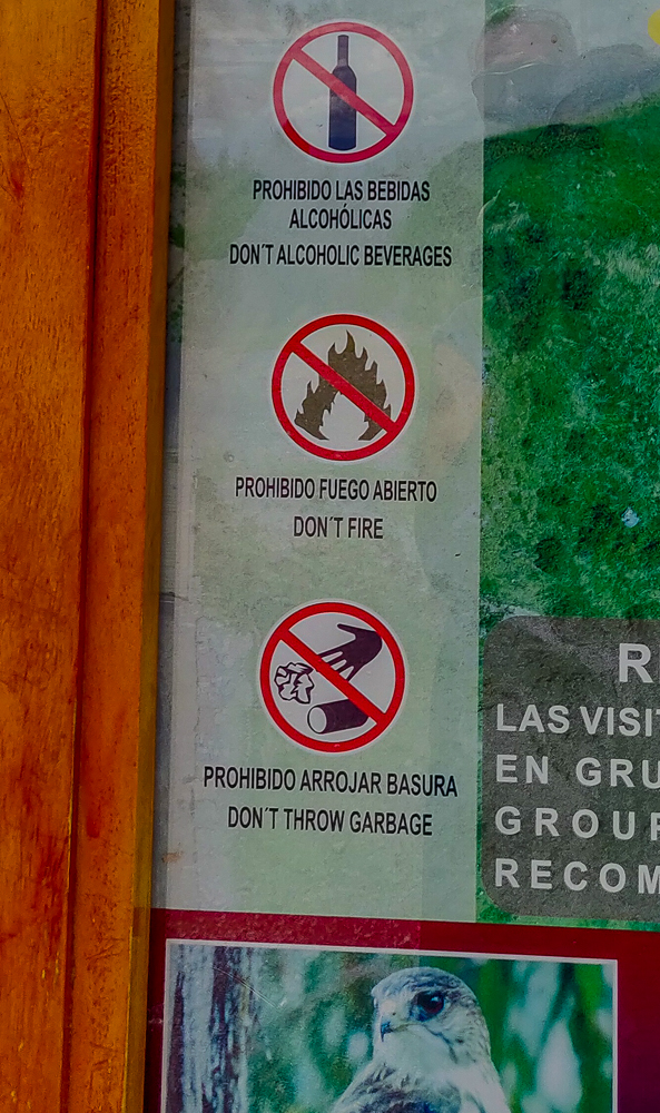
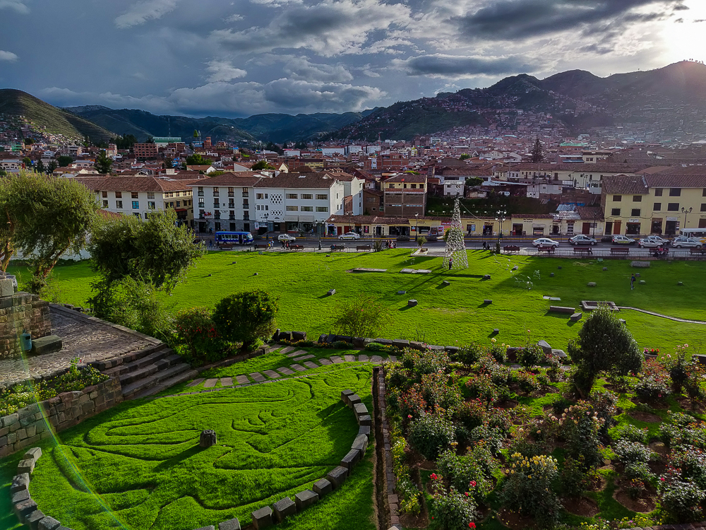
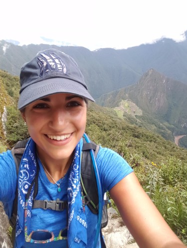
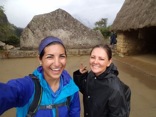
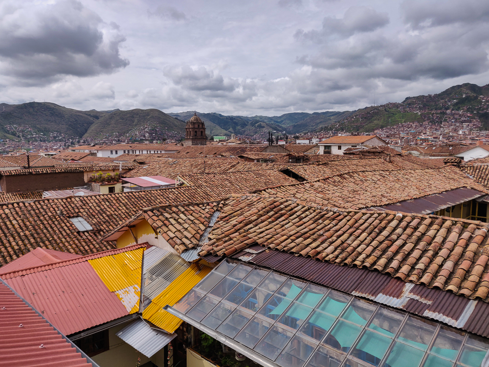
We had one final day in Cusco after we returned from our marathon day at Machu Picchu, and I was struggling to decide how we should spend it. There are about a million different things to do and see in the Sacred Valley, and they’re all amazing. Well, I obviously haven’t done everything, but there isn’t a single thing that I HAVE done that I thought wasn’t worth the time. Anyway, the point of this ramble is to say that if you ever go to Peru and have the time, don’t just rush to Machu Picchu! Hang out in Cusco, explore the less famous sites, and don’t assume that the lack of fame means they’re not awesome.

My decision was also hard because I was choosing between places I hadn’t been to. That was exciting because it’s always fun to go somewhere new, but I was making the decision for everyone and wanted to choose well. In the end, I decided that we should go to Tipón, another Inca site about 45 minutes away from Cusco. I didn’t know much about it, but I did know that it’s considered an engineering marvel and there are cool water features. Like I said, not much… but actually, that’s about the extent of what they know for sure, so not bad.

Views over Cusco from our hotel’s breakfast room
There’s the cathedral!

I wanted to take a bus to Tipón, mostly because I wanted everyone to experience public transit, and it seemed like a straightforward opportunity to do so. There was no one at the hotel desk to direct us to a bus stop, so we put our faith in our internet intel and headed out. When we got close, a lady on the street pointed us to the correct bus stop and said that we shouldn’t have to wait too long. We waited about 10 minutes for a bus, I worried for all 10 of them that we were in the wrong place, and then I worried after we got on that it was the wrong bus… even though the bus said “Tipón” on it, AND I double-checked with the driver. I apparently put a lot of pressure on myself as the planner of other people’s trips, but I wanted everything to go smoothly!

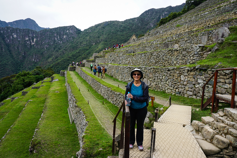
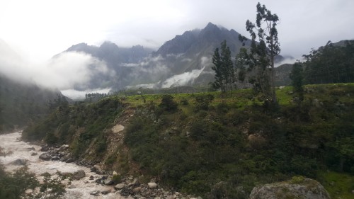
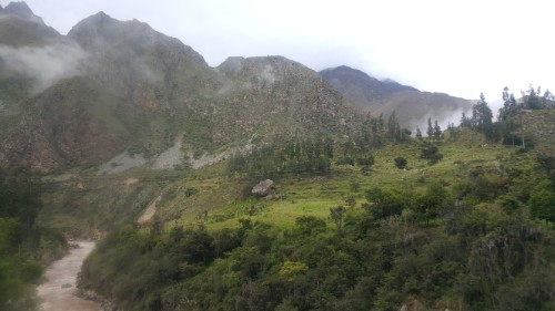
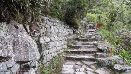
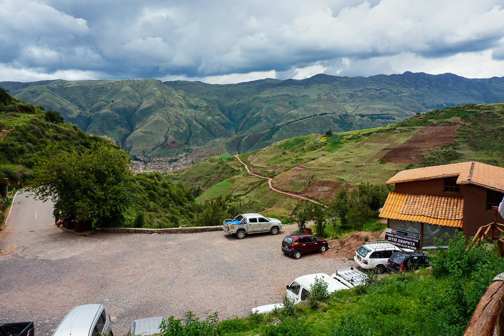
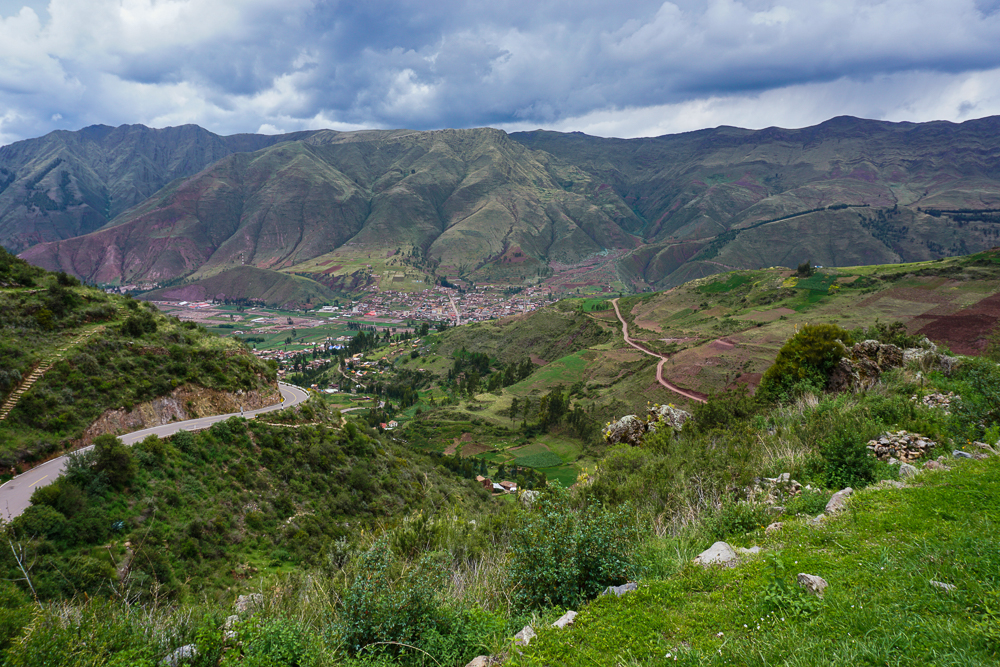
As we got off at the final stop, the bus driver pointed us in the direction of the ruins and said it was probably best to take a taxi there. We took his advice, thank goodness, saving us from a brutal uphill trek on a skinny, winding road. After the taxi dropped us off, I worried briefly about how we’d get back down and then decided to leave that for future Lara to deal with.

I love this view. Also, don’t be fooled by how many cars there are in the parking lot. There were only a couple of other groups of people visiting the ruins. The cars must belong to the park rangers and the construction guys who you can see working up on the mountain in the background of a few pictures.

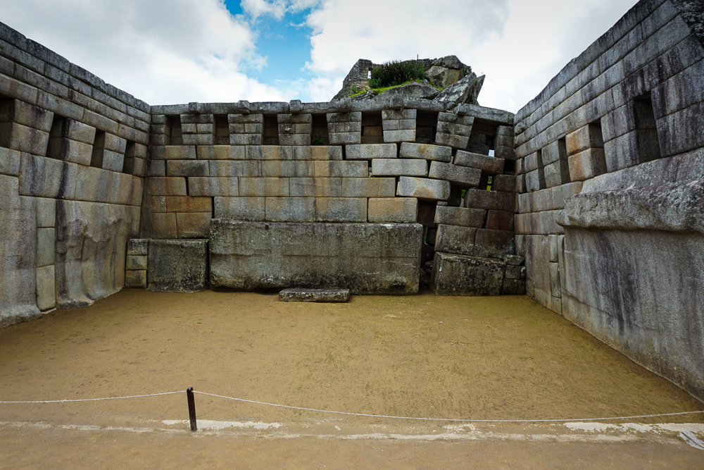
According to archaeological evidence, Tipón was occupied for thousands of years before the Incas arrived, dating back to sometime between 6000-4000BC (very specific). The Incas then developed it into what it is today: a water ritual garden… or a royal country residence… or an agricultural lab… you know, the usual “well, could be anything”. Very little is known for certain about Tipón; even the original name was lost. The only written reference comes from a 16th-century chronicler. He describes a site that could possibly be Tipón, and it says that the complex was built as a royal palace for an old Inka after his son usurped him and booted him out of Cusco. I suppose luxurious house arrest was a kinder sentence than death.

Pretty flowers around the site!
You know how I feel about flowers.

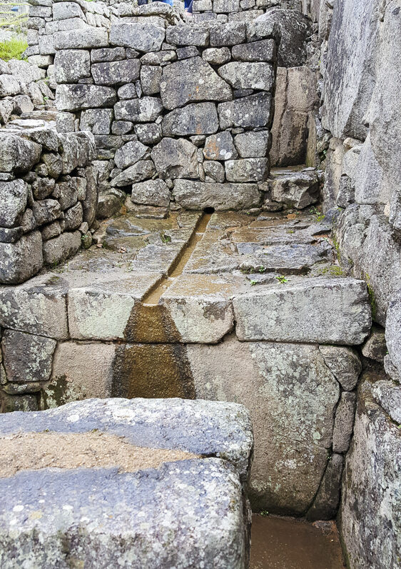
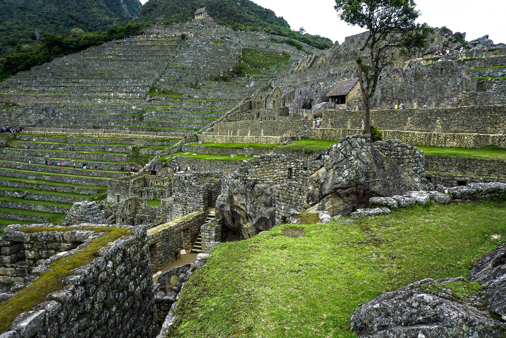
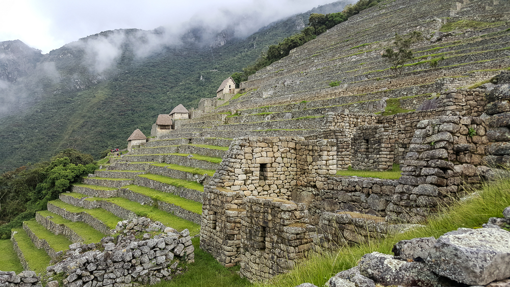
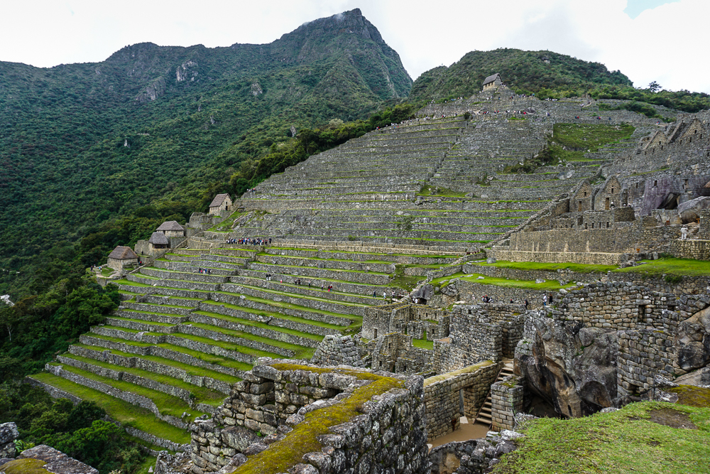
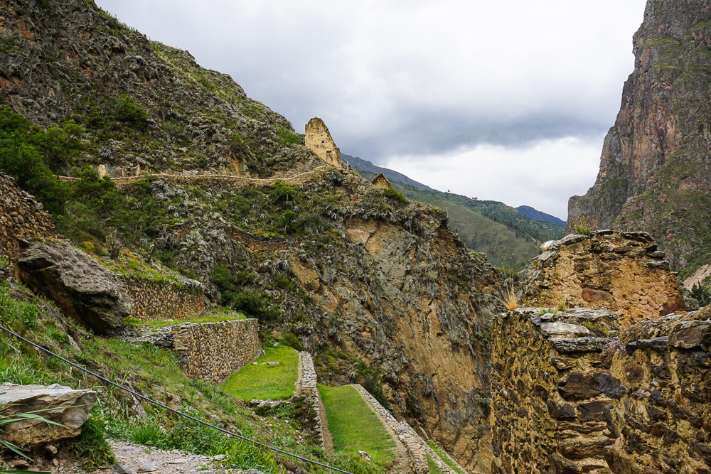
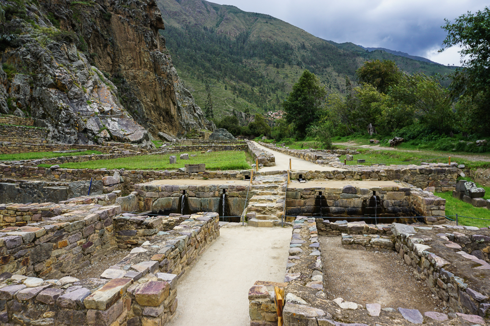
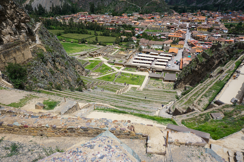
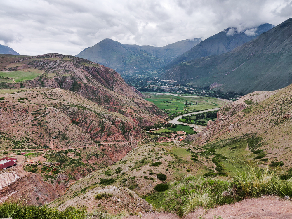
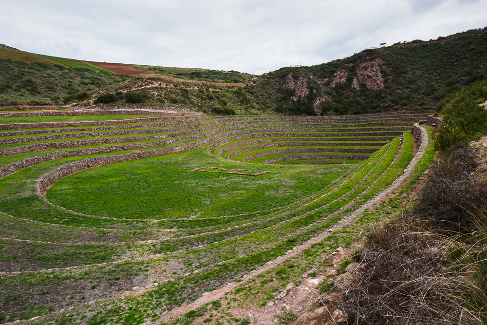
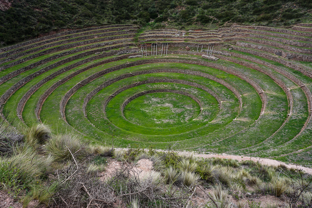
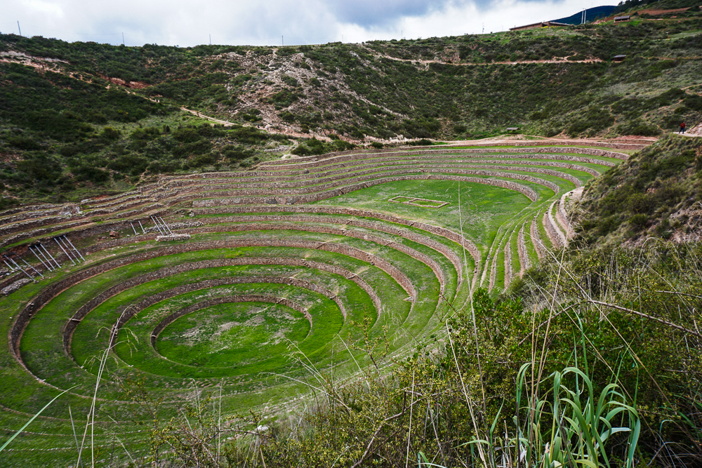
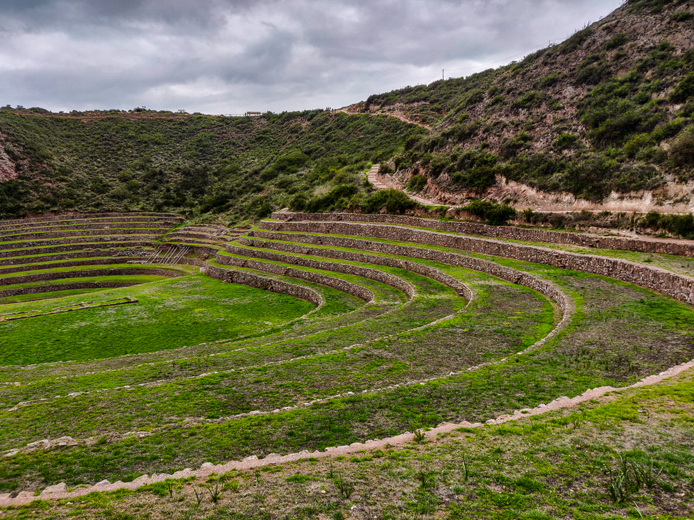
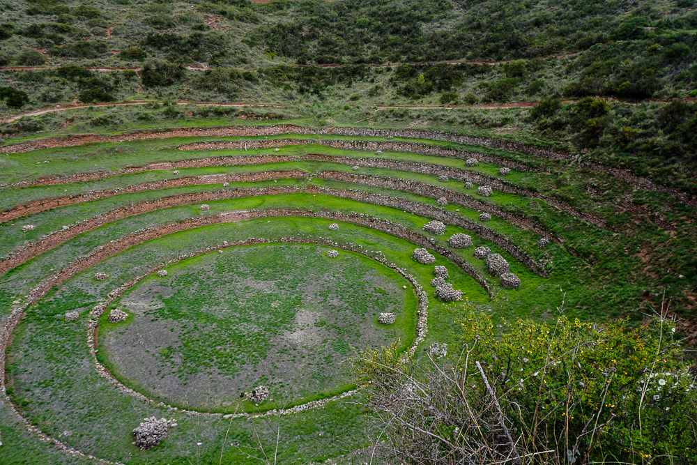
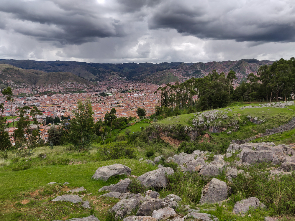
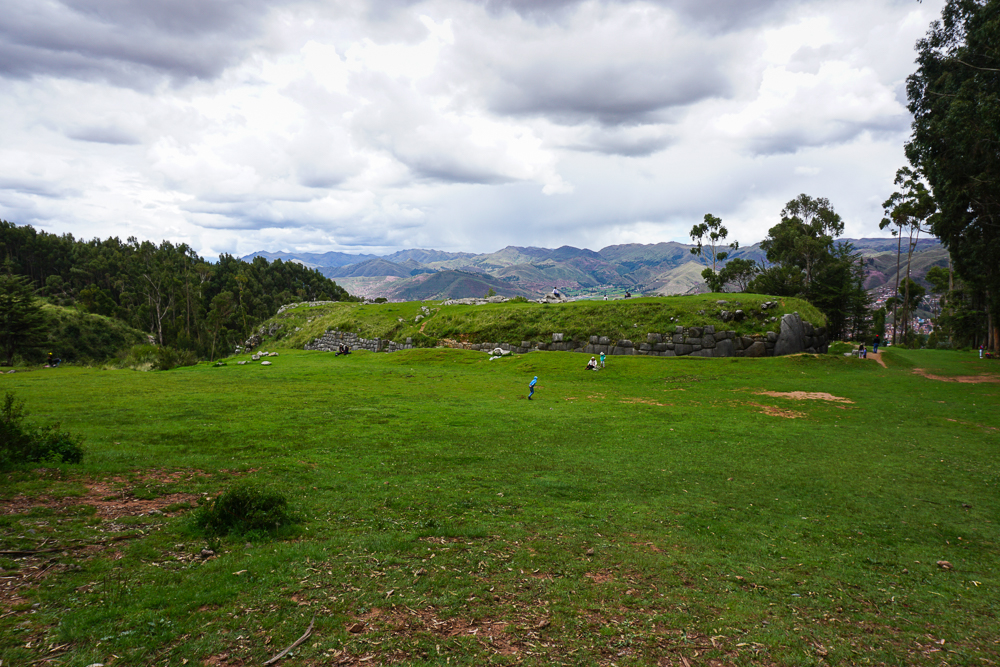
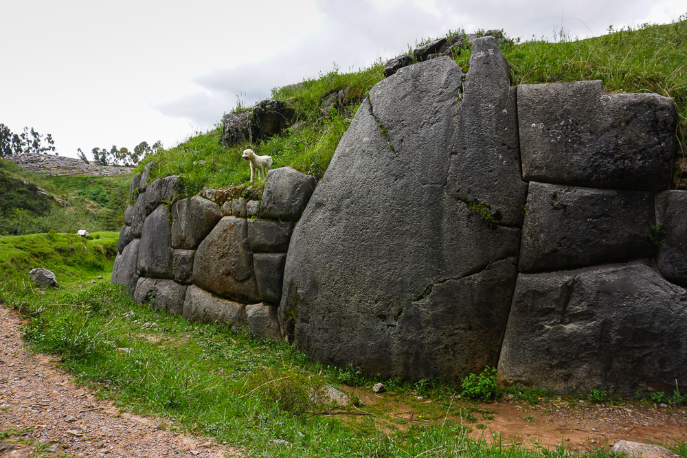
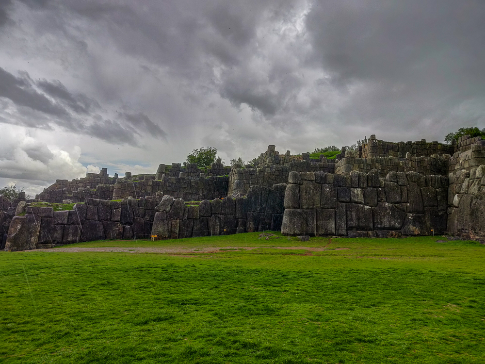
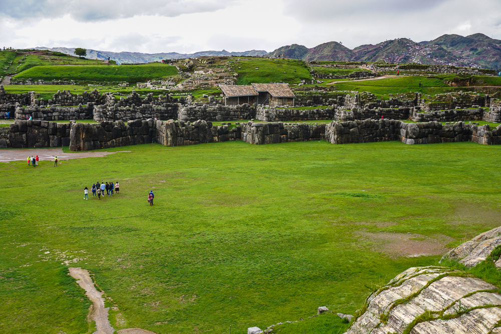
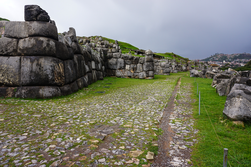
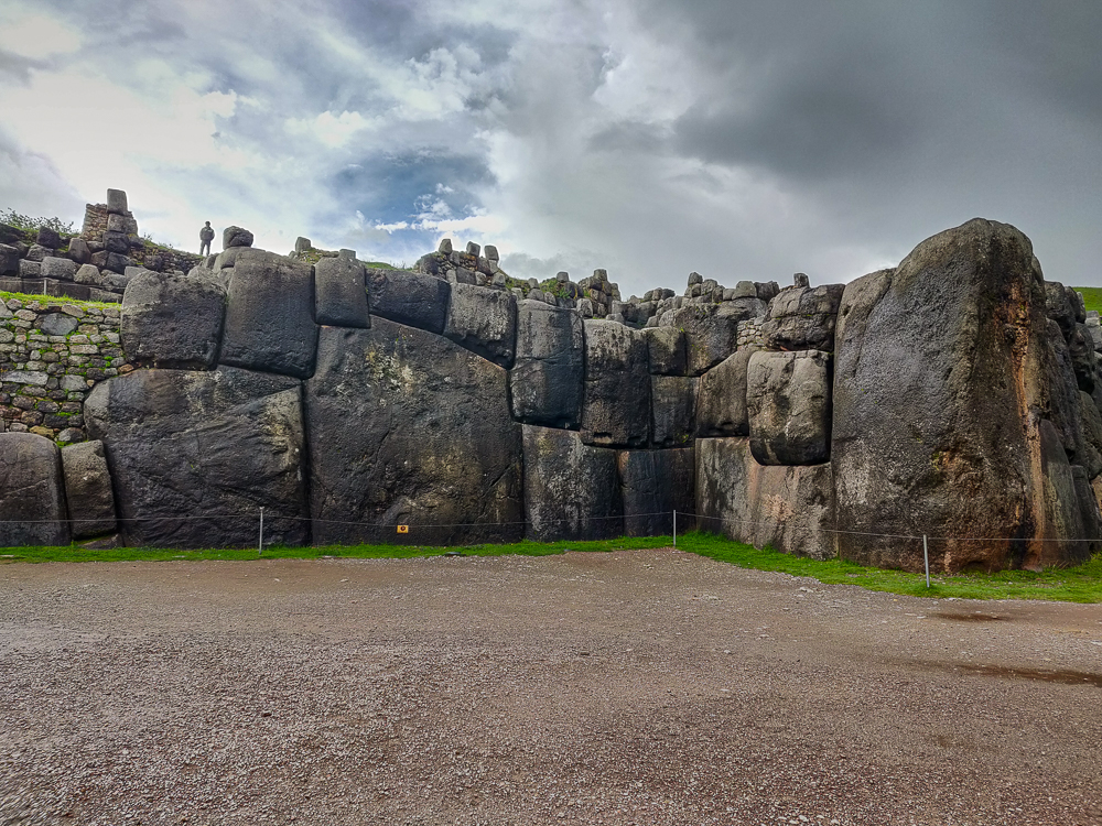
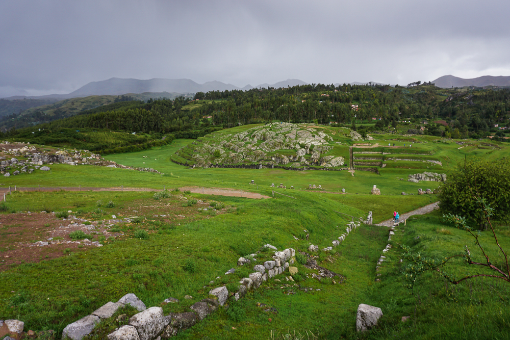
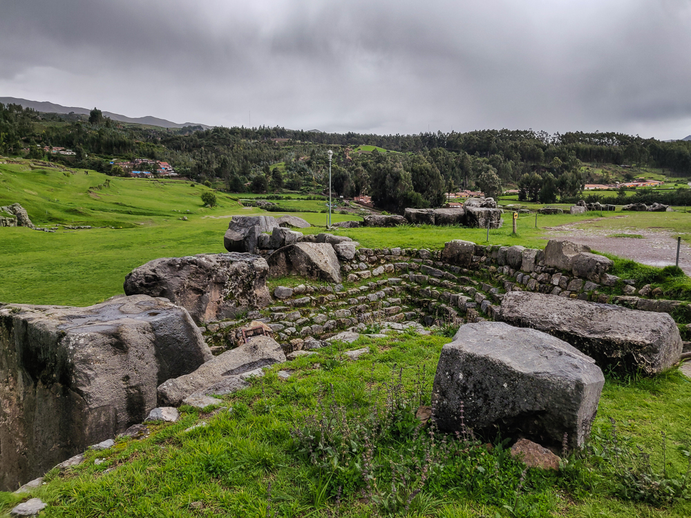
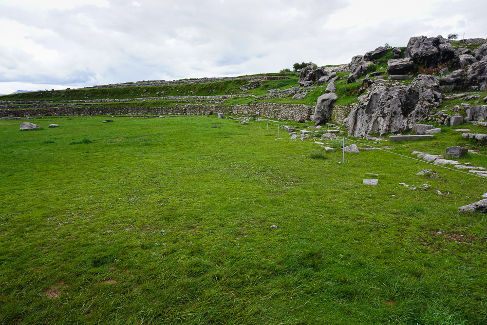
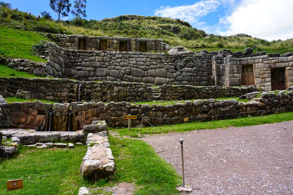
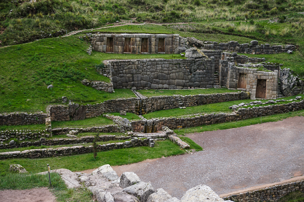
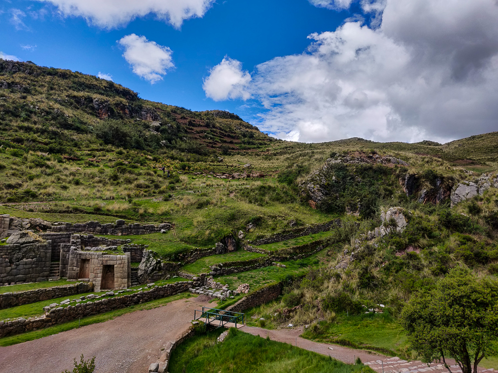
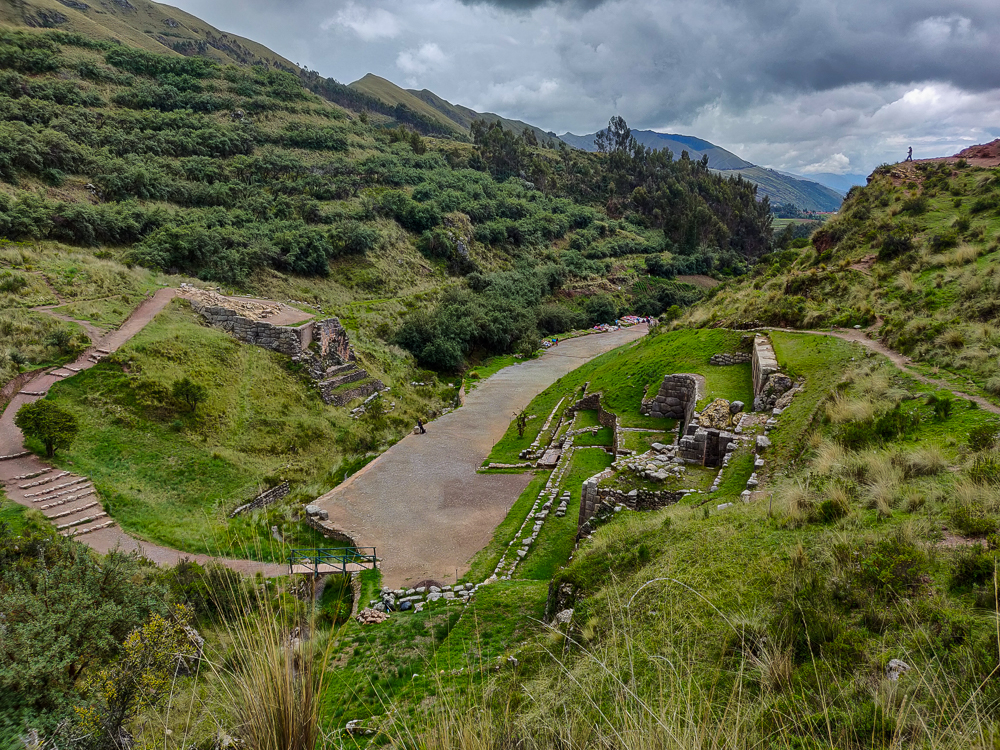
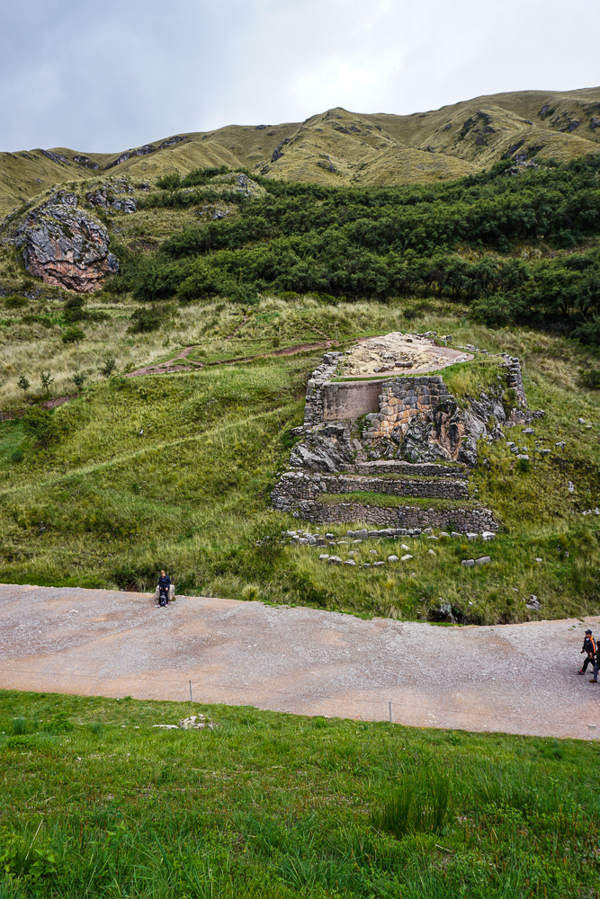
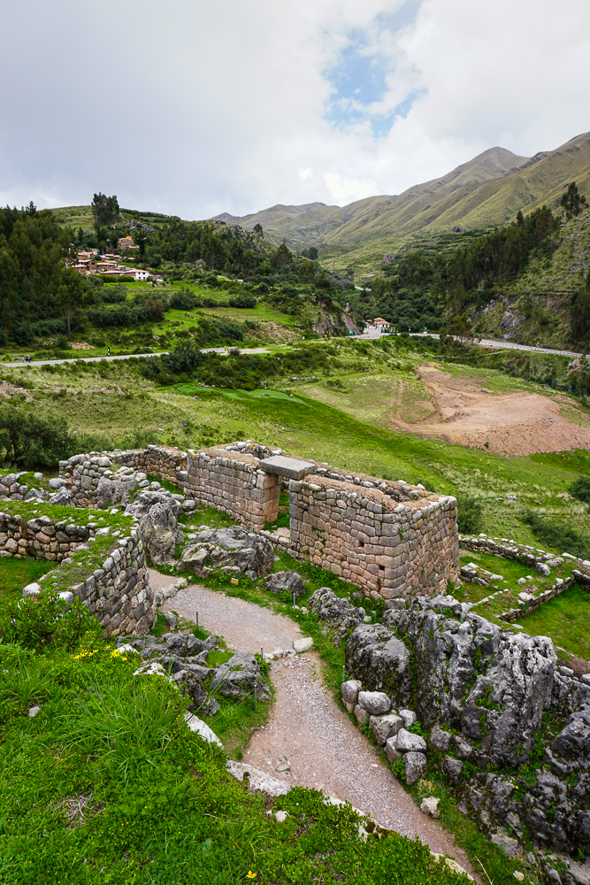
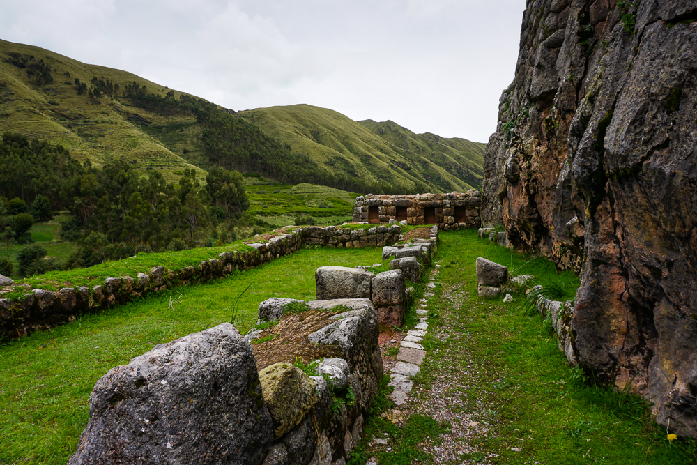
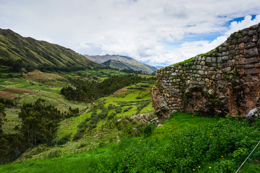
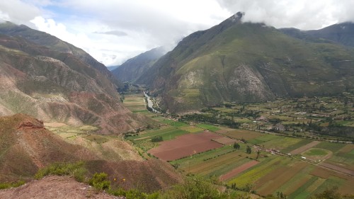
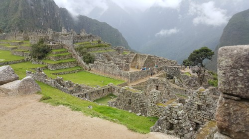
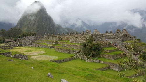
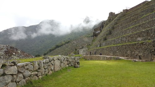
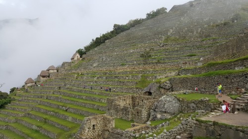
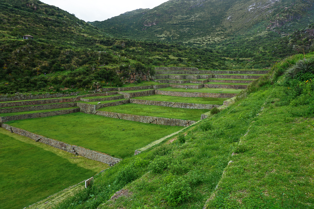
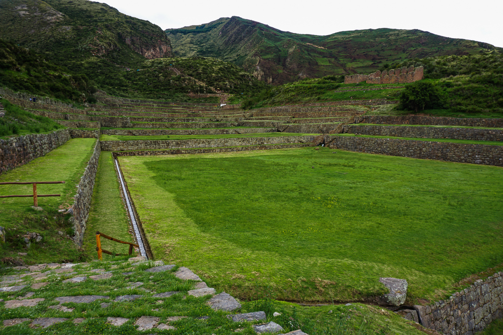
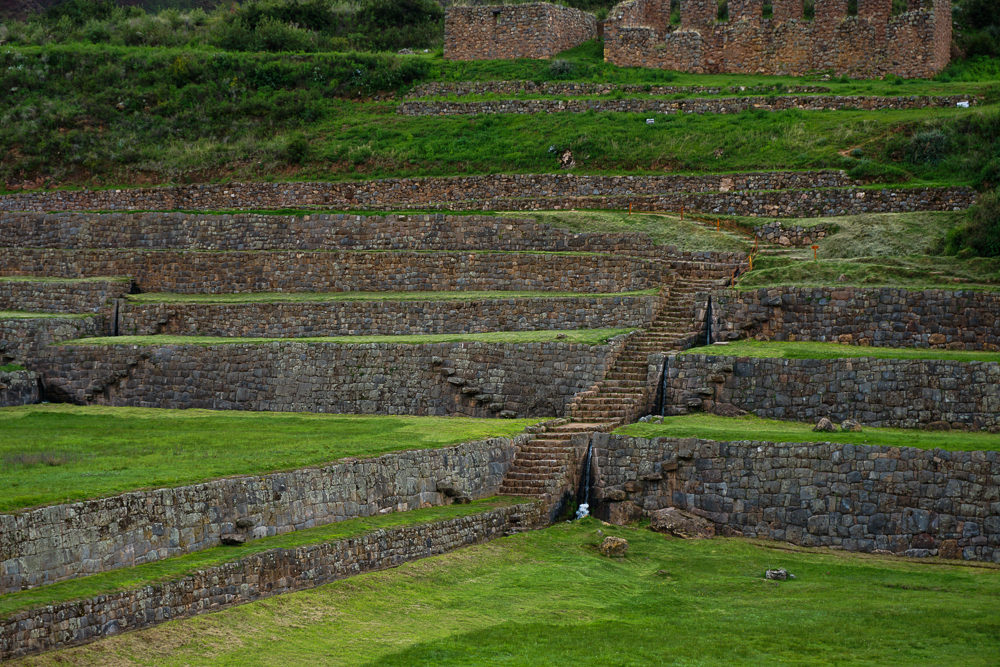
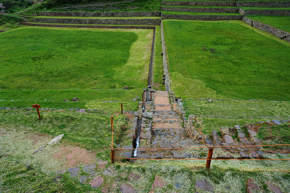
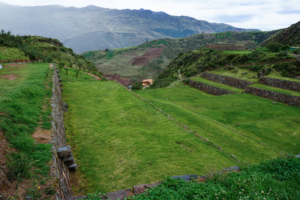
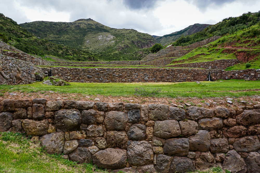
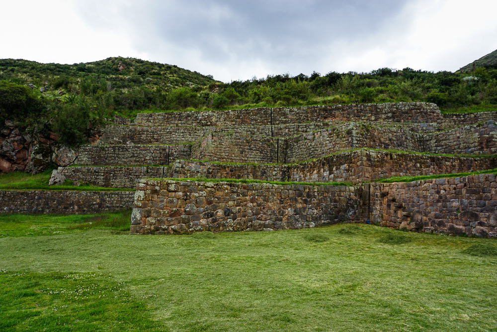
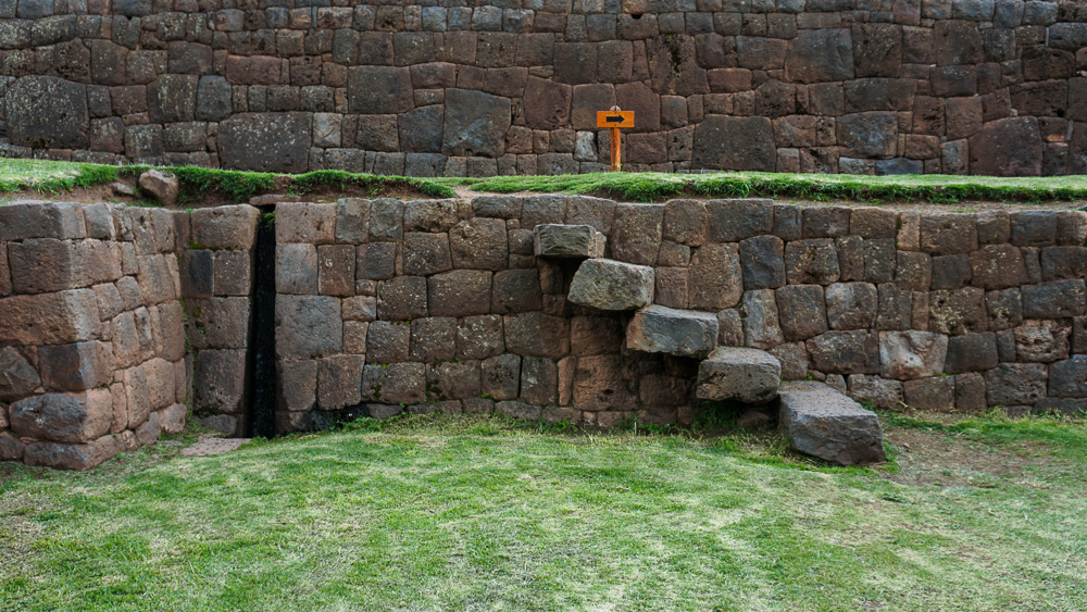
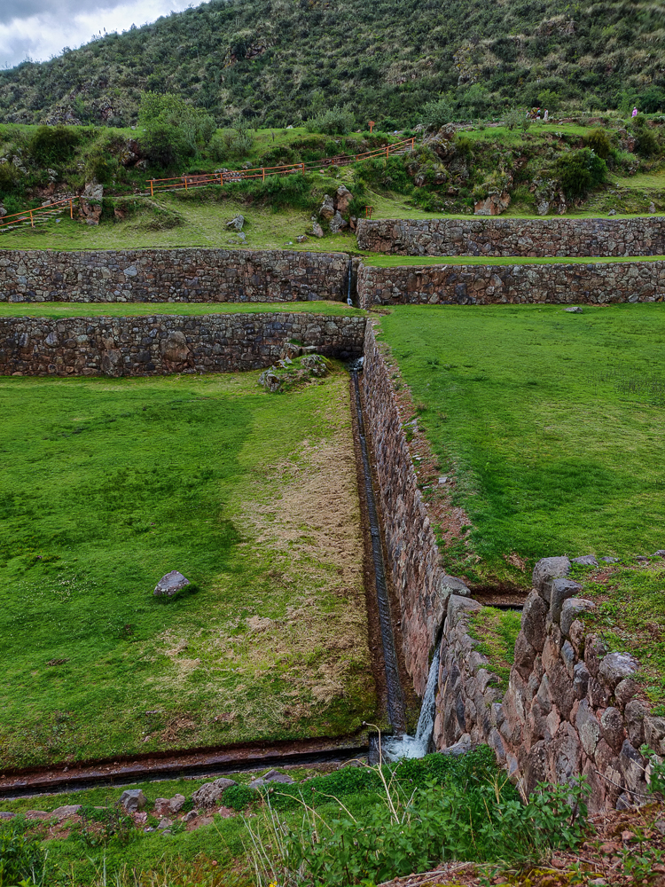
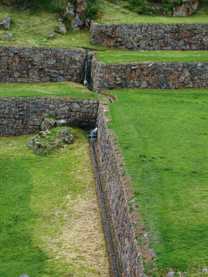
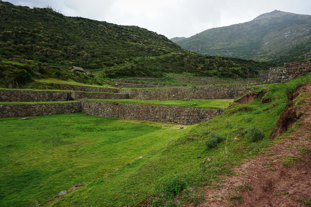
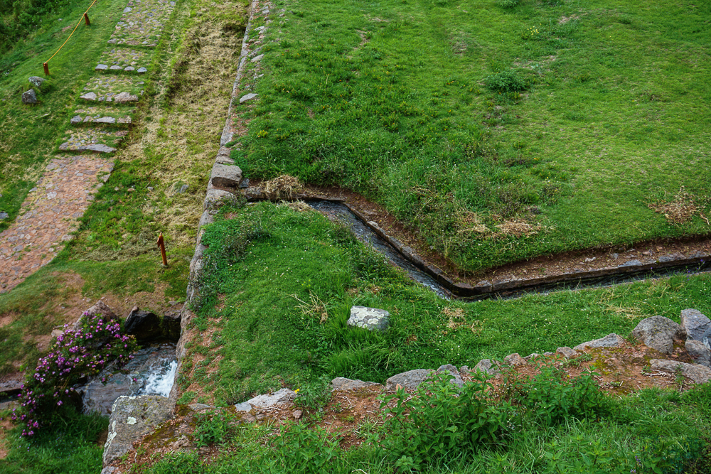
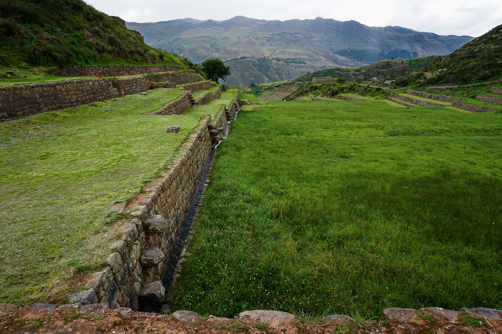
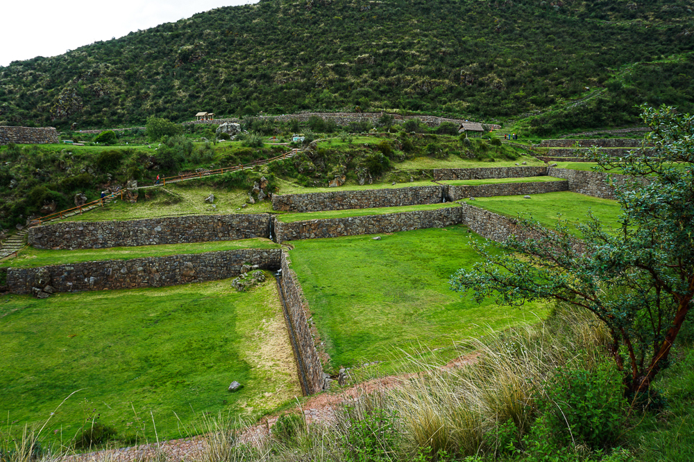
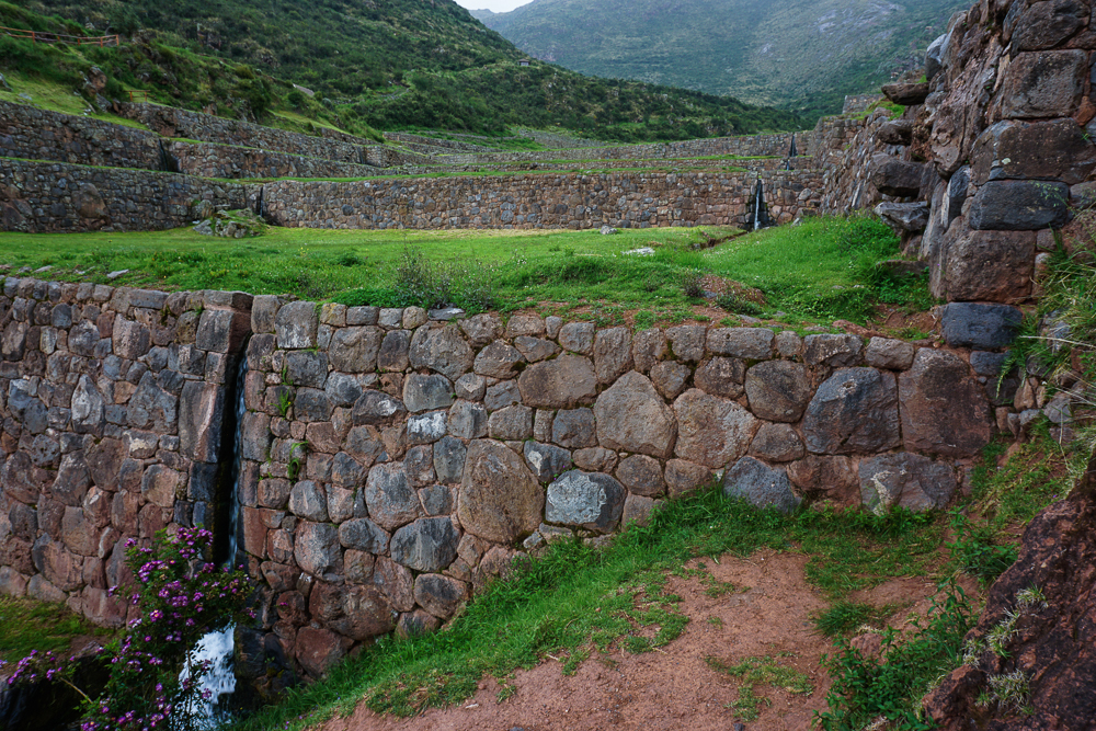
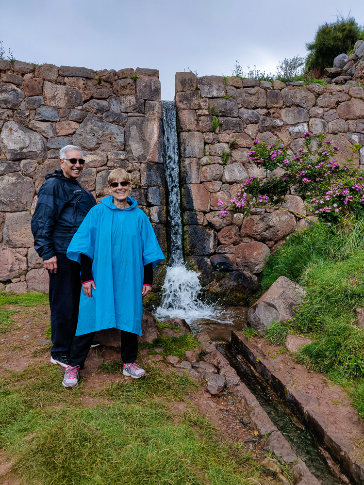
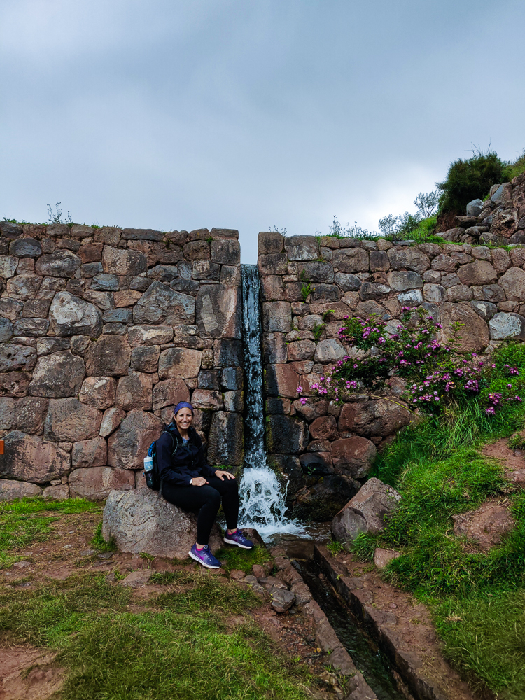
The complex is up in the mountains, built into a dip between two peaks. It consists of twelve terraces (some sources say there are thirteen, but I counted twelve) edged with stone channels that direct water around the site and into waterfalls from terrace to terrace. The water comes from a spring over a kilometer away, brought to the site through the mountains via a series of aqueducts and channels.

The many layers of terracing required to get these big, flat areas are incredible. Just think about how much material had to be cut away and filled in to achieve something so orderly in the middle of the mountains.
They’re just so beautiful! Usually, you don’t see the sides of the terraces like this, but this is what was necessary to level off the site. Wow!!
CHECK OUT THIS VIEW!!!! Also, Tipón was the highest-elevation place we visited, at 11,480ft/3,500m (Cusco is 11,150ft/3,400m and Machu Picchu is 7,970ft/2,430m).

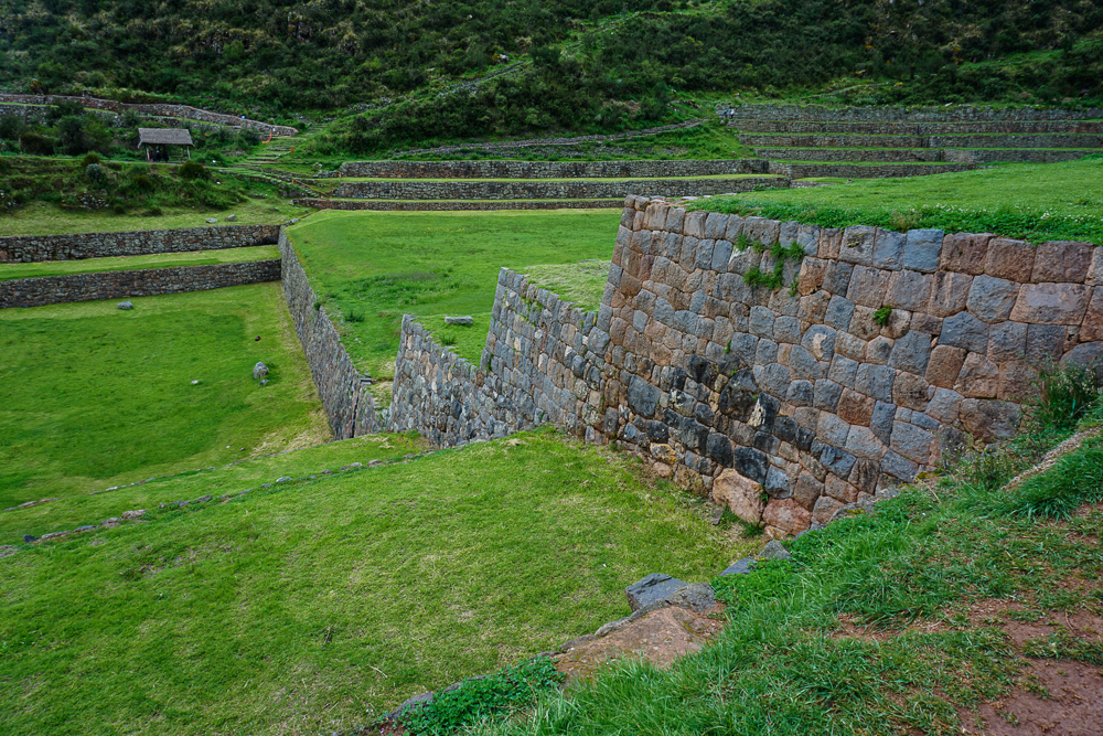
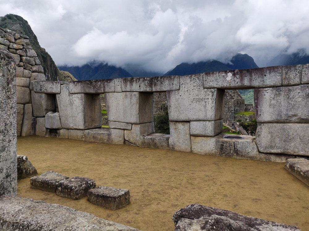
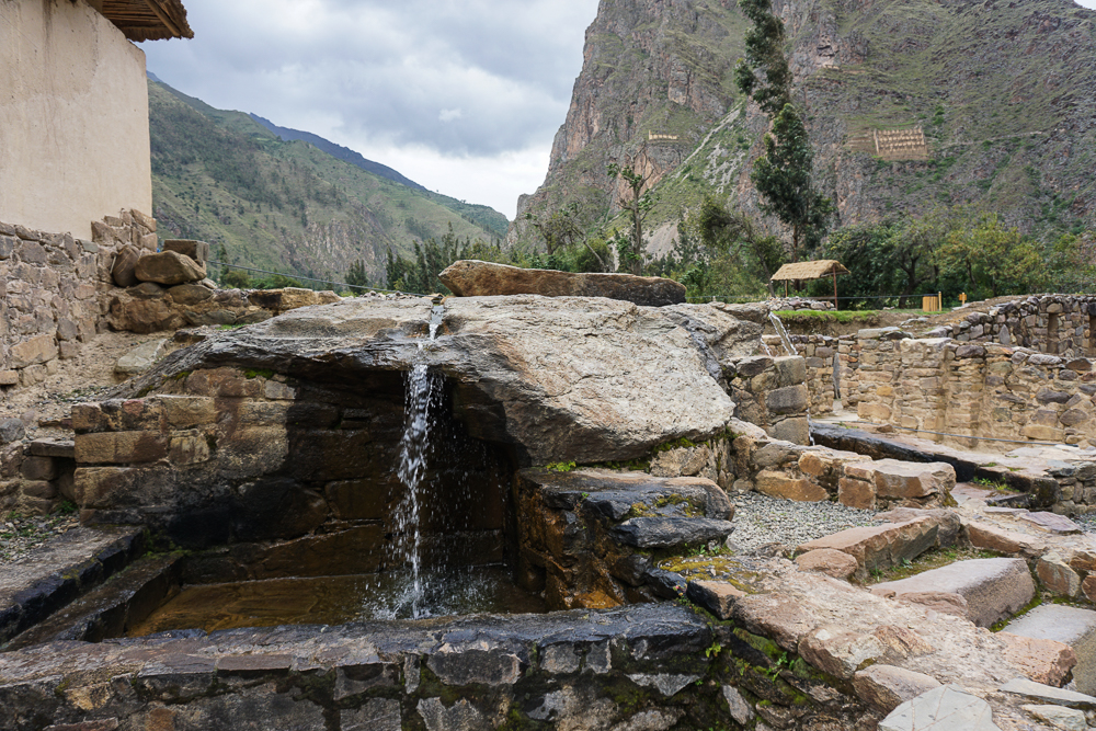
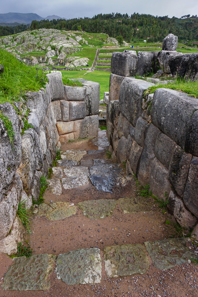
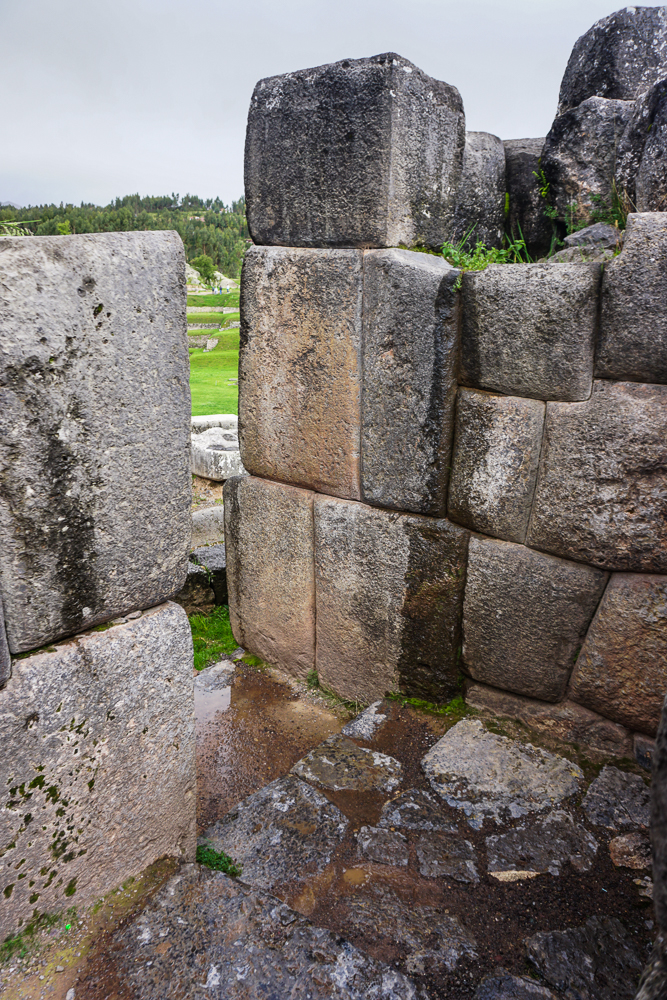
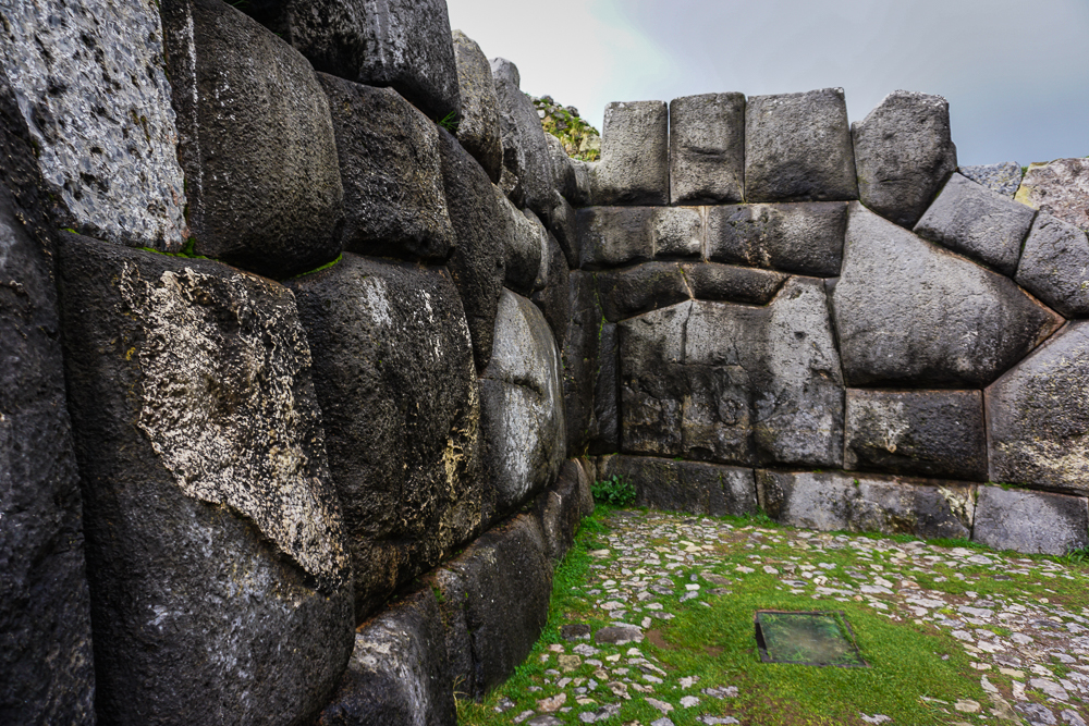
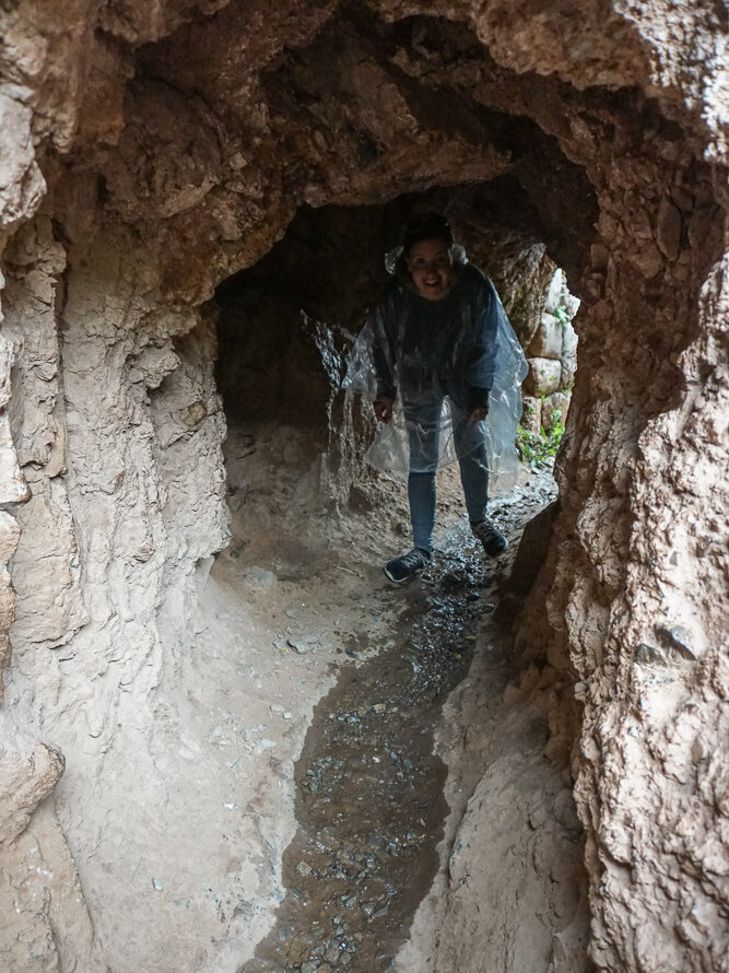
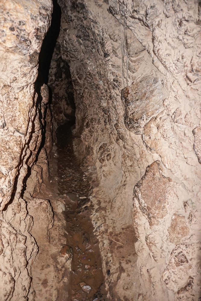
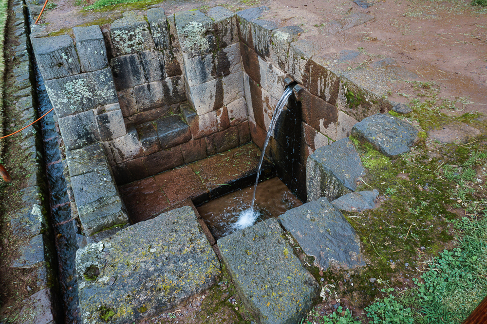
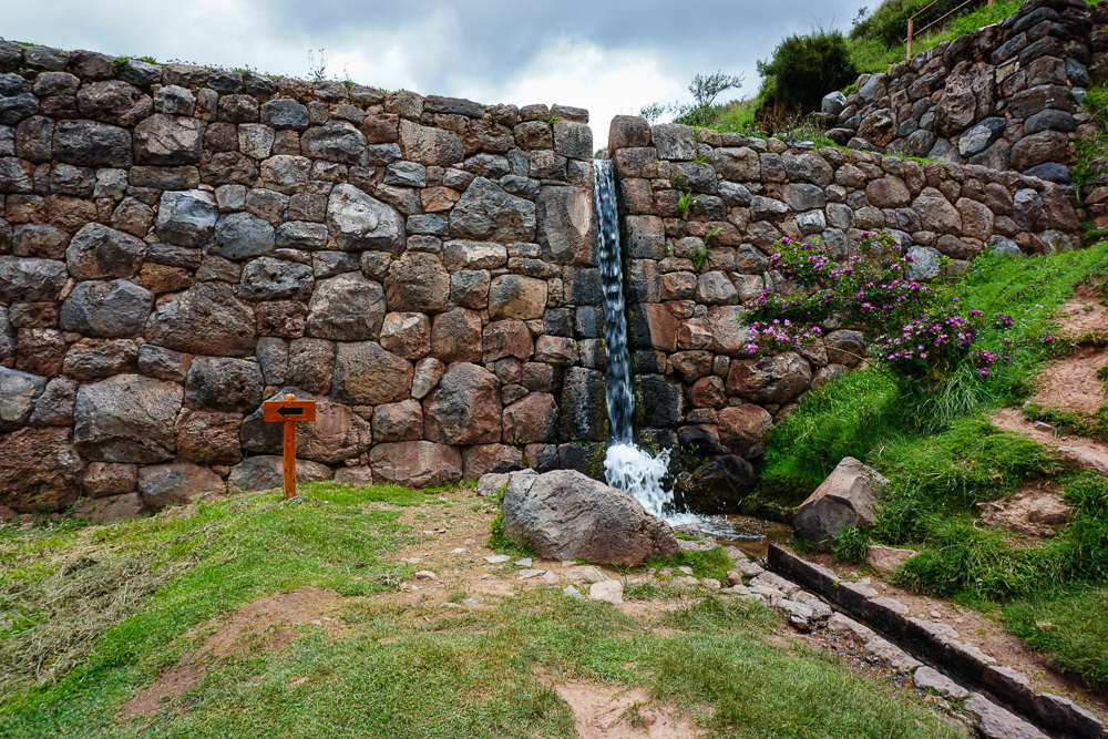
All Inca sites show evidence of water management systems, but Tipón is special. First of all, it still functions! Of course, after years of neglect, there was some cleaning/plant clearing to be done, but isn’t that amazing?? You can hike to see the channel that carries water down from the spring, and the channels and waterfalls around the site are still going strong. Second, the design feels more epic, more monumental than at other sites. It’s not just functional; it’s like a celebration of water.

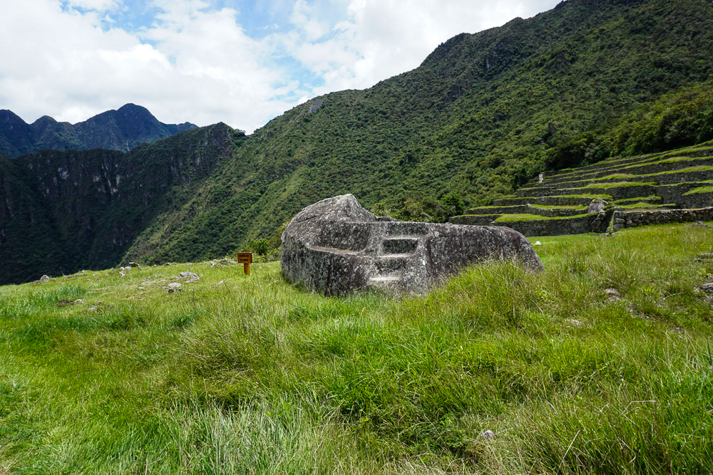
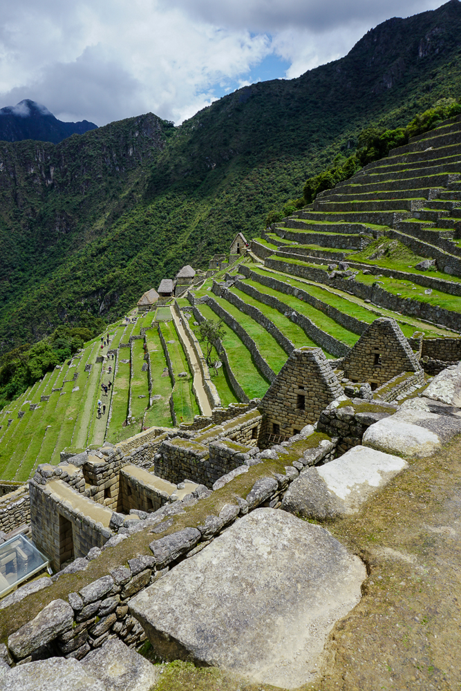
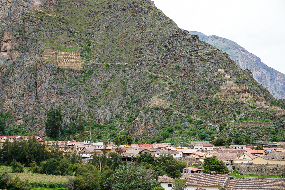
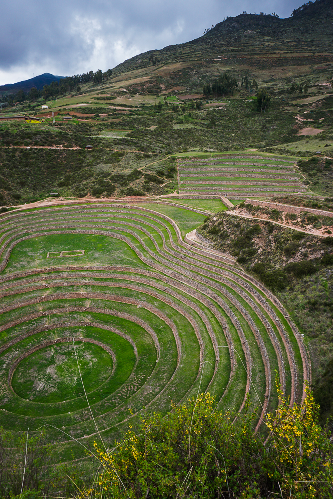
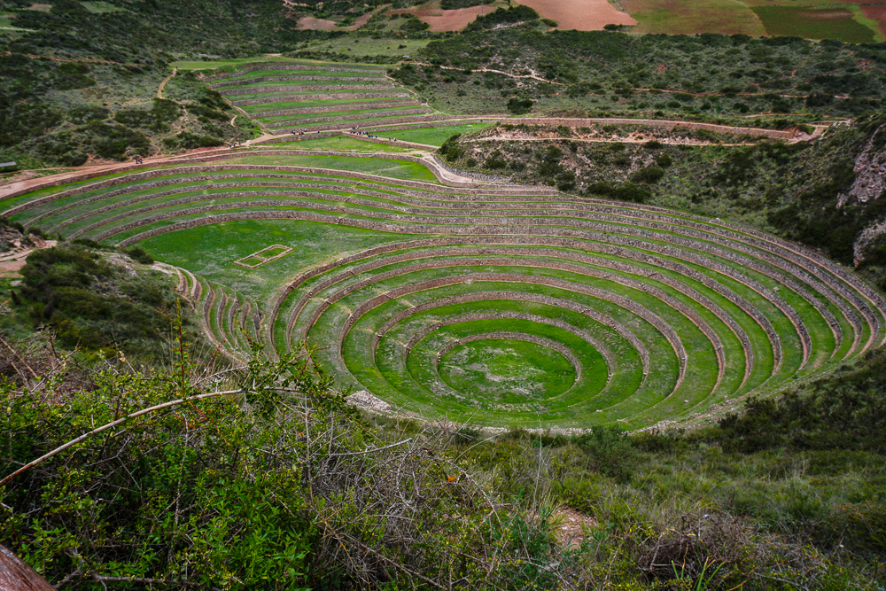
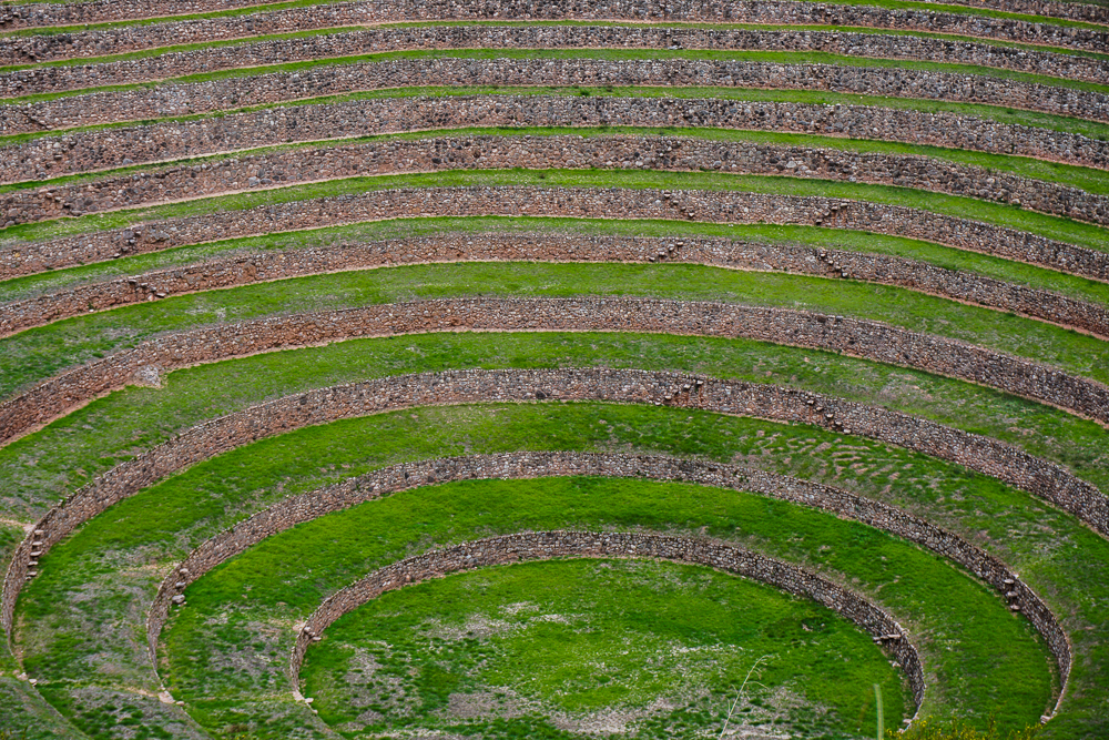
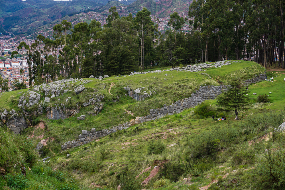
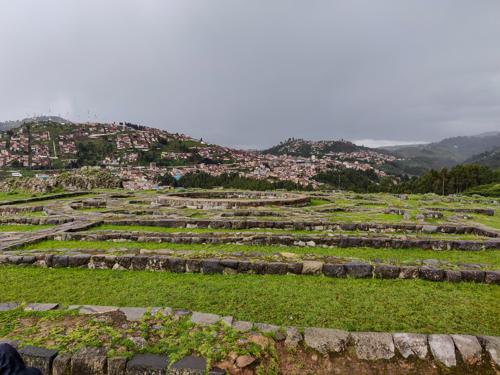
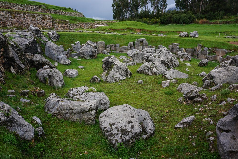
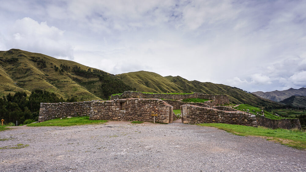
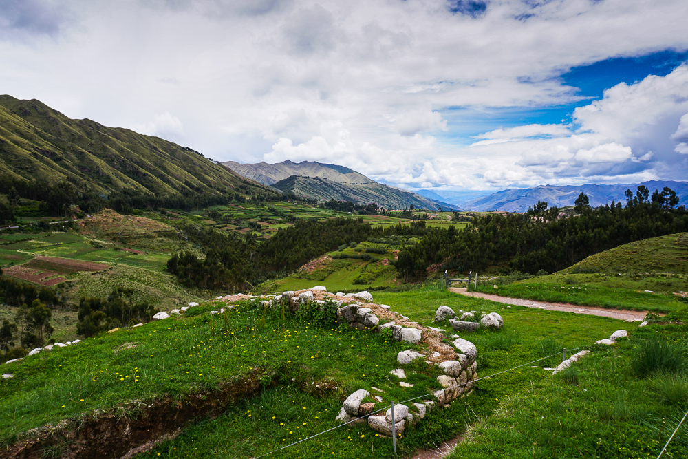
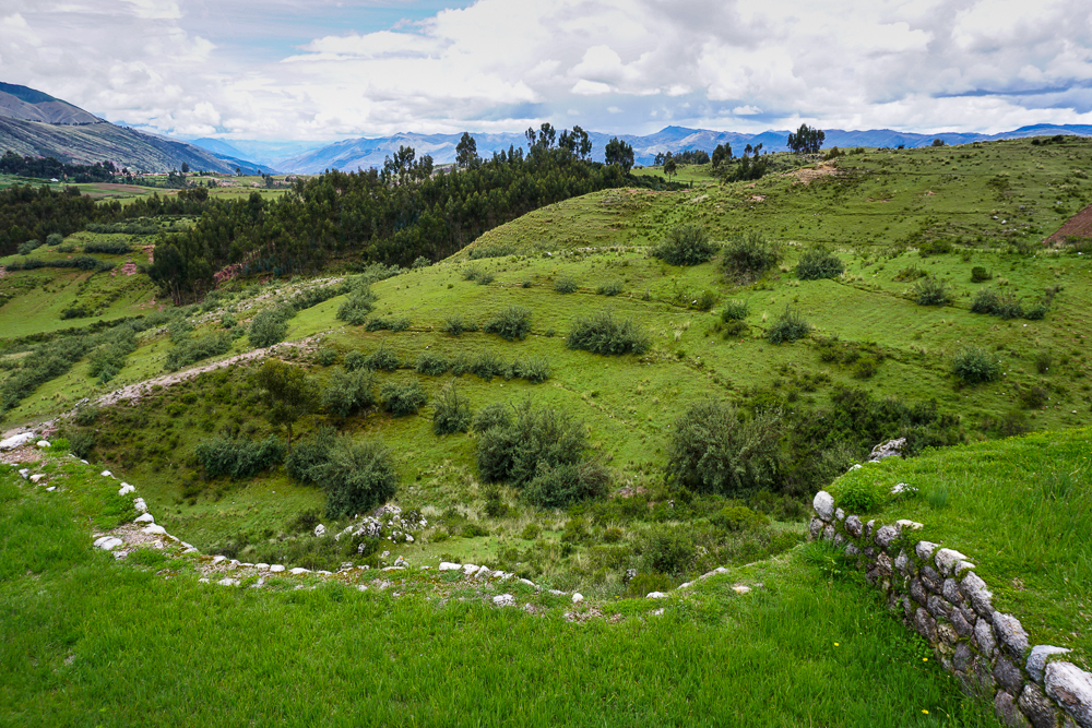
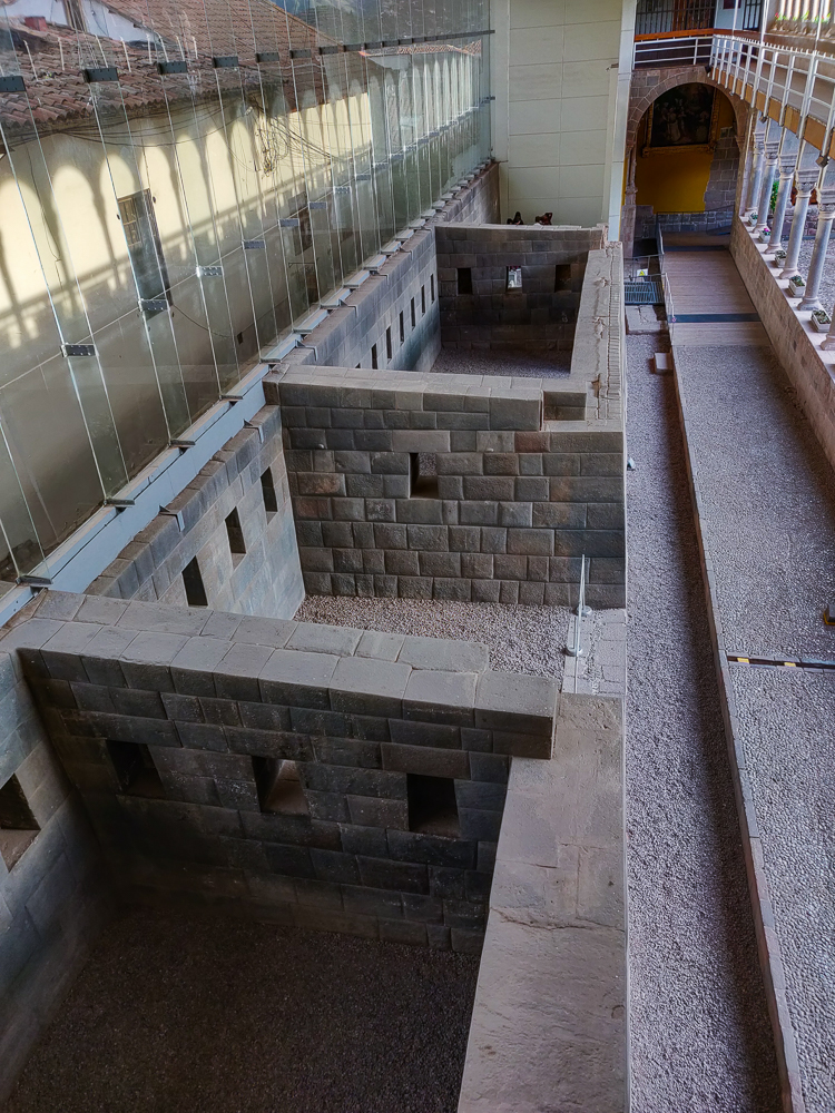
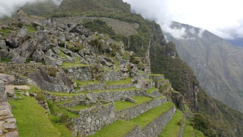
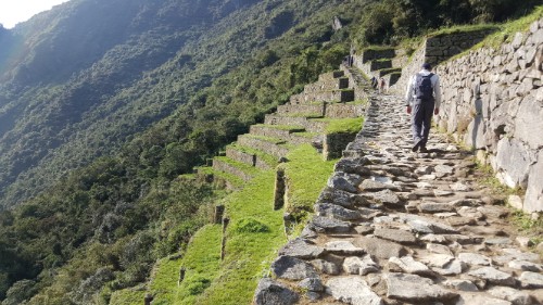
The agricultural terraces at Tipón immediately stand out as different. Take another look… what do you notice about these vs. the terraces at Machu Picchu, for example?

What do you notice?

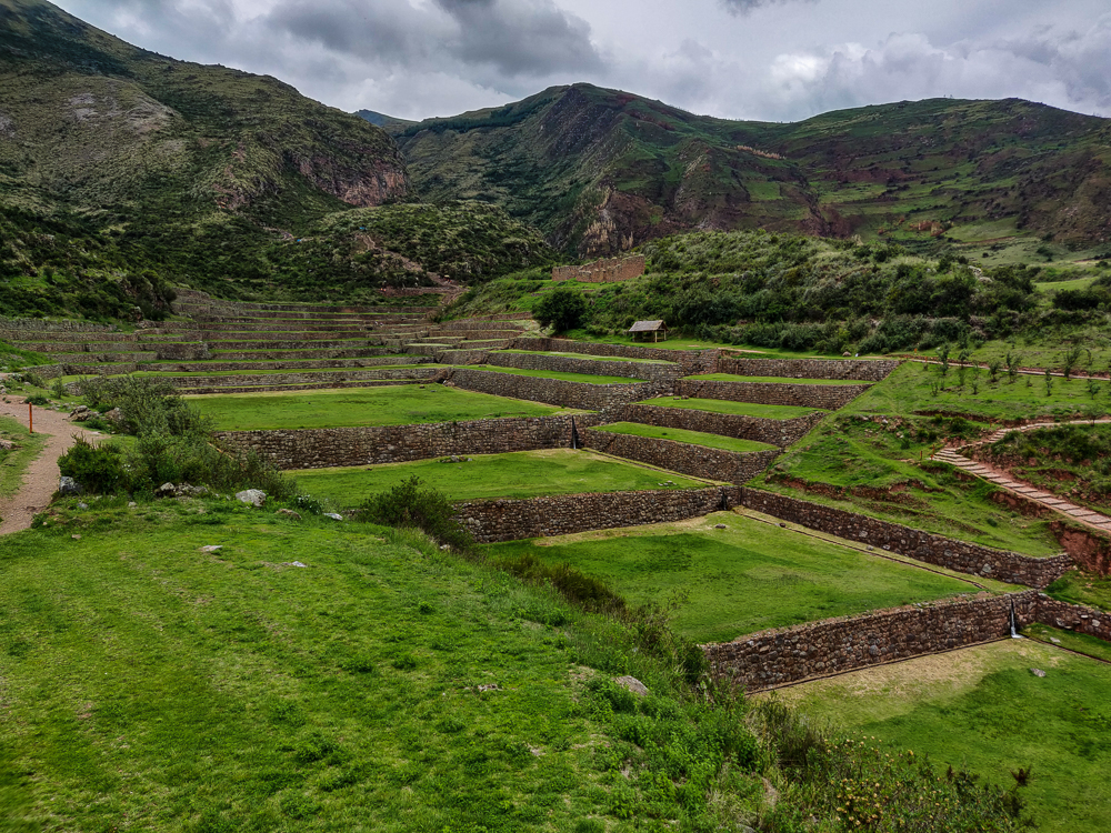
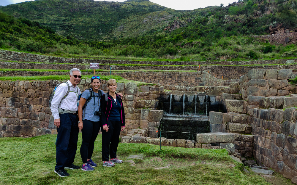
The most obvious answer is that they’re huge. Each one creates a massive area of farmable land, rather than the little slivers we’re used to. Beyond that, the Incas generally built their agricultural terraces to follow the topography. At Tipón, however, right angles and straight walls are imposed on the landscape. It’s very orderly and precise, contributing to the belief that it was an important religious site. That would mean that design decisions were likely also symbolic. The twelve terraces (if there are truly twelve), for example, could represent the twelve months of the Inca solar calendar. There’s a main fountain near the high point of the complex, and as the water flows down, it splits from one stream of water into two (possibly representing heaven and earth), then into four (which could be the four elements), and finally combines back into one to flow into a ritual pool.

The crew!
The straight lines are so satisfying. Especially that water channel on the left side of the terrace.
I love the staircase and the stairs on the sides of the terraces and the line of waterfalls that comes down next to the staircase.
Top view of that staircase
With the main fountain. You can’t see the split from one into two, but there’s the four -> one -> ritual pool.
I did edit these pictures a bit, but I promise you that the grass seriously was this green. It’s unreal… but it’s real.

I don’t think it’s possible to fully appreciate the experience without also being able to hear it, so check out this video!

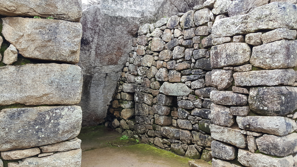
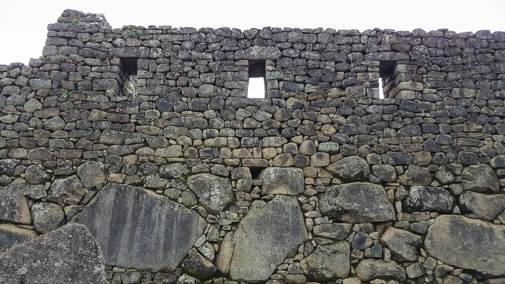
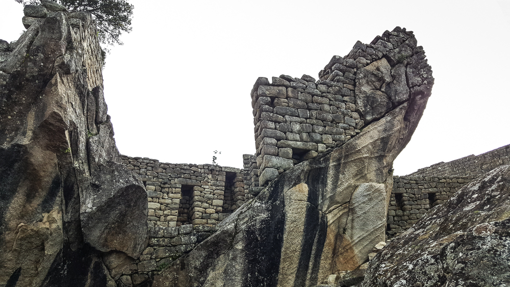
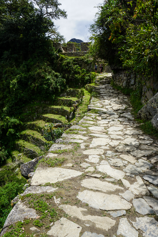
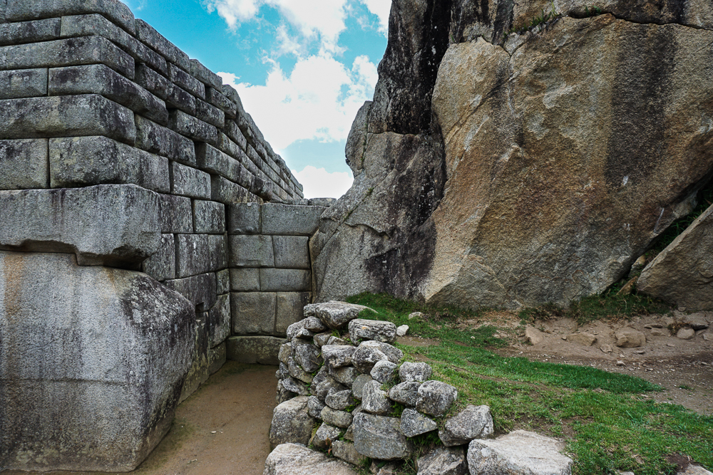
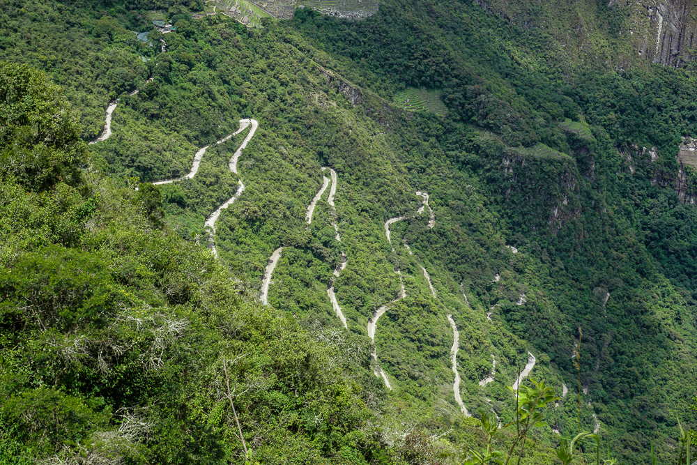
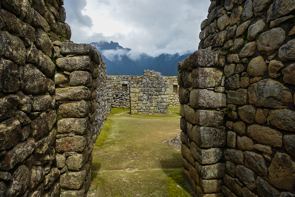
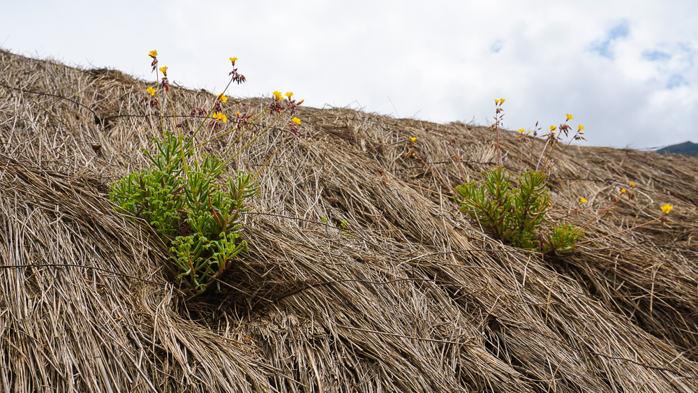
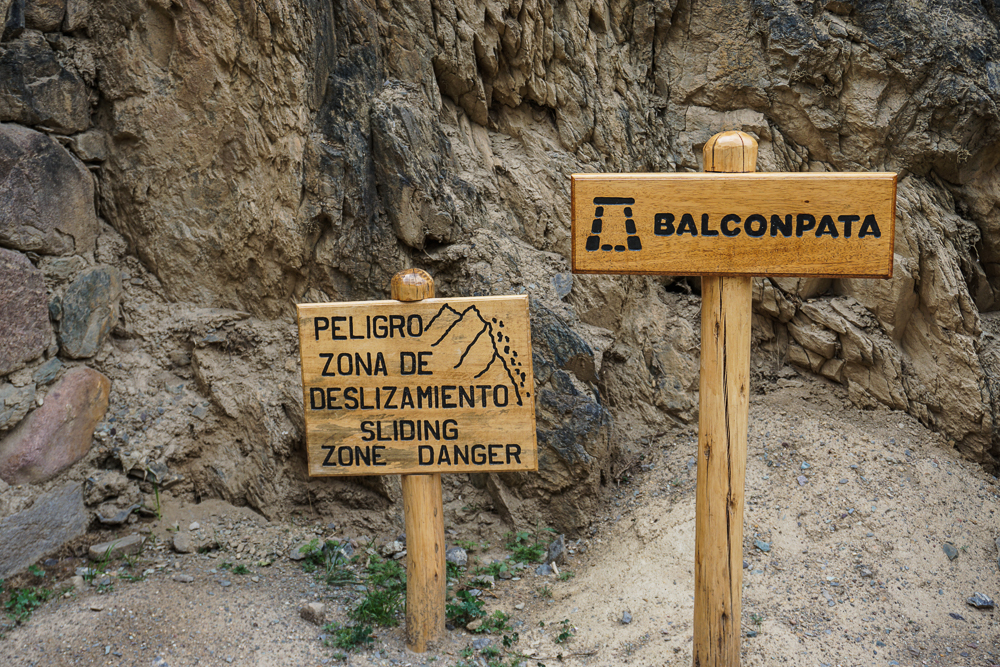
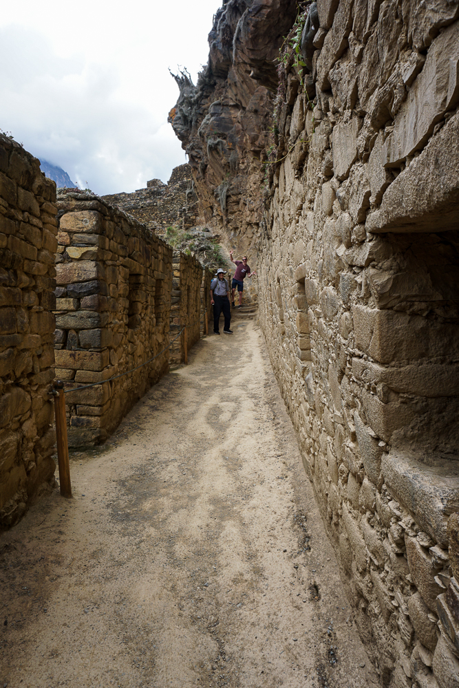
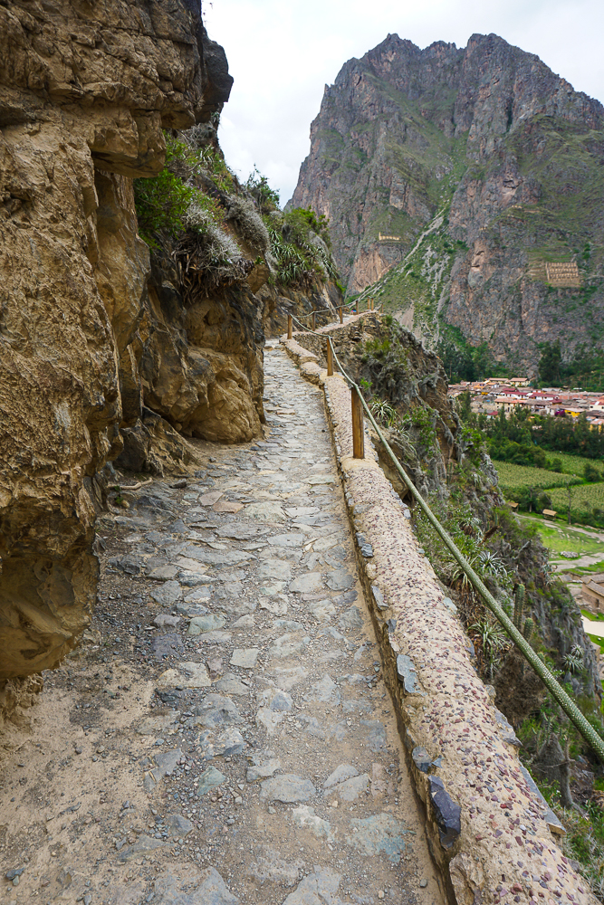
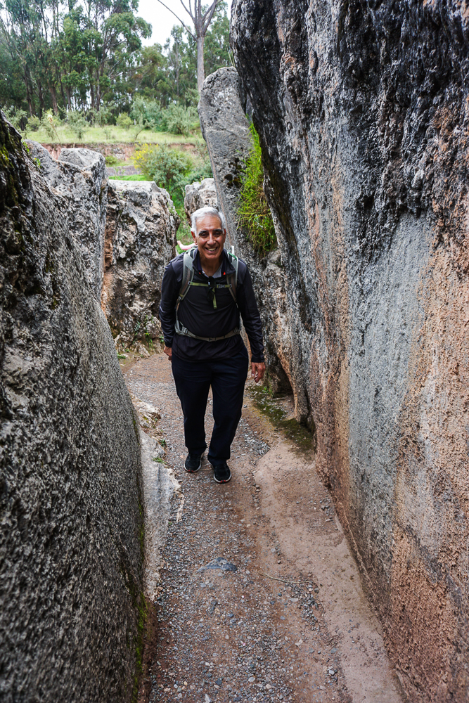
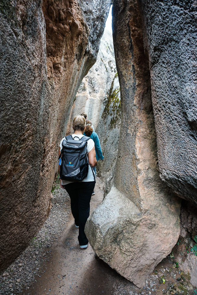
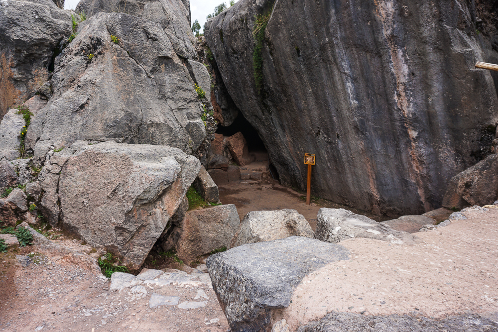
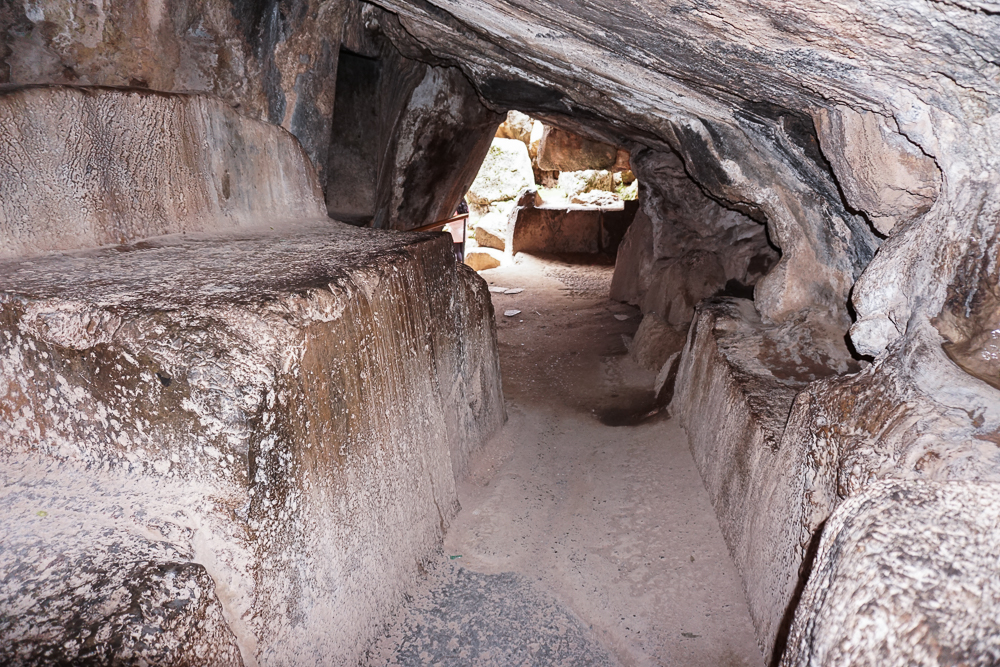
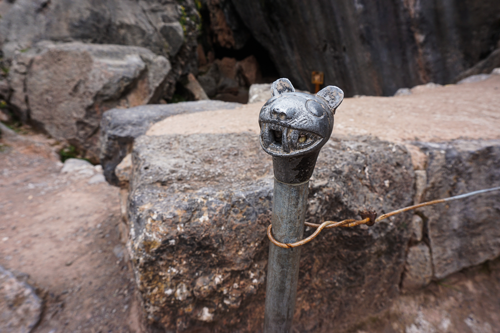
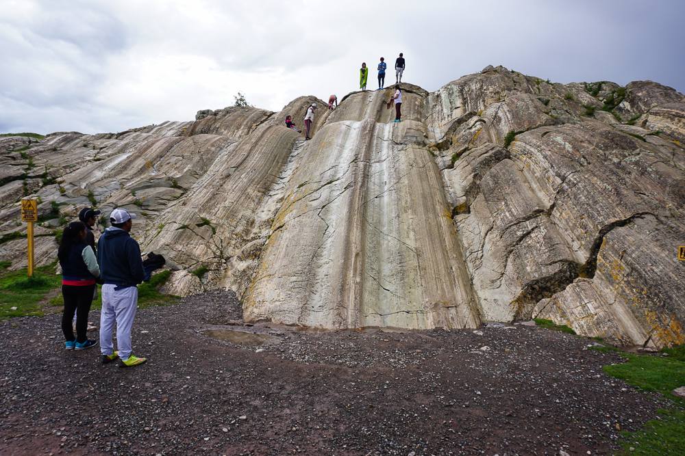
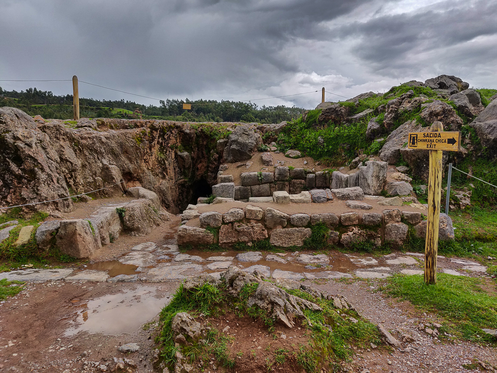
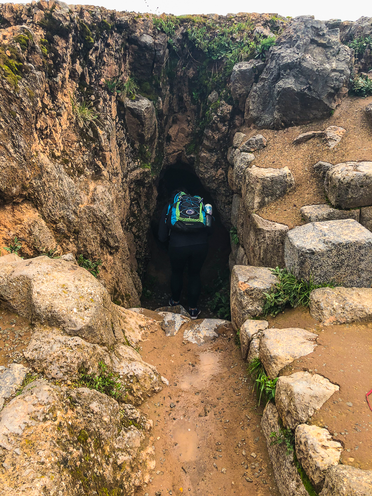
And more of the infinite pictures I took…

Mom, Dad, and me
The stone at this site is a red stone, giving it a very different vibe from the grey-white granite of Machu Picchu
These jagged terraces remind me of the zig-zagging walls at Saqsayhuaman.
Possibly military buildings, definitely a beautiful view.
I’m admiring three things in this picture: 1. the stonework because I’m always obsessed with that. 2. the stairs because how cool are these cantilevered stone steps?? and 3. see that vertical channel on the left? After the water falls down, it goes underground! There’s so much more to this site than what you can see, and that already was enough to blow my mind.
THREE waterfalls in this picture.
I took this more zoomed-in picture because I liked the bend between those two waterfalls. See how the top one is facing us? And then a channel curves around so that the next waterfall is rotated 90 degrees.
That’s some fancy stonework. Also, even though we can see a lot of how the water is being circulated around the site, this picture makes it clear that there’s still way more going on than meets the eye because there has to be something going on underground that brings the water here. So cool!
I thought the stonework here was interesting because usually, it seems like the stones are relatively similar in size. In this building, there are a bunch of large stones, and the gaps are filled in with small stones.
The royal palace next to the terraces. Actually, you can also kind of see the main fountain’s split into two waterfalls in this picture. See that person in the bright pink? Just above her, you can see two little waterfalls.
Exploring some of the other ruins around the site… and Jocelyn looking fashionable in her poncho.
A sign identified these ruins as the “church”. So there you have it.
It’s incredible that they managed to create this in the middle of the mountains.
There’s a bunch of somewhat-excavated ruins on that hill up ahead (where you can see the short, curved wall). I don’t know if it really was a military outpost (I think those are the buildings the guidebook was talking about?), but it certainly looks like a good spot to defend from.
I know it looks simple, but I love the curves in the channels. Also, think about it. They had to make sure that the channels were sloped enough to keep the water flowing until the very end!
More stairs that I love and a water channel that you can follow allllll the way down the terraces.

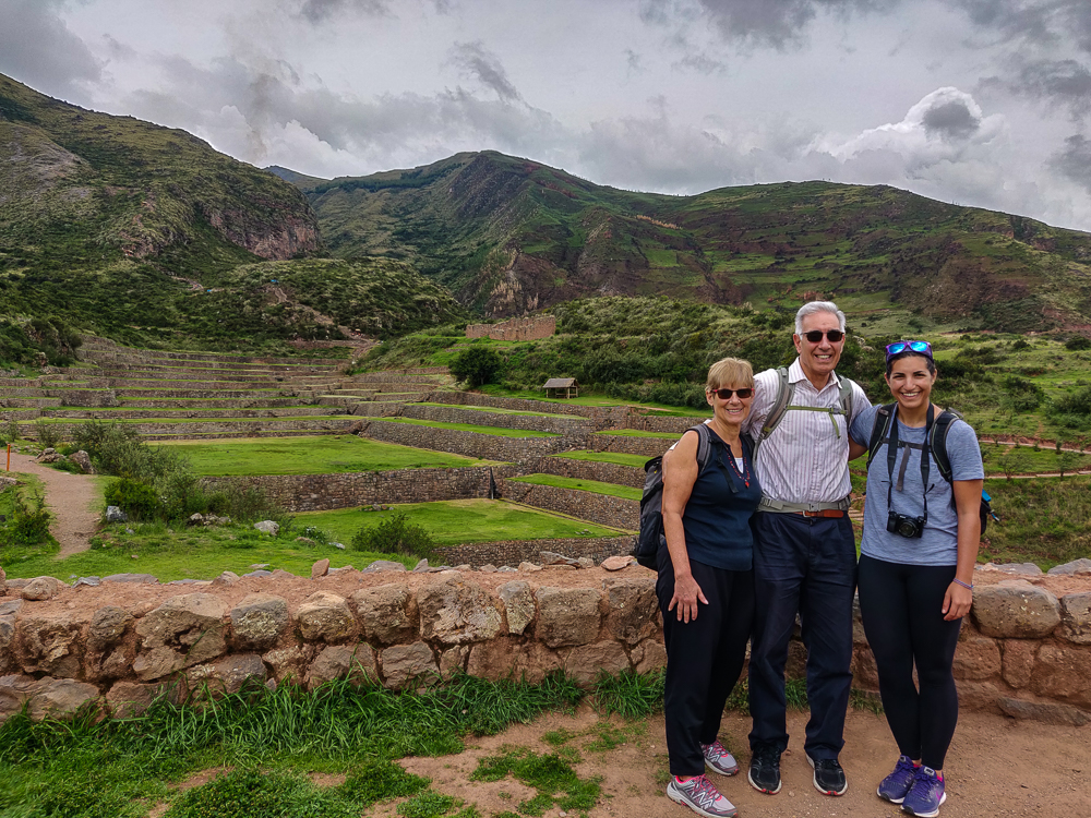
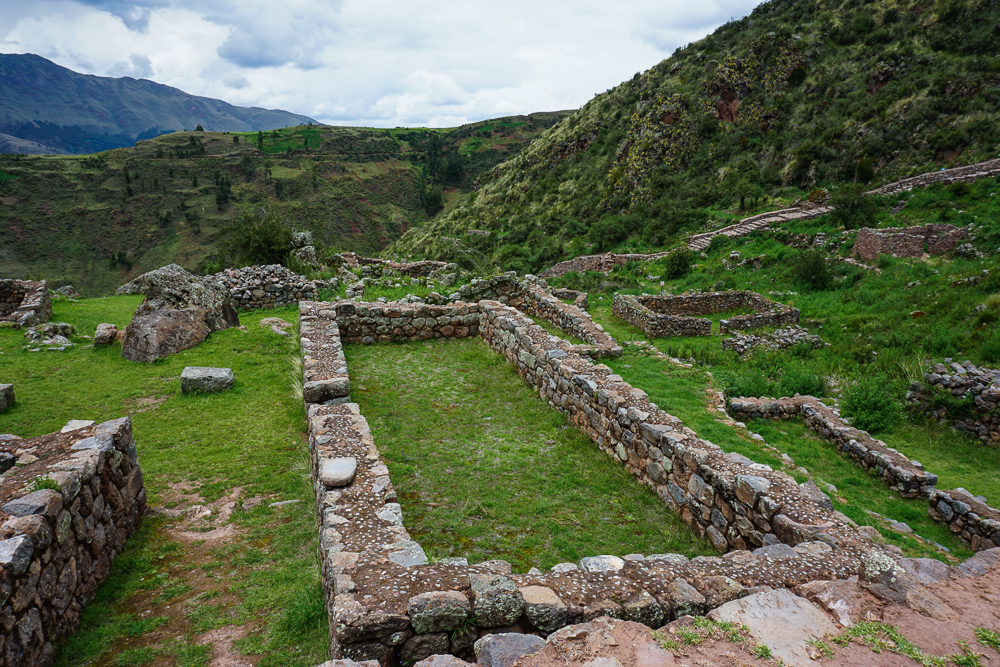
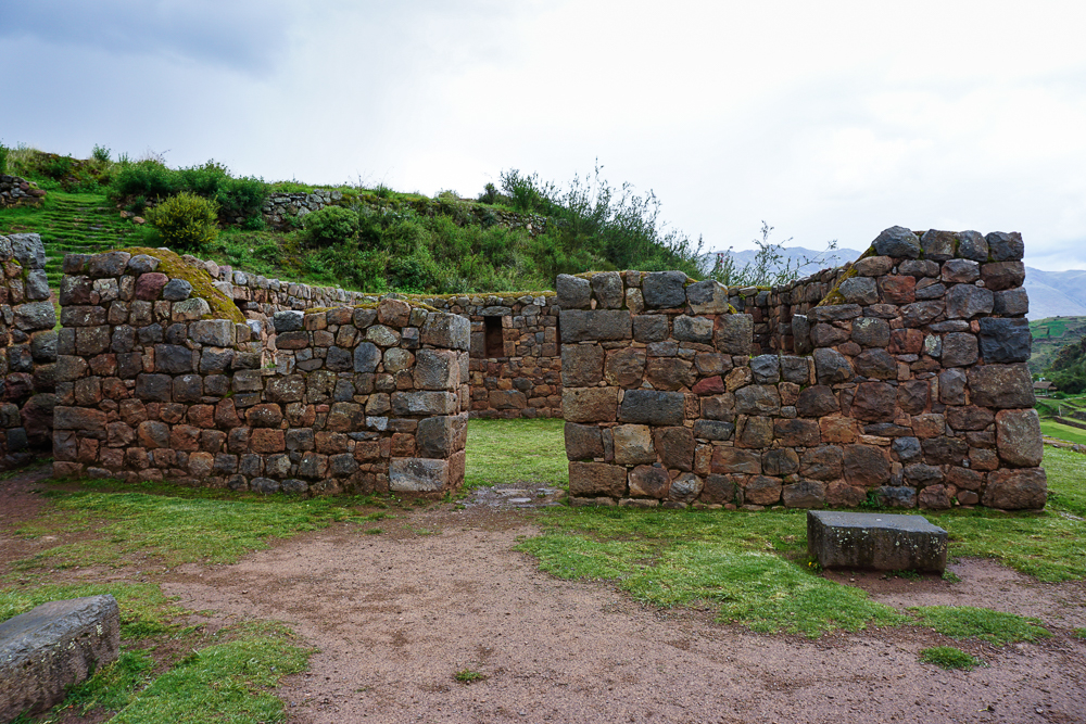
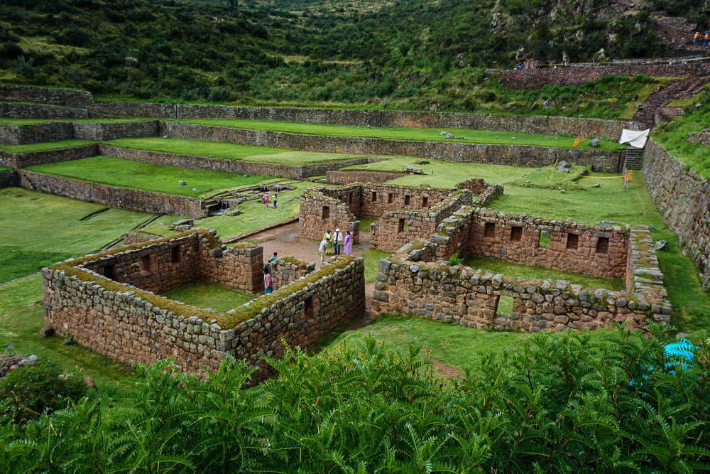
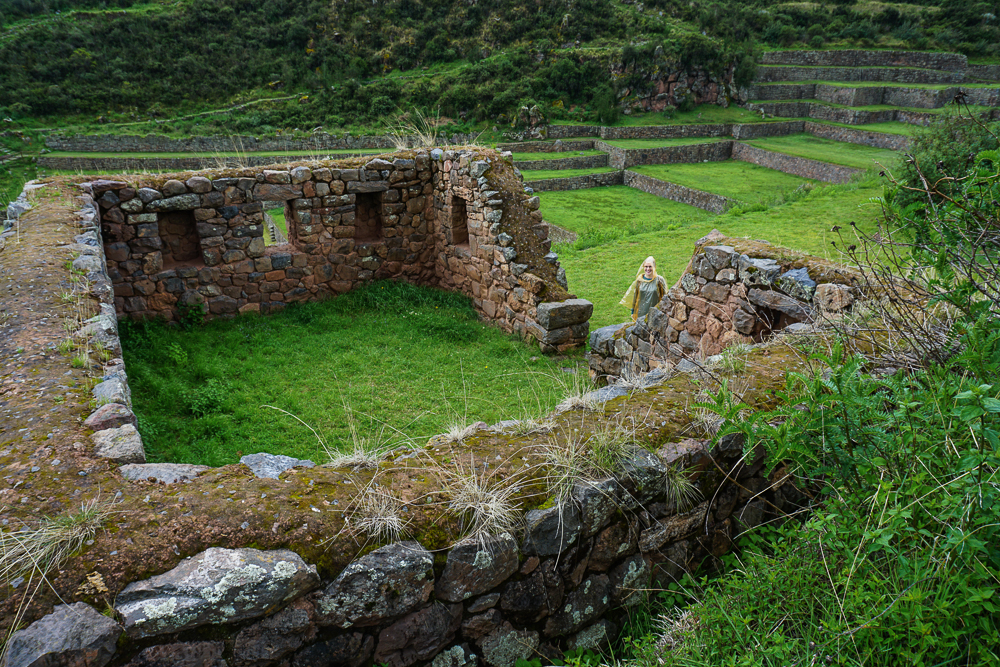
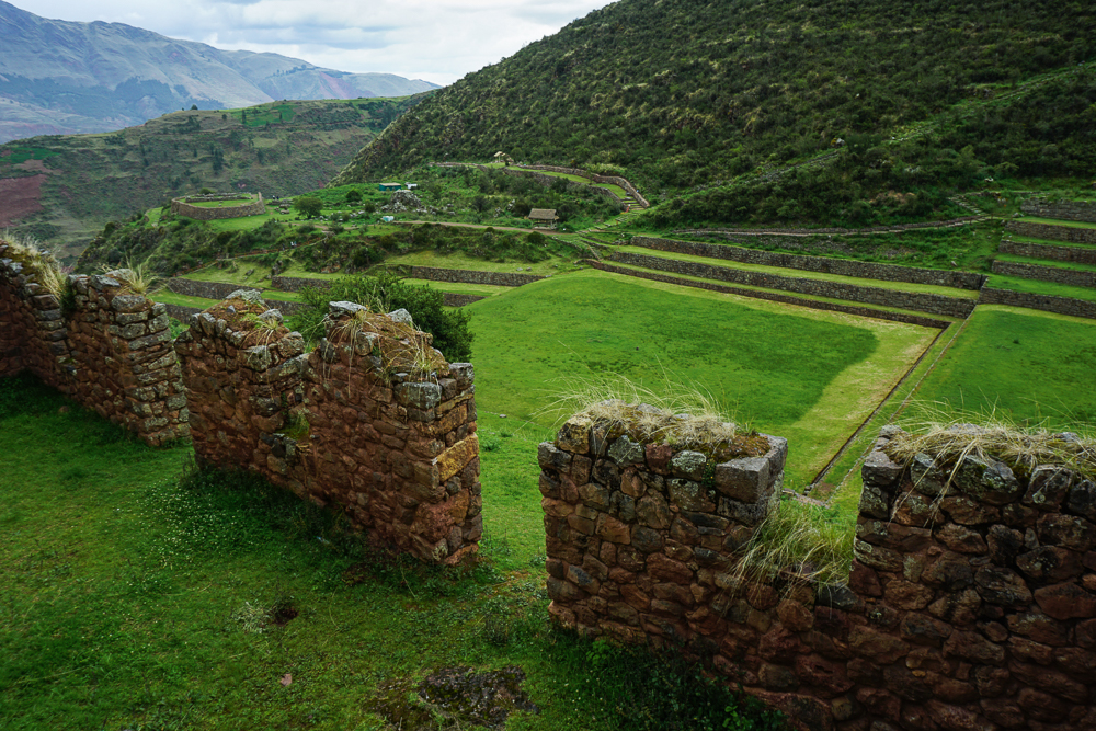
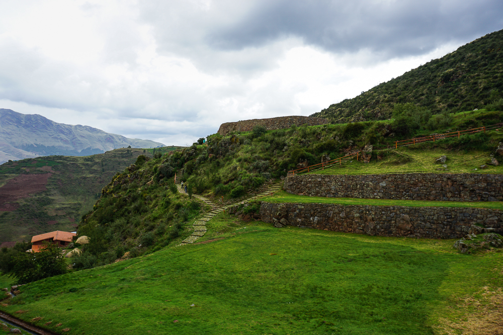
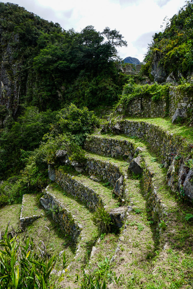
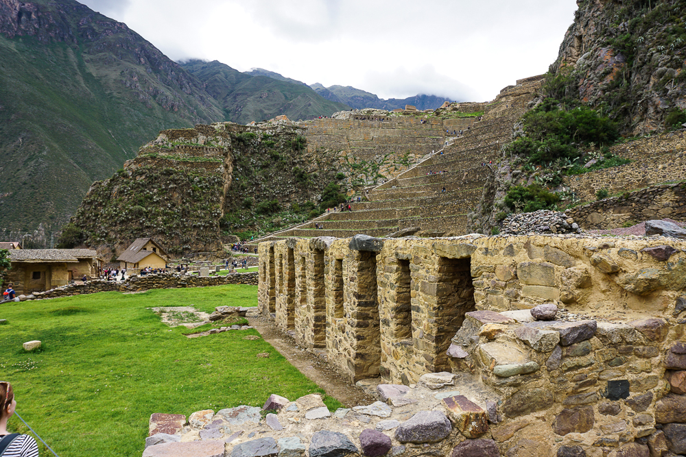
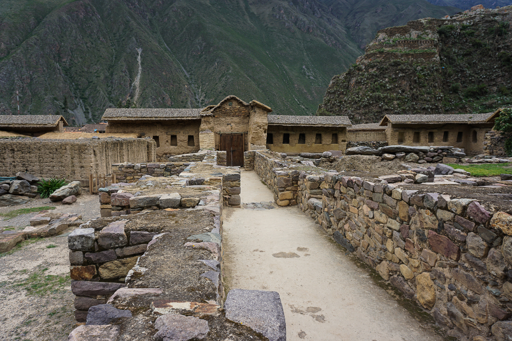
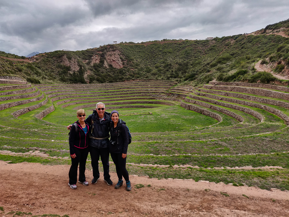
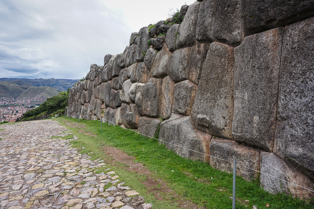
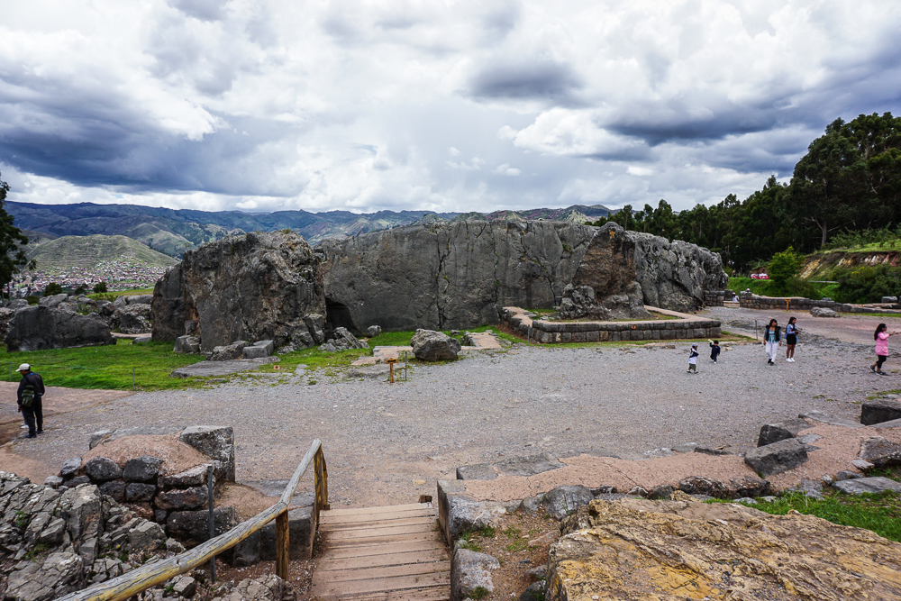
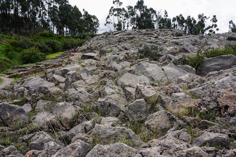
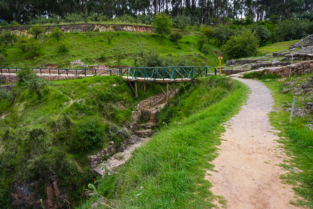
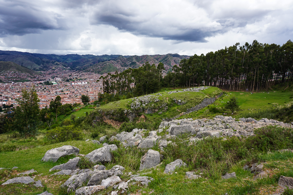
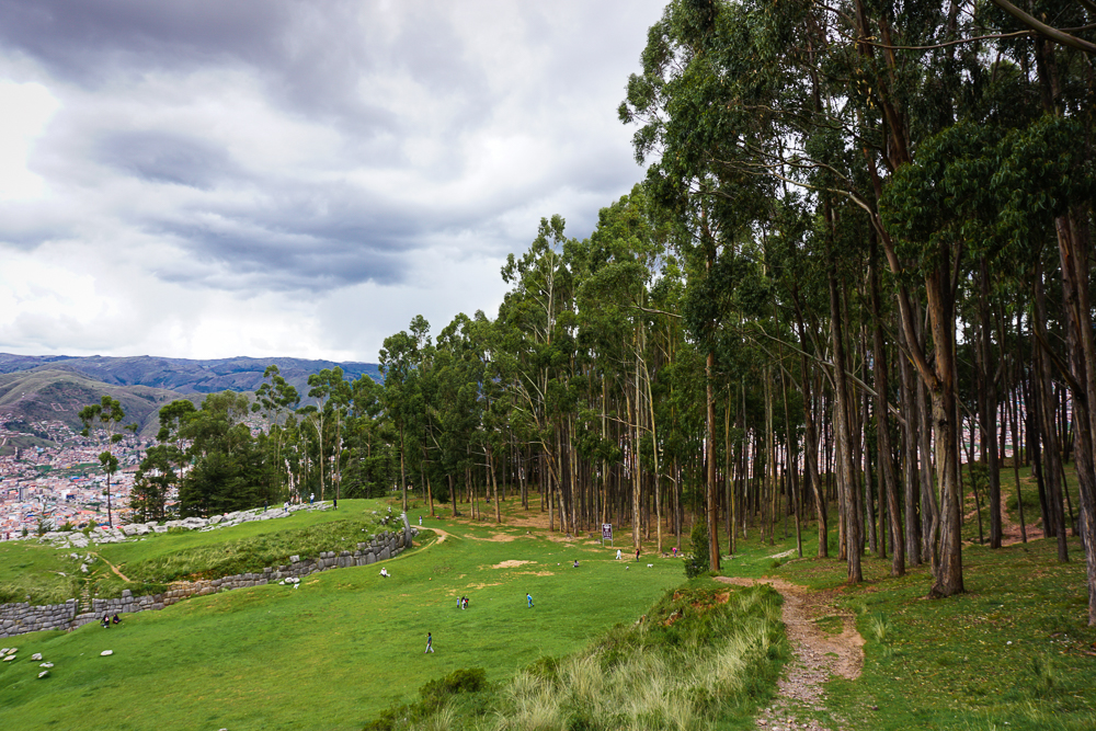
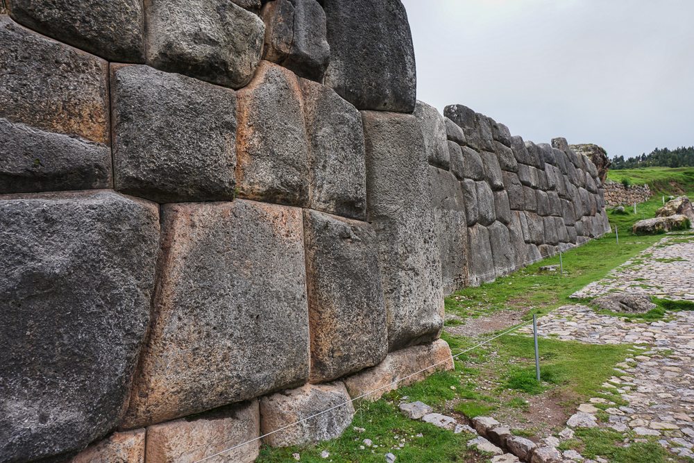
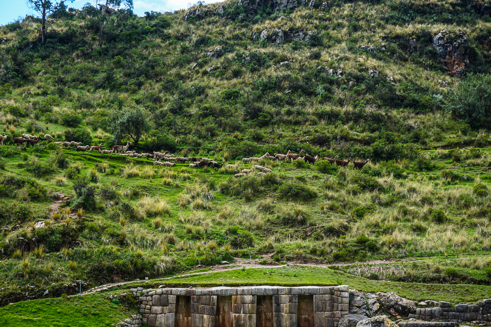
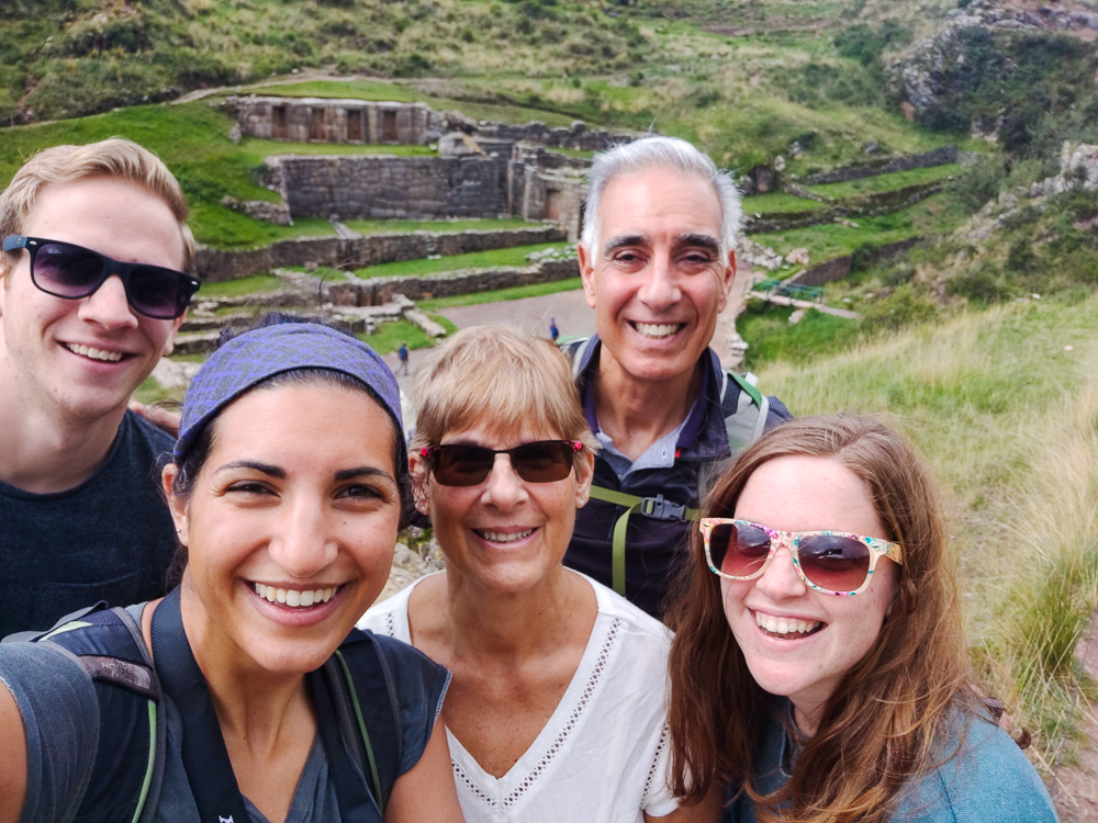
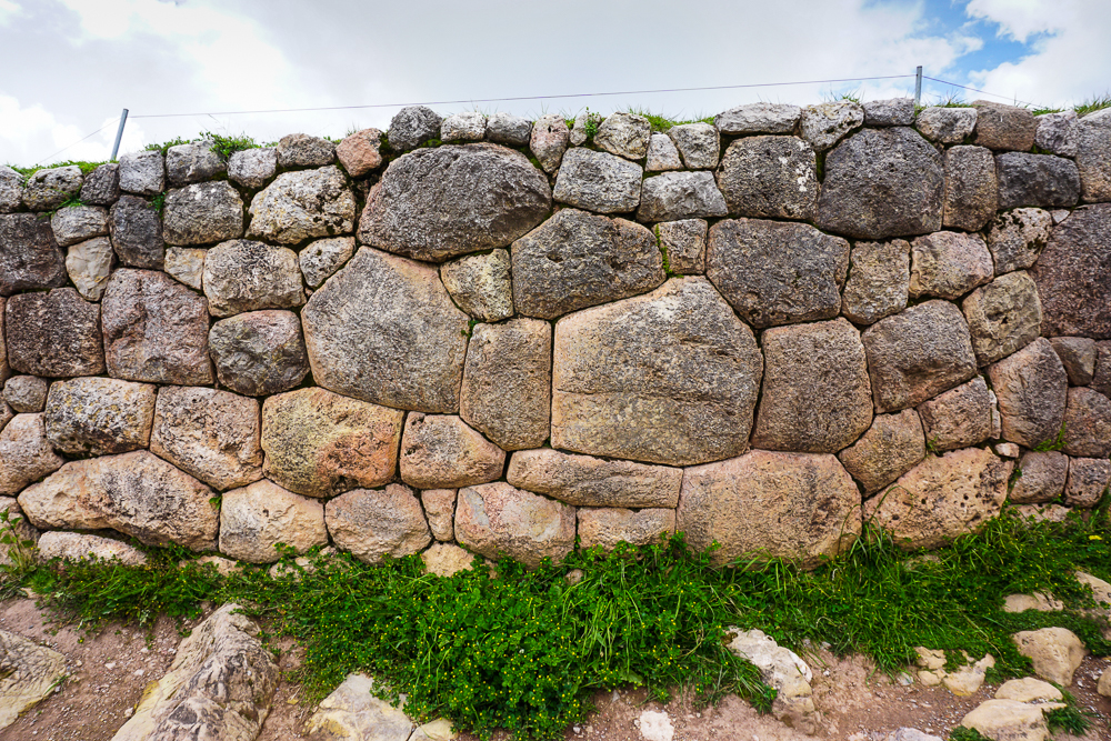
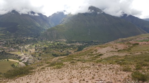
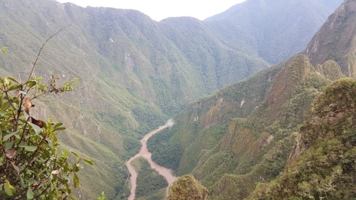
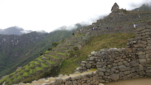
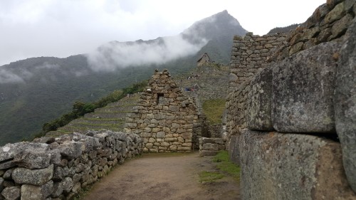
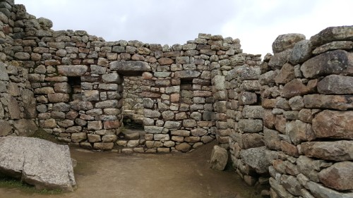
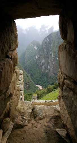
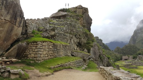
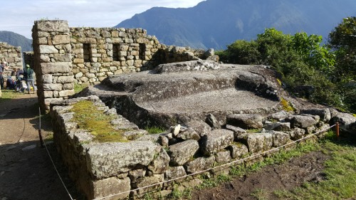
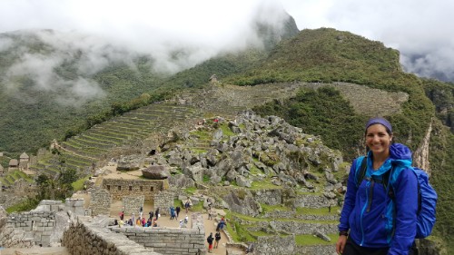
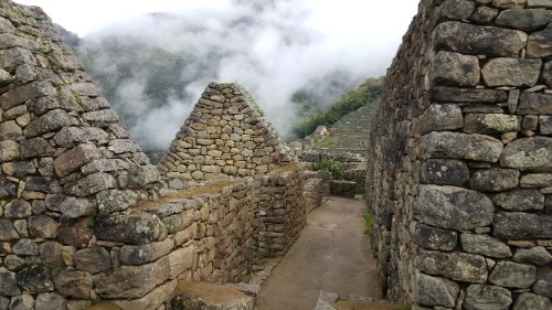
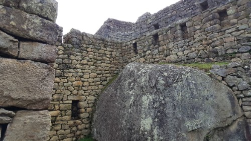
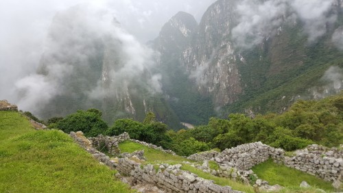
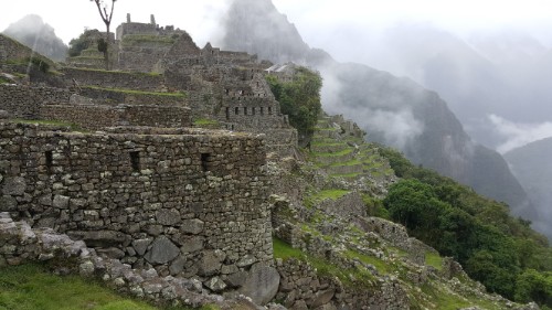
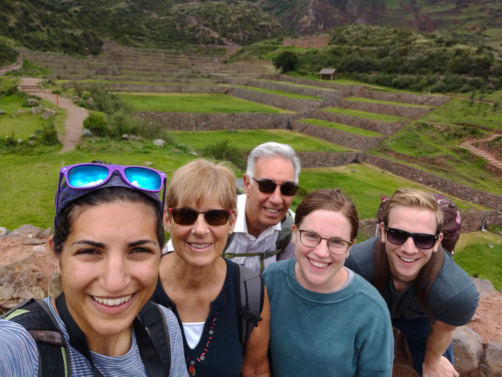
We took our time exploring, and even so, we only saw a small portion of the complex. We visited the main section only, consisting of the primary terraces and fountains, the royal residence, and some other, partially excavated ruins that may have been military-related or simply other support buildings for the site. If we’d had more time and were willing to do some hiking (everyone was still feeling exhausted from our long day at Machu Picchu, so we opted for a lower-intensity day), we could have visited the Intiwatana (Sun Temple) and the water reservoir on the lower peak. On the high peak, Cruzmoqo, there’s a cross, a view of the valley, and ancient petroglyphs. The Incas also used this point for a military observation post. There are 15 foot-tall (4.5m) stone walls around the complex that were probably built by a previous civilization, before the time of the Incas. Unexcavated dwellings, terraces, and storehouses dot the mountainside, and an old Inca road still zig-zags its way to the site. Around the back of the mountain, there’s another terraced area that is similar to the main terraces, but it hasn’t been excavated or restored as much.

The hill straight ahead is the location of the Sun Temple (at the top, of course).
In conclusion, it’s a masterpiece and please tell me you appreciate its awesomeness (and if you don’t, please don’t tell me anything unless you want me to lecture you on why you should).
The final waterfall. See how the water is splashing up so much at the bottom? That’s because they put a stone underneath, so rather than the water falling into a pool, it hits a hard surface and creates a more dramatic splash-effect. They really thought of everything.

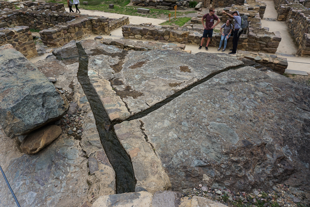
Okay, just one more (slow motion) video showing the impact of the splash stone (the technical name, I’m sure):

Mom is sporting her poncho because it started pouring while we were there. Thankfully, it didn’t last long, and there was conveniently a little sheltered area where we waited it out.
Exceedingly happy because I was coming off of a few hours of geeking out at the awesomeness of Tipón.

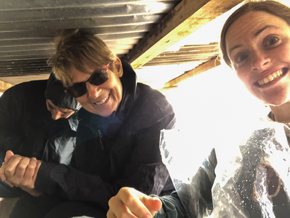
As soon as we were ready to head back to town, I shook my head at past Lara’s decision to leave the taxi problem to me. Despite its awesomeness, Tipón isn’t very popular which means that there aren’t just taxis hanging around, waiting to be hired. Why hadn’t I asked for the taxi man’s phone number when he dropped us off? I had no idea what we should do. Luckily, a car pulled up a few minutes later, and a young Peruvian couple started to get in. Benjamin said, “This is our shot!”, and ran over to get the driver’s attention. I asked if he had space in his car for us, that we had five people and wanted to go back to town. He said sure and charged us two soles each. I would have paid anything. Thank goodness for outgoing travel companions!

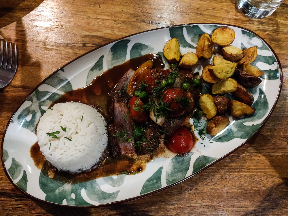
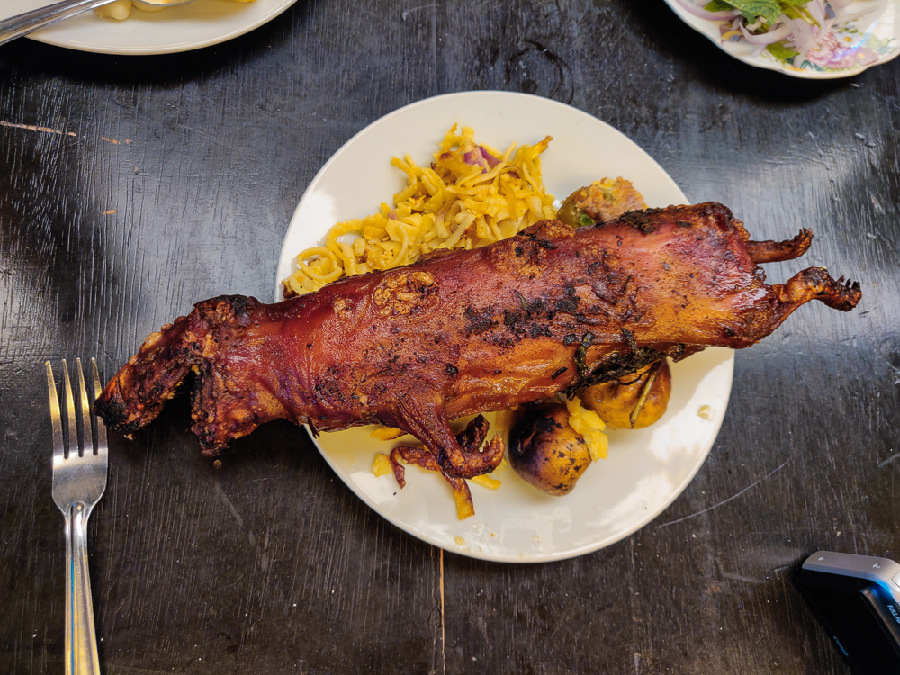
On the way down, I asked the driver if he knew of a good place to eat cui (guinea pig). Tipón is the “cui capital of Peru”, and Benjamin was determined to try it. After he left the other couple in the main square, the driver took us to a restaurant, confirmed with the lady there that she had cui, and assured me that we’d be able to get a bus back to Cusco from there, no problem. The restaurant was clearly not used to tourists… there was no menu, and the lady who took our order (AND cooked the food AND carried a baby around on her back the whole time) spoke the world’s fastest Spanish as she listed our options. It made my head spin. After she repeated it about three times and I asked approximately twenty clarifying questions, Dad and Benjamin got the cui, and Mom, Jocelyn, and I opted for a pork dish. I had tried cui before, and I’d describe it as slimy chicken. It was fine, but I don’t need to have it again.

Are you in or out?

When we finished eating, we started walking to the main road. A bus pulled up before we even reached the corner, honking and with the money-collecting guy waving his arms and yelling, “CUSCO!” at us. So, we waved back at him, ran over, and hopped on. Phew! I didn’t even have time to worry about a bus never coming. Back in Cusco, we headed back to the hotel, packed our bags, and had a quiet night. Our flight back to Lima was early the next morning, and everyone was exhausted.

Related Posts

Cusco Adventures: Tambomachay and Puka Pukara – visit another Inca site with functioning fountains 

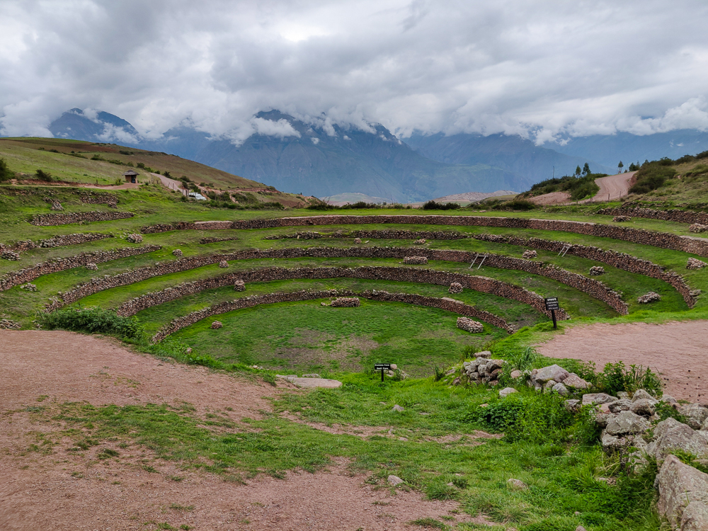
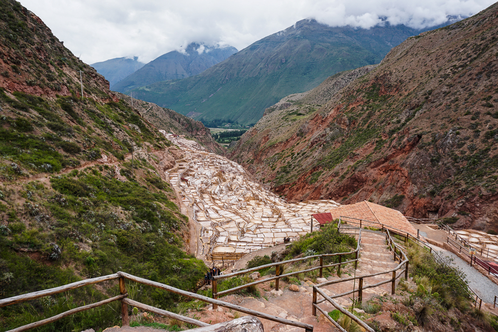
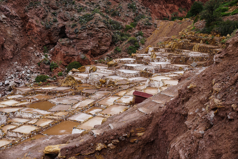
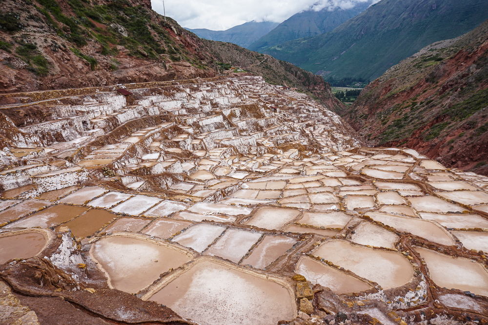
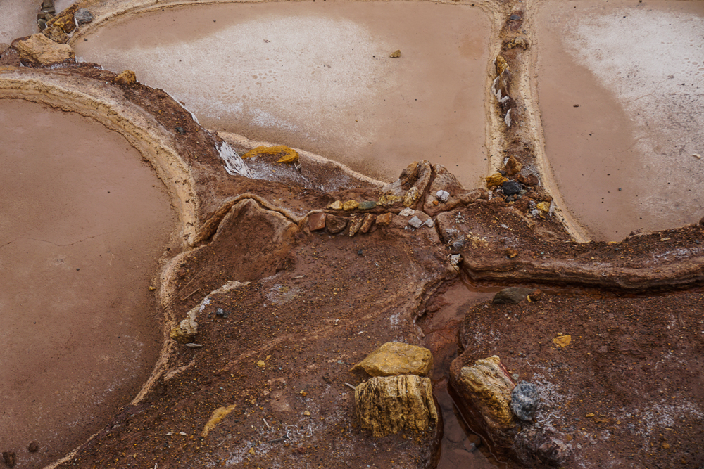
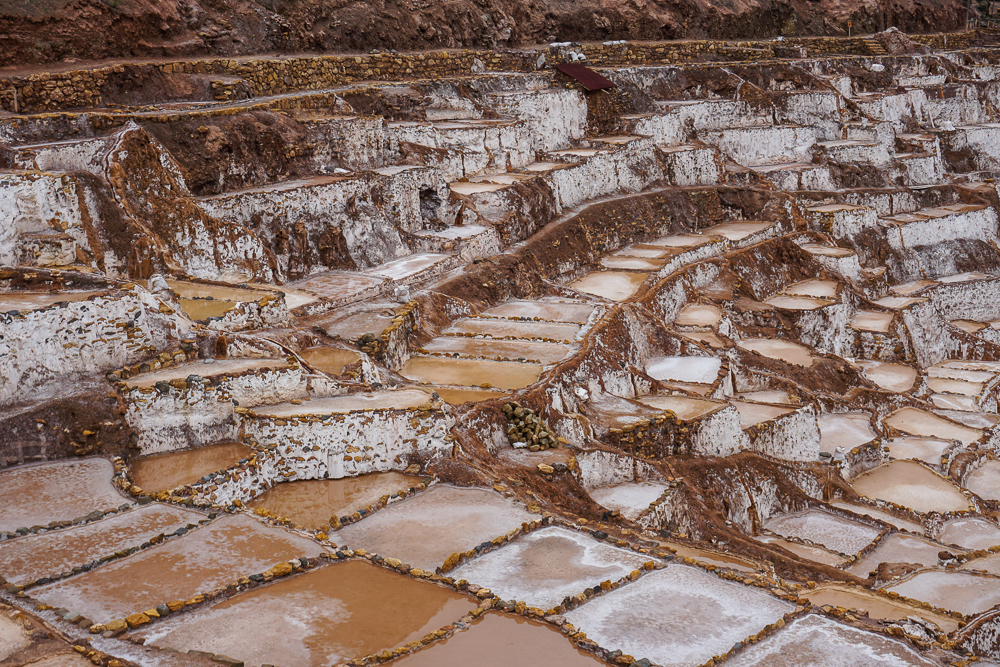
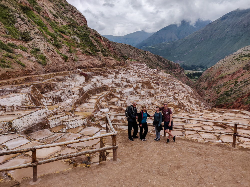
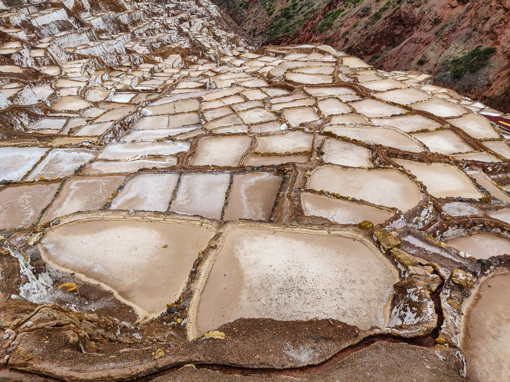
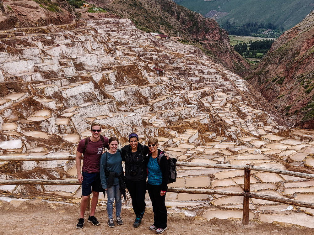
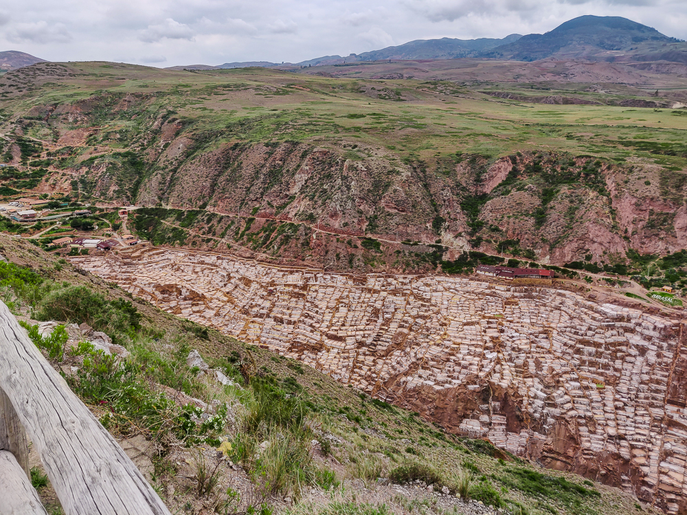
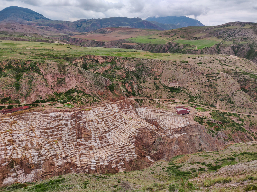
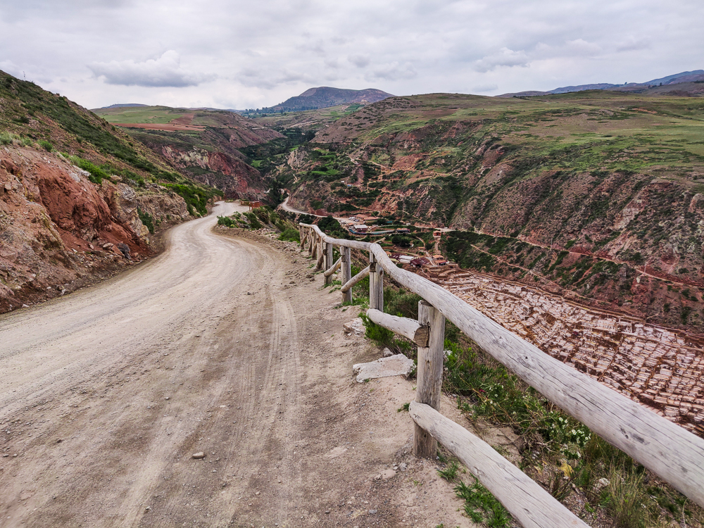
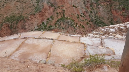
Moray and Maras Salt Mines – explore an Inca agricultural lab and salt evaporation pools

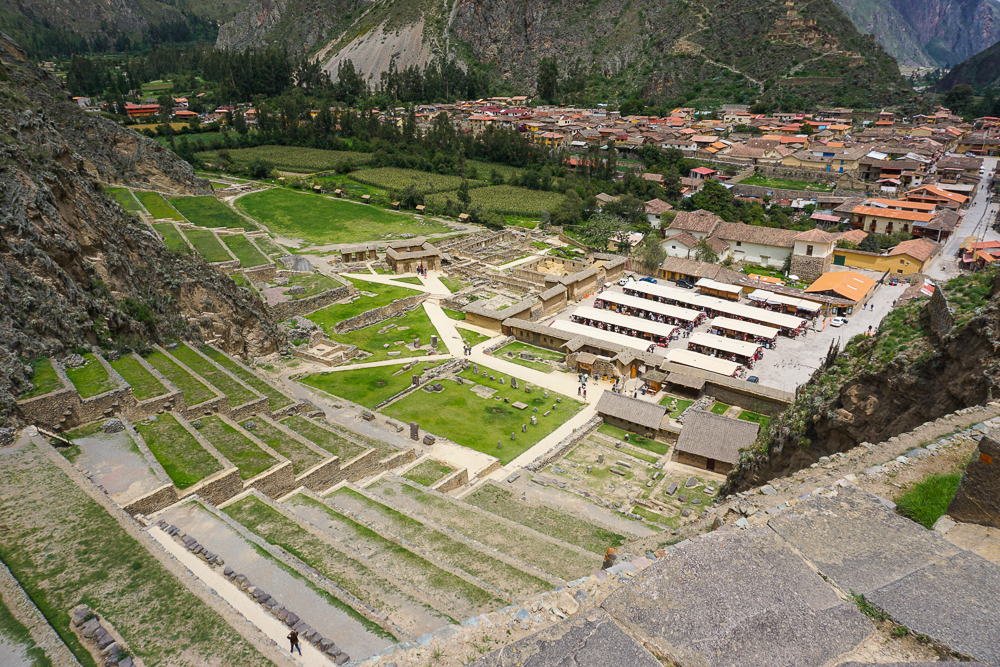
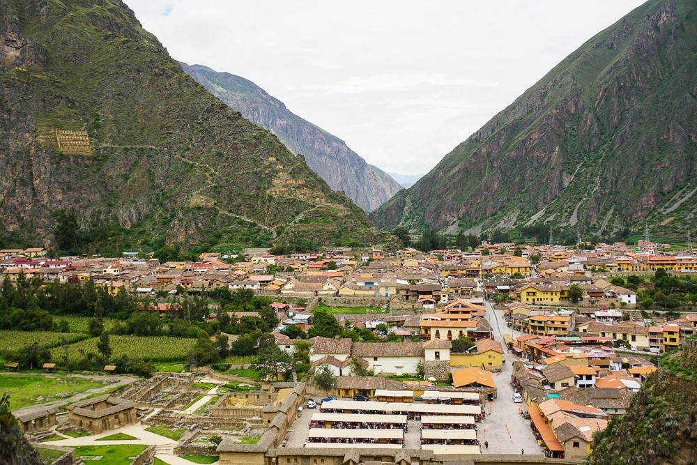
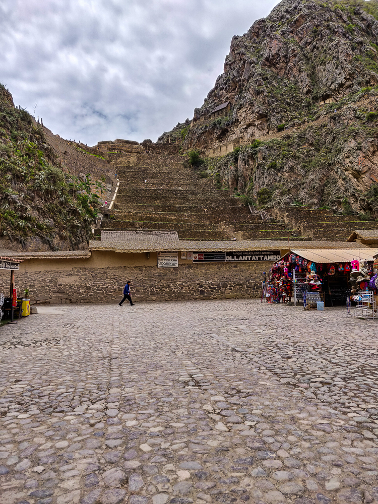
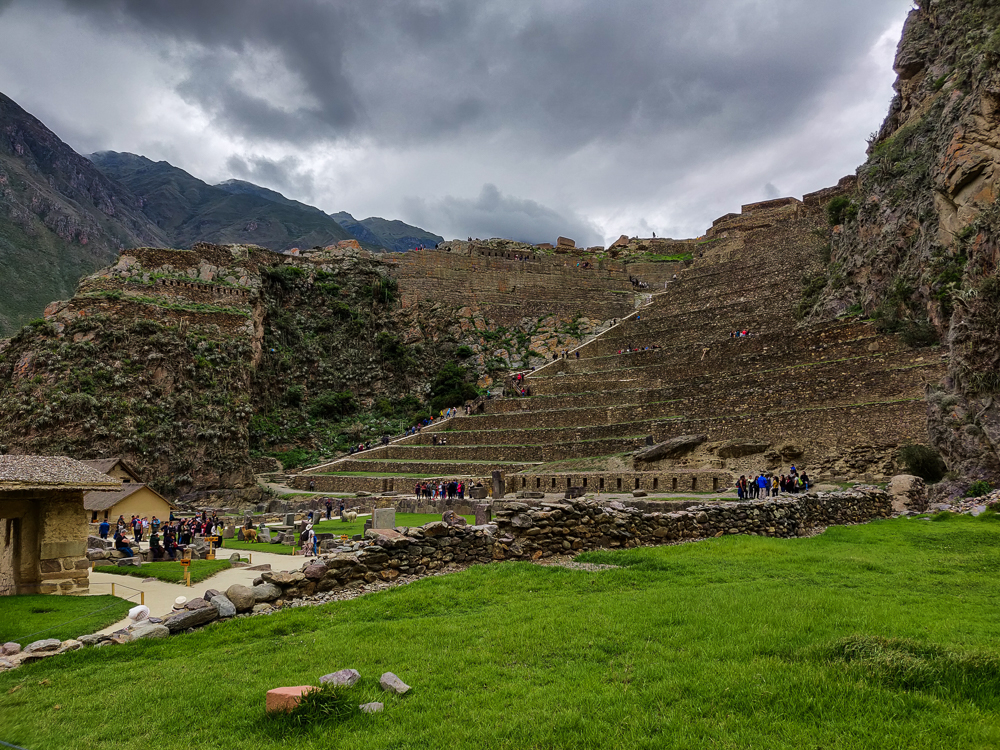
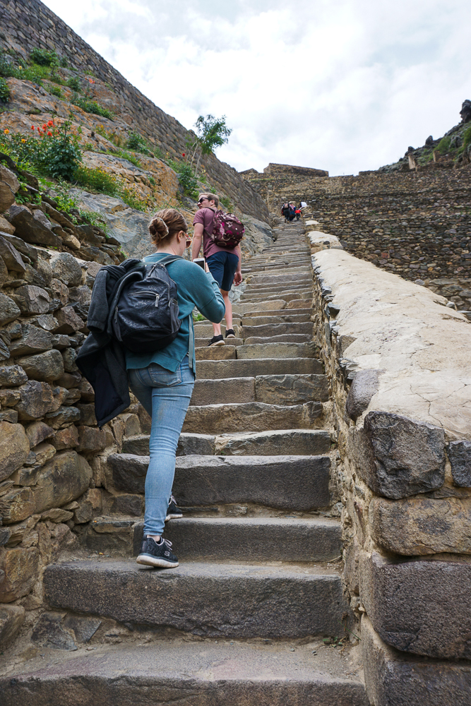
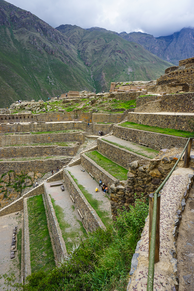
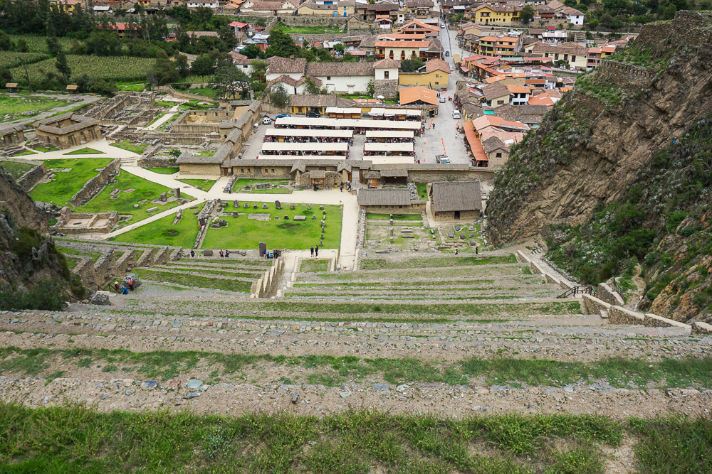
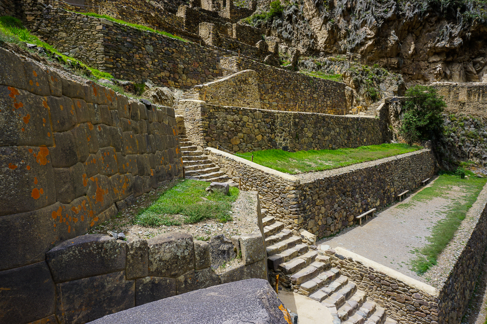
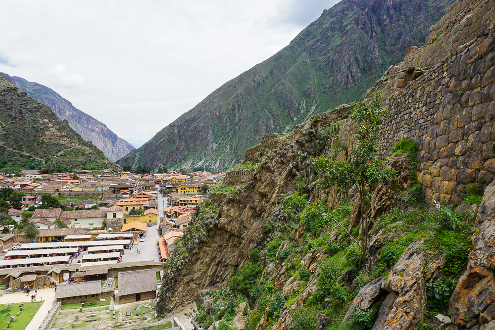
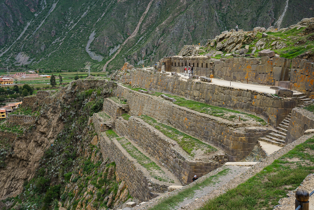
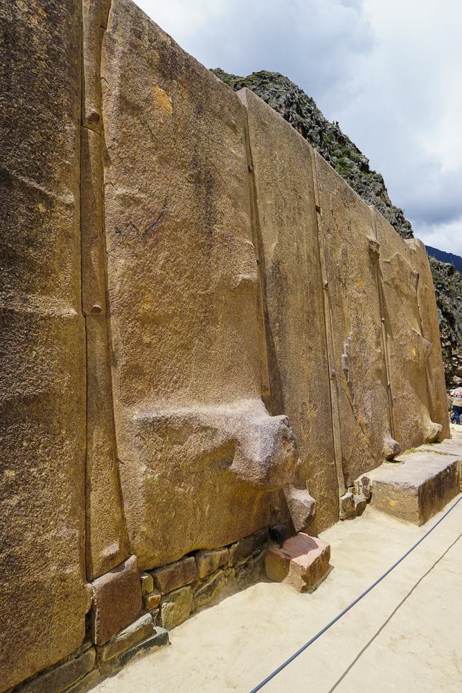
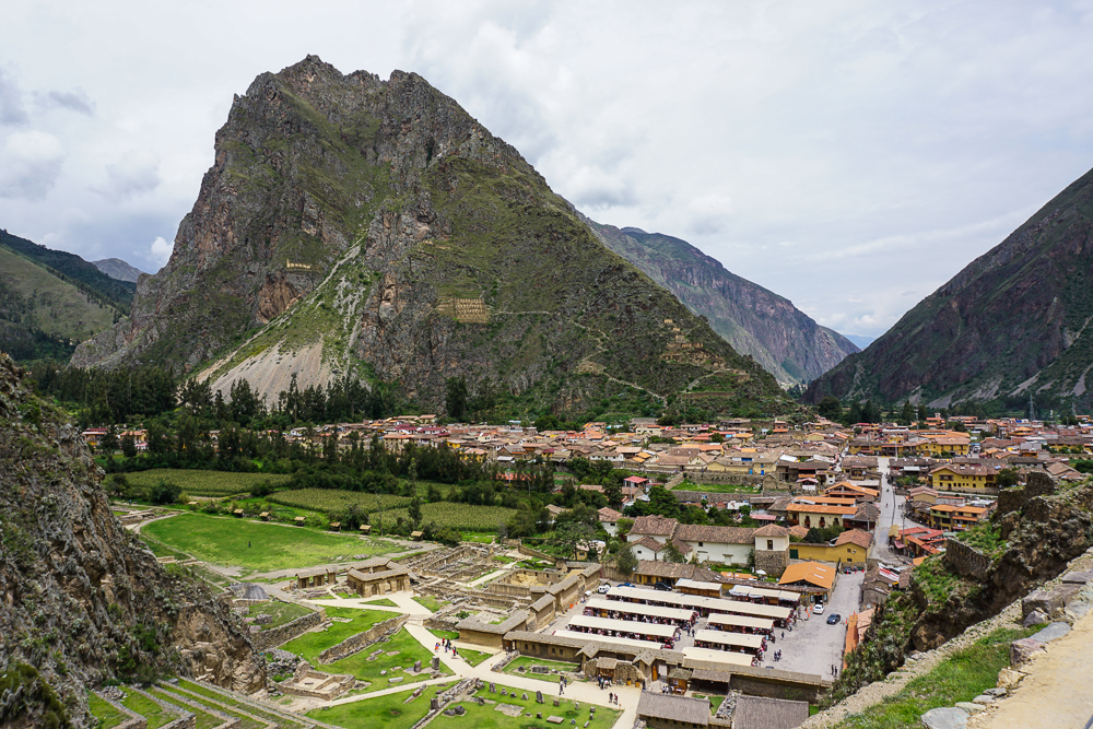
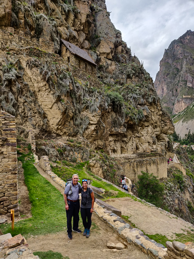
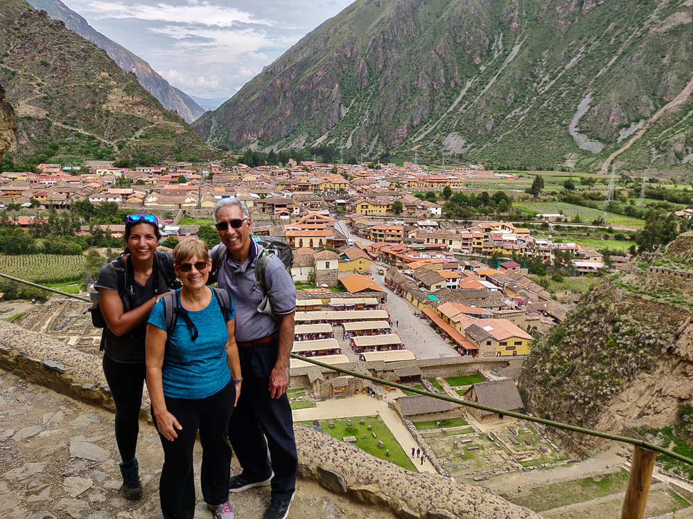
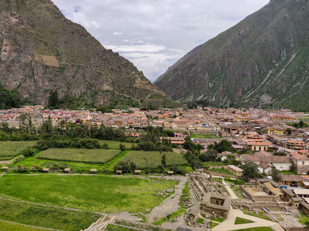
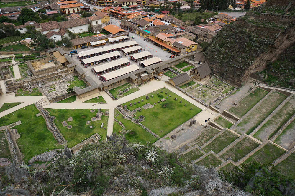
Ollantaytambo – climb the steep terraces of this scenic Inca royal estate

Inka Pachakuteq and the History of Machu Picchu – read about the Inca Empire’s greatest Inka (king) and the origins of Machu Picchu

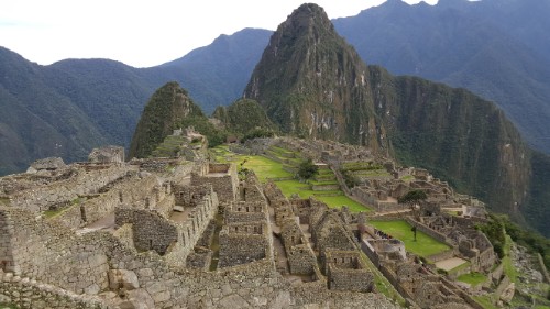
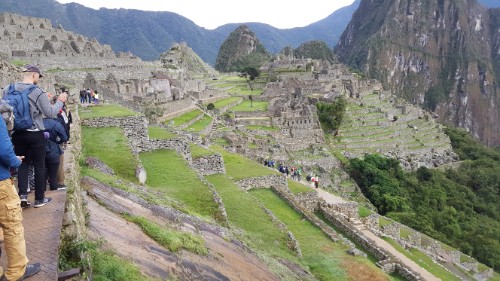
Machu Picchu: The Citadel – walk around the Incas’ most famous site

Now that we’ve talked about Inka Pachakuteq and the history of Machu Picchu and have explored the outskirts of the site, it’s finally time to explore the citadel! That’s what they call the main area of buildings onsite even though “citadel” gives more of a fortress vibe, and we’ve already covered the fact that historians think Machu Picchu was most likely a royal estate. That, at least, is the assumption that we’re going to go with as we walk through the site and learn about what the different buildings were potentially used for. Again, everything I say may or may not be true. Thanks to the Incas’ lack of a written language, best guesses are sometimes all that historians can make. So, here are a bunch of best guesses about the ruins at Machu Picchu! Just insert a “maybe” before each statement I make from here on out.

Everyone looking tired but happy after finishing our morning hikes!

The site can be divided into two main sectors, farming and urban. The farming sector consists of the terraces, many of which are still unexcavated. Vegetation grows quickly in the cloud forest! There are also some buildings around the terraces that may have been used to house farmers, but the majority of the buildings are located in the urban sector/citadel.

After you enter through the ticketing area, you walk up lots of stairs and past lots of farming terraces until you finally get your first glimpse of the urban sector. There are a bunch of different viewpoints from which you can get a low-flying bird’s eye view, and at one of these is the “watchman’s post” or maybe “the hut of the caretaker of the funerary rock” or “call it whatever you want because who knows”. This three-walled structure has a great view of the citadel and the surrounding valley and is one of the few buildings with a restored thatch roof. Remember that this type of roof would have been standard, so based on that alone, the urban sector would have looked very different. Just outside, there’s a large “funerary rock”, carved into an altar and used for embalming and mummification… or maybe used for animal sacrifices. In the nearby field, a number of skeletons were excavated which is part of the reason for the mummy theory. In that case, the hut would have potentially been used in the mummification process as well.

The “upper cemetery” where they found a bunch of graves. You can see the funerary rock at the far end of the field, plus the “whatever it is” hut just behind the rock. (Side note, some of the pictures in this post, including this one, are from my first trip to Machu Picchu. There were a few things that I wanted to show that I didn’t have pictures of from this visit, so if you notice that the weather randomly appears to have changed between pictures, that might be why.)
Funerary rock
I’m going to give you a little preview of our route. We started at the hut that’s out of frame to the upper right. We’ll enter town through the main gate, which is where that big group of people is gathered. From there, we’ll walk through that first group of buildings and then stay to the left to visit the plaza (the dirt patch), go up the Sacred Hill behind it (with all of those narrow terraces). Next, we’ll cross the main grassy plaza to the very back of the site where we’ll see a Sacred Rock, and then we’ll head back towards the starting point through the buildings on the far side of the main plaza. (If that made no sense, sorry! I tried. Ignore me and just continue reading.)

A dry moat separates the outer buildings and farming areas from the urban sector. Through the main gate (that used to have a door with a locking mechanism!), you enter into the upper part of town which contains support buildings like storehouses and public buildings and the remnants of a quarry that likely supplied much of the stone for the buildings. What an exciting welcome to town, right? But it makes sense not to put the really important stuff right next to the city gate, just in case (Lara speculation).

The dry moat runs along that staircase in the front, and the main gate is just out of frame to the left.
The rock quarry as viewed from the Sacred Plaza

Downhill from these structures is where things start getting interesting. Not surprisingly, the most unique building in the city is the Sun Temple. It has a curved wall with that classic imperial stonework, and it’s built above a giant boulder. The top of that boulder was carved into an altar that was used for animal sacrifices (to read the future in their entrails… ick). This was also where the Inka would come to drink chicha (corn beer) with his “father” the sun, as the Incas believed that the Inka (king) was descended from the sun god, Inti (side note: to keep the royal bloodline pure, each heir had to be a son of the Inka and his sister).

The Sun Temple. There are windows facing to the north and to the east. The east window is aligned to the sun position on the winter solstice.
See the carved rock that makes up the floor? That was used as an altar.

The Incas mummified their dead and treated them a bit like they were still living, so underneath the temple is a “royal tomb”, basically a cave where it is believed that the Inka’s mummy was kept. Even after Inka Pachakuteq died, it is likely that his mummy was brought back to Machu Picchu, kept beneath his father’s temple, and given food and drink (not quite sure about the logistics of that).

Near the sun temple are the royal apartments, aka the residence of the living, pre-mummified Inka. The spring on Machu Picchu Mountain was first directed through the Inka’s apartment so that he could have the freshest possible water, and from there, it flowed through a series of ceremonial fountains. The residence consists of a central patio area surrounded by two large and two small rooms.

Beyond the rock quarry and royal apartments is the main sacred area for the town. A small plaza is bordered by two temples and another room that could have been the priest’s dwelling. You can tell that the temples are important buildings just by looking at their quality stonework.

One of the fountains that used to flow with water from the spring. The water would still flow through here, but it’s been redirected for tourism purposes (bummer).
View from the quarry. Straight ahead, you can see the Sacred Plaza with its two temples, and behind that is the terraced Sacred Hill. Another temple, the Moon Temple, is located on the back of Huayna Picchu, the tall mountain peak that you see straight ahead.
The main temple has only three walls. They’re not sure exactly who this temple was dedicated to, especially since the Sun Temple is elsewhere, but clearly it was someone important! You can see that the collapse in the corner isn’t because the rocks shifted. The bottom rock is actually sinking into the ground, so it’s likely some sort of foundational problem. That could have been caused by an earthquake, or it could have been a water-related failure.
This is the Temple of Three Windows. Can you guess how it got its name? It likely was covered by a gabled thatch roof with the side nearest to us left open.
With the main temple!

The sacred spaces continue up “Sacred Hill”. There are more temple-like buildings with high-quality stonework, but again, the exact use of each space isn’t really known. At the top of Sacred Hill is one of the only remaining “Intiwatana”, or “sun fastener”, stones. This carved rock was used during the winter solstice celebration, Inti Raymi, to symbolically tie the sun to the earth. Inti Raymi was a festival to ask Inti not to abandon his people, to move closer instead of farther away. Otherwise, the stone was also used to measure the solar year and keep track of important sun dates like equinoxes and solstices. It was not, however, a sundial or solar clock. The Incas didn’t have clocks as they didn’t measure days in hours and minutes. This hill was also the priest’s pulpit. He could stand high above the main plaza and address the people gathered below.

Walking up Sacred Hill. You can see the Sacred Plaza in the bottom left, with the main temple closest to us and the maybe-priest’s-house across the plaza from there. And then there’s the rock quarry, and the hut where we started is perched up on the terraces near the top of the picture.
Intiwatana. Originally, it was probably polished… the rain is giving it a decent shine in this picture. I’m imagining a granite countertop-level shine.
The entrance to the site is on the far end straight ahead, and Sacred Hill is the one to the right with all of the terraces. The terraces on Sacred Hill are very shallow. This shows that they were mostly for protecting against erosion and were also used as decorative gardens, not for actual farming.
Looking up the side of Sacred Hill. You can see those shallow terraces at the right edge of the picture. From this angle, it’s pretty clear why they decided this needed some erosion-prevention terraces!
I like this picture because I think it really shows how important the terraces are to making this site a viable location for building. Without those terraces, there’s no way that the site could have handled the weight of the buildings, and erosion definitely would have caused some serious collapses. I also like looking at the main plaza and seeing the effort that went into creating such a large, flat space.
Sacred Hill is up to the left. The main plaza, in the middle, was used for festivities and ceremonies.

Across the lawn, right in front of Huayna Picchu, is a “Sacred Rock”. It’s clearly important because a stone pedestal was built around it (it’s a natural projection of the mountain), but what were people worshipping there? It supposedly could look like a puma or a guinea pig, but personally, I don’t see it. Another possibility is that it was simply a representation of a sacred mountain peak. Mountains were believed to have spirits that were considered protectors of the people. I’m going to go with that because I can definitely see “mountain” in this rock.

You tell me… puma? guinea pig? or mountain? This rock was probably polished as well.
It seems like a pretty cushy existence to be a Machu Picchu alpaca. They just wander around, eat, and get fawned over by tourists.

Finally, moving back towards the main gate but on the other side of the main plaza, there are TONS of buildings. These were apartments for support staff, storehouses, and other utility spaces. There are various interesting features sprinkled throughout these rooms, including these two “water mirrors”. Some guess that they were used to reflect the night sky and study the stars, but that seems silly because why look down at a reflection when you could look up at the real thing? Oh well, at this point, what’s one more unsolved mystery?

Water Mirrors. Does it not seem a bit silly to use these for astronomical purposes? To use these liiittle water pools rather than the big night sky?
I’m obsessed with the way that they integrated these ginormous boulders.
I don’t know why things like this still surprise me, considering I know how skilled the Inca stonemasons were. But it’s so seamless!
This is a nice wall.

On the way out, you walk through one of my favorite parts of town. I don’t know what it was used for… maybe just more support buildings? But the reason I love it is because there are large boulders all over the place, and the buildings are built right into/onto/around them. It’s so cool! There’s one in particular that’s very important, the Temple of the Condor. There’s a huge rock at the center that somehow looks like a landing condor? Condors, pumas, and snakes were sacred animals for the Incas, so it was likely an important religious space.

This is the world’s least helpful photo of the Temple of the Condor, but clearly I was more focused on the ridiculousness of the wall on top of that slant than on the entirety of the condor-shaped rock. I’m pretty sure that the head is the part on the left side of the picture, and that crazy slanted rock is maybe one of the wings?
This is what happens when you do most of your learning about a site AFTER you visit. To be fair, though, it’s very hard to understand what anything is talking about until you’ve been there. I guess that’s one argument for taking a tour, but even so, I think I still prefer exploring on my own.
In the bottom middle, you can see the big rock in the Temple of the Condor. You can also see the hut from the very beginning of our tour in the top middle!

By the time we were about halfway through the citadel, we were all more than ready to call it a day. Mom and Dad actually said before we even entered the town that they felt like they’d already seen enough. I insisted that we walk through, but I understood their exhaustion. We had already done a lot of walking! We walked through the exit gates EIGHT hours after we walked in. Eight. Hours. But we did it! We survived! And we did/saw everything we wanted to do/see which is VERY impressive.

Farming terraces along the edge of the citadel. The buildings you see in the distance could have been housing for farmers.
Survived! Mom’s somehow still smiling after 8 hours of walking.

We took the bus back to town and then mostly hung out in our hotel until it was time to head to the train station for our ride back to Cusco. We were taking a train that went all the way back to the city, rather than the other option of having to transfer to a car in Ollantaytambo. Good in theory, but I probably should have looked more closely at the schedule. It’s insane. The train from Machu Picchu to Ollantaytambo takes about 1:45. To drive to Cusco from there would take about 2 hours. The train, on the other hand, took nearly 3 HOURS. How? Well, please direct your attention to the helpful map below. I traced the train tracks in blue.

Have you ever seen such a route??

When we felt like it was time for the ride to be over, we called over the train attendant and grilled him for answers. We could literally SEE Cusco, and he said it was still going to take at least a half-hour to arrive at the station. I was so exhausted that I almost cried. He explained that in order to get down into the valley, the train goes down a series of switchbacks. Switchbacks! For a train! It hits a dead end, they switch the tracks, the back of the train becomes the front, and it continues on until the next dead end. I ranted in delirious Spanish about how silly that was, and he excused himself/escaped at the first opportunity.

Eventually, though, we made it. Everyone was tired of sitting, so we walked the 15 minutes to our hotel and collapsed. Talk about a long day.

Manco Cápac Plaza in Aguas Calientes. Manco Cápac is the legendary first Inka, and it’s uncertain whether he actually lived or if he’s simply a legend. He’s one of the main characters in the legend that explains the beginnings of the Inca civilization.
The ride home also included some entertainment, including a fashion show of alpaca clothing products (surprisingly entertaining) and some interesting dances with this Andean folk character.

Related Posts

Inka Pachakuteq and the History of Machu Picchu – learn about the Inka who built Machu Picchu and how it came to be

Machu Picchu: Inca Bridge and Intipunku (Sun Gate) – take two hikes to interesting features near the citadel

Machu Picchu – come along on my first visit to Machu Picchu, including the hike up Machu Picchu Mountain

Ollantaytambo – explore another royal Inca estate!

Cusco: Q’enko and Saqsayhuaman – admire some impressive Inca stonework at Saqsayhuaman

Before I talk about our visit to Machu Picchu, I think it’s important to understand some of the backstory to fully appreciate its awesomeness. Visually, it’s incredible no matter how little you know, but the story is a good one! Remember, though, that the Incas had no written language, so the earliest written accounts of their history come from oral histories recorded by the Spanish. That information is far from comprehensive, so in combination with archaeological evidence, a certain amount has been extrapolated (by experts, not by me). In some cases, there are disagreements about the specifics, so just read along with a big “MAYBE” disclaimer in the back of your mind. Okay! As I was saying…

Our story begins in the 15th century with an attack on Cusco by the Chanca people, a group with military strength comparable to the Incas. The Inka (king) at the time, Viracocha, abandoned his people. He fled the city in fear and took his heir with him. Some king! Another son, Cusi Yupanqui, decided to stay and defend the city, leading the Inca army with one of his brothers and a few other Inca chiefs. They won decisively, crushing the Chanca army and humiliating Viracocha. Having gained the support of the people during the battle, Cusi Yupanqui later declared himself the new Inka, forced his father to abdicate, and changed his name to Pachakuteq which means “earth-shaker” or “he who turns the world upside down”.

Machu Picchu flower

If that seems like a bold name statement, well, it is. But Pachakuteq knew that he was destined for greatness. First, as the battle against the Chanca proved, he had an aptitude for military strategy and leadership. Second, as a child, he had a vision where the sun god, Inti, called him “son” and told him that he would conquer many nations, and when he did, to honor and remember him. Pachakuteq took this to heart, elevating Inti throughout the empire as the supreme Inca god and constructing grand tributes in his honor, including Qorikancha in Cusco and other opulent temples in important cities.

Pachakuteq quickly defined himself as an Inka of great ambition. During his ~30 years as Inka, he reorganized the government structure and set out to expand the small Inca kingdom into an empire. He led with diplomacy, giving neighboring tribes the opportunity to surrender peacefully to avoid bloodshed. Those who refused were quickly overpowered by the Incas’ powerful military. To integrate the new tribes, their leaders were killed, and royal children were sent to Cusco to be indoctrinated. Sons later returned to their native lands to rule under the Inka, and daughters were married off to other leaders within the empire to build unity. Pachakuteq started an age of expansion that continued until the Spanish invasion.

In addition to growing the empire through his conquests, Pachakuteq undertook grand construction projects that showcased the Incas’ superior engineering and craftsmanship abilities. He was very involved in the design decisions and was likely shown clay models of proposed projects, approving each of them himself. The famous “imperial style” stonework, where stones are perfectly cut and fit together without mortar, was his preferred style as it highlighted the skill of the craftsmen and demonstrated the power and dominance of the empire. Besides completely overhauling Cusco, he also built several royal estates, assumed to be monuments to his victories.

Some quality “imperial style” stonework. I love it.

We’ve already visited one of these estates, Ollantaytambo. Another is at Pisac, and finally, the most impressive, Machu Picchu. The estates celebrated Pachakuteq’s successes and were luxurious retreats for him and his family. Machu Picchu was the last one built and is thought to commemorate his conquest of the Vilcabamba Valley.

So, how did this city in the clouds come into being? The first step was to choose a site, and while the reasons for the specific site selection aren’t known for certain, there are some clear advantages to this one. A major benefit is its access to clean water via a spring located on the mountain of Machu Picchu. It also has views of the Incas’ most sacred mountain peaks, and its challenging location offered the opportunity to show off what the Inca builders were capable of.

Ugh what a terrible view.
I totally support the Incas’ location choice.
You can see the Urubamba River in the bottom left corner… it actually wraps around Huayna Picchu (that peak in the middle), so it’s nearly surrounding the site.
Here’s the Urubamba River again! See how it wraps right around Huayna Picchu?
Also, can you spot the city? If you saw this landscape before it was built, would you have thought, “Now THAT’S the perfect place for a city!”?

While the site looks conveniently flat today, that’s not how it started out. The “city” is located between two mountain peaks, or “picchus” – Machu Picchu (old peak) and Huayna Picchu (young peak) (Huayna Picchu is the one that you see in the background of the classic Machu Picchu photos). Before it was even possible to build the structures, the dip between the two peaks had to be filled in and leveled off to create a flat area for building. To stabilize the ground and decrease the risk of collapse from the weight of the new city, terraces were constructed, deep foundation and retaining walls installed, and drainage systems designed. Estimates are that 60% of the construction at Machu Picchu is actually underground.

Leave it to the Incas to create flat ground on top of a mountain. Well, I guess it’s not on TOP… so leave it to the Incas to create flat ground between two mountain peaks. Yeah, that’s no less insane.
The tallest peak in the background is Machu Picchu.

The 700+ terraces at Machu Picchu create about 12-14 acres of farmable land. This likely wasn’t sufficient to support the estimated 750-1000 people who were on site when the Inka was there, and additional food was brought in to supplement the harvest. Even so, for farming on a mountaintop, it sounds pretty good to me! When the Inka wasn’t in town, a skeleton staff was left to maintain it. The remains of over 170 people were found at the site, and bone analyses indicate that people came from all over the empire to serve there.

Did someone say “terraces”?
Llamas and alpacas aren’t native to the area but were brought by the Incas

Back to the terraces… I’ve previously talked about the integrated irrigation systems that the Incas included in some of their terraces. At Machu Picchu, it was determined that irrigation was unnecessary due to the wet and humid climate. Instead, extra attention had to be paid to water management. Analysis of the terraces revealed that they were constructed in layers to facilitate drainage with large stones at the bottom, a mix of packed sand and gravel in the middle, and topsoil on the surface, probably carried up from the more fertile valley to better support crops.

And terraces…
…and overgrown terraces…
Morning mist rising up from the Urubamba River. Even when it doesn’t rain, the mornings are still nice and damp!
This is a good angle to appreciate the stabilizing terracing that was included to help level off and protect the city from collapse/erosion.
I’ll never get tired of this stonework. Please, admire.
Huayna Picchu. You can see some terraces on the top… these were likely for erosion protection rather than for farming. Can you imagine having to hike up there to take care of your potatoes? Yeah, right!

With the foundations completed, work could finally begin on the buildings. I’ll talk more about the specifics next time, but assuming the site was, in fact, a royal estate, it included royal residences, housing for nobles, ceremonial and religious spaces, and support spaces like servant housing and storage. There are about 200 buildings in total.

The city. Now imagine those buildings covered with thatch roofs!
Did you know that Machu Picchu is actually built at the intersection of two fault lines? That means lots of earthquakes, but the good news is that the Incas knew what they were doing. Here are a few construction techniques that helped their structures to survive for so long:
See how the walls are slightly inclined inward? You can see it best if you look at the corner. This slight incline at the inside corners, plus the use of L-shaped stones on the outside corners, helped to stabilize the walls.
We’ve already talked about this, but the mortar-less construction was great for earthquakes, too. Stones can wiggle around during the earthquake, and after it’s over, they settle right back into their perfectly-cut places.
See how the doorways and windows are actually trapezoidal, rather than rectangular? This helps to make stronger, more stable openings!

Beyond the construction work on the mountain, there was also a massive road-building project to link this new estate with other significant parts of the Empire. The road from Cusco winds 27 miles through the mountains, passing Ollantaytambo and continuing its way up, down, and around the peaks until reaching Machu Picchu. A much easier option would have been to construct a road along the Urubamba River, but that’s no fun! It’s possible that Machu Picchu was also a pilgrimage site for the worship of Inti, and the long, difficult journey to get there was meant to test and prepare the pilgrims.

One of the reasons Machu Picchu is so archaeologically significant is because the Spanish never visited. That means that religious structures were never defaced in their campaign to Christianize the pagan civilizations, giving valuable insight to researchers. Why did the Spanish never make it there? The site was completed in the 1450s or 60s and was abandoned less than 100 years later. What happened? No one is really sure. Perhaps the site was deserted after Pachakuteq’s death. Perhaps there was an epidemic or an attack by the jungle tribes that wiped it out. Perhaps it was simply forgotten. Likely, most people in the empire had no idea it even existed.

Part of the original Inca road. How. Cool.
The buildings transition seamlessly into the mountain!

Machu Picchu sat abandoned for hundreds of years and was only brought to the world’s attention when it was “rediscovered” in 1911 by an American historian, Hiram Bingham, as he was searching for the “lost city” of the Incas, Vilcabamba (where Manco Inka set up his remnant Neo-Inca state). Bingham gets the credit for finding it, but in reality, it was no secret. He traveled along the Urubamba River, asking if anyone knew of ruins in the area, and was shown to Machu Picchu by a farmer. There were multiple local families living there and farming on the old terraces. Also, as the site was excavated, the absence of precious artifacts suggested that treasure hunters had already plundered it.

Hiram Bingham and crew walked up the mountain. It’s an exhausting uphill trek! But nowadays, you can take a bus up these crazy switchbacks. Not recommended for sensitive stomachs, but definitely preferred to walking!
I can’t imagine walking around this place for the first time as an explorer!

Bingham and his crew excavated the site for five years and sent artifacts back to Yale, where he worked, for further research. Peru is still trying to get these items returned today. In 1981, Peru created a national sanctuary protecting Machu Picchu and its surroundings. In 1983, it was declared a UNESCO World Heritage Site as “a masterpiece of art, urbanism, architecture and engineering” and “a unique testimony of the Inca Civilization”.

Next time, we’ll take a closer look at the details of the site!

When we left off last time, our good friend Amerigo had just dropped us off in the Ollantaytambo Plaza de Armas after an eventful morning of driving all over the Sacred Valley. We had a few hours until our train was leaving for Aguas Calientes (the gateway town to Machu Picchu), so we stopped for a quick lunch before heading to the Ollantaytambo ruins.

Ollantaytambo Plaza de Armas
If you look straight ahead, you can see some of the agricultural terraces rising up over the city.

Ollantaytambo was a royal estate, including a town for Incan nobles and religious areas. Its name comes from a combination of “Ollantay”, a character in a classical Quechua play, and “tambo” which, as we learned at Tambomachay, means a resting place for travelers, offering lodging and food. It was a fortified town, surrounded by protective walls and watchtowers. The streets are designed in a grid, and the Incas engineered a system to channel clean water through the streets to be used by the inhabitants. The modern town is built on the same foundations, and sometimes even within the same buildings, as the Inca town and has some of the oldest continuously inhabited houses in South America.

The town, as seen from some of the terraces.

Agricultural terraces extend both down from the town to the Urubamba River and up the nearby mountains. The geography, especially around the terraces to the river, creates microclimates on the different terrace levels. These terraces have average temperatures a few degrees warmer than those at the town level, and this allowed crops to be grown that normally wouldn’t survive at such an altitude.

One set of terraces dominates the town, and these lead up to “Temple Hill” where the main temples were located. They look very steep and intimidating. Mom took one look at the seemingly endless stairs to the top and told me to go ahead with Benjamin and Jocelyn so that she and Dad could take their time. It wasn’t just an illusion… the terraces in Ollantaytambo actually are steeper than others in the Empire. They were built to a higher standard than most, and this follows the same pattern that we’ve talked about before where more important buildings/sites can be identified by the construction quality. These terraces match what was built at other royal estates, with higher walls between levels and the use of cut, rather than rough, stones.

Approaching the religious sector through a plaza that was surrounded by the most important buildings during Inca times
Do you see the diagonal of the stairs, kind of like a white line running along the left edge of the terraces (from bottom left to upper right)? Above that diagonal is Temple Hill, with the Sun Temple just about in the middle of the picture.
Just a few stairs…
You can also see two levels of stonework quality in the terraces in this picture. The ones rising up to the right are the “regular” terraces (though still nicer than most), and the ones straight ahead are on Temple Hill. Can you see how much less noticeable the joints between the stones are for the Temple Hill terraces? And even in the straight-ahead terraces, they get nicer from bottom to top.
Does this angle make the terraces look steep? Eek!

Temple Hill is topped by the Sun Temple because, as you may remember from our discussion of Qorikancha, the sun deity was the major Incan god. As it appears now, the temple seems to be incomplete, though whether it was truly unfinished or was destroyed by the Spanish is another question.

This is actually a pretty good picture to see the contrast in the stonework. The terrace on the left of the picture is on Temple Hill. Those on the right are not.
Temple Hill is on the right. These terraces were probably more for protecting against erosion than for farming.
Another view of the Temple Hill terraces with their pretty stonework. In the top middle, you can see the Temple of the Ten Niches. It used to have another wall that no longer stands, and they’re not sure exactly what it was for… but my professional guess is that that’s where they kept their golden corn.

The major feature of the Sun Temple is a towering wall formed by six pink granite boulders. These were brought from a quarry about 5km away, probably via log rollers, and then were somehow hauled up the mountain to their final resting place. The route from the quarry also includes a river crossing, and it is believed that the Incas diverted the river in order to move the stones across the riverbed. Insanity. Between the quarry and Temple Hill, other giant pieces of pink granite lie abandoned. These are called “tired stones” which I think is absolutely hilarious because whether it’s true or not, it makes me laugh to imagine a bunch of people struggling to move a giant stone, then looking at each other like, “This is exhausting. Why are we doing this??” and just leaving it there.

Pink granite monstrosities. You can still see some of the symbols… There’s one in the middle that looks like steps and is a symbol representing heaven, earth, and underground.
Taking a deep breath and enjoying the altitude

Above the terraces, there are ruins of structures that were likely military barracks, storage rooms, and such.

Surrounded by roof-less buildings
Hm… not really sure how you’re supposed to get up there…
Can’t get over this view of the town!
Or this view that makes me feel like I’m looking off the edge of a cliff…
Taking another of my million pictures of the town
Dad + me!
Mom did eventually make it up the stairs!

Away from the groups of buildings, there are others in more isolated positions on the mountainside. These were most likely storehouses for the food grown on the terraces. Their high-altitude locations, with lower temperatures and more wind, helped to guard against decay. They have openings for ventilation and for the entrance and exit of grain. We were confused by the first storehouse we came across because it seemed like it used to be a two-story building. It’s hard to explain, so check out the picture below. Jocelyn and I are in doorways that enter from higher up on the mountain. Benjamin is down the mountain. Why are there doors leading to a 12-foot drop? There’s no indication that there used to be a floor that no longer exists. Well, the storehouse explanation solves that mystery. The “second-floor” openings were for pouring the grain into the storehouse, and the “first-floor” openings were for removing it. Pretty smart, right?

Grain storage!
Looking out at the town from the inside of the storehouse
Flowers growing on the storehouse’s thatch roof.
This was the path that we had to take to the storehouse, accompanied by this very encouraging sign about the possible danger of a landslide.
Along the way…
Thank goodness they have that rope to keep you from falling off the edge… very effective, I’m sure
That barely-visible roof peak in the middle of the picture is the storehouse we were standing in
More storehouses on the mountain across town. You can see the path to get there, zig-zagging up the mountain

At ground level, there’s a series of ceremonial fountains that were used to worship the water god. They’re still flowing today, fed from the nearby Patakancha River, the same one that brought water to the town’s streets. The river is also used for irrigation in some of the terraces, and there are terraces that still function and are in use today! Kind of amazing for hundreds of years later. Unfortunately, as many of the Incas’ aqueduct systems fell into disrepair under the Spanish, this isn’t the case for most across the former Empire. I guess the Spanish were more focused on extracting gold and silver rather than on agricultural development.

I can’t get enough of these waterworks
This is the top view of the fountain from the picture above. Does this remind you of the water channels at Maras Salt Mines?
Probably something important?
It amazes me that these fountains still function after so much time
Looking towards Temple Hill from the waterworks
Around the grounds

The ruins in town are often called “Ollantaytambo Fortress”, despite not actually being designed to serve a protective purpose. This is similar to the confusion with Saqsayhuaman and may stem from the fact that both were ultimately used for a defensive advantage in battles against the Spanish invaders. Ollantaytambo was the site of a particularly exciting battle as it was one of the few that ended in an Inca victory. Led by Manco Inka, the Incan forces made a stand there in 1537 after fortifying the eastern defenses, in the direction of Cusco (which the Spanish had already conquered). Besides using the steep farming terraces to their advantage, the Incas redirected the Urubamba River to flood the plain and slow down the Spanish cavalry.

Despite this victory, Manco Inka then fled deep into the jungle, reasoning that Ollantaytambo was too close to Cusco to be held for long. There, he established a small Neo-Inca state that managed to survive until 1572.

If you have to engage in a battle, this seems like a decent position to be in.
Not a bad spot for keeping an eye on the town
Bird’s eye view of the grounds

Personally, I think Ollantaytambo is underrated. Everyone just uses it as a pass-through town, and while I can’t really say much because that’s what we did too, I would love to go back and spend more time there. If you like to hike, there are some super cool hikes in the area… like you can hike to the quarry where they got the stones for Temple Hill, or there’s an abandoned Inca town called Pumamarka nearby. Well, I guess this just means I’ll have to go back to Peru again. Darn!

When we finished exploring the site to everyone’s satisfaction, we had more than enough time to get to the train station. Talk about a well-planned day! (I’m patting myself on the back.) The train ride to Machu Picchu is one of my favorite things. You’re riding beside the Urubamba River for most of the way, and the mountain views are spectacular. I took some pictures, but they’re terrible because of the moving train and the dirty train windows (and also because I have a gift for taking pictures a split second too late… so instead of a view, I get a giant tree trunk in the way)… but just try to imagine.

Everyone enjoying some social time while waiting for the train
Train snacks!
Sorry in advance for these pictures
But you can kind of see how awesome the scenery is
Don’t look at the blurry trees in front… they’ll make your eyes cross. But look at those crazy peaks in the background!
Aguas Calientes!

In Aguas Calientes, we bought our bus tickets for the next morning (from the town center up to the archaeological site), checked into our hotel, ate dinner, and went to bed. We had to rest up for our 5AM departure time the next day for our visit to Machu Picchu!

The restaurant we went to was fancy (by my standards, at least). This appetizer came on a giant piece of salt on a rock… they don’t do things like that at my usual haunts.
Aji de gallina is one of my favorite Peruvian dishes, though this version is a little bit flashier than what I’m used to. But it’s basically chicken and potatoes in a cream sauce and is eaten with rice.

[Check out my old post about Ollantaytambo HERE.]

Like any “travel day”, the morning of our day-long transit to Aguas Calientes, the town at the base of Machu Picchu Mountain, was a bit hectic. Our friend Amerigo the taxi man (who we met on the way back from Saqsayhuaman) had trouble finding our hotel, but it was okay because he was running EARLY. A Peruvian. Running early. I’d never heard of such a thing.

While Amerigo’s punctuality was surprising, his confusion certainly wasn’t. Our hotel was accessed by walking THROUGH a school. If this sounds like the strangest thing, yes. He called us to say that we gave him the wrong address, that it was a school and he couldn’t find parking because of the morning drop-offs. We told him we’d be right there, grabbed our bags, and weaved our way out to the street, through the crowds of students gathered in the school’s courtyards. Can you imagine something like that in the States? A school with a bunch of strangers walking through at every hour of the day? Yeah, not a chance.

The plan for the day was simple. We left Cusco at 8AM, right on schedule thanks to Amerigo’s early arrival. We had a 3PM train to Aguas Calientes from Ollantaytambo, a town about an hour and a half from Cusco. Along the way, I wanted to stop at two other sites, Moray (an Inca ruin) and the Maras Salt Mines. That gave us seven hours for the drive and sightseeing which seemed like plenty.

Sacred Valley view. The drive from Cusco to Ollantaytambo is very pretty!

As we headed out from Cusco, Amerigo started asking about our plans and if we were staying overnight in Ollantaytambo. I told him no, we were taking the train. He asked if it was the 6:00PM train… nope, the 3:00. He freaked out. He said that we didn’t have enough time, that we should have left hours earlier if we wanted to make the 3PM train. I said that I was pretty sure we were going to be fine. He was adamant, and I started to worry. Was there some road condition or change from my last visit that I didn’t know about? Jocelyn put it into google maps, and the total driving time came back as 2.5ish hours. I didn’t want to insult Amerigo with a “well, google maps says…”, but I was SO confused. And terrified that I had made a huge mistake.

Moray, our first stop of the day.

To this point, his driving had been as un-Peruvian as his early arrival… safe and rational. From then, though, it was like he flipped a switch. He morphed into a maniac racecar driver, testing his car’s limits and passing people left and right. A bus tried to run us off the road as we passed it (seriously, what is the deal with these drivers?!?), and we breathed a collective sigh of relief when we didn’t die. I thought Mom was going to hurl. Even though Jocelyn and I were used to Peruvian driving, which is of a similar style even when you’re not in a rush, this was a little scary. I appreciated his determination to get us to our train on time, but it really wasn’t necessary.

Thanks to Amerigo’s breakneck speeds, we got to Moray earlier than expected. I tried to talk to him again after we got out of the car, thinking it would be easier to sort out our misunderstanding face-to-face instead of with Jocelyn and me yelling in Spanish from the back seat. Maybe I was missing something? Or maybe he was planning for more stops than I wanted? Nope. Our conversation resulted in no further clarity. He insisted that we didn’t have enough time and would miss our train. I said I didn’t understand and walked away baffled.

He asked us how long we needed at Moray, and I guessed maybe 20 minutes? 30 minutes? Not too long. He didn’t look like he believed me. There are a few different routes for exploring the ruins: a 2-hour loop that goes around the entire site, a 1.5-hour loop around the main area, or a 1-hour loop to see the highlights. The highlights are sufficient, and looking at the path in real life, I had no idea how it could possibly take an hour. Is that the crawling time? The tortoise time? I don’t know. I usually trust my judgment, but again, I thought I must be missing something since Amerigo didn’t believe me and the sign said it took an hour. We took our time because while I didn’t want to stress him out more, I also didn’t want us to rush through the site for no reason.

The not-very-accurate map of the site, showing the different loop options (also, who made this sign? It’s very confusing because there’s a photo of the site in the background, but it doesn’t correspond to the diagram and is just super misleading. Ignore the background image. Look at the line diagram). We took the yellow loop which goes around the big circle thing in the middle.
Does this look like a 1-hour walk to you?? We went down the path that comes in from the left and up the path on the right.

Moray is an Inca site unlike any other. The Incas modified the natural topography to create a series of terraced depressions. The leading theory is that this was essentially an agricultural lab where the Incas tested various plants to determine which were best suited to grow in the different parts of the empire. How did this happen all in one site? WELL, this is crazy. Thanks to the depths of the depressions and the orientation in relation to the sun and wind, different climate conditions are created on different terrace levels. The largest depression, for example, is about 100 feet deep, and amazingly, there’s a massive annual temperature difference between the top terrace and the bottom – nearly 27°F (15°C)! Also, soil testing has revealed that different soils were transported from near and far to Moray. With this, the Incas were able to use this one research lab to test the performance of their crops across their diverse empire, from the sea-level desert around Lima to the high-altitude Andes and the tropical Amazon. They determined which crops grew best where and modified them to thrive in various conditions.

If that isn’t impressive enough already, the terraces themselves were engineered to include an irrigation and drainage system. Even today, hundreds of years after they were built, the terraces never flood, no matter how heavily it rains.

Headed down the path… seriously, so cool!!!
Can you see the stairs sticking out of the terrace walls?
It’s kind of like an optical illusion. I can’t imagine building this place!
Dad + me
Hundreds of years do tend to take a toll… looks like we have a bit of a landslide on our hands.
This is the largest of the “labs”. Isn’t it a masterpiece?

We took our time walking the 1-hour loop and were back at Amerigo’s car in 35 minutes… He seemed no less stressed as we headed to our next stop, Maras Salt Mines (the site of my multiple mountain biking wipeouts last time I was in Peru. This visit was slightly more relaxed and involved far less bleeding), but thankfully, there wasn’t much opportunity for maniac driving on the winding back roads we took to get there.

The fam!
This is one of the smaller labs next to the one we walked around. I don’t know what the deal is with the piles of stones, but I assume they were gathered together as the site was being excavated/restored? Maybe?
The lab with the worst view. Kiddingggg check out those mountains!

The Maras Salt Mines, unlike the Wieliczka Salt Mines that I visited in Poland, are not underground mines like you’re probably imagining. More accurately, they’re evaporation pools. An underground, salty stream brings water to the site naturally, and it’s distributed among the thousands of man-made, terraced pools by a series of channels. This kind of mastery of water has “Inca” written all over it, but unlike most Inca masterpieces that lie in ruin today, Maras is still being used for its original purpose! Actually, salt production at Maras dates back to the Wari people, a pre-Incan civilization, but the Incas improved and expanded the production area. The setup looks intricate, but the process itself is fairly simple. Salty water fills the shallow pools. The water evaporates. Salt is left behind. This fill/evaporate process is repeated a few times, more salt accumulates, and then, the salt is harvested.

Pools stretching as far as the eye can see… and my gosh, what a beautiful view! (I mean the mountains… but also the pools are kind of awesome.)
I know the mountain slope helped with the construction of the pools, but still, what an undertaking!
Just think… every single one of these pools had to be constructed. The channels between them were formed. The walls built out of stones and mud. The ground compacted down by hand to make it easier to harvest the salt. Repeated thousands and thousands of times.
Some of the channels that distribute water to the pools.
Check out the salt buildup on the walls
The crew (plus me behind the camera!)

As you might expect, this works better in the dry season when the water evaporates more quickly. This results in higher quality salt, either pink or white in color. In the rainy season, the salt is more likely to have a brown tint to it. The best salt is exported, and the rest is sold in Peru. Even the lowest quality salt can be sold, and while it may not make it to someone’s kitchen table, it is used in industrial processes, agriculture, and raising livestock.

We were there in December which is the beginning of the rainy season. I’ve never visited in the dry season, but apparently the pools are much whiter thanks to the more rapid evaporation.
Benjamin, Jocelyn, me, and Mom
It’s kind of hard to grasp the scale of the site, even when seeing it like this.
Like, that last picture didn’t even show all of the pools. They’re endless!

When we’d seen enough, we headed back to the car for the final leg of our journey with Amerigo, from Maras to Ollantaytambo. We met him at the car, and this was the point when he realized that we were not actually going to miss our train. We had more than enough time, in fact, and he resumed driving like a rational human. I breathed a sigh of relief, happy that I wasn’t crazy.

The road to/from the salt mines.

We said our goodbyes to our friend Amerigo as he dropped us off in the main plaza in Ollantaytambo. It was 11:30AM, earlier than expected, thanks to the maniacal speeding. We had more than enough time to eat some lunch and explore the Ollantaytambo ruins before our train left at 3. To be continued…

Last time, we left off on the side of the road after being released from the world’s craziest colectivo. (This time, get ready for a long post and lots of pictures!) The driver dropped us off across the street from our next destination, Q’enko (ken-koh), a large and formerly important rock. “A rock?” you ask. Well, yes, but this is no ordinary boulder. It is limestone and is what’s known as a “karst” landscape, or an area of soluble rock that has dissolved over time to create an irregular formation. Or so I’m told.

Q’enko in all of its karst glory.
Q’enko is the rock on the right, above the grass, and Cusco is in the distance.
Sikllakancha. Nope, I don’t know what it is. But those are some nice rocks, amirite?

Q’enko is not the original Incan name for the site, rather it’s the Quechua name (Quechua is an indigenous language commonly spoken in the Peruvian Andes). That’s the case for many of these sites, with the original names either lost or in disuse. Anyway, the Quechua name, meaning labyrinth, twisted, or zig-zag, has been around since the 1800s. There is, as you can probably guess, an abundance of theories about Q’enko’s use, but they all consider it an important religious ceremonial site. Part of the challenge of understanding the Incan culture results from the Spanish campaign to destroy anything that had to do with pagan religions. Idols made of precious metals were stolen; rocks carved for religious purposes were destroyed. There’s limited information to work with, but at least they didn’t find some way to destroy the whole site.

Dad coming through the rock.
A very strange place.

There are still carvings visible on top of the rock, along with some zig-zagging channels that liquid could flow down. Theories for what liquid may have been used: corn beer. Or maybe animal blood. Basically the same, right? An interior chamber was used for sacrifices (human sacrifices were NOT typical in Incan society, in case you were wondering). There’s some other stuff on top that was probably used for charting the sun. Lots of things happening in/on/around this rock!

The way into the sacrifice chamber
The sacrifice chamber beneath the rock. That’s maybe the altar on the left?
I liked this little guy… kind of looks like a Nittany Lion!

The group started grumbling about being hungry when we arrived at Q’enko and nearly staged a mutiny when I said it wasn’t lunchtime yet. Geez! Traveling with a group is such a pain! I’m kidding, I’m kidding! But it wasn’t even noon yet, and I only had the most perfect picnic spot picked out and had been waiting for two years to use it. No way was that getting taken away from me. Patience, people!

Q’enko rocks!
The path from Q’enko to Q’enko Chico, our lunch spot.
Q’enko Chico, Cusco, and the eucalyptus forest
I just love those mountains.
Headed to Q’enko Chico (little Q’enko), probably used for religious purposes as well.

After everyone moaned and groaned their way through Q’enko and down the path to our lunch spot (with a sprinkling of accusations that I was trying to kill them), we finally arrived. WELL. The group’s attitude transformed. Everyone told me that it was worth waiting for, that the view was great and the rocks were nice to sit on. I KNOW. That’s why I picked it! Moral of the story is, trust me!

Q’enko Chico with a neighboring eucalyptus tree forest. These trees aren’t native to Peru. They came from Australia and were originally planted to be used for firewood.
Again, I wonder what this used to look like. I’m sure those walls weren’t always crumbling!
That’s one big rock! And a bonus pup.
Lunch spot views!
Eucalyptus forest

The bad news was that the sky grew increasingly threatening as we ate, and I crossed my fingers that the rain would hold out just a little longer, through our last stop at Saqsayhuaman (sak-say-WAH-man), the most expansive set of ruins. We walked there, got directions from the park rangers, and within minutes, it started POURING. Welp. So much for crossing my fingers!

The weather radar showed the storm passing in an hour, and the group started discussing staying vs. heading back to town. I really wanted everyone to see the last site, but we weren’t going to wait out in the open, and there’s nowhere to take cover… except… we spotted two roofed areas among the ruins. Our only hope. Benjamin and I looked at each other and made a beeline for them while everyone else followed behind.

Well, if only the route there was direct! We had to go up a few levels which meant finding stairs while pretending that we knew exactly where we were going to avoid losing the confidence of the group. Finally, we reached the right level! The end was in view! Anddd we stopped in our tracks in front of a sign strung up across the path. “No pasa”. Soul crushing. Dad caught up with us, looked at the sign, said “heck no”, and stepped over the rope without hesitation. It was hilarious. And that was all the encouragement we needed to follow suit.

Hehehe do you see the rain, streaking across the picture?
Dad, Mom, and Jocelyn looking happy to be under cover.
Doing some random internet fact read-alouds to entertain the group.

This ended up being the best decision we made all day (thanks, Dad!). Our hideout wasn’t particularly comfortable… we were all contorted and had to stay quiet to keep from attracting the attention of the park rangers who were just out of sight under the adjacent roof. But we were dry, and no way did we want to get booted out into the rain!

Zig-zag walls! Spot our heroic shelter. We were under the top left corner of the right roof. The park rangers were underneath the left roof, all the way on the left side.

Finally, about 45 minutes later, the rain slowed, and we decided it was time to make moves. As we climbed out, one of the rangers under the other roof started blowing his whistle (which is what they do when people are doing something they shouldn’t), and we kept moving, with no hesitation or glance back. Benjamin said he thought it was directed at someone else, but either way, I have no regrets.

Back in legal territory, we took a quick spin around the ruins. Saqsayhuaman is considered one of the most impressive Incan sites. Machu Picchu is so famous and popular mostly because of its location, not as much because of its construction. Saqsayhuaman, on the other hand, is an incredible architectural feat. The name is, of course, Quechua, but the meaning is debated with the most likely options being “marbled falcon” or “marbled head”. It is said that the city of Cusco looks like a puma/cougar/mountain lion, and Saqsayhuaman forms its (marbled?) head.

Faking smiles… just kidding. We were actually happy because we survived the storm without getting drenched. Jocelyn is totally rocking that poncho (jokes aside, she was the most prepared and probably the driest. And the most fashionable, clearly).
What a beautiful place for a city!

Construction began in the 15th century, led by one of the most famous Inkas (kings), Pachakutec. He was responsible for many of the great Incan building projects, and this one took 50 years. You may be wondering – how did they have the manpower for a project like this? The Incas didn’t have slaves, and records claim that 20,000 men worked on the project. Since there was no money in their society, taxes to the government were paid in either labor or goods. This “labor tax” is what made so many of these grand, labor-intensive monuments feasible.

I’m telling you, the stonework here is some of the best.
Like seriously. I still don’t understand how they did this.
They say that the Spanish were so impressed by the construction quality that they thought the Incas must be in cahoots with the devil because there’s no way that mere mortals could build like this.
With the shoddy stonework that the Spanish were used to (re: all colonial buildings in Cusco. Yuck), no wonder they thought this level of skill and precision was above the capabilities of mankind.
Mom and Dad looking nice and dry(ish).

While Saqsayhuaman is often called a “fortress”, it is believed that its primary function was religious and it was well-defended due to this religious importance, not because it was meant as a fortification. However, it did have its moment when it was used as a stronghold in the 16th century during the Spanish invasion. Following the Incas defeat, the Spanish disassembled and buried the site to keep it from being used for that purpose again. Over time, many smaller stones were taken and used for other buildings in colonial Cusco, including the Cathedral. Even into the 20th century, people could pay to use the site as a quarry for their own personal building projects. At the base, three imposing wall layers remain largely intact, thanks to the massive scale of the stones (one is nearly 30 feet tall and weighs 150 tons!). At the top, there used to be three towers, and only the foundations of those remain.

Check out those big rocks!
The base of one of the towers. One tower was round in shape, and the other two were rectangular.
Mildly obsessed with this view.
More foundations at Saqsayhuaman that make you wonder what used to be there.
Three layers of zig-zag walls.
I mean, come on. Those mountains are fab.
Standing on top of the zig-zag walls and looking across at another maybe-sacred, giant stone that’s part of the Saqsayhuaman complex.

Pachakutec also created Inti Raymi in 1412, a festival dedicated to the sun god Inti and the celebration of the Inca New Year. It was held on the winter solstice until pagan religious celebrations were banned by the Spanish in 1535. In 1944, the festival was revived and is celebrated at Saqsayhuaman each year on June 24th, featuring a theatrical representation of the Inca ceremony and festivities.

Even though everyone was feeling pretty drained after the rain, I did want to make sure we got the full experience… including my favorite part, the rock slides! (Admire my avoidance of the bottom-of-the-slide puddle.)

Rock slides!

And my second favorite part, the weird tunnels!

The entrance to the tunnels… well, that’s not true. This is the exit, but we walked through the wrong way (whoops).
Headed into the darkness
The short tunnel
…and the long tunnel
See the church just above the tree/bush/grass line? Okay, now look for the other church on the same square, a little to the left of there. That’s the Cathedral with its stolen stones, sitting on the Plaza Mayor, the main plaza in town (and also sitting on the foundations of an Inca temple that was destroyed to build it).

And here are other various pictures from around the ruins.

Something.
Some rocks that were probably important for something. Actually, this front circle area was definitely important because, as you can see, the stones are much more precisely cut than those other stone walls in the background (I think those are actually restored walls, but either way, the following statement is still valid). The Incas put more effort into more important buildings which is part of how you can tell that Saqsayhuaman was a very important place… so many of the rocks have those important-building-tight joints.
An amphitheater-like area that was used for something ceremonial and religious and important. Probably. Or maybe this is where they had the Inca version of gladiator fights (not a real thing).
I don’t know for sure, but I would assume that the bottom stones are original (the ones that fit together perfectly) and the ones above were rebuilt during restoration. This is a common thing to do during restoration because you want to rebuild enough to show what used to be there/make sure that it’s structurally sound, but you don’t want people to be unsure about what is original and what is not.
Another thing that shows a structure’s importance is these “pillow” stones. Instead of the stone faces being mostly flat, they are rounded. This is much harder to do, and so it is reserved for the most important buildings.
I’m not going to guarantee this statement, but a lot of times, when there are bumps on some of the stone faces, like on the bottom of that big stone near the front, they were used to connect sheets of precious metals to the walls, like what I talked about at Qorikancha. So maybe these stones also had some gold sheets on them. Or maybe I’m totally wrong.

Okay, THEN we’d had enough ruins for one day. I planned for us to walk back down to town from Saqsayhuaman, not remembering that the path isn’t exactly ideal… downhill with uneven and slippery rocks. We made slow progress until the end of the rocky part and breathed a collective sigh of relief when we hit a normal street.

We initially walked past a guy standing at the bottom offering taxi rides, but then I looked at my parents and changed my mind. Jocelyn and I conferenced to determine a reasonable taxi price, and I asked him how much to the central plaza. 10 soles. I said okay… and by the way, we have five people. He tried to raise the price, but we rejected that and got in the car telling him we’d pay 10.

I thought we’d have to squeeze with 5 people, but it turned out that his little car had two back rows. Perfect! As we rode back into town, he asked about our other plans and listed some other places he could take us. Hm… I already had our schedule planned out, but we actually DID need to hire a taxi. I asked if he was free the following day and how much he would charge for my itinerary. It was in line with the price I was expecting, so we accepted! It kind of felt like fate with his perfectly-sized car and open schedule. And it was a huge relief to get that settled!

The rest of the night was low-key. Back at the hotel, we got ourselves organized. We were leaving in the morning for an overnight trip, and thankfully, the hotel was letting us leave some bags there which meant we could travel lighter… but we did need to repack everything and pull out the stuff we wanted to take with us. We took a break to get some alpaca burgers for dinner and then headed back to the hotel to finish getting ready for the next day’s adventures with our new BFF, Amerigo the taxi man!

I had all sorts of plans for our full day in Cusco. Essentially, I wanted to follow the same schedule as my first time in Cusco because I thought that it was a good intro to Incan ruins. There are four major sites within about 20 minutes, driving, from the center of Cusco. Last time, I tromped all over the city searching for a public bus to drop me at the farthest one and then worked my way back from there. This time, the lady at the hotel convinced me it wasn’t worth the pain to take the bus when a taxi was only 20 soles ($6), or 40 for the two we needed. The group seemed to agree which I guess is what happens when you travel while actually having an income. Weird, I don’t know what that’s like.

I asked her to schedule them for a couple of hours later (and I was really proud of myself… this all happened in Spanish. The woman’s daughters speak English, and she was going to call them to help with our conversation until I told her I wanted to try. She was really nice about it and spoke clearly and gave me a big confidence boost. Good way to start the day!), and she gave us directions to a grocery store so we could buy supplies for lunch on the go. On the way, we stopped at the famous 12-sided stone, another example of Incan stoneworking excellence, though after the 14-angled stone from Qorikancha the day before, it’s just another rock. Kidding! I still think it’s awesome. Seriously, Incan stonework is a detail-oriented, precise, engineering-minded person’s dream.

With the 12-sided stone. Count the sides and check out those tight seams! It’s pretty darn amazing, isn’t it?
Mom and Dad insisted on a picture with this keystone-shaped stone (because Pennsylvania).
The alleyway. The lower part of the wall on the right is an Incan masterpiece (it’s the wall containing the 12-sided stone and the keystone), and the upper part is the laaame Spanish colonial structure that they built on top. Sorry, that was probably rude. The upper part is the perfectly adequate but disappointingly boring Spanish colonial structure that they built on top. Was that better?
The Plaza Mayor (the central plaza in town)
The courtyard at the hotel. It’s all VERY decorated for the winter holidays, including these incredibly annoying music boxes that played constantly until Dad went and unplugged them because we could hear them from our room hahaha. But it’s also such a nice escape from the city!

We also picked up our tourist tickets along the way. They’re good for something like 12 different sites across Cusco and the Sacred Valley (technically the “Sacred Valley of the Incas” which is the valley at the heart of the Incan empire and has a ton of significant sites), and four of those were the ones we were planning to visit that day. From there, we rushed back to the hotel, grabbed our bags, and were reconvening in the hotel courtyard just as the taxi guys arrived.

Most actual tours of these ruins start in Cusco and work their way out from the city. Since the official Lara-guided tour goes in reverse, there was practically no one around when we got dropped off at our first stop, Tambomachay. Also, part of that might have been due to the weather. It was drizzling when we got there, and the rain continued off and on, in varying intensities, for the rest of the day.

Tambomachay was a place of rest and relaxation for the Inkas (the kings – from now on, I’m going to use “Inca” to describe the people group and “Inka” for the kings. This is just for my sanity. In reality, both are acceptable spellings for both). “Tambo” means that it is a lodge, or a place where travelers can receive food and lodgings, and “machay” means that it is a resting place. It is believed to have been used by the Inkas as a base while hunting and was also a sacred place.

The niches in the wall were likely used for golden idols and maybe even mummies. There are a few fountains, still operational, fed by an unknown source and brought to the site through underground channels. Some claim that the water has certain mystical qualities that grant the drinker eternal youth or fertility (one specifically promises to give you twins).

You can see the fountains on the right side. A park ranger we met at the site told us that the two fountains at the bottom are the ones for having twins, since the water stream splits into two, and the one on top is for eternal youth.
The niches were probably possibly maybe used for golden idols. I’m picturing giant, human-sized, golden corn cobs in all of them (that’s not historically accurate, it’s just for my own personal enjoyment).
Spot the alpaca herd!
Rounding up the stragglers
You can see some terracing continuing out from the main part of the site… it makes me wonder what this used to look like in its former glory. Like we see these few fountains and a couple of walls now, but there’s no way that this was all there was to it back in the day.
The crew, slowly perfecting our selfie game.

Across from the main fountains, there are the foundations of a destroyed watchtower. According to a park ranger we met at the ruins, it was part of a tower network used to spot enemies and communicate with surrounding towers. From the Tambomachay tower, they would have communicated with the people at Puka-Pukara, the site across the street and the next stop on our tour. Like so many other things, the Spanish destroyed it when they invaded. He told us that it was 30m high (100ft)! That seems amazingly tall for the time and technology, but it’s gone now so who knows? And it’s not like the Incas didn’t accomplish other seemingly impossible feats.

A good view of the whole site, with the main fountain area to the right and the tower foundations to the left.
The foundations of the maybe-30-meter-tall watchtower.
This is from Puka-Pukara looking towards Tambomachay. If you see the road, then that parking lot with the building with the red roof, and then go straight back from there, that’s about where the watchtower would have been.

Puka-Pukara, which means “red fortress” in Quechua, was more of an observation post than an actual defensive fortress. The stones used in its construction have a red hue to them, and it’s located on a natural high point with a clear view of the approaching valley. It was meant to protect the sacred Tambomachay and was also a lodge for travelers, offering shelter and food. Well, all of that is the speculated use, at least. It also was maybe a storage area and maybe a barracks and maybe a checkpoint for travelers. But whatever it is, it inarguably does have a great view of the valley.

Puka-Pukara. I guess the stone does look kind of reddish?
We enjoyed the signage at the ruins IMMENSELY. These activities are forbidden and clearly translated into English:
DON’T HORSE RIDING
DON’T SOLD ON THE STREET
DON’T MOUNTAIN BIKING
Do you think they paid someone for this work??
Here we have:
DON’T ALCOHOLIC BEVERAGES
DON’T FIRE
And, since they deserved to get at least one right,
DON’T THROW GARBAGE
Their greatest mistake was translating “PROHIBIDO” as “DON’T”. Whether you speak Spanish or not, I’ll leave you to work out what a better translation could have been.
The view from Puka-Pukara. Not bad!
Again, this is what we see now, and it just makes me wish that I could see what it used to look like!
I assume the view, at least, is about the same. Maybe? Well, either way, it’s fabulous.
I’m obsessed with these walls. I want every wall in the universe to be as satisfyingly exact as Inca walls… and this one isn’t even the most precise! This is their “eh, not so important” level of precision! Whatever happened to craftsmanship? They don’t build things like they used to, that’s for sure!
Yup, good spot for keeping an eye out for approaching armies. Or just enjoying the view. Do you think they did? The Incas, I mean. While they were up in their towers, keeping their empire safe, do you think they took a second to look around and be like, “Man, what a world!”
What. A. World.

The next part of our adventure was the only part that I was worried about. The walk between Puka-Pukara and Q’enko, our next destination, is fairly long and not especially exciting. I didn’t want to make my parents walk it if they didn’t have to. There was plenty of mandatory walking in our schedule, so no need to wear yourself out on something that you could do by car! My hope was that we would find a colectivo (public mini-bus) going in the right direction, but you never know when those will come along, plus it was a Sunday which makes “schedules” even more erratic.

Welp. I shouldn’t have worried. About half a second after we planted ourselves on the side of the road, a crazy colectivo came whipping around the corner, and we flagged it down. If you’ve ever seen/read Harry Potter, imagine the Knight Bus, though thankfully a mini-bus doesn’t have quite the same tipping potential. Every colectivo driver isn’t equally terrifying, but this one was absolutely on that level. Mom, Dad, and Benjamin found seats, and Jocelyn and I were left standing in the aisle. That was preferred, really, since we were the most experienced in uncomfortable public transit. It seemed like the driver was doing his best to knock us over, and he nearly succeeded a few times as we had to release our death grips on the seats to dig out some money – 1 sol (30 cents) each! Thankfully, we were only on there for about 5 minutes – enough to give my parents and Benjamin a taste of the colectivo experience but not long enough for permanent psychological damage.

Back on solid ground, we made our way across the street to the next site on our whirlwind tour, Q’enko. To be continued…

Next time, Q’enko and Saqsayhuaman!

Travel day! Our final morning in the rainforest was another leisurely one. After eating 7AM breakfast, we walked to a boat, boated to a bus, and bused back to the tour company’s office in Puerto Maldonado to pick up the bags we’d left there. We arrived at the airport about three hours before our flight. Checking in, checking our bags, and going through security took up about 5 minutes of that time. Exploring the entire terminal took maybe 1 minute. Great! Only 2 hours and 54 minutes left.

The Puerto Maldonado to Cusco flight is one of the best I’ve ever been on. You take off over the rainforest and get one last look at the rivers winding their way across the earth. Then, for the landing, you fly through breathtaking mountains, descending into the valley that is home to Cusco. It’s quite the welcome!

Mountain views!
These mountains just have such good texture to them, you know? I love them.
Almost on the ground…

Besides the dramatic change in landscape, we also experienced quite the change in climate! After three days of hot, humid rainforest air, eternally damp clothes, and sweaty, sticky skin, the crisp, cool air of the mountains was invigorating! Cusco also brought a fun change to our group dynamic. Jocelyn, my friend from Esperanza de Ana, and her brother Benjamin joined us for the Cusco/Machu Picchu portion of our trip! The more the merrier! Well, sometimes that’s not true, but I wasn’t worried about this group. Everyone was easygoing and happy to leave the planning to me. Since I had already been in Cusco (when I was in Peru in 2017), it wasn’t too hard to put together an itinerary of what I felt were the “must-dos”.

We made it to our hotel, said hi to Jocelyn and Benjamin, and took a little time to get settled before heading back out into the world to make the most of our day. This was also the first day of Tour Guide Lara, a title I qualified for by 1. Having a guidebook, 2. Knowing incrementally more about the things we were seeing than the rest of the group, and 3. Having previously visited most of the sites (throwback: you can check out my original post about Qorikancha. We’ve certainly made some photo-quality improvements since then).

The crew in front of Qorikancha

Our destination was Qorikancha, an Inca temple that was converted into a church and convent after the Spanish conquest. I love Qorikancha. It’s an incredible example of Inca construction, and since it was the most important temple in the empire, dedicated to their supreme deity, the sun god “Inti”, the craftsmanship is exceptional. Unlike many other Inca sites, there’s actually a decent amount known about its design and function in the Incan society.

On that note, there’s another important point to make, and it’s the fourth reason why the group was fine with having me as its tour guide: even real tour guides have a questionable quality of information, not because they’re bad guides but because there is so much that is unknown. This isn’t as true for Qorikancha because the Incas were still there when the Spanish arrived, and there are numerous written accounts of what it was like, but for places like Machu Picchu (which we’ll get into later) where everyone was gone by the time it was found, it feels like every “fact” carries a strong “maybe” disclaimer. If you want to know every theory about each stone, hole, etc. then it’s totally worth getting a real guide. If you are happy to know some vague details and have the time to walk around and appreciate the beauty of the site and its construction, you might be better suited to a Lara-guided tour.

Yay!

The general format is this: I read all sorts of information that I’ve gathered from here, there, and everywhere. Everyone gets to participate while we assign the information to what we’re seeing (“Maybe that is the stone they’re talking about?” “I think this is the rainbow temple?” etc.). It might be wrong, or it might be right, but does it really matter? In the end, you probably remember everything better because it’s an active discussion instead of a passive lecture. Sure, some of what you remember might not be right, but what is “right” when it’s 90% a mystery anyway? (This seems like another good time for a disclaimer that I try to make these posts factual but don’t guarantee anything.)

Satisfied customers.

Qorikancha is a fantastic example of the cultural tragedy that was the European conquest of the “new world”. As I said, it was the most important temple in the Incan Empire, and as such, the best of the best was put into its construction. The stone used in the temples is incredibly difficult to work with, and any stone that was less than perfect would not have been included. The sheer effort that went into its construction is a testament to both its importance in the Incan culture and the labor resources of the empire.

Cool shadows on the rainbow temple maybe? We’ll go with that. But look at how tight those joints are!

Even though you can still see the phenomenal stonework, today’s Qorikancha is but a shadow of its former self. Originally, there were hundreds of solid gold sheets mounted on the exterior stone and inside the sun temple. The temple literally would have shone. Inside, temples dedicated to the moon and stars were decorated with sheets of silver. Other interior walls featured other precious metals and stones. Golden corn, golden llamas, and golden babies were used in various rituals, and life-sized golden people and other figures filled the lawn. I can’t even begin to imagine how it must have looked, but it must have been an incredible sight! Then, the Spanish came. They melted down the gold, took the jewels, and destroyed what was left behind. Like I said, cultural tragedy.

This building, now the church, was built on the foundations of the sun temple. Look at how weak the Spanish stonework is in comparison to the crisp precision of the Inca temples.
Moon and stars temples. Imagine those walls covered in silver! This is also where you’ll find the famous 14-angled stone. It’s in the doorway at the bottom of the picture, covered in glass. It’s one stone with 14 edges that line up perfectly with the stones around it, just another example of their impressive stonework
Temples to thunder and the rainbow
What remains of the temple grounds. This is what was filled with golden figures. They also used to actually plant the golden corn during agricultural rituals.
Pretty flowers in the garden
So nice!

I read something that explained the difference in how the Spanish and the Incas viewed these riches. The Incas valued them highly for their beauty and thought they should be displayed for people to enjoy. They didn’t place a monetary value on these precious metals and stones, but since they were seen as valuable, they were used mostly in religious contexts. The Spanish, on the other hand, valued them monetarily which meant that they took the beautiful things and hid them away so that no one could steal them. That seems like a shame, doesn’t it? I wish we operated more on the Inca mindset than the Western one for this.

Serious landscaping
I do love a good courtyard.
There’s such satisfying symmetry.

Other random fun Qorikancha facts:

  • Mummies of the old incas (kings) were housed here and brought out each day to be “fed” via burnt food sacrifices.
  • The golden fountain in the middle of the courtyard used to be covered in 55kg of gold (which sounds like a lot, but I have no concept of how much gold weighs. Okay, I just looked it up, and 1kg gold brick is about the size of an iPhone 6. Geez).
Just imagine 55 solid-gold iPhones sitting right there in the middle. Magnificent! (hehehe)
  • Qorikancha means “golden courtyard” or “golden enclosure” in Quechua. It can also be spelled literally however you want, as long as you kind of end up with the same pronunciation. This is a typical problem with Quechua names as there’s no standard spelling, so you might also see it spelled Coricancha, Koricancha, or Qoricancha. Even “Inca” can be spelled “Inka”. (This irregularity bothers me, so I choose default spellings based on whichever one I like best.)
  • Qorikancha has survived multiple large earthquakes, as have many other Inca sites, thanks to their no-mortar construction technique. The lack of mortar allows the stones to move individually during earthquakes, and they’re so well-fitted that they settle back into place when it’s over.
Pretend the flowers are facing us. I didn’t want to disturb them just to get a better picture.

There’s also some stuff onsite to see that’s associated with the church, but I don’t have much to say about that. Lots of religious art that sometimes intriguingly combines aspects from pre-Spanish cultures with Christian images. To me, though, the building is the most interesting part.

The response when I told everyone to make cool shadows. Kind of weak, but we’ll give everyone a pass as it was our first day all together.
There are some changing art displays in the museum as well. This industrial-vibe nativity is a little offbeat but kind of fantastic.
The white buildings are the convent.
Terraced garden
Arches, arches, arches.

When we’d had enough, we stopped for dinner and then headed back to the hotel. Before going to sleep, Mom, Dad, and I hung up every piece of clothing that we had with us in the rainforest. Literally everything was damp because of the rainforest humidity. The rainforest was great, but I wasn’t upset about leaving its air behind!

Benjamin got an alpaca steak for dinner
Lomo saltado (beef stir fry), a Peruvian classic and one of the best meals at EA.

My train left Aguas Calientes the morning after Machu Picchu Day at 5:30AM. UGH for early morning wake ups. I forced myself to stay awake for the ride though because this time, I had a window seat! Easy to do when there are only about 10 people on the train. I tried to take some pictures of the ride, but between the glass in the way and the fact that I’d need an IMAX screen for you to really understand it, they’re not great.

I took better pictures on the train ride this time! Hooray for window seats! Of course, there’s still a window in the way, but this at least gives you a much better idea of what much of the train ride is like.

I decided to plan an adventure for the day, so I signed up for a mountain biking excursion that left from Ollantaytambo. It was just me and the guide, and I learned that mountain biking maybe isn’t my thing… No, that’s not true. I learned that I have plenty of room for improvement. I could totally do it. Anyway, I’m getting ahead of myself.

We drove from Ollantaytambo to Moray, another Incan ruin. This was one of the coolest ones though! First of all, it’s in great condition. Second of all, it’s super nerdy and shows how smart the Incas were. There are three different areas with circular, terraced depressions, and archaeologists think they were used to breed and genetically engineer their plants. Each different layer is at a different altitude and temperature, and this site allowed them to work with plants with varying environmental requirements all in one place. The deepest one has an almost 30-degree F difference between the top and the bottom terraces! They brought soil with the plants and had an irrigation system and a way to drain water out so that the depressions didn’t just turn into lakes.

One of the “labs”

The Incas managed to develop some amazingly strong plants. They needed to, if they wanted them to survive in places like Machu Picchu where the weather is constantly changing and the altitude is so high. It’s a shame that so much was lost when the Spanish conquered them. Most of the Incas were killed, either through war or through new diseases that the Spanish brought like smallpox and measles… I think I read somewhere that only 5% survived (though I potentially just made that up, so don’t quote me). That makes it much harder to pass on knowledge and scientific advances!

This is the biggest one (the one with the 30-degree temperature difference between bottom and top)
Check out the perfection of those curves. Amazing!

From there, we got onto our bikes and started making our way to the salt mines at Maras. It only took me about 2 seconds of biking uphill to realize that maybe I didn’t plan things so well. What idiot goes on a hike that’s ALL STAIRS and then goes biking the next day? This idiot. Those two things use a lot of the same muscles, and my quads were burning. Besides that, the air was still thinner than I’m used to. Between my burning leg muscles and struggling lungs, we made some slow progress. I just kept thinking how easy it would be to do the ride if we were at sea level, but instead, I looked like some biking amateur (how embarrassing).

I love these mountains!!! This whole long valley (stretching for more than 60 miles) is called the Sacred Valley and was an important area for the Incas.

At some point, I got a flat tire. I don’t know how long it took me to realize that I had a flat, but in hindsight, I think the answer to that is “too long”. We stopped, and the guide checked out the damage. If it was me, I would have just replaced the tube, but I don’t know if he didn’t have the right size replacement for my bike or what because he ended up patching it. I see patches as a temporary solution that doesn’t work very well. They especially don’t work well when your tube has more than a couple holes in it. Especially more than 5. Or 10. Or 15. I think there were something like 17 holes in my one tube, and even after all of those were patched, air was still leaking out… just slightly more slowly. I couldn’t even guess how long it took to apply all of those patches, but I have a sunburn on my shoulders to commemorate the eternity spent on that shadeless stretch of trail.

Pre-falls, moments post-tire patching. You know what? I think I need to blame both falls on my tire. Makes sense!

I’m going to blame my couple of spills on the tire, just because I can. Also because I’m not convinced that they aren’t at least part to blame. One thing I learned about myself on the ride is that I REALLY don’t like tight corner turns, especially when the trail is covered with rocks that can shift and slide. The first corner I got to that I felt like I wasn’t going to make, I brought my bike to a stop and tried to put my foot down… but the seat was high, and I was on a hill, so I ended up just falling over from a complete stop with my bike on top of me. It’s a good thing that I’m past the point of getting embarrassed by things like that. I wasn’t hurt at all, but I did need a little help to get the bike off of me.

Fall number two was slightly more dramatic. I was coming around another questionable corner. The terrifying thing about these corners is that if you don’t make the turn, you literally ride off a cliff. So you’re dead. So just know that I wasn’t being completely crazy. This time, I’m not completely sure what happened. I think that I got freaked out at the last second when I didn’t think I was going to make it, braked too hard, and got thrown. I was incredibly calm through the whole thing, though. I remember flying through the air thinking, “whoops… okay hopefully this impact doesn’t hurt too much”, hitting the ground thinking, “well nothing is broken, so now I just have to hope the rocks don’t tear me up too badly”, and laying there afterwards thinking, “hm that wasn’t nearly as bad as it could have been. I could use a hand though.” Sure enough, I was fine. I had a couple of scrapes and cuts that were bleeding way more than they needed to, but no question it ended as well as it could have (the fall, that is. The ride could have ended better, for example, with me NOT falling).

The salt mines are that light brown strip in the valley

Our second official stop (as in, not including the million flat tire stops and multiple Lara fall stops) was at the Maras salt mines. This is where most Peruvian salt is harvested. It’s been running since the time of the Incas, and the process they use currently is mostly unchanged from those days. Different families own the approximately 3,000 different pools, and they’re responsible for maintaining and harvesting the salt in their pools. Since this is the rainy season, there isn’t a lot of salt in production because the rain makes it harder to make quality, white salt.

I have no idea how the water flow works here, but it’s crazy awesome!

Luckily, there was still enough going on for me to see how it all works. There’s a spring that feeds a salty stream that runs to the area, and that stream is routed into all of these different pools. When a pool is filled, the flow of water is stopped, it evaporates, and the salt is scraped off the bottom of the pool. It’s given a rating of quality, the best stuff is exported, and the rest is sold in Peru.

You can see a little salt production happening, but they said that in the dry season, way more of the pools will be operating and will look white from the salt.

After the ride, I wanted nothing more than to get back to my hostel, take a shower, and lay in bed for a bit. The guide helped me clean my cuts, put me into a colectivo, and sent me back to Cusco, bruised and battered but feeling accomplished (mostly just for not dying). I think I’m going to take a short break from mountain biking experiences. Just for now.

When my Machu Picchu day finally came along, I had mixed feelings. On one hand, of course I was beyond excited to visit the place I had been looking forward to seeing ever since I decided to go to Peru. On the other hand, it’s nice to have really exciting things to look forward to, and sometimes the “looking forward” is almost better than the “actually doing”.  That probably doesn’t make any sense… let me try again. When you finally go somewhere or do something that everyone has raved about, aren’t you ever nervous that the idea of it will be better than the actual thing? That it’s been talked up so much that the reality can’t possibly match your expectation? There was a part of me that feared that. Like maybe I’d find myself facing one of the wonders of the world and manage to not feel impressed.

When you walk in, this is the first view you get of the ruins!
SO COOL SO COOL SO COOL!!!

Lucky for me, the experience of visiting Machu Picchu is partly indescribable. No matter how much people told me about it, they couldn’t convey the wonder I’d feel when seeing the huge expanse of beautiful ruins set against a backdrop that’s straight out of a fantasy. No matter what I write about it, I promise you that I can’t even begin to do it justice. Even without the air of mystery that surrounds the history of Machu Picchu, it’s baffling. When you add in the questions about how it was constructed, what everything was used for, and where everyone disappeared off to, it becomes even more marvelous. There’s nothing better than a good mystery!

Along the path to the Inca Bridge
View from the Inca Bridge hike. Still a little foggy (because I was there at 7AM), but still spectacular
This picture is confusing and kind of seems like it should be rotated… but this is right. I promise. The Inca Bridge is at the bottom of the light rocks on the left. See the gap in the rock path and the boards that are placed across it? The Incas could move the wood to block off this entrance into Machu Picchu if they ever needed to.
On my hike back to the main part of the ruins… I just couldn’t stop taking pictures!

Archeologists have concluded that the site was an estate for one of the Inca emperors, which means that it was basically a full city on top of the mountain. About 1000 people could live there, but they think that 5x that number was required to build it. Also, they’ve only recovered the skeletons of about a quarter of that. The stone is a type of granite that was taken straight from the site, and they don’t use any mortar to hold it all together.

Question #1: How was it constructed? The site is way bigger than I realized. I think that’s what everyone says after they go, and even though I’m telling you that right now, you’ll say the exact same thing if you go. There’s the main part of the town that you always see in pictures (which even that is bigger than you realize… all of those pictures are taken from quite far away), but then there are terraces EVERYWHERE that were used for growing crops. Carving out the terraces, cutting, moving, and putting together the millions of rocks, and building a town of that size must have taken an eternity. The methods they used for cutting rocks so precisely and moving the big ones around are still somewhat unknown. It would be an amazing feat even if it WASN’T on top of a mountain, but it is. Oh yeah, I didn’t mention that you have to take a half hour bus ride (or a 1-1/2 hour hike) up the mountain from the town. It is not located for ease of access.

There are also pathways that wind through the surrounding mountains. There’s no way the full extent of them is even known because at this point, the unexcavated ones are buried under almost 450 years of plant growth.

Let me just say that there’s a reason why one of the theories of its origin is aliens. It’s so fantastic that aliens start seeming like a realistic explanation.

Okay, this one was a mini-tripod/self-timer picture. There was no one around to take it, really! I’m standing in the quarry area.
Like, does this even look real?

Question #2: What was it used for? Archaeologists have general ideas about the site as a whole and the functions of some of the different buildings, but for the most part, it’s just speculation. If you hire a guide while you’re there, they’ll tell you all sorts of things about what this rock means and why that room has 5 windows and 4 niches, but the truth is that not much is known for sure. There are a lot of assumptions, but there are so many questions that it makes you wonder how much you can trust them.

I decided to skip the guide and take my sweet time wandering through the buildings, making up my own stories as I went. I did have a guidebook which was nice because it helped to draw my attention to some of the more interesting features, but I still got to move at my own pace and just soak in the wonder of it all.

Did I already take this picture? Yes? Ehh… I’ll take it again just in case.

Ruins and mountains, ruins and mountains
This stonework though…

Question #3: Where did everyone go? When the Spanish invaded in the mid-1500s, they took out much of the Inca civilization. However, they never made it to Machu Picchu. Its existence wasn’t brought to the attention of the general public until 1911 (it was looted by a few German explorers, and some local farmers knew about it and were even farming on some of the terraces prior to that year). So what happened to all of the people? Did they all go to fight in other locations? Did they just die out eventually? Smallpox is one guess. Imagine for a second if whatever did happen hadn’t, and there were still people living there when it was stumbled upon. They certainly had the food resources and planting strategies that they needed to survive. How cool would that have been?

The view from my window… I wish!

My thought about every picture: “this is kind of the same… but kind of different so yeah, I’ll post this one too.”
How epic is this?
The more important buildings had more precise stonework, though none of the buildings used mortar so they were all pretty darn precise. These though… How on earth do you get such tight joints with such massive rock pieces?

Anyway, those are the three main mysteries that I allowed myself to mull over as I wandered around and tried to make sense of it all. I didn’t start out wandering the ruins though. First, I walked up a pile of stairs to look over the site and get that iconic Machu Picchu view. From there, since I was already halfway up, I did two of the hikes that are included in the entrance ticket, one to the Sun Gate, where the people who hike the Inca Trail enter the site and watch the sunrise, and the other to the Inca Bridge, a piece of wood terrifyingly placed across a big gap in the rock path that winds around the mountain. You can’t walk across it anymore because someone fell off and died, and after seeing it, that doesn’t surprise me one bit. More like why did they ever let anyone walk across?

The classic Machu Picchu picture. I actually asked someone to take this, rather than using my usual mini-tripod/self-timer technique.
A cool view of the terraces and the beginning of the hike to the Sun Gate
Some ruins along the Sun Gate path

My big hike of the day was up Machu Picchu mountain. Nothing at Machu Picchu, including the place itself, is called by its Inca name. No one knows the Inca names. Machu Picchu is the Quechua name for the mountain next to the town, so when it was “discovered”, the explorer just called it by the same name. All of the buildings and such that are named were named by him. So like I was saying, everything is complete speculation. Anyway, I bought a separate ticket to hike Machu Picchu mountain, one of the two mountains next to the site. The other one, Huayna Picchu, is shorter, but the hike is more of an adventure with ladders and precarious ledges. I decided to skip the death-cheating hike and save it for if I ever go back with a hiking buddy.

The hike up Machu Picchu mountain is just hundreds and hundreds of stairs. And more stairs and more stairs and these stairs that are so steep you probably want to use your hands too. Every time you turn a corner, you’re faced with another dead-end wall of rocks. Oh wait. Those are stairs. About 20 minutes in, I found a friend! She and I bonded over our pain and the fact that we were moving at similar speeds. I was thankful to have someone to struggle through it with me. The only thing worse than a super intense hike with minimal oxygen is a super intense hike with minimal oxygen where you don’t have anyone to complain to. In hindsight, it was a definite mistake to do the Inca Bridge and especially the Sun Gate hikes before the mountain. I basically set myself up for failure because my legs were already tired when I started.

My hiking buddy speeding ahead on the Machu Picchu mountain hike
MORE STAIRS???!!?? Yes. The answer is always yes.
Pretending I’m not dying
But I eventually made it! This is after about 45 minutes of relaxing at the top, which is the only reason why I’m smiling and not bright red.

Anyway, I’ll spare you the quad-killing, air-gasping details of the hike and just say that it was an hour and a half of me strongly considering turning around and being fairly certain that the mountain was never going to end. I got to the top just before the clouds blew in and completely obstructed the view of the ruins. Can you think of anything worse than finishing that horrible hike and then not even being about to appreciate the view? I had about 20 minutes before we were sitting in a cloud. That’s all I needed though. I found a nice wall to sit on, ate some pretzels, and soaked in the awesomeness.

Everyone gets booted off the mountaintop at noon, so I headed down through the clouds, a moment of rain, and back into the scorching heat. They say that you need to prepare for every type of weather when you go to Machu Picchu, and it’s true. I went in the morning wearing a sweatshirt and pants. I took my sweatshirt off early and changed into shorts on my hike to the Sun Gate. At the summit of Machu Picchu, it was freezing and drizzly, so I put my rain jacket on. Once I hiked down a little, it was hot again. Then, in the afternoon as I was wandering the ruins, I must have put on and taken off my rain jacket at least 5 times as it rained and stopped and rained and cleared up and rained again.

See that mountain enshrouded in clouds in the middle/right of the picture? It looks like the top is actually cut off in this picture too. Yeah, that’s the one I climbed

Me and my hiking friend with a very important rock that supposedly looks like some important animal but actually looks just like, well, a rock.
Remember, imagine thatch roofs!
I think this is hilarious. There are a bunch of places where there’s some ginormous rock that I imagine the Incas looked at and said, “LOL I’m not tryna move that!” (loose translation) So instead, they just left them in place and built the walls around them. The way they fit everything together is amazing no matter how many times I think about it.

I spent the last couple hours of my visit exploring the ruins. I reencountered my hiking friend, and we had fun walking around and making things up about the different ruins and their uses. Sometimes it’s nice to have a friend! It was especially perfect because she and I were on the same page about taking our time and wanting to see everything. Sometimes things work out so much better than you could have imagined!

After finishing up at the site and heading back down the mountain to the town, we considered meeting up for dinner and ended up just showering and laying immobile on our beds at our respective hotels. I could have guessed that was what was going to happen.

Just a few more for good measure…
Can you imagine having this view every day?
But seriously could it be any cooler? Sorry I can’t express myself any better but I’m sitting at my computer, days later, still geeking out over how amazing the whole thing is.