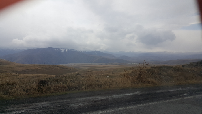
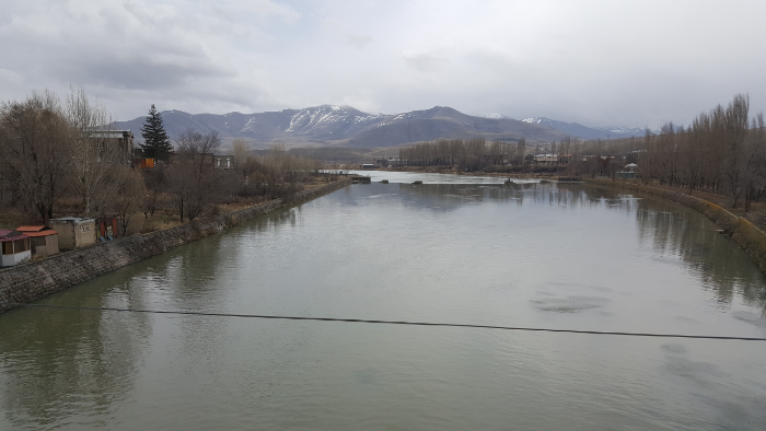
The last stop on my southern Armenia tour was Sisian, a town about 40 minutes north/west of Goris. Mary loaded me onto a marshrutka, and in no time, we were driving into Sisian. I had a reservation at a hotel in town that I made by emailing them and asking if there were any rooms available… after going there, I realize that was completely unnecessary. I knew that it wasn’t exactly high tourist season, but I honestly don’t know that there was anyone else staying there that night.

View out the dirty marshrutka window… it was another beautiful drive from Goris to Sisian

I had two things that I wanted to see while I was in Sisian – Shaki Waterfall and Karahunj. Both of them are reasonably walkable distances away from town, but the weather was gross, and I was feeling a little tired. I decided that the best way to guarantee that I would make it to them was to take a taxi. I asked the receptionist where I should go to find one (also, just keep in mind that any interactions I talk about in this post are happening in Armenian), and she gave me directions and said that it shouldn’t be more than 1500 dram (about $3) for each place I wanted to visit. She also insisted that it was an easy and short walk to Karahunj, so I planned to taxi to the waterfall and back and then walk there.

The river that runs through Sisian

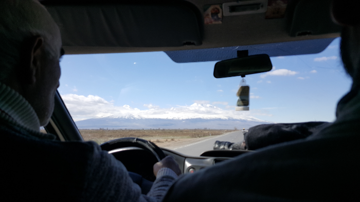
Taxis usually just hang out in certain places around town until you go and hire them, so I went to one of the hang out spots and tapped on a guy’s window until I got his attention. I asked him how much it was to go to Shaki Waterfall, wait, and drive me back. He said 3000 dram, and I’m pretty sure I laughed. In response, he asked how much I wanted to pay, I said 1000, and he asked how long I wanted to stay there. I said half an hour because like… who knows? I knew you had to walk a little to get there, and I didn’t want to feel rushed. He looked appalled by that, so I said, “I don’t know? 20 minutes? I just want to see it.” I guess that was good enough for him because he agreed, and off we went!

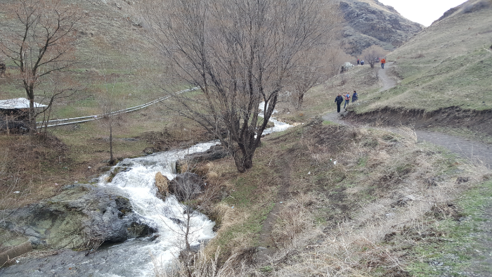
We chatted during the ride there, and I was proud of how much I understood and how much I could say. He told me my Armenian was good which is always nice, but I also think that sometimes people just say that because they’re happy you can speak at all. It’s okay, I’ll take the compliment. When we got to the waterfall parking lot, he pointed me in the direction of the path that leads there and said he’d be waiting when I got back.

The path to Shaki

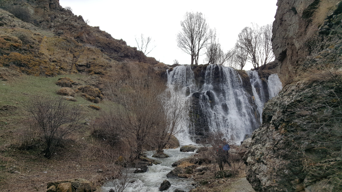
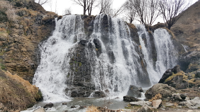
Shaki Waterfall, like everything else in Armenia, has a legend (or factual story, depending on who you ask) behind its origin. According to the story, an army invaded a nearby village and kidnapped 93 beautiful maidens to give to their commander. When they reached the river, the maidens asked if they could bathe in the water and make themselves presentable after the long, dirty journey.

When the army agreed, they all jumped into the water and “disappeared”. One of them, Shaki, tried to escape by swimming across the river. She was about to be recaptured when a rock came up underneath her, and she was concealed by the water flowing over the rock (aka the waterfall).

First glimpse of the waterfall walking up the path

I have a lot of questions about this story, especially because it’s incredibly vague about what happened to the maidens. They “disappeared”… which means what? I assume it means that they all drowned themselves, not that they went through some magical portal into another dimension. And Shaki? Did she also “disappear”? I don’t know. The legend is fine and all, but there are too many unanswered questions for my liking.

Anyway, the walk to the waterfall took less than 5 minutes which made the taxi driver’s reaction make more sense… a 30-minute stay would have given me more than 20 minutes to stand and look at the waterfall. It’s definitely nice, but like I said, the day was cold and wet, and after going and looking at it for a few minutes, I was ready to leave. I think I made it back to the car within 15 minutes, and the driver told me that I could have stayed longer. Geez, you can’t please anyone (hehe).

Shaki Waterfall

Soon after I got into the car to head back into Sisian, it started raining and I started rethinking my decision to walk to Karahunj. As we got closer to the city, I asked the driver how much it would be to go there as well. He looked at me like I was a nut and said that it wasn’t a good day to go and the path there would be very muddy. Oh, well. I was there for one day which meant that no matter how bad the conditions, if I wanted to see it, I didn’t have a choice. I explained that to him, and he said okay and that it would be 1000 dram. Totally reasonable and way better than what I was expecting, so I agreed, and off to Karahunj we went.

My mudshoes

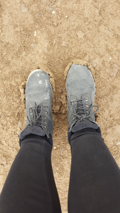
He dropped me off on the main road because, like he said, the path was too muddy for him to drive up. From there, I walked, and he was absolutely right. Within just a few steps, my shoes were completely weighed down with mud. I walked for probably 10-15 minutes, thankful with every step that I had decided to wear my boots.

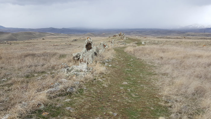
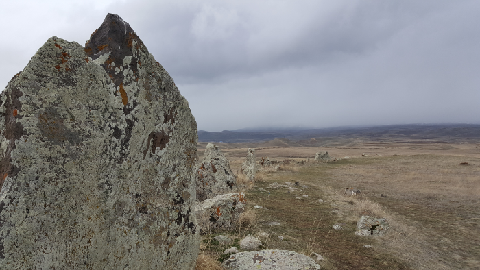
Karahunj/Zorats Karer is, to put it simply, the Armenian Stonehenge. Any proud Armenian will tell you, however, that it’s 3,500 years older than Stonehenge in England. I’m not really sure how they date something like that, though. It’s not like they can carbon date it… it’s just rocks placed in a certain configuration. “They” say it’s from around 5500BC and was used as a religious site and maybe more for around 5000 years or so.

They say that Karahunj is where the name “Stonehenge” comes from. “Henge” doesn’t mean anything in English (well, it does now, but that’s because of the Armenians of course), but Kara = stone and hunj = sound in Armenian, so Karahunj might mean Speaking Stones or something to that effect. They say that it’s an ancient astronomical observatory, despite the fact that the rock alignment doesn’t really make sense in that context. There are also random round holes carved into some of the stones, and they have no idea what those were for.

Super weird
See the hole at the top of the leftmost rock? That’s the type of hole that they’ve found in at least 80 rocks

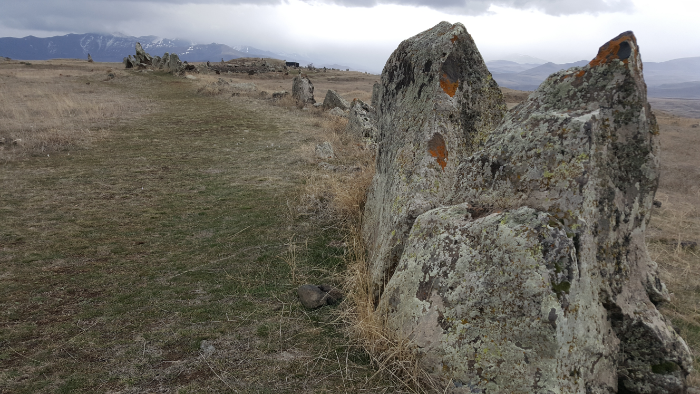
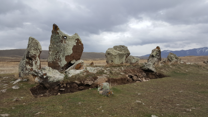
In the center, there’s a temple to the primary god of the ancient Armenians, Ari, the sun god. Then, there’s a sort of circle of stones surrounding the central area and two squiggly arms that extend out to the north and south. There are 223 stones officially documented as part of the monument, and there are other broken stones around that may have originally been part. They’re of varying sizes, but the biggest ones weigh up to 10 tons! Eighty of those stones have a round hole carved into them. Like I said, there’s still no consensus about the purpose of the stone configuration. People have been able to draw some parallels between the layout and the stars, but there are also a lot of things that they can’t make sense of… so they don’t actually know anything for sure.

See the rock path? That’s part of the north/south rock squiggle
Me + Karahunj

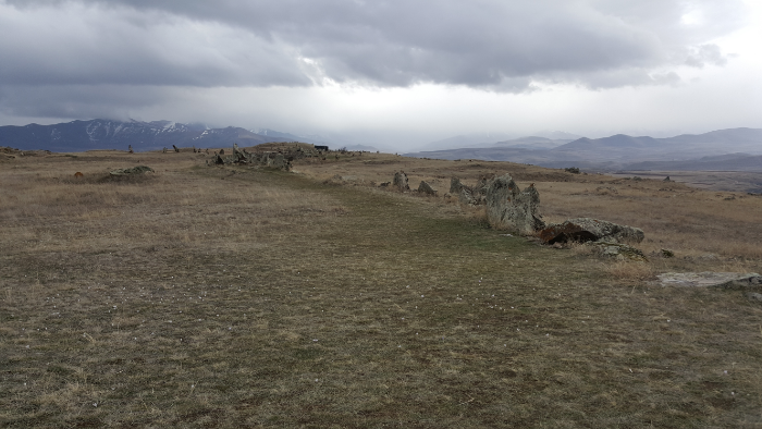
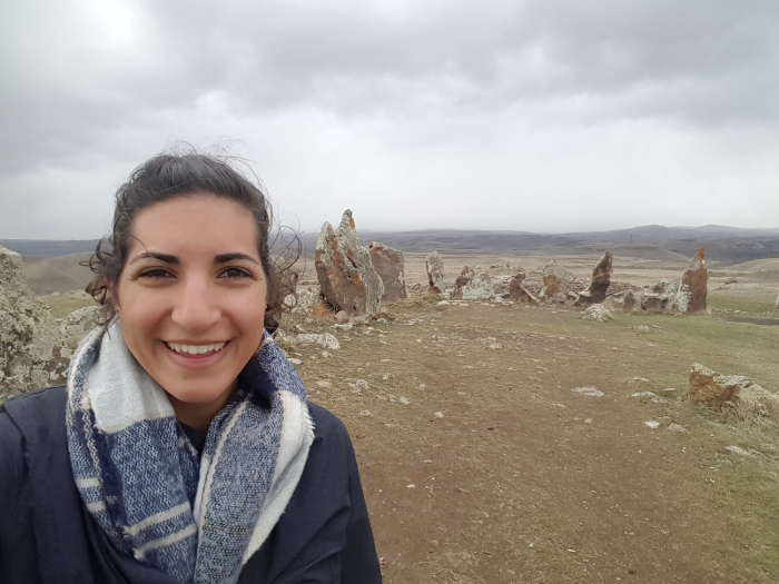
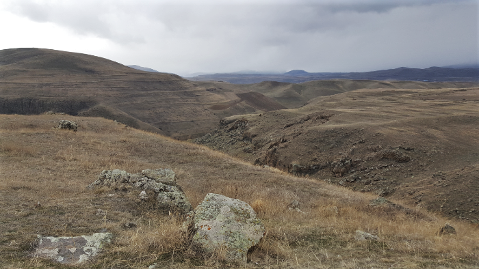
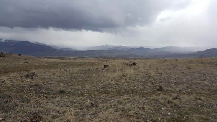
It was cool to see, especially knowing that it has such a weird and mysterious history. Some of those rocks are HUGE, and seeing it inspired the same questions of, “How the heck did people move these?” and, “WHY?” that came about when I was in Peru seeing the stuff that the Incas built. Plus, the setting is beautiful. It’s up on a bit of a hill surrounded by valleys, so there are pretty views in all directions.

Looking out from the south end
I like how eerie the mountains in the distance look

After wandering around for a bit, completely mystified, I headed back through the sticky mud to my taxi. It started raining again when I was about a quarter of the way there, just confirming my decision to take a taxi instead of walking. That would have been miserable! My ears and nose were frozen, and the taxi driver gave me a knowing nod as I tried to scrape the mud off my shoes before getting back into the car and warm up my face on the drive back to the hotel. For sure worth the $4 that I paid for the taxi ride!

I kind of like the fact that there’s some mystery behind the site. It’s a weird experience going there, knowing that it’s so old and was clearly important to the ancient people, and having no idea how or why it exists.

I spent that night relaxing at the hotel and getting ready for my trip back to Yerevan in the morning. One of Mary’s friends who lives in Sisian helped me to reserve a seat on a marshrutka (even though we never met in person!). I don’t know how people are supposed to be able to do any of this travelling without the kind of support system that I had. Without that and without language skills, I imagine it would have been a very different and more frustrating trip.

The end of my south adventure wasn’t the end of my Armenia fun. The day after I got back, some of my cousins came from the States to visit! We didn’t do much that I hadn’t already done before, but I’ll share some pictures from that week in my next post!

View of Ararat on the drive back to Yerevan

Remember when I said that Lebanon is super old? As you might expect from a very old place, there are a lot of museums in Lebanon displaying very old things. I went to two of them, the National Museum of Beirut and the American University of Beirut’s Archaeology Museum. Beyond just museums, there are ruins all over the city (and under the city) and the country. It would be impossible to give you a thorough history of Lebanon, mostly because you would be bored to tears reading it, and I would react similarly to writing it. Instead, I’m going to give you the highlights deemed most interesting by me.

(Disclaimer: as usual, I’m at like 90% confident that what follows is accurate, but I’m not a scholar of ancient history which means that looking at this stuff for too long makes my head hurt. I did my best.)

View of the main hall in the National Museum of Beirut.
Ancient molar! It’s dated to 200000-50000 BP.

To talk about the first humans in Lebanon, we have to go back… waaaaaay back in history to AT LEAST 48000 BC. Oh yes, that’s right. The National Museum has a molar that has been radiocarbon dated to 250000 – 50000 BP (BP means the number of years before 1950). That, yes, seems like quite the range of dates. I know this is complicated stuff, but you’d think they could come up with a gap of less than 200,000 years. Anyway, that’s beside the point. The point is, even if it’s only from 50000 years before 1950, it’s still ridiculous.

The first permanent settlements are estimated to have emerged by 5000BC. By 4000BC, the land was inhabited by the Canaanites, or Phoenicians. They lived in coastal cities, and the inland was covered in forests. Those cities are still in existence today: Tyre and Sidon were big maritime and trade centers, and Gubla (Byblos) and Berytus (Beirut) were trade and religious centers. The Phoenicians thrived because of their location and many tradable resources. They established a trading relationship with Egypt, bringing in wealth and foreign goods.

These bones from a woman are dated to 15000 BP. They’re laid out exactly as they were found.

In the 1400s BC, Lebanon became part of the Egyptian empire for a couple of centuries. Egypt was just the first in a long line of powerful outsiders to come in and rule over the land. Post-Egyptians, the Phoenicians enjoyed a few centuries of independence, thriving again and mastering the arts of textiles, ivory work, metalwork, and glassmaking. The Phoenician alphabet spread, making it possible for common people to learn to read. Many modern alphabets can be traced back to the Phoenician alphabet. It was during this period that Sidon and Tyre first entered the story in the Bible, when cedar trees and craftsmen were provided to Israel’s King David to build his palace. Later, Jezebel, the queen of Israel who led the Israelites astray by worshipping the Phoenician god Baal, was the daughter of the king of Sidon.

Thirty-one anthropoid sarcophagi were found near Sidon. They’re from about the 5th century BC and show both Egyptian (the sarcophagi) and Greek (the style of the carved faces) influences.
Ancient braces! This is dated back to the 5th century BC, during Phoenician times. It’s the earliest known example of “retentive dentistry”.

When the Assyrians conquered the Phoenicians in the 9th century BC, they ruled oppressively. Any uprisings were squashed, and the people were punished for their rebellion. The Babylonians were similarly harsh rulers. The Babylonian king Nebuchadnezzar sieged Tyre, an island city, for 13 years before gaining control. This siege is described by the Old Testament prophets Jeremiah and Ezekiel. Next came Persian rule and a period of peace until they started imposing high taxes, and the people rebelled.

When Alexander the Great and the Macedonians came onto the scene in the 300s BC, most cities didn’t resist and instead welcomed them in. Tyre, on the other hand, refused to allow entry into the city. The Macedonians sieged the island for seven months and ended up victorious after constructing a causeway from stones, timber, and dirt that linked the island to the mainland. Without its water defenses, the city fell, and its inhabitants were harshly punished for their resistance. Over time, the causeway widened as more and more sand and debris washed up, and today, Tyre is a peninsula. The fall of Tyre and its failure to ever recover its previous status as a world-wide trading center was described by the prophet Ezekiel.

After Alexander died, his great kingdom fell apart under the conflict-filled rule of his successors. The Romans took over, and Pompey added Lebanon as a Roman province. The inhabitants of its major cities were given Roman citizenship. The language switched from Phoenician to Aramaic. It was a time of economic prosperity.

This is a model of a 2nd century AD temple. It was made to guide the builders… architectural drawings, classical style! Imagine being an architecture student in those days and having to make your models out of limestone… I thought cardboard was bad enough!

This was also the time period in which Jesus performed his first miracle in Qana, in the south of Lebanon, turning water into wine at a wedding. He visited Tyre and Sidon as part of his ministry. Later, Paul also briefly visited both cities and met with disciples in each. Christianity spread quickly, leading to a Christian majority in the area. The Maronite church emerged at the end of the 4th century from the followers of Saint Maron, a monk.

Natural disaster in the form of earthquakes struck in the 4th and 6th centuries AD. The 4th century earthquakes were accompanied by tidal waves that destroyed the coastal cities. The 6th century’s destroyed Baalbeck (originally a big pilgrimage location for the Phoenician god Baal and later the location of Roman temples) and Beirut, killing thousands. Between these disasters and internal conflicts in the empire, Roman control of the area weakened.

These ruins are guessed to be the remains of the famous Roman law school in Beirut. They haven’t found any decisive evidence of this, so really it’s just a guess because they don’t know what else it might be.

Islam was introduced by the prophet Muhammad at the beginning of the 7th century, and the Muslim Arabs took control from the Romans in the same century. Islam began to spread, and Arabic was introduced as the new language. The Maronite community clung to Christianity and was treated with varying levels of tolerance depending on the ruler at the time. The Druze faith also emerged around the end of the 10th century.

This is some Roman goddess… maybe Venus? I can’t remember, but I thought the fact that she’s wearing a necklace and earrings is pretty cool.

The Crusaders swept in during the 11th century, organized by Western European Christians who were trying to reclaim the Eastern Mediterranean. Lebanon became part of the Crusader states, split between two of them. The Maronites formed a connection with the French and pledged their allegiance to the pope in Rome, rather than to a more local patriarch, bringing them support from both France and Italy.

Muslim control resumed in the late 13th century. The Ottoman Turks were growing their empire, and Lebanon became a semi-autonomous part of it. Fakhr-ad-Din II was a Druze leader who ruled in the 16th century and worked to unify Lebanon. He resolved religious conflicts and enforced tolerance, enlarged the emirate, and is considered the founder of modern Lebanon. His rule led to economic and cultural prosperity, and he wanted Lebanon to gain its independence from the Ottoman Empire. They obviously didn’t like that very much, and his execution was eventually ordered by the sultan.

The AUB museum. It’s very pretty.

Fakhr-ad-Din II’s rule was a high point, and after that, things went downhill. Conflicts between the Maronites and Druze got increasingly violent in the 1800s. The Ottomans helped the Druze conduct massacres of the Maronite population. The Maronites grew more and more discontented with Ottoman rule and were fighting with the support of the French. The British backed the Druze. The Ottomans wanted to maintain the conflict to maintain control. Eventually, foreign powers threatened to intervene, and the Ottomans worked to end the conflict to avoid foreign meddling.

The latter half of the 1800s was more peaceful. The next big disaster struck during World War I when food shortages led to the deaths of almost half of the population. At the end of the war, with Ottoman assets being divided up, control of Lebanon and Syria was given to the French who were meant to prepare the countries for independence.

That’s where I’m going to leave off for now because I’m exhausted, and I assume that if you’ve managed to make it this far with me, you’re also exhausted. Sorry to anyone who fell off somewhere in the middle. I tried to stick to the most interesting and important parts, but we just went through about 7000 years of history so really there’s only so much you can do.

To be continued… HERE

More of the AUB museum.