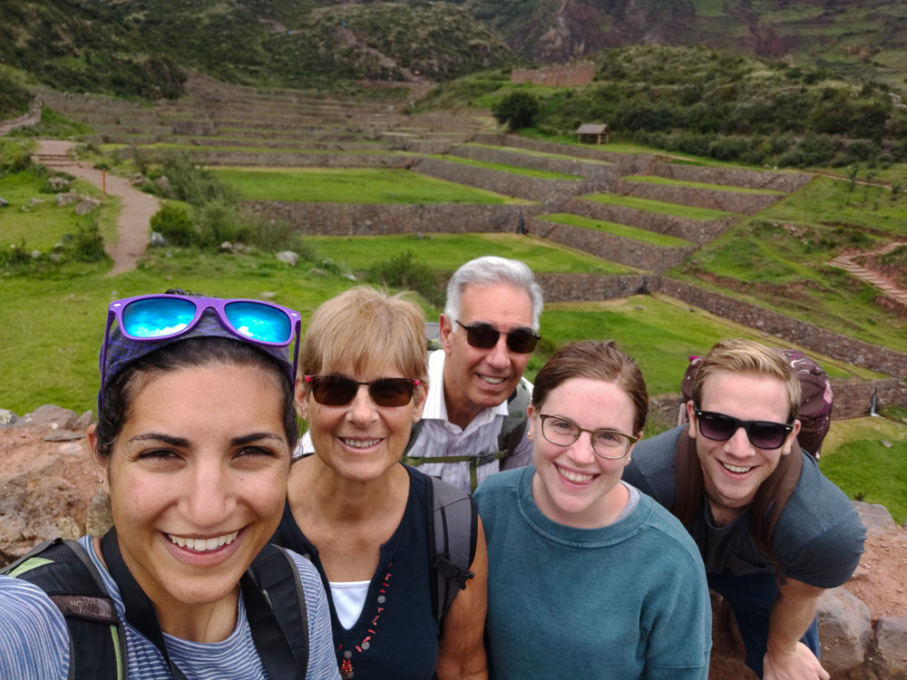
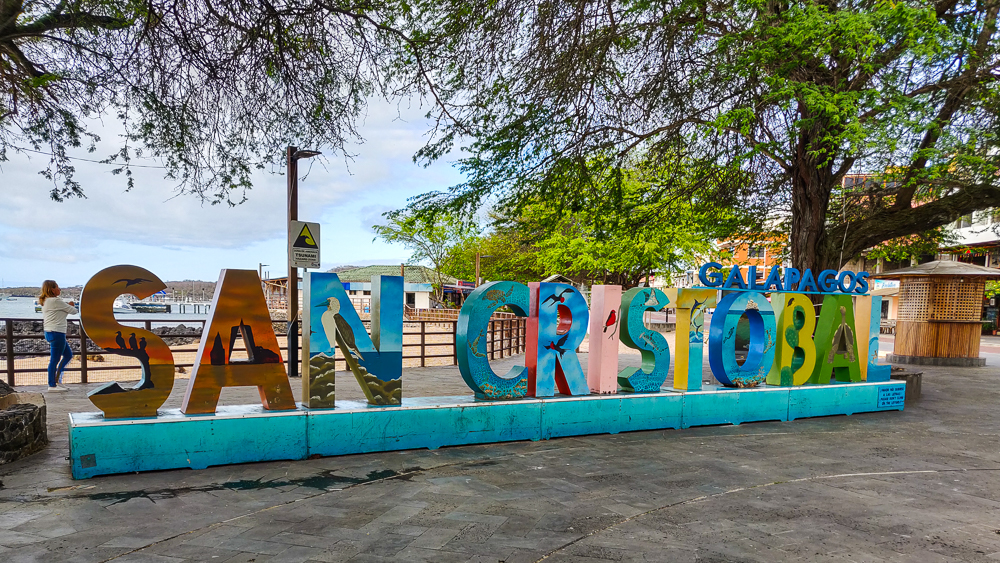
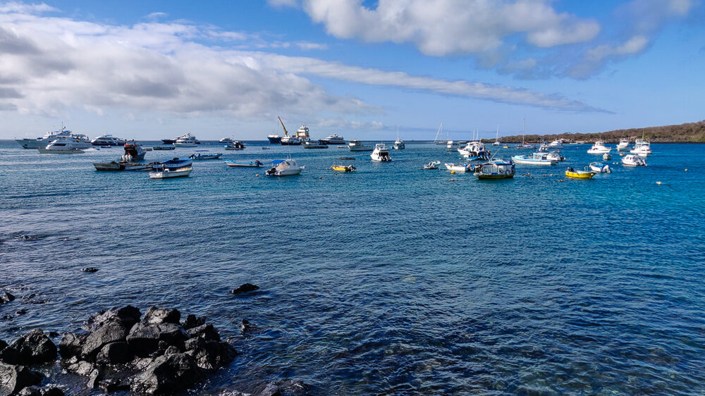
The morning after my short day in Guayaquil, I met my aunt, uncle, and cousins at the airport for our flight to San Cristóbal, our first stop in the Galapagos! I was really excited that it worked out for me to travel with their family because while I do love to travel alone, there are some destinations that are even better with travel companions. To me, the Galapagos is one of those (because you need someone to share your disbelief with! It’s a place like none other).

Cousins! (pic by my uncle)

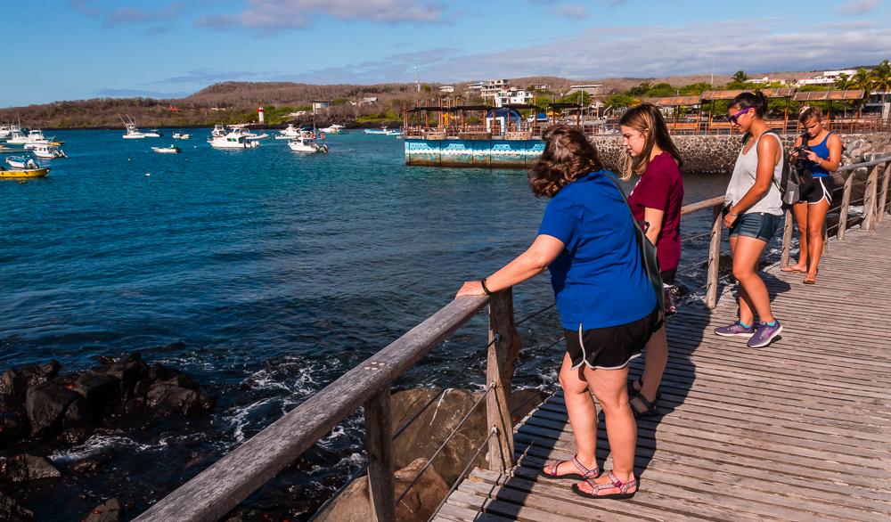
Since the Galapagos Islands are protected, there are lots of hoops to jump through on your way there. We needed to provide all sorts of information about where we were staying and what we were doing, they scanned our luggage to make sure we weren’t bringing any organic materials with us (because non-native seeds and such can really mess things up), and when that whole process was finished, we were off!

Welcome!!

No trip is without its drama, and this time, there was some seat assignment debacle happening. I don’t know exactly what it was all about, but I stepped onto the plane and immediately regretted it. Chaos. People were standing in the aisle and yelling at the flight attendants who were frantically looking at papers and passing them back and forth and yelling across the plane. I managed to scoot past the mess and into my seat, but there was still no resolution in sight. The departure time came and went. Tensions were rising. Finally, a man a few rows in front of me stood up and said, “Okay, so whatever happened to mess this up, it doesn’t matter anymore. The flight is only 2 hours long. Can we all just agree to sit in whatever seats are available so that we can get out of here?” A voice of reason. The plane breathed a collective sigh of relief. The problem passengers sat down. We took off. That man was a hero.

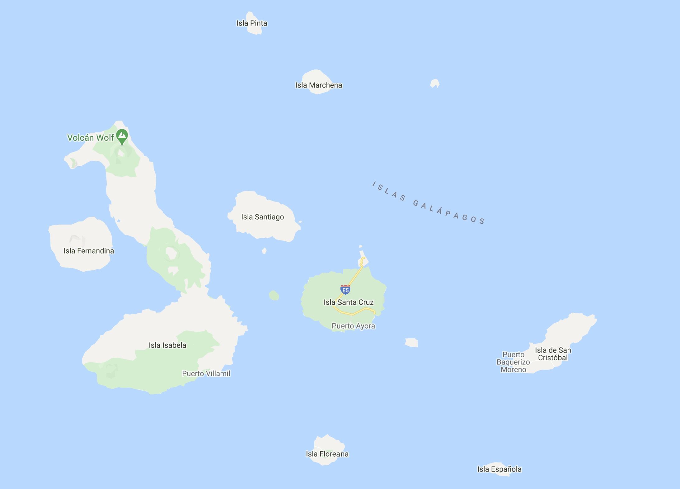
Now that we’re airborne, let’s get some Galapagos backstory. The Galapagos Islands are a volcanically formed archipelago in the Pacific Ocean, straddling the equator about 560 miles (900km) west of Ecuador. There’s a hot spot beneath the earth’s crust, and sometimes, an eruption pierces the crust and sends out a flood of lava that accumulates and cools into an island. Since the earth’s crust is made of tectonic plates, giant areas of crust that are constantly moving, these newly formed islands slowly move away from their source hot spot which remains stationary. The Galapagos are on the Nazca Plate which is moving east towards South America at a rate of about ~1.2”/year (3cm). That may seem slow, but over 50 years, that’s nearly 5 feet (1.5m)! Over millions of years, a group of islands is formed. The oldest Galapagos Islands are on the eastern side, estimated to be 3 million years old. The newer ones to the west are young… more like 50,000 years.

The Galapagos Islands. There are some smaller islands that don’t show in this picture, but these are the major ones that people visit/know about.

The new islands, as nothing more than mountains of cooled lava, are completely devoid of life and rather inhospitable places. Slowly “pioneer species” make their way there, starting with things like cacti and lichens (fungus algae) that don’t need much to survive. Their seeds come to the islands via winds or tides, a few eventually land in places where they manage to germinate and grow, and slowly, they spread. Saltwater-resistant coastal plants, like mangroves, have a better shot than those requiring fresh water.

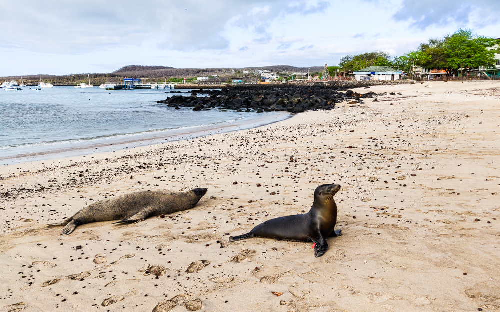
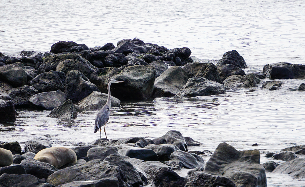
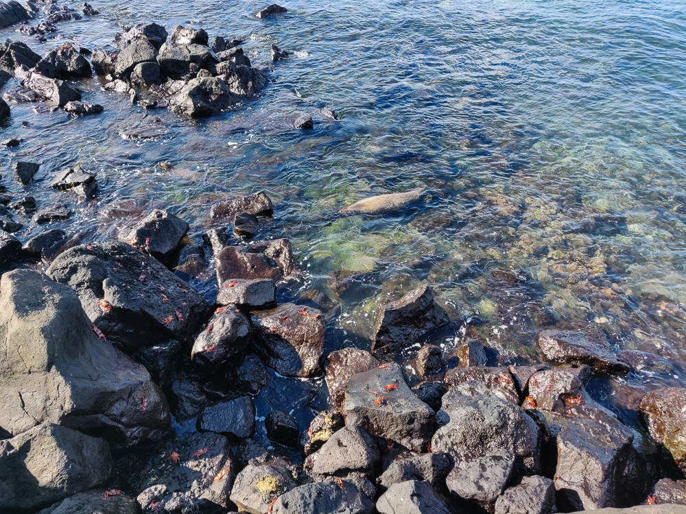
This is a good place to explain that one of the reasons why the Galapagos are so unique is because of their location. There are three different currents that converge on the islands: the warm Panama Current from the northeast, the cold Humboldt Current from the southeast, and the Cromwell Current, an upswell current from the west which brings cold water from the ocean depths. In essence, all ocean roads lead to the Galapagos, making them an incredible site for marine diversity, including marine mammals that also spend time on land, like penguins and sea lions.

Sally Lightfoot crab. The name origin is debated, but some say it’s named after a Caribbean dancer because of its speed and agility. For an idea of scale, this guy is maybe like 6″ wide?
Sea lions!

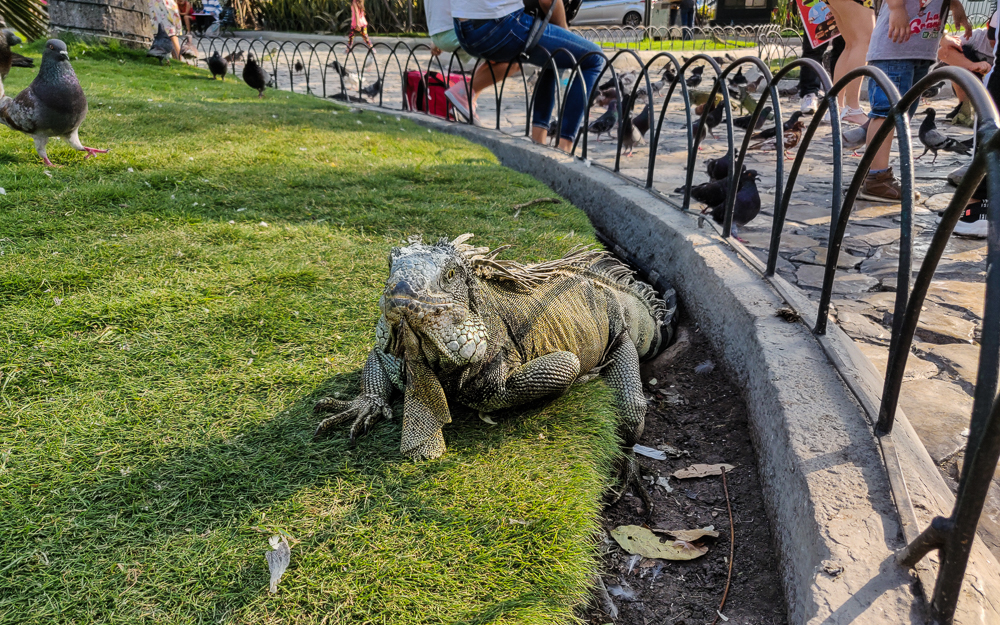
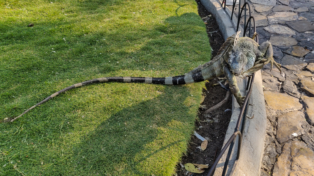
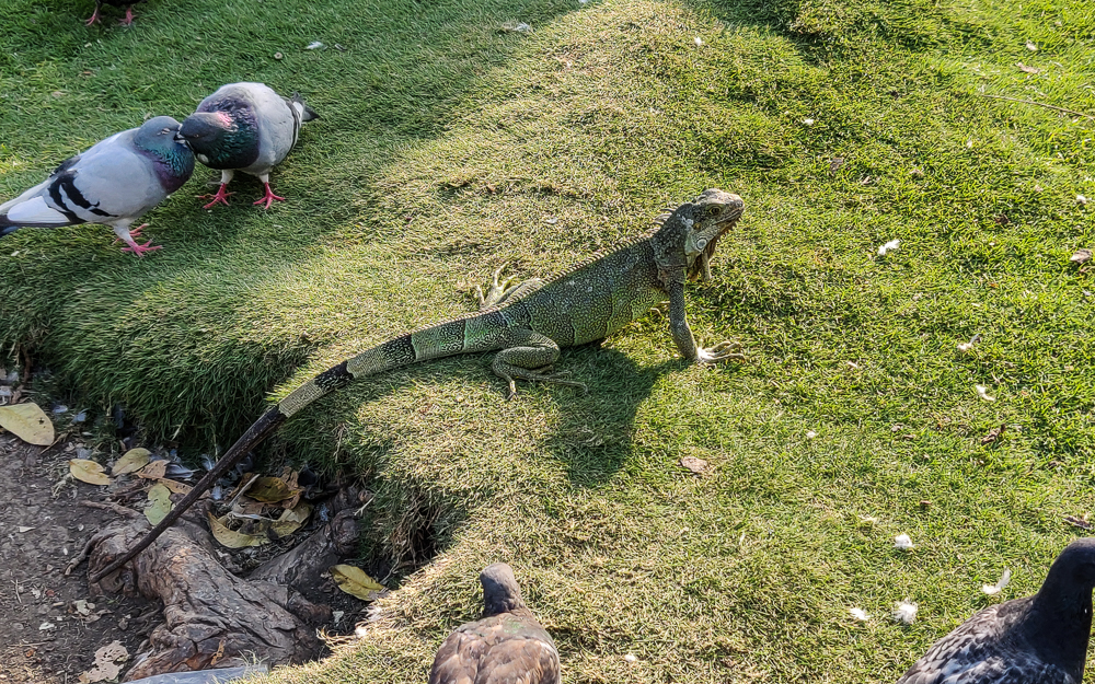
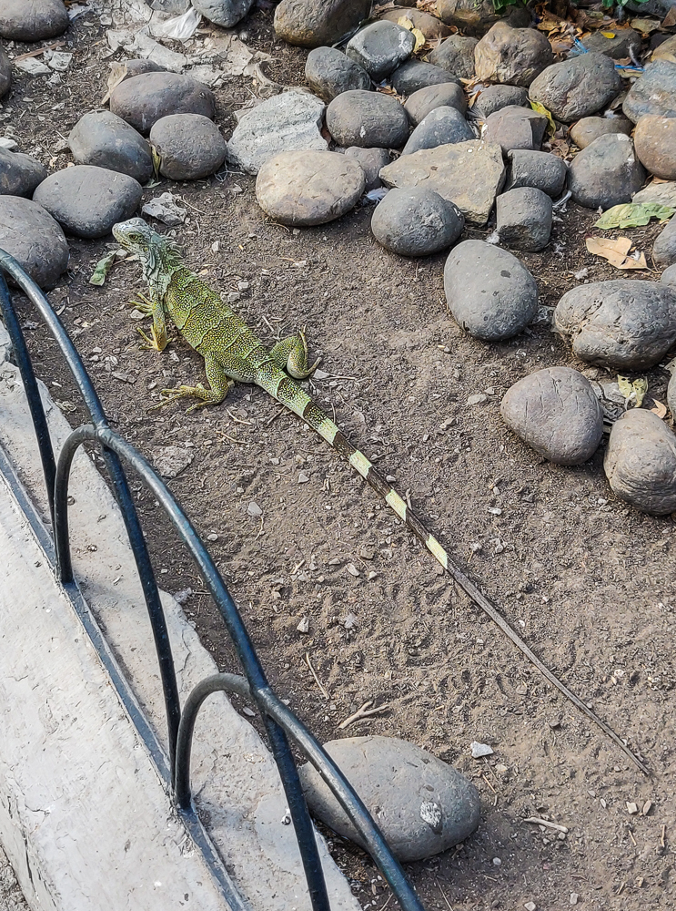
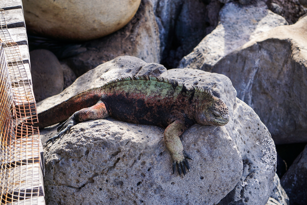
Okay, now we have some basic plant life and marine life… so how did the land animals arrive? Vegetation rafts (floating masses of vegetation) and other large, floating objects like tree trunks sometimes carry animals as well as plants. From the continent, in favorable conditions, it takes about two weeks to float out to the islands which means that any animal capable of surviving two weeks without freshwater and in the hot sun had a chance to make the Galapagos home. Not surprisingly, this mostly limited the land-dwellers to reptiles, mainly tortoises and land iguanas, that thrived in the absence of predators and competitors.

Land iguanas
This guy has some pretty colors!

Finally, the easiest path was taken by sea birds who simply flew to the islands. Many species nest on the various islands, probably attracted in part by the lack of major predators, making the Galapagos an especially famous destination for birders.

Great blue heron (not a great picture, but hey, baby steps)

Everything that came to the Galapagos had to either quickly adapt to the environment or perish, and the plants and animals that live there today sometimes look very different from their mainland ancestors. One famous example is the Galapagos finches. The thirteen species of finch are differentiated by their beak shapes, each best suited to accessing a particular food source. Charles Darwin visited the Galapagos, and his observations of the finches helped to form his theory of evolution.

The islands have two seasons: hot and garúa (drizzle). Hot is from December-May when the warm NE winds are strongest, and rainfall is abundant. Garúa is June-November when the SE and W winds are strongest. Temperatures are cooler with a persistent garúa.

In the lowlands of the islands, the climate is arid. Some of the larger islands have highland areas as well. Their climates transition from arid lowlands around the coast to almost rainforest-like vegetation (and weather!) in the highlands toward the center. It’s very strange. You can have a bright, sunny day on the coast, but a rainy day is just a quick drive into the highlands away.

Can you see the little crabs? They have one GIANT claw. These are actually so teeny that I couldn’t tell what they were from where I was standing. I saw hints of movement, and, curious, I took a picture with my camera zoomed in all the way and then zoomed in on the picture. Only then could I see the claws.
Get ready for post after post of me obsessing over how pretty the water is.

Okay, now I’m going to zoom through the human history of the islands because it’s far less interesting and mostly involves lots of bad decisions, people dying, and destruction and exploitation of the islands. Some evidence has been found to suggest that pre-colonial people made it to the islands, likely on large rafts that were driven by the winds and currents. The first written account of their existence is from 1535 by a Spanish missionary named Fray Tomás. A few days after his ship’s departure from Panama, the wind disappeared, and they were left to the mercy of the currents. By the time the ship reached the islands, its passengers were in desperate need of water. It took three days and two islands before they found freshwater pools which they used to refill their stores before heading back to the mainland. Fray Tomás wrote of “sea lions and turtles and tortoises so large that each could carry a man on top of itself, and many iguanas that are like serpents” and said that there were “many birds like those from Spain, but so silly that they didn’t know how to flee, and many were caught by hand”.

About a century later, pirates moved in, using the islands as a refuge and hiding place after attacking Spanish ships. The Spanish then took an interest in the islands, gathering as much information about them as possible to try to stop the pirates. The 1800s brought whalers who hunted the whale-rich waters, killed fur seals for their pelts, and took/killed tortoises for their oil which was used in lamps. This also was the beginning of the introduction of non-native species, a huge issue for the Galapagos wildlife that persists to this day as they threaten the native species by eating their food, eggs, etc. As Fray Tomás noticed with the “silly” birds, their lack of exposure to humans kept them from recognizing the risk they posed. The same is true for other animals. The native species have no time to adapt to them and the new threats they bring.

Crystal clear water!

The early attempts to colonize the islands all ended in disaster. The first was in 1832 and included 80 prisoners who were pardoned in exchange for their work in the colony. Within five years, it failed due to a toxic atmosphere between the colonists and criminals. Criminals continued to be sent to the islands, and in 1839, the new governor transformed the colony into a work camp where overseers dealt harshly with laborers until an 1841 revolt put an end to the whole mess. The next had a better leader, but he was idealistic and was murdered by some of the pardoned convicts he sought to reform… who were then killed by some of the workers who were loyal to the leader. Another failure. In 1879, the next guy produced sugar and treated his laborers (a mix of volunteers and convicts) like prisoners, allowing extreme punishments like whipping, banishment to another island, and death. He was killed by his workers in 1904. In 1925, 2000 Norwegian immigrants tried to set up a community, but the environmental conditions were too much, their business plans failed, and people died, leading most to return to Norway within three years, tired and disillusioned. In the 1940s, a penal colony was set up and became famous for the mistreatment of prisoners and abuse by the guards. This lasted 13 years until an uprising where the convicts took control, stole a yacht, and sailed themselves back to the continent.

Understandably, this run of “bad luck” led many people to believe that the islands were cursed. I think it was nature’s way of saying “keep out” and also “stop sending tyrants and convicts to start colonies because it’s never going to work”.

The Galapagos became a national park in 1959, the same year the penal colony was dissolved. This was a great step, but four centuries of exploitation had taken its toll. The wildlife on and around the islands was greatly depleted both from being killed by humans and by damage caused by the introduction of non-native species. Whaling logs from North American whalers alone list a minimum of 100,000 tortoises taken, meaning multiple times that were probably killed in total. Some tortoise species were lost to extinction, and the ones that are still around have been repopulated with great human effort.

We’ll talk more about some of these things later, but there’s a brief, whirlwind history of the Galapagos!

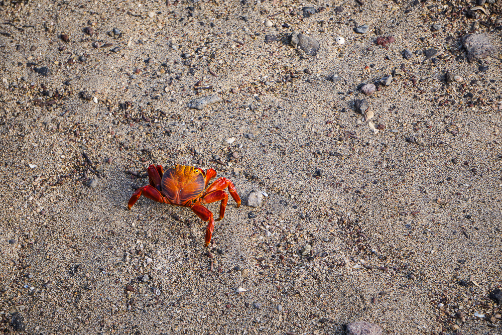
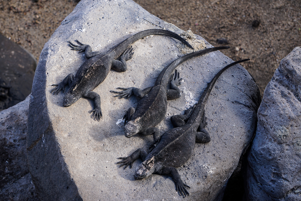
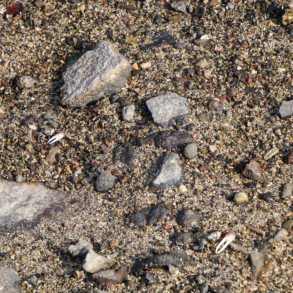
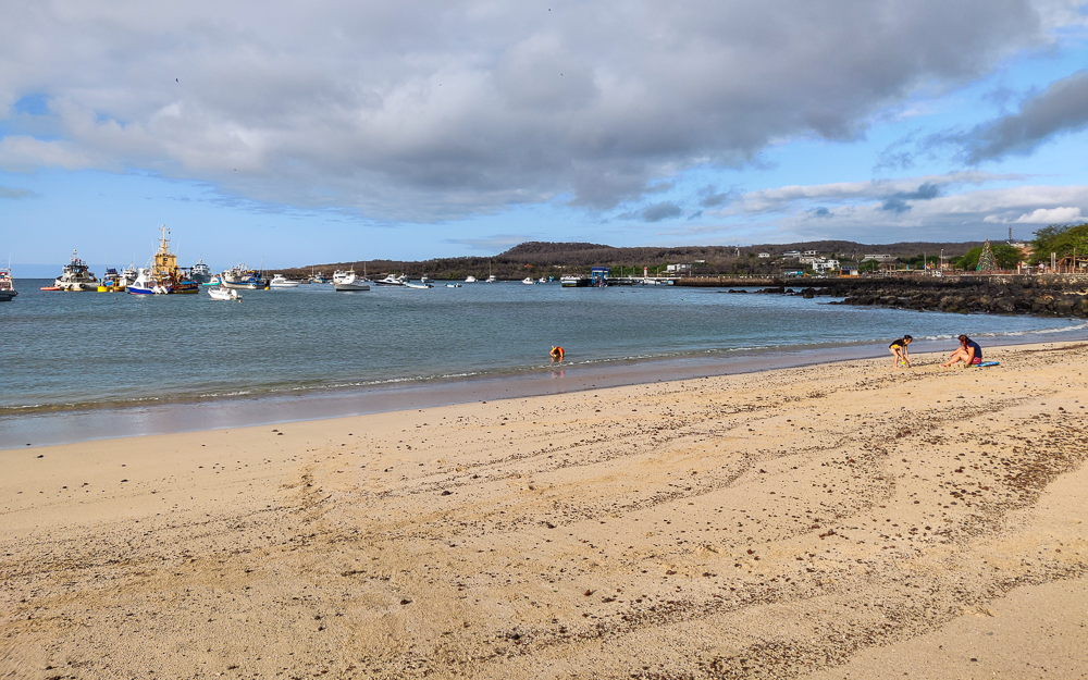
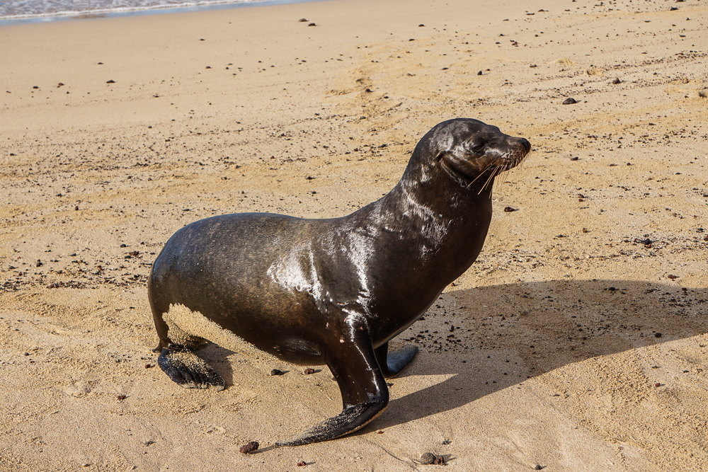
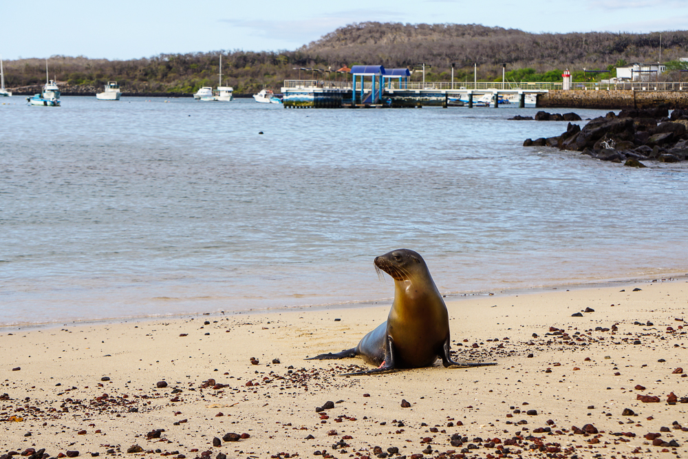
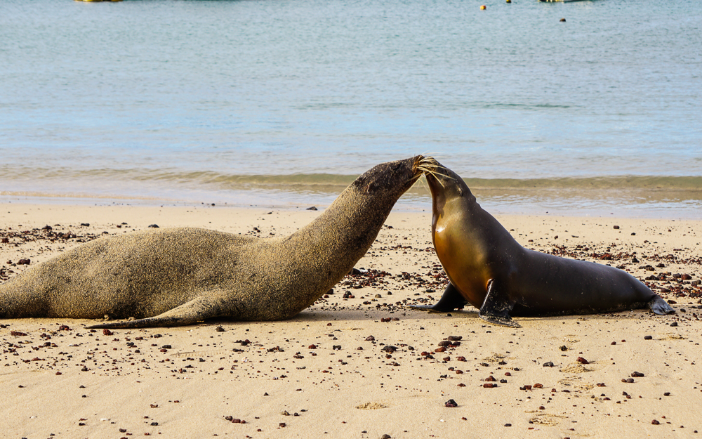
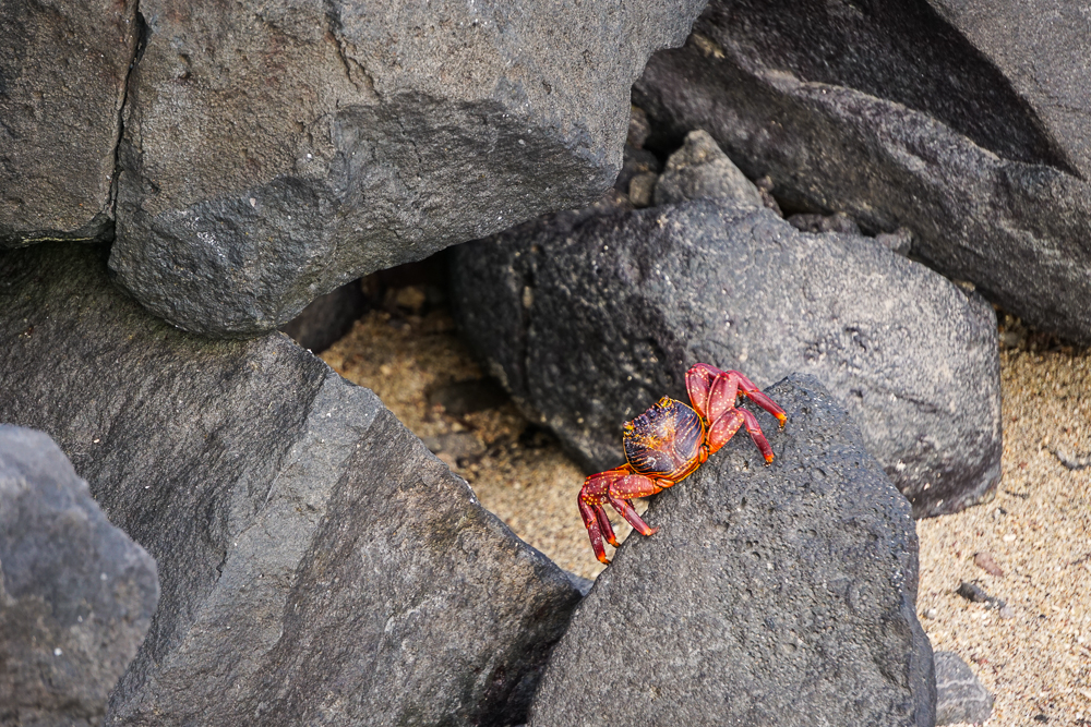
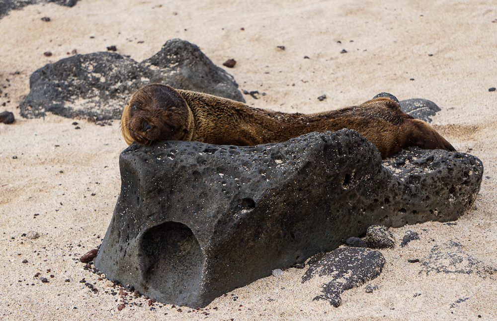
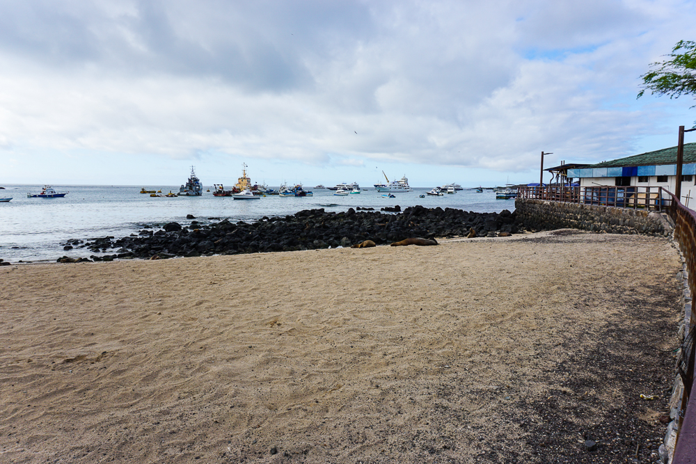
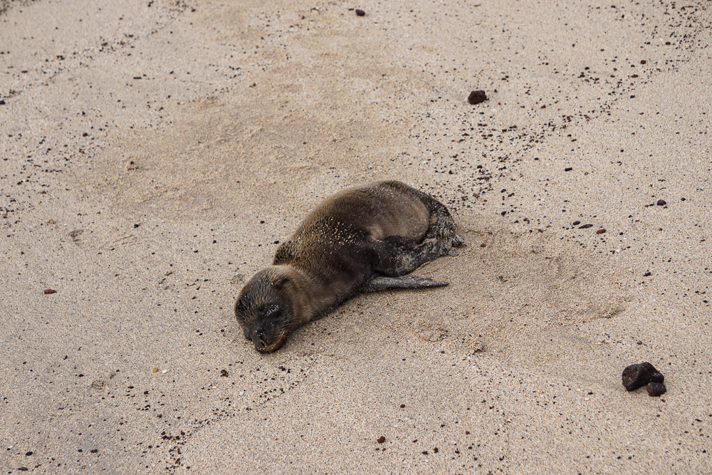
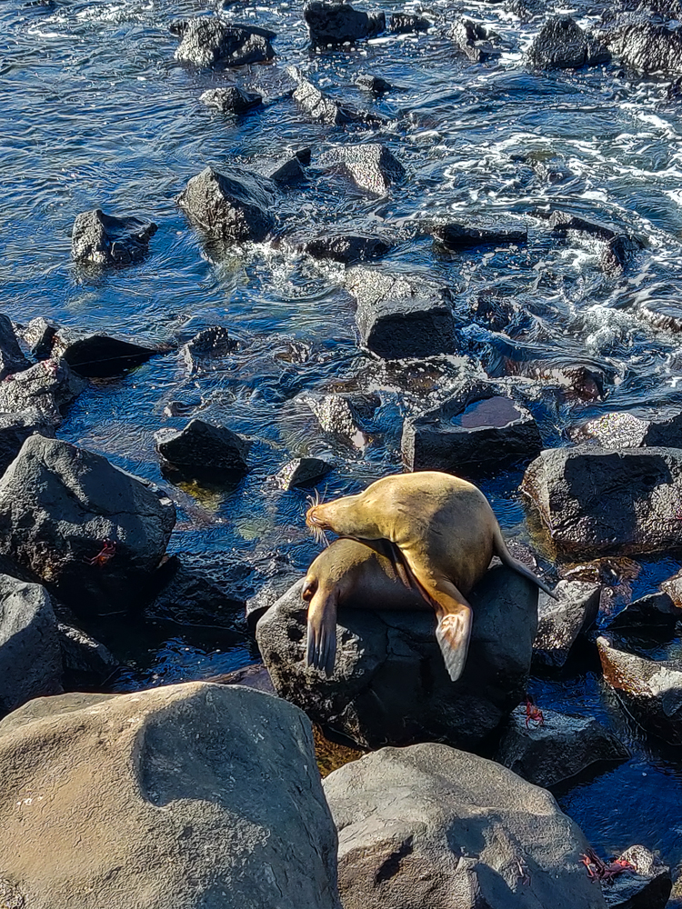
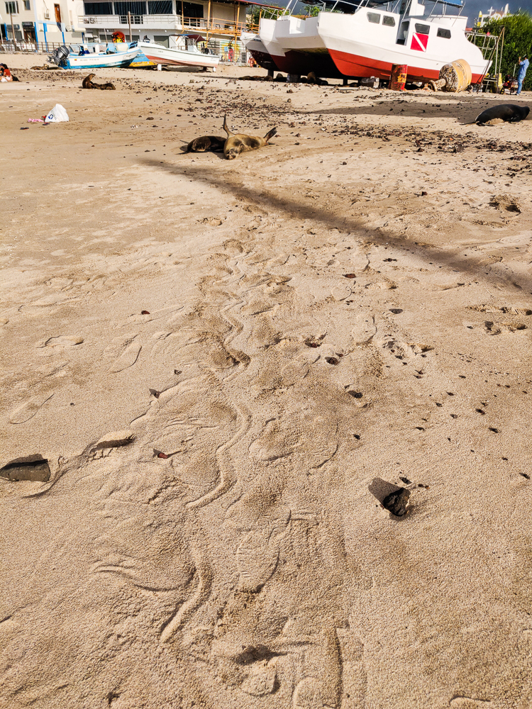
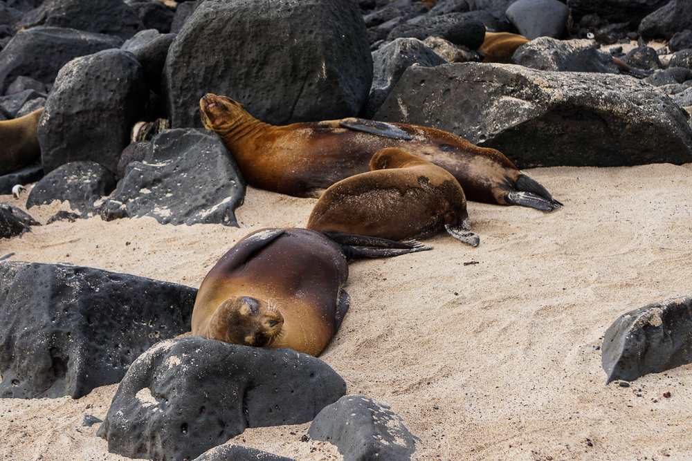
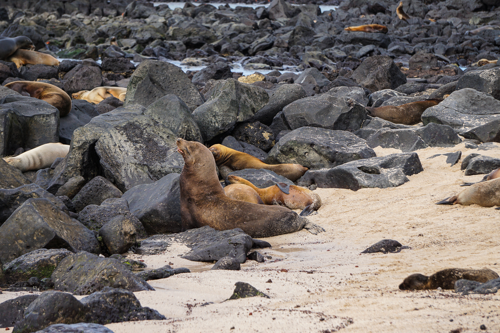
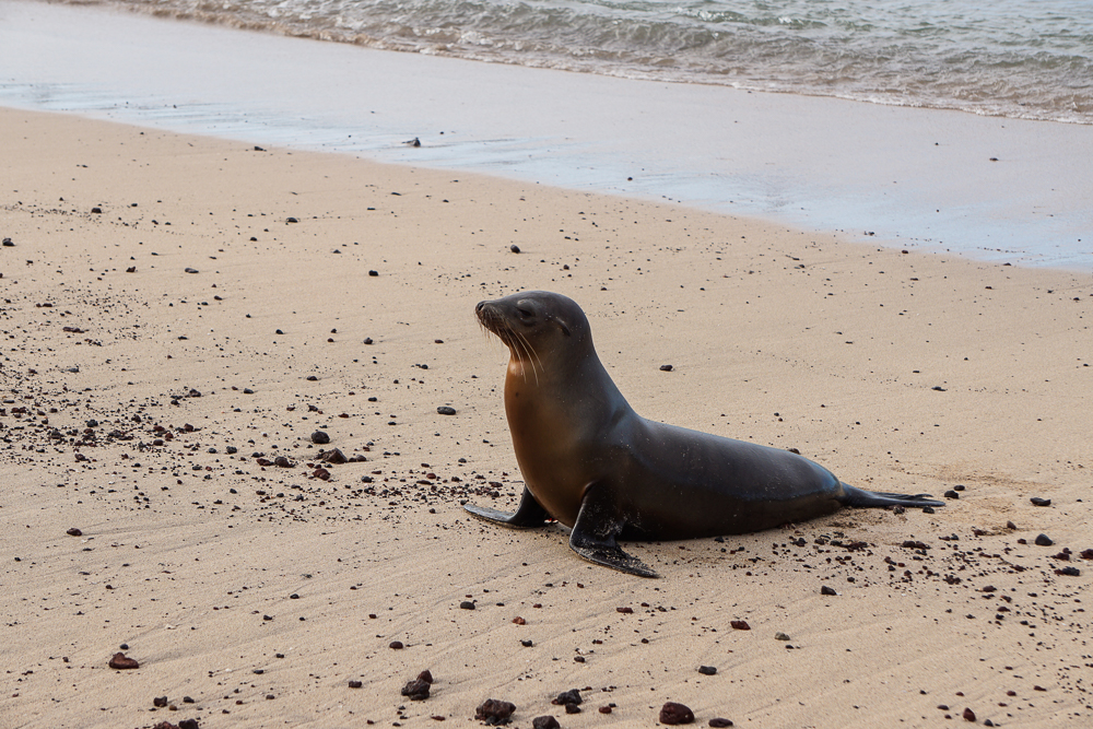
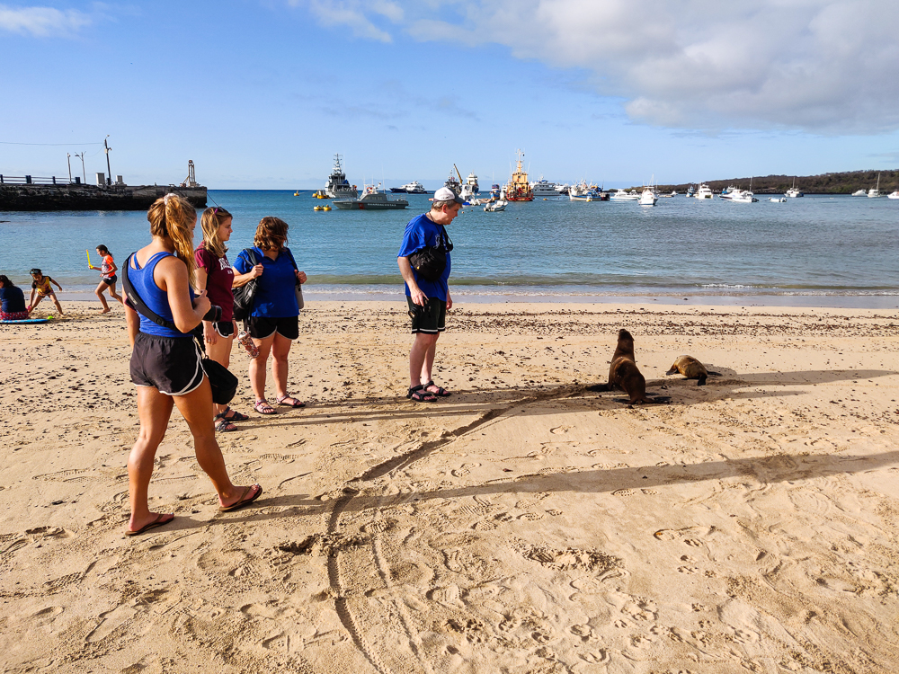
After we landed on San Cristóbal, we dropped off our bags at our apartment and walked down to the coast to check things out. Within two blocks, we were surrounded by sea lions and iguanas and crabs, and that was the end of our exploring. My uncle explained some camera basics to me, and I was happy as a clam (hehe), trying to take better pictures and figuring out the settings (you’ll see my photos gradually get better from this point on). We did eventually make it about two more blocks to a beach where some sea lions were lounging, and that entertained us until dinnertime.

This was where we spent approximately 40 minutes staring at crabs, sea lions, and iguanas. (pic by my uncle)
Another Sally Lightfoot crab
This looks comfortable
Sea lion beach
The little ones are so cute!
Just stretching…
Sea lion tracks
Look at that face

What posture!
My uncle is doing a good job of maintaining the required 2-meter distance between person and wildlife. Also, this is a good depiction of what’s going on behind practically every picture I took in the Galapagos. A crowd of people admiring the celebrity wildlife.

Everyone was exhausted after that. We had a full-day tour the next day, so I went to bed as soon as I could to prepare for our early start!

Related Posts

Iceland History – visit the world’s largest volcanically formed island, Iceland! While Iceland and the Galapagos were formed the same way, you’ll see what a difference location makes!

Macaw Clay Lick – speaking of birds, head to Peru to admire the colorful macaws of the Amazon Rainforest.

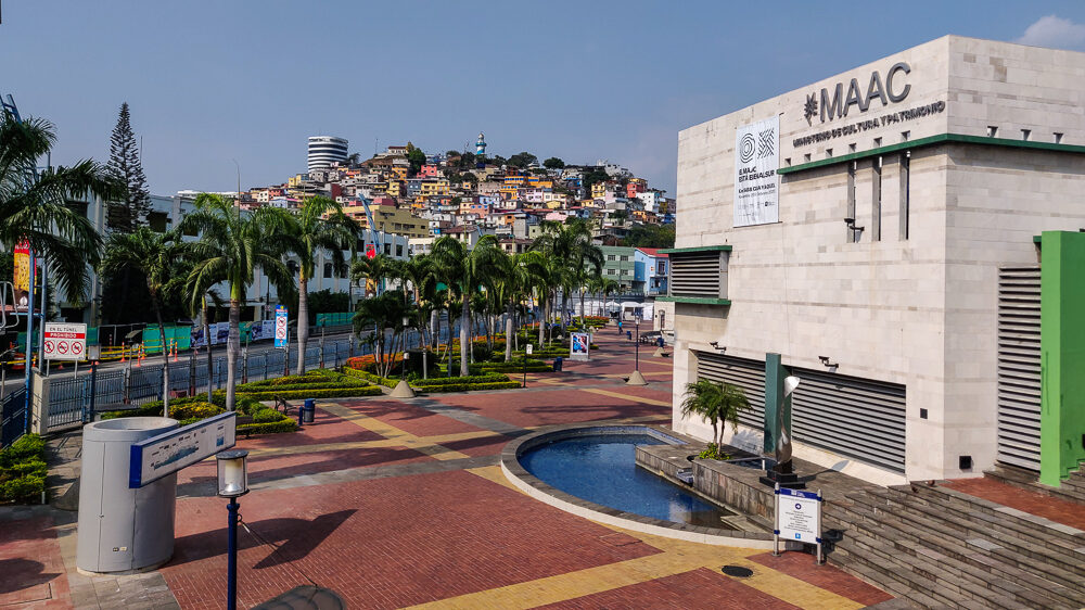
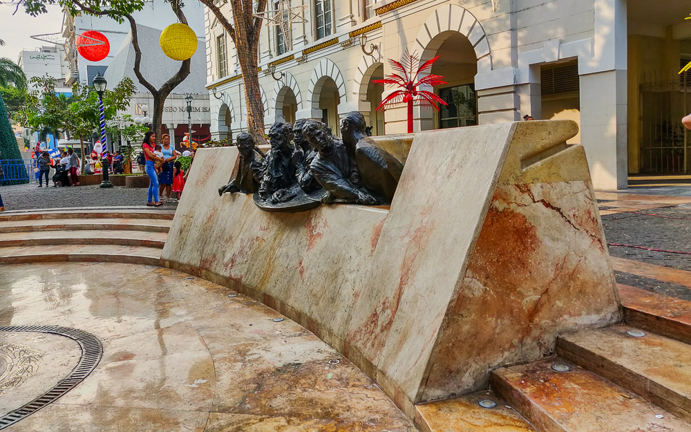
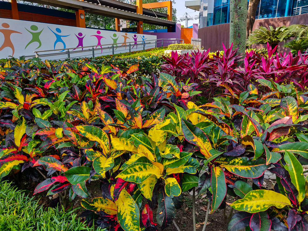
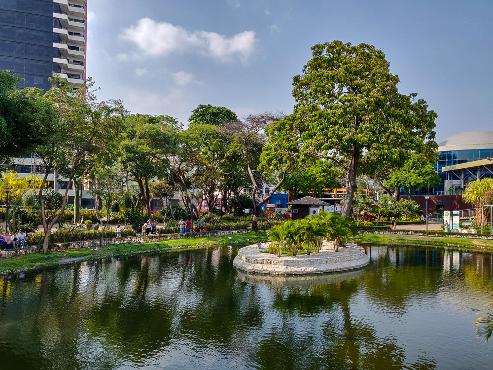
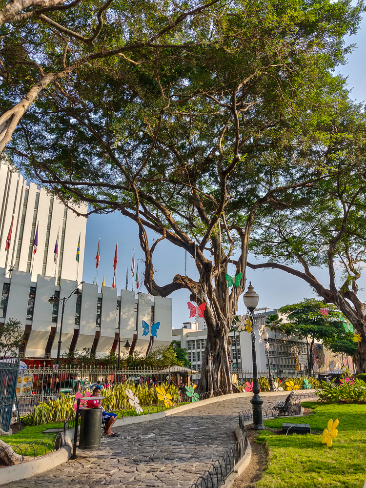
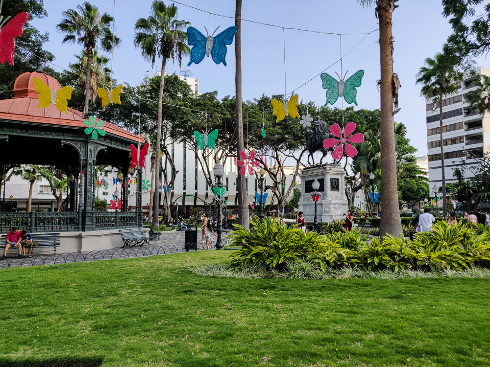
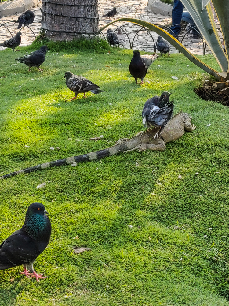
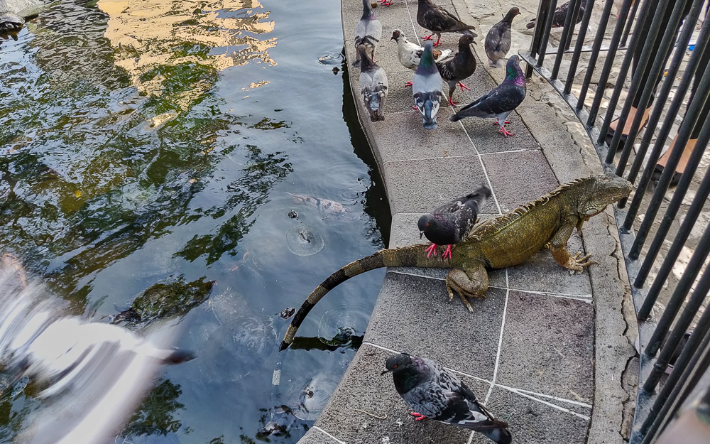
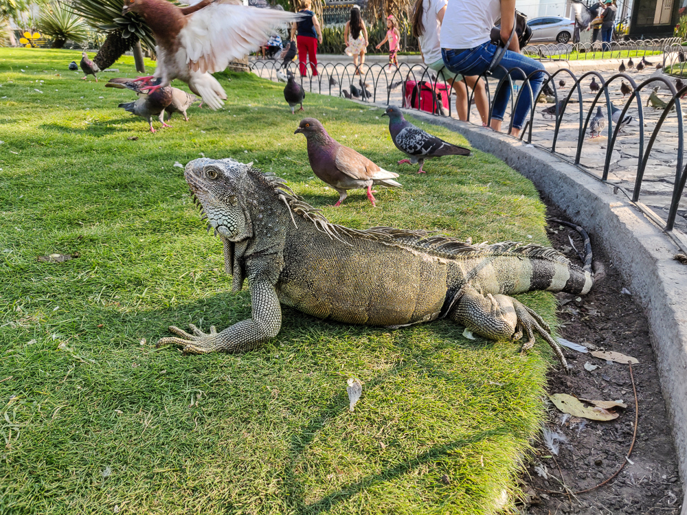
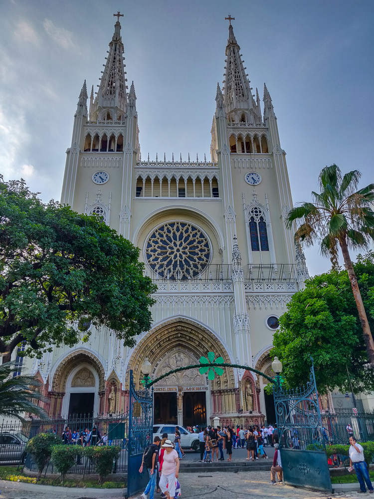
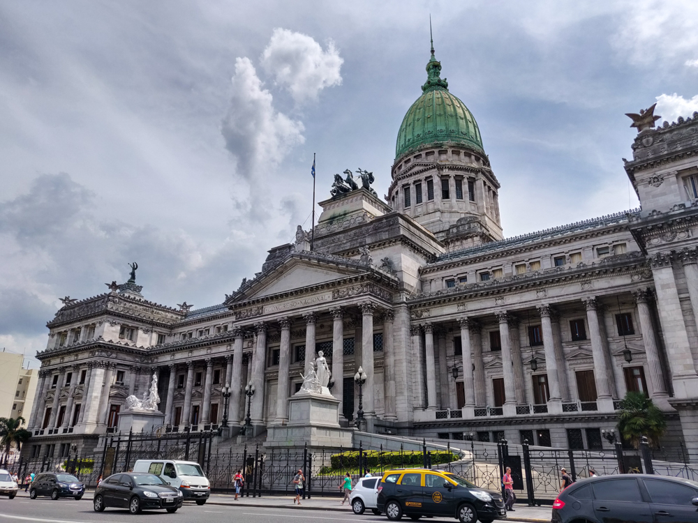
Guayaquil – you know those prisoners who “helped” to colonize the islands? They were sent from the prisons of Guayaquil. Doesn’t that explanation make you want to take a walk around Ecuador’s biggest city? No? Well, you should anyway.

Travel day! Travel days are always kind of the worst, but the ACTUAL worst is when they start with a pre-6AM wake-up. People aren’t supposed to wake up that early! And you can never get to sleep early enough the night before to offset those lost morning hours because of last-minute packing. Our alarm went off at 4AM. DEAD. That’s how I felt when I opened my eyes. Mom and Dad had an 8AM flight (WHY), so we planned to leave the hotel at 4:45 to get to the airport three hours before. It always feels like overkill, but at the Lima airport, sometimes you really do need it. It turned out that the airport wasn’t busy, but there was a taxi mix-up that thankfully wasn’t disastrous thanks to our time cushion.

At the airport, I said a half-asleep goodbye to Mom and Dad, they headed off to the States. and I spent a few drowsy hours in the airport food court until I could check in for my flight to Ecuador! My final destination was the Galapagos Islands, an archipelago in the Pacific that’s known for its wildlife, but my trip there was a multi-day journey. The plan was to fly to Guayaquil, the largest city in Ecuador, explore the city for an afternoon, spend the night, meet up with my cousins and aunt and uncle the next morning, and then fly the rest of the way to island #1, San Cristobal!

I guess there’s no hiding that these pictures are from around Christmas…

Guayaquil doesn’t have the best of reputations. I planned my flights to have at least a few hours to wander around the city, and while I was looking for things to do and see, all sorts of articles with titles like “Why You Shouldn’t Visit Guayaquil” came up. Okay, not terribly encouraging. There were also plenty of articles with tips on how to not get robbed or scammed. After reading enough of them to feel like I had a handle on things but not so many that I was totally freaked out, I concluded that I’d be fine as long as I took official taxis to and from the airport (which you should always do anyway), left my valuables behind while walking around, stayed in the tourist parts of town during the day, and maintained a general awareness of my surroundings. Aka be smart. I wasn’t worried.

I don’t have a ton of pictures of the city, unfortunately, because I was a little extra cautious about how much I had my phone out. So we’ll just have to make do with the ones I did take.

Anyway, like I said, Guayaquil (wai-ah-keel) is Ecuador’s largest city. It’s located on the banks of the Guayas River, about 40 miles (64km) upstream from the Gulf of Guayaquil/Pacific Ocean and is the primary port city of Ecuador. According to legend, the name comes from an indigenous chief, Guayas, and his wife, Quil, who lived back when the Spanish conquistadors arrived in the 1530s. They both fought valiantly but were captured. Guayas tricked the Spanish by promising to lead them to great riches if they were released, and instead, he used the opportunity to kill Quil and then himself, preferring death to imprisonment. When the city was first established, it was given the full name of “Muy Noble y Muy Leal Ciudad de Santiago de Guayaquil”, the Very Noble and Very Loyal City of Santiago of Guayaquil, named after Guayas and Quil as well as St. James (Santiago).

Throughout the colonial years, the city was attacked many times by pirates and privateers (which, to my understanding, are basically gentleman pirates… They did the same things as pirates but were commissioned by different governments to attack and plunder their enemies. So, French and English privateers would have attacked Spanish colonies, etc.), and you can still visit a fort at the top of Cerro Santa Ana, a hill in town, and see the cannons that were used to defend the city.

Cerro Santa Ana, a hill that you can climb up for a nice view… if you don’t mind walking up 444 stairs. At the top, there’s a tower that you can climb (just a few more stairs) for a panoramic view of the city and the fort/cannons that I mentioned.

In 1820, Guayaquil declared independence from Spain and operated as an independent province until 1822 when it was forced to join the newly formed Colombia. In 1830, the southern part of Colombia split off to form Ecuador, taking Guayaquil with it. Today, it’s Ecuador’s largest and most important city economically. Most of the country’s international imports and exports pass through its port, and its rapid industrial development has attracted people from rural areas in search of work.

This is part of a monument outside of City Hall that commemorates the secret meetings that let to Guayaquil’s independence. Also, totally unrelated, but the City Hall is called the “Muy Ilustre Municipalidad de Guayaquil” aka the “Most Illustrious Municipality of Guayaquil”. I’m telling you, they really know how to name things in the Very Noble and Very Loyal City of Santiago of Guayaquil.

In recent years, city leadership has prioritized urban renewal and infrastructure projects, working to grow Guayaquil’s commercial districts, tourism to the city, and international business. There have been massive improvements to the roadways, a large pedestrian bridge project to promote tourism to Santay Island (an island on the Guayas River where over a hundred species of birds have been recorded!), updates to public transit, and various projects meant to create a safer and more welcoming downtown area. One such project, lauded as a great success in urban revitalization, is the Malecón 2000, a 1.6-mile-long (2.5km) river walk featuring monuments, river views, playgrounds, gardens, and more.

Malecón views
What. A. Tree.

I landed in Guayaquil around 1PM, took an official taxi to my hostel, and enjoyed a minute of A/C before heading back out into the million-degree heat. I was in “blend” mode, so despite feeling like all of my skin was going to melt off, I wore pants and jammed my phone, room key, and a couple of dollars into the waistband to avoid having to carry a purse. I was on high alert for pickpockets, but everywhere I walked was in the tourist center, there are cops all over, and I didn’t feel unsafe for even a second.

The Malecón is really well-done. I started with a walk through the Malecón Gardens, and it was a bit jarring to see how different the flora is from Lima. It seems like it should be similar… two cities on the Pacific coast, not too far from one another. But Lima is a subtropical desert, and Guayaquil is a tropical savanna which means that for at least part of the year, there’s a lot of rain (the “wet” season in Lima is mostly just misty).

Sometimes I look at things like this and think I should have studied landscape architecture.
I can’t deal with this color explosion. What cool plants!!!
Duck pond in the gardens

After all of the negative “don’t go there/it’s not worth it” articles I found, I was pleasantly surprised by how many things there are to do in the city. I actually regretted only having a few hours there because I had to contain my sightseeing to a small area, but I have a long list of things to see if I ever find myself there again.

I stuck to the center of town, and another major “must-see” is a plaza called Parque Seminario. It features a statue of Simón Bolívar, one of the main liberators of South America. He and José de San Martín (who, if you recall from our walk through Lima, is one of the liberators celebrated in Peru) had a famous meeting in Guayaquil in 1822 to discuss the future of independent South America… but it sounds like, while they had great respect for one another, they didn’t agree on much beyond liberation. I’m actually not quite sure what the meeting accomplished except for maybe a conclusion of “let’s agree to disagree”.

Simón Bolívar
Parque Seminario

Anyway, Bolívar has the honor of watching over the famous iguanas of Parque Seminario. Yes, that’s right. Iguanas. They’re native to the area, so while it seems like a weird low-budget zoo, they weren’t brought in for the sake of amusement. That’s just where they live. My gosh, though. It is WEIRD to see a bunch of giant iguanas in the middle of the city. The biggest ones are up to 5’ (1.5m) long!

It seems like a perfectly innocent city plaza until…
… BAM! Iguana!
Iguana!
Iguana!
“Giddy up, Mr. Iguana!” – Mr. Pigeon
I couldn’t quite figure out the relationship between the birds and iguanas. They seem like they just ignore each other completely, even while standing on each other.
I felt like this guy and I had a connection
Look at his little dinosaur face

I took a video of one of them because I think they’re such funny creatures:

The Metropolitan Cathedral of Guayaquil is also on the square, and while I would have loved to go inside, there was a massive crowd out front… I think there was a wedding going on.

It was getting late when I left the park, so I grabbed some dinner and went back to my hostel to relax and prepare myself for the busy week and a half ahead! Next time, off to the Galapagos!!!

Related Posts

Argentina History: 1400s-1800s – follow Argentina through its colonial years and quest for independence

Oxbow Lake – if you enjoyed the funky trees of Guayaquil, you’ll love the unique trees of the Peruvian Amazon!

W Trek Day 3 – hop down to Chile for a hike through Torres del Paine, a national park filled with prehistoric-looking landscapes that seem perfect for our dinosaur-iguana friends

Metropolitan Cathedral of Guayaquil. The original structure was wood, and this one was built in 1924 after it burned down. The inside sounds beautiful, with Gothic ceilings and stained glass windows!

Our 7:20AM flight from Cusco to Lima (Peru’s capital) had us waking up bright and early the morning after our adventures in Tipón. Jocelyn picked the flight (thanks a lot, Jocelyn) because she and Benjamin were leaving that evening, and she wanted to be able to sightsee in Lima before their flight out. To take advantage of their limited time, we landed, took a taxi to our hotel, dropped off our bags, and headed right back out. Well, it maybe happened a liiittle more slowly than that… there was crazy traffic, aka typical Lima traffic, on the way from the airport, and then we took a couple of minutes to collect ourselves at the hotel before setting out for our major destination of the day, Huaca Pucllana (pronounced waka pook-yana).

To this point, we’ve talked a LOT about the Incas and visited a LOT of Inca ruins. Obviously, though, the Incas weren’t the only pre-Hispanic civilization in Peru. The first known civilization emerged around 1200BC, the Incas showed up around 1200AD, and there were dozens and dozens of others in between. One tour guide at Huaca Pucllana said that they had to learn about something like 26 pre-Hispanic civilizations in school. Geez! (Meanwhile, U.S. history covers about 250 years, and we still never managed to get through it all in one school year.) So, Jocelyn and I insisted that even though we had visited about ten different ruins in five days, we still had to visit at least this one more.

Huaca Pucllana!

Huaca Pucllana was built by the “Lima people” a society that developed on Peru’s central coast around 200AD and lasted until around 650AD. The society was governed by a caste of priests that ruled over the people and acted as intermediaries to the gods. People were mostly fishermen or farmers and made their own textiles, tools, baskets, and pottery. They lived in small, scattered communities, but they worked together to build and maintain irrigation channels to support agriculture, and there was a “labor for taxes” system, similar to the one the Incas had (which enabled them to build all of those grand but labor-intensive structures). They also built a series of ceremonial complexes which acted as centers for religious, political, and social activities.

Huaca Pucllana was one such complex, built over hundreds of years during the height of the Lima people, from ~450-650AD. The main structure takes the form of a truncated “pyramid” with seven different levels reaching a total height of 72 feet (22m) and is surrounded by open space and shorter structures that were used for meeting space and storage. The site today is about 1/3 of its original size.

Part of a model at Huaca Pucllana showing one of the small communities around the site. I mostly just laughed at the model’s scale issues. The people are way too big for their houses (look at the person in front of the house near the top) and the ears of corn are as long as a person’s arm. Hehe.
Here’s the part of the model showing the pyramid/ceremonial site. The pyramid is on the right, and the lower walled areas are administrative and storage spaces.
A view of the administrative spaces as they appear today

Jocelyn and I had already visited Huaca Pucllana many times before because it’s one of the sightseeing stops for teams when they visit Esperanza de Ana for service trips. These many visits gave us the benefit of learning from a variety of tour guides who all focused on different things and supplied different information. Eventually, we started whispering extra details to our group or sometimes asking the guide leading questions if we thought they were leaving out something important (okay, mostly just I did that). By the time we were there with our families, we probably could have given the tour ourselves. Most of the information in this post is from the various tours we took (because I’m a nerd and take notes on tours), so prepare yourself for an authentic tour experience.

Construction of an important site such as Huaca Pucllana was initiated with a sort of “groundbreaking”. In the case of the Lima people, it was a religious ceremony where a priest broke a large jar with a rock. Then, the people got to work. The pyramid is made of mud bricks, composed of river stones, crushed shells, dirt, and water. These bricks fared well in Lima’s humid climate, as the bricks absorb humidity and are strengthened by the moisture, and the calcium in the seashells also increases the bricks’ compressive strength. Each brick was handmade, as one of our guides repeatedly stressed, “They were made by hand. No molds! By hand only. No molds!” The general process was to mix the ingredients, wait a few hours, shape the mix into bricks (by hand! No molds!), and then sun-dry them.

The jar used for the groundbreaking. You can see a drawing of a priest with a rock on the wall behind it. One tour guide definitely said this is the actual jar that was used. You can see that it was reassembled, but it seems like it’s in pretty good shape for being over a thousand years old/broken/reassembled. In conclusion, that’s what they said, but I don’t really know.
They have these life-size models showing the brick making process. I actually couldn’t tell you what this guy is supposed to be doing, but this particular tour guide used this opportunity to point out how short people were back then. “Look at how tall I am next to him!”
Mixing the ingredients
Making the bricks BY HAND.

The dried bricks were then lined up next to each other in a “bookshelf” configuration. This construction method is credited for the survival of Huaca Pucllana through Peru’s many earthquakes as the orientation of the bricks and space between them allow the pyramid to move with the earth and then settle back into position. It also doesn’t hurt that the pyramid is completely solid inside. There are no secret passageways or hidden rooms. It was simply a way to get closer to the gods via vertical construction.

Original bricks. The craziest thing, to me, is when you can see indents from people’s fingers as they molded the bricks. Like, that’s the finger mark of some low-level brick-maker who lived 1500 years ago. How cool!! It would be mind-blowing to know that something you helped to create was still around thousands of years later.
This wall was reconstructed. They estimate that 20% of the site has been reconstructed and 80% is original. These bricks definitely look like they were made with a mold… but they intentionally make the new look different from the original so that you know which is which.
The bookshelf bricks give it such a cool vibe
IT’S SO COOL
Just one more (that’s a lie… just one more until the next one)

So, I mentioned that they wanted to get closer to the gods, but which gods exactly? There are a few clues… though clearly they were deciphered by someone who knows more about this stuff than I do because none of them seem like great clues to me. First, the pyramid was originally painted yellow with a blend of limestone and fish oil. As it was explained (apparently this is a logical progression): yellow is the color of women, and the moon is a woman. (In contrast, red = man = sun god.) Second, many of these people were fishermen, and the ocean is a woman, so it’s also dedicated to the ocean goddess. Third, evidence of human sacrifices was found in the main square (we’ll come back to this), and most of them were young women. Women symbolize fertility. People came seeking abundance: fertile soil, successful fishing, rain, etc. In conclusion: it was built for the moon and ocean goddesses.

The pyramid. I can’t imagine it all painted yellow!
There are plenty more pyramid pics where these came from…

Most people never ascended the pyramid. That was a right reserved for priests and the most important people only. The common people would have gathered in the main square for feast days, markets, and to discuss major events (like in a Greek agora or Roman forum). Another, less common, use of the main square was for human sacrifices. This would only happen in times of great difficulty, like a drought or famine, maybe every 20-30 years. Our tour guides gave varying information on this, so I’ll give you a couple of versions. One said that around twenty remains were found, and all but one were the remains of young women. The last was a boy dressed in women’s clothing. The theory is that girls were sacrificed to appease the women goddesses, and the boy was disguised as a girl because his family had no daughters to contribute. Another guide said nothing about the sacrifices until I asked, and then his face lit up and he said, “Ah yes. Sometimes people drink the hallucinogenic drink, decide it’s a good idea to make sacrifices. They stone some people, lance them up here until they bleed out, and then cut their bodies apart.” I gaped at him… after only hearing the previous guide’s description, I was NOT ready for that. So, who knows how exactly it happened, but there are two options for you.

The main square with the pyramid in the back.

Moving up the pyramid, we reach the “Plaza of Small Holes” filled with… small holes! There are over 2,500 holes that contained small offerings of food or items used in textile manufacturing. It’s believed that these were offerings to the dead, intended to garner favor for the offeror.

The Plaza of Small Holes. In the back, underneath that roof, you can see some of the original yellow paint!
This little plaza is right next to the small holes, and they believe that there was a roof over both areas, held up by wooden columns like these (except taller, obviously. People weren’t THAT short back then haha).
View from the top of the pyramid. It’s not quite the same rural scene as it was in the model!

After the Lima people moved out of the area, the pyramid was left abandoned for a century until a new society moved in around 750AD, the Wari people. They repurposed the pyramid, converting the upper levels into sacred burial grounds for the elite. The Wari mummified their dead. The body was placed in a curled-up sitting position, with arms and legs bent. It was then wrapped with leaves and linens, and ropes were tied around it to make a tight bundle. Some people were also placed in baskets. A false head of cloth or wood was placed on top, the person’s new face for the afterlife. One Wari tomb contained two adult Wari mummies and a Lima child, possibly a sacrifice intended as a servant in the next life.

This is an actual grave but not actual mummies. You can see the fake cloth head on top of the right mummy, and they’re both in baskets. There are also some grave goods in there, things to help in the afterlife. The little canvas-wrapped bundle at the bottom is a Lima baby that was sacrificed to be an afterlife servant.

The Wari people used the site until around 900AD, and eventually, the Ychsma (eech-mah) people moved in and adopted it as their own ceremonial and burial site around 1100AD. The Ychsma participated in ancestor worship, and offerings of human hair, toads, and clay figures have been found. Toads… why toads? Because they represented water and moisture which were important for the success of their crops. They buried their dead in shallow graves with “grave goods” like pottery, food, and other tools or objects deemed useful for the afterlife.

Model Ychsma people performing a ritual. The guy on the right is carrying a platter of toads which is kind of hilarious.
Another grave
There’s also a small native flora and fauna park on the grounds where they’ve gathered different animals and plants that were raised/cultivated in pre-Hispanic times. Here are some guinea pigs, still a culinary delicacy in Peru.
Llama and alpacas. In my notes, I wrote, “brown is alpaca, white is llama”, but clearly that’s not helpful because there are multiple of each color. I’m sure that he said they only have one llama and the rest are alpacas, so you can choose whichever one you think is the llama. The one on the right, maybe? Llamas are bigger and are better pack animals. That’s the extent of what I know about their differences.
The guide also said that the llama was pregnant with a llam-paca baby, and when we visited again a few months later, there was a baby! So I also assume that’s the mama llama.

By the time the Incas arrived in the mid-15th century, the site was hidden and forgotten. Forgotten? How can a 45-foot-tall pyramid be forgotten? Well, somehow, it turned into a giant dirt pile. There are different theories about how this exactly happened. Maybe it was through natural causes. It eroded and dirt simply accumulated there until the pyramid disappeared from view. Another theory is that the people, knowing that they were going to be conquered, covered it with dirt to hide it, as a way of protecting their sacred monument from the invaders. Honestly, both of these theories sound insane to me, but the only thing that’s certain is that it was, in fact, covered.

Excavated at the top and still looking like a dirt mountain at the bottom.
Quite the transition from dirt heap to ruins…
Ruins in the front, dirt mountain in the back

Hundreds of years passed, and no one knew that the mountain of dirt in the city was anything other than that. It was being used as a dirt bike course. In the mid-1900s, as Lima expanded and new development projects were planned, the ruins were rediscovered. Archaeological efforts seriously began in 1981, it was declared a protected site in 1991, the first intact graves were found in the 2000s, and excavation work continues today. One of the guides said that it should be fully excavated in 20 more years. Oh, that’s all?

Okay, this is the last one. Kind of.
Also, look at these pretty trees next to the ruins!

The group was skeptical when Jocelyn and I said that these ruins were different from ALL of the ruins we’d seen thus far, but after the tour, everyone agreed that we had been right. Obviously.

Next time, I’ll talk about the rest of our adventures in Lima!

If Jocelyn and I look like we’re having the best time, that’s because we love Huaca Pucllana.

Related Posts

Qorikancha – compare the mud bricks of Huaca Pucllana to the precise stonework of the Incas’ most majestic religious complex, Qorikancha

Moray and Maras Salt Mines – explore salt mines that were first used by the Wari people and later expanded by the Incas

Cusco Adventures: Q’enko and Saqsayhuaman – walk around some of the Incas’ important religious and ceremonial sites

We had one final day in Cusco after we returned from our marathon day at Machu Picchu, and I was struggling to decide how we should spend it. There are about a million different things to do and see in the Sacred Valley, and they’re all amazing. Well, I obviously haven’t done everything, but there isn’t a single thing that I HAVE done that I thought wasn’t worth the time. Anyway, the point of this ramble is to say that if you ever go to Peru and have the time, don’t just rush to Machu Picchu! Hang out in Cusco, explore the less famous sites, and don’t assume that the lack of fame means they’re not awesome.

My decision was also hard because I was choosing between places I hadn’t been to. That was exciting because it’s always fun to go somewhere new, but I was making the decision for everyone and wanted to choose well. In the end, I decided that we should go to Tipón, another Inca site about 45 minutes away from Cusco. I didn’t know much about it, but I did know that it’s considered an engineering marvel and there are cool water features. Like I said, not much… but actually, that’s about the extent of what they know for sure, so not bad.

Views over Cusco from our hotel’s breakfast room
There’s the cathedral!

I wanted to take a bus to Tipón, mostly because I wanted everyone to experience public transit, and it seemed like a straightforward opportunity to do so. There was no one at the hotel desk to direct us to a bus stop, so we put our faith in our internet intel and headed out. When we got close, a lady on the street pointed us to the correct bus stop and said that we shouldn’t have to wait too long. We waited about 10 minutes for a bus, I worried for all 10 of them that we were in the wrong place, and then I worried after we got on that it was the wrong bus… even though the bus said “Tipón” on it, AND I double-checked with the driver. I apparently put a lot of pressure on myself as the planner of other people’s trips, but I wanted everything to go smoothly!

As we got off at the final stop, the bus driver pointed us in the direction of the ruins and said it was probably best to take a taxi there. We took his advice, thank goodness, saving us from a brutal uphill trek on a skinny, winding road. After the taxi dropped us off, I worried briefly about how we’d get back down and then decided to leave that for future Lara to deal with.

I love this view. Also, don’t be fooled by how many cars there are in the parking lot. There were only a couple of other groups of people visiting the ruins. The cars must belong to the park rangers and the construction guys who you can see working up on the mountain in the background of a few pictures.

According to archaeological evidence, Tipón was occupied for thousands of years before the Incas arrived, dating back to sometime between 6000-4000BC (very specific). The Incas then developed it into what it is today: a water ritual garden… or a royal country residence… or an agricultural lab… you know, the usual “well, could be anything”. Very little is known for certain about Tipón; even the original name was lost. The only written reference comes from a 16th-century chronicler. He describes a site that could possibly be Tipón, and it says that the complex was built as a royal palace for an old Inka after his son usurped him and booted him out of Cusco. I suppose luxurious house arrest was a kinder sentence than death.

Pretty flowers around the site!
You know how I feel about flowers.

The complex is up in the mountains, built into a dip between two peaks. It consists of twelve terraces (some sources say there are thirteen, but I counted twelve) edged with stone channels that direct water around the site and into waterfalls from terrace to terrace. The water comes from a spring over a kilometer away, brought to the site through the mountains via a series of aqueducts and channels.

The many layers of terracing required to get these big, flat areas are incredible. Just think about how much material had to be cut away and filled in to achieve something so orderly in the middle of the mountains.
They’re just so beautiful! Usually, you don’t see the sides of the terraces like this, but this is what was necessary to level off the site. Wow!!
CHECK OUT THIS VIEW!!!! Also, Tipón was the highest-elevation place we visited, at 11,480ft/3,500m (Cusco is 11,150ft/3,400m and Machu Picchu is 7,970ft/2,430m).

All Inca sites show evidence of water management systems, but Tipón is special. First of all, it still functions! Of course, after years of neglect, there was some cleaning/plant clearing to be done, but isn’t that amazing?? You can hike to see the channel that carries water down from the spring, and the channels and waterfalls around the site are still going strong. Second, the design feels more epic, more monumental than at other sites. It’s not just functional; it’s like a celebration of water.

The agricultural terraces at Tipón immediately stand out as different. Take another look… what do you notice about these vs. the terraces at Machu Picchu, for example?

What do you notice?

The most obvious answer is that they’re huge. Each one creates a massive area of farmable land, rather than the little slivers we’re used to. Beyond that, the Incas generally built their agricultural terraces to follow the topography. At Tipón, however, right angles and straight walls are imposed on the landscape. It’s very orderly and precise, contributing to the belief that it was an important religious site. That would mean that design decisions were likely also symbolic. The twelve terraces (if there are truly twelve), for example, could represent the twelve months of the Inca solar calendar. There’s a main fountain near the high point of the complex, and as the water flows down, it splits from one stream of water into two (possibly representing heaven and earth), then into four (which could be the four elements), and finally combines back into one to flow into a ritual pool.

The crew!
The straight lines are so satisfying. Especially that water channel on the left side of the terrace.
I love the staircase and the stairs on the sides of the terraces and the line of waterfalls that comes down next to the staircase.
Top view of that staircase
With the main fountain. You can’t see the split from one into two, but there’s the four -> one -> ritual pool.
I did edit these pictures a bit, but I promise you that the grass seriously was this green. It’s unreal… but it’s real.

I don’t think it’s possible to fully appreciate the experience without also being able to hear it, so check out this video!

And more of the infinite pictures I took…

Mom, Dad, and me
The stone at this site is a red stone, giving it a very different vibe from the grey-white granite of Machu Picchu
These jagged terraces remind me of the zig-zagging walls at Saqsayhuaman.
Possibly military buildings, definitely a beautiful view.
I’m admiring three things in this picture: 1. the stonework because I’m always obsessed with that. 2. the stairs because how cool are these cantilevered stone steps?? and 3. see that vertical channel on the left? After the water falls down, it goes underground! There’s so much more to this site than what you can see, and that already was enough to blow my mind.
THREE waterfalls in this picture.
I took this more zoomed-in picture because I liked the bend between those two waterfalls. See how the top one is facing us? And then a channel curves around so that the next waterfall is rotated 90 degrees.
That’s some fancy stonework. Also, even though we can see a lot of how the water is being circulated around the site, this picture makes it clear that there’s still way more going on than meets the eye because there has to be something going on underground that brings the water here. So cool!
I thought the stonework here was interesting because usually, it seems like the stones are relatively similar in size. In this building, there are a bunch of large stones, and the gaps are filled in with small stones.
The royal palace next to the terraces. Actually, you can also kind of see the main fountain’s split into two waterfalls in this picture. See that person in the bright pink? Just above her, you can see two little waterfalls.
Exploring some of the other ruins around the site… and Jocelyn looking fashionable in her poncho.
A sign identified these ruins as the “church”. So there you have it.
It’s incredible that they managed to create this in the middle of the mountains.
There’s a bunch of somewhat-excavated ruins on that hill up ahead (where you can see the short, curved wall). I don’t know if it really was a military outpost (I think those are the buildings the guidebook was talking about?), but it certainly looks like a good spot to defend from.
I know it looks simple, but I love the curves in the channels. Also, think about it. They had to make sure that the channels were sloped enough to keep the water flowing until the very end!
More stairs that I love and a water channel that you can follow allllll the way down the terraces.

We took our time exploring, and even so, we only saw a small portion of the complex. We visited the main section only, consisting of the primary terraces and fountains, the royal residence, and some other, partially excavated ruins that may have been military-related or simply other support buildings for the site. If we’d had more time and were willing to do some hiking (everyone was still feeling exhausted from our long day at Machu Picchu, so we opted for a lower-intensity day), we could have visited the Intiwatana (Sun Temple) and the water reservoir on the lower peak. On the high peak, Cruzmoqo, there’s a cross, a view of the valley, and ancient petroglyphs. The Incas also used this point for a military observation post. There are 15 foot-tall (4.5m) stone walls around the complex that were probably built by a previous civilization, before the time of the Incas. Unexcavated dwellings, terraces, and storehouses dot the mountainside, and an old Inca road still zig-zags its way to the site. Around the back of the mountain, there’s another terraced area that is similar to the main terraces, but it hasn’t been excavated or restored as much.

The hill straight ahead is the location of the Sun Temple (at the top, of course).
In conclusion, it’s a masterpiece and please tell me you appreciate its awesomeness (and if you don’t, please don’t tell me anything unless you want me to lecture you on why you should).
The final waterfall. See how the water is splashing up so much at the bottom? That’s because they put a stone underneath, so rather than the water falling into a pool, it hits a hard surface and creates a more dramatic splash-effect. They really thought of everything.

Okay, just one more (slow motion) video showing the impact of the splash stone (the technical name, I’m sure):

Mom is sporting her poncho because it started pouring while we were there. Thankfully, it didn’t last long, and there was conveniently a little sheltered area where we waited it out.
Exceedingly happy because I was coming off of a few hours of geeking out at the awesomeness of Tipón.

As soon as we were ready to head back to town, I shook my head at past Lara’s decision to leave the taxi problem to me. Despite its awesomeness, Tipón isn’t very popular which means that there aren’t just taxis hanging around, waiting to be hired. Why hadn’t I asked for the taxi man’s phone number when he dropped us off? I had no idea what we should do. Luckily, a car pulled up a few minutes later, and a young Peruvian couple started to get in. Benjamin said, “This is our shot!”, and ran over to get the driver’s attention. I asked if he had space in his car for us, that we had five people and wanted to go back to town. He said sure and charged us two soles each. I would have paid anything. Thank goodness for outgoing travel companions!

On the way down, I asked the driver if he knew of a good place to eat cui (guinea pig). Tipón is the “cui capital of Peru”, and Benjamin was determined to try it. After he left the other couple in the main square, the driver took us to a restaurant, confirmed with the lady there that she had cui, and assured me that we’d be able to get a bus back to Cusco from there, no problem. The restaurant was clearly not used to tourists… there was no menu, and the lady who took our order (AND cooked the food AND carried a baby around on her back the whole time) spoke the world’s fastest Spanish as she listed our options. It made my head spin. After she repeated it about three times and I asked approximately twenty clarifying questions, Dad and Benjamin got the cui, and Mom, Jocelyn, and I opted for a pork dish. I had tried cui before, and I’d describe it as slimy chicken. It was fine, but I don’t need to have it again.

Are you in or out?

When we finished eating, we started walking to the main road. A bus pulled up before we even reached the corner, honking and with the money-collecting guy waving his arms and yelling, “CUSCO!” at us. So, we waved back at him, ran over, and hopped on. Phew! I didn’t even have time to worry about a bus never coming. Back in Cusco, we headed back to the hotel, packed our bags, and had a quiet night. Our flight back to Lima was early the next morning, and everyone was exhausted.

Related Posts

Cusco Adventures: Tambomachay and Puka Pukara – visit another Inca site with functioning fountains 

Moray and Maras Salt Mines – explore an Inca agricultural lab and salt evaporation pools

Ollantaytambo – climb the steep terraces of this scenic Inca royal estate

Inka Pachakuteq and the History of Machu Picchu – read about the Inca Empire’s greatest Inka (king) and the origins of Machu Picchu

Machu Picchu: The Citadel – walk around the Incas’ most famous site

Now that we’ve talked about Inka Pachakuteq and the history of Machu Picchu and have explored the outskirts of the site, it’s finally time to explore the citadel! That’s what they call the main area of buildings onsite even though “citadel” gives more of a fortress vibe, and we’ve already covered the fact that historians think Machu Picchu was most likely a royal estate. That, at least, is the assumption that we’re going to go with as we walk through the site and learn about what the different buildings were potentially used for. Again, everything I say may or may not be true. Thanks to the Incas’ lack of a written language, best guesses are sometimes all that historians can make. So, here are a bunch of best guesses about the ruins at Machu Picchu! Just insert a “maybe” before each statement I make from here on out.

Everyone looking tired but happy after finishing our morning hikes!

The site can be divided into two main sectors, farming and urban. The farming sector consists of the terraces, many of which are still unexcavated. Vegetation grows quickly in the cloud forest! There are also some buildings around the terraces that may have been used to house farmers, but the majority of the buildings are located in the urban sector/citadel.

After you enter through the ticketing area, you walk up lots of stairs and past lots of farming terraces until you finally get your first glimpse of the urban sector. There are a bunch of different viewpoints from which you can get a low-flying bird’s eye view, and at one of these is the “watchman’s post” or maybe “the hut of the caretaker of the funerary rock” or “call it whatever you want because who knows”. This three-walled structure has a great view of the citadel and the surrounding valley and is one of the few buildings with a restored thatch roof. Remember that this type of roof would have been standard, so based on that alone, the urban sector would have looked very different. Just outside, there’s a large “funerary rock”, carved into an altar and used for embalming and mummification… or maybe used for animal sacrifices. In the nearby field, a number of skeletons were excavated which is part of the reason for the mummy theory. In that case, the hut would have potentially been used in the mummification process as well.

The “upper cemetery” where they found a bunch of graves. You can see the funerary rock at the far end of the field, plus the “whatever it is” hut just behind the rock. (Side note, some of the pictures in this post, including this one, are from my first trip to Machu Picchu. There were a few things that I wanted to show that I didn’t have pictures of from this visit, so if you notice that the weather randomly appears to have changed between pictures, that might be why.)
Funerary rock
I’m going to give you a little preview of our route. We started at the hut that’s out of frame to the upper right. We’ll enter town through the main gate, which is where that big group of people is gathered. From there, we’ll walk through that first group of buildings and then stay to the left to visit the plaza (the dirt patch), go up the Sacred Hill behind it (with all of those narrow terraces). Next, we’ll cross the main grassy plaza to the very back of the site where we’ll see a Sacred Rock, and then we’ll head back towards the starting point through the buildings on the far side of the main plaza. (If that made no sense, sorry! I tried. Ignore me and just continue reading.)

A dry moat separates the outer buildings and farming areas from the urban sector. Through the main gate (that used to have a door with a locking mechanism!), you enter into the upper part of town which contains support buildings like storehouses and public buildings and the remnants of a quarry that likely supplied much of the stone for the buildings. What an exciting welcome to town, right? But it makes sense not to put the really important stuff right next to the city gate, just in case (Lara speculation).

The dry moat runs along that staircase in the front, and the main gate is just out of frame to the left.
The rock quarry as viewed from the Sacred Plaza

Downhill from these structures is where things start getting interesting. Not surprisingly, the most unique building in the city is the Sun Temple. It has a curved wall with that classic imperial stonework, and it’s built above a giant boulder. The top of that boulder was carved into an altar that was used for animal sacrifices (to read the future in their entrails… ick). This was also where the Inka would come to drink chicha (corn beer) with his “father” the sun, as the Incas believed that the Inka (king) was descended from the sun god, Inti (side note: to keep the royal bloodline pure, each heir had to be a son of the Inka and his sister).

The Sun Temple. There are windows facing to the north and to the east. The east window is aligned to the sun position on the winter solstice.
See the carved rock that makes up the floor? That was used as an altar.

The Incas mummified their dead and treated them a bit like they were still living, so underneath the temple is a “royal tomb”, basically a cave where it is believed that the Inka’s mummy was kept. Even after Inka Pachakuteq died, it is likely that his mummy was brought back to Machu Picchu, kept beneath his father’s temple, and given food and drink (not quite sure about the logistics of that).

Near the sun temple are the royal apartments, aka the residence of the living, pre-mummified Inka. The spring on Machu Picchu Mountain was first directed through the Inka’s apartment so that he could have the freshest possible water, and from there, it flowed through a series of ceremonial fountains. The residence consists of a central patio area surrounded by two large and two small rooms.

Beyond the rock quarry and royal apartments is the main sacred area for the town. A small plaza is bordered by two temples and another room that could have been the priest’s dwelling. You can tell that the temples are important buildings just by looking at their quality stonework.

One of the fountains that used to flow with water from the spring. The water would still flow through here, but it’s been redirected for tourism purposes (bummer).
View from the quarry. Straight ahead, you can see the Sacred Plaza with its two temples, and behind that is the terraced Sacred Hill. Another temple, the Moon Temple, is located on the back of Huayna Picchu, the tall mountain peak that you see straight ahead.
The main temple has only three walls. They’re not sure exactly who this temple was dedicated to, especially since the Sun Temple is elsewhere, but clearly it was someone important! You can see that the collapse in the corner isn’t because the rocks shifted. The bottom rock is actually sinking into the ground, so it’s likely some sort of foundational problem. That could have been caused by an earthquake, or it could have been a water-related failure.
This is the Temple of Three Windows. Can you guess how it got its name? It likely was covered by a gabled thatch roof with the side nearest to us left open.
With the main temple!

The sacred spaces continue up “Sacred Hill”. There are more temple-like buildings with high-quality stonework, but again, the exact use of each space isn’t really known. At the top of Sacred Hill is one of the only remaining “Intiwatana”, or “sun fastener”, stones. This carved rock was used during the winter solstice celebration, Inti Raymi, to symbolically tie the sun to the earth. Inti Raymi was a festival to ask Inti not to abandon his people, to move closer instead of farther away. Otherwise, the stone was also used to measure the solar year and keep track of important sun dates like equinoxes and solstices. It was not, however, a sundial or solar clock. The Incas didn’t have clocks as they didn’t measure days in hours and minutes. This hill was also the priest’s pulpit. He could stand high above the main plaza and address the people gathered below.

Walking up Sacred Hill. You can see the Sacred Plaza in the bottom left, with the main temple closest to us and the maybe-priest’s-house across the plaza from there. And then there’s the rock quarry, and the hut where we started is perched up on the terraces near the top of the picture.
Intiwatana. Originally, it was probably polished… the rain is giving it a decent shine in this picture. I’m imagining a granite countertop-level shine.
The entrance to the site is on the far end straight ahead, and Sacred Hill is the one to the right with all of the terraces. The terraces on Sacred Hill are very shallow. This shows that they were mostly for protecting against erosion and were also used as decorative gardens, not for actual farming.
Looking up the side of Sacred Hill. You can see those shallow terraces at the right edge of the picture. From this angle, it’s pretty clear why they decided this needed some erosion-prevention terraces!
I like this picture because I think it really shows how important the terraces are to making this site a viable location for building. Without those terraces, there’s no way that the site could have handled the weight of the buildings, and erosion definitely would have caused some serious collapses. I also like looking at the main plaza and seeing the effort that went into creating such a large, flat space.
Sacred Hill is up to the left. The main plaza, in the middle, was used for festivities and ceremonies.

Across the lawn, right in front of Huayna Picchu, is a “Sacred Rock”. It’s clearly important because a stone pedestal was built around it (it’s a natural projection of the mountain), but what were people worshipping there? It supposedly could look like a puma or a guinea pig, but personally, I don’t see it. Another possibility is that it was simply a representation of a sacred mountain peak. Mountains were believed to have spirits that were considered protectors of the people. I’m going to go with that because I can definitely see “mountain” in this rock.

You tell me… puma? guinea pig? or mountain? This rock was probably polished as well.
It seems like a pretty cushy existence to be a Machu Picchu alpaca. They just wander around, eat, and get fawned over by tourists.

Finally, moving back towards the main gate but on the other side of the main plaza, there are TONS of buildings. These were apartments for support staff, storehouses, and other utility spaces. There are various interesting features sprinkled throughout these rooms, including these two “water mirrors”. Some guess that they were used to reflect the night sky and study the stars, but that seems silly because why look down at a reflection when you could look up at the real thing? Oh well, at this point, what’s one more unsolved mystery?

Water Mirrors. Does it not seem a bit silly to use these for astronomical purposes? To use these liiittle water pools rather than the big night sky?
I’m obsessed with the way that they integrated these ginormous boulders.
I don’t know why things like this still surprise me, considering I know how skilled the Inca stonemasons were. But it’s so seamless!
This is a nice wall.

On the way out, you walk through one of my favorite parts of town. I don’t know what it was used for… maybe just more support buildings? But the reason I love it is because there are large boulders all over the place, and the buildings are built right into/onto/around them. It’s so cool! There’s one in particular that’s very important, the Temple of the Condor. There’s a huge rock at the center that somehow looks like a landing condor? Condors, pumas, and snakes were sacred animals for the Incas, so it was likely an important religious space.

This is the world’s least helpful photo of the Temple of the Condor, but clearly I was more focused on the ridiculousness of the wall on top of that slant than on the entirety of the condor-shaped rock. I’m pretty sure that the head is the part on the left side of the picture, and that crazy slanted rock is maybe one of the wings?
This is what happens when you do most of your learning about a site AFTER you visit. To be fair, though, it’s very hard to understand what anything is talking about until you’ve been there. I guess that’s one argument for taking a tour, but even so, I think I still prefer exploring on my own.
In the bottom middle, you can see the big rock in the Temple of the Condor. You can also see the hut from the very beginning of our tour in the top middle!

By the time we were about halfway through the citadel, we were all more than ready to call it a day. Mom and Dad actually said before we even entered the town that they felt like they’d already seen enough. I insisted that we walk through, but I understood their exhaustion. We had already done a lot of walking! We walked through the exit gates EIGHT hours after we walked in. Eight. Hours. But we did it! We survived! And we did/saw everything we wanted to do/see which is VERY impressive.

Farming terraces along the edge of the citadel. The buildings you see in the distance could have been housing for farmers.
Survived! Mom’s somehow still smiling after 8 hours of walking.

We took the bus back to town and then mostly hung out in our hotel until it was time to head to the train station for our ride back to Cusco. We were taking a train that went all the way back to the city, rather than the other option of having to transfer to a car in Ollantaytambo. Good in theory, but I probably should have looked more closely at the schedule. It’s insane. The train from Machu Picchu to Ollantaytambo takes about 1:45. To drive to Cusco from there would take about 2 hours. The train, on the other hand, took nearly 3 HOURS. How? Well, please direct your attention to the helpful map below. I traced the train tracks in blue.

Have you ever seen such a route??

When we felt like it was time for the ride to be over, we called over the train attendant and grilled him for answers. We could literally SEE Cusco, and he said it was still going to take at least a half-hour to arrive at the station. I was so exhausted that I almost cried. He explained that in order to get down into the valley, the train goes down a series of switchbacks. Switchbacks! For a train! It hits a dead end, they switch the tracks, the back of the train becomes the front, and it continues on until the next dead end. I ranted in delirious Spanish about how silly that was, and he excused himself/escaped at the first opportunity.

Eventually, though, we made it. Everyone was tired of sitting, so we walked the 15 minutes to our hotel and collapsed. Talk about a long day.

Manco Cápac Plaza in Aguas Calientes. Manco Cápac is the legendary first Inka, and it’s uncertain whether he actually lived or if he’s simply a legend. He’s one of the main characters in the legend that explains the beginnings of the Inca civilization.
The ride home also included some entertainment, including a fashion show of alpaca clothing products (surprisingly entertaining) and some interesting dances with this Andean folk character.

Related Posts

Inka Pachakuteq and the History of Machu Picchu – learn about the Inka who built Machu Picchu and how it came to be

Machu Picchu: Inca Bridge and Intipunku (Sun Gate) – take two hikes to interesting features near the citadel

Machu Picchu – come along on my first visit to Machu Picchu, including the hike up Machu Picchu Mountain

Ollantaytambo – explore another royal Inca estate!

Cusco: Q’enko and Saqsayhuaman – admire some impressive Inca stonework at Saqsayhuaman

Machu Picchu day!!! After three days of visiting ruins all over the region, everyone in the group was excited for a day of… visiting ruins! It may seem like you’d eventually get to the point where you’re like, “Ugh, MORE???” but at least for me, I’ve seen a LOT of Inca ruins and am still not tired of them. It’s not just me, either! My parents, Benjamin, and Jocelyn all said that they were surprised by how different all of the sites we visited were and happy that we saw as many as we did.

Anyway, like I said, we were all excited! When my alarm went off at 4:30AM, I practically leaped out of bed I was so pumped! Okay, that’s not true. Is it even physically possible to leap out of bed at 4:30 in the morning? Instead, I grumbled, forced my eyes open, and prayed that my alarm was set to the wrong time. No such luck.

By 5AM, we were walking from our hotel to the bus stop to ride up the mountain to the ruins. The bus line was already shockingly long, even though the first bus didn’t leave until 5:30. Luckily, it’s probably the most efficient operation in all of Peru, and even though we were on maybe the fourth bus, we still were at the site by 6:05, only five minutes after our ticket time. Impressive!

Once we entered the site, my parents and I parted ways with Jocelyn and Benjamin so that we could all go at our own speed. They were also hiking up Machu Picchu Mountain, something we were definitely NOT doing (I did it last time I visited Machu Picchu… it’s literally ALL stairs. Endless. Stairs). We were, however, planning to do the two non-ticketed hikes to the Inka Bridge and the Sun Gate. As we walked up the mountain to the start of the first hike, we stopped at some viewpoints overlooking the site. The weather was a little iffy, but I was hoping the sun would clear out the clouds as the day progressed.

Alpacas, enjoying the morning mists.
The fog sure gives the site an eerie quality, doesn’t it?

Machu Picchu is one of those places where they tell you to dress in layers and be prepared for a year’s worth of seasons in one day. We were a little worried when we walked in and felt like we were inside of a cloud, but the fog was moving fairly quickly, and we had some moments of good visibility. The key word is “moments”. At one point, while enjoying a clear view of the citadel (what they call the “town” part of the site), I started getting overheated and decided I needed to ditch some layers/apply sunscreen. By the time I finished my wardrobe change, a thick fog had rolled in, completely blocking the view again… and the sun. I put my jacket back on. Dad was laughing at Mom and me because we did two outfit changes without even moving.

Kind of a clear view, but don’t let yourself be fooled.
Here comes the fog!
Byeee, Machu Picchu!
This was after my layer-shedding stop… as you can see, I’m still looking quite bundled, and the mountain is looking a little cloudy.

Our first hike was to the Inca Bridge. In my memory, it was completely flat and not hard at all. With my new parent-oriented eyes, I saw that my memory wasn’t quite reliable. On the way to the trailhead, there are these terrible stone steps of all different heights. Some are mid-thigh high, and you wonder what kind of giants the Incas were… even though you know they were probably shorter than you, so the stairs DON’T MAKE SENSE. They were definitely in prime physical condition, probably thanks to running up and down those ridiculous stairs all the time.

After the trail starts, there’s a little up and down, but it’s not too bad. The good news is that the view is majestic, so at least there’s something to distract from the walking.

View from the path to the Inca Bridge.
It’s a pretty nice path, and there’s lots of plant cover! It feels a little rainforest-y.
Dad on the way to the Inca Bridge. See? Nice and flat-ish.
In contrast, here’s a preview of what we hiked up later in the day on the way to the Sun Gate. Some portions of the trail have stairs, like these, and others are just inclined. But no matter what, you’re going up.

The Inca Bridge itself seems kind of underwhelming, but conceptually, it’s pretty darn cool. A narrow path was built onto the side of the mountain, potentially a secret army entrance to the site, with one 20-foot gap in the path bridged by a long piece of wood. If invaders were coming, the wood could be removed, like a drawbridge, to cut off access from that path.

The Inca Bridge from a distance. How on earth did they build that path?? You can’t even see the bottom because of the plants, but my goodness what insanity.
These are some super cool-looking mountains!
I’m not afraid of heights, but I don’t know how I’d feel about 1. walking with only that narrow stone path keeping me from falling to my death, or 2. walking across those wobbly-looking boards. Err. Maybe not.

From there, we set off on our more ambitious hike of the day to Intipunku, or the Sun Gate. For Incas coming from Cusco along the original Inca road (or for people hiking the Inca Trail today), Intipunku is the first point from which you can see the site. It’s quite the view. It’s also crazy to think that you’re walking on a road built over 500 years ago! Back in Inca times, the roads were only open to people traveling on state business, so it was an elite few who had the opportunity to travel the breathtaking path from Cusco.

Mom and Dad, post-Inca Bridge and pre-Sun Gate. That’s why they still look happy…
Yay!! The day cleared up beautifully.
A cool-looking rock along the path.

The hike to Intipunku from the ruins is all uphill with an elevation gain of nearly 1,000 feet (240 meters). I wanted Mom and Dad to get the perspective of the site from above, and this hike is way easier than going up Machu Picchu Mountain (the other option). I told them that we could go at whatever speed necessary, and if they didn’t want to go all the way there, that was fine. Hiking at nearly 8,000 feet (2,400 meters) of elevation is rough! And that’s the elevation at the trailhead, not the top! High-elevation hiking really redefines the word “breathtaking”. We did a LOT of breath-taking and not a lot of oxygen-getting. Honestly, that’s the hardest part of the hike. The uphill isn’t fun, but it’s doable. The added challenge of limited oxygen just really doesn’t help.

Looking down at the site through some ruins along the way.
I don’t know what this is, but it’s along the path to the Sun Gate and isn’t it pretty?

We kept chugging away, one step at a time. We stopped whenever anyone needed a break. I wasn’t in a rush. The people coming down as we were going up were very encouraging, saying things like, “You’re almost there! Only another 30 minutes.” Mom said that they had a different definition of the word “almost”. Hehe. We passed a woman who gave up maybe 10 minutes from the top. Her ‘encouragement’ was, “The worst part is ahead.” Gee, lady. Thanks a lot. Mom wasn’t fazed. She said, “I’m not giving up this close to the end.” Yeah, Mom!!!

The final stretch… stairs!

We made it. And Mom and Dad both said that it was worth it, so that was a relief. It was only about 10:30AM when we finally arrived, and it felt like we’d already lived an entire day! We took a break at the top, enjoyed the view, and ate some snacks before heading back down the mountain. That had its own challenges because the rocks can get a little slippery, but there were zero falls which means it was a double success. By the time we made it down, we had already been at the site for 6 hours. Ha. We definitely got our money’s worth!

So close you can almost taste it!
The Sun Gate. And some random guy’s backpack.
View of Machu Picchu from the Sun Gate. You can also see the switchbacks of the road that the buses have to drive up to reach the site.
Terracing near Intipunku.
Tired and happy!

Everyone had a teeny bit of energy left, so we headed into the citadel to check out the ruins before calling it a day. Next time, get ready for a tour!

Before I talk about our visit to Machu Picchu, I think it’s important to understand some of the backstory to fully appreciate its awesomeness. Visually, it’s incredible no matter how little you know, but the story is a good one! Remember, though, that the Incas had no written language, so the earliest written accounts of their history come from oral histories recorded by the Spanish. That information is far from comprehensive, so in combination with archaeological evidence, a certain amount has been extrapolated (by experts, not by me). In some cases, there are disagreements about the specifics, so just read along with a big “MAYBE” disclaimer in the back of your mind. Okay! As I was saying…

Our story begins in the 15th century with an attack on Cusco by the Chanca people, a group with military strength comparable to the Incas. The Inka (king) at the time, Viracocha, abandoned his people. He fled the city in fear and took his heir with him. Some king! Another son, Cusi Yupanqui, decided to stay and defend the city, leading the Inca army with one of his brothers and a few other Inca chiefs. They won decisively, crushing the Chanca army and humiliating Viracocha. Having gained the support of the people during the battle, Cusi Yupanqui later declared himself the new Inka, forced his father to abdicate, and changed his name to Pachakuteq which means “earth-shaker” or “he who turns the world upside down”.

Machu Picchu flower

If that seems like a bold name statement, well, it is. But Pachakuteq knew that he was destined for greatness. First, as the battle against the Chanca proved, he had an aptitude for military strategy and leadership. Second, as a child, he had a vision where the sun god, Inti, called him “son” and told him that he would conquer many nations, and when he did, to honor and remember him. Pachakuteq took this to heart, elevating Inti throughout the empire as the supreme Inca god and constructing grand tributes in his honor, including Qorikancha in Cusco and other opulent temples in important cities.

Pachakuteq quickly defined himself as an Inka of great ambition. During his ~30 years as Inka, he reorganized the government structure and set out to expand the small Inca kingdom into an empire. He led with diplomacy, giving neighboring tribes the opportunity to surrender peacefully to avoid bloodshed. Those who refused were quickly overpowered by the Incas’ powerful military. To integrate the new tribes, their leaders were killed, and royal children were sent to Cusco to be indoctrinated. Sons later returned to their native lands to rule under the Inka, and daughters were married off to other leaders within the empire to build unity. Pachakuteq started an age of expansion that continued until the Spanish invasion.

In addition to growing the empire through his conquests, Pachakuteq undertook grand construction projects that showcased the Incas’ superior engineering and craftsmanship abilities. He was very involved in the design decisions and was likely shown clay models of proposed projects, approving each of them himself. The famous “imperial style” stonework, where stones are perfectly cut and fit together without mortar, was his preferred style as it highlighted the skill of the craftsmen and demonstrated the power and dominance of the empire. Besides completely overhauling Cusco, he also built several royal estates, assumed to be monuments to his victories.

Some quality “imperial style” stonework. I love it.

We’ve already visited one of these estates, Ollantaytambo. Another is at Pisac, and finally, the most impressive, Machu Picchu. The estates celebrated Pachakuteq’s successes and were luxurious retreats for him and his family. Machu Picchu was the last one built and is thought to commemorate his conquest of the Vilcabamba Valley.

So, how did this city in the clouds come into being? The first step was to choose a site, and while the reasons for the specific site selection aren’t known for certain, there are some clear advantages to this one. A major benefit is its access to clean water via a spring located on the mountain of Machu Picchu. It also has views of the Incas’ most sacred mountain peaks, and its challenging location offered the opportunity to show off what the Inca builders were capable of.

Ugh what a terrible view.
I totally support the Incas’ location choice.
You can see the Urubamba River in the bottom left corner… it actually wraps around Huayna Picchu (that peak in the middle), so it’s nearly surrounding the site.
Here’s the Urubamba River again! See how it wraps right around Huayna Picchu?
Also, can you spot the city? If you saw this landscape before it was built, would you have thought, “Now THAT’S the perfect place for a city!”?

While the site looks conveniently flat today, that’s not how it started out. The “city” is located between two mountain peaks, or “picchus” – Machu Picchu (old peak) and Huayna Picchu (young peak) (Huayna Picchu is the one that you see in the background of the classic Machu Picchu photos). Before it was even possible to build the structures, the dip between the two peaks had to be filled in and leveled off to create a flat area for building. To stabilize the ground and decrease the risk of collapse from the weight of the new city, terraces were constructed, deep foundation and retaining walls installed, and drainage systems designed. Estimates are that 60% of the construction at Machu Picchu is actually underground.

Leave it to the Incas to create flat ground on top of a mountain. Well, I guess it’s not on TOP… so leave it to the Incas to create flat ground between two mountain peaks. Yeah, that’s no less insane.
The tallest peak in the background is Machu Picchu.

The 700+ terraces at Machu Picchu create about 12-14 acres of farmable land. This likely wasn’t sufficient to support the estimated 750-1000 people who were on site when the Inka was there, and additional food was brought in to supplement the harvest. Even so, for farming on a mountaintop, it sounds pretty good to me! When the Inka wasn’t in town, a skeleton staff was left to maintain it. The remains of over 170 people were found at the site, and bone analyses indicate that people came from all over the empire to serve there.

Did someone say “terraces”?
Llamas and alpacas aren’t native to the area but were brought by the Incas

Back to the terraces… I’ve previously talked about the integrated irrigation systems that the Incas included in some of their terraces. At Machu Picchu, it was determined that irrigation was unnecessary due to the wet and humid climate. Instead, extra attention had to be paid to water management. Analysis of the terraces revealed that they were constructed in layers to facilitate drainage with large stones at the bottom, a mix of packed sand and gravel in the middle, and topsoil on the surface, probably carried up from the more fertile valley to better support crops.

And terraces…
…and overgrown terraces…
Morning mist rising up from the Urubamba River. Even when it doesn’t rain, the mornings are still nice and damp!
This is a good angle to appreciate the stabilizing terracing that was included to help level off and protect the city from collapse/erosion.
I’ll never get tired of this stonework. Please, admire.
Huayna Picchu. You can see some terraces on the top… these were likely for erosion protection rather than for farming. Can you imagine having to hike up there to take care of your potatoes? Yeah, right!

With the foundations completed, work could finally begin on the buildings. I’ll talk more about the specifics next time, but assuming the site was, in fact, a royal estate, it included royal residences, housing for nobles, ceremonial and religious spaces, and support spaces like servant housing and storage. There are about 200 buildings in total.

The city. Now imagine those buildings covered with thatch roofs!
Did you know that Machu Picchu is actually built at the intersection of two fault lines? That means lots of earthquakes, but the good news is that the Incas knew what they were doing. Here are a few construction techniques that helped their structures to survive for so long:
See how the walls are slightly inclined inward? You can see it best if you look at the corner. This slight incline at the inside corners, plus the use of L-shaped stones on the outside corners, helped to stabilize the walls.
We’ve already talked about this, but the mortar-less construction was great for earthquakes, too. Stones can wiggle around during the earthquake, and after it’s over, they settle right back into their perfectly-cut places.
See how the doorways and windows are actually trapezoidal, rather than rectangular? This helps to make stronger, more stable openings!

Beyond the construction work on the mountain, there was also a massive road-building project to link this new estate with other significant parts of the Empire. The road from Cusco winds 27 miles through the mountains, passing Ollantaytambo and continuing its way up, down, and around the peaks until reaching Machu Picchu. A much easier option would have been to construct a road along the Urubamba River, but that’s no fun! It’s possible that Machu Picchu was also a pilgrimage site for the worship of Inti, and the long, difficult journey to get there was meant to test and prepare the pilgrims.

One of the reasons Machu Picchu is so archaeologically significant is because the Spanish never visited. That means that religious structures were never defaced in their campaign to Christianize the pagan civilizations, giving valuable insight to researchers. Why did the Spanish never make it there? The site was completed in the 1450s or 60s and was abandoned less than 100 years later. What happened? No one is really sure. Perhaps the site was deserted after Pachakuteq’s death. Perhaps there was an epidemic or an attack by the jungle tribes that wiped it out. Perhaps it was simply forgotten. Likely, most people in the empire had no idea it even existed.

Part of the original Inca road. How. Cool.
The buildings transition seamlessly into the mountain!

Machu Picchu sat abandoned for hundreds of years and was only brought to the world’s attention when it was “rediscovered” in 1911 by an American historian, Hiram Bingham, as he was searching for the “lost city” of the Incas, Vilcabamba (where Manco Inka set up his remnant Neo-Inca state). Bingham gets the credit for finding it, but in reality, it was no secret. He traveled along the Urubamba River, asking if anyone knew of ruins in the area, and was shown to Machu Picchu by a farmer. There were multiple local families living there and farming on the old terraces. Also, as the site was excavated, the absence of precious artifacts suggested that treasure hunters had already plundered it.

Hiram Bingham and crew walked up the mountain. It’s an exhausting uphill trek! But nowadays, you can take a bus up these crazy switchbacks. Not recommended for sensitive stomachs, but definitely preferred to walking!
I can’t imagine walking around this place for the first time as an explorer!

Bingham and his crew excavated the site for five years and sent artifacts back to Yale, where he worked, for further research. Peru is still trying to get these items returned today. In 1981, Peru created a national sanctuary protecting Machu Picchu and its surroundings. In 1983, it was declared a UNESCO World Heritage Site as “a masterpiece of art, urbanism, architecture and engineering” and “a unique testimony of the Inca Civilization”.

Next time, we’ll take a closer look at the details of the site!

When we left off last time, our good friend Amerigo had just dropped us off in the Ollantaytambo Plaza de Armas after an eventful morning of driving all over the Sacred Valley. We had a few hours until our train was leaving for Aguas Calientes (the gateway town to Machu Picchu), so we stopped for a quick lunch before heading to the Ollantaytambo ruins.

Ollantaytambo Plaza de Armas
If you look straight ahead, you can see some of the agricultural terraces rising up over the city.

Ollantaytambo was a royal estate, including a town for Incan nobles and religious areas. Its name comes from a combination of “Ollantay”, a character in a classical Quechua play, and “tambo” which, as we learned at Tambomachay, means a resting place for travelers, offering lodging and food. It was a fortified town, surrounded by protective walls and watchtowers. The streets are designed in a grid, and the Incas engineered a system to channel clean water through the streets to be used by the inhabitants. The modern town is built on the same foundations, and sometimes even within the same buildings, as the Inca town and has some of the oldest continuously inhabited houses in South America.

The town, as seen from some of the terraces.

Agricultural terraces extend both down from the town to the Urubamba River and up the nearby mountains. The geography, especially around the terraces to the river, creates microclimates on the different terrace levels. These terraces have average temperatures a few degrees warmer than those at the town level, and this allowed crops to be grown that normally wouldn’t survive at such an altitude.

One set of terraces dominates the town, and these lead up to “Temple Hill” where the main temples were located. They look very steep and intimidating. Mom took one look at the seemingly endless stairs to the top and told me to go ahead with Benjamin and Jocelyn so that she and Dad could take their time. It wasn’t just an illusion… the terraces in Ollantaytambo actually are steeper than others in the Empire. They were built to a higher standard than most, and this follows the same pattern that we’ve talked about before where more important buildings/sites can be identified by the construction quality. These terraces match what was built at other royal estates, with higher walls between levels and the use of cut, rather than rough, stones.

Approaching the religious sector through a plaza that was surrounded by the most important buildings during Inca times
Do you see the diagonal of the stairs, kind of like a white line running along the left edge of the terraces (from bottom left to upper right)? Above that diagonal is Temple Hill, with the Sun Temple just about in the middle of the picture.
Just a few stairs…
You can also see two levels of stonework quality in the terraces in this picture. The ones rising up to the right are the “regular” terraces (though still nicer than most), and the ones straight ahead are on Temple Hill. Can you see how much less noticeable the joints between the stones are for the Temple Hill terraces? And even in the straight-ahead terraces, they get nicer from bottom to top.
Does this angle make the terraces look steep? Eek!

Temple Hill is topped by the Sun Temple because, as you may remember from our discussion of Qorikancha, the sun deity was the major Incan god. As it appears now, the temple seems to be incomplete, though whether it was truly unfinished or was destroyed by the Spanish is another question.

This is actually a pretty good picture to see the contrast in the stonework. The terrace on the left of the picture is on Temple Hill. Those on the right are not.
Temple Hill is on the right. These terraces were probably more for protecting against erosion than for farming.
Another view of the Temple Hill terraces with their pretty stonework. In the top middle, you can see the Temple of the Ten Niches. It used to have another wall that no longer stands, and they’re not sure exactly what it was for… but my professional guess is that that’s where they kept their golden corn.

The major feature of the Sun Temple is a towering wall formed by six pink granite boulders. These were brought from a quarry about 5km away, probably via log rollers, and then were somehow hauled up the mountain to their final resting place. The route from the quarry also includes a river crossing, and it is believed that the Incas diverted the river in order to move the stones across the riverbed. Insanity. Between the quarry and Temple Hill, other giant pieces of pink granite lie abandoned. These are called “tired stones” which I think is absolutely hilarious because whether it’s true or not, it makes me laugh to imagine a bunch of people struggling to move a giant stone, then looking at each other like, “This is exhausting. Why are we doing this??” and just leaving it there.

Pink granite monstrosities. You can still see some of the symbols… There’s one in the middle that looks like steps and is a symbol representing heaven, earth, and underground.
Taking a deep breath and enjoying the altitude

Above the terraces, there are ruins of structures that were likely military barracks, storage rooms, and such.

Surrounded by roof-less buildings
Hm… not really sure how you’re supposed to get up there…
Can’t get over this view of the town!
Or this view that makes me feel like I’m looking off the edge of a cliff…
Taking another of my million pictures of the town
Dad + me!
Mom did eventually make it up the stairs!

Away from the groups of buildings, there are others in more isolated positions on the mountainside. These were most likely storehouses for the food grown on the terraces. Their high-altitude locations, with lower temperatures and more wind, helped to guard against decay. They have openings for ventilation and for the entrance and exit of grain. We were confused by the first storehouse we came across because it seemed like it used to be a two-story building. It’s hard to explain, so check out the picture below. Jocelyn and I are in doorways that enter from higher up on the mountain. Benjamin is down the mountain. Why are there doors leading to a 12-foot drop? There’s no indication that there used to be a floor that no longer exists. Well, the storehouse explanation solves that mystery. The “second-floor” openings were for pouring the grain into the storehouse, and the “first-floor” openings were for removing it. Pretty smart, right?

Grain storage!
Looking out at the town from the inside of the storehouse
Flowers growing on the storehouse’s thatch roof.
This was the path that we had to take to the storehouse, accompanied by this very encouraging sign about the possible danger of a landslide.
Along the way…
Thank goodness they have that rope to keep you from falling off the edge… very effective, I’m sure
That barely-visible roof peak in the middle of the picture is the storehouse we were standing in
More storehouses on the mountain across town. You can see the path to get there, zig-zagging up the mountain

At ground level, there’s a series of ceremonial fountains that were used to worship the water god. They’re still flowing today, fed from the nearby Patakancha River, the same one that brought water to the town’s streets. The river is also used for irrigation in some of the terraces, and there are terraces that still function and are in use today! Kind of amazing for hundreds of years later. Unfortunately, as many of the Incas’ aqueduct systems fell into disrepair under the Spanish, this isn’t the case for most across the former Empire. I guess the Spanish were more focused on extracting gold and silver rather than on agricultural development.

I can’t get enough of these waterworks
This is the top view of the fountain from the picture above. Does this remind you of the water channels at Maras Salt Mines?
Probably something important?
It amazes me that these fountains still function after so much time
Looking towards Temple Hill from the waterworks
Around the grounds

The ruins in town are often called “Ollantaytambo Fortress”, despite not actually being designed to serve a protective purpose. This is similar to the confusion with Saqsayhuaman and may stem from the fact that both were ultimately used for a defensive advantage in battles against the Spanish invaders. Ollantaytambo was the site of a particularly exciting battle as it was one of the few that ended in an Inca victory. Led by Manco Inka, the Incan forces made a stand there in 1537 after fortifying the eastern defenses, in the direction of Cusco (which the Spanish had already conquered). Besides using the steep farming terraces to their advantage, the Incas redirected the Urubamba River to flood the plain and slow down the Spanish cavalry.

Despite this victory, Manco Inka then fled deep into the jungle, reasoning that Ollantaytambo was too close to Cusco to be held for long. There, he established a small Neo-Inca state that managed to survive until 1572.

If you have to engage in a battle, this seems like a decent position to be in.
Not a bad spot for keeping an eye on the town
Bird’s eye view of the grounds

Personally, I think Ollantaytambo is underrated. Everyone just uses it as a pass-through town, and while I can’t really say much because that’s what we did too, I would love to go back and spend more time there. If you like to hike, there are some super cool hikes in the area… like you can hike to the quarry where they got the stones for Temple Hill, or there’s an abandoned Inca town called Pumamarka nearby. Well, I guess this just means I’ll have to go back to Peru again. Darn!

When we finished exploring the site to everyone’s satisfaction, we had more than enough time to get to the train station. Talk about a well-planned day! (I’m patting myself on the back.) The train ride to Machu Picchu is one of my favorite things. You’re riding beside the Urubamba River for most of the way, and the mountain views are spectacular. I took some pictures, but they’re terrible because of the moving train and the dirty train windows (and also because I have a gift for taking pictures a split second too late… so instead of a view, I get a giant tree trunk in the way)… but just try to imagine.

Everyone enjoying some social time while waiting for the train
Train snacks!
Sorry in advance for these pictures
But you can kind of see how awesome the scenery is
Don’t look at the blurry trees in front… they’ll make your eyes cross. But look at those crazy peaks in the background!
Aguas Calientes!

In Aguas Calientes, we bought our bus tickets for the next morning (from the town center up to the archaeological site), checked into our hotel, ate dinner, and went to bed. We had to rest up for our 5AM departure time the next day for our visit to Machu Picchu!

The restaurant we went to was fancy (by my standards, at least). This appetizer came on a giant piece of salt on a rock… they don’t do things like that at my usual haunts.
Aji de gallina is one of my favorite Peruvian dishes, though this version is a little bit flashier than what I’m used to. But it’s basically chicken and potatoes in a cream sauce and is eaten with rice.

[Check out my old post about Ollantaytambo HERE.]

Last time, we talked about Argentina’s transformation from a land of indigenous tribes to a Spanish colony to an independent republic. It entered the 20th century in the middle of a very prosperous golden age. During WWI, it remained neutral which allowed it to export goods to countries on both sides of the conflict.

Unfortunately, in 1929, the global depression reached Argentina, and things took a downward turn. The president’s policies accelerated unemployment, and he was removed from office by a 1930 coup d’état, the first of SIX coups in the 20th century. The years after were filled with electoral fraud, persecution and execution of the opposition, and general government corruption. Abroad, WWII was brewing, and Argentina did its best to stay neutral again, mostly for strategic reasons as it was a major food supplier to Great Britain, and joining the Allies would put its cargo ships at risk. Due to mounting international pressure, Argentina did declare war on the Axis powers in 1944, though the majority of citizens supported continued neutrality.

A 1943 military coup brought in a new era. Various leaders took power over the following years, the most influential of whom was Juan Domingo Perón. He was appointed Minister of Labor after the coup which helped to build his popularity with the lower class. He used his position to strengthen unions, raise the minimum wage, and improve working conditions. After he was elected president in 1946, he became a dictator, increasing the powers of the president, censoring the media, appointing friends as advisors, and imprisoning rivals… but also working towards economic independence and for social justice. His wife, Eva, was very popular with the working class as well and led a great deal of charitable work to their benefit. Together, they were a political power couple. During his presidency, there were improvements in infrastructure, education, and social programs… and with that came increased spending and national debt. The peso’s value plummeted.

What a fab flag.
That’s Eva Perón painted on the side of that building. The last president, Cristina Kirchner, erected a lot of monuments during her term. This one was added in 2010 on the side of the Ministry of Health and Social Development as a nod to Eva’s charitable work.

Perón’s presidency had a rough end. Eva died from cancer in 1952. A coup removed Juan from office and forced him into exile in 1955. For 20 years, the leadership was primarily unstable military dictatorships. The people were dissatisfied, the government weak and unreliable. There were two more coups.

In 1973, Juan Perón was once again elected president and came out of exile. This time, his goal was political peace, and he worked to promote harmony and rebuild the country with his new wife, Isabel, as vice president. After only a year, he died in office from a heart attack, leaving Isabel as president and grossly unprepared for the job. After an economic collapse, she lost the people’s confidence and, in 1976, was removed by the sixth military coup in 50 years.

This began the final military dictatorship with a government that sought to destroy the populism that developed under Perón by whatever means. The subsequent years became known as the Dirty War. Anyone suspected of holding contrary views was an enemy, and over seven years, 9000 – 30000 people disappeared. The numbers are so uncertain because no lists of those arrested have been found. Many of them were young, from high school age to young professionals. They vanished without a trace, taken from their homes at night. They were held in concentration camps, tortured, raped, and murdered. Many were killed by being thrown out of planes over the Atlantic. Despite knowing full well what was happening, the US sent millions of dollars in aid to the provisional government during this period. Later, it was also discovered that an estimated 500 babies were kidnapped from prisoners and given to military families.

Starting in 1977, mothers of “los desaparecidos” (the disappeared) marched weekly around the main plaza in protest, demanding to know the fates of their children. By walking instead of standing in protest, they avoided breaking laws against congregating. At first, they were largely ignored by police, seen as a harmless group of old women. However, in 1978, they managed to spread awareness of their plight when the World Cup came to Argentina and brought international journalists with it.

The dictatorship finally ended in 1983, but it took years for justice to truly be served. At first, the new president, Raúl Alfonsín, aggressively investigated the military government and quickly put the leadership on trial for their crimes. He also decreased general government corruption by half. However, fearing justice, the military threatened another coup unless Alfonsín pardoned them. He gave in to their demands to preserve democracy, signing a law that he disagreed with and that was unpopular with the people, and granted amnesty to all others involved in the Dirty War crimes.

Headscarves are a symbol of the Madres de Mayo. They wore headscarves from the beginning, embroidered with the names of their lost kids. This sign says, “We don’t forget, we don’t forgive, we don’t reconcile.”

In 2005, the amnesty laws were finally revoked, and investigations resumed. The Grandmothers and Mothers of the Plaza de Mayo never stopped protesting, and they continue to march every Thursday to raise awareness, demand answers and justice that still have not come, and keep the memories of their children alive. The Grandmothers of the Plaza de Mayo encourage people born during this time period to get DNA tested to learn if they were among the kidnapped.

Madres de la Plaza de Mayo protest. As you can see, it’s more than just mothers now. Many other family members protest too, for various reasons. For example, there are people whose parents were abducted while their mothers were pregnant, and they are hoping to find a long-lost brother or sister (often, babies would be delivered by c-section before the mothers were killed and then given away to military families).

Otherwise, the major issue remained Argentina’s economy. The next president, Carlos Menem, privatized many industries made public during Perón’s presidency. Despite efforts to get the government debt under control, the economy collapsed in 1999, and Argentina entered another depression. The peso was incredibly devalued. People panicked and tried to withdraw all of their money from banks until withdrawals had to be limited. By mid-2002, the peso was at 25% of its former value.

The Plaza de Mayo, the central square in Buenos Aires, is surrounded by the President’s offices, the old cabildo (town hall), and the Cathedral of Buenos Aires. It’s a popular gathering spot for both people and, apparently, birds.

Finally, things started to take a turn for the better. President Eduardo Duhalde appointed Roberto Lavagna, a moderate economist, as Minister of Economy. Lavagna’s reforms brought inflation under control, and in 2003, with the economy on an upswing, the president deemed his work complete and called for elections.

Since then, the economy has continued to have ups and downs. The peso’s value is still constantly in flux, to the point where prices are sometimes listed in US dollars (especially for tourist-type things) to avoid having to change them all the time. I don’t know enough about economics to really understand what’s happening, but the short version is that the economy is still a bit of a mess.

Final fun fact – President Néstor Kirchner was elected in 2003 and his wife, Cristina Fernández de Kirchner, was elected after him in 2007. I don’t have much more to say about them… I just think it’s interesting that there have been multiple husband-wife duos involved in the leadership of Argentina.

And there you have it! The (very abridged) history of Argentina, from the 1400s to now. Is your head spinning? My head is spinning. Next time I promise more pictures! But context is always good for helping to understand a country. When we meet again, be ready to explore Buenos Aires!

Welcome back to Argentina! I know it’s been a while… I’ve put off this post because I had to do some research, and that’s always a bit more time-intensive than when I primarily have pretty pictures to show. Once I get going, I enjoy researching and learning new things, but why is it always so hard to get started? Anyway, you’ve already waited long enough, so let’s get to it! It’s time for some Argentina History!

Like elsewhere in the Americas, Argentina started off with small settlements of various indigenous people groups. Most of these were in the southern part of the country, in what’s now called Patagonia. There were a few different ethnic groups, one of which I’ve mentioned before, the Tehuelche people who were responsible for the name of the park Mike and I visited in Chile, Torres del Paine.

The largest empire of pre-Spanish America was the Inca Empire, but it only crept into a small part of northwestern Argentina in the late 1400s, lasting about 50 years until the Europeans arrived in the early 1500s. Portuguese explorers Gonçalo Coelho and Amerigo Vespucci landed in Brazil in 1502. The Spanish arrived in Argentina in 1516, and the first explorer was killed by tribespeople. Twenty years later (1536), they returned to start a small settlement in the current location of Buenos Aires. It lasted just five years.

The Spanish didn’t give up, though, and in 1542 formed a colony called the Viceroyalty of Peru which included the majority of South America. The main port of this colony was Lima (Peru) on the Pacific side, and there was no Atlantic port. This was great for Lima but bad for everywhere else as it added months to the transport of goods.

The obelisk was built in 1936 as a monument to the 400th birthday of Buenos Aires.
This statue in the main square (Plaza de Mayo) in Buenos Aires depicts Manuel José Joaquín del Corazón de Jesús Belgrano y González… aka Manuel Belgrano (gotta love those Spanish names). He was one of the liberators during the Argentine War of Independence and created the new country’s flag in 1812!

Finally, 1776 saw the reorganization of the colonies and formation of the new Viceroyalty of the Rio de la Plata which included Argentina, Chile, Bolivia, Paraguay, and Uruguay. Free from the control of Lima, Buenos Aires became a bustling port and was set up for a prosperous future. (Crazy side note – the Spanish colonies were considered the king’s personal possessions. Can you imagine claiming ownership of half a continent??? That’s absurd!)

Elsewhere in the world, the Spanish were struggling. With the king distracted by the Peninsular War in Spain, the colonists were forced to fend for themselves. They held off two British invasions in 1806 and 1807 and grew confident in their ability to survive apart from Spain. This fed a growing desire for independence as the colonists were already frustrated with underrepresentation in Spanish politics and bans on trade with any country besides Spain. When King Ferdinand VII was captured in 1808, the colonists decided it was time for the Americas to be left to self-rule.

In May of 1810, the colonists overthrew the viceroy, kicking off the Argentine War of Independence. After declaring independence in 1816, Argentina simultaneously entered a civil war as the new country disagreed on whether there should be a strong, centralized government (the Unitarians) or a federation of autonomous provinces like the USA (the Federalists).

Finally, a constitution was signed in 1853, forming the Argentine Republic. It created a government with three branches (legislative, executive, and judicial) and divided power between them, creating a strong executive government with representation from every province. Buenos Aires was the last province to join the new republic and became part of Argentina in 1862.

The Buenos Aires Cabildo housed the town council during colonial times and was the government house of the Viceroyalty of the Rio de la Plata. Our tour guide said that this is where the colonists gathered in 1810 and decided to seek independence from Spain (that’s my disclaimer that this may or may not be correct haha. Tour guides say a lot of things…).
The Argentinian Parliament. Fun fact it apparently has the largest bronze cupola in the world (a category which I’m sure has a lot of stiff competition) at 18m tall. The building was inaugurated in 1906 but wasn’t finished until about 40 years later.

Finally, Argentina had some stability! The country prospered thanks to Buenos Aires’s position as a major South American port and became a diverse cultural center. Unfortunately, this golden age only lasted about 50 years. Next time, we’ll talk about Argentina’s tumultuous 20th century. Get ready for coup d’états galore!

The Argentine flag