Beautiful view of the lake with sky blue water

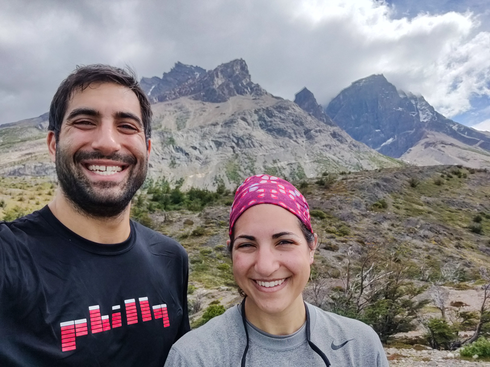
Our third day of the W trek started out much better than the second. There was no wind in the forest where we were camping. I didn’t wake up terrified of blowing away. Nothing disturbed us until my alarm went off at 8AM which means Mike slept for 14 hours straight and I slept for 11.

We treated ourselves with a late morning because we had our shortest day of hiking ahead, just over 10 miles. Plus, we were both exhausted, and I think my body would have full-on rebelled if I had tried to wake up any earlier. Even with the extra rest, I wasn’t thrilled about having to move.

A map of the park with different legs of the trail highlighted
Here’s the map again! Day 1 was up and down the pink line, Day 2 was along the blue line and then up and down the vertical part, and Day 3 was along the orange line.

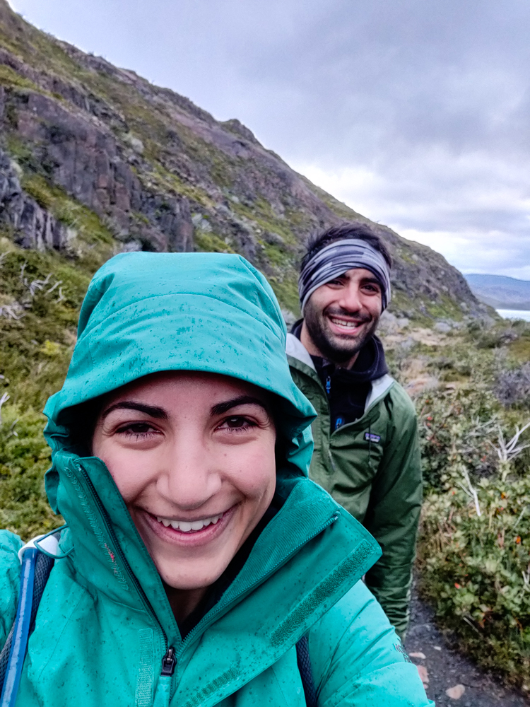
There was no sense of urgency in getting ready to go. We didn’t even have a tent to pack up (we spent that night in a rented tent because it was the only option left when we were booking), and it still took us until about 9:30 to get completely ready (okay… probably it was mostly me taking my sweet time, but we really had no reason to rush). Mike and I met at the trailhead… and it looked like we were dressed for completely different seasons. I was feeling the morning chill, so I had leggings and my winter coat on. He was in his lightweight hiking pants and a t-shirt. The difference is that he’s more often hot than cold, I’m the opposite, and we dress accordingly. Sometimes we’re both right about what will work for us, but this did not end up being one of those times. Who do you think was wrong?

Okay, okay. It was me. I think we walked for 10 minutes before I felt like I was going to melt into a puddle. There was way more sun than I was expecting, plus I hate starting out cold even when I know I’m going to warm up from the exercise.

Lake Nordenskjöld
First views of the lake
Another view of the lake
That. Water.

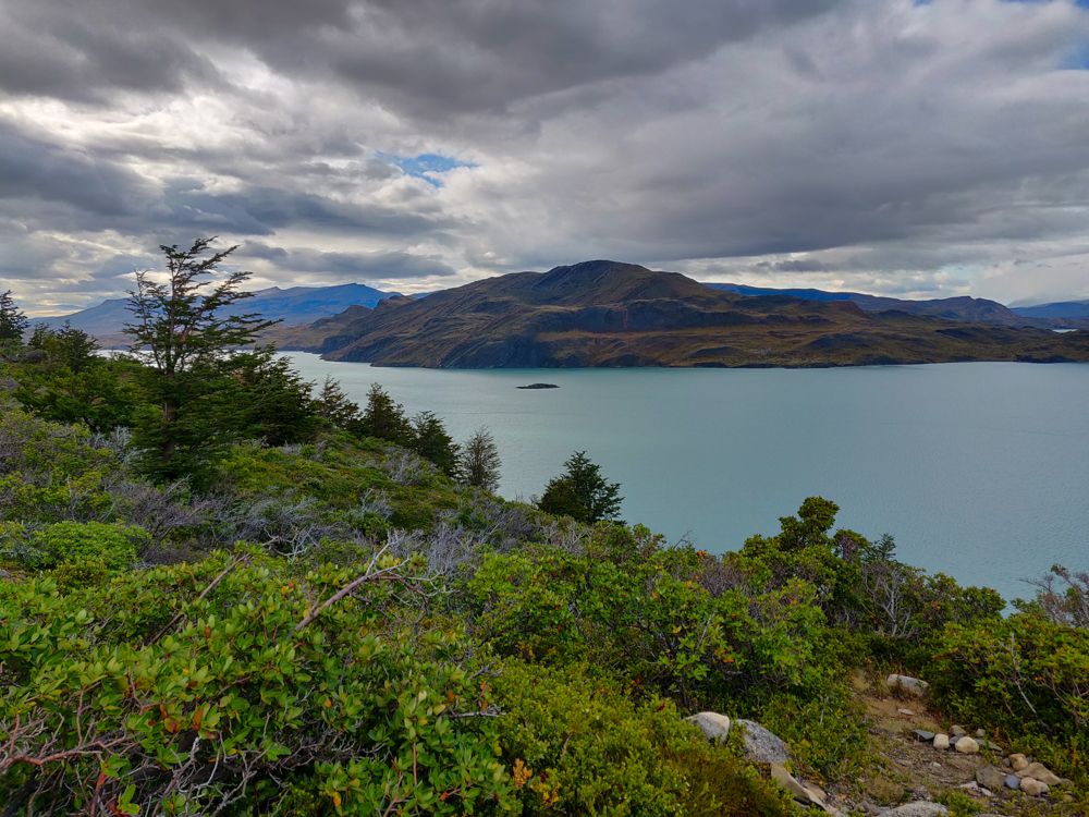
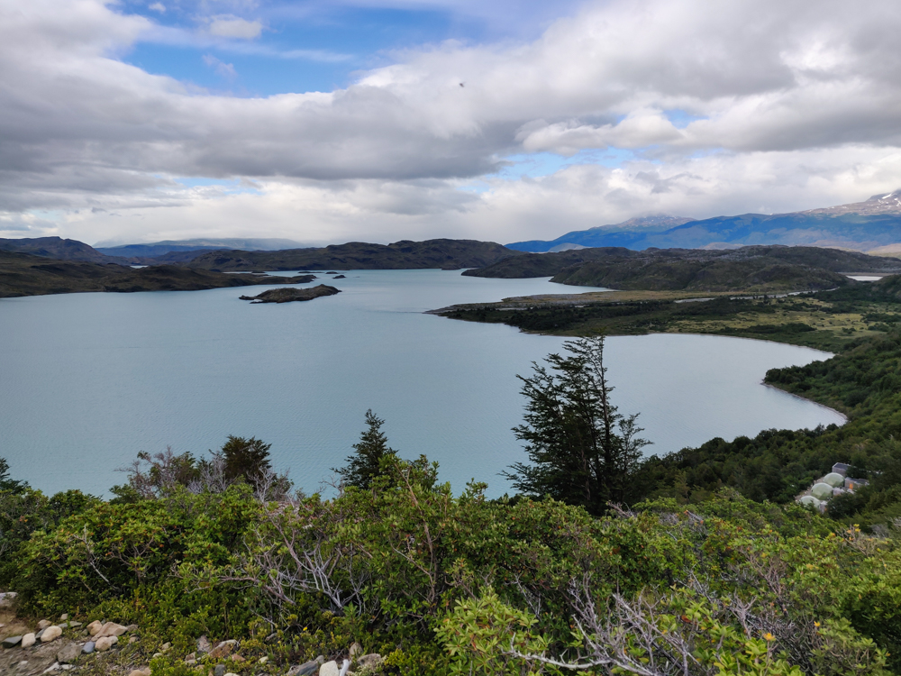
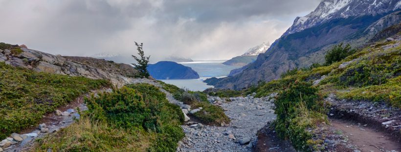
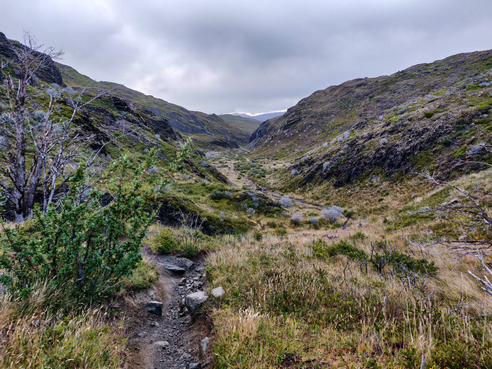
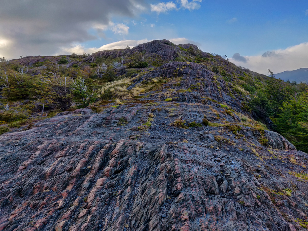
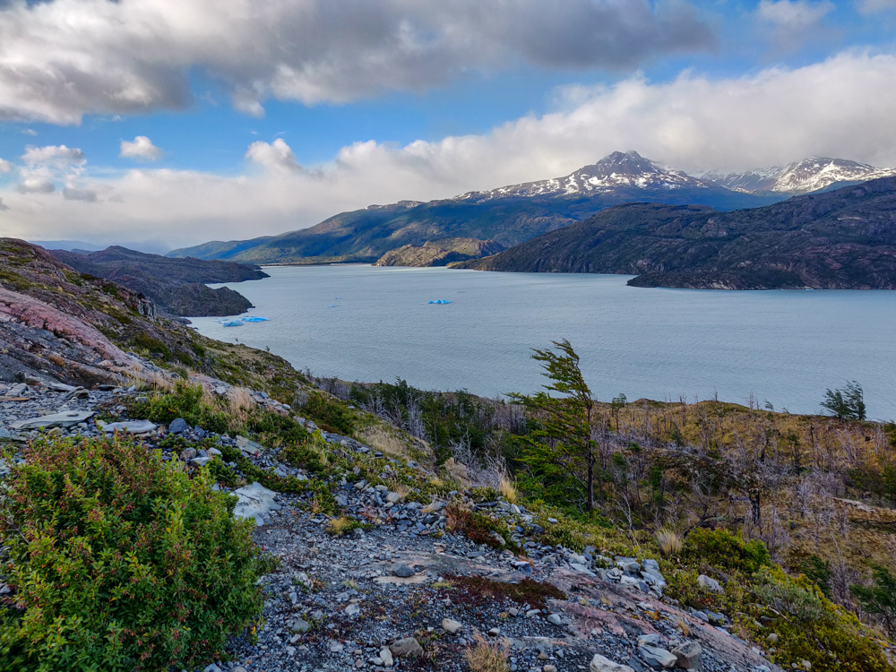
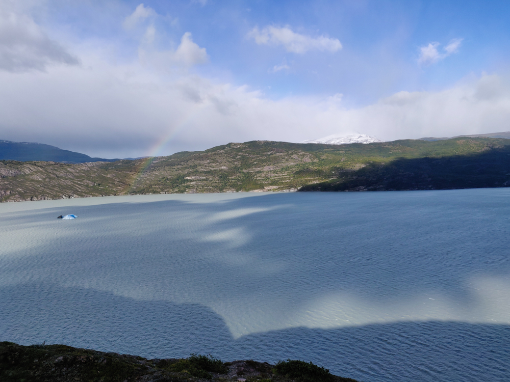
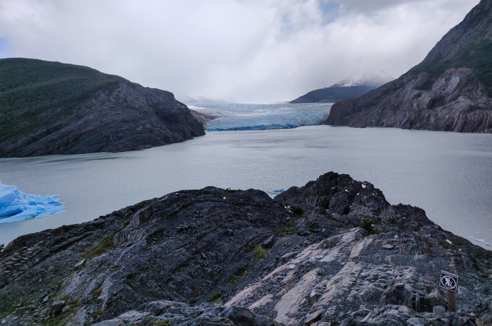
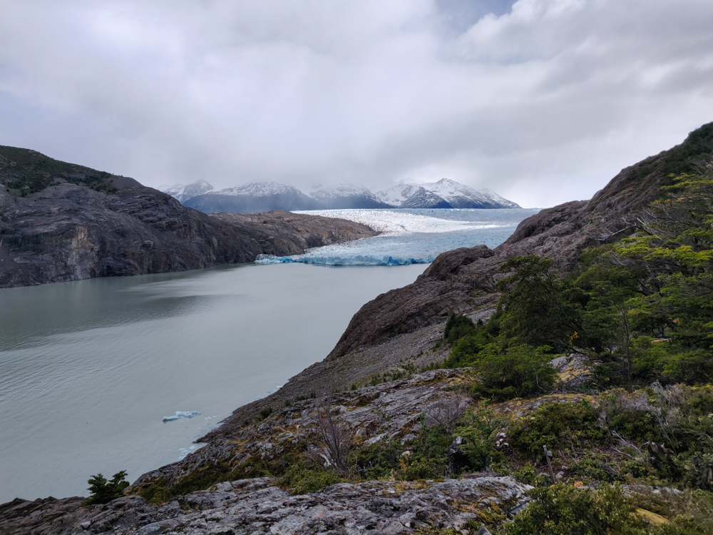
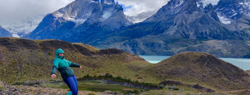
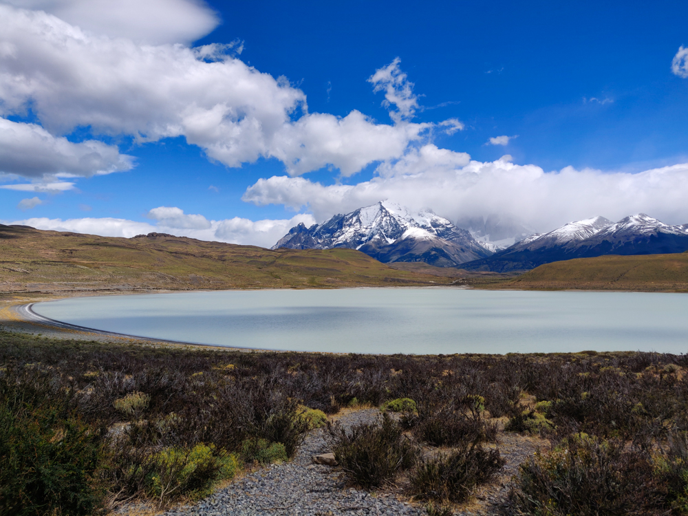
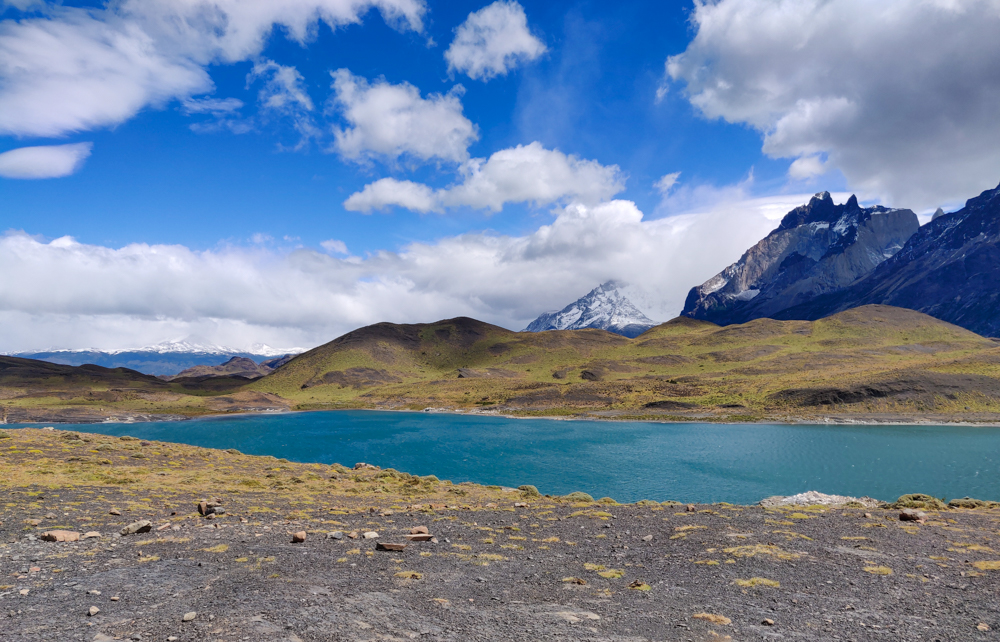
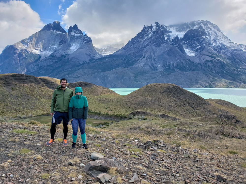
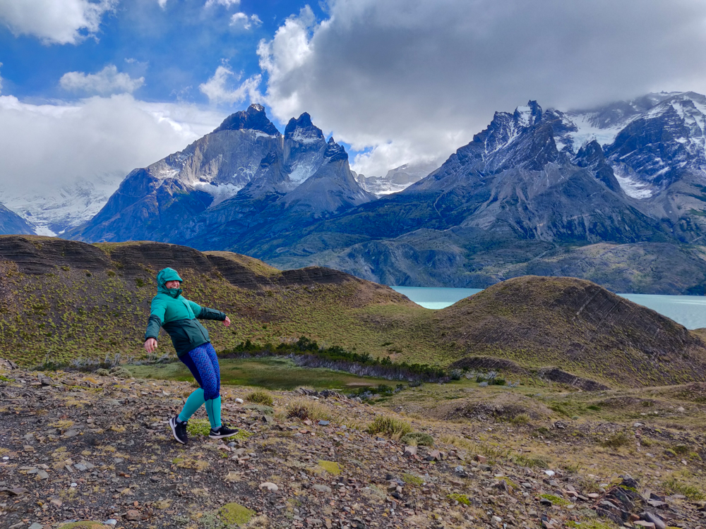
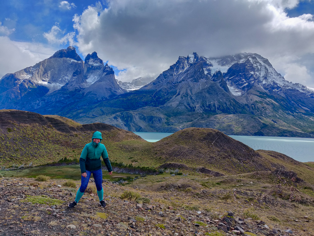
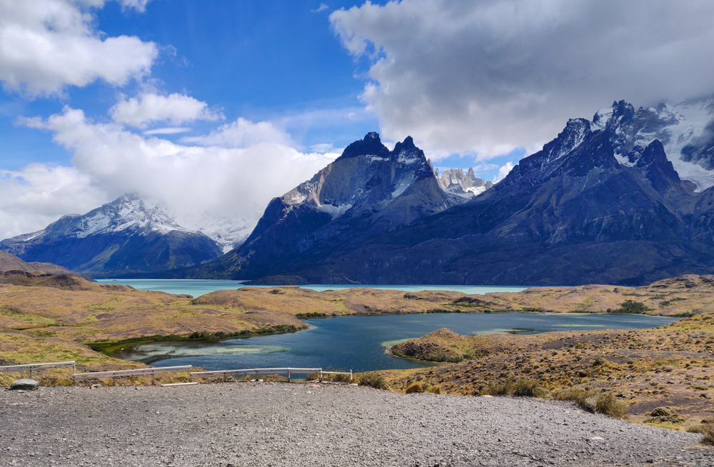
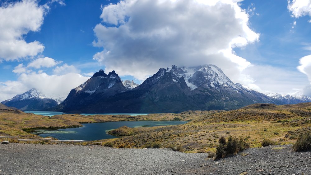
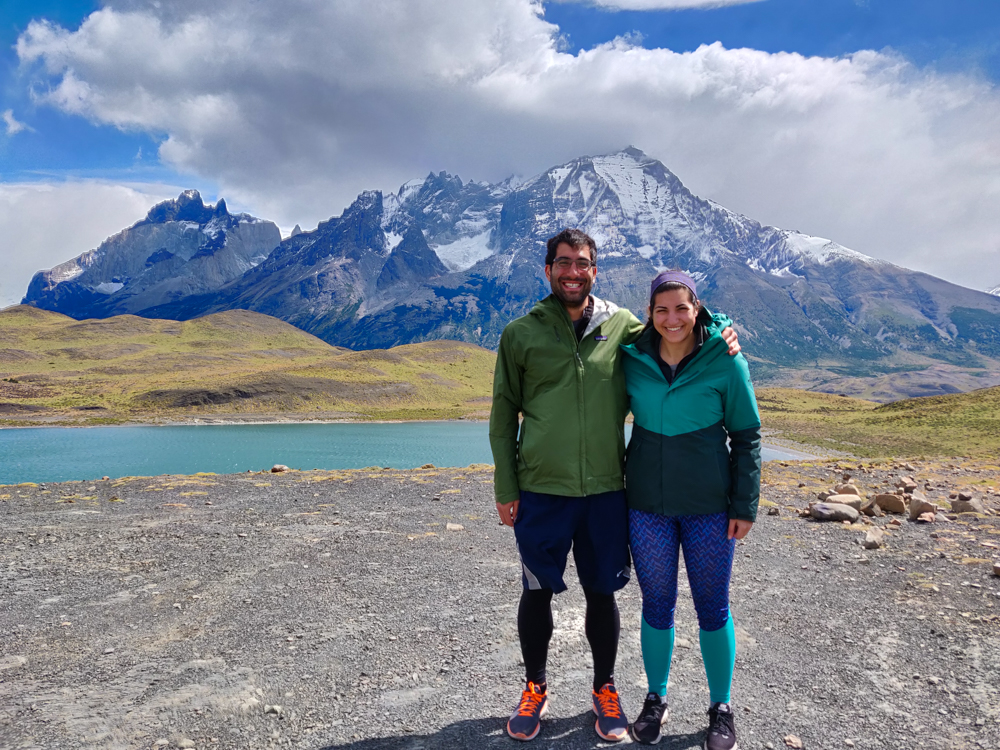
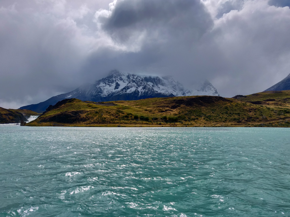
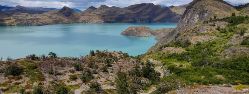
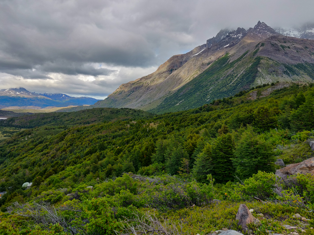
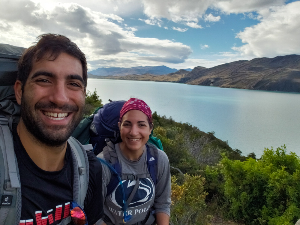
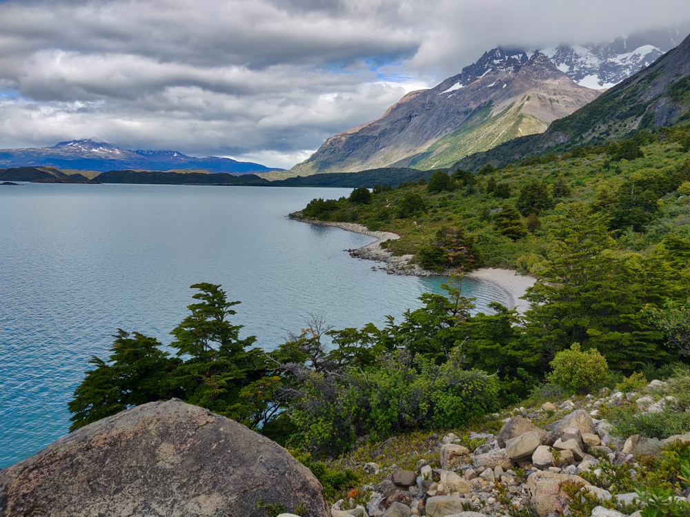
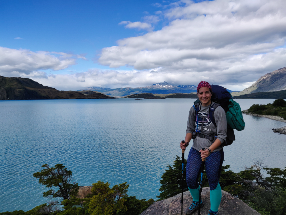
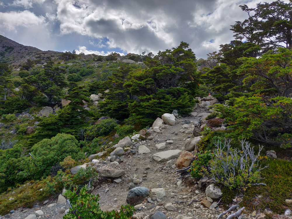
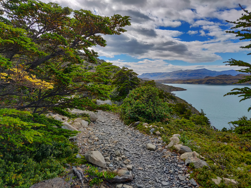
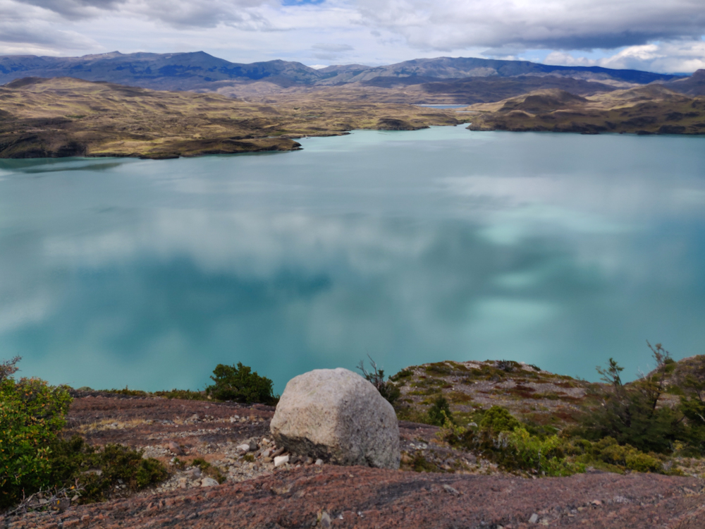
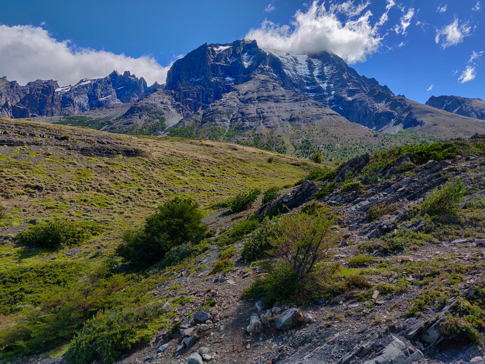
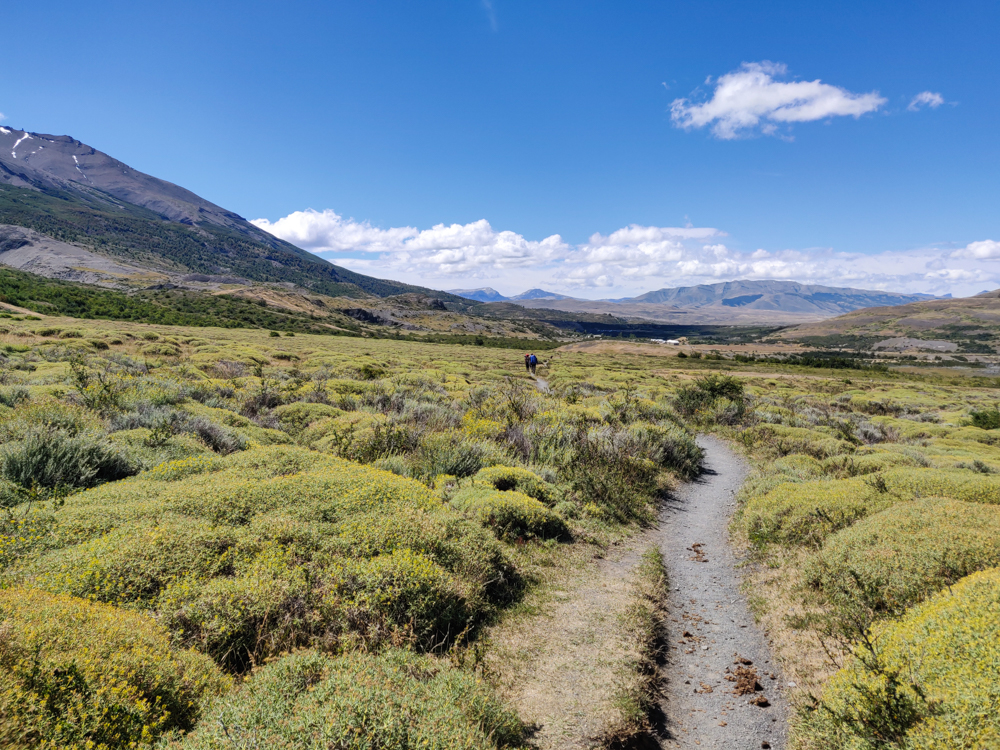
Our segment for the day was the second bottom part of the “W” which meant we had to take all of our stuff with us again. Since there weren’t any big viewpoints along the way, I thought it was going to be an underwhelming day. HA! You’d think I would have figured it out by then. Maybe there weren’t any mind-blowing, mountain-surrounded valleys, but the scenery was still amazing. Soon after we left our campsite, Francés, the forest thinned out, and we started walking downhill towards Lago Nordenskjöld (that’s about when I decided I needed to take my coat off).

Epic mountain
Yeah, the views were still pretty fantastic

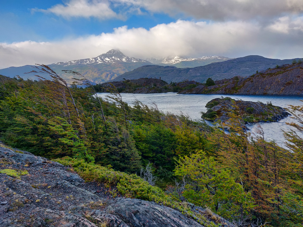
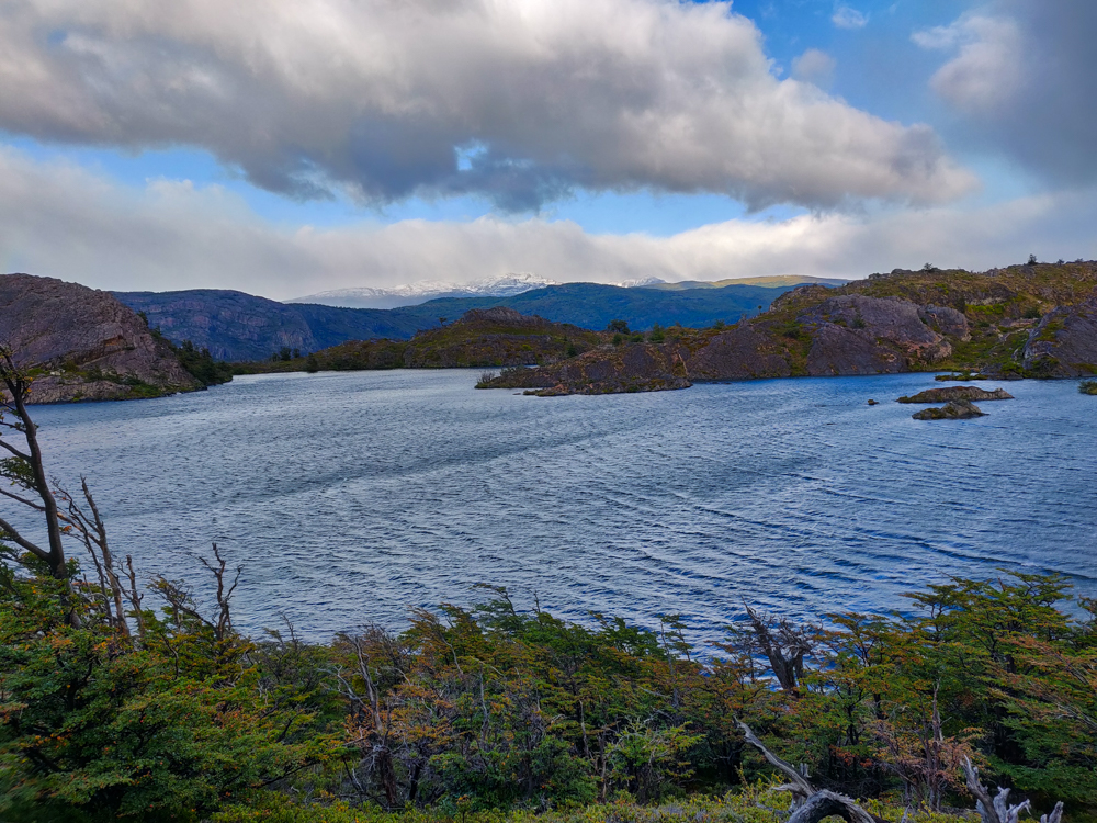
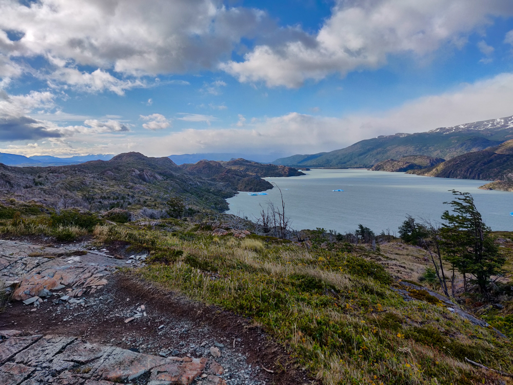
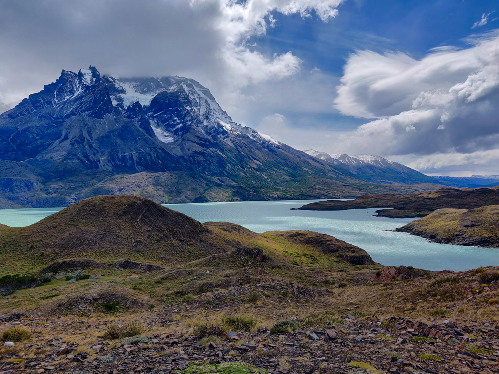
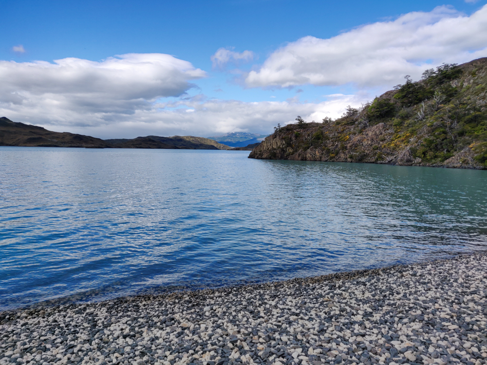
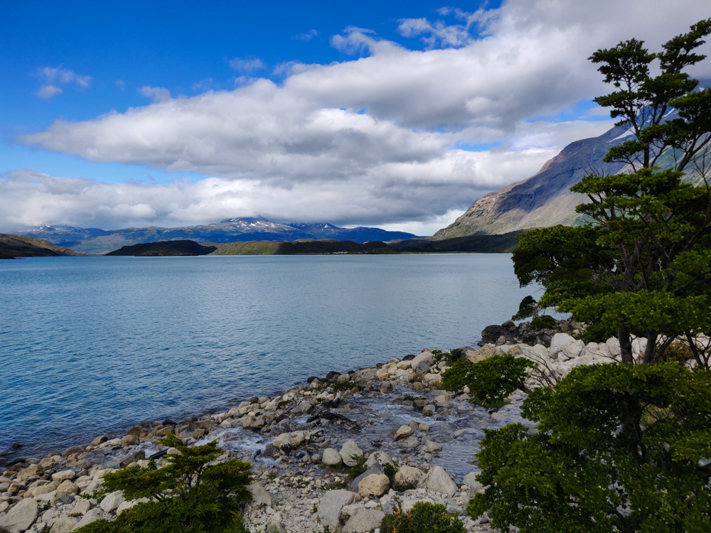
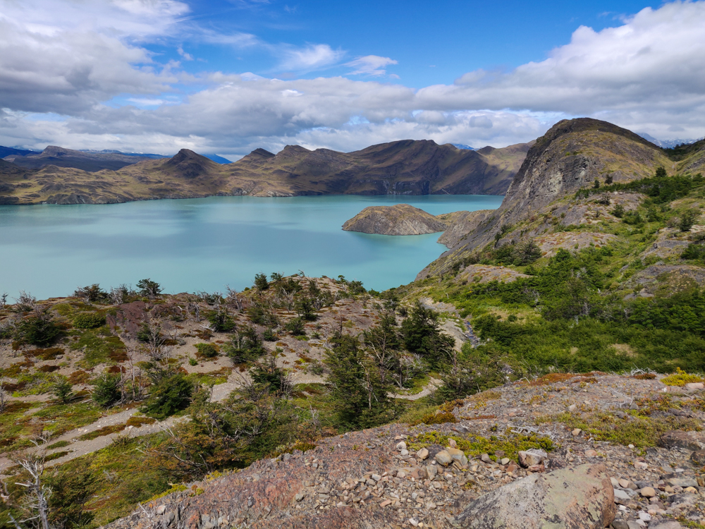
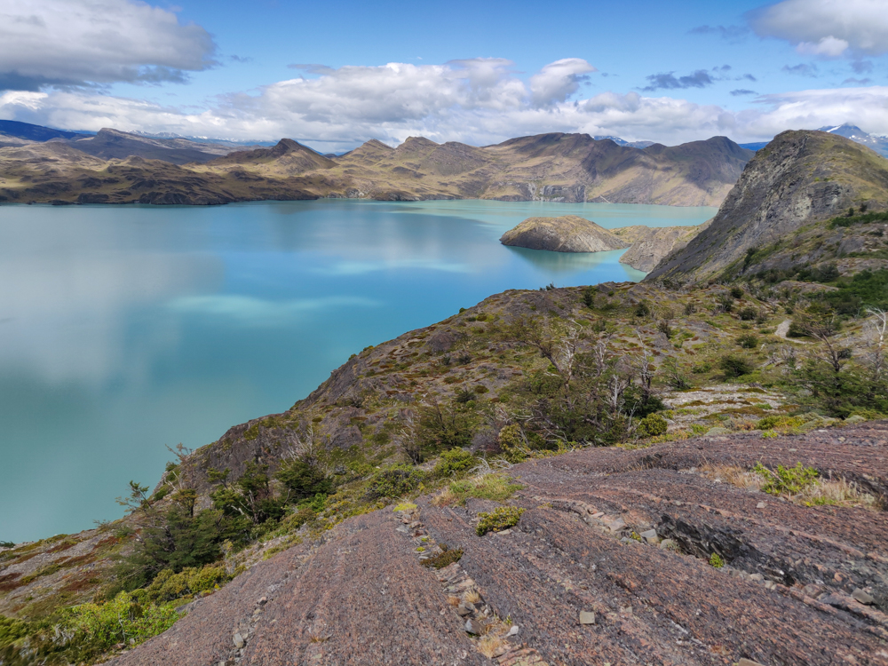
After about an hour, we made it all the way to the edge of the lake! I had no idea that we were going to get so close to the water. It was beautiful! And we walked along a little rock beach which made me like it even more because you know how much I hate sand (and if you don’t, just know that I hate it a lot and do my very best to avoid it).

The rocky shores of the lake
Don’t you just want to go for a swim?
Pretty lake view
If this wasn’t only an hour into the hike, I would have tried to convince Mike to take a snack break so I could stare at the water for longer.
Walking along the lake shoreline
<3 <3 <3

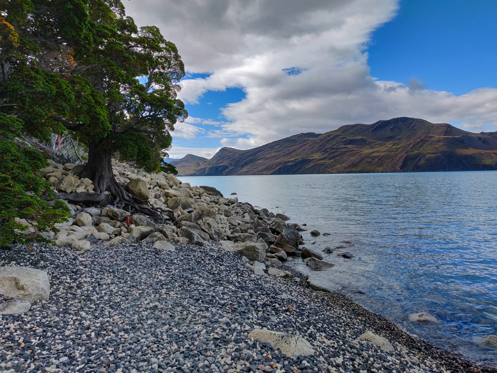
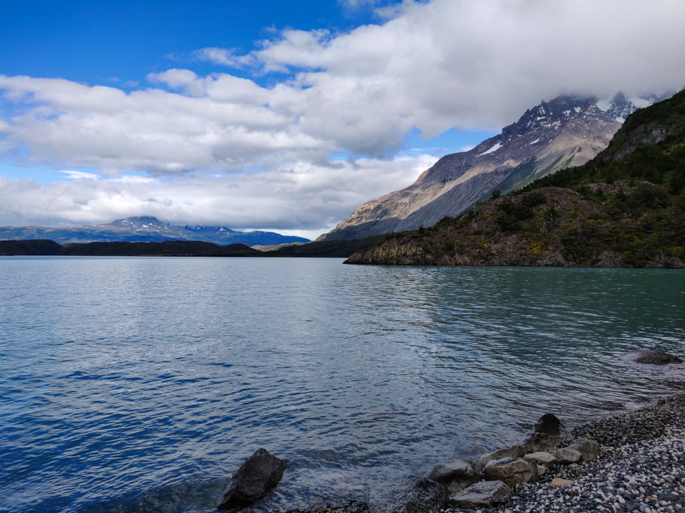
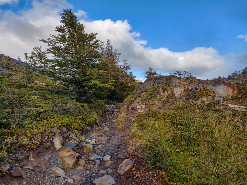
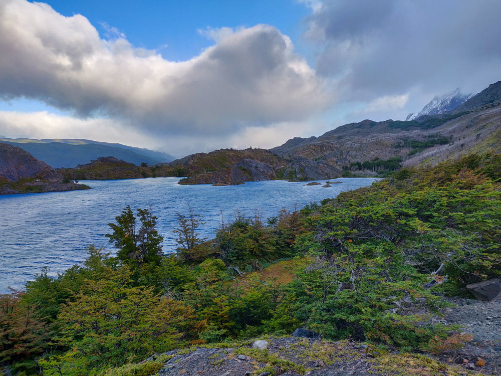
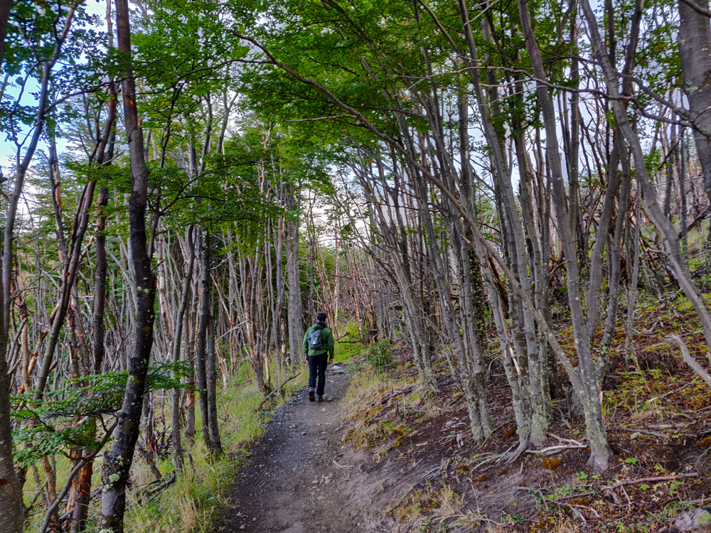
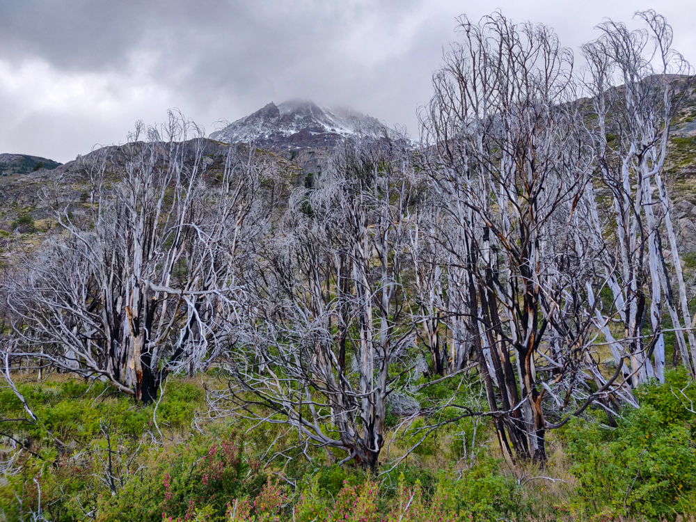
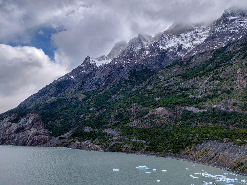
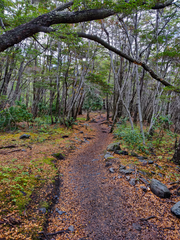
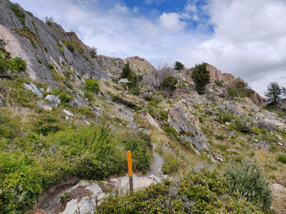
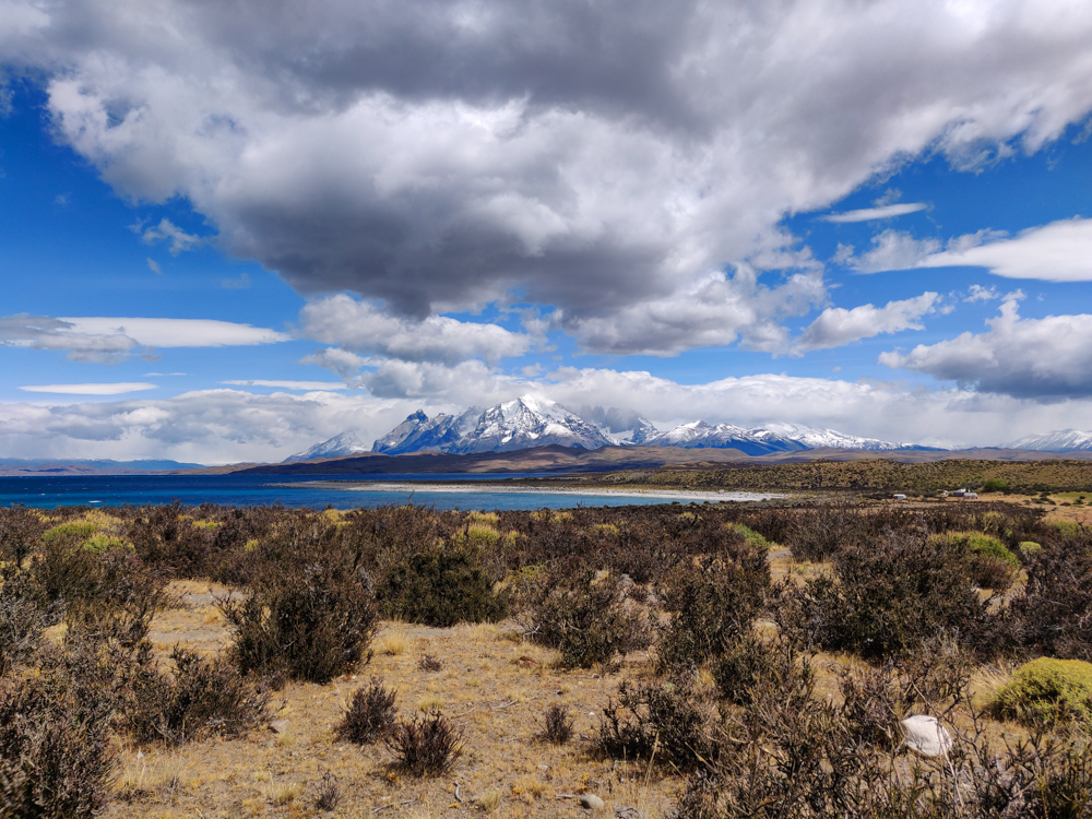
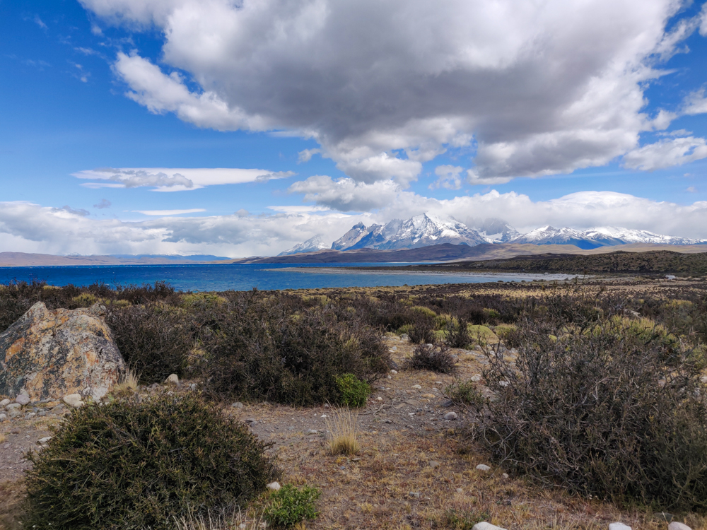
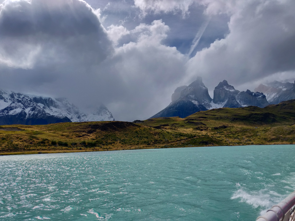
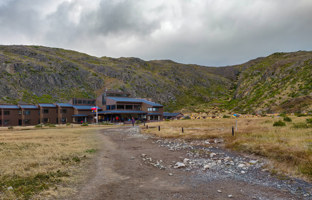
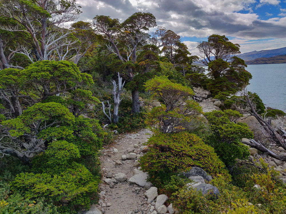
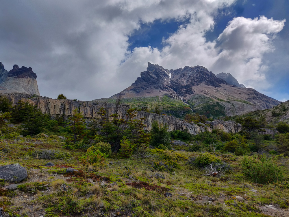
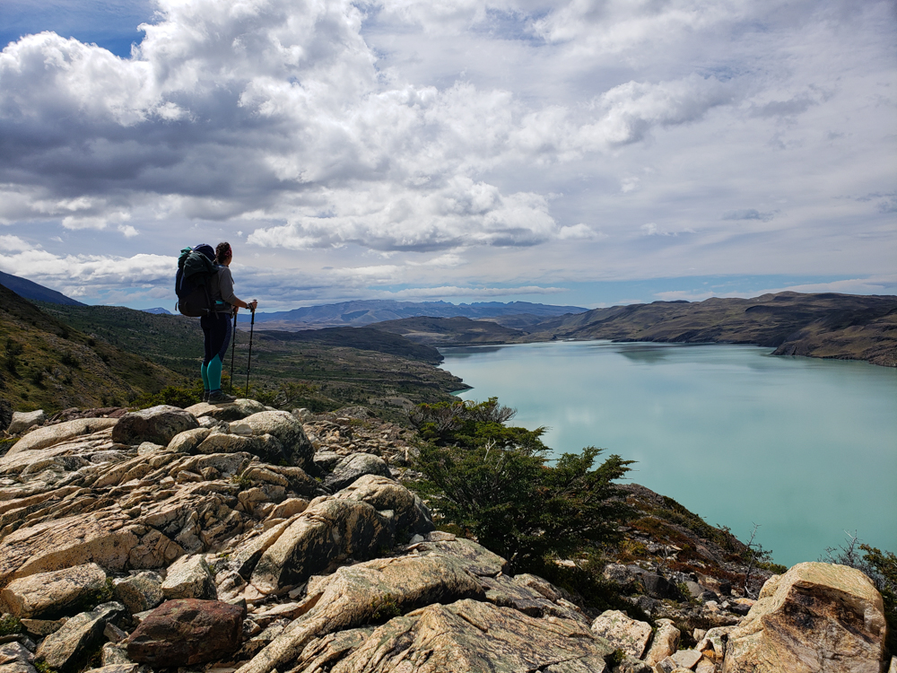
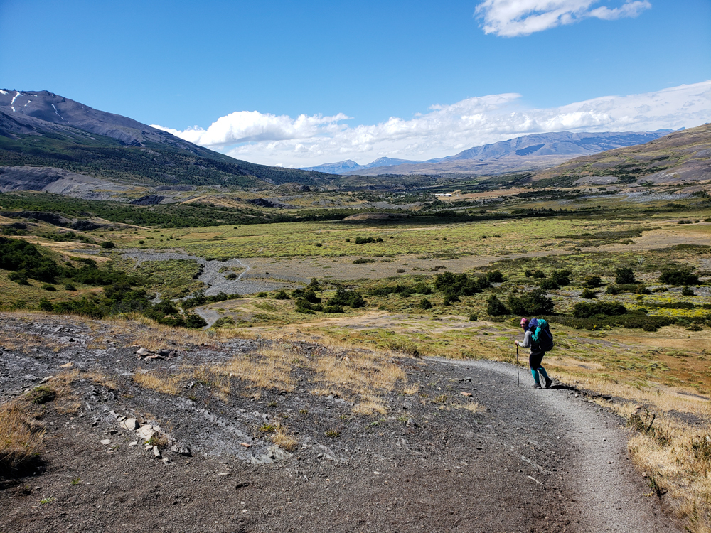
The route for the rest of the day followed the edge of the lake pretty closely, though that was the only time we were actually within touching distance of the water. From there, the trail headed uphill and back into the woods for one of the only shaded stretches of the day. That’s when we reached our first landmark, another campsite, Cuernos. Cuernos is another site where people sometimes stay after the hike we did the day before, and all I can say is thank goodness we got a spot at Francés. No chance would I have survived another two hours of hiking the night before (either my legs would have rejected me, or Mike would have killed me out of annoyance).

Mike filling his water from a rocky stream
This was the actual best thing… I loved being able to drink straight from the rivers! Mike is filling up his water bottle.
The lake
And I thought it was going to be an underwhelming day. HA!
Mike and me with the lake behind us
Lake selfie!

With our fresh day 3 legs, the hike to Cuernos took only about an hour and a half. We stopped briefly to put on sunscreen which turned out to be a VERY good idea, though we probably should have also reapplied because my face was very pink at the end of the day. And my arms! Oh, my poor arms. I was wearing long sleeves, so I didn’t put anything on them… and when I started getting overheated, I pulled my sleeves up to my elbows without even thinking about it. I had an embarrassingly distinct line on my forearms which I hoped would even out the next day a bit. (Spoiler alert, it’s been like a month and a half since this day, and I STILL have a line on my arms. So the moral of the story is to WEAR SUNSCREEN.)

A rocky mountain peak with a little waterfall
Spot the waterfall!
The lake from above
Bye, bye shoreline! Up we go…

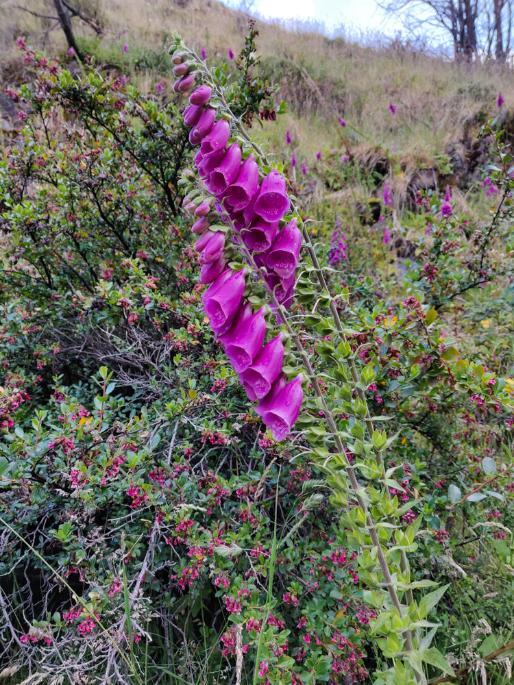
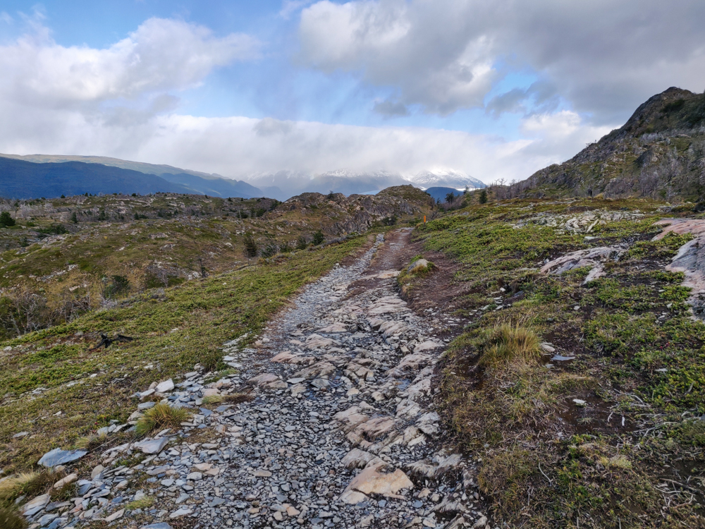
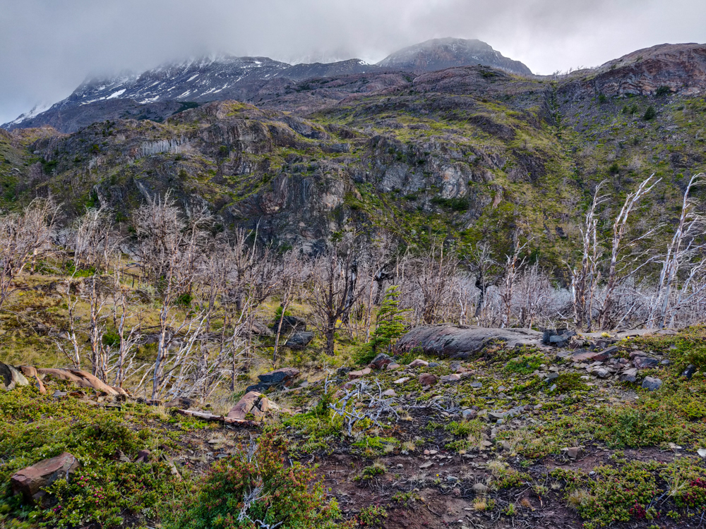
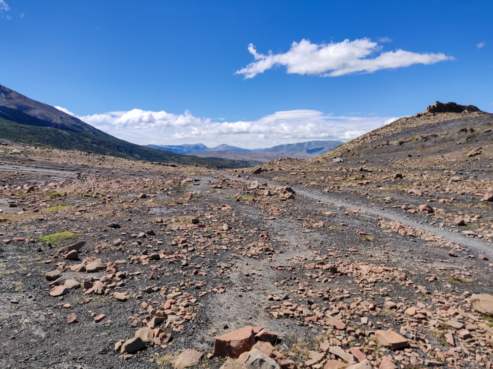
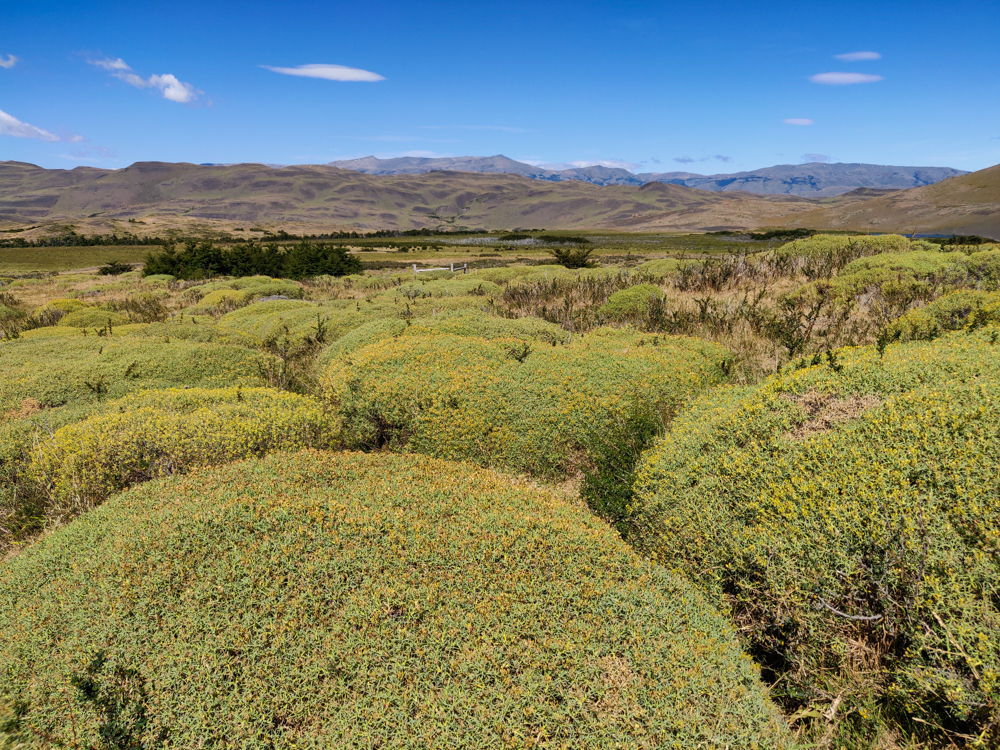
After Cuernos, the hike felt a bit like walking through the desert. Any hint of the morning cool was long gone, and there was NO shade, just low plants. It was pretty, that’s for sure, but it was also exhausting. It kind of ended up working out in my favor because usually, Mike is like, “Meh meh meh, I don’t need a break,” but he was definitely feeling the heat too. It also helped that we had such a short day, so we didn’t feel like we needed to hurry.

The rocky trail with some low plants
The trail. Pretty plants, but not great for shade
Me with the lake
I hope you like lakes because this isn’t even close to the last lake picture
The trail bending away from the lake
Is that a picturesque trail, or what?
A particularly rocky stretch
I can’t say my feet appreciated those rocks, though

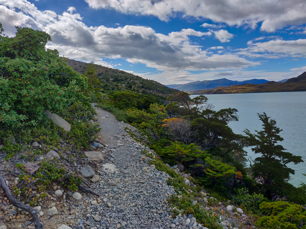
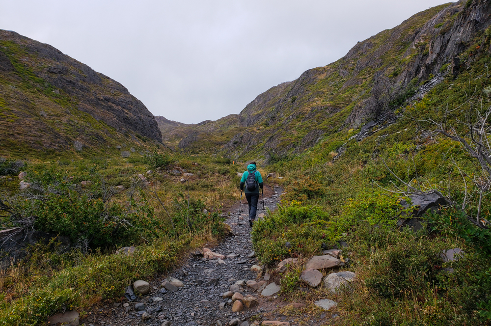
Elevation-wise, the whole day was a constant up and down and up and down. The good news was that my knee wasn’t hating me as much, plus I had a fresh strategy for the downhills to keep it that way (aggressive use of my hiking poles mixed with a slight side turn, in case you were wondering). Thanks to that fortunate development, we managed to keep a good pace throughout the day. I was surprised by how fast we could comfortably go when I wasn’t crippled by blisters and throbbing knees! And it was so nice to be able to focus on enjoying the hike.


Me walking across a suspension bridge
Another suspension bridge! And another 1 person at a time limit
Mike crossing a suspension bridge
Mike making the trek across
Pretty red and orange streaked rocks
LOOK AT THE COLORS OF THESE ROCKS
Another gorgeous trail pic
Ugh so many ugly views I can’t even stand it
Weird-looking cliffs by the trail
Funky mountains. Seriously what is happening with those cliffs?
Beautiful view of the lake with sky blue water
I don’t know what was going on with the light and the water when we got to this point, but yes, this is what it actually looked like and no, I couldn’t believe my eyes.
Another view of the lake with pretty colored rocks
Imagine a pterodactyl in this picture and try to tell me that it doesn’t look like it belongs.
The lake with clouds reflecting on the surface
I CAN’T DEAL WITH THIS. How are these colors real? How is this place real? How did we get so freaking lucky with the weather? WHY CAN’T I LOOK AT THIS VIEW ALL THE TIME FOREVER FOR THE REST OF MY LIFE?
Mike and me with a mountain backdrop
I’m sure you’re sick of lake pictures by now, so here’s us with some mountains instead (except just kidding because how could you ever get sick of those???)
Me gazing out at the lake
So darn pretty
Crossing the river with no bridge
Pretty sure it looks like I’m smiling because I’m laughing about how I’m definitely not going to make it. Mike took this picture and then attempted to direct me across. Once I accepted that water was going to get into my boots, it wasn’t as hard.

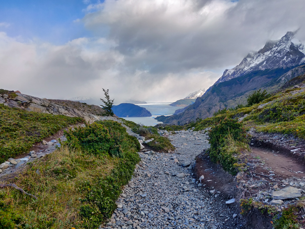
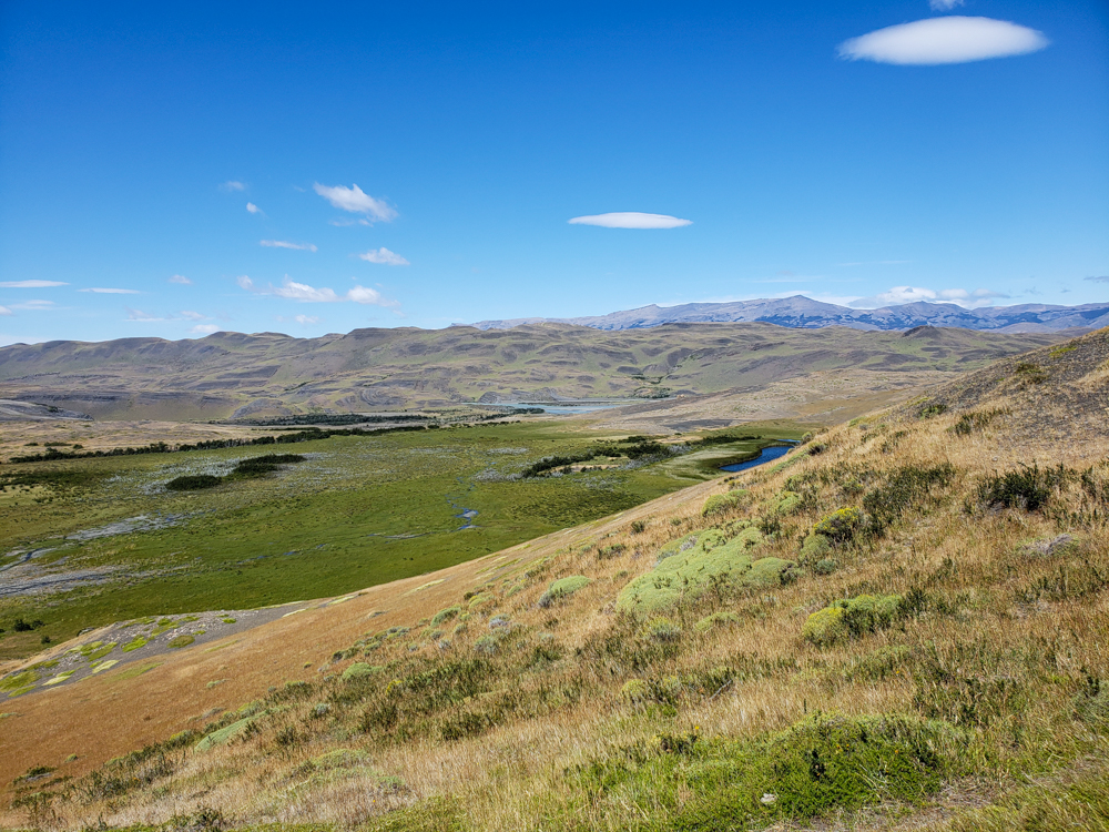
Our next landmark was a fork in the trail. The left fork continues along the route of the W, and the right fork leads to the campsite where we were spending the night (because the more convenient campsite was booked… that’s what happens when you book things only 2 weeks ahead of time. No complaints from me, though. I was just happy we could make it work!). I knew our campsite was kind of in the middle of nowhere, but I didn’t realize just how out of the way it was. I estimated it was maybe another hour after the fork in the road. It was not. Try 2.5 hours.

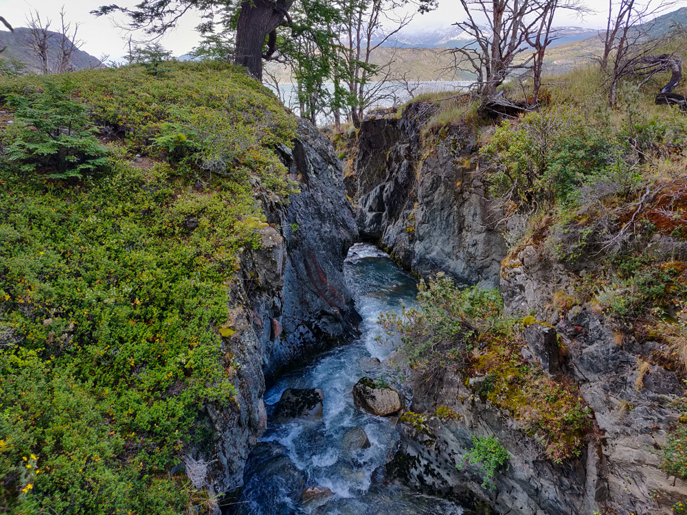
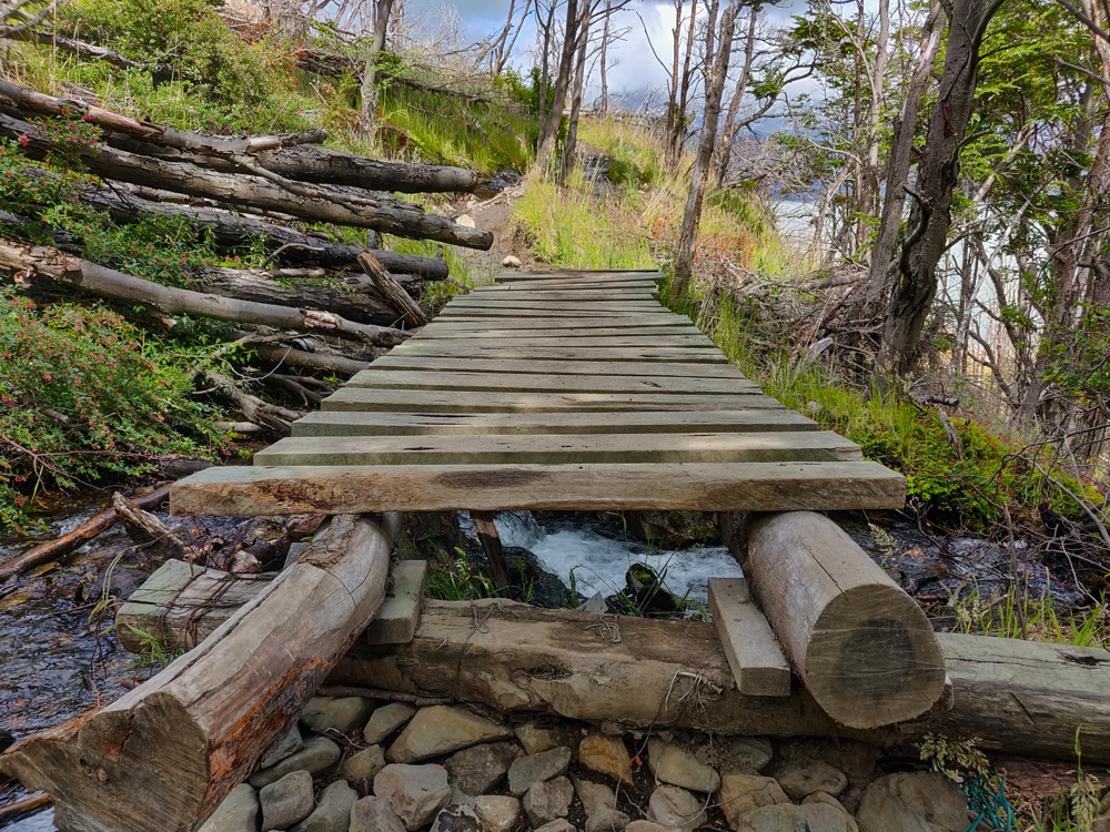
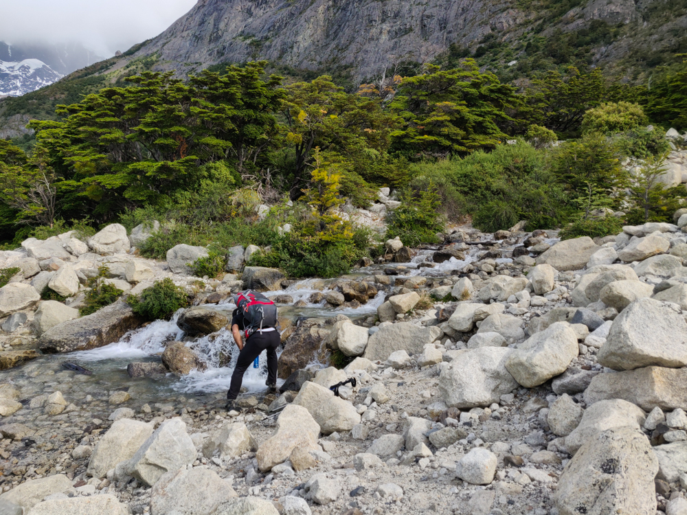
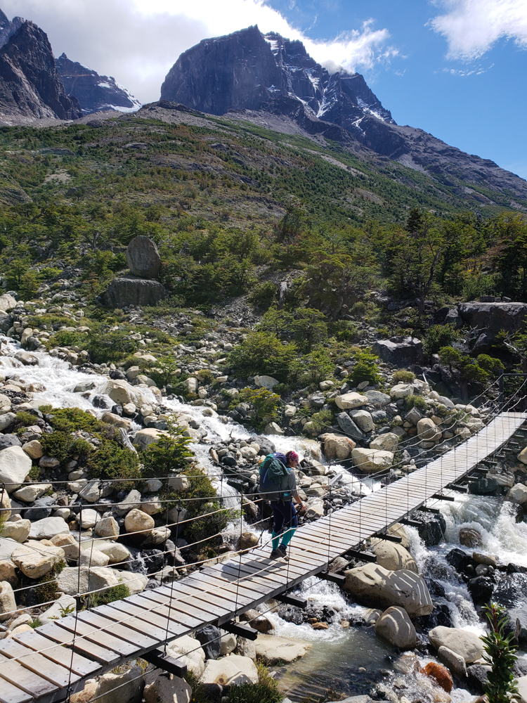
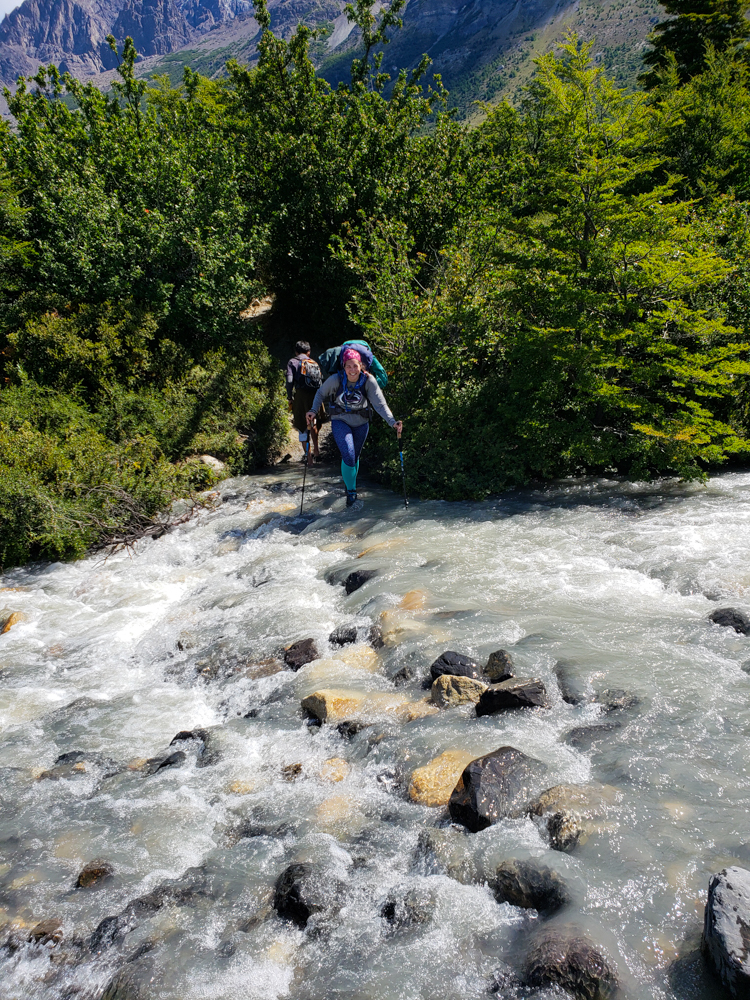
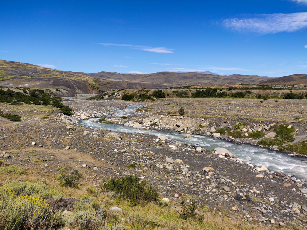
Soon after the fork, we found ourselves at the edge of a river that absolutely should have had a bridge. It was wide, the current was strong, and there was literally no way to get across without getting water in your shoes. I was mostly worried that I was going to fall over and get everything in my bag wet, but my hiking poles saved the day once again, and my socks were the only thing that didn’t come through unscathed.

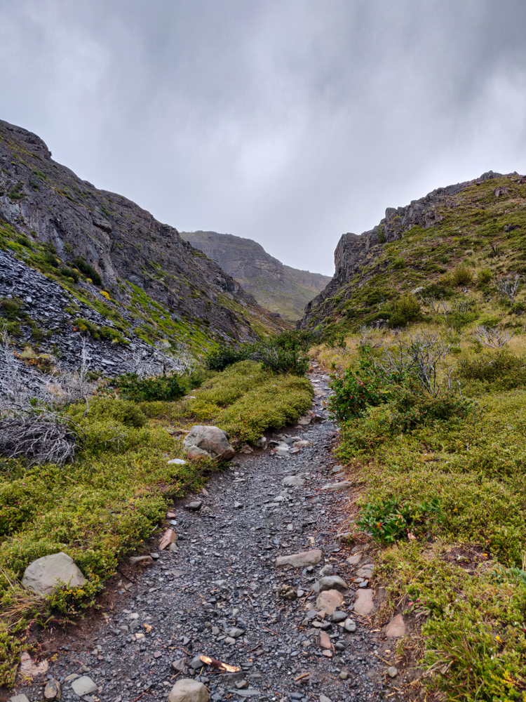
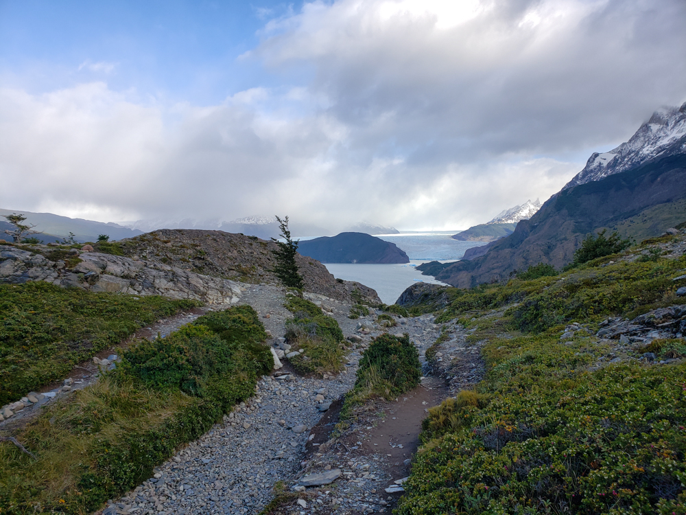
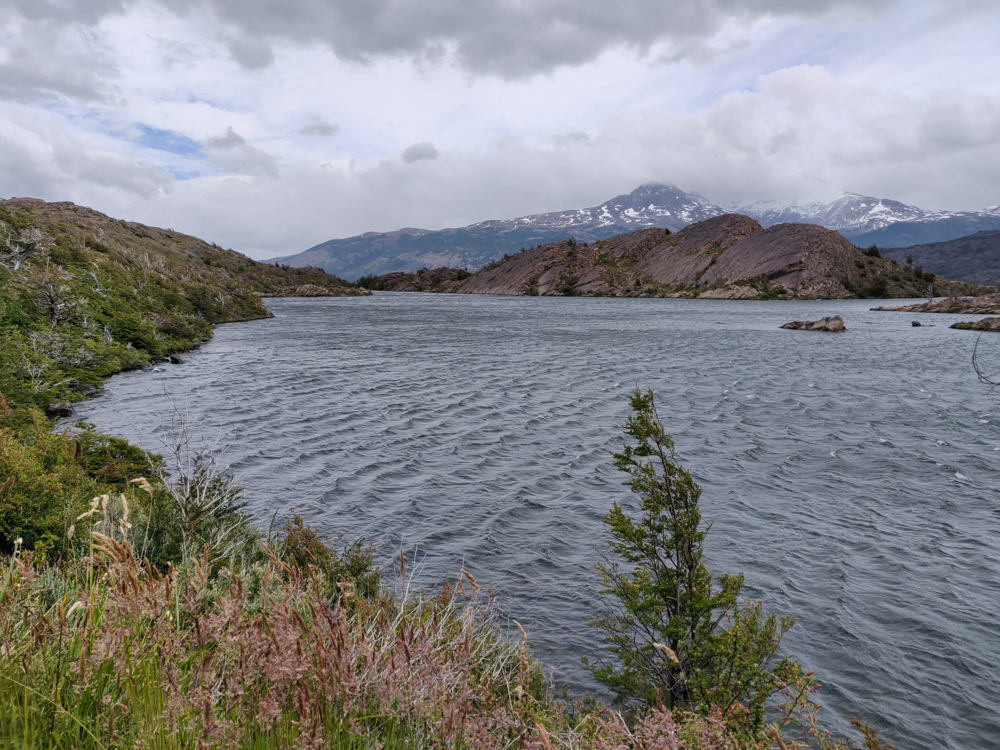
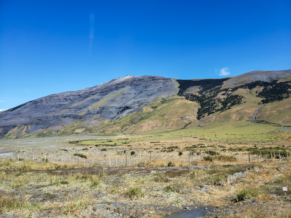
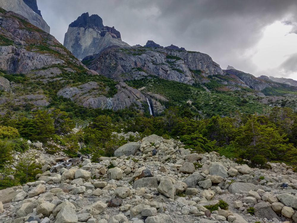
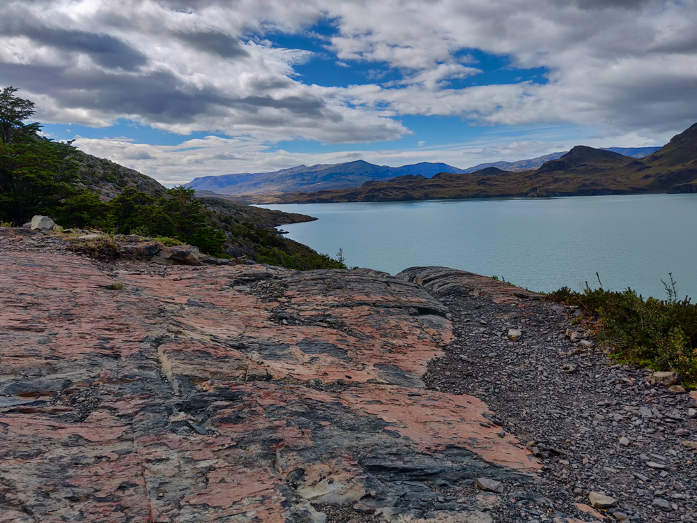
From that point on, there was truly no shade. Mostly, there weren’t even ground plants. Just rocks. On the bright side, it was fairly flat. I spent most of the walk marveling at the colors. It seems almost stupid when I write it out, but the colors just seemed so vibrant in comparison to other places. Like I was walking around with color filters over my eyes that made everything look unrealistically saturated (so if you’re thinking that my pictures look like I did a little too much filtering, I promise I didn’t. It somehow does actually look like that).

Mountain views
Oh, you know. Just another stellar landscape
Red and black rocky stretch along the trail
This is definitely the surface of another planet. Check out those rocks!

Eventually, once I realized that my time estimate was WAY off, I got to the point where I transformed into Mike (a terrifying image). I was trucking because my knee didn’t hurt, and I just wanted to get to the end. No breaks! No pictures! (Kidding, there’s always time for pictures.) No snacks! I was determined to keep moving at my aggressive pace and left Mike behind at some point. Who knows what he was doing back there, but I was not stopping. Then, we got to the place where I thought the campsite was, and nope. There’s a hotel there, Las Torres, and I thought the campsite was close to there. It’s not. We still had at least another 30 minutes.

Me walking down into the valley
“Mike! What’s taking you so long?”
The valley
THE COLORS
The trail running through a field of weird, low bushes
So… these plants are weird.
More weird bushes
Within minutes, we went from the surface of another planet to this… also possibly another planet but like… what?
River running through the valley
At this point, I was ready to be at the campsite. When I took this picture, I probably thought we were almost there. NOPE. This was still maybe 40 minutes away.

By the time we arrived at the campsite, I was beyond ready to sit down. At least my knee wasn’t hurting, though! And I wore approximately 85 pairs of socks (+/- 83 pairs), so I didn’t get any new blisters! So many victories!

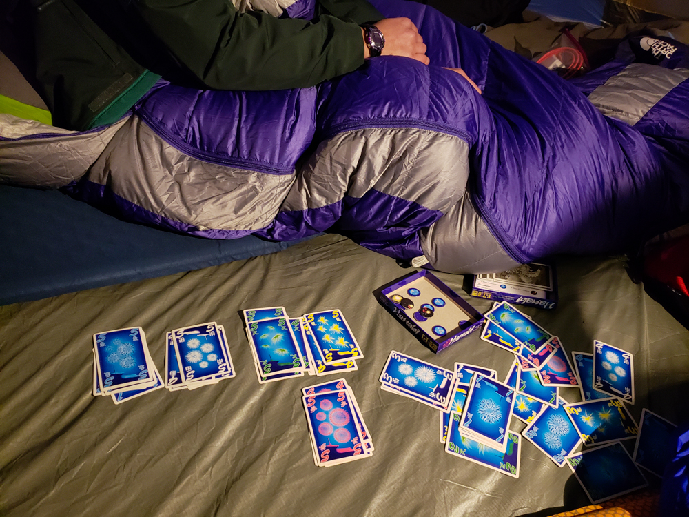
We set up the tent, showered, and went to sleep as soon as we could manage because we had a fun 5AM start the next day. Our last day in Chile!

Torres del Paine National Park is well-known for two major treks. One is called the W, and the other is the O… very creatively named for the approximate shapes of the trails. Based on our time constraints and wanting to have some diversity in our trip, Mike and I decided to do the shorter W (4 days rather than 8ish). For sleeping arrangements, you can choose to camp with your own tent, camp with rented equipment (that’s already set up at the campsites), or sleep in refugios (aka indoors with a bunk bed). For food, you can either bring your own, bring some of your own and get breakfast and dinner provided at the campsite, or get breakfast and dinner plus a bag lunch.

A map of the park with different legs of the trail highlighted
Here’s a map I marked up in an attempt to simplify this explanation for you. The W trek is the pink, blue, orange, and purple lines put together. The O is those plus the green line over the top. Our first day was spent going from the bottom of the pink line to the top and then back again.

We were trying to do this on the cheap (well, I was. Mike was fine with spending some money. I guess that’s what happens when you actually have an income. I don’t remember what that’s like…), so we brought our own tent and packed our own food. The challenge with that was the fact that most people bring camp stoves and eat actual food during the trek. We had no camp stove and no desire to figure one out before our trip… so we packed all dry food. I felt okay about that because it was only going to take four days. Any longer and we would have considered other options, I think. But nope! Four days and a good supply of protein bars, peanut butter (and jelly for Mike), bread, ham and cheese, gross chocolate cookies that I picked out (whoops! You win some, you lose some), peanuts, and dry ramen noodles (for me. I actually kind of like them that way. Mike thinks I’m crazy). Hehehe. Maybe it wasn’t the most elegant solution, but it worked just fine.

I was VERY worried about our first day of hiking. Mike and I have hiked together in the past, and we have very different approaches. I like to stop to take pictures, take frequent snack breaks, and enjoy the ambiance. I keep a good pace usually, but I’m all about the journey. Mike is a speed hiker. He doesn’t take breaks along the way. I don’t understand how he functions. I need snacks! I need water breaks! I need exhaustion breaks! He just powers through until the end. He might be a robot (the most likely explanation).

Selfie of me and Mike
Smiling because this was still very early in the day
Gravel path flanked by green plants and pretty mountains
Such a pretty valley!

We decided to start “early” because I’d rather get out and back early to beat the heat and not have to worry about the sun setting (though with a 10PM sunset on this trip, there wasn’t much danger of that), so we left our campsite at Paine Grande around 7:15. Based on the blogs I read, I was expecting the trails to be crowded. Everyone said that this is the high season, expect crowds, you won’t have that “just you and nature” kind of feeling, so if you’re into that, too bad. I was ready for crowds. We spotted our first hiker approximately 3 HOURS later. Geez, if only the trails were always that crowded. We seriously wondered if maybe we weren’t allowed to be hiking yet, like maybe there were opening times we didn’t know about? Nope. There just weren’t any people. I mean, spoiler alert, there were more people on our way back, but crowded? Definitely not.

Happy Lara walking through the valley before she blew away
You don’t even know how many people we had to ask to hide in the grass so they wouldn’t ruin our pictures

The first part of the hike was through a little valley. It was raining, but after our day on Perito Moreno Glacier, I felt pretty hardcore and was like, “Rain? Psh! NICE TRY, TORRES DEL PAINE. YOU’RE GOING TO HAVE TO DO BETTER THAN THAT.” Then we got out of the valley. And the wind hit us. And I ate my (mental) words.

Valley covered in plants and a pretty, windy trail
Try to tell me this isn’t beautiful (I won’t believe you).
Another view coming out of the valley
I can’t come up with more words to express how pretty it was there

That was around the time that we reached the lookout at Lago Los Patos (Duck Lake) which I, for some reason, thought was a hilarious name. In hindsight I’m not so sure what I was going on about, but I must have laughed about it for a whole mile at least. From Duck Lake on, the day’s hiking followed the lakes’ edges, and it was all incredibly windy.

Lake views with a mountain backdrop and aggressive winds.
Laguna Los Patos. Check out the plants blowing in the wind!
Laguna Los Patos
I can’t get over the colors in the lake!
Streaky rock formation
I thought these rocks were super cool.
Duck Lake
I didn’t realize this until Mike pointed it out, but when you look out in the distance, it looks like the surface of the earth just falls away. Behind this lake is Grey Lake which is at a lower elevation. So weird!

Hiking in the wind is the worst. Especially when the wind might actually be strong enough to blow you away. There were times when it was so strong that my trekking poles essentially turned into stakes that were the only thing keeping me from blowing off the trail. Each time I picked up a foot to take a step, I had zero confidence that it would land where I was aiming. And when the winds were strongest, they pretty much never did.

Lightly forested trail leading away from Laguna Los Patos
Walking away from Duck Lake

Laguna Los Patos is tiny compared to Laguna Grey, the next lake we encountered. We walked along Duck Lake for maybe 15 minutes. We walked along Lake Grey for the rest of our day. It took around three hours to make it to our first real checkpoint, Grey Campsite. That timing was nearly spot-on with the estimate listed on our map, and it made us start to think that we needed to take Chilean hiking estimates much more seriously than we take the ones in the States. At U.S. national parks, if you’re someone who has any experience hiking and is in decent shape, take the hike time they give you and divide it in half. We were thinking that might be the situation here as well, and it was not. Instead, it was like they wanted to give an estimate of how long it would actually take! Imagine that!

Pretty pink flowers along the way
Trail flowers
Grey Lake with some small glacier pieces floating around
Laguna Grey with the first glimpses of glacier pieces. Can you see them?
The hiking trail leading towards snowy mountains
The rocky trail. My feet did NOT like those rocks on the way back.
Grey Lake with its pretty, mountainous surroundings
So. Pretty.
Actually though, my toes were screaming.
Grey Lake with a faint rainbow
Rainbow! We could see both ends of it, too!
Dead tree skeletons
The tour guide on our ride into the park the day before explained why the park is super strict about where you can set fires (only in designated cooking areas). There have been a couple of forest fires accidentally set by hikers, and thanks to the strong winds, they spread crazy quickly and destroyed huge areas of the park. I don’t know if that’s what happened to these trees, but anytime we walked through a tree graveyard, I assumed they were tourist fire trees. They’re eerie, aren’t they? Like sad tree skeletons.
View of a little river gorge from the bridge
We crossed this super cool river along the way
View of the trail with Grey Glacier and Grey Lake in the background
That view… <3

From Grey Campsite, we went on a hunt for the Glacier Grey lookout point (yes, another glacier!). I say “hunt” because the lookout’s location was SO not obvious. Every other trail in the park was extremely well-marked, so I don’t know what happened with this one. After it was all over, I still wasn’t confident that we ended up in the right place. Oh, well. We did find a high point with good views, and what more do you need? Mike’s response to the glacier: “It’s not that cool.” Well, since we were hiking ON a glacier two days prior, yeah, seeing one across a lake wasn’t as impressive. I still thought it was cool though… because everyone knows that glaciers are made of ice! (Bad joke, ignore me.)

View of Grey Glacier and Lake Grey
Checking out Grey Glacier from our “lookout”
Mountains near the glacier. The continuation of the trail runs along the base of them.
Forest view with yellow and orange leaves on the ground
I love the colors!!

When the wind at the “lookout” became too much for even Mike (he said he was getting cold which is something I don’t think I’ve ever heard him say before), we headed back to the main trail. We had one more side trip to take before going all the way back to Paine Grande. There are a couple of suspension bridges near where the O trek meets up with the west side of the W, and I wanted to check at least one of them out. I don’t know what Mike wanted, but I assumed he’d be fine with it because he’s always up for doing more. I guessed that reaching the first one would take about an hour and a half of hiking from the campsite, and apparently at that point in time, an hour and a half extra in each direction (after already being out for 4 hours so far) seemed like a reasonable thing to do

Plank bridge along the way
There were so many fun little bridges and things along the way! I was impressed with the trail building.

For possibly the first time in my life, my estimate was exactly right (estimating is not a strength of mine), and we were there in an hour and a half. I thought the bridge was awesome. It seemed like some people were afraid to walk across, but things like that don’t scare me (I’m only scared of ACTUALLY scary things, like oranges). The height/potential instability probably made me like it even more.

View of the suspension bridge from the side
The suspension bridge! With some random girl crossing
Mike on the suspension bridge
Mike striking a pose
Me crossing the bridge
Venturing across the suspension bridge!

I felt like it was worth the extra time to get there, plus we also got a slightly closer view of the glacier. We crossed and thought about going to the next bridge as well, but as soon as we hit some stairs (maybe like 10 minutes after crossing the bridge), my legs said no way and we turned around.

Slightly closer view of Grey Glacier from below the suspension bridge
Another glacier view
Grey Glacier from slightly closer
Our closest glacier view of the day… aka not very close at all

The walk back to our campsite was painful. Up-and-back hikes are always a little rough because you know that however far you go is how far you’ll have to return. I’d just about reached my limit on the “go”… so the return was rough. My feet hurt. My legs were tired. I had this irritating knee pain that couldn’t seem to decide which knee it wanted to afflict more, so it settled on harassing both. Mike was in his “power through” mode, and I was in my “slowly crumble into pieces” mode. Not compatible.

The trail snaking up a mountain
We went from that nice, wide, rocky trail to this little, skinny, hiding-from-you trail.
Charred tree skeletons along the trail
Tree graveyard.
View of the lake with the water blowing in the wind
Windy, windy, windy

Thanks to a series of brief “second winds” (hehehe) – more like second, third, and fourth winds – I survived (meanwhile, the actual winds were NOT helping). Barely. Mike seemed fine the whole time which made me feel extra pathetic, but he collapsed into the tent when we got back which made me think that maybe he was a little tired too? I had some stellar blisters on my toes which explains the foot pain. My general assessment of my physical condition was, “I’m going to die,” for the first hour of sprawling on the ground, followed by, “Well, maybe not but I definitely need new feet.” I suppose this is what happens when you go straight from 30-minute dance workouts in your living room to 9.5 hour, 17-mile day hikes. Thank goodness I knew that was going to be our longest day because I don’t think I could have done it again without a little recovery time. I felt slightly more alive after a hot shower but was not feeling terribly confident about Day 2.

Me looking like I'm about to blow away

My alarm jolted me awake at 5:15AM, and it didn’t take long for the feelings of soreness and tiredness to sink in. Ugh. Mornings are the worst. Especially early mornings after long days of hiking on glaciers (I know, your feelings of sympathy must be overwhelming). But, we had a bus to Chile to catch, and staying in bed wasn’t an option.

I booked our bus online before the trip because we wanted to take a slightly less common route to save time. Instead of bussing from El Calafate to a town in Chile and then from that town to the national park, I found a company that goes directly from El Calafate to the park. It was a little more expensive but essentially saved us an entire day. Worth it when you have limited time! Booking things online always makes me nervous, so I spent the morning crossing my fingers that the bus was actually going to show up. They sent a confirmation email with a pick-up time of “6:15AM +/- 2 minutes”. That seemed crazy because how can you only give yourself a 4-minute window? Well, turns out that you can’t… or at least you shouldn’t. The bus came at 6:45 which isn’t actually bad, but by then I had already spent 25 minutes going over alternate plans in my head, wondering at what time I should start to seriously panic. Moral of the story (and the ongoing struggle of my life) is that I need to chill and not worry so much.

Mountains along the drive
Decent bus views

It took about 3 hours to get to the border checkpoint between Argentina and Chile. Everyone got off the bus to get stamped out of Argentina, back onto the bus to drive to the Chile checkpoint, and back off again to get into Chile. They’re a little intense about preventing people from bringing fresh foods and uncooked meats into the country, so we had to fill out a form declaring what types of food we had with us while a dog sniffed everyone’s luggage from under the bus. We had lunch meat that was okay because it was cooked and some eggs that were acceptable because they were hard-boiled. Customs was another thing I was irrationally worried about, and of course, it all worked out just fine.

The border adventure took around an hour and a half and then we got onto a smaller bus with the other people who were going directly to the park. We soon realized that most of the people on our bus were doing a day tour which seems absolutely insane. It’s like 10 hours on the road for max 3 hours of actual driving in the park. Oh well. That situation worked to our benefit because instead of taking us straight to our final destination, we got to stop at the viewpoints along the way and listen to the tour guide give background info.

Sarmiento Lake with mountains in the far distance
Our first glimpse of the park across Sarmiento Lake.
Another picture of Sarmiento Lake with a slightly different foreground
Yes this is practically the exact same picture, but I love them both so much and couldn’t decide which to cut so here they both are.

Parque Nacional Torres del Paine was established as a protected area in 1959 after being severely damaged by cattle farming and intentional fires set to clear the land for that purpose. “Paine” means “blue” in the indigenous Tehuelche language, and the “towers of blue” are three granite peaks that form the park’s most distinctive landmark.

A guanaco that we passed on the way to the park
A guanaco chillin’ by the road

The park is diverse in its landscapes, plant and animal life, and climate. There are glaciers, rivers, lakes, and waterfalls, over 500 different types of plants, and 25 native mammals (including a very high concentration of pumas… hurrah!). There are grasslands, shrublands, forests, and deserts. We were amazed by how quickly the entire landscape could change during a day of hiking. Along the way, the guide pointed out some of the different animals. We saw guanacos (similar to llamas), flamingoes, and rheas (large flightless birds).


A lesser rhea bird by the side of the road
Spotted! Mike took this picture of a rhea. They’re huge!
Pixelated flamingos near the shores of a lake
Flamingos! Sorry they’re so pixelated but hey, phone zoom has its limits and they were VERY far away (I’m usually very anti-zoom on phones, but trust me, without the zoom you wouldn’t have been able to see them at all).

When we got to the park entrance, we all got off the bus to pay the entry fee, and Mike and I had to register to let them know that we were planning to stay in the park. Some of the people on the tour were confused about what they needed to do, and the guide explained that they only needed to register if they were planning to hike and stay overnight. Someone’s response was, “Why would anyone want to do that?” Ha. The park ranger went over some standard safety stuff with us and gave us park maps which, side note, were incredibly nice. Not only were they very useful information-wise, but they were also made of this soft plastic-y material that made them incredibly durable. It definitely makes sense because of the extreme conditions in the park! Rain, wind, no problem!

Laguna Amarga with its white-ish water and shores
Laguna Amarga (Bitter Lake). It gets its color and weirdly white banks from calcium deposits.
Incredible blue lake
SO BLUE!

We made a few more viewpoint stops inside the park limits before Mike and I were dropped off at the Pudeto catamaran stop and everyone else continued on their merry tour way. Unfortunately, the next boat wasn’t leaving for another 2 hours, so we attempted to find a sheltered place to wait. The wind was insane! This was our first real taste of the famous Torres del Paine winds. The mixing of warm air from the equator and cold air from Antarctica causes strong winds, and since the southern tip of South America is SO far south, there aren’t many land masses in the way to slow them down. I call them the winds blown ‘round the world. It certainly felt like they had a world’s worth of acceleration time.

Mike and me with a lake and mountain backdrop
The girl who took this picture for us asked if I wanted to take another picture because wouldn’t I regret not looking normal? The answer is no, I don’t. No fake smiles here! Instead, it will always remind me of how cold and windy it was.
Me looking like I'm about to blow away
So windy.
Me laughing after nearly blowing away
Impossible to take a normal picture.
Blue lake with big mountains in the distance
Those mountains in the background are exactly where we were headed to hike… not really UP the mountains, but around the bases of them.
Another incredible lake with mountains view
Seriously none of this looks real but I promise I’m not tryna scam you, this is actually what it looks like.
Lake Nordenskjol with mountains in the background
Lake Nordenskjol. Mike and I were baffled by this because the name belongs in Iceland…
Mike and me with a lake and moutains
One cute pic of the two of us. Side note, pretty sure everyone we met thought we were a couple at first and I’m like… we look identical.

The catamaran left right on time (something that consistently threw me off on this trip. My previous South America experiences led me to expect things to always be operating behind schedule, but everything in Patagonia was crazy prompt!), and it took about 30 minutes to go from Pudeto to Paine Grande where we were camping for the night. The water was the same, bright blue as we experienced in Iceland. Beautiful! We only lasted for like 2 minutes outside before we decided to hide from the wind below decks.

Crazy blue water with cloudy mountains in the background
View from the catamaran… mountains looking nice and mysterious, shrouded in clouds.
View from the catamaran
More cloudy shroudy mountains.

On the other side, the catamaran left us right next to our campsite for the night. Oh, and when we were on our way off the boat, Mike went to get our bags and smacked his head on the low ceiling of the baggage area. He sliced his head open (not too badly, but it still wasn’t good) and was started bleeding everywhere. So we were 2/2 for bloody injuries and days of the trip.

We checked in and went to scout out a spot for our tent. Every blog I read before the trip recommended putting your tent near the edge of the mountain to help block some of the wind… which was great to know, except there was literally no space left next to the mountain. No blocked wind for us! It was a fun adventure trying to assemble the tent without blowing away. Once we got inside, neither of us wanted to leave again (also, is it just me or is it incredibly hard to get out of tents?), but I rallied and took a surprisingly hot and satisfying shower before getting ready for bed. We played a few rounds of Hanabi, Mike’s favorite card game, and then passed out. It was probably good that we didn’t have an intense day because even without doing a lot of hiking, we were completely wiped. Plus, we were starting our big trek the next day! We had an upcoming stretch of four fairly intense days of hiking, and as I said in my voice journal for the day, “I’m mildly terrified, but it should be good.” Optimistic!

(Side note, my journaling strategy for the trip was to do voice journals instead of written ones to save time. It worked… okay-ish? I’ll just say that voice recordings are definitely not a strength of mine, as anyone who’s ever received a voicemail from me can attest.)

Looking back at the Paine Grande campground and facilities
Paine Grande campsite. The buildings have beds inside if you’re not doing it on the cheap like us. To the right, you can see tents set up by the mountain.
Hanabi cards from our game
We played a perfect game in Hanabi, nbd but we’re kind of awesome. (It’s a cooperative game which means we both won.)