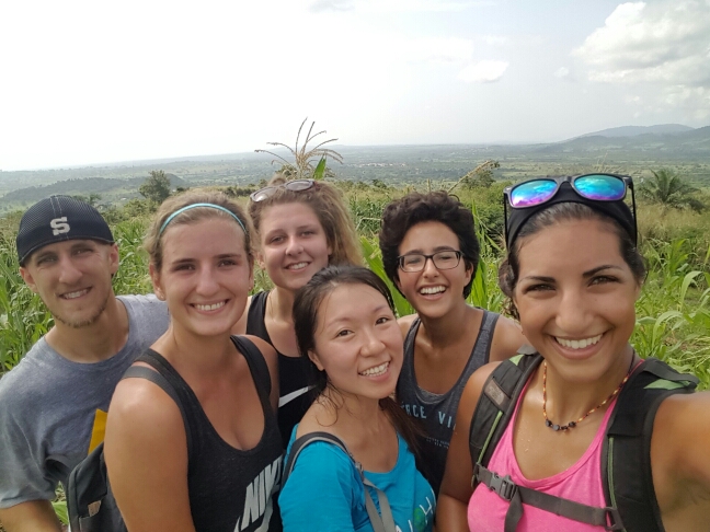
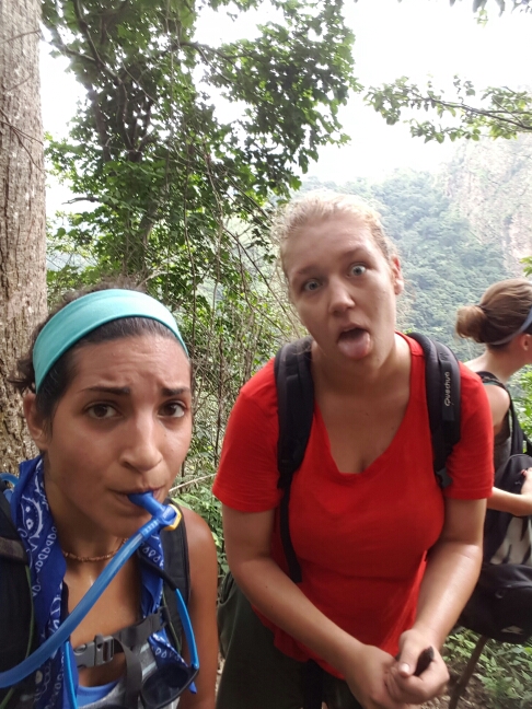
Last weekend, a few friends and I decided to make our own excursion rather than going on the Birthright one because it was just a swimming day at Lake Sevan. We wanted to do something a little more adventurous, you know, because hiking Aragats the weekend before wasn’t enough for us. Carineh found an easy hike between two churches, Saghmosavank and Hovhannavank, and she and I planned to go with one of our other Gyumri friends, Shant.
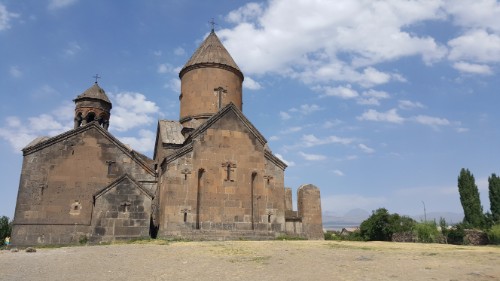
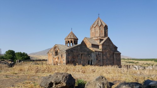
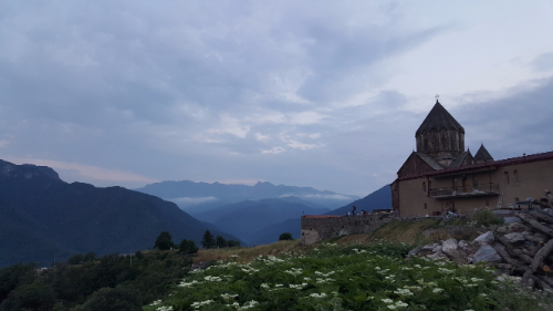
Saghmosavank
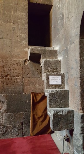
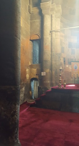
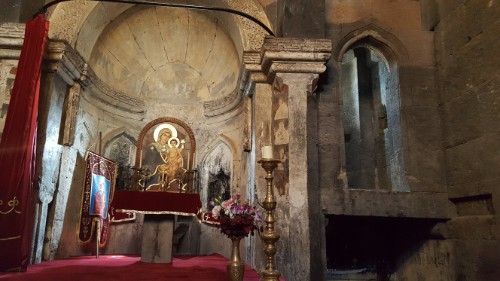
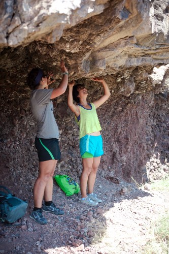
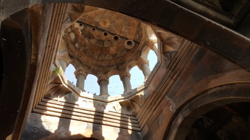
We met “early” in the morning on Saturday… 10AM… to catch a taxi out to Saghmosavank. It was about a 45-minute ride, and when we got there, it looked like they were setting up outside for a post-baptism party. Good timing for us because we made it there before it started and could explore the whole church. Somehow, no matter how many churches we see, there’s always something a little different in each one. This was the church of nooks. Seriously, there were nooks everywhere. Some were high, some were low, some had floating stairs leading up to them, some had no visible means of access. Maybe they used to have a lot of things to store? I don’t know, but as a lover of nooks, I thought it was awesome.
Floating stairs to a nook with another nook underneathNooks on nooksInaccessible nookSo pretty! You might even say… gorges… I know, the joke has been made before, but I’m still entertained by it and that’s all that matters
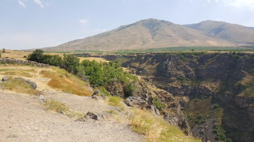
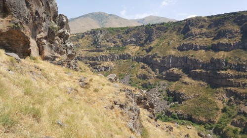
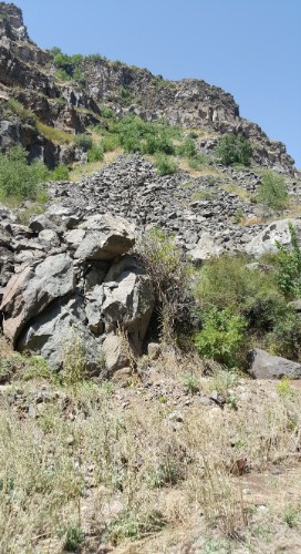
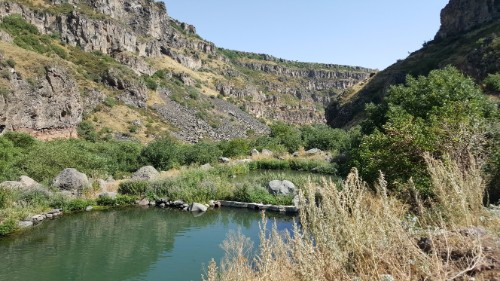
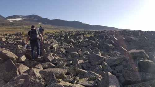
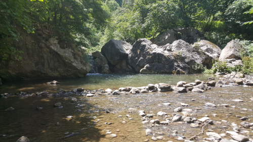
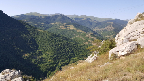
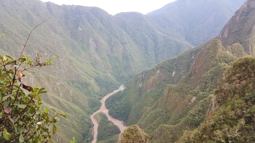
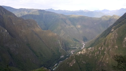
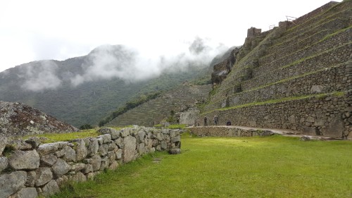
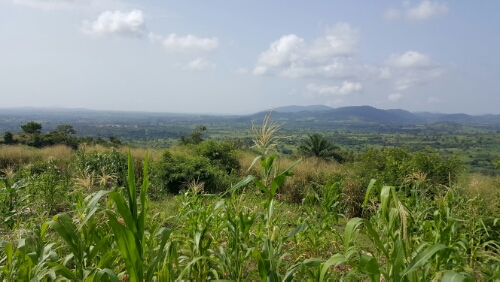
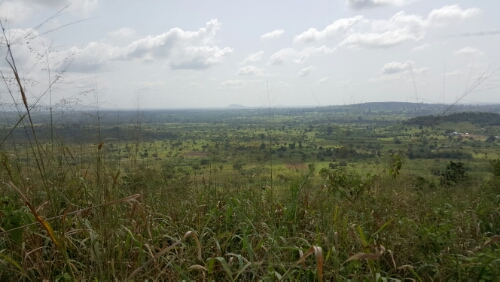
It is also situated in a pretty cool spot. It’s right on the edge of a gorge, and the hike we were planning to do basically just runs along the top of the gorge until you make it to the second church, Hovhannavank, which we could see in the distance. While we were admiring the gorge, we noticed that there was what looked like a decent road at the bottom, and we could hear a river. Then, someone pointed out a vaguely defined path that looked like it led to the bottom from where we were. That was all it took for us to completely ditch our plans and decide to hike down into the gorge instead. Brilliant, except for the fact that none of us were planning for a serious hike and weren’t completely prepared.
The gorge from SaghmosavankSee Saghmosavank peeking out from above the rocks?
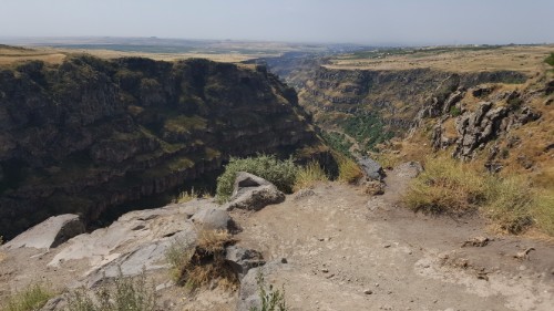
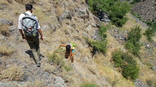
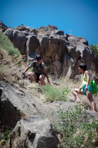
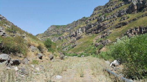
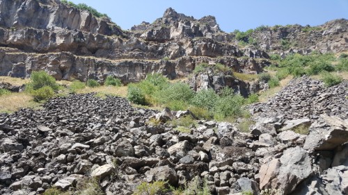
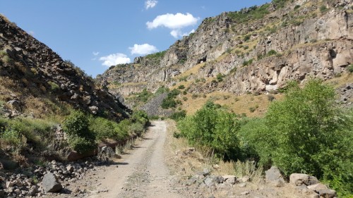
We’re all a little bit crazy, so silly little details like that weren’t enough to stop us. I think it ended up taking about 2-1/2 hours to make it down. The “path” that we saw was not quite as helpful or defined as we originally thought. After about the first 10 minutes, any indication of the best way down vanished, and we were left to plot our route as we went. I wasn’t even completely confident that there WAS a way down, but I had no interest in going back up so that only left one option. It took some gravel sliding, rock climbing, and scrambling, but we made it! And as luck would have it, there was a leak in a water pipe right at the bottom, so we frolicked in the freezing cold water spray before continuing down the road.
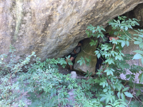
CamouflageThe well-defined path downMaking it up as we goConfused by this random cave that basically looked like someone just glued rocks to the wall and ceilingSlowly…The final stretchYay for roads!
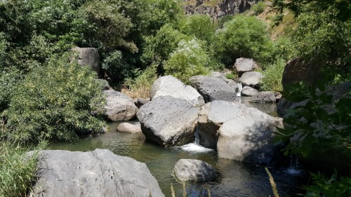
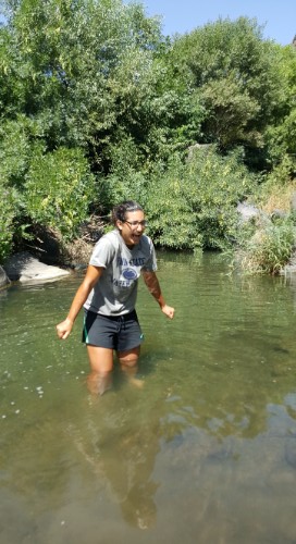
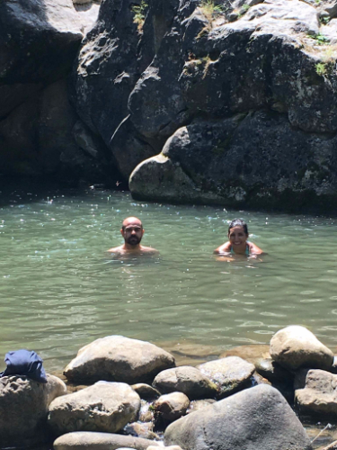
From there, the path was easy. We walked for a bit before spotting a good swimming spot in the river and taking a break to cool down. None of us were prepared for swimming (obviously, considering we weren’t prepared for anything that day), but I don’t even know that I would have wanted to go completely in because the water was frigid. It was enough to just wade up to our shorts and put some cold water on our necks. We also floated our water bottles in the river so that we could leave with some ice-cold water. Genius, I know. One thing we were prepared for was lunch, and after a classic Armenian hiking lunch of lavash (flat bread… kind of like a tortilla), salami, and cheese, we set out again.
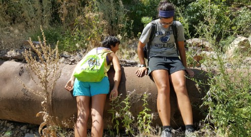
Gorge viewsOur swimming spotThrilled about the water temperatureTaking a minute to cool off on this metal pipe… which I realize doesn’t seem to make sense, but there was super cold water running through, so the pipe was nice and cool rather than super hot from the sun.
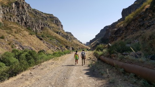
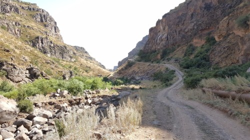
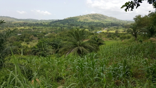
The rest of the walk to Hovhannavank was uneventful. I was worried that we were going to have to hike out in a similar fashion to the hike in, but the road we were on started slowly ascending until we were out of the gorge with barely any effort. I’m glad that we started at Saghmosavank rather than going the other direction! I felt a little bit like an alien when we emerged from the gorge and entered into Ohanavan, the town where Hovhannavank is located. We were weary travelers who felt like we had just trekked across the universe, and it’s always weird entering back into civilization.
The farther we went, the more we found these random swimming holes (with water just as cold as the river)
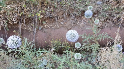
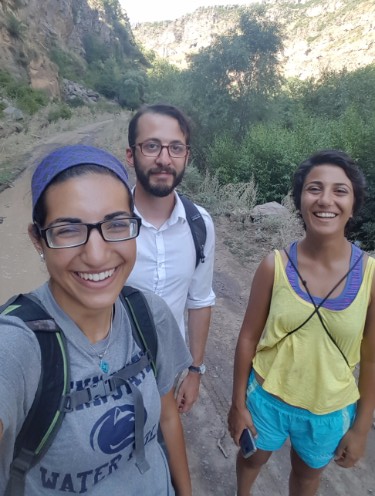
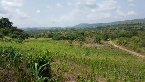
Weird puff ball “flowers”Selfie that I forced everyone to participate inCool, huh?The road starts going up!
So, there’s the story of how our planned 3-hour hike transformed into a 10-hour adventure. Sometimes though, the unplanned ends up being even better than the planned. I don’t think any of us would go back and do it differently… except maybe for bringing more water and wearing more appropriate shoes. It’s fun to know that I have friends here who are as willing as I am to take the road less traveled (or sometimes completely untraveled) just to see where it leads.
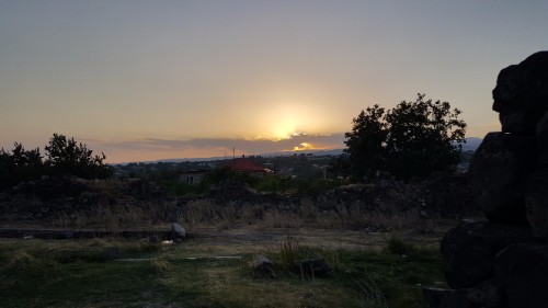
HovhannavankBells. There’s a pulley system so that they can be rung from the groundThe sunset! The clouds around it looked super cool
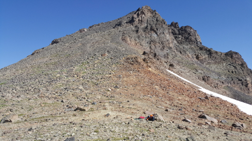
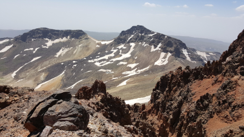
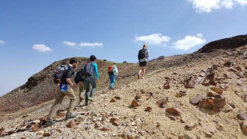
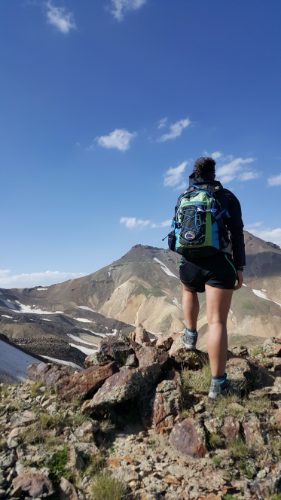
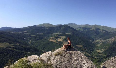
Last weekend’s adventure was hiking the northern peak of Mount Aragats! Aragats was created by a volcanic eruption and is now a huge crater surrounded by four peaks. They’re creatively named the northern, southern, eastern, and western peaks, and the northern peak is the highest point in Armenia at an elevation of 4,091 meters (13,420 feet).
This is what most of the beginning of the hike was, as we made our way past the southern peak
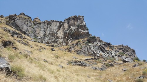
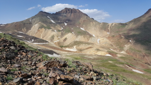
It has also been an important symbol for Armenians since the pre-Christian days and has pagan and Christian shrines scattered around. Many of them are hidden, and according to the legends, some are hidden using methods more magical than simple camouflage. Remember our friend St. Gregory? The one who lived in a pit for years and helped to convert the Armenian king to Christianity in 301AD? Well, he was a VERY busy guy because he also used to climb Aragats pray and at night was guided by a lantern “hanging from heaven”. The lantern supposedly still appears on the mountain, but only the worthy can see it.
Big rocks!
When Sarah and I went on that tour in Yerevan, the tour guide talked about how he and some friends hiked the northern peak, and from that moment, I decided that I was going to do it if I got the chance. I didn’t know at the time if I would find any friends who liked to hike, but I was hoping! Sure enough, about a week into being in Gyumri, I heard about a group forming to hike it, and I signed myself up. I was worried because I hadn’t really planned on doing any serious hiking while here, so I didn’t bring my hiking boots. It was hard to find any real information online about the hike, but from the people we talked to and the information we got from the guide, it sounded like boots would be a good idea. I ended up being the absolute luckiest because a friend was coming to visit Armenia the week before the hike, and she brought my boots with her! I’m telling you, if you ever do this hike, boots or hiking shoes with a hard sole and waterproofing are essential! We even hiked it at the time of year when there’s the least snow, but it doesn’t matter. Trust me.
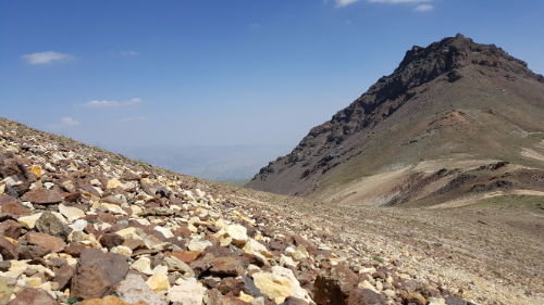
The western peak from the low-ish area between western and southern
We set out from Gyumri at 4:15AM, and yes, that was as miserable as it sounds. My host mom was sure that I was saying the wrong number when I told her when I had to leave the house and then told me to have fun and that she would still be sleeping. The drive to Kari Lake, the spot where the hikes start, takes a little more than 2 hours from Gyumri, and it took us even longer because the taxi drivers needed to take a couple smoke breaks, we hit an animal on the way, and we got stuck behind some farm equipment. Off to a good start.
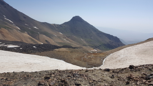
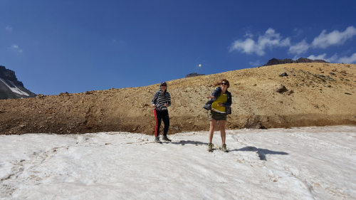
The eastern peak and the first snow patch that we had to cross.
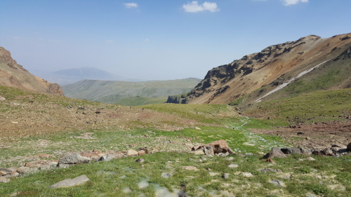
The hike is supposed to take like 8-16 hours or something like that. We were shooting for finishing it in 10, but I had no idea what to expect. Thankfully, we had a guide, so we didn’t really have to know much. I totally didn’t realize how much hiking you have to do to just to make it to the base of the north peak. We set out from the lake, walked past the southern peak, and crossed into the crater through the low-ish point between the western and southern peaks. When I realized that all of the hiking up we had done wasn’t even the beginning of the hike to the peak, I was horrified. We had to hike down into the crater before hiking all the way up again. It took us three hours just to make it to the base of the northern peak.
Making our way down into the canyon
After a break, we started to make our way up. The terrain was basically all rocks. Little rocks and medium sized rocks with sporadic plants. The lack of much plant growth and dirt to hold the rocks in place meant that every step was a potential rock slide. Perfect. This is where the recommendation to bring hiking poles started to make sense. You should bring hiking poles. It’s certainly possible without them but I would estimate approximately 10000x easier/less terrifying with them.
Multicolored stones!
The first half of the hike up to the peak isn’t really that bad. It’s steep, but you can find paths where the rocks aren’t as unstable, and the only part of me that was getting tired was my calves. We stopped to take a break in the least comfortable location (imagine like a 45-degree slope with sharp rocks poking into you) before starting the second half. From that point on, it was way worse. The inclines were steeper, the rocks were smaller and less secure, and the drop offs were mildly terrifying. I’m not afraid of heights, but I am afraid of rock sliding down the side of a mountain. I’m not a fan of feeling like I can’t trust my feet to stay where I put them, so I started going extra slowly. The other people in my group must be half mountain goat because none of them seemed to be that bothered by it (though I’m sure that’s partly because if they were nervous, they just didn’t show it). I let them go ahead of me because, in that kind of situation, I don’t like feeling rushed or like I’m holding people up. I knew that I would make it to the top, it was just a question of the speed at which that would take place.
View from the top!
I think it took us something like 3 hours to make it to the top. Everyone else could have probably done it in 2-1/2 or less, but I was definitely the weakest link in that situation. Fear is a really interesting thing. There are so many things that I’m not afraid of, and there are a lot of similar situations where I would be completely fine. I think that in that case, it was a combination of having a couple foot slips that freaked me out, not wanting to slow down the group (though that happened anyway), and feeling a little unbalanced because of the altitude. I never had the thought that I couldn’t do it or that I should turn around; I just needed to do it my own way and to go at my own pace.
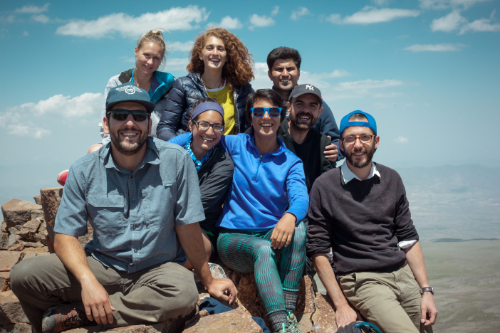
The crew
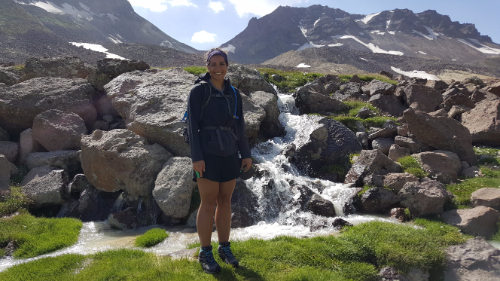
The view from the top was awesome, and the feeling of making it there was even better. I chose to ignore the fact that I was also going to have to make it back down because I didn’t want to spoil the moment. We sat at the top, ate some snacks, and enjoyed the views of the other Aragats peaks and the surrounding landscape until the guide insisted that we start heading back down.
At the top!!!Mid-hike snowball toss
I took my place at the back of the group to avoid slowing anyone down, and the guide came over and offered me his hand. I knew that I could make it down without any help, so the choice was really just between 1) insisting on doing it myself, slowing down the group even more, and feeling terrified the entire descent and 2) accepting some help, moving at a reasonable speed, and feeling slightly at ease. I’m all about doing things for myself, but there’s also no shame in accepting help when it’s offered. I took his hand, and he basically dragged me down the mountain.
Going up again…
At the bottom, we had to decide how we wanted to get back to the lake. The “fastest” option won, but fastest definitely didn’t mean easiest… in this case, it meant steepest. There’s nothing worse than finishing climbing the mountain that you came to climb just to realize that you need to climb two more mountains to get home. We went up and down FOUR times on the hike. The actual northern peak part of the hike was definitely challenging, but if that was all you had to do, it wouldn’t be bad at all. We spent more than half of the total hike time going to and coming from the base of the mountain!
Kind of like paradise…
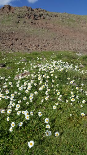
We had one river, two more aggressive uphill climbs, three snow patches, and seemingly endless wildflower spotted fields to make it through before the end of the hike. For all of that though, I was fine mentally. It was just something about the sliding rocks on the north peak that got me into a funk.
Me in the oasisThere she is… the northern peakMe looking much more epic than the realitySo many wildflowers!
When we made it back to the lake, I wanted nothing more than to go to sleep. The whole hike took us about 11 hours and 20 minutes, including our million breaks and my pokiness on the way to the peak. All things considered, I thought that was pretty good. We loaded back into the cabs and made our way down the windy roads down the mountain and home to Gyumri. I got home a little after 10PM and went immediately to bed. I must have looked a mess because my host mom didn’t even try to force feed me when I said I just wanted to sleep.
All in all, I’m glad I did it, and even more, I’m glad that I never have to do it again.
P.S. If you ever find yourself planning to hike the northern peak, talk to me. Hiking boots. Hiking poles. Late summer. Lots of water.
If you’re like me and don’t know much about Artsakh, you might be pleasantly surprised to learn that it’s covered in mountains. If you’re like a certain anonymous dad who I won’t name here, you might sass your daughter on the phone when she exclaims, “I didn’t realize there were so many mountains there!” by responding, “Well, you know, they do call it mountainous Karabakh for a reason.” Not that that’s a true story or anything because what dad would ever say something so rude?
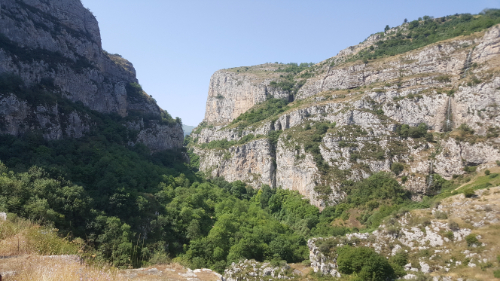
Hunot Gorge
So yes, “they” (you know, the infamous “they” who always have an opinion on things) do, in fact, call Artsakh “mountainous Karabakh”, and with good reason. I would cite some statistic about that except for the fact that I don’t have one, so you’ll just have to take “their” and my word for it (plus my pictures).
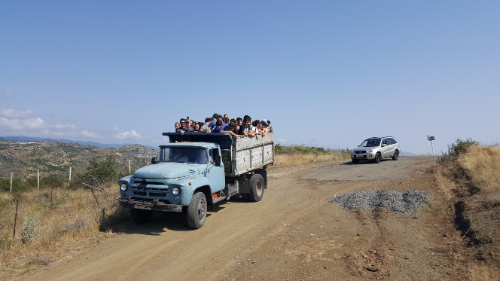
Our transportation to the trailhead, It was about as comfortable as it looks.
We went on a couple of hikes… well, more like “hikes”, aka leisurely strolls through nature. The first one was through Hunot Gorge. There’s a river that runs through the gorge and is crossed in multiple places by questionable bridges that would have gotten someone sued by now if they were in the States. We were with a huge group of people, so the stroll was definitely not the most adventurous experience of my life, but no complaints from me about getting to hang out by a river in the forest! We made it to a kind-of-sort-of swimming area which I wasn’t totally excited about, so a couple of the other volunteers and I asked for permission to go farther on our own. That ended up being the best decision ever because maybe about 7 minutes of walking later (but it was actual hiking that involved some serious inclines), we found a deep swimming hole that we had all to ourselves! The water was frigid, but one of the guys, Arin, and I decided to go for it anyway.
Our swimming hole!
Oh, that was another awesome thing about the trip to Artsakh. You know how sometimes you meet people who you can tell immediately are soul mate friends? Like you just hit it off and conversation and everything is so easy from the very beginning? Arin and I are definitely soul mate friends. He laughs at all of my terrible jokes and makes similarly terrible jokes that I think are funny. You know you’re soul mate friends when no one else is laughing and you can’t understand why not.
Anyway, our swimming hole was awesome and way better than where everyone else was, and once we were completely numb from the water, we hobbled our way out and back to the group.
Pretending we’re not freezingMaking sure I investigated every part of the forest.Some random scenery along the path…Jdrduz views
The second hike was right by Shushi. We hiked to Jdrduz (and if it looks to you like that word is impossible to say because how on earth are THAT MANY consonants in a row, welcome to the world of me trying to learn Armenian) which has an awesome view of the valley and also, shocker, has some historical significance. There are ruins of a fortress built into the side of the cliff which was cool but also seemed a little impractical to me. Why not just build it on top? But that aside, looked much more dramatic in that location. And inaccessible.
Me. On a huge rock. On the side of a huge cliff.
There’s also a village there, Karintak (which literally means “under the rock” because all Armenian village/monastery/etc names are super creative like that), where a battle took place during the Nagorno-Karabakh War. I mean, yes that’s still going on, but we’re talking back in the days of serious fighting, like the early 1990s. It was an Armenian village that was attacked by Azerbaijan to practice for the attack of Stepanakert. Rather than being an easy victory, the villagers and Armenian forces fought back and managed to squash the attack. History aside, the hike had some great views and was even worth the shadeless trek it took to get there.
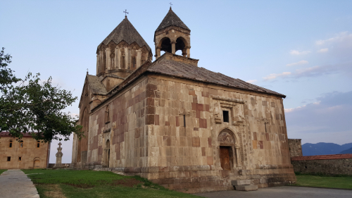
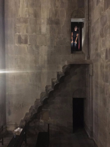
We also visited another monastery, Gandzasar, which had more fantastic mountain views and some awesomely precarious-looking stairs on the inside. I don’t know any crazy stories about this one, so I’ll let the pictures speak for themselves. I’ll just leave you with the fact that the name Gandzasar means “treasure mountain”, and that is just about the coolest name for a monastery in the history of ever.
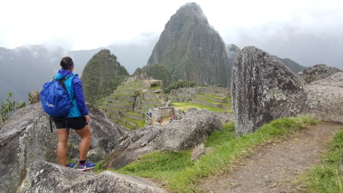
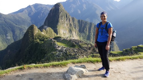
When my Machu Picchu day finally came along, I had mixed feelings. On one hand, of course I was beyond excited to visit the place I had been looking forward to seeing ever since I decided to go to Peru. On the other hand, it’s nice to have really exciting things to look forward to, and sometimes the “looking forward” is almost better than the “actually doing”. That probably doesn’t make any sense… let me try again. When you finally go somewhere or do something that everyone has raved about, aren’t you ever nervous that the idea of it will be better than the actual thing? That it’s been talked up so much that the reality can’t possibly match your expectation? There was a part of me that feared that. Like maybe I’d find myself facing one of the wonders of the world and manage to not feel impressed.
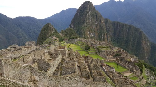
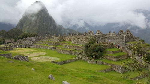
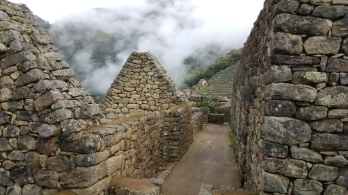
When you walk in, this is the first view you get of the ruins!
SO COOL SO COOL SO COOL!!!
Lucky for me, the experience of visiting Machu Picchu is partly indescribable. No matter how much people told me about it, they couldn’t convey the wonder I’d feel when seeing the huge expanse of beautiful ruins set against a backdrop that’s straight out of a fantasy. No matter what I write about it, I promise you that I can’t even begin to do it justice. Even without the air of mystery that surrounds the history of Machu Picchu, it’s baffling. When you add in the questions about how it was constructed, what everything was used for, and where everyone disappeared off to, it becomes even more marvelous. There’s nothing better than a good mystery!
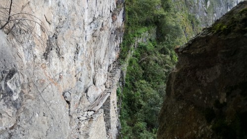
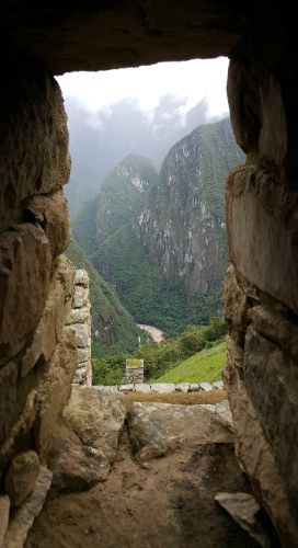
Along the path to the Inca BridgeView from the Inca Bridge hike. Still a little foggy (because I was there at 7AM), but still spectacularThis picture is confusing and kind of seems like it should be rotated… but this is right. I promise. The Inca Bridge is at the bottom of the light rocks on the left. See the gap in the rock path and the boards that are placed across it? The Incas could move the wood to block off this entrance into Machu Picchu if they ever needed to.On my hike back to the main part of the ruins… I just couldn’t stop taking pictures!
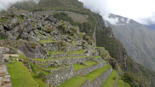
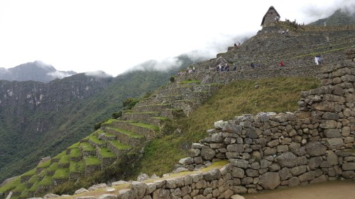
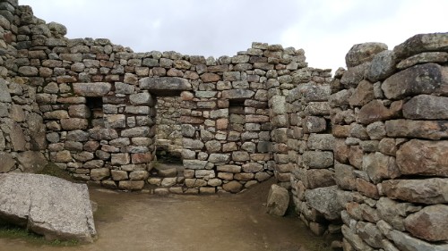
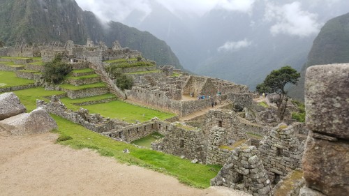
Archeologists have concluded that the site was an estate for one of the Inca emperors, which means that it was basically a full city on top of the mountain. About 1000 people could live there, but they think that 5x that number was required to build it. Also, they’ve only recovered the skeletons of about a quarter of that. The stone is a type of granite that was taken straight from the site, and they don’t use any mortar to hold it all together.
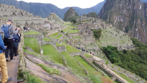
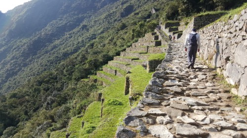
Question #1: How was it constructed? The site is way bigger than I realized. I think that’s what everyone says after they go, and even though I’m telling you that right now, you’ll say the exact same thing if you go. There’s the main part of the town that you always see in pictures (which even that is bigger than you realize… all of those pictures are taken from quite far away), but then there are terraces EVERYWHERE that were used for growing crops. Carving out the terraces, cutting, moving, and putting together the millions of rocks, and building a town of that size must have taken an eternity. The methods they used for cutting rocks so precisely and moving the big ones around are still somewhat unknown. It would be an amazing feat even if it WASN’T on top of a mountain, but it is. Oh yeah, I didn’t mention that you have to take a half hour bus ride (or a 1-1/2 hour hike) up the mountain from the town. It is not located for ease of access.
There are also pathways that wind through the surrounding mountains. There’s no way the full extent of them is even known because at this point, the unexcavated ones are buried under almost 450 years of plant growth.
Let me just say that there’s a reason why one of the theories of its origin is aliens. It’s so fantastic that aliens start seeming like a realistic explanation.
Okay, this one was a mini-tripod/self-timer picture. There was no one around to take it, really! I’m standing in the quarry area.Like, does this even look real?
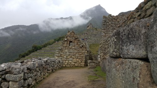
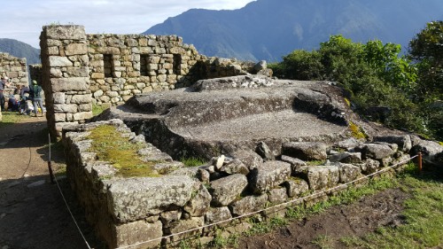
Question #2: What was it used for? Archaeologists have general ideas about the site as a whole and the functions of some of the different buildings, but for the most part, it’s just speculation. If you hire a guide while you’re there, they’ll tell you all sorts of things about what this rock means and why that room has 5 windows and 4 niches, but the truth is that not much is known for sure. There are a lot of assumptions, but there are so many questions that it makes you wonder how much you can trust them.
I decided to skip the guide and take my sweet time wandering through the buildings, making up my own stories as I went. I did have a guidebook which was nice because it helped to draw my attention to some of the more interesting features, but I still got to move at my own pace and just soak in the wonder of it all.
Did I already take this picture? Yes? Ehh… I’ll take it again just in case.
Ruins and mountains, ruins and mountainsThis stonework though…
Question #3: Where did everyone go? When the Spanish invaded in the mid-1500s, they took out much of the Inca civilization. However, they never made it to Machu Picchu. Its existence wasn’t brought to the attention of the general public until 1911 (it was looted by a few German explorers, and some local farmers knew about it and were even farming on some of the terraces prior to that year). So what happened to all of the people? Did they all go to fight in other locations? Did they just die out eventually? Smallpox is one guess. Imagine for a second if whatever did happen hadn’t, and there were still people living there when it was stumbled upon. They certainly had the food resources and planting strategies that they needed to survive. How cool would that have been?
The view from my window… I wish!
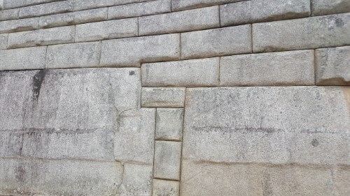
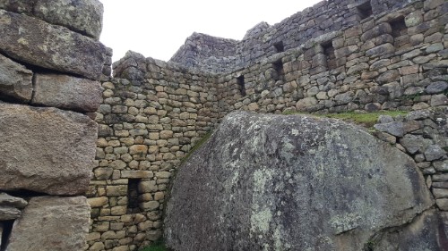
My thought about every picture: “this is kind of the same… but kind of different so yeah, I’ll post this one too.”How epic is this?The more important buildings had more precise stonework, though none of the buildings used mortar so they were all pretty darn precise. These though… How on earth do you get such tight joints with such massive rock pieces?
Anyway, those are the three main mysteries that I allowed myself to mull over as I wandered around and tried to make sense of it all. I didn’t start out wandering the ruins though. First, I walked up a pile of stairs to look over the site and get that iconic Machu Picchu view. From there, since I was already halfway up, I did two of the hikes that are included in the entrance ticket, one to the Sun Gate, where the people who hike the Inca Trail enter the site and watch the sunrise, and the other to the Inca Bridge, a piece of wood terrifyingly placed across a big gap in the rock path that winds around the mountain. You can’t walk across it anymore because someone fell off and died, and after seeing it, that doesn’t surprise me one bit. More like why did they ever let anyone walk across?
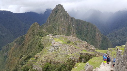
The classic Machu Picchu picture. I actually asked someone to take this, rather than using my usual mini-tripod/self-timer technique.A cool view of the terraces and the beginning of the hike to the Sun GateSome ruins along the Sun Gate path
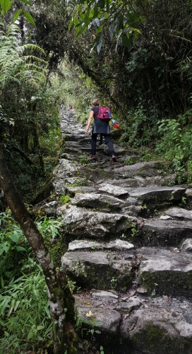
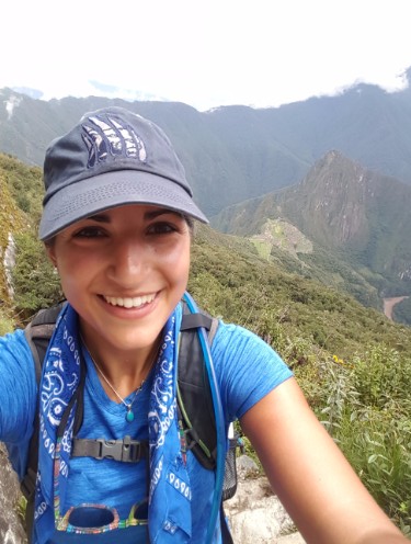
My big hike of the day was up Machu Picchu mountain. Nothing at Machu Picchu, including the place itself, is called by its Inca name. No one knows the Inca names. Machu Picchu is the Quechua name for the mountain next to the town, so when it was “discovered”, the explorer just called it by the same name. All of the buildings and such that are named were named by him. So like I was saying, everything is complete speculation. Anyway, I bought a separate ticket to hike Machu Picchu mountain, one of the two mountains next to the site. The other one, Huayna Picchu, is shorter, but the hike is more of an adventure with ladders and precarious ledges. I decided to skip the death-cheating hike and save it for if I ever go back with a hiking buddy.
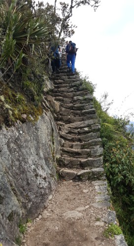
The hike up Machu Picchu mountain is just hundreds and hundreds of stairs. And more stairs and more stairs and these stairs that are so steep you probably want to use your hands too. Every time you turn a corner, you’re faced with another dead-end wall of rocks. Oh wait. Those are stairs. About 20 minutes in, I found a friend! She and I bonded over our pain and the fact that we were moving at similar speeds. I was thankful to have someone to struggle through it with me. The only thing worse than a super intense hike with minimal oxygen is a super intense hike with minimal oxygen where you don’t have anyone to complain to. In hindsight, it was a definite mistake to do the Inca Bridge and especially the Sun Gate hikes before the mountain. I basically set myself up for failure because my legs were already tired when I started.
My hiking buddy speeding ahead on the Machu Picchu mountain hike
MORE STAIRS???!!?? Yes. The answer is always yes.
Pretending I’m not dying
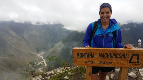
But I eventually made it! This is after about 45 minutes of relaxing at the top, which is the only reason why I’m smiling and not bright red.
Anyway, I’ll spare you the quad-killing, air-gasping details of the hike and just say that it was an hour and a half of me strongly considering turning around and being fairly certain that the mountain was never going to end. I got to the top just before the clouds blew in and completely obstructed the view of the ruins. Can you think of anything worse than finishing that horrible hike and then not even being about to appreciate the view? I had about 20 minutes before we were sitting in a cloud. That’s all I needed though. I found a nice wall to sit on, ate some pretzels, and soaked in the awesomeness.
Everyone gets booted off the mountaintop at noon, so I headed down through the clouds, a moment of rain, and back into the scorching heat. They say that you need to prepare for every type of weather when you go to Machu Picchu, and it’s true. I went in the morning wearing a sweatshirt and pants. I took my sweatshirt off early and changed into shorts on my hike to the Sun Gate. At the summit of Machu Picchu, it was freezing and drizzly, so I put my rain jacket on. Once I hiked down a little, it was hot again. Then, in the afternoon as I was wandering the ruins, I must have put on and taken off my rain jacket at least 5 times as it rained and stopped and rained and cleared up and rained again.
See that mountain enshrouded in clouds in the middle/right of the picture? It looks like the top is actually cut off in this picture too. Yeah, that’s the one I climbed
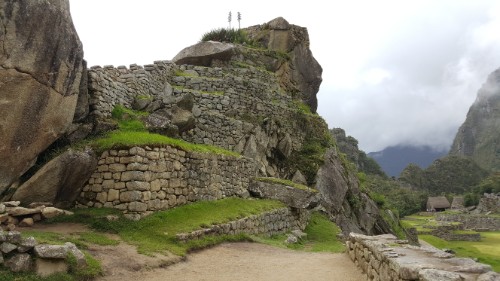
Me and my hiking friend with a very important rock that supposedly looks like some important animal but actually looks just like, well, a rock.Remember, imagine thatch roofs!I think this is hilarious. There are a bunch of places where there’s some ginormous rock that I imagine the Incas looked at and said, “LOL I’m not tryna move that!” (loose translation) So instead, they just left them in place and built the walls around them. The way they fit everything together is amazing no matter how many times I think about it.
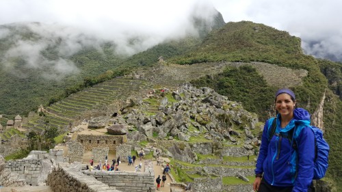
I spent the last couple hours of my visit exploring the ruins. I reencountered my hiking friend, and we had fun walking around and making things up about the different ruins and their uses. Sometimes it’s nice to have a friend! It was especially perfect because she and I were on the same page about taking our time and wanting to see everything. Sometimes things work out so much better than you could have imagined!
After finishing up at the site and heading back down the mountain to the town, we considered meeting up for dinner and ended up just showering and laying immobile on our beds at our respective hotels. I could have guessed that was what was going to happen.
Just a few more for good measure…Can you imagine having this view every day?But seriously could it be any cooler? Sorry I can’t express myself any better but I’m sitting at my computer, days later, still geeking out over how amazing the whole thing is.
Yesterday was another long and tiring day! I started writing this last night, but I was doing the whole fall-sleep-and-write-nonsense thing, so I figured that finishing it would be better left to today.
Wednesdays are usually kind of chill because we don’t have any classes, but yesterday was definitely the exception. The big activity for the day was finishing up the soldering and antennae on the C3 robots to get them ready for class today. I got started in the morning and had only finished the soldering and antennae bending by lunchtime.
The ring-passing game
The afternoon was completely booked by a birthday party for the people with January/February birthdays. The kids get to drink soda and eat candy, and there were some pretty hilarious activities. They started off with some races where each person on the team had a straw in his/her mouth, and two teams raced to pass a plastic ring from straw to straw without using their hands. After that, they did a relay race where the team members had pass a balloon over their heads and through their legs, and then afterwards, the front person waddled their way around a chair while holding the balloon in between their legs. The process repeated until the entire team got a chance to waddle.
Balloon hops
It was fun watching the kids play the games, but my favorite part (besides the cake, of course) was the dance party at the end. Ligia explained the rules: you dance around with the music while it’s playing, and once it stops, you freeze like a statue. The real fun began when the kids started to be creative with their frozen poses, the girls usually opting to hug each other and the boys pretending to fight.
Getting creative
The birthday crew After the party, we had a little down time to work on our robots, until about 5:30 when we left for a staff bonding excursion! I wasn’t sure about going because we still had a lot to do with the robots, but I’m so glad I did! It was cool getting to spend time with everyone outside of work, plus the excursion was great. The wrong way up
The right way up We went to Las Salinas in Chilca to do a group hike. The first part of the hike is pretty short, and you make it to the top of the first hill where there’s a huge cross and a nice view of Chilca. There are two ways to get there: the way you’re probably supposed to go, with a bunch of switchbacks, and the way we went, with an aggressive incline (I’d guess 60 degrees) and shale-type rock pieces sliding around. I thought the view from there was cool, but then we kept going! We went up more super-steep hills until finally reaching the top… where there was a random rock wall. I was confused about why it was there until we got closer and I realized that it wasn’t just one wall, it was a square of rock walls, and inside was a rock circle with one rock in the middle. Weird. The explanation of what it is makes it no less weird: aliens. The front of the Chilca pamphlet. Alien.
Chilca is obsessed with aliens. The tagline of the city is “Chilca es de otro mundo” or “Chilca is from another world”. There are a bunch of reports of UFO sightings, and the Chilca marketing people have run with the idea, making it the center of their marketing material. The pamphlets describing the attractions in Chilca feature pictures of a red-orange alien participating in activities from horseback riding to bathing in the lagoons that supposedly wield “energy from another galaxy” and have various healing powers (here’s the website).
The rock shrine
Julie, me, and Debbie
Vanessa said that people come from all over the world (alien-enthusiast types of people) to do rituals or something to communicate with the aliens from inside the rock shrine. There’s some claim (by a Peruvian “UFO contactee” Sixto Paz Wells… if you’re interested, here’s a weird interview with him) that they’re drawn here because Chilca is on a geological fault and the released energy creates a magnetic corridor that their ships use. Or something. I’ll let you form your own opinions about that.
Whatever the reason for their existence, they’re impressive. The walls are made from rocks just stacked on each other without cement to hold them together, and they aren’t cut into specific shapes or anything to make things easier. Whoever put that place together had a lot of time on their hands.
Anyway, the view from the alien communication square was even better than the first lookout. I’ll just let the pictures speak for themselves.
Check out the mountains in the background! Super cool Debbie and I still had hours of robot work to do after getting back which is why I was falling asleep last night while writing. We finished the antenna connections around 10:45PM… ugh. But now they’re finished! And the hiking break was well worth the time.
Today wasn’t extremely eventful. We had our last period with Vanessa’s class and tried to wrap up their city and robots. It mostly went fine except that one robot started smoking when we put batteries in… ehh well, we’ll figure it out. That’s a problem for tomorrow!
Welcome to Day 2 of Lara’s Last Weekend of Fun! This was an incredibly ambitious day… see the amended schedule below (after the postponement of last night’s lip sync battle and some other things that I didn’t get to).
SATURDAY
Hike the mountain that we hiked before (by the farm)
Hike the mountain by the clinic
Lunch
Go canoeing on the Volta
Lip sync battle
Bonfire and eat s’mores
Dance party
Stargaze
And: carry water on my head, catch a chicken, picture with a baby goat
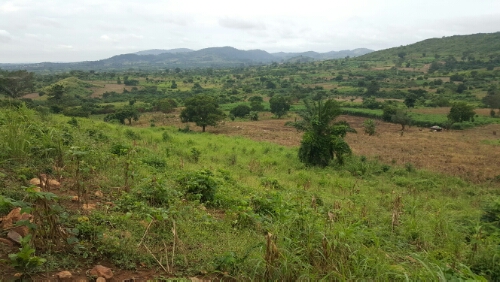
View from the top (once we finally made it)
We left around 9 to begin our trek to farm mountain. Avy, Anna, Yara, Amy, Nick, and I went, and the only two of us who had been there before were me and Avy. I knew that I didn’t remember the way perfectly, but I had some confidence in my sense of direction and didn’t recall getting there as being too complicated. The only thing I was nervous about was finding the path to get up the mountain, since we failed to find that the first time. I did have a picture of a landmark tree to help me find the way again though, so I thought we could manage.
The way to the base of the mountain was mostly uneventful. We made one wrong turn, but I quickly realized the mistake and turned us around. There were other parts that I was maybe 70% sure about… For those, I just acted like all was well and kept marching forward with feigned confidence until I eventually saw something I recognized and was closer to 90% sure again (realistically, there was never any chance of 100% certainty). Eventually though, we made it! The next issue was just finding the footpath to the top…
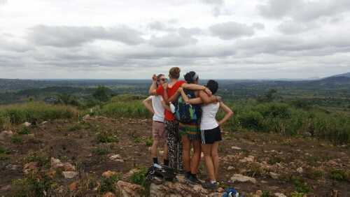
Nick, Anna, Amy, Avy, Yara, and me
A word of advice: when choosing a landmark to help you find your way in the future, pick something that will look the same at that future date as it does in the present. Yes, I know this sounds like common sense. Yes, I did know this when I picked my landmark the first time. No, I didn’t do a very good job of following my own advice. I picked a tree that was about 5’ tall and looked dead. When we went the first time, there were empty fields around it, and it stuck out like a sore thumb. Fast forward two months anddd… Me and Nick!
Corn grows quite quickly, did you know that? It gets pretty tall too. Like 7 or 8 feet within a couple months. Another fun plant fact for you: there are some trees here that can look like they’re completely dead but then they start sprouting new growth! How cool! Do you see what I’m getting at? Yes, I picked a “dead” tree in an “empty” field 2 months ago, and today it was a somewhat living and green covered tree with a field of 8’ corn stalks surrounding it. This might shock you, but we somehow managed to miss my fabulous landmark and walk right by. Me and Avy, falling off of a rock
Twenty minutes of wandering later, Nick shouted out that he thought he might have found the path, and sure enough, he had. I located my worthless landmark tree on the way up and realized the problem. Oh well! Won’t make that mistake again! From there, the way was easy. In 15 minutes, we were at the top, looking over Frankadua and the surrounding towns.
We hung out and wandered around for a bit until everyone was ready to continue our journey to clinic mountain. That mountain (disclaimer: I keep calling these “mountains”, but they’re barely more than hills. This is my story though, so I can say whatever I want) isn’t as off-the-grid as the other one. There’s a hotel and restaurant on top and a car path to get you there. Walking up took probably less than 10 minutes, but the views on the way were nice enough to make me happy we did it. At this point, everyone was out of drinking water and ready to collapse, so we chilled on top for a couple minutes and then headed home. Walking up clinic mountain
Lunch was ready soon after we got back, and the next thing on the schedule was supposed to be canoeing on the Volta. I decided to cut it because I had some things to organize, everyone was exhausted, and I was more concerned about people being rested enough to participate in all the nighttime activities. I’m okay with not doing it though. There were two original reasons why I was into the idea: 1. I wanted to canoe in Ghana and 2. I wanted to see the views on the river. I put it on my list before we canoed on Lake Bosomtwe and got cool views from the walk over the bridge and the dam, so now, I don’t feel like it’s something I HAVE to cross off.
Instead, I spent the afternoon pulling myself together and saying some goodbyes. Everlasting and I met up one last time, and it was surreal. We met in the market, exchanged gifts/letters, said goodbye, shook hands, and that was that. I started crying again on the walk home… how am I supposed to wrap my head around the fact that most of these goodbyes are goodbye forever? I’ll tell you how – by pretending that they’re not. Like maybe someday I’ll come back to Ghana and Frankadua and see these people again. I know it’s unlikely, so I take the 1% possibility and count that as definite. Otherwise I think I would lose my mind.
**to be continued**
We went on an adventure today! A couple weeks ago, we were walking to the farm, and Amber and I decided that we were going to climb one of the random mountains we could see in the distance. Since we stayed in Frankadua this weekend, today was the day! We asked the rest of the house if they wanted to join us, but the two of us were going to go either way. The group ended up being Amber, Nico, James, Avy, and me, plus one of James’s friends, Peter, and a kid, John, who James enlisted to help us get there. I’ll admit, I was a little annoyed at first that he didn’t trust us to make it on our own, but it ended up being helpful to have them there.
Our “mountain”. I’m not going to say that it was tall, but I promise you that it’s taller than it looks in this picture.
They let me lead the group to the mountain because I was determined for it to be an adventure and not just a boring hike where we followed blindly. I got us to the base of the mountain and let John take us from there. We went up the most ridiculous way… basically just ducking under tree branches and walking through tall grass and hoping for the best. I don’t think he had any idea where we were going, so he just kept walking uphill. We really should have brought a machete with us.Mountain top selfie
When we finally made it to the top, we found a farmer working on his field on top of the mountain. At that point, I was thinking, okay, there’s NO way that farmer comes up the mountain every day using the route we just took. Sure enough, there was a completely clear path from his farm to the base of the mountain. Perfect. At least we had a good way down!
The view from the bottom
We weren’t finished though because there was still no view. Nico was convinced that there was no view, so we should just turn around. The trees were too tall and they blocked everything. I was determined to prove him wrong (as if I had any control over it) and was planning to just keep walking until we saw something cool.View from the top!
Luckily, the farmer was there to point us in the right direction, and we climbed up a little higher to get an awesome 200 degree view of the landscape. It was beautiful. I was so happy that there was actually something to see at the top, partly because it proved Nico wrong and partly because it made the trip so much better. It really could have gone either way since it’s not like we knew anything about the mountain when we picked it. We hung out and enjoyed the view for probably 45 minutes before doing the world’s easiest hike back down. Hooray for a successful adventure!
Dysfunctional attempt at a group picture
The rest of the day was nice and relaxing. I cleaned a little and napped and before I knew it, the whole day was gone. That seems to happen to me quite often. Where do the hours go? Anyway, time for bed. Relaxation and renewal weekend continues tomorrow!
Today. Was. Exhausting. We woke up at 4:45AM to get ready to leave for Wli Falls at 5:30AM. It is made up of an upper falls and lower falls and is the highest waterfall in Ghana and West Africa. To get to the lower falls, it’s a flat 40 minute walk through the forest. To get to the upper falls, it’s a 2-3 hour trek up and around a mountain. We planned to do the upper falls hike, so we wanted to get an early start.
Us in the tro tro on the way there. Amber and me in front, Nico and Alex (Gold) in the middle, and Jordan (Gold) and Emma (Gold) in the back
From our house, we had to take a tro tro to Hohoe (ho-hwey) for about 2.5 hours and then transfer there to a tro that would take us to Wli (vlee) for about another half hour. The rides were brutal. The roads as we got farther away from Frankadua got worse and worse, and the tro drivers were swerving all over the place, trying to avoid potholes. There were some areas where the paved road randomly turned to dirt road and then 1km later changed back to paved. Like what? I was planning to attempt to sleep, but we had 4 people on a bench seat meant for 3 the entire way there. Between that and the roads, it was hopeless, even for me.
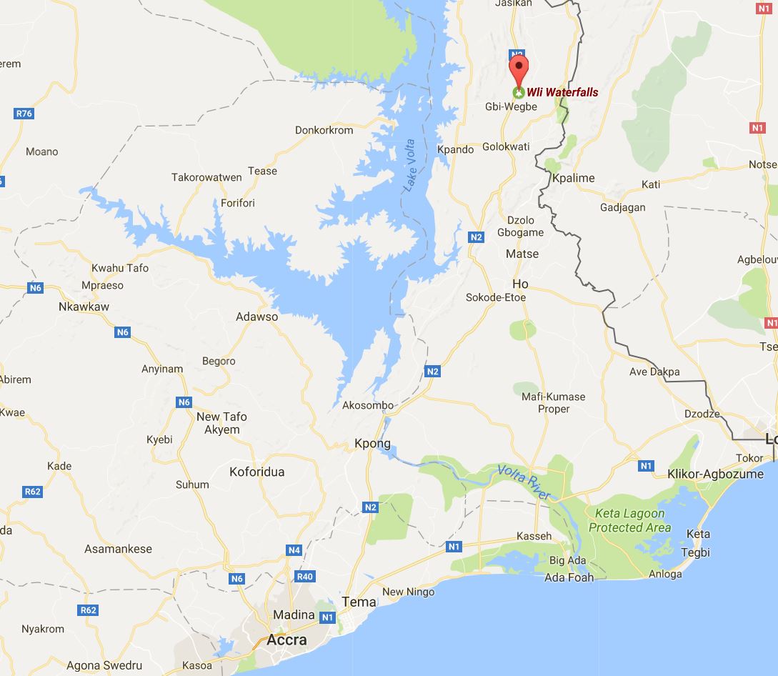
We had to go north to get to the waterfalls. We started about 30 minutes north of Akosombo on the map.The view walking towards the visitor center
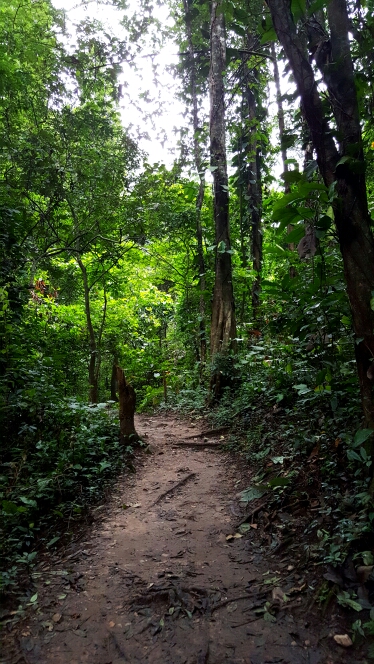
We finally made it to Wli around 10AM. I ate a granola bar and was ready to get going, but some of the group wanted to eat. By the time we actually hit the trail, it was about 11AM. The first part of the hike was no big deal… just a relatively flat stroll through the forest. Then, our guide stopped, gave us all hiking sticks, and pointed up a hill that was probably a 60 degree incline. Oh.
The path before the crazy incline started
Getting into the hiking groove was rough, but once I got going, I felt pretty good. The first 45 minutes or so were really steep. There were parts where I put my hiking stick down and basically just rock climbed instead. It was tiring, but everything was going totally fine… until it started raining. When I say raining, I mean POURING. It went from zero to downpour in a matter of seconds. We could literally hear the rain coming through the forest towards us.
Me and Amber during a much needed break, pre-rain
We were probably ¾ of the way to the waterfall view when it started raining, and we decided to keep going. I took a minute to wrap my rain jacket around my backpack in a weak attempt to keep my stuff dry, and I gave my phone to Nico to put in his bag because he had an actual rain cover for it. My clothes were soaked through in a matter of minutes (and probably my backpack too). Eventually, we made it to the falls, took a minute or two to enjoy the view (as much as was possible in the ongoing downpour), and turned around to head back.
There’s only one way to describe the hike back… it was horrible. The trail was so steep and muddy, so what would have already been a slow hike got even slower. I just kept focusing on my next step and making sure that I had my walking stick and one foot firmly planted every time I moved the other foot. I only slipped once, and it wasn’t a big deal. I caught myself on the way down and was totally fine.
A sneak peak of the upper falls, before the downpour when I put my phone away
We had some real scares though with a few other people in the group. One of the guys from Gold slid probably 3 meters off the side of the trail and luckily only ended up with some muddy pants. Amber had an even more terrifying fall and was stopped by sheer luck (and a conveniently placed tree). She ended up with some bad scrapes and bruises, and we still had probably 2/3 of the hike back left. I don’t want to think about how terribly the hike could have ended, but thank goodness we were all mostly okay.
When we got back to the upper falls trailhead, we were all SOAKED. We went to check out the lower falls because it was only about a 5 minute walk on flat ground. After being there for a few minutes, I was ready to head out. I just wanted to be home and in dry clothes.
My neck pillow helmet… All it took was one solid head collision with the ceiling to make me not care about looking ridiculous
We trudged back to the parking lot, attempted to dry ourselves off (I luckily had a semi-dry towel and some semi-dry pants), and found a tro tro back to Hohoe. The ride home was miserable because it was super bumpy again, and we were all still damp. My feet were completely soaked, and about 5 minutes into the ride, I had to go to the bathroom because I drank so much water on the hike. So just imagine 3 hours of extreme discomfort, complete with a couple of head collisions with the roof of the tro.
I can barely move, my eyes are starting to close, and I can’t think straight anymore. That means it’s definitely time for bed… hopefully I won’t be immobile tomorrow!