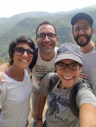
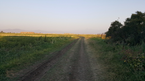
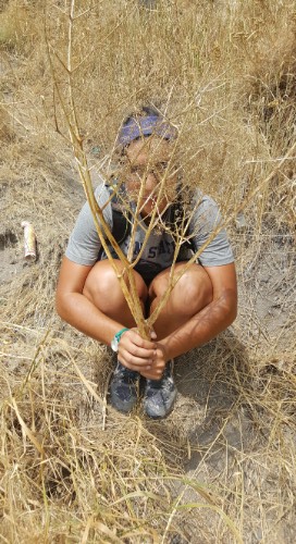
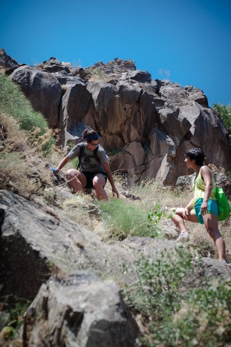
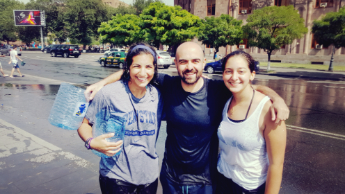
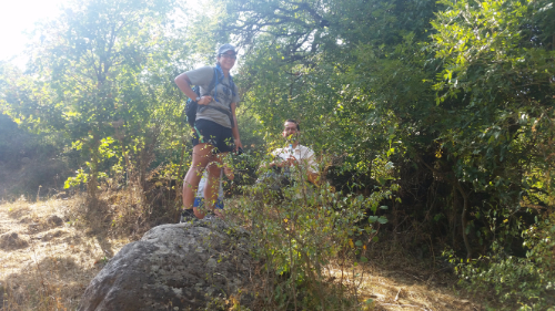
Freedom! Jocelyn, Julie, and I walked out of EA and practically skipped down our street towards the bus stop, ready for our weekend of fun to commence. Living and working within the walls of EA can feel a bit containing, and sometimes, even just stepping out onto the smelly, dirty street is enough to make you feel liberated.

We were headed to Ica, a town about three hours south of Chilca by car. Julie said the bus took five hours, and I was foolishly optimistic when maps said it would only take three. I thought, “So maybe it’s four on the bus. How could the bus add TWO hours to the time?” Well, I still don’t know the answer to that, but I can confirm that it took the full five hours to get there. The bus wasn’t very crowded, so we stretched out in the back row and made the most of it.

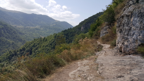
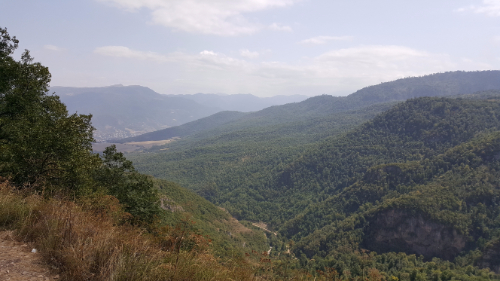
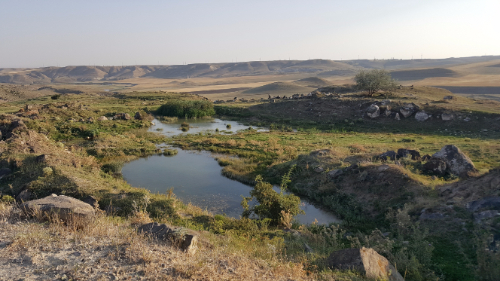
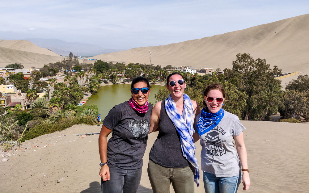
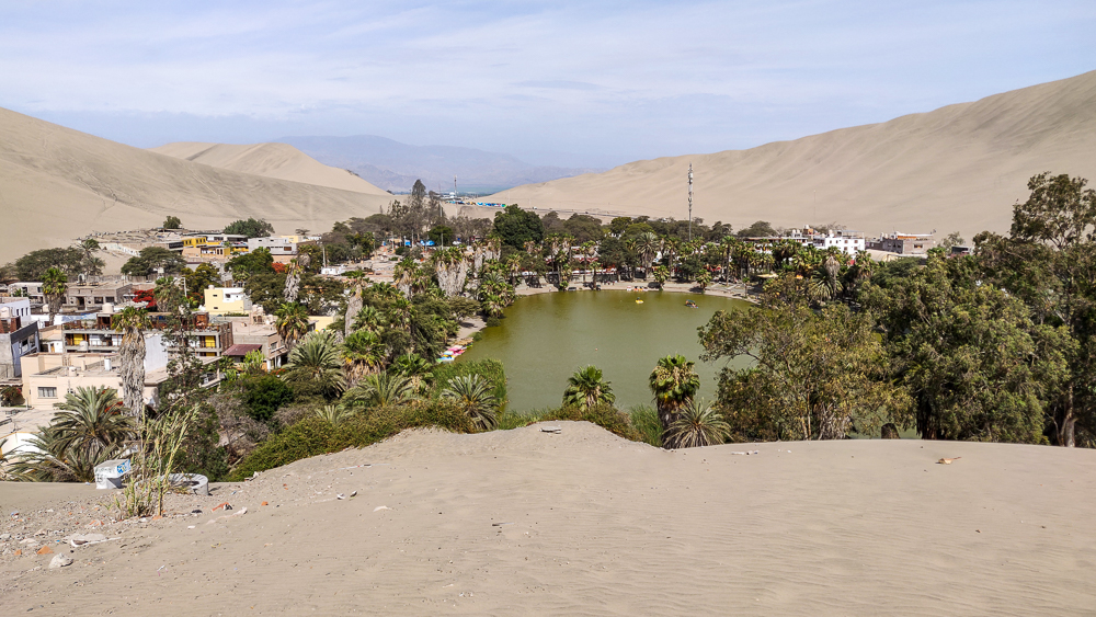
By the time we reached the bus station in Ica, we were exhausted. I think that the definitive crushing of my hope for a shorter bus ride really took it out of me. We decided to walk the 15 minutes to our hotel to stretch our legs out, and walking through the streets of Ica, I felt like a small-town girl in the big city. I don’t know why exactly, but I think that in my mind, Peru only consists of Lima and Cusco and then tiny towns like Chilca. Ica is by no means big, but it is definitely a city. The streets were bustling, and it made me feel like I could really enjoy living in Peru if I was somewhere like that (aka a real city) instead of in the boonies.

This is the Catedral de Ica, right off the main square. It was damaged in a nearly 8.0-magnitude earthquake in 2007, and the restoration work is still “in progress”… but probably mostly waiting for more money.

Saturday was our big day of fun! Julie had been to Ica before and had done a day tour that included a bunch of little stops and then, the main event, a dune buggy ride and sandboarding. This was the primary motivation behind our trip. I had learned only a few months before arriving in Peru that sandboarding was a thing there (thank you, Instagram), and when I committed to serving at EA, I decided that was my sole tourism goal for the year. And so, with time running out, off to Ica we went!

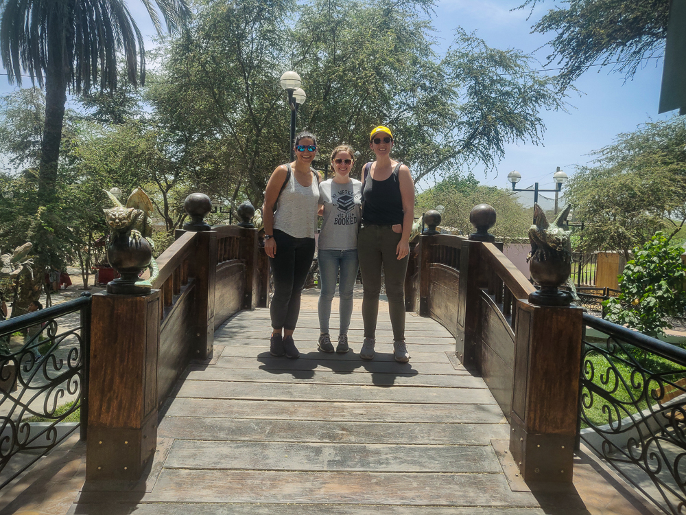
Our strategy for finding a tour was to go to the main square. That was the extent of the plan, and that was all we needed because the moment we crossed the street into the square, a guy came over trying to sell us a tour. Annoying, unless that’s what you’re looking for. We went to the tour office, checked out what was included, signed up, and paid 35 soles each (about $11). Does an $11 day tour sound too good to be true? Well, it was in Spanish… but we knew that going in. I wasn’t too concerned because for me, everything beyond sandboarding was secondary.

Casual dinosaur sighting on the streets of Ica… Also, I made a silly mistake and had gunk all over my phone’s camera lens until halfway through our tour day… so excuse the blurry pictures and give credit for any not blurry ones to Julie and Jocelyn who contributed their photos to the cause (thank you!)

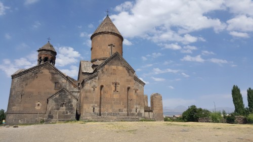
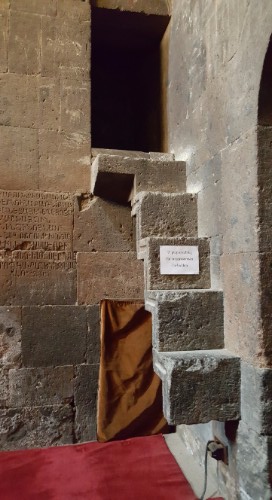
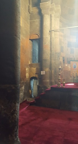
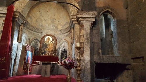
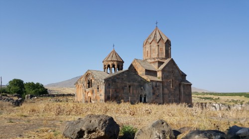
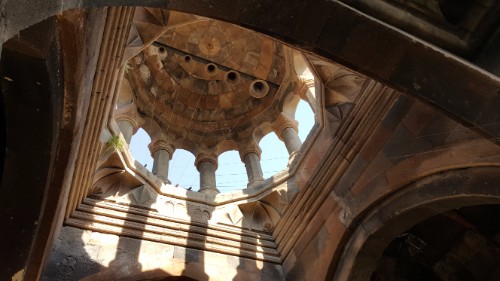
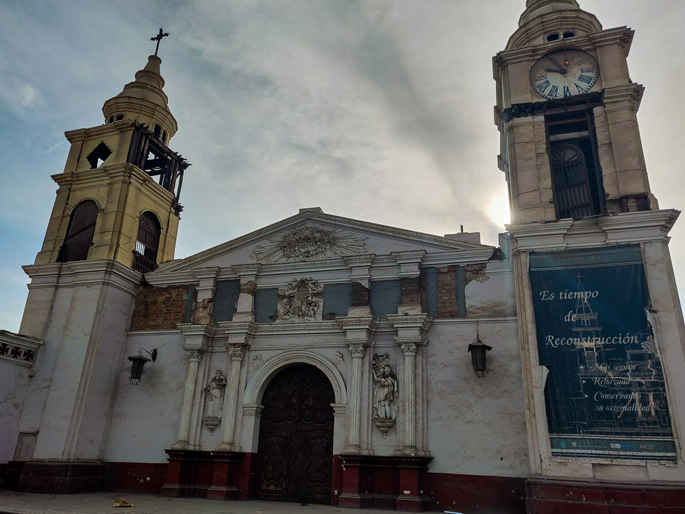
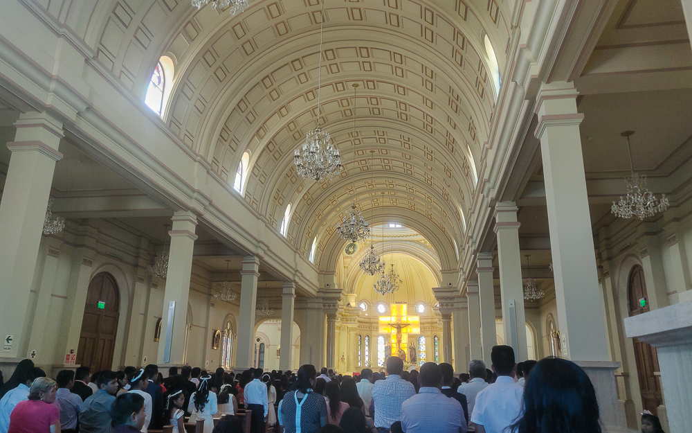
The tour started with a cathedral in town named after the patron saint of Ica, Señor de Luren. The church that stands there now was just completed in 2019! So, we got to see it when it was still hot off the presses. The original church was heavily damaged in the 2007 earthquake, and the new one is, according to our guide, made entirely of concrete. No bricks. This is supposedly an “anti-seismic” design.

Señor de Luren Church
Side note, look at how pretty the courtyard in our hotel was! A little spot of green in the desert.

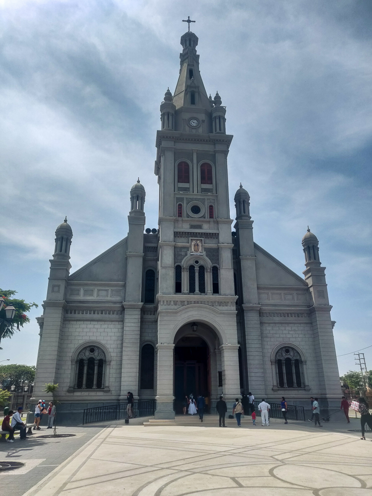
I wasn’t totally sold on that… I’m no structural expert and maybe it is an anti-seismic design, but she was saying it like the fact of it being concrete automatically made it anti-seismic. I don’t know that I believe her about any of it, actually. First of all, what an expensive way to build a church! Second, it seems like a strong enough earthquake would still crack the concrete. Third, what a crazy heavy roof! Bricks are usually used not just to save money but also to reduce weight. It seems silly to use all concrete. And I don’t think I was misunderstanding her because of the language barrier (especially since construction/building material vocabulary is my specialty).

This seems like a good place to make a disclaimer that I’m going to say all sorts of things in this post (like “the entire church is made of concrete”), and I make no promises about accuracy. Between the fact that guides make things up all the time and that I could only kind of understand our guide, I actually promise that some things are wrong… count it as a cultural experience because international living is primarily composed of getting things wrong and having no idea what is going on.

Inside the church. It was PACKED… it seemed like maybe they were having First Holy Communion because there were a bunch of girls in white dresses. But maybe not.

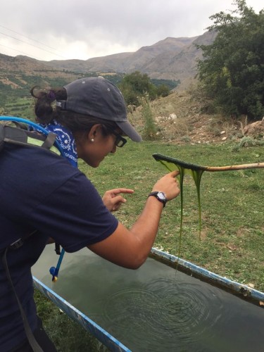
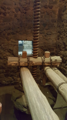
We made two food/drink stops that weren’t my favorite, but I’d say that liking 5/7 things on an $11 tour is pretty good. We ate “paciencias” at a bakery. They’re these traditional crunchy cookie things, but they flavor them with oranges which, in case you didn’t know, I despise. Later, we went to a winery, and since I don’t drink, the prospect of “free” wine and Pisco (a traditional Peruvian brandy made by distilling fermented grape juice… yum…) wasn’t particularly exciting. I sniffed all of the wines as part of my campaign to develop sommelier powers without ever actually drinking… and well, they all smelled like wine. I guess I need to keep training. Pisco is one of those things that burns your nose when you sniff it, and to really savor the flavor, you’re supposed to swish it around in your mouth, coating every surface, before you swallow. Julie followed directions, and based on her face and my still-tingling nose, I don’t think I missed out on much.

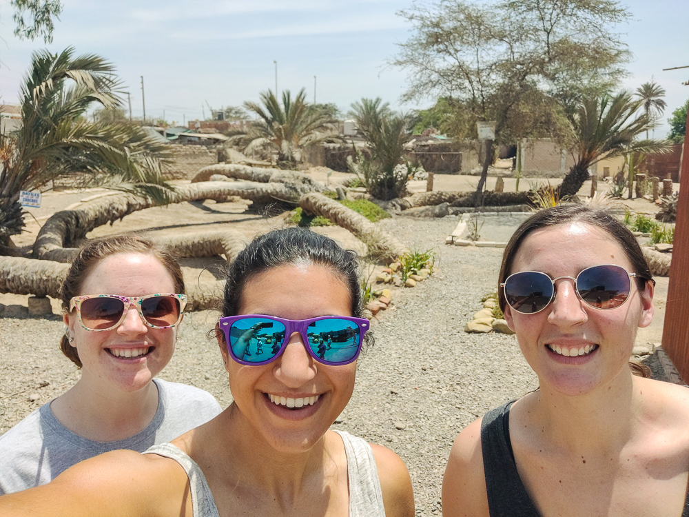
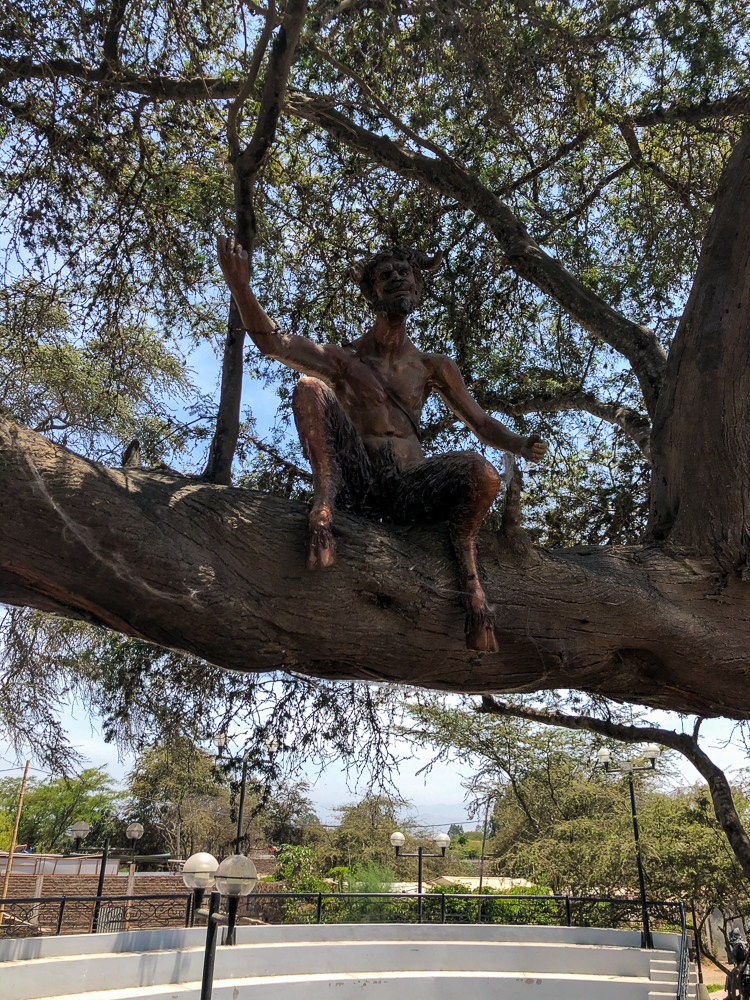
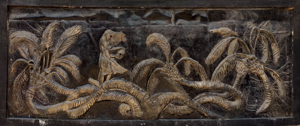
The other stops were much more my style… weird and quirky. There was a 7-headed palm tree which I don’t quite know how to explain. It’s like the palm tree split from the roots into seven different trunks that are all running along the ground like serpents.

Panoramic view of the seven-headed palm tree. Is this not the weirdest thing?? Running along the bottom, you can see one of the trunks. The root system is behind that green area in the middle-ish of the photo.
So strange to see them snaking all over the place. You can see that one of them even goes underground and comes back up… there’s a gravel path running over the underground part.

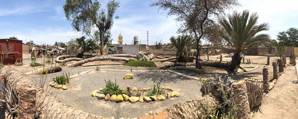
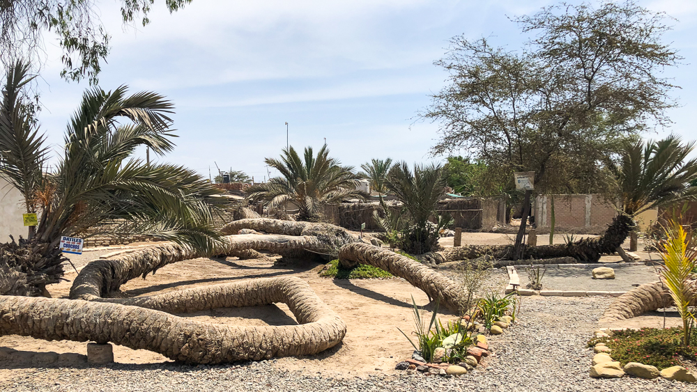
The palm tree technically is in Cachiche, a teeny town right near Ica. Cachiche is “famous” for the witches who sought refuge there after escaping the Inquisition in Europe.

Legends say the tree is so messed up because it was cursed by a witch who was sacrificed there. The last known witch died in the 1980s, and before she did, she predicted that when the palm tree’s seventh head sprouted, Ica would sink. It sprouted in 1998, and that same year, a nearby river overflowed, flooding Ica. Now, the seventh head is trimmed every so often to make sure it doesn’t happen again.

Loving our weird tour

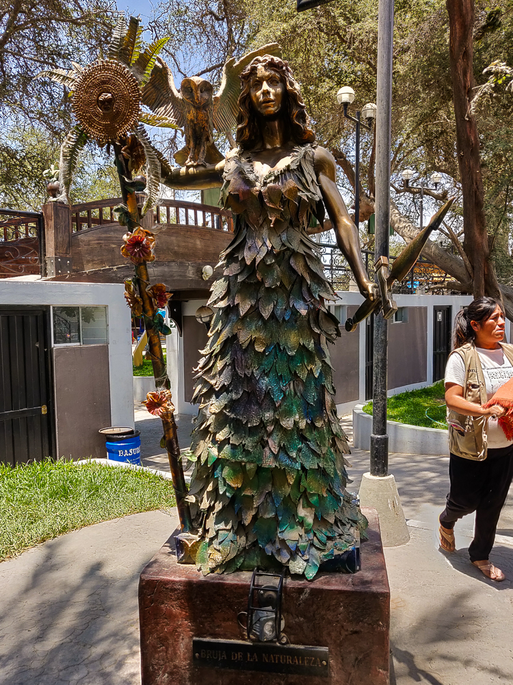
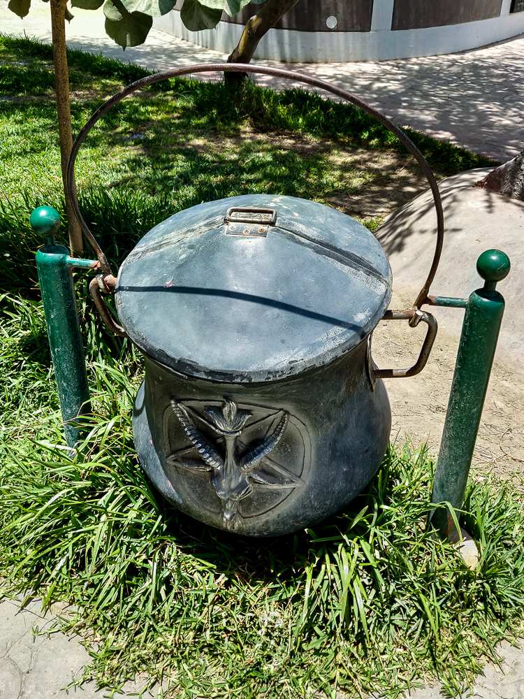
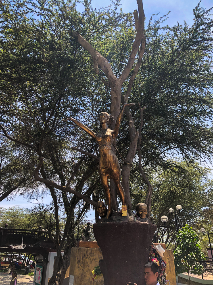
Our next stop was fitting after the visit to the palm tree. We went to the Cachiche “Witch Park” which was just completed in early 2019. It has seven statues of witches, each representing one area of witchcraft: health (medicinal herbs), wisdom (palm and card readings), love (bring a picture of your desired beau, and in three days you’ll be inseparable), money (amulets to bring fortune and find jobs), virility (for man problems, or if a woman couldn’t have kids, she could take a potion and have up to 17! geez), nature (white magic to remove negativity), and huarango (evil and sorcery).

Health Witch with her bird and cauldron
Wisdom Witch with a book and an owl
Love Witch with some flowers growing out of a skull. Not sure what that means but it seems ominous.
Money Witch with a cauldron of gold coins that will give you good fortune if you touch them (the sign on her also literally says “Don’t Touch”… but the guide offered us all the chance to claim our fortune despite the rules)
Virility Witch showing us how to best accessorize with skulls
Nature Witch looking fabulous in her leaf dress
Huarango Witch wearing a strangely pleasant expression for being the witch of evil and sorcery
I appreciated the themed trash cans… cauldron, anyone? Also, this is functionally how most public trash cans work in Peru – they’re suspended and can be flipped over to dump the trash out when someone comes around to collect it.
Gargoyle protector of the park

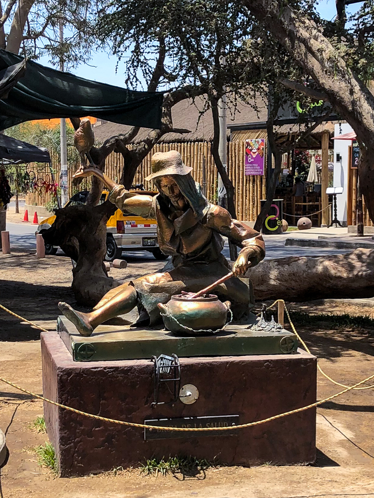
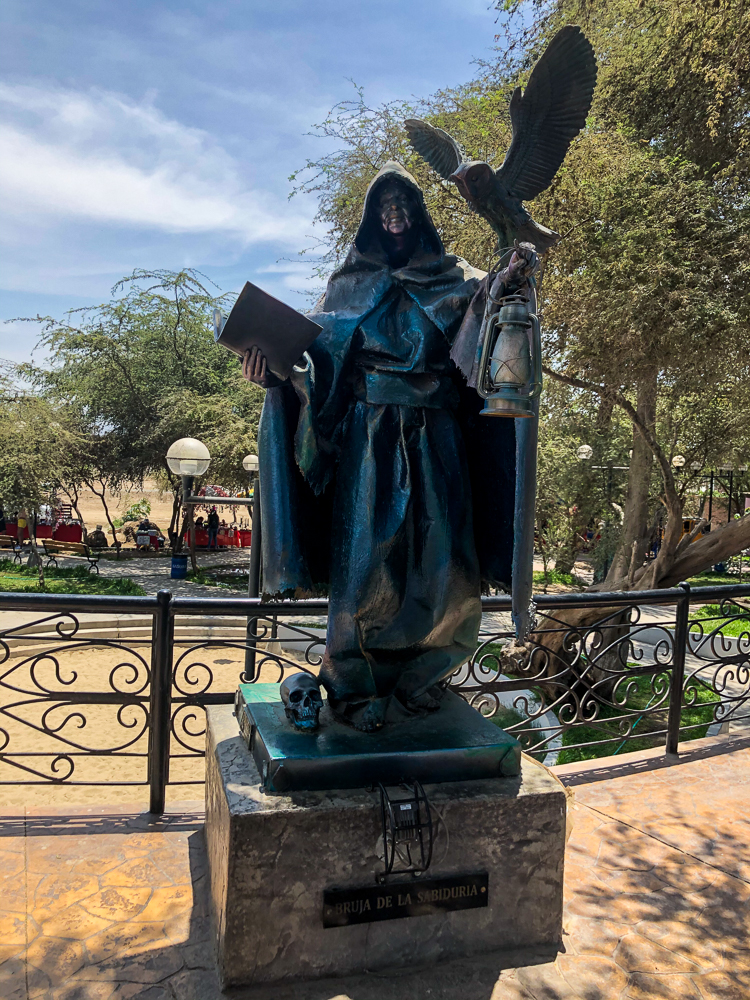
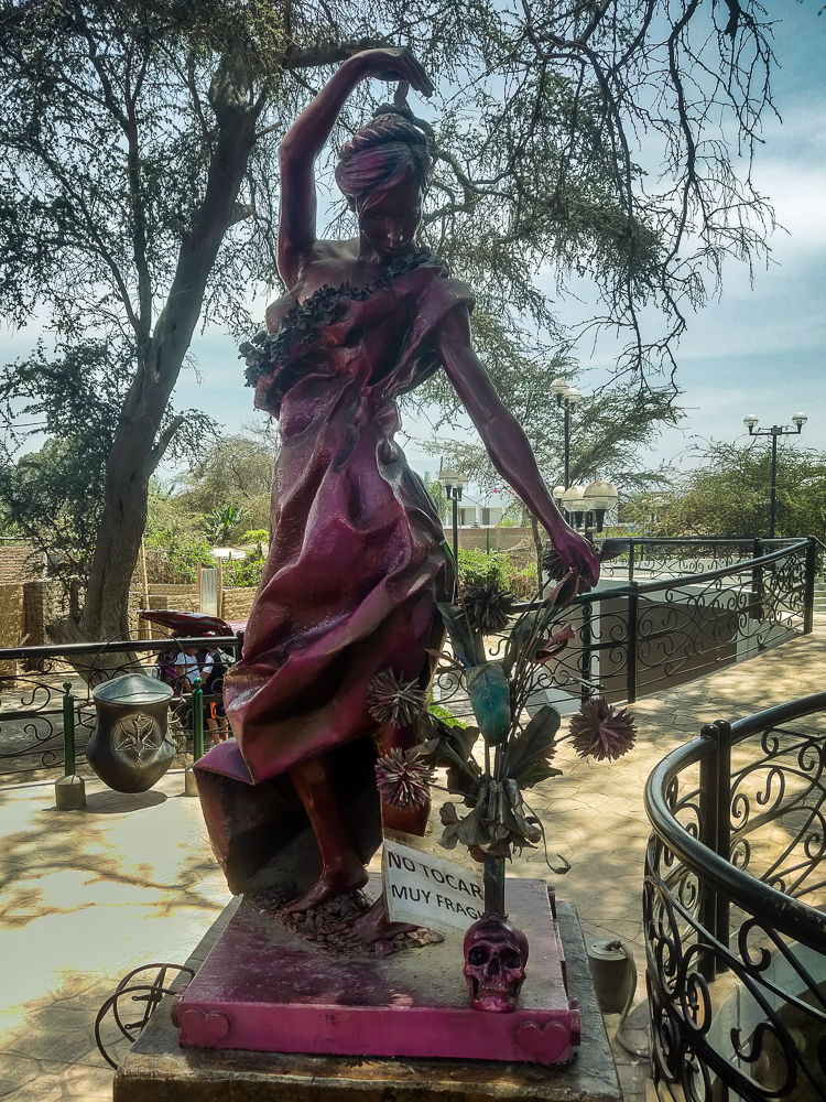
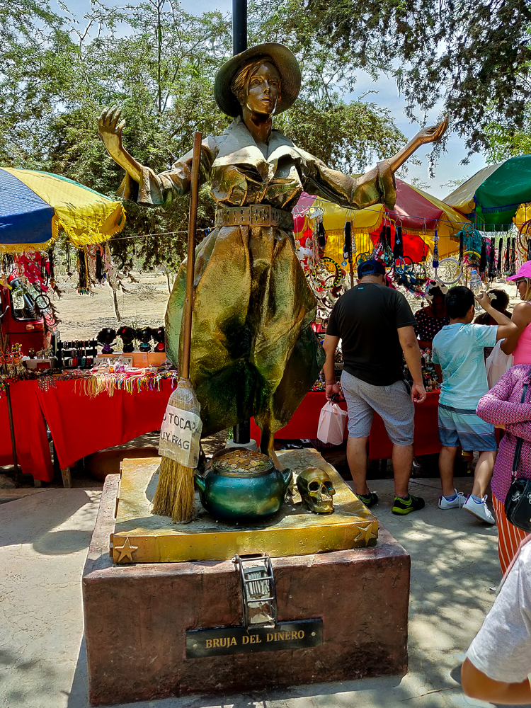
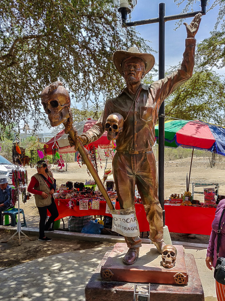
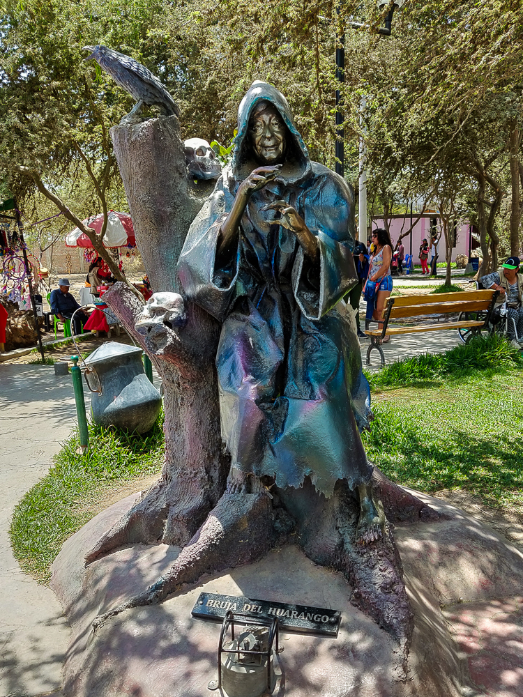
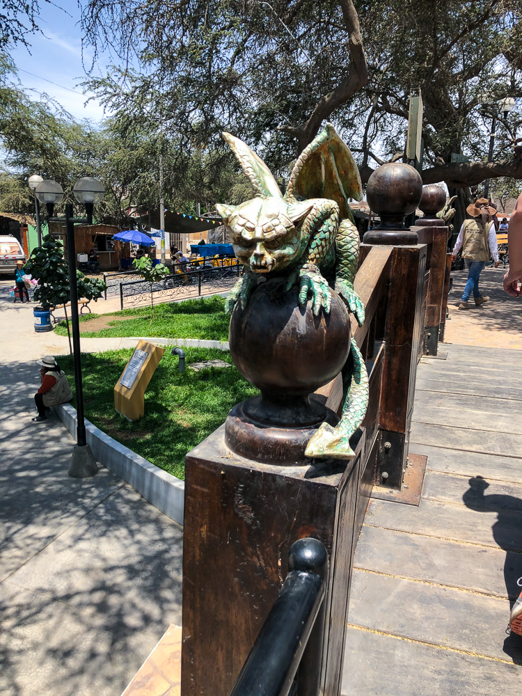
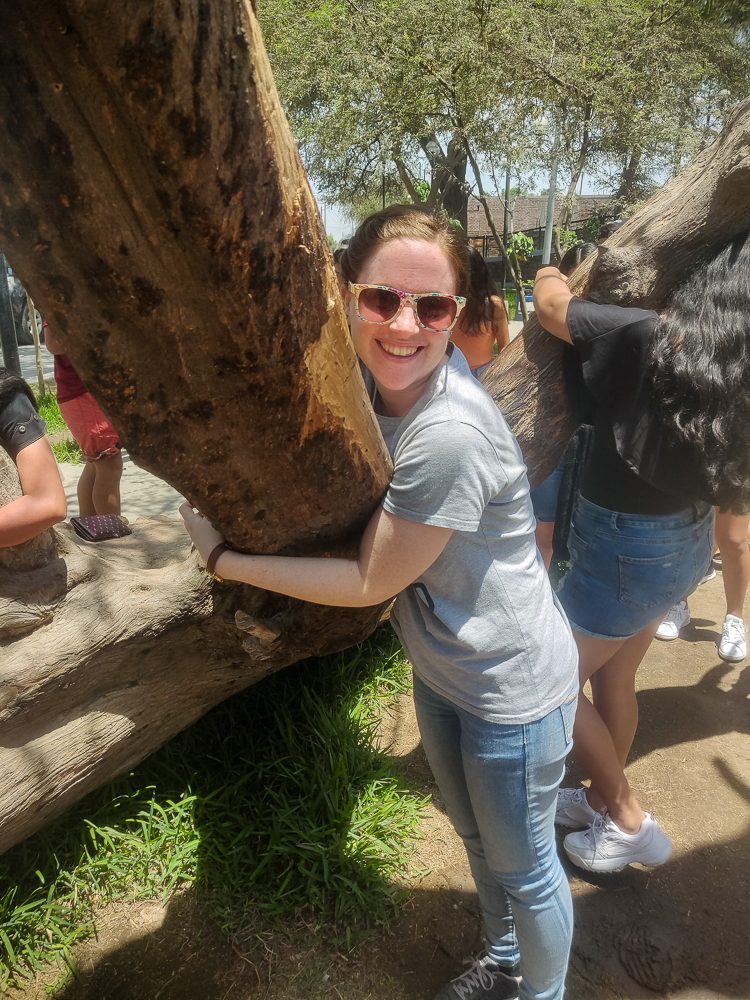
I’m not sure why the evil and sorcery witch is called huarango, but that’s the name of a tree that grows in desert climates, like in Ica. There are huarango trees in the park, some as old as 400 years, and they’re important for preventing erosion in a place where not much else can grow. One of the ones in Witch Park is extra special – you can hug it to make your dreams come true (and then you’re supposed to come back with a thank you offering once it works… the guide gave an example, “like a bracelet!” Very affordable, these witches).

Jocelyn hugging the Dream Tree
This statue is of the “last known witch” who died in the 80s. There’s a story that she helped a boy who had a speech problem when he was young, and he grew up to be a politician and commissioned this statue as a thank you.
Satyr/faun in a tree. Because why not?
There was also this bas-relief at the park, showing the seven-headed palm tree with a bunch of skulls (I’m seeing a theme) and a lady who I assume is a witch. So maybe this is her cursing the tree? Maybe she’s just inspecting a skull she found there? Who knows?
Me, Jocelyn, and Julie on the gargoyle bridge, nice and blurry (oh, silly Lara)

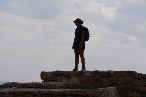
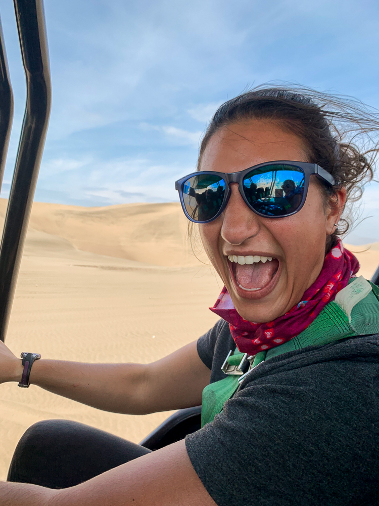
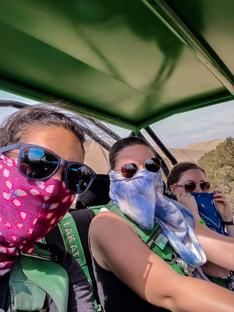
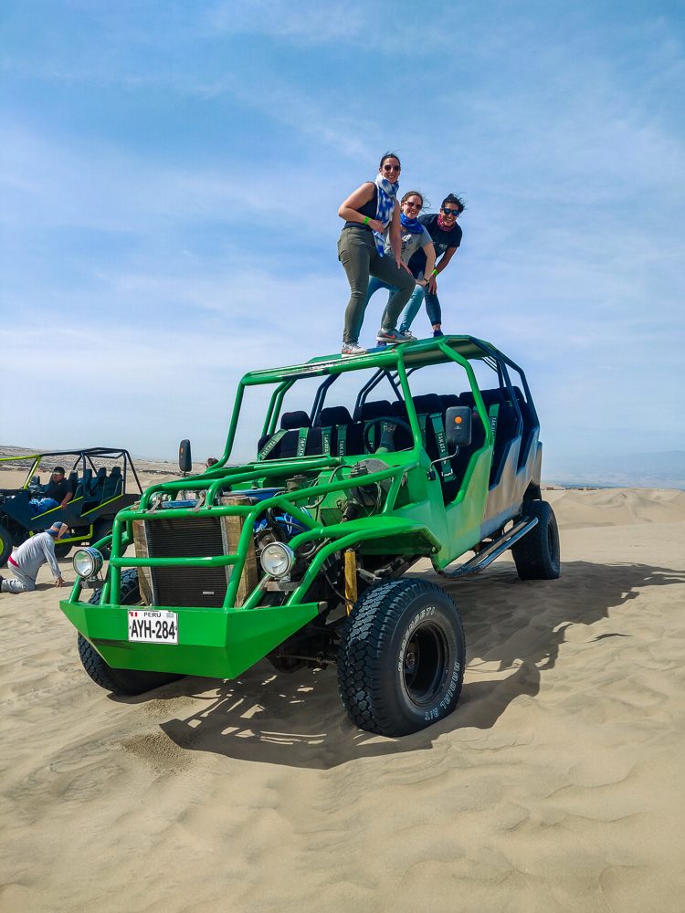
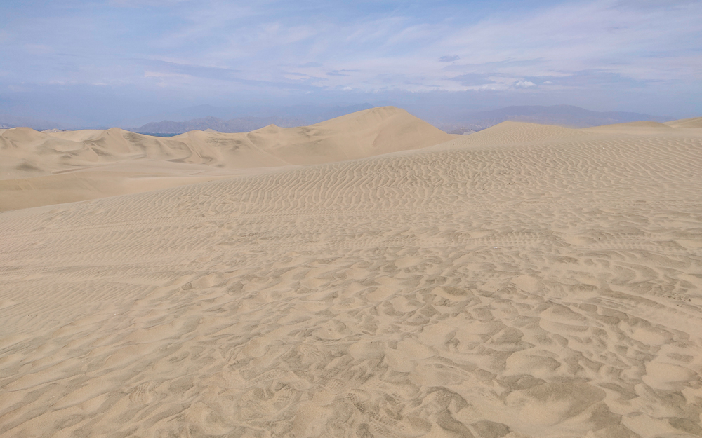
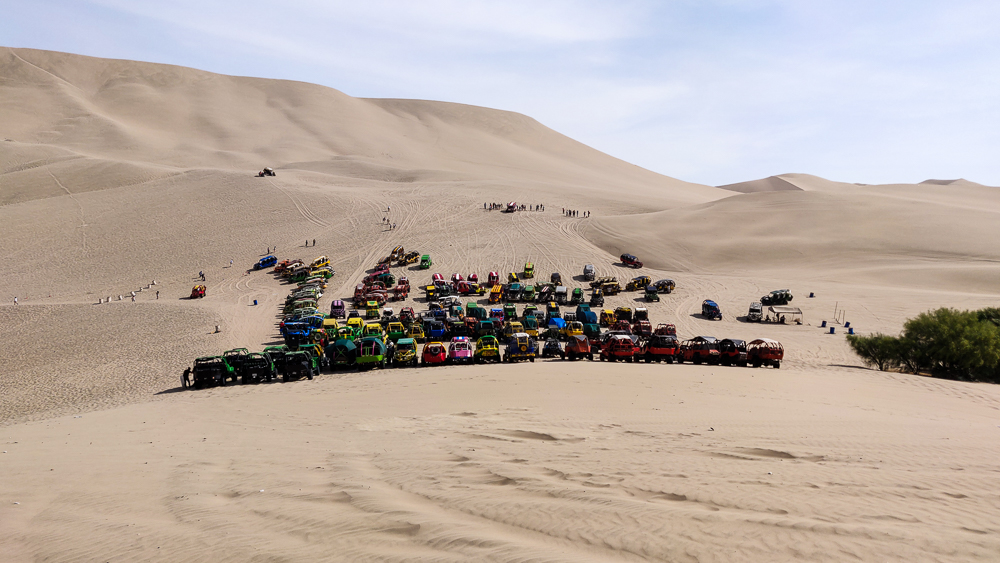
Finally, we were off to the main event of the day – the dune buggy ride and sandboarding!!! I didn’t have any expectations for the dune buggy, but it was so much fun!! We got strapped in, and our driver went zooming up, down, and around the dunes. Julie took a picture of me where I look so happy that I might explode, and that’s pretty much how I felt.

If this face doesn’t scream, “Best day of my life,” I don’t know what would.
I promise this corny pic wasn’t our idea. The driver insisted, “Trust me, it will be a great picture!” (and then he cut off the front of the dune buggy *shaking my head*)

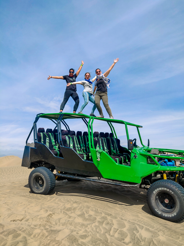
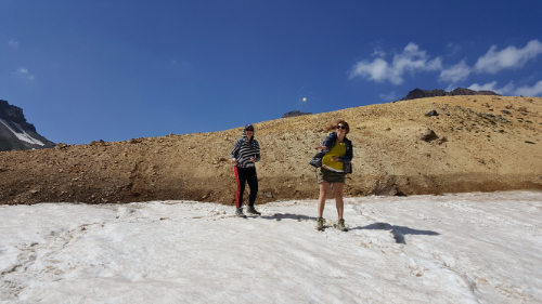
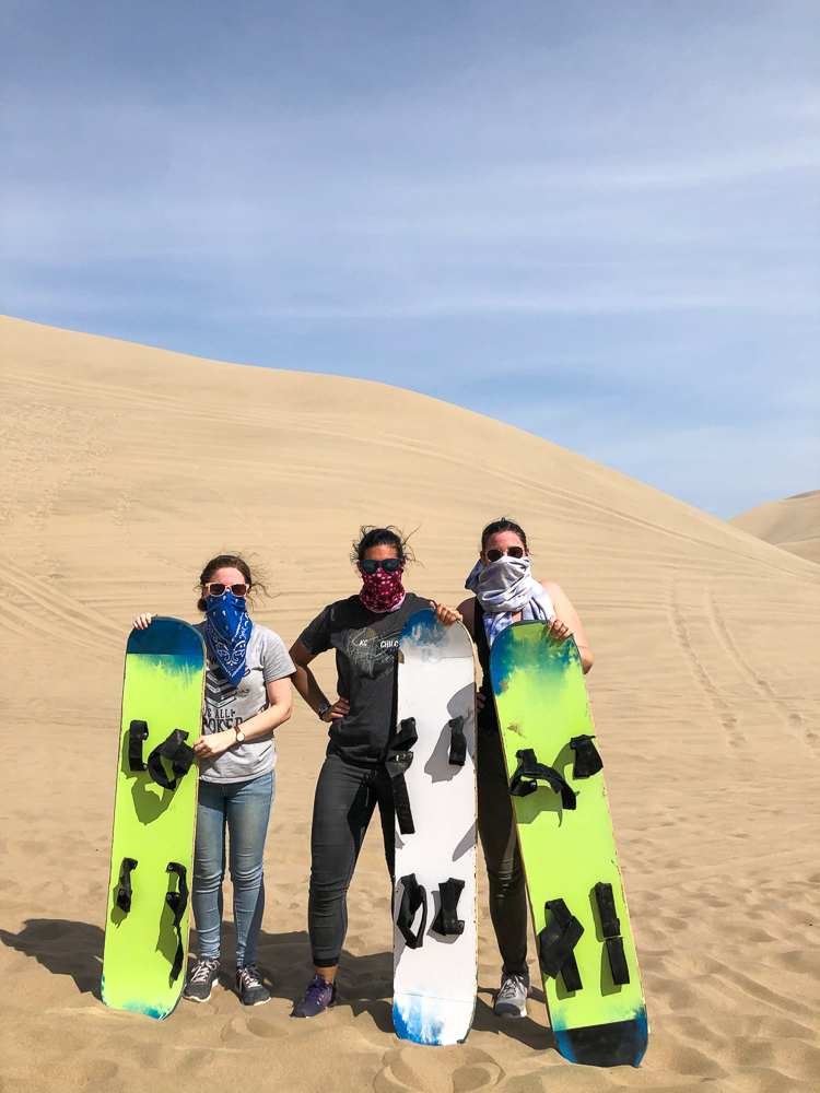
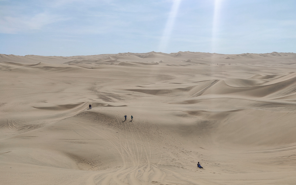
That was even before the sandboarding! We got to do two sandboarding runs each, and Jocelyn and I both spun out on the first one. You’re supposed to put your legs behind you in a V to help you go straight, but I thought it was to slow you down and I didn’t want that! Oh well, live and learn. The second run went better, and even though I was totally coated in sand at the end, it’s possible that I’ve never been happier. My journal that night said it was “literally the best thing of my entire life”. That might be an overstatement. But it also might not be. I can say for sure, at least, that it was absolutely worth the 1-year build up, the 10 hours of round-trip bus ride, and the $11 tour! It would have been worth more than $11 to me standalone, honestly.

Sunglasses and mouth covers strongly recommended for the dune buggy and especially the sandboarding… unless you like sand in your eyes, nose, and mouth. It’s going to end up everywhere else, I promise you, so better to at least protect your face.
Because apparently it’s normal to take pictures on top of the dune buggy?
Also recommend a headband if you ever find yourself sandboarding… unless you’re going for the lion’s mane look, then you’re good without one.
Spot the sandboarders
Sand, sand, nothing but sand as far as the eye can see.
Huacachina is a desert oasis… a little spot of green (including the water… eek!) in a sea of sand. Despite being in the middle-of-nowhere Peru and being VERY far from Lima, it’s actually a very popular stop for international tourists, especially backpackers.
The dune buggy fleet
Still on a high from the dune buggy ride. We’re also fully sand-saturated at this point. I had about a bucket of sand in each sneaker and my pant pockets. Gross.

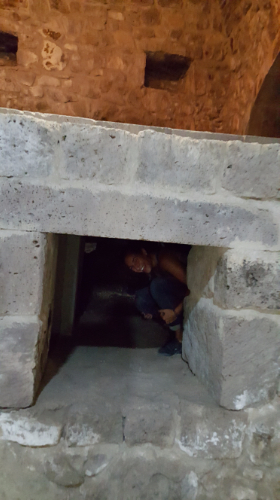
That was the end of our tour, and when we got dropped back in Ica, we decided to make one final stop at the Regional Museum of Ica, an archaeology and history museum. They had some cool stuff there, including a whole strange tribute exhibit to my favorite bean, the pallar (pai-ar) (butter bean), but the most interesting was the exhibit about mummies. There were some actual mummies there, and the signs explained how archaeologists can sometimes use the mummies’ bones to determine a person’s cause of death or to learn things about their culture. It was cool and disturbing, which I think is what they’re going for.

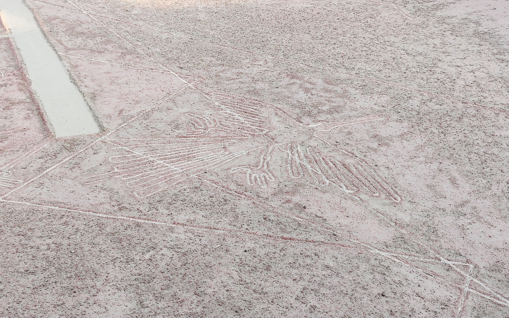
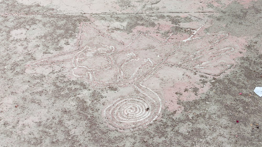
Behind the museum, they have a scale model of the Nazca Lines. The model is, of course, still HUGE. I’m a horrible estimator, but I’d say it was at least 20x20m (or more??). And there’s a tower that you can climb up to view it. Since I don’t know if I’ll ever see the actual Nazca Lines, it was fun to experience them on some level.

The Nazca Lines. If you’ve never heard of them, it’s like Peruvian crop circles. Sometime between 500BC and 500AD (probably the whole 1000 years because 1. there are SO MANY lines and 2. what other activities did people have to entertain themselves?), people dug shallow depressions into the soil to form lines, geometric shapes, and animals! They’re so big that the best way to see them is by airplane… or in the backyard of the Regional Museum of Ica. To get a sense of scale, there’s a tower shown in the top right of the picture that’s 42 feet tall at full scale.
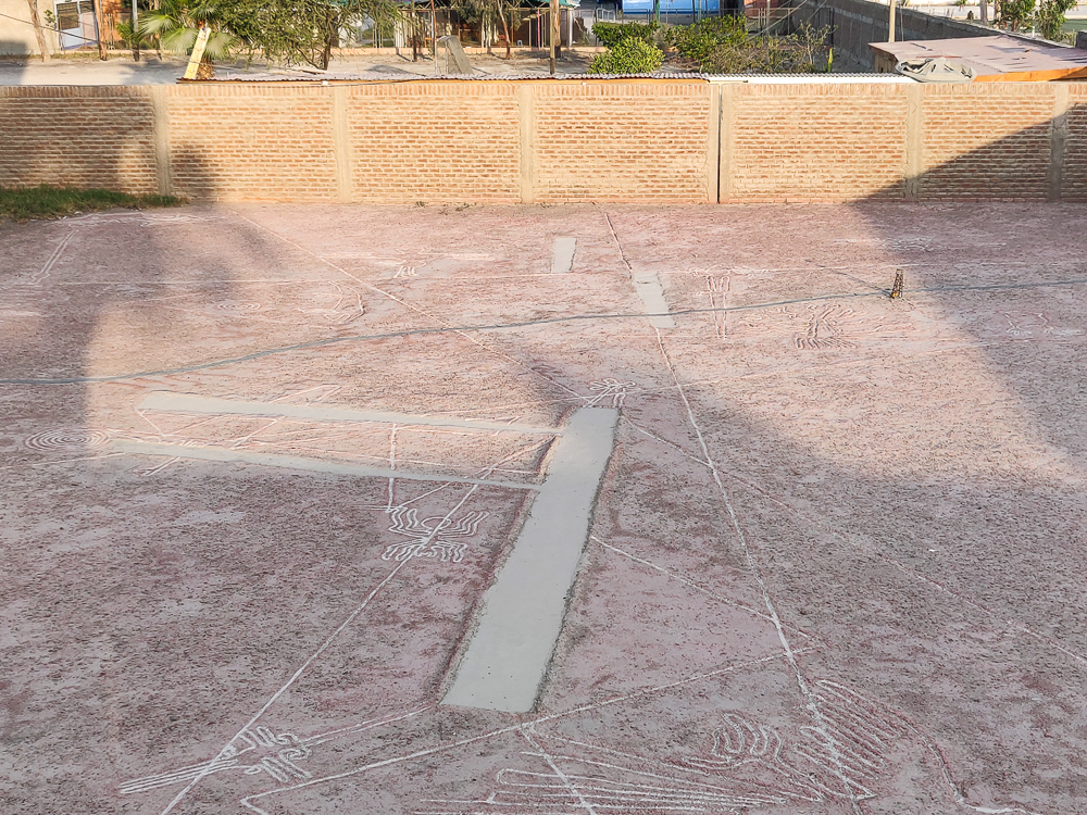
I’m actually more intrigued by the construction of the replica than I am about the actual Nazca lines. Whose idea was this?? Was the idea person also the one who executed the project, or did they make someone else carry the burden of their crazy dream? How long did it take them? And why??
Bird!
Monkey!

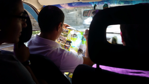
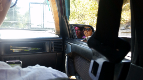
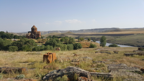
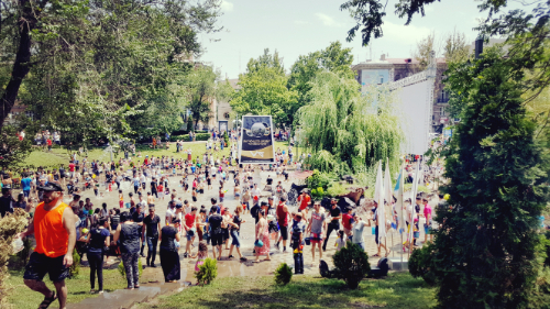
And that was basically the end of our Ica adventures! We stuffed our faces with pizza and ice cream that night, and the next morning, we headed back to Chilca. The return trip was mostly uneventful, until we had to switch from a bus to a combi (van) for the final leg of our journey. We took the last three available seats, and at the next stop, at least 10 more people loaded on. They were headed to the beach and were carrying coolers and pitchers of ice and other beach paraphernalia. We reasonably had space for maybe four people, so it was like being in a clown car. I haven’t been in such a crowded van since Armenia, and from the way the Peruvians were reacting, it clearly wasn’t a common occurrence for them either. Everyone was thrilled to see us go when we squeezed our way out at our stop, and I’ve never been so happy to see the barren brownness of our neighborhood. Home sweet home. What a way to end the weekend!

60-cent ice cream cones
The main plaza is a happening place on Saturday nights! We took a digestion lap after pizza and before ice cream

There was this temporary art exhibition thing going on for a couple of weeks, and I checked it out with my friend Arin. It’s organized by HAYP Pop Up, and they set up a few exhibitions each year. They usually are held at places that are a bit off the beaten path, and this one was at the Byurakan Observatory. Artists from Armenia and abroad are invited to participate and a different theme is selected for each one.

Grounded UFO with knives in it, apparently thrown by human defenses

This time, the theme was aliens. Well, not exactly. I think that the artists had to imagine what it would be like to make contact with extraterrestrials. Or something. I don’t know. (HERE‘s the webpage about it.) I love art, but modern art frequently baffles me, so combining modern art with a spacey (literally) topic like aliens can only possible result in complete stupefaction.

The telescope

There was one exhibit in a different location, so we went there first. It’s apparently a radio-optic telescope but just looked like some weird pendulum thing in the middle of a giant bowl. The exhibit was a sound exhibit where the artist put three speakers around the rim of the bowl and three microphones inside of it. I think he did some mixing of the sounds, but the speakers partly played what the microphones were picking up, resulting in some weird echoey feedback sounds. The speakers were playing what the microphones were picking up, and the microphones were picking up what the speakers were playing. Weird, right? And if you made a sound loud enough, you could make it into the playback too. I don’t know. There was some deep meaning or something to it, but mostly it was just eerie.

The best part of it was the view. It was next to a gorge, and there was another weird, abandoned thing in the distance that Arin and I decided to check out. Things that I often think in Armenia: “I wonder if we’re trespassing by being here.” Immediate next thought: “T.I.A. Is trespassing even a thing here?” I don’t have any clue what this thing was, but there were stairs so we obviously climbed it. And then there was a ladder so I obviously climbed that too. It all seemed sturdy enough… don’t worry, I have health insurance!

Gorge-ous! Yes, I’m going to use the same bad pun EVERY time I take a picture of a gorge.
See the weird mirror thing in the corner? Yeah, that’s what we climbed.
Climbed that tower!
Looking down from the top of the tower. I’m not afraid of heights, but it was a little windy and was blowing in the breeze a bit, so I can’t say I loved that.
Climbed those yellow supports in the back!
Control room


Don’t ask. I don’t know.

I think that my favorite part of the whole exhibit was everything we did that wasn’t part of the exhibit. After the sound thing, we went to the observatory property to see the rest of the art. It was all confusing. We started out trying to read the descriptions and understand what was happening and quickly gave up in favor of just walking around the grounds. Here’s a made-up example in an attempt to express how I usually feel at modern art exhibits:


Description: “This weird art-like thing you see in front of you imagines the moment of successful contact with extraterrestrials. Elation quickly turns to horror as the humans realize that these are not friendly beings. An immediate war breaks out between human-kind on Earth and the hostile alien forces. Within seconds, the humans can see that the alien weapons are far superior and that they have no hope for survival. This complicated emotional journey from elation to terror to defeat is captured by the piece you see in front of you.”

The art: A cardboard box with a one-eyed frowny face drawn in black sharpie on the side and an LED light inside.

The other people there: “Ah yes, I see it!” “Magnificent!” “So many emotions!” “Completely brilliant!” “The artist is a genius!” “The Michelangelo of the 21st century!” “I’m so artsy and sophisticated!” “My life will never be the same!”


This was probably my favorite exhibit haha. Don’t ask me what it’s supposed to mean because I don’t know. I just know it looks cool.

Me: “Hey did someone forget their cardboard box? I hate it when people just leave their trash lying around. Where’s the exhibit? Maybe they unpacked it from this box, put it somewhere else, and forgot to take the description sign with them. Oh well, on to the next one!”


I would describe myself as a person who likes art, but sometimes… yeah. I think that I am more an admirer of impressive things, so I appreciate the skill that goes into creating art. If it’s something that I think would be difficult to create, I like it. If it’s something that seems thrown together with some abstract description, it just reminds me of the people in high school English who got good grades from reading sparknotes and BSing their papers. Aka I’m not impressed.

Anyway, it was an interesting experience. Apparently, modern art is the same confusing adventure no matter what country you’re in. Good to know.

One of the many observatories on the grounds

We’re approaching the time in my trip when all of my best friends start leaving I get sad and have to begin the whole friend-making process again. Ugh. Hopefully I can manage to keep myself from falling into a moody depression like what happened in Ghana. I think I’ll be okay, but still, I’m not excited about having to find new people who are on the same page as me. It’s not as easy as you might think.

Walking into Dilijan (the town)

Anyway, the point of that whole rant is that the first person from our crew to leave was Shant, and his final wish was for us to go hiking and camping in Dilijan National Park. Dilijan is a 240 square kilometer national park. It was established as a nature reserve in 1958 and was changed to a national park in 2002. You know what the best part of Dilijan is? THERE ARE TREES! Yeah, yeah. I know that sounds stupid, but I miss forests. Dilijan has plenty of trees, and it made me very happy.

This is Sharambeyan Street in Dilijan. It’s been preserved as basically the Dilijan “old town”. There are different kinds of artisan shops all the way down the street which is pretty cool.

Are you ready to hear a ridiculous story that supposedly explains the origin of the name “Dilijan”? Once upon a time, there was a shepherd named Dili who fell in love with the daughter of his master. Obviously, since this is how these stories go, the master was wholeheartedly against it and ordered Dili killed! Seems like a dramatic response to me, but well… yeah. Anyway, Dili’s mother searched for him for days and days, wandering around and calling out “Dili jan! Dili jan!” (If you recall, people use “jan” as a term of endearment after someone’s name or sometimes just in place of it.) The End. Hehehe that might be one of my favorite Armenian stories yet.

Along the hike!

Anyway, one of our friends from Gyumri is spending a month working with the Transcaucasian Trail. They’re planning to build over 3,000 kilometers of trails in Armenia and Georgia. It’s going to be super cool! (If you want to see the route or read more about it, check out their WEBSITE.)  It’s also going to take nearly forever, but still, anything is better than what they have now. As you may have realized from my many posts about “hikes” I’ve gone on with my friends, there are a ton of cool places to hike here, but very few of them have actual trails, and even fewer have trail markers. Armenia has a lot of potential as a tourist destination for people who are into outdoorsy activities, but it’s much easier to sell that when you have accessible information and actual official trails.

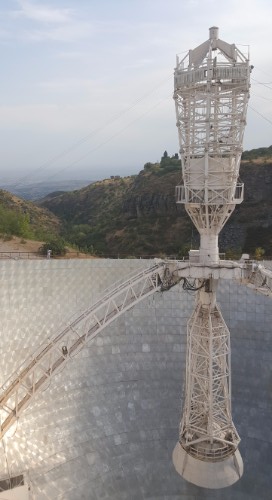
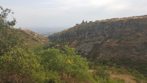
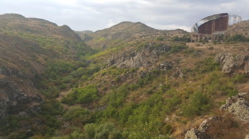
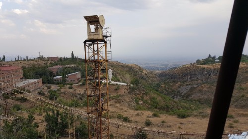
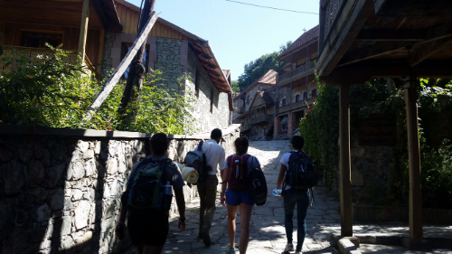
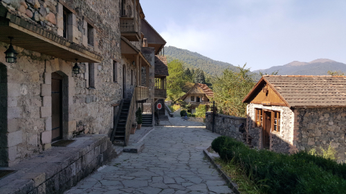
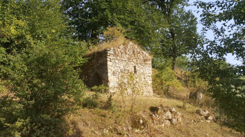
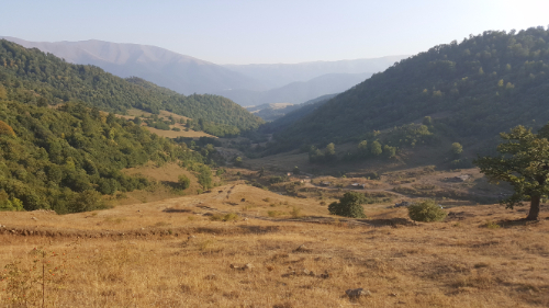
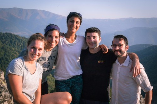
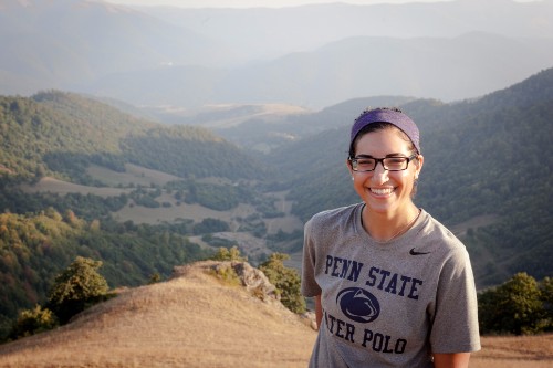
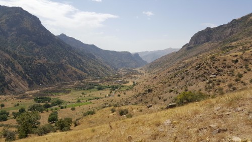
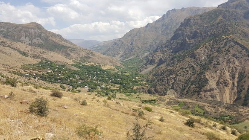
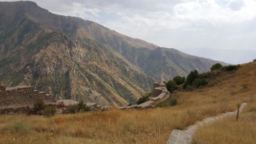
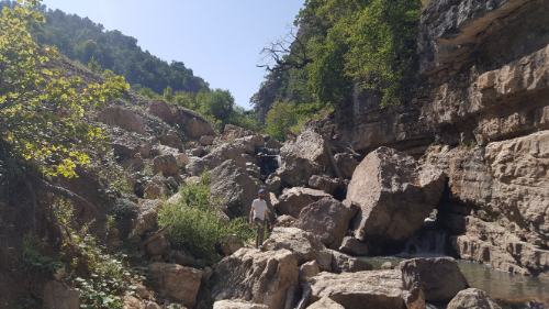
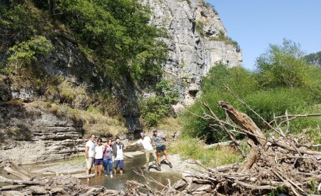
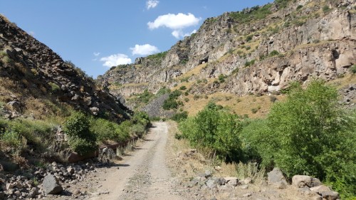
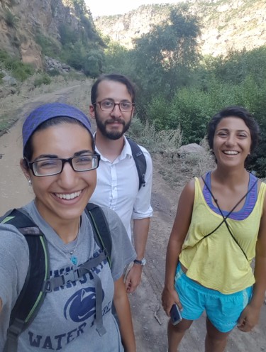
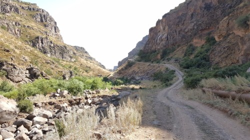
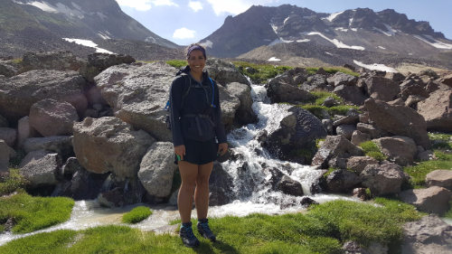
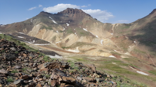
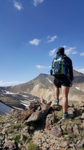
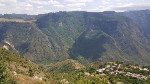
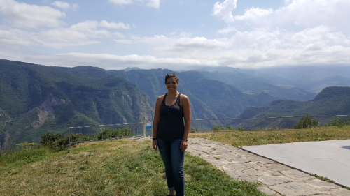
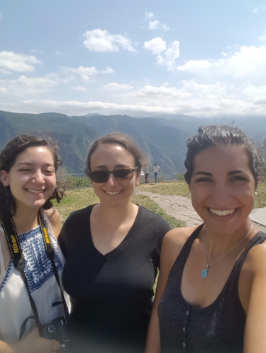
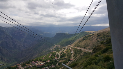
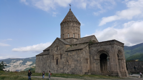
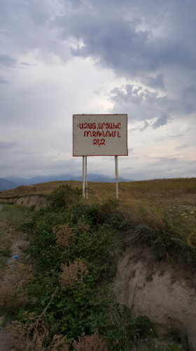
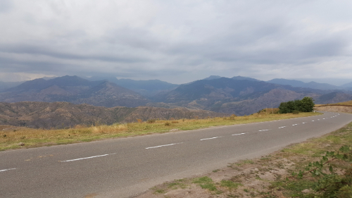
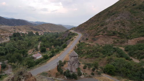
Dilijan is beautiful!! It was on my list of places to definitely visit, so when Shant said that he wanted to go there, I was all about it. We got in touch with our Dilijan friend, and she said that we could camp behind their house and borrow camping equipment. Nice! I’m pretty sure that you can probably just pitch a tent wherever in Dilijan, but this way we didn’t have to worry about renting equipment and carting it with us.

This was the marshrutka on the way back to Yerevan. I was confused about why they had these little cubes inside. They looked like footrests. Nope. They were seats. Gotta pack the people in!

We took the first marshrutka from Yerevan at 9AM and were in Dilijan by 11. After stocking up on snacks and supplies, we walked to the campsite and got our tents set up before heading out for a hike. Since the trail marking is still a work in progress, there aren’t many well-marked options. They have all sorts of maps in the TCT headquarters of the various jeep trails and such that exist around the park, so one of the guys there showed us a route that we could take that had no markers but used existing paths. He said it took him 5 hours which I took to mean it would take us at least 7. He tried to insist that he wasn’t going fast, but that means nothing when you’re talking to someone who hikes all the time. We decided to give it a try, I confirmed the directions to the trailhead about 50 times and took a million pictures of the map, and we were off.

A tiny church along the way

I hate being the navigator. Okay, that’s not a completely fair statement. I like navigating and I’m good at following maps, but depending on who you’re with, having the navigating responsibility can be stressful. If I was with Sarah (best friend Sarah), for example, it would be fun. If we hit a point where we weren’t sure which way to go, we would just try one and turn around if it was wrong, no big deal. It’s all part of the adventure.

The view from the top.

Sometimes though, people see pauses and uncertainty as you not knowing what you’re doing, and they lose all confidence in your guidance. That’s when I hate navigating. Following hiking maps isn’t quite as easy as street maps, so sometimes you need to just take an educated guess. There were some parts where I wasn’t completely sure about where EXACTLY we should be walking, but I knew that we were following a river the whole way, so as long as we were close to the river, we weren’t lost.

The crew! Laura (Carineh’s friend who came to visit), me, Carineh, Gagik, and Shant

There was only one part where the “trail” shown on the map wasn’t even close to right. Otherwise, we made some slow progress, but I always knew where we were. We made it to the halfway point after about 3 hours, and I knew there was no chance that we were making it all the way to the end before it got dark. That dude who made it in 5 hours must have been some sort of mutant. Called that. We made a group decision to go a little bit farther so that we could get a good view and then turn around and head back. At least then we would be following a path that we had walked before, and I had a GPS tracker running so we could use that to make sure that we were going the right way.

Tired and happy

The view from the “end” of the hike was awesome. There was a great view of the valley, some mountains in the distance, and there were even a few trees starting to change colors already! It would be super cool to go there in the middle of fall with all of the leaves changing.

After spending a little time resting and enjoying the view, we started hightailing it back in an attempt to hit the road before dark. We had flashlights with us, but that’s no good when you’re not following a clear path. There were a few parts of the hike where we were walking through fields, so you had to be able to see ahead across the field to make sure you were walking in the right direction. We were about 5 minutes from the road when it got completely dark, but luckily that was close enough. The whole hike ended up taking something like 5-6 hours, and I was wiped by the end.

We ate dinner in town at the one restaurant everyone always talks about before heading back to the tents. And s’mores. Because what is camping without s’mores? We didn’t last very long after getting back… I think everyone was exhausted. I could have slept on a bed of rocks.

Here’s our taxi driver looking at a map while driving. Comforting, yeah?
Me, looking like I’m haunting Carineh. And a mystery person looking like they’re haunting me… though I don’t think you can see it that well. Just know that there’s someone else lurking there who looks even creepier than I do.
Too many people on bikes

There was another cool Birthright excursion a couple weeks ago, so I made another exception to my usual “avoid large groups” rule and signed up. That rule exists for a reason, and I knew that I would be subjecting myself to inevitable irritation by going… but bikes were involved, and I love bikes more than I hate large groups.

Talene and me during an unnecessary break at the airport

Side note: If you’re wondering about why I have that rule, it’s for a lot of reasons. When it comes to traveling, large groups are always late and can never make decisions and there’s always someone who’s unhappy for some reason or who is out of sync with the rest of the group. It’s better, in my opinion, to limit your group sizes and save yourself the stress. Plus, in general, I’m not really the type of person who thrives in large groups. I’m much better one-on-one or in settings where I can talk to each person and actually get to know them. Too many new people or things going on at the same time completely stresses me out.

Funky flower at one of the churches

Anyway, the excursion was biking to Etchmiadzin. I was almost convinced at “biking” until I thought about the fact that it would be 50 people on bikes, and so many people are terrible at biking. I wasn’t exactly interested in having someone who hadn’t ridden a bike in 10 years swerving into me and knocking me over. Somehow, I was convinced to go anyway, and my game plan was to stick to the front of the pack.

For the most part, it worked. There was one dicey second when a girl next to me swerved into a (parked) car and then swerved back out into the street, towards me. Thankfully, there was no collision, but I got away from her as quickly as possible and sped my way to the front.

I forget that a lot of other people don’t really bike that often or that far. The ride was 20 km (about 12.5 miles) on almost completely flat ground, and for me, that was nothing. I used to bike 8.5 miles one way to get to work every day. Especially considering the speed we were going for most of the ride, I probably could have gone for 100 miles. At least. We were moving at about 6.5 miles per hour which is less than half the speed that I’d ride to work. Anyway, afterward, people were talking about how far and difficult the ride was, and I was baffled. I wanted so badly to ride back so that I could do the ride at a normal speed, but I wasn’t allowed, even though two of the BR staff members said they would go with me. Bummer.

Squash at the lunch spot

Once we made it to Vagharshapat, the town where Etchmiadzin is, we went to 4 out of the 5 churches in town. This is the same place where Sarah and I went on our “day of a million churches”. There were weddings in progress at 3 of the 4 churches (that’s Armenia on a Saturday for you). It was cool going back to Etchmiadzin because I still love the ceiling there. Even though there are these weird 3D baby heads randomly on the ceiling that I think are supposed to be angel heads but are mostly just creepy.

They should have just hired me as the tour guide for this trip because telling that story about Saint Gayane and Saint Hripsime is one of my most favorite things. Maybe I can have a career in Armenian folklore storytelling? I hear there’s a big demand for that. Anyway, I won’t tell it again because we’ve already been there and done that, but in case you missed it, you can check out my post about visiting Etchmiadzin with Sarah HERE.

Nice chair feet!
Supposedly the rocks that killed Saint Hripsime. True or not, it’s kind of eerie.

My first weekend in Yerevan, I decided to go on the Birthright excursion because the description said hiking, and the location seemed too far out of the way for us to easily get there on our own. The trip was to Smbataberd, a fortress in the Vayots Dzor Province. That’s south of Yerevan by a couple of hours and is right at the beginning of the skinny tail of Armenia.

The view on the way up. Pretty, right?

Here’s your history lesson of the day: The first mention of the fortress came in the 5th century when it was used in the Vardanak War. They think (“they” being whatever people study and come up with these things) that it was built up much more in the 9th and 10th centuries when it was used by the Syunik princes. Unlike a lot of the fortresses we’ve visited here, this one actually saw a lot of action throughout history. They think that it was involved in some attacks again during the 11th century, built up even more and attacked again in the 13th century, and finally was abandoned in the 17th. Who knows how much of that is accurate, but it’s probably safe to conclude that it’s old and has had its ups and downs through the years.

Mountains are the best.

There’s one story floating around about how it was ultimately defeated. The water to the fortress used to come from a nearby monastery, Tsakhats Kar, through an underground clay pipe. The attackers did the classic “thirsty horse sniffs out water pipeline” trick to cut off the water to the fortress and eventually capture it.

IT’S SO COOL!

I had no idea what to expect and was pleasantly surprised. I had never heard of this fortress before, and after being there, I would say that it’s waaay underrated. To start, it was much bigger than I expected. The walls enclose an area of about 65,000 square meters and are around 2-3 meters thick and 10 meters high. There are a bunch of round guard towers along the walls, and everything on the exterior is in decently good shape, especially considering the age of the ruins. They’ve done some preservation work, pouring concrete on the tops of the walls to keep them from crumbling further and making it possible to walk on them. I thought the whole thing was super cool.

It kind of reminded me of the Great Wall of China. Except smaller. And completely different.

Most of the interior buildings are much worse off. You can still make out their ruins though, and the keep is kind of intact. Even without the fortress being awesome, the views of the surrounding mountains and valleys are worth the trip. I seriously don’t know why more people don’t go there.

There was a horse water trough on the way down the mountain that was filled with algae! It was super cool and looked like green clouds floating in the water, so obviously I wanted to touch it. So obviously I did. It was just as soft as it looked.
Okay maybe it was a little steep at times…
At the top!!
How. Cool. Are. These. Walls.
Talene and me on the walls.

We walked up and it took a couple of hours, but I think it would have gone pretty quickly with a smaller group. Also, there are tire tracks that lead all the way to the top, so with the right car (or with a normal car and an Armenian driving it), you could easily drive there. It gets a strong recommendation from me! You would definitely need a private car to take you there because it’s not super close to any public transit routes (at least not that I could find… which means nothing because Armenia public transit and the internet have a complicated relationship), but like I said, I thought it was great. Honestly, it’s probably one of my favorite places I’ve visited so far in Armenia.

Can you find me in this picture? I’m in a tiny hole in the wall at the bottom of this picture.
Super cool lighting

In general, my friends and I aren’t very big on going to the planned Birthright excursions. They happen every weekend, but since I’ve been here, I’ve only been on two… make that three with the one I’m going to talk about now. In general, the excursions never run on schedule, there are too many people, and we usually want to do something more adventurous than whatever they have planned. We made an exception this weekend because the excursion description mentioned hiking and because we had heard that the destination, Lastiver, was super cool.

Views from the drive to Lastiver. My face was glued to the window in the car. I think everyone else was sleeping.

Lastiver part of a wildlife preserve, Ijevan State Reserve, in the north-ish eastern part of the country. There’s a river with a bunch of little waterfalls, caves, and best of all, trees. We have gone on so many hikes since I’ve been here, and every time, it’s like we’re wandering through the desert. Zero trees, zero shade, zero shelter from the meltingly hot sun. I’m a forest kind of person… forests and mountains, and even better, forested mountains.

Carineh, Karen, me, Shant

Well, I was in luck with this hike. Almost the entire thing was through the trees and nice and shady. It felt a little bit like I was back at home which was comforting because sometimes it’s just nice to see something familiar. The end point was a campground by the river, and by “campground” I mean that they have these little cabins that you can stay in overnight and it’s really not very rustic at all.

When we got there, the announcement was made that we had an hour to swim or hang out until lunch was ready. I, of course, wanted to spend my time exploring. The water was FRIGID which means I wasn’t too interested in swimming, so I started walking upstream. Clearly, my friends and I are all on the same page because Shant and Carineh were right there with me, doing the same thing even though we hadn’t talked about it. We got a little farther upstream and found some of our other friends, Karen, Gagik, and his cousin, Anjela. I thought it was pretty funny how all of my favorite people ended up in the same place without any plans. I guess that’s how you know that you have things in common!

The path
Hi, valley!
Rock hopping route

The upstream “hike” we ended up doing is probably one of my favorite things I’ve done so far in Armenia. It was another one of those fun, brain challenge hikes because there was a river and a bunch of rocks, and I wasn’t interested in getting wet. That meant that we had to be creative and do a lot of jumping from rock to rock. Our group got split up as Karen, Carineh, Gagik, and Anjela gave up on staying dry and started wading through the river, and Shant and I kept hopping from place to place. Ahh it was so fun.

I love rivers

One of my favorite feelings is when I’ve been consistently exercising and I feel like I have good control of my body, like balance and coordination-wise, and I get to do something that puts those to the test. This experience was definitely a balance and coordination challenge, but I felt like I was in control and could trust my legs to do what they were supposed to do. I was jumping from rock to rock without getting tired or worrying for a second that I was misjudging the distances or that I wasn’t capable of making it. I don’t know how else to describe that feeling besides just saying that it’s awesome, and you feel like your body is doing what it was made to do.

A bunch of the Gyumri crew
As you can see, Shant and I are trying not to get wet, and everyone else doesn’t care. The result? The worlds most awkward group photo. From left to right there’s Karen, Carineh, Anjela, Gagik, Shant, and me
Gagik won the caption contest with this picture. “When you discover new land and the locals are friendly.” I’m still laughing.

Anyway, by the time we decided to turn around and go back, lunch was long over. We made it back to the group, and I felt like we were castaways making it back to civilization. Who knows what everyone else spent their day doing, but I’m convinced that ours was the best.

Church views

The next day, Shant and I decided to make the trek out to see the Marmashen, a group of churches about 10 kilometers from where we live in Gyumri. There were originally five churches, only three are still standing, and they haven’t even found the foundations of the last one. I successfully called a taxi to take us there, and we spent some time wandering around, checking out the sights, and eating snacks (obviously, because we never go anywhere without snacks). It seemed like a cool place for locals because there was a picnic area, and people were going hard with their barbecue. After we were finished wandering, Shant really wanted to walk back to Gyumri, so off we went.

I think that the lettering on these churches is amazing. Can you imagine if your job was to write all of this?

I know, I know this all sounds ridiculous. I’m convinced that we’re (“we” being my friend group here) literally incapable as a group of doing anything in a normal way. At Lastiver, literally no one else from the Birthright group walked so far upstream. All of us were just naturally drawn to it. Here, who in their right mind decides to walk 10 km home when you could just call a taxi? I guess that means we aren’t quite in our right minds.

Remains of one of the chapels

To make things more ridiculous, we decided to ignore all of the roads. Instead, we took random paths through the fields that looked like they were leading in the right direction. I wish I had some sort of fitness tracker or something because I promise you that we walked FAR more than 10 kilometers while trying to take “the most direct route”. Ha.

The river and its cool cliffs

Our wanderings took us through some cow pastures and old ruins that looked like one of our archaeology sites, over a river, into the village of Marmashen (where people looked at us like we were actual space aliens), and out into some fields. There, we were summoned by a random farmer named Hamlet. He spoke no English, of course, and so we entered into the usual conversation of hand motions and sporadic Armenian words. He wanted us to come back to his house to eat dinner and spend the night. When we told him that we were walking to Gyumri and had come from Marmashen the church (it’s not that close to the town), he looked at us like we were literally insane and offered to call his friend who has a car to take us home. People usually don’t understand walking somewhere just for the sake of walking. We finally managed to pull ourselves away, and off we went, back into the fields.

Random green oasis area on our epic voyage home
Random cemetery that we encountered along the road to Marmashen… and when I say road, I mean cow path
The happening village of Marmashen
Rubble, rubble everywhere

The rest of the walk was interesting. There are a bunch of abandoned, half-collapsed buildings outside of Gyumri. I thought that they were from the earthquake, but apparently maybe they’re from after? I don’t know, either way, they’re super eerie. Then, there are buildings that seem like they should be abandoned, but upon closer inspection, there are people living in them. We walked briskly by those. Then, there are the massive craters in the ground where there used to be a building and now there’s just a foundation. I don’t know what everything out there is from, but it was certainly an interesting walk.

More of the “road home” landscape
This building was pretty eerie. This is one that Shant said was built after the earthquake, but who knows?
Random foundation
Sunset!
The most defined path we took all day.

We made it back to our neighborhood just as it was getting too dark to see anything. Thank goodness because I was starting to panic a little bit. Since we didn’t follow any roads, if it got dark before we made it home, we would have taken forever. We got ice cream to celebrate our survival, and ice cream fixes all problems, so now I have nothing but happy memories of the day. No, but actually, it was really fun, and I think that I can safely say that no one has EVER had a Marmashen experience like ours (because seriously… who walks??).

Last weekend, a few friends and I decided to make our own excursion rather than going on the Birthright one because it was just a swimming day at Lake Sevan. We wanted to do something a little more adventurous, you know, because hiking Aragats the weekend before wasn’t enough for us. Carineh found an easy hike between two churches, Saghmosavank and Hovhannavank, and she and I planned to go with one of our other Gyumri friends, Shant.

Saghmosavank

We met “early” in the morning on Saturday… 10AM… to catch a taxi out to Saghmosavank. It was about a 45-minute ride, and when we got there, it looked like they were setting up outside for a post-baptism party. Good timing for us because we made it there before it started and could explore the whole church. Somehow, no matter how many churches we see, there’s always something a little different in each one. This was the church of nooks. Seriously, there were nooks everywhere. Some were high, some were low, some had floating stairs leading up to them, some had no visible means of access. Maybe they used to have a lot of things to store? I don’t know, but as a lover of nooks, I thought it was awesome.

Floating stairs to a nook with another nook underneath
Nooks on nooks
Inaccessible nook
So pretty! You might even say… gorges… I know, the joke has been made before, but I’m still entertained by it and that’s all that matters

It is also situated in a pretty cool spot. It’s right on the edge of a gorge, and the hike we were planning to do basically just runs along the top of the gorge until you make it to the second church, Hovhannavank, which we could see in the distance. While we were admiring the gorge, we noticed that there was what looked like a decent road at the bottom, and we could hear a river. Then, someone pointed out a vaguely defined path that looked like it led to the bottom from where we were. That was all it took for us to completely ditch our plans and decide to hike down into the gorge instead. Brilliant, except for the fact that none of us were planning for a serious hike and weren’t completely prepared.

The gorge from Saghmosavank
See Saghmosavank peeking out from above the rocks?

We’re all a little bit crazy, so silly little details like that weren’t enough to stop us. I think it ended up taking about 2-1/2 hours to make it down. The “path” that we saw was not quite as helpful or defined as we originally thought. After about the first 10 minutes, any indication of the best way down vanished, and we were left to plot our route as we went. I wasn’t even completely confident that there WAS a way down, but I had no interest in going back up so that only left one option. It took some gravel sliding, rock climbing, and scrambling, but we made it! And as luck would have it, there was a leak in a water pipe right at the bottom, so we frolicked in the freezing cold water spray before continuing down the road.

Camouflage
The well-defined path down
Making it up as we go
Confused by this random cave that basically looked like someone just glued rocks to the wall and ceiling
Slowly…
The final stretch
Yay for roads!

From there, the path was easy. We walked for a bit before spotting a good swimming spot in the river and taking a break to cool down. None of us were prepared for swimming (obviously, considering we weren’t prepared for anything that day), but I don’t even know that I would have wanted to go completely in because the water was frigid. It was enough to just wade up to our shorts and put some cold water on our necks. We also floated our water bottles in the river so that we could leave with some ice-cold water. Genius, I know. One thing we were prepared for was lunch, and after a classic Armenian hiking lunch of lavash (flat bread… kind of like a tortilla), salami, and cheese, we set out again.

Gorge views
Our swimming spot
Thrilled about the water temperature
Taking a minute to cool off on this metal pipe… which I realize doesn’t seem to make sense, but there was super cold water running through, so the pipe was nice and cool rather than super hot from the sun.

The rest of the walk to Hovhannavank was uneventful. I was worried that we were going to have to hike out in a similar fashion to the hike in, but the road we were on started slowly ascending until we were out of the gorge with barely any effort. I’m glad that we started at Saghmosavank rather than going the other direction! I felt a little bit like an alien when we emerged from the gorge and entered into Ohanavan, the town where Hovhannavank is located. We were weary travelers who felt like we had just trekked across the universe, and it’s always weird entering back into civilization.

The farther we went, the more we found these random swimming holes (with water just as cold as the river)

Weird puff ball “flowers”
Selfie that I forced everyone to participate in
Cool, huh?
The road starts going up!

So, there’s the story of how our planned 3-hour hike transformed into a 10-hour adventure. Sometimes though, the unplanned ends up being even better than the planned. I don’t think any of us would go back and do it differently… except maybe for bringing more water and wearing more appropriate shoes. It’s fun to know that I have friends here who are as willing as I am to take the road less traveled (or sometimes completely untraveled) just to see where it leads.

Hovhannavank
Bells. There’s a pulley system so that they can be rung from the ground
The sunset! The clouds around it looked super cool

Last weekend’s adventure was hiking the northern peak of Mount Aragats! Aragats was created by a volcanic eruption and is now a huge crater surrounded by four peaks. They’re creatively named the northern, southern, eastern, and western peaks, and the northern peak is the highest point in Armenia at an elevation of 4,091 meters (13,420 feet).

This is what most of the beginning of the hike was, as we made our way past the southern peak

It has also been an important symbol for Armenians since the pre-Christian days and has pagan and Christian shrines scattered around. Many of them are hidden, and according to the legends, some are hidden using methods more magical than simple camouflage. Remember our friend St. Gregory? The one who lived in a pit for years and helped to convert the Armenian king to Christianity in 301AD? Well, he was a VERY busy guy because he also used to climb Aragats pray and at night was guided by a lantern “hanging from heaven”. The lantern supposedly still appears on the mountain, but only the worthy can see it.

Big rocks!

When Sarah and I went on that tour in Yerevan, the tour guide talked about how he and some friends hiked the northern peak, and from that moment, I decided that I was going to do it if I got the chance. I didn’t know at the time if I would find any friends who liked to hike, but I was hoping! Sure enough, about a week into being in Gyumri, I heard about a group forming to hike it, and I signed myself up. I was worried because I hadn’t really planned on doing any serious hiking while here, so I didn’t bring my hiking boots. It was hard to find any real information online about the hike, but from the people we talked to and the information we got from the guide, it sounded like boots would be a good idea. I ended up being the absolute luckiest because a friend was coming to visit Armenia the week before the hike, and she brought my boots with her! I’m telling you, if you ever do this hike, boots or hiking shoes with a hard sole and waterproofing are essential! We even hiked it at the time of year when there’s the least snow, but it doesn’t matter. Trust me.

The western peak from the low-ish area between western and southern

We set out from Gyumri at 4:15AM, and yes, that was as miserable as it sounds. My host mom was sure that I was saying the wrong number when I told her when I had to leave the house and then told me to have fun and that she would still be sleeping. The drive to Kari Lake, the spot where the hikes start, takes a little more than 2 hours from Gyumri, and it took us even longer because the taxi drivers needed to take a couple smoke breaks, we hit an animal on the way, and we got stuck behind some farm equipment. Off to a good start.

The eastern peak and the first snow patch that we had to cross.

The hike is supposed to take like 8-16 hours or something like that. We were shooting for finishing it in 10, but I had no idea what to expect. Thankfully, we had a guide, so we didn’t really have to know much. I totally didn’t realize how much hiking you have to do to just to make it to the base of the north peak. We set out from the lake, walked past the southern peak, and crossed into the crater through the low-ish point between the western and southern peaks. When I realized that all of the hiking up we had done wasn’t even the beginning of the hike to the peak, I was horrified. We had to hike down into the crater before hiking all the way up again. It took us three hours just to make it to the base of the northern peak.

Making our way down into the canyon

After a break, we started to make our way up. The terrain was basically all rocks. Little rocks and medium sized rocks with sporadic plants. The lack of much plant growth and dirt to hold the rocks in place meant that every step was a potential rock slide. Perfect. This is where the recommendation to bring hiking poles started to make sense. You should bring hiking poles. It’s certainly possible without them but I would estimate approximately 10000x easier/less terrifying with them.

Multicolored stones!

The first half of the hike up to the peak isn’t really that bad. It’s steep, but you can find paths where the rocks aren’t as unstable, and the only part of me that was getting tired was my calves. We stopped to take a break in the least comfortable location (imagine like a 45-degree slope with sharp rocks poking into you) before starting the second half. From that point on, it was way worse. The inclines were steeper, the rocks were smaller and less secure, and the drop offs were mildly terrifying. I’m not afraid of heights, but I am afraid of rock sliding down the side of a mountain. I’m not a fan of feeling like I can’t trust my feet to stay where I put them, so I started going extra slowly. The other people in my group must be half mountain goat because none of them seemed to be that bothered by it (though I’m sure that’s partly because if they were nervous, they just didn’t show it). I let them go ahead of me because, in that kind of situation, I don’t like feeling rushed or like I’m holding people up. I knew that I would make it to the top, it was just a question of the speed at which that would take place.

View from the top!

I think it took us something like 3 hours to make it to the top. Everyone else could have probably done it in 2-1/2 or less, but I was definitely the weakest link in that situation. Fear is a really interesting thing. There are so many things that I’m not afraid of, and there are a lot of similar situations where I would be completely fine. I think that in that case, it was a combination of having a couple foot slips that freaked me out, not wanting to slow down the group (though that happened anyway), and feeling a little unbalanced because of the altitude. I never had the thought that I couldn’t do it or that I should turn around; I just needed to do it my own way and to go at my own pace.

The crew

The view from the top was awesome, and the feeling of making it there was even better. I chose to ignore the fact that I was also going to have to make it back down because I didn’t want to spoil the moment. We sat at the top, ate some snacks, and enjoyed the views of the other Aragats peaks and the surrounding landscape until the guide insisted that we start heading back down.

At the top!!!
Mid-hike snowball toss

I took my place at the back of the group to avoid slowing anyone down, and the guide came over and offered me his hand. I knew that I could make it down without any help, so the choice was really just between 1) insisting on doing it myself, slowing down the group even more, and feeling terrified the entire descent and 2) accepting some help, moving at a reasonable speed, and feeling slightly at ease. I’m all about doing things for myself, but there’s also no shame in accepting help when it’s offered. I took his hand, and he basically dragged me down the mountain.

Going up again…

At the bottom, we had to decide how we wanted to get back to the lake. The “fastest” option won, but fastest definitely didn’t mean easiest… in this case, it meant steepest. There’s nothing worse than finishing climbing the mountain that you came to climb just to realize that you need to climb two more mountains to get home. We went up and down FOUR times on the hike. The actual northern peak part of the hike was definitely challenging, but if that was all you had to do, it wouldn’t be bad at all. We spent more than half of the total hike time going to and coming from the base of the mountain!

Kind of like paradise…

We had one river, two more aggressive uphill climbs, three snow patches, and seemingly endless wildflower spotted fields to make it through before the end of the hike. For all of that though, I was fine mentally. It was just something about the sliding rocks on the north peak that got me into a funk.

Me in the oasis
There she is… the northern peak
Me looking much more epic than the reality
So many wildflowers!

When we made it back to the lake, I wanted nothing more than to go to sleep. The whole hike took us about 11 hours and 20 minutes, including our million breaks and my pokiness on the way to the peak. All things considered, I thought that was pretty good. We loaded back into the cabs and made our way down the windy roads down the mountain and home to Gyumri. I got home a little after 10PM and went immediately to bed. I must have looked a mess because my host mom didn’t even try to force feed me when I said I just wanted to sleep.

All in all, I’m glad I did it, and even more, I’m glad that I never have to do it again.

P.S. If you ever find yourself planning to hike the northern peak, talk to me. Hiking boots. Hiking poles. Late summer. Lots of water.

Last Sunday was Vardavar, aka my new favorite festival. It’s been celebrated in Armenia since before Christianity was declared the state religion in 301 A.D. I don’t know when it started originally, but that puts it at a minimum of 1700 years ago which is kind of insane.

Pre-outside dryness. Me, Arin, and Ruth

Back in the country’s pagan days, Armenians were sun worshippers. Originally, the Vardavar festival was dedicated to the goddess Astghik. For those of you familiar with Greek/Roman mythology, her closest equivalent would be Aphrodite/Venus. She was the goddess of fertility, love, beauty, and water, and the legends said that she brought love to Armenia by sprinkling the land with rose water. To celebrate her, people would release doves and sprinkle water on each other for good luck.

Like so many other things, after the country became Christian, the tradition remained, and the reason was modified to fit the new state religion. Now, it’s celebrated 14 weeks after Easter and is a celebration of the Transfiguration of Christ, when Jesus became divinely radiant on top of a mountain, was joined by the prophets Moses and Elijah, and was claimed by God as His Beloved Son. Don’t ask me what connection that has to people dumping water on each other’s heads… Some say that it’s a celebration of the end of the flood from the days of Noah which seems to make more sense considering the water connection, but either way, it was an attempt to fit new beliefs into old traditions.

Ruth, creeping on unsuspecting passersby

It’s celebrated all over Armenia, and I joined the fun in Yerevan. I’ve heard that things get pretty crazy in the villages too, so I’ll have to check that out if I’m ever in Armenia for Vardavar again. Yerevan, especially in the central part of the city, turns into a bit of a water war zone. Don’t even think about leaving your house if you’re not prepared to get wet! It seemed like, outside of the city center at least, people were a bit more discriminating when it came to picking victims. Older people, people with kids, and people clearly not interested in getting wet were mostly left alone from what I saw. As soon as you look like you’re participating in the festivities, though, you’re a target (though even there,  I had people considerately ask me if my phone case was waterproof and if they could get me wet. Super nice!).

Craziness. Note the fire truck

The fountains in the city are the main war zones, which makes sense because that’s where it’s easiest to refill your bucket/bottle/water gun/etc. I spent the day with my friends Arin and Ruth, and we decided to meet up with some other volunteers who were planning to go to Republic Square (the fountain where there’s the nightly light/water/music show). First though, we spent a little time chucking water out of Arin’s window at innocent passersby (but only the ones that we deemed acceptable targets). If he was in a location with more foot traffic, I would have just said that we should stay there all day. It was hilarious! But no, we had to leave to get the full experience.

Refills from our new best friend

For our makeshift buckets, we cut the tops off of some big water jugs and then filled them up and hit the road. Ruth and I literally got one foot out the door of the apartment building before we were spotted by a bucket-wielding group of guys, and like I said, as soon as you’re holding a bucket, you’re a target. We managed to dodge the worst of it but also threw away all of our water in the first 15 seconds of being outside. Luckily, we passed a man soon after who waved us over and refilled us from a secret water supply. Back in business.

I felt like a spy walking down the street. You couldn’t trust anyone! I started to perfect the technique of walking past someone, letting them think they were safe, and turning around to drench them from behind. Once we got to Republic Square, it was a whole different game. There was a fire truck spraying people with the fire hose. Arin and I decided to just go for it and jump into the fountain because getting completely soaked was inevitable, and when else were we going to get the chance to go into that fountain? We hung out there for a bit before deciding to hit the streets again in the hope of finding some still dry people to attack. Okay, that sounds bad, but that’s the way it works!

My main emotion for the entire day

We passed some parents holding their babies up under those misters that some restaurants have. I thought that was hilarious. Baby Vardavar!

I started perfecting my water dumping technique… I would creep up behind people and pour just a little bit of water down the backs of their necks. It made everyone jump, and then they’d whip around, see me, and give me the “yeah, you got me” laugh and shrug. I thought it was perfect because I wasn’t trying to make anyone mad, and who can get mad about just a little water like that?

Swan Lake chaos with gross brown water

We stayed far away from Swan Lake, one of the other big pools in the city center. Apparently things get kind of violent and especially not fun for girls, so I wasn’t really interested in finding that out for myself. Some of our friends came out with unpleasant stories which is too bad… it stinks when people take a fun, innocent thing and make it into something else. I was just content to roam around and gently pour water on people.

After some time in the streets, we decided to head back to Republic Square because it was much easier to refill our buckets with a fountain in the vicinity. I stuck with my same strategy of sneaking up behind people and pouring water down their necks, but I started doing it with a full bucket. I perfected the dump-and-turn technique. It’s a protective strategy because sometimes after you gently pour water on someone (males especially), they choose to retaliate by throwing water knives at you (my made-up terminology for “whipping water as hard as possible in an attempt to make it hurt”). Another case of people trying to ruin a fun thing. I was happy to have Arin and a couple other guys with us who could yell at people in Armenian if they were getting too aggressive.

I luckily had a waterproof case for my phone, so I didn’t have to worry about keeping it dry. That case is seriously the best thing I own.
Proof that we were in the fountain!
Loving life
Post-fun drenched

For the last hour or so of our time outside, we found ourselves a quiet corner of the fountain and mostly battled with little kids who, like us, were just trying to dump water on people and have some fun.

All in all, the day was super fun. A couple days later, I found out that I got an eye infection probably from the water getting trapped behind my contacts, so that’s good. Souvenirs from Vardavar! No regrets! Except maybe my one regret of not taking out and throwing away my contacts right after. Live and learn, I guess.

Breakfast views of Ararat… it’s there, I promise. You just have to look closely.

I’m exhausted. The weekend was a whirlwind, and I spent most of it wanting to take a nap. Each day was so ambitiously scheduled that it was literally impossible to get enough sleep, but I survived it and didn’t even get sick! That’s pretty good. I do want to go to sleep ASAP tonight though, and I know I’m going to spend the rest of the week trying to catch up on the hours I should have gotten over the weekend.

Views from the drive

The sleep deprivation started on Friday morning when we had to meet at 5:30AM to go to Yerevan. I somehow managed to drag myself out of bed on time and scored a prime seat in the taxi (we had one packed van and one taxi) where I logged another hour of semi-restful sleep.

In Yerevan, we joined up with the other volunteers who are living in Yerevan and Vanadzor. Again, I lucked out with the seating and got a spot in one of the two vans rather than in the big bus with most of the volunteers. Perks of the van: no microphone for people to yell into, functional air conditioning, (slightly) less vomit-inducing movements, faster, and fewer people. It was basically paradise.

I love driving through the mountains because of the great views. I hate driving through the mountains because mountain roads are always windy and always make everyone want to throw up.
In Halidzor before getting on the cable car to Tatev

After multiple snack/bathroom stops and about four more hours of driving, we made it to Tatev Monastery. Well, to be accurate, we made it to the town of Halidzor where the end of the cableway that takes you to Tatev is located. The big claim to fame of the cableway is that it’s the longest non-stop double track aerial tramway in the world. It’s 3.5 miles (5.7 km) long, and the ride takes about 10 minutes. It’s in the mountains, so the views along the way to the monastery are incredible. It’s probably the most expensive thing to do in Armenia, with round trip tickets costing 5000 dram for tourists (about USD$11).

Me + mountains
Ruth, Talene, and me
PUSH! I thought these signs were hilarious… they’re on the doors into the bathrooms to tell you to push vs. pull, but they’re very exaggerated examples of what that looks like.
PULL!
Cable car cables

The cableway would have been awesome even if it didn’t lead anywhere, but it’s even better because it gets you to the town of Tatev and the monastery. The complex is pretty extensive. There are multiple churches, residential areas, a library, a dining hall, school buildings, an olive mill, and more. The olive mill is from the Middle Ages, and we visited that first. I can’t tell you any real information about it because I zoned out when the guide was talking. Then, instead of getting facts, I asked people to tell me made up explanations about what the different things there were used for. I definitely had more fun on my made-up tour, but I also definitely left with zero accurate information.

I was too busy crawling around in random holes in the olive mill to pay attention
Probably some sort of olive press, but I’ll forever know it as the world’s first liposuction machine because the Armenians invented everything, didn’t you know?

The monastery was built originally in the 9th century on the former site of a pagan temple. There was also an important university there in the 14th and 15th centuries that was a leading cultural and scientific center and trained teachers who then taught across Armenia. After that, the complex was attacked, damaged, and looted multiple times throughout history by different groups as they invaded Armenia. In 1931, there was an earthquake that damaged it even more, and there’s still restoration work going on now.

The main church in the monastery
One of the other rooms around the monastery complex
Tatev!


On the road to Artsakh… “Free Artsakh Welcomes You”

After leaving Tatev and taking another scenic ride through the mountains, we continued our trek to Artsakh. We had a few more hours of driving, and by the time we got to Shushi, the city where we were staying, I was ready to pass out. We were in homestays, and the process of getting everyone where they needed to go was just as much of a mess as you would expect. I fell asleep in the van as we were driving around and then completely ate it on my way out because I was still 95% asleep and my leg collapsed instead of holding me up when I stepped down. Oops. I was fine and too tired to even be embarrassed about it. I think the total drive time for the day was something like 10 hours, though I didn’t keep track so who knows. Whether that’s right or not, it wasn’t a short amount of time. I don’t blame my leg for collapsing because that’s really what my entire body wanted to do!


View of the mountains from the Artsakh sign. If you like mountains, Artsakh might be the place for you!
Waiting at the border for the bus to catch up. Check out the tiny church at the bottom of the picture!