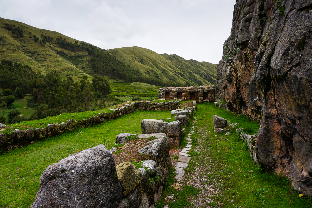
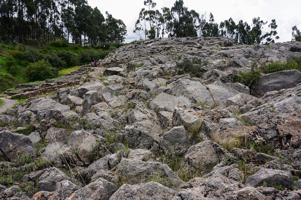
Last time, we left off on the side of the road after being released from the world’s craziest colectivo. (This time, get ready for a long post and lots of pictures!) The driver dropped us off across the street from our next destination, Q’enko (ken-koh), a large and formerly important rock. “A rock?” you ask. Well, yes, but this is no ordinary boulder. It is limestone and is what’s known as a “karst” landscape, or an area of soluble rock that has dissolved over time to create an irregular formation. Or so I’m told.

Q’enko in all of its karst glory.
Q’enko is the rock on the right, above the grass, and Cusco is in the distance.
Sikllakancha. Nope, I don’t know what it is. But those are some nice rocks, amirite?

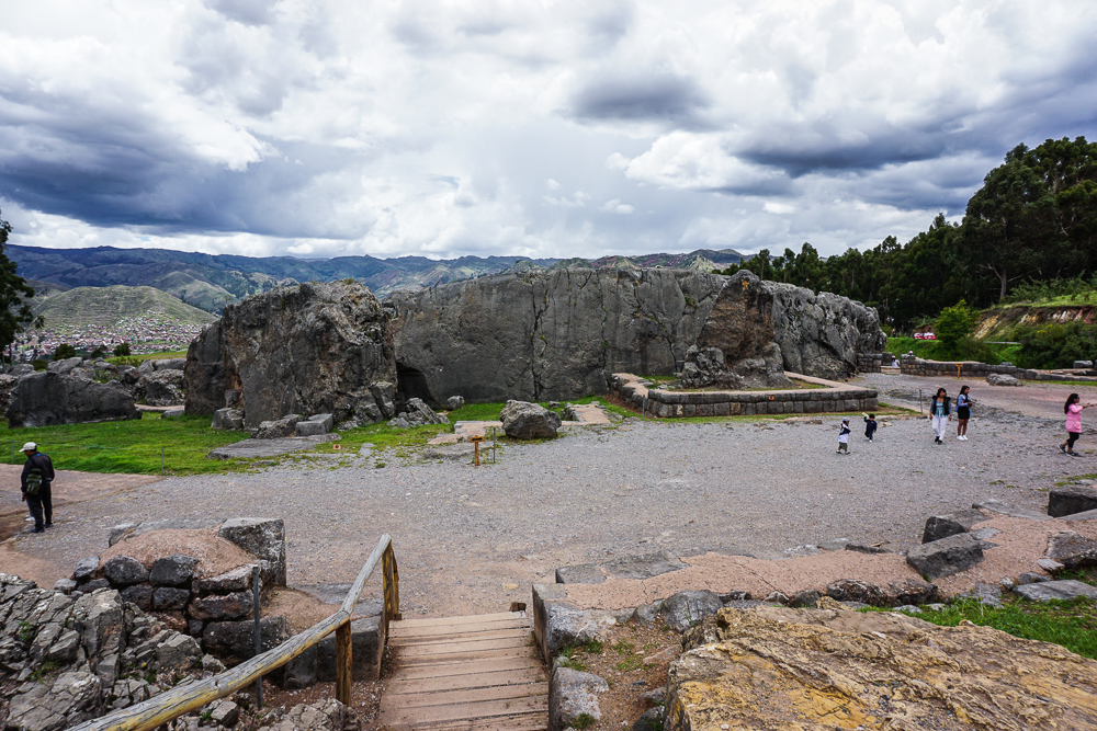
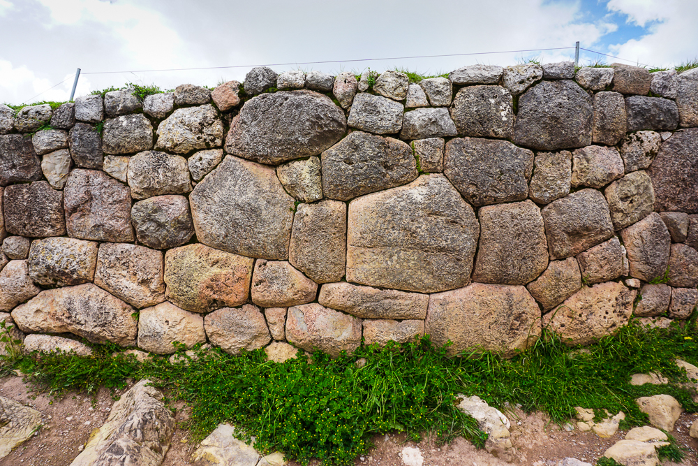
Q’enko is not the original Incan name for the site, rather it’s the Quechua name (Quechua is an indigenous language commonly spoken in the Peruvian Andes). That’s the case for many of these sites, with the original names either lost or in disuse. Anyway, the Quechua name, meaning labyrinth, twisted, or zig-zag, has been around since the 1800s. There is, as you can probably guess, an abundance of theories about Q’enko’s use, but they all consider it an important religious ceremonial site. Part of the challenge of understanding the Incan culture results from the Spanish campaign to destroy anything that had to do with pagan religions. Idols made of precious metals were stolen; rocks carved for religious purposes were destroyed. There’s limited information to work with, but at least they didn’t find some way to destroy the whole site.

Dad coming through the rock.
A very strange place.

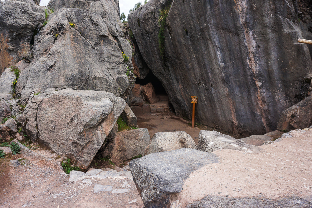
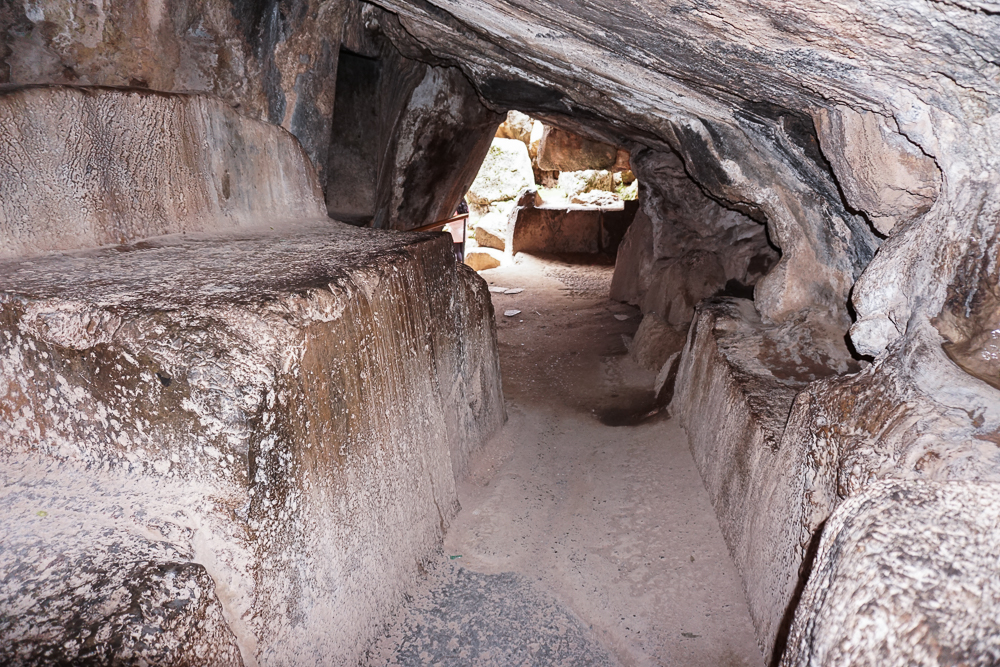
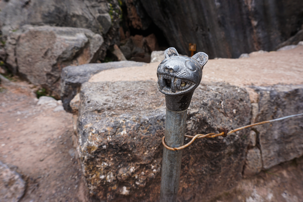
There are still carvings visible on top of the rock, along with some zig-zagging channels that liquid could flow down. Theories for what liquid may have been used: corn beer. Or maybe animal blood. Basically the same, right? An interior chamber was used for sacrifices (human sacrifices were NOT typical in Incan society, in case you were wondering). There’s some other stuff on top that was probably used for charting the sun. Lots of things happening in/on/around this rock!

The way into the sacrifice chamber
The sacrifice chamber beneath the rock. That’s maybe the altar on the left?
I liked this little guy… kind of looks like a Nittany Lion!

The group started grumbling about being hungry when we arrived at Q’enko and nearly staged a mutiny when I said it wasn’t lunchtime yet. Geez! Traveling with a group is such a pain! I’m kidding, I’m kidding! But it wasn’t even noon yet, and I only had the most perfect picnic spot picked out and had been waiting for two years to use it. No way was that getting taken away from me. Patience, people!

Q’enko rocks!
The path from Q’enko to Q’enko Chico, our lunch spot.
Q’enko Chico, Cusco, and the eucalyptus forest
I just love those mountains.
Headed to Q’enko Chico (little Q’enko), probably used for religious purposes as well.

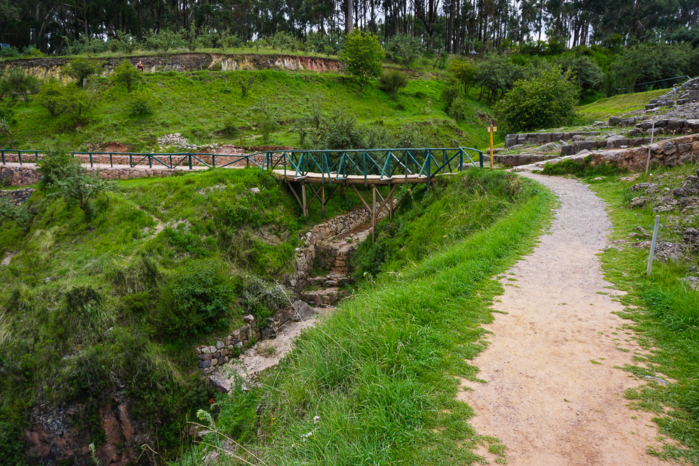
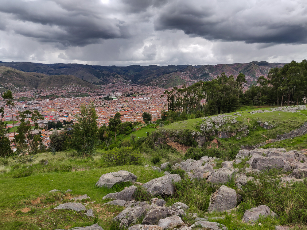
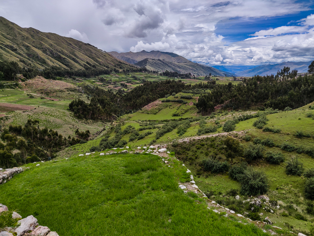
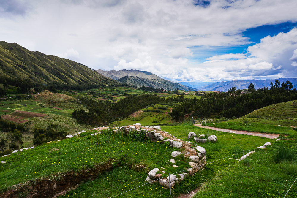
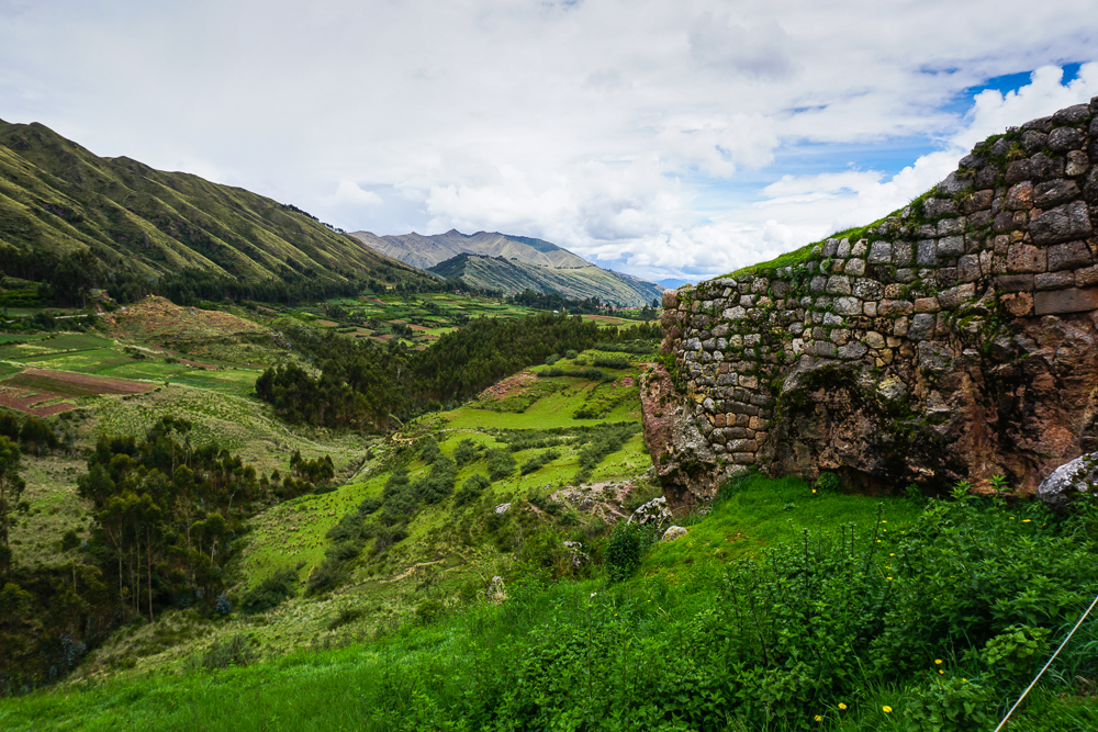
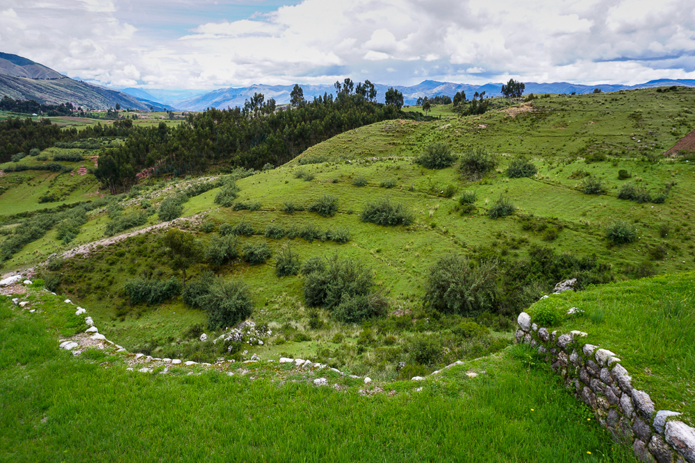
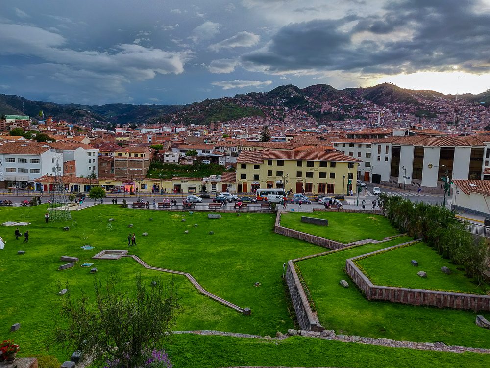
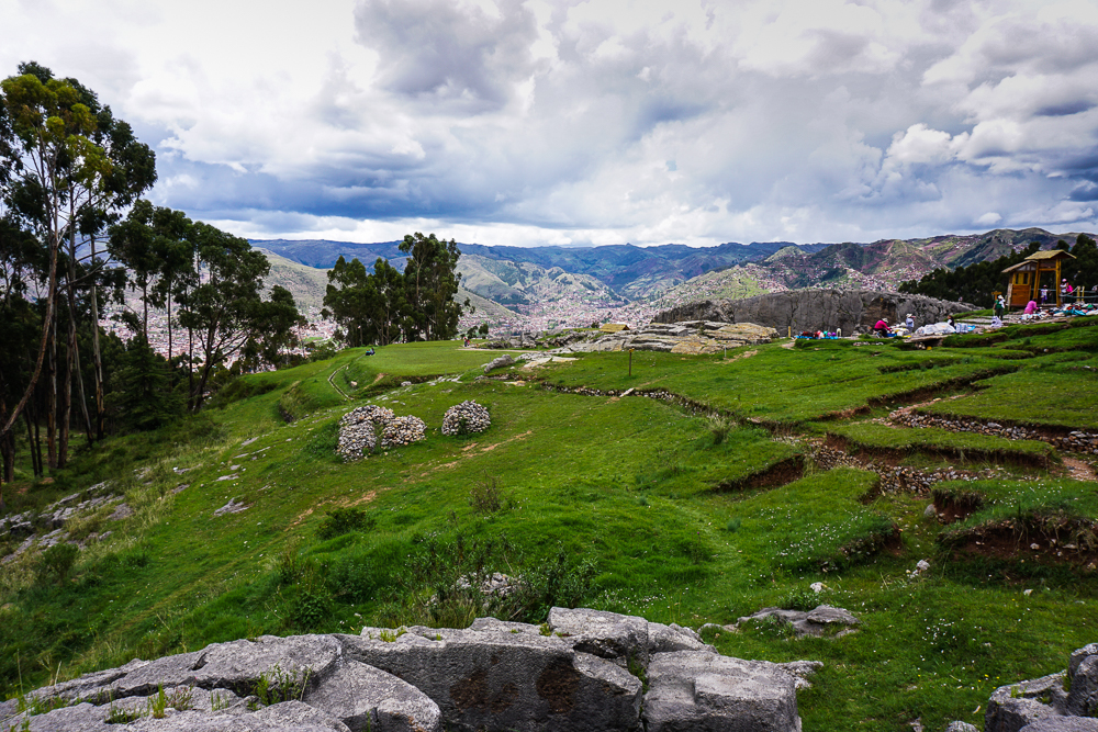
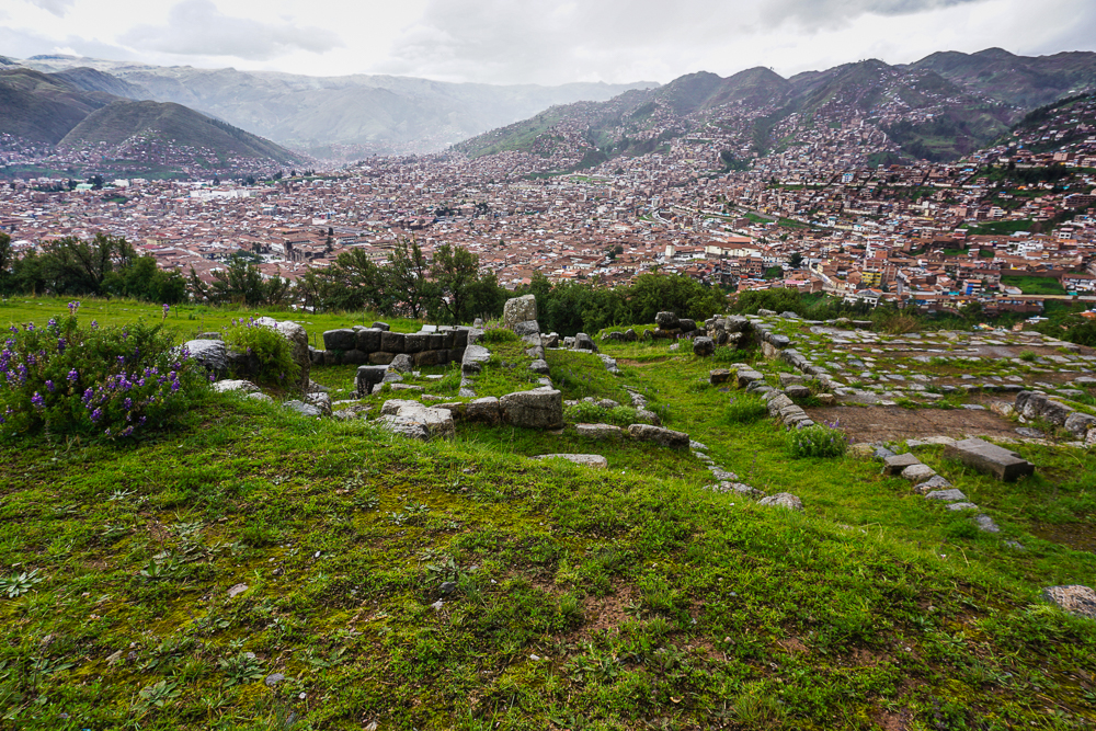
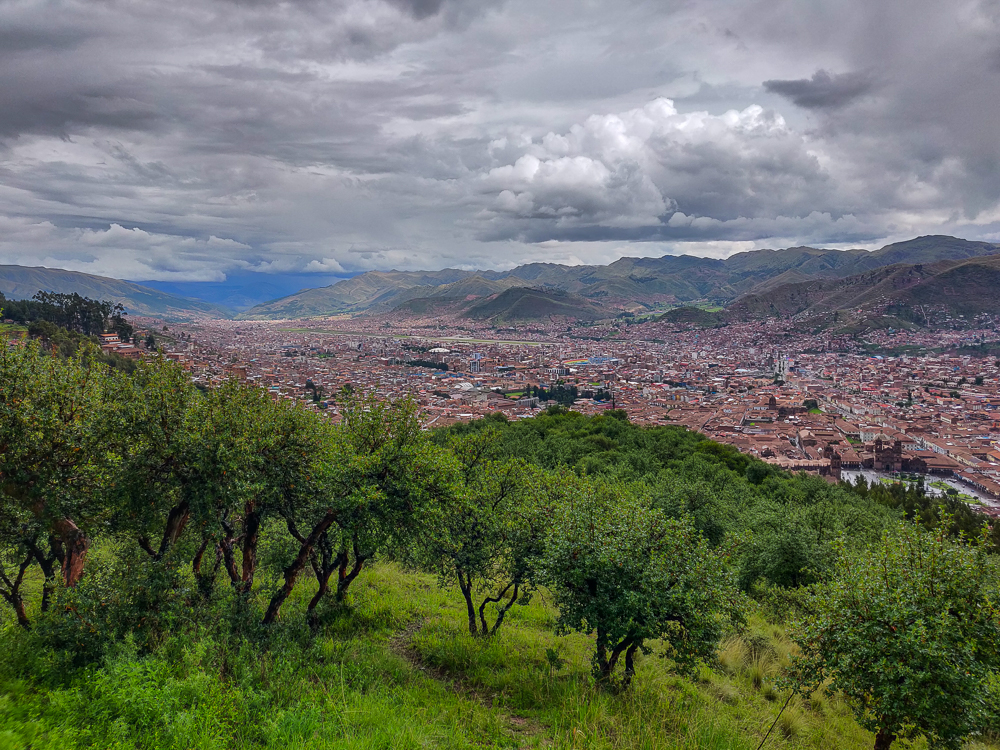
After everyone moaned and groaned their way through Q’enko and down the path to our lunch spot (with a sprinkling of accusations that I was trying to kill them), we finally arrived. WELL. The group’s attitude transformed. Everyone told me that it was worth waiting for, that the view was great and the rocks were nice to sit on. I KNOW. That’s why I picked it! Moral of the story is, trust me!

Q’enko Chico with a neighboring eucalyptus tree forest. These trees aren’t native to Peru. They came from Australia and were originally planted to be used for firewood.
Again, I wonder what this used to look like. I’m sure those walls weren’t always crumbling!
That’s one big rock! And a bonus pup.
Lunch spot views!
Eucalyptus forest

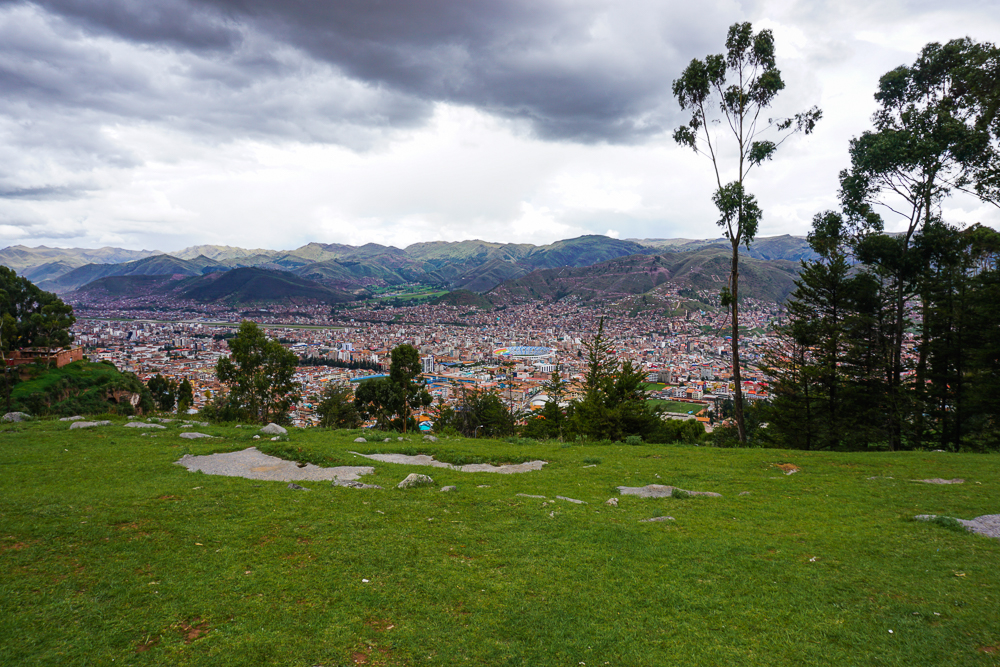
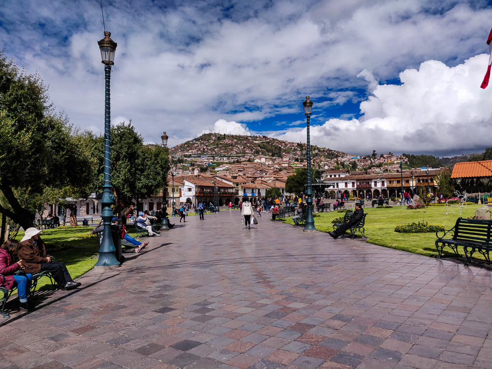
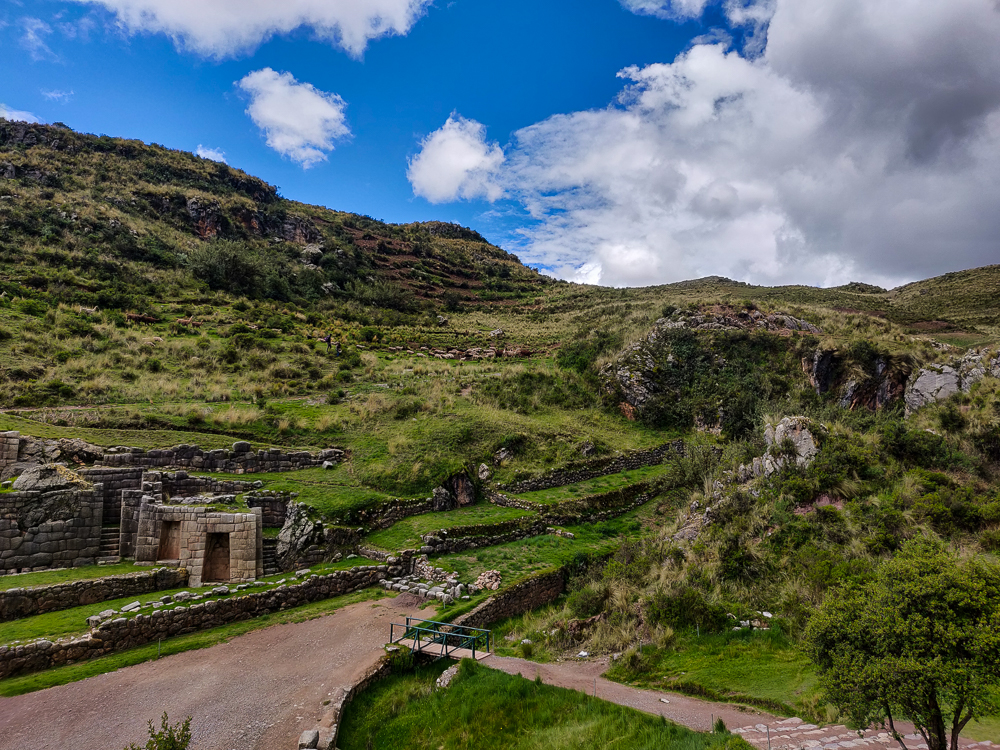
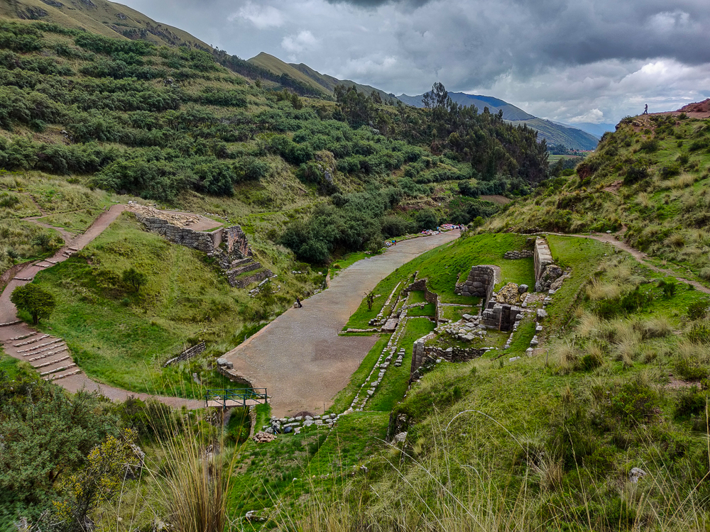
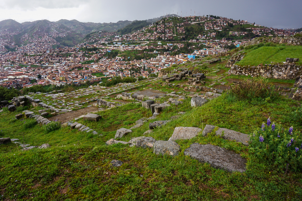
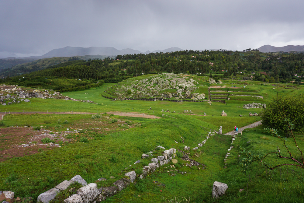
The bad news was that the sky grew increasingly threatening as we ate, and I crossed my fingers that the rain would hold out just a little longer, through our last stop at Saqsayhuaman (sak-say-WAH-man), the most expansive set of ruins. We walked there, got directions from the park rangers, and within minutes, it started POURING. Welp. So much for crossing my fingers!

The weather radar showed the storm passing in an hour, and the group started discussing staying vs. heading back to town. I really wanted everyone to see the last site, but we weren’t going to wait out in the open, and there’s nowhere to take cover… except… we spotted two roofed areas among the ruins. Our only hope. Benjamin and I looked at each other and made a beeline for them while everyone else followed behind.

Well, if only the route there was direct! We had to go up a few levels which meant finding stairs while pretending that we knew exactly where we were going to avoid losing the confidence of the group. Finally, we reached the right level! The end was in view! Anddd we stopped in our tracks in front of a sign strung up across the path. “No pasa”. Soul crushing. Dad caught up with us, looked at the sign, said “heck no”, and stepped over the rope without hesitation. It was hilarious. And that was all the encouragement we needed to follow suit.

Hehehe do you see the rain, streaking across the picture?
Dad, Mom, and Jocelyn looking happy to be under cover.
Doing some random internet fact read-alouds to entertain the group.

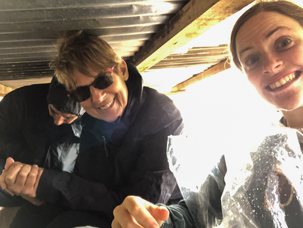
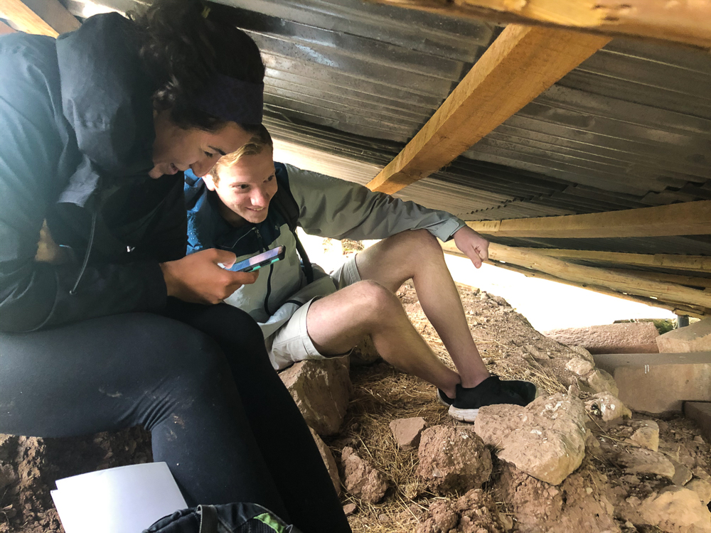
This ended up being the best decision we made all day (thanks, Dad!). Our hideout wasn’t particularly comfortable… we were all contorted and had to stay quiet to keep from attracting the attention of the park rangers who were just out of sight under the adjacent roof. But we were dry, and no way did we want to get booted out into the rain!

Zig-zag walls! Spot our heroic shelter. We were under the top left corner of the right roof. The park rangers were underneath the left roof, all the way on the left side.

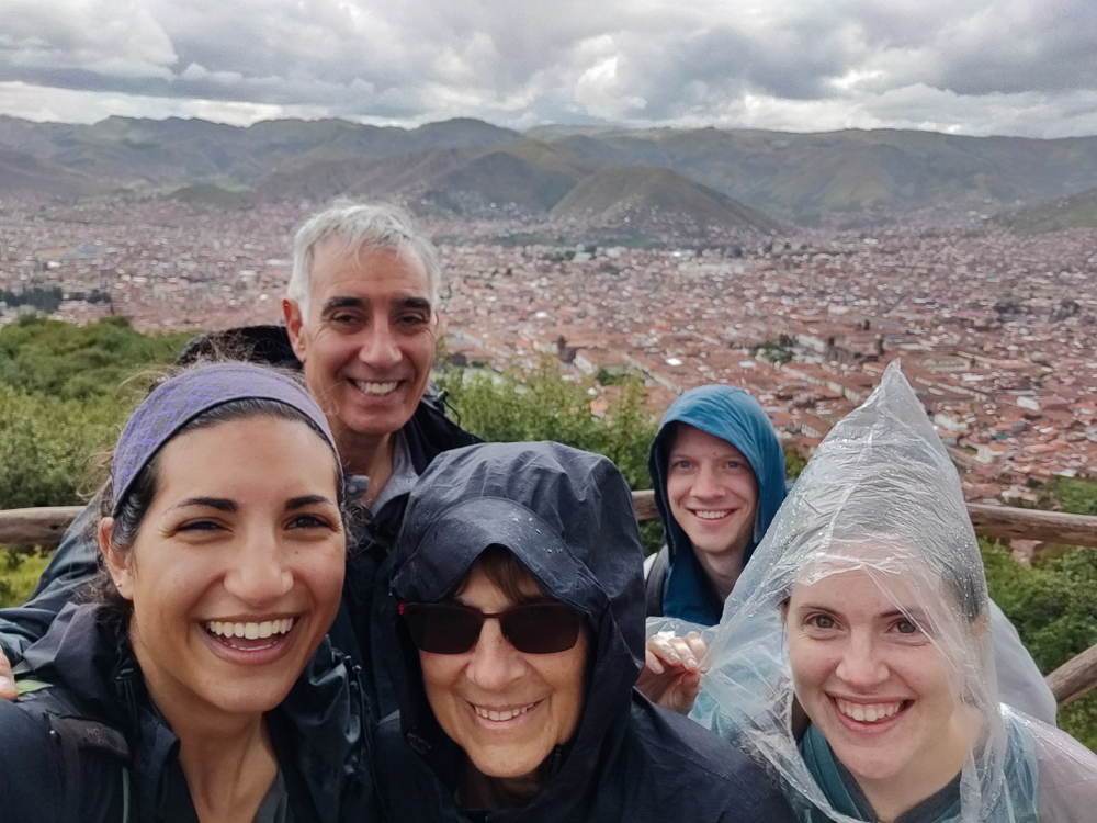
Finally, about 45 minutes later, the rain slowed, and we decided it was time to make moves. As we climbed out, one of the rangers under the other roof started blowing his whistle (which is what they do when people are doing something they shouldn’t), and we kept moving, with no hesitation or glance back. Benjamin said he thought it was directed at someone else, but either way, I have no regrets.

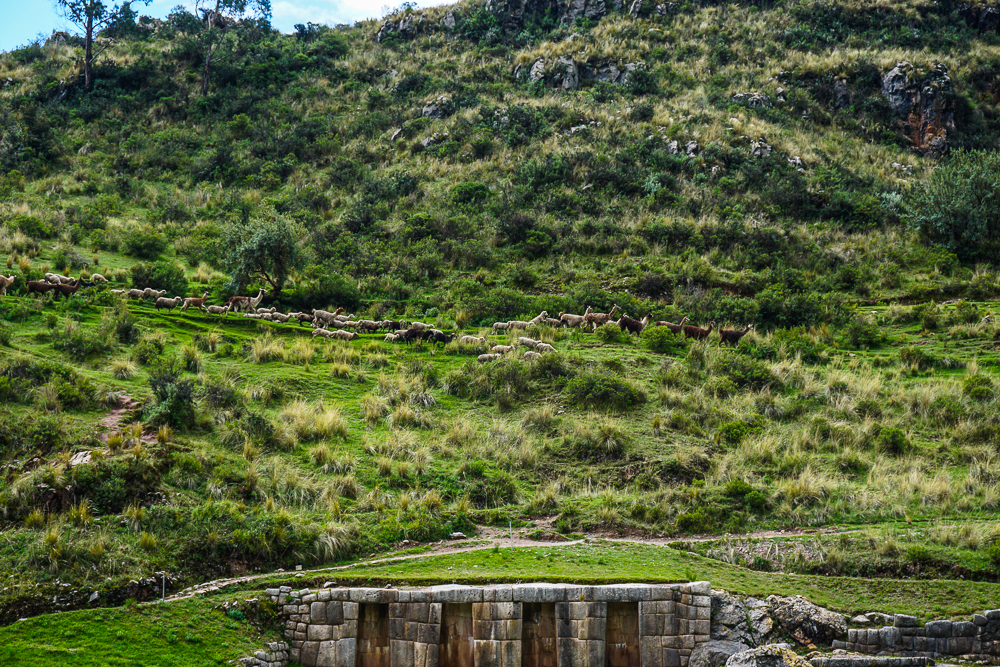
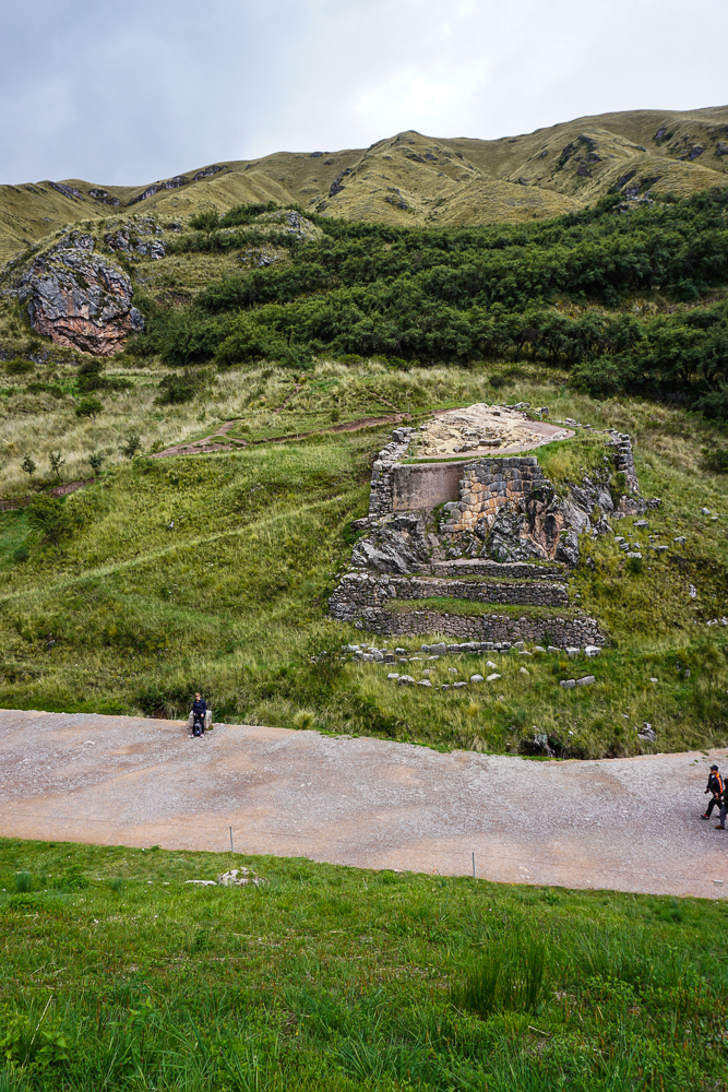
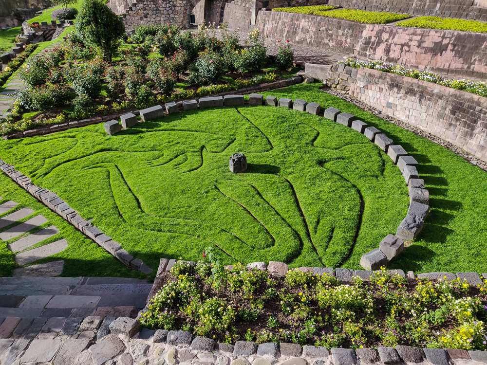
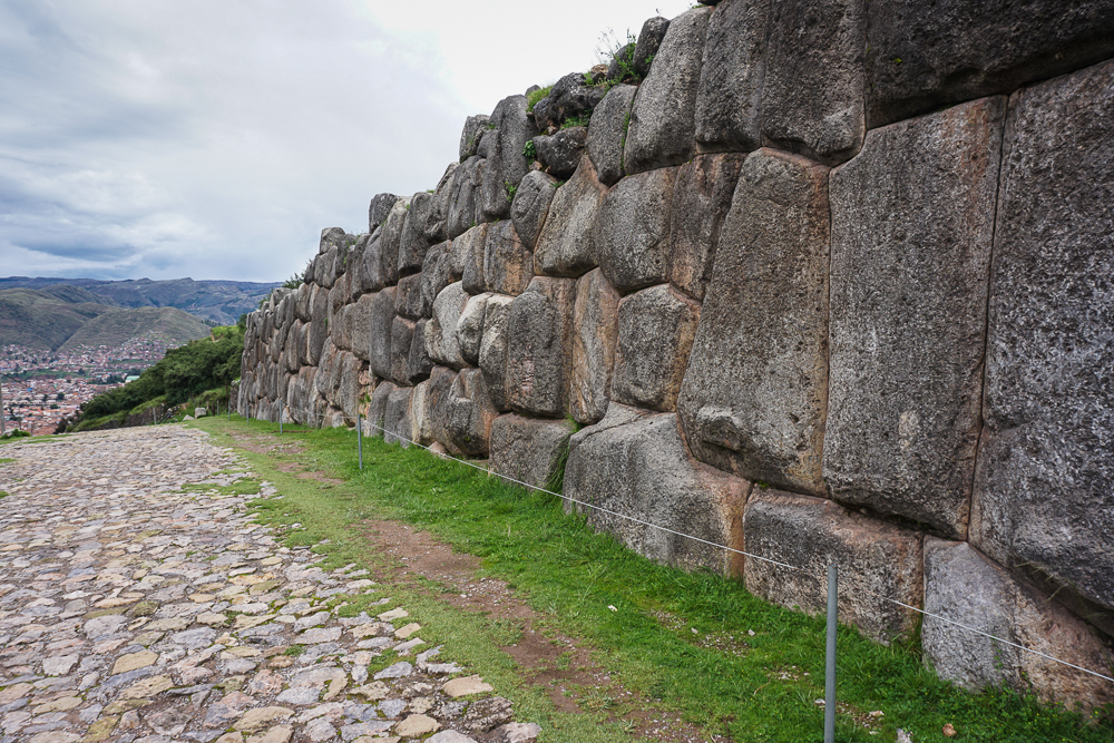
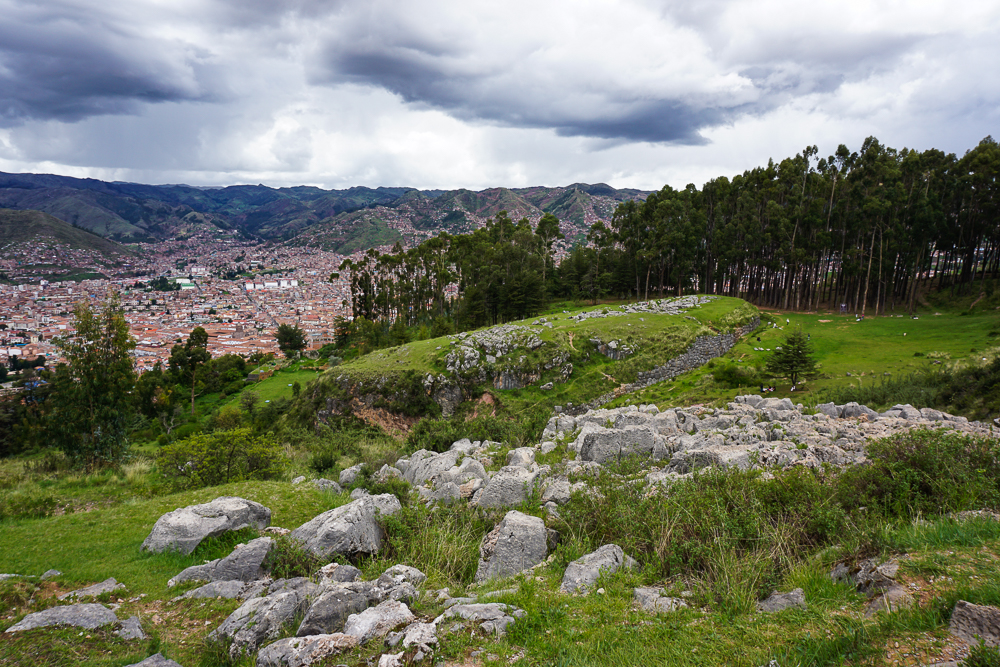
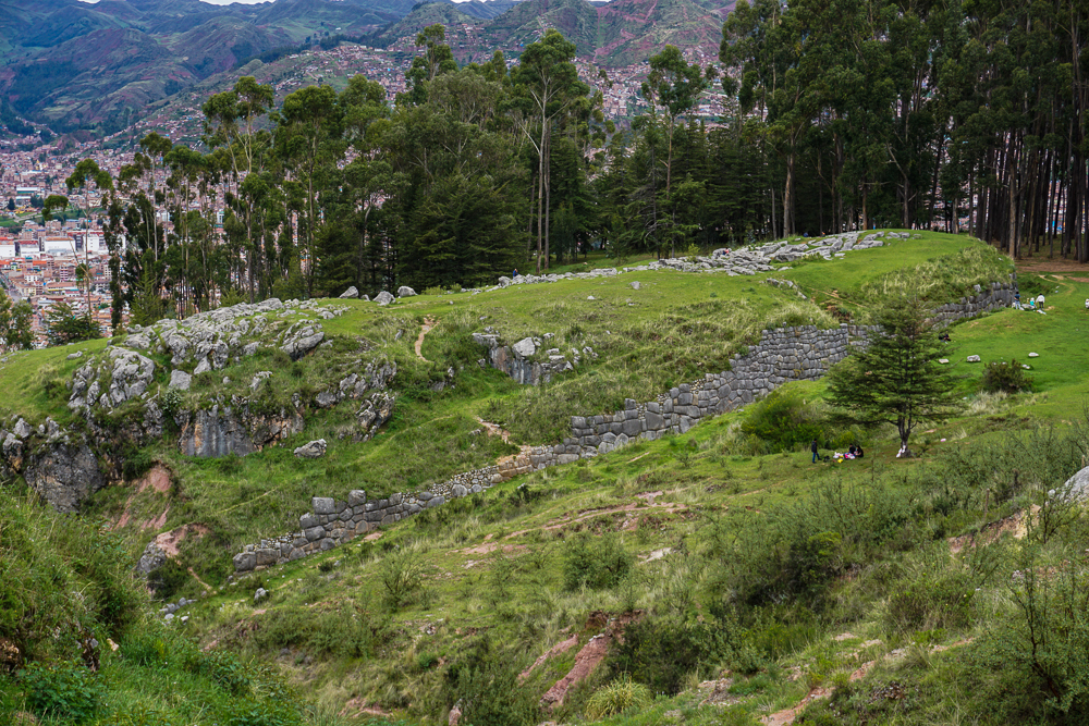
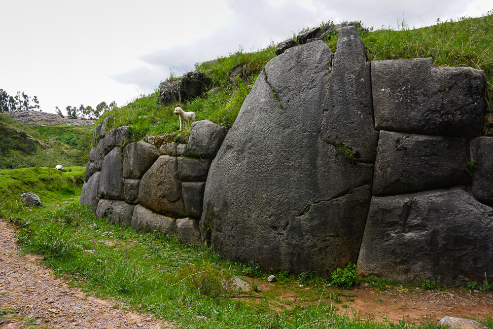
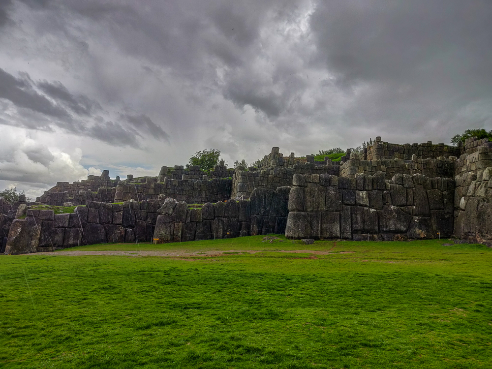
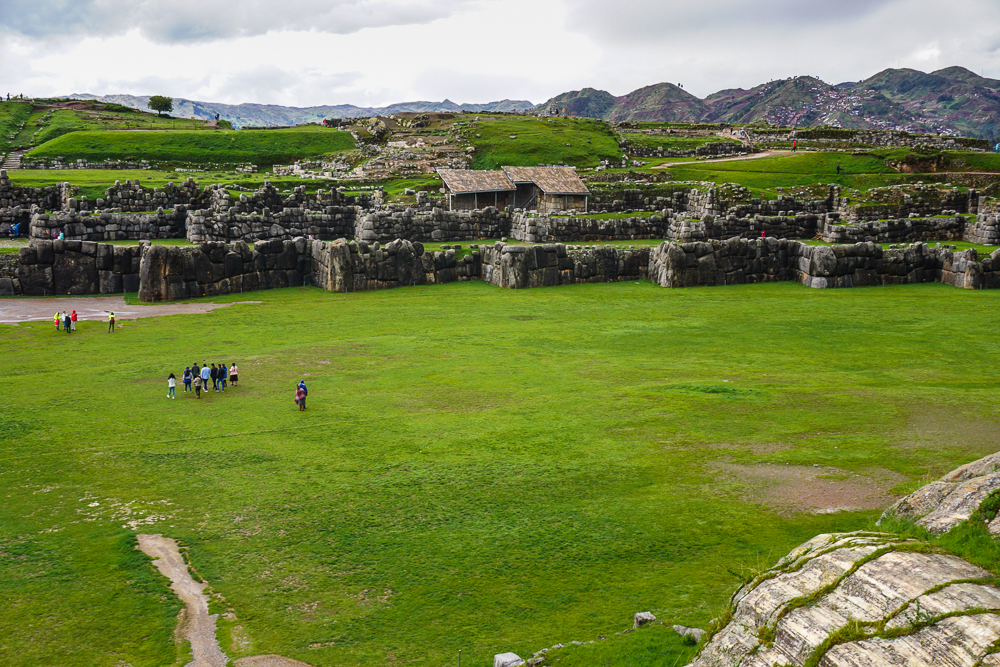
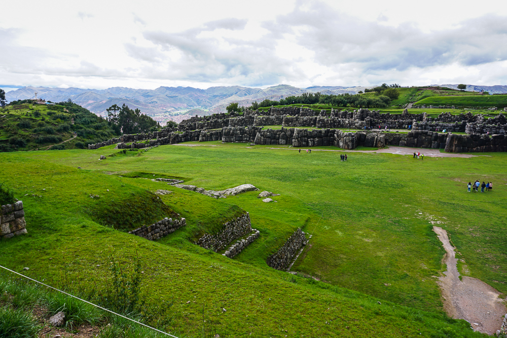
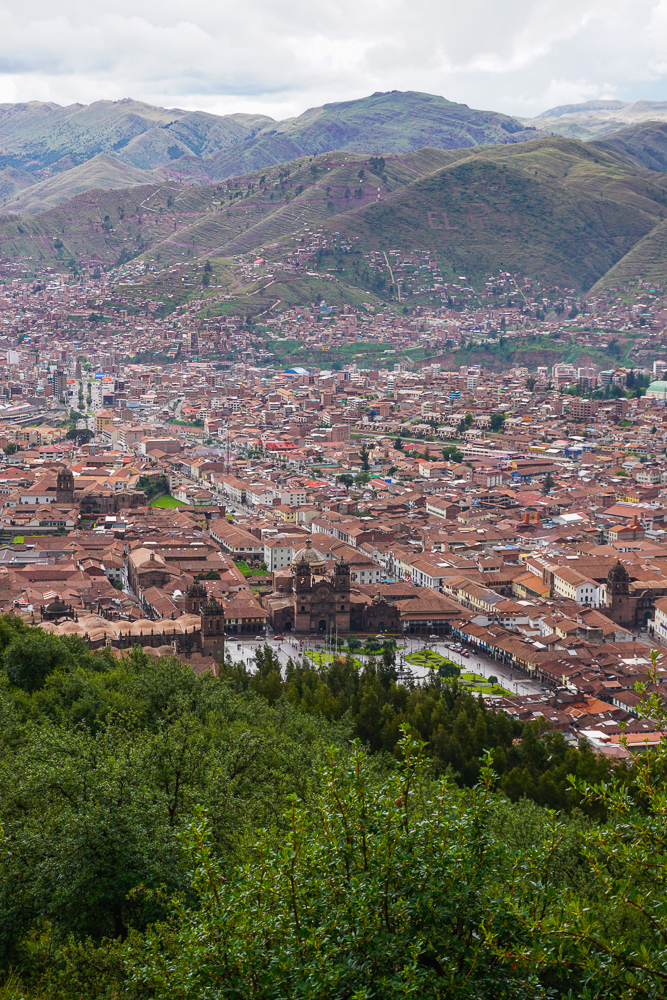
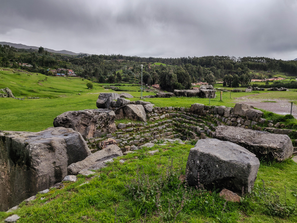
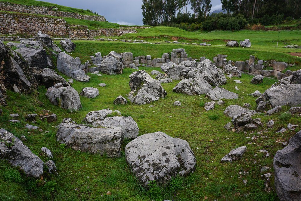
Back in legal territory, we took a quick spin around the ruins. Saqsayhuaman is considered one of the most impressive Incan sites. Machu Picchu is so famous and popular mostly because of its location, not as much because of its construction. Saqsayhuaman, on the other hand, is an incredible architectural feat. The name is, of course, Quechua, but the meaning is debated with the most likely options being “marbled falcon” or “marbled head”. It is said that the city of Cusco looks like a puma/cougar/mountain lion, and Saqsayhuaman forms its (marbled?) head.

Faking smiles… just kidding. We were actually happy because we survived the storm without getting drenched. Jocelyn is totally rocking that poncho (jokes aside, she was the most prepared and probably the driest. And the most fashionable, clearly).
What a beautiful place for a city!

Construction began in the 15th century, led by one of the most famous Inkas (kings), Pachakutec. He was responsible for many of the great Incan building projects, and this one took 50 years. You may be wondering – how did they have the manpower for a project like this? The Incas didn’t have slaves, and records claim that 20,000 men worked on the project. Since there was no money in their society, taxes to the government were paid in either labor or goods. This “labor tax” is what made so many of these grand, labor-intensive monuments feasible.

I’m telling you, the stonework here is some of the best.
Like seriously. I still don’t understand how they did this.
They say that the Spanish were so impressed by the construction quality that they thought the Incas must be in cahoots with the devil because there’s no way that mere mortals could build like this.
With the shoddy stonework that the Spanish were used to (re: all colonial buildings in Cusco. Yuck), no wonder they thought this level of skill and precision was above the capabilities of mankind.
Mom and Dad looking nice and dry(ish).

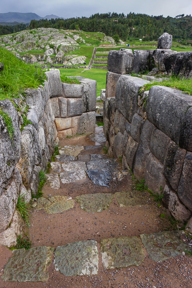
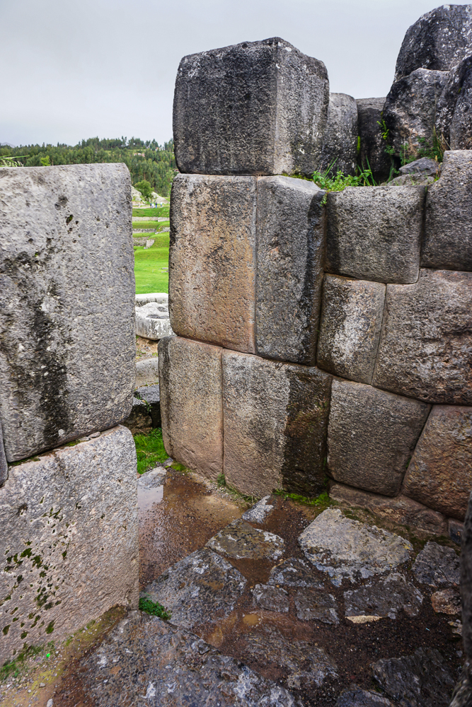
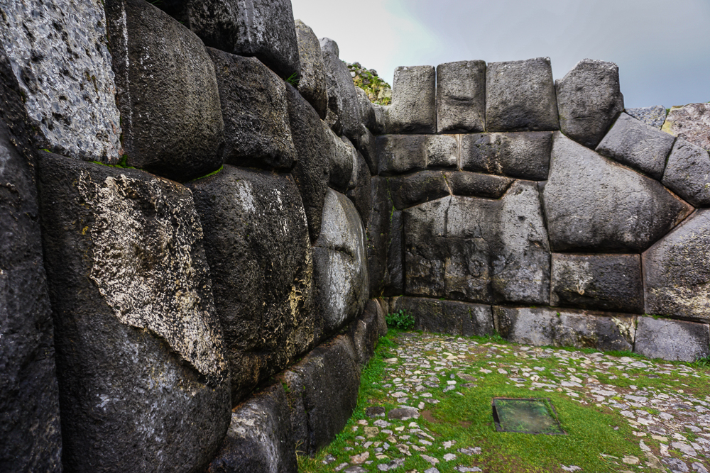
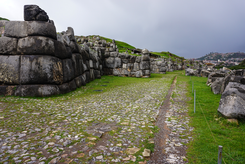
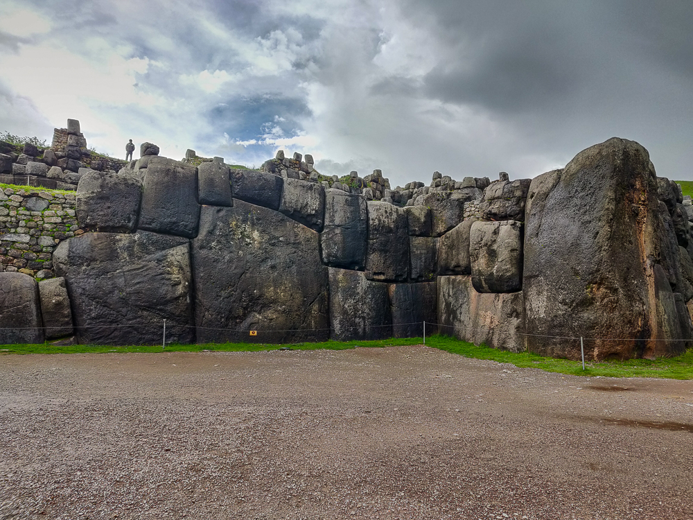
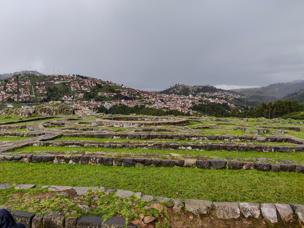
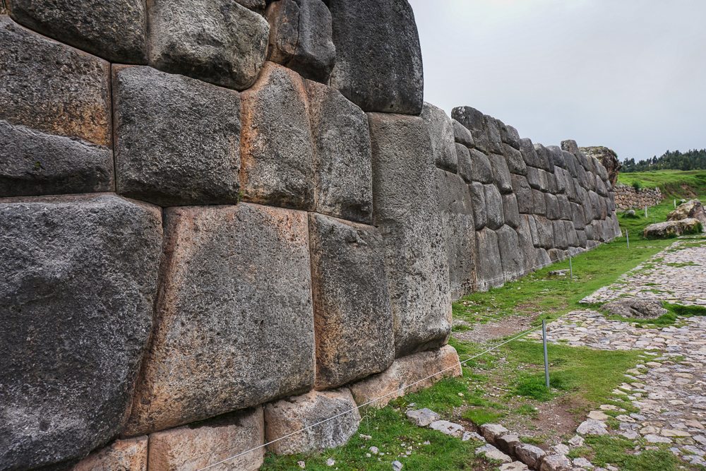
While Saqsayhuaman is often called a “fortress”, it is believed that its primary function was religious and it was well-defended due to this religious importance, not because it was meant as a fortification. However, it did have its moment when it was used as a stronghold in the 16th century during the Spanish invasion. Following the Incas defeat, the Spanish disassembled and buried the site to keep it from being used for that purpose again. Over time, many smaller stones were taken and used for other buildings in colonial Cusco, including the Cathedral. Even into the 20th century, people could pay to use the site as a quarry for their own personal building projects. At the base, three imposing wall layers remain largely intact, thanks to the massive scale of the stones (one is nearly 30 feet tall and weighs 150 tons!). At the top, there used to be three towers, and only the foundations of those remain.

Check out those big rocks!
The base of one of the towers. One tower was round in shape, and the other two were rectangular.
Mildly obsessed with this view.
More foundations at Saqsayhuaman that make you wonder what used to be there.
Three layers of zig-zag walls.
I mean, come on. Those mountains are fab.
Standing on top of the zig-zag walls and looking across at another maybe-sacred, giant stone that’s part of the Saqsayhuaman complex.

Pachakutec also created Inti Raymi in 1412, a festival dedicated to the sun god Inti and the celebration of the Inca New Year. It was held on the winter solstice until pagan religious celebrations were banned by the Spanish in 1535. In 1944, the festival was revived and is celebrated at Saqsayhuaman each year on June 24th, featuring a theatrical representation of the Inca ceremony and festivities.

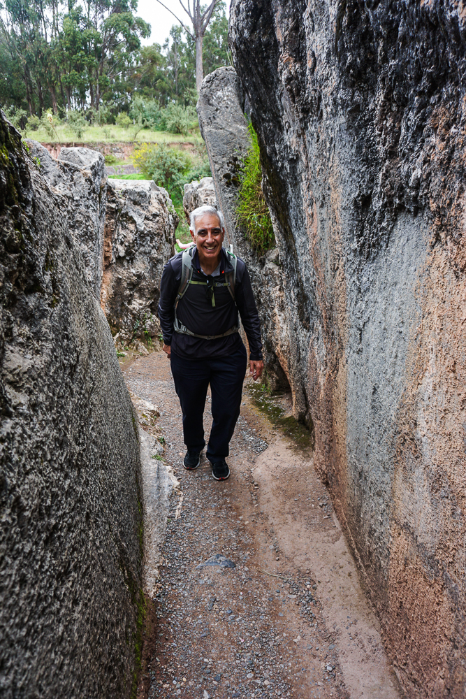
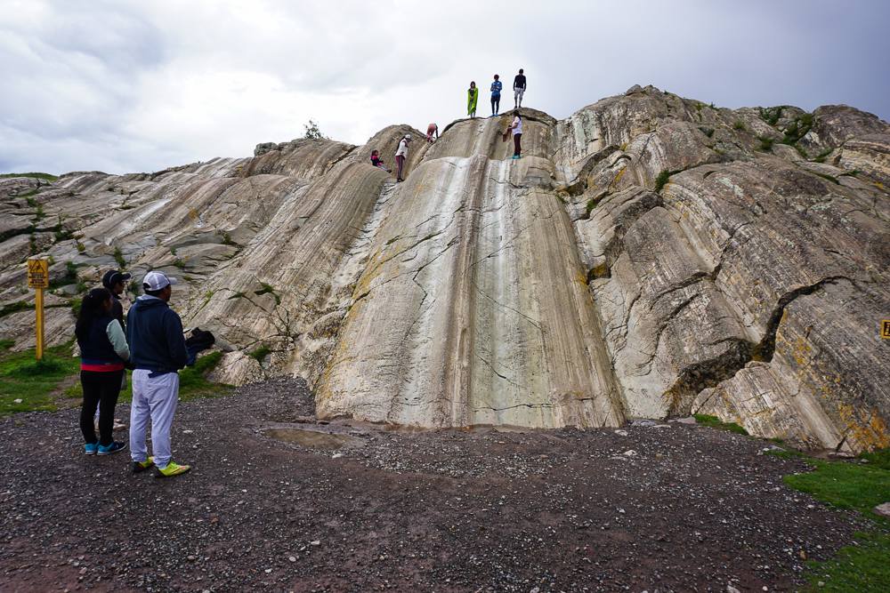
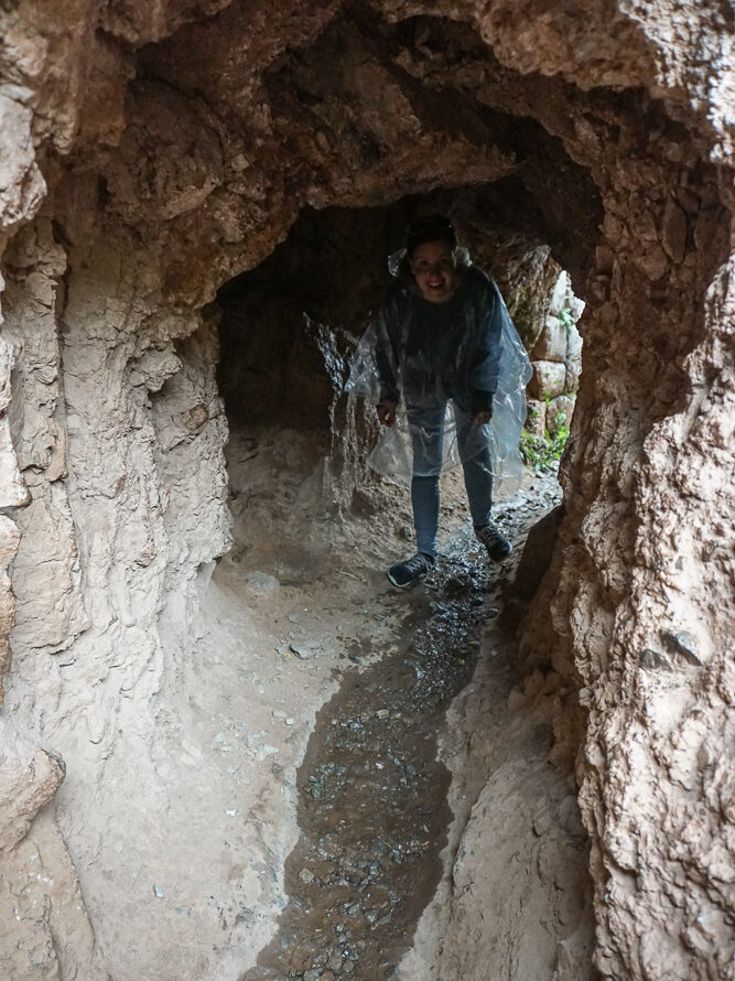
Even though everyone was feeling pretty drained after the rain, I did want to make sure we got the full experience… including my favorite part, the rock slides! (Admire my avoidance of the bottom-of-the-slide puddle.)

Rock slides!

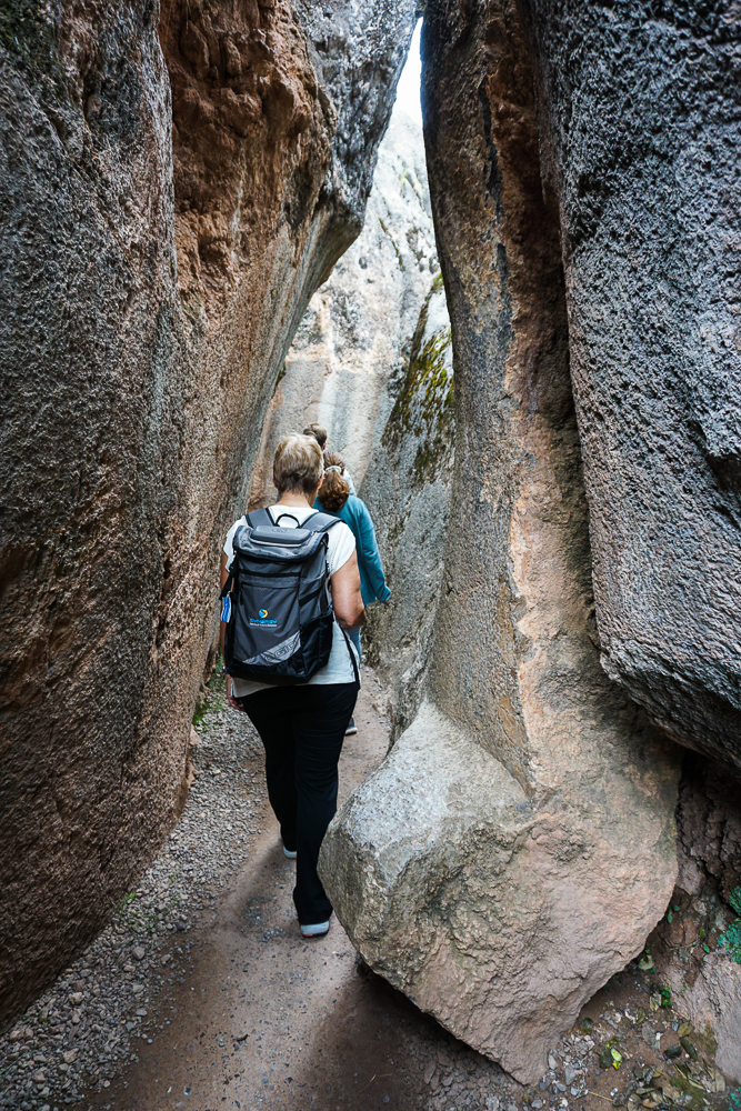
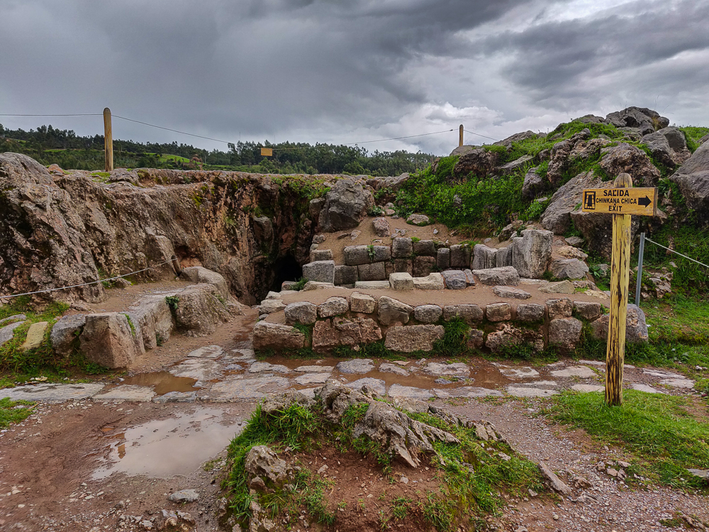
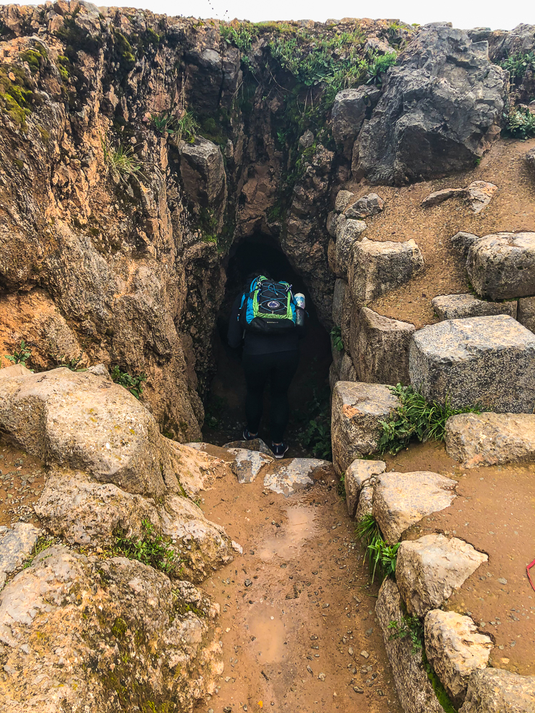
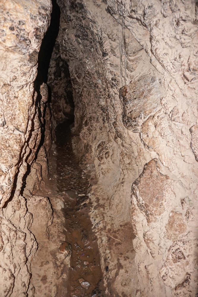
And my second favorite part, the weird tunnels!

The entrance to the tunnels… well, that’s not true. This is the exit, but we walked through the wrong way (whoops).
Headed into the darkness
The short tunnel
…and the long tunnel
See the church just above the tree/bush/grass line? Okay, now look for the other church on the same square, a little to the left of there. That’s the Cathedral with its stolen stones, sitting on the Plaza Mayor, the main plaza in town (and also sitting on the foundations of an Inca temple that was destroyed to build it).

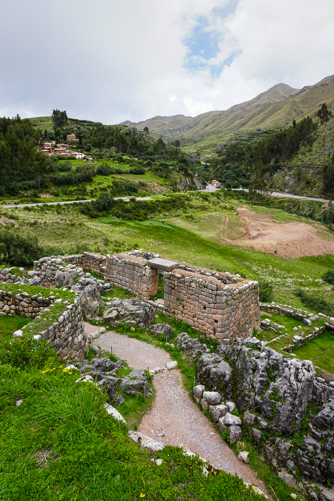
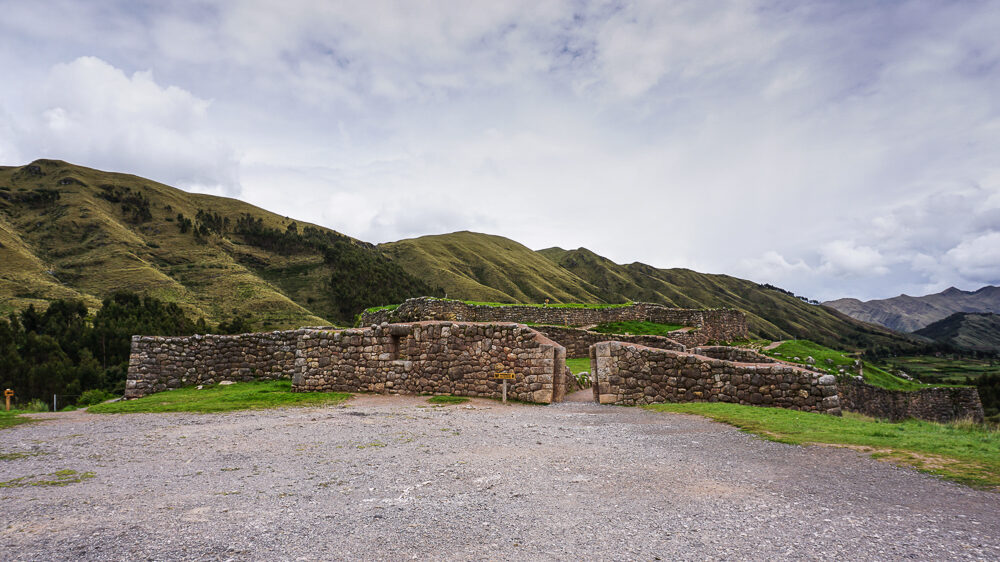
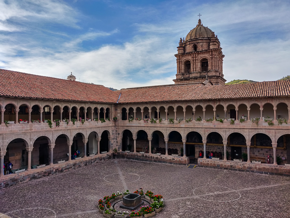
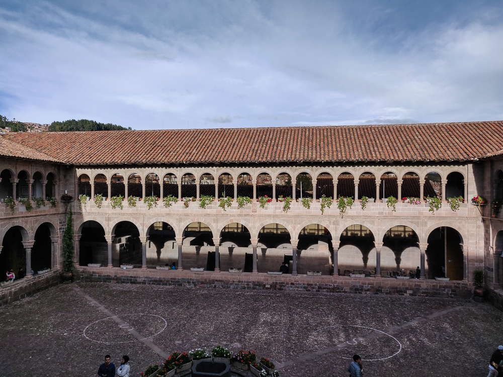
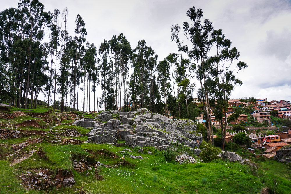
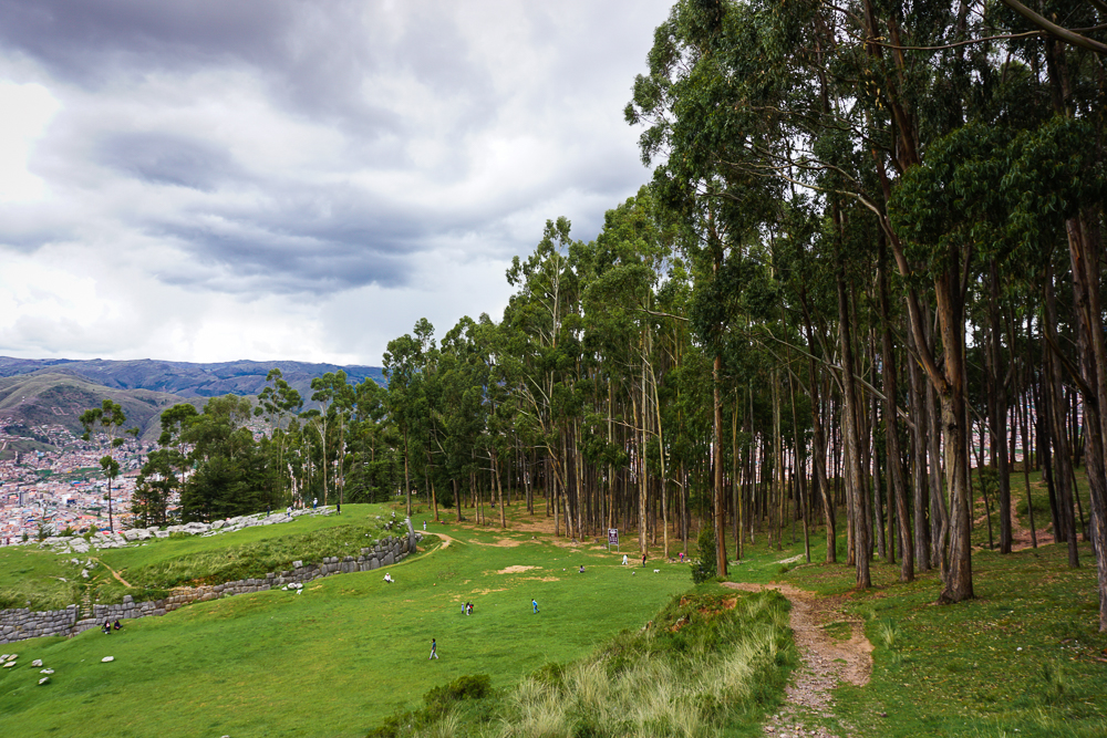
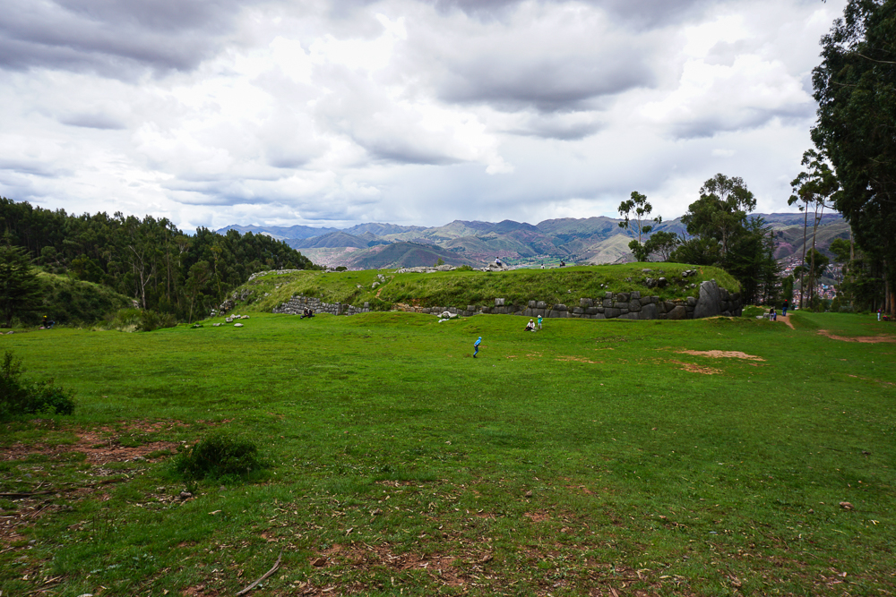
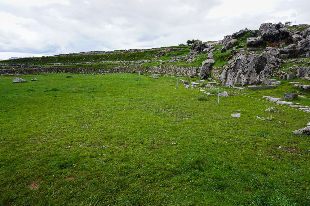
And here are other various pictures from around the ruins.

Something.
Some rocks that were probably important for something. Actually, this front circle area was definitely important because, as you can see, the stones are much more precisely cut than those other stone walls in the background (I think those are actually restored walls, but either way, the following statement is still valid). The Incas put more effort into more important buildings which is part of how you can tell that Saqsayhuaman was a very important place… so many of the rocks have those important-building-tight joints.
An amphitheater-like area that was used for something ceremonial and religious and important. Probably. Or maybe this is where they had the Inca version of gladiator fights (not a real thing).
I don’t know for sure, but I would assume that the bottom stones are original (the ones that fit together perfectly) and the ones above were rebuilt during restoration. This is a common thing to do during restoration because you want to rebuild enough to show what used to be there/make sure that it’s structurally sound, but you don’t want people to be unsure about what is original and what is not.
Another thing that shows a structure’s importance is these “pillow” stones. Instead of the stone faces being mostly flat, they are rounded. This is much harder to do, and so it is reserved for the most important buildings.
I’m not going to guarantee this statement, but a lot of times, when there are bumps on some of the stone faces, like on the bottom of that big stone near the front, they were used to connect sheets of precious metals to the walls, like what I talked about at Qorikancha. So maybe these stones also had some gold sheets on them. Or maybe I’m totally wrong.

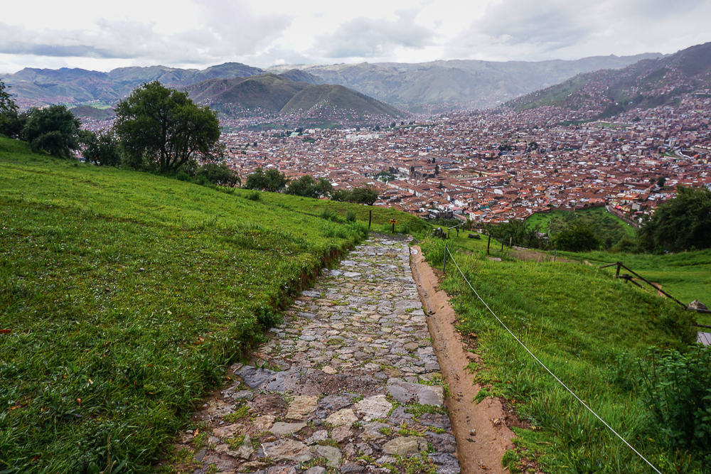
Okay, THEN we’d had enough ruins for one day. I planned for us to walk back down to town from Saqsayhuaman, not remembering that the path isn’t exactly ideal… downhill with uneven and slippery rocks. We made slow progress until the end of the rocky part and breathed a collective sigh of relief when we hit a normal street.

We initially walked past a guy standing at the bottom offering taxi rides, but then I looked at my parents and changed my mind. Jocelyn and I conferenced to determine a reasonable taxi price, and I asked him how much to the central plaza. 10 soles. I said okay… and by the way, we have five people. He tried to raise the price, but we rejected that and got in the car telling him we’d pay 10.

I thought we’d have to squeeze with 5 people, but it turned out that his little car had two back rows. Perfect! As we rode back into town, he asked about our other plans and listed some other places he could take us. Hm… I already had our schedule planned out, but we actually DID need to hire a taxi. I asked if he was free the following day and how much he would charge for my itinerary. It was in line with the price I was expecting, so we accepted! It kind of felt like fate with his perfectly-sized car and open schedule. And it was a huge relief to get that settled!

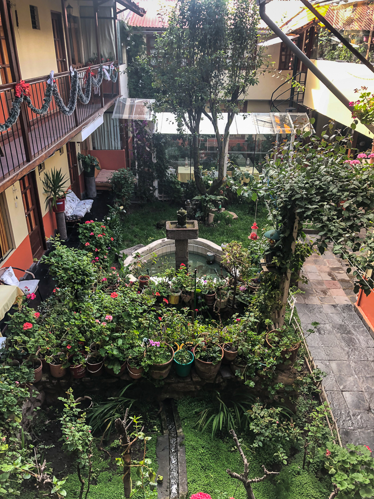
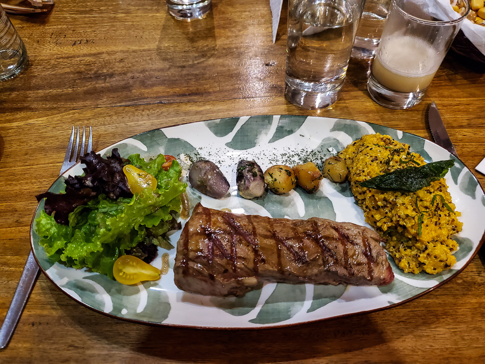
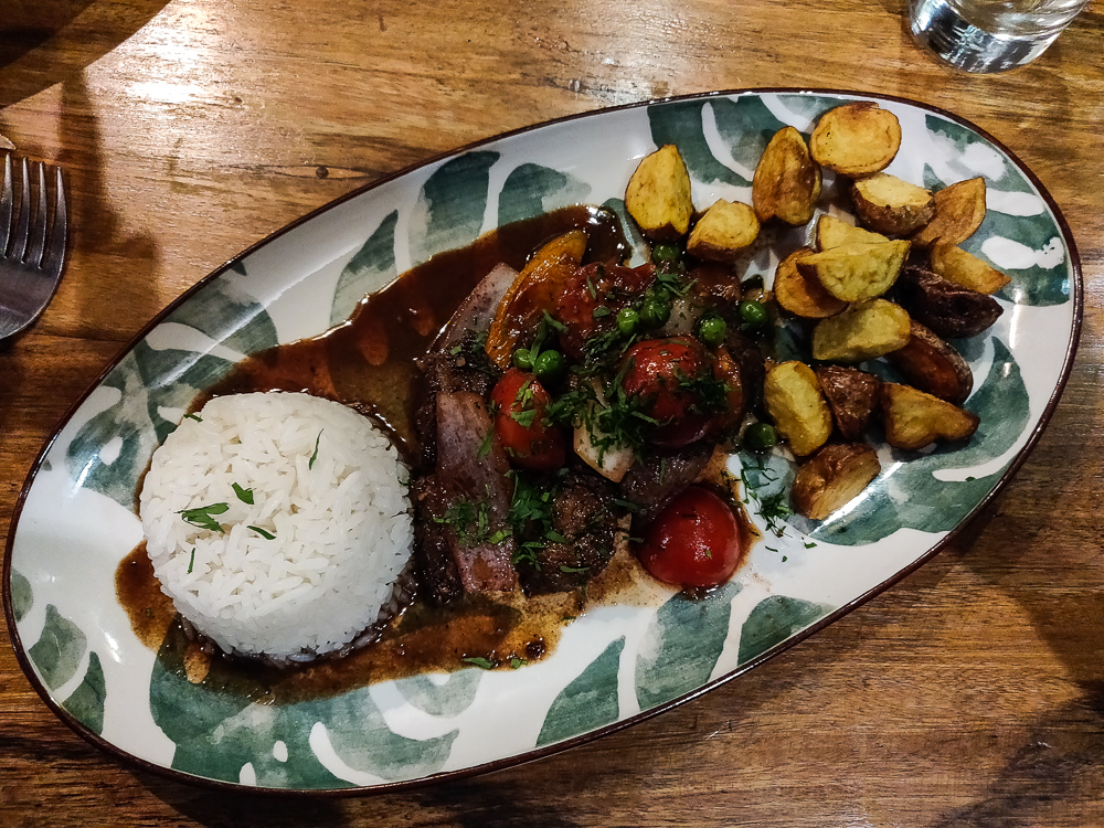
The rest of the night was low-key. Back at the hotel, we got ourselves organized. We were leaving in the morning for an overnight trip, and thankfully, the hotel was letting us leave some bags there which meant we could travel lighter… but we did need to repack everything and pull out the stuff we wanted to take with us. We took a break to get some alpaca burgers for dinner and then headed back to the hotel to finish getting ready for the next day’s adventures with our new BFF, Amerigo the taxi man!

I had all sorts of plans for our full day in Cusco. Essentially, I wanted to follow the same schedule as my first time in Cusco because I thought that it was a good intro to Incan ruins. There are four major sites within about 20 minutes, driving, from the center of Cusco. Last time, I tromped all over the city searching for a public bus to drop me at the farthest one and then worked my way back from there. This time, the lady at the hotel convinced me it wasn’t worth the pain to take the bus when a taxi was only 20 soles ($6), or 40 for the two we needed. The group seemed to agree which I guess is what happens when you travel while actually having an income. Weird, I don’t know what that’s like.

I asked her to schedule them for a couple of hours later (and I was really proud of myself… this all happened in Spanish. The woman’s daughters speak English, and she was going to call them to help with our conversation until I told her I wanted to try. She was really nice about it and spoke clearly and gave me a big confidence boost. Good way to start the day!), and she gave us directions to a grocery store so we could buy supplies for lunch on the go. On the way, we stopped at the famous 12-sided stone, another example of Incan stoneworking excellence, though after the 14-angled stone from Qorikancha the day before, it’s just another rock. Kidding! I still think it’s awesome. Seriously, Incan stonework is a detail-oriented, precise, engineering-minded person’s dream.

With the 12-sided stone. Count the sides and check out those tight seams! It’s pretty darn amazing, isn’t it?
Mom and Dad insisted on a picture with this keystone-shaped stone (because Pennsylvania).
The alleyway. The lower part of the wall on the right is an Incan masterpiece (it’s the wall containing the 12-sided stone and the keystone), and the upper part is the laaame Spanish colonial structure that they built on top. Sorry, that was probably rude. The upper part is the perfectly adequate but disappointingly boring Spanish colonial structure that they built on top. Was that better?
The Plaza Mayor (the central plaza in town)
The courtyard at the hotel. It’s all VERY decorated for the winter holidays, including these incredibly annoying music boxes that played constantly until Dad went and unplugged them because we could hear them from our room hahaha. But it’s also such a nice escape from the city!

We also picked up our tourist tickets along the way. They’re good for something like 12 different sites across Cusco and the Sacred Valley (technically the “Sacred Valley of the Incas” which is the valley at the heart of the Incan empire and has a ton of significant sites), and four of those were the ones we were planning to visit that day. From there, we rushed back to the hotel, grabbed our bags, and were reconvening in the hotel courtyard just as the taxi guys arrived.

Most actual tours of these ruins start in Cusco and work their way out from the city. Since the official Lara-guided tour goes in reverse, there was practically no one around when we got dropped off at our first stop, Tambomachay. Also, part of that might have been due to the weather. It was drizzling when we got there, and the rain continued off and on, in varying intensities, for the rest of the day.

Tambomachay was a place of rest and relaxation for the Inkas (the kings – from now on, I’m going to use “Inca” to describe the people group and “Inka” for the kings. This is just for my sanity. In reality, both are acceptable spellings for both). “Tambo” means that it is a lodge, or a place where travelers can receive food and lodgings, and “machay” means that it is a resting place. It is believed to have been used by the Inkas as a base while hunting and was also a sacred place.

The niches in the wall were likely used for golden idols and maybe even mummies. There are a few fountains, still operational, fed by an unknown source and brought to the site through underground channels. Some claim that the water has certain mystical qualities that grant the drinker eternal youth or fertility (one specifically promises to give you twins).

You can see the fountains on the right side. A park ranger we met at the site told us that the two fountains at the bottom are the ones for having twins, since the water stream splits into two, and the one on top is for eternal youth.
The niches were probably possibly maybe used for golden idols. I’m picturing giant, human-sized, golden corn cobs in all of them (that’s not historically accurate, it’s just for my own personal enjoyment).
Spot the alpaca herd!
Rounding up the stragglers
You can see some terracing continuing out from the main part of the site… it makes me wonder what this used to look like in its former glory. Like we see these few fountains and a couple of walls now, but there’s no way that this was all there was to it back in the day.
The crew, slowly perfecting our selfie game.

Across from the main fountains, there are the foundations of a destroyed watchtower. According to a park ranger we met at the ruins, it was part of a tower network used to spot enemies and communicate with surrounding towers. From the Tambomachay tower, they would have communicated with the people at Puka-Pukara, the site across the street and the next stop on our tour. Like so many other things, the Spanish destroyed it when they invaded. He told us that it was 30m high (100ft)! That seems amazingly tall for the time and technology, but it’s gone now so who knows? And it’s not like the Incas didn’t accomplish other seemingly impossible feats.

A good view of the whole site, with the main fountain area to the right and the tower foundations to the left.
The foundations of the maybe-30-meter-tall watchtower.
This is from Puka-Pukara looking towards Tambomachay. If you see the road, then that parking lot with the building with the red roof, and then go straight back from there, that’s about where the watchtower would have been.

Puka-Pukara, which means “red fortress” in Quechua, was more of an observation post than an actual defensive fortress. The stones used in its construction have a red hue to them, and it’s located on a natural high point with a clear view of the approaching valley. It was meant to protect the sacred Tambomachay and was also a lodge for travelers, offering shelter and food. Well, all of that is the speculated use, at least. It also was maybe a storage area and maybe a barracks and maybe a checkpoint for travelers. But whatever it is, it inarguably does have a great view of the valley.

Puka-Pukara. I guess the stone does look kind of reddish?
We enjoyed the signage at the ruins IMMENSELY. These activities are forbidden and clearly translated into English:
DON’T HORSE RIDING
DON’T SOLD ON THE STREET
DON’T MOUNTAIN BIKING
Do you think they paid someone for this work??
Here we have:
DON’T ALCOHOLIC BEVERAGES
DON’T FIRE
And, since they deserved to get at least one right,
DON’T THROW GARBAGE
Their greatest mistake was translating “PROHIBIDO” as “DON’T”. Whether you speak Spanish or not, I’ll leave you to work out what a better translation could have been.
The view from Puka-Pukara. Not bad!
Again, this is what we see now, and it just makes me wish that I could see what it used to look like!
I assume the view, at least, is about the same. Maybe? Well, either way, it’s fabulous.
I’m obsessed with these walls. I want every wall in the universe to be as satisfyingly exact as Inca walls… and this one isn’t even the most precise! This is their “eh, not so important” level of precision! Whatever happened to craftsmanship? They don’t build things like they used to, that’s for sure!
Yup, good spot for keeping an eye out for approaching armies. Or just enjoying the view. Do you think they did? The Incas, I mean. While they were up in their towers, keeping their empire safe, do you think they took a second to look around and be like, “Man, what a world!”
What. A. World.

The next part of our adventure was the only part that I was worried about. The walk between Puka-Pukara and Q’enko, our next destination, is fairly long and not especially exciting. I didn’t want to make my parents walk it if they didn’t have to. There was plenty of mandatory walking in our schedule, so no need to wear yourself out on something that you could do by car! My hope was that we would find a colectivo (public mini-bus) going in the right direction, but you never know when those will come along, plus it was a Sunday which makes “schedules” even more erratic.

Welp. I shouldn’t have worried. About half a second after we planted ourselves on the side of the road, a crazy colectivo came whipping around the corner, and we flagged it down. If you’ve ever seen/read Harry Potter, imagine the Knight Bus, though thankfully a mini-bus doesn’t have quite the same tipping potential. Every colectivo driver isn’t equally terrifying, but this one was absolutely on that level. Mom, Dad, and Benjamin found seats, and Jocelyn and I were left standing in the aisle. That was preferred, really, since we were the most experienced in uncomfortable public transit. It seemed like the driver was doing his best to knock us over, and he nearly succeeded a few times as we had to release our death grips on the seats to dig out some money – 1 sol (30 cents) each! Thankfully, we were only on there for about 5 minutes – enough to give my parents and Benjamin a taste of the colectivo experience but not long enough for permanent psychological damage.

Back on solid ground, we made our way across the street to the next site on our whirlwind tour, Q’enko. To be continued…

Next time, Q’enko and Saqsayhuaman!

Travel day! Our final morning in the rainforest was another leisurely one. After eating 7AM breakfast, we walked to a boat, boated to a bus, and bused back to the tour company’s office in Puerto Maldonado to pick up the bags we’d left there. We arrived at the airport about three hours before our flight. Checking in, checking our bags, and going through security took up about 5 minutes of that time. Exploring the entire terminal took maybe 1 minute. Great! Only 2 hours and 54 minutes left.

The Puerto Maldonado to Cusco flight is one of the best I’ve ever been on. You take off over the rainforest and get one last look at the rivers winding their way across the earth. Then, for the landing, you fly through breathtaking mountains, descending into the valley that is home to Cusco. It’s quite the welcome!

Mountain views!
These mountains just have such good texture to them, you know? I love them.
Almost on the ground…

Besides the dramatic change in landscape, we also experienced quite the change in climate! After three days of hot, humid rainforest air, eternally damp clothes, and sweaty, sticky skin, the crisp, cool air of the mountains was invigorating! Cusco also brought a fun change to our group dynamic. Jocelyn, my friend from Esperanza de Ana, and her brother Benjamin joined us for the Cusco/Machu Picchu portion of our trip! The more the merrier! Well, sometimes that’s not true, but I wasn’t worried about this group. Everyone was easygoing and happy to leave the planning to me. Since I had already been in Cusco (when I was in Peru in 2017), it wasn’t too hard to put together an itinerary of what I felt were the “must-dos”.

We made it to our hotel, said hi to Jocelyn and Benjamin, and took a little time to get settled before heading back out into the world to make the most of our day. This was also the first day of Tour Guide Lara, a title I qualified for by 1. Having a guidebook, 2. Knowing incrementally more about the things we were seeing than the rest of the group, and 3. Having previously visited most of the sites (throwback: you can check out my original post about Qorikancha. We’ve certainly made some photo-quality improvements since then).

The crew in front of Qorikancha

Our destination was Qorikancha, an Inca temple that was converted into a church and convent after the Spanish conquest. I love Qorikancha. It’s an incredible example of Inca construction, and since it was the most important temple in the empire, dedicated to their supreme deity, the sun god “Inti”, the craftsmanship is exceptional. Unlike many other Inca sites, there’s actually a decent amount known about its design and function in the Incan society.

On that note, there’s another important point to make, and it’s the fourth reason why the group was fine with having me as its tour guide: even real tour guides have a questionable quality of information, not because they’re bad guides but because there is so much that is unknown. This isn’t as true for Qorikancha because the Incas were still there when the Spanish arrived, and there are numerous written accounts of what it was like, but for places like Machu Picchu (which we’ll get into later) where everyone was gone by the time it was found, it feels like every “fact” carries a strong “maybe” disclaimer. If you want to know every theory about each stone, hole, etc. then it’s totally worth getting a real guide. If you are happy to know some vague details and have the time to walk around and appreciate the beauty of the site and its construction, you might be better suited to a Lara-guided tour.

Yay!

The general format is this: I read all sorts of information that I’ve gathered from here, there, and everywhere. Everyone gets to participate while we assign the information to what we’re seeing (“Maybe that is the stone they’re talking about?” “I think this is the rainbow temple?” etc.). It might be wrong, or it might be right, but does it really matter? In the end, you probably remember everything better because it’s an active discussion instead of a passive lecture. Sure, some of what you remember might not be right, but what is “right” when it’s 90% a mystery anyway? (This seems like another good time for a disclaimer that I try to make these posts factual but don’t guarantee anything.)

Satisfied customers.

Qorikancha is a fantastic example of the cultural tragedy that was the European conquest of the “new world”. As I said, it was the most important temple in the Incan Empire, and as such, the best of the best was put into its construction. The stone used in the temples is incredibly difficult to work with, and any stone that was less than perfect would not have been included. The sheer effort that went into its construction is a testament to both its importance in the Incan culture and the labor resources of the empire.

Cool shadows on the rainbow temple maybe? We’ll go with that. But look at how tight those joints are!

Even though you can still see the phenomenal stonework, today’s Qorikancha is but a shadow of its former self. Originally, there were hundreds of solid gold sheets mounted on the exterior stone and inside the sun temple. The temple literally would have shone. Inside, temples dedicated to the moon and stars were decorated with sheets of silver. Other interior walls featured other precious metals and stones. Golden corn, golden llamas, and golden babies were used in various rituals, and life-sized golden people and other figures filled the lawn. I can’t even begin to imagine how it must have looked, but it must have been an incredible sight! Then, the Spanish came. They melted down the gold, took the jewels, and destroyed what was left behind. Like I said, cultural tragedy.

This building, now the church, was built on the foundations of the sun temple. Look at how weak the Spanish stonework is in comparison to the crisp precision of the Inca temples.
Moon and stars temples. Imagine those walls covered in silver! This is also where you’ll find the famous 14-angled stone. It’s in the doorway at the bottom of the picture, covered in glass. It’s one stone with 14 edges that line up perfectly with the stones around it, just another example of their impressive stonework
Temples to thunder and the rainbow
What remains of the temple grounds. This is what was filled with golden figures. They also used to actually plant the golden corn during agricultural rituals.
Pretty flowers in the garden
So nice!

I read something that explained the difference in how the Spanish and the Incas viewed these riches. The Incas valued them highly for their beauty and thought they should be displayed for people to enjoy. They didn’t place a monetary value on these precious metals and stones, but since they were seen as valuable, they were used mostly in religious contexts. The Spanish, on the other hand, valued them monetarily which meant that they took the beautiful things and hid them away so that no one could steal them. That seems like a shame, doesn’t it? I wish we operated more on the Inca mindset than the Western one for this.

Serious landscaping
I do love a good courtyard.
There’s such satisfying symmetry.

Other random fun Qorikancha facts:

  • Mummies of the old incas (kings) were housed here and brought out each day to be “fed” via burnt food sacrifices.
  • The golden fountain in the middle of the courtyard used to be covered in 55kg of gold (which sounds like a lot, but I have no concept of how much gold weighs. Okay, I just looked it up, and 1kg gold brick is about the size of an iPhone 6. Geez).
Just imagine 55 solid-gold iPhones sitting right there in the middle. Magnificent! (hehehe)
  • Qorikancha means “golden courtyard” or “golden enclosure” in Quechua. It can also be spelled literally however you want, as long as you kind of end up with the same pronunciation. This is a typical problem with Quechua names as there’s no standard spelling, so you might also see it spelled Coricancha, Koricancha, or Qoricancha. Even “Inca” can be spelled “Inka”. (This irregularity bothers me, so I choose default spellings based on whichever one I like best.)
  • Qorikancha has survived multiple large earthquakes, as have many other Inca sites, thanks to their no-mortar construction technique. The lack of mortar allows the stones to move individually during earthquakes, and they’re so well-fitted that they settle back into place when it’s over.
Pretend the flowers are facing us. I didn’t want to disturb them just to get a better picture.

There’s also some stuff onsite to see that’s associated with the church, but I don’t have much to say about that. Lots of religious art that sometimes intriguingly combines aspects from pre-Spanish cultures with Christian images. To me, though, the building is the most interesting part.

The response when I told everyone to make cool shadows. Kind of weak, but we’ll give everyone a pass as it was our first day all together.
There are some changing art displays in the museum as well. This industrial-vibe nativity is a little offbeat but kind of fantastic.
The white buildings are the convent.
Terraced garden
Arches, arches, arches.

When we’d had enough, we stopped for dinner and then headed back to the hotel. Before going to sleep, Mom, Dad, and I hung up every piece of clothing that we had with us in the rainforest. Literally everything was damp because of the rainforest humidity. The rainforest was great, but I wasn’t upset about leaving its air behind!

Benjamin got an alpaca steak for dinner
Lomo saltado (beef stir fry), a Peruvian classic and one of the best meals at EA.

We got to “sleep in” on our second morning in the rainforest. Breakfast was at 7AM, and we left directly after for our morning excursion. The weather looked mildly threatening, but since it wasn’t raining, we decided to chance it and visit a lake about an hour’s walk away, Lake Condenado.

Despite our optimism that the rain would hold off until we got back, well… that didn’t happen. We were walking for maybe half an hour before it started sounding like the rains were coming. Have you ever been in a forest as a storm was approaching? It’s a little intimidating! You hear the leaves rustling and the rain pounding down in the distance, and it sounds like it will be on top of you in a second. I always feel this tension in the air, like a foreboding, and a voice in the back of my head is yelling, “Run! It’s coming!” It’s pointless, of course. There’s no outrunning a storm like that (at least not at my speed). So, we did the next best thing and took advantage of the warning by donning our rain gear. We’d all brought umbrellas, too, which ended up being the best idea of the day.

Mom in full rain gear. I used to think ponchos were nerdy. In a rainforest, ponchos are incredibly fashionable and also practical. Also, the entire path, as you can see, is a puddle. So yeah… waterproof boots were a must!
I thought this was a big tree until we saw some actual big trees later in the day… stay tuned!
These are the roots of a “walking palm” tree. The name is based on an unsubstantiated theory that the tree can move up to a few centimeters per year in order to position itself for the best sunlight. True or not, I would believe just about anything weird that you told me about this tree, including that it comes alive at night and walks around on those creepy stilt legs.
Speaking of weird roots… I don’t know if this is another variety of walking palm or something else, but it just looks like the tree has no idea what it’s supposed to be doing.

A couple of minutes later, the rain reached us, and from then on, it was pouring. POURING. I kept hoping it would let up a little… nope. We got the full rainforest experience. It was still going strong when we reached the lake.

I was surprised to hear that there are lakes in the rainforest. Maybe it’s just me, but “rainforest” puts a picture of rivers in my head rather than lakes. Well, the reason for the lakes is actually the rivers! Remember that picture of the winding river that I took from the plane? Here it is again, in case you don’t:

Look at those crazy bends. This is what causes lakes to form!

As the river turns, there are two things happening: the outside of the bend erodes and inside builds up deposits of silt. Eventually, enough erosion happens between two bends that a shortcut is formed, and silt keeps building up until the loop of the river between the two bends gets cut off. Water stops flowing through this original route, turning it into a lake, called an oxbow lake. These lakes create a completely new habitat within the rainforest. Enjoy a very helpful visual aid below:

Focus on those two bends where all of the arrows are pointing. On the insides of the curves, there are silt deposits (red arrows). On the outsides, there’s erosion (blue arrows). Eventually, those two erosion points meet, essentially short-circuiting the river and making the loopy original route unnecessary. After the silt deposits build up enough, the loop gets cut off from the river and becomes a lake (green oval). (Excuse this rudimentary visual aid. I tried.)

We loaded into a canoe at the lake, and Juvenal paddled us across while Dad bailed out the boat. And it kept on raining.

Calm, serene oxbow lake (actually though, that rain is no joke!), and another group.
Mom smiling because she’s dry under that poncho.
Dad taking a break from bailing (see bail bucket aka cut off milk jug to his left).

We unfortunately didn’t get the full lake experience because of the rain. Normally, these lakes are great places to see wildlife. Endangered giant river otters, the longest of all weasels (they grow up to 5’ long!), take advantage of the more sheltered habitat to raise their young. Caiman, including the 15-foot-long Black Caiman, and anaconda sightings are possible if you’re very lucky (or unlucky, depending on your viewpoint). Piranhas are guaranteed to be in attendance, and Juvenal brought bread to lure them up to the surface. Who knew that piranhas were such carb-lovers? We couldn’t see them, but we could see the pieces of bread bobbing up and down as they were eaten from below. Apparently, piranhas will jump out of the water when the weather is nice, but they don’t do that in the rain. Why not? Who knows? It’s not like they’re worried about getting wet!

(Here’s a terrible piranha video I took where I apparently got distracted partway through and let the bread drift out of frame even though it’s only 20 seconds long. My videography skills could use some work still…)

Speaking of animals getting wet in the rain… We saw some birds around, sitting in the trees around the lake. They looked just about how I felt: soggy and a little miserable. I hadn’t really thought before about the animals having to deal with the rain. In my mind, they all have nice, dry jungle houses to go to. But those birds were definitely not nice and dry. Maybe that doesn’t actually bother them at all, but they sure didn’t look very happy. As they say, misery loves company, and seeing them made me feel slightly better… and also thankful for my umbrella and waterproof clothes. At least I was dry!

Across the lake, we got out of the canoe and to visit a couple of trees. The best thing about trees is that there’s a 100% chance of them being there where you left them (except maybe, theoretically, in the case of the walking palm tree…), unlike any time you go to look for wildlife. The first was a huge tree with some serious buttress roots. I don’t remember what kind of tree it was, but maybe a ceiba (kapok tree in English)? That’s my unprofessional guess, based on other ceibas I’ve seen. We’ll just go with that unless any of you know any better, then feel free to burst my arborist ego.

We asked how old it was, and Juvenal said that there’s really no way to know for sure. Even if the tree was cut down, there are no rings to indicate its age! Each ring marks the beginning of a “growing season”, and in places with cold winters and hot summers, the result is one ring each year. In the tropics, the weather is relatively stable throughout the year which means that the trees have nothing telling them to stop growing. Their growing season is ongoing. So, we have to be content with the mystery.

This isn’t the ceiba. This is just a tree that I thought was pretty.
My first attempt to convey the magnitude of the ceiba.
It really doesn’t come through well in pictures.
I guess you’ll just have to trust me.
People shown for scale. Still not helpful, though.
Note: Despite how it may look in this picture, I’m not pregnant and also do not have a new beer belly (ditto for Dad). I put my backpack on my front/inside my rain jacket to protect my stuff because it’s much easier to keep a backpack dry with an umbrella when it’s in front of you! Otherwise, the umbrella runoff often falls right onto your bag.

The other “tree” was a parasite. You can see these growing all over the forest in varying levels of development. It’s quite the long process… the parasite tree grows around an existing tree. It looks like interconnected vines wrapping around the trunk, and eventually grows to about the height of the host tree. The parasite ultimately chokes out the host tree and kills it. Over time, the host decays and leaves the parasite standing on its own with a cavity in the middle where the original tree trunk used to be.

So, this particular parasite tree was at the point where the original tree was gone, and since it was so big, we could go inside! How weird. It was hard to take pictures with the rain and such, but I did my very best (and that will have to be enough).

Out in front.
Mom making her way into the parasite tree
Looking up through the parasite tree.
Family gathering inside!
It’s very strange.

The ride back across the lake was about the same as the way there. Juvenal paddled. Dad bailed. Mom and I sat and tried to stay dry (important work we were doing). From there, we headed back to the lodge, and the rain started to slow when we were nearly there. I was ready to turn around and give the lake another try! Thanks for nothing, rainforest weather! Though, I do have to point out that we were incredibly lucky/foresighted when we decided to visit the macaws the previous day and not risk hoping for better weather the next morning. That would have been a huge disappointment! The trees are there rain or shine, but the macaws aren’t.

A couple more rainy lake views…
It would probably be super nice on a sunny day.

We had some good relaxation time for the rest of the day. We made a quick trip across the river in the afternoon to check out some of the plants that people grow in the region, as there are people who live and farm in unprotected areas of the rainforest. There are also indigenous tribes who live in the protected parts of the forest (as many as 15 uncontacted tribes in the Peruvian Amazon alone), but they aren’t planting and growing cacao and sugar cane.

Star fruit
Cacao
Papaya

Did you know that a banana tree only produces one bunch of bananas before it dies? Well, the whole tree doesn’t die, but most of what you see does. The base of the tree remains, and after about nine more months, another tree will stand in its place and produce another bunch. Seems like a lot of work for a substandard fruit (sorry if you’re a banana-lover. I’m decidedly not).

By the river.
A pretty night after a not-so-pleasant morning.
A little too cloudy for a good sunset, but there are some hints of color!

Dinner was a lot of fun that night. There were so few people staying at the lodge that everyone started talking. It was like a weird extended-family dinner. I got to practice my Spanish with one lady who works as travel agent in Lima. She was visiting with her sister and niece to take pictures and assess the lodge for work. Pretty cool! She could speak English, but it was probably about the level of my Spanish… decent but tentative. We made good Spanglish conversation buddies!

After dinner, we had to pack up our stuff because we were headed to Cusco the next day! I was sad to be leaving the rainforest but excited about the possibility of sleeping past 6AM for once…

Our last time coming “home” to the lodge.