During the rest of my time in Georgia, I’ll be honest… I didn’t exactly make the most of my time, if you’re looking at it from simply a sightseeing perspective. I, however, was thinking about it from more of a mental health perspective, and part of the reason I even planned to go to Tbilisi in the first place was because I wanted to feel like I could take some time to just relax without feeling the need to run around like a maniac and explore a new city. I had already seen a decent number of things there, and it made me feel like I could take some “me” time.

It also didn’t help that the weather was mostly a bummer. I was there for three days, and it was rainy and gross for two of them. My motivation was already fairly low, and the weather was all that was necessary to completely eliminate any chance of me being adventurous.

While traveling to more cash-based countries, I always have such an issue with the quantity of coins that everyone uses. I hate coins, but in Georgia, there’s a whole collection of them. Here we have the 1, 5, 10, 20, and 50 tetri coins, plus the 1 and 2 lari coins. WHY SO MANY???
If only you could also smell it…

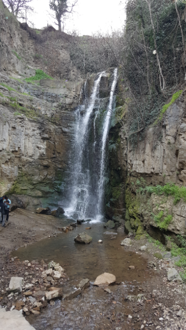
On my first day back after Batumi, I committed to doing the few things that I still had on my list. That list was admittedly pretty short, but I figured I should cross off the remaining items so that there was no danger of me leaving the country again without doing them. My first stop was in Old Town, right near the sulfur baths. There’s a sulfur waterfall there that we didn’t end up going to because everyone was hungry… the funny part about that is the fact that it took MAYBE 10 minutes to walk there from the location where that decision was made. It wasn’t anything jaw-dropping, but it was cool to think about the fact that I was standing in the middle of the capital city of Georgia, looking at a waterfall. Like… they have a waterfall in the middle of the city! Of course, it smells like sulfur and that’s gross, but conceptually very cool.
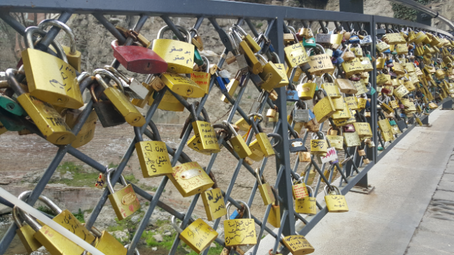
Love locks on the way to the sulfur waterfall
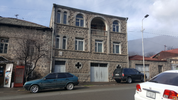
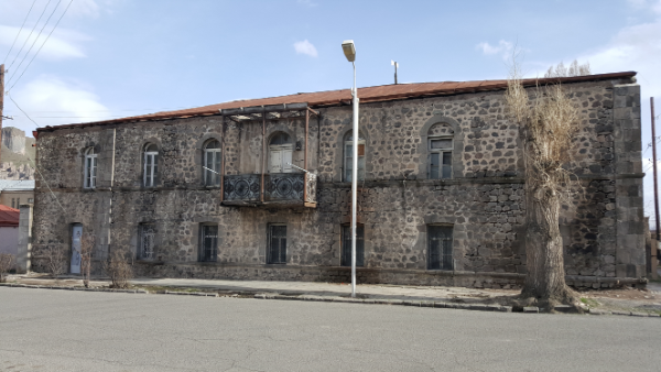
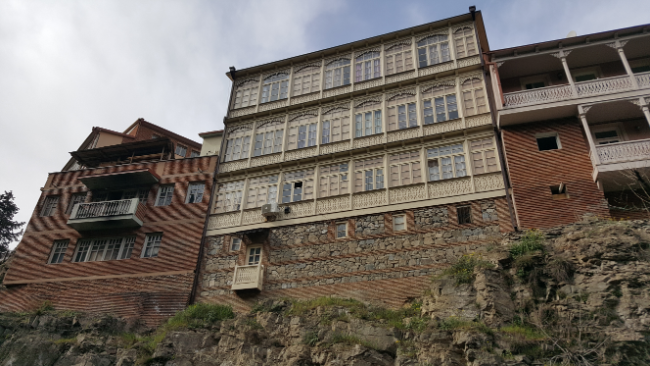
One of the buildings along the way to the waterfall. Not terrifying at all, right?
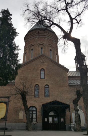
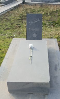
St. George’s Church with Sayat Nova’s grave marker to the right of the door

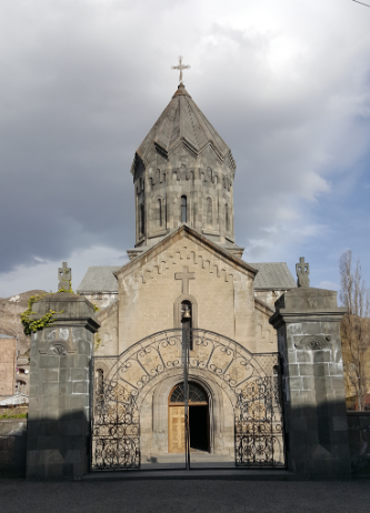
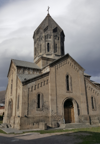
I also went back to St. George’s Armenian Church to pay homage to Sayat Nova, since I didn’t realize his gravestone was there until after we had already visited and left (I wrote more about that visit, who Sayat Nova is, and some other famous Armenians whose gravestones I visited here) and Ejmiadzin, the other major Armenian church that was closed last time we went. It wasn’t my favorite church from the inside, but I was excited to hear people speaking Armenian after only hearing Georgian for a few days, and I bought a candle to light just because I could. I asked for it in Armenian, the woman understood me, and I was thrilled to use my hard-earned language skills again, even for something so basic. It’s such a bummer when you spend all this time learning a language while living in the country where it’s spoken, get to a level of proficiency that makes you feel comfortable, and then leave the country and realize that everything you worked so hard to learn is completely useless in helping you to communicate in this new place. I know I’ve talked about this a lot, but it still frustrates me every time I think about it.
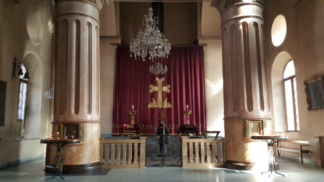
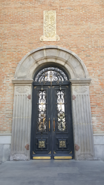
Inside Ejmiadzin Church
The door to Ejmiadzin

From there, I went back to the big Holy Trinity Cathedral that was partially built on the site of an Armenian cemetery. In my previous post about visiting there, I explained how the Armenian community freaked out about how the graves were being dug up without any respect, and the only appeasement offered was this little Armenian Pantheon that they hid behind the church. I say “hid” because even though I was looking for it, I STILL had trouble finding it. You might think I mean oh, if someone didn’t know it was there, they wouldn’t find it… no. I knew it was there, I had the location in front of me on google maps, and I still wandered around for at least 15 minutes before I figured out where it was and how to get there.
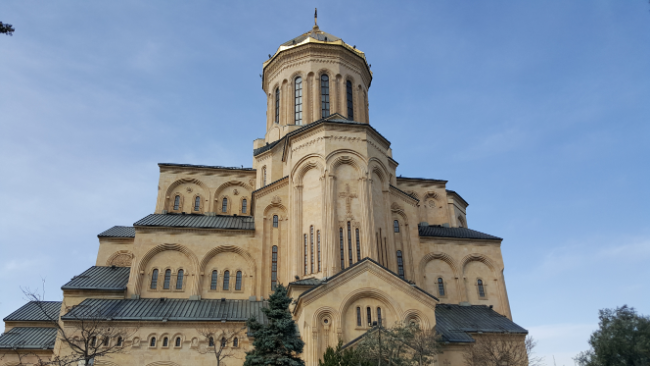
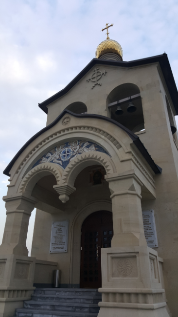
Holy Trinity Cathedral

Yes, figuring out where it was and then how to get there were two separate steps, and neither of them was particularly easy. I walked in the general direction that google pointed me, and I couldn’t figure out what I was even looking for. Luckily, there were some pictures, and I spotted the top of the highest point in the pantheon peeking over someone’s house. Okay, now I knew where it was… but HOW was I supposed to get there?? I tried taking a direct route, and I’m fairly certain that I walked down someone’s driveway and through their yard before realizing that I couldn’t see my reference point anymore, and there was a wall blocking me from going the way I thought I needed to. Finally, I figured out the roundabout way you have to walk there, including walking by a security guard who, I didn’t realize until afterward, was only there to make sure that unauthorized cars didn’t try to come into the church grounds. I thought I wasn’t allowed to leave that way, but he couldn’t have cared less about me walking past. Good to know.

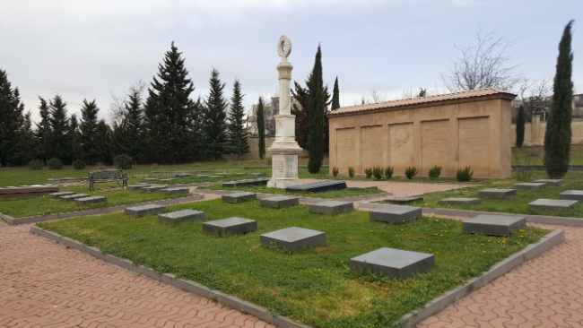
The Pantheon was kind of sad, mostly because I knew that it was just a shadow of what it used to be. The most notable person buried there (in my personal opinion) is Hovhannes Tumanyan, the writer that I also talked about in my Famous Armenians post.
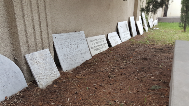
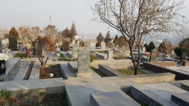
Remains of the original grave markers in the Armenian cemetery
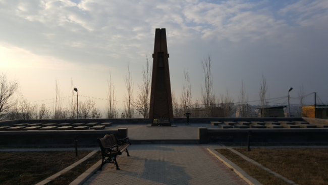
The Armenian Pantheon. The big white thing in the middle is the only reason why I found my way there.

Having crossed those few things off my list, I felt pretty good about relaxing for the next few days. Well, I kind of relaxed. I had a bunch of things I needed to get done, and as is the way with those things, they all took longer than I expected. I also had some things come up related to planning the later stages of my trip, and planning-related tasks are always rabbit holes. You can spend an eternity on them without even realizing.
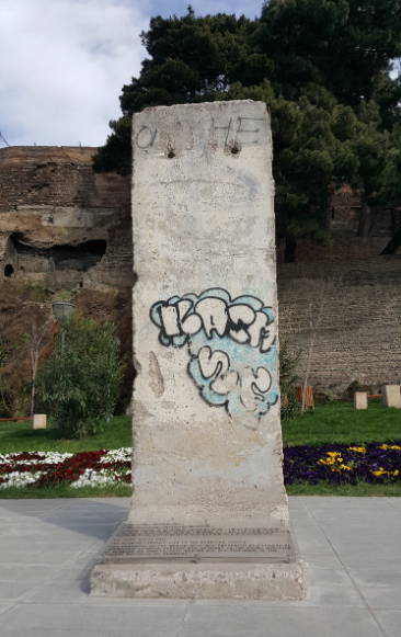
A piece of the Berlin wall, gifted to the people of Georgia from the people of Germany. It was given to the PM of Georgia when he visited Germany. My first thought was, “Oh, that’s so nice.” Second thought: “Do they just have pieces of the wall in a warehouse somewhere to give out as gifts?” Third thought: “Imagine going on a trip and getting a huge concrete wall to take home with you. ‘How am I supposed to get this home?? I only get two 23kg checked bags!'” (Yes, I’m joking. I’m aware that the PM of Georgia probably doesn’t fly commercial.)

The next day, I went on a sketching adventure. I’ve been carting a sketchbook around with me since I got to Armenia, and I’ve done barely anything with it. I decided that I might as well put it to use if I’m going to keep carrying it with me, so I walked around the downtown area and made a couple “quick-sketch” stops. I’m trying to get better at sketching quickly, rather than always spending hours on each drawing, so I limited myself to half-hour-long stops. After I get better at those, maybe I’ll cut down the time a bit more, but for now, I’ll just say that I need to keep practicing. You have to start somewhere!

I also spent a decent amount of time hanging out with the other people in my hostel. This hostel was much smaller than the ones I usually stay in, so it felt more like a little family. There were some cool people there, and we went out to eat together, played Jenga (Including potentially the world’s longest game where, by the end, we all just wanted to stop playing because it was way too stressful), learned about each other’s countries, and had fun just spending time together. Hostel living frequently becomes such an interesting way to learn more about the world because you get to hear the opinions of people who are actually from different places. We always hear one side of the global narrative in the States, and it’s whatever side the government wants us to hear. As much as we like to think that we aren’t fed propaganda, we are. It’s just slightly more subtle. It’s like the same thing I realized in Armenia… In the US, we have such a different picture of, for example, Russia, than they do there. In Georgia, I met a girl from Russia, and she obviously had another perspective to offer. It’s still not easy to pick out the “facts” (whatever that even means) about things, but hearing different views is a good way to make sure that you’re thinking critically about the information you’re given. That’s a good lesson for life in general.

Anyway, just more random musings. My next stop after Tbilisi was Istanbul, Turkey, and I had an inconveniently-timed 4:30AM flight there. I didn’t bother reserving a space at the hostel for the night because I knew I wouldn’t end up sleeping even if I did. Instead, I just hung around until midnight when I made my way to the bus stop to hop on an airport-bound bus.

There are certain times in particular that not being able to speak the language in a country becomes extra frustrating. One of those times is when announcements are being made, like on my delayed train to Batumi, and you have no idea what information is being shared. Another time is when people are having an argument or someone is causing a ruckus and you can’t determine what your response should be to their actions because you don’t know what the issue is. On the bus to the airport, this guy got on (let’s call him “yelling guy”) and started yelling about this and that… and I had no idea what this and that were because it was all in Georgian. Most people were just ignoring him. Eventually, some guy started shouting back at him and then got off the bus. Then a new guy came and started trying to calm yelling guy down, but I don’t think he made a difference. Eventually, the bus stopped and the driver and some other transit officer came back and then they were all shouting at each other, and calming guy was seemingly defending him…? But who knows because this entire analysis is based on body language and tone. Finally, they got him to settle down a little, and someone motioned for yelling guy to come sit next to him. THEN yelling guy started trying to talk to me (I was standing nearby), and I had the fun task of getting him to understand that I don’t speak Georgian… thankfully, the guy next to him figured it out and explained the situation, but somehow that never seems to stop anyone from still trying to communicate by just speaking AT you. After he was just told that I couldn’t speak, he continued to ask me questions which I responded to with wide eyes and a confused face. The guy next to him kept laughing and saying (I imagine), “DUDE! She can’t understand you!”

Finally, we made it to the airport, and I jetted off the bus. I still had some time to wait before I could check in, so I made myself comfortable on an airport chair and began a long night of non-restful sleep in various awkward and uncomfortable positions.

I had a brilliant idea to maximize my sightseeing efficiency in Batumi: a sightseeing run. In hindsight, I see the million flaws with this idea and also the million better options, but I didn’t see those at the time, so here we are.

What is a sightseeing run, you ask? Well, exactly what it sounds like. Go for a run, stop at any sights, keep running. I thought this sounded like a perfect idea because I wanted to work out, I wanted to go sightseeing, and sometimes, I feel like walking between sights just takes too long. I planned to run along the boulevard by the beach so that I didn’t have to deal with cars and could have nice views of the water along the way.

More beach pictures! The weather was much better on Day 2.

Since I’ve given you no real information about Batumi yet, here’s a little background for you. Like I briefly mentioned, Batumi is the major beach resort of Georgia, located on the western side of the country along the Black Sea. It’s the second-largest city in Georgia after the capital city, Tbilisi, and its economy is centered around tourism, gambling, and its port which is the biggest in Georgia.

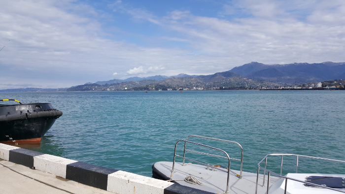
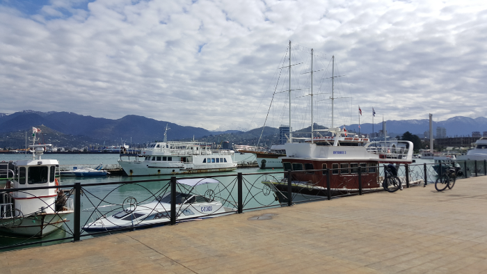
The harbor

Historically, the first record of a city on the site of Batumi was an ancient Greek city, Bathus, in the 4th century BC. The Romans conquered it in the 2nd century AD, and after that, it went through a series of rulers along with the rest of the cities in the region.

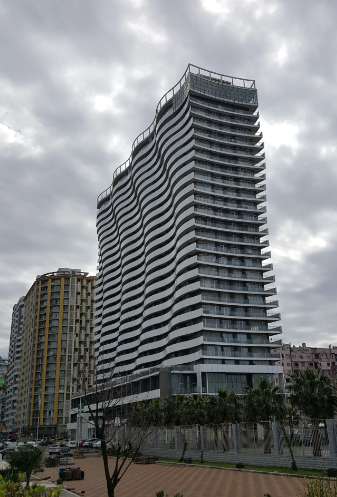
Architecturally, the city is particularly interesting. This is something I absolutely didn’t expect going in and was pleasantly surprised by (though of course, I knew nothing going in, so it’s not very surprising that I wasn’t ready for what I found). Many of the buildings are from the 19th century and are a mix of different styles: European and Asian, Georgian, Turkish, and Soviet, etc. There’s also a strong sea theme, so you can see a lot of mythical sea creatures woven into the architectural details. And the colors! There are so many pretty and unexpected colors.

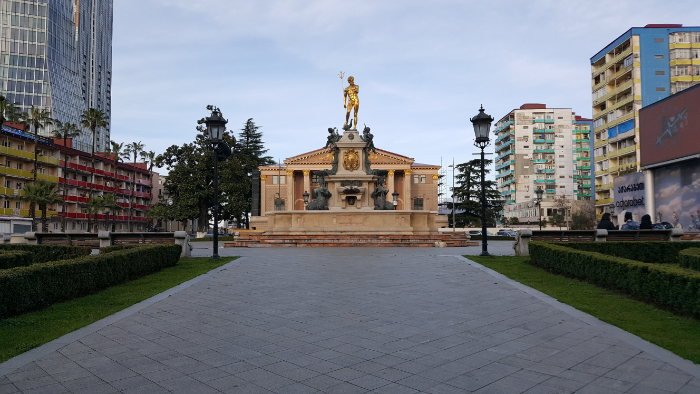
The Batumi Drama Theater in the background with creatively-named Theater Square in front of it.

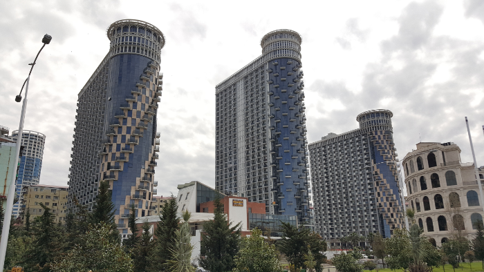
Recently, there’s been a push to grow Batumi, and these historic buildings have been joined by new, modern high-rise buildings. It was already a strange architectural mash-up, and now it’s even more so. Just wait… you’ll see what I mean in the pictures.

Okay, back to my sightseeing run. I hadn’t worked out in quite a while, so I thought maybe three miles (5k) or so would be a good start (I’m not a good runner AT ALL, so even this was kind of a stretch). Plus, with the sightseeing component, it allowed for “photo stops” aka “find something to take a photo of because you don’t want to run anymore” stops. It seemed like a good way to ease back into running. Maybe it would have been, too, but after I had gone two miles and hadn’t turned around yet, I saw some mountains in the distance and decided that I wanted to be closer to them. Very specific, I know. So, I kept going, and I kept thinking that I was going to reach the point where I had some epic mountain view and would know that it was time to turn around and go back.

The sky!!
So many shades of blue!!

The path was nice, too. It went right along the beach, there were interesting buildings to look at, and there were barely any other people around. Then, somehow I was more than four miles away from home and seemingly no closer to the mountains. I could have kept going. I kept thinking that if I just went a litttttttle farther, I would hit a good spot to turn around after the next bend. Or the next bend. Or the next bend. That maybe would have been fine, but I did NOT plan ahead for that kind of adventure and was carrying no money and no bus ticket. Not my brightest moment. Note to self: always bring bus money.

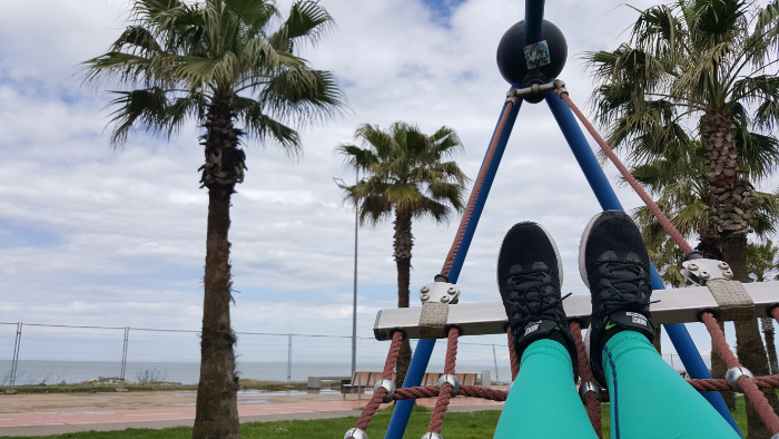
Found a hammock along the way…
???
No clue what this is but weird, right?
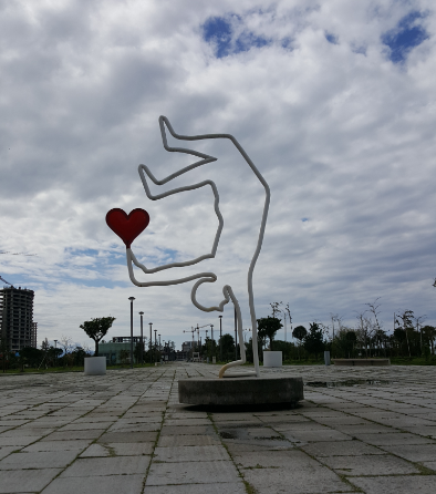
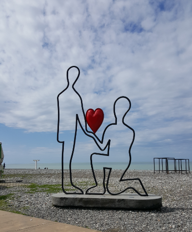
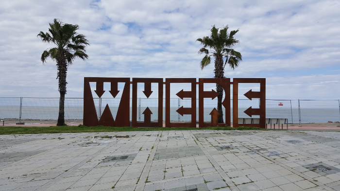
There’s also a ton of public art everywhere, including a series of silhouettes doing various things while holding hearts.
More public art
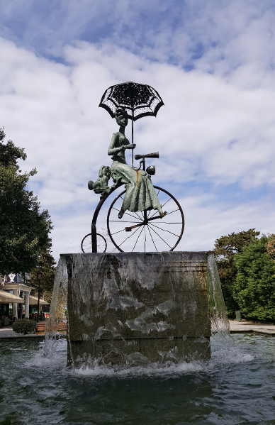
This fountain was cool… Her wheels spun around and kicked up water!
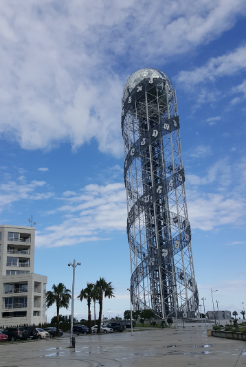
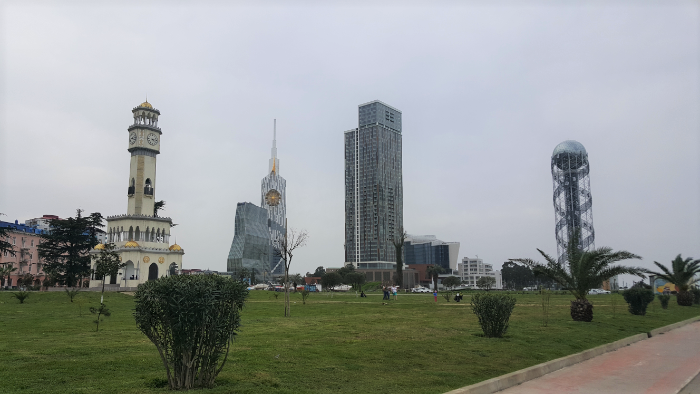
This is a tower celebrating the Georgian alphabet
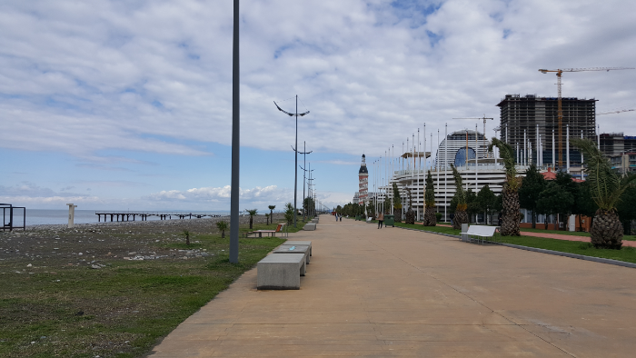
View on the boardwalk during my sightseeing run
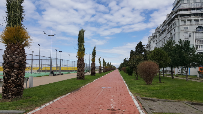
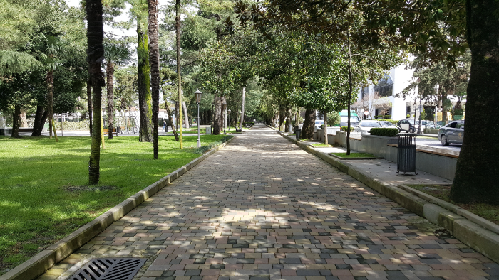
A park along the boulevard
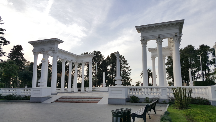
“The Colonnade”, designed as an entrance to the beach. The concept, as you might guess, was developed by someone who had recently gone to Italy. Now it’s just a random and confusing monument, in my opinion. Though definitely pretty.
More interesting architecture

Finally, I had to accept that if I hadn’t gotten a good view of the mountains yet, it probably wasn’t going to happen and that I needed to turn back or risk collapsing from exhaustion. Oh yeah, I also didn’t bring any water. Or money to buy water. And I had only eaten a granola bar for breakfast. I know, I know, but remember that I was planning for a two- to three-mile jog/walk/stop, not an almost nine-mile (15k) adventure. Hehe. Oops.

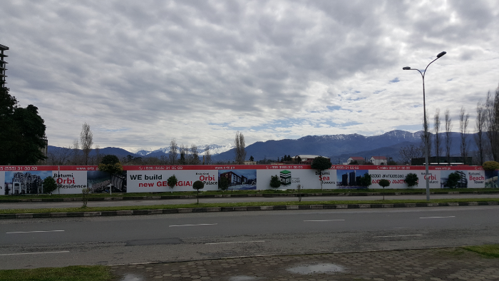
The closest I ever got to the mountains… so not close at all
Right near my turn around point… good question, random street art. Where the heck am I?

My post-experience thoughts about this whole thing:

  1. What on earth was I thinking?
  2. Why didn’t I just rent a bike?
  3. What on earth was I thinking?
  4. I don’t even like to run.
  5. At least I got a good workout.

After I got back to the hostel, cooled down, drank some water, and ate something, I changed and went out again because despite the ridiculous distance I had covered, I had only seen the sights along the coast and still had the entire downtown area to check out. This time, I aggressively plotted my route to avoid covering any extra distance, and off I went.

I did NOT want to leave the hostel again after I got back and sat down, but it was my last day in Batumi, so I didn’t feel like I had a choice. My legs were killing me, and I walked at an impressively slow pace the entire time.

My loop around the city included a whole pile of churches, whatever parks I happened to stumble upon (because who doesn’t like parks??), some city squares, and a few of the tall buildings that I didn’t get to on my “run”. I’ll let the pictures speak for themselves for the most part because it’s not even worth me trying to explain without visual aids!

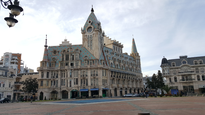
A building on Europe Square. Does it not look like it was taken straight out of a fairy tale?
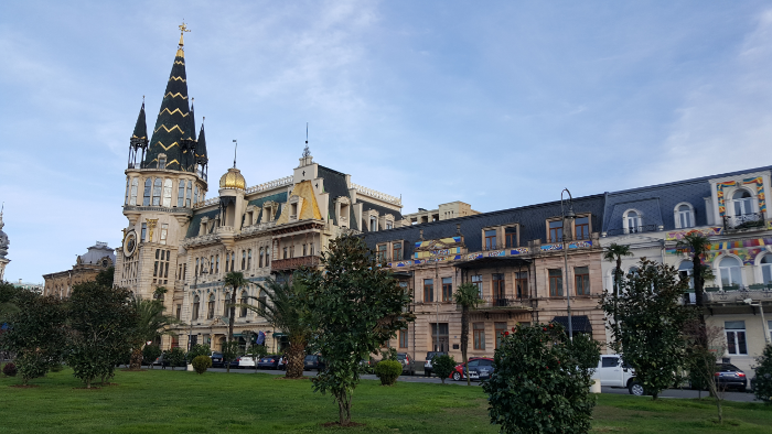
More buildings along Europe Square, all so different from each other!
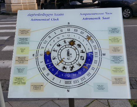
There’s an astronomical clock on one of the buildings (farthest to the left in the picture above), and this was the diagram explaining it. I looked at it for about 5 minutes before deciding that there was too much going on and taking a picture to try to figure out later.
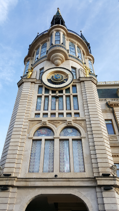
The astronomical clock from below
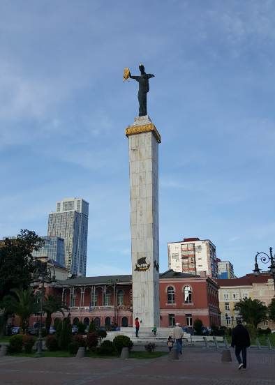
This statue on Europe Square is of Medea, a daughter of a Georgian king, holding the Golden Fleece. The story goes that she helped Jason, the legendary Greek hero, to steal the fleece.
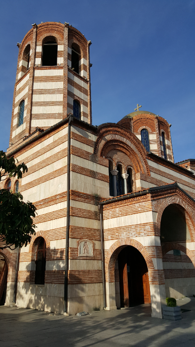
St. Nicholas Orthodox Church
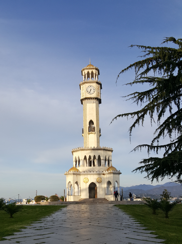
This thing is called Chacha fountain. Chacha is a classic Georgian alcohol made from distilled grapes, and supposedly you can get free chacha from the fountain for 10 minutes each day. Who knows if this is true or not but either way, hilarious.
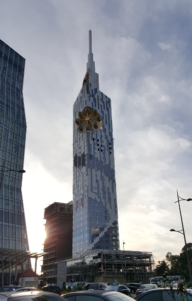
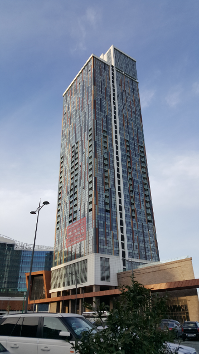
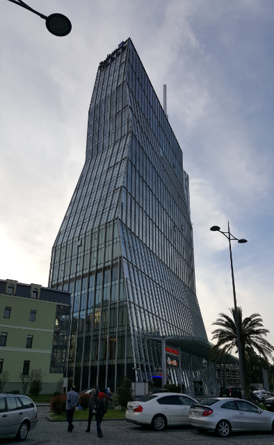
This building, Batumi Tower, was designed by a Georgian architect, is 200-m tall (and is the tallest building in Batumi), and was supposed to house a technological university. Instead, it got sold and now it’s a hotel. And there’s a ferris wheel in the side. Did I mention the ferris wheel? Like… what????
Pretty sure these are condos
Rocks!

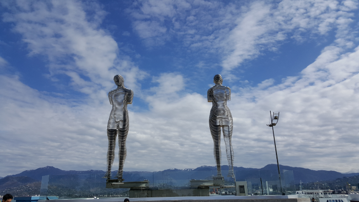
This is a sculpture called Ali and Nino, inspired by a story about a Georgian princess, Nino, and an Azerbaijani Muslim, Ali, fall in love but are kept apart by WWI. It’s like the Romeo and Juliet of the Caucasus. The two figures move back and forth, literally through one another.
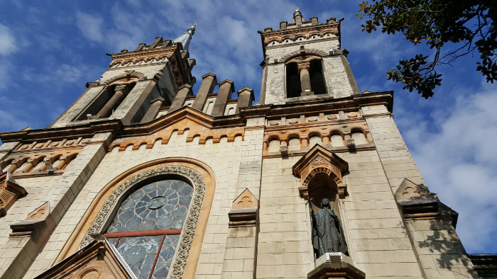
Holy Mother Virgin Nativity Cathedral. Quite the mouthful of a name… maybe it’s shorter in Georgian

Armenian church!

I had a train ticket to go back to Tbilisi the next morning, so as much as I enjoyed my time chilling in peaceful Batumi, it was time to move on to the next adventure. I asked at the hostel about how to get to the train station so early in the morning, and the guy said that the buses weren’t running yet, but I could probably get a marshrutka there.

I walked out to the bus stop around 6:45 because my train was at 7:30, and it was like I was the only person awake in the entire city. As you might imagine, I started doubting that there were even marshrutkas running after not seeing any for the first 10 or so minutes waiting at the bus stop. This one taxi driver kept asking me if I wanted a ride, but I was determined not to take a taxi. He asked where I was going, and I told him the train station (using a very unhelpful Georgian phrasebook I found online). He said he would take me there for 20 lari. HA! I literally laughed at him. I didn’t know how much it SHOULD cost to get there, but 20 lari is like $8 and is completely ridiculous for a 5-minute ride.

After I laughed at him, he lowered his price to 10 lari, and when I said no again, he changed it to free. I apparently am a phenomenal negotiator… This conversation all happened through hand motions and google translate because he spoke ZERO English. When he said he would take me for zero, I typed, “Why???” into google translate. I thought that was a valid question. He just looked at it, laughed, and gave me the “come along” hand wave.

An architecturally-hip Catholic church
And this is a hotel

At this point, I still hadn’t seen any marshrutkas drive by, and I was starting to get a little worried about missing my train. I figured what the heck, and off we went. Let me just say that if I was in practically any other country, I never would have done that, but this was Georgia and I was mostly not worried about it. We got close to the train station, and I started pointing that I wanted to go there. From our broken conversation, I gathered that we’d had a slight misunderstanding. I thought I was saying that I wanted to go to the Batumi train station to take the train to Tbilisi. HE thought I was saying that I wanted to go to the Tbilisi train station. I mean, I guess I technically did, but not in his car!

Thanks to my mostly worthless Georgian phrasebook, I knew how to say, “Stop here!”, and I said it on repeat until he listened. He kept trying to tell me that he would take me all the way to Tbilisi for free, and still I have no idea why. Eventually, I convinced him (in my fluent Georgian) to take me back to the Batumi station, and that was that. He didn’t ask for any money, and I’m almost positive that he would have been insulted if I had offered.

It wasn’t the most conventional method of getting to the train station, and I’m sure my mother is losing her mind right now, but hey, it worked. I’m happy to report that the rest of the trip was uneventful. I took the train, I took the metro, and soon enough, I was back at my hostel to enjoy a couple more days in Tbilisi.

I took it slow during my first day in Georgia because I wanted to give myself some time to process everything going on in my brain. I checked into my hostel, sat in a park and journaled, and went to bed early because the next day, I had an 8AM train to Batumi.

Batumi is the major beach town in Georgia. It’s on the Black Sea, and I knew basically nothing about it going in except for those two things. Last time I was in Georgia, we met some people who said it was a great place to visit, and apparently that’s all I needed to be convinced. I also knew that I wanted to get out of Tbilisi for a few days, and Batumi seemed like as good a place as any.

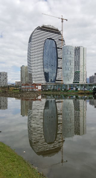
I was definitely not prepared for such interesting buildings! The pointy one in the middle literally has a ferris wheel on the side of it.

The train ride was five hours which is maybe a lot, but at this point, unless a leg of my journey is more than ten hours, I don’t even think twice about it. Five hours is easy, plus on a train you have a bathroom and space to walk around if you want. Luxury!

After the all-too-familiar packing struggle, I pulled myself together and left the hostel around 7:15 to get to the train station early in case I had any issues. It was a little confusing to figure out how to get into the station, but with my “keep cool and use your brain” mantra playing on repeat in my head, I followed some people carrying suitcases and was delivered straight to my train. Fabulous.

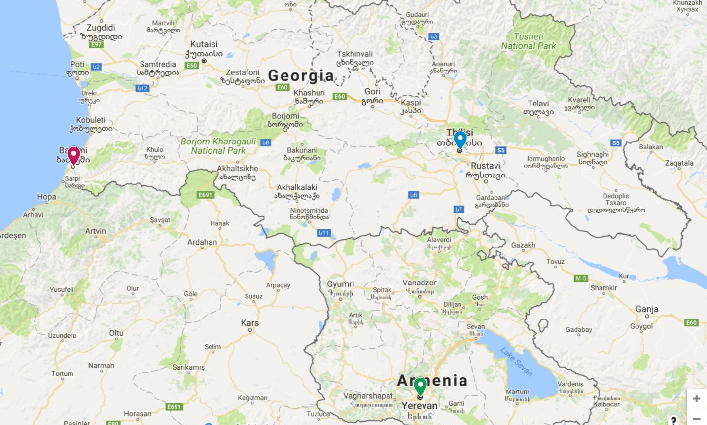
To help orient you, Armenia is at the bottom (Yerevan is marked with green pin), Tbilisi is marked in blue, and Batumi is to the west in red

The train ride went smoothly until we were maybe 20 minutes from Batumi. We stopped at a station along the way and then didn’t start moving again. They made some announcement in Georgian and Russian, and people started freaking out. I asked some Russian-speaking girls sitting near me if they spoke English, and one knew enough to explain that there was something happening with the train and the tracks and the weather maybe? But the conclusion was that the train was not moving until whatever was resolved, and there was no timeline on when that would happen. Okay, cool. I settled in to wait it out because sometimes these things happen. Around me, it was chaos. People were yelling at the conductors in Georgian and Russian (as if that was going to change anything). Some were jumping ship and aggravatedly calling taxis to go the rest of the way. An English-speaking kid was whining about how the wifi wasn’t working, and his mom was going on and on about how she was worried that the train was going to leave us in the middle of nowhere as if she thought that was an actual possibility. And then she said, “and we’re running out of water,” as if we were stranded on a desert island and minutes away from death by dehydration.

Batumi!

About an hour later, we started moving again and made it to Batumi maybe an hour and a half behind schedule. Not a big deal. The next step was figuring out how to get from the train station to my hostel. The easy thing to do would be to take a taxi. When you’re trying to travel on a budget, you usually choose economic over easy, so I was taking the bus. I had scoped out the bus routes online, so I was fairly confident that I knew which numbers I could take. After a struggle figuring out where the bus stop was, I made it there and hopped on the first bus that came by.

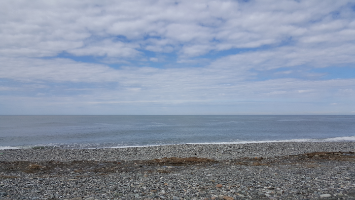
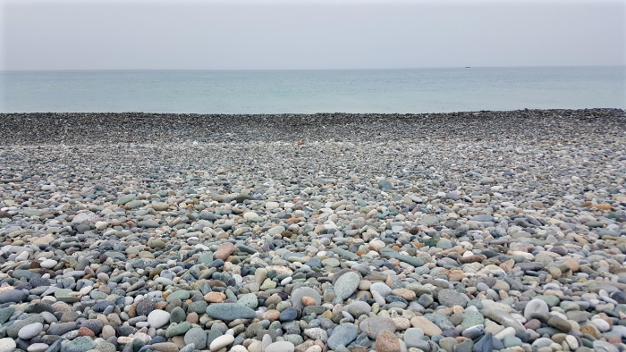
Grey rock, grey sky

When I’m figuring out a new public transport system, I usually watch to see how everyone else pays and then just follow along with that. This time, I was the only one to get on, so that wasn’t an option. I sat down and stared at the various payment locations like maybe they’d make sense if I focused hard enough. Finally, a woman got on and I watched to see what she’d do. She took a chip card out of her purse and tapped it on one of the card readers. Okay, not helpful. I only had cash which meant that I needed to figure out the cash payment method. The woman looked nice, so I made eye contact (probably with a slightly panicked look in my eyes), held up some change, and made my best “how do I pay with cash?” face.

This is the way that travelling works when you don’t speak the language. Observation, facial expressions, sign language, and charades are key. She pointed to a woman who was sitting in the back of the bus, and the woman quickly came over to me. I pulled out the amount I thought I owed, she looked perplexed, and I dumped a bunch of change in my hand and held it out to her. She took what she needed, gave me some change, went to one of the machines to punch my ticket, handed it to me, and showed me that I had paid for two rides instead of just one which was why my ticket cost more than I thought. When we got close to my stop, my friend was getting off too. She offered to help me with my bags, and the ticket woman helped me to untuck my scarf which was stuck in my backpack. Basically, everyone was taking care of me. On the street, my friend introduced herself as Mina and asked if I needed a place to stay (via charades). I had a hostel booked so I was good, but I was definitely appreciative of the fact that everyone was so nice and helpful.

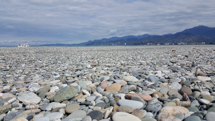
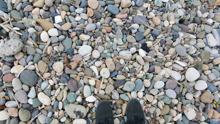
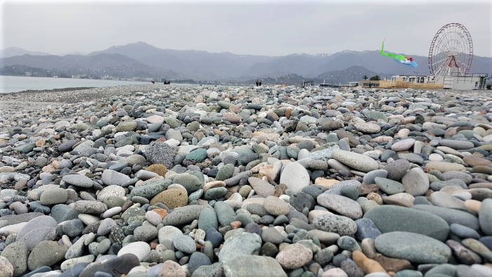
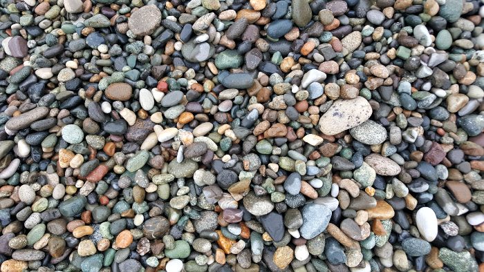
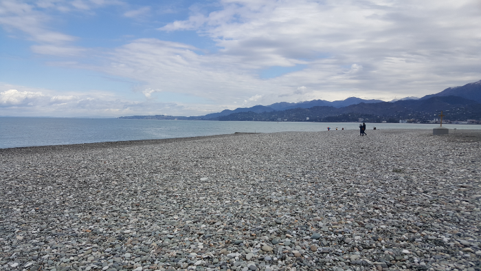
Since it’s still the off-season in Batumi and I was there during the week, I had the entire 6-person room in the hostel to myself! I was super happy to see how quiet and relaxed the city was because that’s exactly what I needed, a little escape from chaos and some time to think. I walked out to the harbor and followed the water to the beach where I had the BEST surprise. It was a stone beach! Okay, I know what you’re thinking. “Lara, you went to this place without even knowing that the beaches weren’t sand? Did you read literally nothing about it??” The answer to that would be yes, and that is totally not like me but I’m trying this new thing where I go with the flow and don’t over-plan my life.

Okay so prepare yourself for a lot of rock pictures but like… I’m in love.

Anyway, that complete lack of research led to me being pleasantly surprised and extremely excited by what I found, so I’d argue that it was even better that way. In case you don’t know this about me, I despise sand. I don’t think I’ve ever truly liked it, but I successfully ignored that truth until a pivotal experience. Long story short, my friend Sarah and I went camping on a beach once because that’s such a romanticized idea and how cool to sleep on a beach… and by the morning, we were so over it. Three words: Sand. Gets. Everywhere. It was in the tent, in our clothes, in our mouths, all over everything. There was no shade because we were on a beach, and the tent was like an oven in the morning (that’s not sand’s fault, but it didn’t help the situation). We took showers and still felt sandy. We were on an island, and when the morning’s first ferry to the mainland pulled up, we couldn’t get on it fast enough. And that was the dramatic end to my already rocky (hehe) relationship with sand.

<3 <3 <3
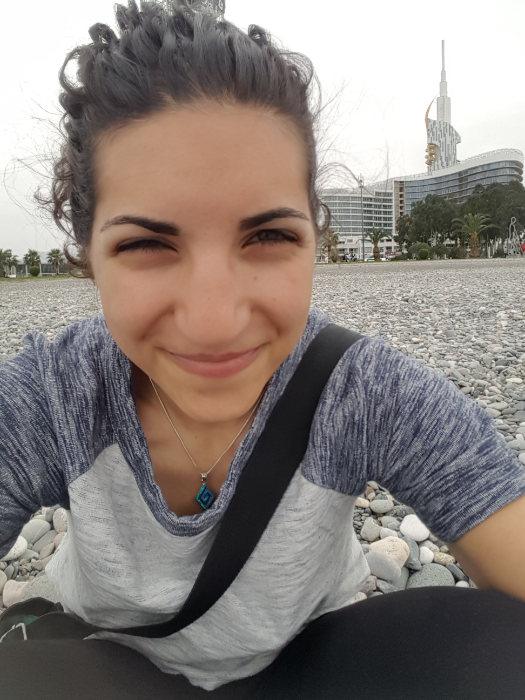
Me pretending I wasn’t taking a picture of myself

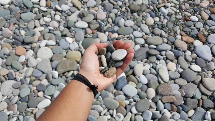
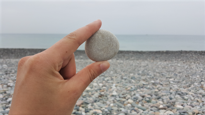
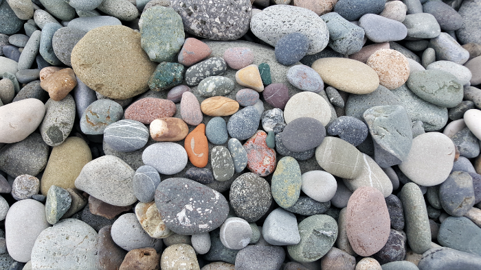
So anyway, as I was saying, stone beach. I think this might be one of my new favorite things because besides the fact that there’s no sand, the stones were beautiful! They were a million different colors, smoothed out by the sea and with pieces of driftwood mixed in. I walked along the shore (note: walking on a stone beach is at least as awkward as walking on sand, especially as the stones get smaller. Also, infinitely louder. There’s no way to sneak up on someone on a stone beach) until I found a good spot devoid of weird beach couples, plopped down, and organized my rock collection.

I love rocks. Pretty much in every application. I love old buildings made of rocks and rock-filled ruins. I also LOVE smooth and colorful rocks, and that is exactly what I was surrounded by. Between the rocks and the sound of the waves, I was in heaven. AND the weather was perfect. I had a t-shirt on, there was a nice, warm breeze coming off the water, and I didn’t even notice the temperature which means it was exactly right.

Some of the best rocks that I picked up along my walk

After sitting there and sorting rocks for who even knows how long, I decided that I had to go and touch the water because it’s the Black Sea, and I’m trying to touch as many bodies of water as possible. Okay, always a difficult task when you’re trying to touch water that’s coming in waves and you don’t want the rest of you to get wet. As I got closer to the water, I realized that half of the sound of the waves was the rocks clinking over one another as the waves went back out to sea. Seriously one of the coolest sounds. So of course, I stood there for a bit just listening before I got back to my mission.

Wet rocks near the sea

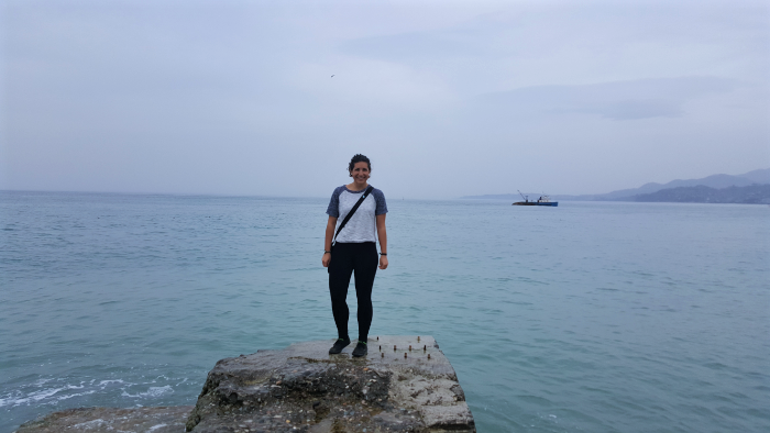
I spotted a good strategic location… there was a concrete pier sticking out into the water, and I thought that would be the perfect place to stick my hand down and keep the rest of me dry. The only problem was that there was some guy filming a video of himself that seemed to go on and on forever. After he finished, I hopped onto the pier, did my water touch, and was about to leave when he asked me to take a picture. He was British, and we got to talking and that was the end of any plans I had for the day.

Me and the sea! Photo thanks to my new friend Ben

Meeting people is arguably the best part of travelling. I know, you can meet people anywhere, but it’s not the same. This guy, Ben, is in the middle of a motorcycle trip around the world. The purpose of his trip is to raise money in memory of his friend who passed away from Crohn’s disease, and it grew into a round-the-world adventure (if you’re interested in donating, you can do that here). He’s been going for eight months now and he thinks it’s going to take about four more years. Yes. Four years. He was planning to go through Armenia next, so we started talking about that and ended up getting dinner and hanging out for the rest of the day. That was the first time that I realized I’m now one of those crazy travel people. I looked at him and thought, “Look at this guy who’s doing this crazy travel thing!” and while we were talking, I was like, “Whoa, I can actually keep up with him. Look at this girl who’s doing this crazy travel thing!”

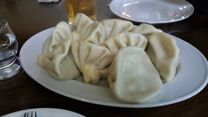
Ben and I got khinkali for dinner because he hadn’t had it yet, and it’s a classic Georgian dish. I always describe them as little meat-filled money sacks.

Nearly every travel friend I’ve made has taught me something about myself. I’ve met some incredibly insightful people, and despite the fact that those relationships are generally short-lived, it doesn’t matter. Sometimes, an 8-hour friendship can have a lifetime impact. It’s a good reminder that every interaction, no matter how brief, has the possibility to shift someone’s life.

(P.S. Sorry for the philosophical musings, but they’re probably going to be semi-frequent. I have a lot of things to sort out in my head right now, so enjoy your complimentary window into my swirling thoughts.)

The last stop on my southern Armenia tour was Sisian, a town about 40 minutes north/west of Goris. Mary loaded me onto a marshrutka, and in no time, we were driving into Sisian. I had a reservation at a hotel in town that I made by emailing them and asking if there were any rooms available… after going there, I realize that was completely unnecessary. I knew that it wasn’t exactly high tourist season, but I honestly don’t know that there was anyone else staying there that night.

View out the dirty marshrutka window… it was another beautiful drive from Goris to Sisian

I had two things that I wanted to see while I was in Sisian – Shaki Waterfall and Karahunj. Both of them are reasonably walkable distances away from town, but the weather was gross, and I was feeling a little tired. I decided that the best way to guarantee that I would make it to them was to take a taxi. I asked the receptionist where I should go to find one (also, just keep in mind that any interactions I talk about in this post are happening in Armenian), and she gave me directions and said that it shouldn’t be more than 1500 dram (about $3) for each place I wanted to visit. She also insisted that it was an easy and short walk to Karahunj, so I planned to taxi to the waterfall and back and then walk there.

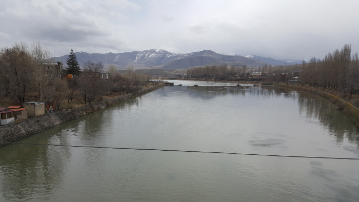
The river that runs through Sisian

Taxis usually just hang out in certain places around town until you go and hire them, so I went to one of the hang out spots and tapped on a guy’s window until I got his attention. I asked him how much it was to go to Shaki Waterfall, wait, and drive me back. He said 3000 dram, and I’m pretty sure I laughed. In response, he asked how much I wanted to pay, I said 1000, and he asked how long I wanted to stay there. I said half an hour because like… who knows? I knew you had to walk a little to get there, and I didn’t want to feel rushed. He looked appalled by that, so I said, “I don’t know? 20 minutes? I just want to see it.” I guess that was good enough for him because he agreed, and off we went!

We chatted during the ride there, and I was proud of how much I understood and how much I could say. He told me my Armenian was good which is always nice, but I also think that sometimes people just say that because they’re happy you can speak at all. It’s okay, I’ll take the compliment. When we got to the waterfall parking lot, he pointed me in the direction of the path that leads there and said he’d be waiting when I got back.

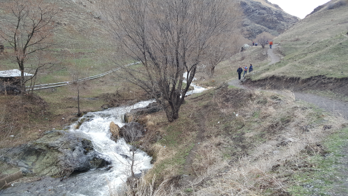
The path to Shaki

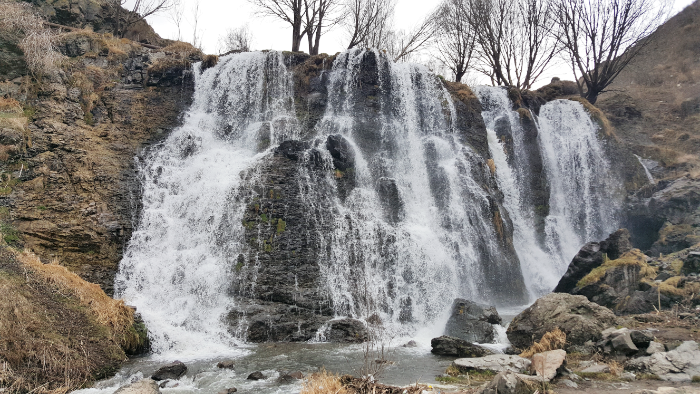
Shaki Waterfall, like everything else in Armenia, has a legend (or factual story, depending on who you ask) behind its origin. According to the story, an army invaded a nearby village and kidnapped 93 beautiful maidens to give to their commander. When they reached the river, the maidens asked if they could bathe in the water and make themselves presentable after the long, dirty journey.

When the army agreed, they all jumped into the water and “disappeared”. One of them, Shaki, tried to escape by swimming across the river. She was about to be recaptured when a rock came up underneath her, and she was concealed by the water flowing over the rock (aka the waterfall).

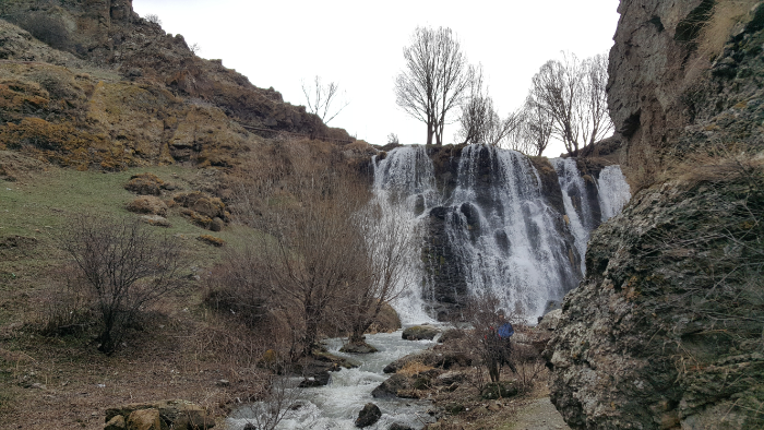
First glimpse of the waterfall walking up the path

I have a lot of questions about this story, especially because it’s incredibly vague about what happened to the maidens. They “disappeared”… which means what? I assume it means that they all drowned themselves, not that they went through some magical portal into another dimension. And Shaki? Did she also “disappear”? I don’t know. The legend is fine and all, but there are too many unanswered questions for my liking.

Anyway, the walk to the waterfall took less than 5 minutes which made the taxi driver’s reaction make more sense… a 30-minute stay would have given me more than 20 minutes to stand and look at the waterfall. It’s definitely nice, but like I said, the day was cold and wet, and after going and looking at it for a few minutes, I was ready to leave. I think I made it back to the car within 15 minutes, and the driver told me that I could have stayed longer. Geez, you can’t please anyone (hehe).

Shaki Waterfall

Soon after I got into the car to head back into Sisian, it started raining and I started rethinking my decision to walk to Karahunj. As we got closer to the city, I asked the driver how much it would be to go there as well. He looked at me like I was a nut and said that it wasn’t a good day to go and the path there would be very muddy. Oh, well. I was there for one day which meant that no matter how bad the conditions, if I wanted to see it, I didn’t have a choice. I explained that to him, and he said okay and that it would be 1000 dram. Totally reasonable and way better than what I was expecting, so I agreed, and off to Karahunj we went.

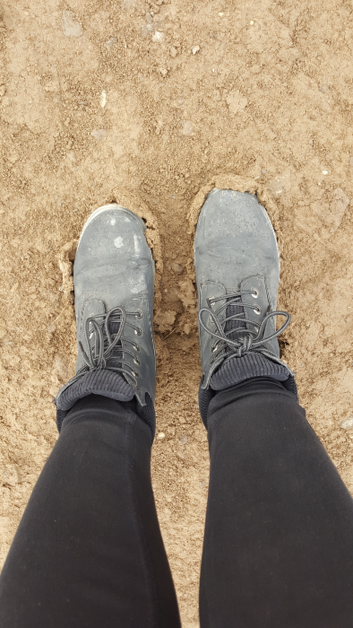
My mudshoes

He dropped me off on the main road because, like he said, the path was too muddy for him to drive up. From there, I walked, and he was absolutely right. Within just a few steps, my shoes were completely weighed down with mud. I walked for probably 10-15 minutes, thankful with every step that I had decided to wear my boots.

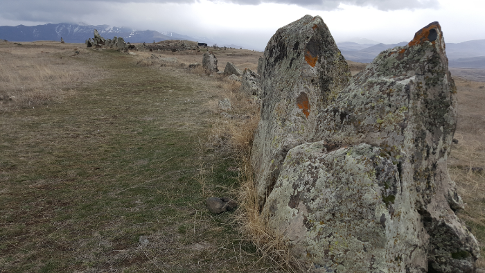
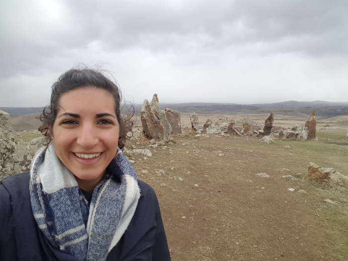
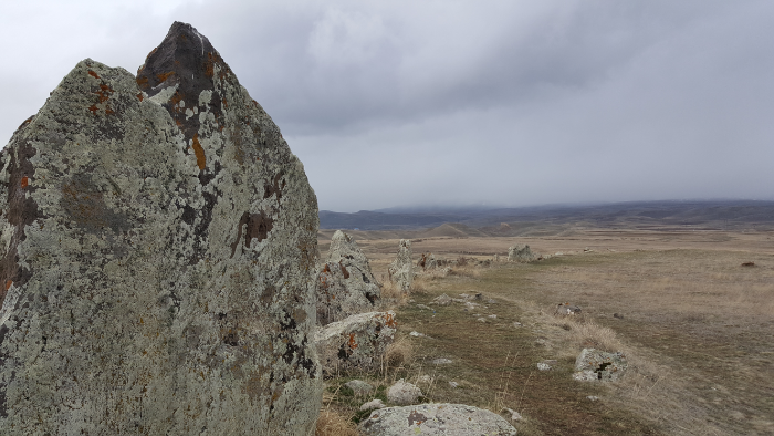
Karahunj/Zorats Karer is, to put it simply, the Armenian Stonehenge. Any proud Armenian will tell you, however, that it’s 3,500 years older than Stonehenge in England. I’m not really sure how they date something like that, though. It’s not like they can carbon date it… it’s just rocks placed in a certain configuration. “They” say it’s from around 5500BC and was used as a religious site and maybe more for around 5000 years or so.

They say that Karahunj is where the name “Stonehenge” comes from. “Henge” doesn’t mean anything in English (well, it does now, but that’s because of the Armenians of course), but Kara = stone and hunj = sound in Armenian, so Karahunj might mean Speaking Stones or something to that effect. They say that it’s an ancient astronomical observatory, despite the fact that the rock alignment doesn’t really make sense in that context. There are also random round holes carved into some of the stones, and they have no idea what those were for.

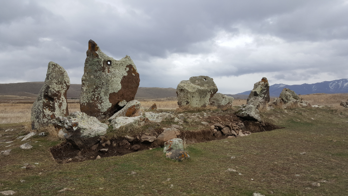
Super weird
See the hole at the top of the leftmost rock? That’s the type of hole that they’ve found in at least 80 rocks

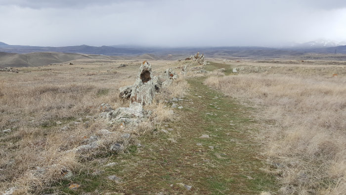
In the center, there’s a temple to the primary god of the ancient Armenians, Ari, the sun god. Then, there’s a sort of circle of stones surrounding the central area and two squiggly arms that extend out to the north and south. There are 223 stones officially documented as part of the monument, and there are other broken stones around that may have originally been part. They’re of varying sizes, but the biggest ones weigh up to 10 tons! Eighty of those stones have a round hole carved into them. Like I said, there’s still no consensus about the purpose of the stone configuration. People have been able to draw some parallels between the layout and the stars, but there are also a lot of things that they can’t make sense of… so they don’t actually know anything for sure.

See the rock path? That’s part of the north/south rock squiggle
Me + Karahunj

It was cool to see, especially knowing that it has such a weird and mysterious history. Some of those rocks are HUGE, and seeing it inspired the same questions of, “How the heck did people move these?” and, “WHY?” that came about when I was in Peru seeing the stuff that the Incas built. Plus, the setting is beautiful. It’s up on a bit of a hill surrounded by valleys, so there are pretty views in all directions.
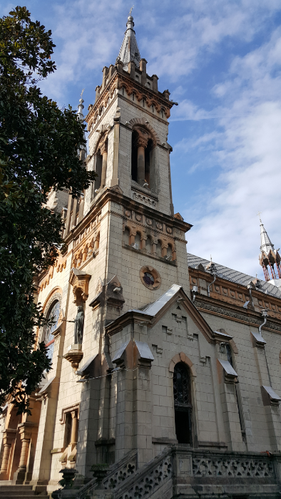
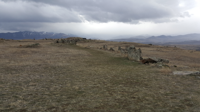
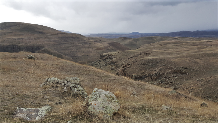
Looking out from the south end
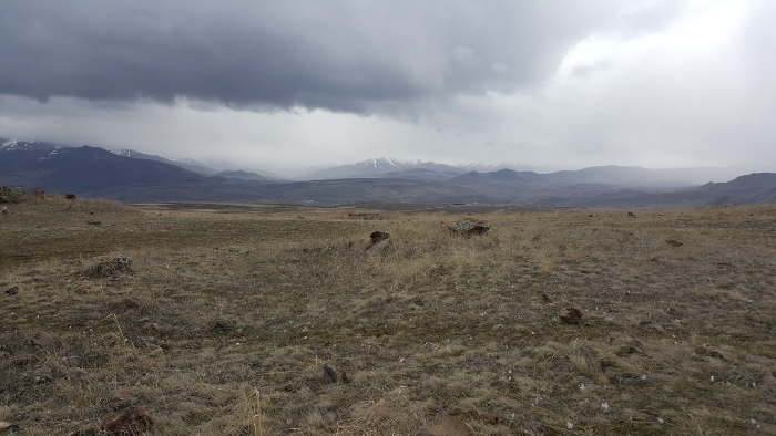
I like how eerie the mountains in the distance look

After wandering around for a bit, completely mystified, I headed back through the sticky mud to my taxi. It started raining again when I was about a quarter of the way there, just confirming my decision to take a taxi instead of walking. That would have been miserable! My ears and nose were frozen, and the taxi driver gave me a knowing nod as I tried to scrape the mud off my shoes before getting back into the car and warm up my face on the drive back to the hotel. For sure worth the $4 that I paid for the taxi ride!

I kind of like the fact that there’s some mystery behind the site. It’s a weird experience going there, knowing that it’s so old and was clearly important to the ancient people, and having no idea how or why it exists.

I spent that night relaxing at the hotel and getting ready for my trip back to Yerevan in the morning. One of Mary’s friends who lives in Sisian helped me to reserve a seat on a marshrutka (even though we never met in person!). I don’t know how people are supposed to be able to do any of this travelling without the kind of support system that I had. Without that and without language skills, I imagine it would have been a very different and more frustrating trip.

The end of my south adventure wasn’t the end of my Armenia fun. The day after I got back, some of my cousins came from the States to visit! We didn’t do much that I hadn’t already done before, but I’ll share some pictures from that week in my next post!

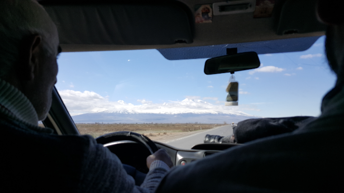
View of Ararat on the drive back to Yerevan

Things we all know about Lara:
Lara loves rocks.
Lara loves caves and other enclosed spaces.
Lara loves climbing things.
Lara loves pretty views.

These are four very basic Lara facts. These four facts also make Lara sound like she might be four years old, but that’s not the point. The point is that, while travelling southern Armenia, Lara finally found the place where she belongs. That place is, quite unfortunately, a deserted cave village, but we don’t need to dwell on the little, insignificant details like “deserted”. That just means there’s more room for me!

Where is this magical, mystical place? Khndzoresk, aka the future site of Larkzoresk. The village is only a 40-minute drive or so from Goris where I was staying for a few nights with my new friend Mary, and she connected me with a guide, Ara, who grew up in new Khndzoresk. I know, I’m getting ahead of myself again. Typical.

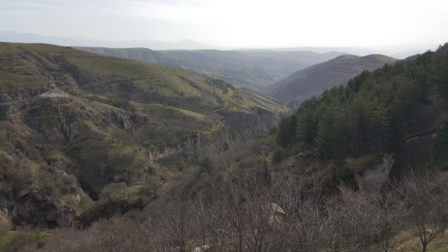
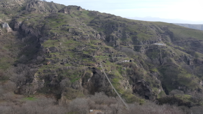
Looking down the gorge. The land in the distance is Artsakh/formerly Azerbaijan-controlled land

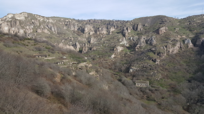
Khndzoreskis a village in the eastern part of Armenia, right on the border of what is now Artsakh. One name-origin theory is that “Khndzoresk” comes from the words “Khor Dzor”, meaning “deep gorge” in Armenian. At the beginning of the war with Azerbaijan, the village was so close to the fighting that some of the shepherds who lived there were kidnapped and killed. Anyway, the village has been occupied since ancient times, and until the end of the 1800s, Khndzoresk was the most populated village in eastern Armenia! At its height, there were around 24,000 people living there (though who knows how accurate that number is… that’s what I was told, but it seems like something that probably everyone has a different answer for). The thing that makes it so interesting is that it was a cave city… until the 1950s!

View of the city. It has those same weird rock formations as Goris! You can also see one of the churches, Surp Hripsime, in the bottomish right.
The village… mostly just looks like a cliff from this far away haha
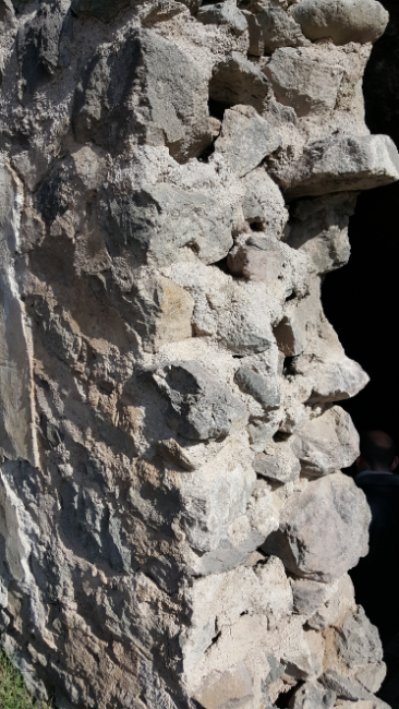
Fake concrete

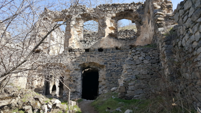
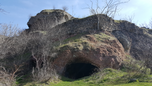
It’s made up of both natural and man-made caves situated in the cliffs along a gorge. Many of the houses had a cave in the back and then a structure built in front of it, and the roof of one house created the floor for the next. Ara explained that there were three different kinds of caves: houses, stables, and safe houses. The houses had the highest ceilings and often consisted of multiple rooms. They had holes in the ground for cooking and for storing grain. Chimneys were carved out to allow smoke to escape. If someone had a two-story structure as the front part of their house, it meant they were rich because it was expensive to build like that. The house structures were built out of stones, and they didn’t use concrete. Instead, some used just clay/mud, and others used a mix of clay, eggs, and water.

Remains of a two-story rich person house
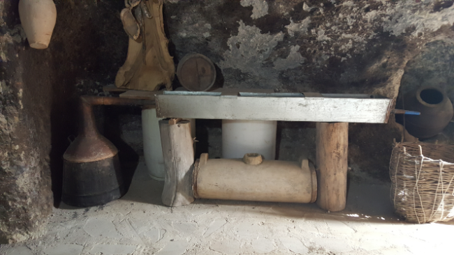
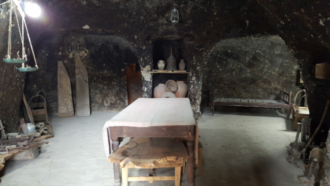
They have a little museum with a sample cave home that’s filled with things they found in the actual village. You can make alcohol with this thing. Pretty sure Ara said that he has the same thing at home now.
Cave living room. In the back left and right, there are two more little rooms that served as bedrooms.
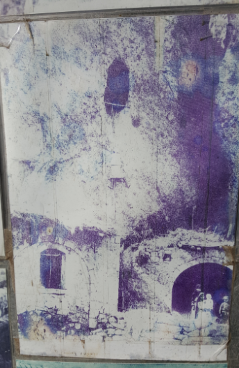
A picture of a woman climbing up into one of the safe caves

The stables had lower ceilings and didn’t have any additional construction in front. The safe caves were located high up in the cliffs. They could only be accessed by ropes which were supported by pieces of wood set across the cave entrances. In times of danger, the women and children would climb up and pull the ropes in to prevent invaders from reaching them. (Questions about this… did the women and children train for this?? It’s not like it’s easy to climb a rope into a cave! And I assume that a lot of the kids had to get carried up which means that the women must have been incredibly fit. Though I assume that everyone in the village was fit because you had to climb to get practically anywhere. Okay, I’ll stop. I just think the whole thing is kind of marvelous.)

Stable caves

There are four churches in town. The oldest is in a cave and dates back to 305AD! That’s impressive because Armenia adopted Christianity only four years earlier in 301AD. There were also schools, shops, businesses, springs for fresh water… it was a town, so there was everything a town needs. Ara’s father was born in old Khndzoresk, but in the 1950s, the Soviet leadership decided that the town should be moved to the flat land above. I asked why, and he said that it was closer to the existing infrastructure and people’s gardens (they were already on the flat ground). Most people moved out in the 1950s and 1960s, but the last family didn’t leave until 1974!

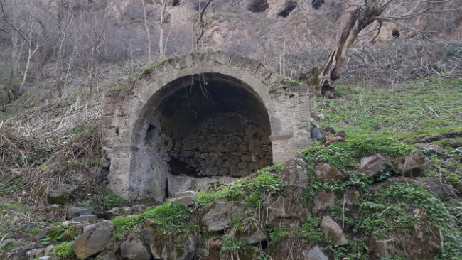
One of the many springs in town. I think this is the one that has a weird legend behind it. Back during one of the times when the village was under attack, the women fought alongside the men. One woman, Sona, was a widow with nine kids. She was killed in battle, and her father built this spring to honor her.
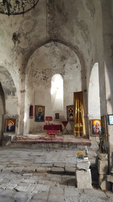
Inside Surp Hripsime

After the exodus, the cave town fell into disrepair. Ara said that he used to play in the caves with his friends growing up. He can still point out where his grandparents’ cave was, though it’s now overgrown by plants and inaccessible. The town also is kind of in ruins because when people moved, they took the stones from their cave houses to use in their new ones. Now, it’s a government protected area, so people can’t take materials or anything. They’re slowly cleaning up and restoring different parts of the town, such as one of the newer churches, Surp Hripsime, that was built in 1665. For a long time, it acted as a stable, so as you can imagine, it was filthy. Now, it’s been cleaned, and there are plans to fix parts of it. It was also cool because there are just random pictures and other documents inside the church. I asked Ara where all of the pictures came from, and he said that when the old town started attracting attention, villagers began bringing pictures and other things that they had laying around that they thought might be of interest.

There have been various improvements made to the old town over time. Ara explained that there’s a kind of unspoken rule that if you move out of the town and make a lot of money, you come back and build something. He said that some of those changes are good, but each one makes the town less authentic. I completely understand what he means… you want people to be able to access and see this awesome place, but you don’t want those changes to take away from its history and personality.

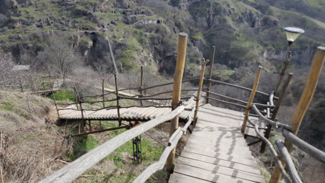
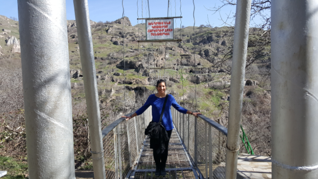
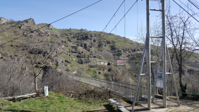
So far, the improvements have included a lookout point, stairs down into the gorge, paved paths leading to some of the sights, and a suspension bridge across the gorge. Supposedly there are plans to build a cable car down from the new town, but that seems like overkill to me. He told a story about the bridge, which looks somewhat terrifying, and said that it was built by hand by three guys: the one who was financing it, plus two others from the village. They didn’t have an engineer or anyone with bridge knowledge helping them, and when it was completed, someone complained to the government saying that it might not be safe. In response, the government sent out some engineers to evaluate the bridge, and they determined that it was strong enough to hold 500 people at once. As usual, who knows how true any of these stories are, but that’s all part of the fun.

Stairs into the gorge
Me on the questionably-500-person-capacity bridge
Bridge view
Church ruins near the cemetery

On the opposite side of the gorge from the main part of town, there’s a little area with ruins of a church and school and a cemetery. The cemetery contains the grave of an Armenian war hero, Mkhitar Sparapet, who fought with another hero, David Bek, leading the Armenian liberation efforts against Safavid Iran and the Ottoman Empire in the 18th century. Sparapet had a cave fortress at the top of the gorge. He was eventually murdered by some villagers who wanted him to move his fortifications away from the village because they were worried about what would happen if the enemies found him hiding there. They delivered his head to the Ottoman leader who apparently found their actions despicable and had them killed. Now, Iran still has his head (I have SO MANY questions about this… where have they kept it all these years? Why? In what conditions? I just don’t understand!), but they’ve agreed to give it back (ALSO so many questions about this… I asked what they’re going to do with it, but Ara didn’t know. What are they going to do with it? Bury it with the body? How will this handover occur? In person? By mail? Who will it be delivered to? Does anyone besides me think that this is the weirdest thing? Was that part of some big diplomatic discussion between Armenia and Iran? This whole thing is weird, right??).

Ruins of the school near the graveyard
Mkhitar’s grave. Ara also showed me where his mistress is buried nearby. Apparently he was quite the stand-up guy (sarcasm).

In the past, if you said the words “cave town” to me, I would have thought it sounded like the kind of thing I’d be interested in. Now that I’ve been to a cave town, that thought has been MORE than confirmed. If anyone out there is trying to start a cave town and needs resident volunteers, count me in!!! I already know exactly how I’d set up my cave.

My southern adventure continued with a relocation from Kapan to Goris. The hotel staff in Kapan spoke no English, so I had to rely on my Armenian skills to figure out how to get there via public transportation. Here’s basically how my conversation with the hotel guy went:

Me: Tomorrow I want to go to Goris. Is there a marshrutka?
Guy: Yes, at 9 and noon.
Me: Do I have to call? (to reserve a seat)
Guy: Yes.
Me: Can YOU call?
Guy: Yes.

I crossed my fingers that I had actually said what I wanted to say, and sure enough, the hotel guy knocked on my door at 8:50, right as I was getting ready to walk out. He walked me out to the street, the marshrutka came, and I was off! Nice.

Along the drive from Kapan to Goris. Excuse the fact that they’re blurry… the window was dirty and kept fogging up, so use your imagination.

In Goris, I was staying with one of Kelsey and Olivia’s friends, Mary, who I had never met but has an extra room and was willing to take me in. Cool! She was going to call me when she finished with work for the day, but by chance, we bumped into each other on the street! Goris is a decently big town, so I think that’s impressive. She was walking up the street towards me, I looked at her and thought, “Hmm… she doesn’t fit here,” and I gave her an inquiring look. She apparently thought the same about me and said, “Are you Lara?” So that’s how we met.

Goris is a city (town?) of about 20,000 people. I wasn’t expecting that when I got there. I guess I always think that places are going to be tiny little villages with nothing going on because everyone always acts like there’s nothing happening in the country outside of Yerevan. I was pleasantly surprised! It’s nestled in the mountains, right near the eastern border with Artsakh, so the scenery is stunning. The area has been occupied since at least the 700s BC, and for much of that time, people lived in caves in the weirdly shaped mountains around the town. The caves were inhabited until the 18th century!

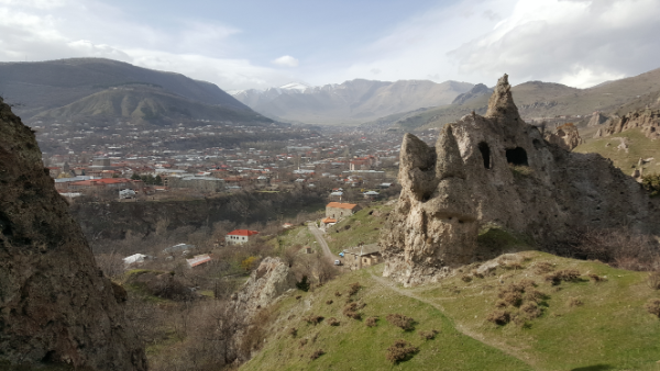
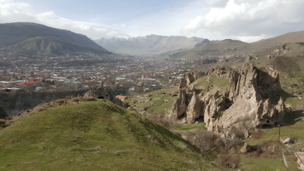
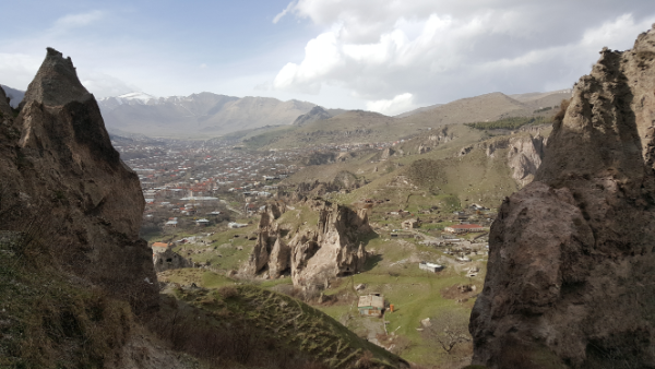
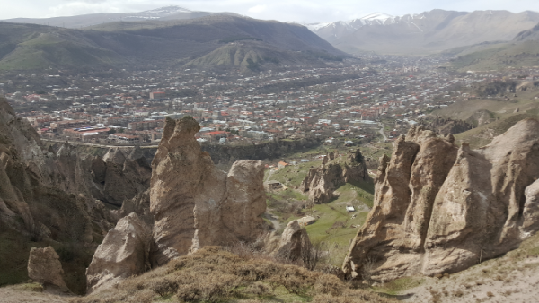
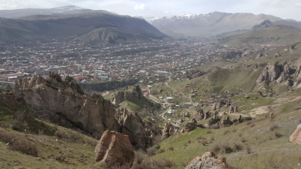
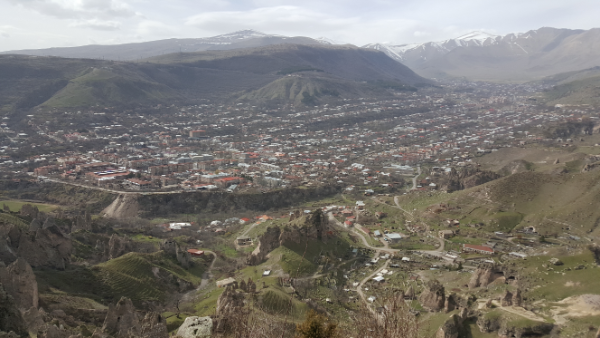
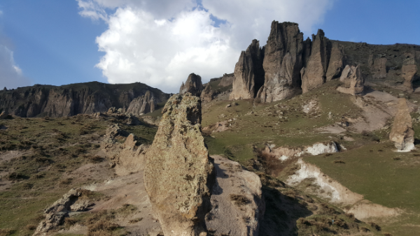
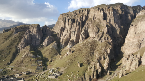
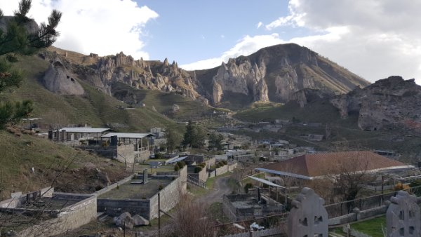
I think one of my favorite things about the south is that in every place I visited, the topography was sooo different. The cities aren’t even that far apart, but they look nothing like each other. In Goris, if you walk around the “Old Goris” area, it’s like you stepped onto another planet. I can’t even begin to describe the rock formations, so check out the pictures to see what I mean.

These mountains. Are so weird. But I love them.
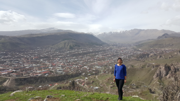
Pretty Goris, pretty mountains.

Self timer + rock = pretend photographer

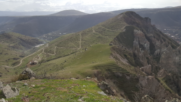
Mary and I walked around Old Goris a bit during the evening after I got into town, and I went on a more intense trek the following day. I tried to follow an actual hike through the mountains, but it was poorly marked and very confusing. Instead, I ended up wandering around on random cow paths that went into some of the strangest places. Oh, well. That was more interesting anyway… at least, I assume it was but couldn’t tell you for sure because I still don’t know where I was supposed to walk.

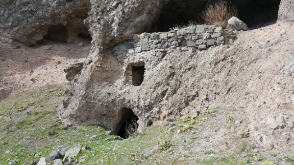
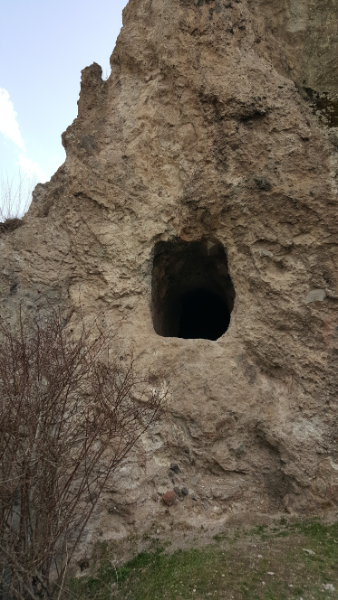
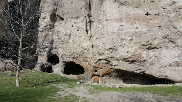
Cave dwelling

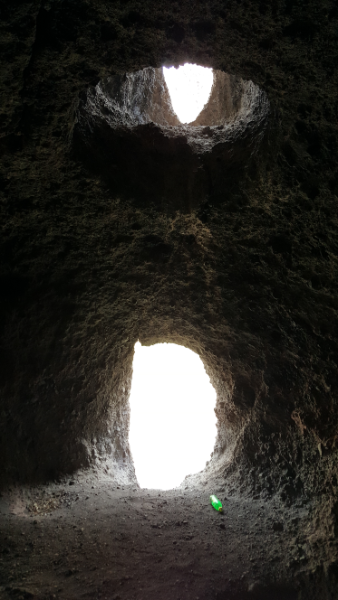
As far as I can tell, the actual path doesn’t go past any of the coolest things. My favorite part of the walk was checking out some of the cave homes. So many of them had doors that you needed to rock climb into, and you could see where the previous inhabitants had chipped hand and foot holes into the rock to help them climb up. Can you imagine having to rock climb into your house?? My reaction to that question is, “IS THAT NOT THE COOLEST THING YOU’VE EVER HEARD?” but I imagine that some of you are probably more on the, “Ummm that sounds horrible,” page. I love enclosed spaces which means that caves are just about my favorite thing, and I’ve now officially decided that my dream home is a cave home (with a very comfy couch inside, of course).

This is one of the caves I climbed into and immediately fell in love with.
Chimney above the window.
Door to the left, window to the right.
Cave window views.

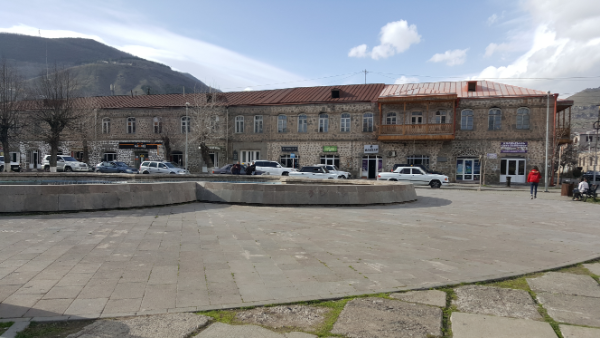
After I finished getting lost in the weird mountains and creeping around abandoned cave houses, I headed into town to check out a few of the sights. I have to say that the buildings in Goris are some of my favorite in the whole country. I love stonework, and the town is overflowing with pretty stone buildings. Even the abandoned buildings look beautiful!

Picturesque
Here’s a series of my favorite random buildings from around town. I’m in love.

I visited two churches in town, St. Hripsime and St. Gregory the Illuminator. St. Hripsime was originally built in the 4th century, and St. Gregory was built in the early 1900s. St. Hripsime is small and pretty and was rebuilt a few times, first in the 1500s and then in the early 2000s. the inside feels like you’re inside a cave… appropriate. St. Gregory the Illuminator Church is slightly more Armenian-church-typical. The inside is plain, and the outside design is nothing extraordinary, but the stone color is a pretty grey that I enjoyed. They also had a very nice gate entering into the grounds, and metalwork is another craft that I’m a big fan of.

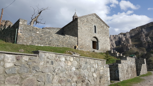
St. Gregory the Illuminator Church. Check out the gate in front.
On the side of the church (between the door and the window to the left), you can see artillery shell damage from the war with Azerbaijan

Between the natural beauty of the surroundings and the man-made beauty of the town, it’s definitely on my list of favorite places in Armenia. Mountain views, easily accessible adventure, caves, stone buildings… what more do you need?

St. Hripsime
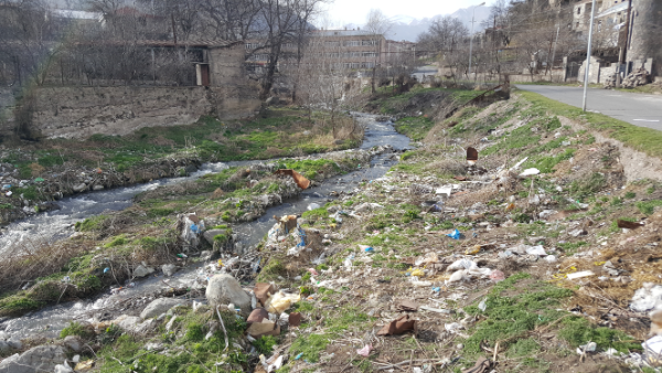
One thing that consistently makes me sad is the amount of trash that’s just laying around the country. This could be such a pretty river, but instead it’s polluted with garbage.
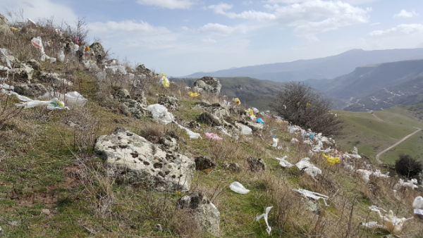
Field of trash encountered during my hike.
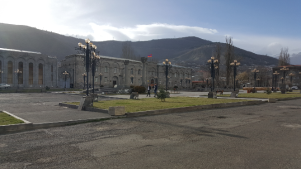
The central square
Spot the little cave door!

My trek from Meghri to Kapan started VERY early in the morning, especially by Armenia standards. The marshrutka left at 7:30AM, but it actually wasn’t too hard to get up on time… thanks to all of the walking the day before, I had a fabulous, comatose night’s sleep.

Kelsey was going all the way to Yerevan, about eight hours, and I was hopping off in Kapan after about two. It was nice to have some company for the ride! I’m so used to going places by myself now that it always throws me off when I have a friend.

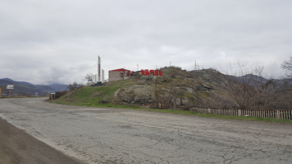
Kapan city sign

The marshrutka dropped me off right in front of my hotel for the night. I didn’t do much pre-planning for this trip (I’m trying to learn how to “go with the flow” and be okay with that), so I looked for somewhere to stay only one night in advance. According to the internet, there weren’t many cheap choices left. In hindsight, I feel like I should have just gotten dropped off in the city center and wandered around asking hotels if they had vacancies. Anyway, I didn’t do that, so I stayed at an inexpensive and NOT centrally located hotel. Everything except for the location was great! But that resulted in me having another ridiculous walking day.

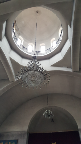
Inside Surp Mesrop Mashtots

I had two sightseeing goals for the day, Halidzor Fortress and Vahanavank. According to google maps, it was a 15 km walk to Vahanavank, and Halidzor is in the same general area. I looked at that and thought, “Oh hey, that’s not bad! Only 3 hours!” Any rational person would have looked at that and said, “I’m going to ask the hotel to call me a taxi.” Oh, well. I figured that I would walk there and then find an alternate method of transportation back.

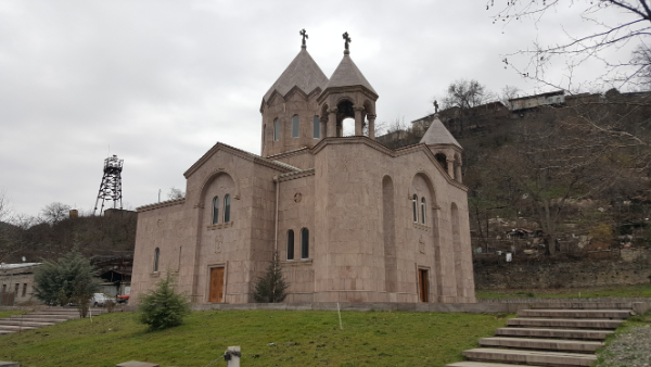
I walked about 40 minutes just to get to Kapan. The thing is, though, that you can’t just think of it as a long walk. You have to think about the fact that you’re seeing things you wouldn’t have seen otherwise because you don’t enjoy the scenery as much when you’re in a car. See? That’s my way of rationalizing my decision and telling you that it was the right one to make (though strong recommend that you just get a taxi if you’re ever in this situation). On my way through Kapan, I went to see the church, Surp Mesrop Mashtots. If you feel like you’ve heard this all before, it’s because every city/town/village in Armenia seemingly picks from the same list of five church names and ten street names, and things can get confusing very quickly.

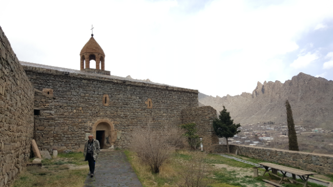
Surp Mesrop Mashtots
The municipal building

From there, I roamed a little more, stopped in a store to buy some snacks (where they stared at me like I was a Martian and forgot to put my human suit on – classic Armenia moment right there), and continued on my way. I walked more… a lot more… and eventually realized that I could have taken a bus nearly the ENTIRE way that I walked. Well. I got some good exercise, and I REALLY saw the scenery. After maybe 11 km, I finally got to the point where I turned off the main road and started heading up to Vahanavank.

Finally off the main road
See the little peek of orange roof along the line between the brown front mountain and the darker back mountain? Vahanavank.

I was probably 20 minutes from the church when a car came up behind me. I did what I usually do and pretended that I had everything under control and totally wanted to be walking up a mountain after already walking for almost three hours… and at that moment, I got caught on a spiky plant and had to stop to untangle myself. So much for looking like I knew what I was doing. The driver pulled up next to me, rolled down his window, and asked if I was going to Vahanavank… as if there was any other reason I would be walking on a random mountain road that literally only leads to the church. I said yes, and he told me to hop in. I’m not too proud to accept a ride, especially when my legs are ready to fall off, so I got in and we were at the top in three minutes.

The river that runs beside the town

When we got to the church, there was actually a priest there! I was so thrown off. I think that’s literally the first time I’ve ever seen a priest in a church who wasn’t in the middle of conducting a service. The guys who picked me up seemed to be buddies with him, and I heard them telling him that they picked me up on the side of the road. I started poking around the church, and the priest invited me to drink tea with them… which he was in the process of heating water for on his little propane tank. Ha! It was a little chilly up there, and I was kind of hoping for a ride back down the mountain too, so I said okay.

The priest spoke some English, so our conversation was actually pretty good. I spoke broken Armenian, he spoke broken English, and we figured it out. He was excited that I’m an architecture person (no one knows what an architectural engineer is, so they usually just decide that I’m an architect), and after tea, we walked around the church and he pointed out different architectural features.

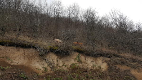
Wild pigs along the way. The priest took it upon himself to tell me about all of the creatures that live in the mountains there, including bears, snakes, deer, pigs, creepy spiders, lizards, etc.
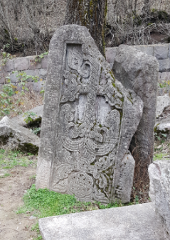
One of the priest’s favorite khatchkars. I think he said that a prayer is written around it asking for the prince to be healed.

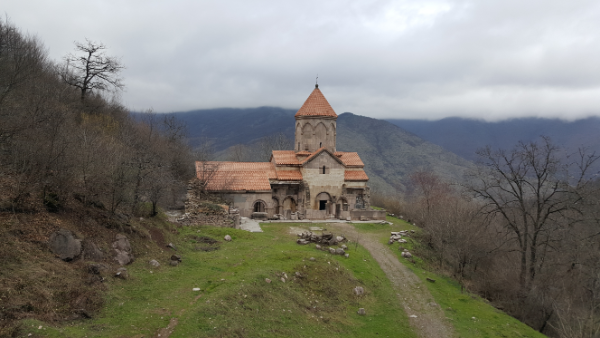
Vahanavank was founded in 911 by the prince of Kapan, Prince Vahan, who supposedly became a monk to cure himself of a demonic possession. The main church is called… wait for it… Surp Grigor Lusavorich aka Saint Gregory the Illuminator Church. It functioned as a monastery and a spiritual school for some time, and there are a bunch of graves in/around the church, including Prince Vahan and many other kings and princes of Syunik (the province where Kapan is located).

Vahanavank

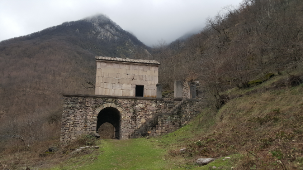
There’s another little chapel on the grounds as well, Surp Astvatsatsin, that was built by one of the Syunik queens, and it also serves as a mausoleum for her and her relatives. It seems like people just built churches when they wanted fancy places to be buried.

Surp Astvatsatsin Chapel

There was an earthquake that destroyed practically everything on the grounds, and they just recently did some restoration work that was never finished. The main chapel of Surp Grigor Lusavorich Church was completely restored, but the vestibule on the side is only partially completed. The priest showed us where they put in different structural features to help if there’s ever another earthquake and the difference between the original and the new stones. The original stones were quarried from a neighboring mountain, but the new ones were brought in from elsewhere.

The little indents in the side of the building are to help with side-to-side movements if there’s another earthquake.
The more reddish stones on the left are original, and the more orange ones on the right are the new ones.

I stayed at Vahanavank MUCH longer than anticipated. If I had gone on my own, I probably would have stayed 15 minutes max and then kept going to Halidzor. Instead, I was there for more than an hour. When they asked where I was going next and I said Halidzor, everyone looked at me like I was a lunatic. They went on and on about how it had just rained and the path was going to be muddy and I shouldn’t go. Usually I’m not one to listen to things like that, but I was kind of cold and the sky had been overcast and dark all day, and I was a little worried about getting stuck out there in the dark. The priest gave me his phone number in case I decided to go and needed help, but I ended up deciding that I had walked enough for one day. I asked the guys who gave me a ride where they were headed, and they said, “Wherever you’re going.” I kind of assumed that would be the answer. People are too nice.

Apartment buildings along the way. Is it just me or do these look ridiculous?

They drove me all the way back to my hotel, laughing the entire time about the fact that I had walked all the way there. I’ll tell you this much – it seemed like a long way even in a car! At least I got my exercise in for the day! I was happy to have some extra chill time at the hotel to take an incredibly long, hot shower and attempt to warm up. The weather was much colder than I expected, and when I stopped walking at my breakneck pace, I think my body got pretty cold.

Anyway, it was certainly an adventure, and now I still have things to do the next time I go to Kapan! This trip is just making me even more sure of my thoughts that I need to come back to Armenia someday. Maybe Sarah and I will do another trip to conquer all of the hiking destinations!

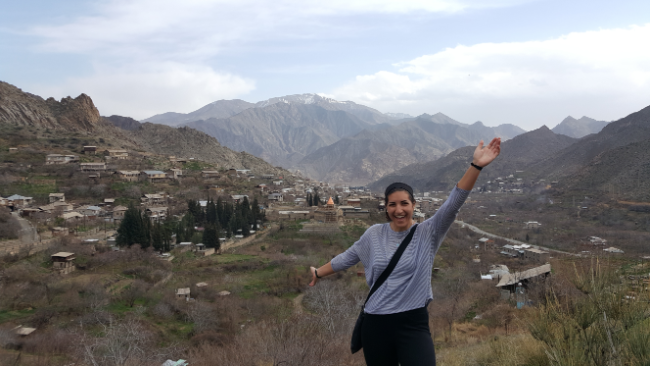
After my long day of travel from Yerevan to Meghri, I hit the ground running the next day and did some intense Meghri sightseeing. Kelsey had work, so I was on my own. I got tips from her about what to do in town, and then I did all of it. In Meghri, the major attractions are parts of the old Meghri Fortress (four parts, though who knows, there might be more), three churches, and a nice view of Iran. I started with the two fortress parts on the ridge closest to Kelsey’s apartment, and the trek there involved some sketchy felt-like-trespassing-but-what-does-that-mean-in-Armenia-anyway moments. There are houses all along the bottom of the mountain ridge, and I had to get past the houses somehow… I walked through someone’s open gate and no one said anything, so that was that.

Meghri

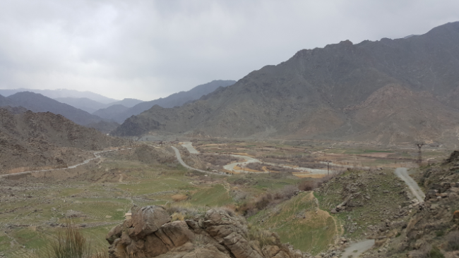
I’ve decided that the Meghri mountains are my favorite for climbing. They’re very rocky and steep which means that climbing them involves a lot of basic rock climbing/scrambling. It makes things interesting! I think that’s way more fun than just hiking. The views from both places were awesome. Throughout the day, I took about a million pictures of the same mountains over and over again because they never got less cool.

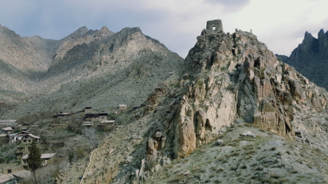
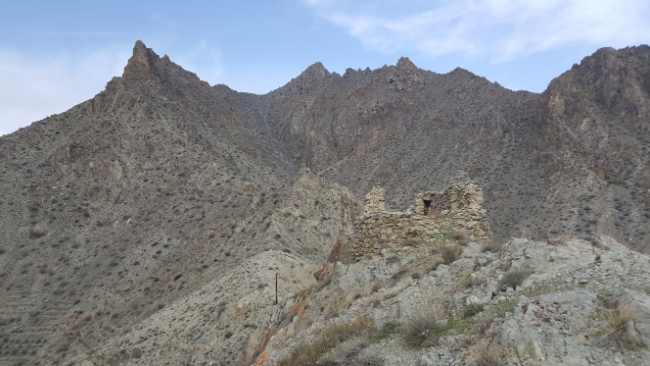
See rectangular structure #1 on top of the jaggedy cliff mountain
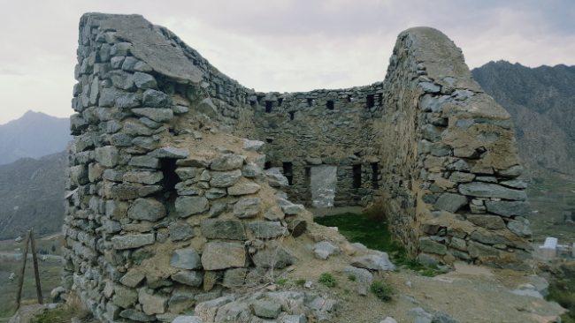
Rectangular structure #1
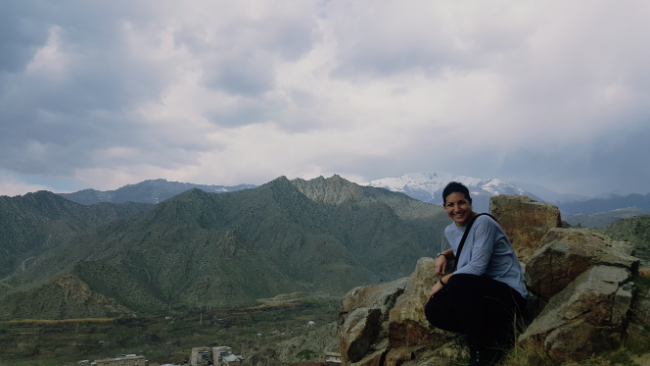
The never-ending struggle of travelling alone is remembering to take pictures that you’re actually in… and also figuring out how to physically take those pictures. Selfies aren’t my favorite, and I usually have a mini tripod, but of course I forgot it and all of the pictures on this trip are going to have to be improvised rock tripod pictures.

From there, I adventured down the other side of the ridge because I saw a road that I thought met up with the one I wanted to take to see Iran. That was kind of right… I got there eventually, so that’s all that matters. I also found a bonus church! I was walking down the street past some ruined buildings, and I saw a little peek of an arch that looked like part of a church. I decided to check it out, assuming that, as usual, no one would care that I was poking around, and sure enough, there was an altar inside! Who knows what happened to the church, but now it’s filled with grass and, based on the poop, grazing animals. I felt like I had stumbled upon a hidden treasure.

The faint mountains in the middle background are in Iran
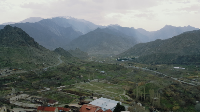
Just enjoy the many mountain views… probably all the same mountains over and over again
Surprise church!
Another ruined building near the secret church

Finally, I found myself on the road to the view of Iran. I mean, you can see Iran from pretty much the whole town, but there’s a road that zigzags in that direction, so I walked down until I hit a little ridge that had a clear view of the Araks River and the border. Of course, I climbed the ridge because why not? I also took a bunch more pictures of the same mountains until it started drizzling and getting pretty windy, and I decided it would be wise to head down and avoid getting blown off the mountain.

Armenia on the left, Iran on the right
The murky looking squiggle is the Araks River. It runs along the Armenia/Iran border.
One of the arches inside Surp Sarkis

Luckily, the rain didn’t last too long. I say luckily because I didn’t have any rain gear (following a morning conversation with Kelsey where she checked the weather and assured me that it wouldn’t rain… oops), and that earned me a stern talking-to from an old woman who I passed on the street. Instead of taking the main roads, I chose adventure and walked down some dirt roads that seemed to be heading in the direction of the church I wanted to see next. It kind of worked… after some winding around, I popped out on a main road again, and from there, I headed to the 17th century Surp Sarkis Church (thank goodness for phone GPS). Again, I didn’t really know where I was going. I walked on the roads that looked like they were going in the right direction until I hit a dead end and asked some nearby old men how to get the rest of the way there.

My Armenian isn’t fabulous, but it’s usually good enough to understand directions. This time, not so much. He said something about taking the high path and then turning after going under the balcony and then something something something and I was completely confused. After one explanation attempt, the guy giving me the directions gave up and just went with me. I definitely would not have figured it out on my own. I don’t think I would have understood even if he had told me the directions in English. We went up this little path, walked under a balcony, around the corner, up some steps, across a rock, up some more steps, and we were there.
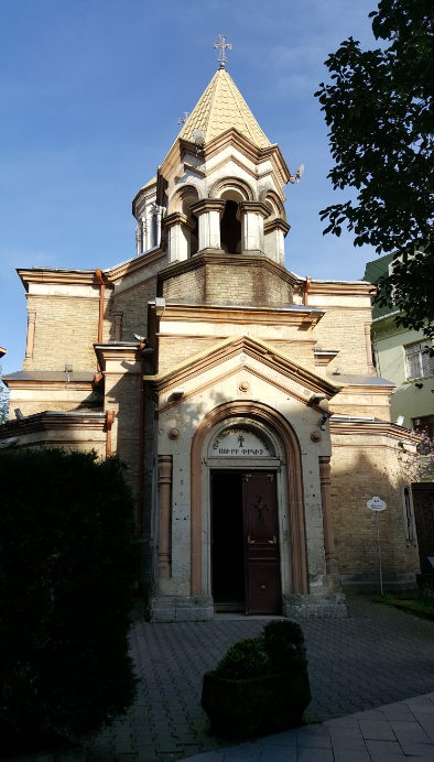
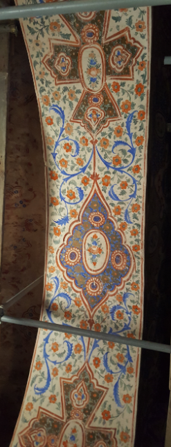
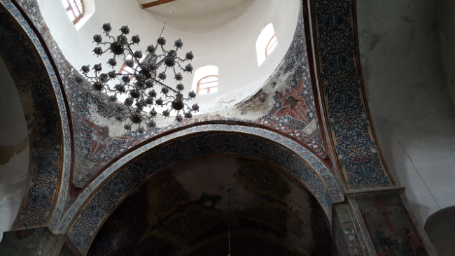
The inside of the church is filled with frescoes, and based on the scaffolding inside, I’d guess they’re getting restored. That exciting because they’re really nice already, and if the colors were a little bolder and less chipped, they’d be breathtaking.

Surp Sarkis and my new friend

When I was finished looking around, my friend and I headed back to where I picked him up. He invited me to come in for coffee, but I said “no, thank you” because I had a packed schedule to keep. My next church was in the middle of town, Surp Astvatsatsin Church (17th century). The main part of the church is stone, and the cupola is brick. Brick isn’t that popular in Armenia, so it’s a little weird to see that on a church. It was pretty though. Again, the inside was filled with frescoes in the same style as the first church.

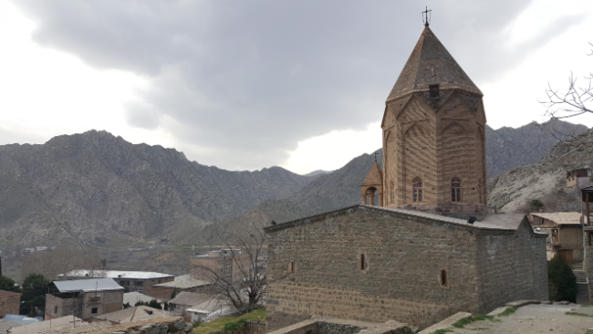
Surp Astvatsatsin

Inside Surp Astvatsatsin
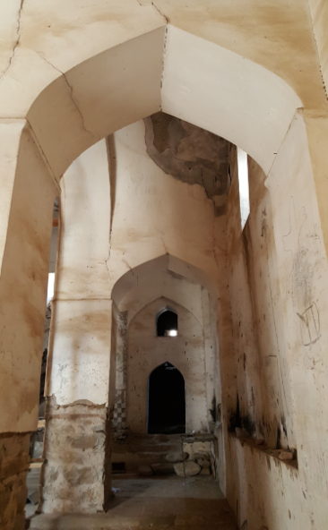
Inside Surp Hovhannes. Check out those arches!

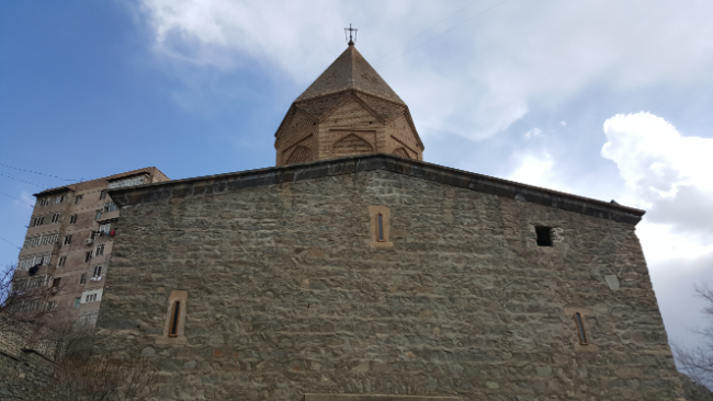
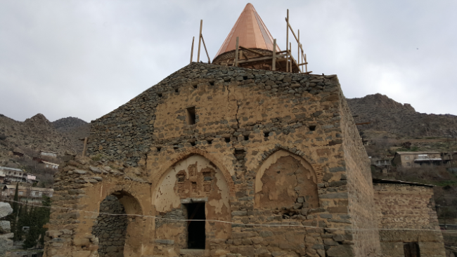
My last church stop was Surp Hovhannes. It’s in the worst condition out of the three churches and is undergoing some significant restoration work. Kelsey said some French organization is restoring it. It has a shiny, new roof on the cupola and there’s scaffolding all over the inside. The major interesting feature of the church is the arches inside. They look like Persian arches and were intentionally designed that way so that the Persians wouldn’t destroy the church if they came in and conquered the town.

Surp Hovhannes

Since I still had plenty of time in the day and I wasn’t completely exhausted yet, I decided to climb to the other two fortress parts. I don’t know what way you’re supposed to get to them, but it’s definitely NOT however I went. I looked incredibly suspicious as I tried to find a way around all of the houses, and then I for sure walked straight down someone’s driveway and through their garden when I got tired of looking. Oh well. The climb to the first structure on the ridge was the most intense and highest climb of the day. I don’t completely understand what the different things, but two of the structures I went to were rectangular and two were round. I guess the round ones are watchtowers, and who knows about the other two. I tried to understand via the internet, but that was less than helpful.

Me + Meghri
Rectangular structure #2

After climbing to the highest point, it seemed almost pointless to go to the last watchtower, but I figured it was basically on my way down… and I hoped that from there, I’d be able to see a less shady way off the mountain. Sure enough, I saw exactly the way I should have come up. It wasn’t through anyone’s yard or garden, and it would have made things a whole lot easier. Oh, well. Live and learn!

Who doesn’t like a good ‘ole panorama?

This is another one of those times when I wish I had a fitness watch or had thought to turn on a GPS tracker because it would be interesting to know how far I walked. Based on how my legs felt, it was a looong way. I was walking/climbing for probably like 5 hours, excluding stopping time and such. My conclusion about Meghri? It’s beautiful, the mountains are the best, it was absolutely worth visiting, and if you’re a lunatic who likes climbing things, you’ll probably agree.

My south trip started with a long marshrutka ride. I decided to go all the way south and then slowly work my way back because that seemed like the plan that made the most sense. My first stop was Meghri, a town almost right on the border with Iran and the last major town before the border crossing (the border town is still after that, but it’s very small). I wanted to go to see the town and because you can see the mountains of northern Iran from the Armenia side which is the closest I can get.

My friend Olivia has a friend in Meghri, Kelsey, and she graciously offered to let me stay with her while I was there! It worked out perfectly because I took the marshrutka there, stayed with her, and when I was planning to move to the next town, she was planning to go to Yerevan, so we took the same marshrutka (but I got off MUCH earlier). I’m getting very ahead of myself, sorry. Let me go back to the beginning.

I took a marshrutka from Yerevan to Meghri. It takes around 8 hours and involves a lot of windy roads. The same marshrutka passes through every town that I’m planning to visit on this trip, so it was like I got a little sneak preview of the rest of the week… when I wasn’t sleeping at least. We left at 7:30, I woke up at 5AM because I hadn’t packed (of course), and around 7, I called a taxi to take me to the bus station. I was assigned a seat next to an old woman, and soon after our intended departure time, we were off. This was one of the marshrutkas where you’re supposed to call to make a reservation, so I asked Zoe’s roommate to help me out the day before by calling to save me a seat. Part of the goal of my trip IS to work on my Armenian, but speaking over the phone is HARD! Especially when you’re asking someone to do something for you, and you’re not really sure how to ask them properly.

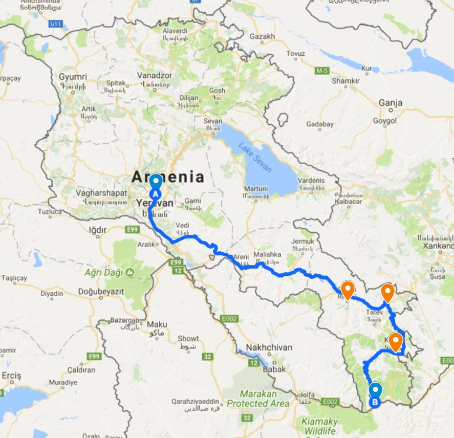
Here’s approximately the route we took to get from Yerevan to Meghri (the blue pin all the way in the south). The other destinations for my trip are the orange pins. From south to north it’s Kapan, Goris, and Sisian.
The long marshrutka rides always involve a lot of stops. You stop to let people on, you stop to let people off, and you stop so that all of the men can smoke (and so people can eat and go to the bathroom I guess, but mostly so that the men can smoke). During one of the stops, I started talking to my seatmate. She was very patient with me, letting me try to speak and speaking to me. Her name is Laura, she’s 78 years old, and she is from Meghri but lives in Yerevan with her husband. She was very excited about the fact that I also speak Spanish (though at this point my Spanish skills are at a pathetic level), and I felt like she kind of adopted me. Eventually, another woman sat on my other side, and when we got to our “lunch” stop, I was force-fed from both sides. Laura asked if I ate breakfast that morning and I said yes… and then she proceeded to put food in my hands, ignoring my insistent “no thank you”s. I was piled high with lavash bread, pork khorovadz (barbecue), cheese, peppers, lunch meat, sesame seed dessert things, and hard candy. Anytime I stopped eating, she pointed at my food and said “Ker!” which is essentially the equivalent of “Eat!”
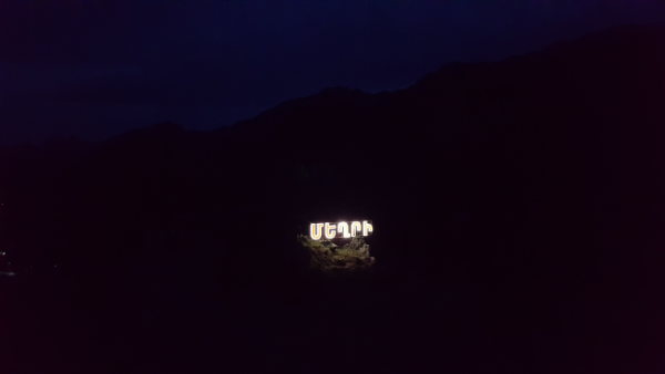
The Meghri city sign, with the faint outline of mountains in the background

For the most part, the rest of the ride was filled with me sleeping or just closing my eyes so that I wouldn’t feel like I wanted to throw up. I’m not usually one to get carsick, but whipping around those windy mountain roads in a marshrutka is enough to freak out even my stomach. Plus, it’s a little disconcerting to see the little gravestones lining the roads from cars that almost certainly fell off the side… I’d rather not think too hard about how much I trust the marshrutka drivers. The one benefit of keeping my eyes open was that the view was beautiful. The mountains were just the right amount of snow-covered, and the sky was clear and blue… so I switched between forcing my eyes to stay open and look out the window and closing them so I wouldn’t feel nauseous.

You kind of feel a sort of kinship with the other people on the marshrutka on those long trips.  I felt like we were all on a grand adventure together. The ride is also very entertaining because people on the marshrutka will drop off bags of stuff with people who are waiting on the side of the road. One woman hailed a taxi in a town along the way and asked it to take a bag of stuff to a village nearby. The coordination that goes into those roadside handoffs is impressive. Also, the marshrutka will stop wherever you want it to, and sometimes, people get off in what seems like the middle of nowhere. After one woman got off, the driver asked her if she was sure because there was literally nothing around. Anyway, it’s all very interesting.

Kelsey said she’d meet me in the center of town, and I was worried that I wouldn’t know where that was. Hehe. Worrying not necessary. I knew when we were entering Meghri, and as soon as we pulled up somewhere that had a little plaza in the middle of a roundabout, there was no question that I was in the right place. Kelsey was there when I got off, and we spent the rest of the day hanging out, eating pizza (actually pretty good!), and roaming around town a bit. My major Meghri adventures happened the next day, but I’ll save that story for the next post

Meghri at night

Today on “Random Places Lara Decided to Visit”, we have one not-random-but-just-happened-to-be-on-the-way place and one google-map-located place.

Ceiling detailing inside the train station

My plans for the day included visiting the Komitas Pantheon and Yerablur Military Cemetery… because why not just visit a bunch of cemeteries one after the next? Actually though, they’re just kind of in the same direction, and I thought I could visit both on the same day without much trouble.

I took the metro to Sasuntsi David Station on my way to the Pantheon and figured I’d pay a visit to the train station and the famous David of Sassoun statue out front while I was in the area (this is the not-random-but-just-happened-to-be-on-the-way place). Before that, the last time I had been at the train station was when I was moving to Yerevan from Gyumri and was too busy falling asleep/trying to carry my stuff to admire the building. My general thought stream was something like, “hm this is nice. I’m tired. I should come back when it’s light. ZZZzzzZZZzzzZZZ.”

Inside the train station… the Christmas tree is gone now, the weird red lines are still there

David of Sassoun is a mythological hero of Armenia from a classic folk epic poem. The oral tales about David date back to between the 8th and 10th centuries. They were passed down from generation to generation and were finally recorded for the first time in written form in 1873 by Garegin Srvantsdiants, an Armenian bishop. It took him days to record it as it was narrated to him. In 1903, Hovhannes Tumanian, a famous Armenian poet, created a rhymed version. During the Soviet years, the story was further developed and made into a more coherent work because as a previously oral work, there were well over 100 variations of the story. The entire epic is called “Daredevils of Sassoun”, and it’s like the Armenian Illiad. It is divided into four parts that tell the stories of four generations of a family.

Sasuntsi David appears in the third part of the epic. He is a giant with super strength. He is brave, generous, selfless, peace-loving, honest, upright, and patriotic. He will do anything to protect his land and his people. The overarching theme of the epic is good vs. evil and fighting for justice.


Sasuntsi David

David was the son of a king and queen who previously had no children. They were visited by an angel who told them that they could have a child, but they would die immediately after he was born. They agreed, and so David started his life as an orphan.


He was a very strong boy, and after he grew up, he took his place as defender of the Armenian people. Throughout the epic, he fearlessly defends his people against invaders from Egypt and Persia. In one battle, to avoid shedding the blood of the enemy soldiers, he challenges their leader to a duel and emerges victorious.

The statue was sculpted by Yervand Kochar and was unveiled in 1959. Kochar was an Armenian sculptor and artist who was born in Tbilisi, Georgia, lived in Paris while his career developed, and eventually moved to Soviet Armenia. Sasuntsi David is one of his most famous works, depicting David on his faithful steed and holding his sword of lightning. It’s a pretty… epic… statue (hehe).

Isn’t it a cool statue?

The train station is behind the statue, and it was built in 1956. I think the inside is really nice, but there are currently some weird red lines all over the ceiling and walls, and they kind of ruin things. I thought that they were just an addition for the holidays, but they’re still there now, so I’m not quite sure what’s going on.

Yerevan train station
Main hall of the train station

From there, I walked to the Komitas Pantheon which I’m going to write about separately, and finally, I made my way to Yerablur Military Cemetery. It’s on the outskirts of Yerevan, so I took a marshrutka there, and we wound our way through the surrounding neighborhoods before finally making it to the base of the hill where the cemetery is located. There’s nothing else in the area. It’s just built on top of a hill in the middle of a lowkey neighborhood. If I didn’t know it was there (and wasn’t following along on my phone map), I would have thought I was in the wrong place.

The cemetery was established in 1992 and is for Armenian soldiers who lost their lives during the Nagorno-Karabakh War. There are over 700 people buried there.

I just wanted to go and pay my respects. I knew it wouldn’t be a happy trip, but war isn’t a happy thing. I try not to shield myself from unpleasant things because then you can make yourself forget how unpleasant they are. Then you start to think things like, “Oh, Armenia is in a never-ending war, and that’s just the way things are,” instead of thinking about the fact that war is a horrible thing and it takes the lives of fathers, brothers, sons, and friends. Each number in a death toll statistic was a person, and that person’s death was heartbreaking for a lot of others.

Coming into the cemetery
Church at Yerablur
One of the things that makes cemetery visits even more emotional here are the faces of the deceased displayed on the headstones. Reading a name is one thing, but seeing a face makes each person a lot more real.
Memorial at Yerablur
Church doors

One thing that I noticed very quickly was the general youth of most of the people buried there. As much as I feel like I’m getting old, I’m really not. Meanwhile, I would say that at least half of the people buried there never even made it to my age. The youngest person I saw was 15. A huge number of graves were for 18-22 years olds. At 18, you haven’t even gotten to the best stuff in life. Things only get better from there, and none of those people got to experience that.

Most of the graves are from about 25-30 years ago, but so many had fresh flowers on them. Some of them smelled like freshly burned incense. Thirty years, and those families are still feeling the loss. Everyone else might forget or be able to put the war out of their minds, but they don’t have that luxury. Then, there are the families who have sons there now, the kids doing their mandatory two-year military service. I don’t doubt that those families, those mothers especially, don’t let a single day pass without thinking about the war. It’s not right. Life shouldn’t have to be like that.

I hate that this cemetery even has to exist, but they did do a beautiful job of landscaping and giving these families a place to grieve.
This memorial is to the Armenian Secret Army for the Liberation of Armenia (ASALA). I had never heard of it before seeing this at the cemetery and looking it up, but it was an organization that carried out various attacks and assassinations, primarily of Turkish diplomats and politicians. It seems a little shady… that’s all I’m going to say about it, and you can do your own research if you want to know more.
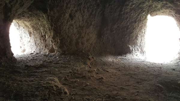
Unknown soldier grave
Cathedral of the Holy Cross

From the cemetery, I could see a shiny church that I wanted to visit since the first time its gold roof caught my eye. I thought it didn’t look too far away… so I walked there. Probably not my best call because despite the fact that the distance was quite walkable, it wasn’t terribly pedestrian friendly. Live and learn… and I did live, so now we can all just laugh it off as a funny story that happened in the past and isn’t a big deal because it all turned out okay (Mom – I’m fine.).

On the bright side, the church was very pretty and worth the visit. There was a groundskeeper who came out to see what I was doing, and I was so busy trying to reassure him that I wasn’t up to anything shady that I didn’t even think to ask if he could open the door and show me the inside. I did my best to peek in the windows, and from what I could see, it looked beautiful. I bet he would have let me in, too. Life lessons: you’ll never know the answer unless you ask. And here, the answer is so frequently yes.
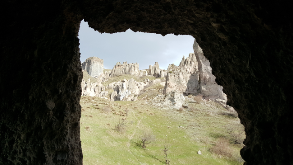
Shiny, right?