My first few days in Lebanon were rainy. When I say “rainy”, I’m not talking about just overcast skies and some little showers here and there. I mean that for three straight days, it was like the sky decided to finally unload some serious emotional baggage. I usually don’t believe in umbrellas (don’t bother trying to make sense of me), but no chance was I going out in THAT with just a rain jacket.

We started out by planning “rainy day activities” and ended by defiantly going outside despite the rain. The National Museum of Beirut was stop #1 on the rainy-day Beirut tour, and it was a great way to start off my time in Lebanon! It’s an archaeology museum, and they have a huge variety of artifacts. There are so many different types of things, and they span thousands of years of history. The museum has over 100,000 artifacts, and about 1,300 of them are displayed. If you think that sounds like they’re kind of gypping you, trust me when I say that 1,300 is more than enough. The museum is incredibly well done with enough stuff to make you feel satisfied but not so much that your brain is mush by the time you leave. I was also impressed with their audio guide… they give you an ipad! And you go around the museum scanning barcodes to bring up more information about certain objects. So high tech!
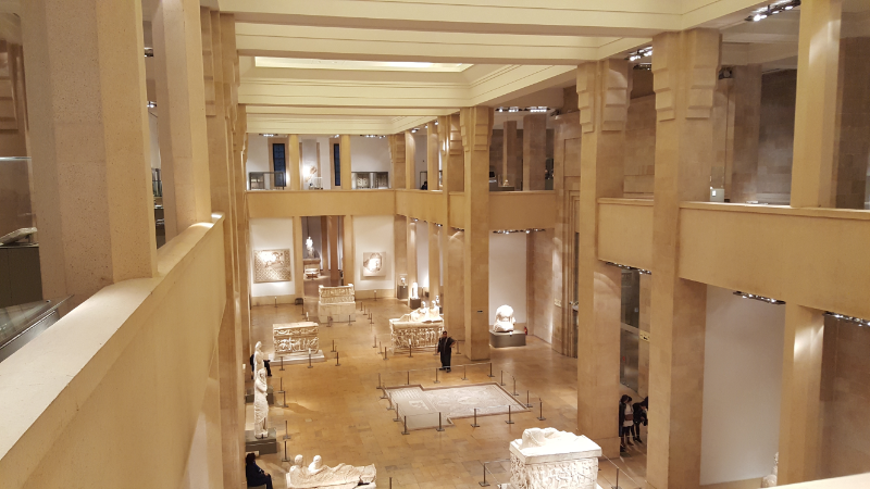
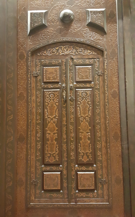
Doesn’t this just look exactly the way you think an archaeology museum should look?

The museum is located right along the road that served as the separating line between the east and west sides of Beirut during the civil war. That meant that there was no chance of the building making it through the war unharmed, so the curator of the museum at the time undertook measures to protect the collection. Some artifacts were relocated to other parts of the country, and other small objects were hidden in the basement. Those storerooms were walled in so that no one even knew they existed, aside from the very few who were involved with the installation. Larger, unmovable objects, such as the mosaics set into the floor and large statues, were encased in wood and concrete and left in place.
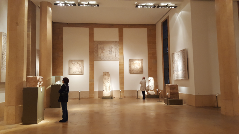
Museums are the best.

The war lasted longer than expected, so despite these protection measures, the collection still suffered greatly. The artifacts hidden in the basement storerooms were in an uncontrolled environment for 15 years. Flooding in the museum led to high humidity levels (around 95%). A fire caused by shelling resulted in the destruction of museum records and artifacts. Large objects suffered damage from the salt in the concrete and the lack of ventilation in their emergency casings. Looting scattered the collection across the world. The building itself was covered in shell and bullet holes and graffiti.
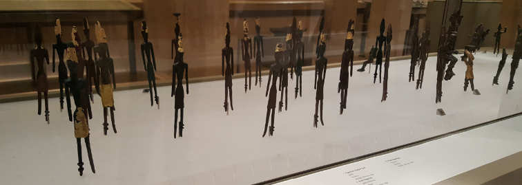
I’ll be honest, I don’t remember what these are. I imagine they’re like the ancient version of little green army dudes (ignore me).

It took 21 years after restoration began for the entire museum to open again. The building needed a serious overhaul, and the collection had to be inventoried and restored. In 1999, four years after restoration efforts began, the museum permanently reopened, but the final floor wasn’t completed until October 2016. The museum is STILL working to track down artifacts that were stolen and sold during the war.
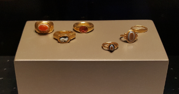
Some cool rings that they found buried with the anthropoid sarcophagi.

I was lucky that the basement was open by the time I visited. It included some of the coolest stuff in the whole museum… there were three naturally mummified people who were found in a cave, a huge collection of anthropoid sarcophagi, and a 2nd-century frescoed tomb that was relocated from Tyre. I don’t have pictures of the people because it seemed disrespectful or of the tomb because photography isn’t allowed, so I guess you just need to visit Lebanon if you want to see them…

I checked out the National Museum solo, but Badveli and Maria joined me for the next museum on the list, the Nicolas Sursock Museum. During his life, Sursock was an art collector, and his will left his house to the city of Beirut to be converted into an art museum. I’ll be honest, 90% of the reason I wanted to go was just to see the house. It’s a modern/contemporary art museum, and we all know the complicated relationship I have with modern art. I figured that no matter what the art was like, the building would be worth the trip. Badveli was interested in checking out these 19th-century pictures they have of the ruins in Baalbeck, so we made it a family trip!
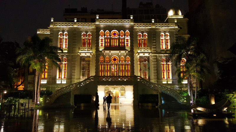
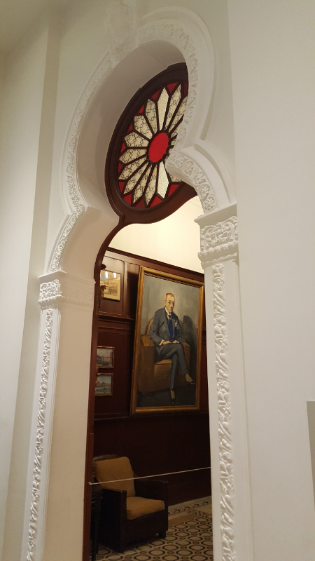
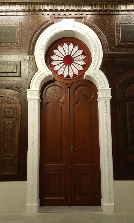
That stained glass though…
Talk about an epic doorway!

The house was built in 1912 and is a cool mix of architectural styles, including some elements inspired by Venetian and Ottoman architecture. It also has a bunch of stained glass which basically guarantees that I’m going to like it. The museum first opened with the house kept in its original condition, and exhibitions were shown in the many rooms of the mansion. Eventually, a project was undertaken to reconfigure some of the rooms into more traditional gallery spaces. Recently, a much larger project was completed that added four underground floors beneath the house and garden. I can only imagine how fun that construction process must have been, figuring out how to levitate a mansion while constructing another building underneath it.

For the most part, the exhibitions were about what I expected… weird. There were a few cool pieces, but it was largely baffling, as is the way with modern art. Don’t get me wrong, I have no issues with weird. I love weird things! But the weirdness of most modern art is a type that must be incompatible with my personal brand of weird. There was one thing though… as we were leaving, we walked past a curtained doorway marked with a sign saying, “Please do not touch the floating burger.” I was intrigued. Burger like hamburger? Why was it floating? What about it made touching it so tempting that they explicitly had to tell people not to? I peeked my head inside, and somehow what I saw was simultaneously exactly what I expected and the last thing that I expected. It was a floating burger. The room was completely dark, a blacker darkness than any I’d ever experienced. The only light shone directly onto a floating hamburger. It was like a beacon, calling you towards it. The burger practically screamed, “TOUCH ME!” I’m not an uncultured scrub… I know that you’re not supposed to touch things at museums, but I’ll be honest. I wanted to touch that burger. HOW DID THEY KNOW?  It was like I was hypnotized. There was also a museum staff woman standing by the entrance, probably making sure that the burger was left untouched because I bet she’s felt the same, inexplicable desire that I felt to touch the forbidden burger.
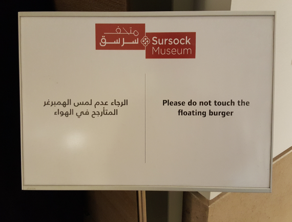
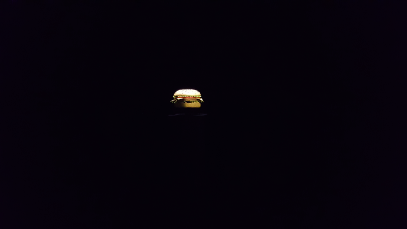
Like… how could you NOT look after seeing this??
Genius.

I felt like my faith in modern art was restored… until we left the museum and I read the pamphlet that accompanied the piece. It was something about capitalism and blah blah blah profound symbolism blah blah blah. I immediately forgot what I read because I knew that trying to assign too much meaning would inevitably ruin the whole thing for me. Maybe that’s the problem. I want modern art that has no explanation besides “I made this because I thought it was weird and funny.” Otherwise, it gives me flashbacks to university where we’d make a design that we thought looked cool and then go back later to make up some stupid, symbolic meaning because the project required it. What’s wrong with just saying, “I did this because it looked cool”? To be fair, sometimes the explanations feel legitimate, but most of the time they seem like a bunch of hooey.
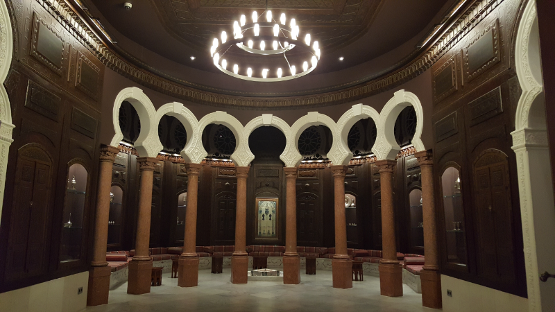
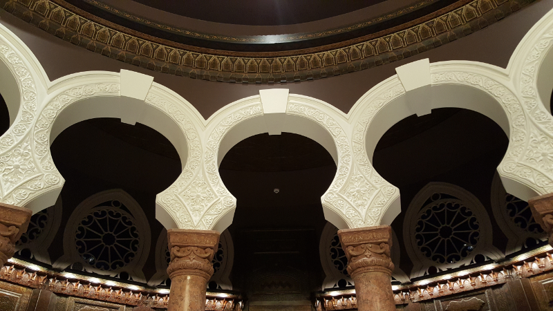
This is the salon where Sursock would entertain guests. It’s a ridiculous room but also kind of awesome.
I couldn’t get over how much detail there was in EVERY aspect of the room.
The wood paneling on the walls was brought in from Damascus.
Geez.

What a day! I just spent WAY more time than expected trying to understand the history of Lebanon from 1915 to the present, and I kind of think that my brain might fall out of my head. I’m one of those people who really likes math because there’s always a clear answer. It’s straightforward. This, on the other hand, is not. There are too many details and too many people involved and too many things happening. My. Brain. Hurts.

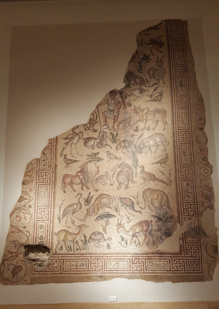
I’m going to show some various war-damaged things, but some of them have longer stories that I’ll talk more about later. For now, I’ll just caption them briefly. This is a mosaic in the National Museum. The hole in the bottom left is from a sniper who shot at bystanders through the wall behind the mosaic.

You might be wondering why I’m spending so much time on history instead of just getting right to the fun, pretty things I saw. One thing that I’ve realized more and more over the last year is how much better you can understand the people and the situation of a country if you take the time to look at their history. I know, that’s another “DUH” statement, but it’s something that I didn’t used to do. Usually, when people travel internationally, they go to a country, they see the sights, they decide all the things that they like and don’t like about how the country works and how the people behave there, and they go home, usually with some feeling of superiority about their country and the way that they live. I know that’s not true for everyone, but from what I’ve seen, it’s not uncommon. I’ve heard people talking about experiences in other countries and ending with the basic statement of, “They just aren’t as civilized as we are.” That statement. Is horrible. People are different. Different cultures value different things. My idea of “civilized behavior” isn’t the same as that of someone born in India or someone born in Ghana. Does that make any of our ideas wrong? Yes, there are some universal morals that stand despite any cultural argument. More often than not, though, the things that we find so offensive in others are based on nothing more than personal preference and stereotypes.

Sorry for that rant. Mostly I’m not even talking about Lebanon anymore, but this is just something I’ve been thinking about a lot lately. So, like I was saying, if you want to be able to identify WHY something is the way it is, something you may not like, you need to have some context… which leads us back to the history lesson. On that note, here is my attempt to explain the last century the best I can without making your brain hurt too.

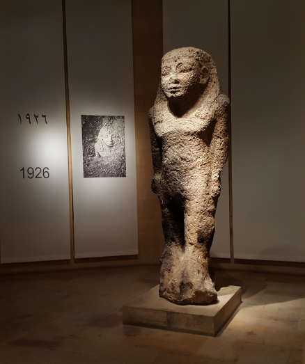
Many of the large pieces in the National Museum that couldn’t be moved during the civil war, including this one, were encased in concrete for protection. Smaller artifacts were hidden in the basement behind fake walls so that no one would know they were there.

I left off my last post at the end of World War I when Lebanon and Syria were put under French control. During the Ottoman years, the size of Lebanon was greatly reduced. Much of the eastern and southern land was cut from Lebanon’s territory by the empire. In 1919, a Lebanese delegation presented their argument for an extension of Lebanon’s borders back to their previous locations. This was mostly driven by the Maronite Christian population who wanted a Lebanese nation. Interestingly, those territories were majority Muslim populated, so the addition of that land to Lebanon practically eliminated the Christian majority.

A constitution was written in 1926 that was supposedly meant to balance power between religious groups but was really favoring the Maronites. The President was a Maronite Christian, the Prime Minister a Sunni Muslim, and the Speaker of Parliament a Shiite Muslim. The Parliament seats were divided into a 6:5 Christian:Muslim ratio based on census information at the time. The President had a very strong and influential position, and this is still mostly true today, though some things have changed since the original constitution (and the Parliament ratio has changed to half and half of Christians and Muslims).

During World War II, Britain sent troops to Lebanon because Germany was moving weapons through the country. In 1941, the British recognized Lebanon’s independence. There were elections in 1943 that weren’t recognized by France, and the new leaders were thrown into prison. International pressure convinced the French to release the leaders and recognize the new, independent Lebanon!

From the time of independence until around 1958, Lebanon prospered. The economy was booming, and tourism, agriculture, and education were flourishing. Then, in 1958, Arab nationalism was on the rise in the Middle East, and Egypt and Syria joined together to create the United Arab Republic. They wanted to unite all Arab nations into one country which required eliminating any governments seen as “pro-West”. After Iraq’s government was toppled, the Lebanese president asked for help from the US to keep Lebanon independent. Some Lebanese, mostly Christians, wanted to remain aligned with the west, while others, mostly Muslims, wanted to join the new Arab nation. The US intervention successfully stabilized the country, though 2000-4000 people were still killed.

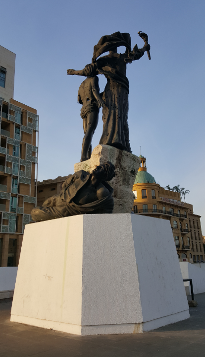
This is Martyrs’ Monument. After the war, it was restored, but some of the war damage was left as a reminder. You can see holes in all of the statues, and one of them is missing half an arm.

The beginning of the 1960s was relatively calm, and Lebanon continued to grow economically. Then, in 1967, more Palestinian refugees fled to Lebanon after the 1967 Arab-Israeli War, joining the over 100,000 who had already settled there after the 1948 war. The Palestinian militant forces, previously operating out of Jordan, were kicked out and also moved to Lebanon. The Palestinian Liberation Organization (PLO) started using southern Lebanon to launch attacks on Israel. Israel retaliated, and the Lebanese people were split between pro- and anti-Palestinian groups (the former was mostly Muslim and the latter mostly Christian).

An agreement signed in 1969 gave the PLO control over the refugee camps and access to northern Israel, and it had to recognize the sovereignty of the Lebanese government. The Lebanese army then had to leave the PLO alone, and Maronite militias took their place. Before this, Lebanon had managed to stay out of all conflicts with Israel. The PLO ended that neutrality when it set up what was effectively a mini-state in southern Lebanon and stepped up its attacks. Israel retaliated by bombing Lebanon. The Lebanese government was weak and divided and couldn’t really do anything to defend its people.

The Lebanese Civil War started in 1975. The fighting between the Maronite militia and PLO spread to Beirut. It started with a few minor clashes and then erupted into an all-out war. More and more militias started to emerge, each generally tied to a religious group. Practically everyone had their own militias – the Maronites, the PLO, random secular groups, the Druze, the Sunnis, the Shiites, and the Armenians. Everyone had their agendas, supported different sides for different reasons, and were funded by different outside sources. The Armenians mostly tried to remain neutral and only fought when they needed to defend Armenian areas. The western part of Beirut turned into the “Muslim side” of the city and the eastern part the “Christian side”, and they were separated by a road that became known as the “green line”. People fled to the appropriate sides for safety.

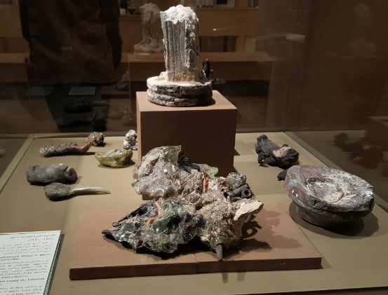
These are some objects in the National Museum that were damaged during the civil war. The storage room where they were located was shelled, and the resulting fire fused together all of these different materials.
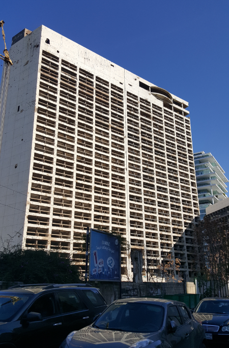
The part of the city with a bunch of nice hotels became a battleground with militias fighting each other from building to building. This one, the old Holiday Inn, had only been operating for a couple years before the war started. It is the only hotel in the area that’s still left in its post-war condition due to disagreements about its future between the owners.

Meanwhile, the leader of Syria declared that “Lebanon is part of Syria, and Syria will take it back”. Syrian troops entered the country and started fighting for control of the land and the Palestinians. The Maronite militias, the PLO and pro-Palestinian Lebanese National Movement (LNM), and the Syrian army fought each other and also massacred innocent civilians during random attacks on villages, camps, and neighborhoods. A ceasefire was negotiated near the end of 1976, but the PLO continued to attack Israel, and Israel continued to retaliate.

In 1982, after Israel invaded Lebanon all the way to Beirut, there was an international attempt to move the PLO and Syrian forces out of Lebanon. Israel was told to withdraw from Lebanon as well as stop its attacks. Foreign troops landed to supervise the PLO evacuations. Fighting continued with Maronite militias attacking Palestinian refugee camps and killing innocent people. The Syrian army refused to leave, and suicide bombers attacked the US and French troops who were there for peacekeeping, eventually forcing them out of the country.

The fighting didn’t stop, but it was a little more sporadic after that. A new extremist group, Hezbollah, entered the mix in the early 1980s, backed by Iran and Syria, and worked with Palestinian forces to attack Israel. Raids on towns continued by all of the various groups, and civilians continued to be killed. There were bombings and shellings and assassinations.

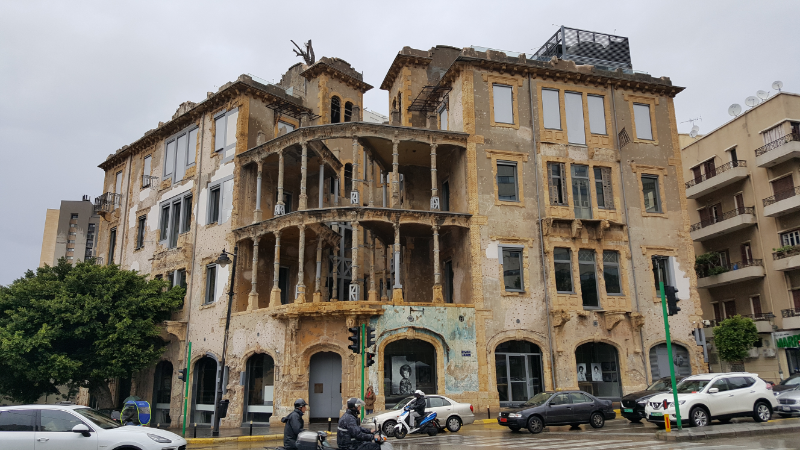
This building, the Barakat house, had tenants before the war who all moved out because it’s located right near the green line that divided the city. Thanks to its open architecture, it was the perfect place for snipers to hide and be well protected. It was a big strategic location during the war.

Finally, in 1989, an agreement was signed to try to end the war. It called for the Syrian army to withdraw within two years, which they rejected. The war ended in 1990 when the Syrian Air Force bombed the presidential palace, driving the interim prime minister, General Michel Aoun (Lebanon’s current President) into exile. The government was restructured to give equal representation to Muslims and Christians. The militias were disarmed, except for Hezbollah because it was a “resistance force” fighting Israel (and had Western hostages to use as leverage). Over the next few years, Syria did all it could to keep the Lebanese government dependent on it to run the country.

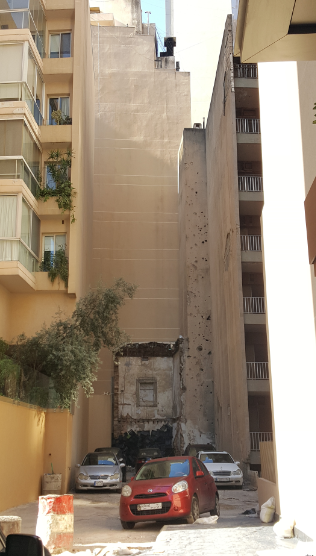
This is a random alleyway I wandered down, and I was thrown off by the fact that there are all of these rebuilt and refinished buildings except for this one little swiss-cheese wall that still shows war damage.

General elections were held again in 1992 and were boycotted by the vast majority of citizens because they were organized by Syria. Despite the civil war being “over”, there were still ongoing incidents. Hezbollah and Israel continued to actively fight, even after Israel withdrew the rest of its forces in 2000. In 2005, there was a series of assassinations of government leaders. The same year, the remainder of the Syrian troops finally withdrew. In 2006, another war broke out between Hezbollah and Israel. The infrastructure of Lebanon took a hard hit with Israel’s bombing of many of the bridges throughout the country.

Since then, things have settled down, and the country is in a weird limbo of simultaneously rebuilding and still having a bunch of unresolved issues. The Syrian war has put extra strain on the country in the form of an estimated 2 million refugees. For a country of only about 4.5 million people, that’s significant. Plus, there are still about half a million Palestinian refugees in the country. That is a huge economic challenge, and it’s expecting A LOT from the country’s infrastructure.

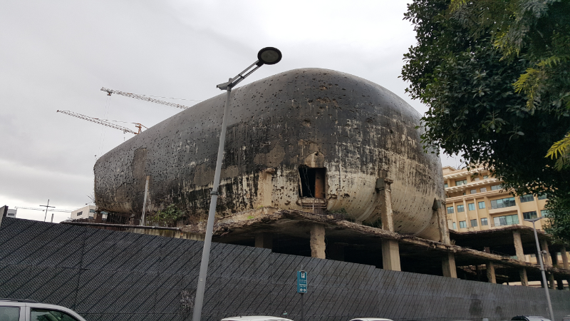
“The Egg” was part of an unfinished construction project when the war started. It was meant to be a movie theater. Now, it just looks like a weird, concrete bunker.

Lebanon has so much potential in so many ways. It’s beautiful, for one. It used to be a hopping tourist destination, and there’s no reason why it shouldn’t be able to get there again. There have been so many conflicts in the country’s history, and after many of them, it was able to enter a period of peace and prosperity. Maybe I’m just optimistic, but I hope that’s something that can happen again. Let me try to help out with the tourism revival… you should visit Lebanon! I never felt unsafe, and it was so interesting to visit a place with such a complex history.

Now that you’ve read more historic details than you probably ever wanted, my next post will get into the fun stuff!

The rebuilding had the unexpected side effect of revealing hidden ruins, and the unique circumstances gave archaeologists a chance to investigate things that had previously been inaccessible. Their findings led to the conclusion that the city of Beirut may date back as far as 3000BC!

Remember when I said that Lebanon is super old? As you might expect from a very old place, there are a lot of museums in Lebanon displaying very old things. I went to two of them, the National Museum of Beirut and the American University of Beirut’s Archaeology Museum. Beyond just museums, there are ruins all over the city (and under the city) and the country. It would be impossible to give you a thorough history of Lebanon, mostly because you would be bored to tears reading it, and I would react similarly to writing it. Instead, I’m going to give you the highlights deemed most interesting by me.

(Disclaimer: as usual, I’m at like 90% confident that what follows is accurate, but I’m not a scholar of ancient history which means that looking at this stuff for too long makes my head hurt. I did my best.)

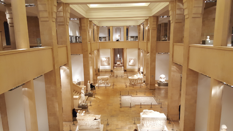
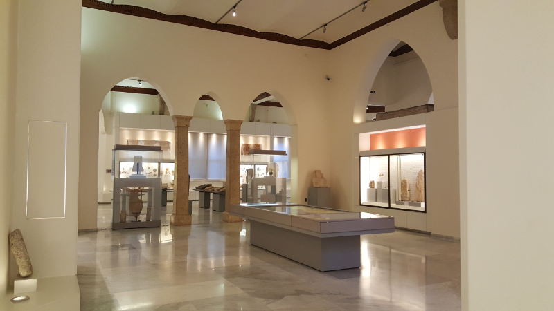
View of the main hall in the National Museum of Beirut.
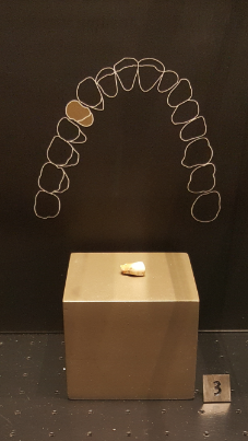
Ancient molar! It’s dated to 200000-50000 BP.

To talk about the first humans in Lebanon, we have to go back… waaaaaay back in history to AT LEAST 48000 BC. Oh yes, that’s right. The National Museum has a molar that has been radiocarbon dated to 250000 – 50000 BP (BP means the number of years before 1950). That, yes, seems like quite the range of dates. I know this is complicated stuff, but you’d think they could come up with a gap of less than 200,000 years. Anyway, that’s beside the point. The point is, even if it’s only from 50000 years before 1950, it’s still ridiculous.

The first permanent settlements are estimated to have emerged by 5000BC. By 4000BC, the land was inhabited by the Canaanites, or Phoenicians. They lived in coastal cities, and the inland was covered in forests. Those cities are still in existence today: Tyre and Sidon were big maritime and trade centers, and Gubla (Byblos) and Berytus (Beirut) were trade and religious centers. The Phoenicians thrived because of their location and many tradable resources. They established a trading relationship with Egypt, bringing in wealth and foreign goods.

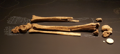
These bones from a woman are dated to 15000 BP. They’re laid out exactly as they were found.

In the 1400s BC, Lebanon became part of the Egyptian empire for a couple of centuries. Egypt was just the first in a long line of powerful outsiders to come in and rule over the land. Post-Egyptians, the Phoenicians enjoyed a few centuries of independence, thriving again and mastering the arts of textiles, ivory work, metalwork, and glassmaking. The Phoenician alphabet spread, making it possible for common people to learn to read. Many modern alphabets can be traced back to the Phoenician alphabet. It was during this period that Sidon and Tyre first entered the story in the Bible, when cedar trees and craftsmen were provided to Israel’s King David to build his palace. Later, Jezebel, the queen of Israel who led the Israelites astray by worshipping the Phoenician god Baal, was the daughter of the king of Sidon.

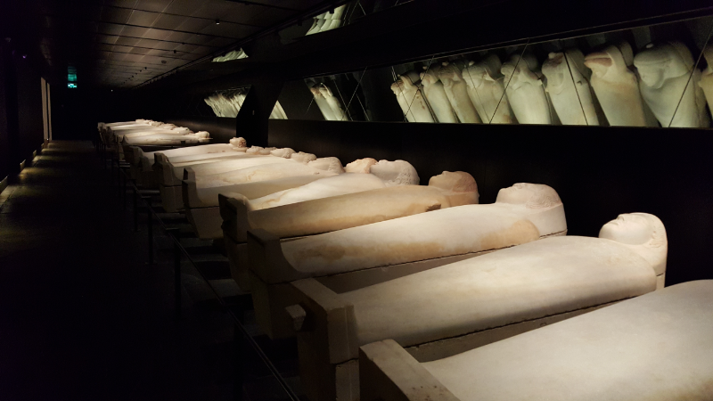
Thirty-one anthropoid sarcophagi were found near Sidon. They’re from about the 5th century BC and show both Egyptian (the sarcophagi) and Greek (the style of the carved faces) influences.
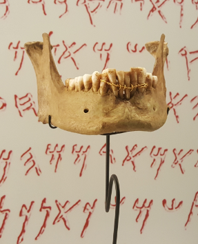
Ancient braces! This is dated back to the 5th century BC, during Phoenician times. It’s the earliest known example of “retentive dentistry”.

When the Assyrians conquered the Phoenicians in the 9th century BC, they ruled oppressively. Any uprisings were squashed, and the people were punished for their rebellion. The Babylonians were similarly harsh rulers. The Babylonian king Nebuchadnezzar sieged Tyre, an island city, for 13 years before gaining control. This siege is described by the Old Testament prophets Jeremiah and Ezekiel. Next came Persian rule and a period of peace until they started imposing high taxes, and the people rebelled.

When Alexander the Great and the Macedonians came onto the scene in the 300s BC, most cities didn’t resist and instead welcomed them in. Tyre, on the other hand, refused to allow entry into the city. The Macedonians sieged the island for seven months and ended up victorious after constructing a causeway from stones, timber, and dirt that linked the island to the mainland. Without its water defenses, the city fell, and its inhabitants were harshly punished for their resistance. Over time, the causeway widened as more and more sand and debris washed up, and today, Tyre is a peninsula. The fall of Tyre and its failure to ever recover its previous status as a world-wide trading center was described by the prophet Ezekiel.

After Alexander died, his great kingdom fell apart under the conflict-filled rule of his successors. The Romans took over, and Pompey added Lebanon as a Roman province. The inhabitants of its major cities were given Roman citizenship. The language switched from Phoenician to Aramaic. It was a time of economic prosperity.

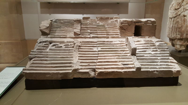
This is a model of a 2nd century AD temple. It was made to guide the builders… architectural drawings, classical style! Imagine being an architecture student in those days and having to make your models out of limestone… I thought cardboard was bad enough!

This was also the time period in which Jesus performed his first miracle in Qana, in the south of Lebanon, turning water into wine at a wedding. He visited Tyre and Sidon as part of his ministry. Later, Paul also briefly visited both cities and met with disciples in each. Christianity spread quickly, leading to a Christian majority in the area. The Maronite church emerged at the end of the 4th century from the followers of Saint Maron, a monk.

Natural disaster in the form of earthquakes struck in the 4th and 6th centuries AD. The 4th century earthquakes were accompanied by tidal waves that destroyed the coastal cities. The 6th century’s destroyed Baalbeck (originally a big pilgrimage location for the Phoenician god Baal and later the location of Roman temples) and Beirut, killing thousands. Between these disasters and internal conflicts in the empire, Roman control of the area weakened.

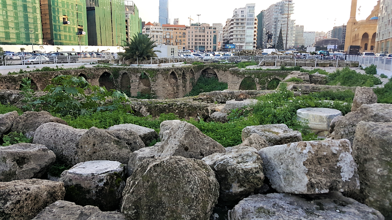
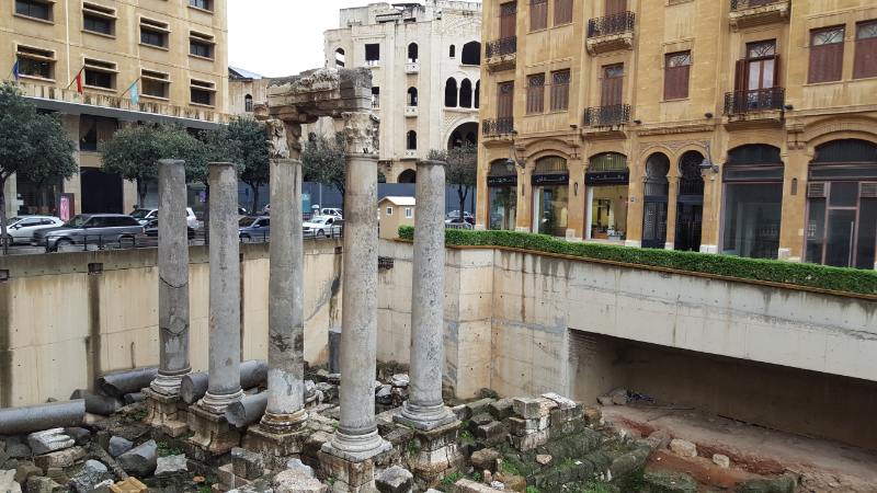
These ruins are guessed to be the remains of the famous Roman law school in Beirut. They haven’t found any decisive evidence of this, so really it’s just a guess because they don’t know what else it might be.

Islam was introduced by the prophet Muhammad at the beginning of the 7th century, and the Muslim Arabs took control from the Romans in the same century. Islam began to spread, and Arabic was introduced as the new language. The Maronite community clung to Christianity and was treated with varying levels of tolerance depending on the ruler at the time. The Druze faith also emerged around the end of the 10th century.

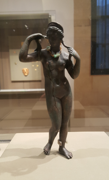
This is some Roman goddess… maybe Venus? I can’t remember, but I thought the fact that she’s wearing a necklace and earrings is pretty cool.

The Crusaders swept in during the 11th century, organized by Western European Christians who were trying to reclaim the Eastern Mediterranean. Lebanon became part of the Crusader states, split between two of them. The Maronites formed a connection with the French and pledged their allegiance to the pope in Rome, rather than to a more local patriarch, bringing them support from both France and Italy.

Muslim control resumed in the late 13th century. The Ottoman Turks were growing their empire, and Lebanon became a semi-autonomous part of it. Fakhr-ad-Din II was a Druze leader who ruled in the 16th century and worked to unify Lebanon. He resolved religious conflicts and enforced tolerance, enlarged the emirate, and is considered the founder of modern Lebanon. His rule led to economic and cultural prosperity, and he wanted Lebanon to gain its independence from the Ottoman Empire. They obviously didn’t like that very much, and his execution was eventually ordered by the sultan.

The AUB museum. It’s very pretty.

Fakhr-ad-Din II’s rule was a high point, and after that, things went downhill. Conflicts between the Maronites and Druze got increasingly violent in the 1800s. The Ottomans helped the Druze conduct massacres of the Maronite population. The Maronites grew more and more discontented with Ottoman rule and were fighting with the support of the French. The British backed the Druze. The Ottomans wanted to maintain the conflict to maintain control. Eventually, foreign powers threatened to intervene, and the Ottomans worked to end the conflict to avoid foreign meddling.

The latter half of the 1800s was more peaceful. The next big disaster struck during World War I when food shortages led to the deaths of almost half of the population. At the end of the war, with Ottoman assets being divided up, control of Lebanon and Syria was given to the French who were meant to prepare the countries for independence.

That’s where I’m going to leave off for now because I’m exhausted, and I assume that if you’ve managed to make it this far with me, you’re also exhausted. Sorry to anyone who fell off somewhere in the middle. I tried to stick to the most interesting and important parts, but we just went through about 7000 years of history so really there’s only so much you can do.

To be continued… HERE

More of the AUB museum.
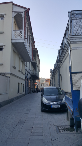
Random Tbilisi street with more of those classic balconies (similar to ones you’ll see in Armenia)

As promised, brace yourself for some history! I’m sure most Armenians would never admit it, but Georgia and Armenia have had somewhat similar historical experiences and are similar culturally. Both countries declared Christianity the state religion in the early 4th century, though any Armenian will quickly tell you that Armenia was first in 301 AD. Georgia followed not long after in 337 AD. Predictably, the populations today are majority Christian, though it would be interesting to know how religiously active people in Georgia are. In Armenia, practically everyone will say that they’re Christian and practically no one regularly attends church. I imagine a lot of that has to do with the 70 secular years of the Soviet Union which would mean that you’d expect Georgia to be in a similar situation. I don’t know if that’s true or not, though.

As usual, I’m getting ahead of myself… I could go into detail about the years between the beginning of the world and modern times, but that could take all day. Let me focus on the highlights.

The oldest wine jars in the world were found in Georgia. This is apparently a commonly ignored fact by the people who insist that Armenians invented wine because the world’s oldest winery was found here. The wine jars are around 2,000 years older, but I’m sure that any good Armenian would quickly recover and maintain their claims by telling you that either 1. wherever those jars were found used to be Armenia, 2. whoever made the wine was definitely Armenian and the Georgians just bought some because it was so good, or 3. the Georgians were jealous, so they fabricated history and the jars are a lie.

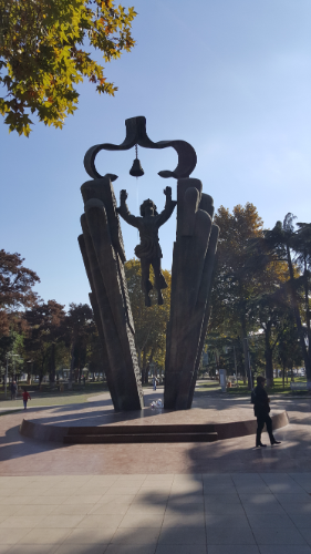
This is the “Mother Language Monument”. During Soviet times, there was an attempt to impose Russian as the official language in all Soviet republics. Georgians protested, and as a result, they were allowed to continue with Georgian as their official language. The story in Armenia is pretty much exactly the same with the Armenian language.

Throughout history, both countries spent a considerable amount of time getting conquered and reconquered by different empires and dynasties. They each had their golden ages when they were on top, and those were both short-lived. For a while, the Byzantine Empire and then Ottoman Turkey controlled both western Georgia and Western Armenia. Eastern Armenia and eastern Georgia were under the rule of the Persians and later the Russian Empire. The Russian Empire managed to win back many of the Ottoman-controlled regions of Georgia, reuniting the country. Western Armenia, on the other hand, remained under Ottoman rule. (Side note: this long period of being ruled by different empires is much of the reason for the linguistic and cultural differences between Western Armenians – most of the Diaspora – and Eastern Armenians – most of the people in modern-day Armenia.)

In 1918 at the end of World War I, both Armenia and Georgia set up their first republics and swiftly got into a border conflict with one another. It seems like every single one of these stories has the same plot line. Two countries. One believes that the land should be allocated based on historical claims or majority populations. The other believes that the land should be allocated based on a random line drawn by some random, powerful country. You can probably guess that each chooses its stance based on which is most beneficial to them. They fought for about a month until the British got involved, and the border landed where it is now with part of the disputed territory in each country.

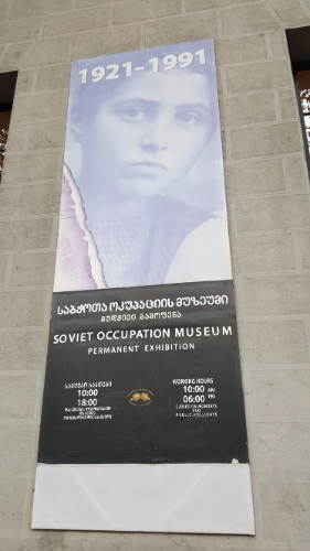
I thought this poster was interesting because of how the museum is clearly presenting the Soviet years. Even without seeing the exhibit, you can tell that it’s all going to be very negative. In Armenia, on the other hand, it doesn’t seem like most people look back on the Soviet years with the same intense negative feelings.

Both countries had short-lived independence as they got sucked into the Soviet Union in 1921. They were combined with Azerbaijan to form the “Transcaucasian Socialist Federative Soviet Republic” until it was re-split into those three parts in 1936. After 70 years as part of the Soviet Union, Armenia and Georgia became independent again in 1991 and formed their second republics.

Now, Georgia is an important trade partner for Armenia because the Armenia-Georgia border is the largest open border that Armenia has left (since the west and east borders with Turkey and Azerbaijan are closed due to the ongoing conflict with Azerbaijan in Karabakh). However, Armenia is allied with Russia and is on bad terms with Turkey and Azerbaijan. Georgia is having its own territory issues because two of its regions have declared independence, supported by Russia, and Georgia refuses to recognize them. So, Georgia and Russia are on bad terms, and Georgia is allied with Turkey and Azerbaijan.

Does your head hurt? My head hurts. You don’t even know how much I left out, but just say thank you. The Armenian/Georgian relationship is fragile at best, but the Armenian government at least isn’t going to do anything to mess it up. It hasn’t recognized either of Georgia’s “independent” regions, but that’s not surprising because it also hasn’t recognized Karabakh/Artsakh as independent even though the Armenian military is physically involved in that conflict. I think Armenia’s international stance is “we really can’t afford to get on anyone else’s bad side so let’s be as diplomatic as we can about everything and not make anyone mad”.

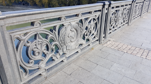
On one of the bridges in Tbilisi.. See the hammer and sickle in the middle? I guess there’s some limit to the Georgian determination to erase the memory of Soviet years… or maybe they just haven’t gotten to this bridge yet.

Okay, so there you go! Some mind-numbing historical background. I guess my point was to show that the two countries have kind of been living parallel histories, and it’s interesting to see how they’ve reacted in similar ways to some things and in very different ways to others.

I’ll get into fun sightseeing stuff in the next post. No more long history, I promise! (Short history though… there will likely be some short history.)

After the Day 3 marathon, I think everyone was happy with our shorter Day 4 plans. At the very least, everyone was happy about the later departure time – 10AM instead of 8. The schedule for the day was Sardarabad and Etchmidazin/the Vagharshapat churches. I was looking forward to Sardarabad because I hadn’t been there yet, and I was looking forward to the rest of the day because I actually know something about the churches we were visiting and could be a better tour guide than some of the other days.

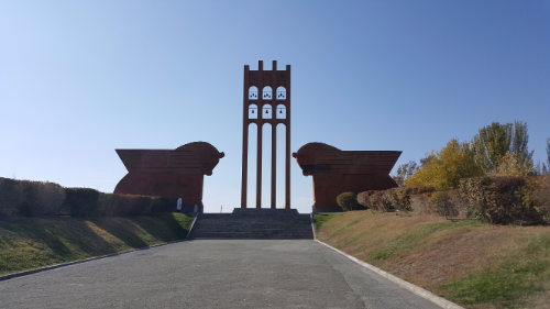
The approach…

Sardarabad, an Armenian town west of Yerevan, is often considered to be the site of the most important battle in Armenian history. In January of 1918, the new Bolshevik Russian government ordered the withdrawal of Russian troops from the Caucasus. Ottoman Turkey saw this as an opportunity to not only complete their seizure of Western Armenia but to take over Eastern Armenia as well. This would have meant the complete the destruction of the Armenian nation.

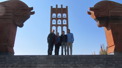
Not a great pictures, but this is the only one we have of all of us from this day.

The Armenian army rushed to deploy forces to hold the positions formerly defended by the Russians. Only a fraction of the historical Armenian homeland remained unconquered by the Ottoman Empire, and hundreds of thousands of Western Armenian refugees had fled to safety there. In May, Ottoman forces marched into Armenia and attacked modern-day Gyumri. After Gyumri (then called Alexandropol) fell, the army turned towards Yerevan. They launched three simultaneous attacks in Sardarabad, Karaklisa (now Vanadzor), and Bash Abaran.

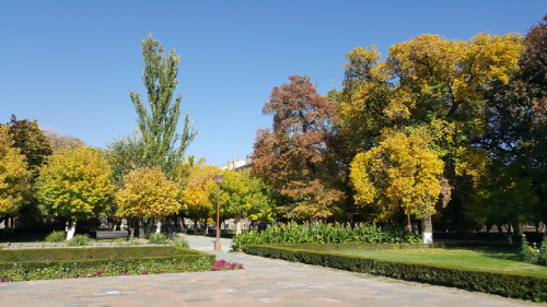
Fall. Is. The. Best.

The Armenian forces were vastly outnumbered, and a massive civilian recruiting effort was organized. There’s a story about the Catholicos at the time refusing to leave Etchmiadzin when people wanted to relocate him to safety. He said that he would fight if it came to that, and he ordered all of the church bells in the valley to ring for six days to recruit more people. People, regardless of age or occupation, volunteered to fight and were organized into civilian units. Women and children helped in various capacities as well, and I have no doubt that many even ended up in combat.

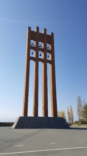
The belfry

Against all odds, the three battles resulted in Armenian victories, halting the advance of the Ottoman army and preserving the last bit of Armenia. They (once again, the mysterious “they” who have an opinion about everything) say that what the Armenian volunteers lacked in training, they made up for in determination and passion. For them, it was personal. They were fighting to protect their families and for the survival of Armenia.

The thing about war is that even when you win, you still lose. Thousands of lives were lost during the battles, and I’m sure that the families of those people didn’t much feel like celebrating. However, due to the courage and sacrifice of the army and those volunteers, Armenia exists today.

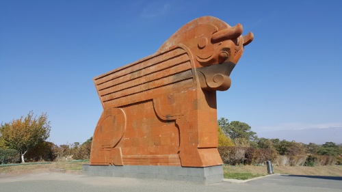
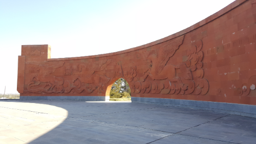
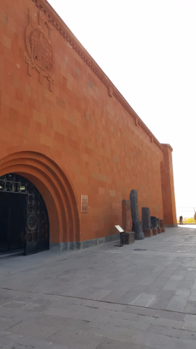
The memorial complex was built for the 50th anniversary of the battle, in 1968, and it’s kind of amazing. You drive straight at it on your way there and have an epic view of the bulls and the belfry. The bulls represent the united strength and persistence of the Armenian people. The bells are a shrine to those who were killed in battle and now represent victory bells. The eagles lining the path to the memorial wall are standing guard over the future of the Armenian people. The memorial wall depicts the battle (very symbolically I think because we totally didn’t get it) and the rebirth of the Armenian people. Finally, the museum is designed like an Armenian medieval fortress. All of the windows face interior courtyards except for two – one facing Aragats and the other facing Ararat. Everything is made from red tuff and is gigantic. On days when the sky is blue, the contrast between the red stone and the blue sky is pretty awesome.

One of the bulls
The eagle walk
The memorial wall
The fortress-like museum

The museum was built later and has two parts: the majority of the museum is filled with various historical and cultural objects (ethnography museum), similar to the Armenian History Museum in Yerevan, and the other part is dedicated to the battle. We went on a tour of the Ethnography Museum, and it was exhaustingly long but also very well done. It’s one of those places that’s almost not even worth visiting without doing the tour because you can walk around and completely miss the important things without realizing it.

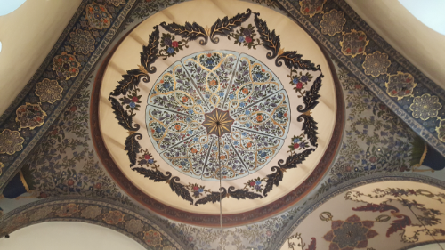
I can never get enough of the painted ceilings at Etchmiadzin.

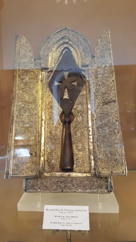
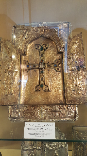
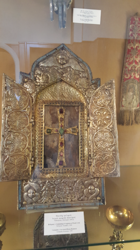
By the time we left the museum, I think everyone was ready for a nap, but we had more things to do! We drove to Etchmiadzin, and I walked everyone around my favorite parts of the complex. We also went to the museum inside Etchmiadzin which I was excited about because they have (supposedly) a piece of the cross, a piece of Noah’s Ark, and the spear that pierced Jesus’s side when he was on the cross. Each of these relics is one of many in the world with similar claims attached. The cross and Noah’s Ark could at least physically have multiple pieces in different places, but the spear is another matter. There can be only one. Obviously, all of the others are fakes and the Armenia one is real. It’s said to have been brought by the Apostle Thaddeus to Armenia and was housed in Geghard Monastery for a long time before ending up in Etchmiadzin.

The rest of the museum was less exciting. Lots of fancy Catholicos clothing and other reliquaries that didn’t have much information about what was inside them. Honestly, the museum could use a good labeling. I thought it was cool anyway and the rooms were beautiful, but I also wouldn’t have minded actually knowing what we were looking at.

Like seriously… is this not awesome??
Piece of Noah’s Ark. We were a little confused about this but think that maybe the brown stuff you can see behind the cross is the piece? Maybe?
The spear. The only real spear.
Here’s another confusing one. I guess the piece of the cross is inside, but you can’t see anything. For all we know, it could be empty. Or filled with cotton balls. Or Hello Kitty erasers. Or M&Ms. My point is, it could be anything. Or nothing.
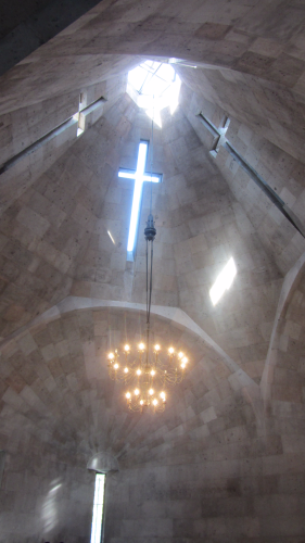
Not a fantastic picture, but this is inside one of my favorite chapels at Etchmiadzin. When the sun is in the right positions, the light coming through the windows makes crosses on the ground or the walls. It’s cool!

From there, we walked to Saint Gayane Church and later drove to Saint Hripsime. There were weddings happening at both churches, so we pretended we were invisible and tried to stay out of everyone’s way. It was only semi-successful because at Saint Hripsime, if you want to see the tomb and the stones that supposedly stoned her, you need to get all the way to the front of the church. Not easy to do without being noticed. Anyway, I’ve written in great detail about the stories of Saint Gayane and Saint Hripsime and the origins of Etchmiadzin, so if you want a refresher, you can check out those old posts HERE.

We were planning on stopping by the ruins of Zvartnots Cathedral on the way back to Yerevan and decided to skip it because everyone was about ready to pass out. I think we made the right choice in the moment, but it’s still on my list. Maybe I’ll manage to get there one of these days!

Sarah left on Thursday, and I started the Birthright program the same day. It was definitely a bummer to see her leave, but I’m just happy that we were able to spend as much time as we did together. Plus, with all of that time to get my bearings, I felt ready to face whatever came next. At least I felt like I had SOME clue about what was happening around me, so rather than having a million new things to process at once, I got a few out of the way ahead of time.

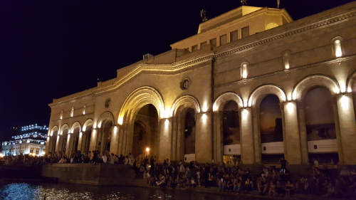
Since I don’t have any applicable photos, enjoy this random selection of pretty pictures that I don’t think I’ve posted before.

Basically, the entire day was spent in orientation. I won’t bore you with the details that are completely irrelevant to you, but there was one section that I found particularly interesting. We got a crash course in recent Armenian history which is something, I’m embarrassed to say, I didn’t know a lot about. It was very helpful in understanding why Armenia is the way it is today, and after seeing how much the country has changed in recent years, I thought it was exciting. Ready for a little recent Armenian history crash course? (Just remember that I’m not a historian, so this is me doing my best. If I messed up, corrections are encouraged.)

Armenia was part of the Soviet Union from 1920-1991. For much of that time, Armenia was very loyal and managed to do quite well under Soviet rule. This is also how Armenia got its current borders; they were determined by the Soviet Union. In 1988, things started to go downhill, and Armenians become disillusioned with the Soviet government. This was mostly due to the territories of Nagorno-Karabakh and Nakhichevan, both historically Armenian territories. Nakhichevan was populated by a majority Azerbaijanis, and it was declared an autonomous region under Azerbaijani jurisdiction by the Soviet Union. The Azerbaijanis then forced out most of the Armenian population in the area. Nagorno-Karabakh, on the other hand, was about 94% Armenian when the Soviets made it part of Azerbaijan. That percentage began reducing, and Armenia petitioned the government to make it officially part of Armenia to protect the Armenian population there and claim the land that was considered rightfully Armenia’s. The government failed to act, and with the crisis escalating, Armenia lost faith in Soviet rule.

A vote was held in Armenia with 99% of voters electing to leave the Soviet Union, and Armenia declared its independence in September of 1991. This didn’t become internationally recognized until December of that year when the Soviet Union dissolved. So, from the very beginning of independence, Armenia was already involved in a war with Azerbaijan and had to figure out how to build an army without having any money. That was challenge #1. Thousands of Armenians fled into Nagorno-Karabakh from other parts of Azerbaijan, and thousands of Azerbaijanis fled from Armenia. It was like a population swap.
Challenge #2 was a total lack of an economy (hence the no money to build an army). Many Armenians had been employed in Russian factories, and when the Soviet Union ended and no one wanted those goods anymore, a lot of people lost their jobs. Many Armenians left the country due to this.

Challenge #3 was earthquake recovery. There was an earthquake in 1988 that hit the northern part of the country pretty hard. 25,000 people were killed, many were injured, and there was a lot of property damage. There was another massive emigration out of the country due to this and the inability of the government to handle all of the people who were now homeless and the kids who were orphaned.
Finally, challenge #4 was directly related to the war with Azerbaijan. Azerbaijan closed down the eastern border of Armenia which led to a huge energy crisis. For 3-4 years, people lived with only 1-2 hours of electricity per day, 90% of the natural gas supply was cut off, and on top of all that, there were food shortages everywhere. Turkey closed the western border of Armenia as well, trying to strengthen their relationship with Azerbaijan. These years became known as the “dark and cold years”, and even more people left the country.
All of these challenges have now been kind of resolved. The war with Azerbaijan is at a bit of a standstill. The Armenian army occupies the region, and Nagorno-Karabakh has declared its independence, but nothing is internationally recognized. A ceasefire was signed in 1994 and has been somewhat followed (there have been a few breaches), but no one has been able to negotiate a peace treaty.
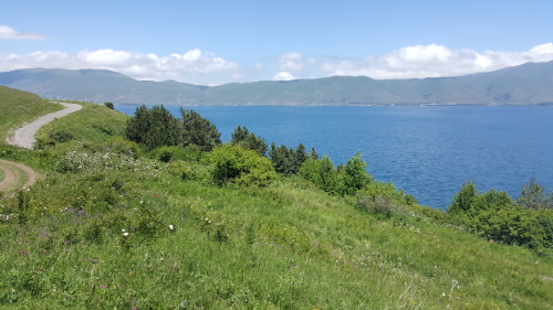
The economy is much improved but obviously still has a long way to go. It’s past the point of trying to survive though, and now the next step is progress and development. There are a lot of initiatives geared towards trying to educate people into IT and engineering-related fields because those are seen as the future.
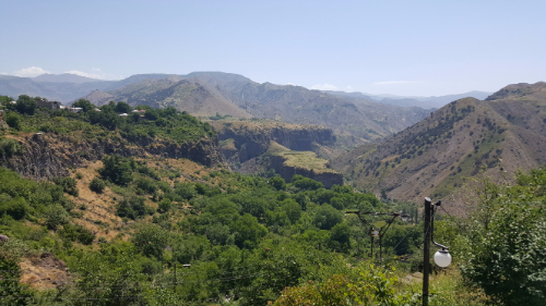
The earthquake situation also has a long way to go. Gyumri, the city I’m going to be in for rest of the summer, is one of the cities that was affected the most. It’s in waaay better shape than it was, of course, but there are still half-collapsed buildings and random rubble scattered about, especially on the outskirts of town.
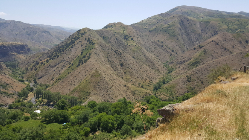
The energy crisis improved after the reopening of a previously shut-down nuclear power plant. Now, the energy supply is about evenly split between nuclear, thermal, and hydroelectric power, and natural gas is supplied from Russia in a pipeline that runs through Georgia. The borders with Turkey and Azerbaijan are still closed.
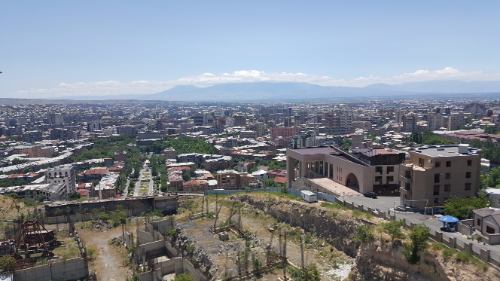
That’s a long story (even with a whole lot of details cut out), but understanding that history makes me appreciate Armenia’s current condition so much more. People here have been working very hard to rebuild the country, and it’s becoming a place where people actually want to move back. Of course, there are still the pessimists and doubters who want to leave, but there will always be those. From an outside perspective, I think there’s still a lot to do, but knowing where the starting point was makes me appreciate the good so much more!

One thing that there’s no shortage of in Armenia is churches. We wanted to go to Etchmiadzin (basically the Vatican of Armenia), and we decided to turn it into a full-on church day.

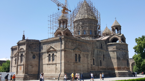
Etchmiadzin. Probably would look cooler without the scaffolding, but what can you do?

Etchmiadzin is located in Vagharshapat, a town about half an hour west of Yerevan. Even though the town isn’t that big, there are five churches there (including Etchmiadzin which is like a little church city), so we decided to visit them all. Why not, right?

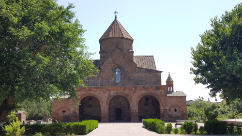
Church of Saint Gayane

We did the usual routine, taking a city bus to a marshrutka station and getting a marshrutka from there to Vagharshapat. The churches we were planning to see were kind of laid out in an L-shape, so we started at one end of the L and worked our way through. The first stop was the Church of Saint Gayane. It was built originally in 630AD and had some renovations done in 1652. Just pause for a second… That. Is. Ridiculous. I don’t know about you, but I think that St. Peter’s (the Vatican) is old, and construction on that didn’t start until the 1500s! Also, the fact that they went over 1000 years without needing renovations, and that after 1000 years they just did some work on the dome and ceilings, is crazy. Who knows, maybe it’s not as impressive as I think, but it sounds pretty good to me!

Lots of curved and perfectly fit together stones.

Anyway, do you want to hear the story of Saint Gayane? Because obviously she has a story because everything is part of a long, interconnected history here. Get ready for your head to hurt a little. Remember how I talked about St. Gregory? The guy who was imprisoned for 13 years in the pit in Khor Virap and was only freed when the king went mad? Well, the reason why the king went mad has something to do with both Saint Gayane and Saint Hripsime, the namesake of church #5 in our Vagharshapat church tour. (Note: this is another one of those stories that definitely has a certain amount of fact in it but has also certainly been embellished over the years. You can decide what you want to take and leave.)

The word is that Gayane was the head of an abbey of nuns in Rome, with Hripsime included. Hripsime was very beautiful, and Diocletian, the Roman emperor, noticed her and wanted to force her to marry him. The entire abbey of 30-some nuns fled Rome and ended up in Vagharshapat. There, Hripsime attracted the attention of yet another unwanted suitor, King Tiridates III, the same king who St. Gregory helped. When she refused his advances, she and the rest of the nuns were tortured and martyred. Some stories say that the king also fell in love with Gayane, and she also refused him. The exact facts on this are a little unclear, as are the exact methods of the martyring. Both Saint Gayane and Saint Hripsime’s churches are supposedly built on the sites where each woman was killed, and the rest of the nuns were killed at the future site of Shoghakat (church #4 on the tour). I read somewhere that Saint Hripsime was stoned, and her church supposedly has some of the actual stones that were used. Who knows if that’s true, but I can attest that there’s a little glassed-in alcove in the wall near her tomb with some rocks in it. Anyway, these women are considered the first Christian martyrs in Armenia’s history.

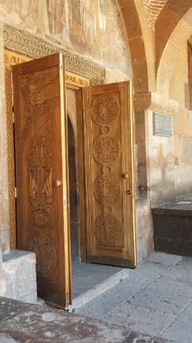
Sarah’s beloved doors

After killing a bunch of nuns for doing nothing wrong, the king went crazy (with some stories saying that he literally turned into a wild boar or that he had a boar’s head), and that’s when St. Gregory came in and saved the day and Armenia became the first Christian nation. So really, these women deserve the credit for turning Armenia into the country that it is today, though it would have been nice if they didn’t have to be murdered for that to happen.

Saint Gayane’s church is beautiful. It’s the same style as so many other Armenian churches, but I still think they’re all super cool. The doors are wooden and covered with insanely intricate carvings (Sarah closely examined and marveled at a door for a solid 5 minutes: “This is WOOD??! And someone carved it like THIS? What if they messed up? How did they do this? THIS IS AMAZING. This is WOOD??”) The inside of the church is simple, but it’s still impressive when you think about the fact that it’s stone, and all of those stones had to be shaped and fit together perfectly to make all the curves and arches.

Etchmiadzin (church #2) was up next. Guess who is involved with the story of Etchmiadzin? If you said “St. Gregory”, you win! St. Gregory had a vision of Jesus Christ descending from heaven and striking the site with a golden hammer, so that’s where the cathedral was built. Etchimiadzin means “where the Only Begotten descended”. It was originally built in 301AD and is considered the oldest cathedral in the world, but it has been destroyed and rebuilt many times since the original. It is the headquarters of the Armenian Apostolic Church and is where the Catolicos (like the Armenian pope) resides.

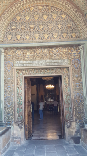
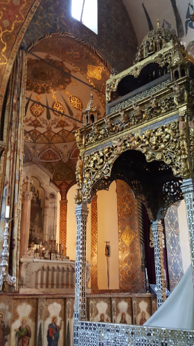
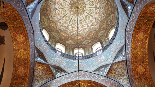
The inside of this church was anything BUT simple. Everything was beautifully painted, and Sarah and I sat on a bench inside and just stared at the walls and ceilings until we felt ready to leave. It was beautiful. Check out the pictures because words aren’t sufficient.

Talk about epic doorways…
Simple, right?
My new most favorite ceiling in the universe.

Church #3 was Holy Mother of God Church. No crazy story with this one. There was an actual service going on when we visited, so that was fun to see. That also means I don’t have any pictures though, so you’ll just have to go for yourself if you want to know what it’s like.

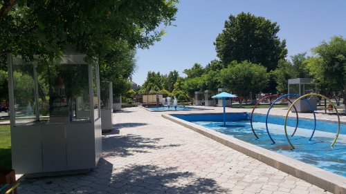
This is a park in Vagharshapat. Some kids were playing in the far fountain, and Sarah and I were about 5 seconds away from joining them to escape the heat. This park is also funny because there are all of these little church replicas around it, so we did a mini-church tour in the middle of our human-sized church tour. You can see a couple in the cases on the left side of the picture.
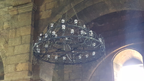
I laughed at this. There are a bunch of churches where I’ve seen similar things, and maybe you won’t think its as funny as I do… but instead of using light bulbs that look nice and match the chandelier, they have these icky spiral compact fluorescent bulbs. I mean, good for them for trying to save energy, but it is possible to do that without sacrificing aesthetics. Okay, rant over.
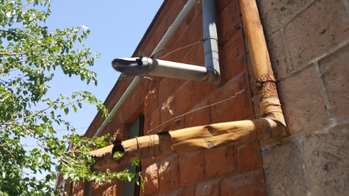
Intense dragon drainpipes

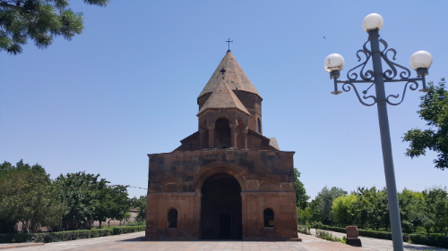
Church #4 was Shoghakat, the site where the remaining nuns were martyred. That was probably the smallest of the five churches, but it was still interesting to see and compare it to the others.

Shoghakat
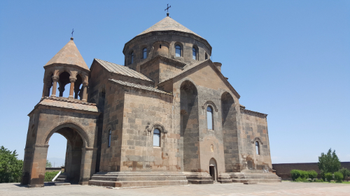
Saint Hripsime

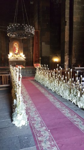
Finally, church #5 was St. Hripsime’s church. It’s definitely one of my favorites if you’re going off of exterior appearance, and the fact that it’s basically sitting on a pedestal probably helps. It makes the church seem so much more commanding because it’s raised up above the surroundings, and nothing is impeding your view of it. The inside was simple again, but very pretty. I think it was set up for a wedding or something because the aisle was lined with candles and flowers (Sarah and I approved… they looked nice). We popped our heads into the tomb to see the glass-encased stones and then high-tailed it out of there because it felt weird.

The candles are a nice touch, right?
This is from the back of the building, but you can get an idea of the mosaic work from the dome.

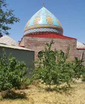
When we got back to Yerevan, we stopped by the Blue Mosque, the only active mosque in all of Armenia. It avoided the fate of other mosques because it was temporarily the History Museum of Yerevan. It seems like temporary repurposing is the only way that religious buildings make it through tumultuous times. We only snuck into the complex for a couple of seconds because it technically wasn’t visiting hours, but the mosaic work on the mosque is awesome.

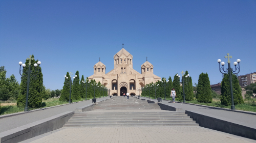
Last stop was St. Gregory the Illuminator Cathedral (yes, as in our BFF St. Gregory) which is the biggest Armenian church in the world. It was finished in 2001 for the 1700th anniversary of Christianity as the state religion of Armenia. It is massive, obviously, and very simple inside except for a crazy big chandelier that I didn’t feel comfortable taking a picture of at the time. I could probably go into more detail, but I’m exhausted just writing this, and I’m sure you’re exhausted reading it. Gosh, Armenia. You have too much history!

I don’t know that this picture conveys the scale or epic-ness of this church, but just trust me, it’s huge.

Congratulations, you’ve now virtually visited EVERY mosque in Armenia and six of the 1 bagazillion churches in Armenia. How does it feel?

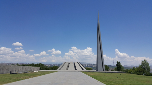
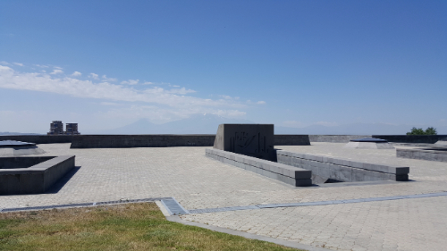
The memorial from afar

One of the must-visit spots in Yerevan is the Armenian Genocide Memorial and Museum (Tsitsernakaberd), and Sarah and I wanted to be sure that we would have as much time as we needed there. It opens at 11AM, and we were there at 10:45, taking advantage of the nonexistent crowds and visiting the memorial first.

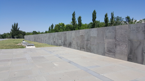
The memorial wall

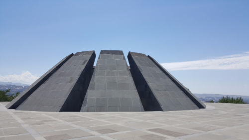
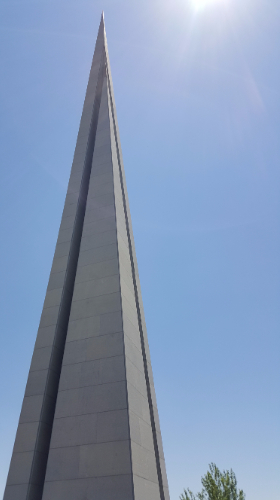
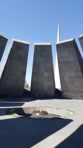
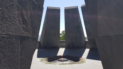
The memorial is very well done. There are three main parts: the memorial wall, the eternal flame, and the stele (I’m sure there are official names for these parts, but I don’t know them). As you approach the memorial, there is a 100m long wall with engravings of the town names where massacres took place. The eternal flame is housed in a memorial hall where the floor is 1.5 meters lower than the surrounding walkway, representing the 1.5 million Armenian victims. The area is semi-enclosed by 12 huge concrete slabs that slant in and up, representing the 12 lost provinces that are in modern-day Turkey. The tall stele symbolizes the Armenians’ survival and spiritual rebirth. It is partially split into two parts, expressing the unity of the Armenian people despite their physical separation/dispersion.

The outside of the hall with the eternal flame

It looks beautiful from a distance, and everything was so deliberately done. Sarah observed that the concrete slabs made you feel a certain heaviness when standing in the hall with the eternal flame, and I definitely agree with her. It’s a space that almost forces emotion and reflection. Who knows what exactly the designers were aiming for, but I’d say they did their job well.

The stele

There’s also a museum that gives a VERY thorough timeline of the repeated persecution of the Armenian people, starting in the 1870s and extending through the 1920s. I knew a good amount of the information presented there, but getting all of it in such a detailed, chronological format was really helpful. I’m going to do my very best to summarize while also doing the story justice, but I’d obviously recommend going to the museum if you ever get the chance because they do it 1,000x better than I ever could (which, whether you’re Armenian or not, come to Armenia for vacation! Sarah will be the first to tell you that you should).

1915 is the year that people think of as the beginning of the genocide, but that wasn’t the beginning of the Armenians’ problems. Minority groups in the Ottoman Empire, Christians included, had limited rights (there were even restrictions on what they could wear!) and high taxes. The 1876 Ottoman Constitution supposedly guaranteed some rights, but even that wasn’t followed. Even so, the Armenians thrived during this period and were successful in business and education. During the negotiation talks for the 1878 Treaty of Berlin, Armenians pushed to make their struggles known to the Western powers, and an article was put into the treaty saying that they should be treated differently but not including any real way to confirm that it actually happened.

Entrance to the underground museum

The sultan ordered the first round of massacres to take place in 1894-1896. The thought was that if there were no Armenians left, then no reforms were necessary. It was a convenient answer to the “Armenian Question”. About 300,000 Armenians were killed during this period, and many more were converted or moved. Any efforts made to get fair rights were met with aggression.

When the Young Turk party started, it called for freedom, equality, and justice, and many Armenians supported the movement, thinking that it would be better than the current government. Those policies were soon abandoned, and a “Turkification” movement started with the goal of taking back the Turkish homeland. In 1909, there was another round of massacres in Adana. Armenians were disarmed, their houses were marked, and Turkish civilians and criminals were given weapons and set free.


Elsewhere during this time, Armenians were gradually being scapegoated, accused of treason, and turned into the enemy in the eyes of the public. The government waited for an opportunity to move into the next phase of the plan and then World War I came. The Ottoman Empire joined sides with Germany under the agreement that their eastern border could be expanded. 60,000 Armenian soldiers were drafted, blamed for a battle loss, and put into labor battalions that were starved or killed once they were no longer needed.

On April 24, 1915, 235 Armenian intellectuals were arrested in Constantinople, based on a previously compiled list. That number eventually grew to 800 leaders in the Armenian community who were imprisoned. Political leaders and members of the clergy were killed. The property that all of these people left behind was considered “abandoned” and was confiscated by the government.

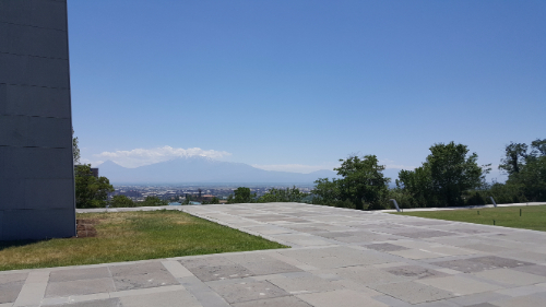
The view of Ararat from the memorial

After these two phases, the military-age men and national elite were out of the way, leaving mostly women, children, and the elderly. Mass deportations were organized. Any remaining men were usually killed first, and the rest were “spared” to embark on grueling marches through the desert where starvation, planned attacks, and kidnappings were the norm. There were group drownings, burnings, forced jumps from cliffs and bridges, and medical experiments. Those who survived went to concentration camps in the desert where many succumbed to infection or starvation.

The museum had pictures of big families, school students, etc., and the captions said which people in the pictures survived. The family pictures would have maybe 15 people in them, and the only person who survived was the baby in the picture. One school picture had probably 80 or so girls in it, and only two survived. That really put things into perspective.

On May 24, 1915, Great Britain, France, and Russia issued a joint declaration condemning the massacres and holding the Turkish government responsible, but it didn’t change a thing. It wasn’t until the end of WW1 that much of this was stopped. The government officials involved were tried and convicted, but after that, they were freed in exchange for the release of British POWs. Even after all of this happened, in 1922, Armenians and Greeks in Smyrna were killed in masses, and the city was burned to the ground. That same year, Armenia became part of the USSR.

To this day, the Turkish government denies that the massacres were genocide. Armenians are scattered across the globe, and the size of Armenia is a tiny fraction of what it once was. The museum ended on a positive note though, talking a bit about the people who helped to recover orphans who had been taken to be “Turkified” and rescue kidnapped women. It was a good reminder that even in the face of so much evil, there are incredible, selfless people who will step up and risk their own well-being to help others.

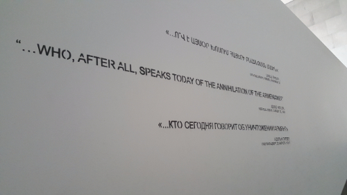
The museum ends with the classic Hitler quote, reminding us that if we don’t acknowledge and learn from history, it will repeat itself. “…who, after all, speaks today of the annihilation of the Armenians?”

Like I said before, the memorial and museum were very well done. We left feeling a bit sad but mostly hopeful and extremely well-informed. The amount of information and materials gathered there is amazing!