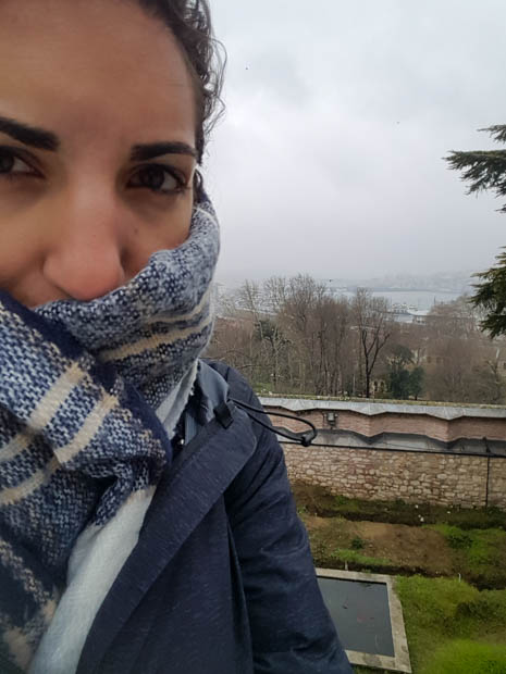
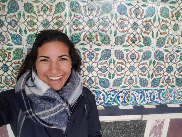
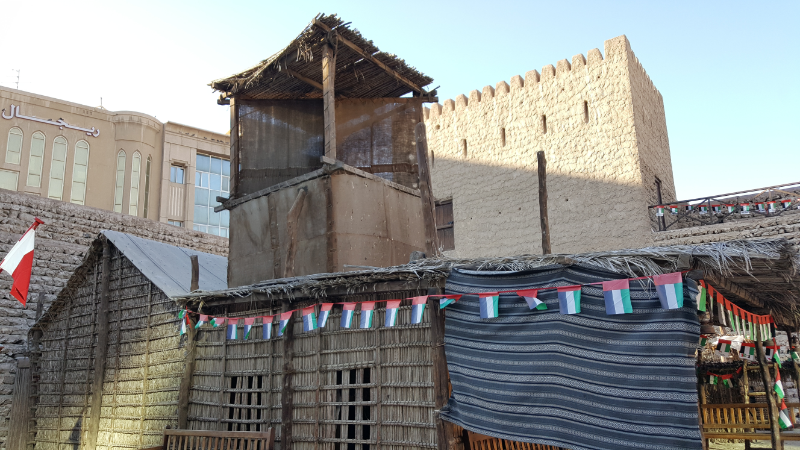
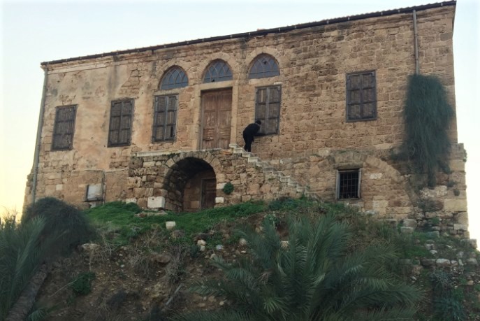
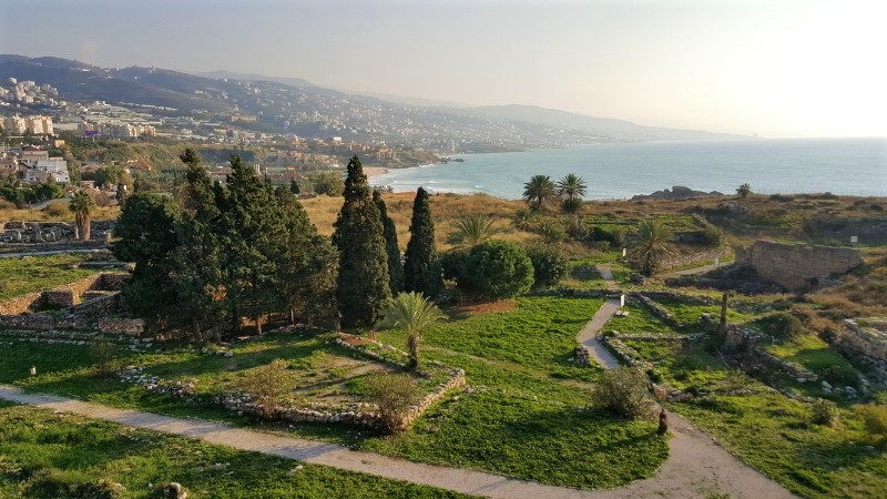
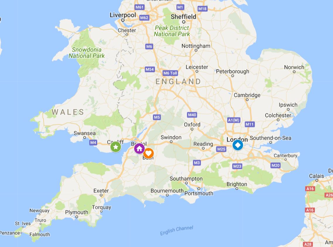
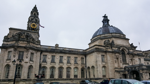
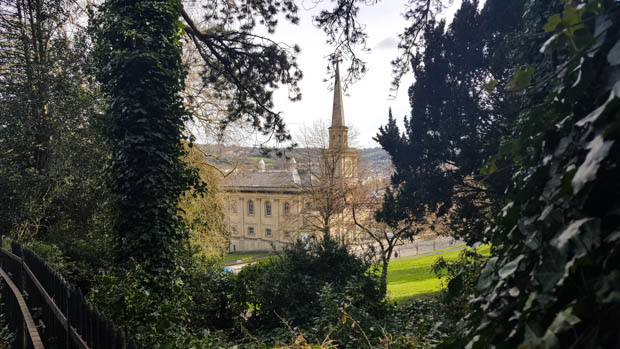
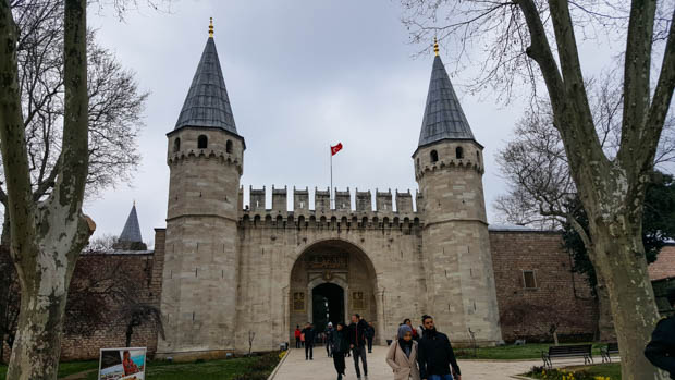
Here we go, back at it! To reorient you, we’re in England. I spent a few nights in Bristol on the suggestion of a random couple I met in Georgia, and while I was there, I did a couple of day trips: one to Bath and one to my final random-stranger-selected destination of the UK, Cardiff. Here’s where I once again embarrass myself by admitting that the only thing I knew about Cardiff was that it’s in Wales, and I only knew THAT because the previously-mentioned random strangers told me as much. It took me more than half the day to realize that Cardiff isn’t just some city in Wales, it’s the capital. Only slightly more embarrassing is the fact that I learned this from the city buses, branded as, “capital transport for our capital city”. Oops. On the bright side, travelling alone means less talking which means less opportunity for me to accidentally say something stupid before I figure things out.

Here’s a map to help you get oriented… The blue diamond is London, the purple house is Bristol, the orange heart is Bath, and the green star is Cardiff.

For anyone confused by the whole UK/Great Britain/England thing, here’s a five-second explanation. England is a country. Great Britain is the name of the island that contains the primary land area of England, Wales, and Scotland. The UK (United Kingdom of Great Britain and Northern Ireland) is a collection of four countries: England, Wales, Scotland, and Northern Ireland. London is the capital city of both England and the UK as a whole. The UK countries have the same currency, military, and overall government (the Queen, Prime Minister, and the two Parliamentary houses), but they are four distinct countries with their own smaller executive governments, education systems, cultures, flags, and even languages. There are four Celtic languages spoken in various parts of the UK. In Wales, about 20% of the population can speak Welsh. Fun side fact: the blue, white, and red UK flag is the one you’re probably most familiar with. It’s a combination of the flags of England, Scotland, and Northern Ireland.

That was more than five seconds, I know, but even that is a SUPER simplified explanation. The full details are enough to make your brain explode. Now that we have the essentials covered, here we go. Once again, I was advised that the best way to get to my destination from Bristol was the train. I still don’t understand how the train can possibly be the cheapest option, but I’m not going to question it!

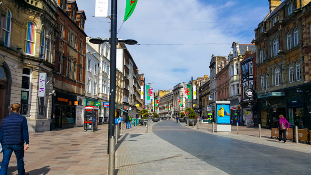
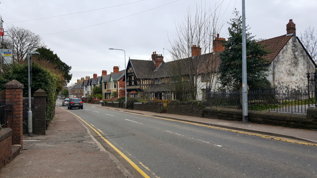
When I walked out of the station in Cardiff, I had this feeling that I couldn’t completely understand… I felt like I had been there before. Things seemed familiar. Since I had definitely never been to Wales, I disregarded my feeling and kept moving. But still, it was disconcerting.

My initial thoughts:

  • Wow it really does look different than England! (*facepalm* at my ignorant past self)
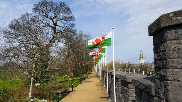
  • There are so many flags here! Guess they don’t want you to forget that you’re in Wales! (Yeah, plus it’s the capital… silly Lara.)
  • Is that Welsh on those signs? Whatttttt? HOW DO YOU PRONOUNCE THAT?
  • Hm… sooo where should I go?
First impression street. Welsh flags everywhere! (Also, prepare yourself for TONS of pictures.)

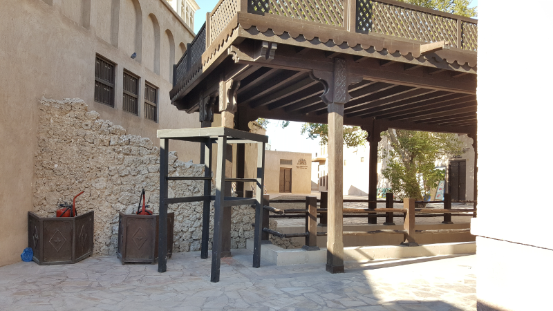
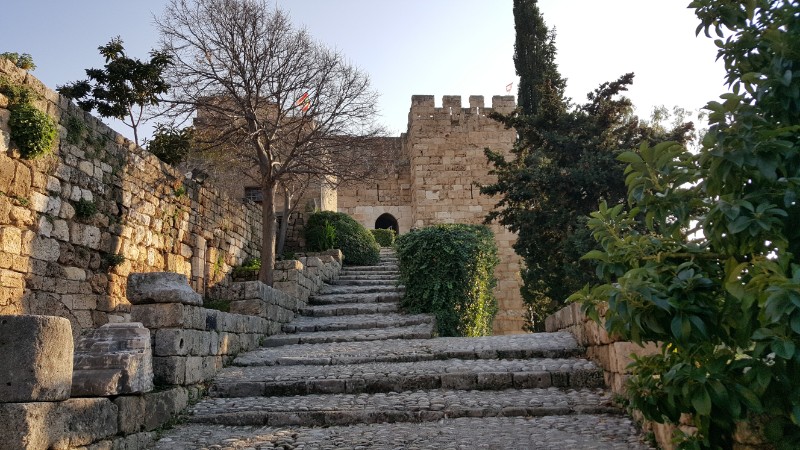
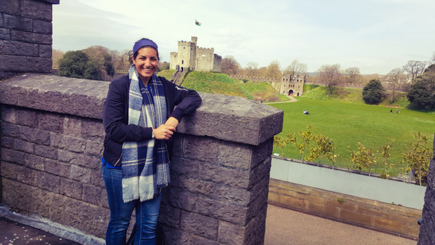
I guess maybe I should’ve done some planning beyond flagging things on Google maps on the train ride from Bristol. It’s hard to plan when you’re going somewhere new every day! So maybe it wasn’t my best-planned day, but I knew I at least had to go to Cardiff Castle and decided that the rest would work itself out.

St. John the Baptist on the approach

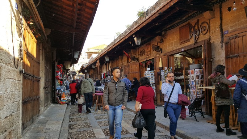
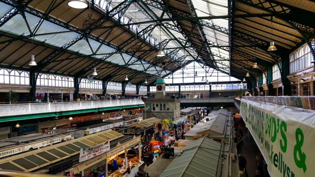
I have a never-fail strategy for times when I don’t know where to go: Look at the people around you, and walk like you have a clue. I followed the crowd, impulsively turned into a cool-looking building, and found myself in the central market! Okay, so I didn’t actually realize that’s where I was until after I walked out… Whoops! Thank you, GPS and Google maps. But it was on my list of things to see, so be impressed with my intuition and natural directional abilities. The market has two levels – the ground floor and a balcony that wraps around the perimeter. It’s been around since 1891, and the stalls sell a WIDE range of things, from produce and prepared food to souvenirs and vintage vinyl (side note: in case you were wondering, there is such a thing as NON-vintage vinyl. Apparently, vinyl is making a comeback and you can actually get records for new music). I had fun just walking around and checking out the offerings.

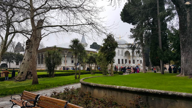
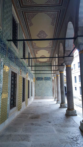
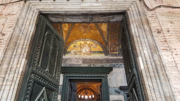
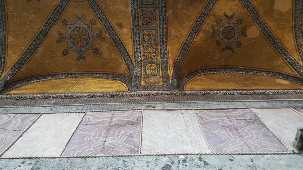
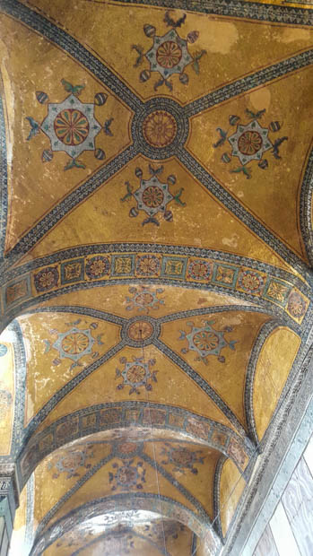
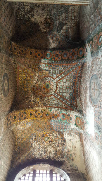
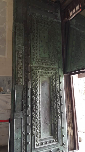
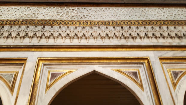
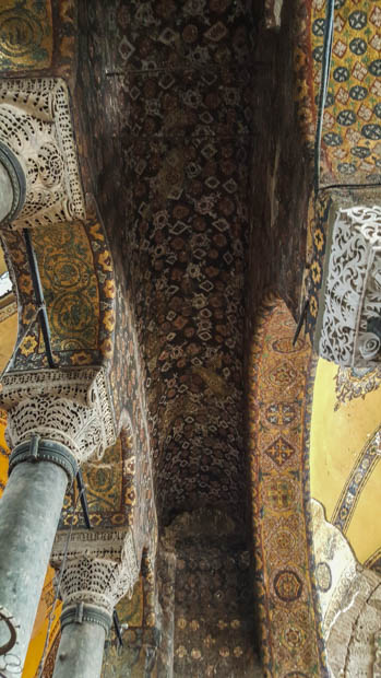
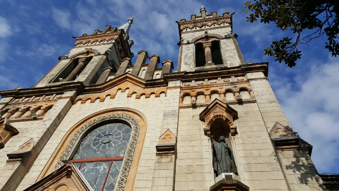
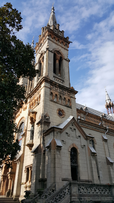
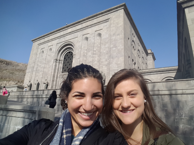
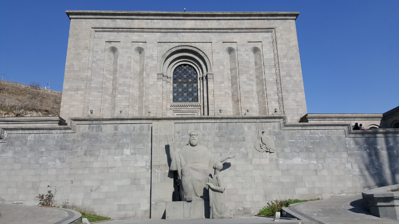
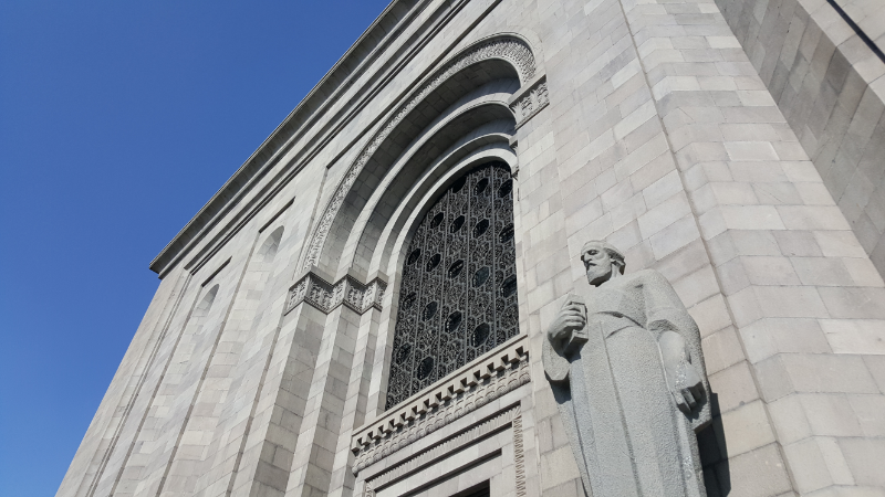
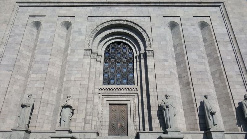
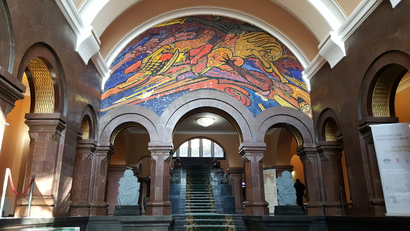
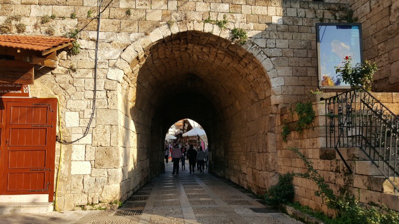
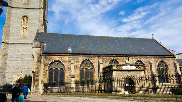
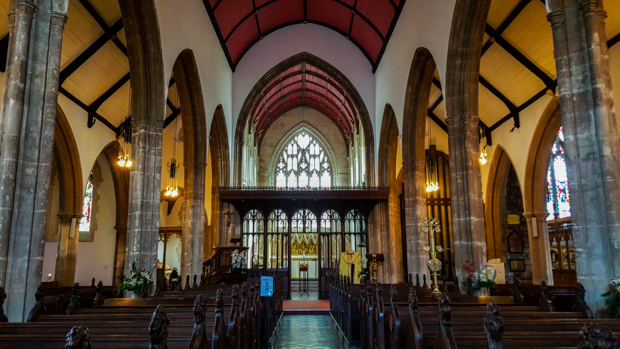
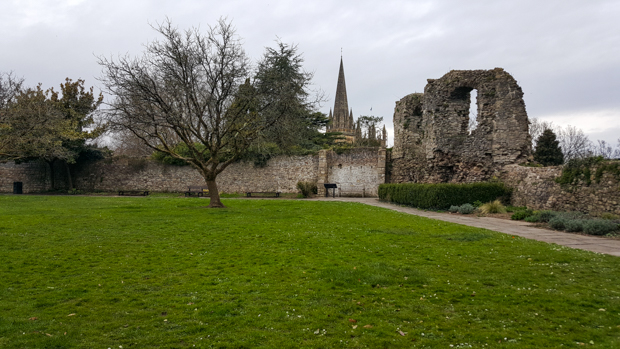
From there, I made my way to Cardiff Castle, popping into St. John the Baptist City Parish Church along the way (I think they need a few more words in that name. Way too short).

View inside the market from the balcony level
St. John the Baptist Church
Inside St. John the Baptist Church

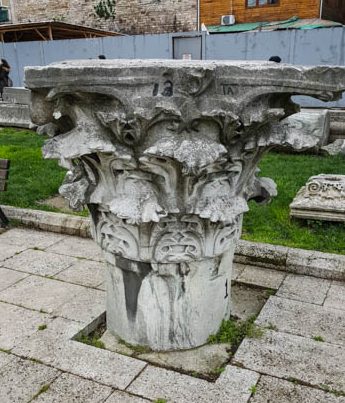
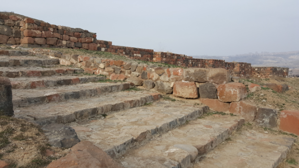
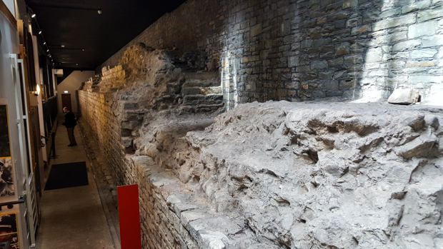
The first known fortification at the site of the castle was a 3rd-century Roman fortress, but there were probably smaller Roman defenses there starting in the 1st century. It still blows my mind that the Roman Empire stretched all the way to Wales. I know it was huge, but like… whoa. After that, a castle was built on the site in the 11th century. Throughout the years, it was held by various forces and owners who all made their own additions and modifications. It didn’t become the property of the city of Cardiff until almost 1950!

Some of the original Roman walls!

I don’t know if I’ve mentioned this before (just kidding… I’m sure I’ve mentioned this at least 100 times), but I LOVE CASTLES. Sometimes when I say that, especially in front of jaded backpackers who have been wandering around Europe for far too long, the response is an eye roll, a knowing smile, and the question, “How long have you been in Europe?” Their assumption is that I haven’t spent much time in Europe because if I HAD, I would be bored with castles like they are because EVERY town has a castle and they think they’re all the same and oh how cute that this little amateur traveler still finds castles exciting. You know what I have to say to those people? I have been to A LOT of castles, and guess what? I still think they’re all exciting. And a lot of churches. And I’ve walked a lot of bridges and visited a lot of cities and seen a lot of amazing views… but I’m not sick of any of those either. I think that if you’re sick of those things, you need to go back to wherever you lost your “awe” glasses and put them back on because the fact that other amazing places exist doesn’t make the one you’re at any LESS amazing. End rant. Sorry. I had to get that out. But seriously. If you’re travelling and you’re not surprised or amazed by anything, take a pause and check yourself because the world is freaking incredible. Okay, NOW I’m finished.

Entrance into the castle
Outside the castle walls

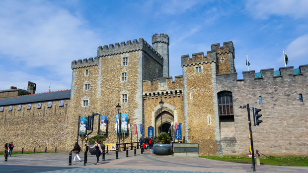
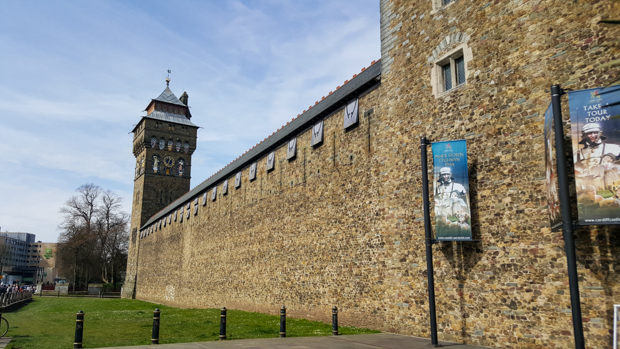
Like I was saying, I LOVE CASTLES. Even better if you can walk along the walls because my favorite thing to do (feel free to judge me for this) is walk along the walls and pretend I’m a princess. Or better yet, a queen. (As I get older, I more often go in the queen direction.)

The wall walk. Perfect for princess strolling. It would be better if you could see over the walls while strolling, but it’ll do. I’m not too picky.

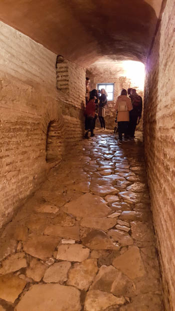
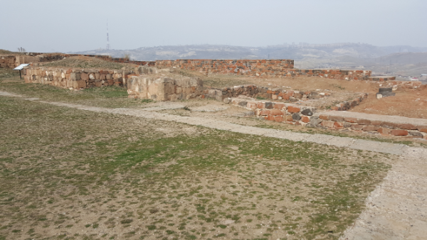
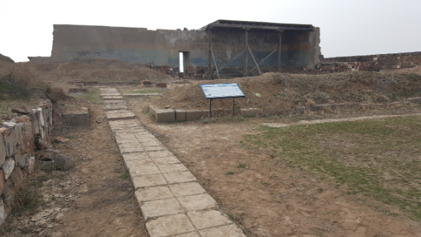
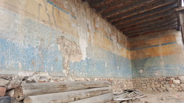
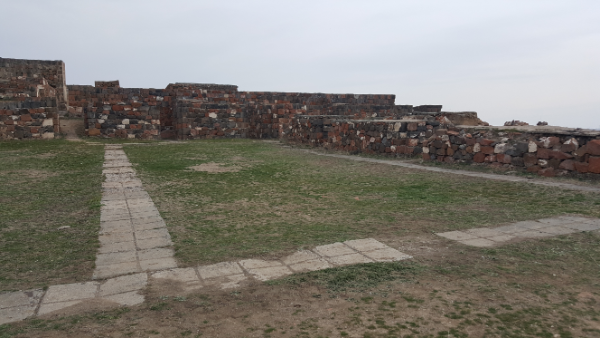
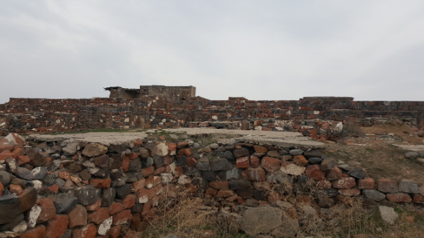
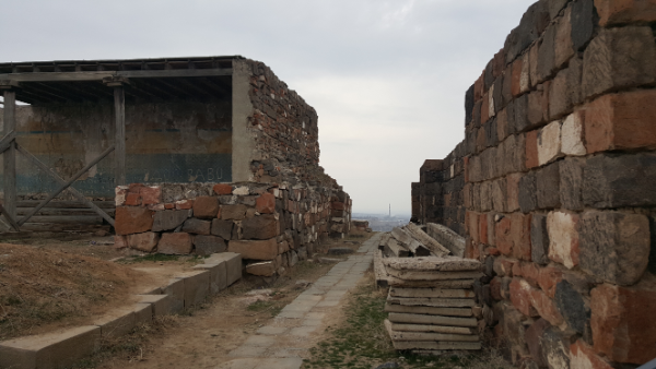
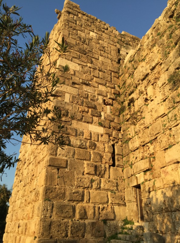
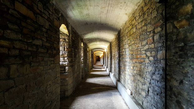
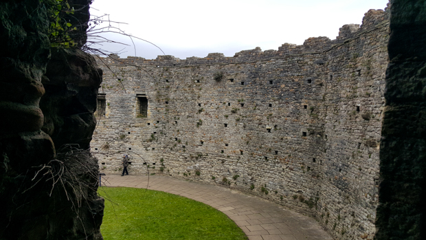
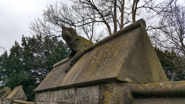
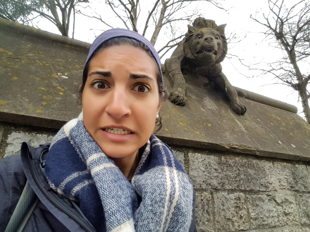
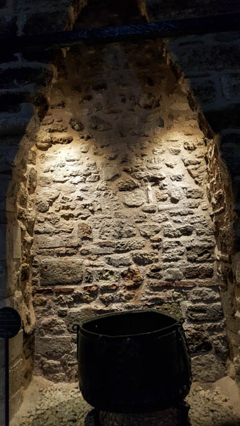
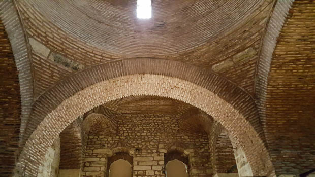
I had no idea how many parts there were to the castle complex. After my regal wall-stroll, I went INSIDE the walls. During World War II, the walls were used as air-raid shelters and could hold almost 2,000 people! As an important port city, Cardiff was heavily bombed during WWII, killing hundreds of civilians. In case you had trouble imagining that terrifying experience, there was a soundtrack that included air-raid sirens and planes flying overhead. I closed my eyes and tried to imagine how it felt. Total darkness. Stale air heavy with fear. Silence except for the sound of breathing and the occasional cry of a child. Feeling completely powerless. I started feeling claustrophobic and had to go outside.

Inside the walls. This was the part without the windows blocked off. There was another section that was almost completely dark to help with the visualization process. It wasn’t nearly as pleasant.
They had old posters from WWII on display inside the walls. This was one of a series reminding people to watch what they say because the enemy has ears everywhere. In this one, two women are talking, and the wall behind them is covered in Hitler faces. It says, “Don’t forget that walls have ears! Careless talk costs lives”
This poster reminds you of the things that you should put into place before you go to sleep.
“LOOK before you sleep
All windows and inner doors open?
Water in buckets?
Sand in buckets?
Gas mask, clothes, and torch handy?
Good night!”
Eek.

This poster is asking for women to volunteer to help children from evacuated areas. The images show the various things that need to be done, such as getting the kids ready for school, preparing meals, sewing, supervising playtime, etc.
The best part is at the bottom where it says, “These are jobs which will have to be done. All women love children and like to help them. Offer your services.”
So, in case you were wondering, ALL WOMEN LOVE CHILDREN AND WANT TO HELP THEM. But we’re not going to generalize or anything.
This poster encourages people to grow their own vegetables throughout the year. It explains what things can be planted in each season, shows a plan for crop rotation, and gives detailed instructions about how your garden should operate.

This poster shows how to properly put on and use your gas mask. It firmly reminds readers that their gas masks should be kept on-hand at ALL times.
“In an air raid
If you are caught in the street
1. Don’t stand and stare at the sky
2. Take cover at once”
This is terrifying.

Heyy self-timer with the keep in the background

Flowers!
I had to take a picture of this because it was too darn stereotypical. The two boys you can kind of see in front of the keep were sword fighting with wooden swords.

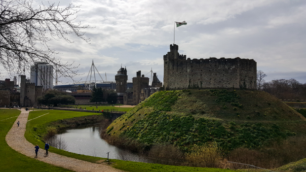
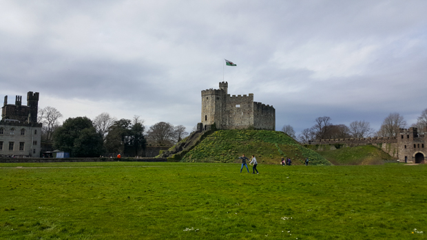
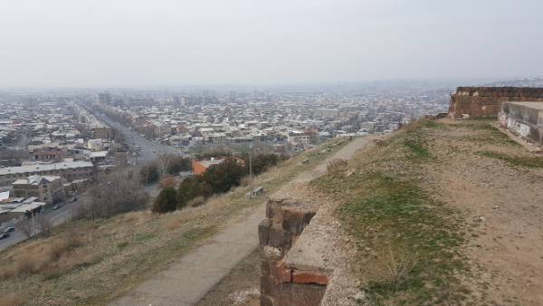
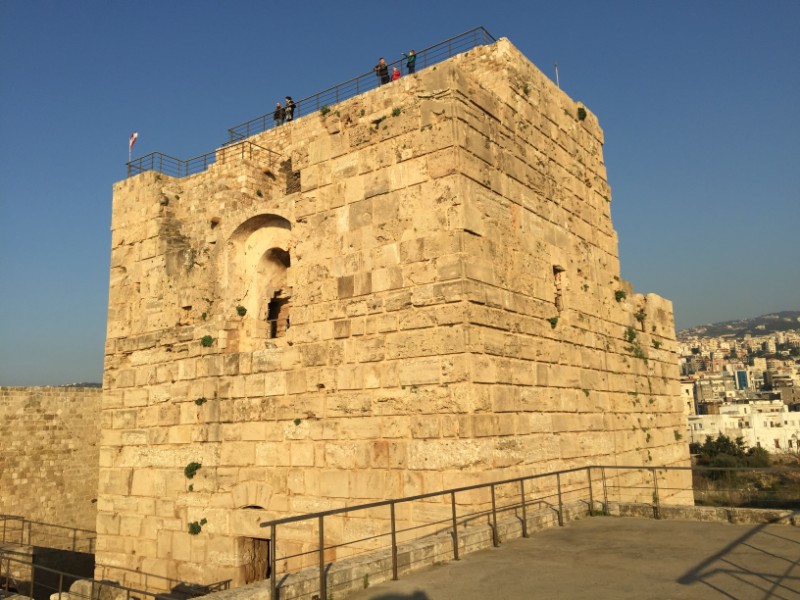
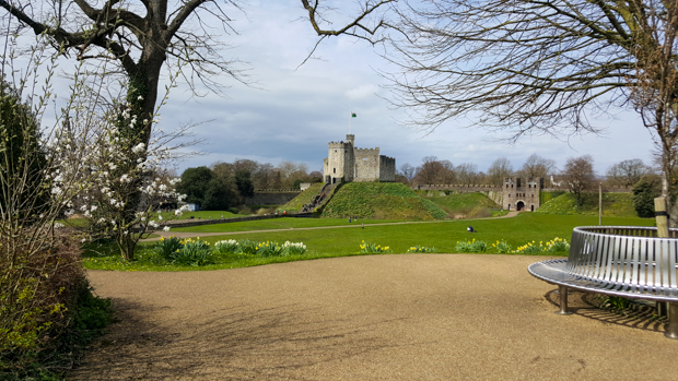
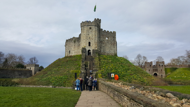
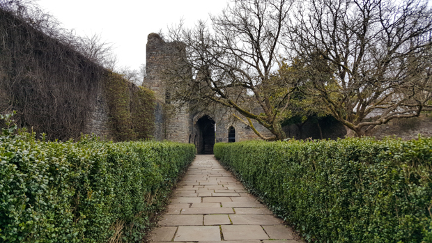
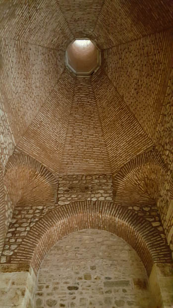
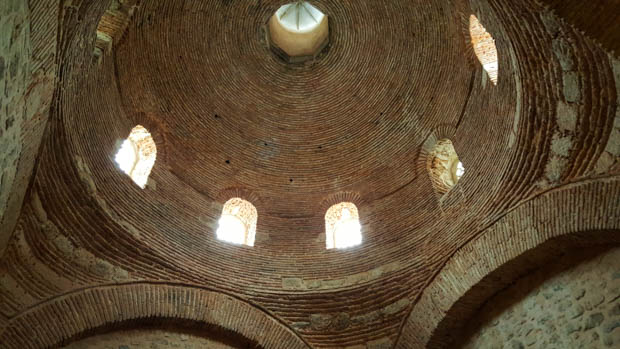
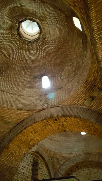
After leaving the walls, I climbed up to the keep. The current structure was built in the 12th century, and for those of you unfamiliar with castle terminology, was the main stronghold of the castle. This one is basically just a very tall stone cylinder on top of a very natural-looking hill (or motte), and from the top, there’s a nice view of the city.

Approaching the keep. Check out that motte!
The keep
Looking out from the keep. You can see the foundations where there used to be more walls. The keep was once much bigger than it is now.
Inside the keep
At the top!
View of the House and Cardiff (and tower cranes)

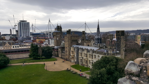
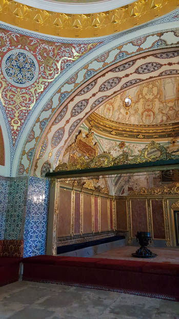
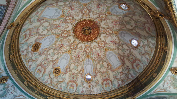
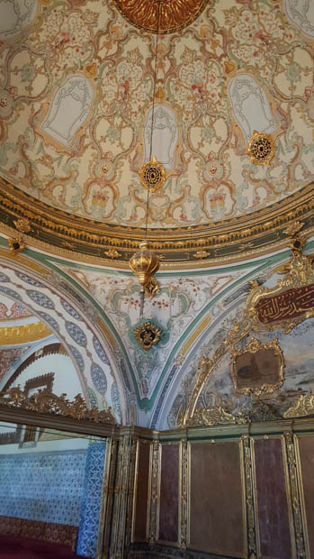
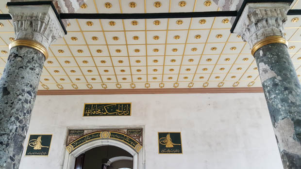
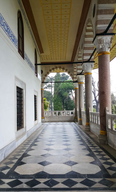
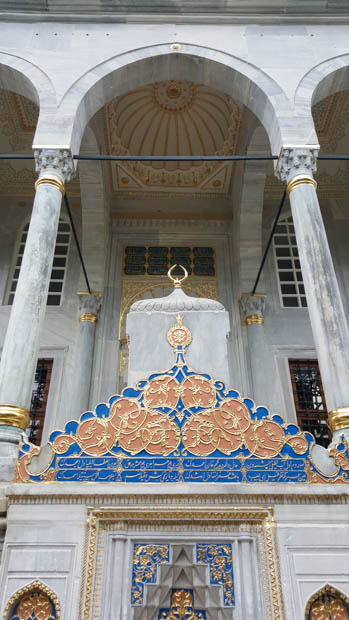
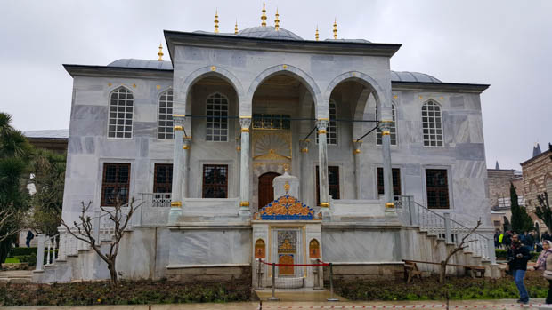
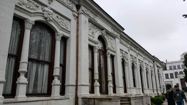
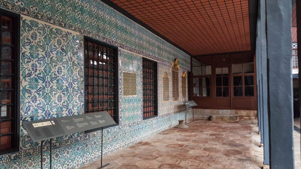
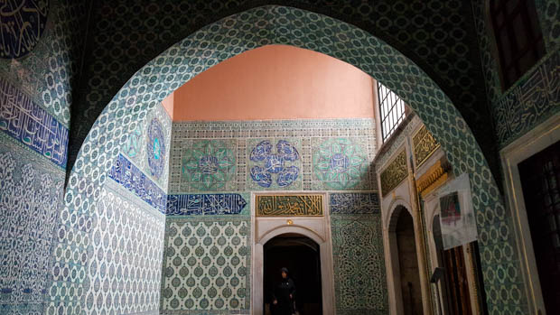
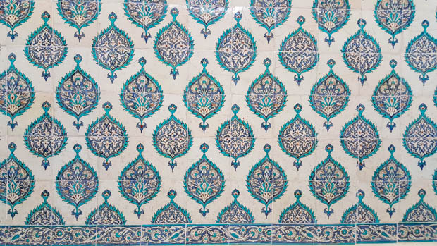
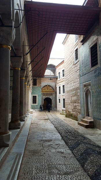
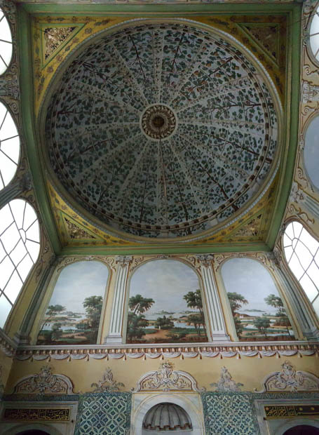
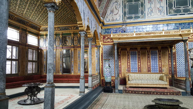
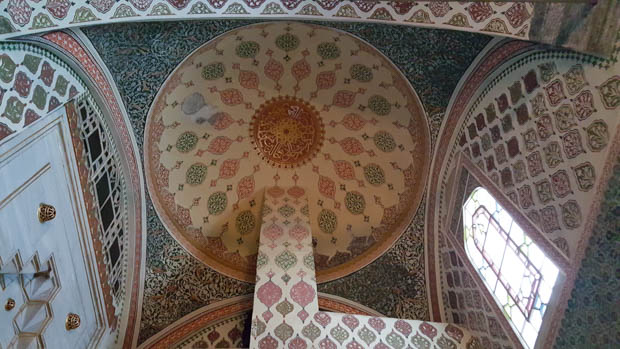
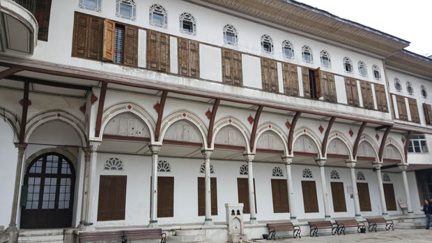
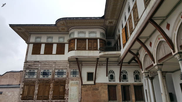
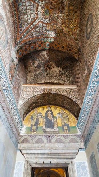
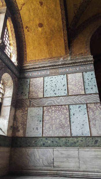
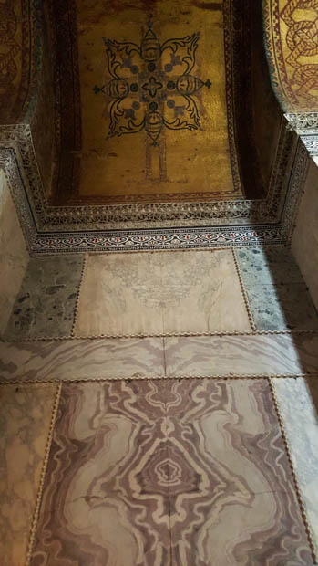
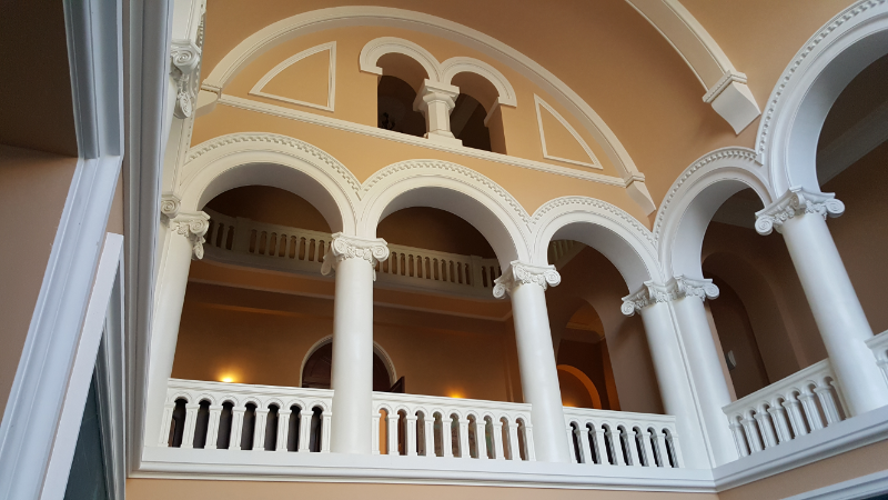
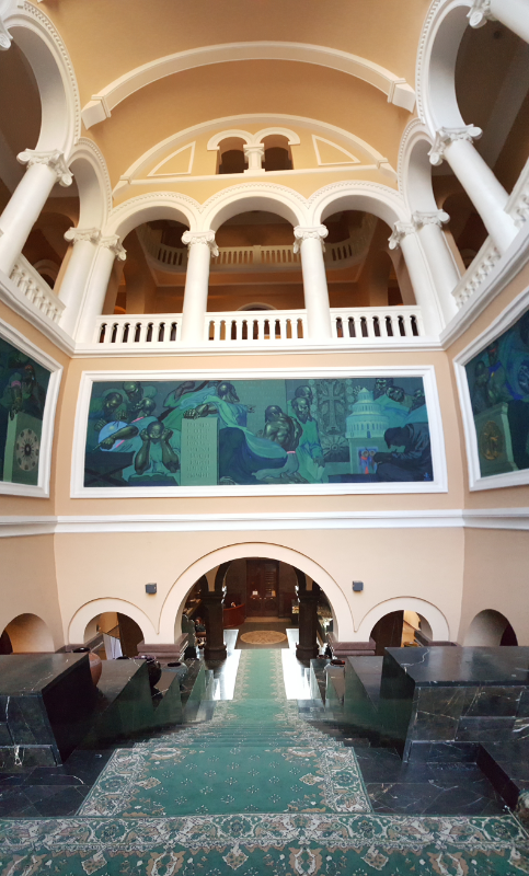
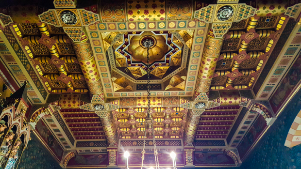
The last building inside the castle walls is the “House” (their words), or more accurately, the mansion. The first structure was built in the early 1400s, but practically every subsequent owner made modifications, giving it a strong architectural-collage vibe.

The House. Can you see why I don’t think “House” (even with a capital ‘H’) is a sufficient name??
Clock tower

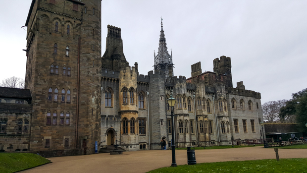
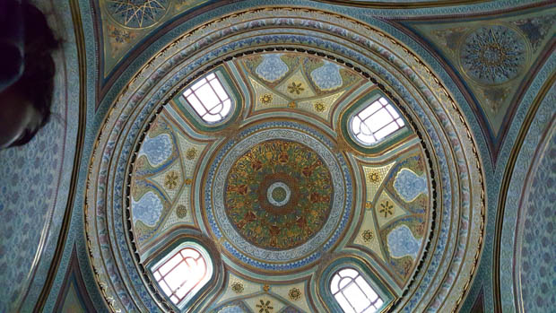
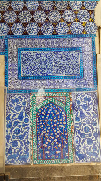
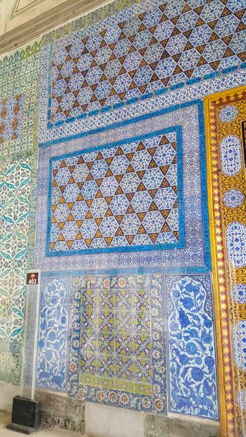
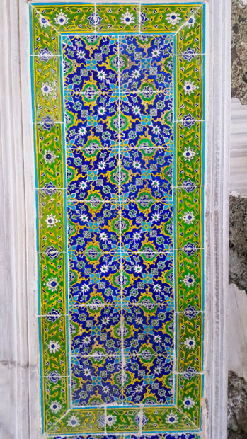
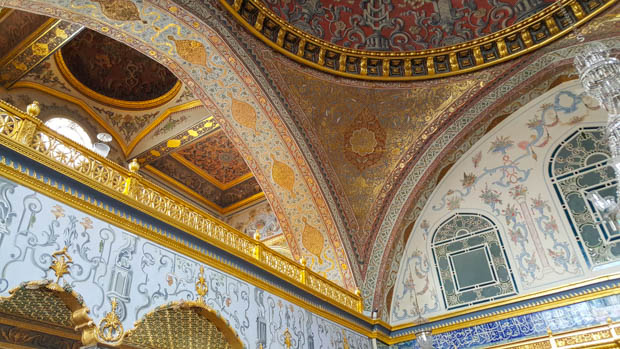
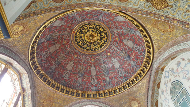
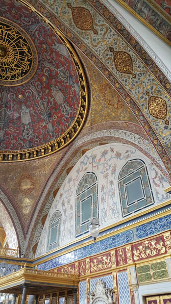
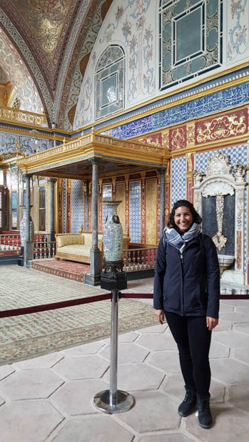
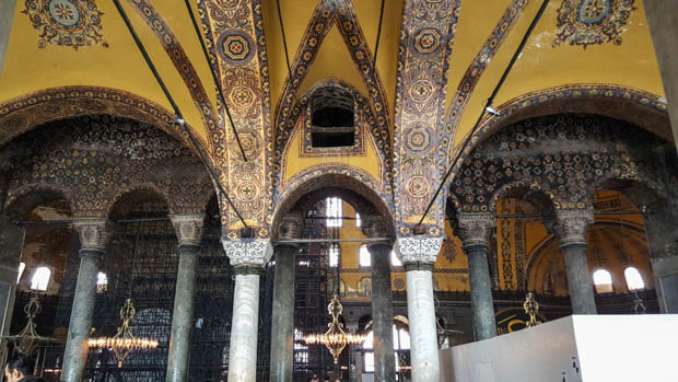
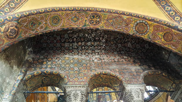
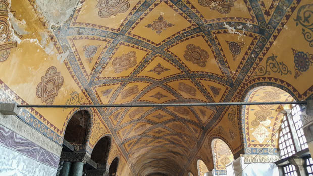
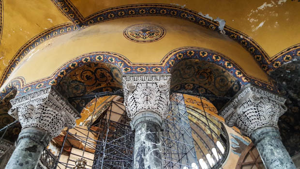
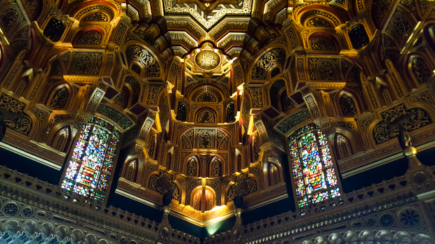
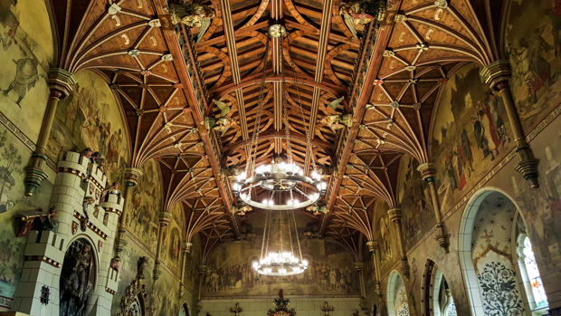
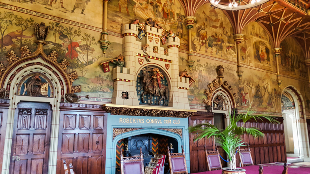
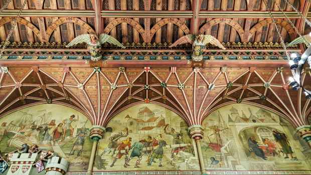
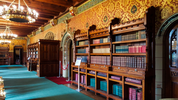
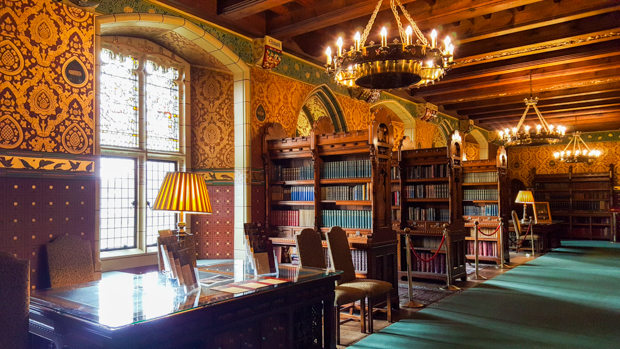
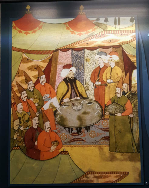
The inside of the mansion was predictably lavish, but the décor was surprisingly varied. There was one room called the “Arab Room” that was definitely not what I was expecting to find in Wales. Then, the next second, I was in the banqueting hall that looks like the set of a movie in the Middle Ages where people are meant to be swigging beers and slamming their glasses down on the table. There’s also an absolutely amaaaaazinggg library where I wanted to touch everything and, of course, was allowed to touch nothing.

The ceiling in the Arab Room
I couldn’t stop staring… like what is even happening on this ceiling? How the heck did they build it??
Staircase. I just wish it wasn’t so plain-looking.
Honestly, I don’t even understand what’s going on up there
This place is ridiculous
Details of the banqueting hall
Casual dining room ceiling
Isn’t this what your fireplaces look like?
First peek into the library…
One day, I’m going to have a library like this (even if I have to rebind every trashy novel I own in order to make it look this classy)
Isn’t it beautiful??
There’s also a falconry on the castle grounds

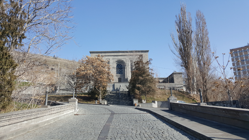
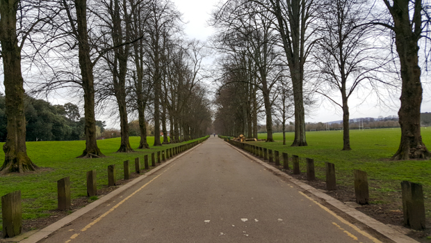
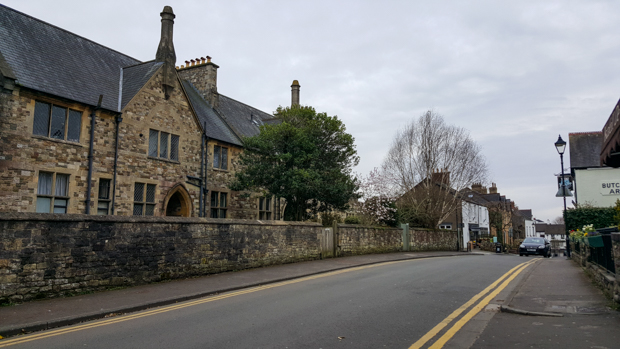
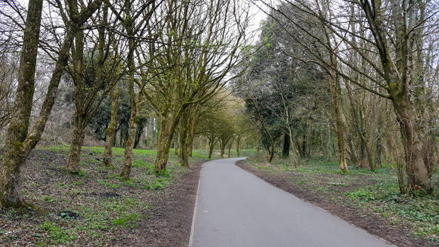
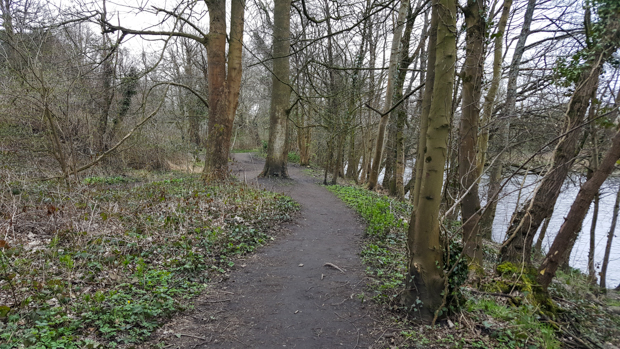
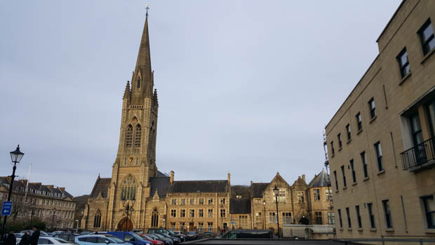
I was all castled-out after I finished walking through the “House”, so I started the long walk to my next destination, Llandaff Cathedral. To be honest, I have no idea why I decided to go there. I saw it on the map, decided it might be nice to walk around a bit, and apparently wasn’t deterred by the fact that it was three miles away… ha. I tried to at least pick a scenic route through some parks, and I saw lots of normal people doing normal things. That’s another one of my favorite things to do when I’m travelling: wander into the parts of the city where regular people live life.

Outside of the castle is the famous “Animal Wall”. Along the wall, there are 15 different animals that appear to be climbing out of the park and into the city.
This hyena (I think??) was my favorite. It looks confused/terrified.
Walking the tree-lined paths to Llandaff
Llandaff Cathedral from the back
This stone is right outside the cathedral and reads, “On 2nd January 1941, the cathedral was devastated by an enemy landmine which fell in this place now set apart to receive the cremated remains of the faithful departed. Remember them before God & honour this hallowed ground.”

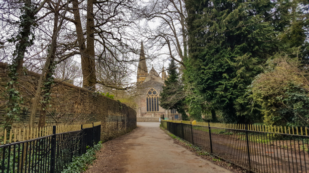
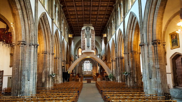
The cathedral was massive and beautiful, as expected. The current building isn’t actually that old because it was built after WWII when the previous building was severely damaged. I wandered through the church and around the nearby neighborhood before heading back into town.

I really don’t understand the purpose of this archway and the huge cylindrical drum over it, but I think maybe it’s just art.
Inside the cathedral
They had some serious stained glass
Llandaff Cathedral
This park used to be the Bishop’s Palace. The ruins of the old palace were left in place, and now it’s a public park. This is another thing I just stumbled upon.
On the way out of the Bishop’s palace park
Street views

Flowers along my walking route!

I still had a few things that I wanted to see down on the waterfront, but when it started drizzling and I was near the train station anyway, I decided to call it a day. Plus, my feet were hurting. A couple minutes later, I patted myself on the back for a well-made decision because it started POURING rain. No, thank you!

At the end of the day, after all of my wandering across the universe, I still couldn’t shake the feeling that I had been to Wales before. The houses, the terrain, the names of places… everything seemed too familiar. It wasn’t until a couple days later that I realized the reason why. Many of the early settlers of the area where I grew up in Pennsylvania were from Wales. In fact, the Welsh Quakers were granted a large tract of land west of Philadelphia and even attempted to make it a separate county with a local government that operated in Welsh. They established settlements with Welsh names, some of which have carried on until today, such as Bala Cynwyd, Bryn Mawr, Berwyn, etc. If you’re looking at those words and wondering how the heck you pronounce them, exactly.

So, there you have it. The very long story of how I went all the way to Wales just to realize that I could have walked around at home and gotten the same effect.

Peaceful and pretty!
Happy to be in the woods!
This house is literally 80% of the houses in my town
I took the scenic route on the way back to town
How slow exactly is “DEAD SLOW”?
What country am I even in anymore???
City Hall and pretty trees
City Hall
Mr. Knightley

As I mentioned in my last post about Bath, I started off my Bath day… er that sounds weird… my day in Bath… with a Jane Austen walking tour of the city. Since I apparently knew nothing about Jane’s actual life, I didn’t know that Bath played a BIG role in it and was even where she went to get inspiration and do research for her first book (Northanger Abbey). When I thought about it, I realized that Bath is either mentioned or is the main setting in most of her books. It frequently comes up in the context of either going there on holiday or going to get treatment for some illness as it was a big resort town at that time and, get this… in BATH, the old Roman BATHS were thought to have special healing properties. Ah. It’s all starting to make sense, right?

If you hate Jane Austen, then you should probably just stop reading now because fair warning: the rest of this post is about her.

In case you don’t know who Jane Austen is, let me give you a little summary. She was an English novelist in the early 1800s who wrote 6 novels. Four of them were published during her lifetime (Sense and Sensibility, Pride and Prejudice, Mansfield Park, and Emma), and while they did actually reach a level of success during her lifetime, that’s nothing compared to their popularity since then. The other two (Northanger Abbey and Persuasion) were published by her siblings after her early death at the age of 41.

Why did people stop wearing this kind of stuff?? Very unfortunate, in my opinion.

During her life, her books were published anonymously because it wasn’t proper for ladies to write as anything more than a hobby. They weren’t supposed to be seeking fame or fortune from their work, and writing as a full-time job wasn’t seen as a feminine pursuit. So, none of her books had her name attached until after her death. Originally, they were published as being written “By a Lady”.

One of the things that’s so interesting about her is the fact that very little is known about her actual life. She and her sister, Cassandra, were very close and wrote each other thousands of letters over the years, but Cassandra burned most of them after Jane died to prevent relatives and others from reading Jane’s “sometimes acid or forthright comments on neighbours or family members” (Cassandra’s words). Hahahahaha. If you read her books, I think you can tell that anyway. Her characters generally aren’t very shy about sharing their opinions of the people they encounter.

Beyond just details about her life, no one is even sure about what she looked like! The museum started out with like eight portraits of “maybe” Jane, and one of the girls working there explained the likelihood of each actually being a portrait of her. The conclusion was that only one of them is fairly certain because it was drawn by her sister Cassandra, but since it shows her from behind, that gives no helpful information about her face.

Me and Mr. Darcy, one of the main characters of Pride and Prejudice. On the inside, I’m even happier than I look in this picture. (Except the character was way more lifelike than I was comfortable with, to be honest. It was kind of creepy.)

Anyway, that’s enough background information. Let’s get back to it. The tour guide was hilarious and did a brilliant job. He was dressed in period clothing and introduced himself as Mr. Knightly, one of the characters in Emma. He explained that Jane’s experiences in Bath and her career as a writer were very intertwined. Her first visit to the city was on holiday for six weeks with her mother and sister, and a couple years later, she spent two months living with her brother who was being treated for gout (a type of arthritis) there. During that two-month period, she did research for Northanger Abbey, and that was her first completed novel.

A couple years later, when she was 25, her father retired, and she moved with her parents and sister Cassandra (they were both unmarried) to Bath. Their first couple of years there were nice, but after her father died unexpectedly, she, her mother, and her sister were left with nearly nothing since women couldn’t inherit. They ended up renting a place on one of the shadiest streets in town, Trim Street, primarily populated by prostitutes, beggars, pimps, and thieves. Our guide said that previously, Jane wrote in a letter that, “I will do all in my power to avoid Trim Street.” So, needless to say, those probably weren’t exactly the best of times. They finally moved away when Jane was 30 and one of her brothers was in a financial position to give them a house.

St. Swithin’s Church, where Jane’s parents were married and her father is buried.
Jane’s father’s grave. The plaque reads, “The Reverend George Austen (1731-1805), Rector of Steventon in Hampshire, married Cassandra Leigh (1739-1827) at the medieval church of St. Swithin’s Walcot, on 26 April 1764.
Their seventh child was the novelist Jane Austen (1775-1817), author of Sense and Sensibility, Pride and Prejudice, Mansfield Park, Emma, Northanger Abbey, and Persuasion.
With her parents and sister Cassandra, Jane Austen came to live in Bath in 1801, at 4 Sydney Place, until 1804, and then at 3 Green Park Buildings East, where George Austen died on 21 January 1805. He was buried in the crypt of the rebuilt church of St. Swithin’s.
His tombstone was removed to the present site in 1968…”

There were a few notable early fans of her work including Prince George IV, Prince Regent of Wales. He was known as a very extravagant man who apparently drank the equivalent of £2 million of wine each year. Seems to me that you would need to be drinking almost constantly… Anyway, as you might imagine from that statistic, he was very fat and did as much as he could to hide the full extent of his weight. Some of the things that came into men’s fashion at the time were literally only because they helped to make him look less overweight.

Jane had a very low opinion of the Prince Regent. He, on the contrary, had specially bound copies of her books in all of his houses. Regardless of her personal feelings towards him, it was very useful to have rich patrons, not to mention royal ones. When he invited her to visit his home, she didn’t have much choice but to accept. He didn’t meet her in person, but his assistant asked her if she would dedicate her next book to him.

Of course, she didn’t want to, but how do you say no to a prince? Her next book was Emma, and the dedication she wrote was so sarcastic that they had to revise it multiple times to make it acceptable. Even so, you can still absolutely feel the sarcasm when you read it. It says:

TO
HIS ROYAL HIGHNESS
THE PRINCE REGENT,
THIS WORK IS,
BY HIS ROYAL HIGHNESS’S PERMISSION,
MOST RESPECTFULLY DEDICATED,
BY HIS ROYAL HIGHNESS’S
DUTIFUL
AND OBEDIENT
HUMBLE SERVANT,
THE AUTHOR

That, to me, screams, “I didn’t want to do this, but I did because he told me to and he’s important so here we are.”

Creepy house stalker picture taken from across the street. Their house was the one with the white door.

I may not have known much about Jane Austen at the beginning of the day, but by the end, I was even more impressed and obsessed with her. She’s so funny! And it seems like she was so confident and bold in a time when that wasn’t “acceptable” female behavior. Also, one of the reasons that her books weren’t terribly popular at the time was because they weren’t as dry as the other books that were in style. So basically she had a sense of humor and personality that were ahead of her time.

She died early, at age 41, and the cause is unknown.

After I left the museum, I wandered around town and added a few Jane Austen pilgrimage sites to my list. I did a walk-by of the church where Jane Austen’s parents got married and where her father is buried, and I went to see the house where she lived when her family first moved to Bath following her father’s retirement. I felt a bit creepy because it’s on a normal street and seems like a regular house, though I found out later that it’s a themed B&B. Someone’s bike was parked out front, and that made me wonder (pretending that it WAS just a normal house) if the house would be considered more or less valuable because of its history… maybe more because a famous person lived there, but maybe less because that leads to random people coming to gawk outside.

Sydney Place, the street where the Austens first lived in Bath.
See the plaque to the left of the door?

The house and nearby park were my last two stops of the day, so after I was finished with those, I zombie-walked my way to the train station to head back to Bristol. Another long day, but the random people who told me to visit Bath were right; I did love it there. They have a Jane Austen festival every year where everyone goes to Bath and dresses up in period clothing… I don’t know, I might have to add that to my bucket list…

I walked across this bridge, Pulteney Bridge, on my way across the Avon River to see Jane’s house. This bridge is known for the fact that it has stores lining both sides of the street that runs across it.
Walking across the bridge.
Bath, the city of very unique buildings…
Former location of “the Labyrinth”, a hedge maze in the park across from the Sydney Place house. Jane enjoyed walking in the park and exploring the maze and even mentions it in some of her books.
Railway tracks running next to the park
City views
On the way to the train station

I was feeling ambitious on Istanbul Day 5. I made this long list of things that I wanted to visit, and I didn’t think it through at all. I mean, at the time, I thought I was thinking it through, but that was using the incredibly limited information that I had in my brain.

The major planned destination was Topkapi Palace, a former palace of the Ottoman sultans. The weather wasn’t very good, but I heard the word “palace” and very mistakenly thought that corresponded to “good rainy-day activity”. Anyone who has done one millisecond of research about Topkapi would tell you that’s definitely not true because the palace prominently features four very large courtyards. Uncovered courtyards. Aka outside. Aka when it rains, it will rain on you. Brilliant, Lara.

Model of the palace compound. Note the many outdoor spaces.

Even after realizing that maybe I hadn’t planned things out perfectly, I pressed on because I was just happy that I managed to make a plan at all. You don’t go messing with the plan when you have nothing to replace it with. I mean, now I would happily offer multiple ways that I could have reworked my schedule to better accommodate the weather, but hindsight’s 20/20 and as we’ve seen, my foresight was essentially blind. Literally the only commendable planning I did that day was deciding to take my raincoat and the plastic bag I modified to cover my backpack when it’s raining. Better than nothing I suppose.

In the second courtyard, there are all of these hollow trees. They’re still alive, but at some point they got an infection that ate their insides.

The hill where Topkapi is located was once the home to the Greek acropolis during the Byzantine years with huge temples dedicated to the Greek gods. During the years of Roman rule, these temples were repurposed but eventually started to fall into ruin. After the Ottoman conquest of the city, a palace was constructed in place of the temples from 1460-1478AD.

In the years that followed, the palace was gradually expanded and was home to the Ottoman sultans and their court until the 1850s. At that point, it was no longer able to adequately support the ceremonial needs of the government, and Dolmabahce Palace was built. Despite the end of use as a royal residence, it continued to operate as the imperial treasury, library, and mint and host state ceremonies until it was converted into a museum in 1924 after the fall of the Ottoman Empire.

The palace has a prime location on the tip of the Istanbul Peninsula and covers somewhere between 590,000 and 700,000 square meters (145-175 acres). The general layout of the palace is four courtyards surrounded by various rooms and structures, and as you move from one courtyard to the next, the spaces get increasingly more private.

The first courtyard, or the Parade Court, is massive. I came in the side entrance which doesn’t have an epic gate or anything, so I didn’t initially realize that I was inside the palace compound. It’s mostly a huge open space with a few randomly scattered buildings including a church, Hagia Irene, the very first church built in Constantinople. It was the head of the Byzantine Orthodox Church until the completion of the Hagia Sophia. Hagia Irene is one of the only churches that wasn’t converted to a mosque during Ottoman times. Instead, it was used as the armory for the palace. (Fair warning – get ready for a TON of pictures in this post.)

The Fountain of Ahmed III, a public drinking fountain located just outside the Imperial Gate
The Imperial Gate
The first courtyard
Hagia Irene

The Gate of Salutation leads into the second courtyard and the beginning of the main palace. The second courtyard was home to the administrative buildings and palace kitchens. The courtyard itself was also used for ceremonies. Now, the museum houses exhibitions about the palace kitchens, weaponry, and clocks and has some extravagant rooms that you can poke around.

The Gate of Salutation. Only the sultan was allowed to ride through this gate on his horse. Everyone else had to dismount first.
This ground is uneven because underneath it is a cistern! One of the many in the city (though not as big as the Basilica Cistern)

I was completely mesmerized by the kitchens exhibit. It’s always incredible how many people it takes to maintain the lifestyles of various rulers. At its height, there were 10,000 people living and working in the palace, and there were 1,300 working in the kitchen to feed everyone!

Crazy ceilings in the kitchens!
Daily, the cooks had to prepare meals for 4000-5000 people. Four times a year, a meal was prepared for 15,000 soldiers as well. Imagine being in charge of planning THAT meal! Eek!
This picture made me laugh because it shows how many attendants the sultan had at a meal. The head servant guy (official name) laid the table, had the food brought from the kitchen, placed it on the table, and removed the lid. Other servants were specifically assigned to bread, drinking water, dishwashing, trays, fruit, and pickles. Yes, someone was in charge of pickles. There were people to help him wash his hands and hold the towel for him to dry them. Another brought the coffee and another brought the sherbet. Besides all of those people serving him, he also had people entertaining him. All of that for one dude to eat a meal.

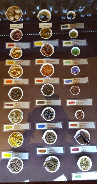
They had some interesting records that showed menus from different years, supply orders, etc. They really put things into perspective. Ready for this? Here’s a list of the palace’s meat consumption in 1184:

985,000kg mutton
2335 yearling lambs
4452 lambs
17,600 large intestines (eek!)
3,700 abomasums (one of the stomachs of cattle, sheep, etc.)
162,370 sheep’s feet (FEET??)
1120 livers
16,800 kidneys
31,390 sheep’s heads (what are you doing with all of those sheep’s heads????)

They also had a crazy amount of Chinese porcelain. I laughed at one caption that said during the month of Ramadan, the sultans ate from porcelain dishes instead of gold and silver. WOW. Really depriving themselves of the finer things in life.

So much porcelain! I must have looked at like 20 different porcelain sets. I think I spent most of my time shaking my head in disbelief, like when I read a description of one of them that said it was a gift from the Russian Czar Nicholas I and had 2000 pieces. 2000!!!
Total, there are more than 10,000 pieces of porcelain in the museum’s collection, and according to records, there used to be over 16,000 pieces

My favorite list, though, was a list of spoons purchased in 1839. Just spoons. They were made from all sorts of different materials: tortoiseshell, walrus ivory, walnut, ebony, horn, pistachio wood, and more. The list is not short, and I’m mostly just confused because how many spoons do you really need?

The next exhibit was weaponry which I’m not that interested in, but a lot of it was just ceremonial and as a result VERY decorative.

Quiver for arrows. Isn’t the inlay beautiful?
You can’t really tell how big this middle sword is from the picture, but it’s at least as tall as I am. My question: who the heck is this sword for? A giant??
Because who doesn’t need a bejeweled stirrup?
When just putting in a door isn’t quite extravagant enough…
This is the entrance to the Imperial Council
Imperial Council ceilings

The description of this column says that it was erected to commemorate Selim III’s shooting of a jug from 898 meters away using a rifle. Maybe that’s impressive, I don’t really know, but the fact that there was a column erected to commemorate something that sounds so stupid fits perfectly with the over-the-top-ness of the entire palace.

The third courtyard was much more private and was surrounded by the living quarters of the page boys who served the sultan.

Third courtyard

This courtyard is also the location of an exhibit showing various religious artifacts including some of the most random things in the universe. These include the saucepan of Abraham, Joseph’s turban (Old Testament Joseph who was sold into slavery by his brothers and ended up working for the Pharaoh), David’s sword, Moses’s staff, John the Baptist’s arm (ew), a footprint of Muhammad and a piece of one of his teeth. You get the idea.

Ceiling outside the chamber of petitions where people would come, bring gifts, and ask the sultan for things while he lounged

Outside the chamber of petitions


Library of Ahmed III
Illegal ceiling pic. I felt okay taking it even though I wasn’t supposed to because the things they really didn’t want you to photograph were the artifacts in the room. I just wanted a picture of the ceiling!

The fourth courtyard had the best tiles in the whole palace, and it was filled with various pavilions and commemorative buildings.

Building in the fourth courtyard. Honestly, I have no idea what it’s for.
Gulhane Gate leading out of the fourth courtyard
Baghdad Pavilion, again commemorating a military campaign. These people really couldn’t do anything without building a trophy for themselves.
Ceiling of Baghdad Pavilion

Inside Baghdad Pavilion


Feeling nice and warm and enjoying the amazing view…
So many selfies with tile walls because I LOVE THEM
Brace yourselves for lots of pretty tiles

Revan Pavilion, built to commemorate a military victory

Inside Revan Pavilion


Best hallway in the palace

Entrance to the circumcision room… which makes this seem like a strange place to take a picture, but let’s ignore the room’s purpose and just focus on the tiles


Railings
View of the Bosphorus from the fourth courtyard


Inside the barracks of the palace guards

The Harem is the most private part of the palace, and it’s where the sultans and their families lived. Residents included the sultan, his mom (the Queen Mother), his wives (he could have up to four), concubines (female slaves), favorites (the Sultan’s girlfriends), eunuch guards, and the children.


The Queen Mother was basically in charge of the sultan’s social life. She decided who socialized with him and which women he could have relations with. The eunuchs were slaves brought from Africa to help guard the harem, and their genitals were removed.

The rooms in the harem were generally spectacular. I think my jaw dropped every single time I walked into a new room. You’d think I would have started to expect it, but I never did. I would walk in, stare in amazement at the rooms for way longer than anyone else (most people just walked in, click clicked a couple pictures, and walked out again), take a few pictures, and then walk into the next room and repeat. I think it’s a shame when people only see things from behind their cameras. Take a second to enjoy things with your eyes, people! Sorry, mini rant…

Here’s a tour in photos and captions:

Barracks again. Pretty fancily decorated, huh?
Outside the barracks
Ceiling in one of the barrack bathhouse rooms
This room was labeled as “hall with fountain” aka “the fanciest waiting room you’ve ever seen”

Courtyard of the eunuchs
This is where the eunuch apartments were
The Queen Mother apartments. I was obsessed with this room because see all of the paintings on the wall? They’re completely flat but are so well done that they look 3D
The Imperial Hall… There’s really no way to communicate the grandness of this room through pictures

This wasn’t even a room… more of just a transition space
Courtyard of the Favorites (aka housing for the sultan’s girlfriends)

My day at the palace was long and VERY cold, but also awesome. I mean, it definitely could have been more awesome if I had checked the weather, but we won’t think about that. I had plans to go to another museum after I finished at the palace, but I ended up spending more than 5 hours there which meant that everything was closed by the time I made it out. Oops. I think it’s better to do a few things thoroughly, though, rather than a bunch of things halfway.

By the time I hit day 4 of my time in Istanbul, I decided that I need to step up my game if I wanted to leave the city feeling like I had seen what I wanted to see. I always have these grand plans of waking up early, working out, sightseeing, getting home at a reasonable hour, being productive, and going to sleep at a time that allows me to wake up the next day to do it again without feeling like I’m dying. As you might expect, things rarely go this way. Usually I have one day where I wake up, work out, sightsee… and then end up meeting people and hanging out and getting back late… and then either passing out or staying up late to get work done. And the next day, the plan falls apart before it even starts.

As much as I love routine and being productive, I’m making a huge effort not to skip out on opportunities to spend time with people because that’s always what I remember the most about my trips. I have so many awesome friends that I never would have met if I had stayed in my comfort zone. My comfort zone, by the way, is a place where I never talk to strangers or put myself in a position where I’m uncertain about the outcome. Comfortable, yes. Boring, also yes. So yeah, things didn’t go exactly according to the grand plan, but I think they turned out even better.

Point of that tangent was that by day 4, I still had a lot to see. Since I just needed to get moving on SOMETHING, I picked the Hagia Sophia (Ayasofya in Turkish) as my destination for the day and was off.

We learned about the Hagia Sophia in my architecture history classes in university, but heck if I remember anything from those. That’s not true, I do remember a few things, but apparently not the historic details of the Hagia Sophia because I felt like I was going in blind again. No problem! I had a written guide from the internet, and with no expectations, you’re setting yourself up to be amazed.

Top of a column (capital) from the second church

The current Hagia Sophia started out as a church, built in 537AD by the Byzantines. There were two churches previously built on the same site. First, the Great Church was built in 360AD and destroyed in 404AD during riots that took place in the city. A replacement church was built in 415AD and destroyed in 532AD during a revolt that burned down half the city. When the last structure was built, Europe was in the Dark Ages, and Istanbul was emerging as a center of Christianity.

There are a few remaining parts of the second Hagia Sophia predecessor from Theodosian times
I assumed this was a ceiling coffer, but I could be wrong
You can see how massive the space is

The main dome of the structure is 182 feet tall and 104 feet wide, and at the time of its construction, it was the largest dome in the world. It held that title for 900 years until it was overtaken by the Florence Cathedral (fun side fact: construction on the Florence Cathedral was started before anyone knew a way to complete the dome. They figured that was a problem for the future generations to figure out – since building a church took an eternity – and the final solution was some brilliantly engineered machinery that no one besides the inventor thought would work). The entire Cathedral of Notre Dame in Paris can fit inside!

The Crusaders took over in 1204, and for almost 60 years, it was under the control of the Roman Catholic Church. Shockingly (not), during this time, many of the riches inside were stolen and sent to Italy, though the golden ceiling mosaics were left mostly untouched. I guess those are slightly harder to steal than other things.

When the Ottomans took the city in the 1450s, Hagia Sophia was converted into a mosque. This involved covering or removing any images of living beings, and the mosaic ceilings were plastered over and forgotten about. Despite this unfortunate redecorating, the conversion to a mosque kept the building safe and maintained. Four minarets were added to the outside, and the prayer niche was moved to face Mecca instead of Jerusalem.

The minarets were added when it was converted to a mosque. You can see that they don’t match the rest of the building.
Fountain for washing before Muslim prayer
Close up of the fountain

At the fall of the Ottoman Empire, the mosque was closed and converted into a museum. The golden mosaics were rediscovered beneath the plastered ceilings and were in generally good condition. Now, the building is a clear mix of Christian and Islamic elements with many of the furnishings remaining from the mosque, including giant, calligraphed medallions, and the original Christian architecture and décor.

View of the main dome

I had no idea what to expect, I had no idea how long it would take me to visit, and I definitely went a bit later than I should have… oops. It wasn’t a big deal though because I wasn’t in Istanbul at a terribly busy time, so waiting in the line to get inside only took maybe 40 minutes. I people-watched to entertain myself, and before I knew it, I was inside.

The building is under construction, but it doesn’t even matter. I mean, I’m sure it would have been great if half of the main hall wasn’t filled with scaffolding, but even with it, you could see how impressive the space is. The ceiling looks like it’s miles away, and since there aren’t big, bulky columns or anything crowding the dome, it seems even bigger. I spent my first 20 minutes staring at the ceiling and trying not to walk into anyone.

The place is so big that even though it was crowded, it didn’t feel like it was. It was probably loud too, but sound had a way of just getting lost. Sometimes I like to sing worship songs when I’m visiting churches (what can I say? They get me in the mood), but I don’t want anyone to hear me… so spaces like that are perfect. I sang to myself, and as soon as the sound left me, it was lost to the open space and the murmurs of the people around me.

So many chandeliers!

From here, I’m going to use the photo captions to give you a mini-tour… I think that will work out the best.

Entrance and ceiling mosaics


Mosaics in the exit corridor

Doors supposedly made with a wooden core of wood from Noah’s Ark. I’m sure it’s true…
This mosaic is the “Donation Mosaic” showing Mary with baby Jesus. Constantine is on the right offering a model of the city, and Justinian is on the left with a model of the Hagia Sophia

One of the most interesting things, in my opinion, was the variety of marble that was used in the construction. It’s kind of like they went to the marble warehouse, couldn’t decide which one they liked best, and decided to leave with one of everything.
Funky, right?

Weeping column. I’m not sure which is right, but I’ve heard two different stories about what you’re supposed to do here. First is that you stick your thumb in the hole and spin your hand counterclockwise. If you make it all the way around, your wish comes true!
The second is that the column was blessed and sticking your finger into the hole can cure your sickness… though I assume it probably just ended up spreading sicknesses because I can’t imagine they ever cleaned it.


The Mimber, where the Imam stands during Friday services.
The prayer niche, adjusted to face Mecca instead of Jerusalem
I’m obsessed with all of the detailing
The Omphalion, where Byzantine Emperors sat during the service and also where their coronations took place

Golden gates because why not?

Going upstairs…

Ramp to the upper gallery
Leave no surface un-mosaic-ed
Mary holding baby Jesus and sitting between Byzantine Empress Irene and Emperor John II (ruled from 1118-1143AD)
Jesus with Byzantine Emperor Constantine IX (ruled 1042-1055AD) and Empress Zoe.
Jesus with Mary to the left and John the Baptist to the right. This was made at the end of the Crusader occupation of the church.

Casual ceiling paintings


Booo construction scaffolding 🙁
In the upper gallery

View of the Bosphorus
Blue Mosque from the window
Baptistery basin
Buttresses added during Byzantine times

Istanbul is one of those cities where, if you don’t understand the history behind it, you’re left scratching your head. Architecturally, it’s a huge mash-up that tells the story of the city’s past. Back when I was in university, we had a project in architecture studio where we made architecture collages. The first person got a blank board and a name of a building, and they built a model of that building. They passed the board to the next person who got another random building, and they had to find a way to integrate that into what had already been built. The board was passed again, and the last person had to add in another architectural component. The final result was weird and interesting because each collage was a confusing mix of different architectural styles, and if you didn’t understand the project, you would have stood there wondering what crazy person put the models together. Similarly, if you don’t understand the story behind Istanbul’s growth and development, the architecture of the city doesn’t seem to make much sense.

Let’s start from the beginning… If you look at a map, it’s obvious why Istanbul is located where it is. To the north is the Black Sea, to the south the Sea of Marmara, and right through the middle is the Bosphorus Strait, connecting the Caucasus and southeastern Europe to northern Africa and the Middle East. It’s like a trader’s dream.

The Bosphorous!

The first inhabitants of the area may have arrived as early as 3000BC, but a true city wasn’t established until the 600s BC when Greek colonists settled there because of its location. They were led by King Byzas, and in typical, modest-king fashion, he gave the city its first name, Byzantium, after himself.

Rome conquered Greece in 149BC and moved into Byzantium soon after. The Romans started to build it up into a Roman city, complete with city walls, a Roman layout, a hippodrome, and monuments to various Roman battle victories. The Roman Empire was divided in two with Rome as the western capital and the newly named “Augusta Antonina” (really rolls off the tongue, doesn’t it?) as the eastern capital.

Constantine came to power in 324AD, officially moved the capital of the Roman Empire to the city, and renamed it “Nova Roma”. He wanted to rebuild the city and fill it with epic monuments like those in Rome. After Constantine’s death in 337AD, the city was renamed Constantinople in honor of him. (The people in that city must have had a serious identity crisis from all of the name changes.)

Examples of random things you can find around the city because of its complicated past: columns, probably from Roman times, half buried in the middle of a random park in the city.

In 395, the Empire was split into Eastern and Western halves, and after the Western Empire fell, Constantinople and the Eastern Empire were still going strong. Between the time of Constantine’s rule and the eventual conquest of the city by the Crusaders in 1204, there was a lot of action. The walls were expanded, aqueducts and churches were built, and the city resisted multiple attacks by Arab conquerors. There were various revolts in the city, buildings were destroyed and rebuilt, and the emperors continued to build ever more impressive and ridiculous buildings.

In 1204, Catholic Crusaders from Italy broke through the city’s sea walls and took control. During their brief period of control and in typical Crusader fashion, they stole all sorts of items from the palaces and churches and sent them back to Rome, where many of them remain to this day.

The Romans managed to push the Crusaders out in 1261 and reclaim control of Constantinople. They never reached the strength of their former occupation and were weakened further by the repeated attacks of the Ottomans. Finally, in 1453, Sultan Mehmed II was successful in conquering the city, and Constantinople became part of the Ottoman Empire.


View overlooking the city

Over the next almost 500 years, the Ottoman Empire expanded its control across the region. The sultan was determined to rejuvenate Constantinople. He created the Grand Bazaar (a huge covered market), built palaces, mosques, bathhouses, and other public buildings, brought people from various religious backgrounds into the city to have a diverse population, and started the movement of the city towards its later status as a major cultural, political, and commercial center.


This is the Hagia Sofya. It started as a church and was converted into a mosque later. Can you see how the towers were clearly built at a different time from the rest of the building?

Following its defeat in WWI, the Ottoman Empire ceased to exist, and in 1923, the Republic of Turkey was born in its place. Within the new republic, the capital was moved to Ankara, and Constantinople started to decline. The population decreased, and parts of the city fell into disrepair.

Eventually, things started to turn around. In 1930, the city of many names became Istanbul. In the 1940s and 50s, the city’s structure was updated with the construction of new public squares and boulevards. Finally, in the 1970s, people were drawn back to Istanbul because of the many new factory jobs available on the outskirts. This led to the rapid growth of the city, turning it into a sprawling metropolitan area.

The city looks like it goes on forever…

Currently, it is the largest city in Turkey with a population of approximately 13.5 million people, and it enjoys the exclusive status of being the world’s only metropolitan area that exists on two continents (Europe and Asia).

Its complicated history makes it an even more interesting place to visit, and I had a lot of head-scratching moments as I explored and tried to figure out how everything fit together. I’ll do my best to spare you the same struggle!

I had a brilliant idea to maximize my sightseeing efficiency in Batumi: a sightseeing run. In hindsight, I see the million flaws with this idea and also the million better options, but I didn’t see those at the time, so here we are.

What is a sightseeing run, you ask? Well, exactly what it sounds like. Go for a run, stop at any sights, keep running. I thought this sounded like a perfect idea because I wanted to work out, I wanted to go sightseeing, and sometimes, I feel like walking between sights just takes too long. I planned to run along the boulevard by the beach so that I didn’t have to deal with cars and could have nice views of the water along the way.

More beach pictures! The weather was much better on Day 2.

Since I’ve given you no real information about Batumi yet, here’s a little background for you. Like I briefly mentioned, Batumi is the major beach resort of Georgia, located on the western side of the country along the Black Sea. It’s the second-largest city in Georgia after the capital city, Tbilisi, and its economy is centered around tourism, gambling, and its port which is the biggest in Georgia.

The harbor

Historically, the first record of a city on the site of Batumi was an ancient Greek city, Bathus, in the 4th century BC. The Romans conquered it in the 2nd century AD, and after that, it went through a series of rulers along with the rest of the cities in the region.

Architecturally, the city is particularly interesting. This is something I absolutely didn’t expect going in and was pleasantly surprised by (though of course, I knew nothing going in, so it’s not very surprising that I wasn’t ready for what I found). Many of the buildings are from the 19th century and are a mix of different styles: European and Asian, Georgian, Turkish, and Soviet, etc. There’s also a strong sea theme, so you can see a lot of mythical sea creatures woven into the architectural details. And the colors! There are so many pretty and unexpected colors.

The Batumi Drama Theater in the background with creatively-named Theater Square in front of it.

Recently, there’s been a push to grow Batumi, and these historic buildings have been joined by new, modern high-rise buildings. It was already a strange architectural mash-up, and now it’s even more so. Just wait… you’ll see what I mean in the pictures.

Okay, back to my sightseeing run. I hadn’t worked out in quite a while, so I thought maybe three miles (5k) or so would be a good start (I’m not a good runner AT ALL, so even this was kind of a stretch). Plus, with the sightseeing component, it allowed for “photo stops” aka “find something to take a photo of because you don’t want to run anymore” stops. It seemed like a good way to ease back into running. Maybe it would have been, too, but after I had gone two miles and hadn’t turned around yet, I saw some mountains in the distance and decided that I wanted to be closer to them. Very specific, I know. So, I kept going, and I kept thinking that I was going to reach the point where I had some epic mountain view and would know that it was time to turn around and go back.

The sky!!
So many shades of blue!!

The path was nice, too. It went right along the beach, there were interesting buildings to look at, and there were barely any other people around. Then, somehow I was more than four miles away from home and seemingly no closer to the mountains. I could have kept going. I kept thinking that if I just went a litttttttle farther, I would hit a good spot to turn around after the next bend. Or the next bend. Or the next bend. That maybe would have been fine, but I did NOT plan ahead for that kind of adventure and was carrying no money and no bus ticket. Not my brightest moment. Note to self: always bring bus money.

Found a hammock along the way…
???
No clue what this is but weird, right?
There’s also a ton of public art everywhere, including a series of silhouettes doing various things while holding hearts.
More public art
This fountain was cool… Her wheels spun around and kicked up water!
This is a tower celebrating the Georgian alphabet
View on the boardwalk during my sightseeing run
A park along the boulevard
“The Colonnade”, designed as an entrance to the beach. The concept, as you might guess, was developed by someone who had recently gone to Italy. Now it’s just a random and confusing monument, in my opinion. Though definitely pretty.
More interesting architecture

Finally, I had to accept that if I hadn’t gotten a good view of the mountains yet, it probably wasn’t going to happen and that I needed to turn back or risk collapsing from exhaustion. Oh yeah, I also didn’t bring any water. Or money to buy water. And I had only eaten a granola bar for breakfast. I know, I know, but remember that I was planning for a two- to three-mile jog/walk/stop, not an almost nine-mile (15k) adventure. Hehe. Oops.

The closest I ever got to the mountains… so not close at all
Right near my turn around point… good question, random street art. Where the heck am I?

My post-experience thoughts about this whole thing:

  1. What on earth was I thinking?
  2. Why didn’t I just rent a bike?
  3. What on earth was I thinking?
  4. I don’t even like to run.
  5. At least I got a good workout.

After I got back to the hostel, cooled down, drank some water, and ate something, I changed and went out again because despite the ridiculous distance I had covered, I had only seen the sights along the coast and still had the entire downtown area to check out. This time, I aggressively plotted my route to avoid covering any extra distance, and off I went.

I did NOT want to leave the hostel again after I got back and sat down, but it was my last day in Batumi, so I didn’t feel like I had a choice. My legs were killing me, and I walked at an impressively slow pace the entire time.

My loop around the city included a whole pile of churches, whatever parks I happened to stumble upon (because who doesn’t like parks??), some city squares, and a few of the tall buildings that I didn’t get to on my “run”. I’ll let the pictures speak for themselves for the most part because it’s not even worth me trying to explain without visual aids!

A building on Europe Square. Does it not look like it was taken straight out of a fairy tale?
More buildings along Europe Square, all so different from each other!
There’s an astronomical clock on one of the buildings (farthest to the left in the picture above), and this was the diagram explaining it. I looked at it for about 5 minutes before deciding that there was too much going on and taking a picture to try to figure out later.
The astronomical clock from below
This statue on Europe Square is of Medea, a daughter of a Georgian king, holding the Golden Fleece. The story goes that she helped Jason, the legendary Greek hero, to steal the fleece.
St. Nicholas Orthodox Church
This thing is called Chacha fountain. Chacha is a classic Georgian alcohol made from distilled grapes, and supposedly you can get free chacha from the fountain for 10 minutes each day. Who knows if this is true or not but either way, hilarious.
This building, Batumi Tower, was designed by a Georgian architect, is 200-m tall (and is the tallest building in Batumi), and was supposed to house a technological university. Instead, it got sold and now it’s a hotel. And there’s a ferris wheel in the side. Did I mention the ferris wheel? Like… what????
Pretty sure these are condos
Rocks!

This is a sculpture called Ali and Nino, inspired by a story about a Georgian princess, Nino, and an Azerbaijani Muslim, Ali, fall in love but are kept apart by WWI. It’s like the Romeo and Juliet of the Caucasus. The two figures move back and forth, literally through one another.
Holy Mother Virgin Nativity Cathedral. Quite the mouthful of a name… maybe it’s shorter in Georgian

Armenian church!

I had a train ticket to go back to Tbilisi the next morning, so as much as I enjoyed my time chilling in peaceful Batumi, it was time to move on to the next adventure. I asked at the hostel about how to get to the train station so early in the morning, and the guy said that the buses weren’t running yet, but I could probably get a marshrutka there.

I walked out to the bus stop around 6:45 because my train was at 7:30, and it was like I was the only person awake in the entire city. As you might imagine, I started doubting that there were even marshrutkas running after not seeing any for the first 10 or so minutes waiting at the bus stop. This one taxi driver kept asking me if I wanted a ride, but I was determined not to take a taxi. He asked where I was going, and I told him the train station (using a very unhelpful Georgian phrasebook I found online). He said he would take me there for 20 lari. HA! I literally laughed at him. I didn’t know how much it SHOULD cost to get there, but 20 lari is like $8 and is completely ridiculous for a 5-minute ride.

After I laughed at him, he lowered his price to 10 lari, and when I said no again, he changed it to free. I apparently am a phenomenal negotiator… This conversation all happened through hand motions and google translate because he spoke ZERO English. When he said he would take me for zero, I typed, “Why???” into google translate. I thought that was a valid question. He just looked at it, laughed, and gave me the “come along” hand wave.

An architecturally-hip Catholic church
And this is a hotel

At this point, I still hadn’t seen any marshrutkas drive by, and I was starting to get a little worried about missing my train. I figured what the heck, and off we went. Let me just say that if I was in practically any other country, I never would have done that, but this was Georgia and I was mostly not worried about it. We got close to the train station, and I started pointing that I wanted to go there. From our broken conversation, I gathered that we’d had a slight misunderstanding. I thought I was saying that I wanted to go to the Batumi train station to take the train to Tbilisi. HE thought I was saying that I wanted to go to the Tbilisi train station. I mean, I guess I technically did, but not in his car!

Thanks to my mostly worthless Georgian phrasebook, I knew how to say, “Stop here!”, and I said it on repeat until he listened. He kept trying to tell me that he would take me all the way to Tbilisi for free, and still I have no idea why. Eventually, I convinced him (in my fluent Georgian) to take me back to the Batumi station, and that was that. He didn’t ask for any money, and I’m almost positive that he would have been insulted if I had offered.

It wasn’t the most conventional method of getting to the train station, and I’m sure my mother is losing her mind right now, but hey, it worked. I’m happy to report that the rest of the trip was uneventful. I took the train, I took the metro, and soon enough, I was back at my hostel to enjoy a couple more days in Tbilisi.

I’ve been aggressively tackling my Armenia bucket list over the last few weeks, and this past weekend’s item was visiting Erebuni Fortress. The way I’ve been making my bucket list, especially around Yerevan, is this: I go to google maps. I click on random things on the map that look like they may be interesting. If it looks like anyone has ever been there and liked it, I add it to the list. That means that, besides the mainstream sights, I really have no idea what to expect from things because I don’t actually know other people who have been to them.

Erebuni Fortress was one of those mysteries. I found it while browsing maps and was like, “Oh yeah! This is where the city of Yerevan started!” and I added it to my list. I don’t know anyone else who has been there, besides one old volunteer friend who I found out actually volunteered there… but clearly, it meant nothing to me when she told me that the first time, and I immediately forgot. I suckered Olivia into coming with me, and the plans were set!

Me and Olivia

Erebuni Fortress, also called Arin Berd, is on top of a hill in the southern part of modern-day Yerevan. It was built in 782 BC by King Argishti I and was part of the kingdom of Urartu. It was one of a series of fortresses built along the kingdom’s northern border and became an important political, cultural, and economic center. The name “Erebuni” is thought to mean “capture” or “victory” (but maybe not because there are like 50 other guesses to what it might mean). If you visit the site, the location they selected makes perfect sense. The hill seems to come out of nowhere. Surrounded by flatness, it’s a random mountain, rising up 65 meters (about 215 feet).

Walls and walls and I don’t know what this is because it wasn’t labeled on the map.

A town was constructed at the base of the mountain, and the fortress had a view of the town, the surrounding settlements, and all roads leading to the fortress. They think that the walls used to be 12 meters high! And if that wasn’t enough defense, there were three layers of walls. And they tied in with the slopes of the mountain, making access seemingly impossible. The fortress had a triangular plan and included a main courtyard, temples to Haldi (the supreme Urartian god) and Ivarsha (some other god), the palace, grain storehouses, and guards’ and servants’ quarters.

The formerly-but-not-currently-12-meter-tall walls
Looking towards the center of Yerevan.

The existence of the fortress was forgotten until excavations in 1950 rediscovered it and revealed inscriptions crediting King Argishti with the construction. They also found the citadel walls, pipes for running water, frescoes, statues, ornaments, weapons, and over 20 cuneiform inscriptions. The water pipes were one of the craziest things because they’re made out of stone, and one of the signs in the museum said the water was piped in from GARNI. That’s like a 40-minute drive from Yerevan which doesn’t sound like much, but it is when you’re CARVING STONE PIPES to span the distance. Crazy.

These are some parts of the water pipe system. The extra hole in the middle one was for maintenance. Can you imagine having the job of carving out all of those stone pipes??? Do you know how hard it is to carve a hole through stone without splitting the whole thing apart?
This wine jug was in one of the temples. It’s also huge.

There are also some awesome mural paintings on the walls of the palace and temple. It’s amazing to think about the fact that those paints have survived for almost 3000 years! Mostly, the paintings are just patterns, but some of them also show scenes of the gods.

In celebration of Yerevan’s 2750th birthday in 1968, the fortress was partially restored, and a museum was built on the grounds to display some of the artifacts found during the excavations.

We visited the museum first, and it was kind of underwhelming. I’d still do it again though because it was only 1000 dram (about $2) for admission to the museum and the ruins, so it’s not like I felt gypped. We also didn’t get a guide which maybe would have been a good idea. Eh, it was still interesting enough, and they had some cool stuff in there like the stone water pipes. I think part of the problem was that it was kind of dark and the font on the signs was small, so I just felt like I should be falling asleep.

Museum views. Kind of dark, right?

They had a reconstructed model of the site, and when we looked at it and noticed the painted walls, we thought that the modeler had just taken some artistic liberties. When we walked up to the fortress and saw painted walls in the very first building, we were VERY excited and also made mental apologies to the modeler for doubting him/her. To get to the ruins from the museum, you have to walk up a LOT of stairs. Olivia and I pretended to stop periodically to “check out the view”, but we were both just pretending that we weren’t getting winded. I used the excuse that since we were walking up a mountain, the air was thinning out so it had nothing to do with our physical shape and everything to do with the lack of oxygen in the air.

Model of the fortress. the part at the bottom of the triangle is the religious part of the fortress with the main temple, the top left part is the palace complex including the smaller temple, and the top right is mostly servants’ quarters.

To be fair, the view was pretty great. If we had gone on a clearer day, it would have been spectacular. It’s without a doubt the best view of Ararat in the city, and you can see Yerevan stretching out in every direction around you. I always forget what a sprawling city it is because I live near the center, and if I don’t have a specific reason to go into the outskirts (such as a random sightseeing excursion), I never do.

Hey hey, Yerevan! And Ararat is lurking under a whole load of clouds.

I don’t know what I expected from the ruins, but I think I imagined them smaller and in worse condition. They are not small, and it looks like they did a decent amount of work rebuilding things. The walls are only maybe three meters high, and I can’t even imagine how imposing it must have looked when they were 12 meters. We entered through the original entrance to the fortress on the southeastern side, walking past the famous cuneiform stone about King Argishti coming to this place where there used to be nothing but desert and accomplishing great works upon it… or something to that effect. Very modest guy, that King Argishti.

This was the outer post where visitors came before getting admitted to the fortress. This is when Olivia and I realized the wall paintings were real
They must have looked amazing when they weren’t 2800 years old!
Entrance stairs into the fortress.

We wandered around the ruins for a bit and marveled at how extensive they were. We also both ranted about how no one respects history and “kids these days” because a bunch of the murals had names and other jibberish carved into them. Like come on… do you really have to do that? No one cares about your declaration of love or the fact that you “wuz here” (I don’t know if that was actually written anywhere, but probably). Why can’t people just go somewhere, admire it, and then NOT deface it? I know, crazy talk. Sorry for even suggesting it.

The main courtyard, looking towards the servant quarters.
Looking towards the temple area from the main courtyard.
Temple hall with vandalized walls.

If we had explored the entire fortress, we could have spent hours and hours there. Instead, we explored a decent amount of it and then decided we were hungry and went to get dinner. I think we were still there for a considerable amount of time though because I ate before we went and was famished by the time we left (we’re apparently going to reference my stomach clock instead of actual times… mostly because I don’t remember those).

Anyway, all I can say about the general experience is thank you, google map browsing, for preventing me from missing out on a Yerevan not-so-hidden-but-definitely-underrated gem. Why on earth don’t more people go there???

Courtyard in the palace area.
Palace… kind of… used to be.
The temple area is to the left, and the palace area is to the right.

I’m starting to have the feeling that I’m running out of time, and I’m not going to be able to do all the things I want to do before I leave Armenia. That feeling has given me renewed motivation to use my weekends wisely and start crossing things off my list again.

One of the big things that I’ve repeatedly put off is a visit to the Matenadaran, the manuscript museum and repository in Yerevan. Sarah and I tried to go when I first came to Armenia, but we went on a Sunday and it was closed. My family thought about going, but the week was already too museum-packed. I didn’t want to go alone, and that’s why it was put off for so long. Finally, I decided that I was going to go no matter what. I still asked a couple friends if they wanted to come along, and one said yes! I guess all it took was for me to make up my mind, make a firm plan, and THEN ask someone to join. That works much better than saying, “Do you want to do this together at some point?” because ‘some point’ never ends up getting scheduled.

Matenadaran on the approach
Me and Zoe

I met Zoe, my friend from church, outside the Matenadaran. It’s a pretty epic building, set at the top of a hill on the edge of the Yerevan city center. Aptly, it’s on Mesrop Mashtots Street, and out front, there’s a statue of Mashtots sitting next to a stone tablet displaying his prized alphabet. Makes sense that the creator of the Armenian alphabet would be the hero of the manuscript museum!

Can you find me in this picture?

The Matenadaran was completed in 1957. Before then, most of the manuscripts were kept at Etchmiadzin and the State Library. Today, the building houses around 20,000 manuscripts. Only about 1% of the collection is on display, and the rest is kept in environmentally-controlled storage for preservation purposes. They still receive new (old) manuscripts to add to the collection, mostly from the diaspora.

So epic!
Those doors weigh A LOT
Entry area of the museum
Inside the Matenadaran
Grand staircase (it’s a panorama picture which is why it looks warped)

One percent of the total collection might not sound like a lot, but trust me, it’s plenty. I knew that it would be a waste to go to the museum without a tour guide, so we sprung the extra $5 (split between the two of us) for a tour. As always, it was MORE than worth it. Zoe was a great museum buddy too. We both asked the guide a bunch of questions which she patiently and thoroughly answered. If we had just gone on our own, I wouldn’t have even gotten half as much out of our visit. Most of the stuff I’m going to say is based on what we learned from the tour, so if something is wrong, I’m passing off the blame!

The Armenian alphabet was created by Mashtots in 405AD in order to translate and record the Bible in Armenian. The first Bible was translated, and many other books followed. There were a lot of books translated from the famous Library of Alexandria in Egypt, and our guide said that when that library burned down, a number of books were translated from Armenian back into the original languages to replace those that were destroyed.

The materials used to make the different ink colors.

The first books were written on lambskin and later parchment. They used all-natural inks, so the colors have been preserved in their original quality throughout the years. Blue is from lapis lazuli, a rock known for its rich blue color. Green is from copper oxide. Red is from the Armenian cochineal bug, found in the Armenian highlands. The bugs live underground and only emerge for a few hours each morning from mid-September to mid-October to mate. Gold is real gold, and it’s attached to the pages with garlic juice. How on earth did people figure this stuff out?? (Excuse the upcoming series of horrible pictures because it’s not easy to take good pictures of things covered in glass.)

It’s amazing that the ink is unrestored! This copy of the gospels is from the 13th century.
That’s one serious Bible cover

The Bibles especially have very beautiful covers because the quality of the cover should reflect the importance of the contents. Mostly, Bibles had silver, leather, or velvet covers. One Bible that they have on display was copied at Etchmiadzin and has a 6th-century ivory cover.

After the alphabet was invented, Bibles and other books started being copied all over Armenia, mostly in monasteries. It could take around two or three years to complete one copy. That sounds like long, but when you look at the amazing penmanship and drawings inside, it almost doesn’t seem like it should be enough time!

The original 36 letters of the alphabet as designed by Mashtots. For the old numbering system, the first column is ones, second tens, third hundreds, and fourth thousands.

Until the 10th century, everything was written in all capital letters. They think that Mashtots only made the capitals, and lowercase letters were developed later on. They also used to use the alphabet for numbers. When the alphabet is written in four columns from left to right, the first column is ones, the second is tens, the third is hundreds, and the fourth is thousands. From top to bottom, the letters are 1-9. There’s no way to write zero, so don’t ask me how they dealt with that. For numbers greater than 9999, a horizontal line drawn over a letter meant that the value of that letter should be multiplied by 10,000. The western Arabic numbering system started being used in the 16th century… thank goodness because that old system is confuuuuuusing.

Ivory covered Etchmiadzin gospel
These are some books that were in very bad shape and had to be grafted onto new pages to keep them from falling apart. You can see the original pages in the little pictures to the left, and the book shows those pages attached to new ones.

Armenians also used to have their own system for music. There are 49 classical Armenian musical notes and the great tragedy is that no one knows how to read it anymore. They can’t find a key that explains it, so all of the music that they have is unusable. I feel like someone should write a historical mystery novel where the characters are searching for the lost key (if anyone out there wants to write it, you don’t even need to give me credit… just send me a free copy of your book when it’s finished).

I just love how museums look. So neat and organized!

There are more than just Bibles at the Matenadaran, though at this point it might sound like that’s the extent of the collection. There are definitely MOSTLY Bibles, but they have a bunch of other cool things too. There’s a 6th-century book written by David the Invincible, the first Armenian philosopher. There are 5th-century Armenian history books, including one written by Movses Khorenatsi that was the first attempt to create a complete history of Armenia from its origins. Armenia’s first legal text is displayed, written in the 12th century by Mkhitar Gosh (he also founded Goshavank Monastery). Since, as you know, everything was done first by the Armenians, Anania Shirakatsi’s work is also displayed, showing that he claimed in the 7th century that the earth is round and that the moon has no light of its own and instead reflects the sun’s light, though he had no way to prove either claim (Galileo didn’t come along until the 16th century). There are also 3,500 manuscripts written in languages other than Armenian.

History books! Why did I never have any history books with such awesome pictures?
This is an example of a book that was copied from one at the Library of Alexandria, and now the original no longer exists
This inscription was found at a destroyed church. It is the only thing that survived. It was written by the builder and says that he gives it to his brother and his sons. Then, the brother adds on saying that anyone who destroys the inscription will not have God’s mercy. It was the only part of the church that was left untouched.
This is written on palm leaves in the Tamil language (spoken in parts of India, Sri Lanka, Singapore, etc)

The printing press was invented in Germany in 1440, and the first Armenian book was printed in 1512 in Venice. The first Armenian Bible was printed in 1666 in Amsterdam. Etchmiadzin eventually got its own press, and it printed its first book in 1772. All of those books are displayed in the museum.

There is also an entire medical section. Mkhitar Heratsi, the father of Armenian medicine, lived in the 12th century. Some of his books are there, plus many others. There are books talking about different herbs, Armenian and imported, and their medicinal qualities. At the Matenadaran, they have used some of the recipes for elixirs and lotions and other beauty products in the old books and recreated them! Isn’t that cool?? One of them, the “royal elixir” is made from 54 herbs that are gathered on specific lunar days in order to make the elixir stronger. It was used in the Middle Ages to give the kings “youthfulness and zest” and it “heals the heart and makes the spirit happy”.

These are the 54 spices used to make the royal elixir.
Medical book talking about herbs and their uses.
Looking out at the city.

Side tidbit: when we were talking about the royal elixir, our guide brought up the fact that at Etchmiadzin, they make myrrh every seven years. Armenian priests come from around the world to take some back with them and use it sparingly until the next batch is made. Each new batch is mixed with the old, so there’s continuity from the very beginning of the Armenian church. It contains over 40 herbs and is mixed in a big, silver cauldron.

Reading the biggest book. Captions courtesy of Zoe.

Finally, the funniest display they have is a contrast between the biggest and the smallest books in the museum. The largest one is 604 pages, and each page is an ENTIRE lambskin. That means that 604 lambs went into the creation of that book. Like what. It weighs 28kg and is the Homilies of Mush. It’s now split into two parts because two women decided to save it during the Armenian Genocide. They found it in the ruins of the church in Mush, split it in half, and both headed towards Etchmiadzin. One woman made it. The other did not, but before she died, she buried her half at a monastery. It was found years later by a Russian soldier. Those two women saved that book from sharing the fate of the estimated 20,000 manuscripts destroyed during the Armenian Genocide.

The smallest book doesn’t have a story to go along with it, but it weighs 19g and, in contrast, did not require one lamb for the creation of each page. It’s a church calendar, and apparently you can’t really read it with the naked eye which seems a little inconvenient to me… Oh well.

The biggest book and the smallest book!

It would have been a shame to leave Armenia after 9 months without visiting the Matenadaran. It was absolutely worth the visit, and absolutely x10000000 worth the tour. I am a lover of books, art, and architecture, so it was kind of like heaven to me, but I think that even if you weren’t, it would be an interesting and worthwhile trip.

It’s time for everyone’s favorite thing… history! I promise that this isn’t going to be nearly as in-depth or complicated as Lebanon’s history. I also realize that promising something is “less complicated than Lebanon’s history” is stupid because I could give a thorough walk-through of brain surgery, and it would still be less complicated than that.

Part of the reason this is guaranteed to be easier is because much of Dubai’s history is relatively unknown. There is evidence of settlements there as early as 3000BC, and then there’s close to nothing until the 1500s AD. So that saves us the review of a solid 4500 years of history.

Enjoy this selection of pictures from the Dubai History Museum that may or may not directly relate to what I’m talking about.

The first settlers in the area were probably nomadic cattle herders who started to explore agriculture and eventually managed to become successful date palm farmers. They settled next to Dubai Creek, right where the river meets the Persian Gulf. Fast forward 3500 years to the 500s AD and the settlement became a stop along a trade route linking modern-day Oman and Iraq.

Classic house with the big tower thing used to keep the house cool.

In the 1500s, there are writings from an Italian merchant talking about the pearling industry. Dubai had grown from an agricultural community to one built on fishing, pearl diving, shipbuilding, and support for the trade route that ran through the area.

Traditional ship outside of the history museum
These axes made me laugh. They’re definitely not for chopping wood! Though I can see how they might be useful in battle. Eek!

There was a time of conflict in the late 1700s/early 1800s. A new tribe settled in nearby Abu Dhabi, leading to frequent fighting between tribes. During this time, Dubai was a walled city. The economy took a hit because the fighting discouraged traders from coming through the area. In 1820, the British negotiated a maritime truce that allowed trade routes to reopen.

The Al Maktoum dynasty took control of Dubai in the 1830s. Under their leadership, the city began to grow. Expats were given tax exemption, and this led to a big increase in the number of foreign workers. The city and economy continued to grow around fishing, pearling, and trading. After the creation of fake pearls in the 1950s, the economy took a temporary dip until a new discovery: oil.

After this development, everything changed. The sheikh at the time, Sheikh Rashid, used the oil money to give Dubai what it needed to become a trade hub again. Dubai Creek was dredged and widened, and other necessary infrastructure projects were completed. Sheikh Rashid was wise and didn’t want Dubai to become completely reliant on oil.

Cruising along the widened and dredged Dubai Creek. On the bank, you can see some rebuilt “historic” structures in Dubai’s Heritage Village.
Wall fragment from when Dubai was a walled city during the tribal conflict years. This is one of the only actual old things that exists in Dubai.
Those little round things are shields… made of shark skin!
The museum talked about the different trades in historic Dubai, and these were illustrated with life-size models.
Some traditional musical instruments. The body of the one in the middle is made from a single piece of wood!

The United Arab Emirates was formed in 1971 and consists of seven emirates. Dubai is the second biggest by land area and the most populous emirate. Dubai and Abu Dhabi have the most political power in the country. The UAE currency, dirhams, was developed and it was tied to the US dollar in 1997. That means that the exchange rate between the two currencies stays the same, and as the US dollar gets stronger and weaker, the dirham does as well.

The first highrise was built in 1979, and that was just a small preview of what was to come. Since the 1990s, Dubai has been working to become a business hub and tourist destination. It has the world’s only 7-star hotel (how do you even get 7-stars if there are only 5 in existence? It seems like the rating system is kind of worthless once you can score better than perfect), the world’s tallest building (only for the moment though… the next one is already under construction in Saudi Arabia and will claim the title by 2020), the world’s largest shopping mall, crazy man-made islands, and a ton of other attractions and features that scream “luxury”.

All of those skyscrapers… brand new. This is at the Dubai Marina which says, “If you’re rich, this is the place for you!” (It doesn’t literally say that, but it might as well.)

The current sheikh, Sheikh Mohammed, has been in power since 2006, and much of the development toward and focus on increased tourism is due to his vision and the work started by his father, Sheikh Rashid. Things such as allowing foreigners to own property and work tax-free have been big draws to bring people in from around the world and make Dubai into a truly international city. Around 90% of its residents are foreigners!

The growth in Dubai over the last 40 years is pretty incredible. Think about the fact that ALL of those skyscrapers that dominate the skyline were built since 1979. Like whatttt? I remember that when I was in Shanghai, we watched a video comparing the development of New York City and Shanghai. For years and years and years, New York slowly grew vertically. It was a very gradual change. Meanwhile, during those same years and years and years, Shanghai was completely flat and flat and flat… until it started to boom. Then, in a snap, buildings shot up and quickly filled out the skyline… while New York stayed basically the same. Dubai’s growth has been at least that dramatic. It’s like everything just dropped out of the sky… the land is empty, you blink, and there’s an entire city in front of you.

I’ve already decided that I need to go back to Lebanon because there’s SO much more to see there (and because I had a great time hanging out with Badveli and Maria). I spent most of my time in Beirut, so I definitely have to go back to see the major sights that I didn’t get to outside of the city. Next time will be a cross-country tour… which sounds intense until you remember that it takes about 2 hours to drive across the country from west to east and maybe 6 from north to south.

HI, PRETTY WATER!

Anyway, we did get out of the city a couple of times, and one of those adventures was to Byblos (Jbail in Arabic)! Byblos is a coastal city north of Beirut. “They” say it’s one of the oldest continuously inhabited cities in the world. “They” seem to say that about a lot of cities though, so I’m a little hesitant to listen to anyone who tries to claim that title. People in Armenia say that about Yerevan too, but there are a TON of waaay older cities than Yerevan. I guess that when you say it’s “one of the oldest”, there isn’t a clear place to draw the line. Convenient. Well then, I’m one of the oldest people in the world. I’m one of the tallest humans. I’m one of the coolest people in the universe. These all could very well be true as long as you stretch your imagination a little bit.

View of the city to the north of the castle

Wow okay, I got a little carried away with that. Like I was saying, pre-rant, Byblos is old. That certainly can’t be argued… Back in the day, Byblos was a fishing village until it turned into an important Phoenician port, shipping out the famous Lebanon cedars and more. It was known for both that and for fantastic shipbuilding. The city grew very wealthy due to its trade with Egypt, and it was heavily influenced by Egyptian culture. It’s also one of the Phoenician cities that gets a few shout-outs in the Bible (though that’s not exactly a good thing because it’s usually when one of God’s prophets is foretelling judgment on the city that will lead to its destruction or something to that effect).

That water though…

As Tyre became more and more important, Byblos became less and less and started to decline. It had a resurgence under Babylonian and Roman rule until almost fading out completely during Muslim rule. During the brief upswing, they exported a lot of papyrus. For this reason, the Greek word for book, biblio, came from the city’s Greek name. And the word for Bible came from the Greek word for book… so the Bible is kind of named after Byblos. After the Muslim conquest of Byblos, they cared so little about the city that they didn’t even bother fixing the things that were destroyed during their invasion. Byblos was nearly forgotten until the 1860s when it was brought back into the picture by a French historian (Ernest Renan).

Today, Byblos is becoming a more and more popular tourist destination because of its beaches, history, and beautiful setting.

Obsessed.
One of the restored “souk” streets in the city which basically just sells souvenirs and such now

The “modern” Christmas tree in Byblos. Hovig despised it. I thought it was kind of interesting.

Badveli asked one of his car-owning friends, Hovig, if he could drive us there, and thankfully he said yes. It didn’t take long for me to realize that Hovig has the same *brilliant* sense of humor as Badveli and I do, so all it took was a few corny jokes before it felt like we were old friends.

We went to the Crusader castle in the city, and I absolutely loved it. The castle was built in the 12th century by… you guessed it, the Crusaders. Besides the castle, there are also extensive ruins on the grounds. You can see the foundations of temples and dwellings and fortifications, and the actual castle has been restored to give you a better idea of what it was like in its former glory. It’s pretty cool because there are ruins from practically every part of Lebanon’s history… prehistoric dwellings, the Phoenician necropolis, Egyptian temples, Persian fortress, a Roman amphitheater, and more. The site is right on the coast, so there’s a beautiful view of the sea which is made even better by the fact that you can go all the way to the top of the castle to see it. I kept marveling at how pretty and blue the water is… and Badveli and Hovig responded by saying how gross and dirty it is because trash and stuff get dumped into it. Well excuuuuse me. I didn’t say it looked clean (though from afar it looked fine), I just said it looked pretty.

Entrance to the castle

Can you see me?
Me, Badveli, and Hovig on top of the castle

Badveli took over as the official “Lara in holes” photographer during the trip. Can you find me?We were at the castle until closing when a guy started aggressively blowing a whistle to get people to leave. I, of course at that very moment, was poking around a building on the site that I felt like maybe I shouldn’t be poking around. (My recent approach to sightseeing has been “do what you want until someone yells at you” because so often, things that you wouldn’t be allowed to do in the US are totally okay in other countries. If you limit yourself to the things you think would/should be allowed, you’ll probably miss out on something.) Since you get super jumpy when you think you’re doing something wrong (or at least I do), the instant the whistle started blowing, I was sure that it was someone whistling at me for being somewhere I shouldn’t be. I’ve been to places (I can’t remember exactly where… Machu Picchu maybe?) where that’s the how the guards get your attention. I kind of spazzed and ran to what I deemed a more acceptable location before realizing that he wasn’t whistling at me. And of course, Badveli and Hovig laughed at me the entire time (to be fair, I deserved to be laughed at). Apparently not having learned my lesson about trying to look semi-normal, I then ran around like a lunatic, trying to see the couple of things we hadn’t gotten to yet before the whistle man kicked us out.

Poke poke poking around… this is just moments pre-whistle and spaz attack.
The castle from my illegal (but not actually) stop on the steps of that building
Egyptian obelisk temple that was relocated to this site to conserve it
Weird flower field
Looking south

We used the last hour or so of daylight to walk down to the harbor where Hovig was a helpful tour guide by showing me where you can see trash floating in the water. I chose to ignore it, not because I think it’s fine that the water is gross, but because I wanted to enjoy the illusion that the water was blue and pure and that humans weren’t doing what they do best and ruining nature.

Despite the garbage, it really was beautiful. There were some very nice rocks, and the sun was starting to set. Boats bobbed around in the harbor, surrounded by picturesque buildings. The air was that perfect, comfortable temperature, and a breeze was coming off the sea. We stayed there for a bit, me soaking in the beauty of the moment, Hovig looking in disgust at the dirty water, and Badveli most likely making a fantastic(ly bad) joke (Badveli – by bad I obviously mean good… but if not good, definitely funny… or at least cringe-worthy).

The harbor
Sunset!
Admiring the *clean* water

Okay, quiz time. What’s the best way to make a great day into a phenomenal day? The answer is ice cream. Always ice cream. On the ride back to Beirut, we stopped and got Arabic ice cream which is different because it uses flour made from orchids that helps keep it from melting and mastic tree resin to help stabilize it (whatever that all means). I’ll be honest, if you didn’t tell me that it wasn’t normal ice cream, I never would have known. It was delicious. We were supposed to just stop to pick up a container to bring back with us, but we obviously ate some there also (unless Maria is reading this… then that didn’t happen and we just did what we were told because we’re very good at following directions). Then, I ended up eating ice cream TWICE, and that’s how you make a phenomenal day into a historic day that will be remembered forever.

If you remember anything from my blog, let it be this: Ice cream makes everything better.

LOL
Chocolate and vanilla because I’m boring