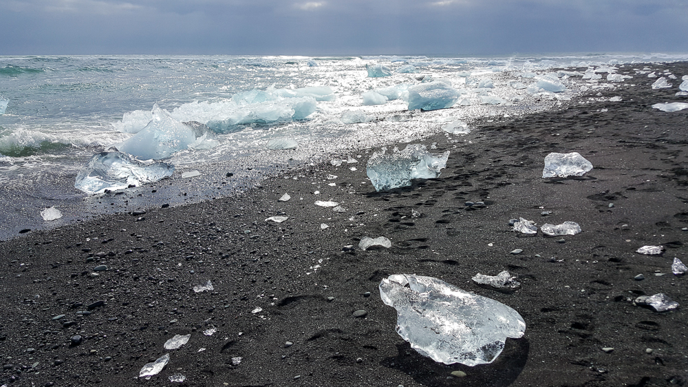
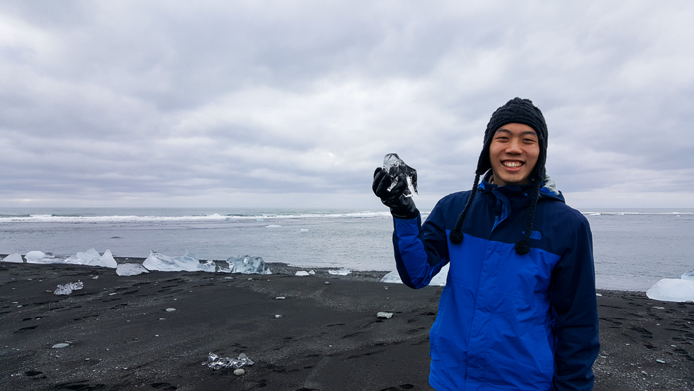
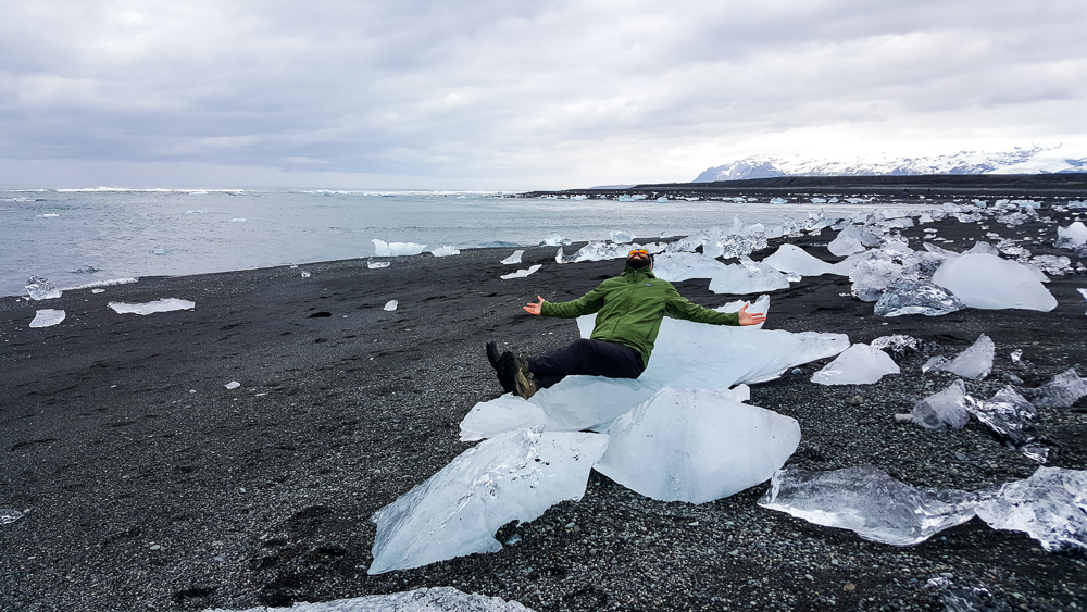
At the beginning of our trip, if you’d asked Tony what one thing he was most excited to see, he would have said, without a moment of hesitation, Diamond Beach. The interesting thing about his obsession was the fact that he didn’t seem to know much about it. Mike and I asked why it’s called Diamond Beach, and his response was “because it’s beautiful. Like a diamond.” Thanks, Tony. So, off we went to Diamond Beach, knowing nothing more about it than its name… which Tony insisted on repeating over and over and over until I was ready to throw him out of the car, and Mike banned him from mentioning it again until we got there (under the threat that if he heard the words “Diamond Beach” one more time, we were turning around and going back to Reykjavik. Tony wisely kept his mouth shut after that).

We had some good driving views…
It doesn’t even look real.

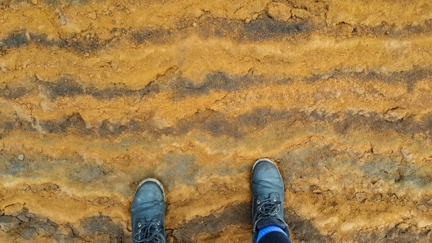
We got on the road after a brief stop at a waterfall near our campsite, Systrafoss, located in the forest of Kirkjubæjarklaustur. It wasn’t much more than a trickle when we were there, and I probably could have skipped telling you about it, but then I wouldn’t have gotten to type Kirkjubæjarklaustur and given you another opportunity to appreciate the names of Iceland.

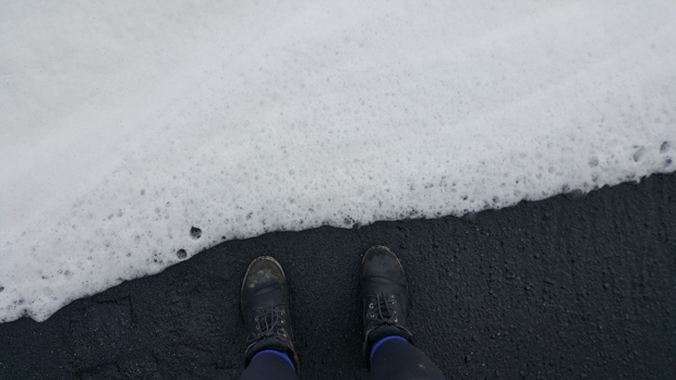
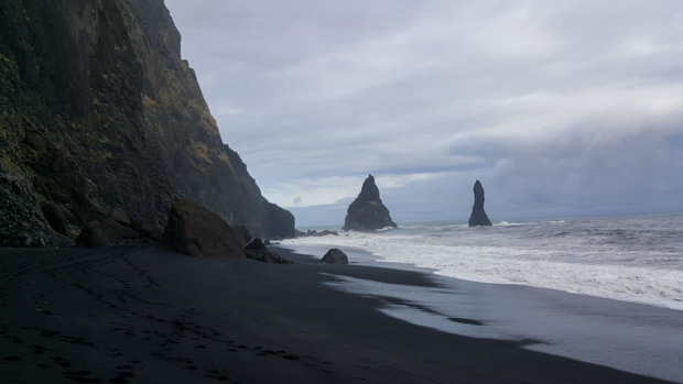
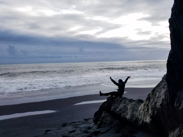
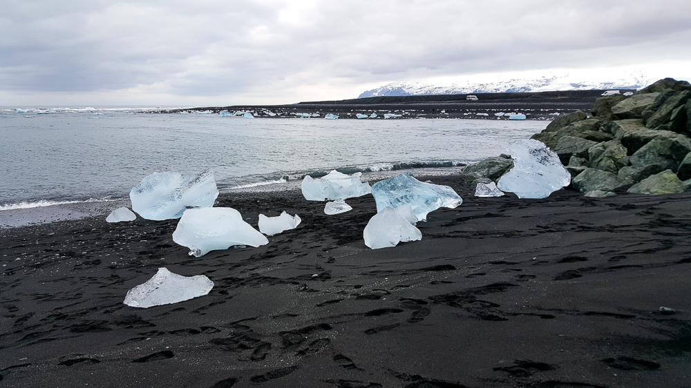
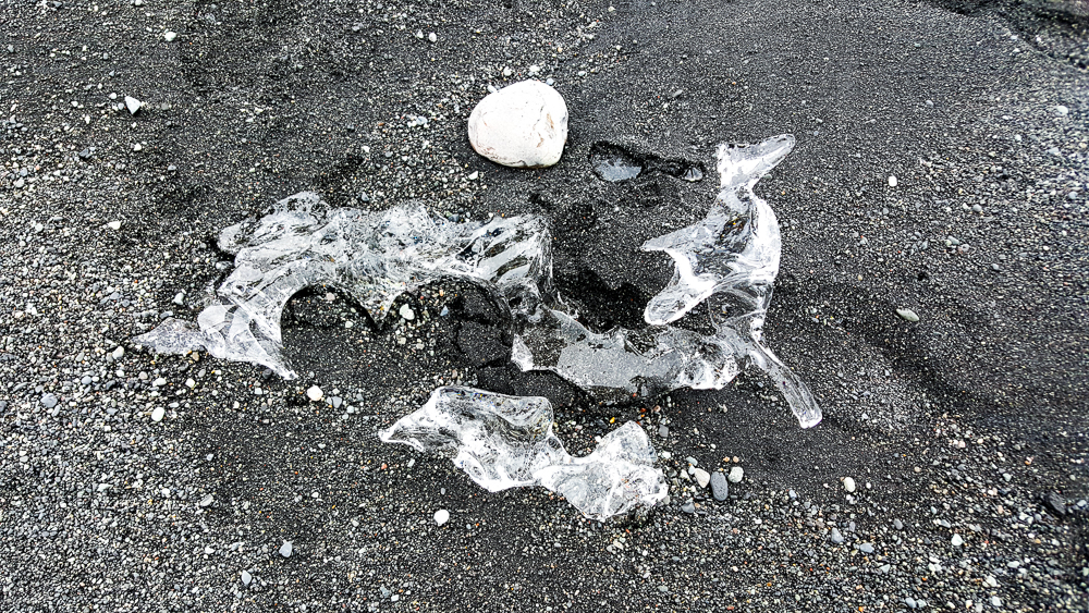
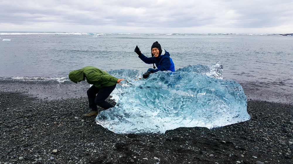
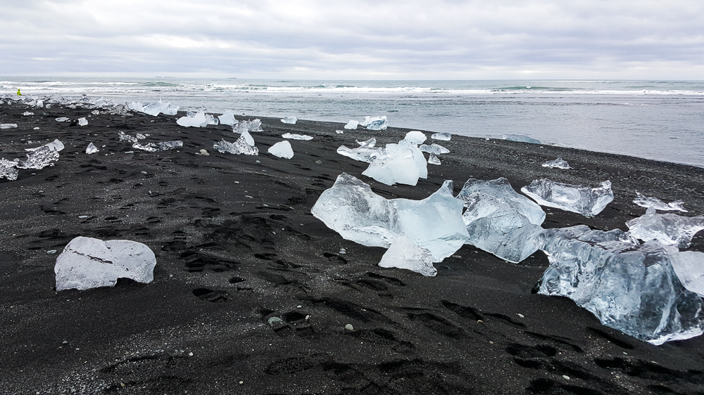
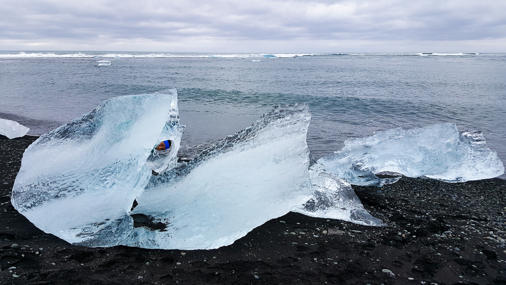
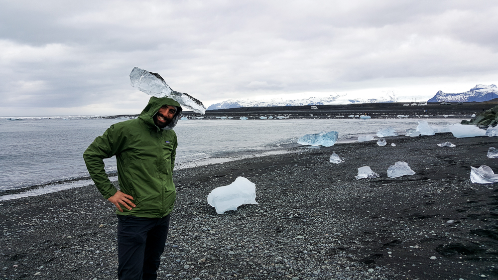
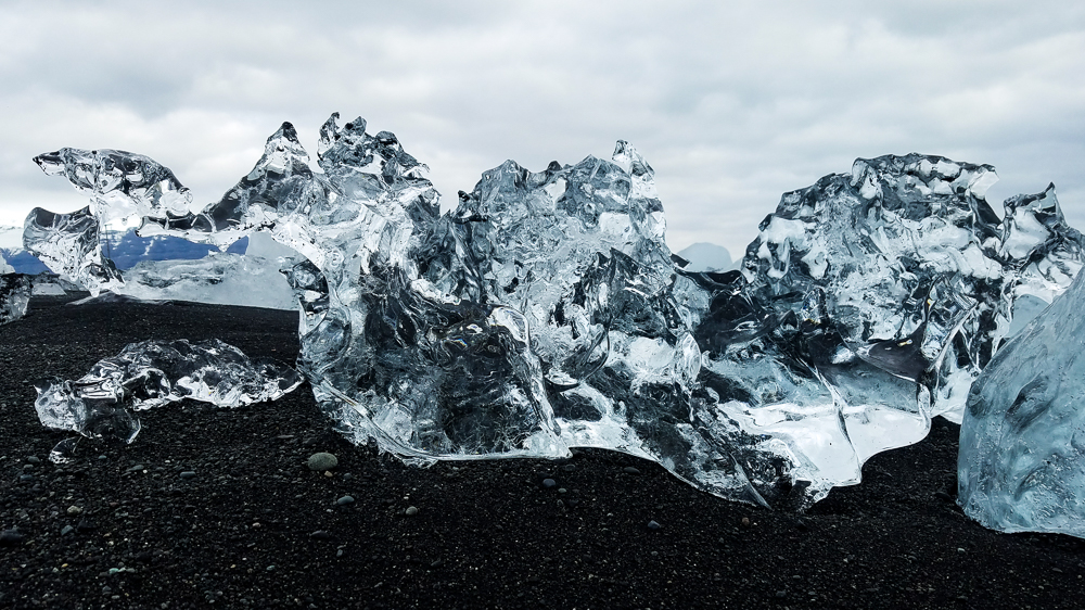
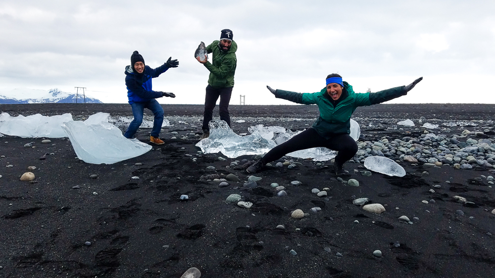
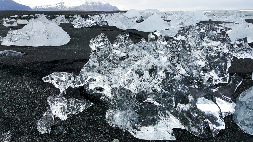
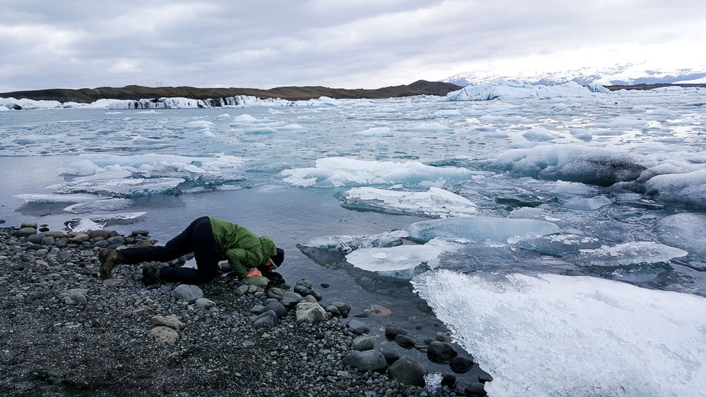
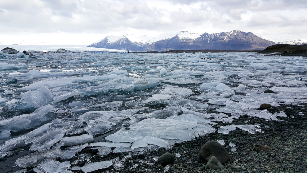
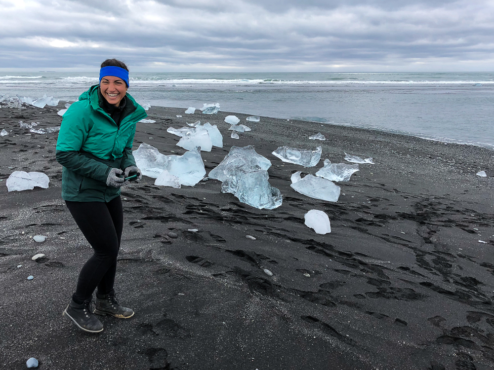
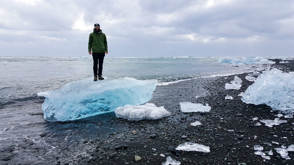
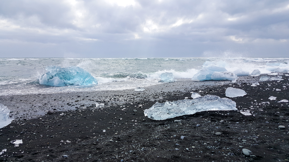
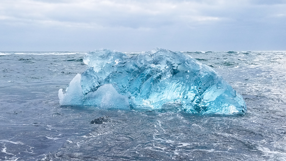
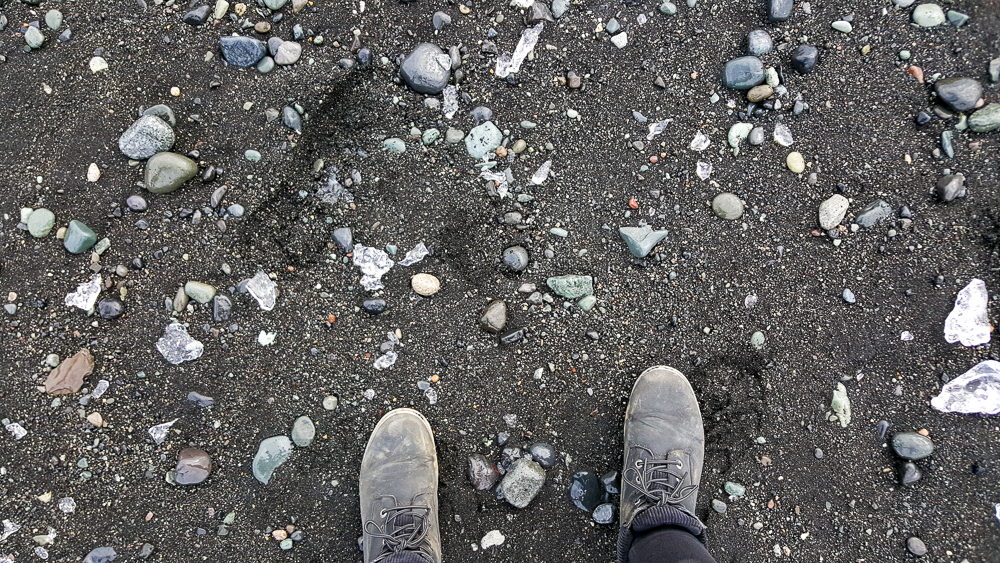
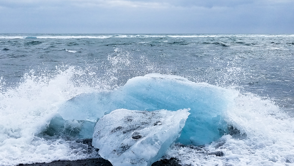
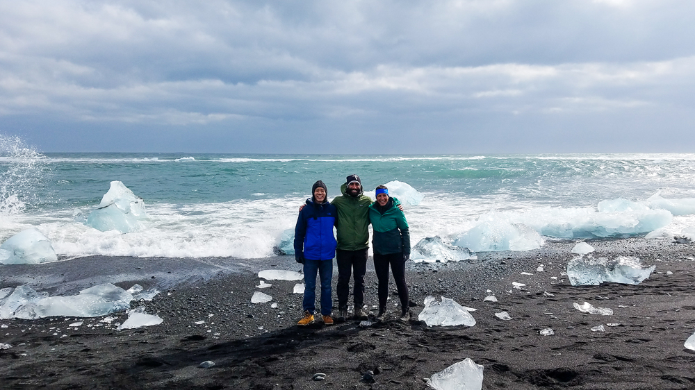
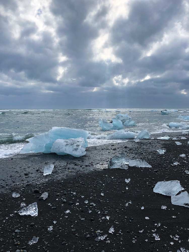
Next stop, DIAMOND BEACH! The mystery of the name was solved pretty quickly once we got there. It’s a black sand beach, and thanks to the nearby glacier lake, it’s covered with glacier pieces that wash up on the beach after drifting out to sea. There are pieces of all different sizes, and many of them form abstract ice sculptures that sparkle in the sunlight as they melt. We had fun imagining what the different pieces looked like (it’s like cloud animals, glacier edition) and taking ridiculous pictures with them.

Okay, so maybe “trickle” was a bit of a down-sell, but compared to most of the other waterfalls we saw, this IS a trickle!
Diamonds! And you can see the other side of the beach across the outlet from the glacier lake
Tony, thrilled to be at Diamond Beach
Ice sculpture! I think this one looks like a baby ice dragon.
Mike pulling Tony on an ice sleigh
So cool!
Can you find me?
Ice hat. There was a hole all the way through.
I have to give Mike the credit for this picture… He was so committed that he practically lay down on the ground for it. This one looks like maybe a dragon or maybe a pegasus.
Adventures in self-timer
Some of the coolest ice I’ve ever seen (hehe get it?)
Getting his tan on

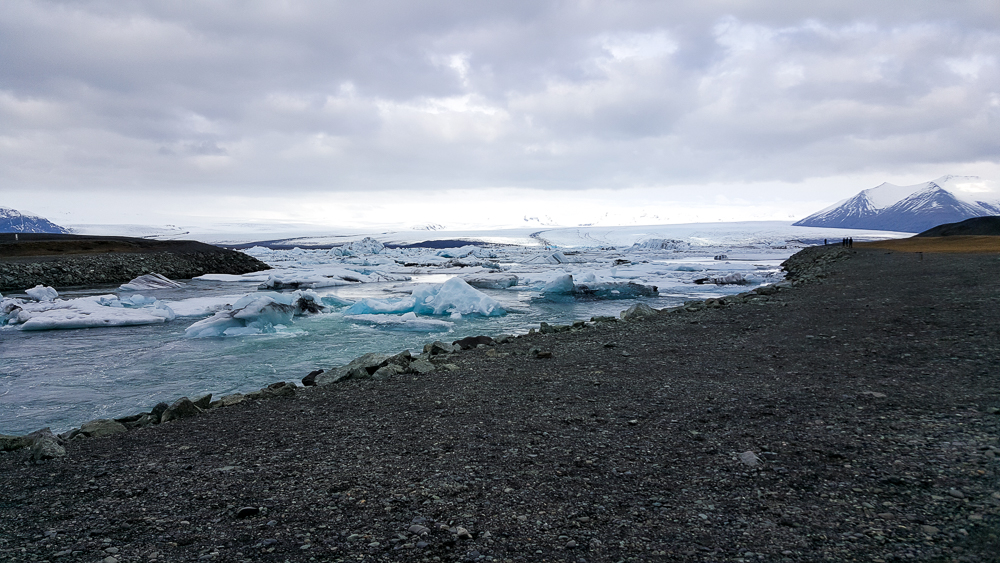
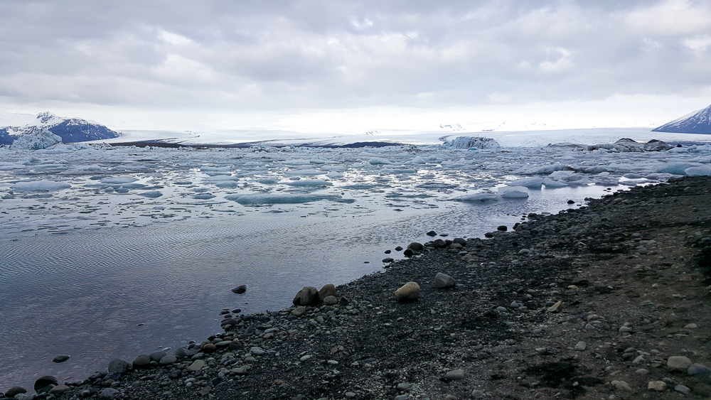
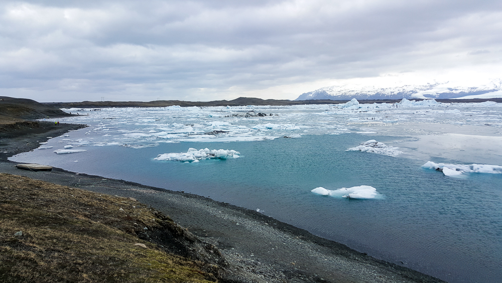
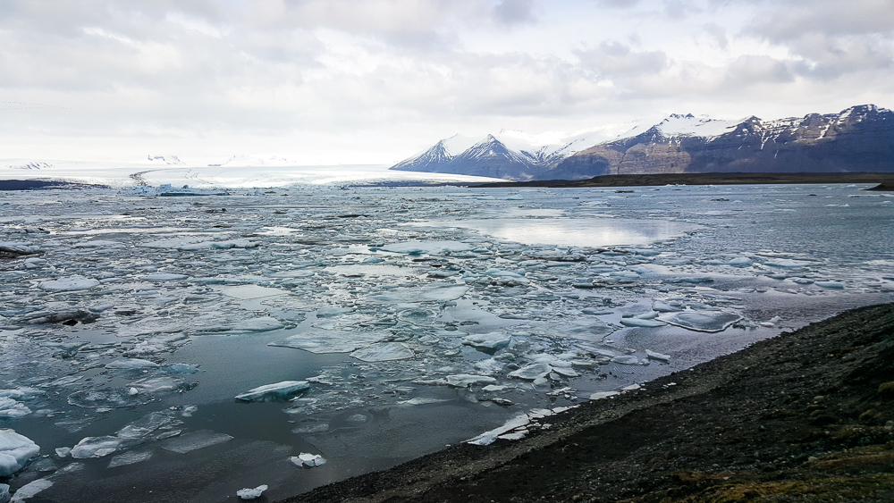
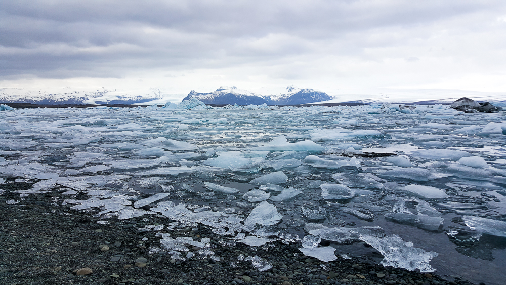
When Tony was satisfied with his Diamond Beach experience, we walked upstream to the glacier lake, Jökulsárlón. It was very pretty. I’m not sure what else to say about it, but it’s a lake… full of ice. And there’s a part that runs out to the sea, giving the future beach diamonds a way out. When we were finished staring at the lake, we paused to watch some little ice pieces that were trying to make a run for the freedom of the sea but were blocked by larger ones. We were completely sucked in by the action and cheered for one little ice as it struggled to break free. I imagine this is what Icelanders did in their free time pre-television. Maybe it’s also like the Icelandic equivalent of horseraces (but MUCH slower). You can put your money on an ice chunk, and whichever one successfully reaches the ocean first, wins. I’m a genius.

The glacier escape route (looking towards the glacier lake)
Walking up to the lake. This was the location of the big roadblock that the little ice pieces had to make it past in order to reach the ocean.
Craziness.
The classic Mike-drinks-freezing-cold-water picture
Just a few more…
So pretty!
Whoa!
Obsessed.
It looks like a partly melted slushie

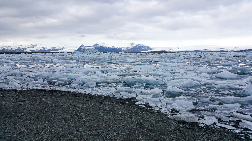
Before we got back on the road, we decided to check out the other side of Diamond Beach too (on the other side of the outlet coming from the lake) because, despite Tony having no idea what he was talking about, he was right about it being beautiful.

My expression for basically the entire Diamond Beach adventure
Mike on ice
I love that you can see the waves crashing into the ice
Seriously… can you believe this is real? It’s like a precious gemstone… a MASSIVE precious gemstone
Boots, rocks, and little ice pieces
Crash!
So many diamonds!
Turned our backs on the ocean…

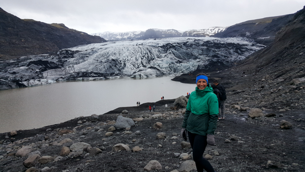
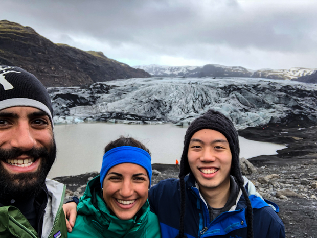
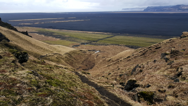
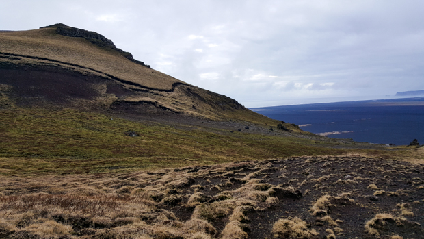
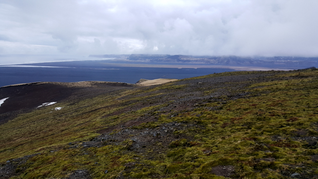
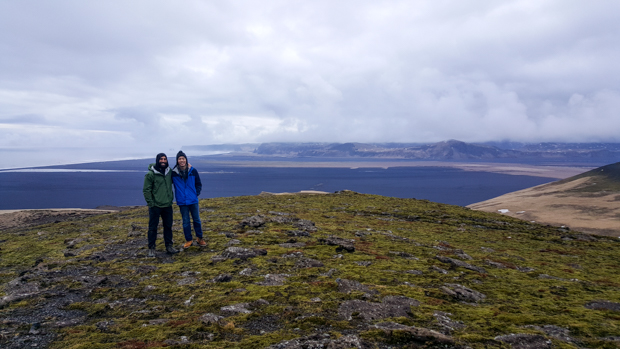
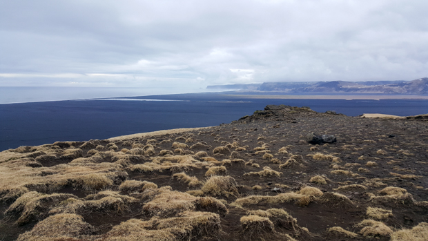
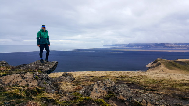
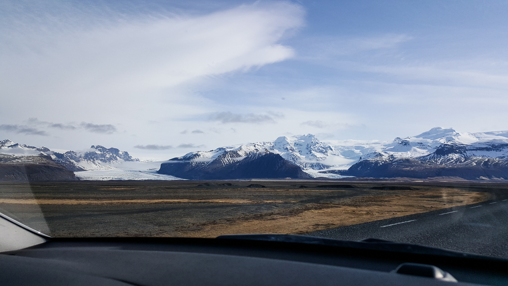
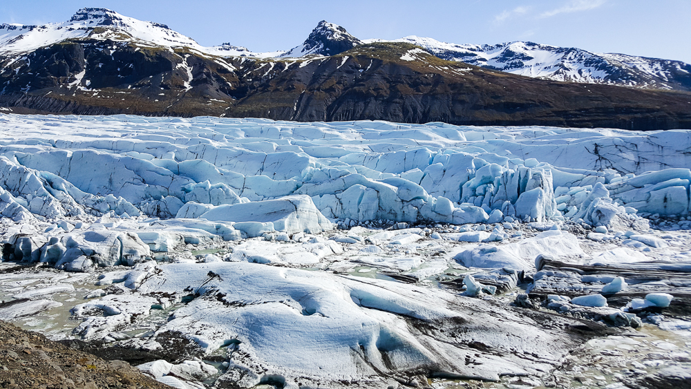
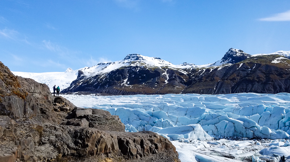
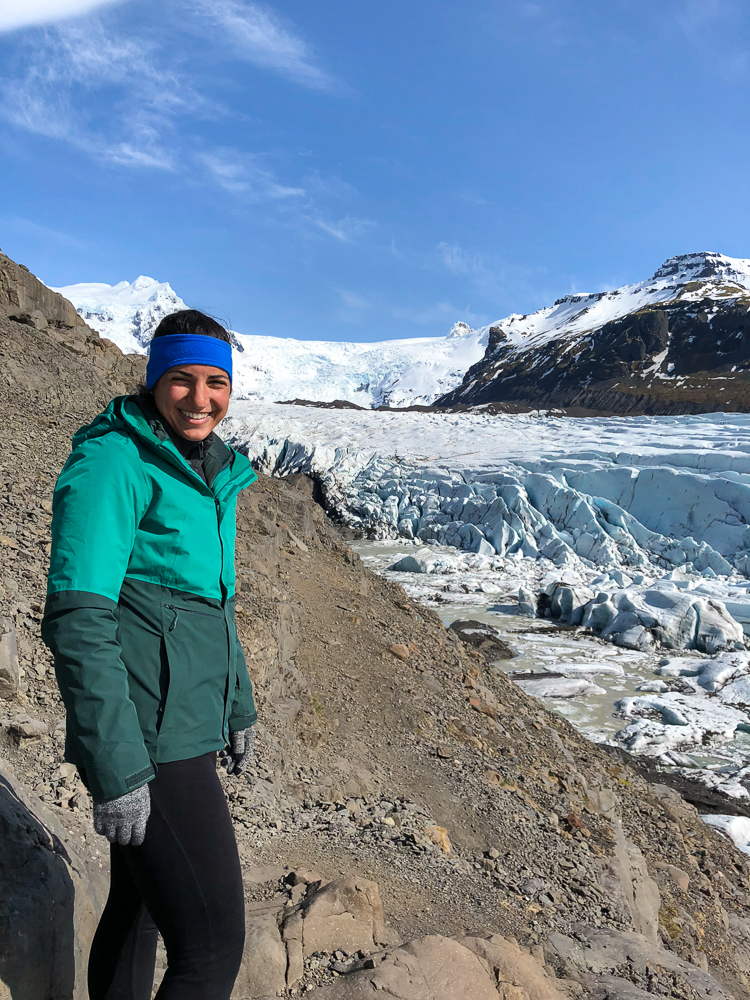
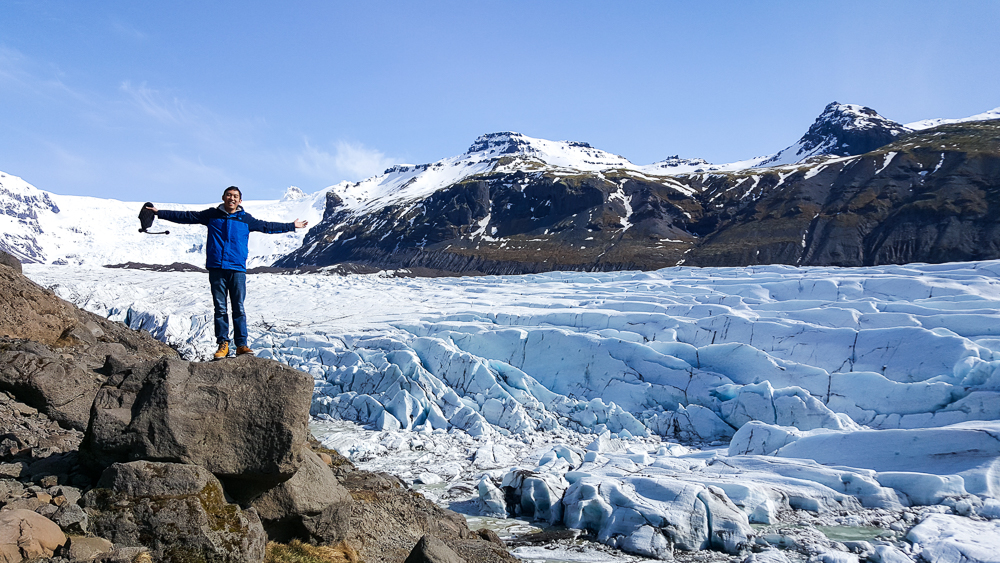
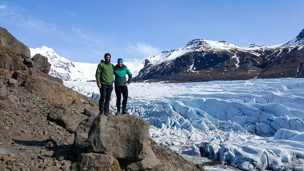
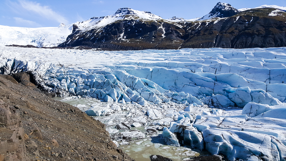
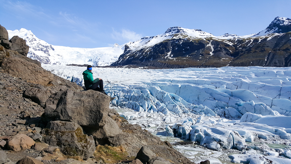
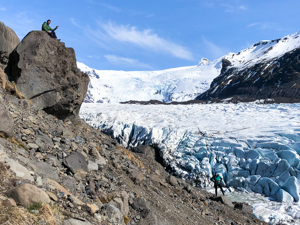
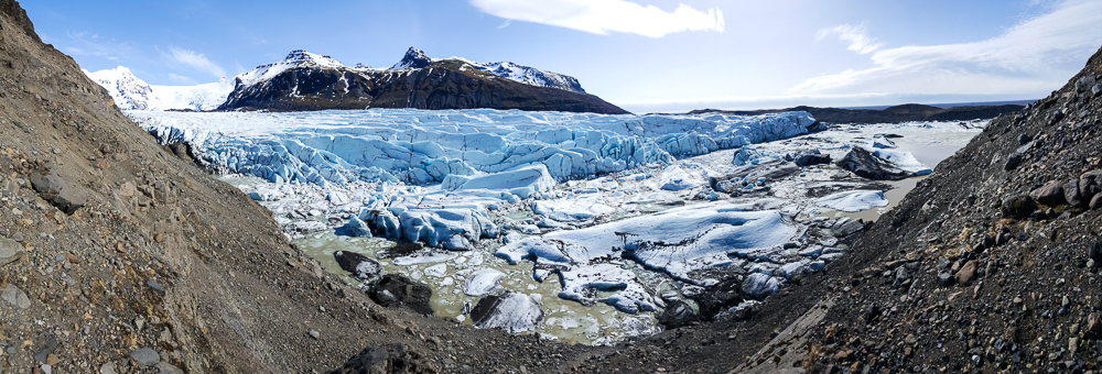
Diamond Beach was as far east as we were going, so when we finished there, we started back in the direction of Reykjavik. There were a few places we wanted to stop at on the way back, but we were also scouring google maps as we drove to see if there were other things nearby that might be worth checking out. One such discovery was Svínafellsjökull, another stick-out part of a much bigger glacier. The glacier that it’s a part of is called Vatnajökull, the largest glacier in Iceland. I quickly decided that visiting Svínafellsjökull was worth the detour x100000. We hiked up a ridge along the side, and it was breathtaking. I would have been happy to hike way farther than we did, but Mike and Tony were keen to keep moving. We walked until we were past all of the other people, at least, before turning around. Even with just that quick stop, it’s probably one of my favorite things we saw.

The road to Svínafellsjökull
Svínafellsjökull! Pretty sure the first words out of my mouth were, “You have GOT to be kidding me.”
Little speck Lara and speck Tony with ginormous Svínafellsjökull
Lara and the majestic glacier
Mike being Mike
Tony!
Sibling pic 🙂
I know, you’ve seen enough… but come on. This is crazy!!!
It’s quite the view
This picture is pretty funny. Can you find Mike? Can you find me?
Just one more! Hehe

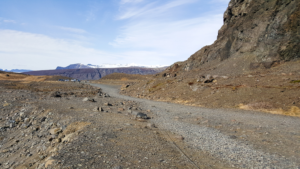
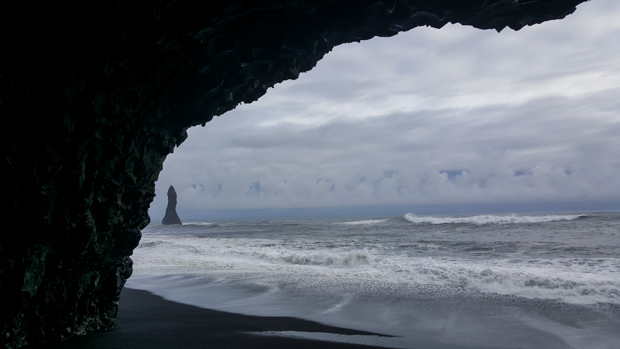
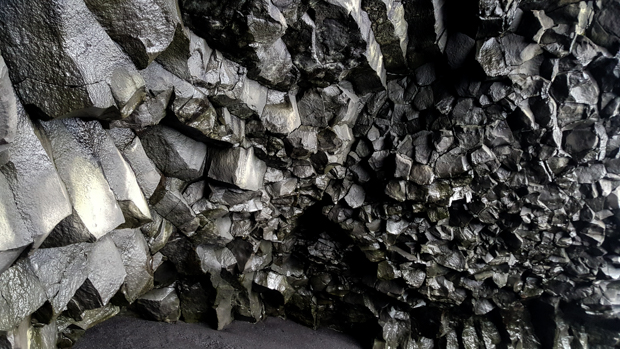
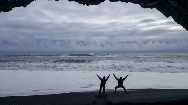
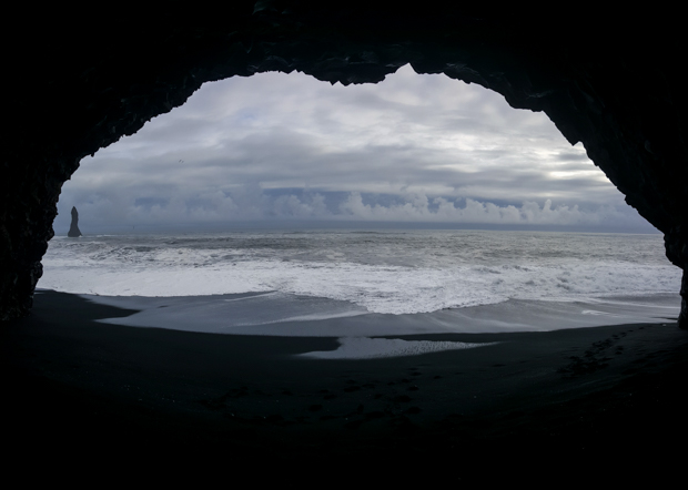
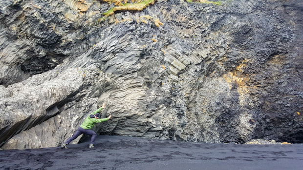
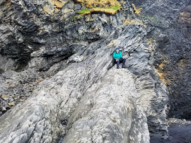
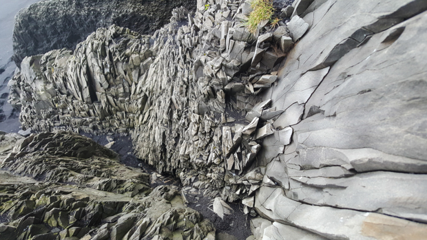
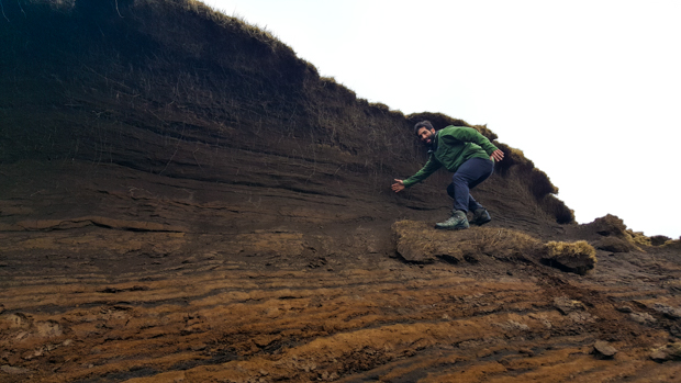
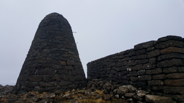
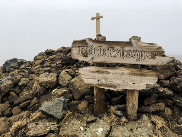
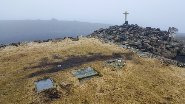
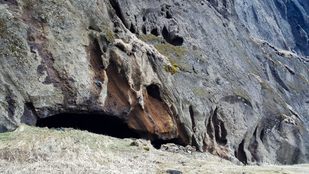
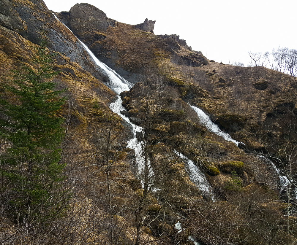
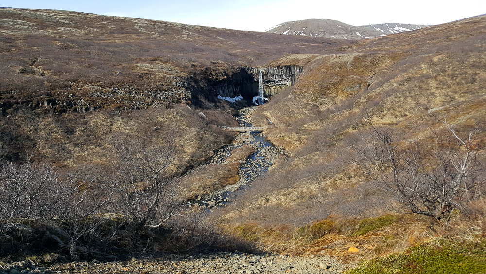
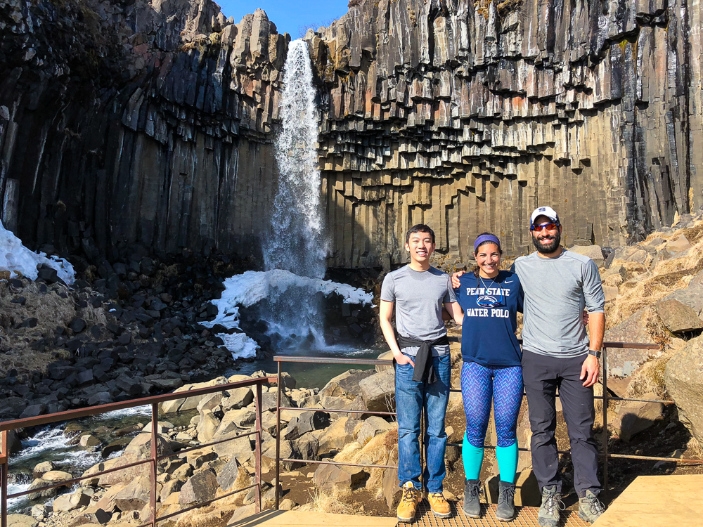
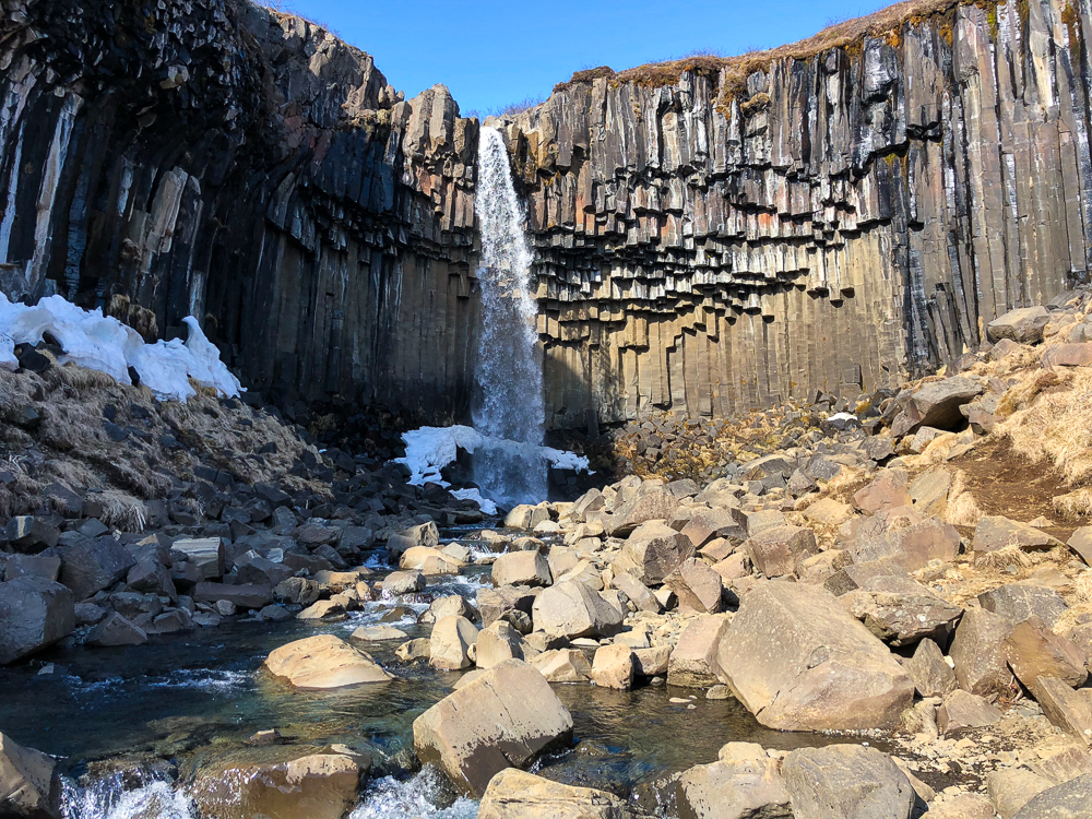
Our next planned stop was Vatnajökulsþjóðgarður, or Vatnajökull National Park. Mike and Tony were hoping to do some of the hikes there, but unfortunately, our visit wasn’t timed very well for hiking season. Most of the trails were closed for the season with an opening date of May 1, and we were there in mid-April (now you can see how far behind I am… oops). That was a bummer, but at least we could still hike to Svartifoss, another famous waterfall. This one has hexagonal troll rocks like the ones we saw at Reynisfjara beach, but at Svartifoss, they’re mostly hanging down instead of coming up from the ground.

Our classic Iceland lunch – PB (&J for Mike) with the most hideous backdrop
First peek of Svartifoss
Smiling because the weather was warm enough (for about 5 minutes) to wear short sleeves.
Check out those troll rocks! Maybe they’re hanging here because they’re troll bats that forgot to retreat into their caves before the sun came up.
It was actually (kind of) hot out, so I took off my top layer of pants and was left with these leggings. Mike made fun of me because he said my outfit was ridiculous. I think I look fantastic. Check out that color coordination!

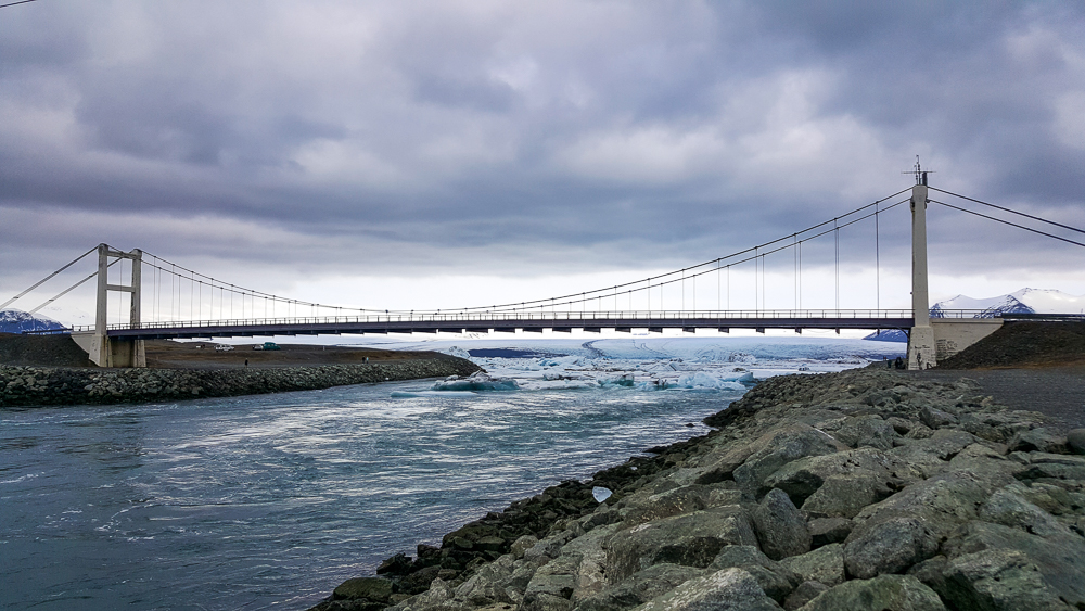
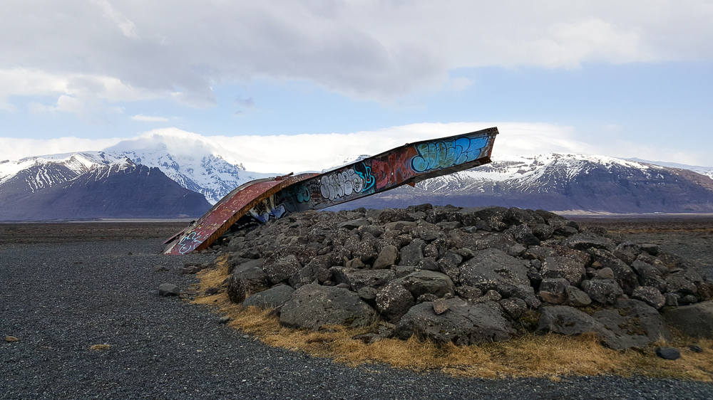
We made one more unplanned stop on our way to the campground for the night. This was another “there are lots of people over there so maybe we should see what they’re looking at” moment. Well, it was clear what they were looking at: a couple of massive, mangled steel girders. What wasn’t immediately clear was why they were there and what was so interesting about them.

Remember how I talked about how there are volcanoes under the glaciers? There are also some sub-glacial lakes that are maintained by the volcanic heat. One such lake, Grímsvötn, is beneath the glacier Vatnajökull. It cycles between slowly filling and eventually releasing the water in a mega-flood. In 1996, there was a volcanic eruption that accelerated the fill cycle, melting 0.75 mi3 (3 km3) of ice in just 13 days. The lake was filled higher than ever before in recorded history, and the resulting mega-flood was incredibly destructive. The flood waters carried glacier pieces along with them, some weighing as much as 1000-2000 tons. TONS!

The mangled steel girders that we were looking at used to be part of a bridge that clearly didn’t fare so well, despite being designed to withstand mega-floods. It had deep foundations and allowed about 6m clearance for glacier pieces to pass underneath, but in this instance, it would have needed more than twice that height to be safe. The result? Well, the beams speak for themselves…

That is NOT a small or weak beam. Imagine the force that was needed to do this! And it was all natural! Crazy, amazing, and a little terrifying

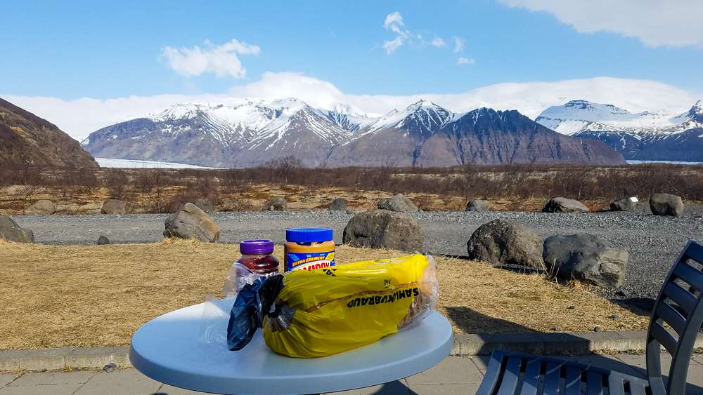
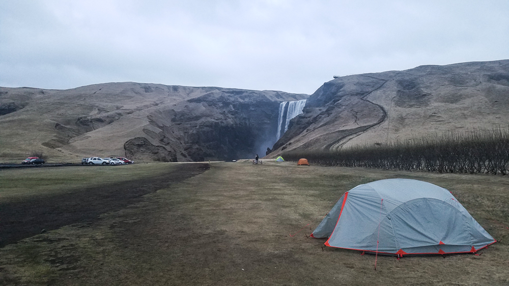
We made our way to that night’s campground, set up the tent, and played card games before falling asleep. Mike and Tony were hoping to do a long, waterfall-filled hike the next day, so we needed all the sleep we could get!

Campsite for the night

Related Posts

Petrified Trolls of Iceland – Do you like the funky “troll” rocks around Svartifoss? Do you have no idea what I’m talking about? Learn more about the formation of these interesting lava rocks.

Perito Moreno Glacier – if you’re a glacier fan, join us for a trek on this South American glacier!

Ada Foah – compare the black sand beaches of Iceland to the picturesque and slightly more tropical beaches of Ghana.


Continued from the previous post

Our next stop was to see a glacier! I was excited because it was our first one of the trip. We weren’t sure if it was worth stopping just to take a look, but we figured why not? The glacier is called Mýrdalsjökull (jökull = glacier), and we went to this one part that sticks out a bit called Sólheimajökull. At least that’s what I think the situation is with the names, but honestly it’s a little hard to keep track, especially with all of the crazy Icelandic names. Mýrdalsjökull is on top of Iceland’s largest volcano, Katla, which is due for an eruption anytime. The big eruption in 2010 that sent ash all over Europe was from a smaller volcano nearby… and usually, the eruption of one leads to the eruption of the other within a decade. Katla is very closely monitored because even minor eruptions can result in major flooding from the glacier melt.

Me with Sólheimajökull! Mýrdalsjökull, the full glacier, is the 4th largest in Iceland.

I thought the glacier was awesome, but we were pretty far away so we didn’t get the full effect. It would have been cool to do some glacier hiking or whatever it’s called. I’ll have to add that to my list of things to do when I go back to Iceland one day!

Mike, me, and Tony
Sibling pic on some petrified trolls. Mike said I could go on a higher one so that I could be taller for once. Thanks, Mike.

This is where the craziness of Iceland’s landscape diversity comes in… We were at a glacier, and then 30 minutes later, we were on the beach. Reynisfjara is a black sand beach, but the really cool thing is the rock formations there. They look like a bunch of pencils bundled together and sticking up at different heights. There are two options for how they were formed:

  1. The columns are trolls that were turned to stone when they were caught outside at dawn.
  2. They’re basalt columns (basalt is one of the rocks formed by lava). They’re formed when lava cools and contracts, making hexagonal rocks.

Guess which option I prefer.

It was more of a pebble beach than a sand beach. The ground looks super cool!
Mike holding up the entire cave with his super strength

There’s also a cave at the beach which, of course, has a name of its own: Hálsanefshellir. The rock formations in there are similar to the petrified trolls, but since it’s a cave, they’re coming in from all directions instead of being just straight up and down. I think we got lucky because we were there at low-ish tide, so we could get into the cave. It was still a bit of an adventure because we had to run towards the ocean as the water retreated to get to the other side of the troll rocks and then run away as the waves came back in, re-separating the two parts of the beach. And, we had to watch out for sneaker waves…

I love all the shades of blue and grey in the water and the sky
Inside the cave
Tony and Mike messing around
Full view looking out from the cave

Sneaker waves are basically waves that are much bigger and come much farther into shore than the others, hence the “sneaker” part of the name because they can sneak up on you. The concept of sneaker waves is not at all funny… people have died from getting swept out to sea by the strange and unpredictable tides. We were quite entertained by the signs though, and the fact that they’re called sneaker waves never fails to make me giggle.

The sign says:
DANGER
– Very dangerous sea currents
– Deadly sneaker waves
– Never turn your back on the ocean
– Supervise children
The graphic in the middle shows the danger zone close to the waves that you should avoid, the light blue ones are “ordinary waves” and the dark blue ones above are “deadly sneaker waves”.
To the right, it gives information about a tourist death due to the waves.

I kept imagining someone standing on the beach with a big cartoon wave behind them, tapping them on the shoulder… Surprise! The signs tell you to “never turn your back on the ocean!” We had a lot of fun yelling that at each other. And then we turned our backs on the ocean a couple times (unintentionally!) and found ourselves sprinting up the beach to avoid getting soaked by surprise waves. So that’s what we get for not listening. (Strongly recommend that you heed the signs.)

Standing at the edge of a foamy wave, definitely keeping one eye out for sneaker waves…
Mike doing some earthbending
I found the perfect spot to protect me from the sneaker waves!
Cool rocks near the cave
There are also some rock formations out in the water, Reynisdrangar. In typical Iceland fashion, each of the three rocks also has its own name because why not. They are the remains of two trolls who went to help tow in a large ship… and then the dawn came and petrified the trolls AND the ship. Trolls must be extinct considering how many rock formations are attributed to their failure to keep track of time.
Hooray for black sand beaches!

We had a little more driving to do before we got to our campsite for the night, but we still had plenty of daylight (thank you, super long days). We’d hit all the major destinations for the day, so we consulted Aunt Judy’s list of notes to give us some ideas for a few more stops to make along our route.

On our way to see a cave from her list, we passed a sign marking the start of a hike on Hjörleifshöfði mountain. I have no idea what convinced us to do it, but we had some time and why not? Okay, I’ll take the blame. I didn’t think it seemed that long. In the end, I’d say that at least 50% of it was underwhelming mostly because the entire world was brown (it’s probably fab in the summer), but in terms of Icelandic history significance, it wasn’t a complete bust! We trekked across the treeless mountain, through mud and snow and little ground plants, until we finally reached the top of the mountain where there’s supposed to be an amazing view of the surroundings… and guess what? A heavy fog set as we were approaching the top, so we couldn’t see anything except the faint outline of some strange stone structure.

Looking back at the path as we climbed up
Mike surfing a dirt wave on a dirt surfboard
Multicolored mud
So. Weird.
Ground plants!
Mike paying his respects

It turned out to be a Viking graveyard! This is one of those situations where we wouldn’t have been surprised if we had done ANY research or had even just read the signs before starting the hike because it’s kind of a big deal. Oops. Hjörleifur Hróðmarsson is buried there, the “second settler of Iceland”. His brother was Ingólfur Arnarson, the first settler. Hjörleifur only survived one year on Iceland before he was killed by his slaves. He was avenged by his brother, and apparently, the mountain is now haunted by him… add that to the list of things we didn’t know. Maybe that explains the fog.

The graveyard itself was very confusing. There was this big cylinder/cone thing that was next to the plot of land where the graves were. I thought maybe it was some weird Viking burial thing since it didn’t seem to serve any obvious purpose, but turns out it’s a marker built by Danish surveyors.
Hjörleifur’s grave
Family plot from some more recent inhabitants of the mountain with Hjörleifur’s grave mound in the background

Finally, as we started to walk down from the gravesite, the fog cleared and we had a view of the seemingly endless lava fields stretching in every direction. The mountain we were on must have dropped out of the sky because it’s the only one in the area, and around it is flat, flat, flat.

Going down
Mike and Tony, thrilled to be here
The top of the mountain was weird
Lava fields stretching to forever

On the way back to the car, we passed some ruins/old foundations of two farms. The former farm inhabitants are buried on a plot next to Hjörleifur. I thought the whole thing was kind of cool. Mike and Tony were probably just trying to figure out why they’d listened to me about the hike. Sorryyy.

Farmhouse ruins
Walking back down into the valley
Hjörleifshöfði cave

Since we were already so close, we did stop by our original target (2 hours later…) Hjörleifshöfði cave. It was probably worth a quick stop, but at that point, I think we were all tired and hungry and slightly grumpy. After a brief poke around, we headed to the campsite for another much-needed sleep on the cold, hard ground. This night was extra cold. Ugh.

Little caves along the base of Hjörleifshöfði mountain
Our car outside of the cave. Doesn’t this look like a car ad?