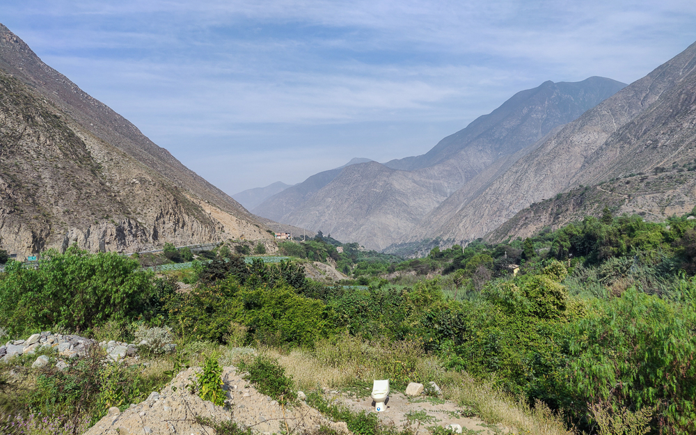
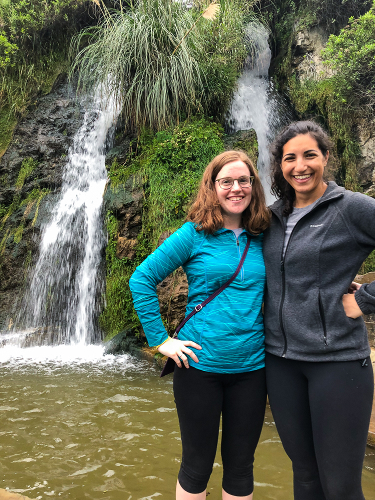
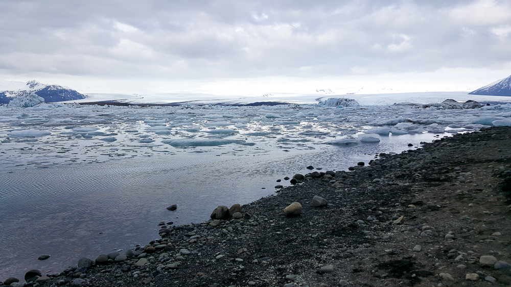
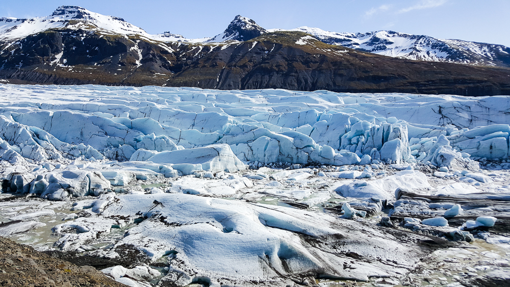
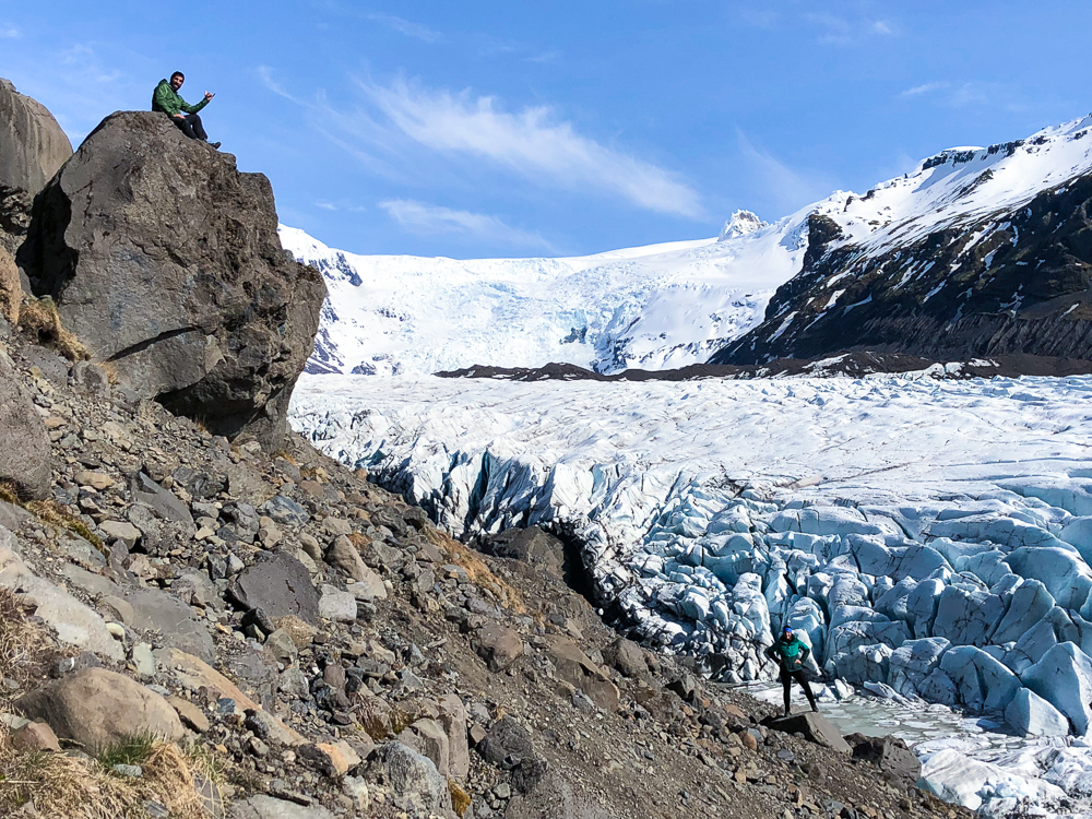
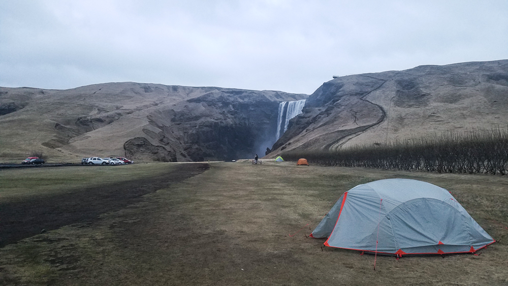
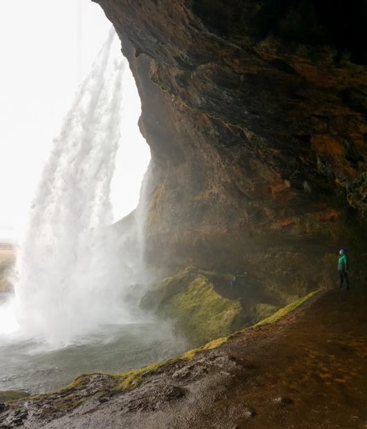
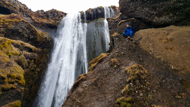
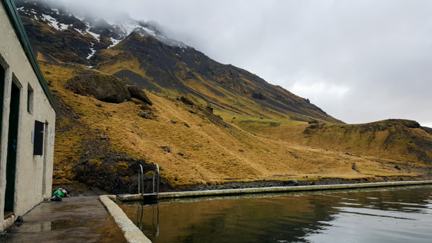
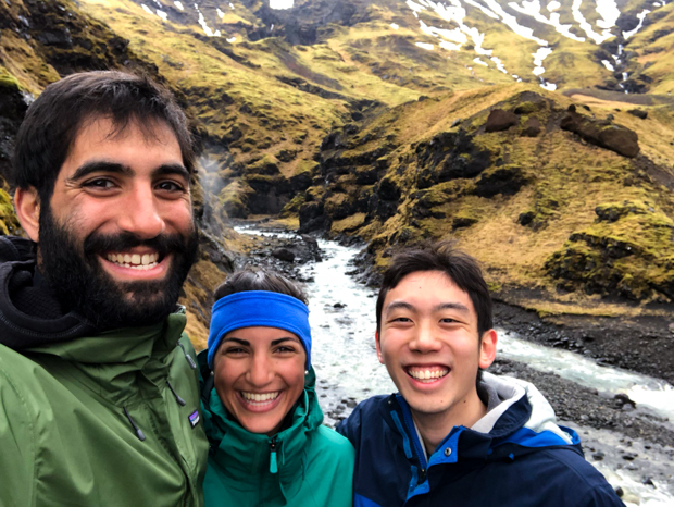
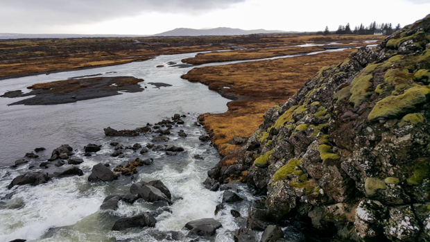
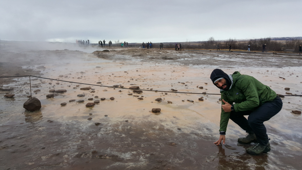
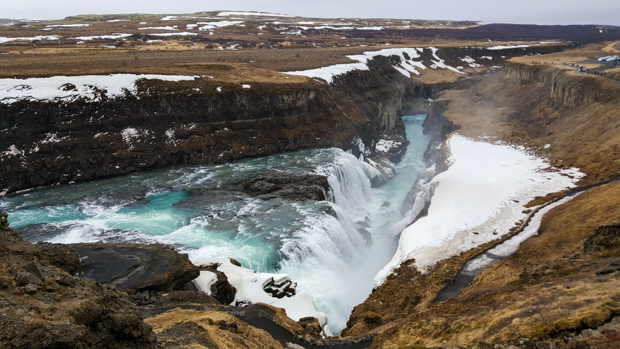
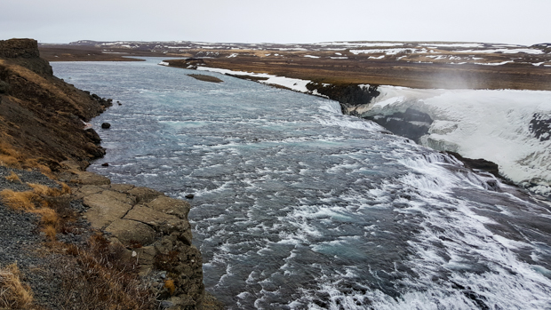
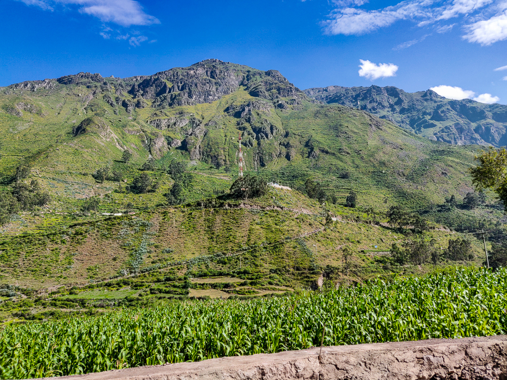
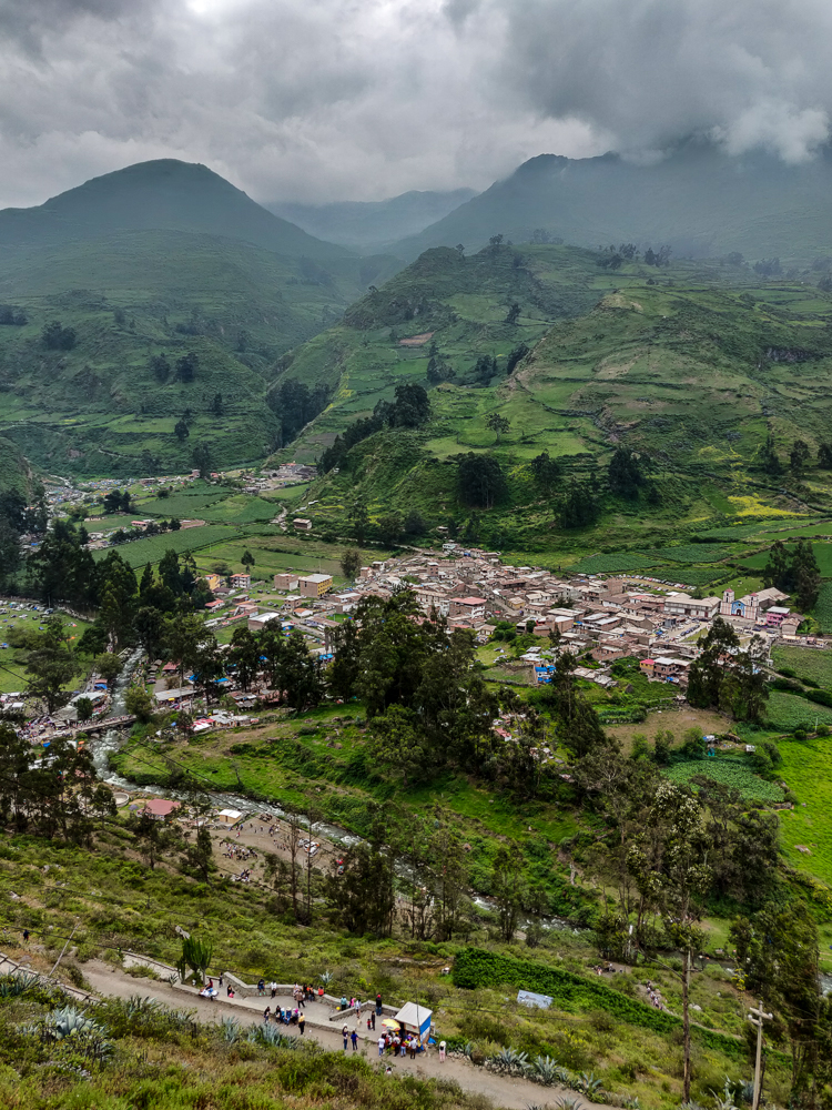
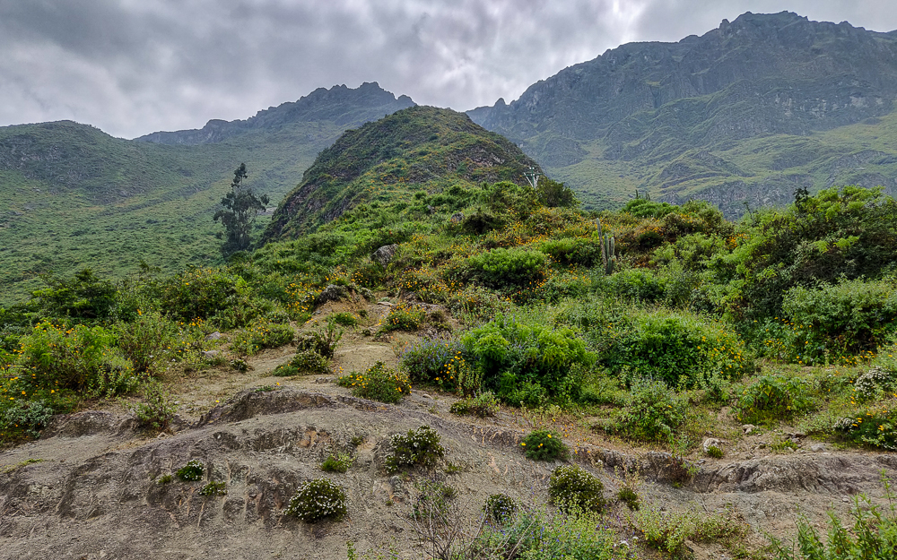
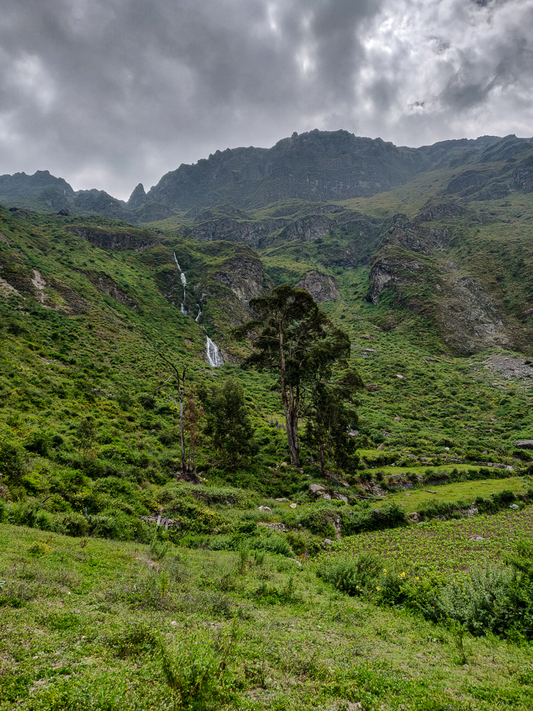
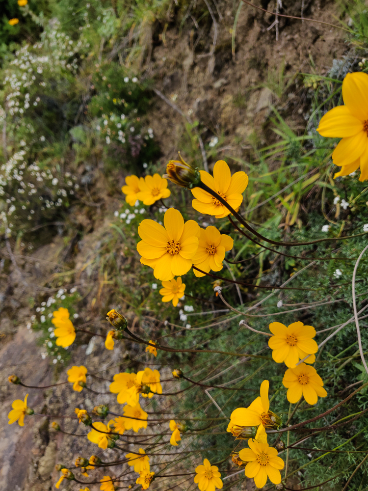
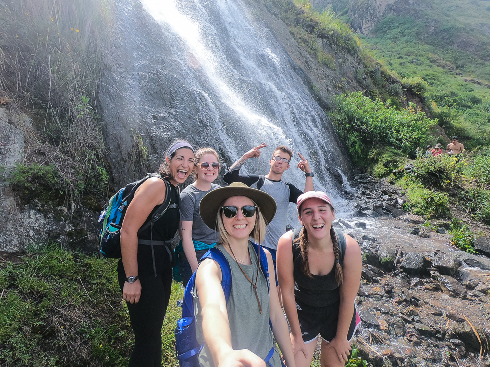
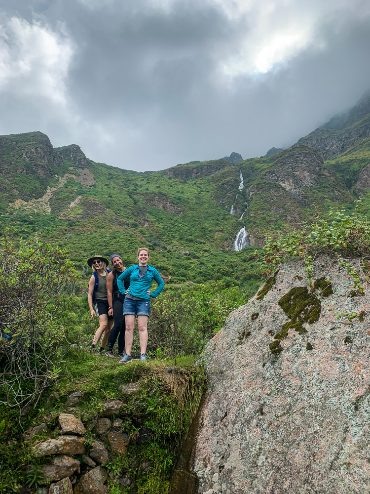
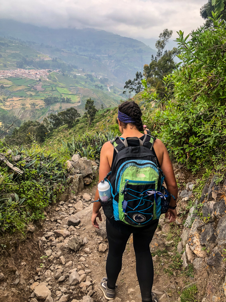
After winging it on our first day in Canta, we started off Day #2 with a very well-defined plan: hike to “that” waterfall. See photo below for details… (Can you find the waterfall?)                                         

Took this picture while speeding down the road between Canta and Obrajillo (David was appreciating the open road after we got past a spot of traffic). Have you located the waterfall? Scroll down for help…
To orient you, Obrajillo is in the valley to the right, the overlook is at the edge of a village, San Miguel, and we hiked up to the waterfall trickle that you can barely see (which seems kind of close to San Miguel, but I promise you that it’s not).

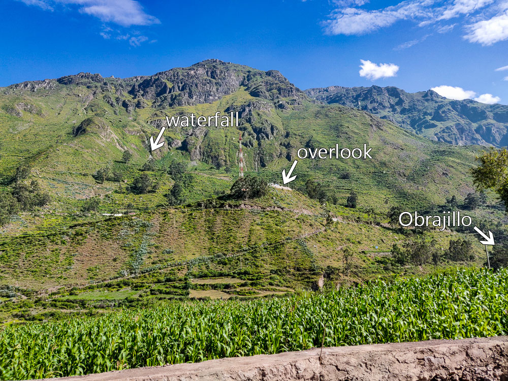
Okay, so the plan was vague, but Julie did some research and came away with the conclusion that it’s definitely possible to hike there (probably). The directions, as far as she could find, were to start by walking up to a popular viewpoint overlooking Obrajillo. Okay, easy enough. And then, walk to the waterfall. Hm. Welp, at least we knew the beginning part! We could figure things out from there, right?

The good news is, I love to overpack for hikes which means I was already prepared for uncertainty. My formula for day hikes is roughly: (day hike + 4 days) x # of people… and then I pack snacks and water accordingly, as though no one else is bringing anything (even though they are). It’s good to be prepared! What if someone else is underprepared? What if we get lost? What if someone gets hurt? What if there’s a mudslide and we get stranded and don’t want to resort to cannibalism? No one ever says, “I wish we had less food.” Worst case, you don’t need it all and get stronger from carrying the extra weight.

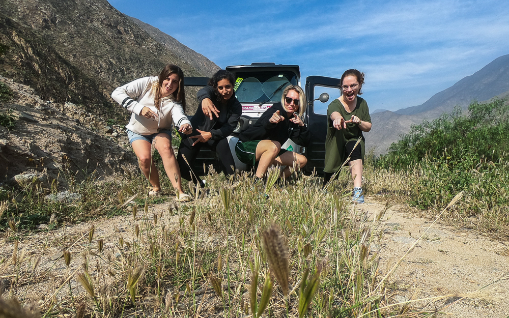
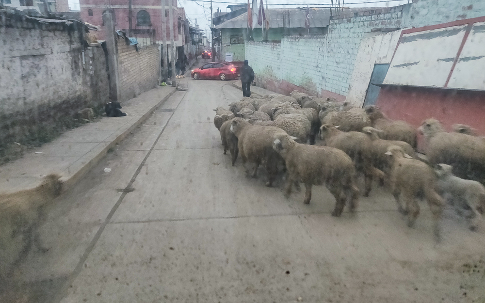
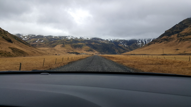
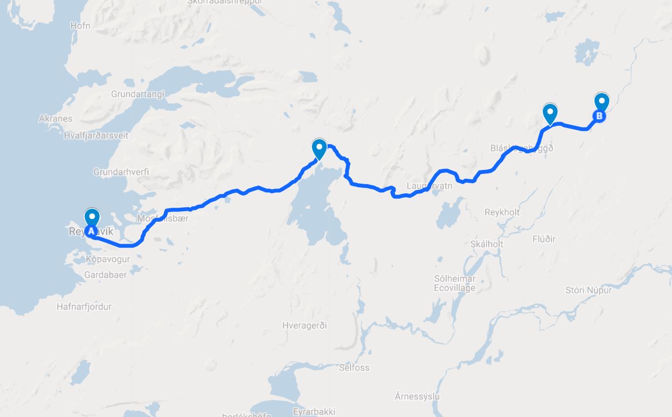
Once we were ready for anything, we walked to get breakfast sandwiches before heading out. This was our staple meal for the weekend (literally 3/5 meals in Canta): a fried egg on a roll. After you eat approximately four, you’re good to go! Then, we piled into the van and drove down to Obrajillo. There was traffic because of course there was. As soon as there are two cars on the road, it seems to be inevitable (I think it’s because Peruvian are so proud of their traffic, they need to make sure it’s always living up to its terrible reputation).

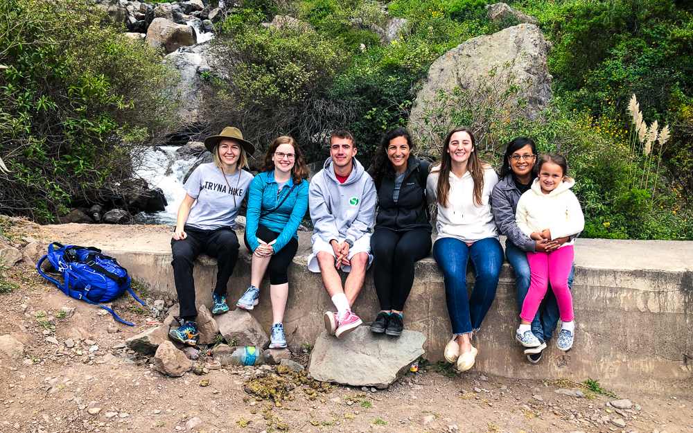
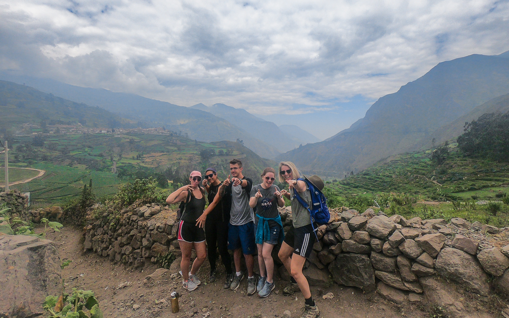
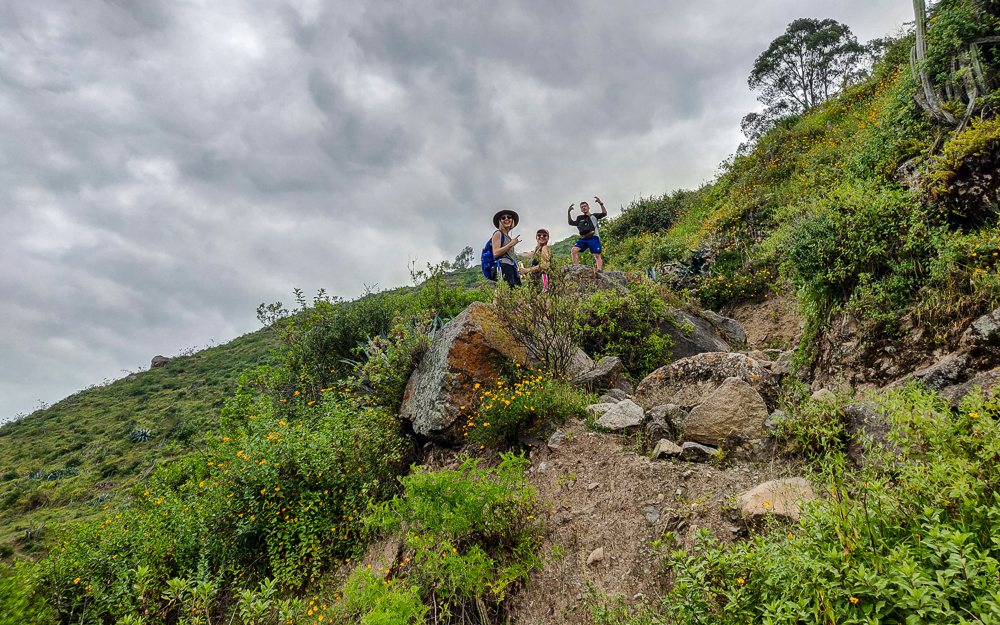
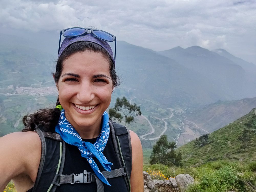
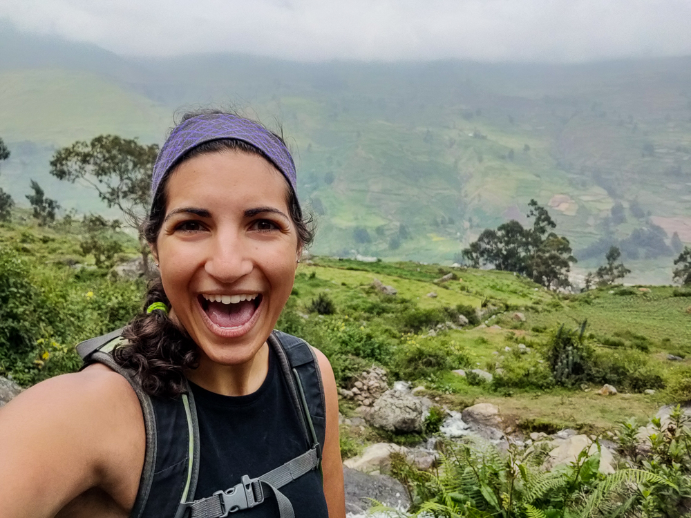
After we parked, we located the path to the viewpoint, and David, Dina, and her daughter split off to do other things… apparently the idea of a potentially endless hike didn’t appeal to them. Sorry, I mean “adventure walk”. Julie doesn’t like “hiking”, so we rebranded the activity. That ended up being a much more appropriate name in this instance anyway. “Hike” implies order, a defined path. “Adventure walk” says “I don’t know where we’re going, but that’s part of the fun!”

At the viewpoint
I can’t get over the greens! Maybe if they knew THIS was the view they were missing out on… nah, they still would have ditched us.

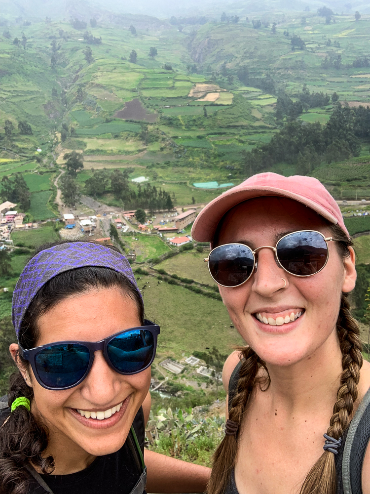
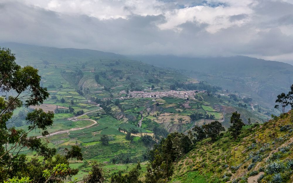
Anyway, the path to the overlook was easy enough to follow. Maybe that could be called a hike. From there, it was inarguably an adventure walk. After the viewpoint, we started asking every person we met for directions. That may sound like overkill, but it was a necessity. When people don’t know the answer to your question, they don’t say, “I don’t know.” They say, “Oh, it’s that way!” and point and say it with full confidence and make you think they have a clue. So, the only way to be safe is to ask as many people as possible, rate their trustworthiness, compare answers, pick a direction, and remind yourself that not knowing where you’re going is part of the fun.

Another album cover option
I love these mountains.
Like seriously. (Also, that’s Canta on the left.)
HOW ARE THERE SO MANY GREENS? Also, fun fact did you know that the human eye can differentiate more shades of green than any other color?

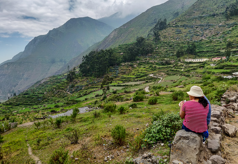
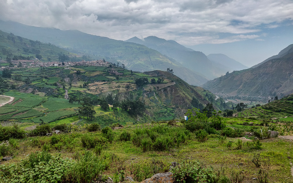
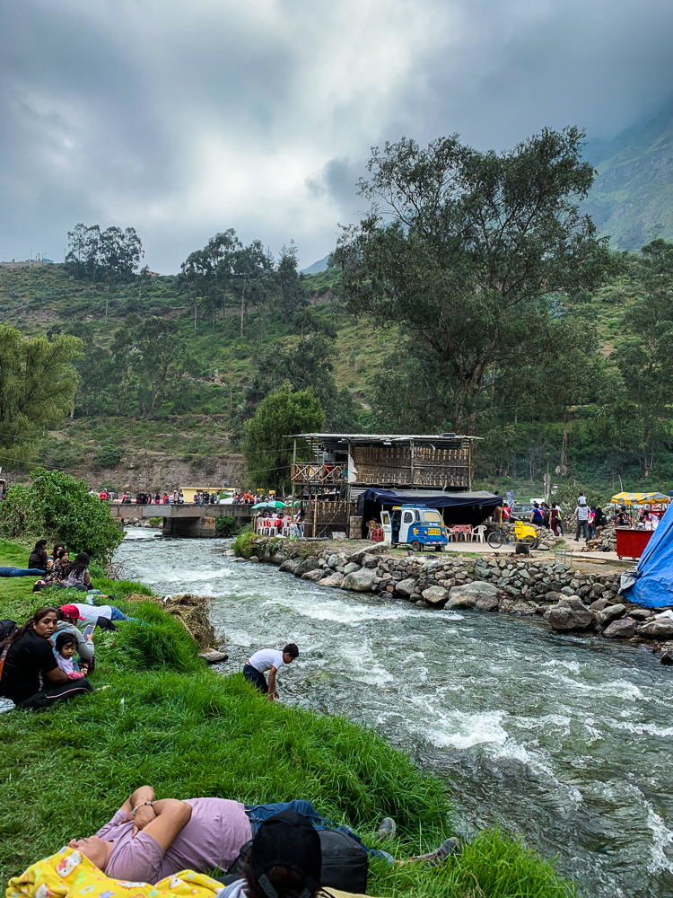
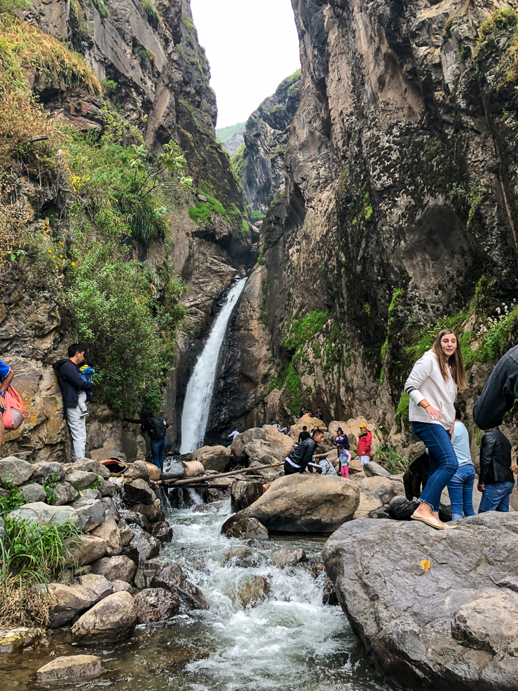
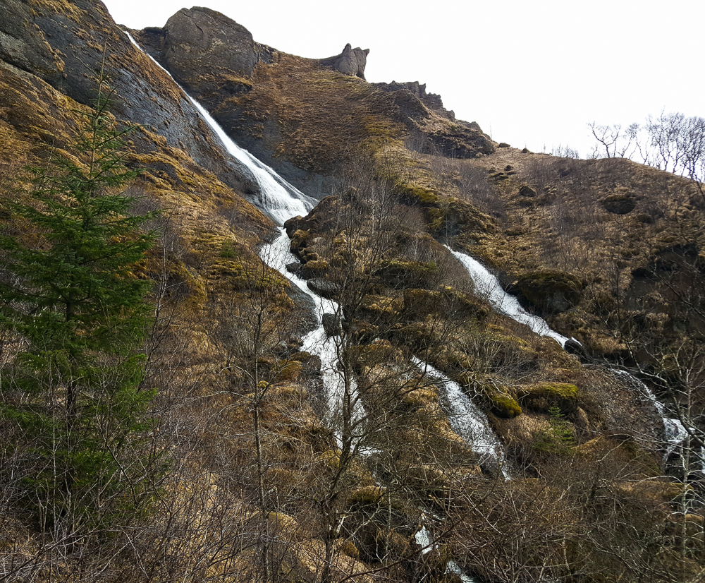
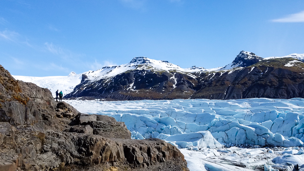
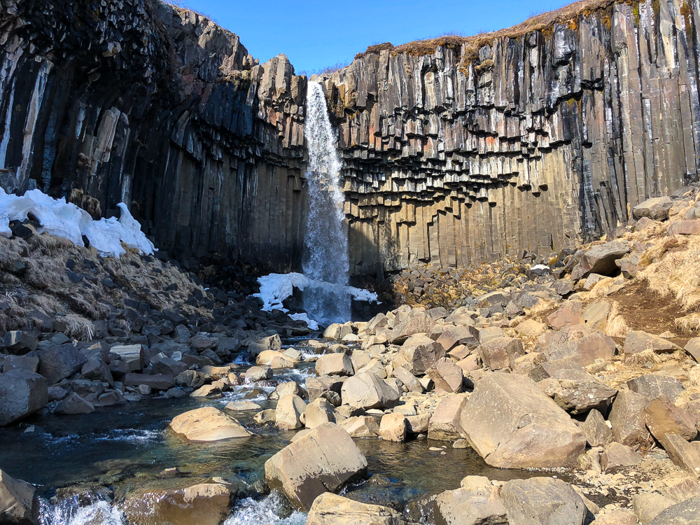
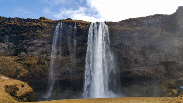
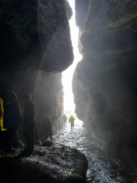
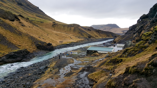
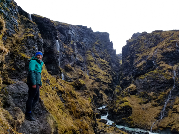
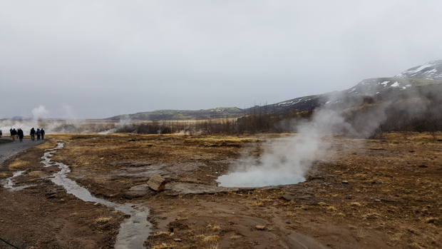
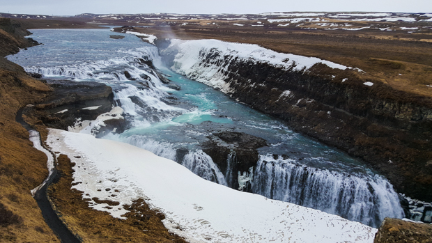
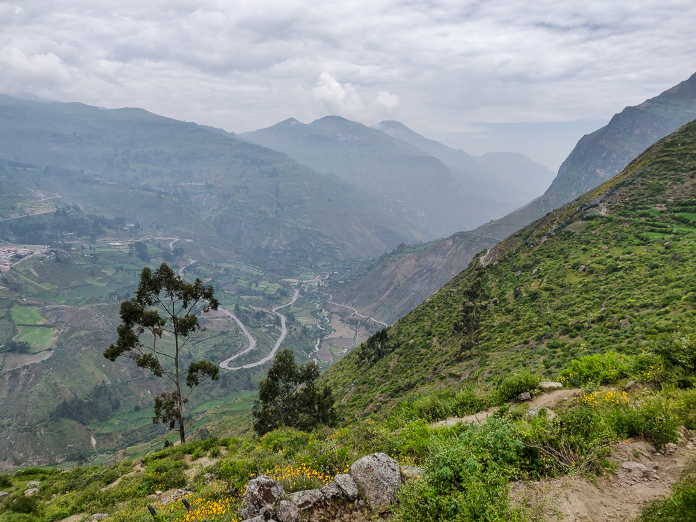
The good news was that we could see the waterfall, Catarata de Shupucro, in the distance. The bad news was that it wasn’t clear how to get there. Even now, the only thing of which I’m certain is that our beginning route was NOT right… because there was no path, and we ended up inside the locked gates of a school. So, thanks for nothing, people who gave us directions up until that point.

Okay, let’s try again with the directions. We asked the school groundskeeper (who looked confused about why we were on the school property… yeah, same) and he unconvincingly pointed us in a direction. A few steps later, a woman vaguely motioned that was as well. Finally, we found a guy who confidently pointed at a path and said it would take us 2 hours to get there. He had the highest trustworthiness ranking. Welp, nothing left to do but cross our fingers and start walking!

Obrajillo. And some fab mountains
Despondent donkey on the path. He was probably trying to find the waterfall as well.
Just starting out, back when we were so young and naive
I mean, it’s kind of like being in an airplane… The earth looks like a patchwork quilt.

Our biggest mistake was asking for more directions after trustworthy-guy. Right as we started up the path, we saw a few people coming down. Julie asked how far it was to the waterfall, and the guy said 20 minutes (LIES) and then gave some directions for how to get there. They seemed trustworthy… I mean, they had just come from there, so you’d think they’d know something. YOU WOULD BE WRONG.

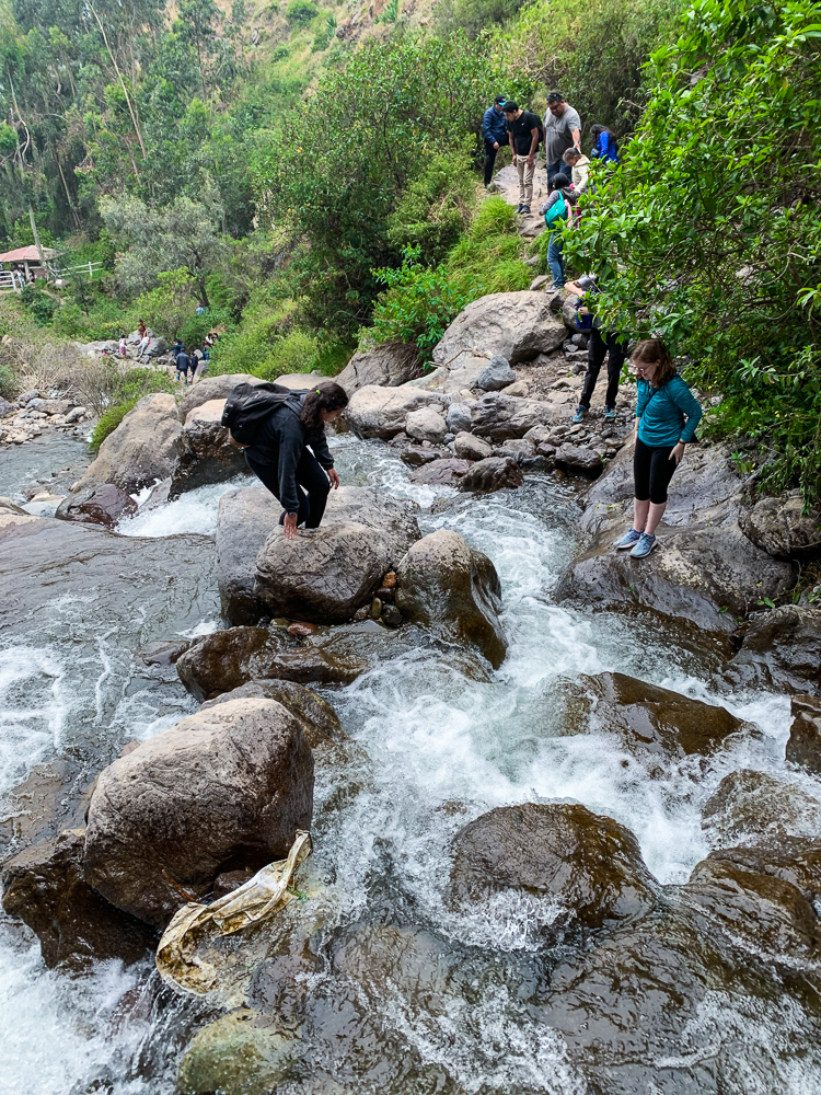
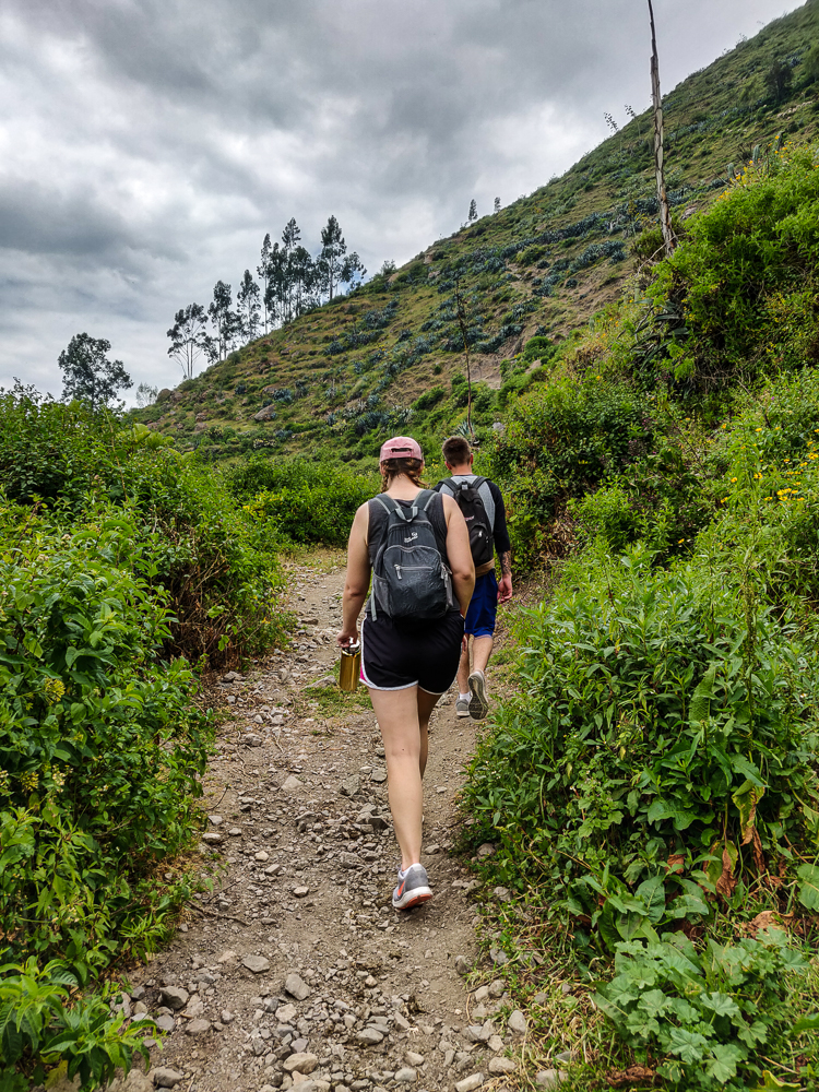
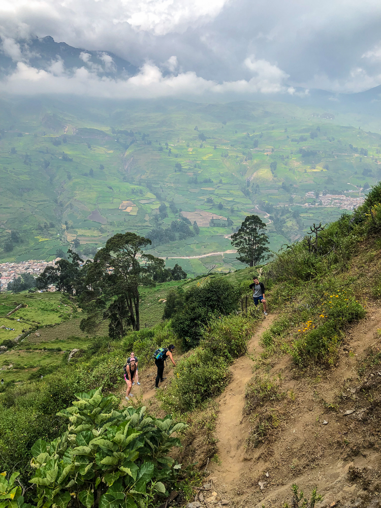
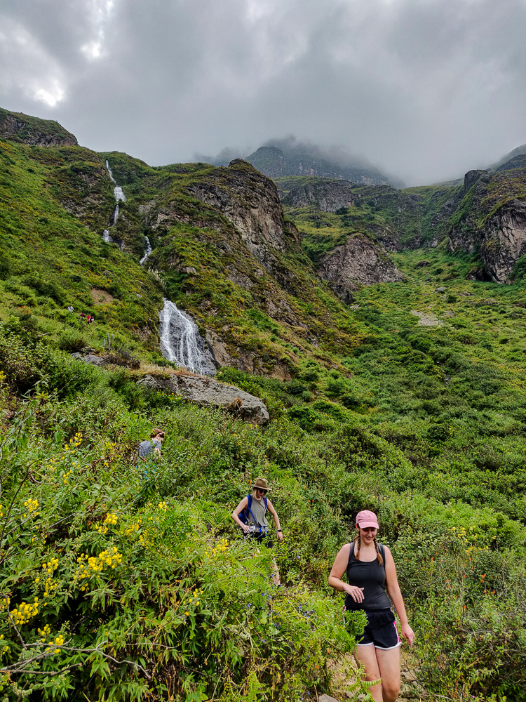
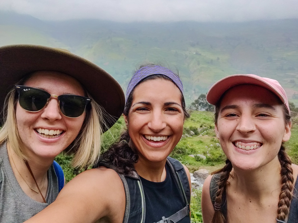
The way up was unpleasant. The path was well-defined but also steep and rocky, and we were all feeling the effects of the altitude. Eventually, Jocelyn tapped out and told us to pick her up on our way back down. I felt bad leaving her, but she clearly wasn’t going to change her mind. We left her just before a fork in the path where we started following the directions of the guy we saw coming down.

Taking a breath before scaling these rocks…
Trail friends

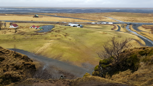
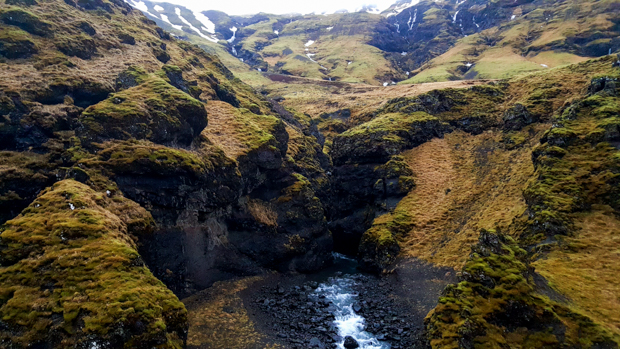
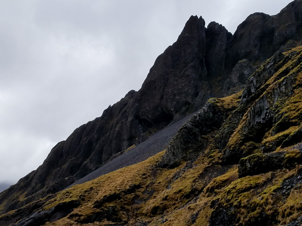
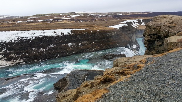
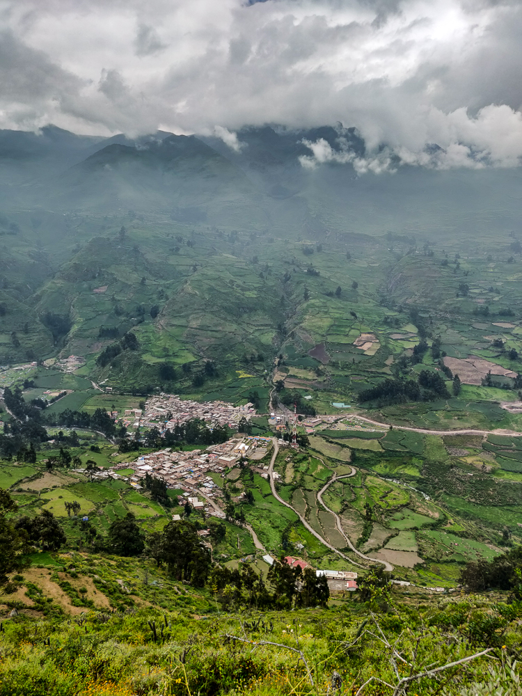
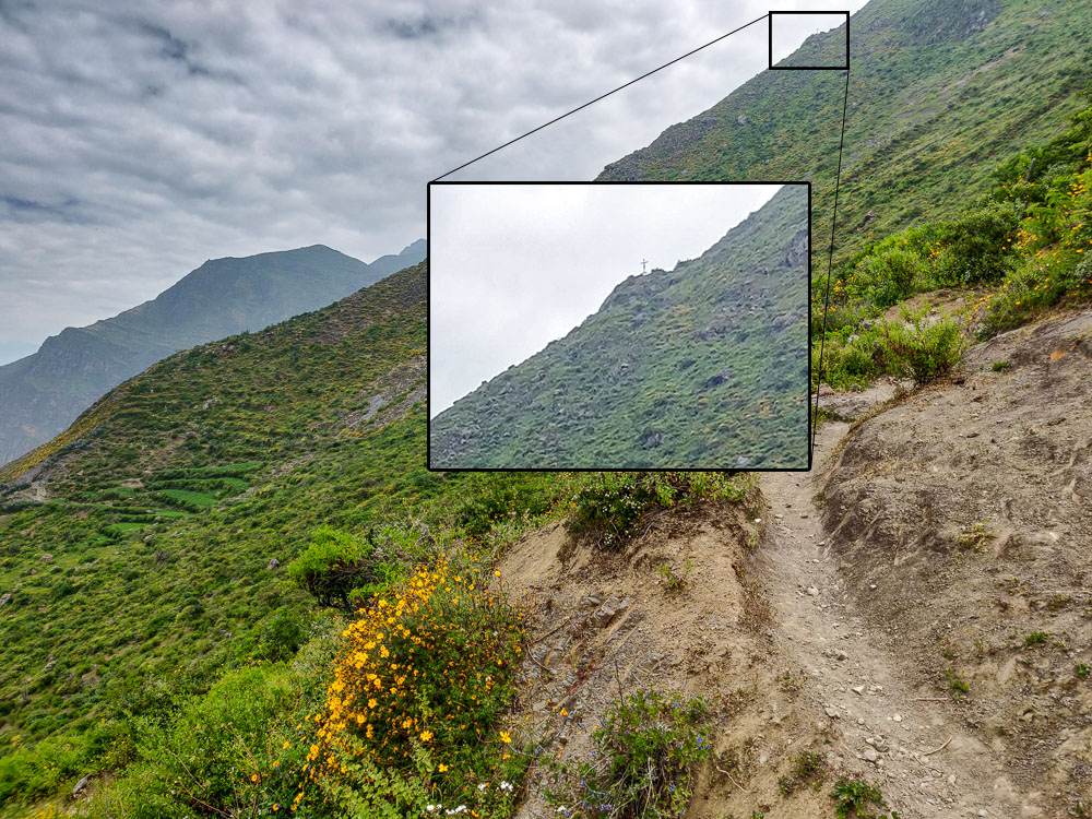
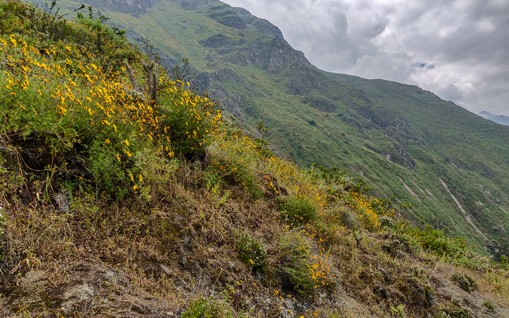
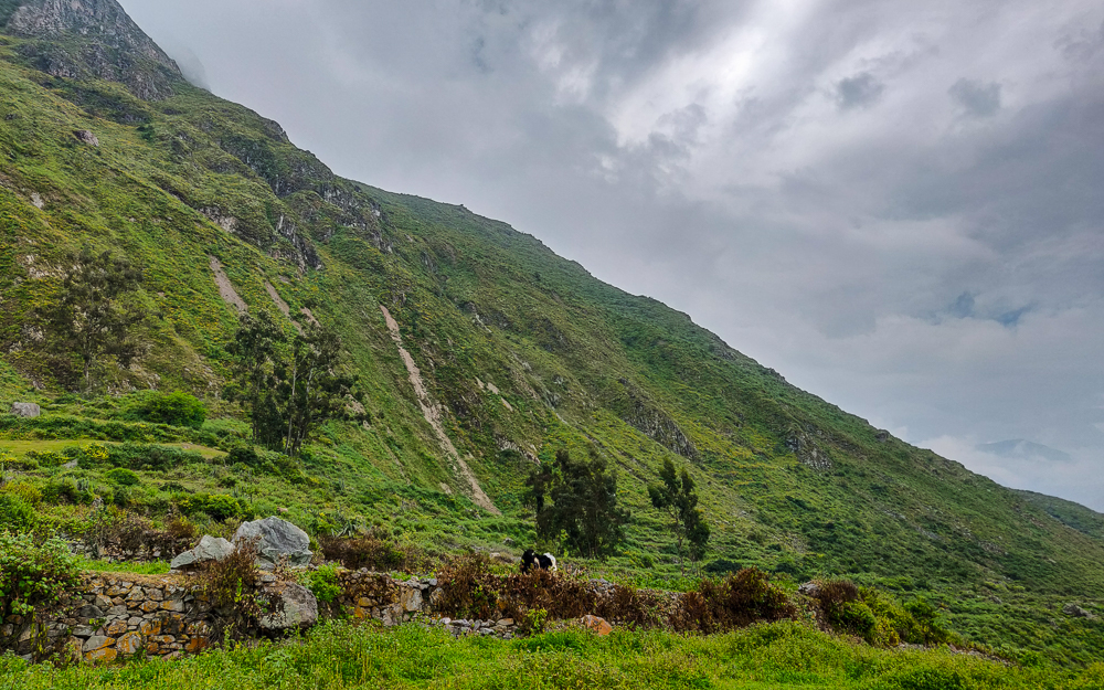
Wrong choice. Very, very wrong. I still don’t know what we should have done, but definitely not that. We ended up on the wrong side of the mountain, and after maybe 30 minutes of walking up the worst ever uphills, we bumped into a couple coming down. Julie asked if we were going to the waterfall, and they said, “No, this is the path to the cross!” And then they pointed at this teeeeeny tiny cross at the top of a mountain in the distance. Can you spot the cross?:

(Scroll for assistance hahaha)
THERE it is. My gosh. Is there anything about this picture that makes you want to walk to that cross??? It looks like torture.
This is me, standing on the path to the cross, looking up at the trail ahead, zig-zagging up this steep mountainside. No, thank you.
Happy because we were taking a break
The only benefit of going the wrong way was getting this view of the valley
Flowery mountainsides

Yeah, no thank you. So, we turned around and tried to find where we went wrong. At this point, we also realized that we were almost all the way back to Jocelyn, so we sent Paul to bring her to meet us. She was nice and rested after her 40-minute break, and we were exhausted after our spirit-crushing uphill climb to nowhere.

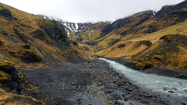
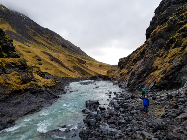
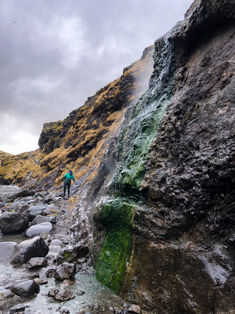
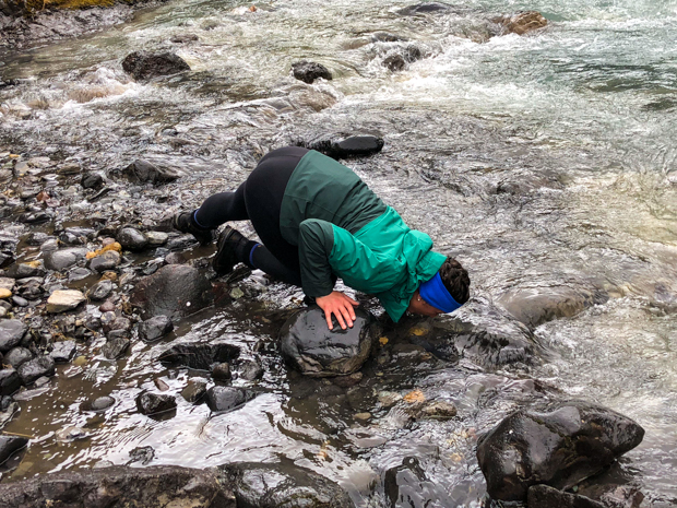
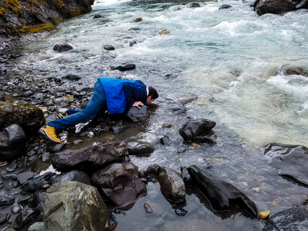
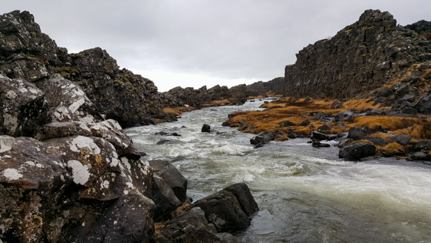
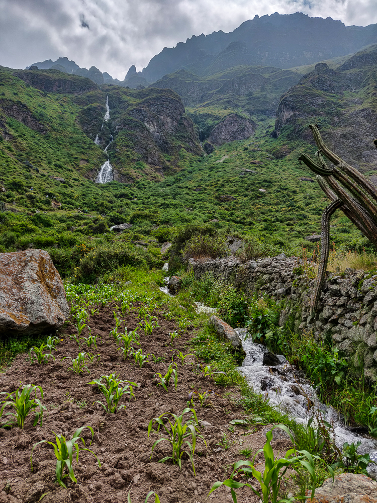
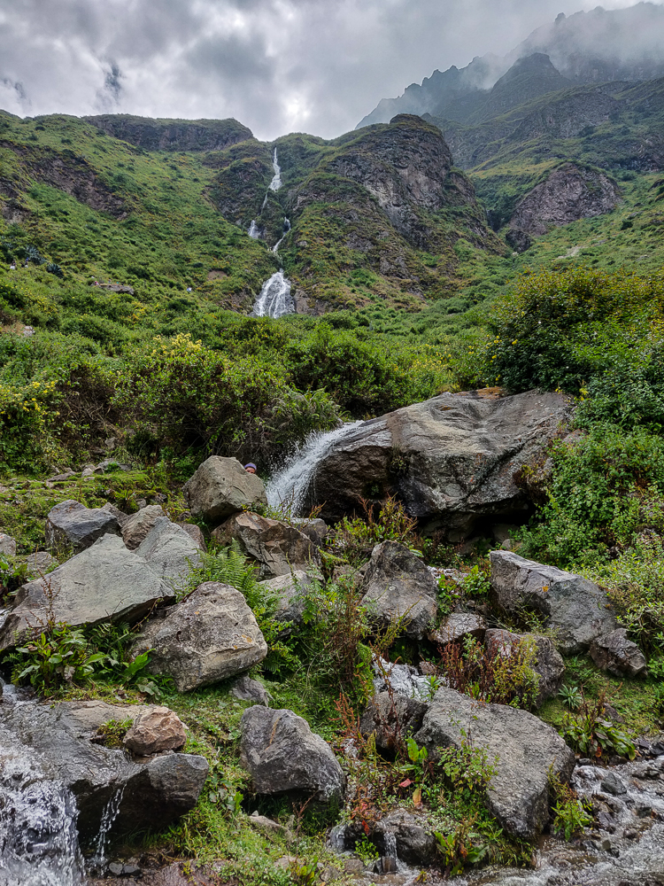
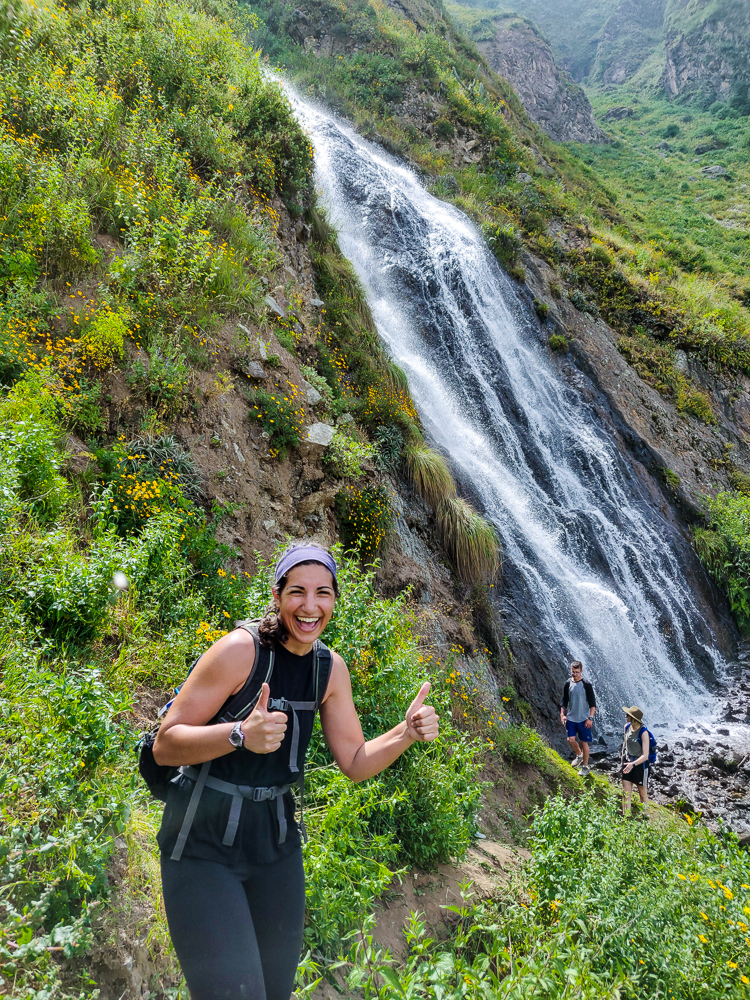
Time to change strategies. We could see the waterfall, so instead of looking for the “right” path, we decided to walk towards it until we got there. I’m Peruvian-giving-directions confident that we took the proper route, and I will now describe it here, just in case you ever find yourself hiking in Canta: when you get to the fork in the path, don’t go left. Also, don’t go right. Instead, walk across the poop-covered field, following no path. Jump down the 5’ wall into the cornfield. Cross the field and climb over the short wall at the other side, taking care to avoid the cacti on top (nature’s barbed wire). Cross the river. Walk along the river until you reach a big rock and little waterfall. Cross the river again. Climb up the 7’ rock wall. Continue to walk towards the waterfall until you see a path. Follow the path to the waterfall.

Walking through the poop-filled field
Keeping our eyes on the waterfall while hopefully not destroying this cornfield
Can you spot the Lara? I’m hiding somewhere in this picture!
Exhaustion break disguised as a photo op
Wildflowers
Climbing up the final stretch

Got that? I couldn’t have made it any clearer. No wonder no one could give us directions!

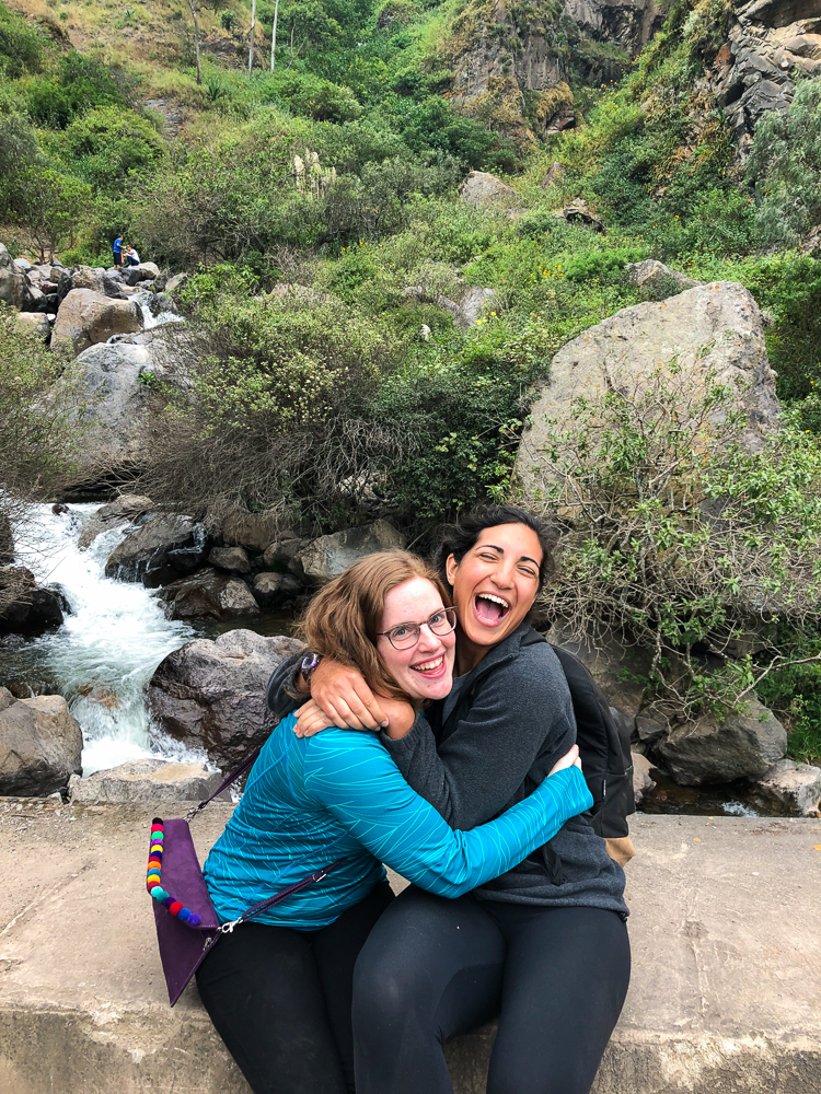
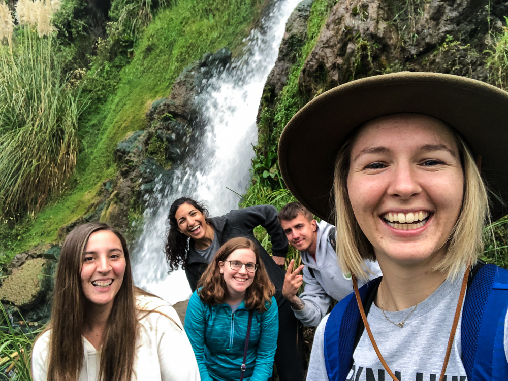
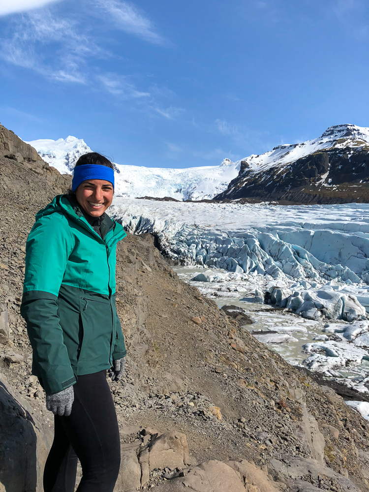
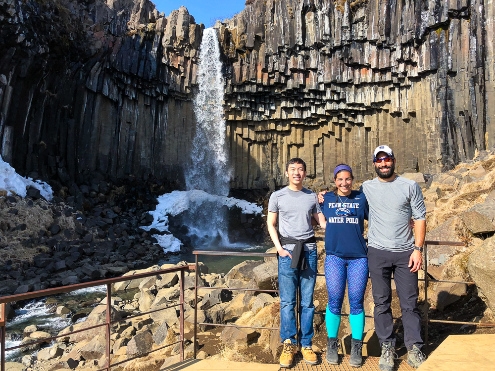
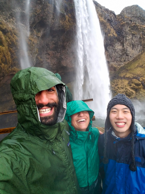
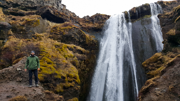
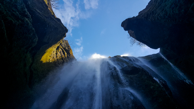
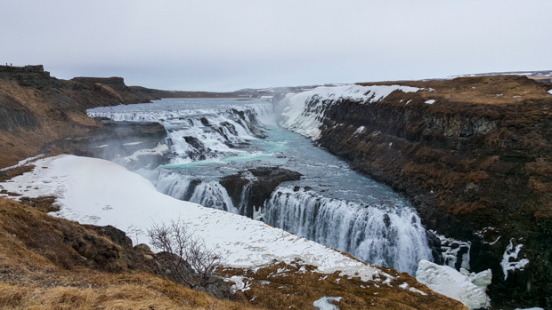
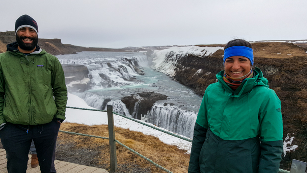
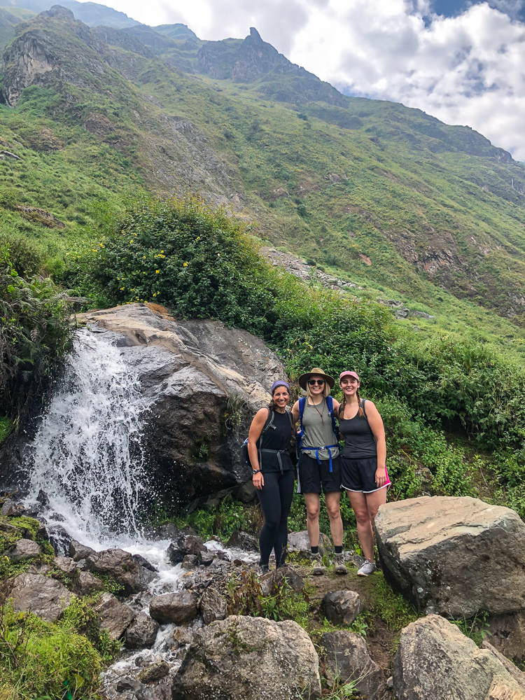
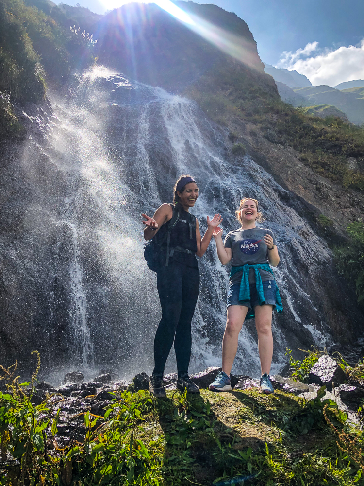
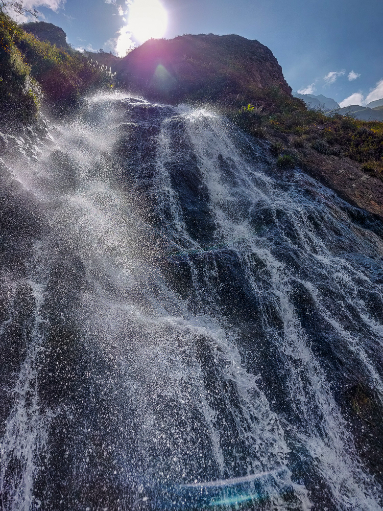
As is generally the case with waterfalls, the view of the actual waterfall wasn’t great from up close. We did, however, get a better view of the valley and took a moment to pat ourselves on the backs because we made it!

Almost there! Almost there!
Sliding my way towards the waterfall
We made it, we made it!!
A little delirious
Waterfall view from the top

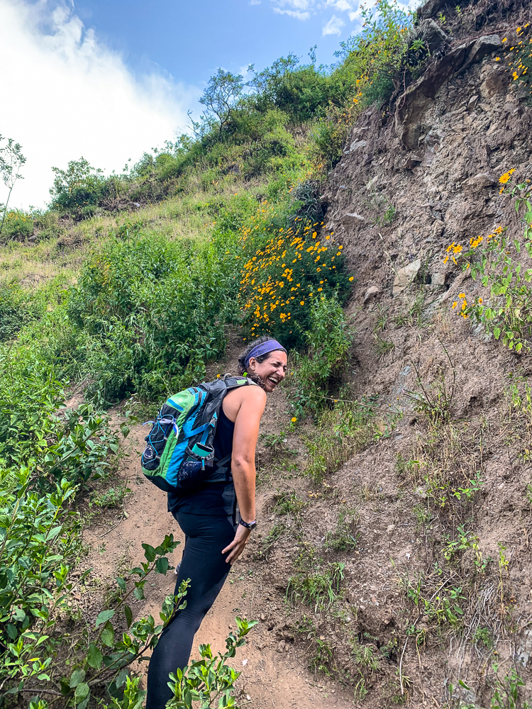
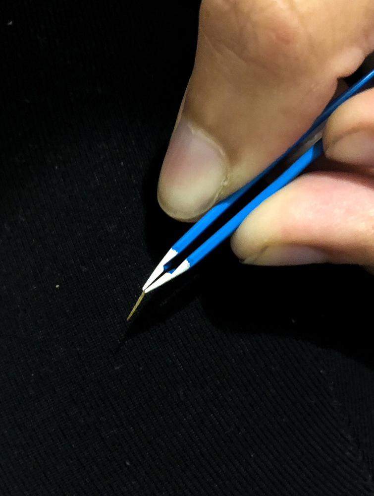
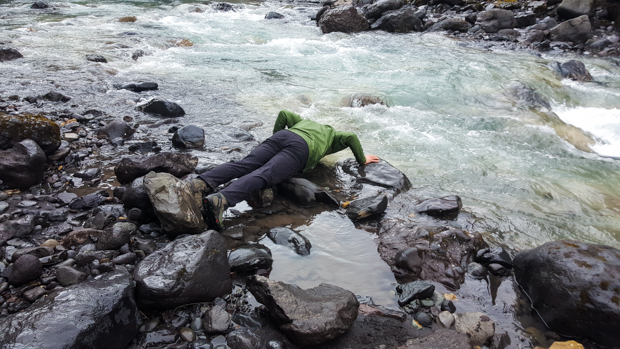
The hike up had been steep and tiring, but the way down was brutal. Lots of slipping and sliding with a few falls. Jocelyn had the worst luck. On one of her falls, she caught herself on a cactus and got a cactus spine stuck in her finger. We tried to pull it out on the trail but couldn’t get a good grip or tell how deep it went. I had tweezers at the hotel, so she decided we should just leave it until we got back.

Finally getting back to flat ground!
Can’t believe we were at that waterfall…

The layers in this picture are crazy… the bright green foreground, the hazy green middle (thank you, smog), and the low clouds above, chopping off the mountain tops.

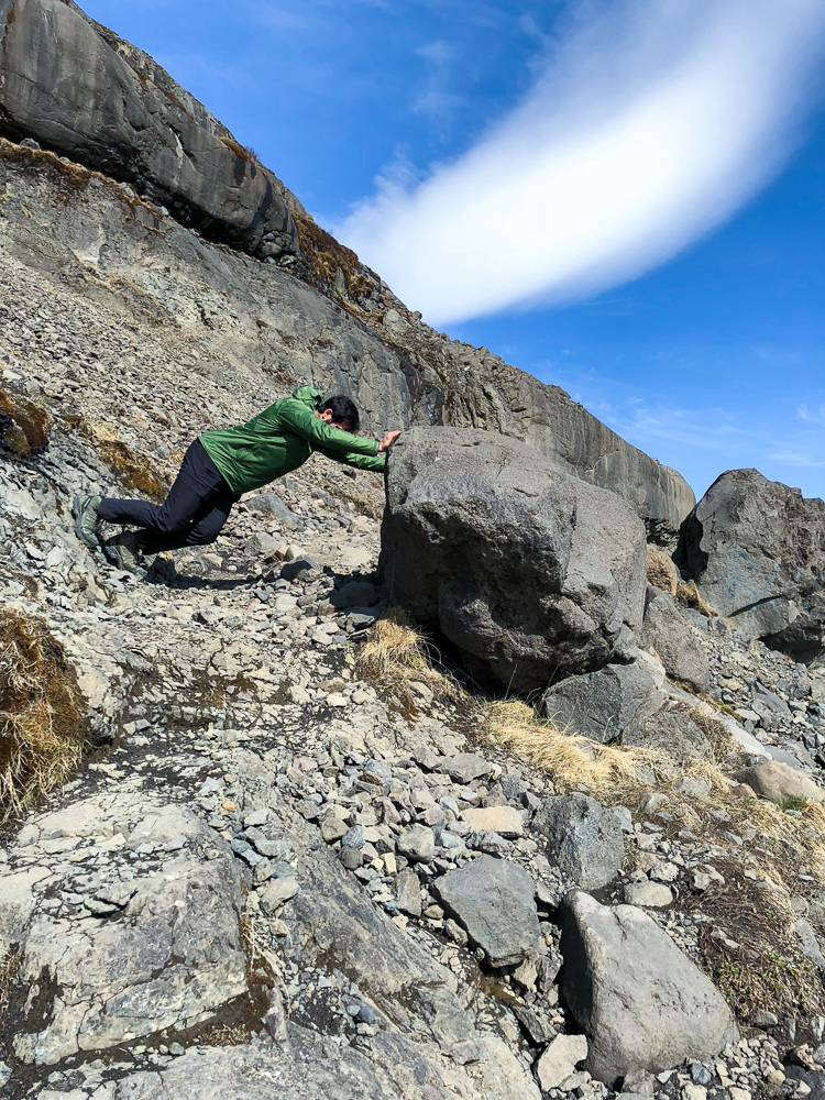
Once we got past the steep part, the rest of the return trip was easy. Well, there was one part where a rock wall collapsed beneath me, but it’s fine because Kylie caught me by the backpack and saved me from disaster. It’s good to have friends with quick reflexes!

Kylie, me, and Julie


Going down
Found this kitten model on the way back to town
Shepherd keeping an eye on his sheep
Spot the sheep!

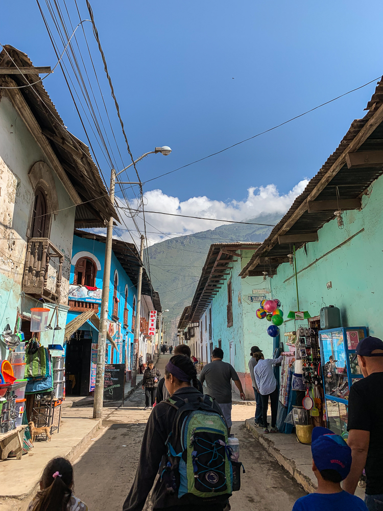
Back in town, we met up with David, Dina, and her daughter and drove back to Canta. Our first order of business was getting the spine out of Jocelyn’s finger. I got my tweezers and tried to ease it out, thinking it might be short. That did nothing, so Jocelyn braced herself and I pulled as hard as I could until it came out. It felt like I was going to pull her finger off! When it finally gave, we all freaked out because it was SO much longer than we thought. I can’t believe she walked around with that thing stuck in her finger for like 4 hours! And I can’t imagine how much the extraction hurt. Geez! Jocelyn wins the pain tolerance award.

We headed to dinner after the drama and devoured our food, only slightly hampered by the nightly power outage. It’s clearly not an uncommon occurrence because the waitress was prepared, bringing in an emergency light. And then the power came back on… and went out, and came on, and went out. Geez, just leave it off.

Back at the hotel, we made a solid effort to stay awake a little longer (it was only like 7:30PM) and eventually gave up and passed out. What a day!

The cactus spine

Now that you’ve seen the final building pictures, you’re probably thinking that we’re finished with Peru and Esperanza de Ana and ready to move on to the next thing, right? Well, yes, we probably should be, but I realized while writing about our Ica weekend that there was another trip I briefly mentioned, said I would write about in more detail later… and then never did. *sigh* We’ll give last-year-Lara a break because she was a little overwhelmed, but now is the time to right that wrong and tell you about our Easter trip to Canta! (Hehehe better late than never, right?)

The week before Easter was a short one, and the break came at just the right time… approximately one second before I lost my mind or collapsed in a puddle of my own tears (to set the scene, I had only been in Peru for about a month and a half and was feeling the pressure of the work + unfamiliar working/living conditions + wrapping my head around having committed to a year in Peru when the first six weeks had already been a rough adjustment period). The major motivations for the weekend getaway were 1. Everyone else felt similarly exhausted and wanted to escape from EA for a few days, 2. We were sick of the brown desert-ness of Chilca and were craving green landscapes, and 3. Julie’s friend Kylie was visiting from the States, and there’s nothing like a guest to motivate action!

And so, a trip was inevitable. But, to where? One of the staff suggested Canta because it’s not too far away, but the mountains are green and there are outdoor activities. That was enough to sell me! Julie also convinced David and Dina, the two Peruvian missionaries at EA, to come with us, and besides adding more fun to the group, David can drive which saved us from the mess of navigating the public buses. Thank goodness. And so, we had quite the travel crew: Jocelyn, Julie, Kylie, Paul (the intern from the beginning of the year), David, Dina, Dina’s daughter, and me. Can you say “party”?

I think mountain roads are amazing. They must have been such a pain in the butt to build! For this one, whenever a hill got in the way, they were like, “NOPE you’re going to have to move” and just cut a chunk out.
Green!! Teeny little hints of life!

Canta is northeast of Lima, so we left at 5:15AM to avoid the horrible Lima traffic. Yuck. The good news is that it worked! The anticipated six-hour drive only took four! I can’t give all the credit to the lack of traffic, though. It’s also because David drives, well, fast. Even on windy mountain roads. Even in the 12-person EA van that’s poised to rust apart at any moment. BUT, we were so distracted by the sight of real mountains flecked with green that it almost didn’t matter that we all thought we might throw up with each turn and that I bounced off my seat and headfirst into the ceiling with each bump. As we got closer, the surroundings got greener, and we got more excited.

View during a stretch break along the drive. Spot the toilet! (Why???)
We found this random moto-taxi on the same stretch break as the random toilet. Julie and I had a dream of recording a stereotypical reggaeton-pop music video. They’re all essentially the same… some dramatic shots by the ocean, people partying in the streets of a village, and a fancy car. But instead of a fancy car, we’d use a moto-taxi because they’re way cooler. Anyway, we’re weird, and this was meant to be our album cover.

We made it to the hotel around 9:30AM, and everyone felt like we had already lived a whole day. I was sure it was 2PM. None of us felt capable of existing without a nap, so we all passed out and moaned and groaned when it was time to get up, only managing to do so because we were starving.

Walking through the streets of Canta
Jocelyn and I shared a twin-sized bed, and Kylie and Julie shared a full-size bed with a mattress covered in plastic (see colorful plastic in the bottom left). This is truly the height of luxury.

We piled in the car and drove down to Obrajillo, a small town in the valley nearby. It’s gorgeous! There are mountains all around, a river running through the center of town, a bunch of waterfalls… and approximately a bazillion Peruvians who were also escaping Lima for the long weekend. We saw no other non-Peruvians, but apparently, Canta is a hot vacation spot for people who live in Lima.

We had a brief delay while driving through the streets of Canta, thanks to this herd of sheep hehehehe. Why is it that animals in the street never get less funny?? Where are they going?
Driving out of Canta towards Obrajillo
This is the church in Obrajillo, and we were entertained every time we drove past. I assume that’s supposed to be God popping out above the doors like a jack-in-the-box? Interesting architectural decision. (This is why I generally like mosque decor better… geometric patterns never look so unsettling.)
Lunch, anyone? Just casually cooking some flattened meat in the street.
The Chillón River, running through the center of Obrajillo
Our clean van. Dina’s daughter practiced her finger-cursive by writing our names in the dirt. Ew.

After we ate and felt semi-human again, the group decided to go horseback riding to a nearby waterfall. I decided that I didn’t want to ride a horse and instead opted to ride ATVs with David and Paul! There were only two ATVs, though, and when we asked if two of us could share, the woman said, “el joven y la chiquita pueden compartir.” The youth and the little girl can share. Little girl? 😂 Hey, I’ll take it.

Paul drove on the way there. The ATV rental man rode along with David and was very concerned that we were going to be reckless and fall off a cliff. “DESPACIO!” (Slowly!) was his constant call, and Paul mostly pretended he couldn’t hear/understand him. I think that the only speed slow enough for the ATV man to be assured of our safety was 0 mph.

The horseback riding crew on the way to the waterfall
Don’t we look like we can be trusted? (Also, LOL at the helmets they gave us. Regulation ATV helmets for sure.)

The waterfall at the end, Cascada de Huamanmayo, was just a little thing, but I’m not hard to please. I thought it was great! There was a trail up to the waterfall from the road, and when we reached a point where the trail was flooded, we scrambled our way across the rocks in the river, doing various gymnastic maneuvers to get a closer look. It was kind of like a team-building challenge. We all worked together to strategize the best route and help each other across. I loved it. Also, the water was FREEZING, so there was plenty of motivation to stay dry.

Travel friends! Except for David because he was taking the picture. This is at the first waterfall… just pretend that you can see up, up, up the hill behind us because that’s where the waterfall is. Also, ignore all of the horse poop on the ground in front of us hahaha.
Me and Jocelyn, finding a way across
The grand Cascada de Huamanmayo

When we’d had our fill, we headed back to our horses/ATVs. I got to drive on the way back! It was my first time driving an ATV, a fact of which Paul was apparently unaware until we were already on our way. Hehe. But I’m sure I did a fabulous job. And the ATV man was far behind us, so there was no one to cramp my style as I whipped around the corners. Kidding! Kind of… All that matters is, I didn’t fall over the edge, and I didn’t have any close calls. Nothing to worry about! Plus, we were wearing helmets (that would have been completely worthless had we fallen off the cliff), and I was totally a natural.

Jocelyn and I really started to cement our friendship on this trip (she clearly loves me).
Born for this.

We hit some heavy traffic on the way back, something that became an ongoing theme during our trip. How is there traffic in the middle of nowhere? Well, when you have a single-lane, two-way road (as in, a single lane for both ways to share, not for each way) being used by cars, buses, horses, ATVs, and motorcycles, how could there NOT be traffic?

Cascada de Lucle

We were all tired after that mess but decided to walk across town to see one more waterfall, Cascada de Lucle, before heading back to Canta. This one is in a campsite, and it was so crowded that it was like a music festival campground but without the music. Definitely not the place to go to if you want to commune with nature for the weekend!

And yet, it was still absolutely beautiful. We walked uphill for a better view of the valley. So green! I didn’t realize how starved I was for green until we were surrounded by it and my heart was jumping for joy. It may sound stupid, but living in a brown wasteland takes a mental toll.

Finally, it started to get dark (I say “finally” because we spent the whole day just trying to survive until it was time to sleep again). We stopped for dinner at another generic restaurant on our way back to the hotel, and the power went out/came back like 12 times while we were there. Oh, the joys of rural living! I awed the group with the classic water bottle lantern trick (shine a phone flashlight up into a water bottle to diffuse the light). We unquestionably had the best-lit table in the restaurant. Mom and Dad will be happy to hear that I’m still putting that lighting design degree to good use!

Waterfall adventures!
A picture of one restaurant in Obrajillo that might as well be every restaurant in Obrajillo. They’re all the same.

From there, it was back to the hotel, and even though it was dark outside, it was only about 7:30PM… so we stayed awake for a few more hours and then completely crashed.

At the beginning of our trip, if you’d asked Tony what one thing he was most excited to see, he would have said, without a moment of hesitation, Diamond Beach. The interesting thing about his obsession was the fact that he didn’t seem to know much about it. Mike and I asked why it’s called Diamond Beach, and his response was “because it’s beautiful. Like a diamond.” Thanks, Tony. So, off we went to Diamond Beach, knowing nothing more about it than its name… which Tony insisted on repeating over and over and over until I was ready to throw him out of the car, and Mike banned him from mentioning it again until we got there (under the threat that if he heard the words “Diamond Beach” one more time, we were turning around and going back to Reykjavik. Tony wisely kept his mouth shut after that).

We had some good driving views…
It doesn’t even look real.

We got on the road after a brief stop at a waterfall near our campsite, Systrafoss, located in the forest of Kirkjubæjarklaustur. It wasn’t much more than a trickle when we were there, and I probably could have skipped telling you about it, but then I wouldn’t have gotten to type Kirkjubæjarklaustur and given you another opportunity to appreciate the names of Iceland.

Next stop, DIAMOND BEACH! The mystery of the name was solved pretty quickly once we got there. It’s a black sand beach, and thanks to the nearby glacier lake, it’s covered with glacier pieces that wash up on the beach after drifting out to sea. There are pieces of all different sizes, and many of them form abstract ice sculptures that sparkle in the sunlight as they melt. We had fun imagining what the different pieces looked like (it’s like cloud animals, glacier edition) and taking ridiculous pictures with them.

Okay, so maybe “trickle” was a bit of a down-sell, but compared to most of the other waterfalls we saw, this IS a trickle!
Diamonds! And you can see the other side of the beach across the outlet from the glacier lake
Tony, thrilled to be at Diamond Beach
Ice sculpture! I think this one looks like a baby ice dragon.
Mike pulling Tony on an ice sleigh
So cool!
Can you find me?
Ice hat. There was a hole all the way through.
I have to give Mike the credit for this picture… He was so committed that he practically lay down on the ground for it. This one looks like maybe a dragon or maybe a pegasus.
Adventures in self-timer
Some of the coolest ice I’ve ever seen (hehe get it?)
Getting his tan on

When Tony was satisfied with his Diamond Beach experience, we walked upstream to the glacier lake, Jökulsárlón. It was very pretty. I’m not sure what else to say about it, but it’s a lake… full of ice. And there’s a part that runs out to the sea, giving the future beach diamonds a way out. When we were finished staring at the lake, we paused to watch some little ice pieces that were trying to make a run for the freedom of the sea but were blocked by larger ones. We were completely sucked in by the action and cheered for one little ice as it struggled to break free. I imagine this is what Icelanders did in their free time pre-television. Maybe it’s also like the Icelandic equivalent of horseraces (but MUCH slower). You can put your money on an ice chunk, and whichever one successfully reaches the ocean first, wins. I’m a genius.

The glacier escape route (looking towards the glacier lake)
Walking up to the lake. This was the location of the big roadblock that the little ice pieces had to make it past in order to reach the ocean.
Craziness.
The classic Mike-drinks-freezing-cold-water picture
Just a few more…
So pretty!
Whoa!
Obsessed.
It looks like a partly melted slushie

Before we got back on the road, we decided to check out the other side of Diamond Beach too (on the other side of the outlet coming from the lake) because, despite Tony having no idea what he was talking about, he was right about it being beautiful.

My expression for basically the entire Diamond Beach adventure
Mike on ice
I love that you can see the waves crashing into the ice
Seriously… can you believe this is real? It’s like a precious gemstone… a MASSIVE precious gemstone
Boots, rocks, and little ice pieces
Crash!
So many diamonds!
Turned our backs on the ocean…

Diamond Beach was as far east as we were going, so when we finished there, we started back in the direction of Reykjavik. There were a few places we wanted to stop at on the way back, but we were also scouring google maps as we drove to see if there were other things nearby that might be worth checking out. One such discovery was Svínafellsjökull, another stick-out part of a much bigger glacier. The glacier that it’s a part of is called Vatnajökull, the largest glacier in Iceland. I quickly decided that visiting Svínafellsjökull was worth the detour x100000. We hiked up a ridge along the side, and it was breathtaking. I would have been happy to hike way farther than we did, but Mike and Tony were keen to keep moving. We walked until we were past all of the other people, at least, before turning around. Even with just that quick stop, it’s probably one of my favorite things we saw.

The road to Svínafellsjökull
Svínafellsjökull! Pretty sure the first words out of my mouth were, “You have GOT to be kidding me.”
Little speck Lara and speck Tony with ginormous Svínafellsjökull
Lara and the majestic glacier
Mike being Mike
Tony!
Sibling pic 🙂
I know, you’ve seen enough… but come on. This is crazy!!!
It’s quite the view
This picture is pretty funny. Can you find Mike? Can you find me?
Just one more! Hehe

Our next planned stop was Vatnajökulsþjóðgarður, or Vatnajökull National Park. Mike and Tony were hoping to do some of the hikes there, but unfortunately, our visit wasn’t timed very well for hiking season. Most of the trails were closed for the season with an opening date of May 1, and we were there in mid-April (now you can see how far behind I am… oops). That was a bummer, but at least we could still hike to Svartifoss, another famous waterfall. This one has hexagonal troll rocks like the ones we saw at Reynisfjara beach, but at Svartifoss, they’re mostly hanging down instead of coming up from the ground.

Our classic Iceland lunch – PB (&J for Mike) with the most hideous backdrop
First peek of Svartifoss
Smiling because the weather was warm enough (for about 5 minutes) to wear short sleeves.
Check out those troll rocks! Maybe they’re hanging here because they’re troll bats that forgot to retreat into their caves before the sun came up.
It was actually (kind of) hot out, so I took off my top layer of pants and was left with these leggings. Mike made fun of me because he said my outfit was ridiculous. I think I look fantastic. Check out that color coordination!

We made one more unplanned stop on our way to the campground for the night. This was another “there are lots of people over there so maybe we should see what they’re looking at” moment. Well, it was clear what they were looking at: a couple of massive, mangled steel girders. What wasn’t immediately clear was why they were there and what was so interesting about them.

Remember how I talked about how there are volcanoes under the glaciers? There are also some sub-glacial lakes that are maintained by the volcanic heat. One such lake, Grímsvötn, is beneath the glacier Vatnajökull. It cycles between slowly filling and eventually releasing the water in a mega-flood. In 1996, there was a volcanic eruption that accelerated the fill cycle, melting 0.75 mi3 (3 km3) of ice in just 13 days. The lake was filled higher than ever before in recorded history, and the resulting mega-flood was incredibly destructive. The flood waters carried glacier pieces along with them, some weighing as much as 1000-2000 tons. TONS!

The mangled steel girders that we were looking at used to be part of a bridge that clearly didn’t fare so well, despite being designed to withstand mega-floods. It had deep foundations and allowed about 6m clearance for glacier pieces to pass underneath, but in this instance, it would have needed more than twice that height to be safe. The result? Well, the beams speak for themselves…

That is NOT a small or weak beam. Imagine the force that was needed to do this! And it was all natural! Crazy, amazing, and a little terrifying

We made our way to that night’s campground, set up the tent, and played card games before falling asleep. Mike and Tony were hoping to do a long, waterfall-filled hike the next day, so we needed all the sleep we could get!

Campsite for the night

Related Posts

Petrified Trolls of Iceland – Do you like the funky “troll” rocks around Svartifoss? Do you have no idea what I’m talking about? Learn more about the formation of these interesting lava rocks.

Perito Moreno Glacier – if you’re a glacier fan, join us for a trek on this South American glacier!

Ada Foah – compare the black sand beaches of Iceland to the picturesque and slightly more tropical beaches of Ghana.


Where’s the best place to start off your day after sleeping on the cold, hard ground? In a HOT TUB! Thanks to Iceland’s abundance of geothermal heat, there are naturally heated swimming pools all over the place. One of the reasons Mike picked our particular campsite for our first camping night was because it’s in a town (Hveragerði) with a naturally heated pool (Laugaskarð Swimming Pool), and you can pay ~US$9 (not super cheap but very reasonable comparatively) to go in and use the pool and hot tubs. The pool was built in 1938, is Olympic length (50m), and most importantly, used to be the practice location of the Icelandic national swim team.

The pool. The hot tubs are out of view, hidden behind the building to the left. See the steam rising from the water? The lap pool was definitely cooler than the hot tubs, but personally I thought it was a little warm to swim in for more than a few laps.

Anyone who’s been to a swimming pool in Iceland will tell you that there are very specific locker room procedures. They totally have it down to a science. First, we had to leave our shoes upstairs to keep from tracking dirt/water into the locker rooms. Second, they don’t use chlorine in the pools, so you have to take, as the guy working there informed us, “a proper naked shower” before you go in. There are VERY aggressive signs in the locker room telling you 1. that you can’t take pictures while in the locker rooms and 2. what areas of the body to focus on while you’re taking your proper naked shower (privates, armpits, feet, and head). Third, you’re supposed to plan ahead somewhat because the only part of the locker room that should get wet is the shower area/space immediately outside the shower. I did NOT do this and had to run into the dry part of the locker room after showering to get my suit. Whoops. If anyone asks, I’m not the one who got water all over the floor.

Then, after you get out of the pool, you’re supposed to go back into the shower where you’ve thought ahead and stored your towel/shampoo/conditioner/soap in the little cubbies nearby so that you can shower and dry off before going into the dry changing area. Yeah, I also didn’t do that. In summary, I messed up the whole system, the entire locker room floor was dripped on by the time I left, and I was just happy that there weren’t other people present during my mess-up moments to judge me for my ignorance. (Mike and Tony weren’t so lucky and said that they were getting looks from their fellow locker roomers as they failed to follow proper procedures.) A woman came in as I was leaving, and I pretended that I wasn’t the reason why the entire floor was wet. The system is actually kind of genius… once you know what you’re supposed to do. Oops.

At the pool, Mike and Tony and I had very different ideas of what we wanted to spend our time doing. Tony and I were very pro-“sit in the hot tub and bake”. Mike wanted to swim laps so that he could pretend to be an Icelandic Olympian. Weirdo. There were a few different hot tubs, each marked with the water temperature. There was also a place where you could plunge into frigid water, and Tony and I watched in horror as some guy submerged his entire body. Please note that the air was NOT warm, and the only reason we were okay walking around in swimsuits was because our bodies were warmed up by the water. I think I would have turned into an ice sculpture if I got into the cold water and then tried to walk to the locker room.

Seljalandsfoss. I took this picture on our way out when the sky decided to clear up for about 5 minutes. It’s 197′ (60m) tall.

We all had a nice bake in the hot tubs, and after we were fully roasted, we took showers and headed out to start our adventure! That was the warmest I would feel for the rest of our trip… kidding. But seriously. Our first stop was Seljalandsfoss which is, that’s right, a waterfall. This one is cool because you can walk behind it. Remember when I said that waterproof clothing is a must? Yeah, this is why. We got completely soaked, but my top half was totally dry underneath my jacket (shout out to Andrea for lending me a waterproof jacket, without which I would have been completely miserable, no exaggeration).

The cave wall behind Seljalandsfoss. So many colors!
Seljalandsfoss with little speck Lara getting soaked behind it
Mike, me, and Tony after our drenching voyage behind the waterfall
It’s not very easy to see much of the waterfall without doing a little work…

A little farther into the park is another waterfall, Gljúfrafoss (or Gljúfrabúi). It’s mostly hidden behind a cliff, and there are two ways to see it. You can hike up to the top of the cliff to see it from above, or you can walk through a slot canyon/river and see it from below. We went to check it out from above first, but the best part was definitely going in to see it through the canyon. At first, I didn’t want to go because I thought that you had to wade through the water to make it there, and I still wasn’t completely confident in the waterproof-ness of my boots (I bought them in Armenia for $18, so despite the salesgirl’s assurances, I’m sure you can understand the reason for my doubts). Mike and Tony went ahead, and they said that there was a path of stones that you could walk on and make it most of the way, if not all, without even really getting your feet wet. Okay. Sure enough, it was no problem (though it did require some minor contortions), and I also started thinking that maybe my boots really were waterproof… talk about a bargain!

Standing in some very slippery mud… eek
View from the cliff
We hiked up to the top of the cliff first
Tony and Mike both crawled up to this crazy spot. I was happy to stick with mildly terrifying cliff #1
Mike with the falls
Another top-of-cliff view
You can’t get much more than a glimpse without doing some fancy footwork through the river
Not a great picture, but here’s me getting soaked by Gljufrafoss
Looking up from the rock. This was during the approximately 5 minutes of blue skies!
Looking out from the waterfall
Crossing the river on the way to Seljavallalaug

From there, we drove to another pool, Seljavallalaug, that’s also naturally heated, smells strongly of sulfur, and is one of the oldest pools in the country, built in 1923. It was built as a place to teach kids how to swim, obviously an important skill in a country surrounded by water and originally occupied by mainly fisherman. Today, swimming is a required subject in public schools.

Road views
Spooky, right?
Mike, making sure he doesn’t slip on the muddy path

We thought we might go in, but the water was all green with algae and it was more lukewarm than hot… so instead, we just looked at it and then hiked around the area a bit. It’s in a valley with another one of those crystal-clear rivers running through, aka it was hideous and I couldn’t stand looking at it. JUST KIDDING I WANTED TO LIVE IN IT. But it was NOT warm.

The valley
The pool… looking a little green
It looks like that pool just dropped out of the sky
Crystal clear waters! And me and Tony

The crew
Spot the Lara, doing her best not to totally eat it on the hike
Tony and I decided to take a page from Mike’s book for once and drink straight from the river. Great in theory, tricky in execution.
Tony taking his freezing sip of water
Mike successfully executing the push-up-style river drink. My upper body strength wasn’t interested in supporting this technique.

Spooky rocks

There were a bunch of people in the pool when we came back past on our way to the car, but I was VERY happy with our decision to skip it. I actually felt clean after the morning swim/shower. I didn’t want to mess that up so soon. We still had a long day ahead!

Your finger is probably ready to fall off from scrolling through so many pictures, so we’ll take a pause here so you can recover. There are just too many pictures to choose from!

To be continued…

One of the big tourist circuits in Iceland is called the “Golden Circle”. It primarily includes three sights to the east of Reykjavik, and it’s doable in a day trip which makes it popular for bus tours and people on long layovers. Now, don’t ask me why it’s called the Golden Circle because I certainly can’t explain that to you. I would assume that the “golden” part has something to do with the fact that these are major sightseeing destinations and one of them is called “Golden Falls”. Okay, I can get behind that. It’s really the “circle” part that I have an issue with. Please refer to the map below and tell me what shape you would use to describe the route.

This. Is. Not. A. Circle.

If you said “circle”, get out. I know it’s been a long time since I took geometry, but that is a LINE(ish). Some versions of the route include some other sights a little further south, but when the essentials are all in a line and the optional extras are what makes it a circle(ish), I think calling it a circle is a stretch. So, the conclusion of that completely necessary rant is that I will be unapologetically referring to our route as the Golden Line.

Mike and I planned to hit the Golden Line sights on our second day. I want to take this opportunity to give a HUGE shout out to my Aunt Judy because she was the MVP of our trip. The amount of planning that we put into this trip was far from ideal… it was close to zero. Anytime I tried to research, I was completely overwhelmed by information and quickly put off further efforts until “later” (a later that never came). Aunt Judy sent us her research notes from their trip to Iceland a few years ago, and those notes became our guidebook. We didn’t follow them completely, but at least we had a starting point to make sure we didn’t miss anything major.

Our day started later than planned. Mike wanted to leave at 8:30, and considering what time we went to bed the night before (we ate dinner at 10PM, so you can extrapolate from there), I had no confidence in that actually happening. Sure enough, we ended up leaving at closer to 9:30. The first stop on the tour was Þingvellir (Thingvellir) National Park.

Thingvellir, as I explained in the Iceland History post, is considered the founding location of Iceland. This is where the first parliament (the Althing) met back in the days of the chieftains, making laws and settling disputes. So historically, it’s a very important place for the Icelandic nation. We, of course, knew none of this when we arrived and had no idea what we were supposed to do there, so we parked the car (and paid for parking, so we were hoping it was worth it), pep-talked ourselves out of the car (it sounded like we were in the middle of a world-ending rainstorm), realized the weather wasn’t nearly as bad as it sounded from in the car, and went to do some exploring.

Our first glimpse of Thingvellir
I’m doing a great job of pretending that I’m not cold or getting rained on, right?

There was a nice view of the valley near our parking lot, and after reading the signs, we realized that another thing on Aunt Judy’s list, Öxarárfoss (waterfall… “foss” is the ending that they put on the name of a waterfall in Icelandic), was inside the park. Also, it’s another place situated between the two tectonic plates. We walked beneath the cliffs at the edge of the North American plate on our way to the waterfall. I guess that kind of means that we were on no-man’s land, floating between two continents. Weird. There are some places in the park where you can scuba dive between the plates. That would be crazy!

The land on the left is the edge of the North American plate
Walking through no-man’s land

Mike and me with Oxararfoss

We eventually made it to Öxarárfoss, our first of many waterfalls. Unlike most of the others we saw, Öxarárfoss is man-made! The Öxará River was re-routed hundreds of years ago to bring water closer to the meeting point of the Althing, and it flows over the edge of the North American plate. It’s basically a waterfall off the end of the earth! I thought it was pretty, and Mike liked it because he likes waterfalls that “have some substance”. None of those little trickle waterfalls for Mike!

On our way out of Thingvellir, we drove by the largest natural lake in Iceland, Þingvallavatn (Thingvallavatn. “vatn” is the usual ending on a name of a lake). It’s about 32mi2 (84km2) in area and is known for its crystal-clear water and monstrous fish. I don’t know much about fishing, but they say that it’s not uncommon to find trout over 20lbs (9kg)! The lake is in the valley between the two tectonic plates, and it sounds like a good place to explore if you want to feel like you’re swimming on another planet and enjoy being cold.

Thingvallavatn in the distance

If you prefer warm/scalding water, then you might be better suited to our next stop, Geysir. I bet you’ll never guess what that is. Yup, it’s a geyser! It might seem like the people who named Geysir aren’t very creative, but it’s actually the other way around. The English word “geyser” comes from its name and the Icelandic verb meaning “to gush”. Geysir is just one geyser in a much larger geothermal area, Haukadalur, but it is the oldest and most powerful, capable of sending 480oF (250oC) water over 230ft (70m) into the air. It is currently inactive, last erupting from 2000-2003 after it was temporarily reactivated by an earthquake. The big crowd-pleaser now is Strokkur, erupting every 8-10 minutes and shooting water about 100ft (30m) into the air.

First glimpses of the geothermal area

Before we checked out Strokkur, we admired the sleeping beast that is Geysir and a few other pools in the area. The water was beautiful. It’s so clear and so blue… and then you get a whiff of it, and the sulfur smell is overwhelmingly gross. But I was cold and in a constant internal conflict of whether I should stand in the steam to feel warm or if I should stay away from it because it reeked.

Konungshver hot spring. It started boiling vigorously – as in, water flying up to 1m high – after the earthquake that reawakened Geysir. There are boulders blocking its vent, so there’s a chance it could be a geyser if those were removed. Check out that water! So blue!
Don’t be fooled by this calm-looking pool. Here we have The Great Geysir (I didn’t just make that name up, that’s a real thing), just biding its time until another earthquake shakes it into action again.

We joined the crowds to watch Strokkur erupt a few times. The eruption is super cool, and while that’s not happening, it’s entertaining to just watch the people… everyone’s standing around staring at this steaming, bubbling pool, and anytime there’s the slightest change in movement, you can hear people bracing for the eruption. Then, when it’s finally time, it looks like a massive water orb is coming out of the pool, water shoots into the air, and you hear it raining down. When you really think about it, it’s baffling. No wonder people used to believe in all sorts of monsters and stuff because if you told me there was a whale-dragon hybrid living in the earth and superheating/spitting out water at that spot, I’d probably say that sounds like a reasonable explanation.

I spent equal time watching the people at Strokkur and watching the geyser. Everyone had their phones at-the-ready for an eruption at any second. I imagine there were a lot of 10-minute videos waiting for the 5-second eruption.
Strokkur!

Mike had fun touching all of the water… well, not all of it because some of it probably would have burned his hand off… but a lot of the water in various places and guessing whether it was going to be hot or cold. It was usually disappointingly cold, but we did touch the water runoff from right after the geyser erupted, and that was definitely hot.

Mike confirming the warmth of Strokkur’s runoff water. By the time it got to this point, it had plenty of time to cool down, so it wasn’t boiling hot anymore (lucky for Mike’s fingertips).
More hot springs in the area

The last big stop of the day was Gullfoss, another waterfall, as you can see by the name. Again, we knew nothing about it until we got there, but it’s “the Niagara Falls of Iceland”. There are signs determined to convince you that it’s even better than Niagara, but I’m going to say that they are both cool and there’s no need to choose a winner. Gullfoss is interesting because it has two tiers of waterfalls. The volume of water flowing is incredible, and it’s the same, beautiful, clear blue as the lakes. So darn pretty!

Gullfoss! When it’s not so icy, you can walk along a path that runs next to the waterfall. I guess that means we need to plan another trip (oh, darn), this time in the summer!

There were actually plans to build Iceland’s first hydroelectric power plant at Gullfoss, but the owner’s daughter, Sigríður, loved the waterfall and was determined to preserve it. She frequently walked to Reykjavic to gather support (75 miles or 120km) for her cause, and when it seemed that all hope was lost, she threatened to throw herself into the falls. Thanks to her efforts, Gullfoss was saved and eventually declared a national park, protected against any future development.

The second layer of the waterfall crashes down into this ravine.
I can’t get enough of that blue water!
So pretty so pretty so pretty!

One more Gullfoss story – there’s a sign that tells a 17th-century love story about a boy and girl who kept watch over sheep on opposite sides of the river above the falls. They also “kept a keen eye on each other”, and the girl asked the boy to cross over to her. Despite the strong currents, the boy made it across. The sign concludes the story by saying that “little is known about how the girl responded, except that they married and had many well-respected descendants”. Well, I don’t know about you, but I’m just happy that none of their descendants turned out to be disreputable. Phew.

Unlike the love story characters, we were more than happy to have a waterfall separating us 😆 hehe
The water that lover boy supposedly waded across.

The only stop left was our campsite for the night. It was still kind of early, but that was good because Mike got a new tent before the trip, and it was our first time setting it up outside (we did a test run in Tony and Alex’s apartment the night before). We spent our first hour at the campsite sitting in the car because we were cold and it was raining and we didn’t want to get out. Productive. Finally, we convinced ourselves that it would be best to get the tent up before dark. Of course, it was crazy windy and raining, and our attempts to be strategic and use the rain fly to keep the tent from getting wet while we were putting it up completely failed. Live and learn! We successfully assembled it (a task that included driving about 18 stakes into the ground) and then fled to the safety of the car again until Tony showed up. He was joining us for the next phase of the adventure, and we wanted to be able to leave straight from the campsite in the morning.

Mike and I grudgingly got out of the car again, and we piled into the tent and played card games until we were ready to fall asleep. Oh yeah, and it was dry inside, so despite our struggles, tent set-up attempt #1 was a success!

We did make ONE other stop – to see some Icelandic horses! I gave this one a little pat on the head. The Icelandic breed was developed to withstand the harsh Icelandic winters, and there are very few horse diseases on the island. That means the horses have basically no immunity to disease, so foreign horses aren’t allowed on Icelandic soil, and if an Icelandic horse leaves, it’s not allowed to come back. Even horse equipment is required to be new or thoroughly disinfected!
Our beautiful and spacious home.