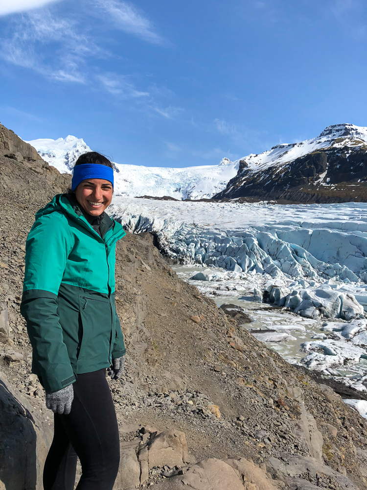
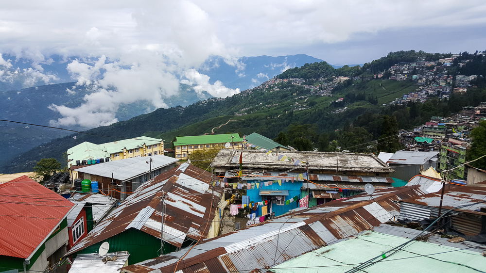
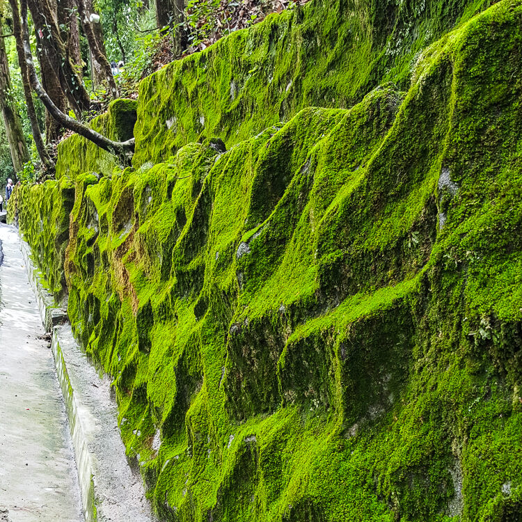
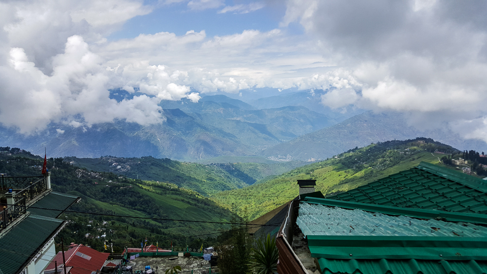
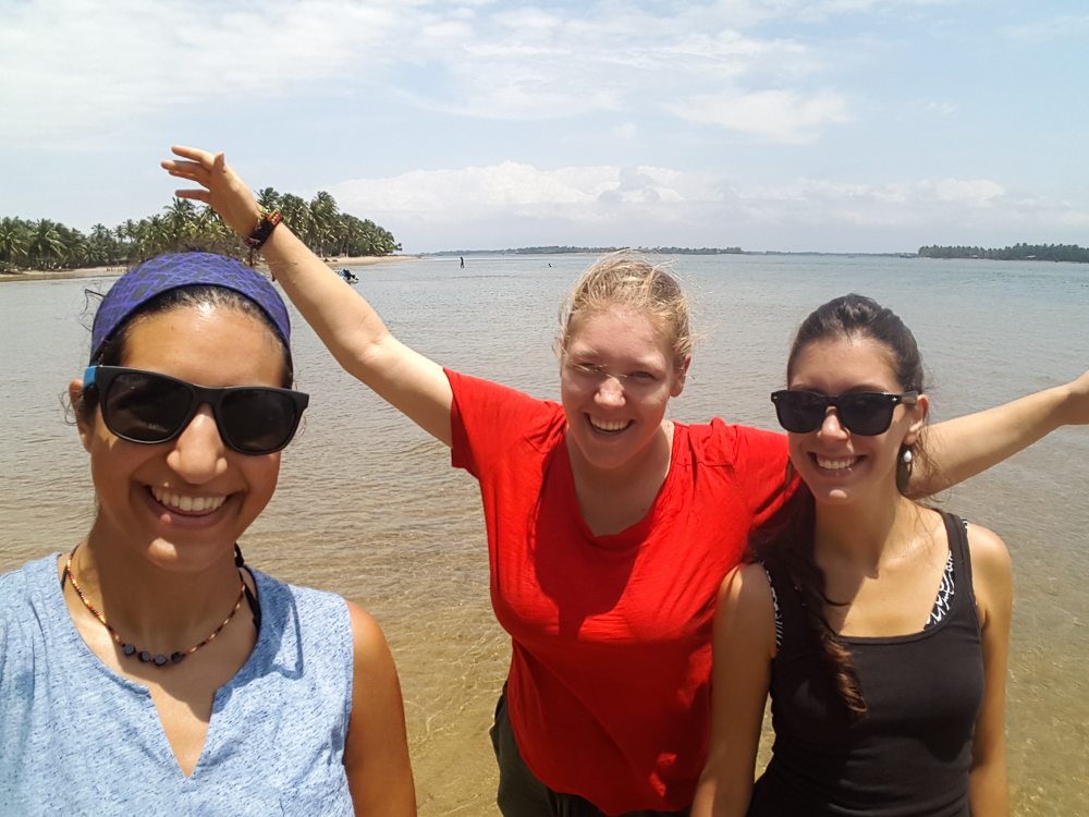
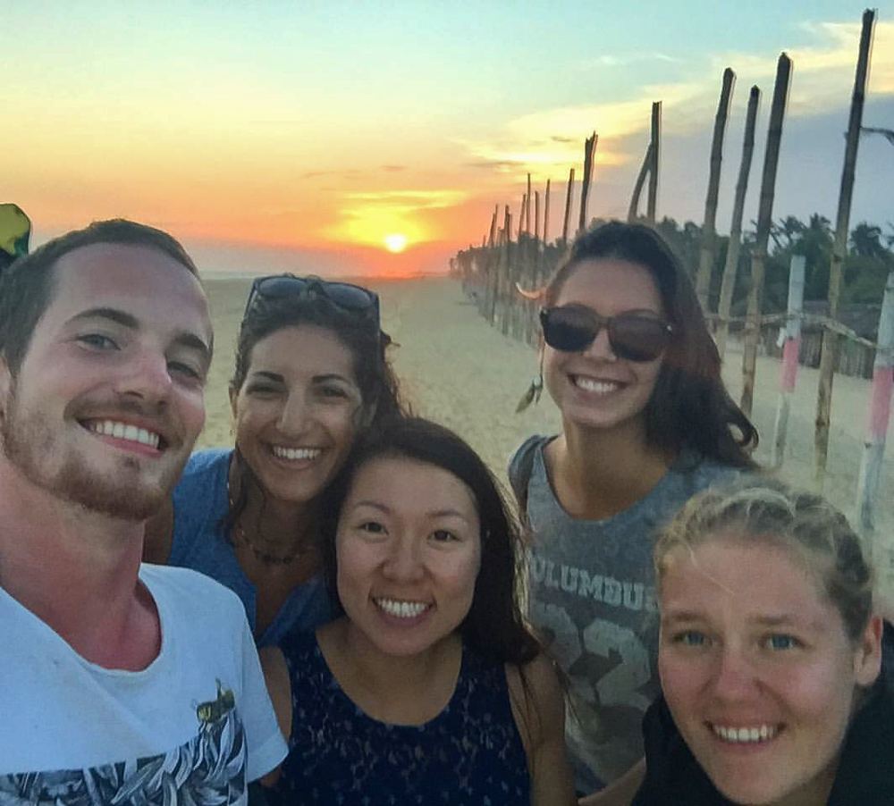
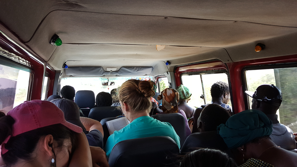
If you’re looking for a relaxing vacation where you can sleep in and lounge around, the rainforest probably isn’t a good destination for you. Well, there’s plenty of lounge time, and you couldn’t pick a prettier place… but don’t expect to do much sleeping in. We set our alarms for 3:30AM because we had a 4:15AM meeting time with our guide, Juvenal.

So, what exactly was exciting enough to rouse us at such an absurd hour? Macaws. We’ll get to that in a bit, but at the end of this post, you can be the judge and let me know if you think it was worth waking up well before dawn was even considering cracking.

When our alarm went off, it sounded like it was raining outside, and Juvenal had mentioned that it’s only worth going if the weather isn’t bad. We got dressed anyway and headed to the lodge to figure out the plan.

Juvenal said that he thought the rain might stop, and it was up to us if we wanted to chance it and go or if we wanted to try the next morning instead. I was 100% on team “let’s go” because no way was I trying to have ANOTHER 3:30AM wake up call the next day! The only thing worse than an early-morning wake-up is an unnecessary early-morning wake-up! And what if it was raining even harder then? We delayed for a few minutes in the hopes that it would let up a bit and then grabbed our boots and umbrellas and hit the road. Well, hit the trail. And then the boat.

My first attempt at taking a picture of a flying bird… hehe not great.
Much easier when the birds are moving slowly!
One more…

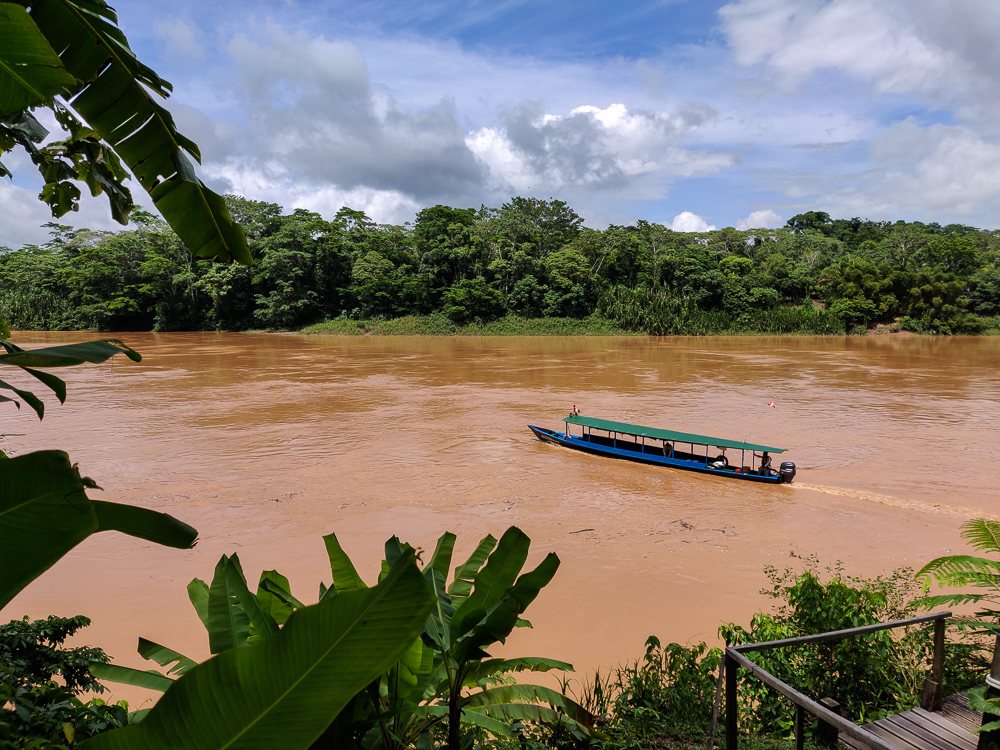
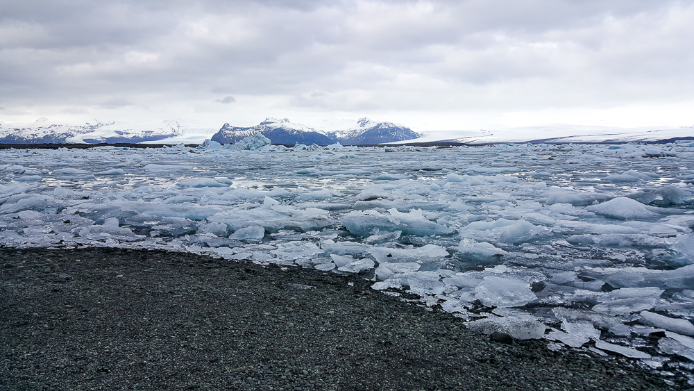
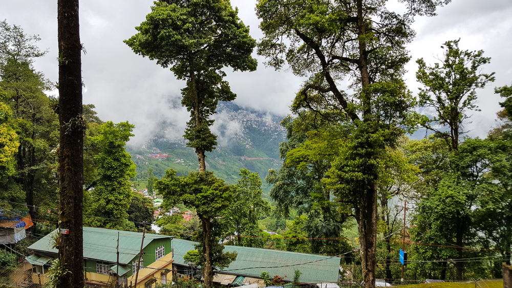
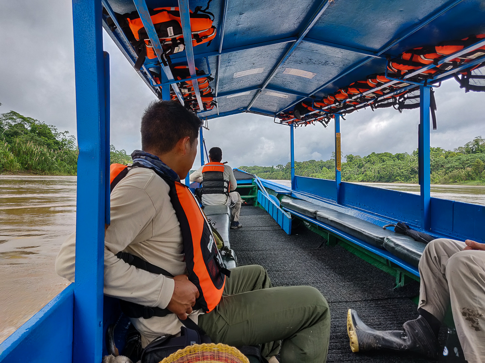
We had a two-hour boat ride, and by the time we reached our destination, the rain had stopped completely, and the weather was absolutely perfect!! So, what exactly WAS our destination?

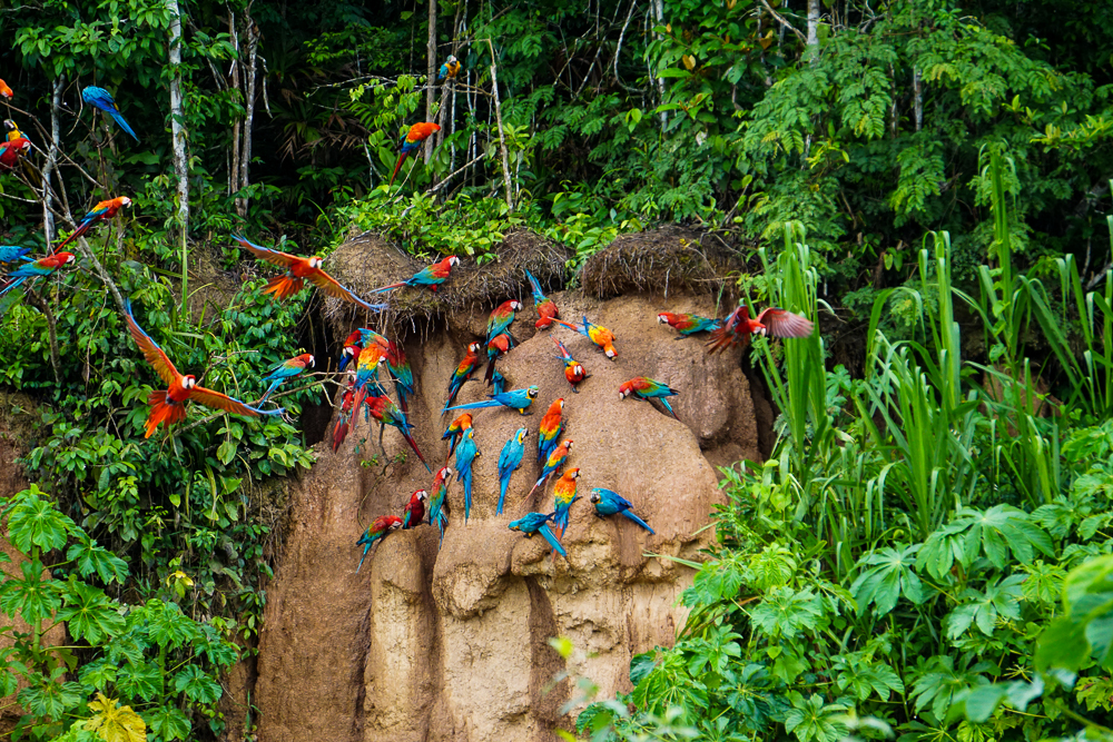
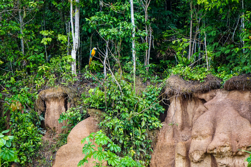
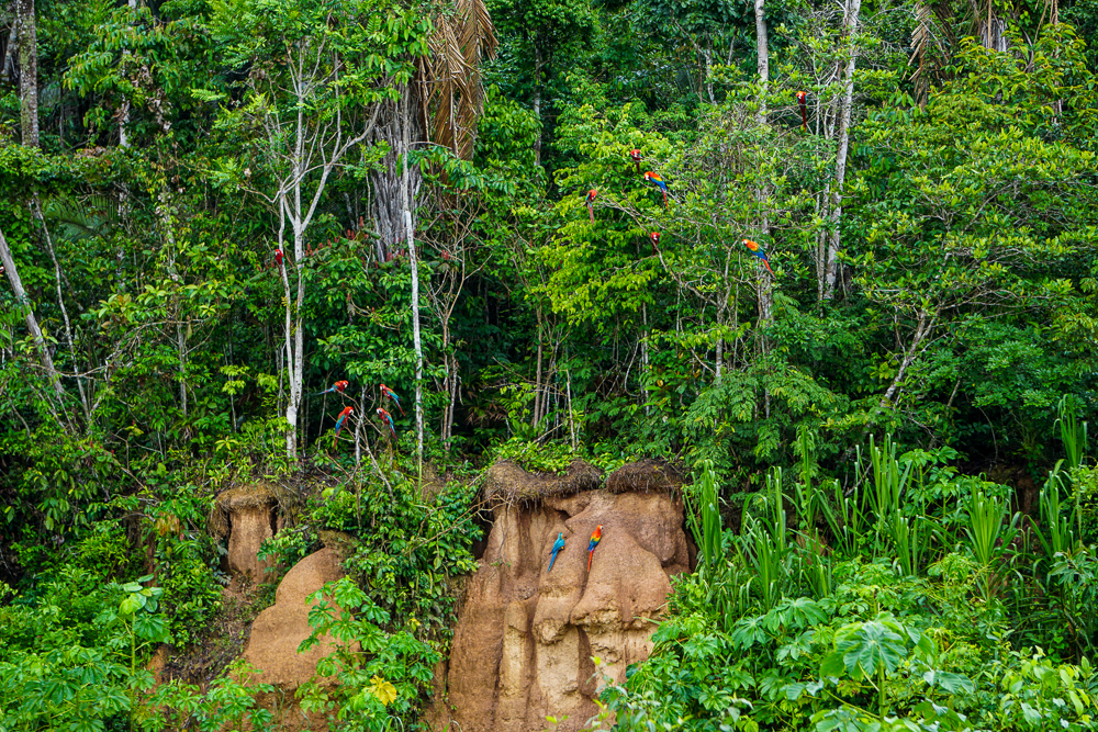
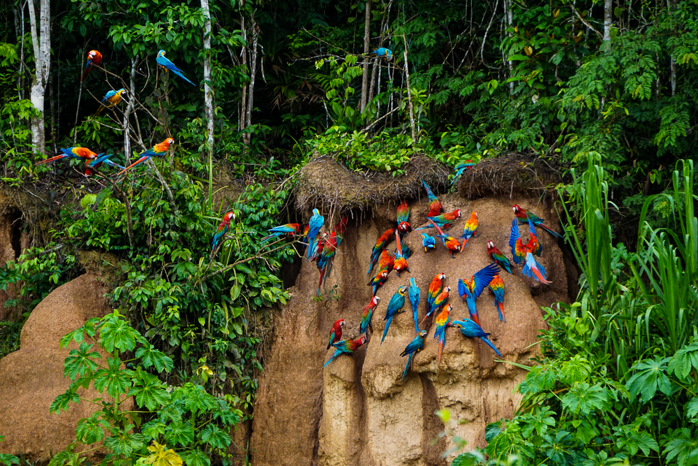
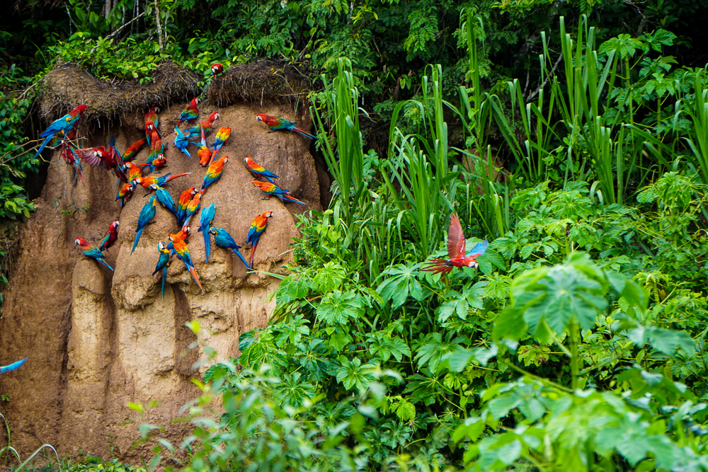
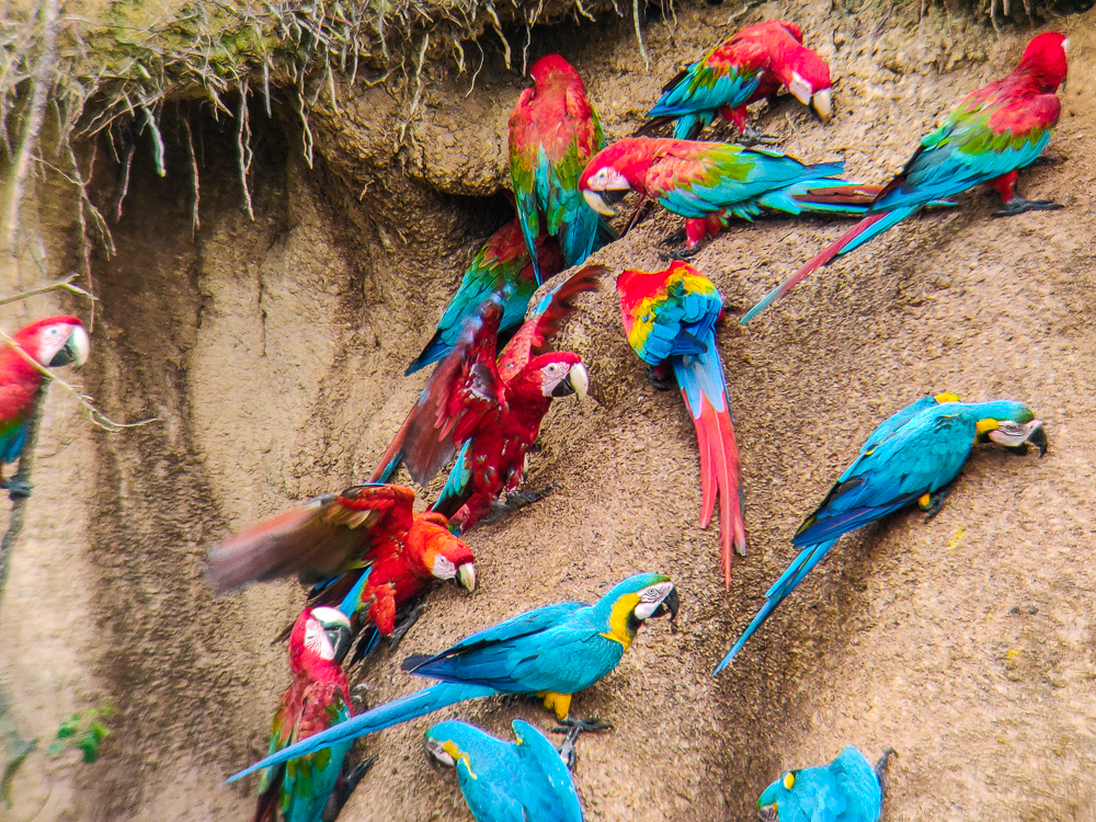
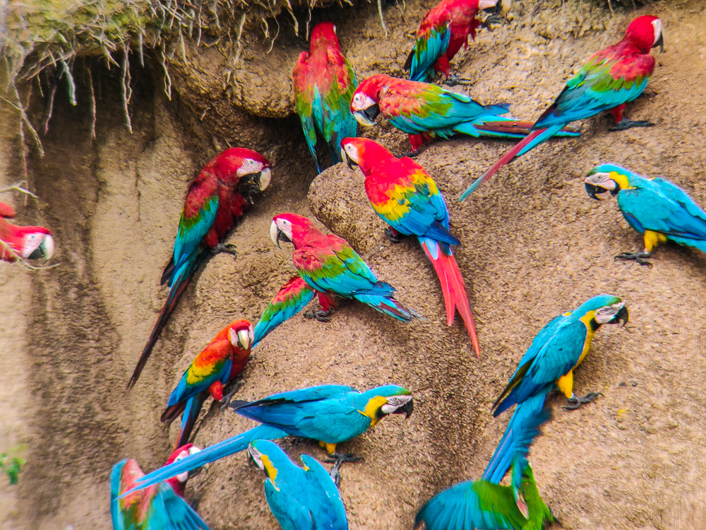
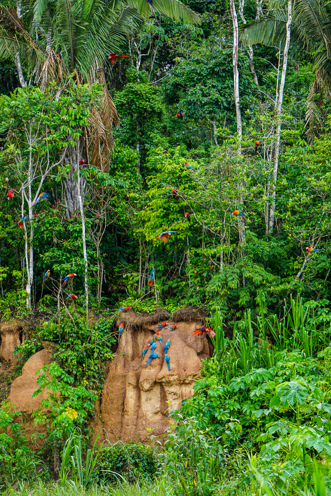
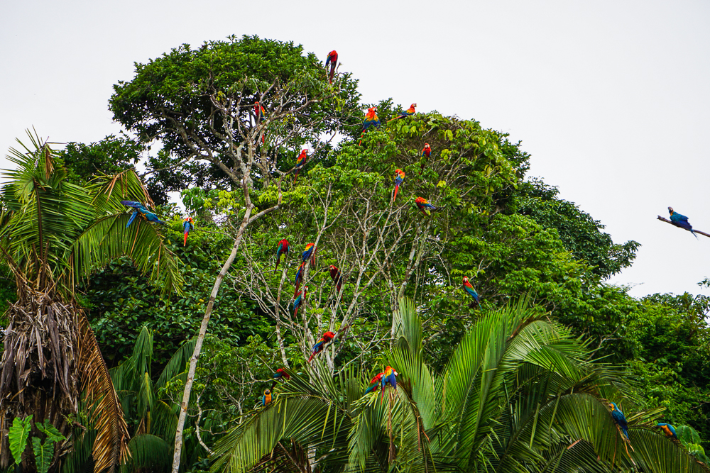
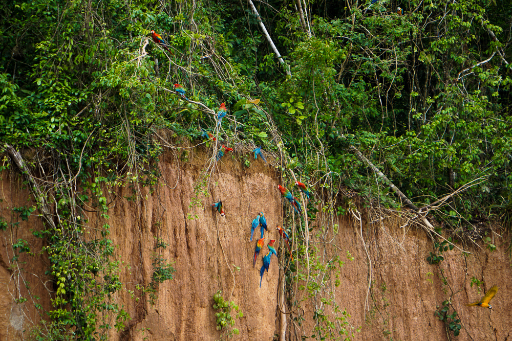
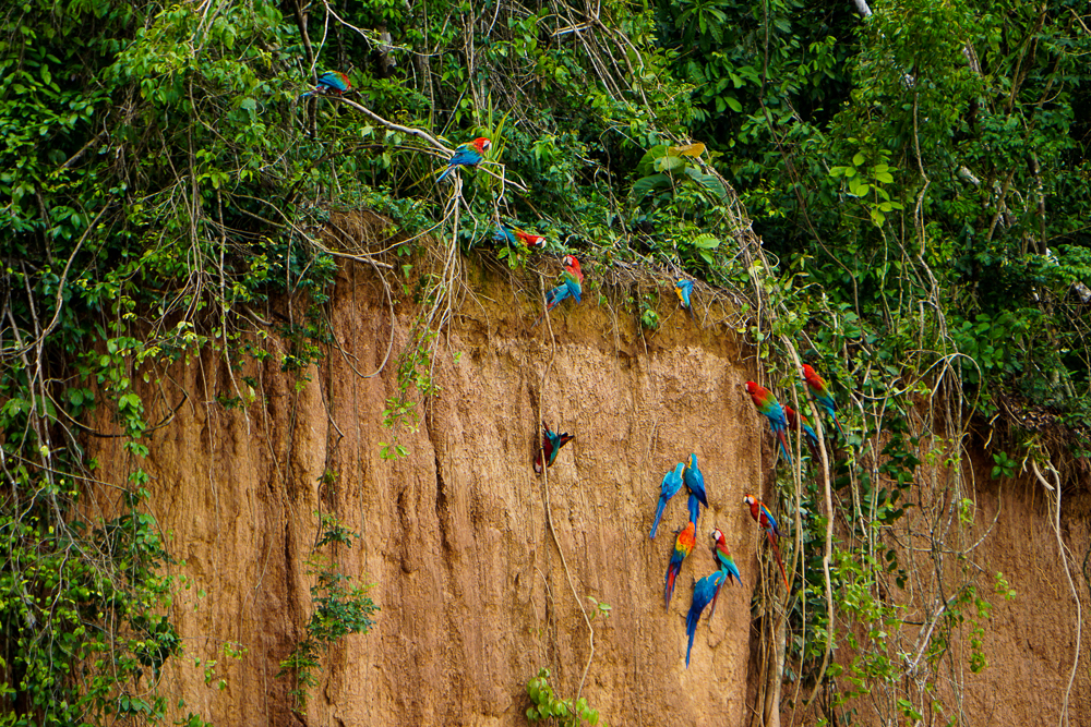
Every morning, as long as the weather is nice, you can find huge numbers of macaws gathering at clay licks to, as Juvenal put it, “get their daily vitamins”. The macaws visit these areas to literally eat the exposed clay. Experts aren’t entirely sure of the reason for this behavior, but a leading theory is that the clay contains salt that is otherwise hard to find in the Amazon. Salt is important for many bodily functions and helps to keep the nervous system and heart functioning properly. Animals, like macaws, with a primarily plant-based diet can have trouble getting sufficient salt from their food. Consuming the salty clay helps to cover this deficiency. Another theory is that the clay helps to cleanse the naturally occurring toxins that are found in plants and prevents them from being absorbed by the gastrointestinal tract. The sodium theory is more widely accepted because studies of macaw behavior have found that they prefer saltier clay. There was one clay lick in particular in Peru where macaws were seen eating from a specific clay layer, and analysis showed a much higher concentration of sodium there than the layers above and below. This isn’t a behavior of only macaws in the Amazon. Other plant-eating birds, like parrots and parakeets, do the same, and even mammals like jungle pigs and deer make regular visits to the clay licks, though not quite as often as the macaws.

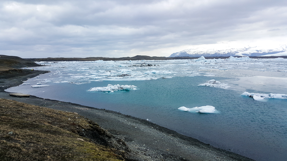
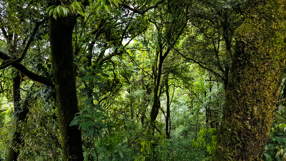
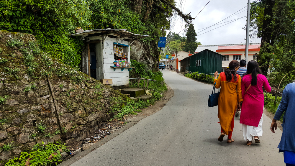
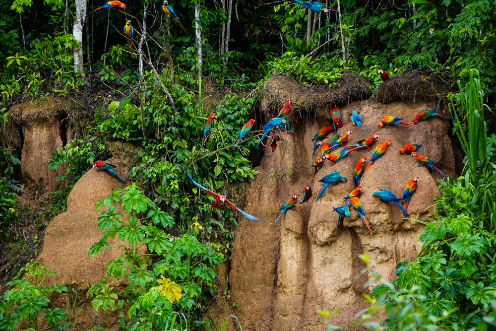
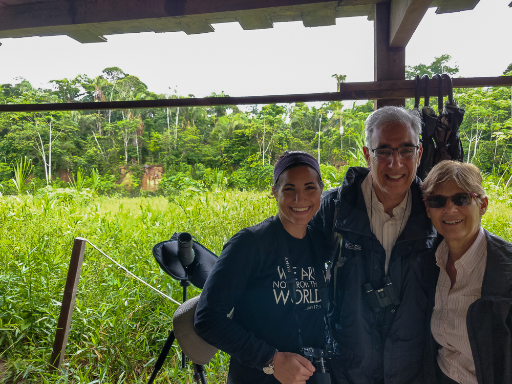
The boat docked, and from there, we had an easy 10-minute walk to the viewing area. There was one other tour group already there, but everyone had plenty of space and a good view. Juvenal said that it can get very crowded in the high season, so I felt pretty good about our timing, even though the more unpredictable weather of the rainy season was less than ideal.

Spot the Macaws!
Just hanging out.

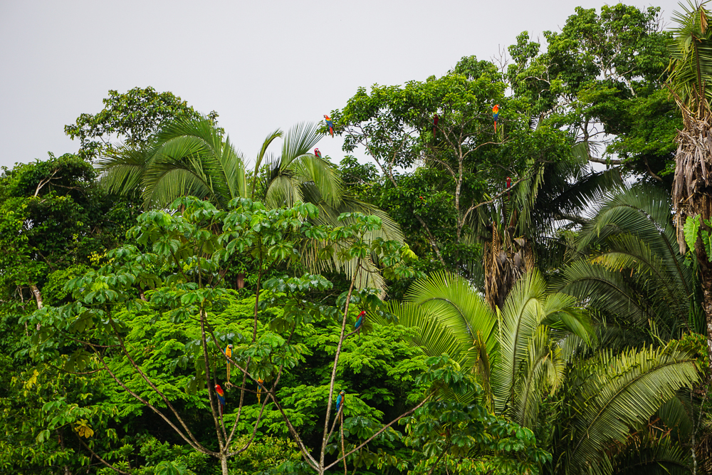
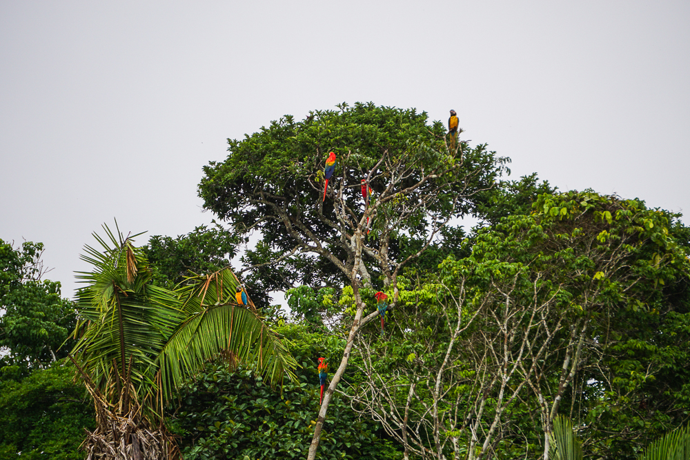
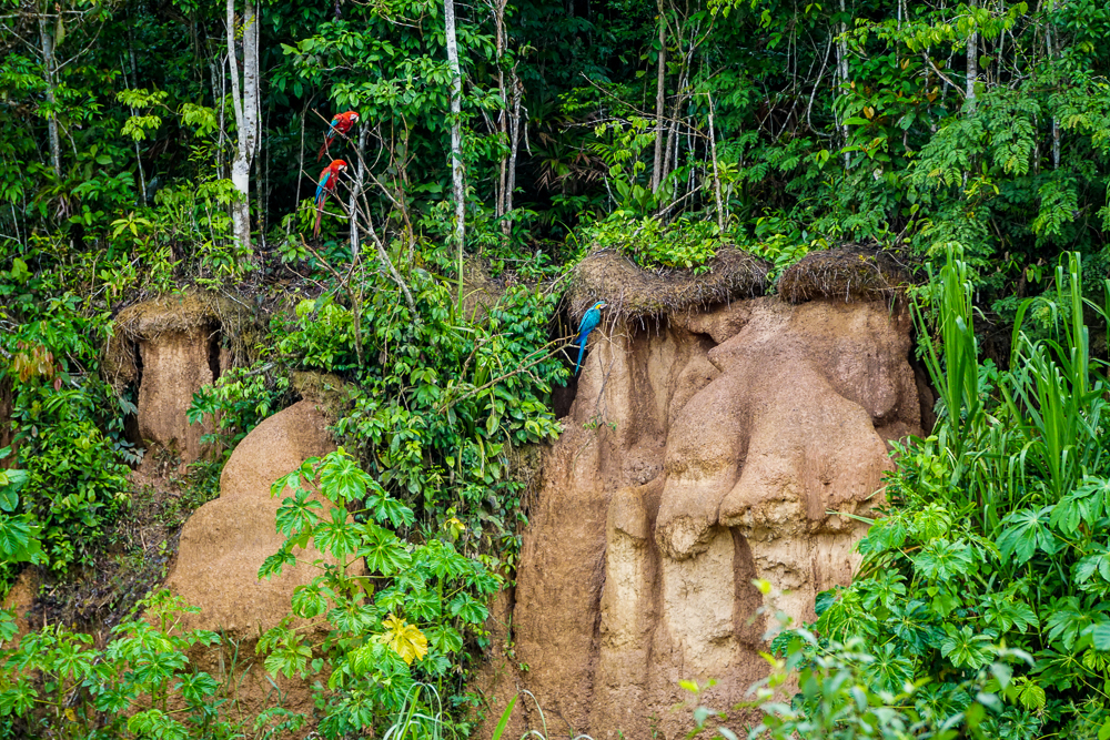
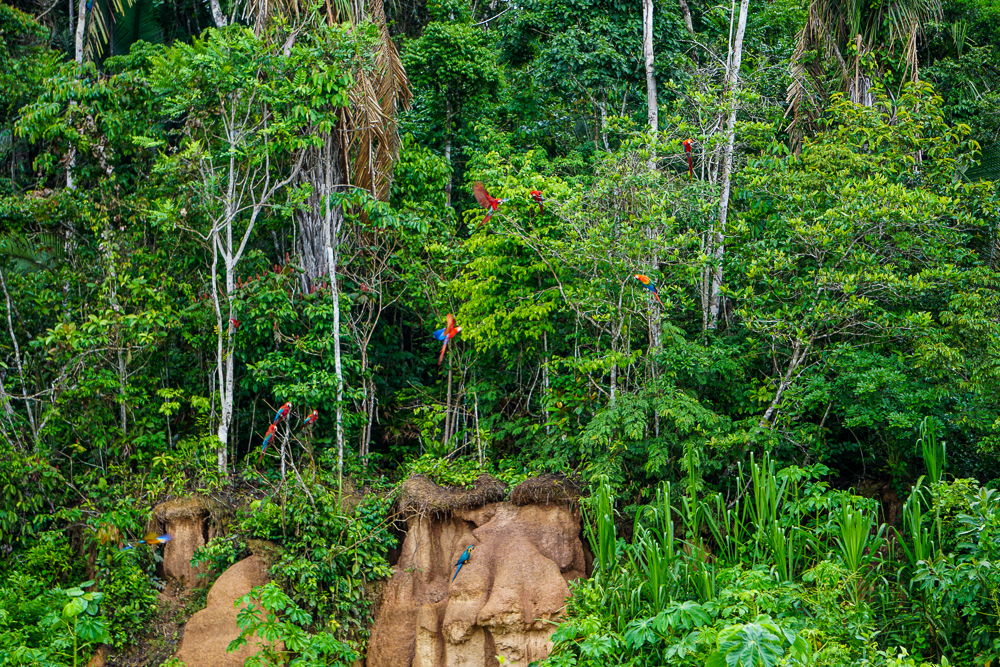
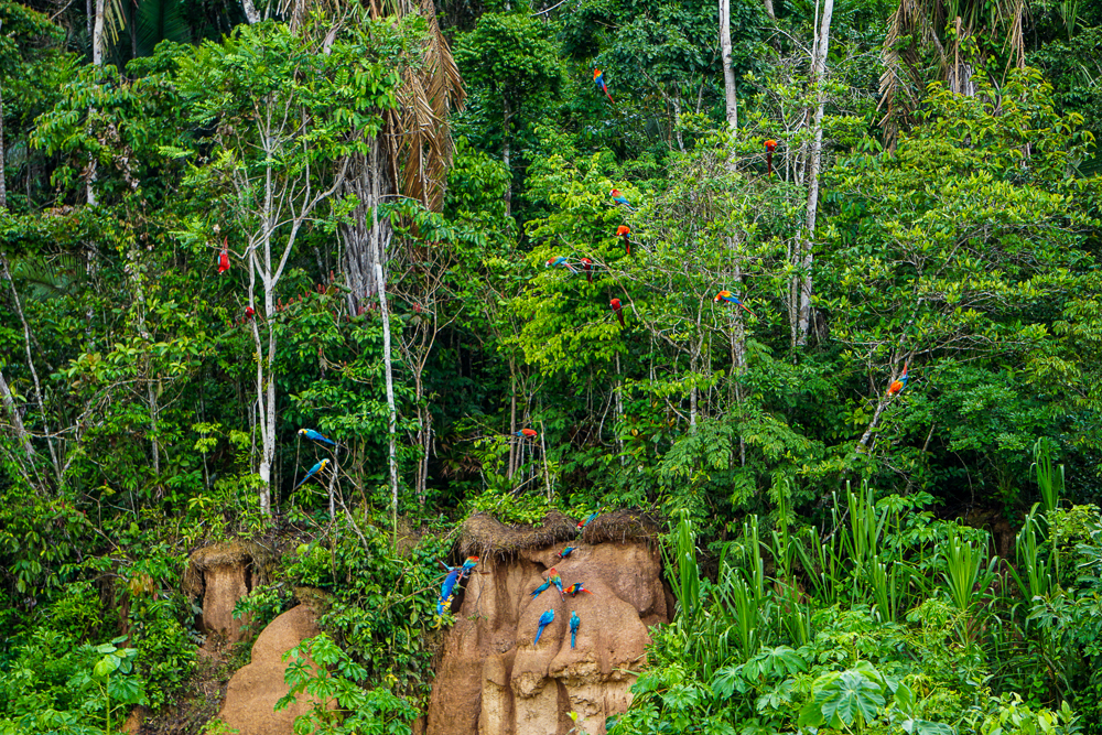
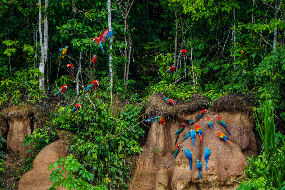
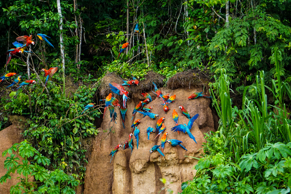
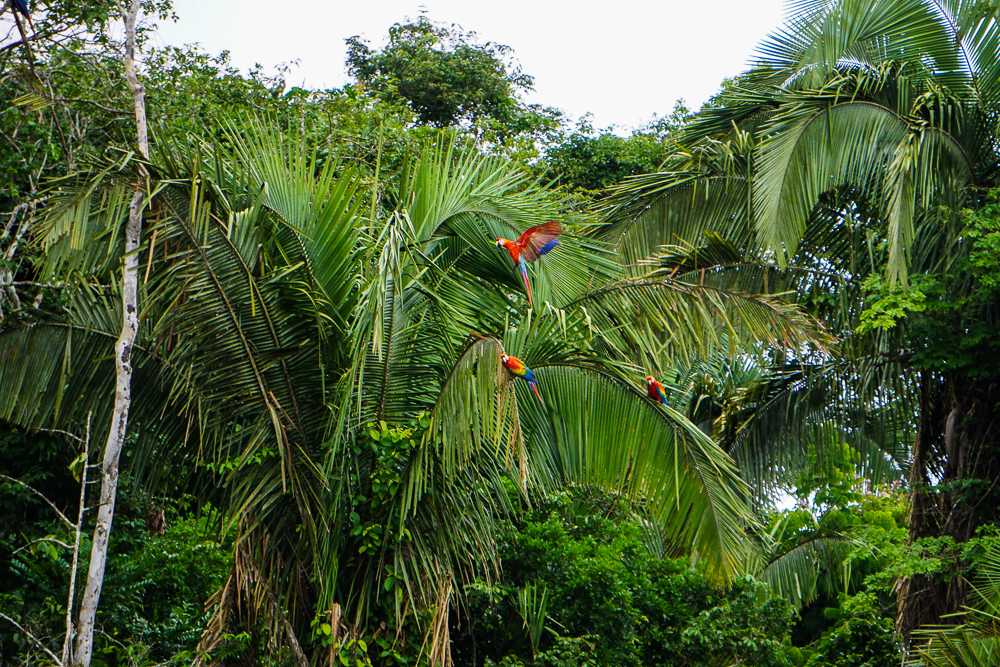
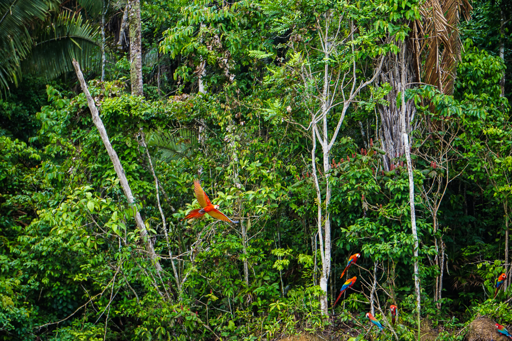
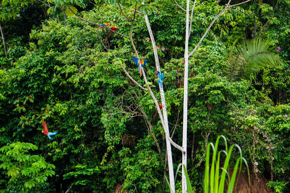
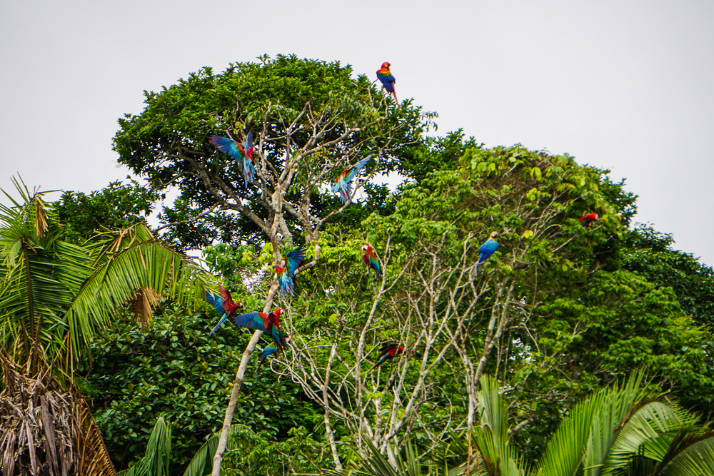
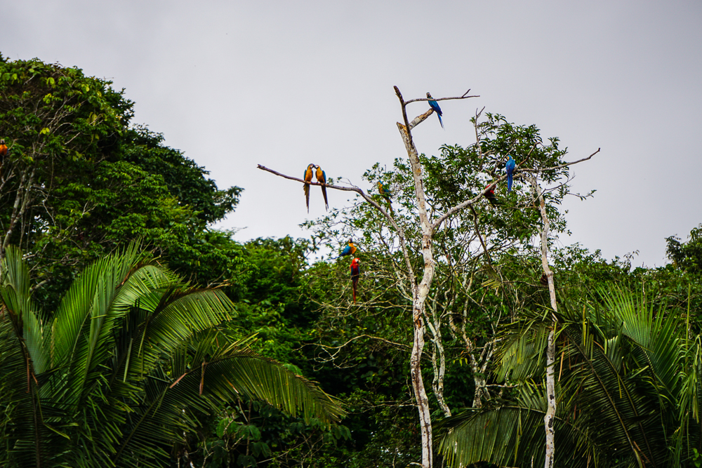
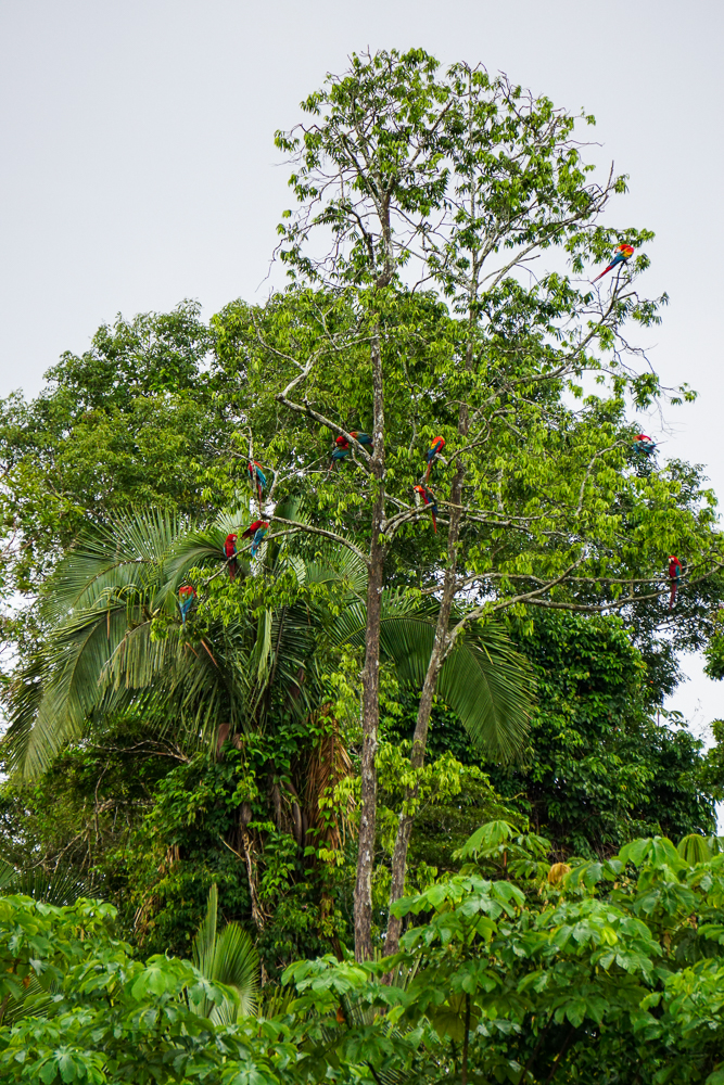
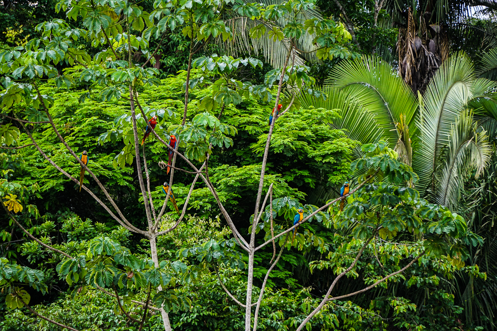
When we first arrived, there wasn’t much going on. There were some macaws high up in the surrounding trees, but none of them were anywhere near the actual clay lick. Juvenal said that they partner up for life, so if we watched closely, we’d notice that they go and come in pairs. More and more gathered, and then they started creeping down to lower and lower branches. He said that all they needed was for one bird to make the first move and then they’d all be on the clay. Sure enough, one brave soul boldly landed, ate some clay, and flew away… and then came back after nothing disastrous happened. Pretty soon, there were birds all over it!

Hovering
Getting a liiittle bit closer, with a couple of new friends.
And, he makes his move!
Slowly…
Then, chaos!
And more birds
AND MORE BIRDS
These are all basically the same now, but my gosh I just can’t even believe that this is a real, normal thing. Like, this happens EVERY DAY. What a world.

I’d never seen anything like it! I mean, I don’t know when I would have, but the screeching and the sounds of their wings flapping… well, I think you have to hear it for yourself.

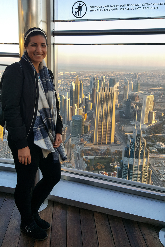
I was having quite the orientation with my new camera. I still wasn’t really sure about the settings or what everything meant, and Dad told me to just shoot on auto because it would still be better than anything I would take with my cell phone. True. The next leg of my trip, after my parents left, was with my aunt, uncle, and cousins, and my uncle knows a lot about cameras. I planned to take advantage of his knowledge, but until then, I just had to make do and play around with it. So… yeah, these aren’t the best pictures. But I’m pretty sure that taking pictures of distant, flying birds is just about the hardest thing to start with.

I wanted to get some pictures of them flying because the colors are even more incredible when their wings are open.
Pretend this isn’t blurry and just appreciate how majestic these birds are.
That one with its wings open on the tree… whoa.
Those two birds flying away on the left are awesome!

The best thing, though, was that Juvenal had a telescope with him. It made you feel like you were right next to the clay lick! And you can literally take pictures through the telescope using a phone camera which is crazy!

Full view through the telescope
Getting even closer…
The wings!
Macaw love
The deep blue feathers are so pretty!

It’s like he’s staring straight into our souls
If I were a bird, I think I would like to be a macaw.

That one on the bottom left is taking a big ‘ole bite. Yummm, clay!

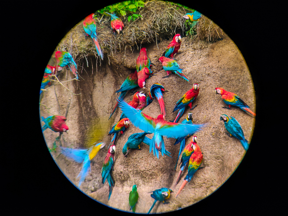
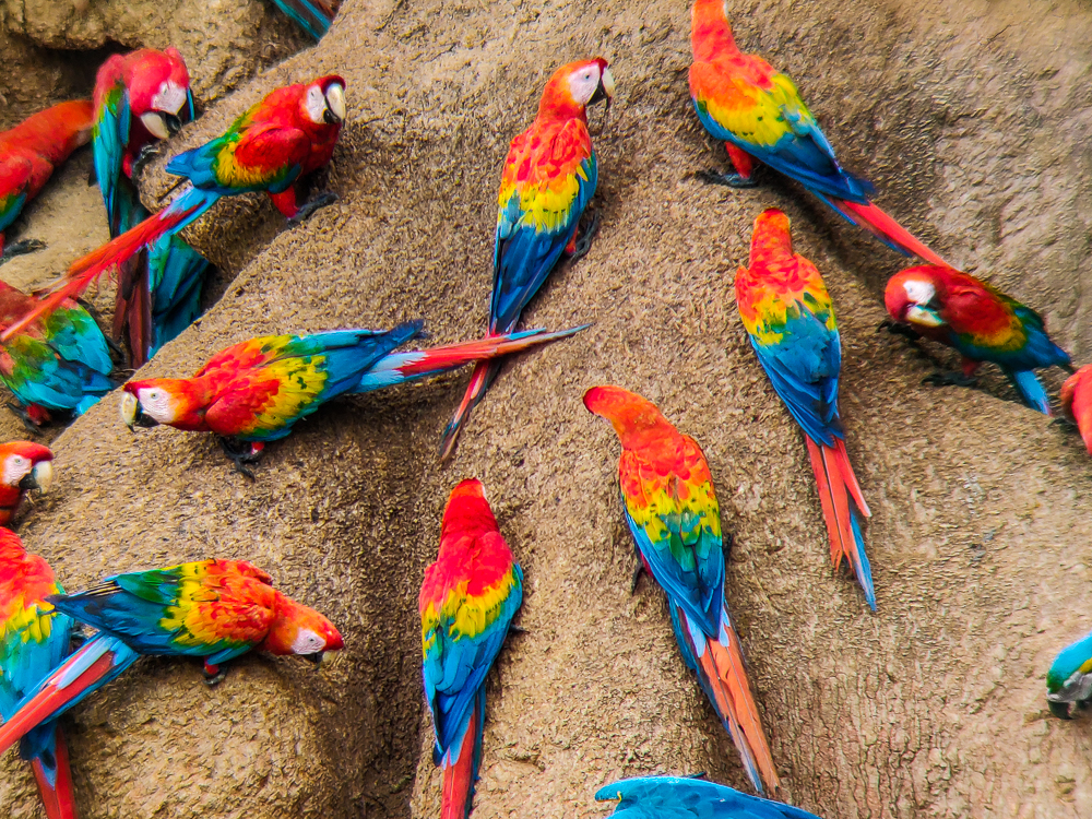
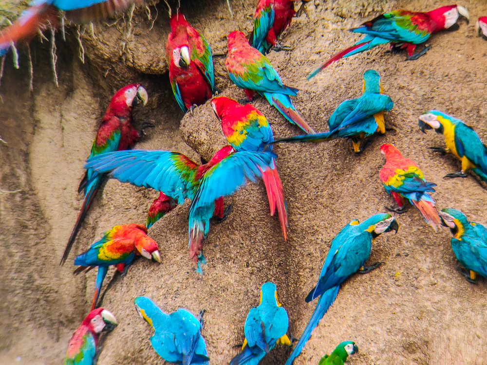
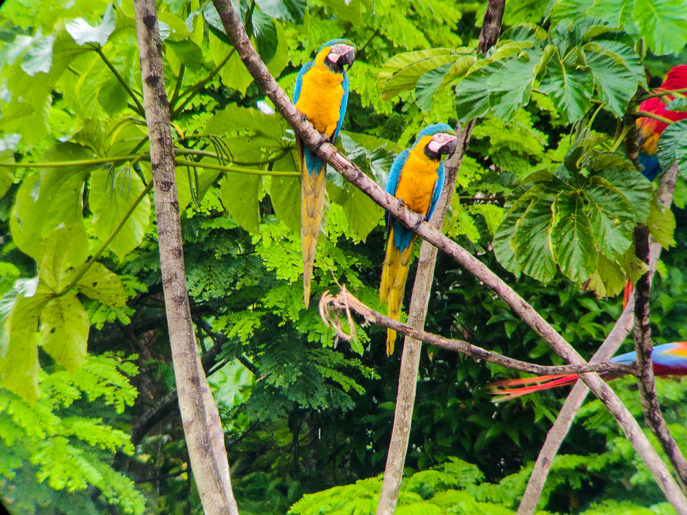
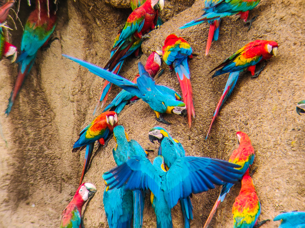
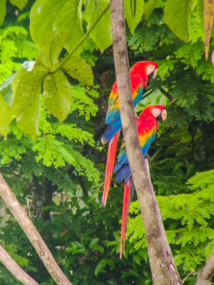
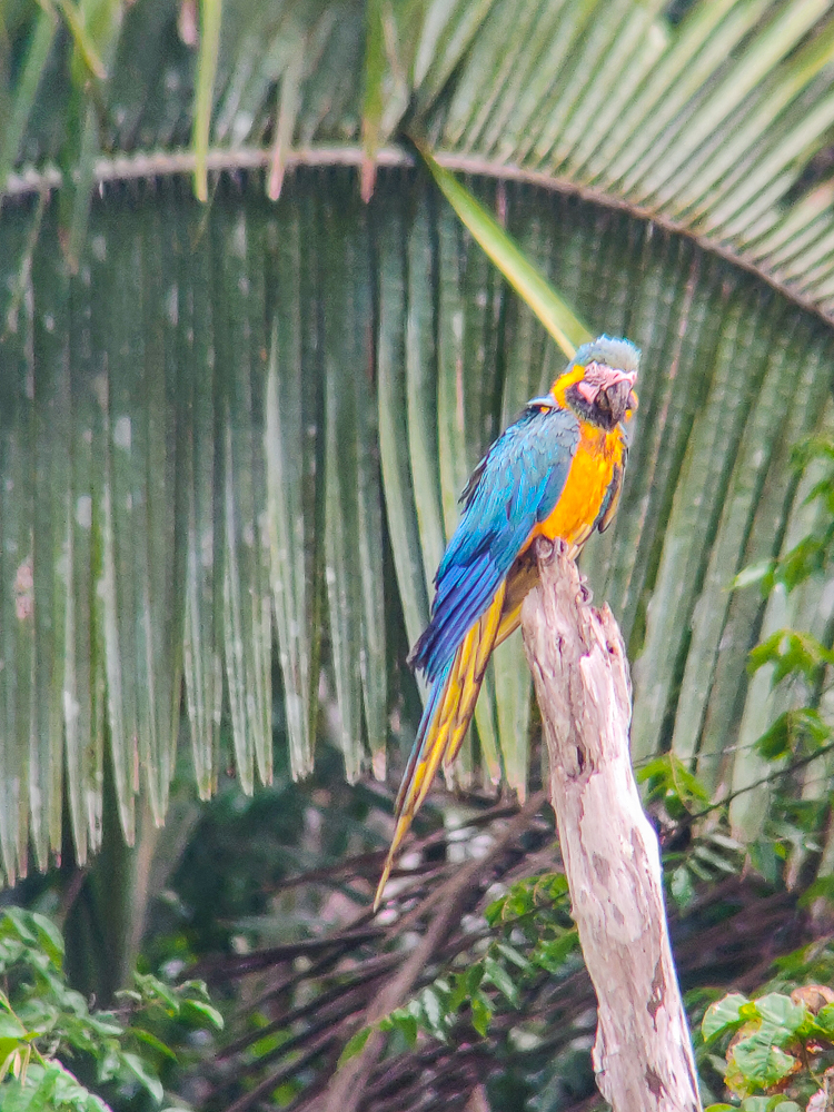
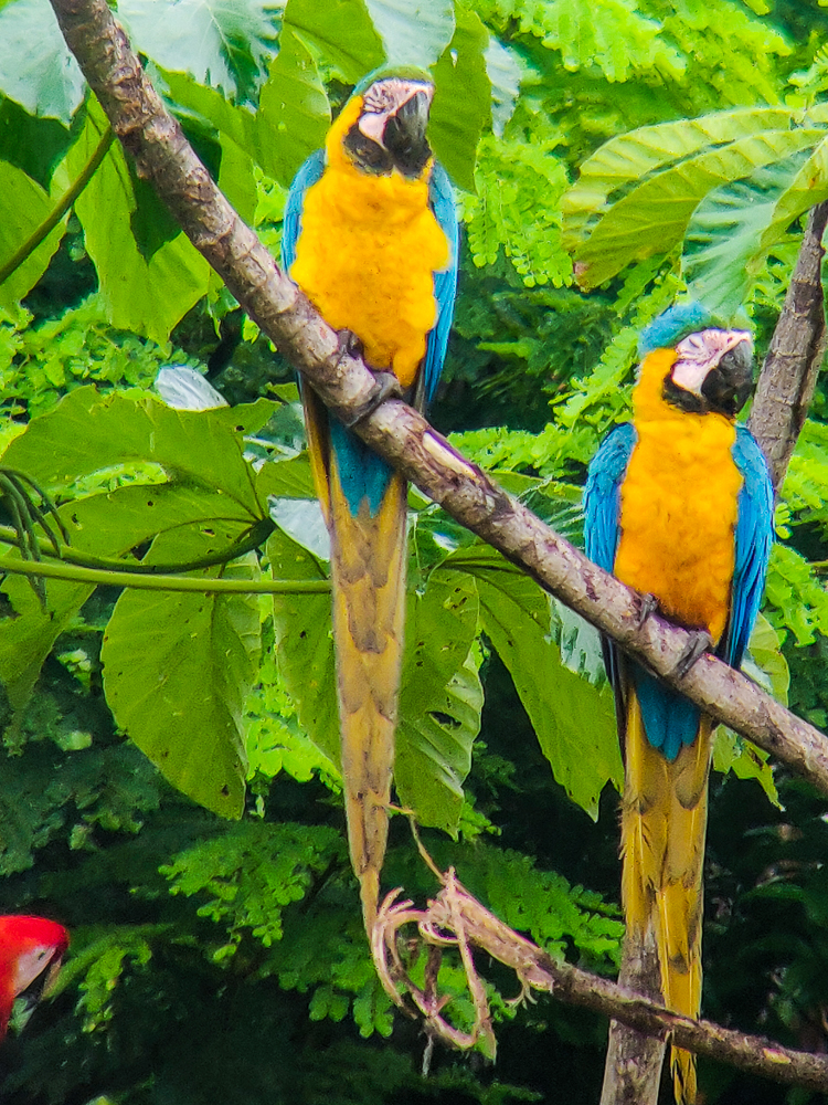
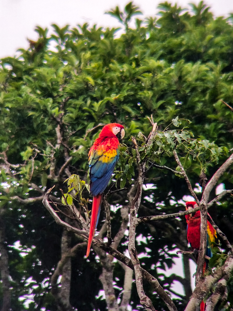
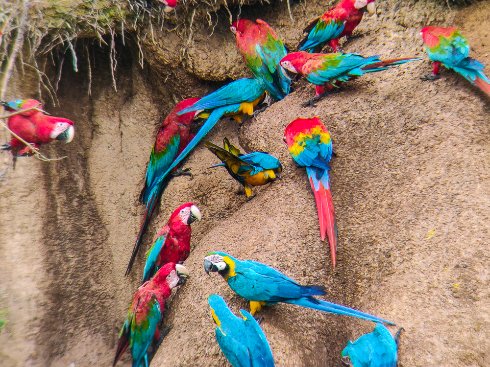
We saw three different types of macaws. The scarlet macaws are, to me, the classics. They’re the ones that look the most rainbow-like. The red-and-green macaws are very similar, but they don’t have yellow feathers like the scarlet macaws. And finally, the blue-and-yellow macaws are pretty easy to separate from the other two. See if you can spot all three types in this photo!

Did you find all three?

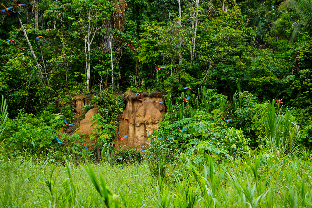
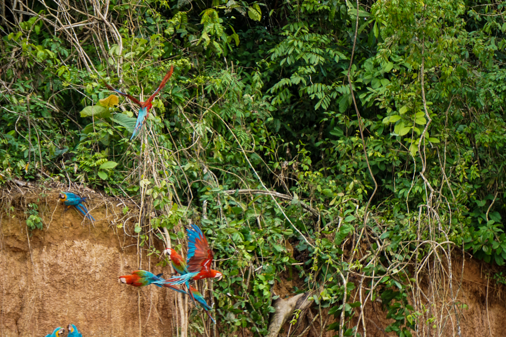
At one point, something scared the macaws and they all flew away. It happened so quickly… they were all on the clay lick, and then a second later, they were gone! I guess they just went and took a lap or something because soon enough, they started gathering in the trees again, and the whole creeping process repeated until they were back on the clay lick in full force.

Business as usual…
…aaand they’re gone.
I’m telling you, taking pictures of flying birds is not easy!
Returning to the safety of the treetops
Not a great picture, but I just love those two blue-and-yellow macaws who look like they’re resting their heads on each other.

We’re back!
Getting set for another round at the clay lick

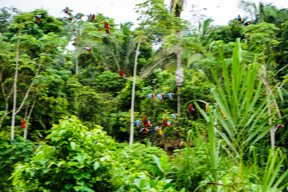
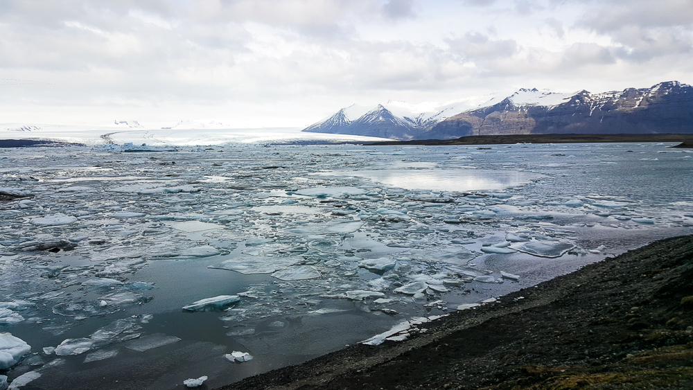
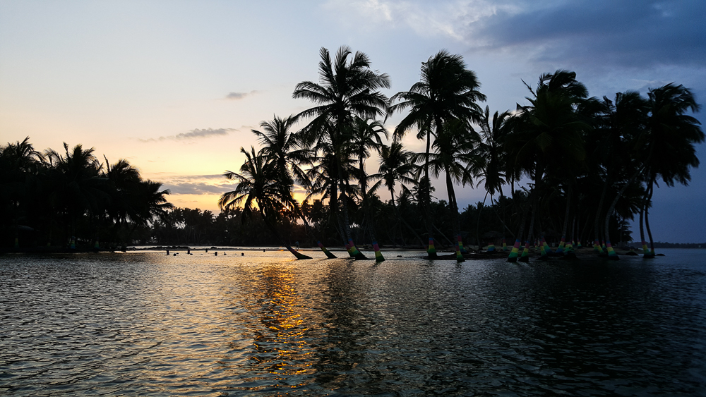
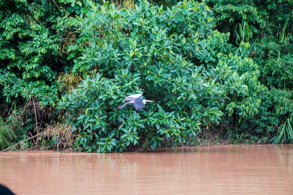
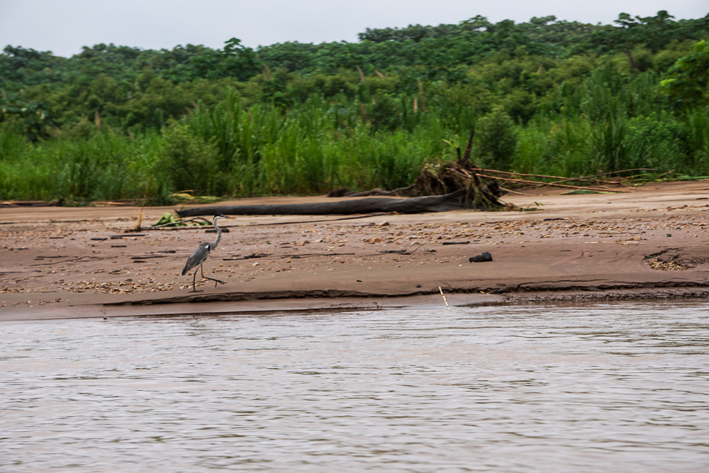
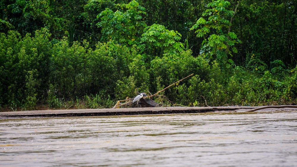
I think I could have stayed there watching until all of the macaws left, but after a while, we called it a morning and headed back to the boat. The ride back to the lodge was so pleasant. There was no sign of the nasty weather from the morning. The sky was blue, and being on the boat on the river was the best feeling in the world. I sat cross-legged on the bench so that I could face forward and look out at the riverbanks and decided that I was at my peak happiness on the river. You think I can live on one of those boats?

The fam with the clay lick in the back left
Juvenal on the ride home

We didn’t see anything too thrilling on the way back, but we did see a bunch of birds. We cruised past another, small clay lick right on the edge of the river. I was no longer afraid of using my camera on the boat, so I had it out (with the strap around my neck and a VERY tight grip in my hands) and was snapping sure-to-be-terrible pictures along the way. The only way to get better is to practice!

Taken from a moving boat
Ride-by photos

It was only about 10AM when we got back to the lodge, but I felt like we’d already lived an entire day! Thankfully, we had some downtime before lunch, and I used the time to lounge on my bed and rest up for our afternoon adventures… which I’ll talk about next time!

Bye, boat!

At the beginning of our trip, if you’d asked Tony what one thing he was most excited to see, he would have said, without a moment of hesitation, Diamond Beach. The interesting thing about his obsession was the fact that he didn’t seem to know much about it. Mike and I asked why it’s called Diamond Beach, and his response was “because it’s beautiful. Like a diamond.” Thanks, Tony. So, off we went to Diamond Beach, knowing nothing more about it than its name… which Tony insisted on repeating over and over and over until I was ready to throw him out of the car, and Mike banned him from mentioning it again until we got there (under the threat that if he heard the words “Diamond Beach” one more time, we were turning around and going back to Reykjavik. Tony wisely kept his mouth shut after that).

We had some good driving views…
It doesn’t even look real.

We got on the road after a brief stop at a waterfall near our campsite, Systrafoss, located in the forest of Kirkjubæjarklaustur. It wasn’t much more than a trickle when we were there, and I probably could have skipped telling you about it, but then I wouldn’t have gotten to type Kirkjubæjarklaustur and given you another opportunity to appreciate the names of Iceland.

Next stop, DIAMOND BEACH! The mystery of the name was solved pretty quickly once we got there. It’s a black sand beach, and thanks to the nearby glacier lake, it’s covered with glacier pieces that wash up on the beach after drifting out to sea. There are pieces of all different sizes, and many of them form abstract ice sculptures that sparkle in the sunlight as they melt. We had fun imagining what the different pieces looked like (it’s like cloud animals, glacier edition) and taking ridiculous pictures with them.

Okay, so maybe “trickle” was a bit of a down-sell, but compared to most of the other waterfalls we saw, this IS a trickle!
Diamonds! And you can see the other side of the beach across the outlet from the glacier lake
Tony, thrilled to be at Diamond Beach
Ice sculpture! I think this one looks like a baby ice dragon.
Mike pulling Tony on an ice sleigh
So cool!
Can you find me?
Ice hat. There was a hole all the way through.
I have to give Mike the credit for this picture… He was so committed that he practically lay down on the ground for it. This one looks like maybe a dragon or maybe a pegasus.
Adventures in self-timer
Some of the coolest ice I’ve ever seen (hehe get it?)
Getting his tan on

When Tony was satisfied with his Diamond Beach experience, we walked upstream to the glacier lake, Jökulsárlón. It was very pretty. I’m not sure what else to say about it, but it’s a lake… full of ice. And there’s a part that runs out to the sea, giving the future beach diamonds a way out. When we were finished staring at the lake, we paused to watch some little ice pieces that were trying to make a run for the freedom of the sea but were blocked by larger ones. We were completely sucked in by the action and cheered for one little ice as it struggled to break free. I imagine this is what Icelanders did in their free time pre-television. Maybe it’s also like the Icelandic equivalent of horseraces (but MUCH slower). You can put your money on an ice chunk, and whichever one successfully reaches the ocean first, wins. I’m a genius.

The glacier escape route (looking towards the glacier lake)
Walking up to the lake. This was the location of the big roadblock that the little ice pieces had to make it past in order to reach the ocean.
Craziness.
The classic Mike-drinks-freezing-cold-water picture
Just a few more…
So pretty!
Whoa!
Obsessed.
It looks like a partly melted slushie

Before we got back on the road, we decided to check out the other side of Diamond Beach too (on the other side of the outlet coming from the lake) because, despite Tony having no idea what he was talking about, he was right about it being beautiful.

My expression for basically the entire Diamond Beach adventure
Mike on ice
I love that you can see the waves crashing into the ice
Seriously… can you believe this is real? It’s like a precious gemstone… a MASSIVE precious gemstone
Boots, rocks, and little ice pieces
Crash!
So many diamonds!
Turned our backs on the ocean…

Diamond Beach was as far east as we were going, so when we finished there, we started back in the direction of Reykjavik. There were a few places we wanted to stop at on the way back, but we were also scouring google maps as we drove to see if there were other things nearby that might be worth checking out. One such discovery was Svínafellsjökull, another stick-out part of a much bigger glacier. The glacier that it’s a part of is called Vatnajökull, the largest glacier in Iceland. I quickly decided that visiting Svínafellsjökull was worth the detour x100000. We hiked up a ridge along the side, and it was breathtaking. I would have been happy to hike way farther than we did, but Mike and Tony were keen to keep moving. We walked until we were past all of the other people, at least, before turning around. Even with just that quick stop, it’s probably one of my favorite things we saw.

The road to Svínafellsjökull
Svínafellsjökull! Pretty sure the first words out of my mouth were, “You have GOT to be kidding me.”
Little speck Lara and speck Tony with ginormous Svínafellsjökull
Lara and the majestic glacier
Mike being Mike
Tony!
Sibling pic 🙂
I know, you’ve seen enough… but come on. This is crazy!!!
It’s quite the view
This picture is pretty funny. Can you find Mike? Can you find me?
Just one more! Hehe

Our next planned stop was Vatnajökulsþjóðgarður, or Vatnajökull National Park. Mike and Tony were hoping to do some of the hikes there, but unfortunately, our visit wasn’t timed very well for hiking season. Most of the trails were closed for the season with an opening date of May 1, and we were there in mid-April (now you can see how far behind I am… oops). That was a bummer, but at least we could still hike to Svartifoss, another famous waterfall. This one has hexagonal troll rocks like the ones we saw at Reynisfjara beach, but at Svartifoss, they’re mostly hanging down instead of coming up from the ground.

Our classic Iceland lunch – PB (&J for Mike) with the most hideous backdrop
First peek of Svartifoss
Smiling because the weather was warm enough (for about 5 minutes) to wear short sleeves.
Check out those troll rocks! Maybe they’re hanging here because they’re troll bats that forgot to retreat into their caves before the sun came up.
It was actually (kind of) hot out, so I took off my top layer of pants and was left with these leggings. Mike made fun of me because he said my outfit was ridiculous. I think I look fantastic. Check out that color coordination!

We made one more unplanned stop on our way to the campground for the night. This was another “there are lots of people over there so maybe we should see what they’re looking at” moment. Well, it was clear what they were looking at: a couple of massive, mangled steel girders. What wasn’t immediately clear was why they were there and what was so interesting about them.

Remember how I talked about how there are volcanoes under the glaciers? There are also some sub-glacial lakes that are maintained by the volcanic heat. One such lake, Grímsvötn, is beneath the glacier Vatnajökull. It cycles between slowly filling and eventually releasing the water in a mega-flood. In 1996, there was a volcanic eruption that accelerated the fill cycle, melting 0.75 mi3 (3 km3) of ice in just 13 days. The lake was filled higher than ever before in recorded history, and the resulting mega-flood was incredibly destructive. The flood waters carried glacier pieces along with them, some weighing as much as 1000-2000 tons. TONS!

The mangled steel girders that we were looking at used to be part of a bridge that clearly didn’t fare so well, despite being designed to withstand mega-floods. It had deep foundations and allowed about 6m clearance for glacier pieces to pass underneath, but in this instance, it would have needed more than twice that height to be safe. The result? Well, the beams speak for themselves…

That is NOT a small or weak beam. Imagine the force that was needed to do this! And it was all natural! Crazy, amazing, and a little terrifying

We made our way to that night’s campground, set up the tent, and played card games before falling asleep. Mike and Tony were hoping to do a long, waterfall-filled hike the next day, so we needed all the sleep we could get!

Campsite for the night

Related Posts

Petrified Trolls of Iceland – Do you like the funky “troll” rocks around Svartifoss? Do you have no idea what I’m talking about? Learn more about the formation of these interesting lava rocks.

Perito Moreno Glacier – if you’re a glacier fan, join us for a trek on this South American glacier!

Ada Foah – compare the black sand beaches of Iceland to the picturesque and slightly more tropical beaches of Ghana.


My adventures of blindly following the advice of strangers continued the next day in Bath. Why Bath? I didn’t know. What’s there? I also didn’t know that. My entire knowledge base going in was that people think it’s beautiful there, and it’s like stepping back in time. That all sounded good to me, so off to Bath I went!

I asked at the hostel about the cheapest way from Bristol, where I was staying, to Bath (because “cheapest” is the key here, not “most efficient” or “easiest”), and I was surprised when the girl told me that I should take the train. It was only 8 pounds round trip which was LESS than taking a bus (when does that ever happen??), and it took 10 minutes instead of close to an hour. Woo! Off to a good start.

Bath streets

My first move when I made it to the city was to make a beeline for the visitors’ center because I had no idea what I was supposed to be doing there. That ended up being my best decision of the day because after I grabbed a map of the city and walked outside, I saw a man holding a “Free Jane Austen Walking Tour” sign. You may not know this about me, but I am a MASSIVE Jane Austen fan. Like huge. I think she’s brilliant and funny and knows how to write a darn good story.

Okay, maybe it’s not right to describe myself as a massive fan of HER because I basically knew nothing about her actual life. I’m just a huge fan of her work. I’ve read all of her books, some of them multiple times, and each time I think they get more entertaining (probably because each time I understand them a bit better… between the British English and the fact that they were written in a different time period, it can be a challenge to catch all of the humor).

I wrote a separate post about the intimate details I learned about Jane’s life, but the tour was cool because the guide (dressed as Mr. Knightley from Emma) didn’t only explain places that directly related to her; he also talked about major sights in town.

First, let me give you a little background on the city of Bath. Bath is located at the site of the only natural hot springs in the UK. It was originally settled by Celtic tribes who thought that the springs were a gift from the gods, specifically their goddess Sulis. When the area was conquered by the Romans in the first century AD, the city and the baths were Romanized. I’ll talk more about the baths later, but for now, just appreciate the incredibly creative naming of the city… It all makes sense now, eh?

Back to the tour. We walked past the Bath Abbey (the main cathedral), and Mr. Knightley explained that none of the aristocratic class used to go there because it was considered smelly and touristy, and at least the latter is still true today. Apparently, they used to put the corpses of the rich in the crypt underneath the church instead of properly burying them, so it literally smelled like rotting bodies. EW. Due to this, the shops that were directly against the walls of the church didn’t have to pay taxes. CAN YOU IMAGINE?? That’s disgusting. At some point after that, they decided that maybe it was kind of gross to leave bodies out to smell up the place, and they were buried instead.

Bath Abbey

There has been a church on the site of the current abbey since the 700s AD, but this building has been there since about the 1500s with major restorations done in the late 1800s. It’s built in the Gothic style, and one of the major features is these angels climbing up “ladders to heaven” on the front façade. Mr. Knightly told us that there’s a story that the Puritans shot off their heads and wings because they were anti-ornamentation, and who knows what’s true except for the fact that some of them are definitely missing heads and wings…

Front of the Abbey. You can see the ladders on the two tall towers, and those little things climbing up are the angels.

The Roman Baths are right near the abbey, and next to those, there’s the Pump House which was a fashionable place for people to hang out in Jane’s day. You could drink water from the spring which supposedly has healing properties, and I learned later in the day that this water was piped up directly from the bath pools… which means people were basically drinking dirty bathwater.

Next to the Pump House is the King’s and Queen’s Baths which was one of the most popular places to “take the waters”. It also contained a book where, during Jane’s time (the early 1800s), you would write when you arrived in town so that everyone would know you were there. It was a time of people knowing everyone else’s business, including how much everyone was worth.

The Pump House

Architecturally, the city is primarily built in the Georgian style. In 1814, the entire city was rebuilt with one main architect, John Wood the Elder. Important buildings were reconstructed in this style, and less important/older ones were simply refaced with a proper façade.

Townhouses called “the circus”. They form a circle with three gaps for roads into the center.
The middle of the circus

One of the interesting features in town is called the Royal Crescent. This was built by John Wood the Younger, and actually, he only designed the curving façade. People purchased a certain length of the façade and then could build whatever they wanted behind it! So, something may look like two houses from the front but actually be only one. Mr. Knightley said that this was the typical Bath way… it was all about having the appearance of high society. The actual substance was less important.

The Royal Crescent
The backs of some of the Royal Crescent houses. See how icky the back looks compared to the uniformity of the front?

In the center of the city, the three primary streets are Quiet Street, John Street, and Wood Street. He told a story about the meeting to name the streets of the new city of Bath. The architect, John Wood, wouldn’t shut up, so the guy in charge of the meeting yelled, “QUIET, John Wood!” and so, they had their first three street names. This sounds like a myth to me, but the streets do exist, so maybe not?

Another random street in town… As you can see, they all look kind of similar.
One of the churches had this for a door handle… I thought it was funny

After the tour, I walked to the Botanical Gardens. It was the PERFECT time of year to go because the flowers were blooming, and things were actually green!

Enjoy these pretty spring pictures!

I continued roaming before finally making my way to the baths. Admission was a bit expensive, but it was totally worth it! There’s a museum portion and then the actual baths. For the museum, there was a free audio guide, and when I got to the baths part, I was just in time for the last guided tour of the day which ended up being fantastic!

The temple in the center was dedicated to Sulis (the Celtic goddess) and the Roman goddess Minerva who they considered to be the same goddess by a different name. These baths are particularly interesting because of the style mixing between the Roman and local tribal cultures. Archaeologists guess that the Romans probably saw parallels between some of the gods that the locals worshipped and their gods, and since they didn’t want to run the risk of offending one of them, the result was these mixed styles.

The side of the temple with what they guess is a gorgon head, but it’s unlike anything anywhere else, so no one actually has a clue where the design came from
Curse tablets

The baths are fed by 10,000-year-old rainwater that goes 3km underground and comes up at 37 degrees C. The local tribes, and later the Romans, thought that it had healing properties, so the bathhouse was one of the first things to be built by the Roman conquerors. The land around the springs was dried, and the temple was built.

In classic Roman form, the design pushed the engineering boundaries of the time. The main bath pool originally had a 20m-high roof. The first iteration was made of wood, but that rotted quickly because of the heat and moisture from the pool. It was replaced with a roof made of hollow bricks.

One of my favorite things was curse tablets. If someone was wronged, for example if something was stolen from them, they would buy these little lead tablets and write what was stolen, who took it (or a list of suspects if they didn’t know for sure), and a request for Minerva to curse them in whatever way they saw fit. They would roll these up and then throw them into the main spring pool. If the tablet floated, it was said that the curse would come back on the curser, so people were sure to make them heavy and fold them up really well.

More curse tablets. They had some of the texts written out, and I thought they were hilarious. Here are a couple of examples:
“May the person who has stolen Vilbia (possibly a slave) from me become as liquid as water… who has stolen it: [list of names of people the author suspects]”
“I curse him who has stolen my hooded cloak, whether man or woman, whether slave or free, that the goddess Sulis inflict death upon… and not allow him to sleep or have children now or in the future.”
That second one seems like a bit of an extreme curse for stealing a cloak, but hey, what do I know?

We walked through the different rooms of the baths, and the guide explained what each was used for. First was the changing room where people would prepare for the bath process. The baths were affordable, so people of all social classes used them. The rich came more often and had servants to help them and to guard their belongings. The poorer people undressed themselves and didn’t have anyone to watch over their stuff which often led to thefts (and people asking Minerva for curses).

The changing room. They had these funny projections to help you visualize the happenings in each room.

After undressing, bathers moved into the tepidarium, the warm heat room, for cleaning and hair removal. People removed all of their body hair from the neck down. If you were rich, you could afford a blade to shave it. Otherwise, you were stuck with plucking… EEK! When your hair was all removed, you were massaged with oil (to clean you, obviously) and then sent to the next room, the caldarium.

Inside the tepidarium. You can see the simulation-people getting massages.

This was the hot room and was like a sauna. It had a raised floor that contained an underfloor heating system. In this room, people sweated, and the oil from the tepidarium was scraped off. What was done with this sweaty oil? Glad you asked. If it was used by someone important, sometimes it was sold by enterprising Romans as a face cream so that you could absorb some of the essence of the person who used it. Otherwise, it was probably sent back to the tepidarium and reused. Hygienic, huh?

Caldarium. The stacks of bricks are called the hypocaust. Those are what held up the raised floor.

After being “cleaned”, people moved to the main pool which was a big social hub. You could buy wine, and to sweeten it, they would often add lead powder. The main pool was also lined with lead sheets for waterproofing purposes. Lead pipes carry water throughout the compound… so it’s probably safe to say that literally everyone had lead poisoning.

Lead pipes for carrying water
Main bathing pool
Standing on ancient ground

The waters in Bath were believed to have healing properties, so this bath has a special immersion pool for healing. Rather than being healed, however, people probably just ended up passing on their skin conditions to other people in the baths.

The “healing” immersion pool (sorry about the weird angle/shadows)

In the early 5th century, the Roman Empire started struggling, and skilled workers were recalled to Rome. No one who was left knew how to maintain the facilities, so the roof started to collapse. By the 12th century, all evidence of the Roman Empire in Bath was gone. The floor level of the baths is six meters below the modern-day street level!

The sacred spring where the curse tablets and other sacrifices were thrown
A recovered sacrifice. I love how delicate it is!

In the late 1800s, people’s basements started filling up with water which led to an investigation to understand why. In this process, they discovered the hot springs and started buying up people’s properties to investigate. This process was delayed by 10 years because one person kept holding out and refusing to sell, so they had to wait for him to die (who wants a basement filled with water??). Since then, the Roman Baths have become one of the major tourist attractions in town… and rightfully so because they’re awesome.

I absolutely loved my time at the baths. I thought it was so freaking cool. At the end, you can drink some of the (cleaned) water. It’s disgusting. There are so many minerals in it that it tastes repulsive. The guide said that they considered bottling and selling it, but legally, you need to have the bottling plant at the site of the spring, and they don’t have the space for that. My question is, would people seriously buy it despite the HORRIBLE taste just because it’s supposedly good for you? When they could just take some vitamins instead? Not me!

The mineral water that you’re allowed to drink. Ew.

Related Posts

Jane Austen – a Jane-focused walking tour of Bath and a visit to the Jane Austen Museum

Bristol – explore the nearby city of Bristol, England

Cardiff – hop over the border into the capital city of Wales!

History of the Tower of London – learn about the Tower of London, England’s most notorious prison

Inside the Tower – take a look inside the famous Tower of London

Dubai Day started bright and early… and after an INCREDIBLY restful four hours of plane sleep on my flight from Beirut. My flight landed at 4:45AM, I zoomed through immigration, and I tried to somewhat pull myself together in an airport bathroom before venturing out into the world.

My first stop was the Burj Khalifa, aka the tallest building in the world. You can schedule a time to go up to one of the viewing decks (I opted for the lower one because I’m not rich), and I signed up for a sunrise time slot. I made the mistake of going to Dubai on a Friday. That was stupid because Friday is the Muslim Sabbath day, and in the UAE, it’s a “non-work day”. It didn’t mess me up TOO much, but most things opened later in the day which wasn’t ideal since I got in so early in the morning. The metro wasn’t open yet, so I took a cab from the airport and got dropped off next to the building.

Welcome to Dubai! That body of water is the Persian Gulf.

The thing about being “next to the building” is that when the building is 828 meters tall (2,716 feet), the base of the building is not small. I had NO idea where to find the correct entrance to go to the viewing decks, so I just walked in a direction that I thought made sense until a guard told me I was going the wrong way and redirected me. No doubt that’s a normal occurrence in his job.

The walk to the right entrance was about 15 minutes, and I didn’t mind one bit because the world was quiet, and the city was still asleep. That’s one of my favorite times in a city (though I hate being awake so early).

Nighttime city view

One of the best parts of going to viewing platforms in tall buildings is getting to learn about the building. They always have information about the design and how it was built. Learning about the process makes the experience so much more interesting!

Excavations for the Burj Khalifa started in January of 2004, and it was officially opened in January of 2010. Even though it boasts a height of 828 meters (2,716 ft), the top floor is located at 584 meters (1,915 ft). The rest is just a ridiculous spire to make it taller.

The piles that make up the foundation system are 50 meters deep (165 ft). They also had the challenge of making sure that the in-ground structure could withstand the harsh minerals found in the soil. After a year of construction to prepare the foundation, work started on the floors. They created a process that allowed them to pour the concrete for one floor every three days! They also pumped concrete from the ground up to 601 meters (1,972 ft) which is about 3/4 the height of the building. That set another world record (there really is a world record for everything).

The quantity of building materials that went into the structure is insane. The foundation alone used 45,000 m3 of concrete (58,900 yd3), which is like if you filled 18 Olympic swimming pools, and the superstructure used another 330,000 m3 (431,600 yd3) or 150 more swimming pools. If you lined up the steel rebar end-to-end, it would go a quarter of the way around the world.

See the area of brown out in the water in the upper right? That’s where they’re building the world islands. There’s an island for each country… It’s like Epcot on steroids.

During the summers, temperatures easily reach over 44 degrees C (about 110 degrees F). In order to keep work going through the summer months, concrete was poured at night when the sun was gone and temperatures were lower. Also, as the tower’s height increased, workers were subjected to stronger winds, making their work more challenging and dangerous. Another crazy statistic for you: 22 MILLION man-hours went into the construction.

The building’s shape was determined by its structural requirements. A Y-shaped floor plan was selected to add stability, and the weird shape and setbacks were designed to reduce the impact of wind on the building. The occupied levels were built with poured concrete floors, but the structure of the spire is entirely steel. It has 54,000 windows. Can you imagine being in charge of window cleaning??? I wonder if they ever do clean the windows because it seems like that would be terribly unsafe. Haha I just looked it up… it takes 36 workers 3-4 months to clean all of the windows. The top 27 levels are cleaned by unmanned machines. (Also, the window-cleaning system cost US$6.3 million which I personally think is insane.)

Looking up… and this is just the part of the building that’s above the viewing deck.

It holds the titles of: tallest building in the world, tallest free-standing structure, tallest man-made structure, building with the most stories, highest occupied floor, highest outdoor observation deck, and a few more. It houses a hotel, apartments, a restaurant, and offices. At its base is the Dubai Mall, filled with expensive stores and ridiculous attractions such as an ice rink and an aquarium.

After my brain was filled with knowledge, I took an elevator to the 124th floor. I think it only took a minute, and the elevator was so smooth that you could barely even tell it was moving. For reference, I live on the 7th floor of my building in Armenia, and I’m fairly certain that the elevator there takes longer to go 6 floors than this one takes to go 124. Not sure if that’s a compliment to the Burj Khalifa elevator, an insult to the one in my building, or a little of both. Apparently, the building is so tall and the elevators are so fast that you can watch the sunset twice from the building, once from the base and once from the observation deck.

At the top, I wandered around a bit before the sun started to rise. It was still completely dark outside, so I got to see the city lights all the way around the building. About half an hour before sunrise, I claimed a spot next to the windows with a good eastern view and waited.

It was awesome getting to see the world light up and the city wake up. The streetlights gradually turned off, along with the building lights. The world got brighter and brighter and the sky more and more orange. Then, finally, the sun broke over the horizon, and everyone cheered.

Based on the group’s reaction, you’d think no one had ever seen a sunrise before, but it felt extra special that day. You know how things like the sunrise or stargazing can make you feel like your problems or day-to-day worries are so small? Like there’s a whole big universe out there, and you’re just a tiny part of it? In that moment, as we watched the sunrise together, It didn’t matter where we were from, what language we spoke, or what our beliefs were. Everyone, young and old, had the same look of excitement and awe on their face. The sun rises every day, it rises in every country, and that morning, it shined its light on our shared humanity. At our core, we’re all the same. And we all love sunrises.

Yes, I’m wearing a scarf in the desert. It was a chilly morning! (But it came off VERY soon after this.)
The sun is cominggggg. I love that the roads are little lines of light. That’s some serious street lighting!
The sky is brightening…
The city lights turn off. The sun peeks out! The crowd goes wild!
Good morning, sun!

After the sun rose, I walked around again and took another look at the city. It’s cool how light transforms things. The city has a completely different personality during the day. It was like I got double the value for my ticket because I got to see two different Dubais, or maybe even three. Night Dubai, waking up Dubai, and daytime Dubai.

It’s such an interesting skyline… most cities have some tall buildings in the middle, and then they gradually get shorter as you move out. In Dubai, it’s like skyscrapers were dropped from the sky without any rhyme or reason.
There’s just so much empty space between the buildings, and immediately next to a 100-story building is a 1-story house. It feels so unnatural.

I stayed there longer than anticipated. By the time I got downstairs, it was about 8AM. Part of the sunrise deal was a drink and breakfast sandwich, so I still had to eat before moving on to my next activity. The only drinks included were different types of coffee (the ongoing struggle of eating and drinking like a child), so I just asked for a cup of hot water. The guy working there thought it was weird (who drinks a cup of hot water in the desert?), but I conveniently had a hot chocolate packet in my backpack. Score!

I was originally planning to take a bus to my next stop at 8:30, but at that point, I figured I might as well take my time and wait for the metro to start running at 10. After breakfast, I headed into the mall to poke around a bit. The stores were mostly still closed, but I wasn’t interested in those. I got to see the aquarium from the outside (you can pay to go in, but even without entering, there’s a huge tank visible from the mall), the ice rink, the “human waterfall”, and the general ambiance of the mall.

Divers in Dubai Mall
The aquarium!
And a dinosaur because why not?

Between the mall and the metro, there’s a crazy long “metro link”, aka a series of above-ground tunnels connecting the two. I didn’t mind the walk because the tunnels are lined with floor-to-ceiling windows, and it was cool to see the city from a VERY different perspective than the top of Burj Khalifa.

To spare you from spending one day reading this post about one day, to be continued…

Check out the continuation here.

Related Posts

Dubai First Impressions – get a feel for the city with a list of my first impressions

Dubai Mini-History Lesson – follow Dubai’s development from a small fishing village into the international, skyscraper-filled city it is today

Dubai Marina and “Old” Dubai – join me as I zig-zag my way across the city after leaving the Burj Khalifa, exploring Dubai Marina and attempting to go back to Dubai’s roots in not-so-old “old” Dubai

Galata Tower (Istanbul, Turkey) – enjoy a panoramic view of Istanbul from the top of Galata Tower… it’s significantly shorter than the Burj Khalifa, but the view is no less impressive

Sky Garden (London, England) – look out over London from the Sky Garden, plus take a stroll through Hyde Park and past Buckingham Palace and St. Paul’s Cathedral

Victoria and I decided that we wanted to go on a Saturday adventure, so we planned a mini-excursion to visit Havuts Tar Monastery. It was on my list of places to go because I read that the view is great and it’s worth a visit even though it’s in ruins. The location was also very convenient… It’s just a short hike away from the town of Garni, and the marshrutka ride from Yerevan to Garni takes less than an hour.

Azat River! Along our walk to the reserve from Garni

I wasn’t so sure about the logistics of hiking there because it’s located inside of Khosrov Forest State Reserve. It’s one of the oldest protected areas in the world, supposedly established by King Khosrov in the 330s. I think he just wanted something to name after himself. It was re-established in its current form in 1958. There are four different landscapes within the park, ranging from desert to alpine meadow, and a ton of different plant and animal species. There are 41 mammal species!

The Khosrov website makes it seem like coordinating a visit to the park is a huge pain. It says that you have to hire a guide and get a permit if you want to hike in the park, and it’s a bit expensive. In all of the reviews I read about Havuts Tar, no one said anything about a guide. Who the heck knows which one is right? The best way to figure anything out is to just show up, so that’s what we planned. We figured we would go, try to visit, and be prepared for a last-minute change of plans if we weren’t allowed into the park.

You can see a little speck on top of the mountain in the background, right side… that’s Amenaprkich Church

Our marshrutka dropped us in the center of Garni, and from there, we started walking in the general direction of the park. Oh yeah, we also weren’t exactly sure about how to get there… but hey, it’s all part of the adventure, right? It took a few near-wrong turns and some helpful directions from locals, but we eventually found what looked like a trail and started hiking. Thank goodness for GPS because otherwise, who knows where we would have ended up? It seemed for a while like we weren’t going to encounter anyone… until we turned a corner and saw a huge gate with a Khosrov seal on it. Okay, showtime. Worst case, we’d get turned away and have to find something else to do. No big deal.

There was a park ranger sitting at the gate, and we said hello and told him that we wanted to see Havuts Tar. (We had practiced saying this in Armenian on the walk so that we would sound like we knew what we were talking about.) He didn’t seem thrown off by our presence or our request and asked where we were from. We said Yerevan, and he told us that it’s 1000 dram to hike there if you’re from Yerevan and 2000 dram if you’re a foreigner, so lucky for us that we’re not foreigners because we get a better price. I think he winked at us when he said that, but I have no idea why because we definitely were passing as locals.

We went into the little visitor’s center to pay, and they had a sign with pricing for all of the different sites within the park. To me, that seems to mean you don’t need a guide… Oh, who knows. Maybe it’s like some local secret that you can just walk in, but they try to trick the internet users into getting a guide? Anyway, I was surprised by how nice the visitor’s center was. They had posters about the different sites in the park, information about environmental preservation, a creepily impressive beetle collection, and best of all, a bathroom.

Khatchkar along the path to the monastery

Victoria and I paid our 1000 dram each and headed up the trail to the monastery. The hike wasn’t bad at all. There were some steep parts, but we were following a dirt car road, making it impossible to get lost. There were even a few shade trees along the way! That’s a rare sight on a hike here.

Imagine if it wasn’t all brown… I guess we could have picked a better time of year (aka spring). Amenaprkich Church is up on the hill, and in the low area to the right, you can see the grey walls of the monastic complex.
The path. Not much room for wrong turns!
Getting closer…
View of the monastery complex from the hiking trail

Havuts Tar Monastic Complex was built between the 11th and 13th centuries, so in Armenia time, it’s new! There was an earthquake in 1679 that destroyed much of the complex, and after that, it was basically abandoned, aside from some minor restoration efforts in the 18th and 20th centuries. There’s another church there as well, Amenaprkich Church, which is just outside of the walled complex and was originally built in the 10th century.

I so wish that I could have seen it in all of its glory. Just imagine! That building on the right is a church within the complex, and there are other auxiliary buildings along the perimeter walls (you can just see the edge of one on the left side of the picture).

The ruins were a pleasant surprise. Everything I read basically said that the monastery is unimpressive, but the view makes the trip worth it. I completely disagree with the first statement. It was beautiful!! The ruins were way more extensive than I expected. There were fortified walls, hidden underground rooms, and some of the best stone reliefs I’ve seen in Armenia. As we wandered around, Victoria and I couldn’t help but express our disbelief at the fact that anyone would say that the monastery was anything less than awesome.

One of the church ruins with lettering on the wall that probably didn’t take one eternity to carve
Me on a relatively stable wall…
Looking out at the ruins from the wall. The ruins of the two churches inside the complex are in the foreground, and Amenaprkich Church is on the hill in the background.
I love these khatchkars. Look at how intricate! And I also love how they integrated different decorative stones into the walls. It gives them a lot of personality.
EVERYTHING is decorated
Entrance to one of the monastery complex churches. I also love how they used two different colors of tuff stone to create accents.
That view! And also I really like that wall. I think it’s pretty.
I’m sure this isn’t going to fall anytime soon… but that doesn’t mean that we didn’t sprint under it just in case
It’s not an adventure without some pictures of me in random holes. These little vaulted rooms are up against the perimeter walls, possibly used as guest chambers for the monastery.
Some of the carvings were the most intricate I’ve seen
This looks like an alien on a space horse capturing another alien, but the captured alien is smiling because he knows that there are twenty of his alien soldier friends on their way to save him.

The view certainly wasn’t anything to complain about either. It overlooks the Azat River Valley, the same one that runs behind Garni Temple, and the whole thing is pretty spectacular. From Amenaprkich, you can see Garni Temple too! We found a shady spot to eat our snacks (some bread, cheese, and cookies, courtesy of Victoria), chatted, and enjoyed the scenery.

Me and Victoria! You can kind of see Garni Temple in the background, but it’s not super easy. Maybe about 1/3 of the way into the picture from the right, there’s a little grey box on top of one of the ridges sticking out into the gorge. That’s the temple.
Amenaprkich Church is the one with the orange/black tuff checkerboard front. On the right side, there’s another church that was added later, but as you can see, it’s mostly collapsed as well.
The last remaining arch inside the church. Again, I have no idea how this is still intact. And you can see part of the ring where the dome would have been.
This room is underground… they think it used to be the monastery’s manuscript library

It’s always nice when a day turns out even better than you expect. I was worried that we wouldn’t even be able to enter the park and I would have dragged Victoria out there for no reason. Far from that, we had a great time! Havuts Tar is pretty close to the top of my list of favorite places to visit in Armenia, along with Dilijan, Levon’s Divine Underground, and Smbataberd. I think my list of favorite places is slightly more obscure than most people’s…

I like this wall.

Related Posts – My Favorite Places in Armenia

Dilijan National Park – go for a hike in one of Armenia’s national parks! Or, for the autumn version, go here

Levon’s Divine Underground – explore a potato cellar turned underground wonderland (just as weird and wonderful as it sounds)

Smbataberd Fortress – soak in the breathtaking views from Smbataberd Fortress

Sergei Parajanov Museum – visit my favorite museum in all of Armenia

Erebuni Fortress – poke around the ruins of the fortress at the heart of ancient Yerevan

Darjeeling is beautiful!!! I already feel like I need to come back here to do some hiking. The crew I’m with right now is not exactly the hiking type, so I don’t think we’ll be uncovering any of the town’s hidden gems while we’re here. Anyone out there want to come and trek across northern India with me?

There’s just something about mountain towns…

Darjeeling is a popular tourist destination for both Indians and foreigners, and its tea industry is internationally recognized. If you’re a tea drinker, you’re probably familiar with Darjeeling tea, especially the classic black tea that is popular worldwide. The town’s recorded history began in the 1800s when the British set up a health resort and military depot in the “Lesser Himalayas” (the shorter mountain range containing Darjeeling that runs parallel to the High Himalayas aka where Mount Everest is located). It became a popular summer escape for the British residents of Kolkata (then Calcutta) who were seeking relief from the heat. The tea growing began in the 1850s when the British started seeking a tea source outside of China. After some trials and hybridization to create teas that would thrive in the Darjeeling climate and elevation, the industry took off. This was good for the town’s growth because it created jobs and motivated the development of infrastructure to transport the tea to Britain.

Hi, little Himalayas! (I don’t want to call them “Lesser” because it makes them sound like they’re not spectacular, and that’s clearly not true.)

We enjoyed one of the benefits of that development when we took the Darjeeling Himalayan Railway (also called the “Toy Train”) from Sonada to Darjeeling. It was built from 1879-81, and in total, the tracks are 55 miles (88km) long, running from New Jalpaiguri at 328ft/100m elevation to Darjeeling at 6,700ft/2,000m. It’s smaller than a normal train… the tracks are only maybe 2’ apart, and to manage the dramatic elevation change, there are loops and switchbacks (it’s like a zig-zag, and the train goes to the end of the track, stops, and then reverses direction to go up the next run of track, stops, and reverses direction up the next, etc.) to keep the tracks from getting too steep. It’s very impressive! It also has India’s highest elevation railway station (in Ghum) and is a UNESCO World Heritage site.

Sonada station
Terrible picture, but this is the only one I have of the front of the train. The locomotives are mostly diesel, but there are a couple of steam ones as well.
Neha and me with the train
Toy train selfie!
Going up…
The train at Ghum Station. This is the highest altitude station! Also, does that station sign look familiar? If you’ve ever been to England, you might recognize it from the London tube station signs! Another British legacy left behind.

After probably an hour on the train (it doesn’t go very fast, plus it made some stops along the way), we arrived at Darjeeling Station. The views for the entire ride were great, and at the station, we got another glimpse of some of the awesomeness that lay beyond (I say “a glimpse” because there were power lines galore blocking us from getting an unobstructed view). I personally am all about mountain views. I’ve seen a lot of them, but I don’t think they’ll ever get old for me. Plus, they’re all so different. The mountains in Peru are green and awesome, and these are also green and awesome, but they look NOTHING alike. Earth is the coolest. Apparently, you can see all the way to Mount Everest in Nepal on a clear day! But I don’t know how often those kinds of days actually happen with all of the smog… maybe after a really heavy rain.

Ah, what a beautiful view! I’m so glad that there isn’t anything blocking it!
Ignore the power lines.
Darjeeling streets. Also, admire those out-of-control power lines in the middle.
Monkeys on the power lines!

From there, we headed to the zoo, aka the Padmaja Naidu Himalayan Zoological Park. It opened in 1958 and specializes in the captive breeding of alpine animals. They’ve successfully bred some critically endangered animals like the Himalayan wolf and red panda and the vulnerable snow leopard. I was VERY excited about this because snow leopards are my absolute favorite animal, and any day when I get to see them in person is an exciting one. I stared at them for a long time. It was just as magical as it always is. Side note though, the best place I’ve been to see snow leopards is the San Diego Zoo. You may have heard about how amazing that zoo is, and I’m telling you, believe it! The zoo is beautifully designed, it’s HUGE, they have multiple snow leopards, and you can get so close to them! Anna (the snow leopard) and I made eye contact and instantly became best friends. Sorry this is a huge aside, but seriously, you should go. Also, they have koalas. And Tasmanian devils.

Outside the zoo entrance

ANYWAY, back to Darjeeling’s zoo. It’s always interesting visiting zoos in different parts of the world because they have different types of animals… like this one had a lot of local fauna which included things like yaks which I don’t think I’d ever seen before. It felt like we were just strolling through the forest (because we were), and as we were leaving, everyone was looking up at a red panda that had climbed up into a tree that was probably (maybe) 100’ tall (at least). It’s nice that they have the space to give them such a big habitat! Or maybe it escaped, who knows.

The wildlife starts before you even get to the zoo. There are wild monkeys all over the place. Pastor Daniel talked to me about the monkeys soon after I got to India and told me what to do if you’re ever in a face-off with one – don’t make eye contact and DON’T smile. It’s funny how, depending on where you grow up, you learn very different animal facts. I learned about what to do around alligators and bears. Here, kids learn about monkeys and elephants.
It’s a yak!
Males can weigh up to 2200lbs (1000kg) while females are only about a third that size.
Crowded, of course
Leopard!
One of the many super-cool walls at the zoo. Come for the animals, stay for the moss-covered walls.
Another mossy wall
Some 100% safe electrical wiring at the zoo. Yes, at the zoo. Like in a public place where people and children visit. Yes, those splices are wrapped in electrical tape. Keep in mind that the voltage here is 240V, so a shock would be quite unpleasant.
I love you, snow leopard.
Still on a high from seeing the snow leopards
No clue what kind of monkey this is (sorry)
Weird bear sculpture-type thing in the bear enclosure.
Isn’t it a pretty zoo? They estimate that there are at least 200 species of plants/trees growing in the zoo.
Hi, mountains.
Spot the red panda…
Red pandas are endangered. They live in forests and usually stay in the treetops, but they do come down to look for food, like bamboo leaves and fruits (they’re herbivores).
There he is! I wish I had a camera with a better zoom… but he kind of looks like a little red raccoon. They’re around 1.5′ (60cm) in length and weigh about 7lbs (3kg), and they live around 16 years in captivity.
I love these trees

After the zoo, we did some wandering. We walked farther up the mountain, somehow managing not to get hit by a single car even though we were basically walking in the middle of the street. I frequently feel like I’m some sort of safety nut here because I’m like “hey, maybe we shouldn’t walk in the middle of the street” and everyone else is posing for selfies right in the path of oncoming traffic. I think I’m just being reasonable though, right?

Walking in the middle of the street
The roads all have these little rocks in them… I guess they’re there for traction? I don’t think that snow is common, but there is a lot of rain (and consequently a lot of landslides that can make the roads impassable).

Ah, yes, that’s another cultural difference you can add to the list. People here love selfies. I know what you’re thinking… “Is that really a cultural difference?” But trust me. Their love of selfies goes beyond anything I’ve ever experienced before. Maybe I’m just not running in the right crowds at home. It’s not just selfies though, to be fair. It’s all pictures. People take SO MANY pictures, and most of the time, they’re of very underwhelming things. Like we’ll take a selfie in the middle of the street with nothing interesting in the background. Then we’ll take a selfie on the train. And next to the train. And sitting at the train station. And walking down the street. And and and and and… the list could go on forever. I’m more of a “take pictures for the memories, but also use your eyes and just enjoy the experience” kind of person, so I quickly grew weary of the constant picture-taking. Luckily, everyone’s phones except for mine were dead long before the end of the day. Life’s little blessings.

Selfieeeee
Seriously breathtaking
Happy to be in the mountains
THIS IS SO COOL!!!!!!

By the time we finished our wandering and made it down the mountain, dark clouds were starting to roll in. Oh, rainy season, how I hate you. The rain comes frequently, quickly, and heavily. We snagged a bus back to Sonada before the worst of it started, thankfully. Oh, and we also ate more momos… yummm! I ate beef ones this time, so now, in two days, I’ve checked off three different kinds. That’s pretty good, right?

Beef momos! Not nearly as beautiful as the ones we made. This is very close to what my first attempt looked like, actually.
Since we’re talking about food… this was breakfast one day. The bowl has potatoes in it, and the bread is kind of crispy but also soft (I think it’s called poori bread but I could be wrong).

**Note: Post has been edited since its original posting to include more information and photos.

Related Posts

Road to Sonada – experience the joys of traveling across India and come along on the trek from where I lived in Jaigaon to Sonada.

Machu Picchu: The Citadel – enjoy the double fun of seeing Machu Picchu and the surrounding mountains AND ride back to Cusco, Peru on the train… via ridiculous switchback train tracks, just like the Toy Train’s.

Lima Zoo – if you like zoos, say hi to the baby tigers at the Lima, Peru zoo! (Plus some bonus material about my life in Peru.)

Mount Aragats – it’s no Everest, but hike to the top of Armenia’s tallest peak, Mount Aragats!

Laguna de los Tres – for some completely different mountain views, hop on over to Argentina!

Fernanda leaves us at the end of the week, so she got to pick the location for our weekend travels. Her demands were simple; she wanted to go someplace pretty and relaxing. And so, that’s how we ended up going to Ada Foah. It’s a town in southeast Ghana, next to where the Volta River flows into the Gulf of Guinea/Atlantic Ocean (that’s the same river as the one near where we live in Frankadua). It used to be a big town for trade. At first, it was product trade, but when the African slave trade started, the fort originally meant to defend the trading post was turned into a slave fort. This is where captured people were packed together in dehumanizing conditions meant to either kill them or break their spirits before they were sent to the Americas. After the slave trade was abolished, it became a trading post for goods again.

Now, it’s mostly a weekend getaway for people from Accra. After the Akosombo Dam was built on the Volta River, it became too shallow for large ships and basically crushed any of the trade industry that remained. There are also big issues with the strong tides eroding the coastline to the point where many of the buildings in the town have washed away.

Vacation homes along the river

The trek to Ada Foah from our village, like the trek to basically anywhere from our village, is a bit of an adventure, and ours ended up being even more interesting than anticipated. At best, a trip to there from Frankadua would involve two tro tros and one boat ride, but we had to make an extra stop in Accra for Nico to extend his visa. We planned to hang out at the Accra Mall while he took care of that and then go from there.

Our journey… From Frankadua (blue) to Accra (green) to Tema (yellow) to Ada Foah (red). As you can see, we took the direct route (haha)
The place where we stayed is in the red circle… literally right at the point where the river meets the gulf

While we were standing by the road waiting for a tro from Frankadua to the mall/immigration office, the mayor drove by and offered to take us in his car! He said that he was headed to Accra anyway, but I’m not sure that was true. I think he might have gone just because of us which was really nice. We all squished in (four of us in the backseat), and off we went! Two uncomfortable hours (and a few traffic stops where he had to “encourage” the cops to let us go even though there were too many people in the car) later, we made it to the mall, and Avy, Fernanda, and I went snack shopping (my favorite thing) until Nico and Amber finished at immigration and met us for lunch.

Party car!

The next part of our journey didn’t go quite as planned either… We thought that we would be able to get a tro from the mall to a big transfer point, Tema Roundabout, but everyone we asked said no such thing existed. Hm… so what now? We had no backup plan and were wandering despondently through the parking lot when someone yelled Nico’s name. We’re used to random people calling out to us, but they usually don’t know our names! It turned out to be a guy that Nico and Amber met a couple of weeks ago in Frankadua, Rudolph, and when they explained our situation, he said he was headed in that direction anyway (was he, though?) and could give us a ride. So, the five of us squeezed into Rudolph’s car, and we were off again! The ride was cramped but seriously luxurious because he had air conditioning!!! I don’t think I’ve experienced functional AC since I’ve been here. It was amazing.

At the transfer point, Rudolph walked with us to find the right tro to take to Ada. Finally, from Ada, we took a boat to Ada Foah. You’re probably thinking that this MUST be the end of the story… but alas, it is not. We got probably 95% of the way there, anddd the boat stalled. The captain, Fred, started using some questionable methods to try to start it up again, and we were so close to land that someone from the hotel started walking through the water to us with the intention of pulling the boat in. He was probably 20 meters away (sorry… I’m starting to think in metric now. 65 feet or so) when the boat finally started up again, and we cruised into shore.

Us with our new best friend, Fred the boat driver. Not sure why Fernanda and Amber are making those faces…

Yay!! We finally made it! By the time we landed, it was past dinnertime and no one was hungry anyway, so we just dropped our stuff in our rooms and hung out/played cards until it was time for bed.

We were welcomed into shore by this hideous sunset
Like… what is this place?!?

​The next day was glorious. Sometimes you don’t realize how in need of a break you are until you get one and are reminded of what it feels like to be relaxed. That’s exactly where I was, and I had the most perfect, relaxing day.

We took our time getting up in the morning (YAY for sleeping in!), ate a leisurely breakfast, and got changed into our bathing suits to go to the beach – 10 feet from our huts.

Oh yeah, I have to tell you about our “hotel”. It’s just a collection of little huts, so we had a three-person hut with a sand floor (aka no floor… just a hut on the sand) and a two-person hut with a floor (luxurious concrete). I think they’re hilarious. Also, sorry, nerd alert but I MUST comment on the electrical situation… There are lights in both huts, but only one has a switch. In the other, we’re supposed to screw the light bulb in and out to turn it on and off. The “fixture” is literally just a bulb hanging from the ceiling by its wires. Where two wires connect, the ends are just twisted together and left exposed. Between huts, the wires are buried under maybe 6” of sand (maybe), and they’re not in tubing or anything to protect them from damage. I could keep ranting about the lights in pretty much the whole country, but I’ll spare you. Maybe another time.

Fernanda with our hut
The light in our room
Admire those wires running straight into the sand
Exterior light fixture (this is the weatherproof-edition)
Huts everywhere!

ANYWAY, we decided to go for a walk to explore, starting on the river side of the peninsula and walking around to the gulf side. I understand why people call it a paradise town because man, it really is beautiful. The only downside is that there’s a lot of garbage that washes up on the beaches, particularly plastic garbage. Not surprising considering the general garbage/litter issues around the country… but I digress. Like I was saying, beautiful! At the end of the peninsula, we could see the place where the river water runs into the gulf which was pretty cool.

The river side
Exploring
Another river view, looking back in the direction of our huts
I bet these rocks were placed here to help with the erosion problem
Obligatory photoshoot
Because why not?

The rest of the day was equally uneventful. We played some volleyball, swam in the river and played monkey in the middle, and lay on the beach. I made a sand sculpture and took a nap in a hammock and lost to Nico in chess. We watched the sunset and ate dinner, and after everyone else went to bed, Fernanda and I hung out on the beach and looked at the stars. On a clear night, there’s nothing better. Since there are barely any lights around, the sky is super dark and the stars are incredible.

I’m really bummed that Fernanda is leaving next week… I think I’m still in denial a little bit. We get along so well and have a lot in common. But Mexico City isn’t TOO far from Philly, and she’s promised me a piñata if I come to visit, so it looks like it’s time for me to start planning a trip to Mexico!

Just hanging out
The river side was really nice for swimming because the tide wasn’t very strong. This is where we played our monkey in the middle
Sand sculpting
Best friends
Sunset on the ocean side

The next morning, we ate breakfast and started the long trip home to Frankadua. I didn’t even mind, though. I felt so refreshed after our day of relaxation that I actually really enjoyed the (very long) ride.

Step 1: Another boat ride with our friend Fred! This one went without a hitch, and he promised to come visit us in Frankadua. This happens pretty much everywhere we go… it’s kind of funny. Thank goodness for Ghana SIM cards because then it’s not a big deal to give out our phone numbers. When we leave the country, they’ll disappear.

Fernanda soaking up some last-minute sun on the boat ride
I was sad to leave this luxurious concrete floor and princess-style mosquito net behind

Step 2: Tro ride. We walked from the dock to the station in town, and when we found it (after asking a bunch of people for directions), there was no one there. Great. Time to ask more people for help! We walked out to the street and started asking around until someone finally directed us down the road because apparently tros don’t run all the way to the station on Sundays. Of course. Because why would they? *internet sarcasm*

We found a tro, and I got a prime seat – back row by the window. That meant that I didn’t have to move for anyone to get on or off, and I got a great breeze. I’m telling you, it gets HOT in those vans, and it was very sunny which doesn’t help. Everyone else slept, but I was happy to look out the window and enjoy the ride.

Tro #1. This was a pretty big one.. There isn’t always this much space

Step 3: Tro transfer at Tema Roundabout. Maybe? We assumed that we could get a tro direct to Frankadua from there, but everyone we asked said that there was no such thing and that we had to take a cab to some other station and get one from there. It’s so hard to tell when people are being helpful vs. trying to take advantage of our ignorance (since we’re so obviously not from here). Who knows what the truth was in this case, but we decided to assume “being helpful” and took a cab to the random station.

Step 4: Tro from random station to Frankadua (FINALLY!). I lucked out again on my seat and was in the front next to the driver which means 1. more legroom and 2. a window AND the windshield. A breeze and a view. What more could you want? Well, a seatbelt would be nice, but I’ll take what I can get! Sometimes you luck out on that, too, but more often not. I’ve been working on not having an anxiety attack every time I get in a vehicle without one.

On the ride home from my prime front-row seat
Drive scenery

Two hours later (as in, two hours after the beginning of step 4), we were home! We survived! The Cape Coast crew got back maybe 20 minutes after us, and the rest of the night was spent exchanging stories and getting ready for school the next day. Last week of summer school… eek!

*Note: This blog has been updated since its original posting to combine three posts into one.

RELATED POSTS

Akosombo Dam – tour the dam that shrank the Volta River and became Ghana’s main power source

Cape Coast Castle – learn more about the West African slave trade with a visit to one of the most well-known and well-maintained slave forts

Batumi – compare the sand beaches of Ghana to the pebble beaches of Batumi, Georgia. The perfect solution for the beach-loving sand-haters among us!

Kokrobite – enjoy another Ghanaian beach weekend

Lake Bosomtwe – canoe around this crater lake, the largest natural lake in Ghana