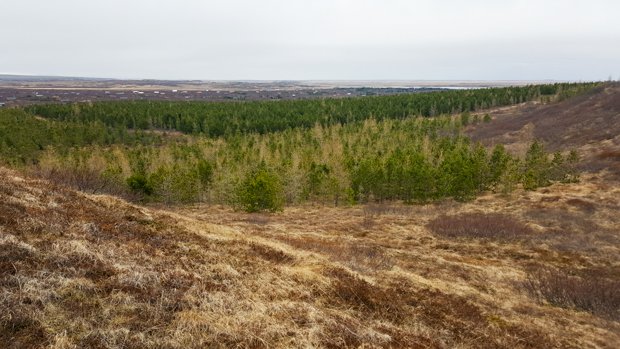
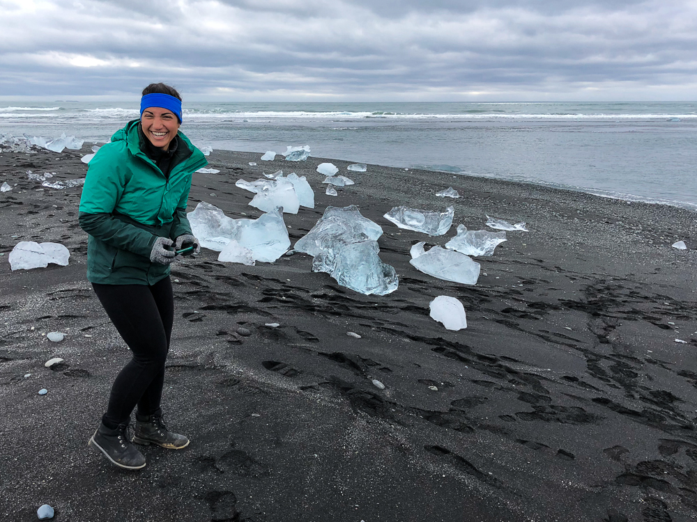
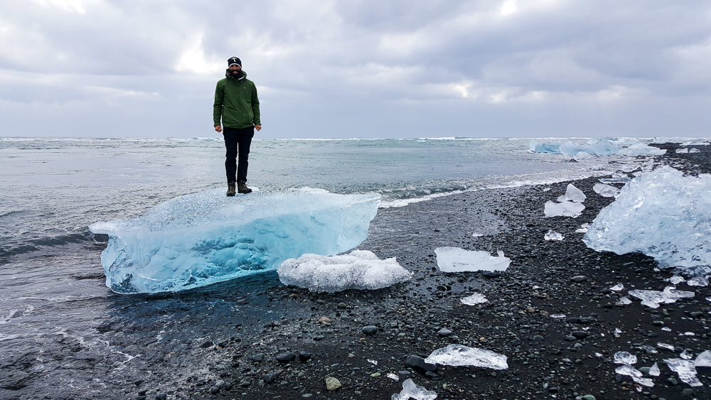
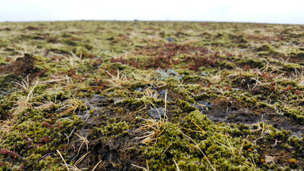
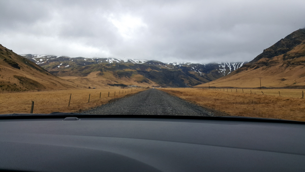
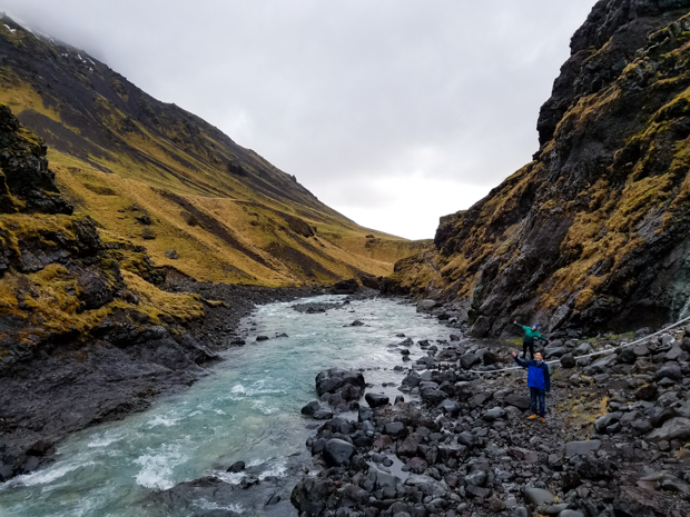
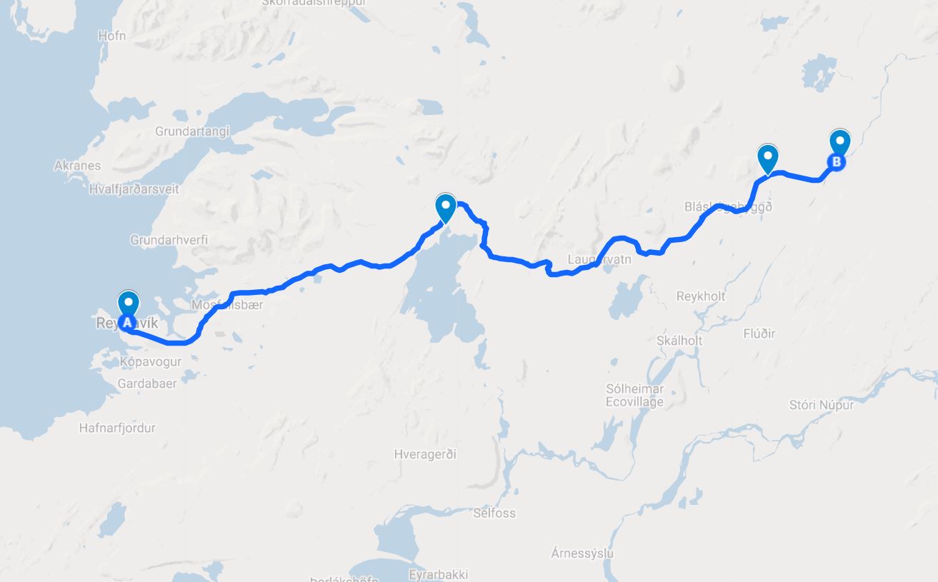
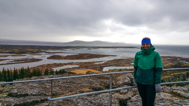
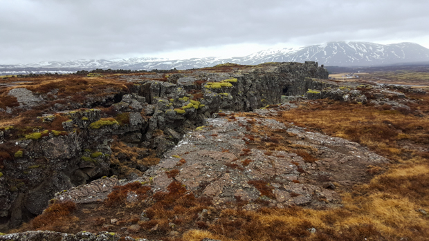
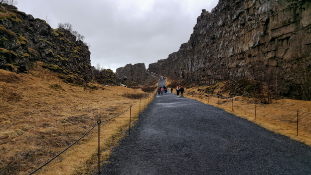
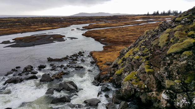
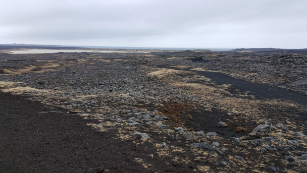
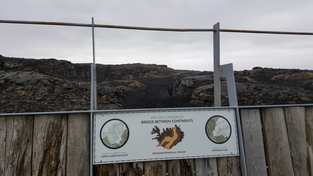
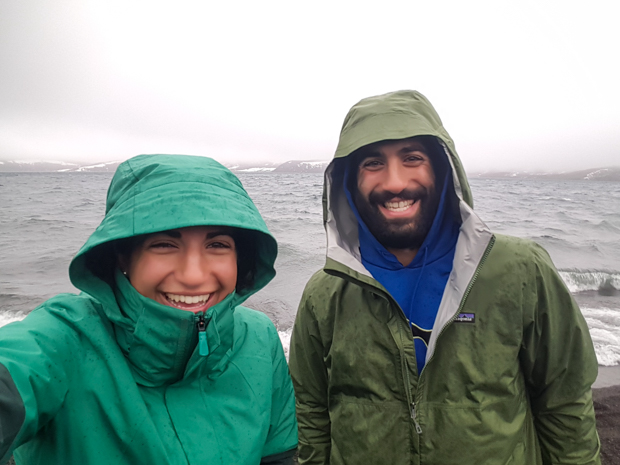
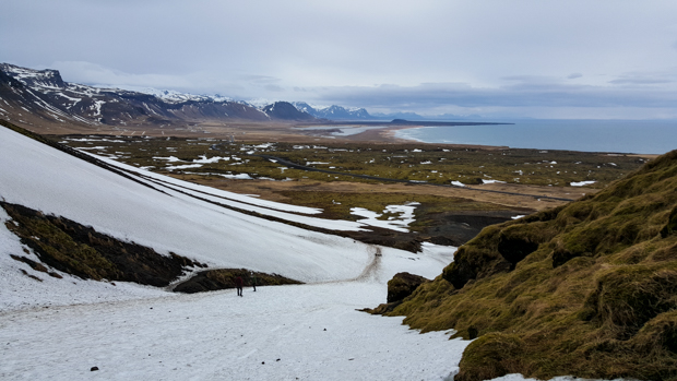
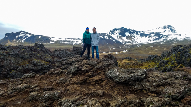
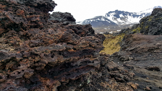
We still had one more day in Iceland, and since we had already gone east from Reykjavik, we decided to spend it exploring Snæfellsnes Peninsula to the north of the city.

Along the drive in the morning! So pretty, and a rare blue-sky sighting!

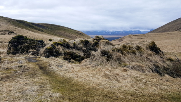
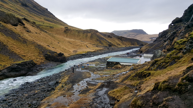
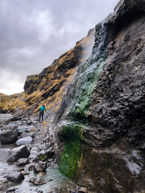
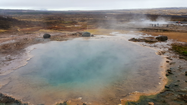
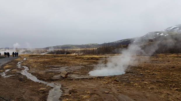
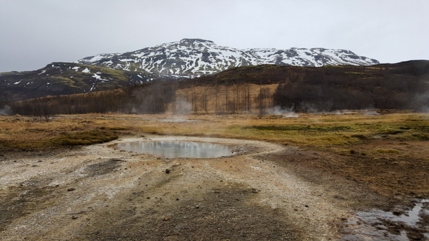
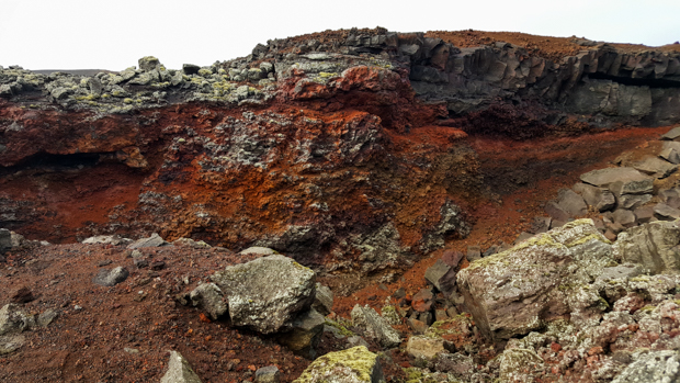
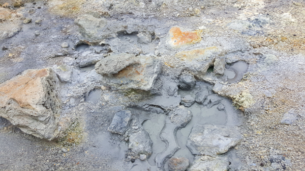
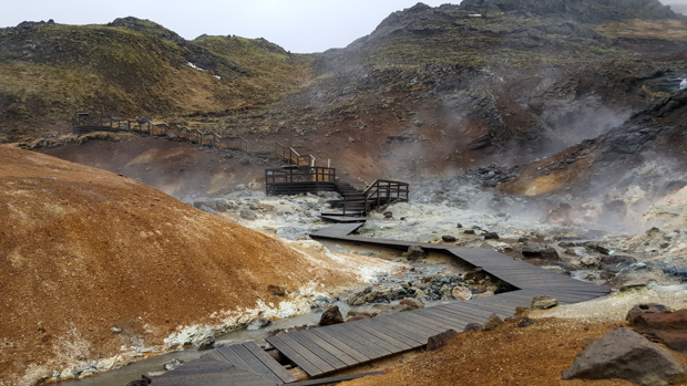
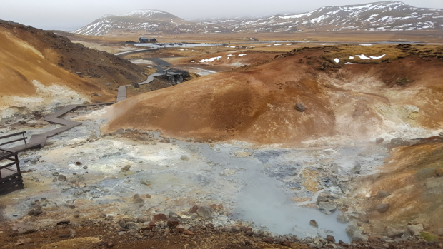
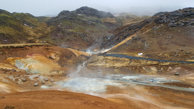
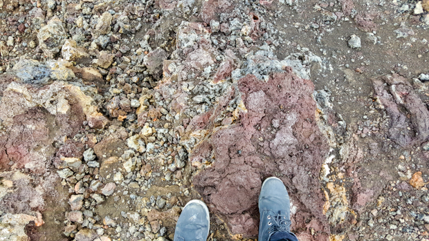
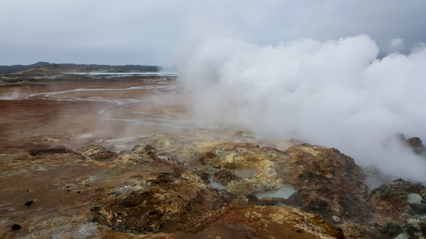
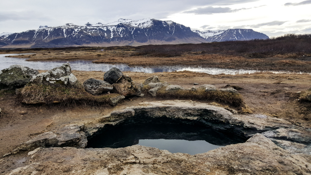
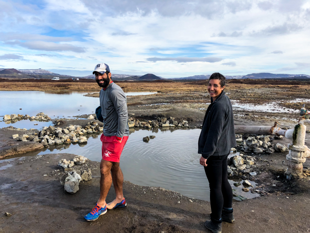
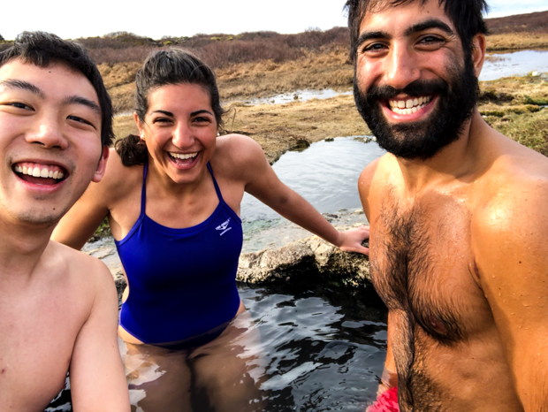
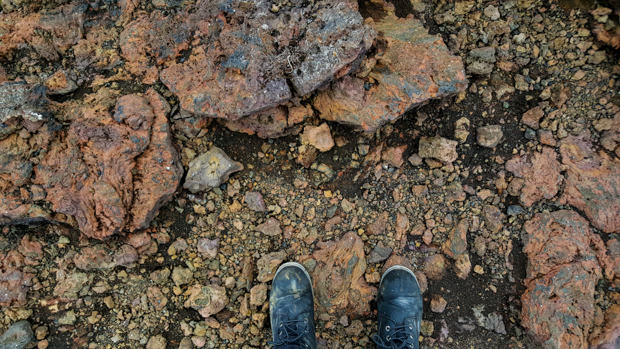
I had one request, and one request ONLY, for our time in Iceland. I wanted to go to a hot spring that wasn’t a swimming pool. I wanted it to be natural in every way, not just naturally heated. Our first stop of the day was a response to my ongoing request. I’d found a few lists of natural hot springs around the country, and one of them, Landbrotalaug, was right along our route. It’s kind of off the beaten path, but there were enough people who knew about it that we had to wait when we got there. Thankfully, we only had one group in front of us, and we didn’t have to wait very long since the water was so hot. There’s only a certain amount of time that you can even stand to stay in there.

Scenery at the hot spring
Personal sized.

We got into our suits and then waited in the car for the group before us to finish up. We were kind of second-guessing waiting, so we asked a couple of girls who were coming back to their car if it was worth it. Without hesitation, they said absolutely yes. Okay, convincing. So, we stayed.

When we saw people getting out, we headed in their direction. I thought that there was only one pool, but it turns out there are two! One is wide but shallow, and the other is deeper but smaller. We went to the big one first, but one of the people told us that we should check out the little one because it would be the perfect size for the three of us. It was so nice!!! It was the perfect size, as promised, and we stayed until we were feeling fully boiled. After that, I was 100% satisfied with our trip. I know, I’m hard to please. The Blue Lagoon may be the famous hot spring destination, but this was way more my style.

Mike and me with the wide/shallow pool
Does this not look like something straight off a postcard? That little pool is now one of my favorite places in the world.
Loving life!

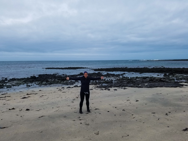
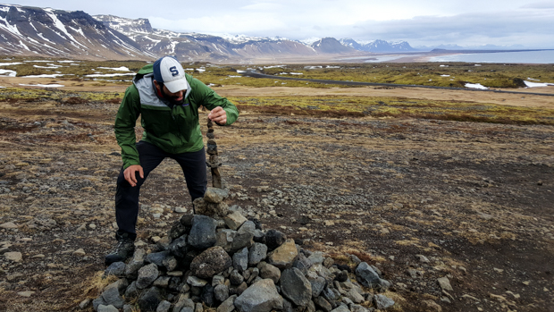
Since we had only a loose plan for the day, Tony and I spent some of the car time scouring the map for other things that people had deemed interesting on google maps. Some of our detour selections were more successful than others, but hey, you win some you lose some. I found a beach (Ytri Tunga Beach) where some of the reviews said you could see seals! I assumed that we wouldn’t see any because it was probably a summer thing, but I was wrong!! They were far away, but I was excited they were there at all! (Mostly because I suggested the stop, so I wanted it to be a good one.)

Can you spot the seals?
If you answered “no” to the spot the seals question, here’s some help.
The actual waterfall is probably the least exciting part of this picture.

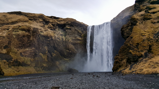
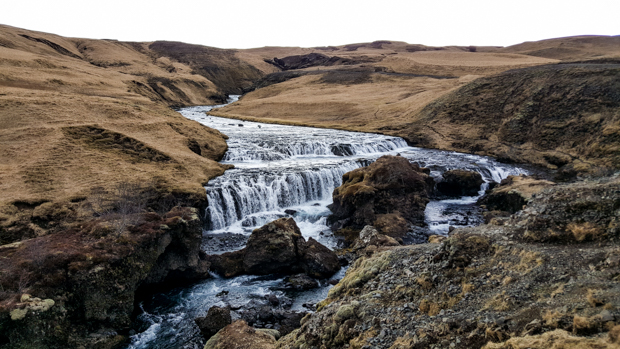
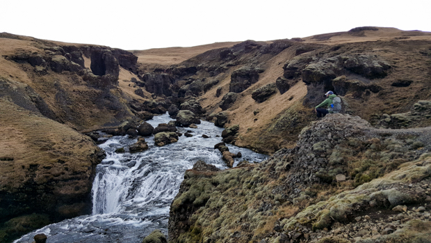
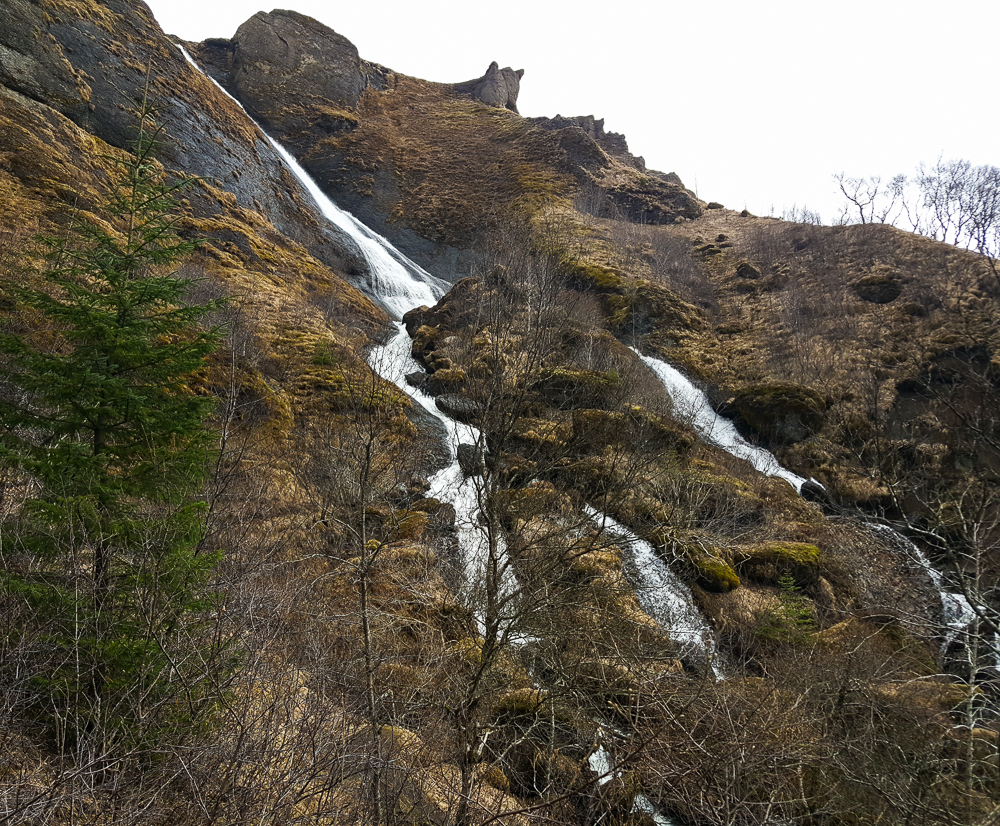
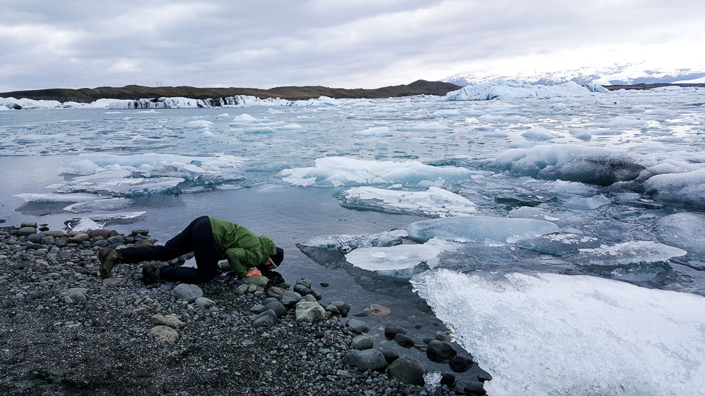
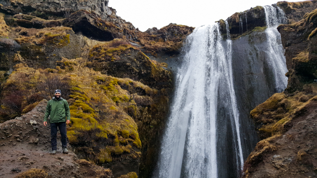
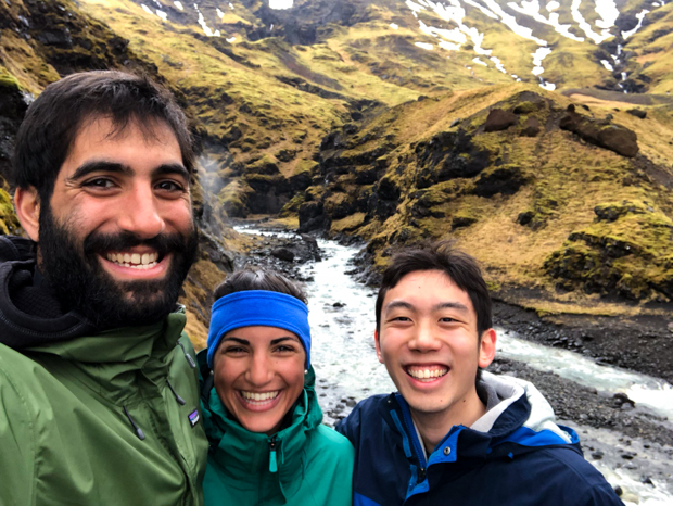
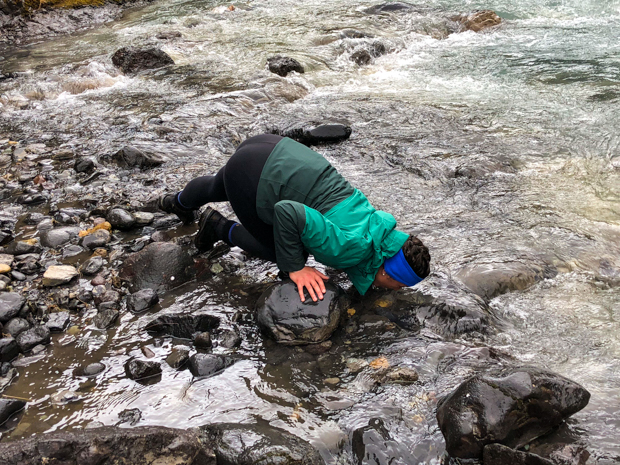
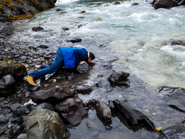
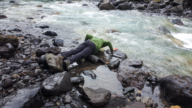
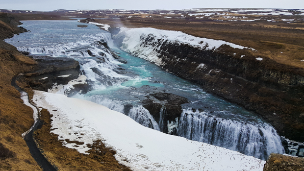
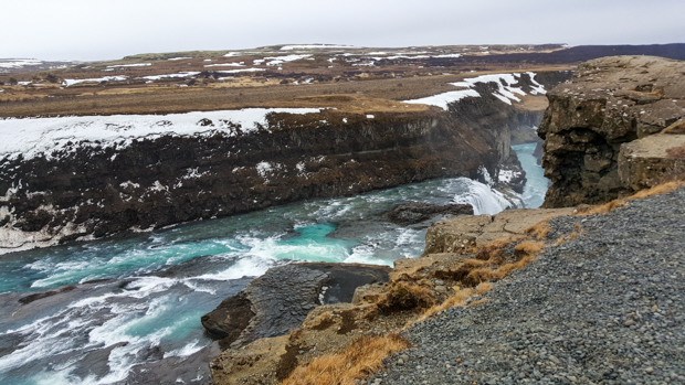
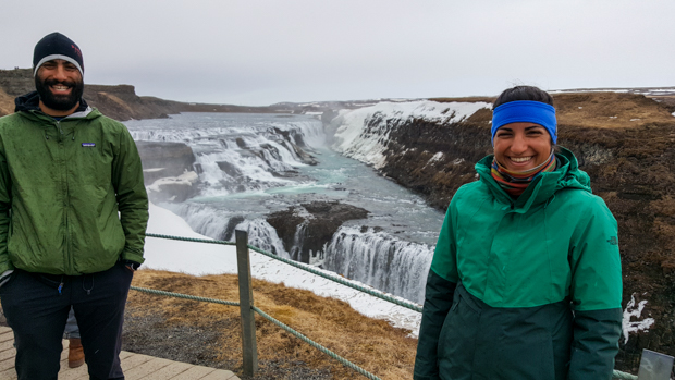
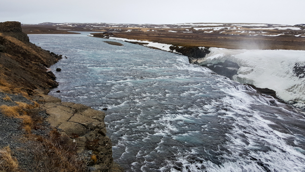
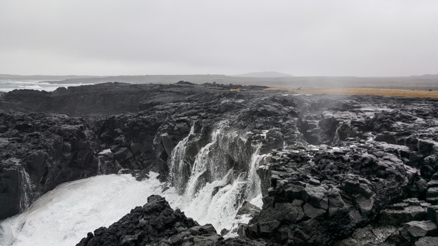
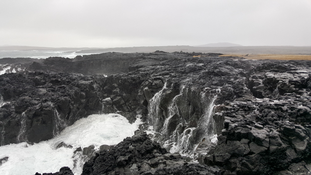
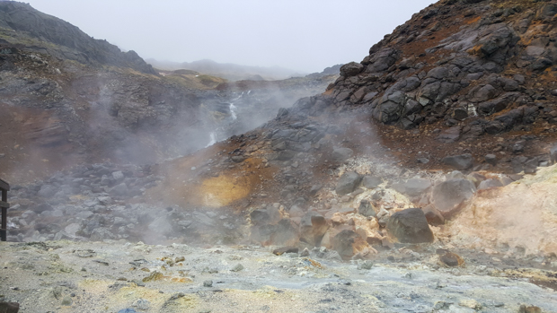
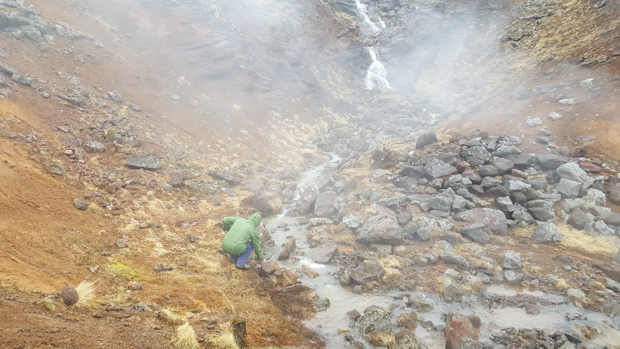
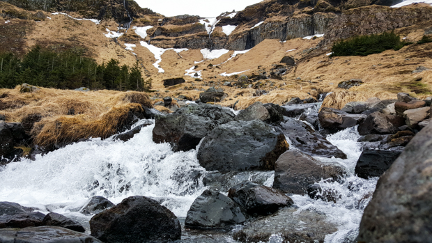
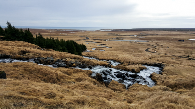
Tony found us another stop, this time a waterfall called Bjarnarfoss. The waterfall itself was practically a trickle coming off the top of a cliff, but the rapids that came cascading down afterwards were awesome. Water is seriously the coolest. Mike continued his strange tradition of drinking from every cold water source that we came across… what a weirdo.

I LOVE WATER!
Look at the river, snaking so clearly off into the distance.
The mossy walls of Rauðfeldsgjá

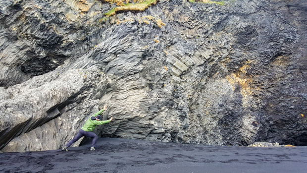
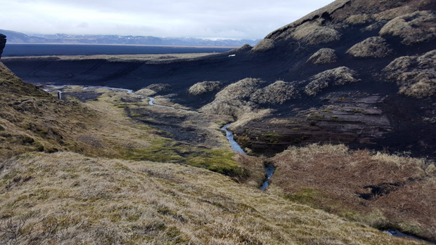
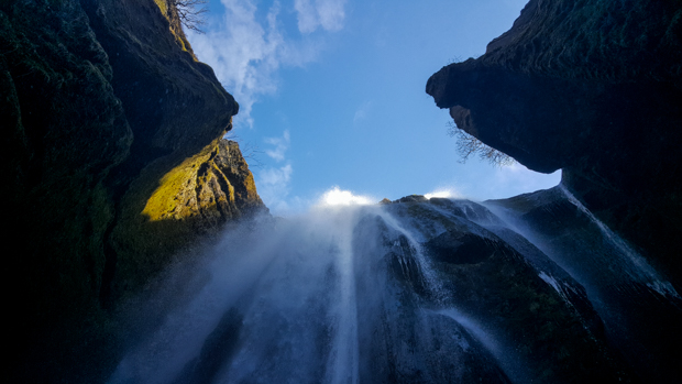
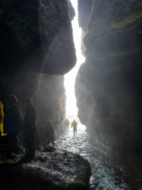
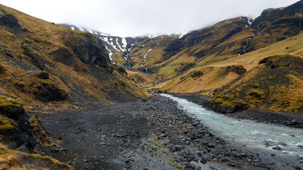
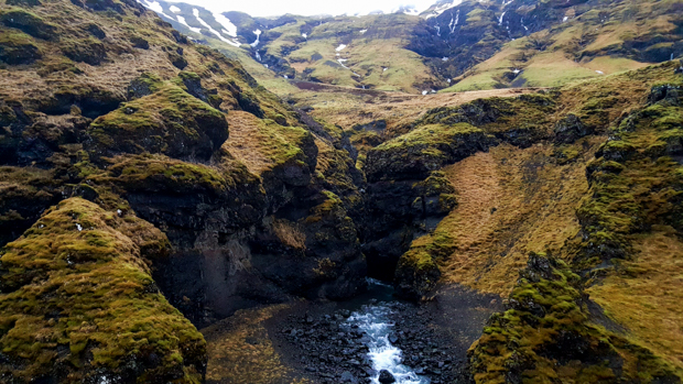
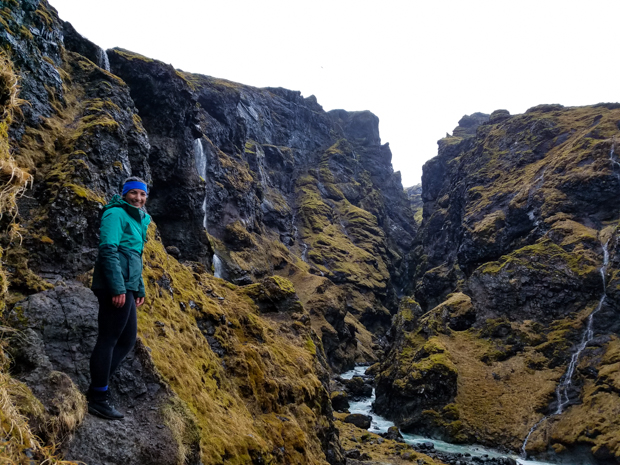
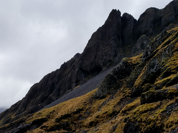
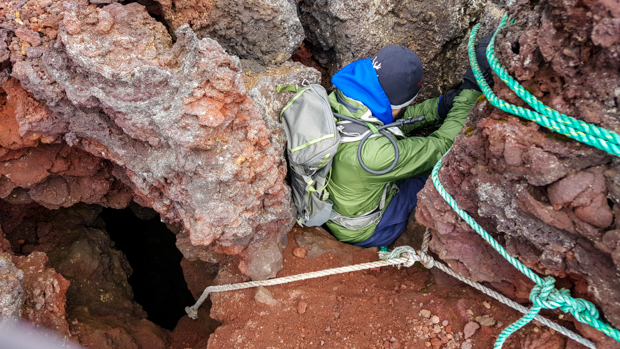
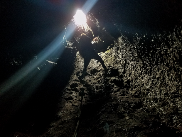
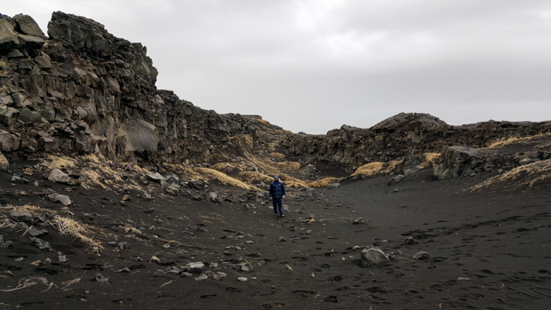
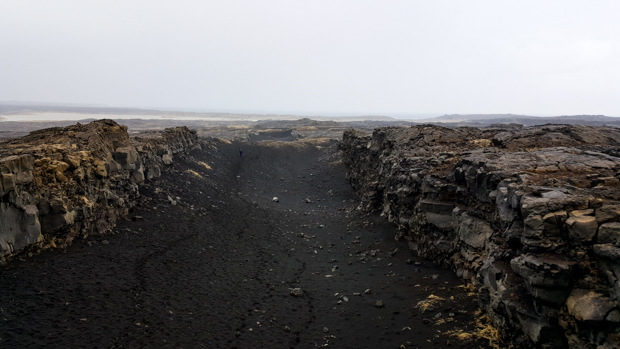
We also found a gorge on the map, Rauðfeldsgjá. It, of course, got its name from a legend. This is one of my favorites. There was a dude, supposedly half-man and half-troll, who “lived with his voluptuous and handsome daughters”. That’s a quote from the sign there, obviously only including the MOST important details of the story. The man/troll’s brother and two nephews lived nearby. One day, the cousins were playing together, and one of the boys, Rauðfeldur, pushed voluptuous and beautiful daughter Helga onto a drifting iceberg. No need to worry; she was unharmed and drifted alllllll the way to Greenland. Her angry father pushed Rauðfeldur to his death in the gorge that now bears his name and pushed the other nephew off a cliff which is now named after him. He then disappeared into a glacier and was never seen again. (Questions: Did Helga ever make it home? How do we know she survived? What was the brother’s response to the murder of his two sons? What happened to the other daughters after their father vanished? Why is it important to note that they were voluptuous? How did an iceberg drift all the way to Greenland, and how long did that take? SO many more, but I’ll stop there.)

Can you spot the gorge?
The surroundings

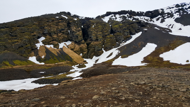
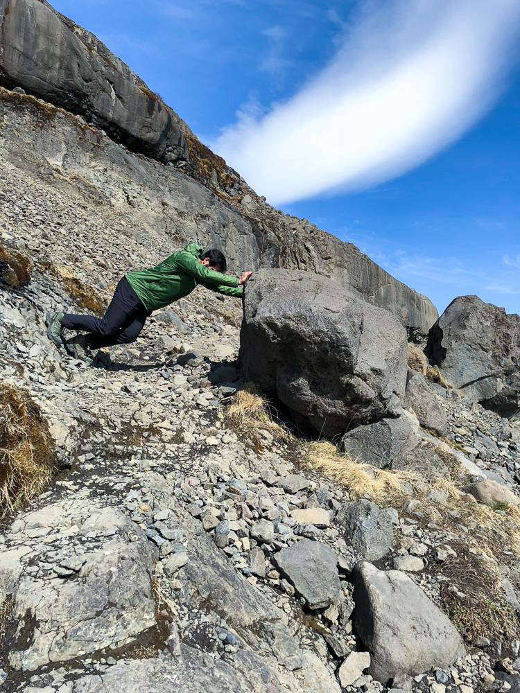
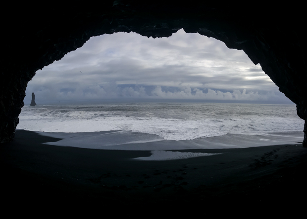
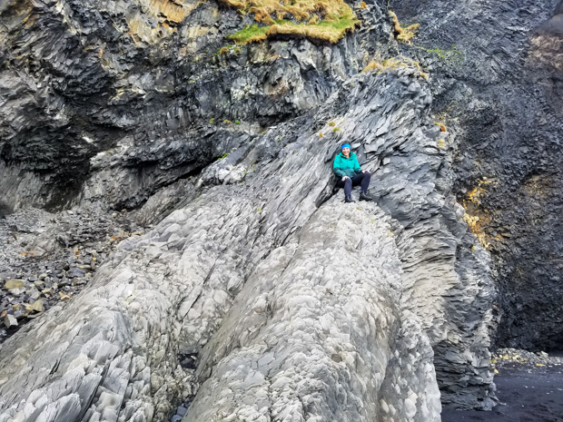
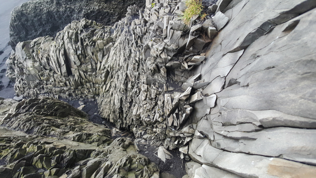
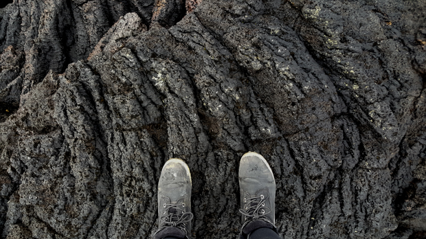
You can hike up into the gorge, and as you go, it gets narrower and narrower. Of course, when we were there, it was also filled with snow. We were already unprepared gear-wise (crampons and waterproof pants would have been helpful), and on top of that, no one even brought gloves from the car. We could have used those for sure… the entire “hike” was just climbing up snow. It probably went on forever. It was super cool, and I wonder what it’s like without the snow. We didn’t make it terribly far because we realized that as far up as we went, we would have to come back down. Down was the much worse direction.

Love this landscape!
Hiking up the endless dirty snow
Nature’s ice sculpture
Mike and Tony… it’s just as steep as it looks
Uphill until the end of time
The view from Rauðfeldsgjá
Mike’s cairn artwork. Look at that intense focus.

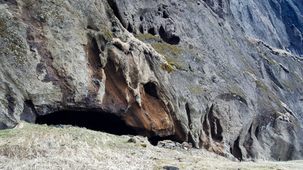
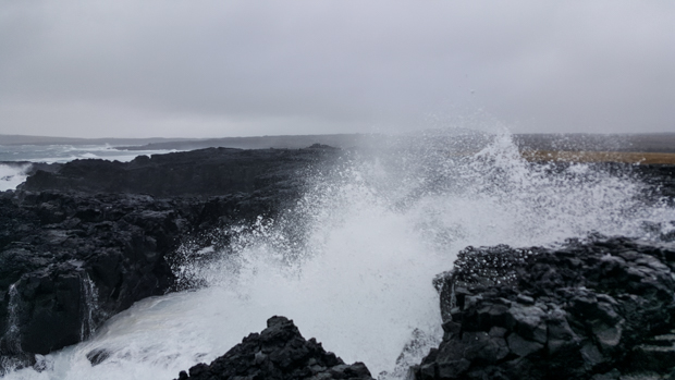
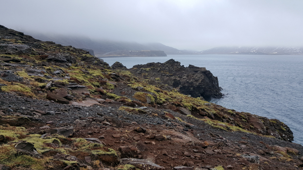
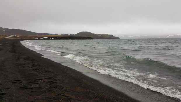
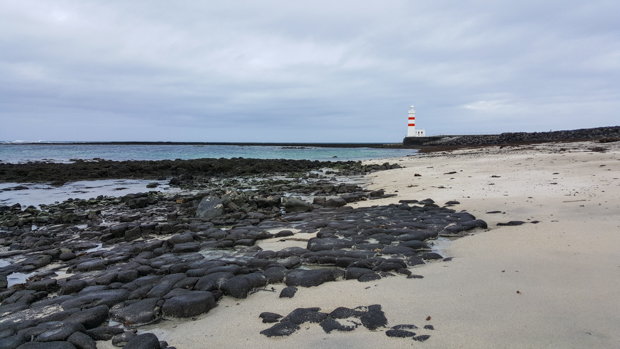
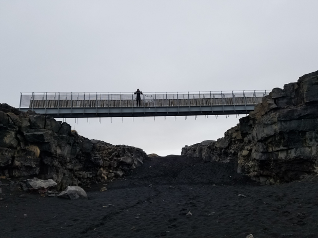
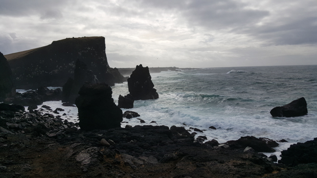
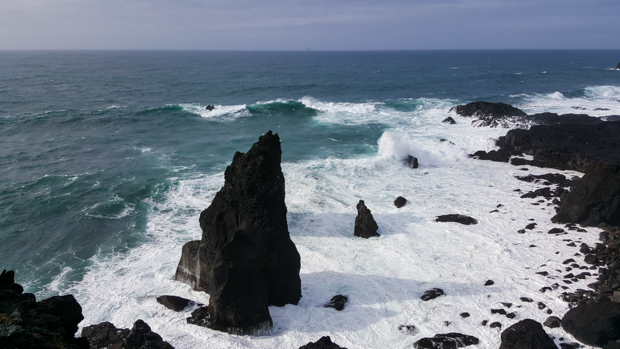
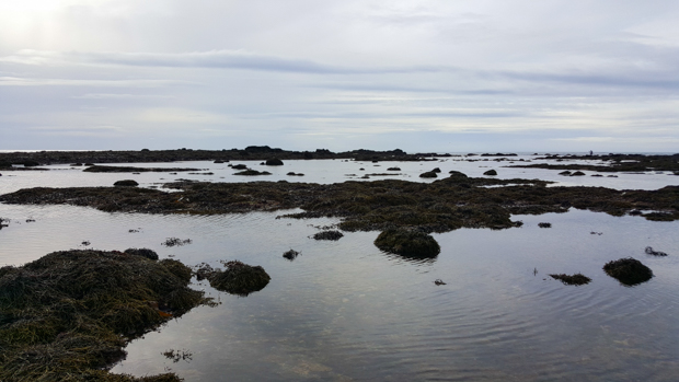
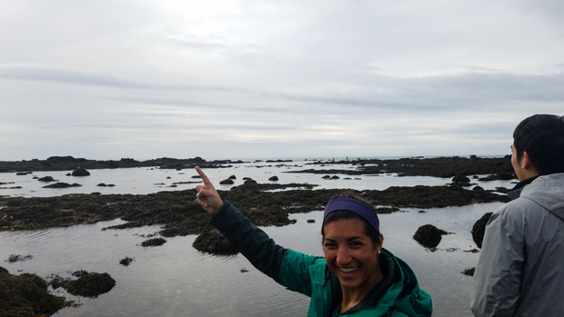
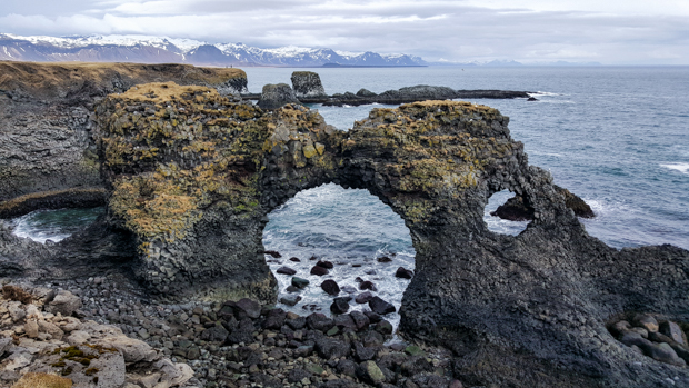
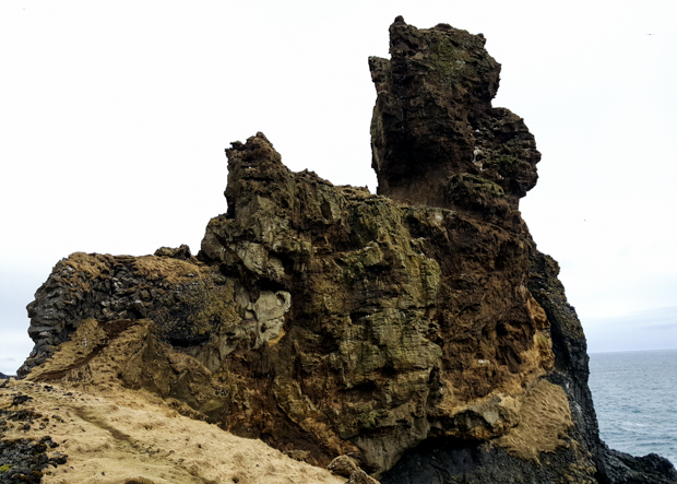
Our next stop was a pre-planned one to see a naturally-formed stone bridge in the water, Gatklettur. It’s a nice spot, and the sounds of the waves add to the whole serene vibe that it has going on.

Gatklettur
Trying to decide what the old man rock looks like (and eventually deciding old man).

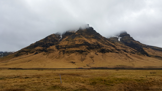
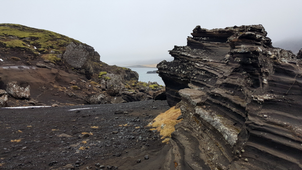
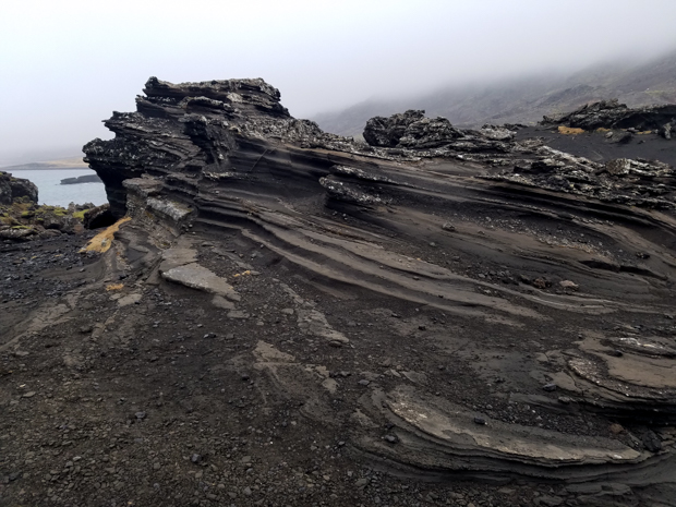
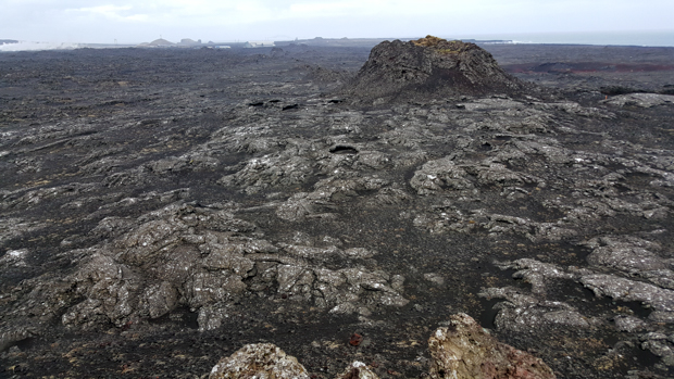
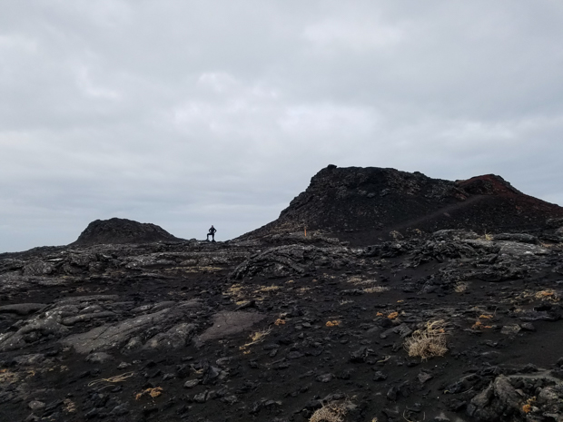
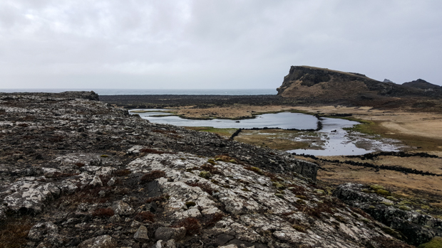
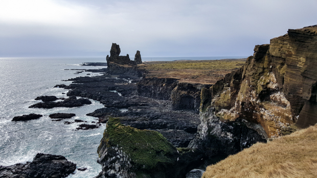
Next along the trek was Snæfellsjökull National Park which covers the end part of the peninsula we were exploring that day. In the park, we first went to see the Lóndrangar pillars… aka these two giant basalt rock formations that look like a horse piñata and the face of an old man (that’s my unofficial assessment). I was fine with just looking at them from afar, but Tony wanted to walk closer. Guess what? Up close, they STILL looked like a horse piñata and the face of an old man. So… not really necessary to walk all the way there, in my opinion.

Lóndrangar rocks from afar
Smooth black stones along the walk to the Lóndrangar rocks
Snæfellsjökull (glacier!) in the background. And Tony in the foreground 🙂
Try to tell me this doesn’t look like a piñata
Chillin’
I know I already had a picture of Snæfellsjökull but can you blame me for putting in another one? It’s crazy!
Malarrif Lighthouse
The steps to the rim of Saxhólar Crater… and Tony and me hating every step

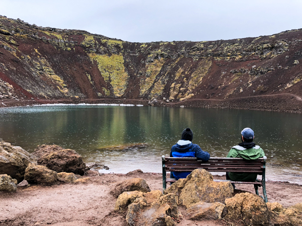
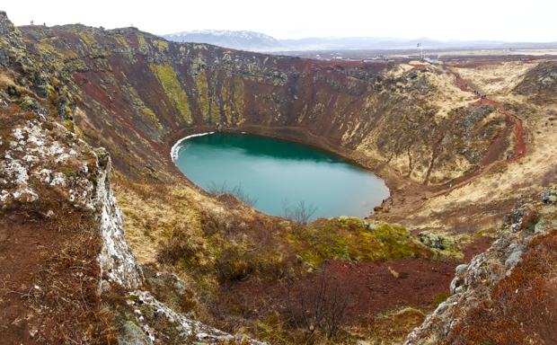
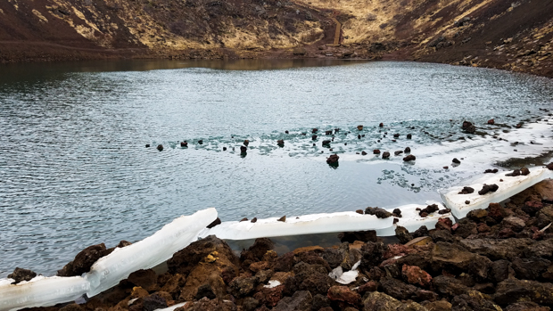
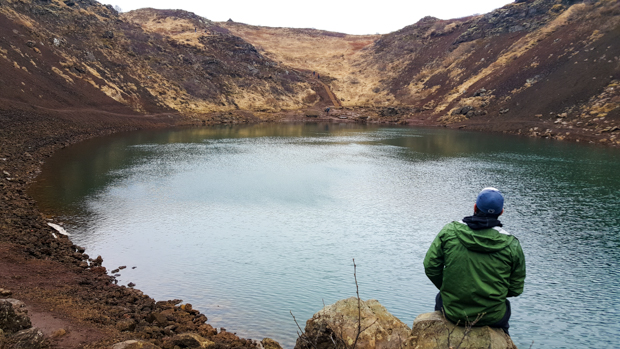
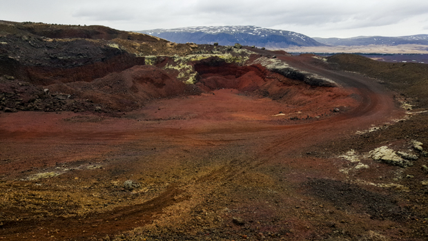
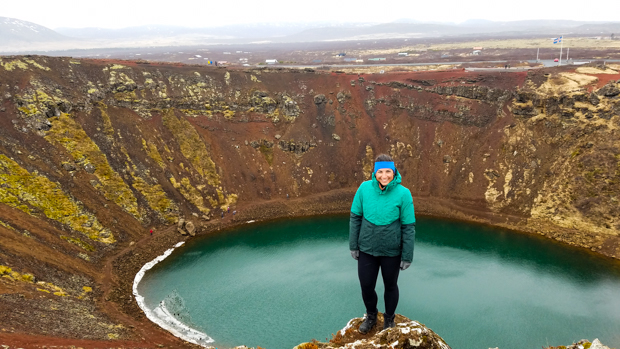
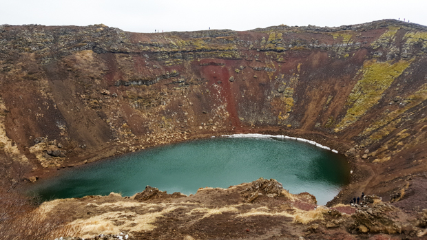
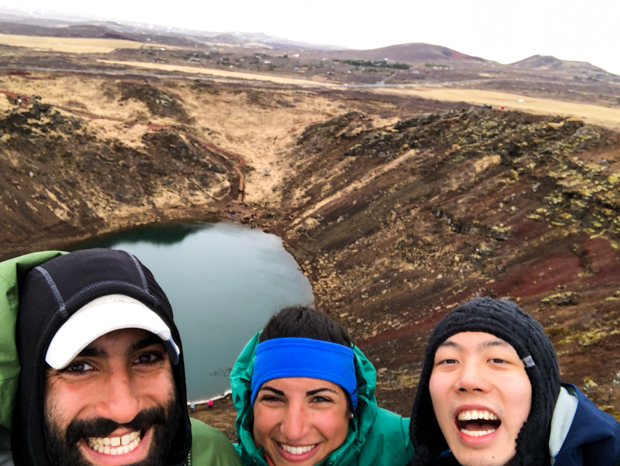
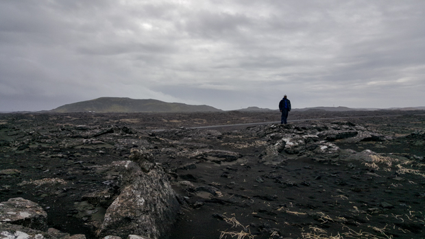
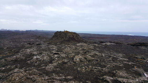
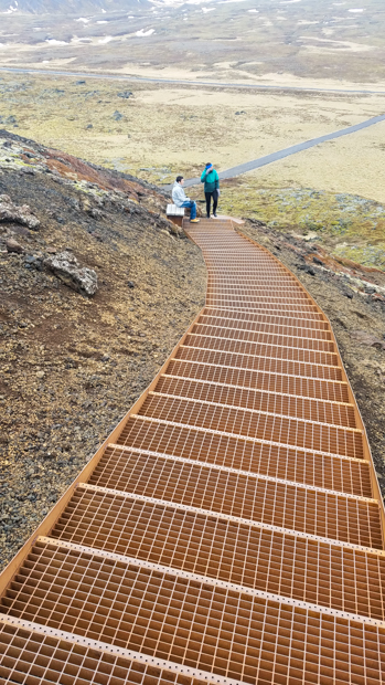
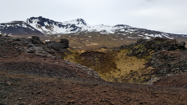
Our next detour was at Saxhólar Crater, another “hmm what’s that? Must be something because there are lots of cars” stop. The trek to the top involved a LOT of metal stairs, and there was a nice view from the rim. I mean, it was no Kerid Crater, but I suppose it was okay… (hehe)

Saxhólar Crater
Bro + sis pic
Some of the rocks at the top of the crater
Me and Tony casually standing on top of a crater
Those colors!

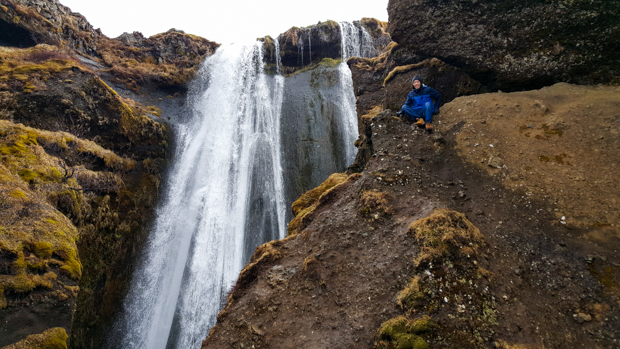
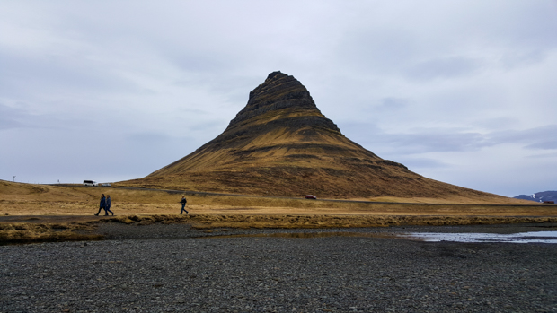
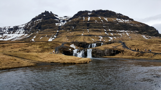
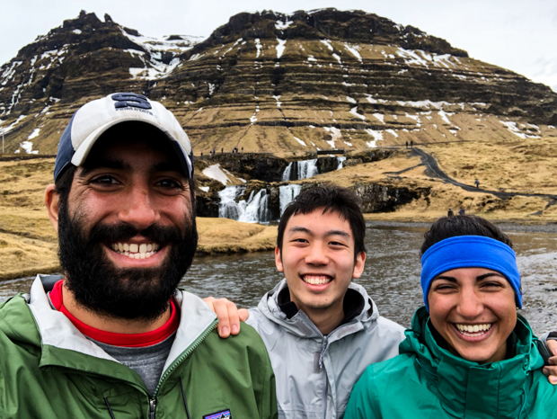
We stopped at one final waterfall, and even though I thought I could never get sick of waterfalls, I was definitely starting to get a little waterfalled out. We all were. Kirkjufellsfoss was absolutely worth a stop, but instead of walking all the way out to it and seeing it from the top as well, we just photographed it from the front and moved on.

Kirkjufellsfoss
Kirkjufell Mountain
Mike, Tony, and me feeling incredibly lazy at Kirkjufellsfoss. This is probably the best view anyway

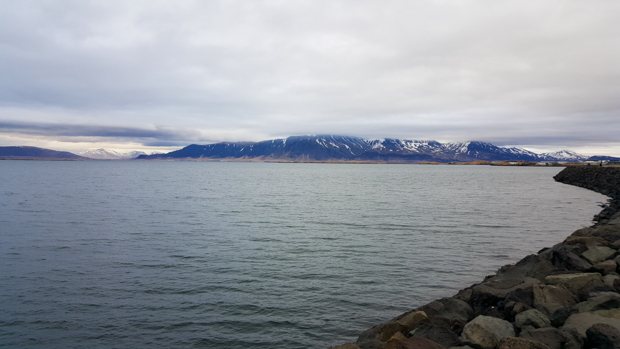
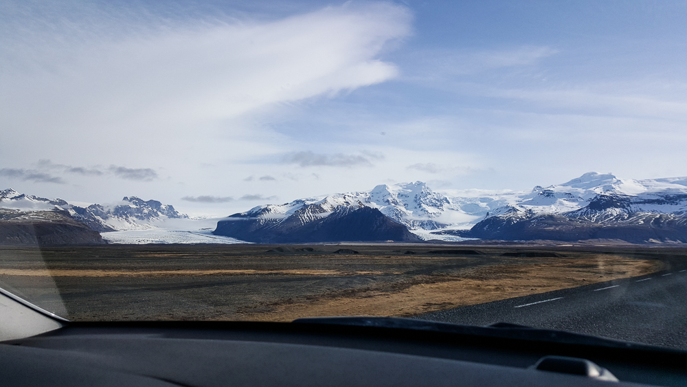
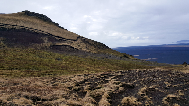
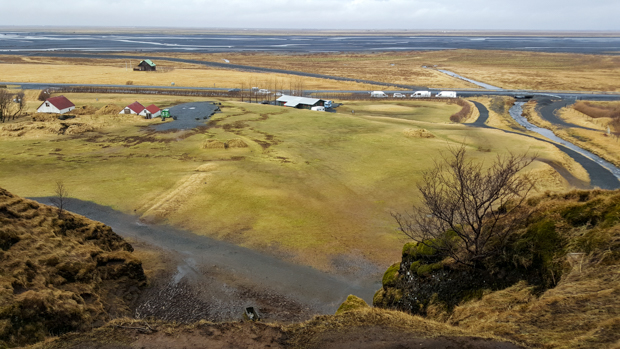
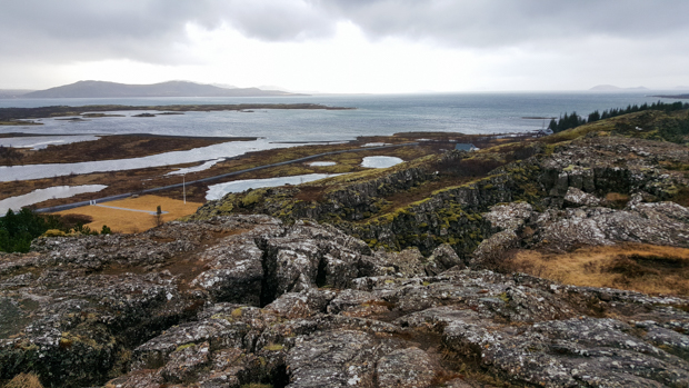
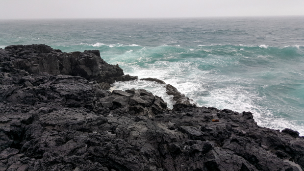
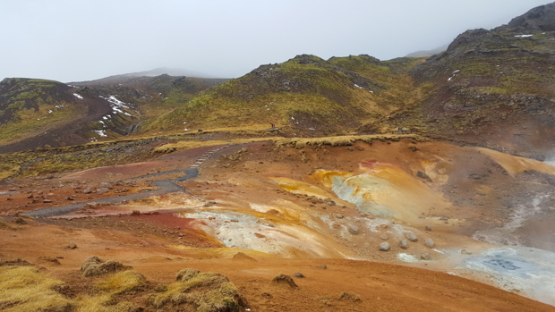
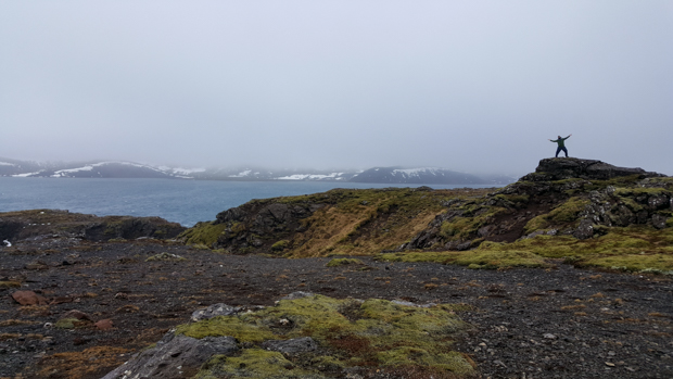
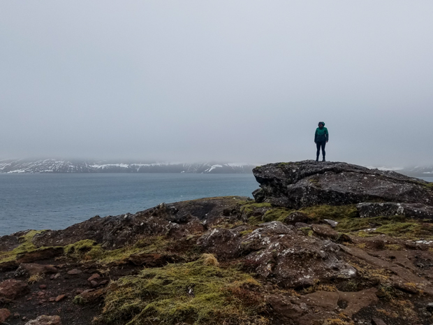
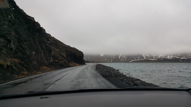
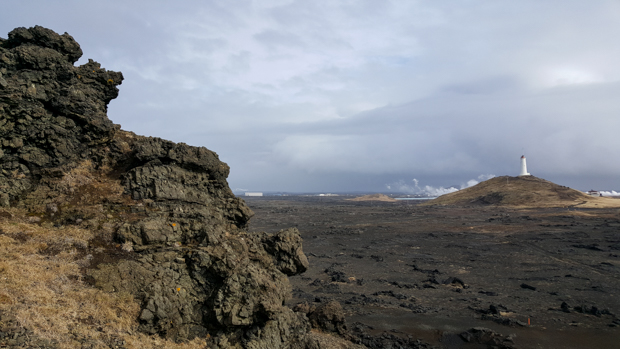
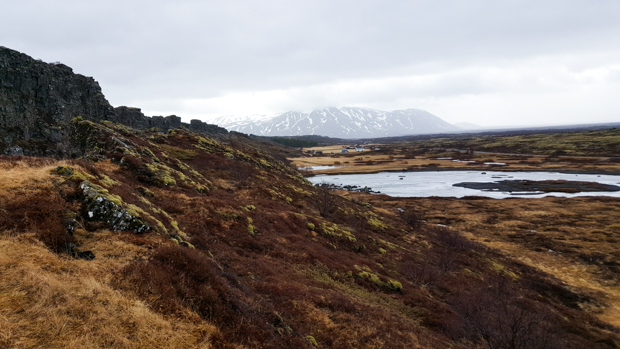
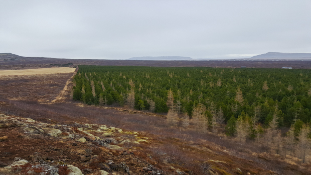
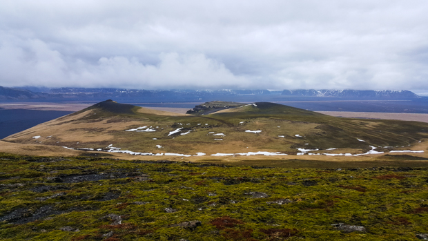
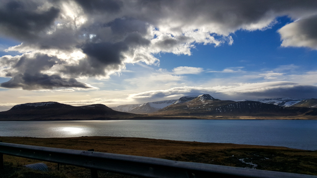
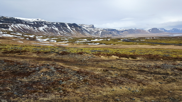
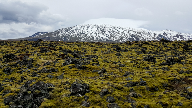
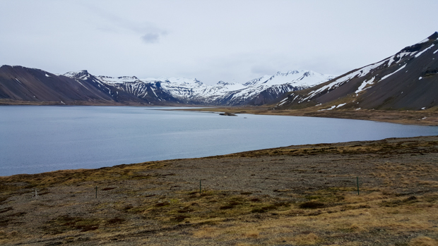
Along the road back to Reykjavik, there was a nice viewpoint looking towards one of the fjords, Kolgrafarfjördur, with some awesome mountains around it. I think that this was my favorite day for scenery, by the way. While we were driving and during our various walks, it was gorgeous. There were way more mountains than on the other days, and I’m a big mountain fan.

Kolgrafarfjördur. This is supposed to be a great place to spot ocean life during the winter, but we were a bit late for that.

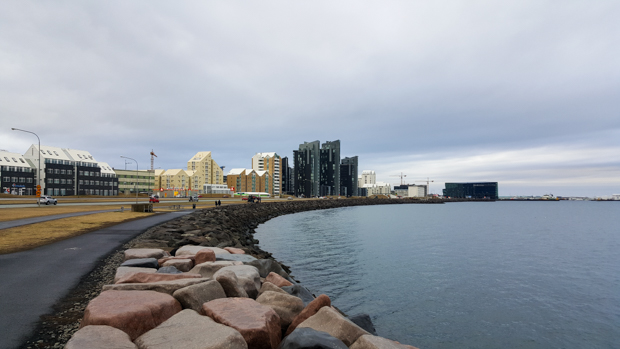
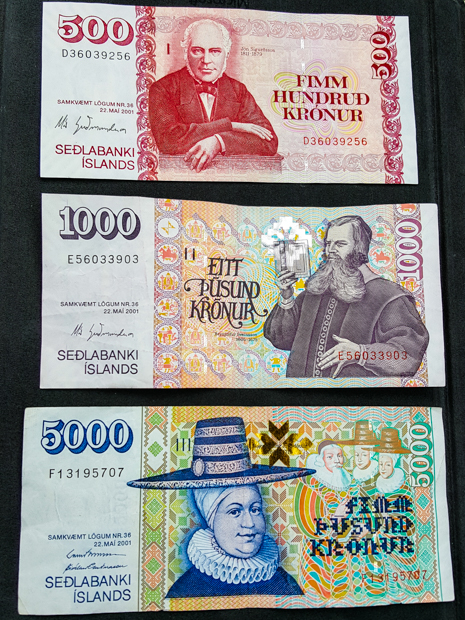
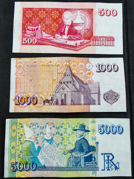
From there, we drove all the way back to Reykjavik. Mike and Tony went to the public pool for some hot tub time, but I opted out. I wanted to get started on packing and showering. After they got back, we went to dinner and then did some snack shopping. I had a VERY long airport day ahead of me, so I was sure to pick out nutritious snacks like mini chocolate chip muffins, Ritz crackers, and apples (1 out of 3 is good enough, right?). Travel day snack shopping is one of my favorite things because little-known fact but calories don’t count on travel days.

Tony enjoying our company, yet again
On the road…
We attempted to take a picture in front of Skogafoss… I clearly was NOT into it after standing there for a second and already getting soaked.

Negatives of visiting Iceland in the middle of spring:

  1. Rain
  2. Brown
  3. Closed trails

On this particular day, negative #3 was the primary bummer. Mike and Tony were excited about this hike (Fimmvörðuháls) that starts at Skogafoss, the waterfall where we spent the night. It’s supposed to be beautiful. It goes past a bunch of waterfalls and through diverse landscapes, and the whole thing (one way) takes 12-14 hours. We obviously weren’t going to do it all… we didn’t have the time, plus we had the car parked at Skogafoss, but we were hoping to hike for at least a couple of hours.

Our day started out as usual. We dragged ourselves out of the warmth of our sleeping bags, got ready and changed as quickly as possible (because brrr!), and put the tent and camping supplies into the car.

We were prepared for a hike of an unknown length because, despite all of the research Mike and Tony did, they couldn’t tell exactly how much of the trail was going to be hike-able. There wasn’t information online about trail closures except to say that some parts of the trail may be closed at certain times of the year. They decided that we’d go as far as we could, and that sounded like a good plan to me! So, we got ready for anything that might come our way and then set out with enough water and snacks for an army (a very small army… of three).

Skogafoss from a safe, spray-free distance
Skogafoss from above

First, we got up close and personal with Skogafoss… and then Mike had to change his pants because they weren’t waterproof and got completely soaked by the falls… and then we started the hike by walking up the seemingly endless stairs to the top of the cliff. The stairs were particularly annoying because they aren’t quite tall enough, so you can’t decide if you should go up one at a time or two, but they’re kind of long so two is a stretch (literally). Then as soon as you figure it out, you realize that they’re changing height and getting taller and you have to reevaluate everything. Who knew that going up stairs could be such a mentally exhausting experience?

When we made it to the top (Tony and I were out of breath and Mike was not), we stopped to see Skogafoss running off the side of the cliff before continuing down the trail. A few steps later, we passed waterfall #2, and Tony started up a waterfall count for the hike because we were supposed to see a ton. It unfortunately turned out that we didn’t need a waterfall count after all. At waterfall #3, there was a sign blocking the trail. Closed for the season.

Waterfall #2
Waterfall #3 and Mike

That was a bummer. Closed trails and changed plans are a part of life, but the most frustrating thing was that the only sign indicating the trail closure was about a mile into the hike. It would have been nice to know from the beginning, rather than preparing for hours of hiking only to find out 20 minutes in that it wasn’t going to happen. Side note though, if you’re into hiking and are going to Iceland in the summer, this hike looks amazing and you should do it.

Random stop along the road because we thought the water was pretty

We had a lot of extra time on our hands after the hike got crossed off the list. We tried to find something else to do along the road back to Reykjavik… and searched for a hot stream that ended up being closed as well. Okay, not ideal. Tony found a different waterfall on the map, Hjalparfoss, that was along the way and sure to be open, so we went there. I think it was mostly just so that we could do something that didn’t fail. We needed to turn our luck around!

Hjalparfoss in all of its glory. Mike liked it because he likes “waterfalls with some substance”.

Tony mentioned another sight that we could visit, Kerid Crater. Sometimes people do it as part of the Golden “Circle”, but Mike and I didn’t, so we decided to make that our next destination. Tony had already been, but he was happy to check it out again. He said that when he visited just a few weeks before, the crater was covered in snow and ice! We could see a little leftover snow, but for the most part, any indication of winter was gone. Tony also said that the water level was much higher before. His reference point was a bench at the bottom of the crater that was underwater during his first visit. This time, I took a few pictures of him and Mike sitting on the bench. Hehe.

Kerid Crater!
The last bits of snow and ice
Mike and Tony on the formerly-submerged bench (I took this absolutely phenomenal photo, in case you were wondering and even if you weren’t)

We walked around the rim of the crater and next to the water at the bottom, explored some of the other craters next to Kerid, and laughed at the perfect rows of trees that we could see in the nearby forest. Oh, the wonderful, unnatural foliage of Iceland.

Mike, enjoying the view
Rocks near Kerid Crater
If this doesn’t look like a strange planet to you, you must be an alien
Between the funky soil and the strange ground plants, everything about the landscape here confuses me.
Have you ever seen a picture crater than this one?
Still completely fascinated by the ground…
Check out that all-natural forest!
So pretty!!
Selfie struggles with Kerid

Once we had our fill of vibrant soil and freakish landscapes, we finished the drive back to Reykjavik. I was so excited to eat something besides peanut butter sandwiches and protein bars! Those were our primary food staples when we were on the road, and I think I got to the point where my mind didn’t even register them as food anymore.

As you can see, Tony loved checking out the scenery as we drove

First, we took showers because… well, it had been a while. Second, we went out for $20 Thai food again. Third, since we got back earlier than anticipated, we had time to check out some things around Reykjavik that I wanted to see!

The coastline in Reykjavik
We had a nice walk along the water on our way to the concert hall. The buildings look like they were made out of boxes.
Weirdly tall buildings. Most of the buildings in the city are only a few stories, so these really stick out.

I don’t think Mike or Tony cared much about seeing the city, but oh well for them. I had done some research, and there were a few buildings that I was determined to see. Plus, I just wanted to walk around a bit because it’s fun to explore new cities in interesting places. Our first stop was Sun Voyager, a sculpture installed in commemoration of the city of Reykjavik’s 200th anniversary. It’s made of stainless steel and looks like a Viking long-ship, but it’s intended to be “a dreamboat and ode to the sun”, symbolizing “the promise of undiscovered territory, a dream of hope, progress and freedom.” Whatever it’s supposed to be, it is pretty, especially with the backdrop of the water and distant mountains.

Sun Voyager! I waited for at least 3 minutes (specific, I know… it wasn’t quite 5 but definitely more than 1) until I could snap a picture without any unwanted tourists in the way.

The next two stops were the ones I was really pumped about: the concert hall/convention center and the church. Remember the hexagonal troll rocks that we saw at Reynisfjara and later at Svartifoss? Those rock formations seem to be the basis for basically all of the nature-inspired architecture in Iceland. The concert hall/convention center? Yep, it has a design that was inspired by the troll rocks. The church? TROLL ROCKS. It almost makes it seem like those are the only interesting thing in Iceland since that’s all anyone uses as inspiration, but that’s totally not true, as you’ve seen. I don’t know. I think people need to be a little more creative because come on, the rocks are such an easy choice. I want to see a geyser or volcano or Diamond Beach-inspired building.

We got to go inside the concert hall/convention center which was VERY exciting because I especially wanted to see the ceiling in the main atrium. I don’t know if it’s always open, but there was a gaming convention happening while we were there. Maybe we just got lucky for once!

Cairns outside of the concert hall. Don’t ask me why because I don’t know.
Harpa Concert Hall and Convention Center. The outside was inspired by the troll rocks. If you can’t see it, don’t worry. I think it’s easier to see from the inside
The geometry of the windows is definitely reminiscent of the rocks, but I thought this looked more like a pile of bubbles. There’s another place where the troll rock inspiration is much more obvious.
THIS is the ceiling of the main atrium, and if you can’t see the hexagonal troll rocks in this, you’re not going to be able to see them anywhere.
Up close with the facade
The concert hall from the side

The church (Hallgrímskirkja), unfortunately, wasn’t open. Not surprising considering it was about 9PM, even though it didn’t feel that late since it was still light outside. I’ve seen pictures of the inside, and despite the funky façade, it’s otherwise surprisingly traditional-looking. Very pretty though. It’s on the list for next time!

Hallgrímskirkja
Looking up!
You can definitely see the troll inspiration. In front, there’s a statue of Leif Erikson (the first European explorer known to have set foot in North America. He settled in Greenland).
Reykjavik street. I love the simplicity and the colors of the buildings. It’s like a cardboard city.

When we got back to Tony’s apartment, he and Mike planned for our last day of exploring while I attempted to start planning for my next stop! But we still had one day left in Iceland, so I won’t get ahead of myself. That night was luxurious. I slept on a sofa bed and didn’t have to wear a winter coat to bed. A 5-star sleep experience!

We played more pre-bedtime card games, and this photo is to prove that we played a perfect game. It’s this card game called Hanabi that Mike is obsessed with at the moment. I’ll admit that it’s pretty fun.

At the beginning of our trip, if you’d asked Tony what one thing he was most excited to see, he would have said, without a moment of hesitation, Diamond Beach. The interesting thing about his obsession was the fact that he didn’t seem to know much about it. Mike and I asked why it’s called Diamond Beach, and his response was “because it’s beautiful. Like a diamond.” Thanks, Tony. So, off we went to Diamond Beach, knowing nothing more about it than its name… which Tony insisted on repeating over and over and over until I was ready to throw him out of the car, and Mike banned him from mentioning it again until we got there (under the threat that if he heard the words “Diamond Beach” one more time, we were turning around and going back to Reykjavik. Tony wisely kept his mouth shut after that).

We had some good driving views…
It doesn’t even look real.

We got on the road after a brief stop at a waterfall near our campsite, Systrafoss, located in the forest of Kirkjubæjarklaustur. It wasn’t much more than a trickle when we were there, and I probably could have skipped telling you about it, but then I wouldn’t have gotten to type Kirkjubæjarklaustur and given you another opportunity to appreciate the names of Iceland.

Next stop, DIAMOND BEACH! The mystery of the name was solved pretty quickly once we got there. It’s a black sand beach, and thanks to the nearby glacier lake, it’s covered with glacier pieces that wash up on the beach after drifting out to sea. There are pieces of all different sizes, and many of them form abstract ice sculptures that sparkle in the sunlight as they melt. We had fun imagining what the different pieces looked like (it’s like cloud animals, glacier edition) and taking ridiculous pictures with them.

Okay, so maybe “trickle” was a bit of a down-sell, but compared to most of the other waterfalls we saw, this IS a trickle!
Diamonds! And you can see the other side of the beach across the outlet from the glacier lake
Tony, thrilled to be at Diamond Beach
Ice sculpture! I think this one looks like a baby ice dragon.
Mike pulling Tony on an ice sleigh
So cool!
Can you find me?
Ice hat. There was a hole all the way through.
I have to give Mike the credit for this picture… He was so committed that he practically lay down on the ground for it. This one looks like maybe a dragon or maybe a pegasus.
Adventures in self-timer
Some of the coolest ice I’ve ever seen (hehe get it?)
Getting his tan on

When Tony was satisfied with his Diamond Beach experience, we walked upstream to the glacier lake, Jökulsárlón. It was very pretty. I’m not sure what else to say about it, but it’s a lake… full of ice. And there’s a part that runs out to the sea, giving the future beach diamonds a way out. When we were finished staring at the lake, we paused to watch some little ice pieces that were trying to make a run for the freedom of the sea but were blocked by larger ones. We were completely sucked in by the action and cheered for one little ice as it struggled to break free. I imagine this is what Icelanders did in their free time pre-television. Maybe it’s also like the Icelandic equivalent of horseraces (but MUCH slower). You can put your money on an ice chunk, and whichever one successfully reaches the ocean first, wins. I’m a genius.

The glacier escape route (looking towards the glacier lake)
Walking up to the lake. This was the location of the big roadblock that the little ice pieces had to make it past in order to reach the ocean.
Craziness.
The classic Mike-drinks-freezing-cold-water picture
Just a few more…
So pretty!
Whoa!
Obsessed.
It looks like a partly melted slushie

Before we got back on the road, we decided to check out the other side of Diamond Beach too (on the other side of the outlet coming from the lake) because, despite Tony having no idea what he was talking about, he was right about it being beautiful.

My expression for basically the entire Diamond Beach adventure
Mike on ice
I love that you can see the waves crashing into the ice
Seriously… can you believe this is real? It’s like a precious gemstone… a MASSIVE precious gemstone
Boots, rocks, and little ice pieces
Crash!
So many diamonds!
Turned our backs on the ocean…

Diamond Beach was as far east as we were going, so when we finished there, we started back in the direction of Reykjavik. There were a few places we wanted to stop at on the way back, but we were also scouring google maps as we drove to see if there were other things nearby that might be worth checking out. One such discovery was Svínafellsjökull, another stick-out part of a much bigger glacier. The glacier that it’s a part of is called Vatnajökull, the largest glacier in Iceland. I quickly decided that visiting Svínafellsjökull was worth the detour x100000. We hiked up a ridge along the side, and it was breathtaking. I would have been happy to hike way farther than we did, but Mike and Tony were keen to keep moving. We walked until we were past all of the other people, at least, before turning around. Even with just that quick stop, it’s probably one of my favorite things we saw.

The road to Svínafellsjökull
Svínafellsjökull! Pretty sure the first words out of my mouth were, “You have GOT to be kidding me.”
Little speck Lara and speck Tony with ginormous Svínafellsjökull
Lara and the majestic glacier
Mike being Mike
Tony!
Sibling pic 🙂
I know, you’ve seen enough… but come on. This is crazy!!!
It’s quite the view
This picture is pretty funny. Can you find Mike? Can you find me?
Just one more! Hehe

Our next planned stop was Vatnajökulsþjóðgarður, or Vatnajökull National Park. Mike and Tony were hoping to do some of the hikes there, but unfortunately, our visit wasn’t timed very well for hiking season. Most of the trails were closed for the season with an opening date of May 1, and we were there in mid-April (now you can see how far behind I am… oops). That was a bummer, but at least we could still hike to Svartifoss, another famous waterfall. This one has hexagonal troll rocks like the ones we saw at Reynisfjara beach, but at Svartifoss, they’re mostly hanging down instead of coming up from the ground.

Our classic Iceland lunch – PB (&J for Mike) with the most hideous backdrop
First peek of Svartifoss
Smiling because the weather was warm enough (for about 5 minutes) to wear short sleeves.
Check out those troll rocks! Maybe they’re hanging here because they’re troll bats that forgot to retreat into their caves before the sun came up.
It was actually (kind of) hot out, so I took off my top layer of pants and was left with these leggings. Mike made fun of me because he said my outfit was ridiculous. I think I look fantastic. Check out that color coordination!

We made one more unplanned stop on our way to the campground for the night. This was another “there are lots of people over there so maybe we should see what they’re looking at” moment. Well, it was clear what they were looking at: a couple of massive, mangled steel girders. What wasn’t immediately clear was why they were there and what was so interesting about them.

Remember how I talked about how there are volcanoes under the glaciers? There are also some sub-glacial lakes that are maintained by the volcanic heat. One such lake, Grímsvötn, is beneath the glacier Vatnajökull. It cycles between slowly filling and eventually releasing the water in a mega-flood. In 1996, there was a volcanic eruption that accelerated the fill cycle, melting 0.75 mi3 (3 km3) of ice in just 13 days. The lake was filled higher than ever before in recorded history, and the resulting mega-flood was incredibly destructive. The flood waters carried glacier pieces along with them, some weighing as much as 1000-2000 tons. TONS!

The mangled steel girders that we were looking at used to be part of a bridge that clearly didn’t fare so well, despite being designed to withstand mega-floods. It had deep foundations and allowed about 6m clearance for glacier pieces to pass underneath, but in this instance, it would have needed more than twice that height to be safe. The result? Well, the beams speak for themselves…

That is NOT a small or weak beam. Imagine the force that was needed to do this! And it was all natural! Crazy, amazing, and a little terrifying

We made our way to that night’s campground, set up the tent, and played card games before falling asleep. Mike and Tony were hoping to do a long, waterfall-filled hike the next day, so we needed all the sleep we could get!

Campsite for the night

Related Posts

Petrified Trolls of Iceland – Do you like the funky “troll” rocks around Svartifoss? Do you have no idea what I’m talking about? Learn more about the formation of these interesting lava rocks.

Perito Moreno Glacier – if you’re a glacier fan, join us for a trek on this South American glacier!

Ada Foah – compare the black sand beaches of Iceland to the picturesque and slightly more tropical beaches of Ghana.


Continued from the previous post

Our next stop was to see a glacier! I was excited because it was our first one of the trip. We weren’t sure if it was worth stopping just to take a look, but we figured why not? The glacier is called Mýrdalsjökull (jökull = glacier), and we went to this one part that sticks out a bit called Sólheimajökull. At least that’s what I think the situation is with the names, but honestly it’s a little hard to keep track, especially with all of the crazy Icelandic names. Mýrdalsjökull is on top of Iceland’s largest volcano, Katla, which is due for an eruption anytime. The big eruption in 2010 that sent ash all over Europe was from a smaller volcano nearby… and usually, the eruption of one leads to the eruption of the other within a decade. Katla is very closely monitored because even minor eruptions can result in major flooding from the glacier melt.

Me with Sólheimajökull! Mýrdalsjökull, the full glacier, is the 4th largest in Iceland.

I thought the glacier was awesome, but we were pretty far away so we didn’t get the full effect. It would have been cool to do some glacier hiking or whatever it’s called. I’ll have to add that to my list of things to do when I go back to Iceland one day!

Mike, me, and Tony
Sibling pic on some petrified trolls. Mike said I could go on a higher one so that I could be taller for once. Thanks, Mike.

This is where the craziness of Iceland’s landscape diversity comes in… We were at a glacier, and then 30 minutes later, we were on the beach. Reynisfjara is a black sand beach, but the really cool thing is the rock formations there. They look like a bunch of pencils bundled together and sticking up at different heights. There are two options for how they were formed:

  1. The columns are trolls that were turned to stone when they were caught outside at dawn.
  2. They’re basalt columns (basalt is one of the rocks formed by lava). They’re formed when lava cools and contracts, making hexagonal rocks.

Guess which option I prefer.

It was more of a pebble beach than a sand beach. The ground looks super cool!
Mike holding up the entire cave with his super strength

There’s also a cave at the beach which, of course, has a name of its own: Hálsanefshellir. The rock formations in there are similar to the petrified trolls, but since it’s a cave, they’re coming in from all directions instead of being just straight up and down. I think we got lucky because we were there at low-ish tide, so we could get into the cave. It was still a bit of an adventure because we had to run towards the ocean as the water retreated to get to the other side of the troll rocks and then run away as the waves came back in, re-separating the two parts of the beach. And, we had to watch out for sneaker waves…

I love all the shades of blue and grey in the water and the sky
Inside the cave
Tony and Mike messing around
Full view looking out from the cave

Sneaker waves are basically waves that are much bigger and come much farther into shore than the others, hence the “sneaker” part of the name because they can sneak up on you. The concept of sneaker waves is not at all funny… people have died from getting swept out to sea by the strange and unpredictable tides. We were quite entertained by the signs though, and the fact that they’re called sneaker waves never fails to make me giggle.

The sign says:
DANGER
– Very dangerous sea currents
– Deadly sneaker waves
– Never turn your back on the ocean
– Supervise children
The graphic in the middle shows the danger zone close to the waves that you should avoid, the light blue ones are “ordinary waves” and the dark blue ones above are “deadly sneaker waves”.
To the right, it gives information about a tourist death due to the waves.

I kept imagining someone standing on the beach with a big cartoon wave behind them, tapping them on the shoulder… Surprise! The signs tell you to “never turn your back on the ocean!” We had a lot of fun yelling that at each other. And then we turned our backs on the ocean a couple times (unintentionally!) and found ourselves sprinting up the beach to avoid getting soaked by surprise waves. So that’s what we get for not listening. (Strongly recommend that you heed the signs.)

Standing at the edge of a foamy wave, definitely keeping one eye out for sneaker waves…
Mike doing some earthbending
I found the perfect spot to protect me from the sneaker waves!
Cool rocks near the cave
There are also some rock formations out in the water, Reynisdrangar. In typical Iceland fashion, each of the three rocks also has its own name because why not. They are the remains of two trolls who went to help tow in a large ship… and then the dawn came and petrified the trolls AND the ship. Trolls must be extinct considering how many rock formations are attributed to their failure to keep track of time.
Hooray for black sand beaches!

We had a little more driving to do before we got to our campsite for the night, but we still had plenty of daylight (thank you, super long days). We’d hit all the major destinations for the day, so we consulted Aunt Judy’s list of notes to give us some ideas for a few more stops to make along our route.

On our way to see a cave from her list, we passed a sign marking the start of a hike on Hjörleifshöfði mountain. I have no idea what convinced us to do it, but we had some time and why not? Okay, I’ll take the blame. I didn’t think it seemed that long. In the end, I’d say that at least 50% of it was underwhelming mostly because the entire world was brown (it’s probably fab in the summer), but in terms of Icelandic history significance, it wasn’t a complete bust! We trekked across the treeless mountain, through mud and snow and little ground plants, until we finally reached the top of the mountain where there’s supposed to be an amazing view of the surroundings… and guess what? A heavy fog set as we were approaching the top, so we couldn’t see anything except the faint outline of some strange stone structure.

Looking back at the path as we climbed up
Mike surfing a dirt wave on a dirt surfboard
Multicolored mud
So. Weird.
Ground plants!
Mike paying his respects

It turned out to be a Viking graveyard! This is one of those situations where we wouldn’t have been surprised if we had done ANY research or had even just read the signs before starting the hike because it’s kind of a big deal. Oops. Hjörleifur Hróðmarsson is buried there, the “second settler of Iceland”. His brother was Ingólfur Arnarson, the first settler. Hjörleifur only survived one year on Iceland before he was killed by his slaves. He was avenged by his brother, and apparently, the mountain is now haunted by him… add that to the list of things we didn’t know. Maybe that explains the fog.

The graveyard itself was very confusing. There was this big cylinder/cone thing that was next to the plot of land where the graves were. I thought maybe it was some weird Viking burial thing since it didn’t seem to serve any obvious purpose, but turns out it’s a marker built by Danish surveyors.
Hjörleifur’s grave
Family plot from some more recent inhabitants of the mountain with Hjörleifur’s grave mound in the background

Finally, as we started to walk down from the gravesite, the fog cleared and we had a view of the seemingly endless lava fields stretching in every direction. The mountain we were on must have dropped out of the sky because it’s the only one in the area, and around it is flat, flat, flat.

Going down
Mike and Tony, thrilled to be here
The top of the mountain was weird
Lava fields stretching to forever

On the way back to the car, we passed some ruins/old foundations of two farms. The former farm inhabitants are buried on a plot next to Hjörleifur. I thought the whole thing was kind of cool. Mike and Tony were probably just trying to figure out why they’d listened to me about the hike. Sorryyy.

Farmhouse ruins
Walking back down into the valley
Hjörleifshöfði cave

Since we were already so close, we did stop by our original target (2 hours later…) Hjörleifshöfði cave. It was probably worth a quick stop, but at that point, I think we were all tired and hungry and slightly grumpy. After a brief poke around, we headed to the campsite for another much-needed sleep on the cold, hard ground. This night was extra cold. Ugh.

Little caves along the base of Hjörleifshöfði mountain
Our car outside of the cave. Doesn’t this look like a car ad?

Where’s the best place to start off your day after sleeping on the cold, hard ground? In a HOT TUB! Thanks to Iceland’s abundance of geothermal heat, there are naturally heated swimming pools all over the place. One of the reasons Mike picked our particular campsite for our first camping night was because it’s in a town (Hveragerði) with a naturally heated pool (Laugaskarð Swimming Pool), and you can pay ~US$9 (not super cheap but very reasonable comparatively) to go in and use the pool and hot tubs. The pool was built in 1938, is Olympic length (50m), and most importantly, used to be the practice location of the Icelandic national swim team.

The pool. The hot tubs are out of view, hidden behind the building to the left. See the steam rising from the water? The lap pool was definitely cooler than the hot tubs, but personally I thought it was a little warm to swim in for more than a few laps.

Anyone who’s been to a swimming pool in Iceland will tell you that there are very specific locker room procedures. They totally have it down to a science. First, we had to leave our shoes upstairs to keep from tracking dirt/water into the locker rooms. Second, they don’t use chlorine in the pools, so you have to take, as the guy working there informed us, “a proper naked shower” before you go in. There are VERY aggressive signs in the locker room telling you 1. that you can’t take pictures while in the locker rooms and 2. what areas of the body to focus on while you’re taking your proper naked shower (privates, armpits, feet, and head). Third, you’re supposed to plan ahead somewhat because the only part of the locker room that should get wet is the shower area/space immediately outside the shower. I did NOT do this and had to run into the dry part of the locker room after showering to get my suit. Whoops. If anyone asks, I’m not the one who got water all over the floor.

Then, after you get out of the pool, you’re supposed to go back into the shower where you’ve thought ahead and stored your towel/shampoo/conditioner/soap in the little cubbies nearby so that you can shower and dry off before going into the dry changing area. Yeah, I also didn’t do that. In summary, I messed up the whole system, the entire locker room floor was dripped on by the time I left, and I was just happy that there weren’t other people present during my mess-up moments to judge me for my ignorance. (Mike and Tony weren’t so lucky and said that they were getting looks from their fellow locker roomers as they failed to follow proper procedures.) A woman came in as I was leaving, and I pretended that I wasn’t the reason why the entire floor was wet. The system is actually kind of genius… once you know what you’re supposed to do. Oops.

At the pool, Mike and Tony and I had very different ideas of what we wanted to spend our time doing. Tony and I were very pro-“sit in the hot tub and bake”. Mike wanted to swim laps so that he could pretend to be an Icelandic Olympian. Weirdo. There were a few different hot tubs, each marked with the water temperature. There was also a place where you could plunge into frigid water, and Tony and I watched in horror as some guy submerged his entire body. Please note that the air was NOT warm, and the only reason we were okay walking around in swimsuits was because our bodies were warmed up by the water. I think I would have turned into an ice sculpture if I got into the cold water and then tried to walk to the locker room.

Seljalandsfoss. I took this picture on our way out when the sky decided to clear up for about 5 minutes. It’s 197′ (60m) tall.

We all had a nice bake in the hot tubs, and after we were fully roasted, we took showers and headed out to start our adventure! That was the warmest I would feel for the rest of our trip… kidding. But seriously. Our first stop was Seljalandsfoss which is, that’s right, a waterfall. This one is cool because you can walk behind it. Remember when I said that waterproof clothing is a must? Yeah, this is why. We got completely soaked, but my top half was totally dry underneath my jacket (shout out to Andrea for lending me a waterproof jacket, without which I would have been completely miserable, no exaggeration).

The cave wall behind Seljalandsfoss. So many colors!
Seljalandsfoss with little speck Lara getting soaked behind it
Mike, me, and Tony after our drenching voyage behind the waterfall
It’s not very easy to see much of the waterfall without doing a little work…

A little farther into the park is another waterfall, Gljúfrafoss (or Gljúfrabúi). It’s mostly hidden behind a cliff, and there are two ways to see it. You can hike up to the top of the cliff to see it from above, or you can walk through a slot canyon/river and see it from below. We went to check it out from above first, but the best part was definitely going in to see it through the canyon. At first, I didn’t want to go because I thought that you had to wade through the water to make it there, and I still wasn’t completely confident in the waterproof-ness of my boots (I bought them in Armenia for $18, so despite the salesgirl’s assurances, I’m sure you can understand the reason for my doubts). Mike and Tony went ahead, and they said that there was a path of stones that you could walk on and make it most of the way, if not all, without even really getting your feet wet. Okay. Sure enough, it was no problem (though it did require some minor contortions), and I also started thinking that maybe my boots really were waterproof… talk about a bargain!

Standing in some very slippery mud… eek
View from the cliff
We hiked up to the top of the cliff first
Tony and Mike both crawled up to this crazy spot. I was happy to stick with mildly terrifying cliff #1
Mike with the falls
Another top-of-cliff view
You can’t get much more than a glimpse without doing some fancy footwork through the river
Not a great picture, but here’s me getting soaked by Gljufrafoss
Looking up from the rock. This was during the approximately 5 minutes of blue skies!
Looking out from the waterfall
Crossing the river on the way to Seljavallalaug

From there, we drove to another pool, Seljavallalaug, that’s also naturally heated, smells strongly of sulfur, and is one of the oldest pools in the country, built in 1923. It was built as a place to teach kids how to swim, obviously an important skill in a country surrounded by water and originally occupied by mainly fisherman. Today, swimming is a required subject in public schools.

Road views
Spooky, right?
Mike, making sure he doesn’t slip on the muddy path

We thought we might go in, but the water was all green with algae and it was more lukewarm than hot… so instead, we just looked at it and then hiked around the area a bit. It’s in a valley with another one of those crystal-clear rivers running through, aka it was hideous and I couldn’t stand looking at it. JUST KIDDING I WANTED TO LIVE IN IT. But it was NOT warm.

The valley
The pool… looking a little green
It looks like that pool just dropped out of the sky
Crystal clear waters! And me and Tony

The crew
Spot the Lara, doing her best not to totally eat it on the hike
Tony and I decided to take a page from Mike’s book for once and drink straight from the river. Great in theory, tricky in execution.
Tony taking his freezing sip of water
Mike successfully executing the push-up-style river drink. My upper body strength wasn’t interested in supporting this technique.

Spooky rocks

There were a bunch of people in the pool when we came back past on our way to the car, but I was VERY happy with our decision to skip it. I actually felt clean after the morning swim/shower. I didn’t want to mess that up so soon. We still had a long day ahead!

Your finger is probably ready to fall off from scrolling through so many pictures, so we’ll take a pause here so you can recover. There are just too many pictures to choose from!

To be continued…

One of the big tourist circuits in Iceland is called the “Golden Circle”. It primarily includes three sights to the east of Reykjavik, and it’s doable in a day trip which makes it popular for bus tours and people on long layovers. Now, don’t ask me why it’s called the Golden Circle because I certainly can’t explain that to you. I would assume that the “golden” part has something to do with the fact that these are major sightseeing destinations and one of them is called “Golden Falls”. Okay, I can get behind that. It’s really the “circle” part that I have an issue with. Please refer to the map below and tell me what shape you would use to describe the route.

This. Is. Not. A. Circle.

If you said “circle”, get out. I know it’s been a long time since I took geometry, but that is a LINE(ish). Some versions of the route include some other sights a little further south, but when the essentials are all in a line and the optional extras are what makes it a circle(ish), I think calling it a circle is a stretch. So, the conclusion of that completely necessary rant is that I will be unapologetically referring to our route as the Golden Line.

Mike and I planned to hit the Golden Line sights on our second day. I want to take this opportunity to give a HUGE shout out to my Aunt Judy because she was the MVP of our trip. The amount of planning that we put into this trip was far from ideal… it was close to zero. Anytime I tried to research, I was completely overwhelmed by information and quickly put off further efforts until “later” (a later that never came). Aunt Judy sent us her research notes from their trip to Iceland a few years ago, and those notes became our guidebook. We didn’t follow them completely, but at least we had a starting point to make sure we didn’t miss anything major.

Our day started later than planned. Mike wanted to leave at 8:30, and considering what time we went to bed the night before (we ate dinner at 10PM, so you can extrapolate from there), I had no confidence in that actually happening. Sure enough, we ended up leaving at closer to 9:30. The first stop on the tour was Þingvellir (Thingvellir) National Park.

Thingvellir, as I explained in the Iceland History post, is considered the founding location of Iceland. This is where the first parliament (the Althing) met back in the days of the chieftains, making laws and settling disputes. So historically, it’s a very important place for the Icelandic nation. We, of course, knew none of this when we arrived and had no idea what we were supposed to do there, so we parked the car (and paid for parking, so we were hoping it was worth it), pep-talked ourselves out of the car (it sounded like we were in the middle of a world-ending rainstorm), realized the weather wasn’t nearly as bad as it sounded from in the car, and went to do some exploring.

Our first glimpse of Thingvellir
I’m doing a great job of pretending that I’m not cold or getting rained on, right?

There was a nice view of the valley near our parking lot, and after reading the signs, we realized that another thing on Aunt Judy’s list, Öxarárfoss (waterfall… “foss” is the ending that they put on the name of a waterfall in Icelandic), was inside the park. Also, it’s another place situated between the two tectonic plates. We walked beneath the cliffs at the edge of the North American plate on our way to the waterfall. I guess that kind of means that we were on no-man’s land, floating between two continents. Weird. There are some places in the park where you can scuba dive between the plates. That would be crazy!

The land on the left is the edge of the North American plate
Walking through no-man’s land

Mike and me with Oxararfoss

We eventually made it to Öxarárfoss, our first of many waterfalls. Unlike most of the others we saw, Öxarárfoss is man-made! The Öxará River was re-routed hundreds of years ago to bring water closer to the meeting point of the Althing, and it flows over the edge of the North American plate. It’s basically a waterfall off the end of the earth! I thought it was pretty, and Mike liked it because he likes waterfalls that “have some substance”. None of those little trickle waterfalls for Mike!

On our way out of Thingvellir, we drove by the largest natural lake in Iceland, Þingvallavatn (Thingvallavatn. “vatn” is the usual ending on a name of a lake). It’s about 32mi2 (84km2) in area and is known for its crystal-clear water and monstrous fish. I don’t know much about fishing, but they say that it’s not uncommon to find trout over 20lbs (9kg)! The lake is in the valley between the two tectonic plates, and it sounds like a good place to explore if you want to feel like you’re swimming on another planet and enjoy being cold.

Thingvallavatn in the distance

If you prefer warm/scalding water, then you might be better suited to our next stop, Geysir. I bet you’ll never guess what that is. Yup, it’s a geyser! It might seem like the people who named Geysir aren’t very creative, but it’s actually the other way around. The English word “geyser” comes from its name and the Icelandic verb meaning “to gush”. Geysir is just one geyser in a much larger geothermal area, Haukadalur, but it is the oldest and most powerful, capable of sending 480oF (250oC) water over 230ft (70m) into the air. It is currently inactive, last erupting from 2000-2003 after it was temporarily reactivated by an earthquake. The big crowd-pleaser now is Strokkur, erupting every 8-10 minutes and shooting water about 100ft (30m) into the air.

First glimpses of the geothermal area

Before we checked out Strokkur, we admired the sleeping beast that is Geysir and a few other pools in the area. The water was beautiful. It’s so clear and so blue… and then you get a whiff of it, and the sulfur smell is overwhelmingly gross. But I was cold and in a constant internal conflict of whether I should stand in the steam to feel warm or if I should stay away from it because it reeked.

Konungshver hot spring. It started boiling vigorously – as in, water flying up to 1m high – after the earthquake that reawakened Geysir. There are boulders blocking its vent, so there’s a chance it could be a geyser if those were removed. Check out that water! So blue!
Don’t be fooled by this calm-looking pool. Here we have The Great Geysir (I didn’t just make that name up, that’s a real thing), just biding its time until another earthquake shakes it into action again.

We joined the crowds to watch Strokkur erupt a few times. The eruption is super cool, and while that’s not happening, it’s entertaining to just watch the people… everyone’s standing around staring at this steaming, bubbling pool, and anytime there’s the slightest change in movement, you can hear people bracing for the eruption. Then, when it’s finally time, it looks like a massive water orb is coming out of the pool, water shoots into the air, and you hear it raining down. When you really think about it, it’s baffling. No wonder people used to believe in all sorts of monsters and stuff because if you told me there was a whale-dragon hybrid living in the earth and superheating/spitting out water at that spot, I’d probably say that sounds like a reasonable explanation.

I spent equal time watching the people at Strokkur and watching the geyser. Everyone had their phones at-the-ready for an eruption at any second. I imagine there were a lot of 10-minute videos waiting for the 5-second eruption.
Strokkur!

Mike had fun touching all of the water… well, not all of it because some of it probably would have burned his hand off… but a lot of the water in various places and guessing whether it was going to be hot or cold. It was usually disappointingly cold, but we did touch the water runoff from right after the geyser erupted, and that was definitely hot.

Mike confirming the warmth of Strokkur’s runoff water. By the time it got to this point, it had plenty of time to cool down, so it wasn’t boiling hot anymore (lucky for Mike’s fingertips).
More hot springs in the area

The last big stop of the day was Gullfoss, another waterfall, as you can see by the name. Again, we knew nothing about it until we got there, but it’s “the Niagara Falls of Iceland”. There are signs determined to convince you that it’s even better than Niagara, but I’m going to say that they are both cool and there’s no need to choose a winner. Gullfoss is interesting because it has two tiers of waterfalls. The volume of water flowing is incredible, and it’s the same, beautiful, clear blue as the lakes. So darn pretty!

Gullfoss! When it’s not so icy, you can walk along a path that runs next to the waterfall. I guess that means we need to plan another trip (oh, darn), this time in the summer!

There were actually plans to build Iceland’s first hydroelectric power plant at Gullfoss, but the owner’s daughter, Sigríður, loved the waterfall and was determined to preserve it. She frequently walked to Reykjavic to gather support (75 miles or 120km) for her cause, and when it seemed that all hope was lost, she threatened to throw herself into the falls. Thanks to her efforts, Gullfoss was saved and eventually declared a national park, protected against any future development.

The second layer of the waterfall crashes down into this ravine.
I can’t get enough of that blue water!
So pretty so pretty so pretty!

One more Gullfoss story – there’s a sign that tells a 17th-century love story about a boy and girl who kept watch over sheep on opposite sides of the river above the falls. They also “kept a keen eye on each other”, and the girl asked the boy to cross over to her. Despite the strong currents, the boy made it across. The sign concludes the story by saying that “little is known about how the girl responded, except that they married and had many well-respected descendants”. Well, I don’t know about you, but I’m just happy that none of their descendants turned out to be disreputable. Phew.

Unlike the love story characters, we were more than happy to have a waterfall separating us 😆 hehe
The water that lover boy supposedly waded across.

The only stop left was our campsite for the night. It was still kind of early, but that was good because Mike got a new tent before the trip, and it was our first time setting it up outside (we did a test run in Tony and Alex’s apartment the night before). We spent our first hour at the campsite sitting in the car because we were cold and it was raining and we didn’t want to get out. Productive. Finally, we convinced ourselves that it would be best to get the tent up before dark. Of course, it was crazy windy and raining, and our attempts to be strategic and use the rain fly to keep the tent from getting wet while we were putting it up completely failed. Live and learn! We successfully assembled it (a task that included driving about 18 stakes into the ground) and then fled to the safety of the car again until Tony showed up. He was joining us for the next phase of the adventure, and we wanted to be able to leave straight from the campsite in the morning.

Mike and I grudgingly got out of the car again, and we piled into the tent and played card games until we were ready to fall asleep. Oh yeah, and it was dry inside, so despite our struggles, tent set-up attempt #1 was a success!

We did make ONE other stop – to see some Icelandic horses! I gave this one a little pat on the head. The Icelandic breed was developed to withstand the harsh Icelandic winters, and there are very few horse diseases on the island. That means the horses have basically no immunity to disease, so foreign horses aren’t allowed on Icelandic soil, and if an Icelandic horse leaves, it’s not allowed to come back. Even horse equipment is required to be new or thoroughly disinfected!
Our beautiful and spacious home.

Last time we left off at a tense moment (not really). Mike and I had just come across a cave hole in the ground and were trying to decide whether or not to go in. I could tell that Mike wasn’t sure about it, but if I said yes, he would be all in. He’s used to going on vacation with a friend who is also ridiculous, and the two of them take pride in things like doing two days’ worth of hiking in one day. Knowing that, my general attitude towards the trip was “don’t hold Mike back.” So, I said we should go for it.

Down he goes! Byeee Mike!

We ran back to the car to grab flashlights (and learned our lesson about travelling prepared for anything) before climbing down into a big, open space. It looked like it ended right there until Mike found another hole in the back. That led us into a hallway-like area with a high ceiling, and at the end of that, there was a short hole into one final room at the back. That had a low ceiling and was much wider. The ground was all very soft dirt, and it was the definition of pitch black. Maybe there was a tiny hole that would have let us keep going, but we decided to turn around. Our curiosity was satisfied, and I personally wasn’t interested in getting even dirtier.

Journey to the center of the earth
Explorer Mike
Check out the colors on those rocks!

Turns out that there was no need for me to worry about climbing out. It was way easier than expected because it wasn’t a hanging rope climb… I just used the rope to support my arms, walked up the cave wall, and found a ledge to stand on while I squeezed out through the hole to the surface.

Me, climbing out

I’m glad we went. Otherwise we would have spent forever wondering about what was down there and how far it stretched and if maybe it was a passageway to the center of the earth or a troll treasure trove.  (I don’t even know if troll treasure is a thing, but if it is, Iceland would be an ideal place to go looking.) Plus, when adventure calls, I want to be the kind of person who responds with an enthusiastic “YES!” I’m going to say that I passed my adventure test of the day.

The colors! We saw these rocks during our hike back to the car.
Love those groundscape shots!

On the way back to the car, we stopped at Gunnuhver, a geothermal area. It’s different from other hot springs because it’s so close to the ocean that it uses seawater. The steam coming out is 570⁰F (300⁰C)! Eek! The name of the hot spring comes from a legend. This was our first exposure to an Icelandic legend, and they quickly became another of my favorite things about Iceland.

Gunnuhver from afar

This story is about a woman named Gunna who lived on a farm owned by a lawyer. She failed to pay her rent, and the lawyer took away the only thing she owned – a cooking pot. Gunna grew furious to the point of madness and died. On the day of her funeral, the men carrying the coffin felt it get lighter, and people heard a voice during the grave-digging, saying, “No need deep to dig, no plans long to lie.” The obvious conclusion to all of this was that Gunna was a ghost, and she soon took her revenge on the lawyer who was found dead and beaten. Gunna continued to wreak havoc on the peninsula, killing the lawyer’s wife and leading to the deaths of others who saw her. Finally, a group of men was sent to seek the help of a sorcerer. He gave them a ball of yarn and explained that if Gunna grabbed the loose end, the ball would roll her to a place where she could no longer cause harm. It worked (because I guess ghosts really like yarn?), and the yarn rolled Gunna into the spring. It is said that those with “the second sight” can still see Gunna following the ball around the edge and screaming as she falls. (Story adapted from the sign at Gunnuhver.)

Gunna was hungry and she ate this formerly-functional bridge. But actually, the geothermal area expanded and consumed the former viewing area… who’s to say it wasn’t Gunna’s doing?

One of the interesting things about the story, to me, is the fact that since the Icelandic settlers kept such complete records, there’s a census from 1703 that lists her name. So a woman actually existed and lived in the area… and some freaky things happened that may or may not have been caused by her ghost… that’s up to you to decide, but it’s a fact that she lived. Creepy.

The census listing Gunna’s name is one example of the meticulous recordkeeping that allowed the creation of an incredibly complete genealogic database. Nearly all Icelanders can trace their genealogy back to the original settlers. In the early 1990s, an Icelandic software engineer started the first electronic database. This got even further developed in the late 90s when a genetics company signed on. With the help of census data and marriage, birth, and death records, the database is said to include 95% of Icelanders who lived in the last 300 years. It’s been used for genetics research as a way to trace genes to understand how diseases are passed down through generations. The information is available to all Icelanders, so people can see how they’re related to famous Icelanders or their friends and coworkers. When two Icelanders meet for the first time, it’s common to exchange the question, “Who are your people?” as a way to understand someone’s lineage since family names aren’t passed down. There are also jokes about using the database to make sure that no one is dating a family member, but in practice, that’s likely not a problem because most people know their close relatives.

After learning all about Gunna’s demise, we hopped in the car and made it about three minutes before getting sucked in by another sign. This one was for Brimketill, a naturally-formed rock pool along the coast. It looks like a little hot tub (ignoring the facts that the water is frigid and if you tried to sit in it, you’d get crushed within minutes by the waves and the rocks).

The waves were nice and calm near Brimketill… scroll down for the aftereffects.

It wouldn’t be Iceland without a troll-related legend about the pool. This one is about the night troll Oddný. She frequently bathed in the “surf cauldron” (that’s what Brimketill translates to), and on one particular night, she went to retrieve a whale carcass that had washed up on shore. On her way home, she stopped for a rest in her pool, and it was so relaxing that she stayed much longer than intended. She rushed to get home before the sun came up, but she didn’t make it in time and was turned to stone. The pool is sometimes also called Oddnýjarlaug, meaning Oddný’s pool, after her. There was a sign at Brimketill that told the whole story, including specific details like where she lived and the names of her husband and son. Those Icelanders don’t mess around with their legends! Or maybe those details mean it really happened, just like the story of Gunna.

Can you see it? The little hot tub?

We started heading in the direction of Reykjavik and only made two more stops along the way. I’m pretty sure that both of them were unplanned (Mike was driving and did the “planning”, so maybe he knew they were there or maybe it was just luck… I think the latter). We also had to really pep-talk ourselves out of the car because the weather was getting grosser and grosser by the second. Essential Iceland packing list: waterproof jacket. And shoes. And pants.

Despite the fact that one of our stops was at a geothermal area aka where heat from inside the earth is coming up to the surface, it was still freezing. Maybe you have to throw yourself into the bubbling mud in order to feel any warmth. Anyway, the area is called Krýsuvík, and – wait for it – it’s super weird. The soil is multicolored and seems like it couldn’t possibly be natural. Have you ever seen red, yellow, green, and grey soil in the same place? It was baffling. I guess the grey was mud, but still. It was bubbling up like there was a lava monster living under the surface.

Bubbly mud
Count the colors
Weird.
Mike insisted on touching whatever water we were close to in order to report on its temperature. That seemed pretty dumb to me, but it’s not my hand, so go ahead, Mike. He did, fortunately, steer clear of the spots with signs warning you to stay away or the ones with steam pouring out.


There were some hiking trails leading up a nearby hill which Mike wanted to check out, but it was getting late and I was starving and my big toe was still not recovered from whatever I did to it in the UK *facepalm*. And my nose was running because I was trying to fight off a cold. You can’t do it all. (And just like that, my “don’t hold Mike back” mantra completely failed. Oh well.)

Boardwalks that hopefully won’t get consumed by steam like the one at Gunnuhver

What is this place?!?!

We were sure that we were going to go straight to Reykjavik from there… butttt then we drove past this beautiful lake, Kleifarvatn, and we HAD to stop and get out to stare at it. And then get back in and drive another couple feet and get back out and stare at it again. And touch the water. Temperature report: FREEZING. Mike said that he would swim in it. I stared at him like he must be some sort of alien because my fingertips almost froze off in the one instant they were immersed, and you couldn’t have possibly paid me enough to make me go in there. Plus, there’s supposedly a whale-sized, worm-shaped monster living in it, and I’m not interested in getting ingested by a giant water worm (I’m telling you, if there’s anywhere that the stories of these funky creatures would be true, it’s Iceland). If Mike and I didn’t look exactly the same, I would question our relation.

A pretty view with a goofy Mike on the side

Pretending I’m not cold. Are you convinced?
Funkyyy rocks

The black sand shores of Kleifarvatn and the water that almost froze my fingers off.

After THAT stop (x4), we went STRAIGHT to Reykjavik to meet up with Mike’s friends, Tony and Alex, who were living in Iceland for a month. We went out to dinner at about 10PM, it was still as bright as day outside, and we ate the most expensive Thai food of my life. The End.

Our drive along the lake
Dinner! From left to right: Tony, me, Alex, and Mike

My thoughts for our entire time in Iceland can be summarized into one sentence… “WHAT IS THIS PLACE??” Yeah, I know that doesn’t make it sound like there’s much going on in my mind, but oh well. I could NOT get over the landscape. Everything looked like nothing I had ever seen before and was completely baffling to me.

Mike on the moon

Many things seem to defy logic. When Mike and I were trying to put together plans for our first day (okay, to be fair, any credit for the miniscule amount of planning that happened belongs to Mike), we looked at going to the Blue Lagoon. If you’ve ever seen the pictures of people in massive hot springs with seemingly unnatural blue-green water, that’s probably where they were. So the question is, “Hmm. Do you want to put on a bathing suit and go outside in this place where a winter coat is much more appropriate? Don’t worry, the water is warm.” Right but then there’s the air. Which is NOT warm. At all. “Want to go sit in some lava-heated water?” LAVA?? Does that really sound wise?

We ultimately decided to skip it (not because of any of my questions) because it’s not cheap (nearly $100 each) and neither of us had any strong feelings about going. The Blue Lagoon takes the output water from a nearby geothermal power plant and feeds it into a man-made pool. I was more interested in hunting down some natural hot springs (because going in unregulated lava-heated water sounds like a much better idea, doesn’t it?). Fun facts though: the mineral-rich water at the Blue Lagoon is thought to help with certain skin conditions like psoriasis (there’s even a research facility there). Icelandic doctors will literally prescribe visits as part of treatment, and patients visit for free.

What is this place??

Instead, we went in a completely different direction (geographically and conceptually) and made our way to Garður, once the most populous town in Iceland… but definitely not anymore. Now, the population is around 1,500, and as far as we could tell, the major (only) sights there are two lighthouses. The first was built in 1897, replacing a giant, 50-year-old pile of stones that was used for wayfinding. The second was built in 1944 and is much taller than the first – 28m compared to 12.5m. That makes it the tallest lighthouse on the island, and according to a survey, it’s the second most favorite lighthouse of the Icelandic people. No, I didn’t make that up. These are the divisive questions facing the people of Iceland.

Very confusing beach-scape
Spot the lighthouses! The one on the right is the second favorite. Can you see why? (Don’t ask me, I have no idea.)

When we got out of the car, we 1. almost blew away because the wind was completely out of control, and 2. got our first glimpse of the Icelandic terrain. Well, make that Icelandic terrain type 1 because as we soon learned, nowhere looks like anywhere else on the island, but everything looks weird. In Garður, there are white sand beaches… but they’re spotted with big black lava rocks, in case you managed to forget for a second that you’re on a volcanic island. If I wasn’t worried about unintentionally taking flight, I probably would have spent longer admiring the combination of pretty blue water, dark lava rocks, and light sand. Fair warning that I’m going to completely overuse the word “weird” anytime I try to explain what anything looked like. But like… weird.

Blowing away

From there, we went to a bridge that’s probably not what you imagine when you think “bridge”. This one doesn’t span a river… nope, it spans the gap between two tectonic plates. Like I explained in my Iceland History post, Iceland is along the ridge between the Eurasian and the North American tectonic plates, so there are a few places on the island where you can see a gorge that I guess is basically a giant earth crack. How weird is that? (I know, I said it again.) This was also where we had our first experience with black sand. I was completely fascinated by it and took a picture of my feet, kicking off my trip-long obsession with Icelandic groundscapes.

Headed to the bridge between continents…
Black sand!
The bridge!
Mike is hiding again. Also, this sign makes it seem like you’re standing on two continents at once, but really, you’re on neither.
Spot camouflage Mike in the earth crack!

During his research, Mike spotted some craters on Google satellite view, so that was our next target. The only issue was that he wasn’t sure exactly where they were along the road or what they were called… good, right? And you might think that it would be clear, but there are pull-offs and places to turn to see different things about every 5 feet, so the chances of you finding what you’re looking for are slim. We saw a car pulled off the road somewhere, decided to check out whatever they were checking out (this is like 90% of our decision-making process, “Oh, there are a lot of people there so it must be something cool. Let’s go.”), and realized it was Mike’s craters. Of course they have a name, the Stampar craters, because everything in Iceland has a name. Again, weird and spacey, but this time a different planet. There were some places where the rock looked like it had been liquid lava only seconds before. It was cool to be able to see so clearly how it was formed. Also, totally insane because like… lava.

Crater field
Colorful!
Me and some craters
LAVA!

We were exploring the southwest corner for the day, and there’s another popular lighthouse in the area called Reykjanesviti. Let’s take a moment to talk about Icelandic names. I mentioned this when talking about my first impressions of Iceland, but they’re ridiculous so I’m going to rant again. I don’t know much about Icelandic, but it’s one of those languages where they like to mash things together, especially in names, so instead of it being Reykjanes Lighthouse (yes, I realize that’s longer but SHH!), they just put their word for lighthouse, viti, onto the end. That leads to a lot of incredibly long names and a lot of laughing while attempting to pronounce ANYTHING correctly. Usually you get halfway through the word, reach the point where you’re just tired of making so many sounds, and give up. When you’re driving, you read about half of the word and then you’ve driven past the sign so it’s a lost cause anyway.

Reykjanes Lighthouse

Anyway, as I was saying. Reykjanesviti. It was built to replace the island’s first lighthouse because they were worried it was going to fall into the sea. So, they blew it up (you can still see the foundations) and built a new one farther inland. The same erosion (caused by a combination of storms, the sea, and earthquakes) that threatened the first lighthouse formed cliffs, Valahnúkamöl (see what I mean about the names??). They are beautiful! We climbed up to the top of one of the cliffs and were mesmerized by the sight and sound of the waves crashing into the rocks. We were also absolutely freezing, and it was windy enough to make you think you were going to get blown into the ocean. On the positive side, it wasn’t raining at that particular moment (it was off and on all day).

Valahnukamol cliffs
View from the cliff

The coastline was really pretty, so when Mike suggested we follow some ATV tracks that went out in that direction, I was all in. We walked through expanses of colorful ground plants (I’m not sure if those are natural or if they were planted as part of the efforts to stabilize the soil to eventually reforest) and finally made it to the lava-rocky coast. Again, baffling. I’m not going to waste my time trying to describe it and instead will just direct your attention to the pictures.

Views from our walk

The coastline
Other-worldly

When we’d had enough of getting drenched with sea spray, we kept moving. I think Mike was getting annoyed at me because I was walking like a lost child. I was definitely not going quickly because how was I supposed to walk and take in the fascinating landscape at the same time?? Like I said, every other thought was, “WHAT IS THIS PLACE??” I stepped off the path to see what the ground felt like where the plants were (I know, you’re probably not supposed to do that but I was curious!), and it was like stepping on a pile of cotton balls. No impact, just a slowww sink of your foot.

We eventually ended up at a crater where Mike found a cave opening with ropes hanging down. I’m sure there’s some technical name and explanation for what it is and how it was formed, but I’m going to call it a cave because I don’t know any of that. We couldn’t see very far because it was pitch black. If we wanted to know what, if anything, was down there, our only choice was to go in. We looked at each other, the question hanging between us. I, for one, wasn’t worried about the cave or what was in it. I was primarily concerned about having to trust the sufficiency of my upper body strength to get back out because I haven’t done a rope-climb since elementary school. I don’t know what Mike was thinking, but he didn’t come up with a quick answer either. Explore or play it safe? What do you think we should have done? What do you think we did?

The crater where we found the cave
The cave in question

This is a PERFECT time to leave you with a “to be continued…” cavehanger (it’s like a cliffhanger but this was a cave, soo…).

Check out the continuation post HERE!

Iceland is the world’s largest volcanically-formed island. Like other volcanic islands, it’s located on a “hot spot” on the earth’s surface. These hot spots occur where magma from the earth’s mantle layer (the one between the crust and the core) breaks through the crust. In the cases of islands like Hawaii, the hot spot is in the middle of a tectonic plate (the big pieces of the earth’s crust that the different land masses are attached to), and as the plates shift, the hot spot leaves a trail of islands behind it. In the case of Iceland, the hot spot coincides with a ridge between two tectonic plates, the North American and the Eurasian. There are a few places on the island where you can actually go and stand between the two continental plates! They continue to drift farther and farther apart, moving at a rate of about 2cm per year (a little less than an inch). That maybe doesn’t sound like much, but we’re talking about massive portions of the earth’s crust. That’s insane!!

This is one of the areas where the Mid-Atlantic Ridge is visible on land. The North American plate is on the right, and the Eurasian plate is on the left. I’m standing on a bridge that spans the gap between the two.
Here’s a helpful sign showing the locations of the tectonic plates with a star on Iceland

According to estimates, the island started to form around 20 million years ago when magma broke through the earth’s crust, came up through the seafloor, and quickly cooled and hardened. This area grew and grew over time, and due to its location on the ridge line, there are a lot of earthquakes, geysers, and volcanoes. The volcanoes grew the island even more, adding new land with each eruption. On average, there’s a volcanic eruption in Iceland every three years! One-third of the lava that has reached earth’s surface in recorded history has come from eruptions in Iceland.

It looks like this lava could have cooled about 5 seconds ago…

Iceland is considered very young in the scheme of the world’s land masses, but get this: between 1963 and 1967, a new volcanic island was formed about 32km (20mi) off the coast of Iceland! It’s called Surtsey, and it was quickly claimed by the Icelandic government. In 1967, it was about 2.7km2 (1mi2) in area, and now, less than 50 years later, it has eroded to half that size. It’s really cool because it’s completely uninhabited by humans, and scientists are using it to understand more about how plants begin to grow on new land and how animals move in and affect its development. There are currently more than 65 plant species and 16 bird species found on the island! In some places, the land is still incredibly hot. Temperatures can be as high as 100 degrees C (over 200 degrees F) just slightly below the surface!

There are plenty of places where you can see steam rising up from the ground in Iceland. They have an abundance of geothermal heat! That’s the primary source of energy for heating homes and water, and there are some geothermal power plants. They also produce a lot of hydropower from all of the glacial rivers and waterfalls on the island.

The first serious settlers came to Iceland around 870AD. Before that, Nordic Viking explorers came and went, learning more about the island and seeing if it would be feasible to settle there. It started with just a couple families, and at the end of the 9th century, there was an influx of settlers from the British Isles and the Nordic countries, especially Norway due to the oppressive and barbaric king at the time.

This is a statue of Ingolfur Arnarson. He and his crew were the first to settle in Iceland, specifically in the now-capital, Reykjavik. They named it Reykjavic, or “Smoke Cove”, after the steam coming from the hot springs. The statue also depicts various figures from Norse mythology.

People were free to claim land as they came, and within about 60 years, the habitable land on the island was fully settled. During this time of settlement, the people were mostly led by various chieftains, but by 1930, they recognized that there needed to be greater coordination to establish order. As a result, the “Althing”, the world’s oldest nationwide parliament, was formed. It met each summer at Thingvellir to make laws, settle disputes, and organize trade.

The settlers arrived as pagans, mostly worshipping the Norse gods (you’re probably familiar with at least one of them, Thor). When a new king came to power in Norway in 995AD, he decided to make a project of converting the people of Iceland. He sent missionaries who were semi-successful, and this led to conflict both on the island and between Iceland and Norway. To avoid civil war, the pagan Law Speaker (responsible for reciting the laws at Althing sessions) at the time was given the authority to decide the official religion. He concluded that Iceland should become Christian, mostly to avoid further conflict, but people should be allowed to continue their pagan worship practices in private.

This flagpole marks the believed location of Law Rock, where the Law Speaker would stand to read the laws to the attendees at the beginning of each annual Althing session.
This picture (from a sign at Thingvellir) shows the Law Speaker standing on Law Rock. He is reciting the laws to the people standing below.
The rocky area near Law Rock.
This picture (from a sign at Thingvellir) shows a meeting of the Law Council. This was the time when new laws were enacted and legal disputes were settled. The people were then responsible for the enforcement of the laws. The Law Speaker was elected by the chieftains and served as the moderator.

And so, all was generally calm for a while. Writing was introduced in the early 12th century, and this led to the Age of Writing. A written lawbook came first in 1117 and was followed by various history books and sagas. Then, in 1220, the peace was broken when power struggles arose between one of the most powerful clans on the island, the Sturlung clan, and others. During this “Age of Sturlungs”, the clans fought each other in a bloody civil war. Even after the Sturlungs were defeated, fighting continued sporadically for years and years. Finally, in 1262, the Althing signed the “Old Covenant” with Norway, agreeing to become a province of the Kingdom of Norway and ending the clan conflicts.

Iceland was part of the Norwegian kingdom until 1380 when Norway, Sweden, and Denmark were unified. Denmark was the dominant power, and unlike Norway, it didn’t have a need for Icelandic goods, and it didn’t care much about Iceland. Without this trade, the Icelanders struggled, and the next few centuries under Danish rule were difficult. The Black Death and other widespread diseases wiped out large portions of the population. A climate shift made it difficult to grow crops. Hundreds of people were kidnapped into slavery by pirates from North Africa. A volcanic eruption killed thousands, eliminated most of the livestock, and caused the eventual starvation of thousands more. A trade monopoly implemented by Denmark made it impossible for the economy to grow.

Finally, in 1843, Iceland started to make moves towards independence again. The Althing, which had been virtually powerless for centuries and shut down in 1800 by the Danish king, was reestablished. In 1874, Denmark granted the Althing limited power and allowed the creation of a new constitution! One thousand years after Iceland’s settlement, the people were finally back on track to become independent. In 1904, Denmark recognized Iceland as a sovereign state, and Iceland continued to use Denmark for defense until World War II when Denmark was occupied by Nazi Germany.

Iceland was declared neutral and was determined to stay out of the war. After the occupation of neutral Denmark by the Nazis, the UK worried that Iceland was next. Despite Iceland’s insistence that they be left alone, British troops were sent to occupy the island. Iceland protested the invasion for violating its neutrality but cooperated under the assurance that the troops would leave after the war.

This sculpture, Sun Voyager, is located in Reykjavik and is “a dream boat and ode to the sun”. It symbolizes “the promise of undiscovered territory, a dream of hope, progress and freedom.”

Interestingly enough, the war helped to turn Iceland’s economy around. The occupiers flooded the economy with foreign money and hired locals to work on their projects, dramatically lowering the unemployment rate. Meanwhile, the people voted to become a fully independent republic in 1944. After the war, Iceland received aid that the new government used to improve the country’s industrial infrastructure, ensuring that the prosperity and high employment levels enjoyed during the war would continue.

I don’t know about you, but my head is just about spinning. It’s crazy how quickly Iceland’s luck turned around! Within 100 years, it went from poor and weak to thriving and independent. Now, it has booming tourism, aluminum, and fishing industries, among others, and is in no danger of returning to its pre-WWII economic struggle.

Usually, historical context is helpful for understanding the sights in a place. Since Iceland’s most well-known features are primarily natural, that doesn’t necessarily apply as much in this situation. Even so, I think it’s interesting to see how different countries have gotten to where they are today and how they’ve interacted with the countries around them in the past. Recently, I’ve changed the way I think about history, seeing it as a big, complicated story instead of just a school subject where you’re forced to memorize lots of dates and names. It’s changed everything for me because who doesn’t like stories?? (I know, it’s right there in the name. Silly Lara.) Now, when I go to a new place, I can’t wait to learn another part of the story of the world.

My flight to Iceland left London Stansted at 6AM, so I decided that there was no point in paying for a hostel the night before because there was no chance I’d go to bed early enough to make it worth it. I took the tube to a bus to the airport, and that whole adventure took close to two hours. I was pretty darn tired by the time I got on the bus and fell asleep the instant I sat down. That was a solid 1:15 of sleep, plus the hour and a half maybe that I slept at the airport… So I was running on about 3 hours as I attempted to navigate my way to the gate which may not sound like a big deal, but I am a zombie mess without enough sleep.

Stansted does the same stupid thing as Heathrow where they don’t just announce your gate when you get to the airport. Instead, they wait until ~ 45 minutes before to release that information. My flight was at 6, the board said that the gate info would be up at 5:15, my ticket said that the gates close 30 minutes before the takeoff time, and the airport estimated that it would take at least 10 minutes to get to my gate. Does that not sound like maybe they should come up with a new system?

As usual, there was someone sitting in my seat on the plane. I thought that everyone consistently had this problem, but it seems to be just me. On at least 4/5 flights, someone is either in my seat or asks me to trade from my carefully-selected window seat to a middle seat. I like to sleep against the side of the plane, so unless my neighbors are cool with me drooling on them, it’s best if I’m left to the window.

Getting off the plane in Iceland, I was super excited about the fact that someone was waiting for me! I met my brother Mike there, and it was a nice change to see a familiar face in an unfamiliar place.

Reunited! And both practically falling asleep but not Mike because he was driving…

We picked up our rental car and headed out into the weird alien landscape that is Iceland. Here are some of my first impressions/random observations:

      1. Groundscape – I think I spent 90% of my time in Iceland staring at the ground. No, it’s not because I have terrible self-esteem. It’s because the ground is so freaking cool-looking, and in every place we went, it looked completely different. The colors, the plants, the rock formations… they’re like nothing I’d ever seen before.

        Try to tell me this isn’t awesome
      2. Prices – This is something that everyone who’s ever been to Iceland will mention. The prices are incredibly high. I’m used to going to countries where the US dollar is stronger than the local currency, but that’s totally not the case in Iceland. $1 is about 100 krónur which sounds nice, but when the cheapest meal you’ll find is 1600 krónur ($16), it’s a little less so. And that was the price for essentially ramen noodles with some chicken. An actual restaurant meal would be at least 5000 krónur ($50). I bought a 1000 krónur ($10) magnet for my cousin’s magnet collection.
        Front of Icelandic money
        Backside

      3. Language – Icelandic is VERY low on my list of languages to ever try learning. Partly because it’s almost completely worthless if you’re not in Iceland (about 90% of speakers live in Iceland), but also because it’s one of those languages where the names of things are so long that you need to stop halfway through to take a breath. Most of the letters are the same as the ones we use in English, but there are enough accented letters and extras like ð, þ, and æ to make it look very foreign. Mike and I never got sick of laughing at each other’s attempts to read the street signs.

        Here’s a good example of the kinds of place names we were dealing with. I would get as far as like “Kirkjubae…” and then shake my head and say gibberish because trying to sound out the entire thing is hopeless.
      4. Trees – Namely that there aren’t very many, and the ones that do exist are planted in VERY natural-looking rows. The island used to be about 25% forest, and after it was settled in the 9th century, the trees were gone within 300 years. They’re working on re-planting trees, but it’s an incredibly slow process because they have to stabilize the soil with smaller plants first. At the rate they’re going now, estimates are that it will take 150 years to reforest to just 5%.

        Reforestation. The trees are very well-organized
      5. Wind – I’m sure that the wind isn’t helping with the reforestation efforts. I’ve never been somewhere so consistently windy, and not only is it consistent, it’s STRONG. There were plenty of times that Mike and I had trouble even walking through it. The rental car doors had warnings on them telling you to hold on tightly when opening so that they don’t blow open too far and get damaged.
      6. Rain – Constantly. I’m sure this depends on the season, but we were there in April, and it was always raining. Usually it was a light rain, but still. Always. Raining.

        Smiling despite the wind and the rain
      7. Credit cards – You can use credit cards everywhere. Even the bathrooms that cost 100 kroner ($1) had credit card machines outside. I was especially thrown off by this because I was coming from 9 months of living in a completely cash-based culture, and we would have been almost completely fine without ANY cash in Iceland (we only needed cash at one campsite).
      8. Landscape – Even though the entire island looks like another planet, it doesn’t all necessarily look like the SAME another planet. In one place, you have black sand beaches. In another, there’s white sand. There are mountains and craters, black rocks and red rocks, glaciers and geysers. And waterfalls everywhere. I kind of thought that we were going to get tired of seeing the same thing over and over again because it’s just a little island and how much variety could there be? But no matter how many similarities things had, they were also COMPLETELY different.
        Alien. Landscape.
        Another planet.
        Can you spot Mike in this picture?
        Like… what is this place???

        Stairs at one of the random sights we stopped at along the road
      9. There are things to see everywhere – Literally. We had pretty loose plans, so a lot of the things we checked out were just what we happened to be driving past. It seemed like there was a sign announcing something to see every two seconds, so we had to start filtering some out because otherwise we’d never make it to the things we planned.
      10. Well-maintained – And despite the fact that there are things to see everywhere, it’s not like they’re falling into disrepair or there’s no tourist infrastructure there. I seriously don’t know how they keep up with maintenance. Everything we stopped at had a parking area, a path with those plastic ground-grate things to keep it from getting slippery, and a built viewing area if necessary. And nothing was falling apart or looked like it had seen better days, even at the tiny little sights that weren’t super popular.
      11. Everything has a name – Like EVERYTHING. This mountain range has a name, and so does every single mountain in it. This rock has a name. This little trickle of a waterfall. That crater… and the other one and the other one. They all have names. Probably, when they reforest, they give each tree a name too. And each blade of grass and ant and so on.
      12. Legends – Similarly, everything has a legend for how/why it exists. I loved the legends in Armenia, but honestly, I think Icelandic folklore is even a step above that. It’s filled with stories of elves and trolls, and I couldn’t get enough of it.
      13. People names – Obviously all of the people have names… that’s not what I was going to say. But people names are taken from lists of pre-approved boy and girl names, unless their parents go through the process to submit a new name that must meet all of the criteria, such as: names must be grammatically compatible with Icelandic, girls must be given girl names and boys boy names, names must not cause the bearer embarrassment. Also, for last names, people generally don’t use family names. Instead, last names depend on the person’s parents’ first names; for example Jónsson “Jon’s son” or Jónsdóttir “Jon’s daughter”. Sometimes, mothers’ names are used. In the phone book, people are listed by first name, and first names are used almost exclusively for addressing others. Even when speaking to someone like the president, you would use his first name.

I could probably write 20 pages about my first impressions and things that I thought were absolutely fascinating, but I’ll leave you with these for now. Next time, I’ll get into a little history before taking you along with us on a sightseeing tour of the island!