Continued from the previous post

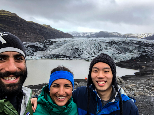
Our next stop was to see a glacier! I was excited because it was our first one of the trip. We weren’t sure if it was worth stopping just to take a look, but we figured why not? The glacier is called Mýrdalsjökull (jökull = glacier), and we went to this one part that sticks out a bit called Sólheimajökull. At least that’s what I think the situation is with the names, but honestly it’s a little hard to keep track, especially with all of the crazy Icelandic names. Mýrdalsjökull is on top of Iceland’s largest volcano, Katla, which is due for an eruption anytime. The big eruption in 2010 that sent ash all over Europe was from a smaller volcano nearby… and usually, the eruption of one leads to the eruption of the other within a decade. Katla is very closely monitored because even minor eruptions can result in major flooding from the glacier melt.

Me with Sólheimajökull! Mýrdalsjökull, the full glacier, is the 4th largest in Iceland.

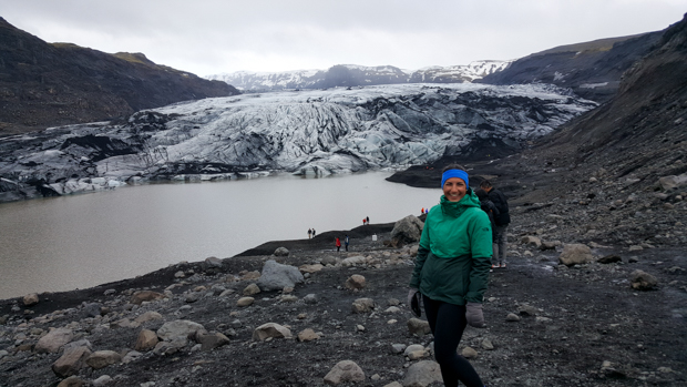
I thought the glacier was awesome, but we were pretty far away so we didn’t get the full effect. It would have been cool to do some glacier hiking or whatever it’s called. I’ll have to add that to my list of things to do when I go back to Iceland one day!

Mike, me, and Tony
Sibling pic on some petrified trolls. Mike said I could go on a higher one so that I could be taller for once. Thanks, Mike.

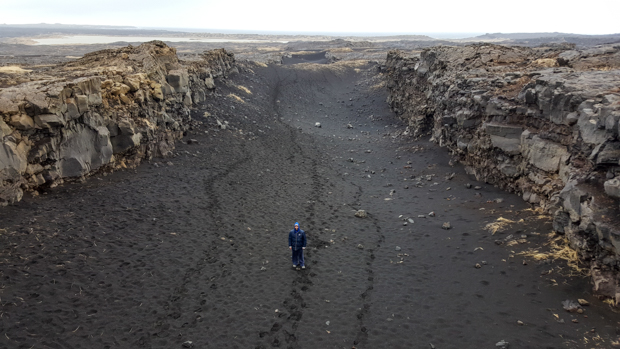
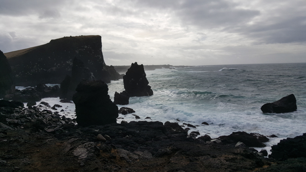
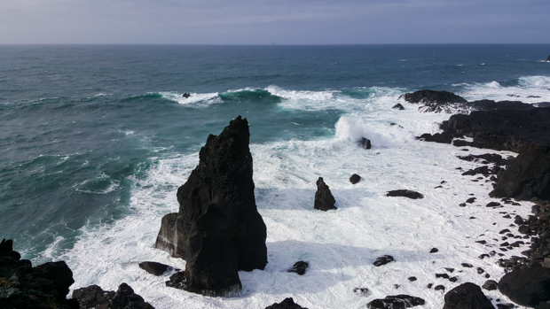
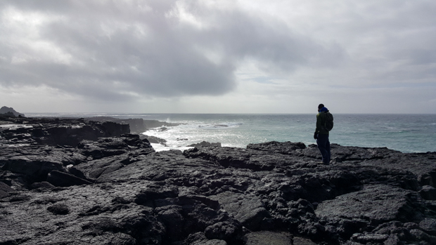
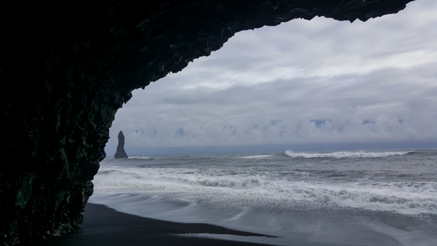
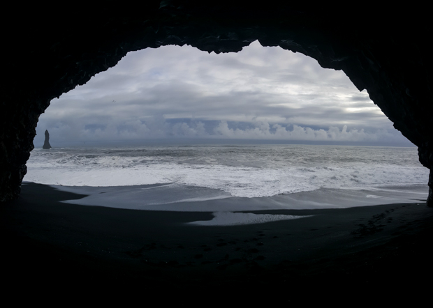
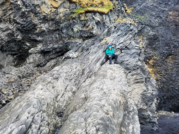
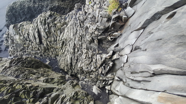
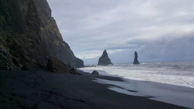
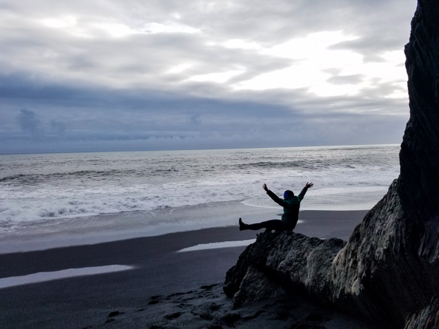
This is where the craziness of Iceland’s landscape diversity comes in… We were at a glacier, and then 30 minutes later, we were on the beach. Reynisfjara is a black sand beach, but the really cool thing is the rock formations there. They look like a bunch of pencils bundled together and sticking up at different heights. There are two options for how they were formed:

  1. The columns are trolls that were turned to stone when they were caught outside at dawn.
  2. They’re basalt columns (basalt is one of the rocks formed by lava). They’re formed when lava cools and contracts, making hexagonal rocks.

Guess which option I prefer.

It was more of a pebble beach than a sand beach. The ground looks super cool!
Mike holding up the entire cave with his super strength

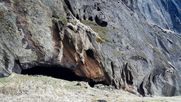
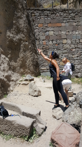
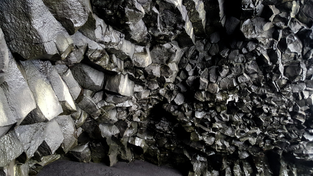
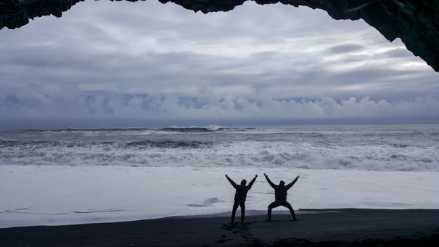
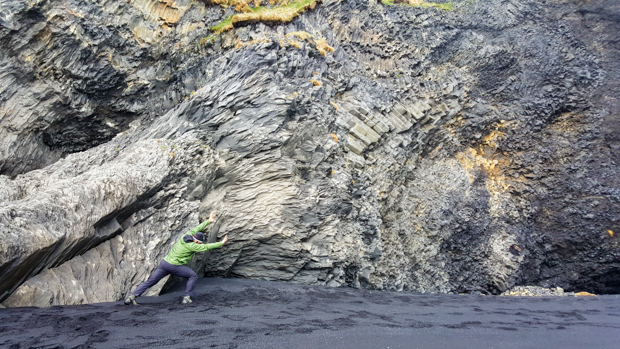
There’s also a cave at the beach which, of course, has a name of its own: Hálsanefshellir. The rock formations in there are similar to the petrified trolls, but since it’s a cave, they’re coming in from all directions instead of being just straight up and down. I think we got lucky because we were there at low-ish tide, so we could get into the cave. It was still a bit of an adventure because we had to run towards the ocean as the water retreated to get to the other side of the troll rocks and then run away as the waves came back in, re-separating the two parts of the beach. And, we had to watch out for sneaker waves…

I love all the shades of blue and grey in the water and the sky
Inside the cave
Tony and Mike messing around
Full view looking out from the cave

Sneaker waves are basically waves that are much bigger and come much farther into shore than the others, hence the “sneaker” part of the name because they can sneak up on you. The concept of sneaker waves is not at all funny… people have died from getting swept out to sea by the strange and unpredictable tides. We were quite entertained by the signs though, and the fact that they’re called sneaker waves never fails to make me giggle.
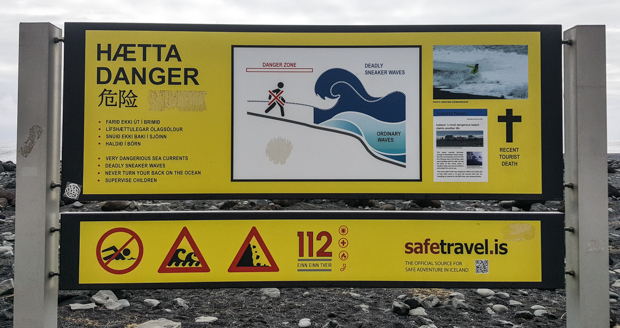
The sign says:
DANGER
– Very dangerous sea currents
– Deadly sneaker waves
– Never turn your back on the ocean
– Supervise children
The graphic in the middle shows the danger zone close to the waves that you should avoid, the light blue ones are “ordinary waves” and the dark blue ones above are “deadly sneaker waves”.
To the right, it gives information about a tourist death due to the waves.

I kept imagining someone standing on the beach with a big cartoon wave behind them, tapping them on the shoulder… Surprise! The signs tell you to “never turn your back on the ocean!” We had a lot of fun yelling that at each other. And then we turned our backs on the ocean a couple times (unintentionally!) and found ourselves sprinting up the beach to avoid getting soaked by surprise waves. So that’s what we get for not listening. (Strongly recommend that you heed the signs.)

Standing at the edge of a foamy wave, definitely keeping one eye out for sneaker waves…
Mike doing some earthbending
I found the perfect spot to protect me from the sneaker waves!
Cool rocks near the cave
There are also some rock formations out in the water, Reynisdrangar. In typical Iceland fashion, each of the three rocks also has its own name because why not. They are the remains of two trolls who went to help tow in a large ship… and then the dawn came and petrified the trolls AND the ship. Trolls must be extinct considering how many rock formations are attributed to their failure to keep track of time.
Hooray for black sand beaches!

We had a little more driving to do before we got to our campsite for the night, but we still had plenty of daylight (thank you, super long days). We’d hit all the major destinations for the day, so we consulted Aunt Judy’s list of notes to give us some ideas for a few more stops to make along our route.

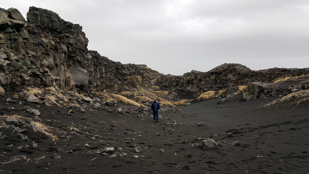
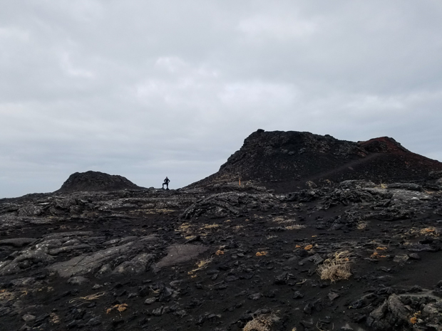
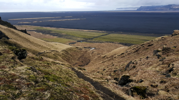
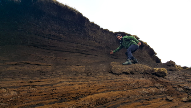
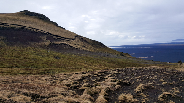
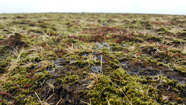
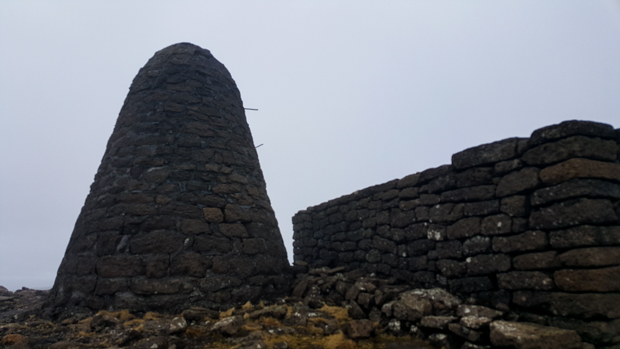
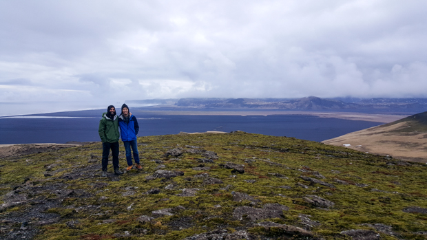
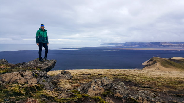
On our way to see a cave from her list, we passed a sign marking the start of a hike on Hjörleifshöfði mountain. I have no idea what convinced us to do it, but we had some time and why not? Okay, I’ll take the blame. I didn’t think it seemed that long. In the end, I’d say that at least 50% of it was underwhelming mostly because the entire world was brown (it’s probably fab in the summer), but in terms of Icelandic history significance, it wasn’t a complete bust! We trekked across the treeless mountain, through mud and snow and little ground plants, until we finally reached the top of the mountain where there’s supposed to be an amazing view of the surroundings… and guess what? A heavy fog set as we were approaching the top, so we couldn’t see anything except the faint outline of some strange stone structure.

Looking back at the path as we climbed up
Mike surfing a dirt wave on a dirt surfboard
Multicolored mud
So. Weird.
Ground plants!
Mike paying his respects

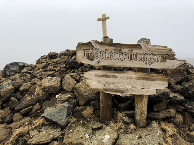
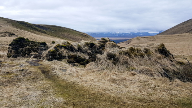
It turned out to be a Viking graveyard! This is one of those situations where we wouldn’t have been surprised if we had done ANY research or had even just read the signs before starting the hike because it’s kind of a big deal. Oops. Hjörleifur Hróðmarsson is buried there, the “second settler of Iceland”. His brother was Ingólfur Arnarson, the first settler. Hjörleifur only survived one year on Iceland before he was killed by his slaves. He was avenged by his brother, and apparently, the mountain is now haunted by him… add that to the list of things we didn’t know. Maybe that explains the fog.

The graveyard itself was very confusing. There was this big cylinder/cone thing that was next to the plot of land where the graves were. I thought maybe it was some weird Viking burial thing since it didn’t seem to serve any obvious purpose, but turns out it’s a marker built by Danish surveyors.
Hjörleifur’s grave
Family plot from some more recent inhabitants of the mountain with Hjörleifur’s grave mound in the background

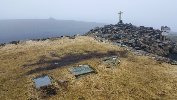
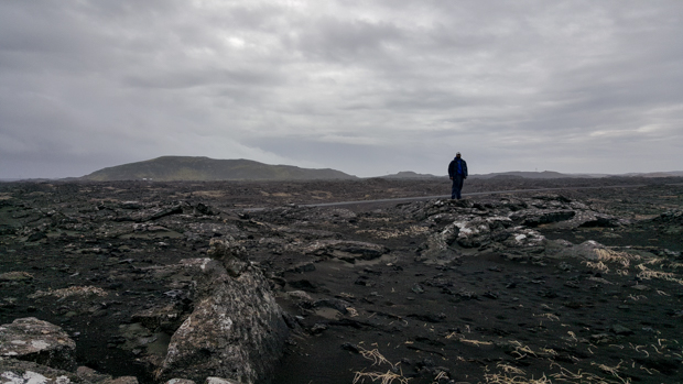
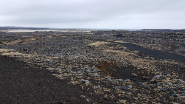
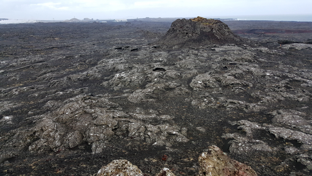
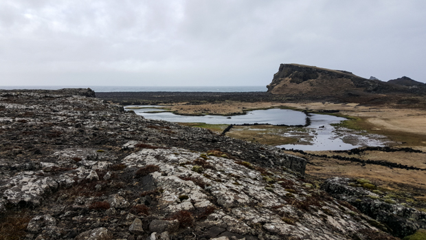
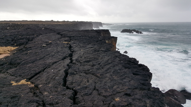
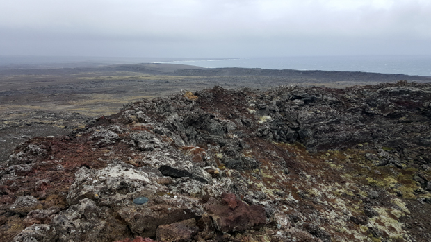
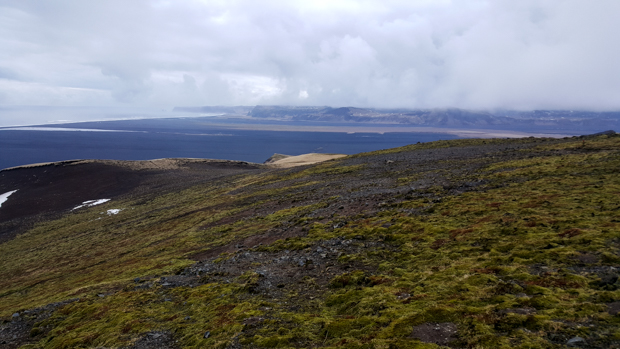
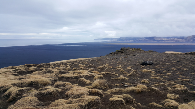
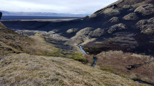
Finally, as we started to walk down from the gravesite, the fog cleared and we had a view of the seemingly endless lava fields stretching in every direction. The mountain we were on must have dropped out of the sky because it’s the only one in the area, and around it is flat, flat, flat.

Going down
Mike and Tony, thrilled to be here
The top of the mountain was weird
Lava fields stretching to forever

On the way back to the car, we passed some ruins/old foundations of two farms. The former farm inhabitants are buried on a plot next to Hjörleifur. I thought the whole thing was kind of cool. Mike and Tony were probably just trying to figure out why they’d listened to me about the hike. Sorryyy.

Farmhouse ruins
Walking back down into the valley
Hjörleifshöfði cave

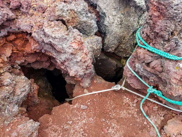
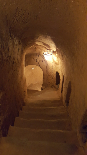
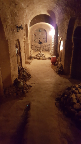
Since we were already so close, we did stop by our original target (2 hours later…) Hjörleifshöfði cave. It was probably worth a quick stop, but at that point, I think we were all tired and hungry and slightly grumpy. After a brief poke around, we headed to the campsite for another much-needed sleep on the cold, hard ground. This night was extra cold. Ugh.

Little caves along the base of Hjörleifshöfði mountain
Our car outside of the cave. Doesn’t this look like a car ad?

My thoughts for our entire time in Iceland can be summarized into one sentence… “WHAT IS THIS PLACE??” Yeah, I know that doesn’t make it sound like there’s much going on in my mind, but oh well. I could NOT get over the landscape. Everything looked like nothing I had ever seen before and was completely baffling to me.

Mike on the moon

Many things seem to defy logic. When Mike and I were trying to put together plans for our first day (okay, to be fair, any credit for the miniscule amount of planning that happened belongs to Mike), we looked at going to the Blue Lagoon. If you’ve ever seen the pictures of people in massive hot springs with seemingly unnatural blue-green water, that’s probably where they were. So the question is, “Hmm. Do you want to put on a bathing suit and go outside in this place where a winter coat is much more appropriate? Don’t worry, the water is warm.” Right but then there’s the air. Which is NOT warm. At all. “Want to go sit in some lava-heated water?” LAVA?? Does that really sound wise?

We ultimately decided to skip it (not because of any of my questions) because it’s not cheap (nearly $100 each) and neither of us had any strong feelings about going. The Blue Lagoon takes the output water from a nearby geothermal power plant and feeds it into a man-made pool. I was more interested in hunting down some natural hot springs (because going in unregulated lava-heated water sounds like a much better idea, doesn’t it?). Fun facts though: the mineral-rich water at the Blue Lagoon is thought to help with certain skin conditions like psoriasis (there’s even a research facility there). Icelandic doctors will literally prescribe visits as part of treatment, and patients visit for free.

What is this place??

Instead, we went in a completely different direction (geographically and conceptually) and made our way to Garður, once the most populous town in Iceland… but definitely not anymore. Now, the population is around 1,500, and as far as we could tell, the major (only) sights there are two lighthouses. The first was built in 1897, replacing a giant, 50-year-old pile of stones that was used for wayfinding. The second was built in 1944 and is much taller than the first – 28m compared to 12.5m. That makes it the tallest lighthouse on the island, and according to a survey, it’s the second most favorite lighthouse of the Icelandic people. No, I didn’t make that up. These are the divisive questions facing the people of Iceland.

Very confusing beach-scape
Spot the lighthouses! The one on the right is the second favorite. Can you see why? (Don’t ask me, I have no idea.)

When we got out of the car, we 1. almost blew away because the wind was completely out of control, and 2. got our first glimpse of the Icelandic terrain. Well, make that Icelandic terrain type 1 because as we soon learned, nowhere looks like anywhere else on the island, but everything looks weird. In Garður, there are white sand beaches… but they’re spotted with big black lava rocks, in case you managed to forget for a second that you’re on a volcanic island. If I wasn’t worried about unintentionally taking flight, I probably would have spent longer admiring the combination of pretty blue water, dark lava rocks, and light sand. Fair warning that I’m going to completely overuse the word “weird” anytime I try to explain what anything looked like. But like… weird.

Blowing away

From there, we went to a bridge that’s probably not what you imagine when you think “bridge”. This one doesn’t span a river… nope, it spans the gap between two tectonic plates. Like I explained in my Iceland History post, Iceland is along the ridge between the Eurasian and the North American tectonic plates, so there are a few places on the island where you can see a gorge that I guess is basically a giant earth crack. How weird is that? (I know, I said it again.) This was also where we had our first experience with black sand. I was completely fascinated by it and took a picture of my feet, kicking off my trip-long obsession with Icelandic groundscapes.

Headed to the bridge between continents…
Black sand!
The bridge!
Mike is hiding again. Also, this sign makes it seem like you’re standing on two continents at once, but really, you’re on neither.
Spot camouflage Mike in the earth crack!

During his research, Mike spotted some craters on Google satellite view, so that was our next target. The only issue was that he wasn’t sure exactly where they were along the road or what they were called… good, right? And you might think that it would be clear, but there are pull-offs and places to turn to see different things about every 5 feet, so the chances of you finding what you’re looking for are slim. We saw a car pulled off the road somewhere, decided to check out whatever they were checking out (this is like 90% of our decision-making process, “Oh, there are a lot of people there so it must be something cool. Let’s go.”), and realized it was Mike’s craters. Of course they have a name, the Stampar craters, because everything in Iceland has a name. Again, weird and spacey, but this time a different planet. There were some places where the rock looked like it had been liquid lava only seconds before. It was cool to be able to see so clearly how it was formed. Also, totally insane because like… lava.

Crater field
Colorful!
Me and some craters
LAVA!

We were exploring the southwest corner for the day, and there’s another popular lighthouse in the area called Reykjanesviti. Let’s take a moment to talk about Icelandic names. I mentioned this when talking about my first impressions of Iceland, but they’re ridiculous so I’m going to rant again. I don’t know much about Icelandic, but it’s one of those languages where they like to mash things together, especially in names, so instead of it being Reykjanes Lighthouse (yes, I realize that’s longer but SHH!), they just put their word for lighthouse, viti, onto the end. That leads to a lot of incredibly long names and a lot of laughing while attempting to pronounce ANYTHING correctly. Usually you get halfway through the word, reach the point where you’re just tired of making so many sounds, and give up. When you’re driving, you read about half of the word and then you’ve driven past the sign so it’s a lost cause anyway.

Reykjanes Lighthouse

Anyway, as I was saying. Reykjanesviti. It was built to replace the island’s first lighthouse because they were worried it was going to fall into the sea. So, they blew it up (you can still see the foundations) and built a new one farther inland. The same erosion (caused by a combination of storms, the sea, and earthquakes) that threatened the first lighthouse formed cliffs, Valahnúkamöl (see what I mean about the names??). They are beautiful! We climbed up to the top of one of the cliffs and were mesmerized by the sight and sound of the waves crashing into the rocks. We were also absolutely freezing, and it was windy enough to make you think you were going to get blown into the ocean. On the positive side, it wasn’t raining at that particular moment (it was off and on all day).

Valahnukamol cliffs
View from the cliff

The coastline was really pretty, so when Mike suggested we follow some ATV tracks that went out in that direction, I was all in. We walked through expanses of colorful ground plants (I’m not sure if those are natural or if they were planted as part of the efforts to stabilize the soil to eventually reforest) and finally made it to the lava-rocky coast. Again, baffling. I’m not going to waste my time trying to describe it and instead will just direct your attention to the pictures.

Views from our walk

The coastline
Other-worldly

When we’d had enough of getting drenched with sea spray, we kept moving. I think Mike was getting annoyed at me because I was walking like a lost child. I was definitely not going quickly because how was I supposed to walk and take in the fascinating landscape at the same time?? Like I said, every other thought was, “WHAT IS THIS PLACE??” I stepped off the path to see what the ground felt like where the plants were (I know, you’re probably not supposed to do that but I was curious!), and it was like stepping on a pile of cotton balls. No impact, just a slowww sink of your foot.

We eventually ended up at a crater where Mike found a cave opening with ropes hanging down. I’m sure there’s some technical name and explanation for what it is and how it was formed, but I’m going to call it a cave because I don’t know any of that. We couldn’t see very far because it was pitch black. If we wanted to know what, if anything, was down there, our only choice was to go in. We looked at each other, the question hanging between us. I, for one, wasn’t worried about the cave or what was in it. I was primarily concerned about having to trust the sufficiency of my upper body strength to get back out because I haven’t done a rope-climb since elementary school. I don’t know what Mike was thinking, but he didn’t come up with a quick answer either. Explore or play it safe? What do you think we should have done? What do you think we did?

The crater where we found the cave
The cave in question

This is a PERFECT time to leave you with a “to be continued…” cavehanger (it’s like a cliffhanger but this was a cave, soo…).

Check out the continuation post HERE!

Our last day of sightseeing unintendedly ended up being somewhat rock themed. Since we obviously hadn’t seen enough monasteries yet, we had another one, Geghard, on the docket for the morning, plus the only remaining pagan temple in the country, Garni Temple.

Temple of Garni

By now you’re used to the process of getting around… we took a city bus to a marshrutka station and a marshrutka to Garni, the town where Garni Temple is. It took under an hour to get there, and the walk from the bus stop was less than 10 minutes. Easy peasy.

Back in the day (like waaay back), the Armenians were sun worshippers. It’s interesting because you can look at the Christian art and architecture that came after the country’s conversion to Christianity and see how it’s connected to the art and architecture that came before. Pagan symbols were re-explained in Christian terms, rather than getting rid of them. For example, the pomegranate is used A LOT as a symbol here. In the pagan days, it was a symbol of fertility. In the Christian days, it was changed into a symbol of unity (people are the seeds, all individuals but part of the same body of Christ).

Temple from the back

Anyway, I kind of went off on a tangent. The point is that Garni Temple was a temple built in the first century AD and dedicated to the sun god, Mihr. The reason it survived even after Armenia’s conversion was because it was turned into a royal summer house. An earthquake in 1679 caused it to collapse, and it was finally excavated and reconstructed in the 1970s. They used almost all original stones to reconstruct it, but the ones that are not original were made obvious. It’s built in the classical Greek style with a little bit of an Armenian twist. The temple is cool, and the location makes it even better. You can get a great view of the Azat River gorge which is part of a big national park, Khosrov Forest State Reserve, one of the oldest protected areas in the world. It was founded in the 330s AD! I’m getting sidetracked again, but I’m definitely putting it on my list of places to visit while I’m here.

Such cool detailing!

The gorge
Looking out into Khosrov Reserve

After Garni Temple, we headed to Geghard. That required getting a taxi which we weren’t too excited about, but it ended up being extremely easy! Walking back towards the main street, we met an older gentleman who asked if we were going to Geghard. He asked if we needed a taxi and offered to take us in his, there and back for 2000 dram (a little more than $4). It’s about 10km away, and he said he would wait for an hour which is plenty of time to see everything. We agreed because that price was definitely lower than it should have been (and we gave him some extra at the end because we kind of felt like we were cheating him), and we were off!

First glimpse of Geghard

Geghard Monastery has a connection to everyone’s favorite historical figure… that’s right, St. Gregory! In its current form, it has multiple churches and tombs, but it started out just as a cave church. There’s a spring inside where you can wash your hands and face or drink some fresh, freezing cold water. There’s some great water in this country. The name “Geghard” comes from the word for “spear” because the monastery used to house the spear that was supposedly used to wound Jesus during the crucifixion and brought to Armenia by the apostle Thaddeus. That spear is now kept in the museum at Etchmiadzin.

Geghard scenery

The monastery has a few different chapels now, with most carved into and one built out from the cliff. There’s one chapel in particular that is completely carved into the cliff and has some amazing acoustics. There are khachkars (stone crosses) EVERYWHERE, with some stuck into the cliff. They’re there to commemorate donations or in memory of the deceased. The “khachkar style”, if you will, was developed because stone crosses with the stone following the shape of the cross broke too easily. With a khachkar, the stone is a rectangle, and the cross is carved into it with elaborate decorations surrounding it.

This is all carved into the cliff!
Hallway into the big chapel with khachkars lining the walls. Ignore my finger in the picture (oops)
The biggest chapel completely inside the cliff
Khachkar party!
You’ll see tons of people trying to toss pebbles into little shelves in the rocks. If you get your rock to stay, your wish comes true!
Into the depths…

Our day ended with a trip to a slightly more offbeat attraction. Sarah and I are very into going to see things that are a little bit weird, so when we found the information about Master Levon’s Divine Underground, we knew we had to see it. The story goes (and this I know for a fact is a completely true story) that a man named Levon, a builder by trade, was asked by his wife to dig a potato cellar. He started digging, hit rock, moved over and kept digging more. And then he kept digging. And digging. And digging. And digging. He said that he had divine visions that told him to keep going, so he did. He dug for 23 years, until his death, with just a hammer, a chisel, and a bucket to carry out the rubble. The underground complex he created still isn’t complete according to his plans, but my gosh it’s amazing. My favorite quote by his wife, Tosya, is, “all I wanted was a good house and a potato cellar, and I got neither.” On the bright side though, she now has an ongoing revenue stream from visitors, so maybe Levon knew exactly what he was doing (it’s free to enter, but they accept donations).

At its deepest, the complex goes down 70 feet below the house! How crazy is that?!?! There are seven rooms connected by corridors and staircases, and decorations are carved into the walls at every turn. The pictures don’t do it justice, but they can at least give you the beginnings of an idea of what it was like.

Column carvings like these were all over the place

Awkward self-timer pictures
This room is huge. It was at least a two-story space with an overlook where I propped my mini-tripod and sprinted downstairs for this picture
This is crazy, right?

We were welcomed in by Tosya, and she left us to explore the caves on our own. At 50 degrees F (10 C), it’s fabulously cool down there, and thankfully, there are arrows marking out the route or we would have been hopelessly lost. When we came out, Tosya showed us to a little museum inside the house where you can see the hammers and chisels that Levon used, plus his clothes and a bunch of news articles that have been written about his creation. She spoke no English, but once again, we managed to communicate enough. After that, she led us outside into the garden where the walls were covered with stone mosaics and two paintings: one of Levon, and one of Tosya. This was one talented guy. We signed a guestbook with notes by visitors from all over the world and headed back into the city, our minds still blown by what we had just experienced. Who knew that this would turn into a cave exploration day?