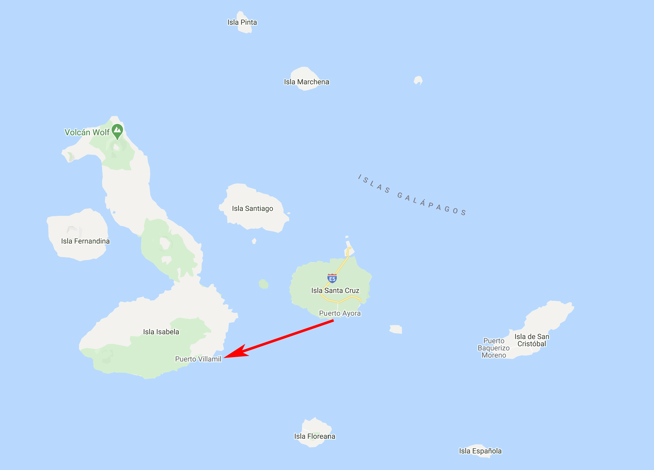
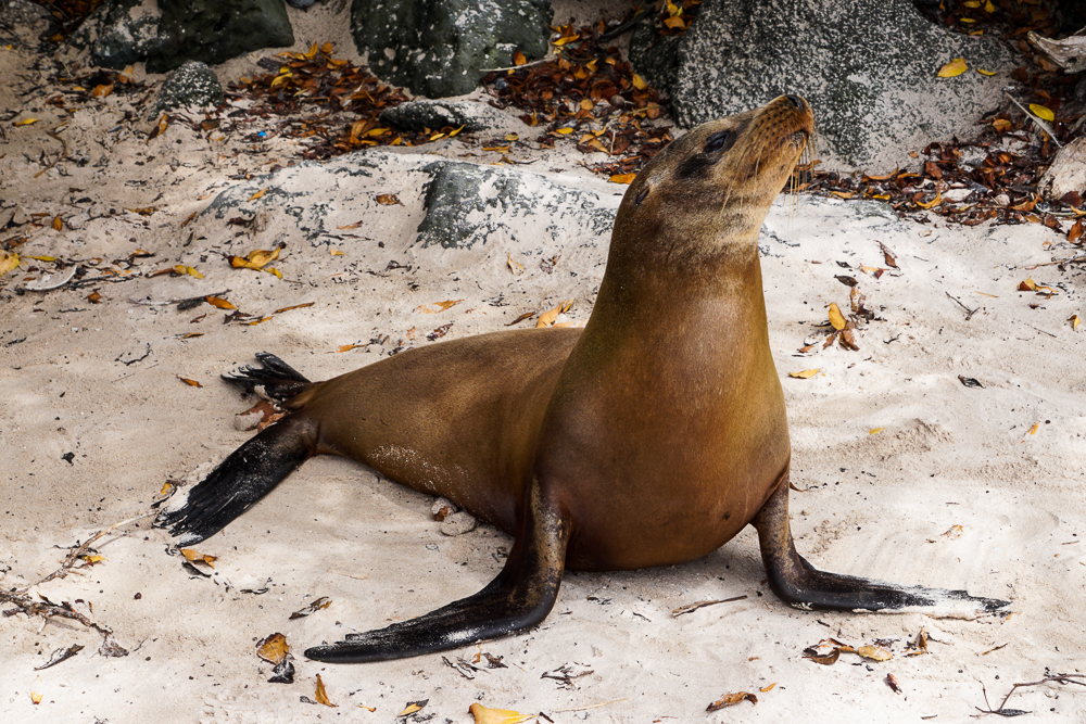
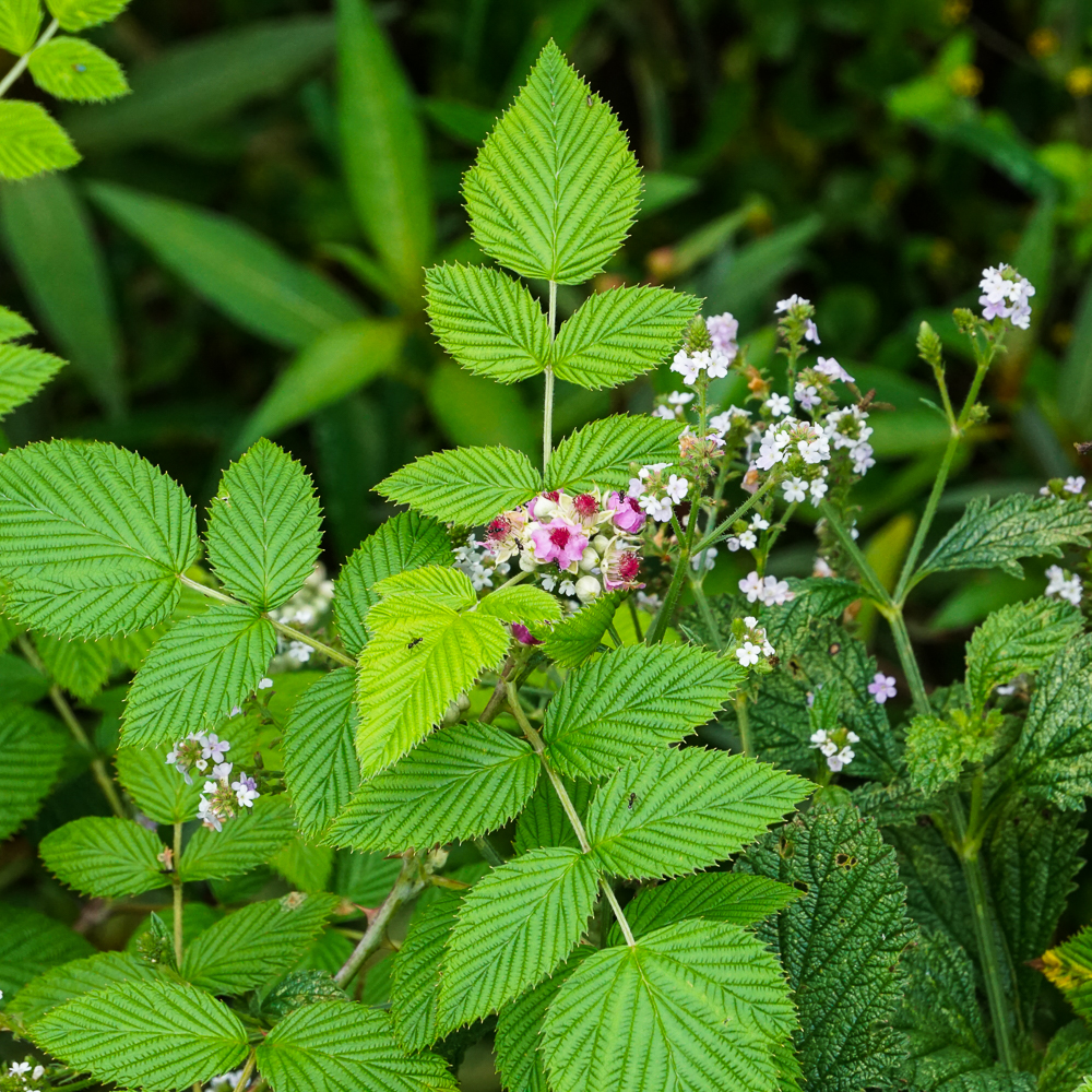
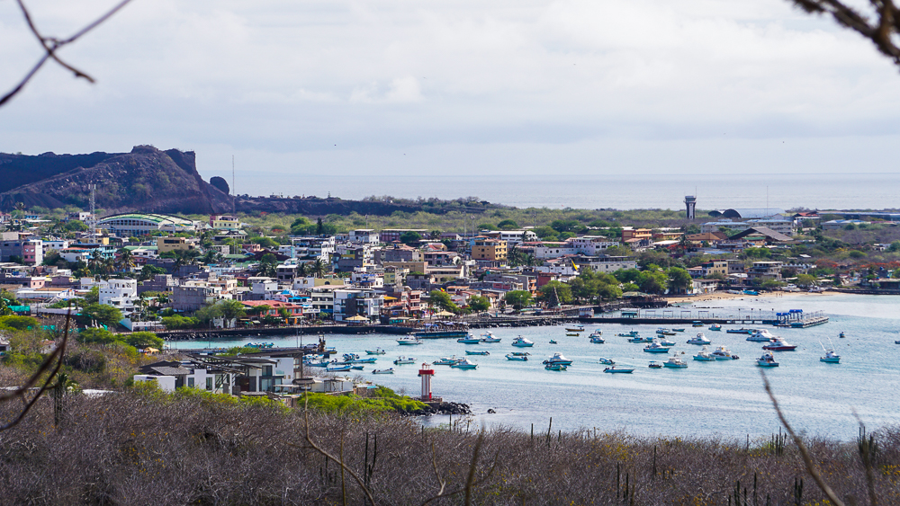
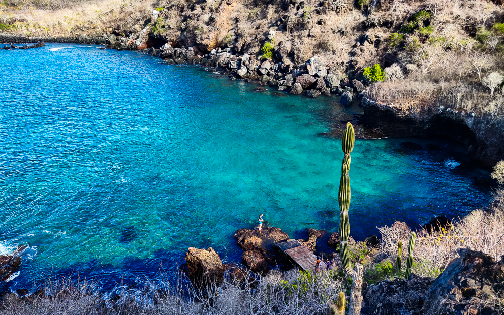
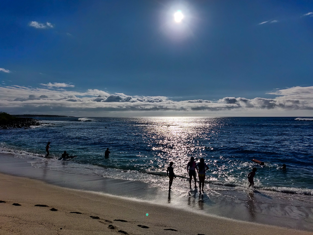
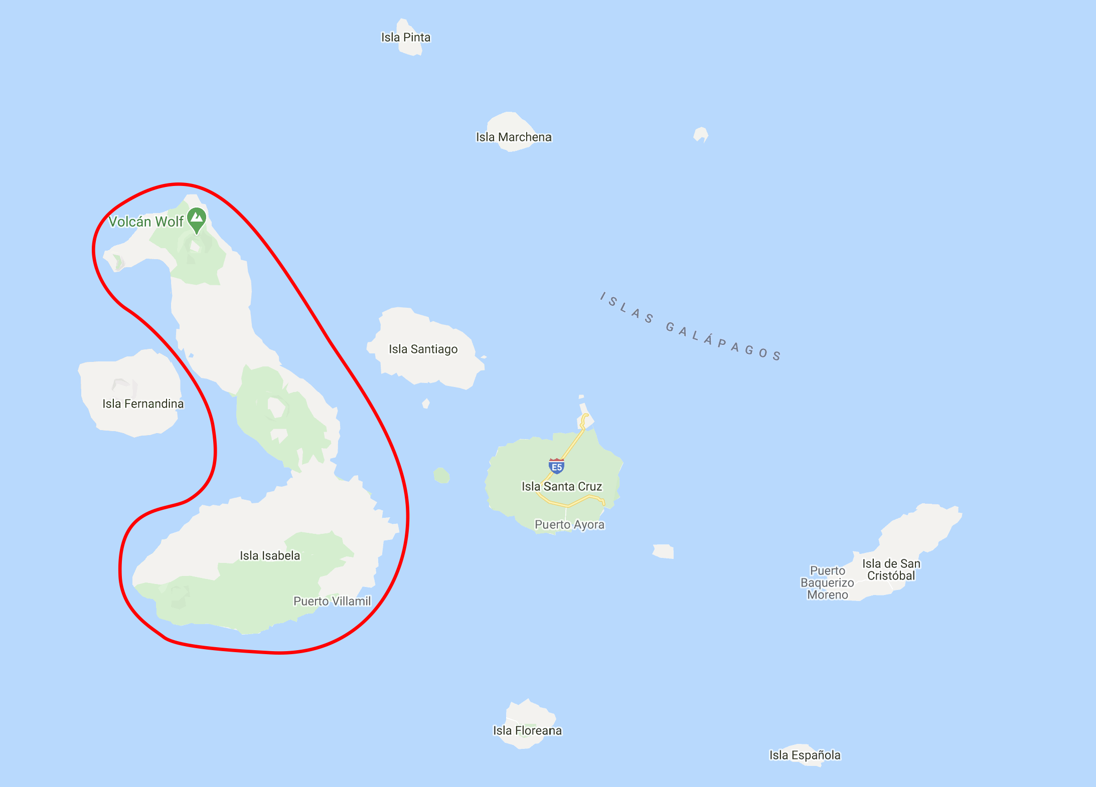
After our morning tour to Las Tintoreras, we still had half of the day free for more activities! My aunt and I went into town after a brief stop at our hotel and started asking around about renting bikes. There’s a 3 mile-long (5km) gravel path to the west of Puerto Villamil (the main town on the island) that winds past different points of interest, and we wanted to make a plan to explore it later in our stay on Isabela.

Here’s Isabela Island, for reference again. And Puerto Villamil, the main town, is on the southern coast.

Welp, as is often the case with traveling, that is NOT what happened. We talked to a few shopkeepers and realized that since the next day was New Year’s Eve, stores were going to be closed for the next two days aka the rest of our time on the island. If we wanted to bike instead of walk the 3+ miles each way, this was our last chance. There was really no question… we went back to the hotel, broke the news to the group that we were NOT going to be having a chill rest of the day, and quickly got ready for another outing.

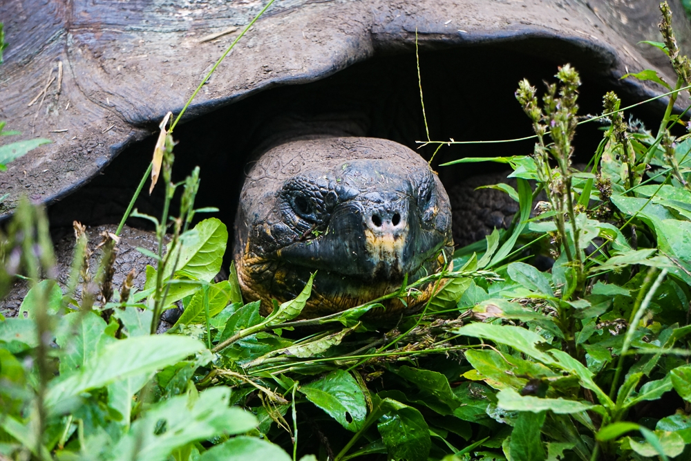
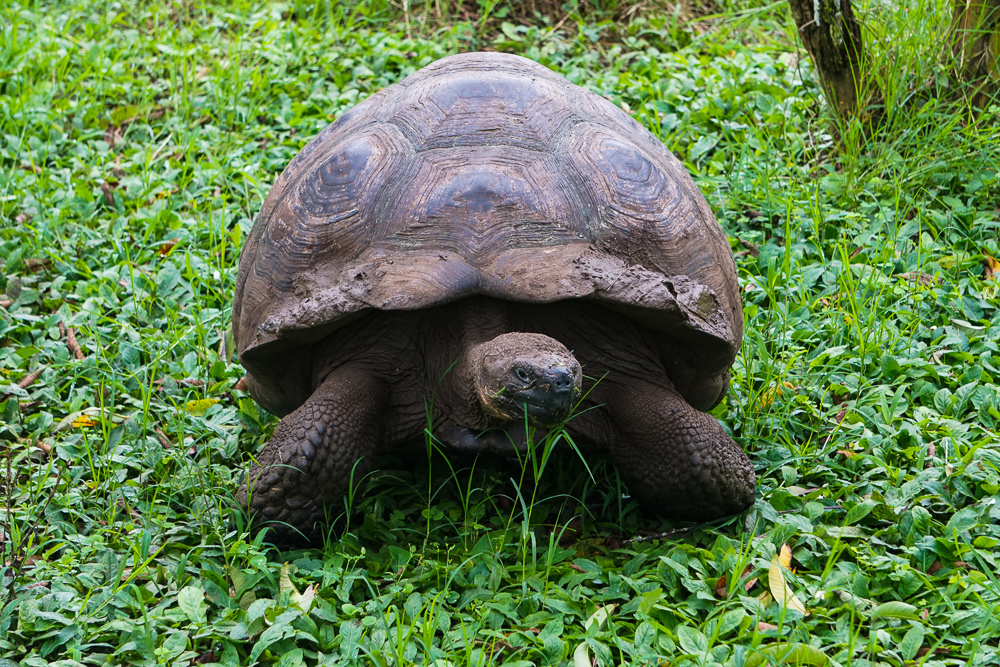
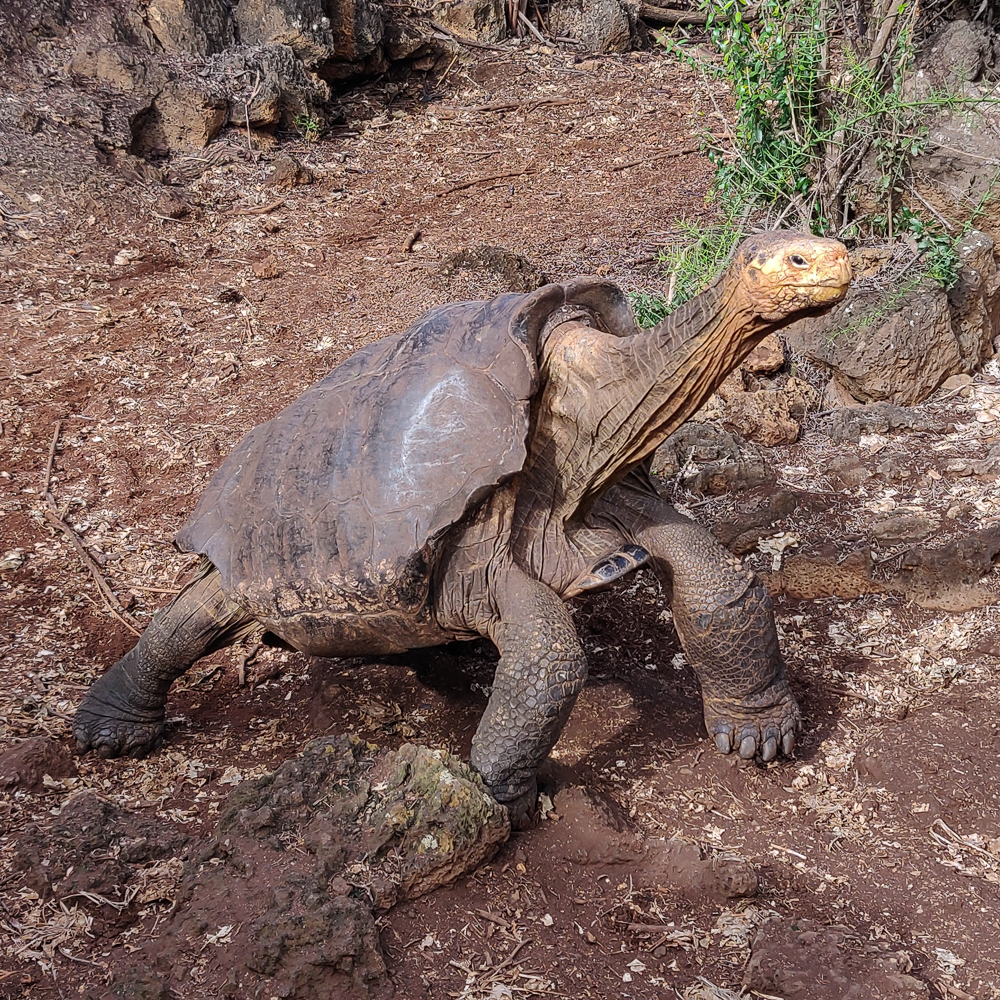
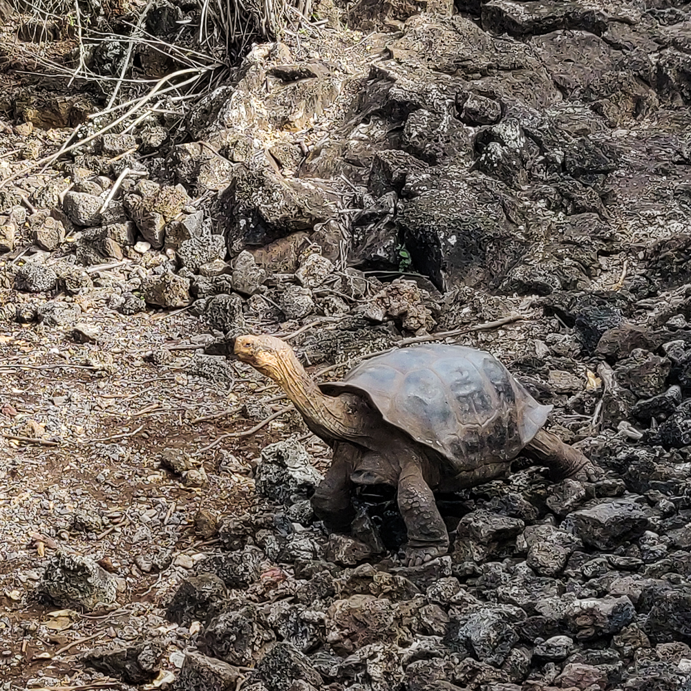
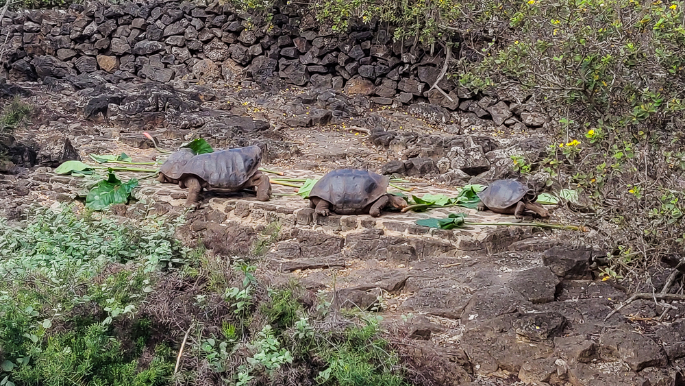
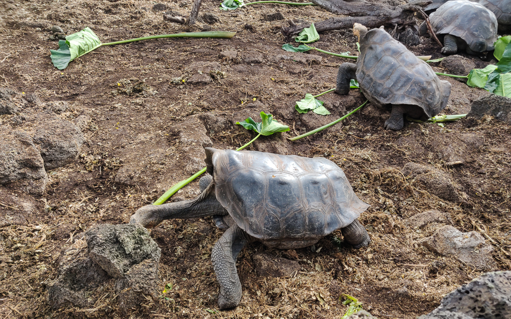
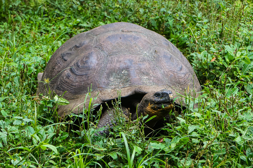
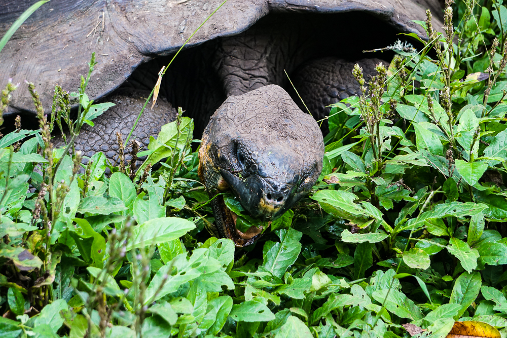
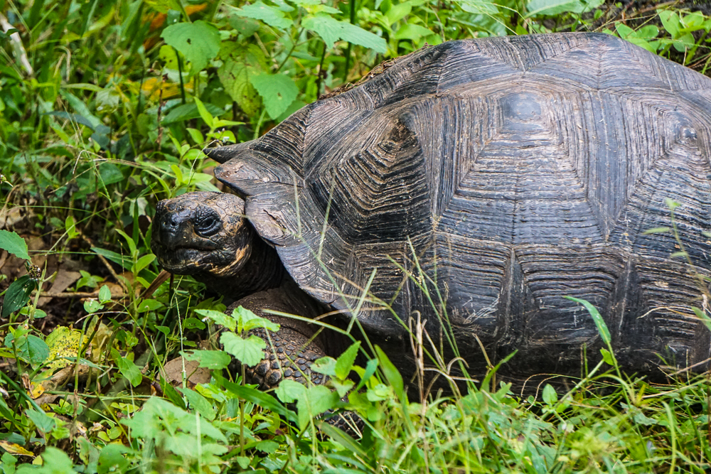
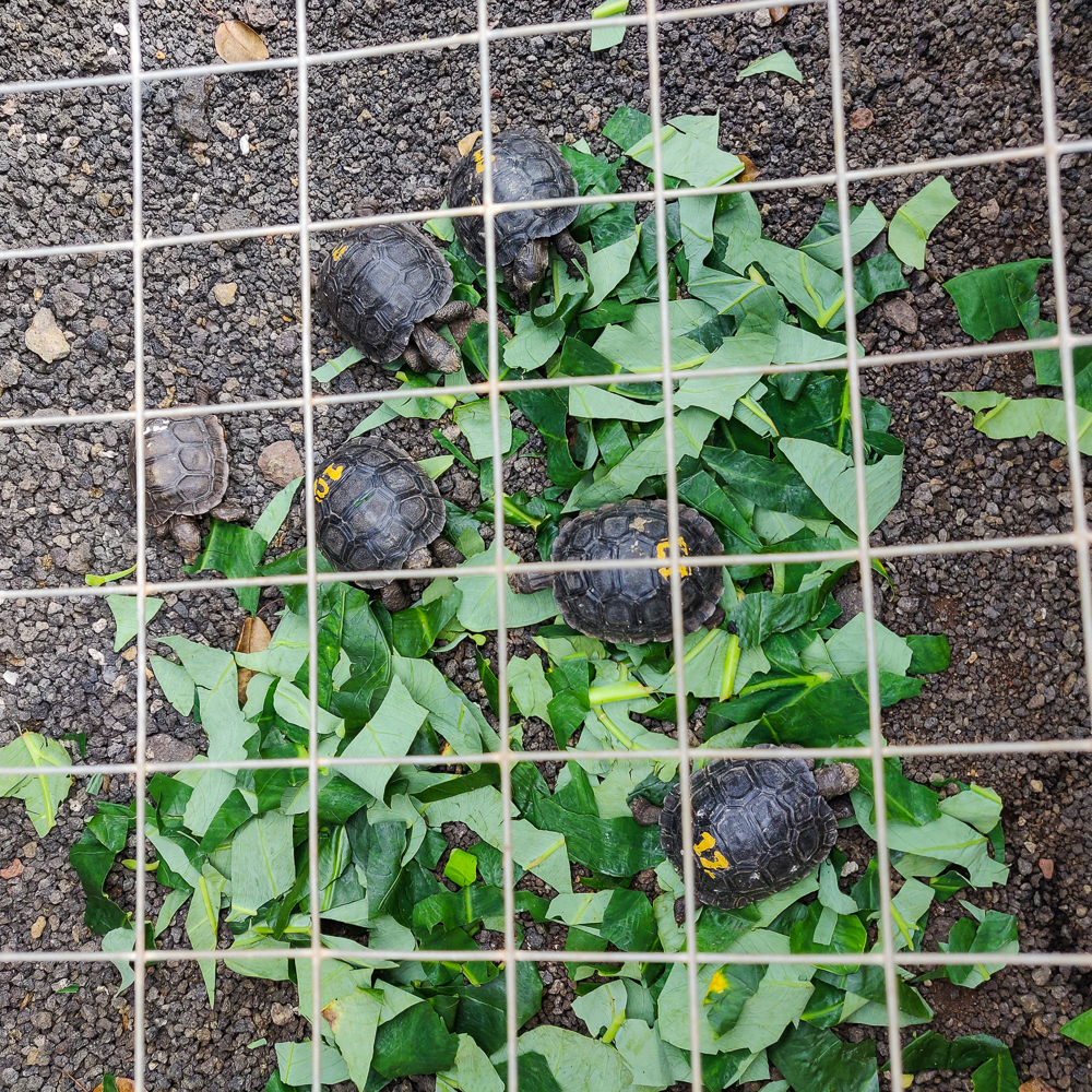
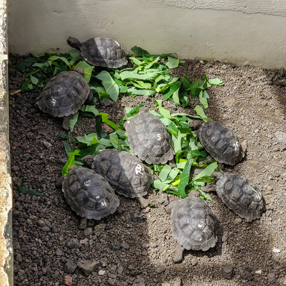
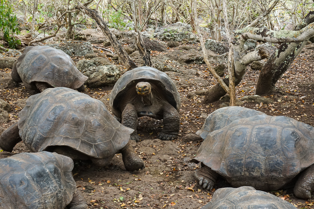
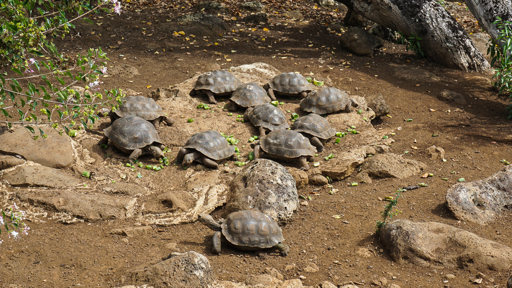
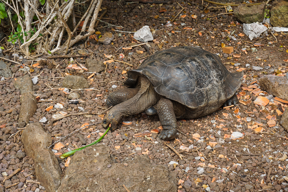
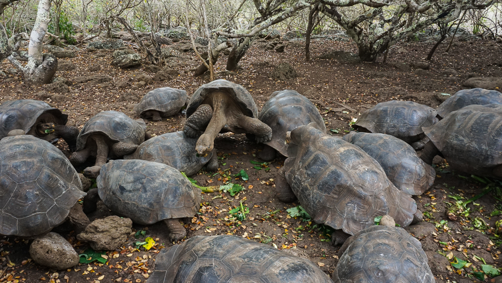
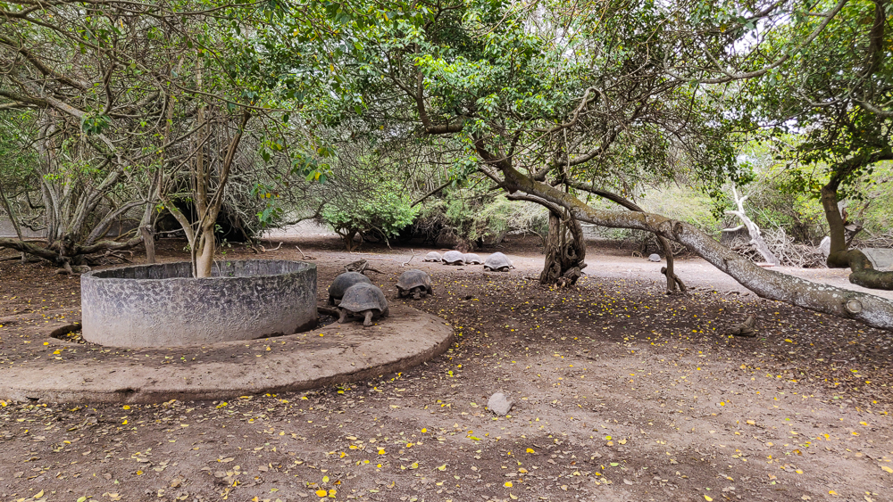
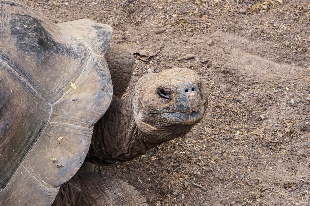
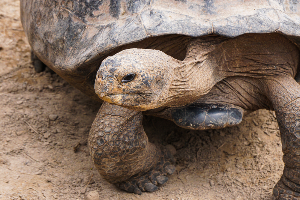
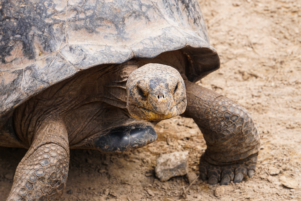
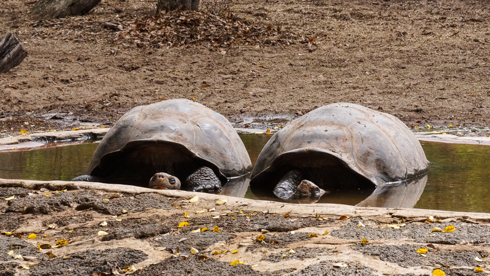
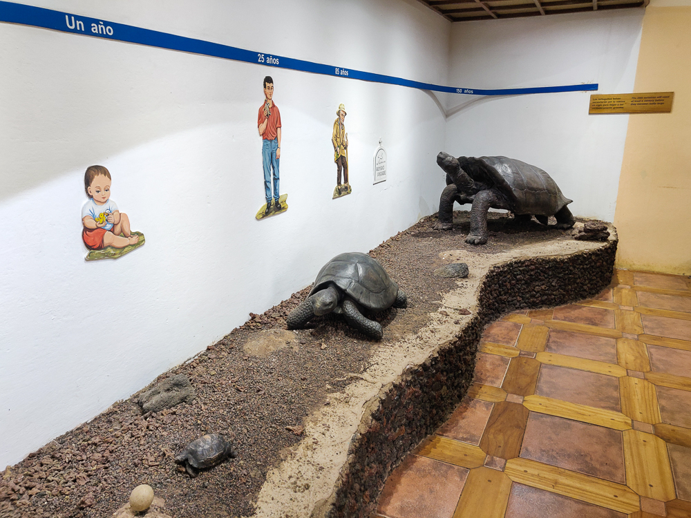
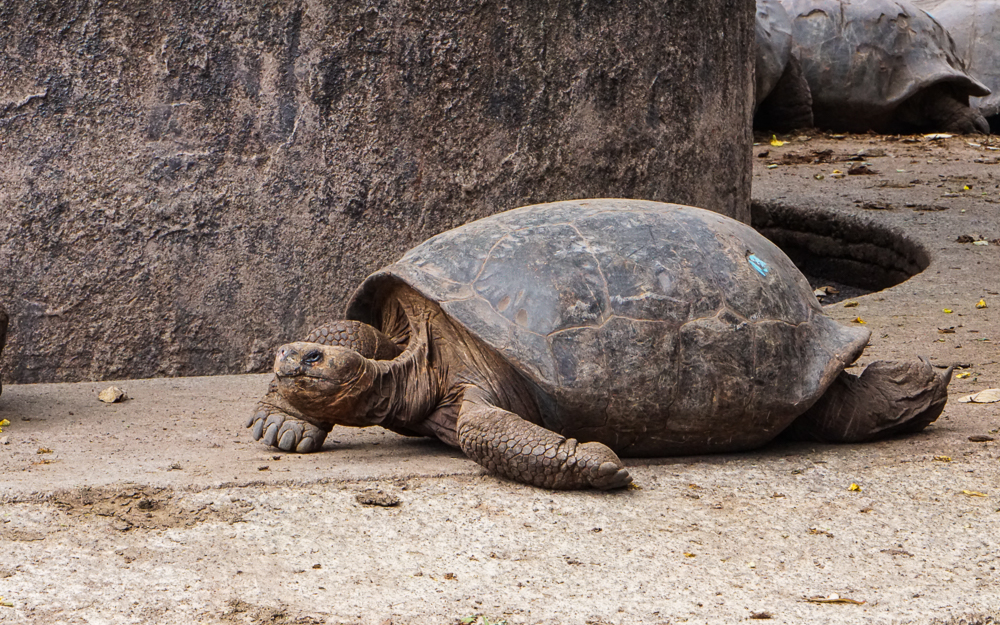
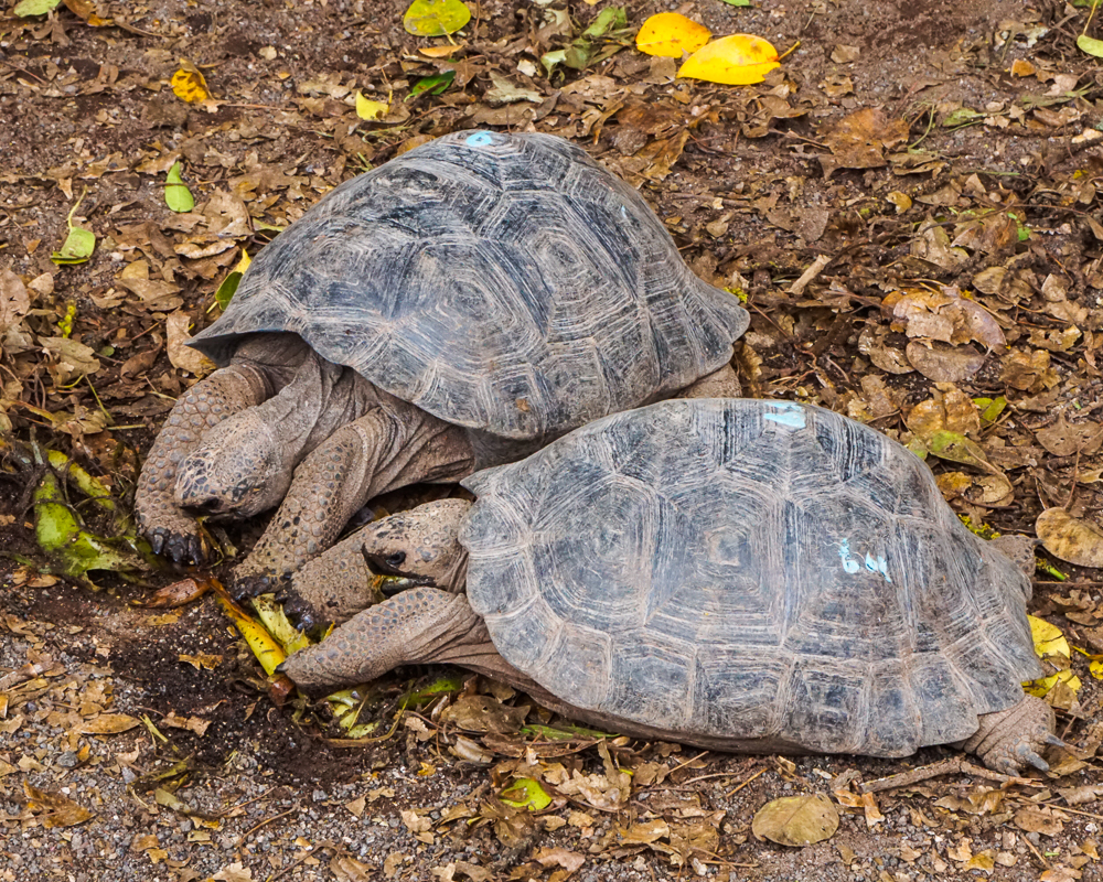
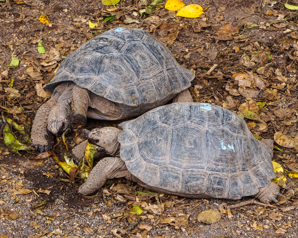
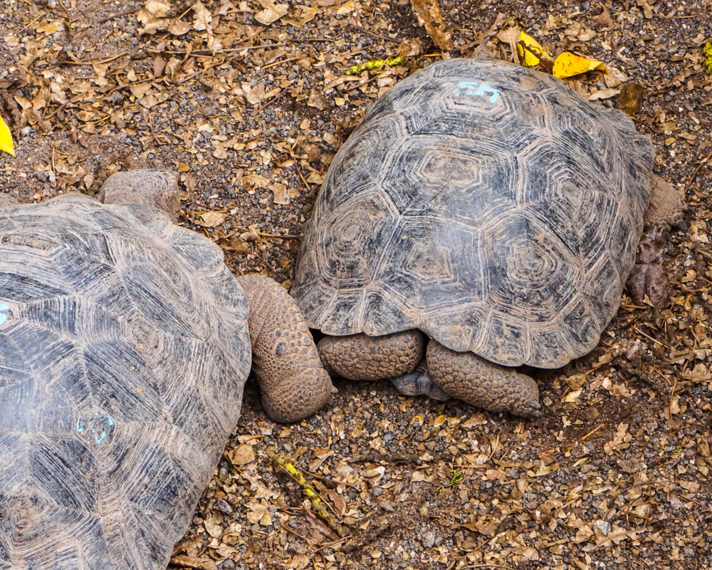
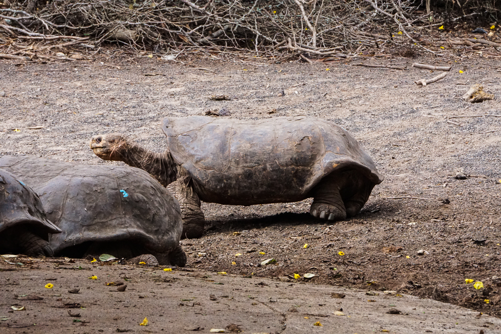
The girl at the bike rental place gave me a map and some recommendations of where to go and in what order. I love it when someone removes the guesswork and just tells you what to do! She showed me how to get out of town and then recommended that we visit the tortoise breeding center and flamingo lake before following the bike path. There was a general “Do we really have to see more tortoises?” vibe coming from the group, but since she who holds the map holds the power, I said yes, we did. And so, off we went. Also, before you start thinking of me as some sort of travel dictator, I’ll just say that we saw a lot of tortoises on our trip and no one ever regretted a tortoise sanctuary/breeding center visit in hindsight, this time included.

How could you say no to this?

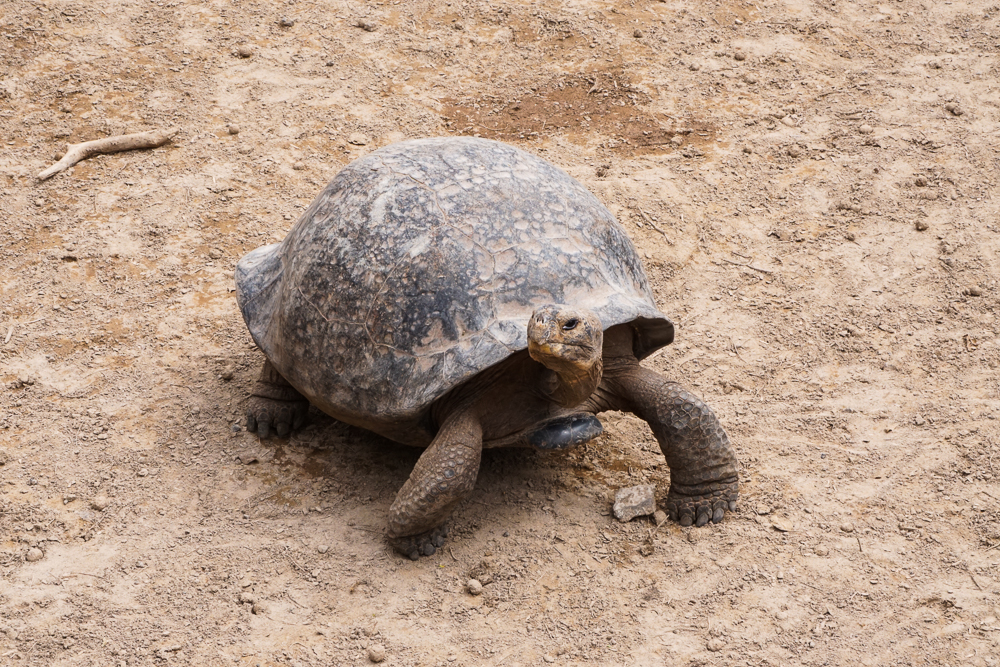
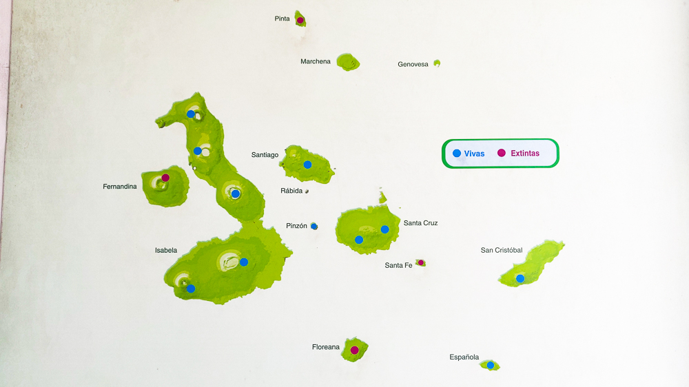
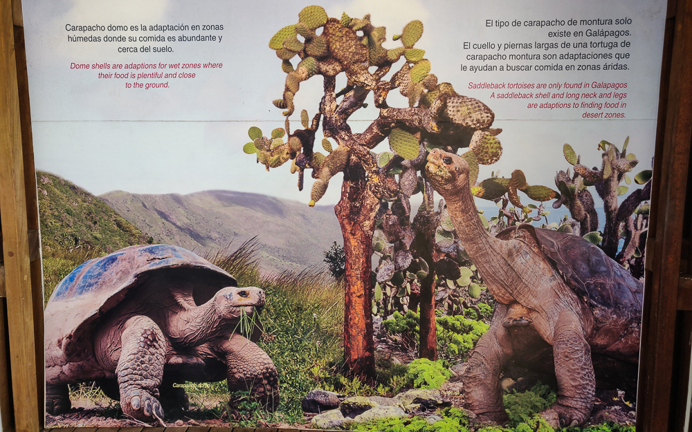
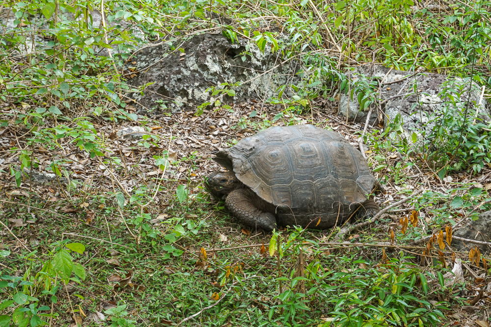
Isabela is, by far, the largest island in the Galapagos. It’s nearly four times the size of the second largest island, Santa Cruz, and was formed by six shield volcanoes. Isabela is home to the most wild tortoises of any island, and due to its size and difficult-to-traverse topography, there are actually five different subspecies of tortoises found across the island. These roam freely in five of the volcano calderas.

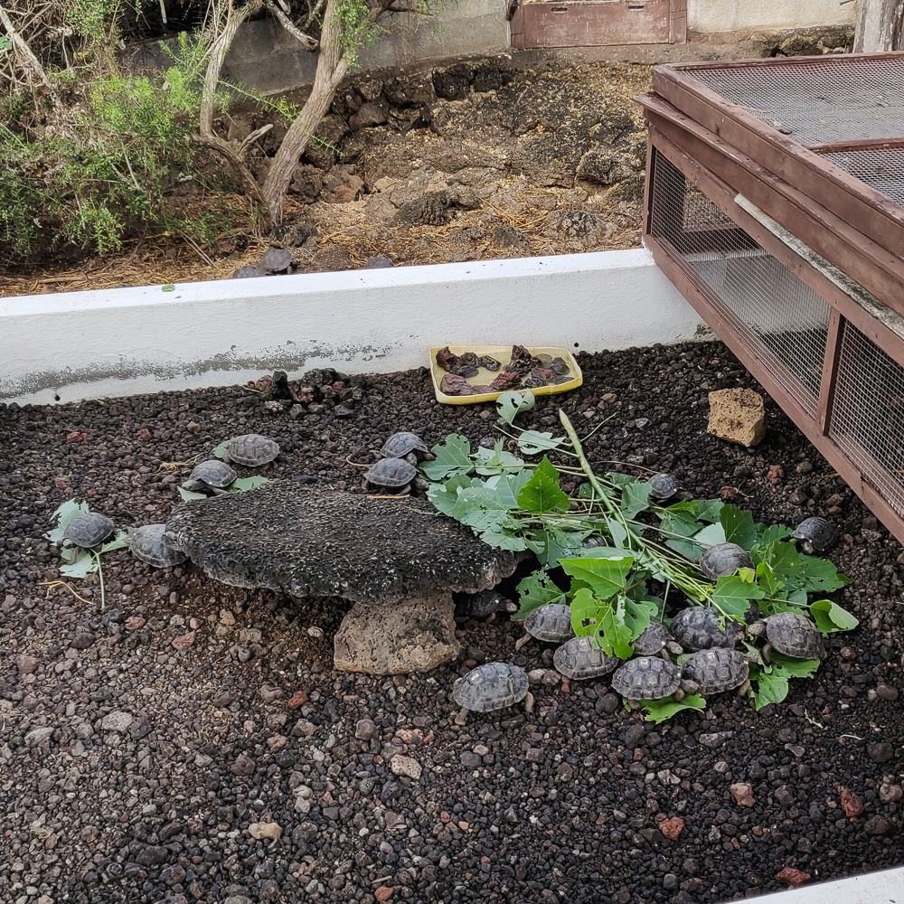
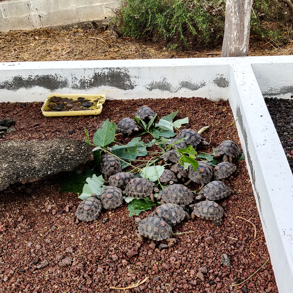
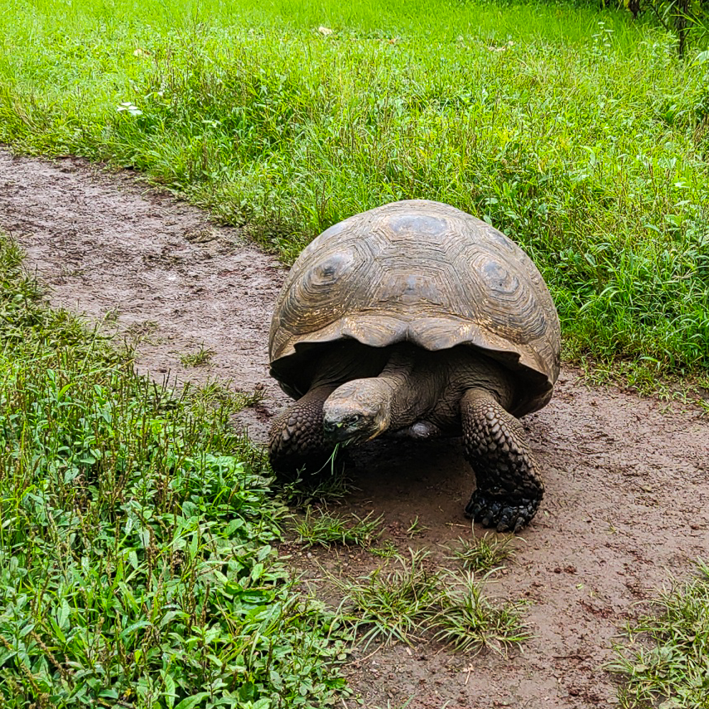
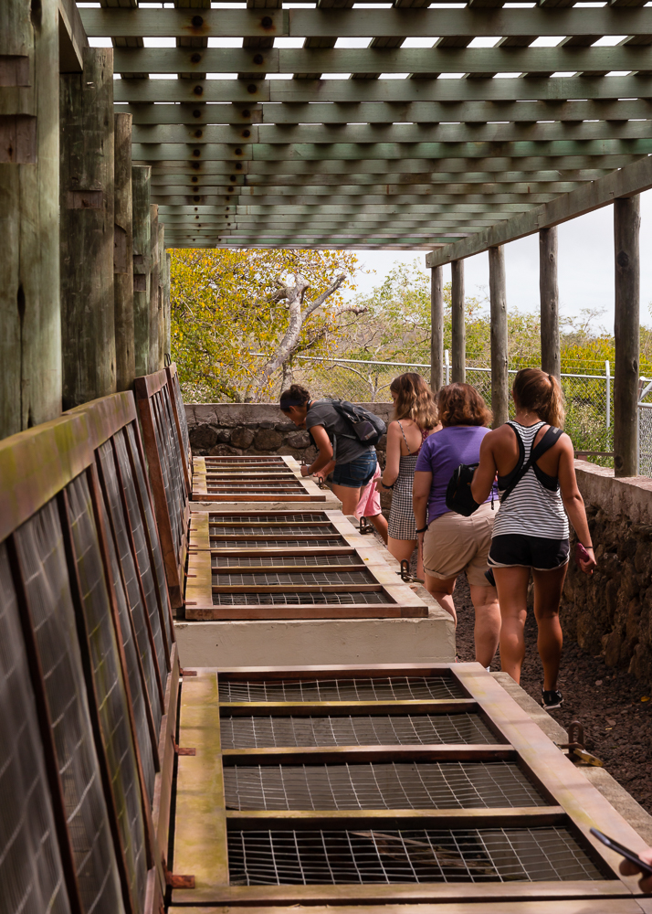
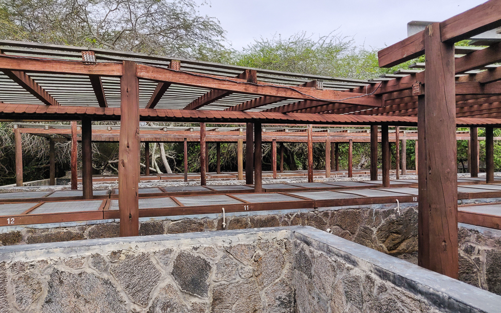
The tortoise breeding center on Isabela was founded in 1995 after some fires in the southern part of the island reduced the southern tortoise populations. Even before that, the tortoises faced survival challenges, such as competition for food with an ever-growing population of non-native goats (these have since been eradicated from Isabela). Tortoises were brought from across the island to the center to breed, and the populations have been seeing steady growth ever since. The center protects eggs and hatchlings, and once the tortoises grow big enough to give them a good chance of survival, they’re released.

This map shows where all of the subspecies of Galapagos tortoise are from. As you can see, there are five on Isabela, and they’re each somewhat centered on a caldera.
Tortoise pens at the breeding center
The cages for the baby tortoises
Face of a serpent
Neck of a giraffe
Feet of an elephant
I love this. Just hanging out!
I enjoyed this visual aid in the little information center. It shows a little timeline of human life vs. tortoise life… the human life starting with a baby and ending with a tombstone around 100 years (optimistic)… and the tortoise starts with an egg and ends with a full-grown tortoise still alive at 150 years.
Hehe I thought it was funny seeing this tortoise flopped on the ground. Looks like she’s having just one of those days, you know?
The tortoises at the breeding center are fed three times per week.
These tortoises were going CRAZY for their leaves.
This guy got scared and hid in his shell. It’s pretty cool… they tuck their heads in and then use their arms to cover/shield their heads.
LOOK AT THIS SHELL. This is a Cinco Cerros tortoise and their shells are just about as flat as they get. It’s almost comical.

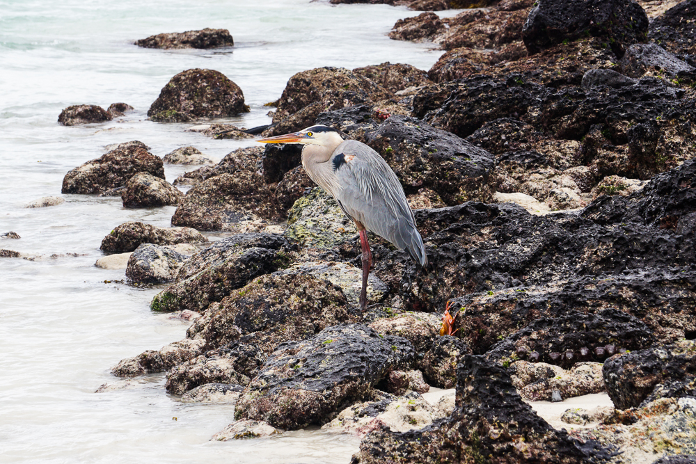
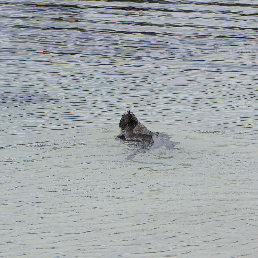
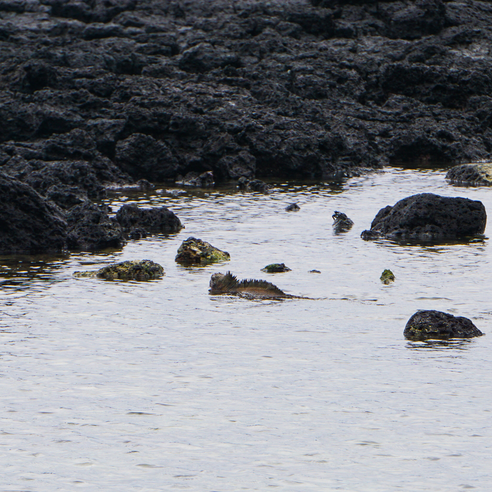
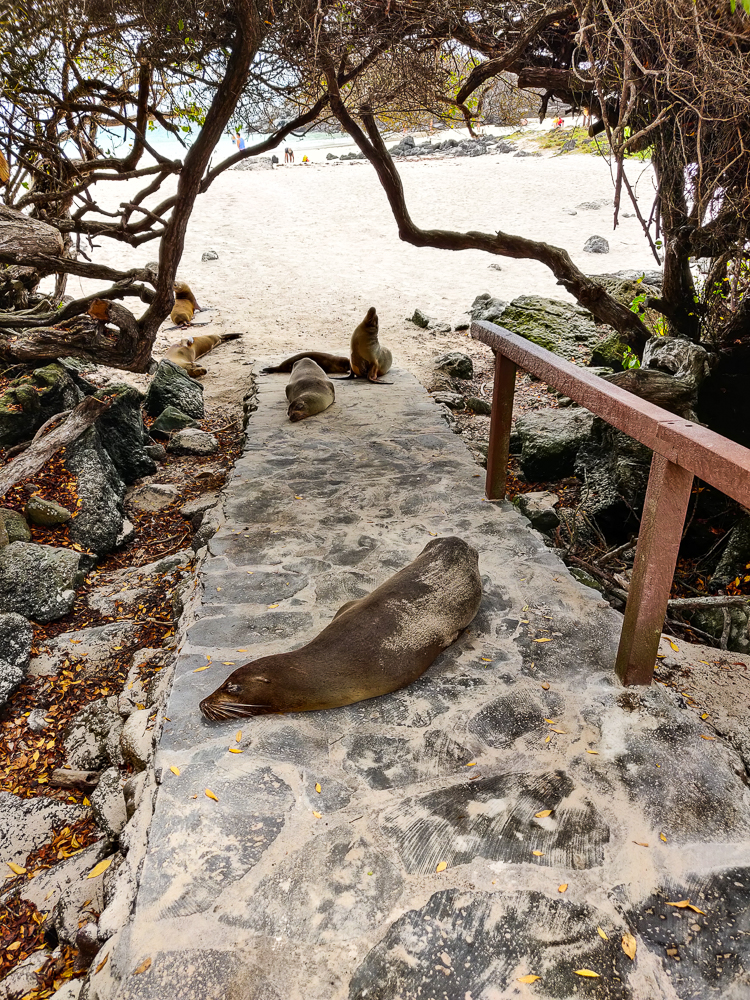
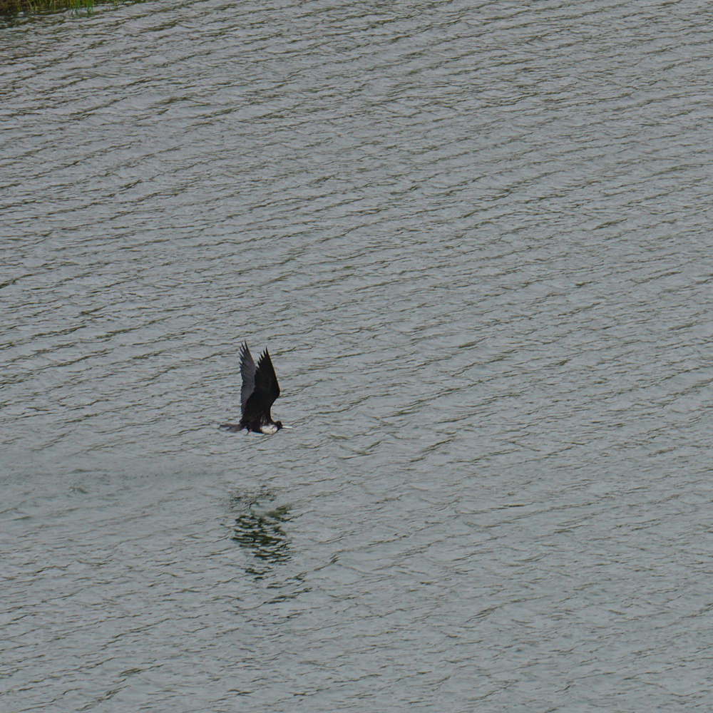
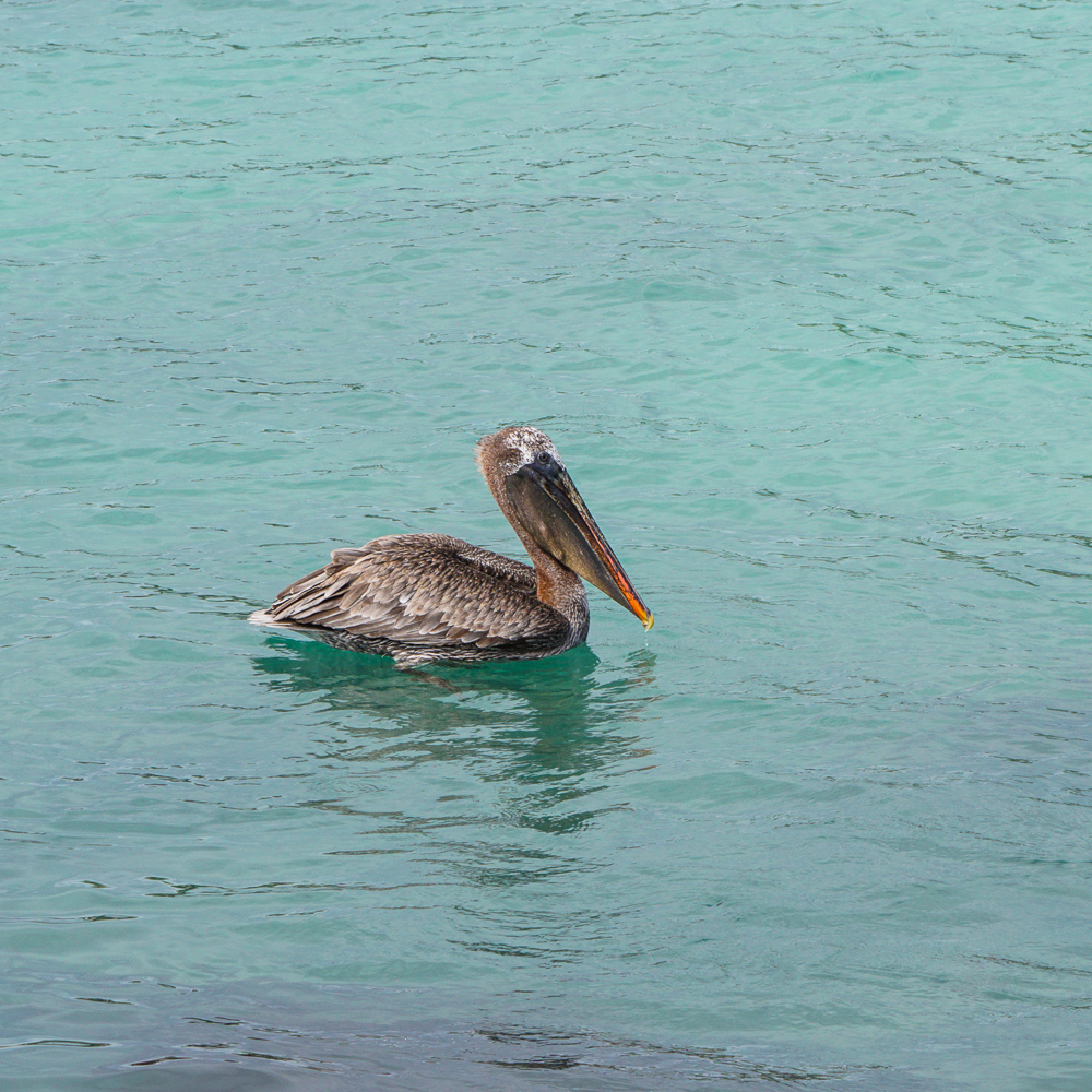
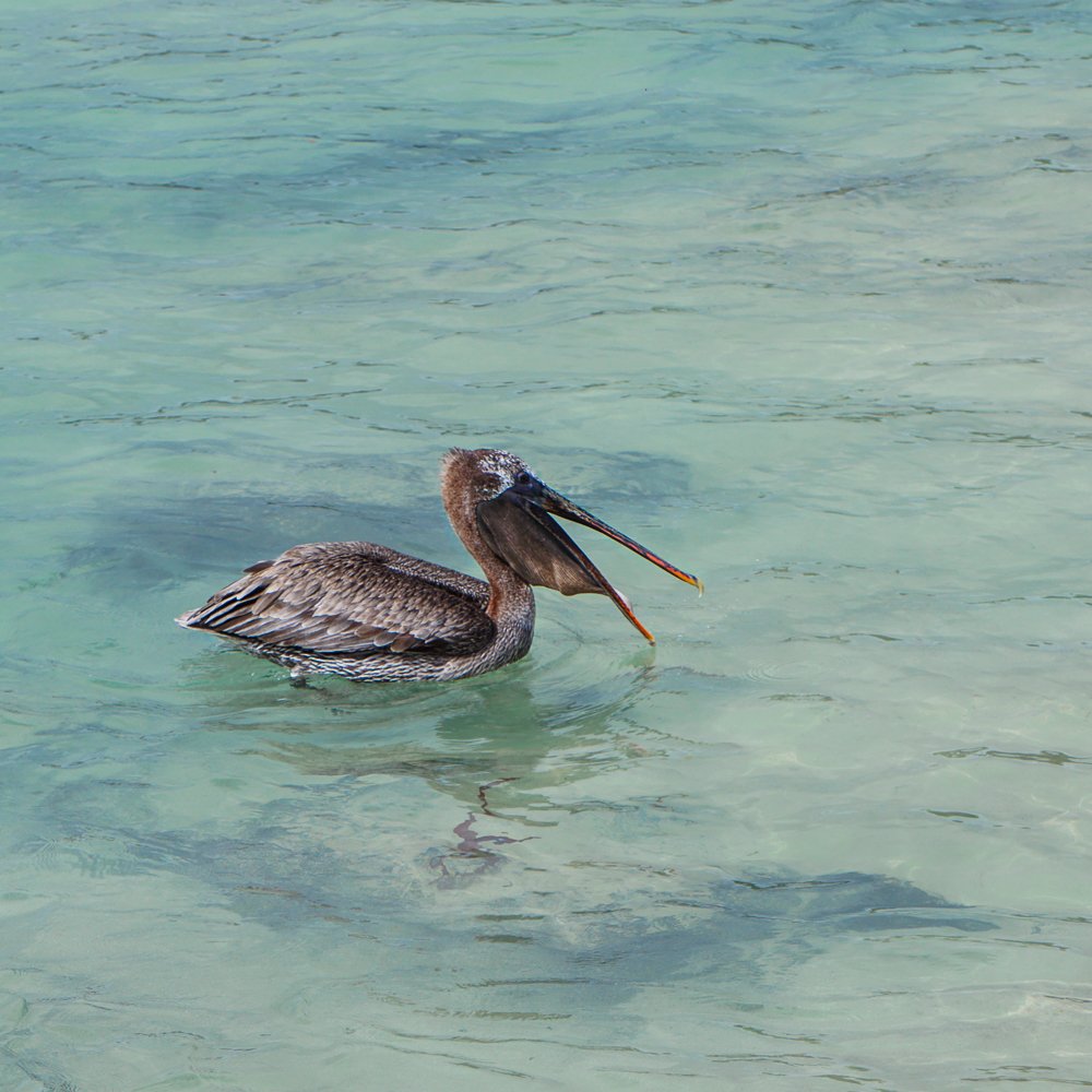
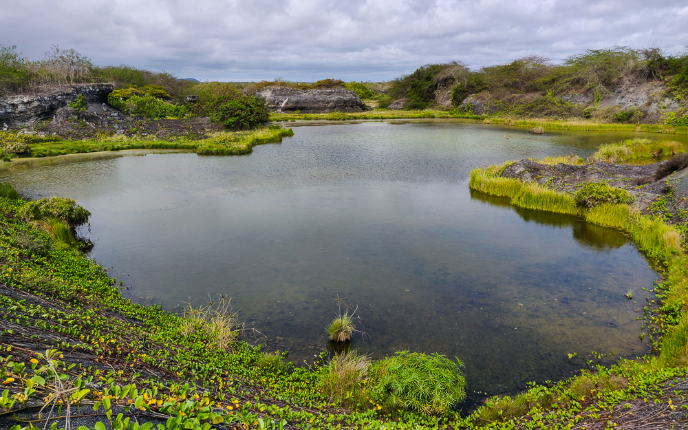
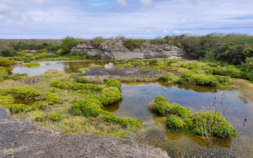
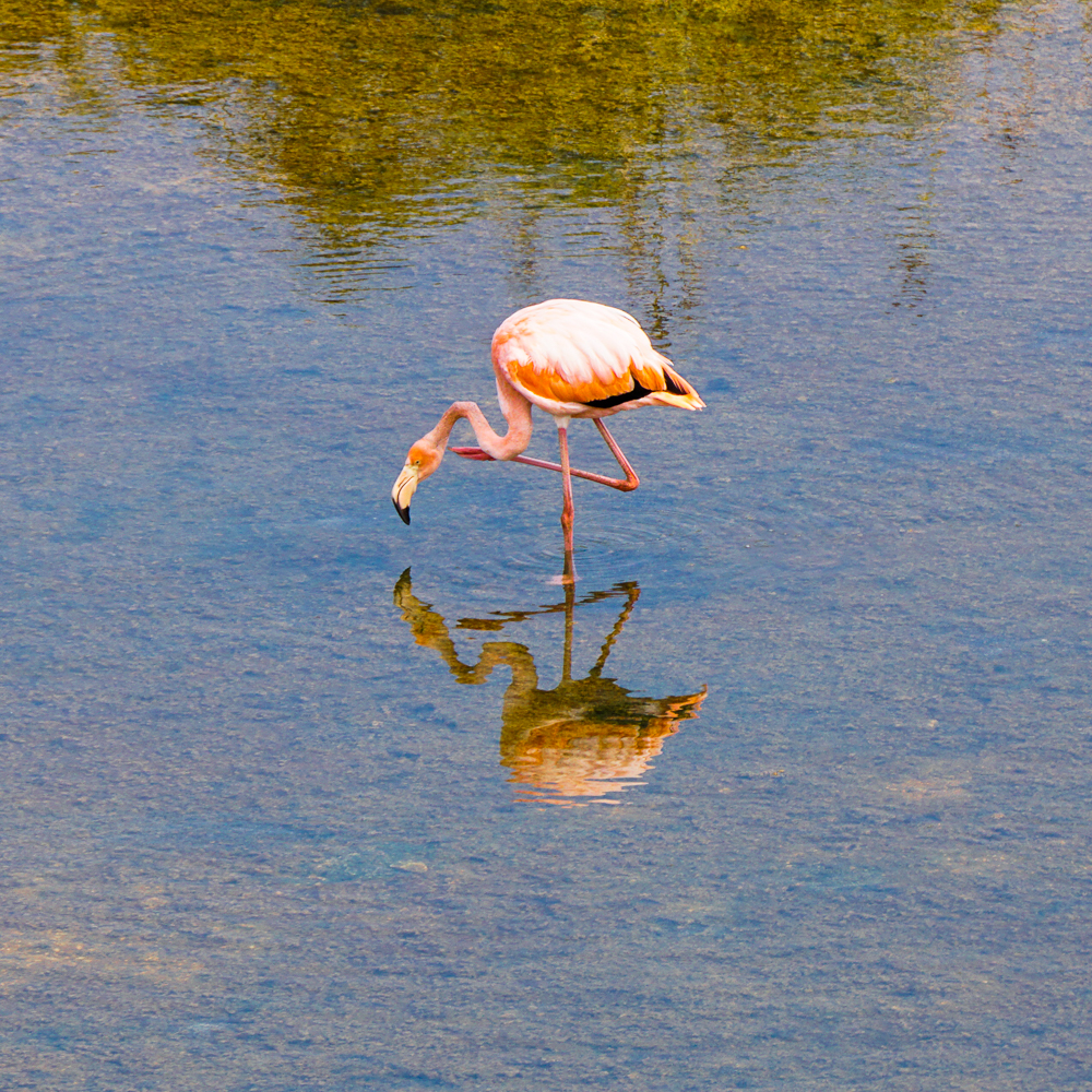
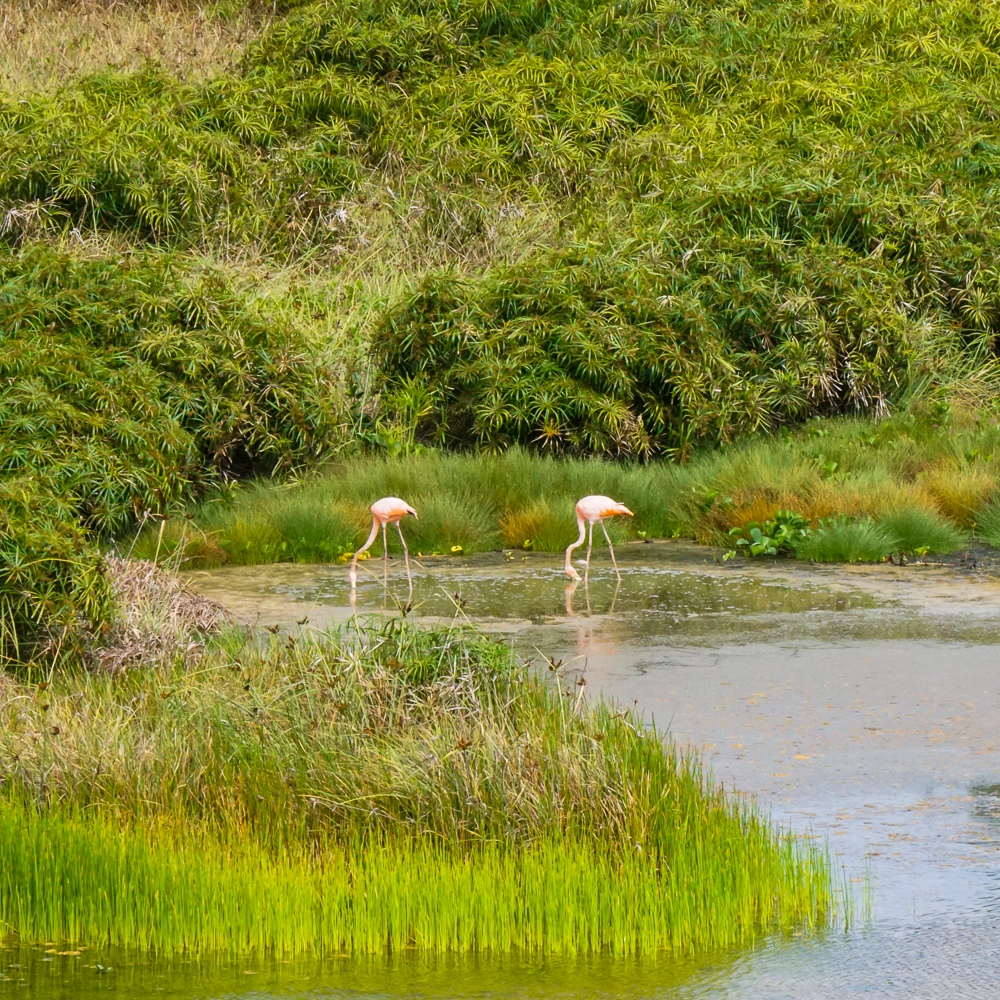
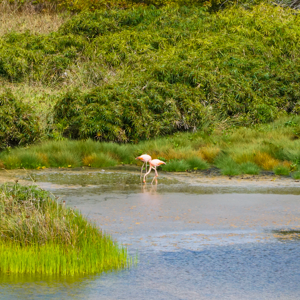
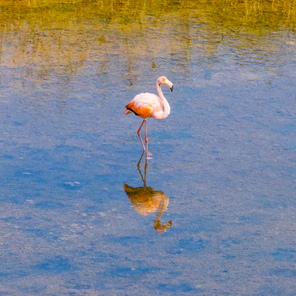
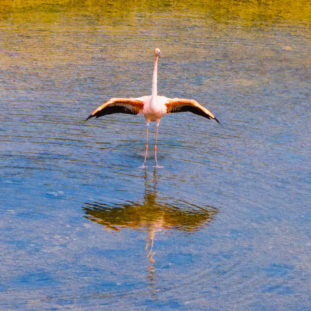
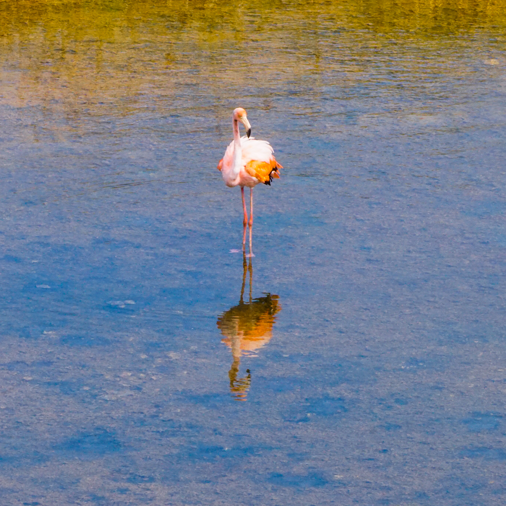
After we left the breeding center, we biked a bit farther down the road to hopefully see some flamingos! Isabela has the most flamingos in the Galapagos, and they can often be spotted feeding in the many salty and brackish lakes near Puerto Villamil. We weren’t there at an ideal feeding time and thought we were out of luck when we reached the first lake and saw nothing. Luckily, there were some people coming off of a side street who told us that there were a few hanging out in the next lake over! Awesome!!

The empty flamingo lake… but even flamingo-less, it’s a pretty view!
Flamingos!! You can (maybe?) see one flamingo in the front lake area, and there are two on the far end of the second lake area.

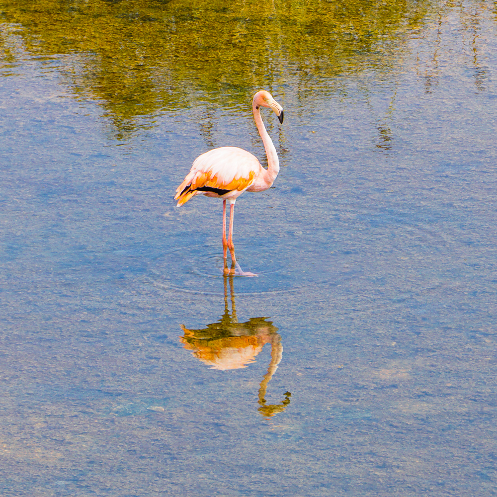
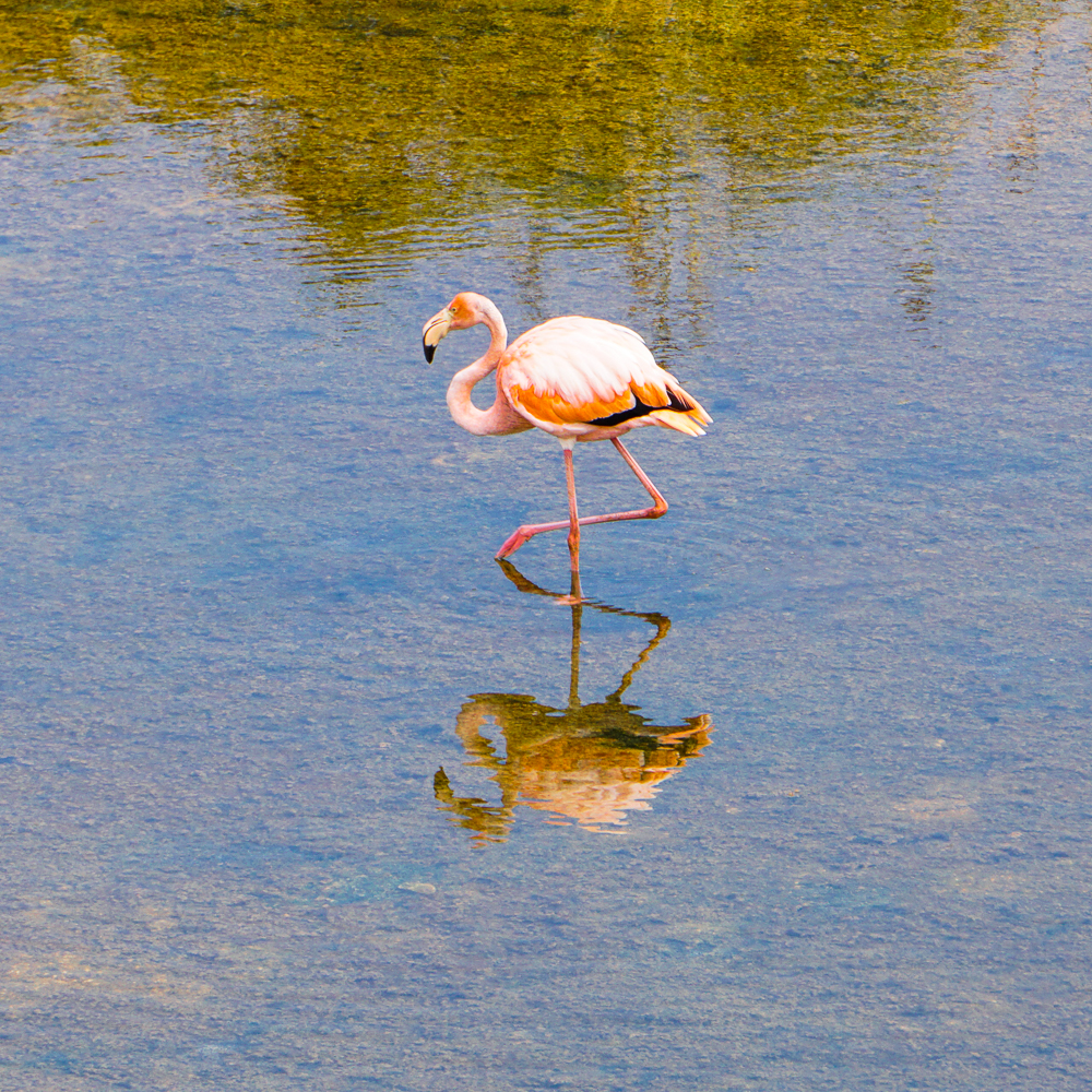
The flamingos were pretty far away, but that didn’t make seeing them any less exciting. My camera lens wasn’t even nearly strong enough to get good pictures of them, so my uncle taught me about the “poor man’s zoom” aka take as many pictures as you can, and once you’re looking at them on a computer, crop the best-quality ones. Ha! So… I took a lot. You can judge the effectiveness of that strategy for yourself.

Flamingos are just so cool
I love the shape of its neck and legs
And the reflection is pretty great too
These two were so far away that there was really no hope

THEY’RE SO PRETTY

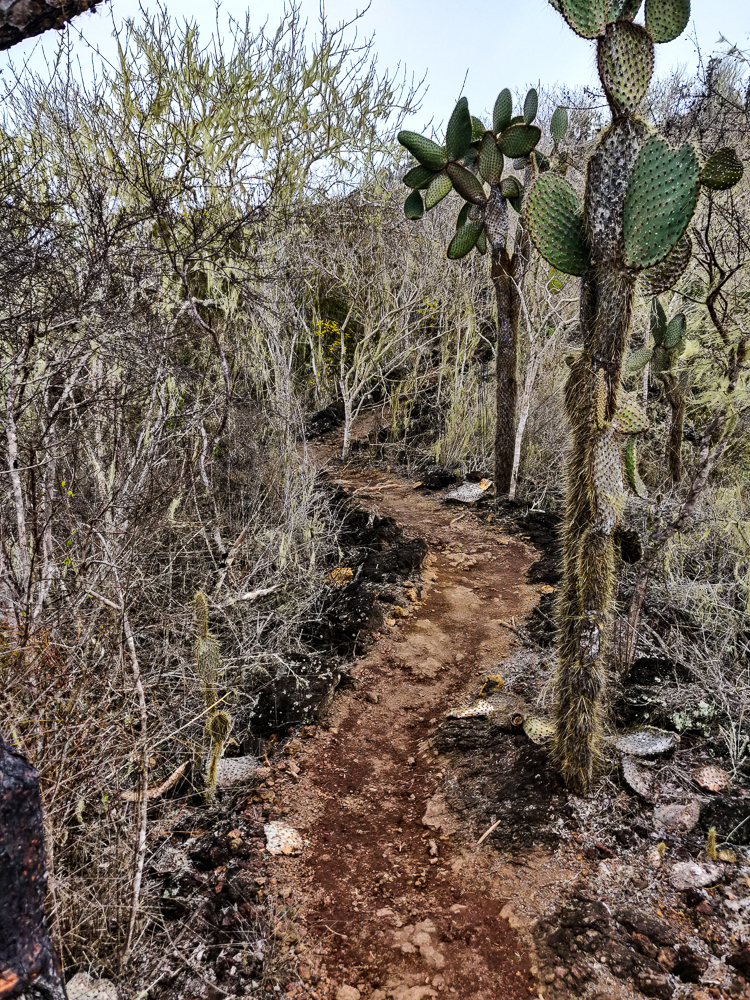
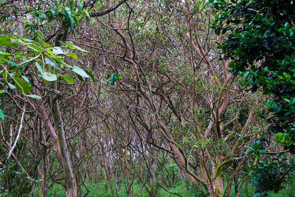
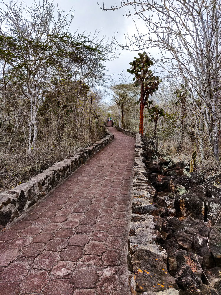
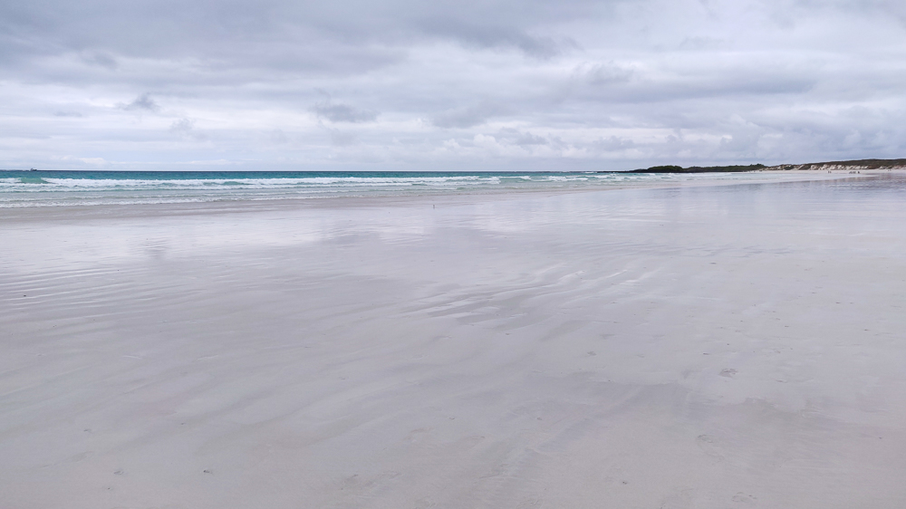
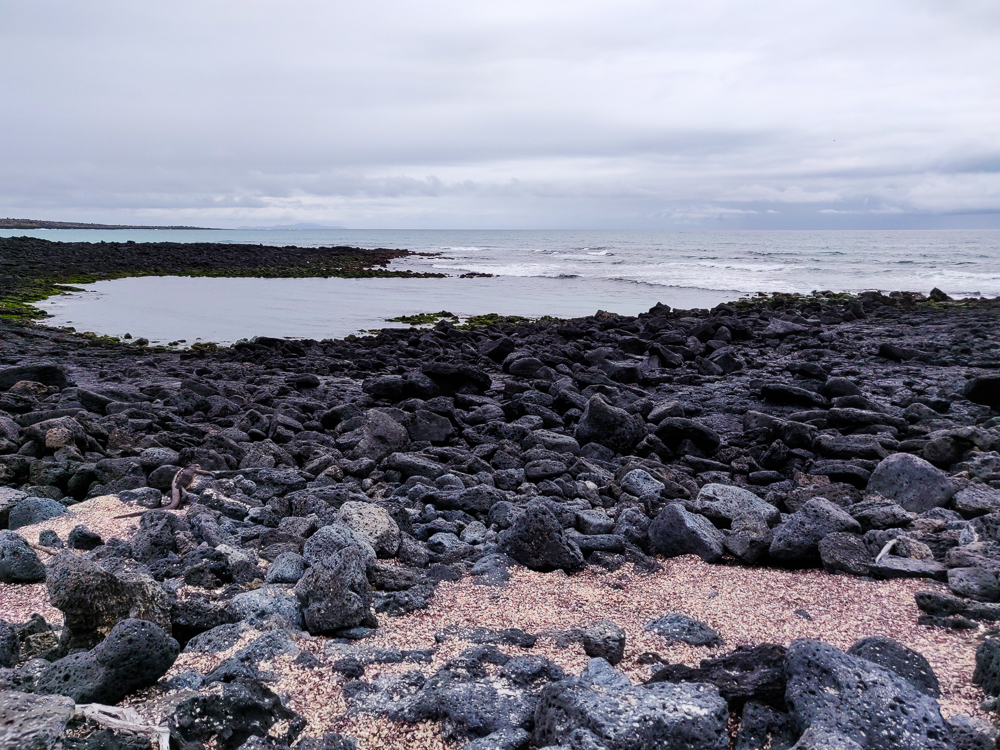
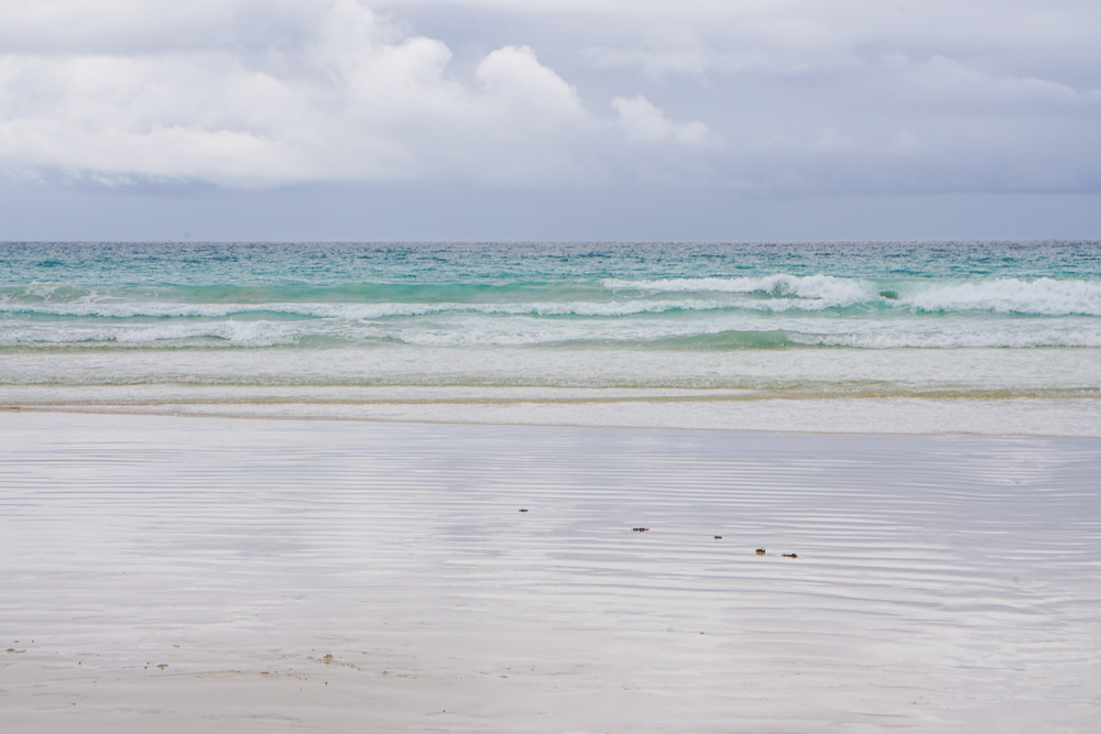
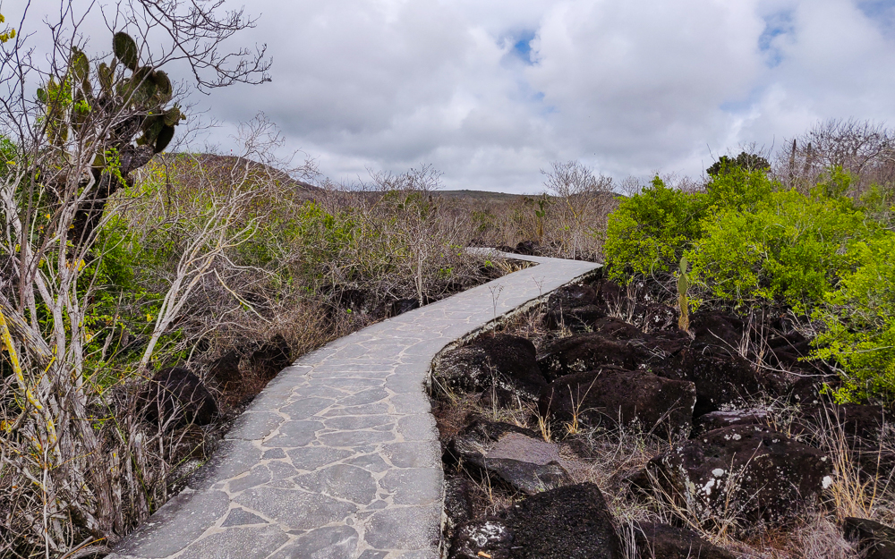
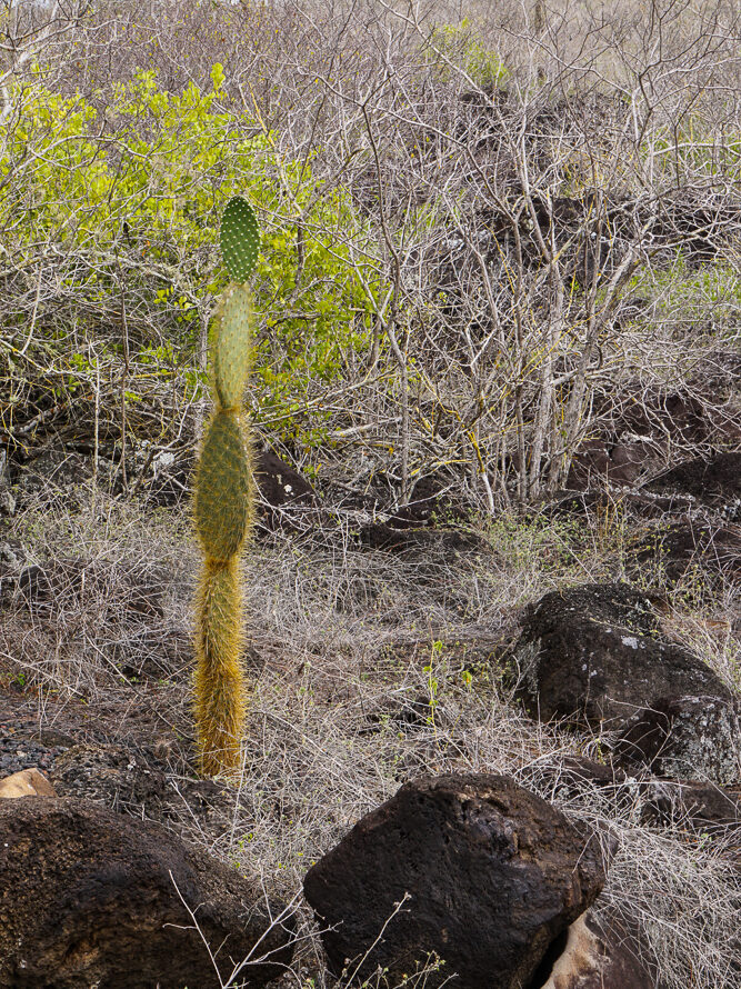
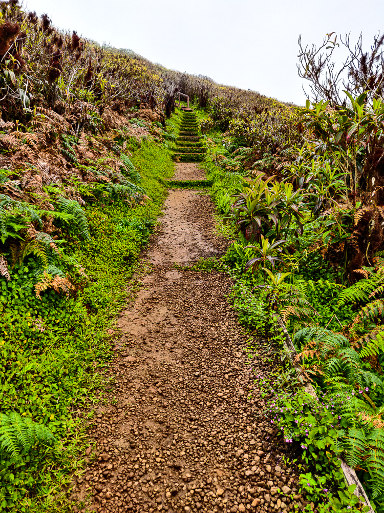
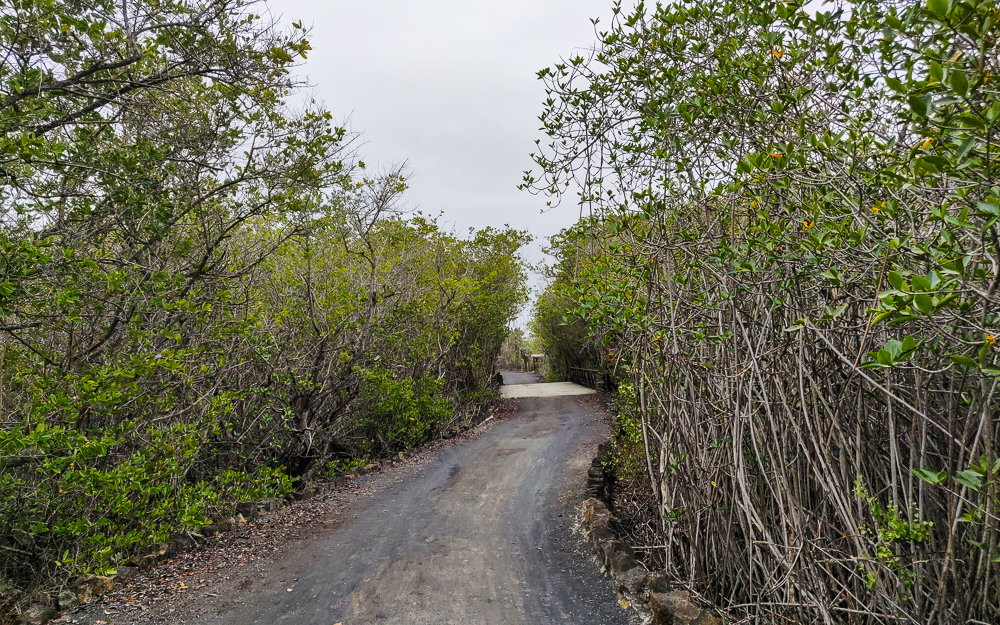
From there, we biked back to the main road and started on the bike trail. The trail started with a sandy stretch, but that thankfully became a nice, packed-gravel path. It was a super pleasant ride, mostly flat with a few uphill sections that weren’t too bad if you accelerated into them a bit.

This sandy stretch was NOT my favorite part of the path. Also, very bold move of me to take a picture while biking on this because I wasn’t feeling especially stable.
Doesn’t this look like it’s meant to be a painting?
Hooray for gravel!

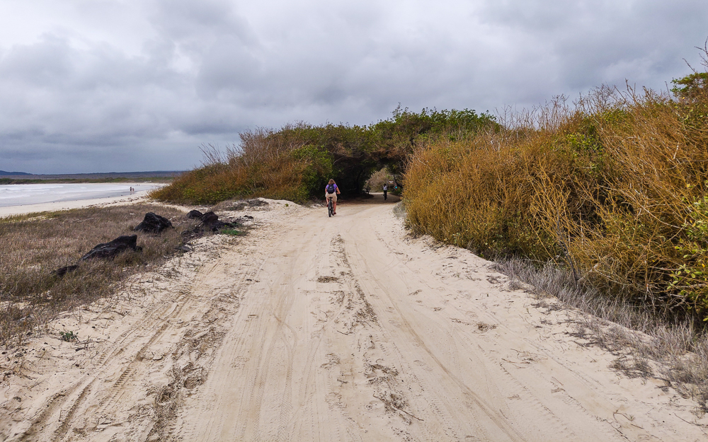
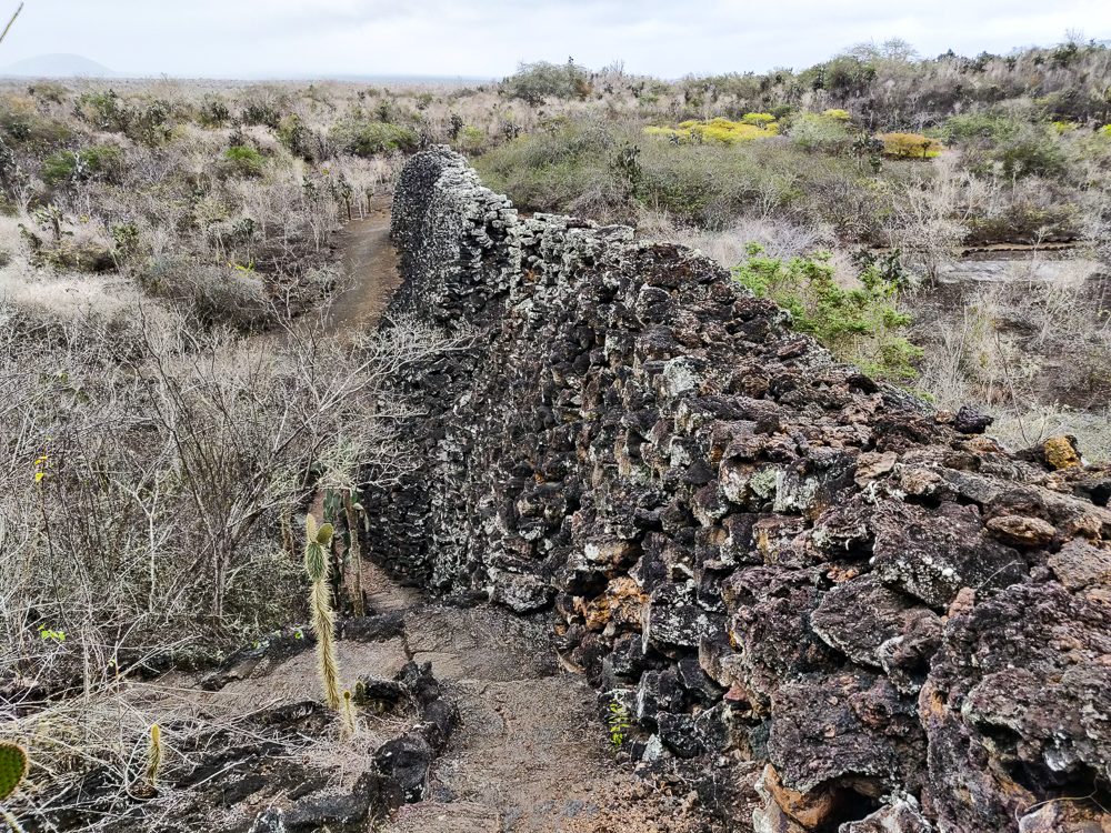
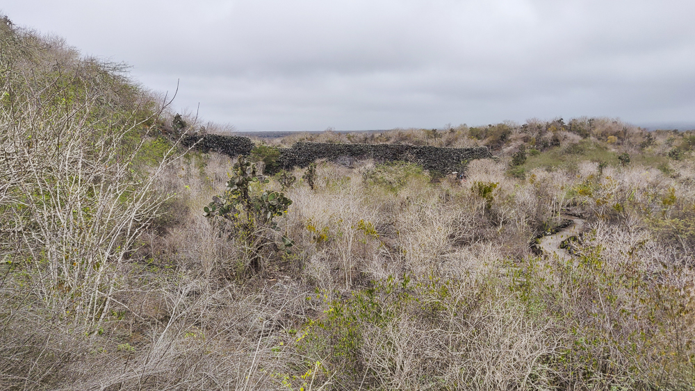
We decided to ride to the end of the path first and then slowly make our way back, stopping at the different sights along the way. The path ends at the Wall of Tears (Muro de las Lágrimas), a memorial to one of the many sad chapters in the Galapagos human history. After World War II, a penal colony was established on Isabela as a bad solution to the problem of an oversaturated prison system in Ecuador. If you remember from the Galapagos History post, there were other penal colonies in the Galapagos throughout history, and none of them ended especially well. This one was no exception.

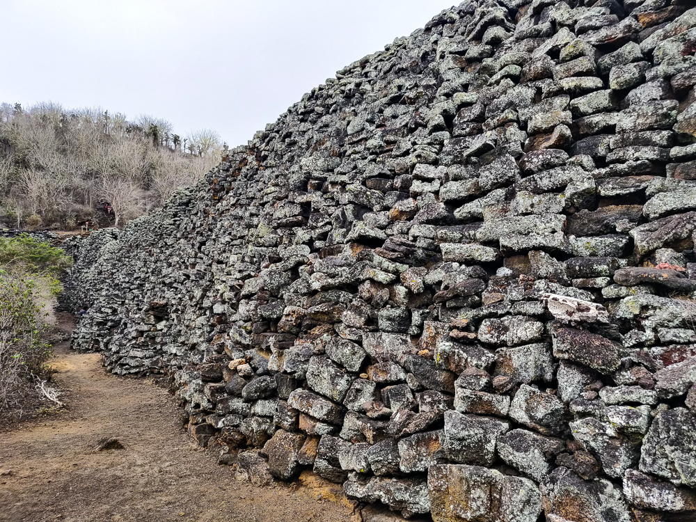
In 1946, about 100 inmates and 30 guards were sent to Isabela. Wooden structures used by American soldiers during WWII were repurposed into prison buildings. From the very beginning, it was a nightmare. There were significant food and water shortages. Many prisoners died from tuberculosis and other diseases. The guards made up pointless tasks to keep the prisoners occupied, the worst of which was constructing a hulking wall out of lava rocks. This process involved harvesting stones from a not-so-nearby quarry and carrying them to the wall location where they were then broken into smaller pieces and stacked on the wall… all while baking in the harsh Galapagos sun. The wall became known as the place where “the strong cry and the weak die”.

First glimpse of the Wall of Tears
“In memory of those who suffered and died here 1946-1959”
Up close

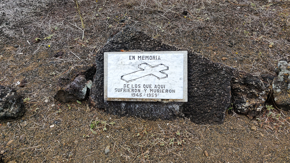
This project was a death trap for many reasons. Those who weren’t pushed to exhaustion by the heat and exposure were in danger of injury by the not-infrequent wall collapses. With no access to proper medical care, even minor injuries could lead to much more serious health problems. The guards were cruel and unrelenting, sometimes shooting inmates for not working hard enough. Many people died, slaving over a worthless wall. In 1958, the prisoners had had enough. They rebelled, escaped from the colony, hijacked an American yacht, and sailed to the mainland. Many prisoners and guards were killed in the uprising. The event was reported in American newspapers, shedding light on the horror of the colony, and it was finally shut down for good in 1959.

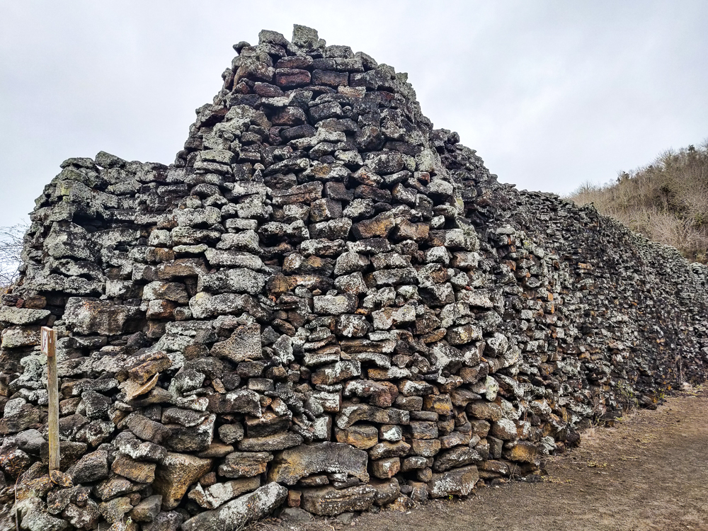
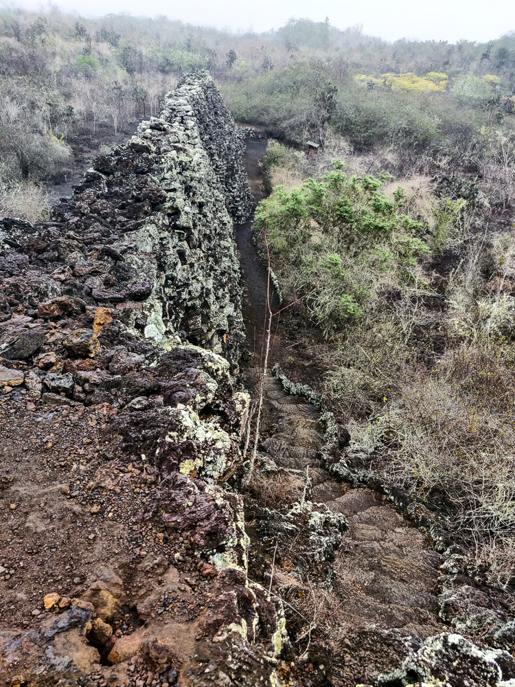
Today, this portion of wall is all that remains of the prison. It was 620 feet (190m) long, 30 feet (9m) tall, and 20 feet (6m) wide at its base. People say that the wall is haunted, that you can still hear the wails and cries of those who perished, hence the name “The Wall of Tears”.

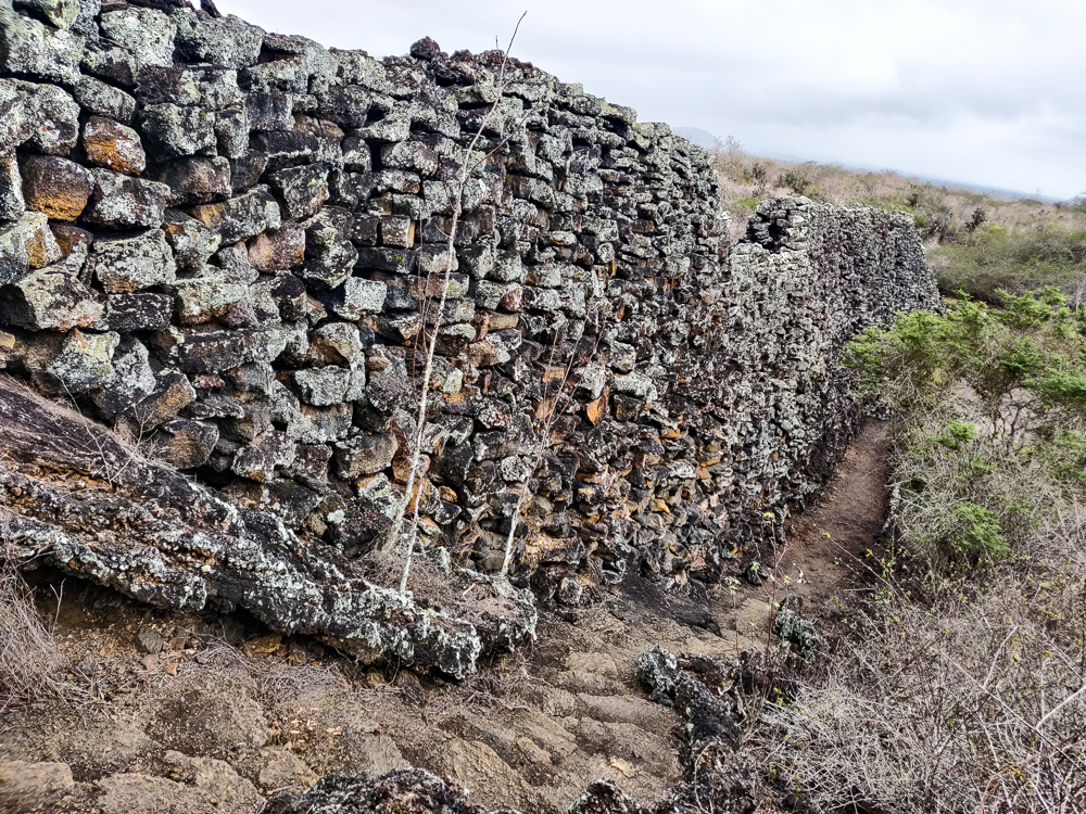
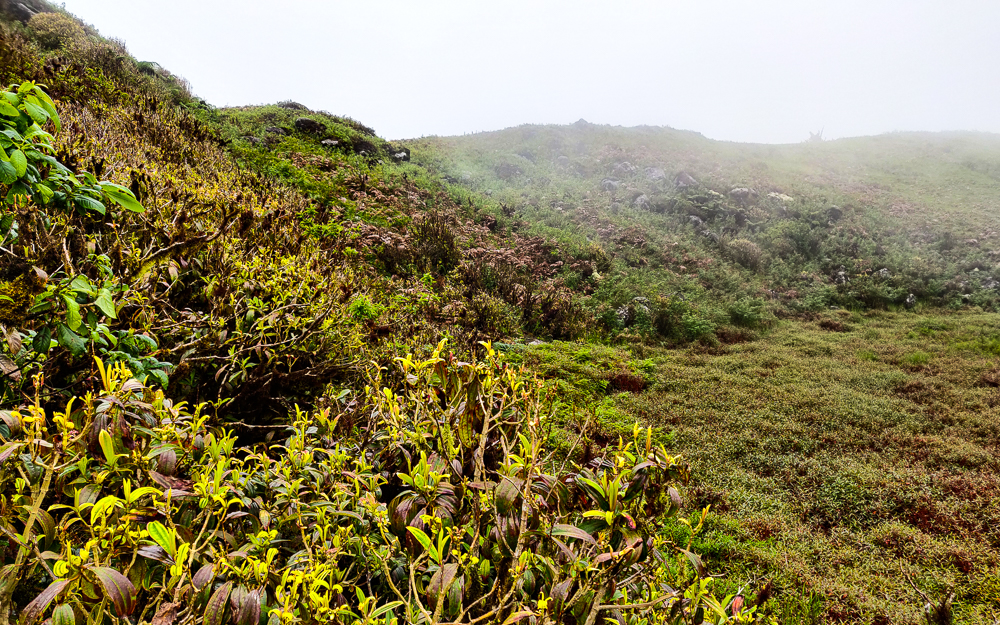
Everything that I read before we went said that you shouldn’t expect too much, that it’s not especially spectacular or impressive. I don’t agree. It has a sort of haunting beauty to it, and anyone who thinks it isn’t impressive has probably never built anything. The stones are stacked up with no mortar, hence the many wall-collapses during construction, and they’re fitted together like a puzzle. To support its height, the wall has a super thick base that narrows as it rises. Along its length, the whole thing undulates, like a snake. I don’t know whether it’s haunted or not, but there is a definite heaviness to the place. I could feel it clutching at my heart as I walked around, amplified even further by the fog that settled in while we were there.

You can see how the wall curves a bit.
This is how the weather conditions looked when we started our hike…
…and this is how it looked by the time we came down. That fog really just rolled on in while we were up the mountain.

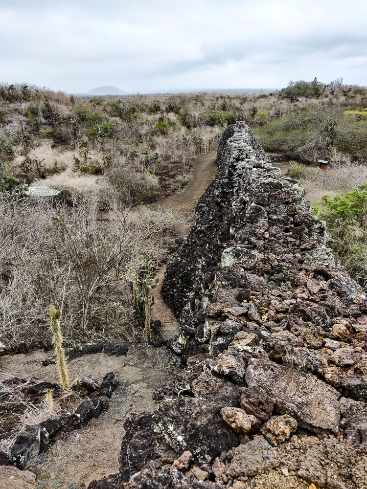
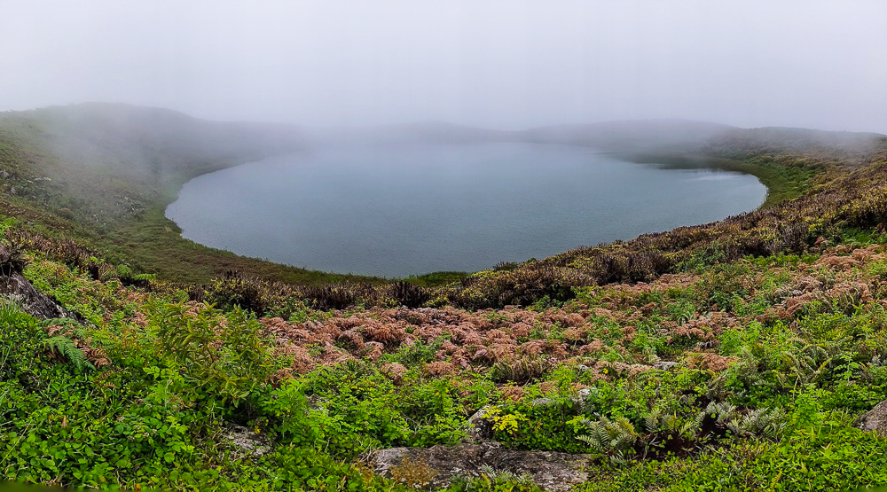
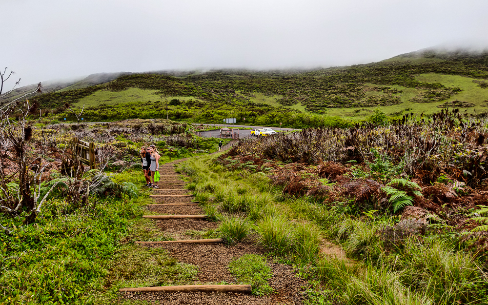
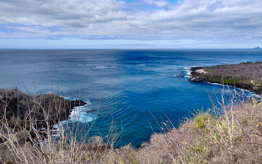
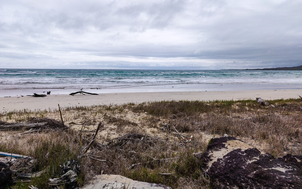
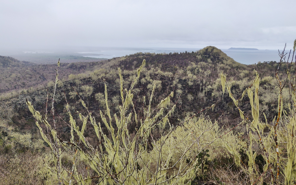
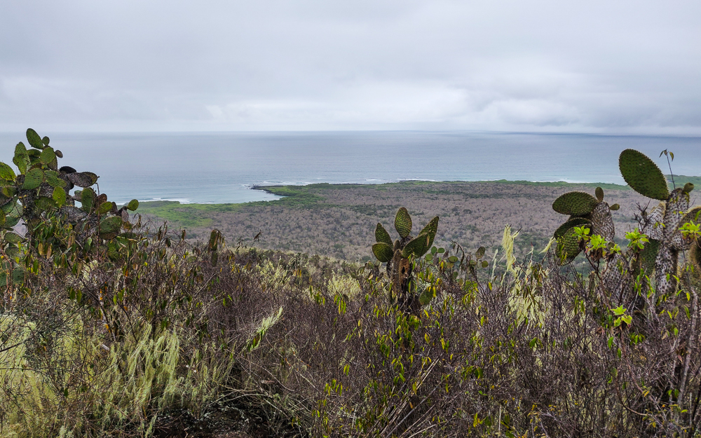
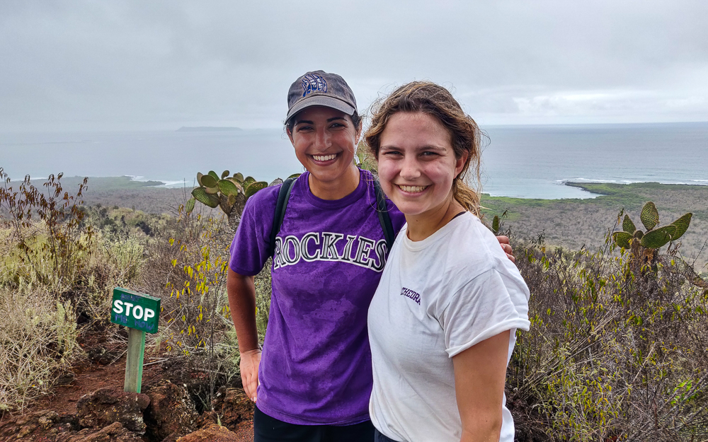
Nearby, there’s a mountain you can climb for a view of the sea and surrounding area. The weather was already looking a little questionable, but by the time we got to the top, there was no more question. It was going to rain, and we needed to get back to town ASAP.

The trees looked kind of eerie with all of this moss (I assume?) hanging off of them.
We hiked approximately forever… and then there was practically nothing to see from the top.
It was cool to see the coastline, though.
That’s rain on my shirt, not sweat hehe

The rain really messed up our plans to visit the other sights along the path on the way back to town. We made no stops, just biking and biking and trying to get back to town and out of the rain in case there was a deluge coming. So, it wasn’t quite the outing we expected, but hey, that’s life!

Related Posts

Santa Cruz Tortoises – if you’re not tired of tortoises yet… meet the tortoises of Santa Cruz!

San Cristobal Highlands – and if you’re STILL not tired of tortoises, meet the tortoises of San Cristobal!


Hiking path

Last time, we did some adventuring around Santa Cruz Island. We visited some spots downtown and checked out Las Grietas (aka the best snorkeling spot), Los Gemelos lava craters, and the lava tubes of El Chato Tortoise Reserve.

There are a few tortoise reserves on Santa Cruz, and I told our taxi driver, Fredy, to take his pick and that we’d be happy as long as there were lava tubes and tortoises. So, we ended up at El Chato. These reserves are different from the conservation centers because they’re privately owned, and the tortoises are technically wild! They’re there because it’s a good habitat, not because they can’t leave. It was weird to see them in the “wild”… we even saw a tortoise crossing the main road! (That sounds like the beginning of a bad joke.) It was a strange sight after only seeing them in captivity to that point. At least with tortoises, unlike with deer, you don’t have to worry about them speedily darting out in front of your car!

Wild tortoise!

Anyway, El Chato used to be a cattle ranch, but around 20 years ago, the owners started working to return the land from farmland to a natural habitat for tortoises, changing the farmland vegetation to native vegetation. This transition naturally brought tortoises back to the land. Now, it’s a lush, green forest and is really beautiful! Besides the vegetation, there are also a bunch of muddy pools that tortoises love. They sometimes spend multiple days hanging out in them, likely to help regulate their body temperatures and maybe to also kill ticks and protect from mosquitos.

Funky trees at El Chato
Look at these crazy branches!

I’ve talked a little bit about tortoises in previous posts, but later in our trip, my aunt and I visited the Charles Darwin Research Center, also on Santa Cruz, and learned a lot about the Galapagos tortoises in general. There were originally fifteen distinct Galapagos tortoise species from ten different islands. Now, unfortunately, only eleven species remain, due mostly to human interference and the thousands and thousands of tortoises that were killed for food and oil back in the whaling days.

This map shows where each of the 15 species originated and differentiates between the ones that still exist (blue) and those that are extinct (pink).

The Darwin Center is a research hub that monitors the wildlife of the islands and works to minimize damage and neutralize threats. The Center is involved with all sorts of conservation projects, and as part of their tortoise research, they’ve identified genes from two of the extinct species, the Pinta and Floreana, in some living tortoises! The hope is that it may be possible to essentially recreate those species through careful breeding. It sounds insane but also kind of amazing!

At the Darwin Center. I’ll never get tired of looking at baby tortoises (note the folded up screen that they use to protect them at night)
It’s just crazy to me that these tiny little things turn into those giant tortoises
This is taxidermized Lonesome George. He was the last Pinta tortoise, found there in 1971. There was a global search for a female Pinta tortoise, but it was unsuccessful, and George died in 2012. He’s now creepily memorialized at the Darwin Center.

The tortoise species fit into two major categories: dome-shell tortoises, and saddleback tortoises. The Santa Cruz tortoises have dome shells. These are typical of tortoises that live in wet zones and where food is plentiful close to the ground. As you’ve seen from the pictures, that’s definitely true of the Santa Cruz highlands! In drier places with less vegetation, the tortoises had to adapt to survive. Saddleback tortoises have shells that allow a wider range of vertical motion which allows them to reach food higher off the ground. It’s so cool to see such a clear example of how different habitats impact how species develop!

This is a good comparison image, showing the difference between the dome shells and saddleback shells.
These are the most dramatic dome shells… It looks like a mushroom was plopped on top of this tortoise. Like it actually almost looks like the tortoise and the shell aren’t really connected.
I’m always up for a pretty flower
I don’t know what kinds of tortoises any of these are, but just observe the similarities and differences in their shells. This one has a very dramatic saddleback shape.
You can see that this is clearly a saddleback shell as well, but it’s not quite as dramatic as the last one.
These are definitely from a wet island because those shells are like pancakes.
I’m not even sure how to describe these

I was surprised to learn that most Santa Cruz tortoises are migratory. It seems crazy for that to be the case for such a slow-moving animal! They move anywhere from about 65-2,300 ft (20-700 m) each day, and they travel up to 6mi (10km) from the coastal areas to the highlands during the rainy season. Tracking has shown that while most migrate (and move back and forth between two general areas), some of them seem almost nomadic, wandering here and there without any clear rhyme or reason. One aspect of the tortoise conservation work in Santa Cruz has been educating the locals about these migrations and asking farmers to use raised barbed wire fences so that tortoises can freely move about.

In case you’re wondering how quickly that distance is covered…

The answer is, “Not very.”

As you can see, plenty of green things to eat close to the ground
Fredy (our taxi driver) said that the tortoises have the feet of an elephant, the neck of a giraffe, and the face of a serpent. He’s not wrong.
Chowing down
Is it just me or does it look like this tortoise is glaring at us?

This balance between allowing people to live their lives vs. conserving wildlife is complicated. Some people think no humans should live in the Galapagos or even visit. Others think that people should be able to do whatever they want. Neither of these extremes is likely, so the question then becomes, “How can we best serve both interests?” It’s like a case study in compromise, and I think it’s something we can all probably learn from. Don’t get me wrong, the situation is far from resolved. But people are paying attention and trying to figure it out, and I think that’s worth something!

Spotted at El Chato!
I think this little buddy is a Galapagos flycatcher
I also think he’s very cute

The tortoise reserve was our last stop for the day, so we headed back into town when we were finished. Everyone was pretty exhausted!

We had dinner at one of the little restaurants along this road. It closes to traffic at night so that they can put tables and chairs out in the street!

The next day, we had time for one more adventure before we had to catch our ferry to Isabela Island. We decided to check out Tortuga Bay, aka the MOST BEAUTIFUL BEACH IN THE WORLD. Yes, another one of those. Like I’ve said, I’m not a great judge of beaches, but this one was definitely memorable.

We walked from our hotel all the way to the beach, first walking about seven blocks to the start of the trail, and then walking another half hour/45 minutes on a shade-less trail to get to the bay.

Lava lizard friend along the way!

The scenery along the way isn’t especially exciting, but I was fascinated by these cactuses with trunks that look like cartoon tree trunks. They’re in the opuntia cactus family, or “prickly pear”, and while many varieties exist, the Galapagos opuntias are endemic (they only exist there) and are the only ones that grow like trees! The tallest opuntia are found on Santa Cruz where they can grow up to 40ft (12m) tall! That’s crazy, in case you didn’t know.

The shade-less path to Tortuga Bay!
Opuntia cactus trunk! Does this not look like a cartoon drawing of a tree trunk? It doesn’t look real. And it feels kind of plasticky and fake as well. But it’s not!

The opuntia cacti are well-suited to survival in the Galapagos. They can store large amounts of water, making them resilient in long dry periods. They can grow directly on rocks, an essential ability when the island is nothing more than a giant lava rock. Finally, they’re able to self-pollinate, so they don’t need other cacti nearby to reproduce. It’s not hard to see why that might be useful in a situation where you’re a wayward seed trying to populate a barren island! These cacti are a critical part of the Galapagos ecosystem. Iguanas and tortoises eat their pads, fruit, and seeds. Cactus finches eat their flowers, fruit, and seeds, extract water from their pads, use them for protection when building nests, and distribute their seeds across the islands (thanks to their poop!).

Try to tell me that these look real. (I won’t believe you.)
Cactus tree!

When we finally reached Tortuga Bay, we found ourselves at Playa Brava, the longest and flattest beach I’ve ever seen. With its white sand stretching out as far as the eye can see, it felt almost otherworldly. Most beautiful beach in the world? You can decide.

Flat and endless
These pictures make me feel so calm!
Isn’t it a relaxing view?
Blue heron!
I like how they can curl themselves up like this.
Outcropping separating Playa Brava from Playa Mansa

We walked the endless beach until we reached another, Playa Mansa, where you’re allowed to swim. (You can’t swim at Playa Brava because the tides are too dangerous.) It’s supposed to be a great snorkeling spot because of the nearby mangroves, full of sharks and sea turtles, so my cousin and I decided to check it out. We tried to swim out to deeper water, but the ground sloped so gradually that even after swimming pretty far, it was maybe 3ft (1m) deep. Even so, it was so cloudy that I could barely make out the bottom! There were a lot of dark spots, but most of them seemed like seaweed until… eek! Was that a stingray?? I turned back to check… and it was! A small one, maybe 8 inches (20cm) in diameter. Apparently, I was emotionally unprepared for an actual stingray. My heart skipped, and I let out an underwater scream in surprise! It scared me half to death, and then my scream scared it (hopefully only) half to death! It shifted to the left, then to the right, and then sped away, like when a person gets scared and looks around spastically before sprinting away. Once I calmed down, I felt terrible for scaring it so badly. Sorry, little stingray! It was kind of hilarious… but I also decided that I did NOT like how close I was to it without being able to see it.

I love these marine iguana tracks

I swam over to my cousin to say that I was ready to go. She said that she had seen a shark fin and tried to swim after it, but she couldn’t see much, and it disappeared. I got the “I need to get out of this water immediately” feeling, and we sprinted back to the beach. Later, my uncle told us that he talked to some people who had been kayaking where we were swimming, and they said there were TONS of sharks in the water. EEK. It would have been cool if we could see them, but you know how I feel about swimming in water that I can’t see through. Normally, I’m just irrationally afraid that there are sharks. This time there really were! Nope nope nope. Noooo thank you.

This seems like a good time for a few more relaxing beach pics…
Breeeathe, Lara. *inhale* and *exhale*
Mangroves! These are another super important plant. Their roots are a great place to lay eggs and hide away if you’re a small fish or other critter trying to escape larger predators. This also means that they’re popular with birds who are looking to eat these little fish! And sharks, doing the same.
Marine iguana in the mangroves
I really thought that I took a video of this dude swimming, but I can only find pictures (argh!)
Look! There he goes! You can see his tail snaking behind and propelling him forward.
It never gets less amazing.

We headed back to town with plenty of time to grab our bags and head to the dock before our ferry departed. The entire organizational system for ferry boarding is a disaster, but I’m not going to go into that (you’re welcome). Just know that my calling that mess a “system” is incredibly generous. The chaos drove my engineering mind insane (I have approximately 1000 ideas for how to improve it). We ended up on a ferry with a “floating casino” sort of vibe. The only two windows were blue and dolphin-shaped, casting bluish light across the interior, and the seating was a plush, wavy bench that wound around the perimeter. Before we left, a guy walked around with a roll of plastic bags for anyone worried about getting seasick… hehehe that’s comforting, right? We had a bumpy start, but after the captain came down and moved some people around to better balance the boat, it was much smoother! Thank goodness because the ride was maybe 2.5 hours, and I don’t think I could have taken another ferry ride like the one from San Cristobal to Santa Cruz (where I closed my eyes and pretended that I was totally comfortable while repeating to myself, “You’re fine. Your stomach is fine. No, your face doesn’t feel hot. You don’t feel queasy. I’m sure we’re almost there.”).

One more lava lizard for the road
The ferry took us from Puerto Ayora, Santa Cruz to Puerto Villamil, Isabela.

Next time, get ready for more adventures on a new island!

Related Posts

Las Grietas and Los Gemelos – explore more of Santa Cruz and learn about the crazy volcanic activity that created some of the island’s most interesting features.

Kicker Rock – for more adventures of swimming in cloudy water with definite but invisible shark companions…

San Cristobal Highlands – investigate other Galapagos claims of “world’s most beautiful beach” and check out the San Cristobal tortoise conservation center.

Diamond Beach – check out this beach in Iceland that may give Tortuga Bay a run for its money… though in a VERY different way!

Española Island – meet some especially colorful members of the marine iguana family.

Following our two days of full-day tours, we “took it easy” with a “free” day that ended up being one of the most exhausting of all. We didn’t have an official tour scheduled, but that doesn’t mean we didn’t have any plans. We hired a taxi driver to drive us around the island, doing the classic “highlands tour” circuit that goes from end-to-end on the island’s one major road.

We started in Puerto Baquerizo Moreno, then visited the Galapaguera de Cerro Colorado (tortoise reserve and breeding center), Puerto Chino (one of the many “world’s most beautiful” beaches), Laguna El Junco (lake), and finally stopped at the island’s oldest ceiba tree/treehouse before heading back to town where we had some other adventures on foot. Like I said, it was quite the day.

To give you some context…
We started at the blue house at the western end of the island, then we went to the Galapaguera (green), Puerto Chino (red), Laguna El Junco (blue), and the ceiba tree (yellow). After getting back to town, we walked up to the Interpretation Center and Cerro Tijeretas (purple).

Let’s not get ahead of ourselves, though! Our first stop was the Galapaguera, a tortoise reserve that was opened in 2003 to help rebuild the island’s tortoise population. There were originally 15 subspecies of Galapagos tortoise. Four of those are extinct, and all of them are endangered, mostly due to human activities. During the pirating/whaling days, it’s estimated that 100,000-200,000 tortoises were taken and killed for their meat and oil. In addition, non-native species were introduced that hindered repopulation. Rats, pigs, snakes, and army ants eat eggs and threaten hatchlings (as do some of the native birds). Goats and other large mammals compete with them for food.

Tiniest lil baby tortoises!! These could easily fit in your hand, maybe like 5″ (13cm) max in length.
Slightly bigger little babies
And these are big enough that you could ride around on their backs.

One of the things that saved many of these tortoise subspecies is their longevity. They live an average of 100 years with the oldest recorded living to 152! This meant that even with the many repopulation challenges, only a few tortoises needed to survive to make conservation efforts possible. Many of the islands now have tortoise reserves and breeding centers which aim to grow the tortoise populations by giving them safe places to mate and grow and eventually releasing many of them into the wild.

In the breeding centers, park rangers collect the tortoise eggs and simulate normal conditions while also protecting them from predators. They incubate the eggs, and after the tortoises hatch, they are kept in growing pens for their first few years of life to further protect them while their shells are still soft. After this vulnerable period, there are virtually no predator risks for the tortoises, and survival is just a matter of finding enough food. The amazing thing, though, is that they can survive for up to a year without eating or drinking! They have a slow metabolism, and they spend more time resting when there isn’t enough food. They also can store water internally for long periods, so they’ll drink a lot when they have access to fresh water and save it for later. (This is actually part of the reason why they were so desirable on ships because they could survive in the ship’s hold without needing food or water, allowing the sailors to have fresh meat at sea with little effort.)

This is where the smallest tortoises are kept until their shells get hard enough. I think they said the first 4 years? Or at least the first two. The fencing on top is to keep out predators, and at night, another cover with even smaller holes is closed as well to protect them even further. (pic by my uncle)
These tortoises were around 5 years old, I think. They’re maybe 1.5′ long (0.5m). Maybe.
This guy was a little freaked out by us. When they get scared, they pull their heads into their shells and use their arms to shield the opening.

We were lucky to arrive at the reserve just in time for feeding! The tortoises are fed twice each week, and the rest of the time, they fend for themselves by eating plants around the sanctuary. Usually, the tortoises are wandering around and you may or may not see many of them, but since it was feeding time, we saw them all! It was really interesting to watch them interact with one another.

This video shows a tortoise “fight”. The dominant tortoise is generally the one that can stretch out its head to be tallest, and you can see that happen in this interaction. Tortoises generally don’t make noise, so it’s just a silent challenge, silent fight, and silent retreat (well, aside from my uncle’s narration hehehe).

Enthusiastically eating that stalk
‘Get out of my way!” Mr. Tortoise says as he steps over his fellow tortoises.

While we’re at it, here’s one more video showing a tiny tortoise stuck on its back. Some of his friends tried to give him a hand, but ultimately, one of the employees came and flipped him back over.

After we were satisfied, we loaded back into the taxi and headed for Puerto Chino. It’s another SUPER BEAUTIFUL beach, supposedly one of the most beautiful in the islands, but I don’t know. They’re all kind of the same and all very pretty. We weren’t planning to go swimming, so I spent my time practicing taking pictures of sea lions, lava lizards, and this pretty yellow bird that kept flitting around.

Path to Puerto Chino. It’s very nice and paved, but hopefully you don’t need any shade along the way…
Cool as a cactus.
You’re supposed to keep 6 feet between you and any animals… but the sea lions do NOT make it easy.
We considered eating lunch at this picnic table, and then a sea lion came and plopped himself right on top.
Puerto Chino. What do you think about the beauty of this beach vs. the others we’ve seen so far?
I’m obsessed with the lava lizard facial expressions
This one is adorable
An American yellow warbler
He’s super cute too
And we’re definitely friends
Sea lion striking a pose at Puerto Chino

From there, we headed to Laguna El Junco, a volcanic crater lake that’s one of the only permanent freshwater supplies in the islands. Now, this goes back to what I mentioned in a previous post about the crazy diversity of landscapes on a single island. The lake is at 700m above sea level, putting it in the “highlands” category which means it’s green and damp and can be foggy while the coasts are simultaneously clear and dry. So even though the weather was beautiful in town, it was VERY foggy at the lake. Even so, we hiked up to see what we could make out through the fog.

At first, nothing. We couldn’t even see across to the other side! But the wind kept the fog moving, and we were lucky to get a few moments of decent visibility. The lake is about 300m wide, and it’s filled by rainwater. Birds like to swoop around and use the water to clean the salt out of their feathers. It felt like we’d stepped into another world! I was happy enough with being able to see the opposite side of the lake, but on a clear day, they say you can see nearly the entire island as you walk around the rim of the crater!

Path leading up to the edge of the crater
Looking back towards the parking lot. Look at the solid layer of fog at the top of the picture!
Plants around the edge of the crater lake
Little flowers by the lake
Frigatebirds!
Soaring around the lake
So cool!
Panoramic picture of the lake during the few seconds that the view was kind of clear
Cousins! (pic by my uncle)

We made one last stop on the way back to town, in the tiny settlement of El Progreso. This is the oldest surviving settlement in the Galapagos, and if you recall from the history post, it has a horrible past. It was a penal colony, and eventually, this guy named Manuel Cobos turned it into a sugar mill. He started treating the workers like slaves, and they ultimately killed him for his cruelty. Now, about 500 people live in town, and it’s also the home of the islands’ oldest ceiba tree! Ceiba trees aren’t native to the islands, but it’s assumed that this one was planted by some of the earliest visitors. It’s said to be ~300 years old which is possible but maybe unlikely because the first settlement attempt wasn’t until the 1830s. But who knows? It is monstrous: 131 ft tall (40m) with a 61ft circumference (19m).

There’s a bridge leading up to the treehouse

The tree is interesting enough just in itself, but it also features a treehouse! And it’s not your average built-by-a-kid treehouse. You can actually rent it overnight, and there’s electricity and wifi (the two most important things, of course), a loft with two beds, a kitchen, and a functioning bathroom (including a shower!). Craziness. And underneath the tree, there’s an underground room where I lasted about a minute before I started thinking about the fact that we were underneath a tree, and if the room collapsed, we’d be dead. So that wasn’t exactly my favorite part, but it was still cool.

Inside the treehouse. The beds are up in the loft, and the kitchen is straight ahead.
Check out that beautiful tree!
My cousin coming up from the underground cave
Not claustrophobic at all…
This is the garden outside of the treehouse. So pretty! (The treehouse is behind me to the right. You can see some of the tree branches sticking into the picture.)

That was the end of the highlands tour, but like I said, it wasn’t the end of our day! After the taxi driver dropped us off back in town, we walked to the Interpretation Center which has a bunch of information about the islands: how they were formed, their human history, the ecosystems and flora and fauna. It’s actually where I got nearly all of the content for my Galapagos History post.

Pelican!
Fishing. Wait for it…
…nom nom nom!
Admiring the pelican (pic by my uncle)
Sea lion baby!

From there, we walked up a nearby hill, Cerro Tijeretas, where you can get nice views of the town and other parts of the island. You can even see Kicker Rock from there! It overlooks a pretty snorkeling spot, and there are a lot of frigatebirds flying around because there’s a colony that nests nearby.

View from Cerro Tijeretas
Looking back towards Puerto Baquerizo Moreno
Frigatebirds from Cerro Tijeretas

This is supposed to be a really great snorkeling spot
Do you see Kicker Rock out there in the distance??

We also popped into a couple of beaches along the way, Playa Punta Carola and Playa Mann. They were fairly crowded because they’re public beaches close to town (especially Playa Mann). I guess if you’re looking for a beach vacation, that’s where you’d go? But I don’t think I’d recommend going to the Galapagos if you’re interested in just chilling on a beach. Save that for a less interesting place.

Playa Punta Carola (pic by my uncle)
I guess this beach is kind of pretty too

I was ready to collapse at this point, but my uncle really wanted to go to ANOTHER beach, Playa Lobería, to watch the sunset. We grabbed a taxi and got there only a few minutes before the beach closed, but that was enough time to look at some adorable little sea lion babies and take a few pictures of the sunset. After THAT, I really was toast. We got some dinner before heading back to our apartment, and I feel confident in saying that everyone slept like a rock that night.

Sunset!
Look at those clouds!
I understand why this beach is named after the sea lions
The tiniest little baby sea lion!!!! The mom sea lions go out to hunt and then come back and reunite with their babies by making sounds at each other. Even though you know they haven’t been abandoned, it tugs on your heartstrings to see such tiny babies crying out for their moms!
I suppose the sunset was worth the exhaustion
On the way out of the park
I’ll leave you with this…
The sea lions literally just go wherever the heck they want. This one was camped out waiting for the tourist information center to open.

Related Posts

Kicker Rock – experience another side of San Cristobal and snorkel in the open ocean!

Lake Bosomtwe – visit a crater lake in Ghana, the country’s largest natural lake

Zakopane – while we’re talking about lakes, go for a hike in Zakopane, Poland to one of the prettiest lakes I’ve ever seen!