My southern adventure continued with a relocation from Kapan to Goris. The hotel staff in Kapan spoke no English, so I had to rely on my Armenian skills to figure out how to get there via public transportation. Here’s basically how my conversation with the hotel guy went:

Me: Tomorrow I want to go to Goris. Is there a marshrutka?
Guy: Yes, at 9 and noon.
Me: Do I have to call? (to reserve a seat)
Guy: Yes.
Me: Can YOU call?
Guy: Yes.

I crossed my fingers that I had actually said what I wanted to say, and sure enough, the hotel guy knocked on my door at 8:50, right as I was getting ready to walk out. He walked me out to the street, the marshrutka came, and I was off! Nice.

Along the drive from Kapan to Goris. Excuse the fact that they’re blurry… the window was dirty and kept fogging up, so use your imagination.

In Goris, I was staying with one of Kelsey and Olivia’s friends, Mary, who I had never met but has an extra room and was willing to take me in. Cool! She was going to call me when she finished with work for the day, but by chance, we bumped into each other on the street! Goris is a decently big town, so I think that’s impressive. She was walking up the street towards me, I looked at her and thought, “Hmm… she doesn’t fit here,” and I gave her an inquiring look. She apparently thought the same about me and said, “Are you Lara?” So that’s how we met.

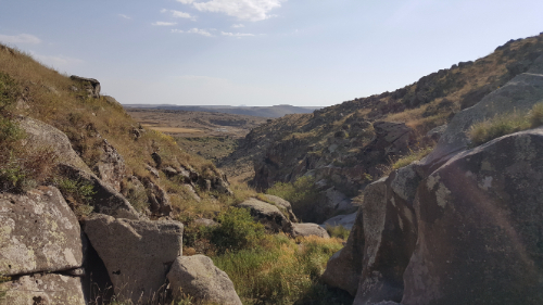
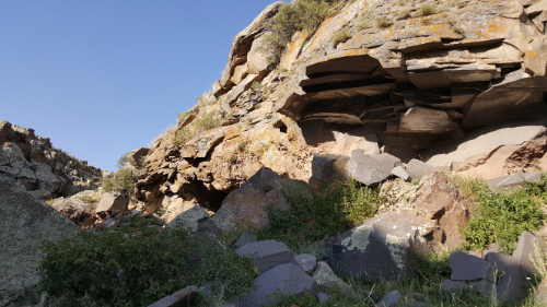
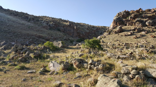
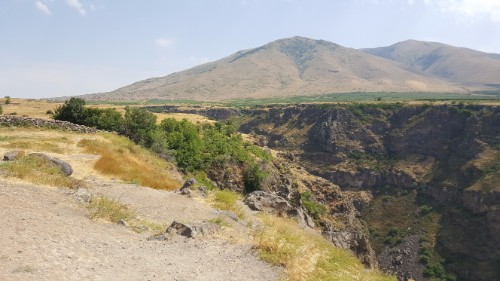
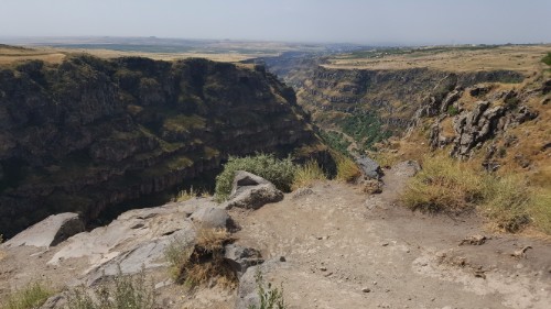
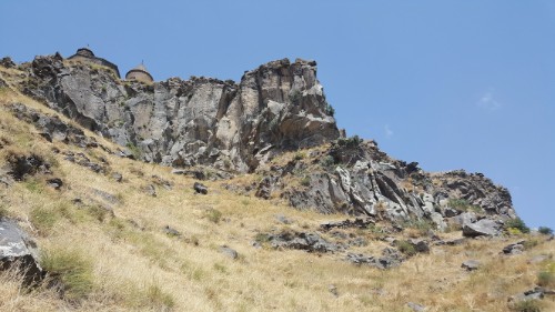
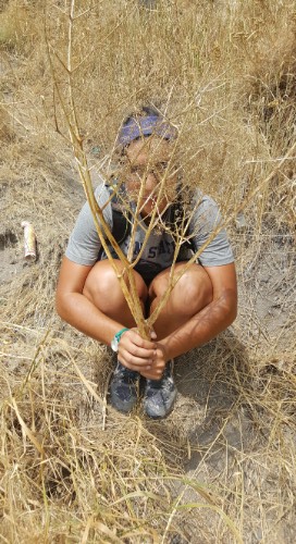
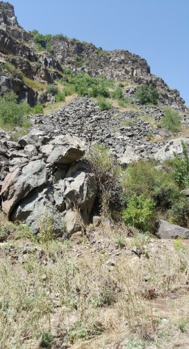
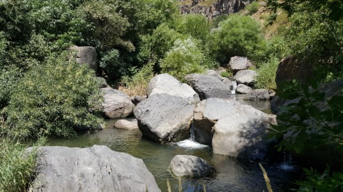
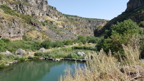
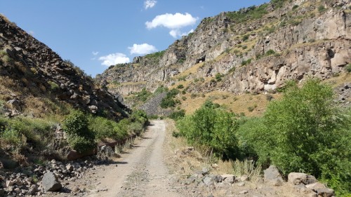
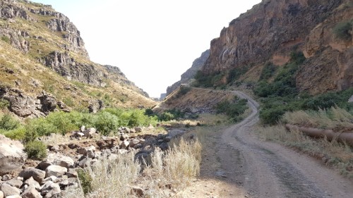
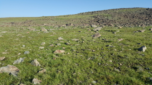
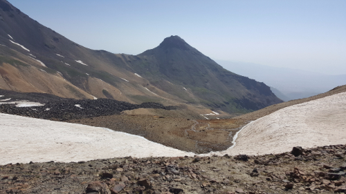
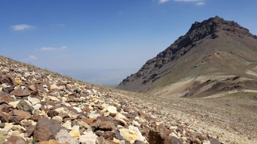
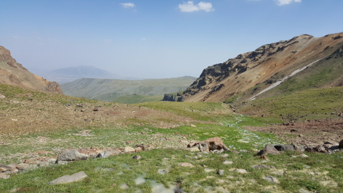
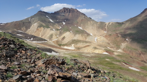
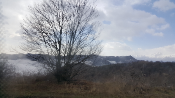
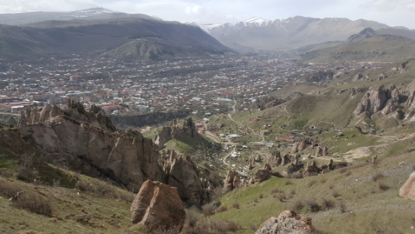
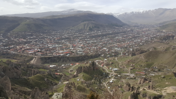
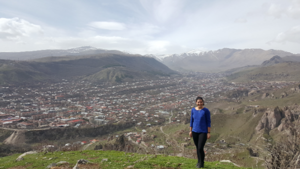
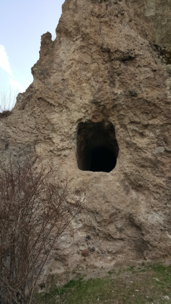
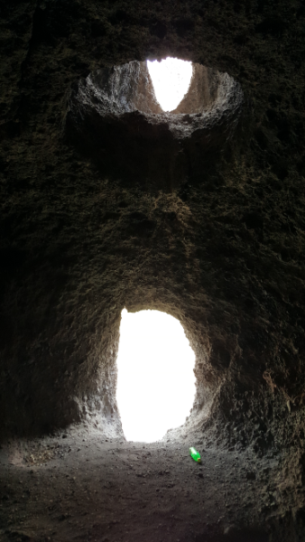
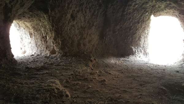
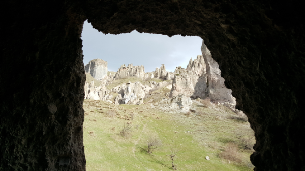
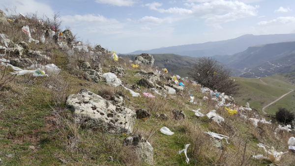
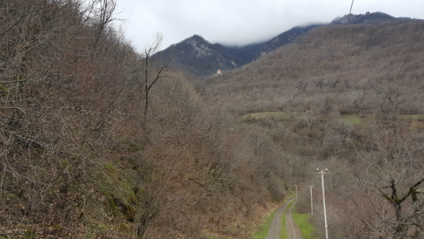
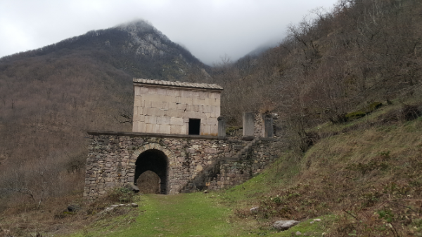
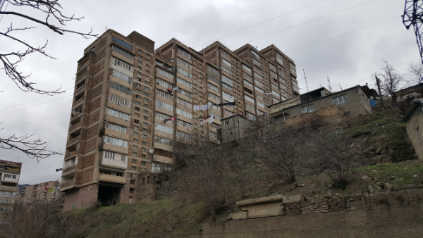
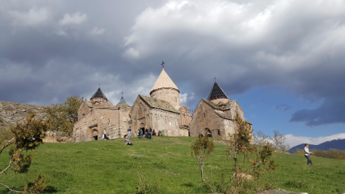
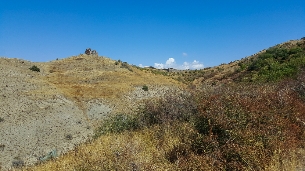
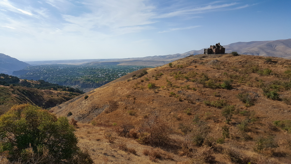
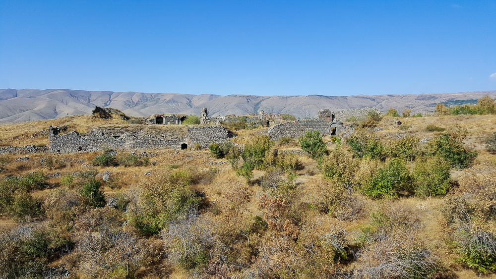
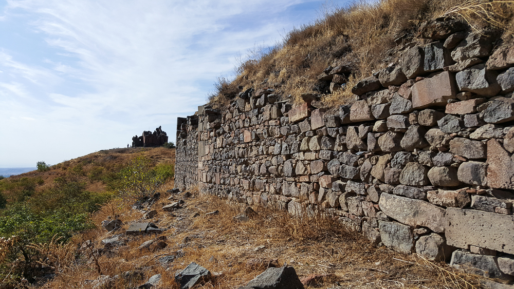
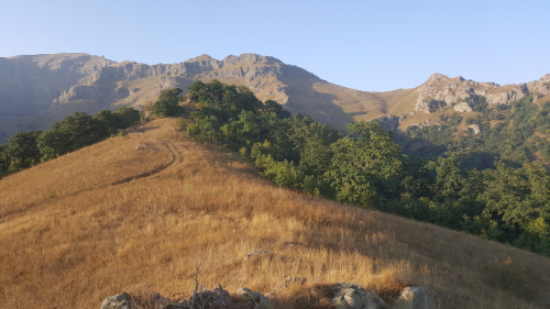
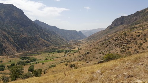
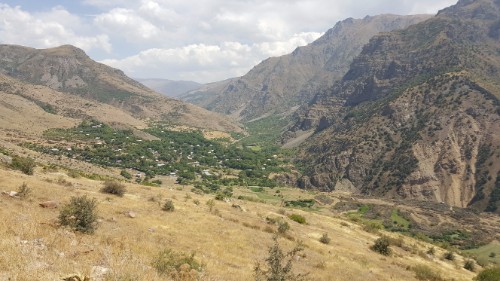
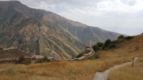
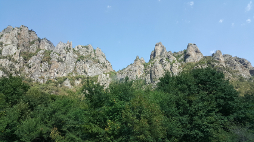
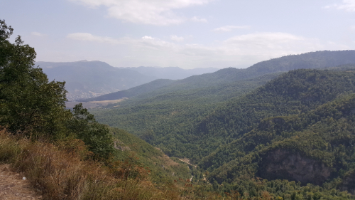
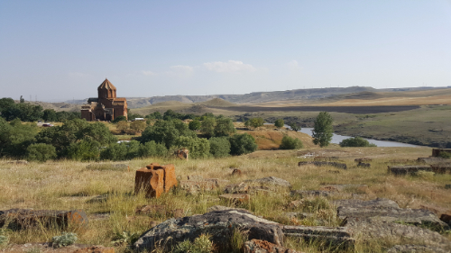
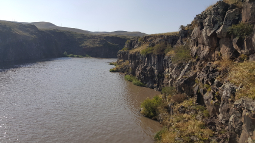
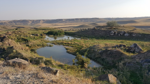
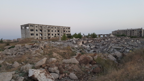
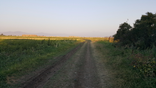
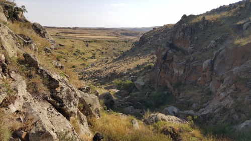
Goris is a city (town?) of about 20,000 people. I wasn’t expecting that when I got there. I guess I always think that places are going to be tiny little villages with nothing going on because everyone always acts like there’s nothing happening in the country outside of Yerevan. I was pleasantly surprised! It’s nestled in the mountains, right near the eastern border with Artsakh, so the scenery is stunning. The area has been occupied since at least the 700s BC, and for much of that time, people lived in caves in the weirdly shaped mountains around the town. The caves were inhabited until the 18th century!

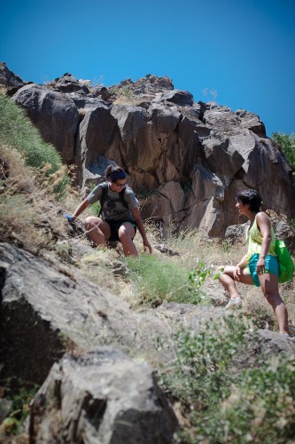
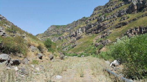
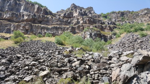
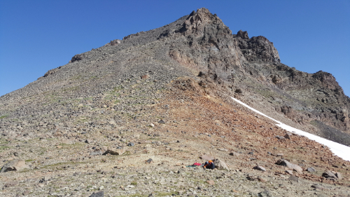
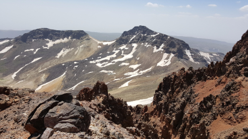
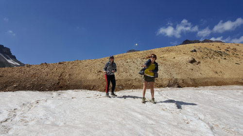
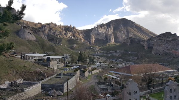
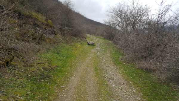
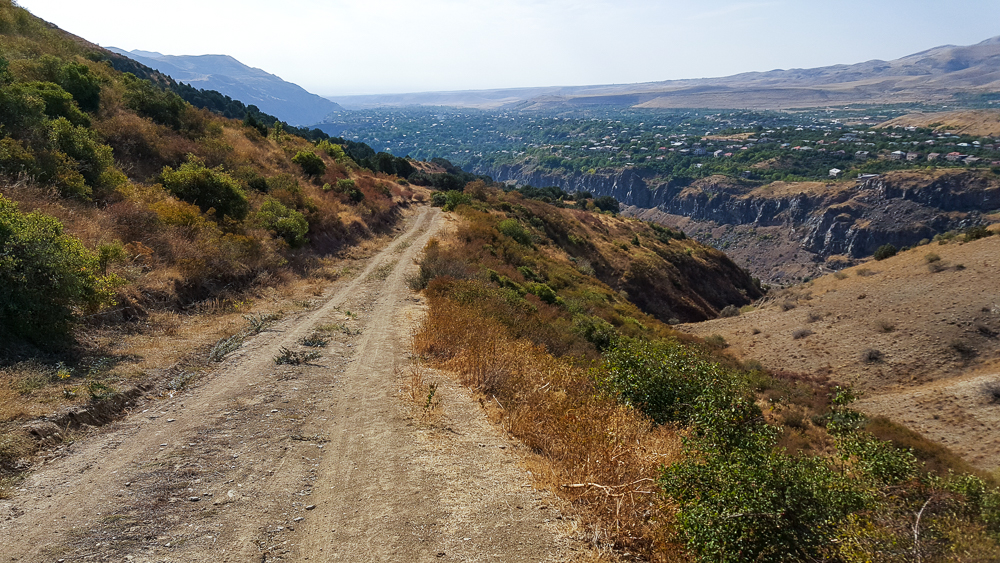
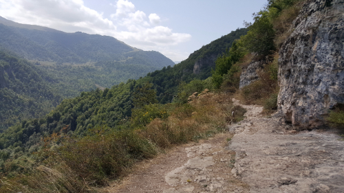
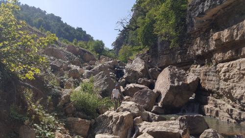
I think one of my favorite things about the south is that in every place I visited, the topography was sooo different. The cities aren’t even that far apart, but they look nothing like each other. In Goris, if you walk around the “Old Goris” area, it’s like you stepped onto another planet. I can’t even begin to describe the rock formations, so check out the pictures to see what I mean.

These mountains. Are so weird. But I love them.
Pretty Goris, pretty mountains.

Self timer + rock = pretend photographer

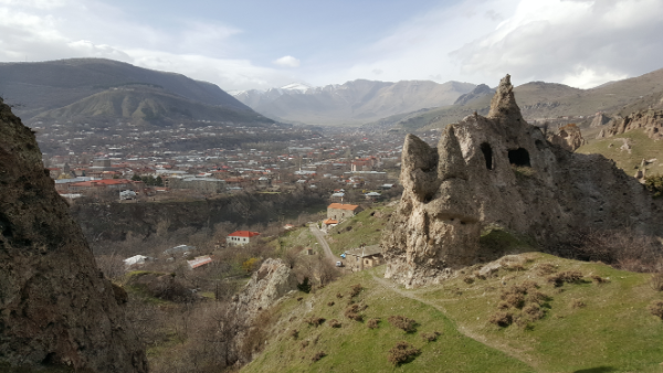
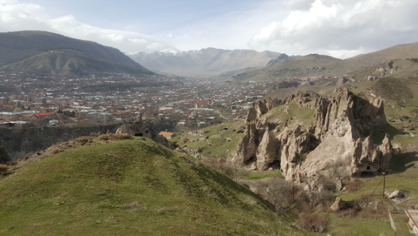
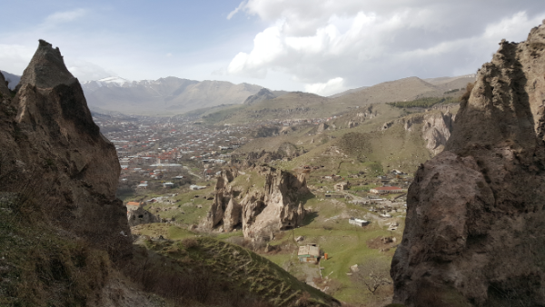
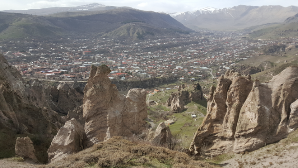
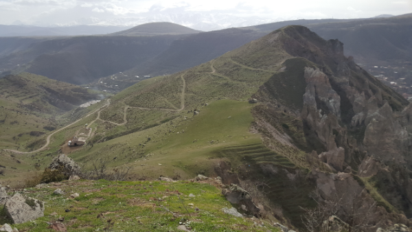
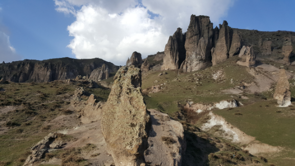
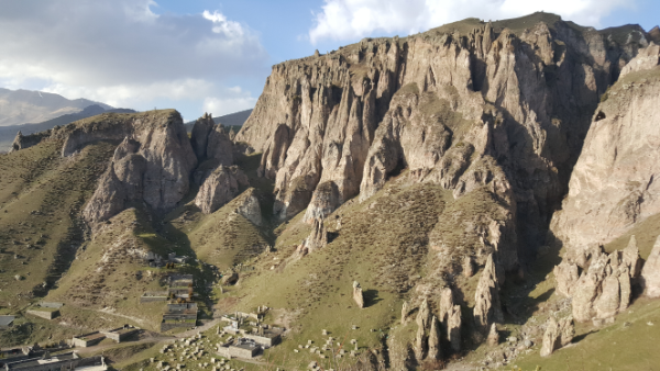
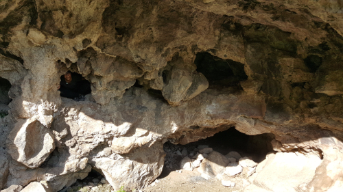
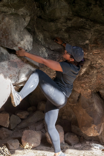
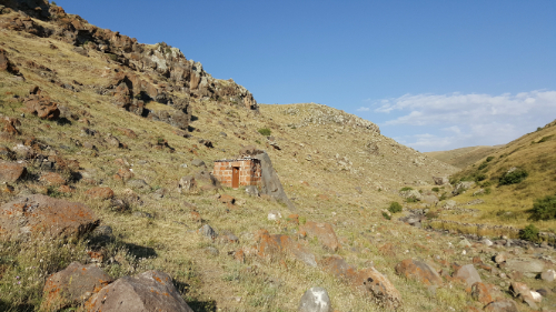
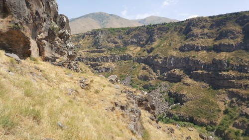
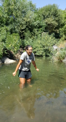
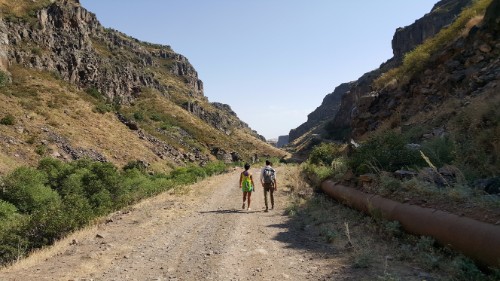
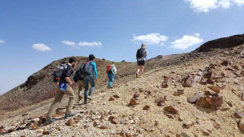
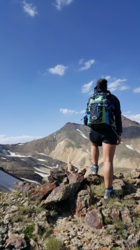
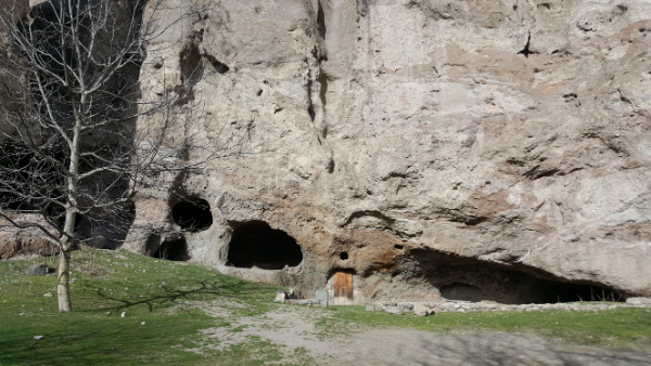
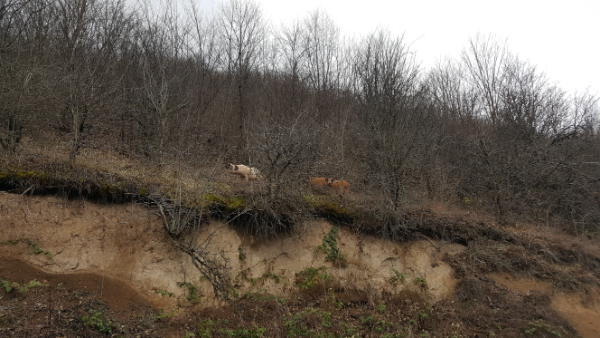
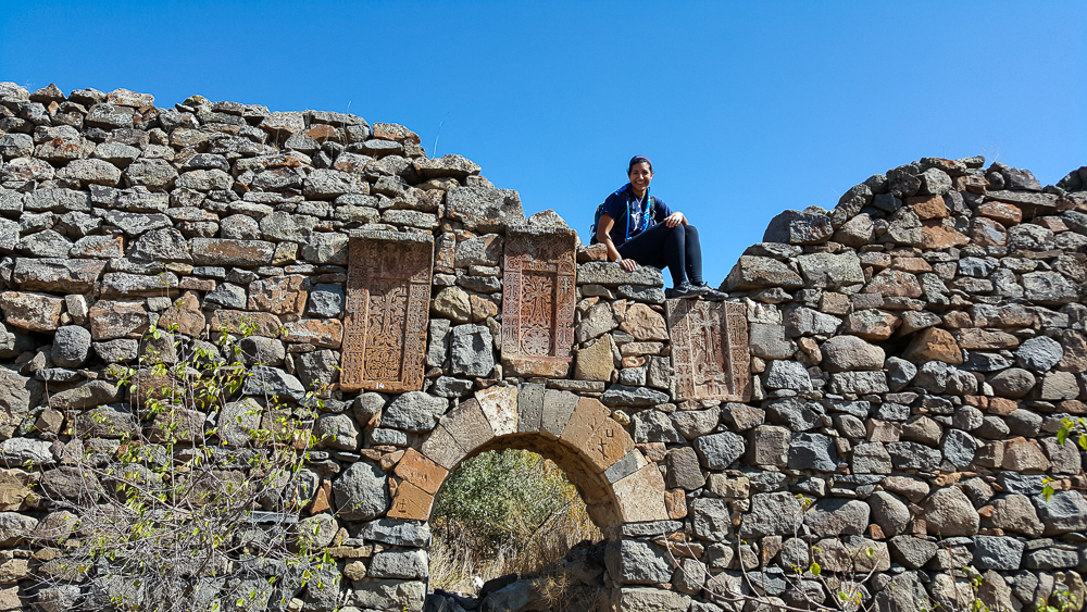
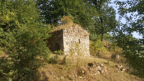
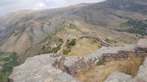
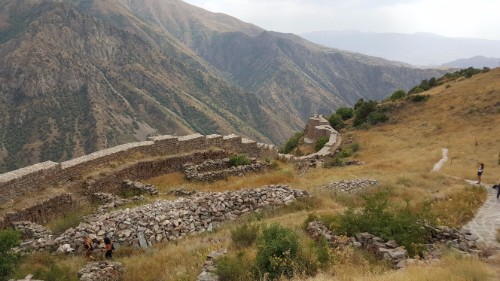
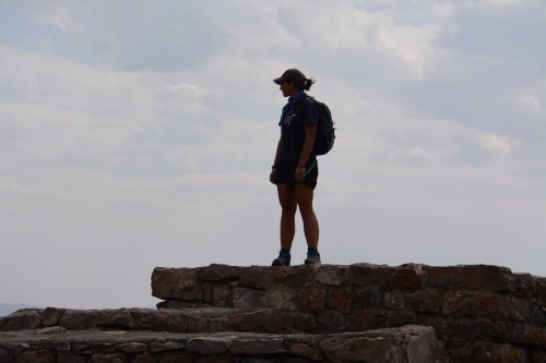
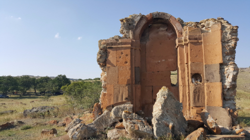
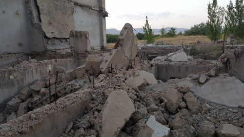
Mary and I walked around Old Goris a bit during the evening after I got into town, and I went on a more intense trek the following day. I tried to follow an actual hike through the mountains, but it was poorly marked and very confusing. Instead, I ended up wandering around on random cow paths that went into some of the strangest places. Oh, well. That was more interesting anyway… at least, I assume it was but couldn’t tell you for sure because I still don’t know where I was supposed to walk.

Cave dwelling

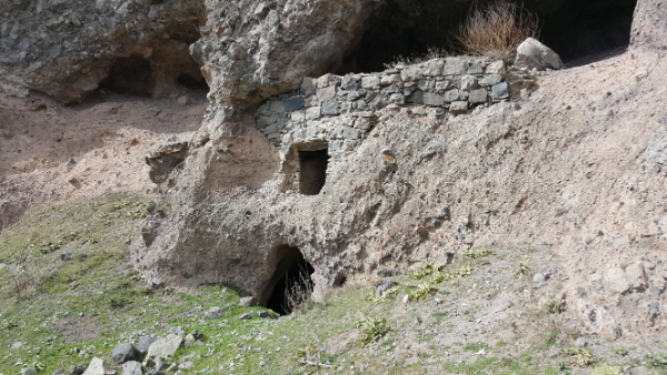
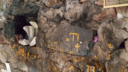
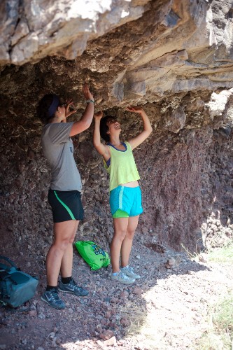
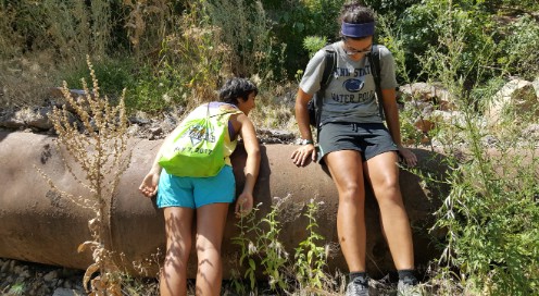
As far as I can tell, the actual path doesn’t go past any of the coolest things. My favorite part of the walk was checking out some of the cave homes. So many of them had doors that you needed to rock climb into, and you could see where the previous inhabitants had chipped hand and foot holes into the rock to help them climb up. Can you imagine having to rock climb into your house?? My reaction to that question is, “IS THAT NOT THE COOLEST THING YOU’VE EVER HEARD?” but I imagine that some of you are probably more on the, “Ummm that sounds horrible,” page. I love enclosed spaces which means that caves are just about my favorite thing, and I’ve now officially decided that my dream home is a cave home (with a very comfy couch inside, of course).

This is one of the caves I climbed into and immediately fell in love with.
Chimney above the window.
Door to the left, window to the right.
Cave window views.

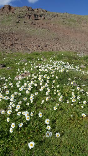
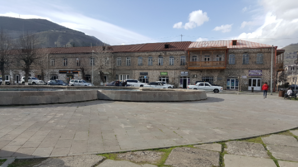
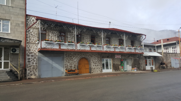
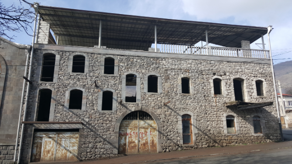
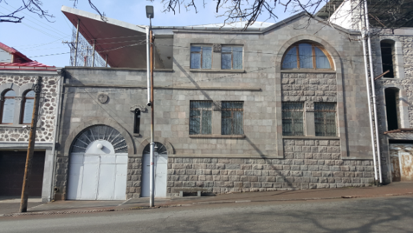
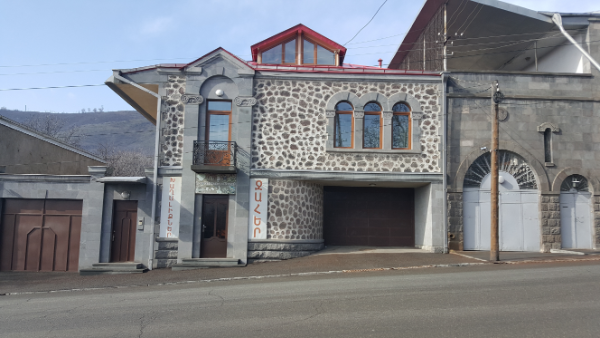
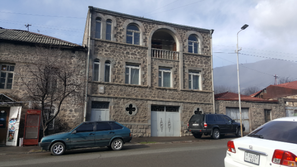
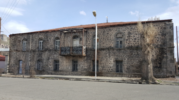
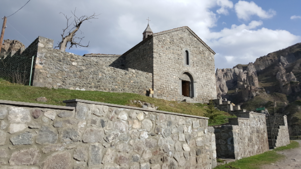
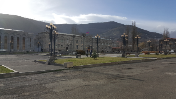
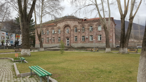
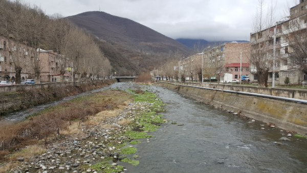
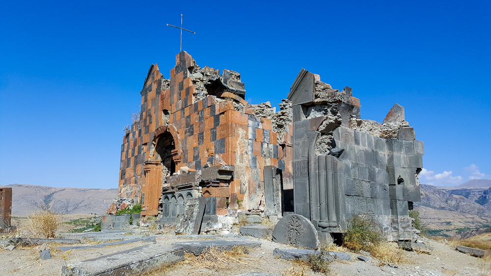
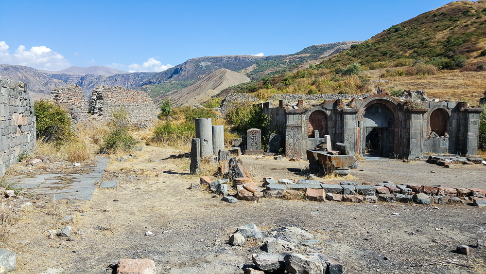
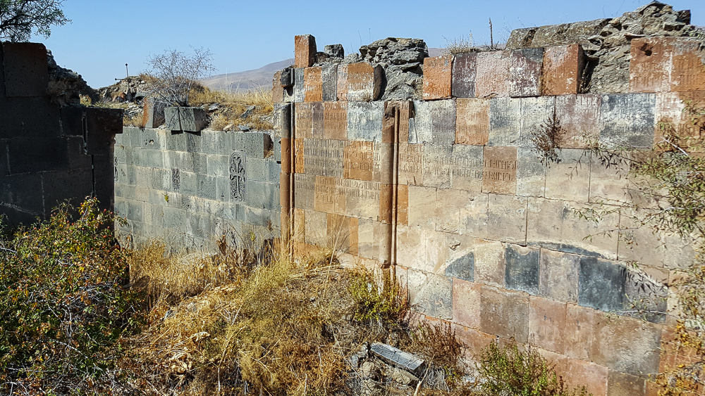
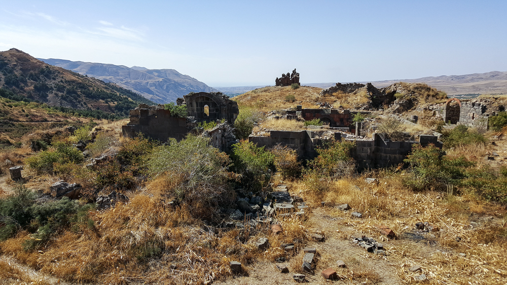
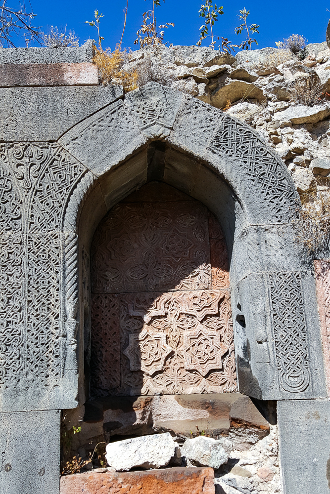
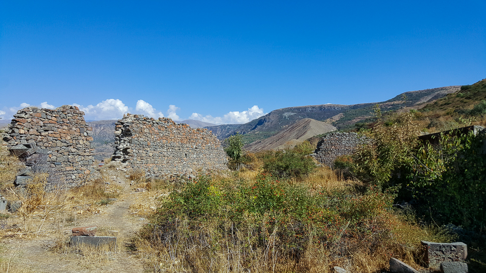
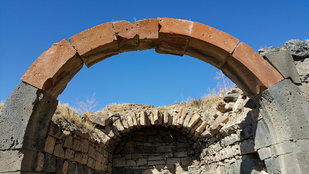
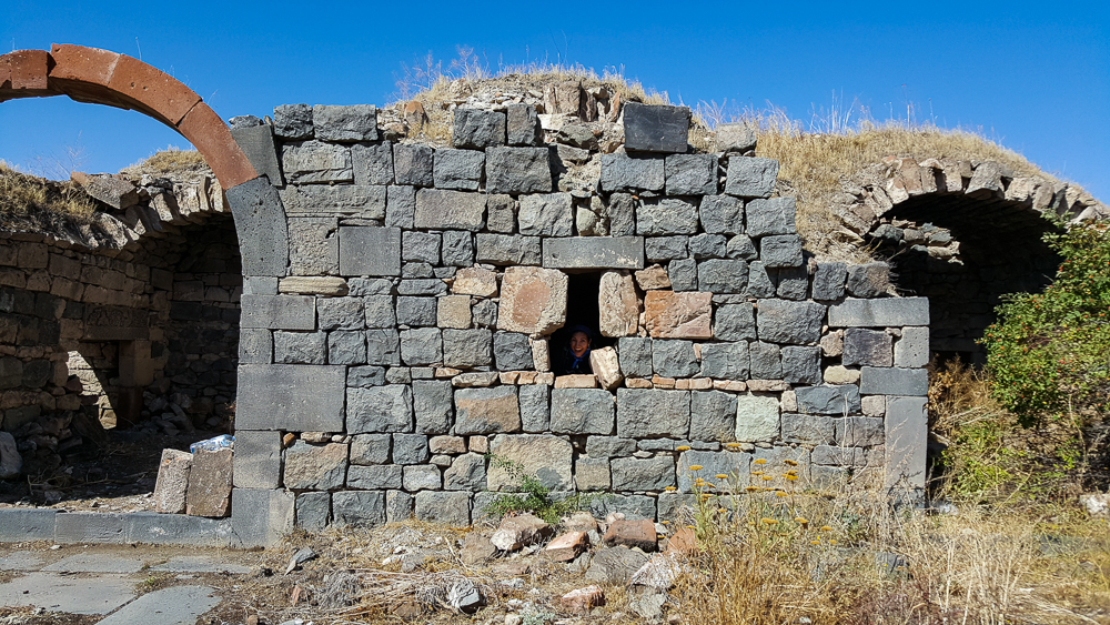
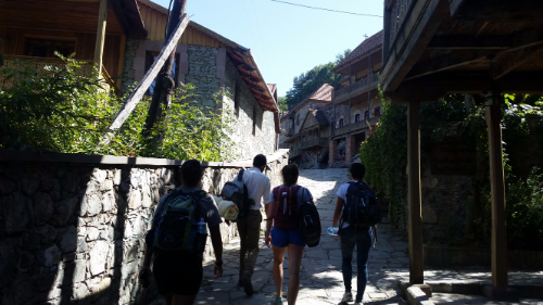
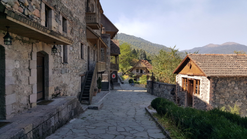
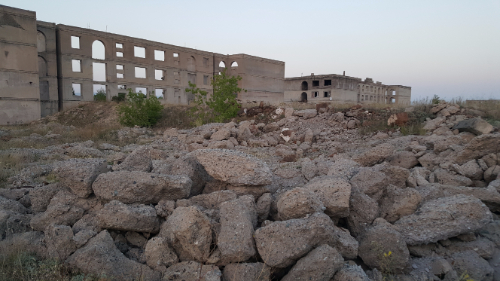
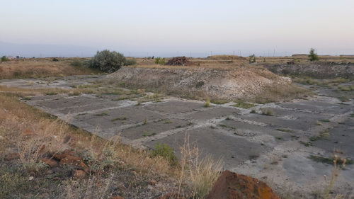
After I finished getting lost in the weird mountains and creeping around abandoned cave houses, I headed into town to check out a few of the sights. I have to say that the buildings in Goris are some of my favorite in the whole country. I love stonework, and the town is overflowing with pretty stone buildings. Even the abandoned buildings look beautiful!

Picturesque
Here’s a series of my favorite random buildings from around town. I’m in love.

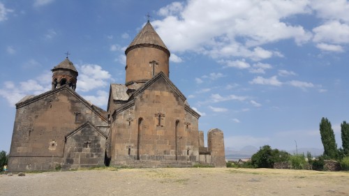
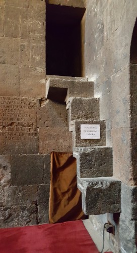
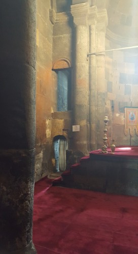
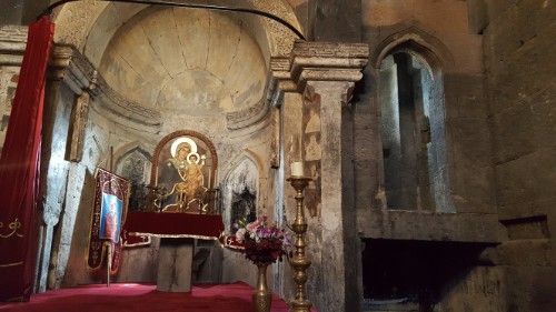
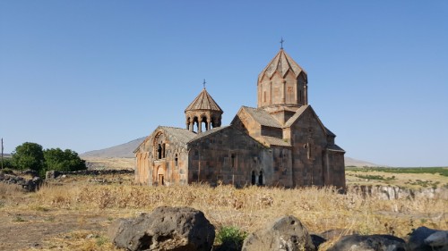
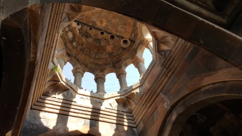
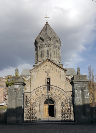
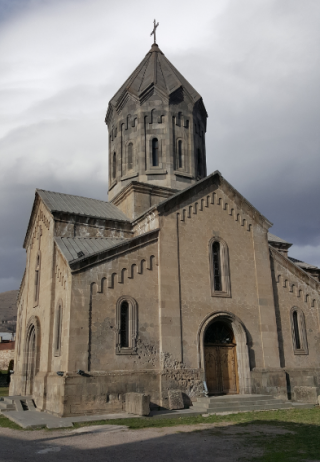
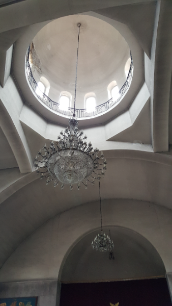
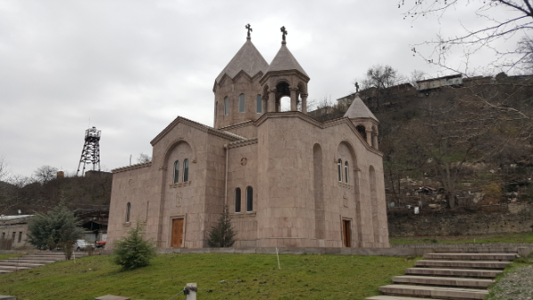
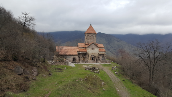
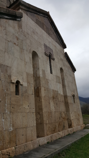
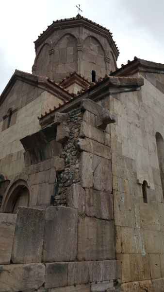
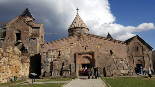
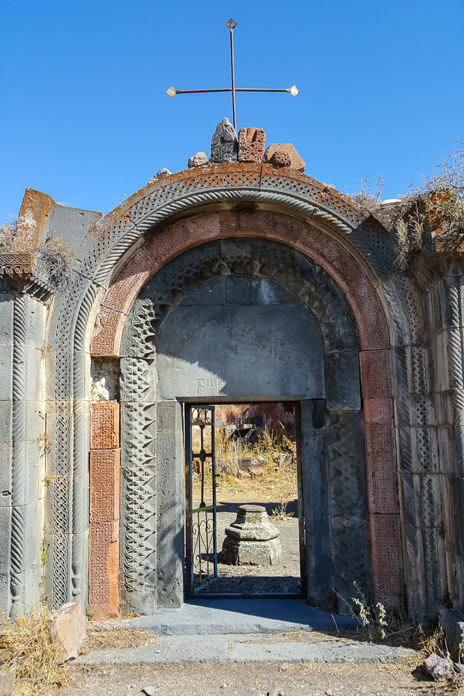
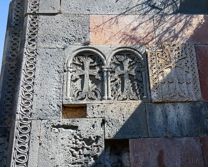
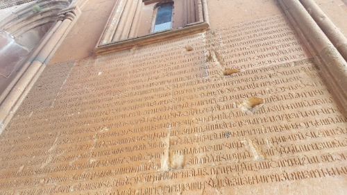
I visited two churches in town, St. Hripsime and St. Gregory the Illuminator. St. Hripsime was originally built in the 4th century, and St. Gregory was built in the early 1900s. St. Hripsime is small and pretty and was rebuilt a few times, first in the 1500s and then in the early 2000s. the inside feels like you’re inside a cave… appropriate. St. Gregory the Illuminator Church is slightly more Armenian-church-typical. The inside is plain, and the outside design is nothing extraordinary, but the stone color is a pretty grey that I enjoyed. They also had a very nice gate entering into the grounds, and metalwork is another craft that I’m a big fan of.

St. Gregory the Illuminator Church. Check out the gate in front.
On the side of the church (between the door and the window to the left), you can see artillery shell damage from the war with Azerbaijan

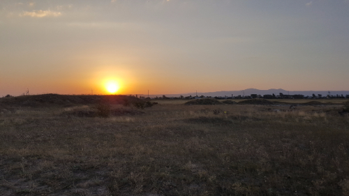
Between the natural beauty of the surroundings and the man-made beauty of the town, it’s definitely on my list of favorite places in Armenia. Mountain views, easily accessible adventure, caves, stone buildings… what more do you need?

St. Hripsime
One thing that consistently makes me sad is the amount of trash that’s just laying around the country. This could be such a pretty river, but instead it’s polluted with garbage.
Field of trash encountered during my hike.
The central square
Spot the little cave door!

My trek from Meghri to Kapan started VERY early in the morning, especially by Armenia standards. The marshrutka left at 7:30AM, but it actually wasn’t too hard to get up on time… thanks to all of the walking the day before, I had a fabulous, comatose night’s sleep.

Kelsey was going all the way to Yerevan, about eight hours, and I was hopping off in Kapan after about two. It was nice to have some company for the ride! I’m so used to going places by myself now that it always throws me off when I have a friend.

Kapan city sign

The marshrutka dropped me off right in front of my hotel for the night. I didn’t do much pre-planning for this trip (I’m trying to learn how to “go with the flow” and be okay with that), so I looked for somewhere to stay only one night in advance. According to the internet, there weren’t many cheap choices left. In hindsight, I feel like I should have just gotten dropped off in the city center and wandered around asking hotels if they had vacancies. Anyway, I didn’t do that, so I stayed at an inexpensive and NOT centrally located hotel. Everything except for the location was great! But that resulted in me having another ridiculous walking day.

Inside Surp Mesrop Mashtots

I had two sightseeing goals for the day, Halidzor Fortress and Vahanavank. According to google maps, it was a 15 km walk to Vahanavank, and Halidzor is in the same general area. I looked at that and thought, “Oh hey, that’s not bad! Only 3 hours!” Any rational person would have looked at that and said, “I’m going to ask the hotel to call me a taxi.” Oh, well. I figured that I would walk there and then find an alternate method of transportation back.

I walked about 40 minutes just to get to Kapan. The thing is, though, that you can’t just think of it as a long walk. You have to think about the fact that you’re seeing things you wouldn’t have seen otherwise because you don’t enjoy the scenery as much when you’re in a car. See? That’s my way of rationalizing my decision and telling you that it was the right one to make (though strong recommend that you just get a taxi if you’re ever in this situation). On my way through Kapan, I went to see the church, Surp Mesrop Mashtots. If you feel like you’ve heard this all before, it’s because every city/town/village in Armenia seemingly picks from the same list of five church names and ten street names, and things can get confusing very quickly.

Surp Mesrop Mashtots
The municipal building

From there, I roamed a little more, stopped in a store to buy some snacks (where they stared at me like I was a Martian and forgot to put my human suit on – classic Armenia moment right there), and continued on my way. I walked more… a lot more… and eventually realized that I could have taken a bus nearly the ENTIRE way that I walked. Well. I got some good exercise, and I REALLY saw the scenery. After maybe 11 km, I finally got to the point where I turned off the main road and started heading up to Vahanavank.

Finally off the main road
See the little peek of orange roof along the line between the brown front mountain and the darker back mountain? Vahanavank.

I was probably 20 minutes from the church when a car came up behind me. I did what I usually do and pretended that I had everything under control and totally wanted to be walking up a mountain after already walking for almost three hours… and at that moment, I got caught on a spiky plant and had to stop to untangle myself. So much for looking like I knew what I was doing. The driver pulled up next to me, rolled down his window, and asked if I was going to Vahanavank… as if there was any other reason I would be walking on a random mountain road that literally only leads to the church. I said yes, and he told me to hop in. I’m not too proud to accept a ride, especially when my legs are ready to fall off, so I got in and we were at the top in three minutes.

The river that runs beside the town

When we got to the church, there was actually a priest there! I was so thrown off. I think that’s literally the first time I’ve ever seen a priest in a church who wasn’t in the middle of conducting a service. The guys who picked me up seemed to be buddies with him, and I heard them telling him that they picked me up on the side of the road. I started poking around the church, and the priest invited me to drink tea with them… which he was in the process of heating water for on his little propane tank. Ha! It was a little chilly up there, and I was kind of hoping for a ride back down the mountain too, so I said okay.

The priest spoke some English, so our conversation was actually pretty good. I spoke broken Armenian, he spoke broken English, and we figured it out. He was excited that I’m an architecture person (no one knows what an architectural engineer is, so they usually just decide that I’m an architect), and after tea, we walked around the church and he pointed out different architectural features.

Wild pigs along the way. The priest took it upon himself to tell me about all of the creatures that live in the mountains there, including bears, snakes, deer, pigs, creepy spiders, lizards, etc.
One of the priest’s favorite khatchkars. I think he said that a prayer is written around it asking for the prince to be healed.

Vahanavank was founded in 911 by the prince of Kapan, Prince Vahan, who supposedly became a monk to cure himself of a demonic possession. The main church is called… wait for it… Surp Grigor Lusavorich aka Saint Gregory the Illuminator Church. It functioned as a monastery and a spiritual school for some time, and there are a bunch of graves in/around the church, including Prince Vahan and many other kings and princes of Syunik (the province where Kapan is located).

Vahanavank

There’s another little chapel on the grounds as well, Surp Astvatsatsin, that was built by one of the Syunik queens, and it also serves as a mausoleum for her and her relatives. It seems like people just built churches when they wanted fancy places to be buried.

Surp Astvatsatsin Chapel

There was an earthquake that destroyed practically everything on the grounds, and they just recently did some restoration work that was never finished. The main chapel of Surp Grigor Lusavorich Church was completely restored, but the vestibule on the side is only partially completed. The priest showed us where they put in different structural features to help if there’s ever another earthquake and the difference between the original and the new stones. The original stones were quarried from a neighboring mountain, but the new ones were brought in from elsewhere.

The little indents in the side of the building are to help with side-to-side movements if there’s another earthquake.
The more reddish stones on the left are original, and the more orange ones on the right are the new ones.

I stayed at Vahanavank MUCH longer than anticipated. If I had gone on my own, I probably would have stayed 15 minutes max and then kept going to Halidzor. Instead, I was there for more than an hour. When they asked where I was going next and I said Halidzor, everyone looked at me like I was a lunatic. They went on and on about how it had just rained and the path was going to be muddy and I shouldn’t go. Usually I’m not one to listen to things like that, but I was kind of cold and the sky had been overcast and dark all day, and I was a little worried about getting stuck out there in the dark. The priest gave me his phone number in case I decided to go and needed help, but I ended up deciding that I had walked enough for one day. I asked the guys who gave me a ride where they were headed, and they said, “Wherever you’re going.” I kind of assumed that would be the answer. People are too nice.

Apartment buildings along the way. Is it just me or do these look ridiculous?

They drove me all the way back to my hotel, laughing the entire time about the fact that I had walked all the way there. I’ll tell you this much – it seemed like a long way even in a car! At least I got my exercise in for the day! I was happy to have some extra chill time at the hotel to take an incredibly long, hot shower and attempt to warm up. The weather was much colder than I expected, and when I stopped walking at my breakneck pace, I think my body got pretty cold.

Anyway, it was certainly an adventure, and now I still have things to do the next time I go to Kapan! This trip is just making me even more sure of my thoughts that I need to come back to Armenia someday. Maybe Sarah and I will do another trip to conquer all of the hiking destinations!

The week is just flying by, isn’t it?? Day 5 was our Yerevan Day. We spent the morning at the Genocide Memorial and Museum, and it was just as exhausting as when I went with Sarah. Since I had already been, I perused a bunch of the photos and other materials that I skipped before. I think you would need to go back 10 times to see everything without your brain turning to mush.

At Vernissage. It kind of looks like we’re just at a football tailgate…

After that, we had a low-key rest of the day and went to Vernissage. Before coming, Mike told me that I needed to “speak Armenian like a local” so that he could get the best prices there. Thanks, Mike. No pressure or anything. I certainly didn’t pass as a local, but I think I at least projected the illusion of knowing what I was talking about. Hopefully.

Sevanavank, looking a bit eerie

Day 6 was another crazy, hectic, “what were you thinking when you planned this?” kind of day. I wanted to go to Lake Sevan and Dilijan, and the only way we were going to have time for both was if we did them in the same day. So what choice did I have? No choice, that’s right.

We made our way to Sevanavank first, the monastery on a peninsula that used to be an island until the water level of the lake dropped from overusing it for irrigation. The water in the lake is a beautiful, brilliant blue color when the sun strikes it, but we were there early in the morning and it was cloudy, so instead, it looked a bit spooky.

Hi, pretty lake.
Family selfie at Sevanavank

The door into Sevanavank.

From there, we headed to Dilijan. Back before I made the schedule for the trip, I asked everyone to send me anything that they definitely wanted to see or do. One of Mike’s requests was for us to go on a hike together. The best place for that is Dilijan, so I was left with the task of figuring out where Mike and I could hike that Mom and Dad could be entertained for the time it took us to complete our hike. Then, a stroke of brilliance!

Pre-hike by Parz Lich

There’s a hike in Dilijan that goes from Parz Lich (lake) to Goshavank, a church in the town of Gosh. I also knew that there’s another monastery in Dilijan that’s supposed to be very nice. I Google mapped it out, and my suspicions were confirmed. We could make it work out perfectly! Mike and I got dropped off at Parz Lich which is a beautiful place anyway and especially in the fall. Mom and Dad hung out there for a little and drank some coffee while Mike and I started the hike. After leaving the lake, they went to Haghartsin Monastery and then met us at Goshavank. Our hike was supposed to take 2.5 hours which we decided meant 2 hours for us, and the timing was spot on!

How cool is this???

Okay so I’m literally obsessed with fall right now. Just brace yourself for a whole lot of hiking through the pretty, fall-colored woods pictures.

I know, I’m getting ahead of myself again. Mike and I had an interesting hike. It had rained the night before, so the ground was super muddy in some spots. To make things worse, it’s that clayey soil, so by the time we were 10 steps in, our shoes were about 10 pounds heavier from all of the mud stuck to them. Luckily, the beginning was the worst part, and we were fine after Mike fashioned us some walking sticks.

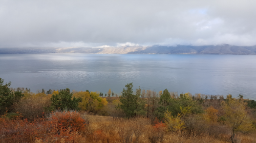
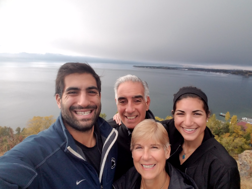
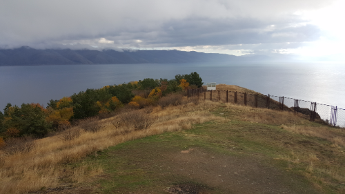
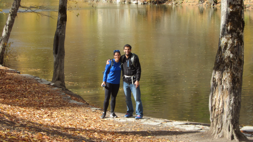
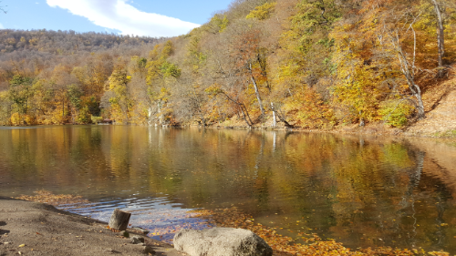
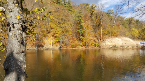
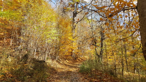
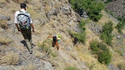
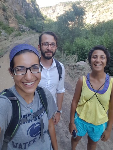
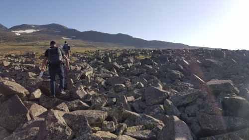
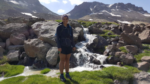
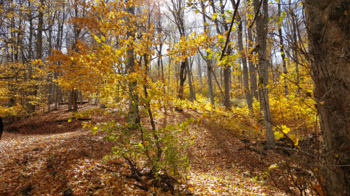
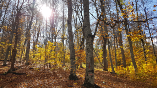
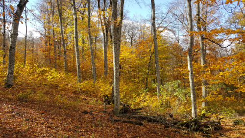
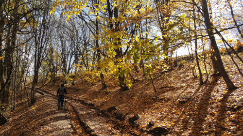
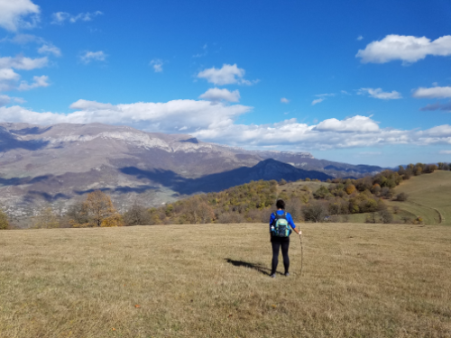
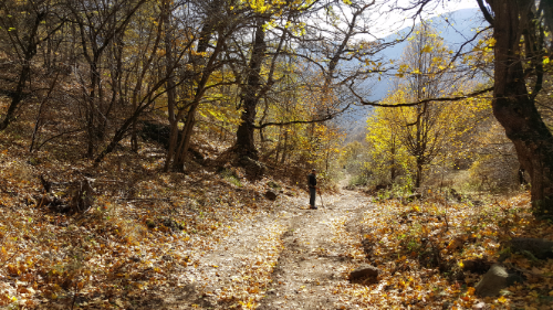
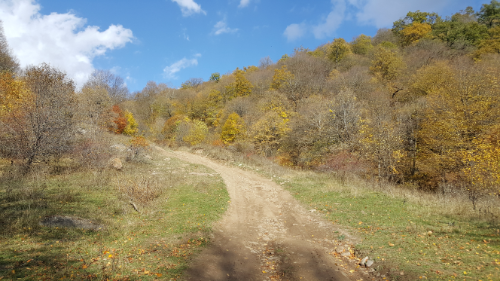
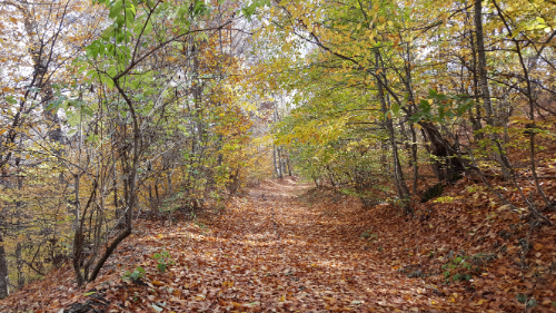
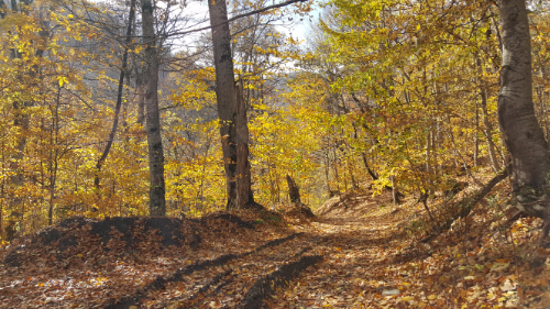
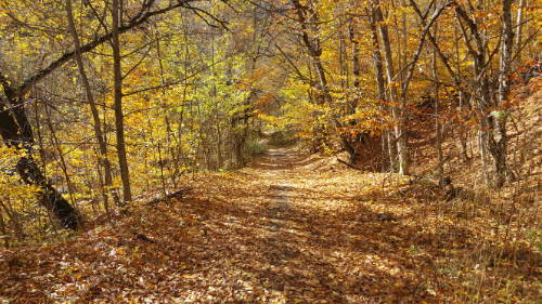
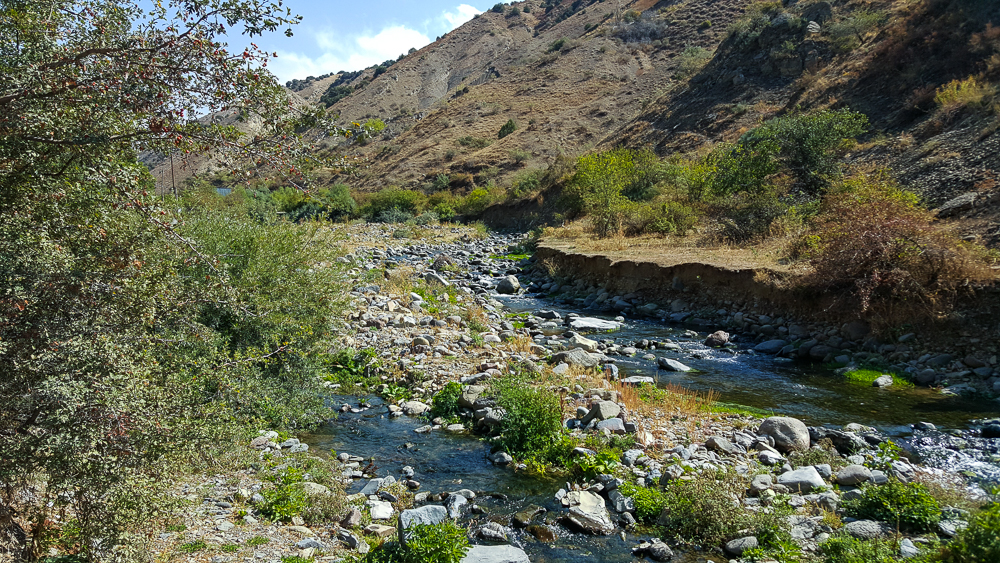
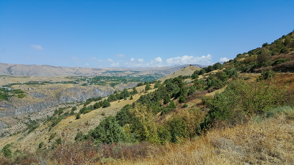
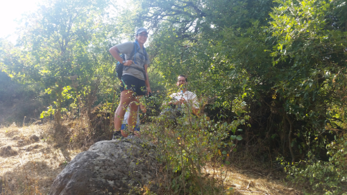
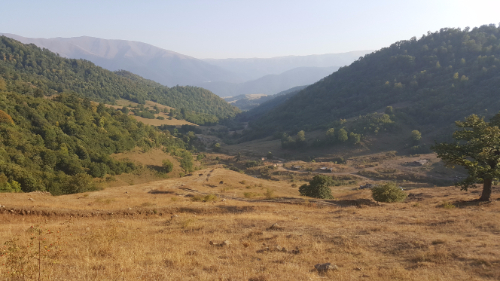
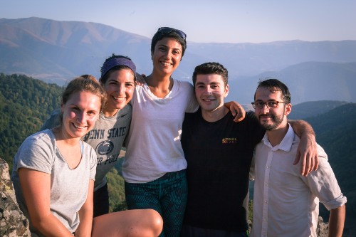
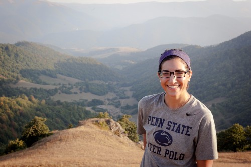
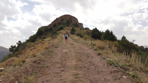
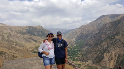
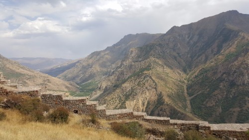
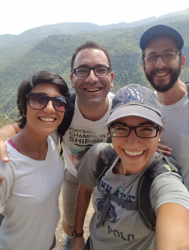
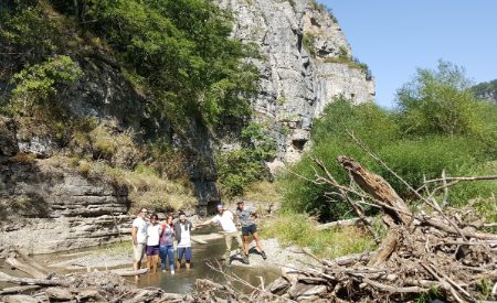
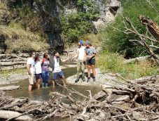
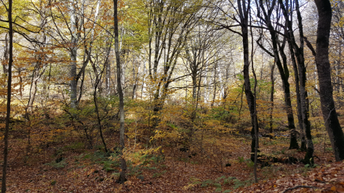
The hike itself was fabulous. The trees were at that perfect point in the fall when they’re all yellow and there are still enough leaves on them that it looks beautiful instead of depressing. The sun was shining through the trees, making the leaves look golden and the forest look mystical. At the peak of the hike, you have an amazing view of the valley and the mountains in the distance. It seriously looked like something out of a stock photo. It was also nice to have some time with Mike. Hikes are great times for good conversations! (Brace yourself for  photo explosion but I seriously couldn’t pick just a few.)

Fork in the road

Quite the view, huh?
Headed down to Goshavank

We beat our parents to Goshavank by a few minutes and spent that time eating Cheetos (gotta love that good ‘ole American snack food) and cleaning the mud off of our shoes. When they caught up with us, we all went to check out Goshavank together.

It’s kind of castle-like, right?

Goshavank is a monastic complex whose main church was built in 1191. There are way more buildings than I anticipated, and while the whole thing is quite nice, the coolest part is the bell tower and book depository. The book depository is a big, boring room, but on top of it is a chapel/bell tower, and you can see it through a hole in the ceiling! I wanted so badly to go inside the chapel, but the only way in is by using these cantilevered stairs that are currently unusable. Maybe that’s why I think that was the coolest part, because I couldn’t actually go inside, and I SO wanted to.

Goshavank! See the book depository and bell tower to the left.

After Goshavank, despite the fact that Mike and I ate a bag of Cheetos, a granola bar, and a pack of M&Ms while waiting for our parents, we were starving. We went to a restaurant in Dilijan, Kchuch, that has the best pizza in Armenia (the competition, to be fair, is nearly nonexistent because I haven’t eaten many things here that could even realistically be called pizza, but it’s also good by real standards too). We had one of those stuff-your-face-and-then-wonder-why-you-ate-so-much-but-it-was-so-good meals before piling into the car to head back towards Lake Sevan.

Hayravank

We had two more stops on our list: Hayravank (another church, of course) and Noratus Cemetery. Both have some weird legends/stories associated with them, so brace yourself. Before I get into that though, let me just say that the drive from the town of Sevan to Hayravank is probably one of the best drives I’ve been on in Armenia. The road runs along the water, and the views are absolutely incredible. Even if there was nothing to see down there, I would still say that it’s worth the drive.

Lake Sevan from Hayravank

Hayravank itself wasn’t anything too spectacular, but the lake is awesome and so was the sky when we were there. The church is small and was built in the 9th century. Ready for the legend? Once upon a time, the Armenians were in a war (it seems like this is a common theme throughout history here). Some mean dude (that’s an understatement) named Timur was conquering his way across Armenia, killing everyone and destroying everything. When he went to Hayravank to kill the priest and destroy the church, the priest flung himself into the lake, and instead of dying, ran on the water.

Timur was amazed and told the priest he could have one wish (he was like a stingy genie – only ONE wish??). The priest asked him to spare the church and as many people as could fit inside. As more and more people piled in, Timur got suspicious and stepped inside just in time to see the priest turning the last person into a dove and releasing it out the window. The End.

Noratus. Don’t be weirded out by how awesome the gravestones and the sky look together. Okay, it’s a little strange to have a cemetery as a tourist destination, but somehow still so cool.

Baffling, right? And I’m left with so many unanswered questions. Did the people get changed back from being doves? Did they remember the time they spent as birds? Did they know that was going to happen to them when they stepped into that church? When they changed back into people (assuming they did), did they have their same clothes on? Why was Timur such a jerk? I’m afraid that I’m going to go through life never knowing the answers to these questions.

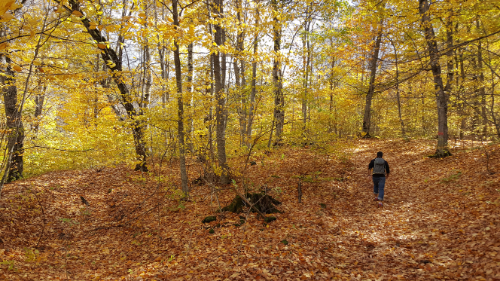
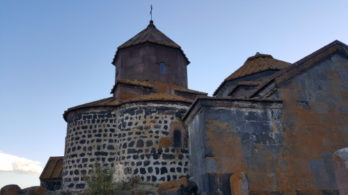
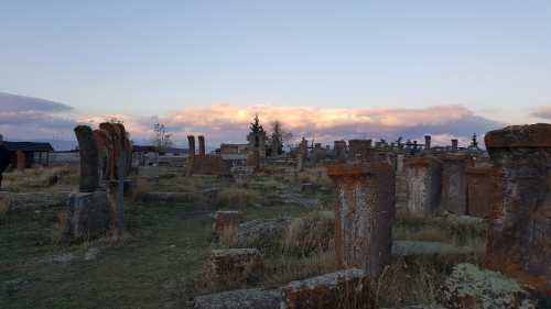
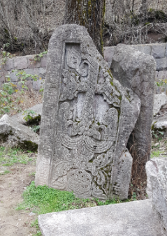
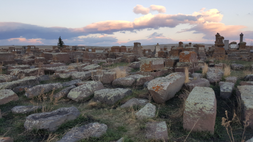
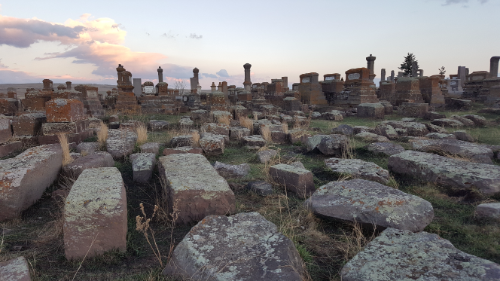
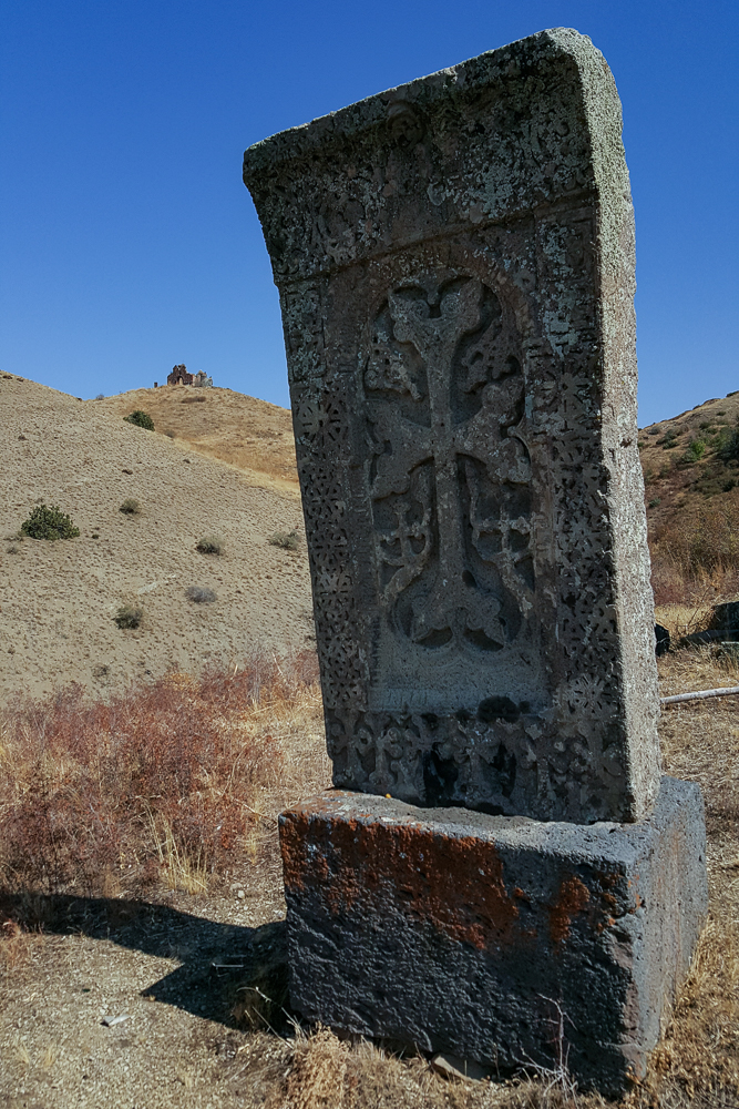
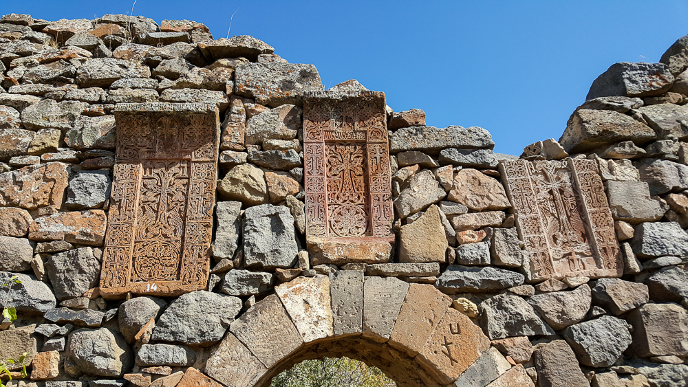
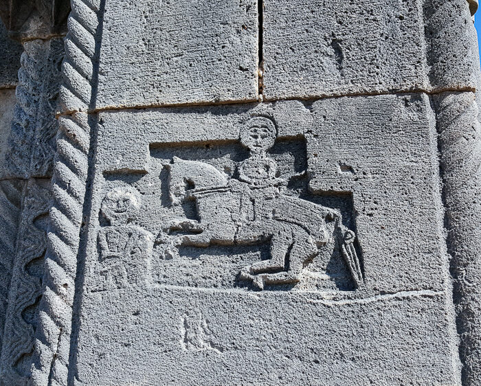
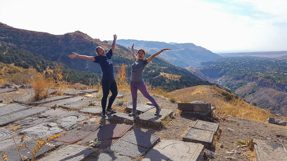
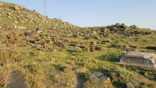
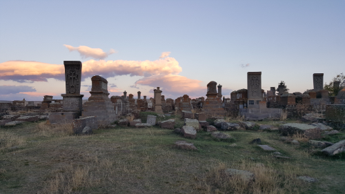
Finally, we went to Noratus. Noratus Cemetery is the largest collection of khatchkars. It used to be the second largest with the largest one in Nakhichevan, the territory to the southwest of Armenia that is currently controlled by Azerbaijan. That cemetery was destroyed by Azerbaijan between 1998 and 2005, and now Noratus takes the title.

The popular story about Noratus takes place during another time when Armenia was in a war. This time, an army approached from across the lake, and it vastly outnumbered the villagers. To make it look like they had more soldiers than they actually did, they dressed up the khatchkars in the cemetery with swords and helments. The army was fooled, and they retreated.

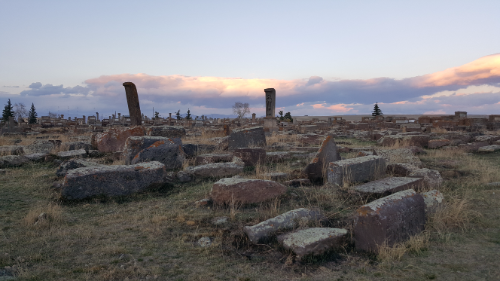
Okay, once again, SO MANY QUESTIONS. Who on earth had this idea in the first place? Where did they get so many extra helmets and swords? How dumb/blind was the army that they couldn’t tell that the “soldiers” they were seeing were a bit rectangular? I could keep going, but I’ll spare you.

It probably would have been interesting to go to Noratus with a guide who knew something about what we were seeing, but honestly, all I wanted was to go to sleep by the time we got there. It was another long day, and just stopping in and getting to check out the sunset was enough for me.

Victoria and I decided that we wanted to go on a Saturday adventure, so we planned a mini-excursion to visit Havuts Tar Monastery. It was on my list of places to go because I read that the view is great and it’s worth a visit even though it’s in ruins. The location was also very convenient… It’s just a short hike away from the town of Garni, and the marshrutka ride from Yerevan to Garni takes less than an hour.

Azat River! Along our walk to the reserve from Garni

I wasn’t so sure about the logistics of hiking there because it’s located inside of Khosrov Forest State Reserve. It’s one of the oldest protected areas in the world, supposedly established by King Khosrov in the 330s. I think he just wanted something to name after himself. It was re-established in its current form in 1958. There are four different landscapes within the park, ranging from desert to alpine meadow, and a ton of different plant and animal species. There are 41 mammal species!

The Khosrov website makes it seem like coordinating a visit to the park is a huge pain. It says that you have to hire a guide and get a permit if you want to hike in the park, and it’s a bit expensive. In all of the reviews I read about Havuts Tar, no one said anything about a guide. Who the heck knows which one is right? The best way to figure anything out is to just show up, so that’s what we planned. We figured we would go, try to visit, and be prepared for a last-minute change of plans if we weren’t allowed into the park.

You can see a little speck on top of the mountain in the background, right side… that’s Amenaprkich Church

Our marshrutka dropped us in the center of Garni, and from there, we started walking in the general direction of the park. Oh yeah, we also weren’t exactly sure about how to get there… but hey, it’s all part of the adventure, right? It took a few near-wrong turns and some helpful directions from locals, but we eventually found what looked like a trail and started hiking. Thank goodness for GPS because otherwise, who knows where we would have ended up? It seemed for a while like we weren’t going to encounter anyone… until we turned a corner and saw a huge gate with a Khosrov seal on it. Okay, showtime. Worst case, we’d get turned away and have to find something else to do. No big deal.

There was a park ranger sitting at the gate, and we said hello and told him that we wanted to see Havuts Tar. (We had practiced saying this in Armenian on the walk so that we would sound like we knew what we were talking about.) He didn’t seem thrown off by our presence or our request and asked where we were from. We said Yerevan, and he told us that it’s 1000 dram to hike there if you’re from Yerevan and 2000 dram if you’re a foreigner, so lucky for us that we’re not foreigners because we get a better price. I think he winked at us when he said that, but I have no idea why because we definitely were passing as locals.

We went into the little visitor’s center to pay, and they had a sign with pricing for all of the different sites within the park. To me, that seems to mean you don’t need a guide… Oh, who knows. Maybe it’s like some local secret that you can just walk in, but they try to trick the internet users into getting a guide? Anyway, I was surprised by how nice the visitor’s center was. They had posters about the different sites in the park, information about environmental preservation, a creepily impressive beetle collection, and best of all, a bathroom.

Khatchkar along the path to the monastery

Victoria and I paid our 1000 dram each and headed up the trail to the monastery. The hike wasn’t bad at all. There were some steep parts, but we were following a dirt car road, making it impossible to get lost. There were even a few shade trees along the way! That’s a rare sight on a hike here.

Imagine if it wasn’t all brown… I guess we could have picked a better time of year (aka spring). Amenaprkich Church is up on the hill, and in the low area to the right, you can see the grey walls of the monastic complex.
The path. Not much room for wrong turns!
Getting closer…
View of the monastery complex from the hiking trail

Havuts Tar Monastic Complex was built between the 11th and 13th centuries, so in Armenia time, it’s new! There was an earthquake in 1679 that destroyed much of the complex, and after that, it was basically abandoned, aside from some minor restoration efforts in the 18th and 20th centuries. There’s another church there as well, Amenaprkich Church, which is just outside of the walled complex and was originally built in the 10th century.

I so wish that I could have seen it in all of its glory. Just imagine! That building on the right is a church within the complex, and there are other auxiliary buildings along the perimeter walls (you can just see the edge of one on the left side of the picture).

The ruins were a pleasant surprise. Everything I read basically said that the monastery is unimpressive, but the view makes the trip worth it. I completely disagree with the first statement. It was beautiful!! The ruins were way more extensive than I expected. There were fortified walls, hidden underground rooms, and some of the best stone reliefs I’ve seen in Armenia. As we wandered around, Victoria and I couldn’t help but express our disbelief at the fact that anyone would say that the monastery was anything less than awesome.

One of the church ruins with lettering on the wall that probably didn’t take one eternity to carve
Me on a relatively stable wall…
Looking out at the ruins from the wall. The ruins of the two churches inside the complex are in the foreground, and Amenaprkich Church is on the hill in the background.
I love these khatchkars. Look at how intricate! And I also love how they integrated different decorative stones into the walls. It gives them a lot of personality.
EVERYTHING is decorated
Entrance to one of the monastery complex churches. I also love how they used two different colors of tuff stone to create accents.
That view! And also I really like that wall. I think it’s pretty.
I’m sure this isn’t going to fall anytime soon… but that doesn’t mean that we didn’t sprint under it just in case
It’s not an adventure without some pictures of me in random holes. These little vaulted rooms are up against the perimeter walls, possibly used as guest chambers for the monastery.
Some of the carvings were the most intricate I’ve seen
This looks like an alien on a space horse capturing another alien, but the captured alien is smiling because he knows that there are twenty of his alien soldier friends on their way to save him.

The view certainly wasn’t anything to complain about either. It overlooks the Azat River Valley, the same one that runs behind Garni Temple, and the whole thing is pretty spectacular. From Amenaprkich, you can see Garni Temple too! We found a shady spot to eat our snacks (some bread, cheese, and cookies, courtesy of Victoria), chatted, and enjoyed the scenery.

Me and Victoria! You can kind of see Garni Temple in the background, but it’s not super easy. Maybe about 1/3 of the way into the picture from the right, there’s a little grey box on top of one of the ridges sticking out into the gorge. That’s the temple.
Amenaprkich Church is the one with the orange/black tuff checkerboard front. On the right side, there’s another church that was added later, but as you can see, it’s mostly collapsed as well.
The last remaining arch inside the church. Again, I have no idea how this is still intact. And you can see part of the ring where the dome would have been.
This room is underground… they think it used to be the monastery’s manuscript library

It’s always nice when a day turns out even better than you expect. I was worried that we wouldn’t even be able to enter the park and I would have dragged Victoria out there for no reason. Far from that, we had a great time! Havuts Tar is pretty close to the top of my list of favorite places to visit in Armenia, along with Dilijan, Levon’s Divine Underground, and Smbataberd. I think my list of favorite places is slightly more obscure than most people’s…

I like this wall.

Related Posts – My Favorite Places in Armenia

Dilijan National Park – go for a hike in one of Armenia’s national parks! Or, for the autumn version, go here

Levon’s Divine Underground – explore a potato cellar turned underground wonderland (just as weird and wonderful as it sounds)

Smbataberd Fortress – soak in the breathtaking views from Smbataberd Fortress

Sergei Parajanov Museum – visit my favorite museum in all of Armenia

Erebuni Fortress – poke around the ruins of the fortress at the heart of ancient Yerevan

We’re approaching the time in my trip when all of my best friends start leaving I get sad and have to begin the whole friend-making process again. Ugh. Hopefully I can manage to keep myself from falling into a moody depression like what happened in Ghana. I think I’ll be okay, but still, I’m not excited about having to find new people who are on the same page as me. It’s not as easy as you might think.

Walking into Dilijan (the town)

Anyway, the point of that whole rant is that the first person from our crew to leave was Shant, and his final wish was for us to go hiking and camping in Dilijan National Park. Dilijan is a 240 square kilometer national park. It was established as a nature reserve in 1958 and was changed to a national park in 2002. You know what the best part of Dilijan is? THERE ARE TREES! Yeah, yeah. I know that sounds stupid, but I miss forests. Dilijan has plenty of trees, and it made me very happy.

This is Sharambeyan Street in Dilijan. It’s been preserved as basically the Dilijan “old town”. There are different kinds of artisan shops all the way down the street which is pretty cool.

Are you ready to hear a ridiculous story that supposedly explains the origin of the name “Dilijan”? Once upon a time, there was a shepherd named Dili who fell in love with the daughter of his master. Obviously, since this is how these stories go, the master was wholeheartedly against it and ordered Dili killed! Seems like a dramatic response to me, but well… yeah. Anyway, Dili’s mother searched for him for days and days, wandering around and calling out “Dili jan! Dili jan!” (If you recall, people use “jan” as a term of endearment after someone’s name or sometimes just in place of it.) The End. Hehehe that might be one of my favorite Armenian stories yet.

Along the hike!

Anyway, one of our friends from Gyumri is spending a month working with the Transcaucasian Trail. They’re planning to build over 3,000 kilometers of trails in Armenia and Georgia. It’s going to be super cool! (If you want to see the route or read more about it, check out their WEBSITE.)  It’s also going to take nearly forever, but still, anything is better than what they have now. As you may have realized from my many posts about “hikes” I’ve gone on with my friends, there are a ton of cool places to hike here, but very few of them have actual trails, and even fewer have trail markers. Armenia has a lot of potential as a tourist destination for people who are into outdoorsy activities, but it’s much easier to sell that when you have accessible information and actual official trails.

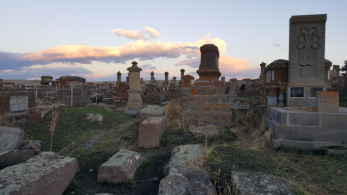
Dilijan is beautiful!! It was on my list of places to definitely visit, so when Shant said that he wanted to go there, I was all about it. We got in touch with our Dilijan friend, and she said that we could camp behind their house and borrow camping equipment. Nice! I’m pretty sure that you can probably just pitch a tent wherever in Dilijan, but this way we didn’t have to worry about renting equipment and carting it with us.

This was the marshrutka on the way back to Yerevan. I was confused about why they had these little cubes inside. They looked like footrests. Nope. They were seats. Gotta pack the people in!

We took the first marshrutka from Yerevan at 9AM and were in Dilijan by 11. After stocking up on snacks and supplies, we walked to the campsite and got our tents set up before heading out for a hike. Since the trail marking is still a work in progress, there aren’t many well-marked options. They have all sorts of maps in the TCT headquarters of the various jeep trails and such that exist around the park, so one of the guys there showed us a route that we could take that had no markers but used existing paths. He said it took him 5 hours which I took to mean it would take us at least 7. He tried to insist that he wasn’t going fast, but that means nothing when you’re talking to someone who hikes all the time. We decided to give it a try, I confirmed the directions to the trailhead about 50 times and took a million pictures of the map, and we were off.

A tiny church along the way

I hate being the navigator. Okay, that’s not a completely fair statement. I like navigating and I’m good at following maps, but depending on who you’re with, having the navigating responsibility can be stressful. If I was with Sarah (best friend Sarah), for example, it would be fun. If we hit a point where we weren’t sure which way to go, we would just try one and turn around if it was wrong, no big deal. It’s all part of the adventure.

The view from the top.

Sometimes though, people see pauses and uncertainty as you not knowing what you’re doing, and they lose all confidence in your guidance. That’s when I hate navigating. Following hiking maps isn’t quite as easy as street maps, so sometimes you need to just take an educated guess. There were some parts where I wasn’t completely sure about where EXACTLY we should be walking, but I knew that we were following a river the whole way, so as long as we were close to the river, we weren’t lost.

The crew! Laura (Carineh’s friend who came to visit), me, Carineh, Gagik, and Shant

There was only one part where the “trail” shown on the map wasn’t even close to right. Otherwise, we made some slow progress, but I always knew where we were. We made it to the halfway point after about 3 hours, and I knew there was no chance that we were making it all the way to the end before it got dark. That dude who made it in 5 hours must have been some sort of mutant. Called that. We made a group decision to go a little bit farther so that we could get a good view and then turn around and head back. At least then we would be following a path that we had walked before, and I had a GPS tracker running so we could use that to make sure that we were going the right way.

Tired and happy

The view from the “end” of the hike was awesome. There was a great view of the valley, some mountains in the distance, and there were even a few trees starting to change colors already! It would be super cool to go there in the middle of fall with all of the leaves changing.

After spending a little time resting and enjoying the view, we started hightailing it back in an attempt to hit the road before dark. We had flashlights with us, but that’s no good when you’re not following a clear path. There were a few parts of the hike where we were walking through fields, so you had to be able to see ahead across the field to make sure you were walking in the right direction. We were about 5 minutes from the road when it got completely dark, but luckily that was close enough. The whole hike ended up taking something like 5-6 hours, and I was wiped by the end.

We ate dinner in town at the one restaurant everyone always talks about before heading back to the tents. And s’mores. Because what is camping without s’mores? We didn’t last very long after getting back… I think everyone was exhausted. I could have slept on a bed of rocks.

Here’s our taxi driver looking at a map while driving. Comforting, yeah?
Me, looking like I’m haunting Carineh. And a mystery person looking like they’re haunting me… though I don’t think you can see it that well. Just know that there’s someone else lurking there who looks even creepier than I do.

My first weekend in Yerevan, I decided to go on the Birthright excursion because the description said hiking, and the location seemed too far out of the way for us to easily get there on our own. The trip was to Smbataberd, a fortress in the Vayots Dzor Province. That’s south of Yerevan by a couple of hours and is right at the beginning of the skinny tail of Armenia.

The view on the way up. Pretty, right?

Here’s your history lesson of the day: The first mention of the fortress came in the 5th century when it was used in the Vardanak War. They think (“they” being whatever people study and come up with these things) that it was built up much more in the 9th and 10th centuries when it was used by the Syunik princes. Unlike a lot of the fortresses we’ve visited here, this one actually saw a lot of action throughout history. They think that it was involved in some attacks again during the 11th century, built up even more and attacked again in the 13th century, and finally was abandoned in the 17th. Who knows how much of that is accurate, but it’s probably safe to conclude that it’s old and has had its ups and downs through the years.

Mountains are the best.

There’s one story floating around about how it was ultimately defeated. The water to the fortress used to come from a nearby monastery, Tsakhats Kar, through an underground clay pipe. The attackers did the classic “thirsty horse sniffs out water pipeline” trick to cut off the water to the fortress and eventually capture it.

IT’S SO COOL!

I had no idea what to expect and was pleasantly surprised. I had never heard of this fortress before, and after being there, I would say that it’s waaay underrated. To start, it was much bigger than I expected. The walls enclose an area of about 65,000 square meters and are around 2-3 meters thick and 10 meters high. There are a bunch of round guard towers along the walls, and everything on the exterior is in decently good shape, especially considering the age of the ruins. They’ve done some preservation work, pouring concrete on the tops of the walls to keep them from crumbling further and making it possible to walk on them. I thought the whole thing was super cool.

It kind of reminded me of the Great Wall of China. Except smaller. And completely different.

Most of the interior buildings are much worse off. You can still make out their ruins though, and the keep is kind of intact. Even without the fortress being awesome, the views of the surrounding mountains and valleys are worth the trip. I seriously don’t know why more people don’t go there.

There was a horse water trough on the way down the mountain that was filled with algae! It was super cool and looked like green clouds floating in the water, so obviously I wanted to touch it. So obviously I did. It was just as soft as it looked.
Okay maybe it was a little steep at times…
At the top!!
How. Cool. Are. These. Walls.
Talene and me on the walls.

We walked up and it took a couple of hours, but I think it would have gone pretty quickly with a smaller group. Also, there are tire tracks that lead all the way to the top, so with the right car (or with a normal car and an Armenian driving it), you could easily drive there. It gets a strong recommendation from me! You would definitely need a private car to take you there because it’s not super close to any public transit routes (at least not that I could find… which means nothing because Armenia public transit and the internet have a complicated relationship), but like I said, I thought it was great. Honestly, it’s probably one of my favorite places I’ve visited so far in Armenia.

Can you find me in this picture? I’m in a tiny hole in the wall at the bottom of this picture.
Super cool lighting

In general, my friends and I aren’t very big on going to the planned Birthright excursions. They happen every weekend, but since I’ve been here, I’ve only been on two… make that three with the one I’m going to talk about now. In general, the excursions never run on schedule, there are too many people, and we usually want to do something more adventurous than whatever they have planned. We made an exception this weekend because the excursion description mentioned hiking and because we had heard that the destination, Lastiver, was super cool.

Views from the drive to Lastiver. My face was glued to the window in the car. I think everyone else was sleeping.

Lastiver part of a wildlife preserve, Ijevan State Reserve, in the north-ish eastern part of the country. There’s a river with a bunch of little waterfalls, caves, and best of all, trees. We have gone on so many hikes since I’ve been here, and every time, it’s like we’re wandering through the desert. Zero trees, zero shade, zero shelter from the meltingly hot sun. I’m a forest kind of person… forests and mountains, and even better, forested mountains.

Carineh, Karen, me, Shant

Well, I was in luck with this hike. Almost the entire thing was through the trees and nice and shady. It felt a little bit like I was back at home which was comforting because sometimes it’s just nice to see something familiar. The end point was a campground by the river, and by “campground” I mean that they have these little cabins that you can stay in overnight and it’s really not very rustic at all.

When we got there, the announcement was made that we had an hour to swim or hang out until lunch was ready. I, of course, wanted to spend my time exploring. The water was FRIGID which means I wasn’t too interested in swimming, so I started walking upstream. Clearly, my friends and I are all on the same page because Shant and Carineh were right there with me, doing the same thing even though we hadn’t talked about it. We got a little farther upstream and found some of our other friends, Karen, Gagik, and his cousin, Anjela. I thought it was pretty funny how all of my favorite people ended up in the same place without any plans. I guess that’s how you know that you have things in common!

The path
Hi, valley!
Rock hopping route

The upstream “hike” we ended up doing is probably one of my favorite things I’ve done so far in Armenia. It was another one of those fun, brain challenge hikes because there was a river and a bunch of rocks, and I wasn’t interested in getting wet. That meant that we had to be creative and do a lot of jumping from rock to rock. Our group got split up as Karen, Carineh, Gagik, and Anjela gave up on staying dry and started wading through the river, and Shant and I kept hopping from place to place. Ahh it was so fun.

I love rivers

One of my favorite feelings is when I’ve been consistently exercising and I feel like I have good control of my body, like balance and coordination-wise, and I get to do something that puts those to the test. This experience was definitely a balance and coordination challenge, but I felt like I was in control and could trust my legs to do what they were supposed to do. I was jumping from rock to rock without getting tired or worrying for a second that I was misjudging the distances or that I wasn’t capable of making it. I don’t know how else to describe that feeling besides just saying that it’s awesome, and you feel like your body is doing what it was made to do.

A bunch of the Gyumri crew
As you can see, Shant and I are trying not to get wet, and everyone else doesn’t care. The result? The worlds most awkward group photo. From left to right there’s Karen, Carineh, Anjela, Gagik, Shant, and me
Gagik won the caption contest with this picture. “When you discover new land and the locals are friendly.” I’m still laughing.

Anyway, by the time we decided to turn around and go back, lunch was long over. We made it back to the group, and I felt like we were castaways making it back to civilization. Who knows what everyone else spent their day doing, but I’m convinced that ours was the best.

Church views

The next day, Shant and I decided to make the trek out to see the Marmashen, a group of churches about 10 kilometers from where we live in Gyumri. There were originally five churches, only three are still standing, and they haven’t even found the foundations of the last one. I successfully called a taxi to take us there, and we spent some time wandering around, checking out the sights, and eating snacks (obviously, because we never go anywhere without snacks). It seemed like a cool place for locals because there was a picnic area, and people were going hard with their barbecue. After we were finished wandering, Shant really wanted to walk back to Gyumri, so off we went.

I think that the lettering on these churches is amazing. Can you imagine if your job was to write all of this?

I know, I know this all sounds ridiculous. I’m convinced that we’re (“we” being my friend group here) literally incapable as a group of doing anything in a normal way. At Lastiver, literally no one else from the Birthright group walked so far upstream. All of us were just naturally drawn to it. Here, who in their right mind decides to walk 10 km home when you could just call a taxi? I guess that means we aren’t quite in our right minds.

Remains of one of the chapels

To make things more ridiculous, we decided to ignore all of the roads. Instead, we took random paths through the fields that looked like they were leading in the right direction. I wish I had some sort of fitness tracker or something because I promise you that we walked FAR more than 10 kilometers while trying to take “the most direct route”. Ha.

The river and its cool cliffs

Our wanderings took us through some cow pastures and old ruins that looked like one of our archaeology sites, over a river, into the village of Marmashen (where people looked at us like we were actual space aliens), and out into some fields. There, we were summoned by a random farmer named Hamlet. He spoke no English, of course, and so we entered into the usual conversation of hand motions and sporadic Armenian words. He wanted us to come back to his house to eat dinner and spend the night. When we told him that we were walking to Gyumri and had come from Marmashen the church (it’s not that close to the town), he looked at us like we were literally insane and offered to call his friend who has a car to take us home. People usually don’t understand walking somewhere just for the sake of walking. We finally managed to pull ourselves away, and off we went, back into the fields.

Random green oasis area on our epic voyage home
Random cemetery that we encountered along the road to Marmashen… and when I say road, I mean cow path
The happening village of Marmashen
Rubble, rubble everywhere

The rest of the walk was interesting. There are a bunch of abandoned, half-collapsed buildings outside of Gyumri. I thought that they were from the earthquake, but apparently maybe they’re from after? I don’t know, either way, they’re super eerie. Then, there are buildings that seem like they should be abandoned, but upon closer inspection, there are people living in them. We walked briskly by those. Then, there are the massive craters in the ground where there used to be a building and now there’s just a foundation. I don’t know what everything out there is from, but it was certainly an interesting walk.

More of the “road home” landscape
This building was pretty eerie. This is one that Shant said was built after the earthquake, but who knows?
Random foundation
Sunset!
The most defined path we took all day.

We made it back to our neighborhood just as it was getting too dark to see anything. Thank goodness because I was starting to panic a little bit. Since we didn’t follow any roads, if it got dark before we made it home, we would have taken forever. We got ice cream to celebrate our survival, and ice cream fixes all problems, so now I have nothing but happy memories of the day. No, but actually, it was really fun, and I think that I can safely say that no one has EVER had a Marmashen experience like ours (because seriously… who walks??).

With a limited time left in Gyumri, we have been trying to do things around the city on the weekends so that we don’t feel like we’ve missed out on things when it’s time to move to Yerevan. A couple weekends ago (I know, I’ve been horrible at keeping up to date), Shant and I decided to cross off a few of our Gyumri bucket list items: Mother Armenia and the Sev Berd (Black Fortress).

Mayr Hayastan from the Sev Berd

You might remember that Yerevan has a Mother Armenia statue as well… it seems like that’s the thing to do here. Find a hill near the city, make a huge statue of a hardcore looking woman, and put her on a towering pedestal. This one was erected in 1975, and from the looks of it, no maintenance work has been done on it since then. Okay, that’s a bit of an exaggeration, but the whole area could definitely benefit from a little love. And cleaning. And weeding.

Sev Berd

The Sev Berd was built by the Russians in the late 1830s. It was never attacked, and today, it’s privately owned and used as a venue for different events. I know there have at least been concerts there, but I’m not sure about what else they do.

Shant and I walked from GTC and instead of taking the very clear, normal person path to get there, we followed the road for part of the way and then turned off onto a “path” (aka the grass was kind of flattened down) that looked like it was going in the right direction. It… kind of worked. I mean, we walked through some people’s yards (but that’s not so weird here) and blazed our own trails through some underbrush, but we made it there in the end so that’s counted as a success, right?

Supposedly she looks like a dragon from the back because that side is facing Turkey

We went to the Sev Berd first and took another slightly questionable path to get there. Were we trespassing? Who knows. Was the security guard very surprised to see us leaving after not seeing us come in that way? Yes. Did anyone give us a hard time about it? Nope, and that’s all that matters. I really wanted to go inside, but Shant and I are pathetic and didn’t want to go through the struggle of trying to speak Armenian. I know, I know, but there are some days when you’re willing to put in the effort and other days when you just can’t. That was a “can’t” kind of day. Some other (Armenian-speaking) volunteers went a different day and talked themselves into an impromptu tour of the inside, so I guess my punishment is having to live with that.

From there, we walked over to Mayr Hayastan (Mother Armenia) and took a lap before heading back into the city. Both things were interesting, but visiting Mayr Hayastan was a bit of a bummer because it was in such a sad state. There are all of these fountains/water features leading up to the statue, and it could be a really cool place to visit if it was kept up. Instead, like so many other things in Gyumri, you can see the former glory and present sadness of the city. It really makes me wonder what Gyumri used to be like, back in the days before the earthquake.

The next day, Shant, Carineh, and I went back to Sarnaghpyur, the village we visited my very first week here, to hang out with Karen in his natural habitat. He promised us a food and adventure-filled day, and it definitely didn’t disappoint.

We got there early in the morning and were treated to a breakfast of pancakes, hard-boiled eggs, bread, cheese, fruit, etc etc etc just imagine every food in the universe and it was probably there. After breakfast, we had ice cream and then hung out until lunch when we ate AGAIN. Very productive day so far, I know. I felt like my stomach was going to explode (which is pretty typical here, to be fair), and still I was being guilted into eating more. Ahhhh peer pressure!

Force feeding aside, it was fun getting to see Karen in his natural habitat. I love seeing how different and at ease people are when you put them in the places where they feel the most comfortable. It’s like you have the chance to peek inside their souls and see the real them.

The canyon

We finally decided to mobilize after lunch and go on a hike in the nearby area. The dinner food (because obviously we needed to eat AGAIN) was packed up, firewood chopped, and everyone got ready for an adventure. Karen led us through a canyon where we got to climb some rocks and strategize the best route to take. That’s one of my favorite kinds of hiking because it’s not just walking up a hill. It requires some thinking and planning and challenging yourself.

Hole cave! See me?

The best part of the hike was this one place where we found the coolest cave. There was a big cave with a bunch of other little caves and passageways inside. I obviously had to climb into as many of the holes as possible because I love holes. This is one of my Armenia-acquired most favorite hobbies (one of the others is discovering more Armenian invention claims… I’ll probably have to do a second post on those because I have a few new gems to share).

Climbing into my new hole home
The crew… Karen, Shant, Carineh, and me in the front

Random tiny church… of course because there are churches everywhere
Inside the little church. I added the little pink flowers to this wall of random things
Wouldn’t this have been the coolest place to play as a kid??


Quick nap while we waited for a taxi

From there, we made our way to a little picnic area to hang out and eat dinner. Armenia has the most randomly but conveniently located picnic tables I’ve ever seen. Anytime we’re out on some random adventure and decide that we want to stop for a snack, there’s a picnic table waiting for us. I don’t completely understand this phenomenon, but it’s one that I choose not to question. In typical Armenian fashion, the dinner plan was khorovats (barbecue). We had eggplants, peppers, tomatoes, and pork, Karen and Shant grilled it all over the fire, and we ate it with lavash (soft, flat Armenian bread).


By the time dinner was finished cooking, it was pitch dark outside. Like not even a little moonlight to help us out. We ate by phone-light, and Karen called for reinforcements so that we didn’t have to walk all the way back to his house. His uncle drove as close to us as he could, and we trekked through the dark with his headlights as our guide. It was like the Armenia version of a helicopter rescue from the wilderness. I was completely exhausted and passed out the instant we got in the car. That’s how you know it was a good day!

Last weekend, a few friends and I decided to make our own excursion rather than going on the Birthright one because it was just a swimming day at Lake Sevan. We wanted to do something a little more adventurous, you know, because hiking Aragats the weekend before wasn’t enough for us. Carineh found an easy hike between two churches, Saghmosavank and Hovhannavank, and she and I planned to go with one of our other Gyumri friends, Shant.

Saghmosavank

We met “early” in the morning on Saturday… 10AM… to catch a taxi out to Saghmosavank. It was about a 45-minute ride, and when we got there, it looked like they were setting up outside for a post-baptism party. Good timing for us because we made it there before it started and could explore the whole church. Somehow, no matter how many churches we see, there’s always something a little different in each one. This was the church of nooks. Seriously, there were nooks everywhere. Some were high, some were low, some had floating stairs leading up to them, some had no visible means of access. Maybe they used to have a lot of things to store? I don’t know, but as a lover of nooks, I thought it was awesome.

Floating stairs to a nook with another nook underneath
Nooks on nooks
Inaccessible nook
So pretty! You might even say… gorges… I know, the joke has been made before, but I’m still entertained by it and that’s all that matters

It is also situated in a pretty cool spot. It’s right on the edge of a gorge, and the hike we were planning to do basically just runs along the top of the gorge until you make it to the second church, Hovhannavank, which we could see in the distance. While we were admiring the gorge, we noticed that there was what looked like a decent road at the bottom, and we could hear a river. Then, someone pointed out a vaguely defined path that looked like it led to the bottom from where we were. That was all it took for us to completely ditch our plans and decide to hike down into the gorge instead. Brilliant, except for the fact that none of us were planning for a serious hike and weren’t completely prepared.

The gorge from Saghmosavank
See Saghmosavank peeking out from above the rocks?

We’re all a little bit crazy, so silly little details like that weren’t enough to stop us. I think it ended up taking about 2-1/2 hours to make it down. The “path” that we saw was not quite as helpful or defined as we originally thought. After about the first 10 minutes, any indication of the best way down vanished, and we were left to plot our route as we went. I wasn’t even completely confident that there WAS a way down, but I had no interest in going back up so that only left one option. It took some gravel sliding, rock climbing, and scrambling, but we made it! And as luck would have it, there was a leak in a water pipe right at the bottom, so we frolicked in the freezing cold water spray before continuing down the road.

Camouflage
The well-defined path down
Making it up as we go
Confused by this random cave that basically looked like someone just glued rocks to the wall and ceiling
Slowly…
The final stretch
Yay for roads!

From there, the path was easy. We walked for a bit before spotting a good swimming spot in the river and taking a break to cool down. None of us were prepared for swimming (obviously, considering we weren’t prepared for anything that day), but I don’t even know that I would have wanted to go completely in because the water was frigid. It was enough to just wade up to our shorts and put some cold water on our necks. We also floated our water bottles in the river so that we could leave with some ice-cold water. Genius, I know. One thing we were prepared for was lunch, and after a classic Armenian hiking lunch of lavash (flat bread… kind of like a tortilla), salami, and cheese, we set out again.

Gorge views
Our swimming spot
Thrilled about the water temperature
Taking a minute to cool off on this metal pipe… which I realize doesn’t seem to make sense, but there was super cold water running through, so the pipe was nice and cool rather than super hot from the sun.

The rest of the walk to Hovhannavank was uneventful. I was worried that we were going to have to hike out in a similar fashion to the hike in, but the road we were on started slowly ascending until we were out of the gorge with barely any effort. I’m glad that we started at Saghmosavank rather than going the other direction! I felt a little bit like an alien when we emerged from the gorge and entered into Ohanavan, the town where Hovhannavank is located. We were weary travelers who felt like we had just trekked across the universe, and it’s always weird entering back into civilization.

The farther we went, the more we found these random swimming holes (with water just as cold as the river)

Weird puff ball “flowers”
Selfie that I forced everyone to participate in
Cool, huh?
The road starts going up!

So, there’s the story of how our planned 3-hour hike transformed into a 10-hour adventure. Sometimes though, the unplanned ends up being even better than the planned. I don’t think any of us would go back and do it differently… except maybe for bringing more water and wearing more appropriate shoes. It’s fun to know that I have friends here who are as willing as I am to take the road less traveled (or sometimes completely untraveled) just to see where it leads.

Hovhannavank
Bells. There’s a pulley system so that they can be rung from the ground
The sunset! The clouds around it looked super cool

Last weekend’s adventure was hiking the northern peak of Mount Aragats! Aragats was created by a volcanic eruption and is now a huge crater surrounded by four peaks. They’re creatively named the northern, southern, eastern, and western peaks, and the northern peak is the highest point in Armenia at an elevation of 4,091 meters (13,420 feet).

This is what most of the beginning of the hike was, as we made our way past the southern peak

It has also been an important symbol for Armenians since the pre-Christian days and has pagan and Christian shrines scattered around. Many of them are hidden, and according to the legends, some are hidden using methods more magical than simple camouflage. Remember our friend St. Gregory? The one who lived in a pit for years and helped to convert the Armenian king to Christianity in 301AD? Well, he was a VERY busy guy because he also used to climb Aragats pray and at night was guided by a lantern “hanging from heaven”. The lantern supposedly still appears on the mountain, but only the worthy can see it.

Big rocks!

When Sarah and I went on that tour in Yerevan, the tour guide talked about how he and some friends hiked the northern peak, and from that moment, I decided that I was going to do it if I got the chance. I didn’t know at the time if I would find any friends who liked to hike, but I was hoping! Sure enough, about a week into being in Gyumri, I heard about a group forming to hike it, and I signed myself up. I was worried because I hadn’t really planned on doing any serious hiking while here, so I didn’t bring my hiking boots. It was hard to find any real information online about the hike, but from the people we talked to and the information we got from the guide, it sounded like boots would be a good idea. I ended up being the absolute luckiest because a friend was coming to visit Armenia the week before the hike, and she brought my boots with her! I’m telling you, if you ever do this hike, boots or hiking shoes with a hard sole and waterproofing are essential! We even hiked it at the time of year when there’s the least snow, but it doesn’t matter. Trust me.

The western peak from the low-ish area between western and southern

We set out from Gyumri at 4:15AM, and yes, that was as miserable as it sounds. My host mom was sure that I was saying the wrong number when I told her when I had to leave the house and then told me to have fun and that she would still be sleeping. The drive to Kari Lake, the spot where the hikes start, takes a little more than 2 hours from Gyumri, and it took us even longer because the taxi drivers needed to take a couple smoke breaks, we hit an animal on the way, and we got stuck behind some farm equipment. Off to a good start.

The eastern peak and the first snow patch that we had to cross.

The hike is supposed to take like 8-16 hours or something like that. We were shooting for finishing it in 10, but I had no idea what to expect. Thankfully, we had a guide, so we didn’t really have to know much. I totally didn’t realize how much hiking you have to do to just to make it to the base of the north peak. We set out from the lake, walked past the southern peak, and crossed into the crater through the low-ish point between the western and southern peaks. When I realized that all of the hiking up we had done wasn’t even the beginning of the hike to the peak, I was horrified. We had to hike down into the crater before hiking all the way up again. It took us three hours just to make it to the base of the northern peak.

Making our way down into the canyon

After a break, we started to make our way up. The terrain was basically all rocks. Little rocks and medium sized rocks with sporadic plants. The lack of much plant growth and dirt to hold the rocks in place meant that every step was a potential rock slide. Perfect. This is where the recommendation to bring hiking poles started to make sense. You should bring hiking poles. It’s certainly possible without them but I would estimate approximately 10000x easier/less terrifying with them.

Multicolored stones!

The first half of the hike up to the peak isn’t really that bad. It’s steep, but you can find paths where the rocks aren’t as unstable, and the only part of me that was getting tired was my calves. We stopped to take a break in the least comfortable location (imagine like a 45-degree slope with sharp rocks poking into you) before starting the second half. From that point on, it was way worse. The inclines were steeper, the rocks were smaller and less secure, and the drop offs were mildly terrifying. I’m not afraid of heights, but I am afraid of rock sliding down the side of a mountain. I’m not a fan of feeling like I can’t trust my feet to stay where I put them, so I started going extra slowly. The other people in my group must be half mountain goat because none of them seemed to be that bothered by it (though I’m sure that’s partly because if they were nervous, they just didn’t show it). I let them go ahead of me because, in that kind of situation, I don’t like feeling rushed or like I’m holding people up. I knew that I would make it to the top, it was just a question of the speed at which that would take place.

View from the top!

I think it took us something like 3 hours to make it to the top. Everyone else could have probably done it in 2-1/2 or less, but I was definitely the weakest link in that situation. Fear is a really interesting thing. There are so many things that I’m not afraid of, and there are a lot of similar situations where I would be completely fine. I think that in that case, it was a combination of having a couple foot slips that freaked me out, not wanting to slow down the group (though that happened anyway), and feeling a little unbalanced because of the altitude. I never had the thought that I couldn’t do it or that I should turn around; I just needed to do it my own way and to go at my own pace.

The crew

The view from the top was awesome, and the feeling of making it there was even better. I chose to ignore the fact that I was also going to have to make it back down because I didn’t want to spoil the moment. We sat at the top, ate some snacks, and enjoyed the views of the other Aragats peaks and the surrounding landscape until the guide insisted that we start heading back down.

At the top!!!
Mid-hike snowball toss

I took my place at the back of the group to avoid slowing anyone down, and the guide came over and offered me his hand. I knew that I could make it down without any help, so the choice was really just between 1) insisting on doing it myself, slowing down the group even more, and feeling terrified the entire descent and 2) accepting some help, moving at a reasonable speed, and feeling slightly at ease. I’m all about doing things for myself, but there’s also no shame in accepting help when it’s offered. I took his hand, and he basically dragged me down the mountain.

Going up again…

At the bottom, we had to decide how we wanted to get back to the lake. The “fastest” option won, but fastest definitely didn’t mean easiest… in this case, it meant steepest. There’s nothing worse than finishing climbing the mountain that you came to climb just to realize that you need to climb two more mountains to get home. We went up and down FOUR times on the hike. The actual northern peak part of the hike was definitely challenging, but if that was all you had to do, it wouldn’t be bad at all. We spent more than half of the total hike time going to and coming from the base of the mountain!

Kind of like paradise…

We had one river, two more aggressive uphill climbs, three snow patches, and seemingly endless wildflower spotted fields to make it through before the end of the hike. For all of that though, I was fine mentally. It was just something about the sliding rocks on the north peak that got me into a funk.

Me in the oasis
There she is… the northern peak
Me looking much more epic than the reality
So many wildflowers!

When we made it back to the lake, I wanted nothing more than to go to sleep. The whole hike took us about 11 hours and 20 minutes, including our million breaks and my pokiness on the way to the peak. All things considered, I thought that was pretty good. We loaded back into the cabs and made our way down the windy roads down the mountain and home to Gyumri. I got home a little after 10PM and went immediately to bed. I must have looked a mess because my host mom didn’t even try to force feed me when I said I just wanted to sleep.

All in all, I’m glad I did it, and even more, I’m glad that I never have to do it again.

P.S. If you ever find yourself planning to hike the northern peak, talk to me. Hiking boots. Hiking poles. Late summer. Lots of water.