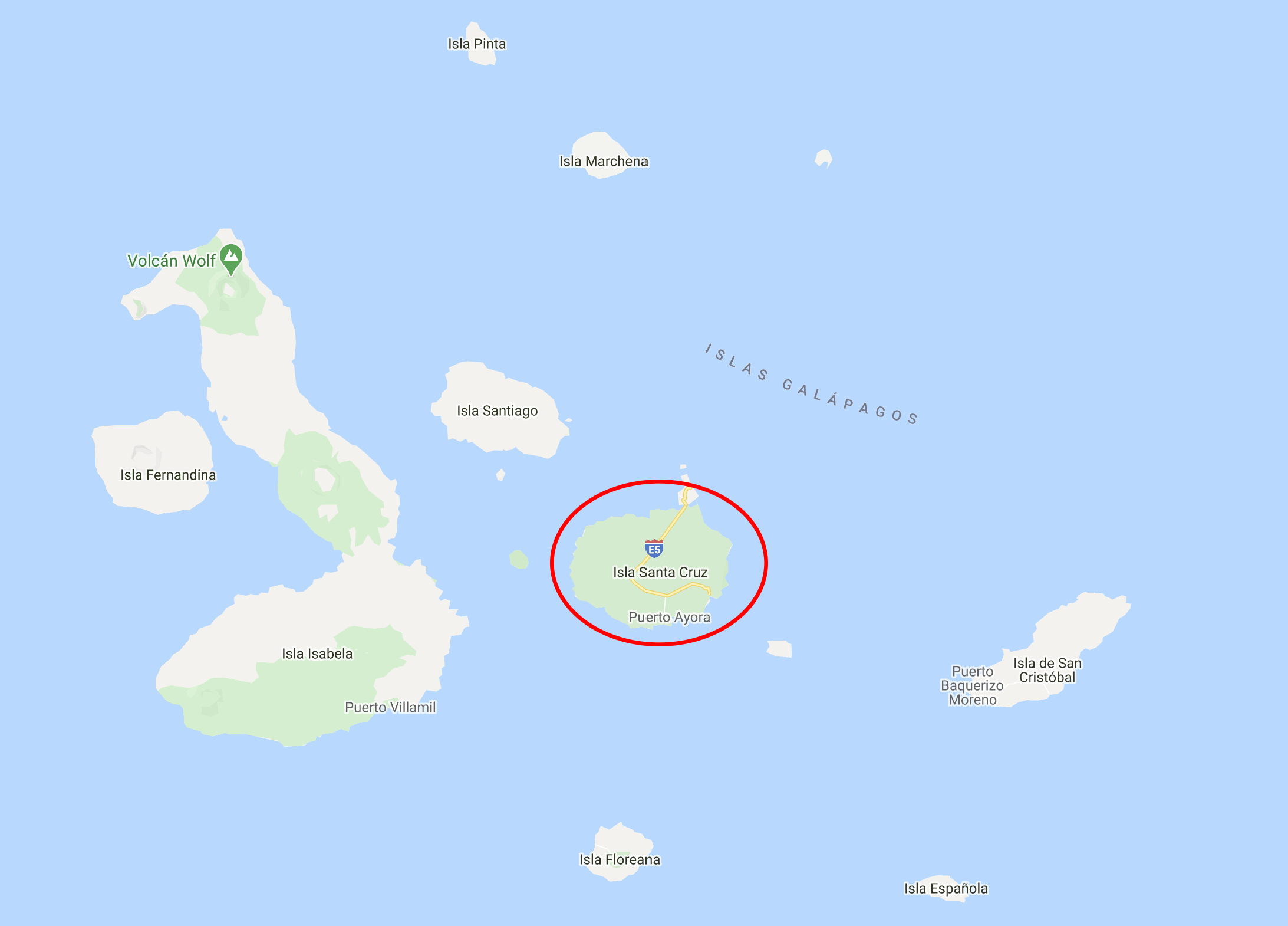
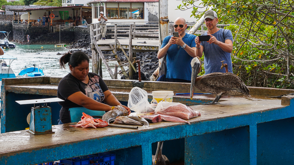
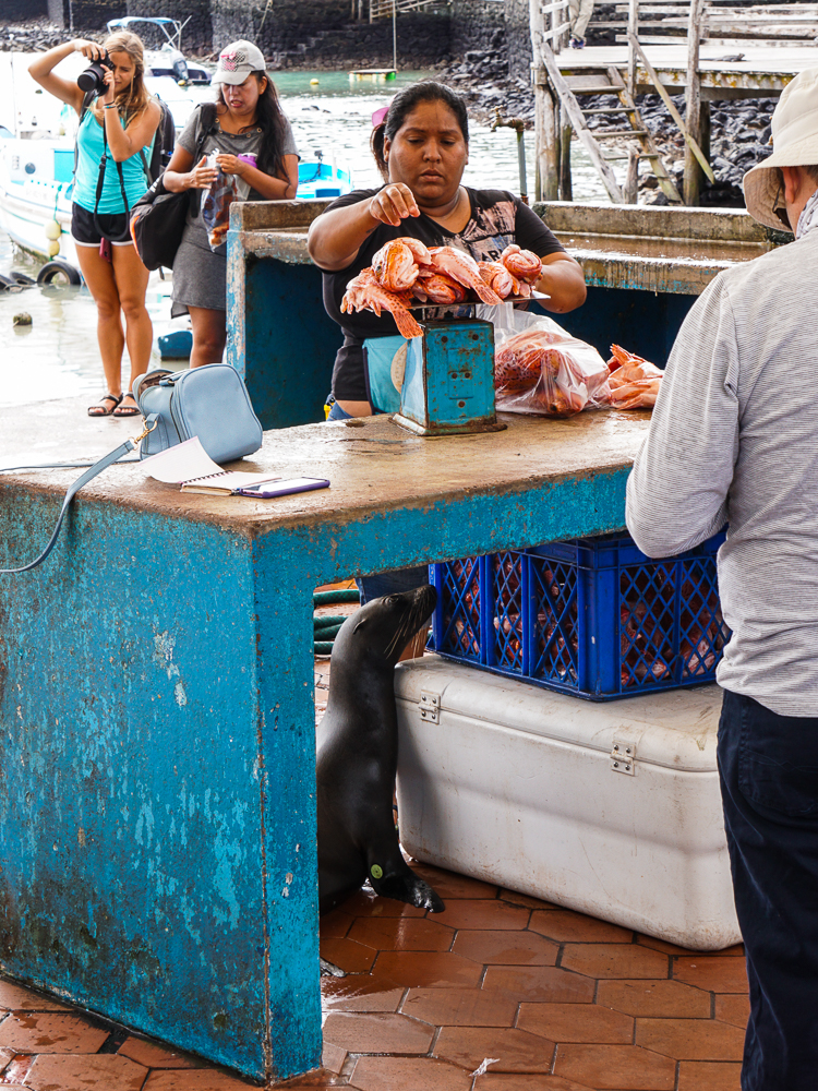
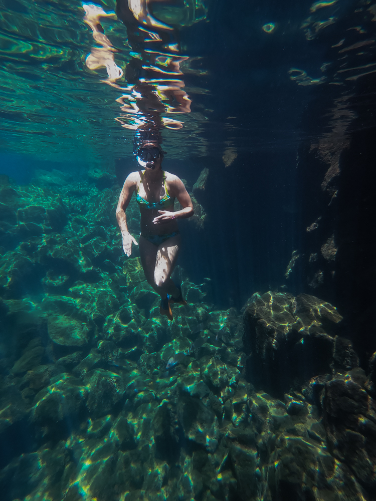
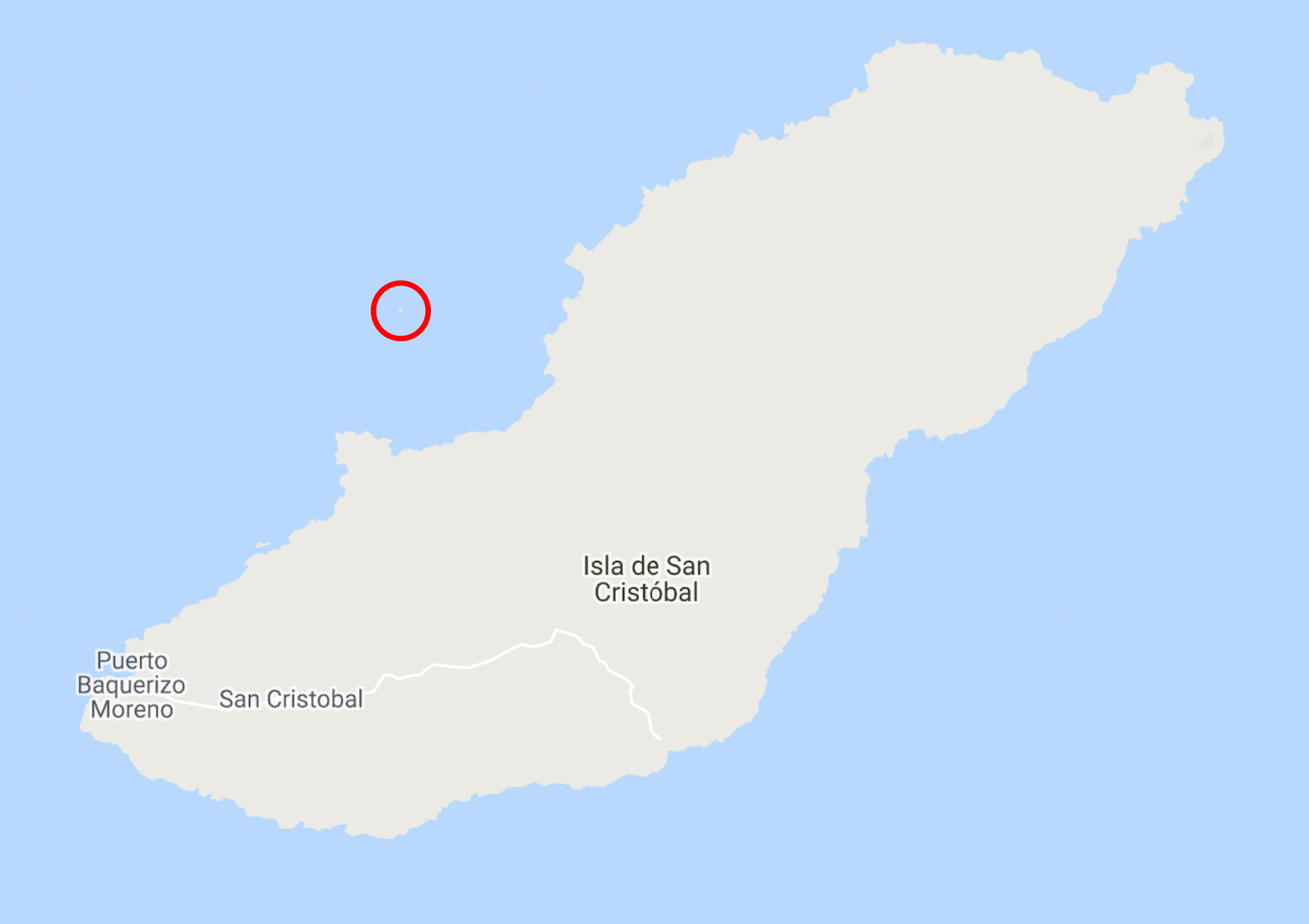
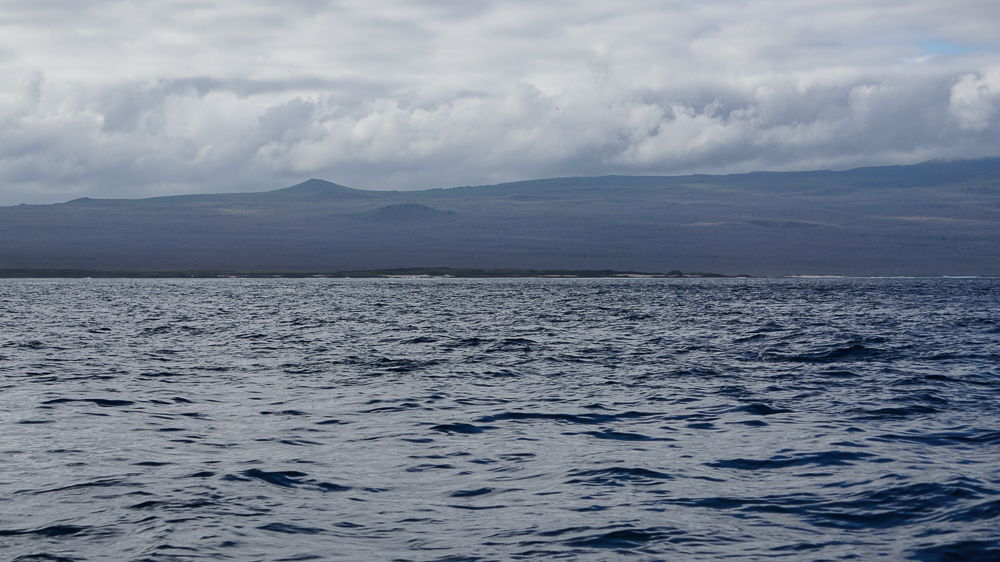
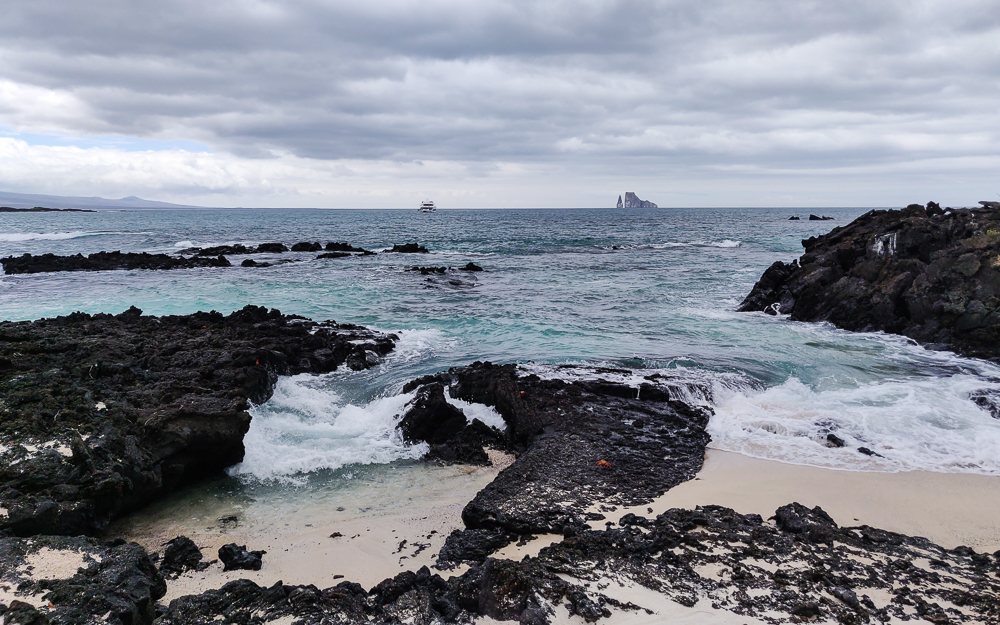
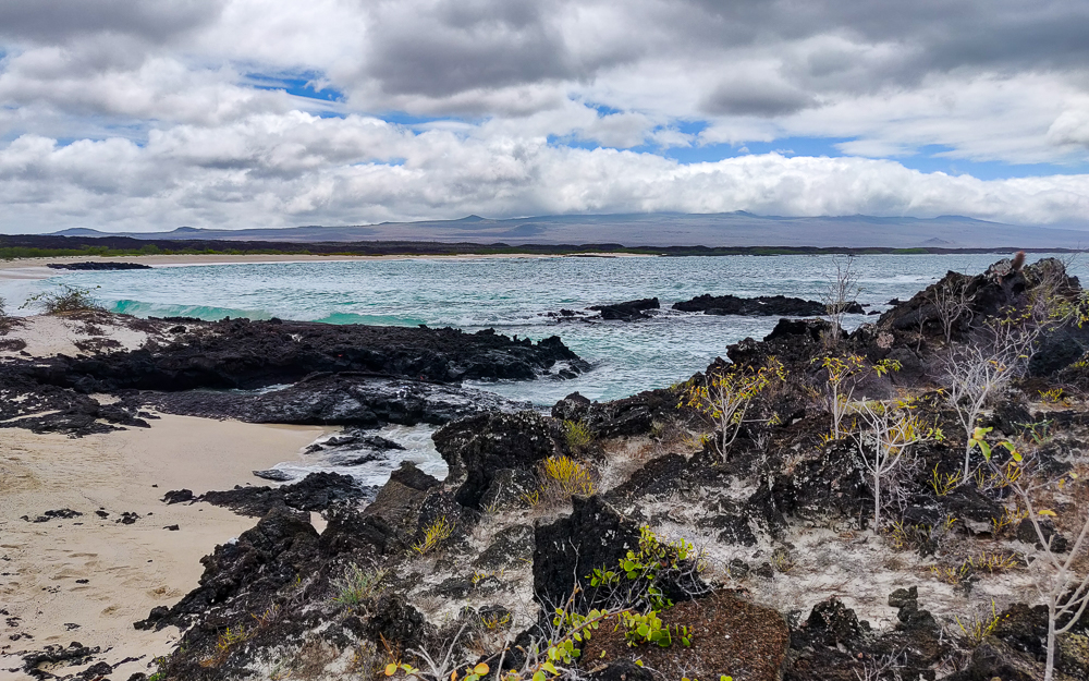
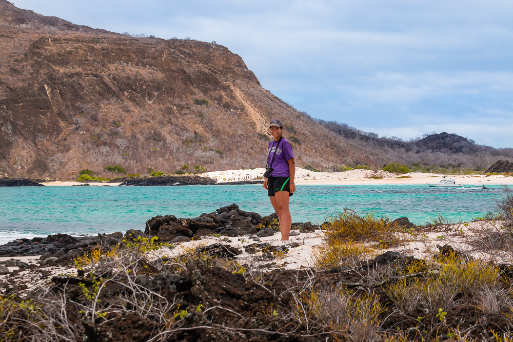
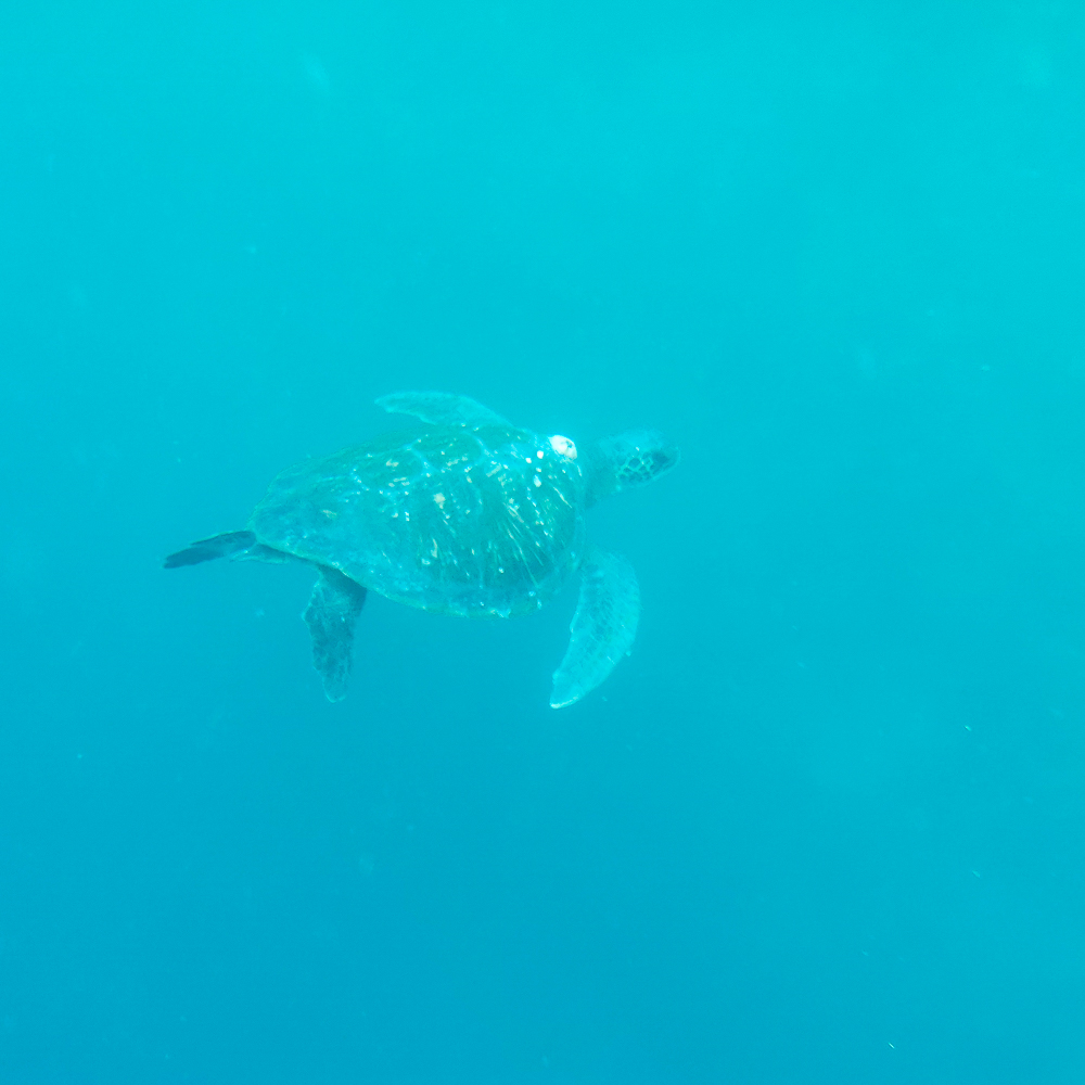
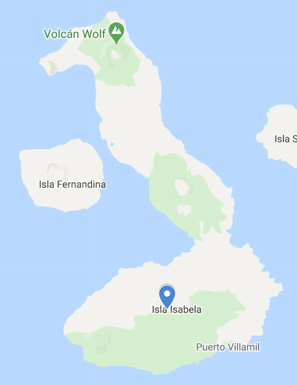
Most Galapagos day tours have a similar pattern… boat ride, walk around and look at animals, snorkel, boat ride, home. On our second-to-last day, we did something a little different and went on a hiking tour! It was to Sierra Negra (Black Mountain), one of the six shield volcanoes that make up Isabela Island, the largest island in the Galapagos. Five of these volcanoes are still active, Sierra Negra included. Its last eruption was in 2018! The main town, Puerto Villamil, is located just to its south, but thankfully, the lava from that eruption mostly made its way north. There are, however, parts of the hiking trail that are still closed because they were covered by lava. Sierra Negra erupts approximately every 15 years, so keep that in mind when you’re planning your trip! Hehe just kidding. They’re super cautious and monitor the volcano closely, and no one is allowed to visit without a guide. I will say, though, that the previous eruption in 2005 came with no advance warning signs… sooo the only sure bet is to steer clear.

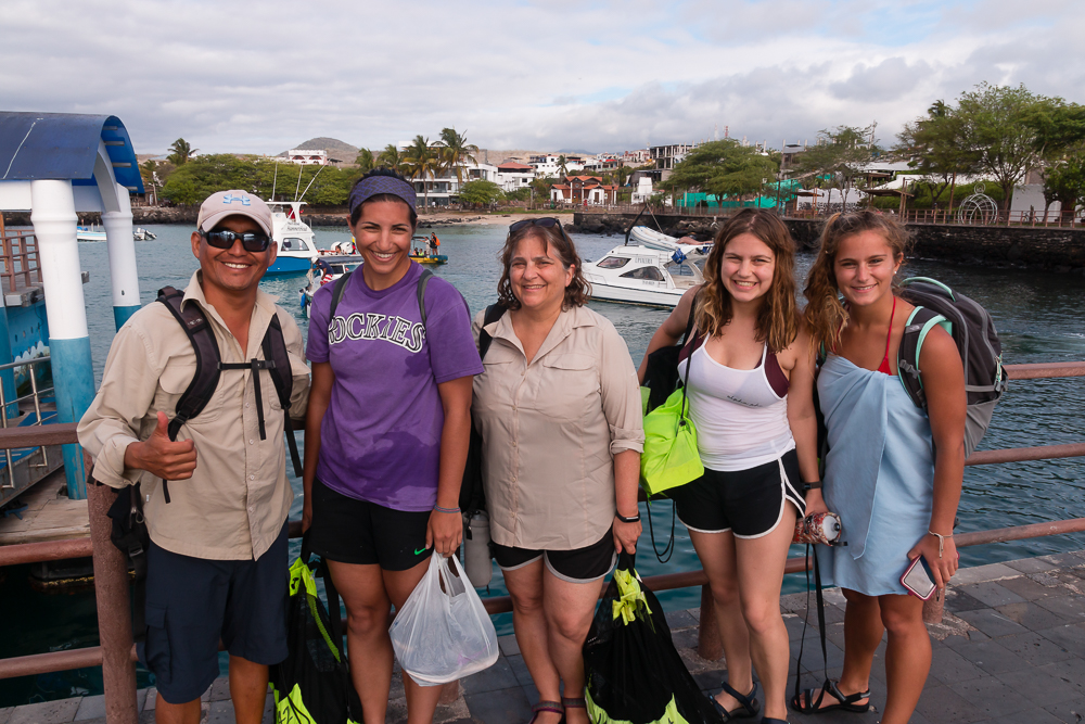
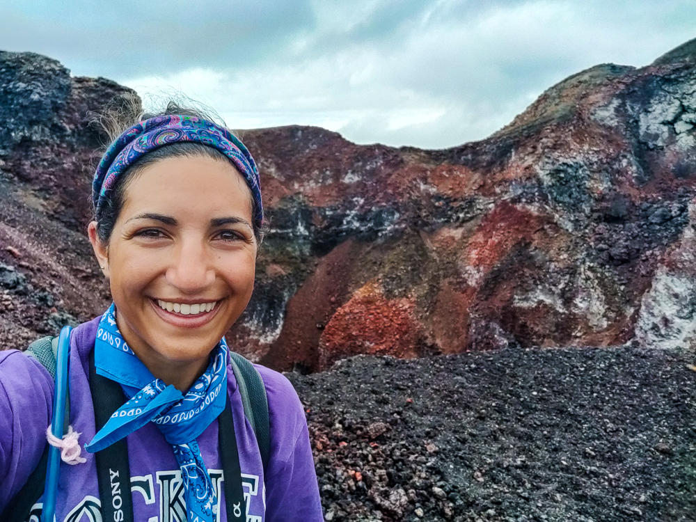
Well, I didn’t know any of that before we went, and maybe that’s for the better. We were picked up bright and early, as usual, and took a bus from Puerto Villamil to the eastern side of the volcano. The tour involved a hike up the rim, a walk along the perimeter, and then an exploration of the lava fields to the northeast of the caldera.

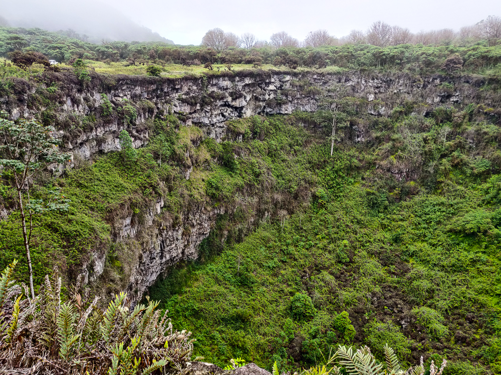
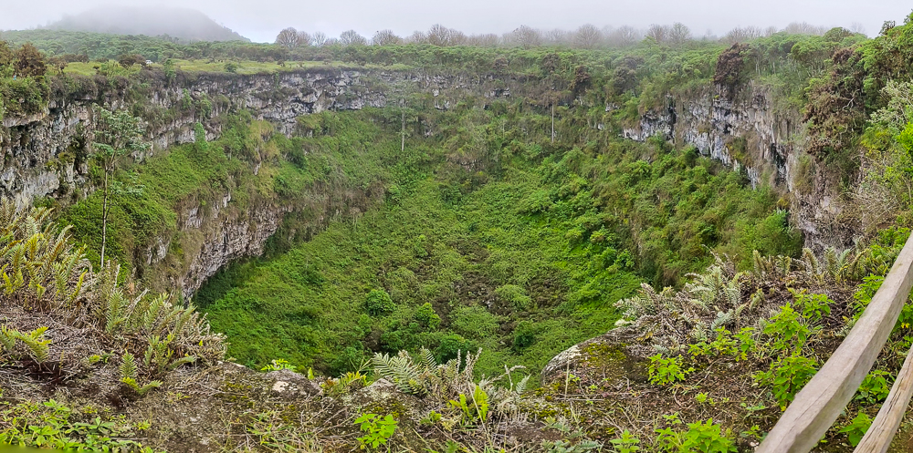
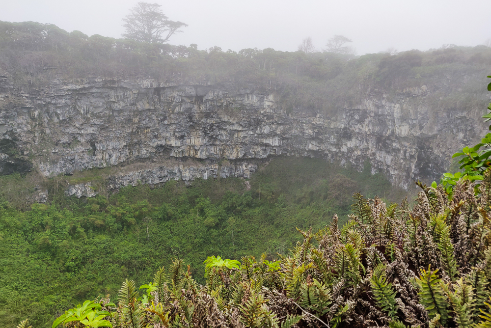
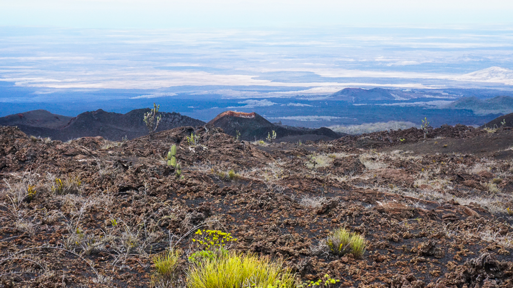
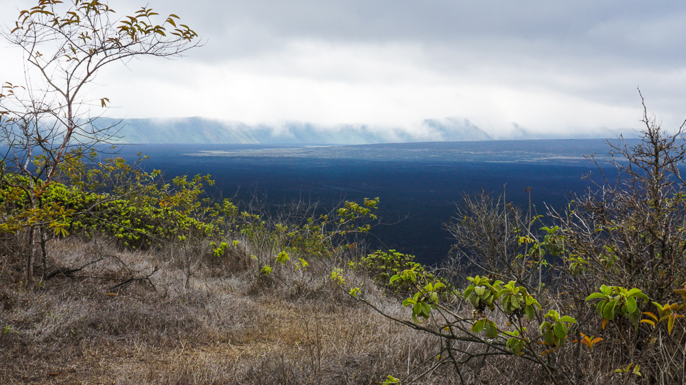
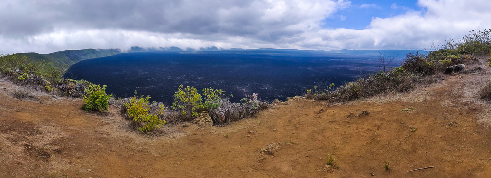
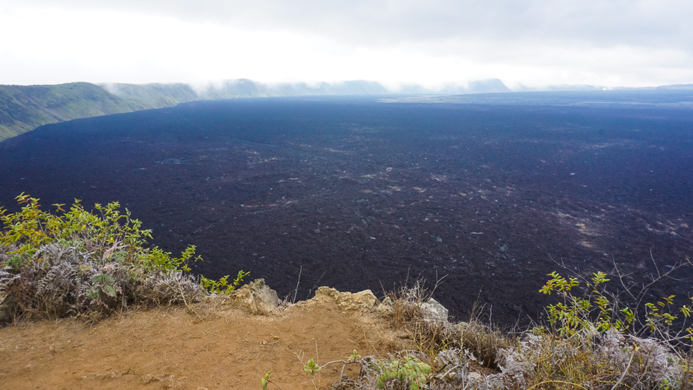
Sierra Negra, besides being one of the most active Galapagos volcanoes, has the largest caldera. It’s oval-shaped, and its long axis is almost 6 miles (9.3km) across! Interestingly, it’s also very shallow, only about 330ft (100m) deep, making it the shallowest one on Isabela.

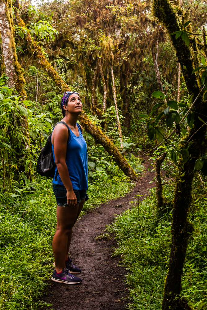
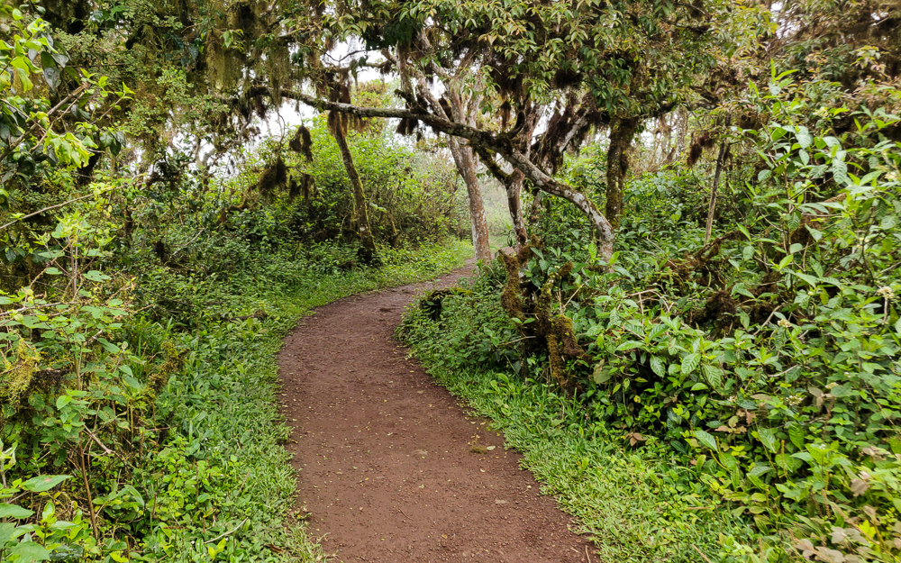
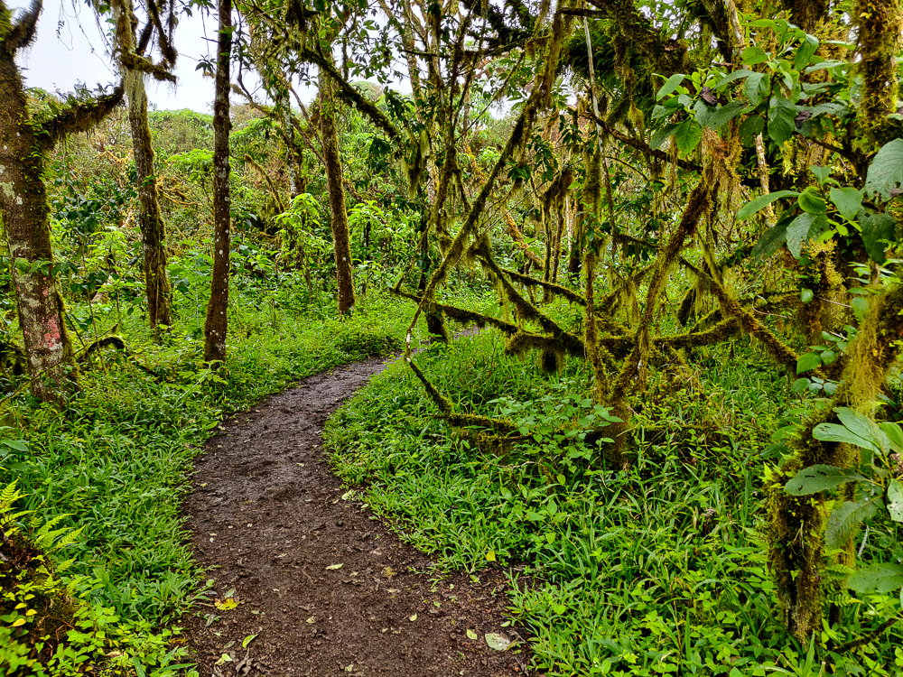
The beginning of the hike was a gradual but constant uphill as we made our way up the side of the volcano to the rim. Remember, shield volcanoes are short and wide and are formed by long-duration eruption events where very flowy lava is supplied continuously. Explosive eruptions, in contrast, are shorter-lived and result in taller and steeper volcanoes. The shallower slope was fine with me! No need to rock climb our way to the rim. Even so, it reaches an altitude of nearly 4,500 feet (1,120m), so don’t be imagining some little hill!

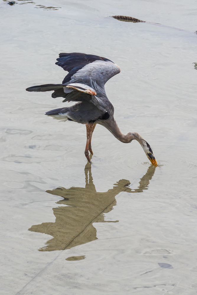
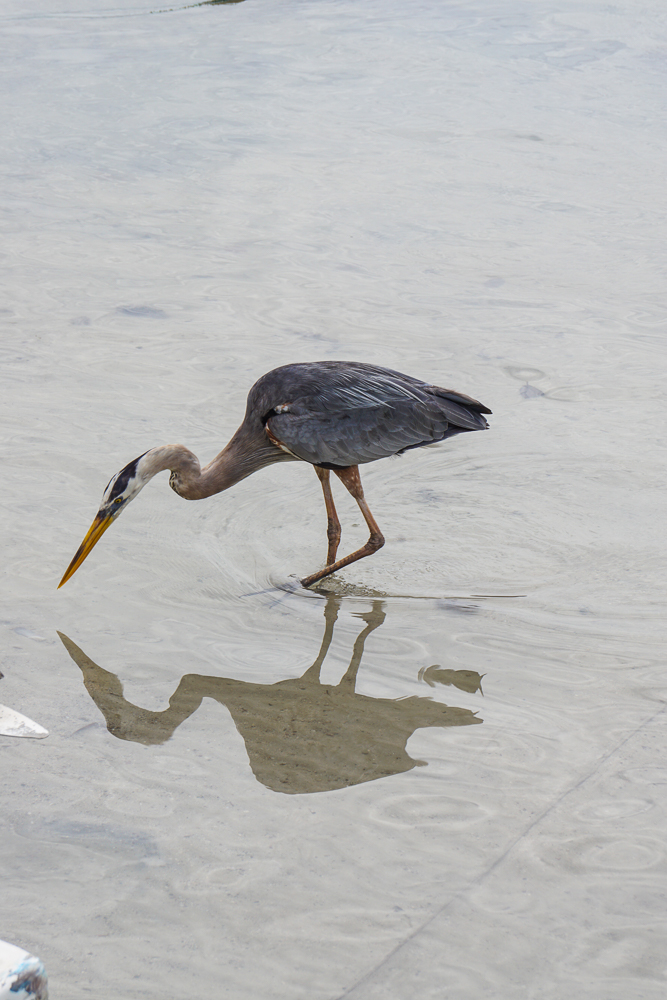
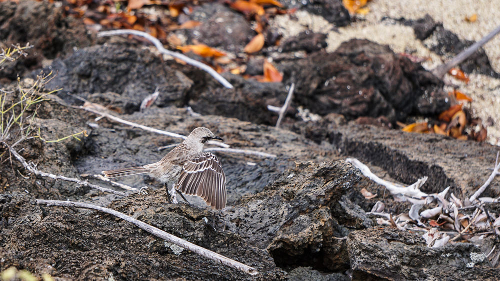
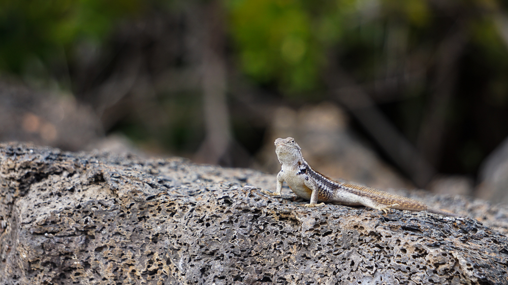
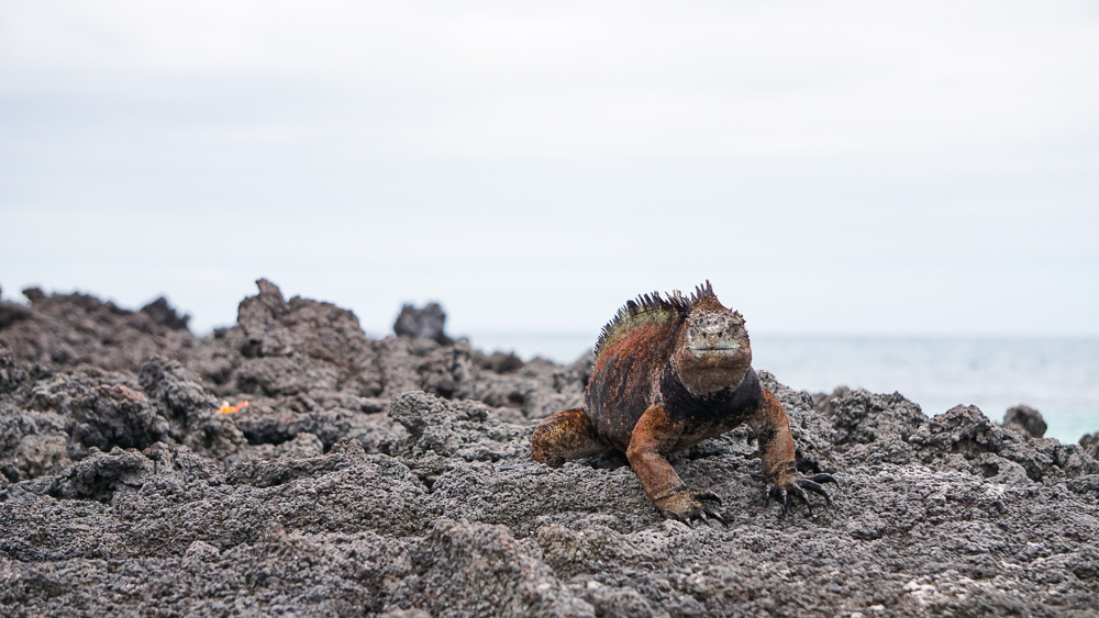
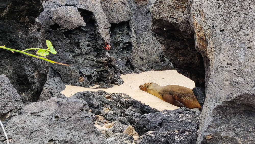
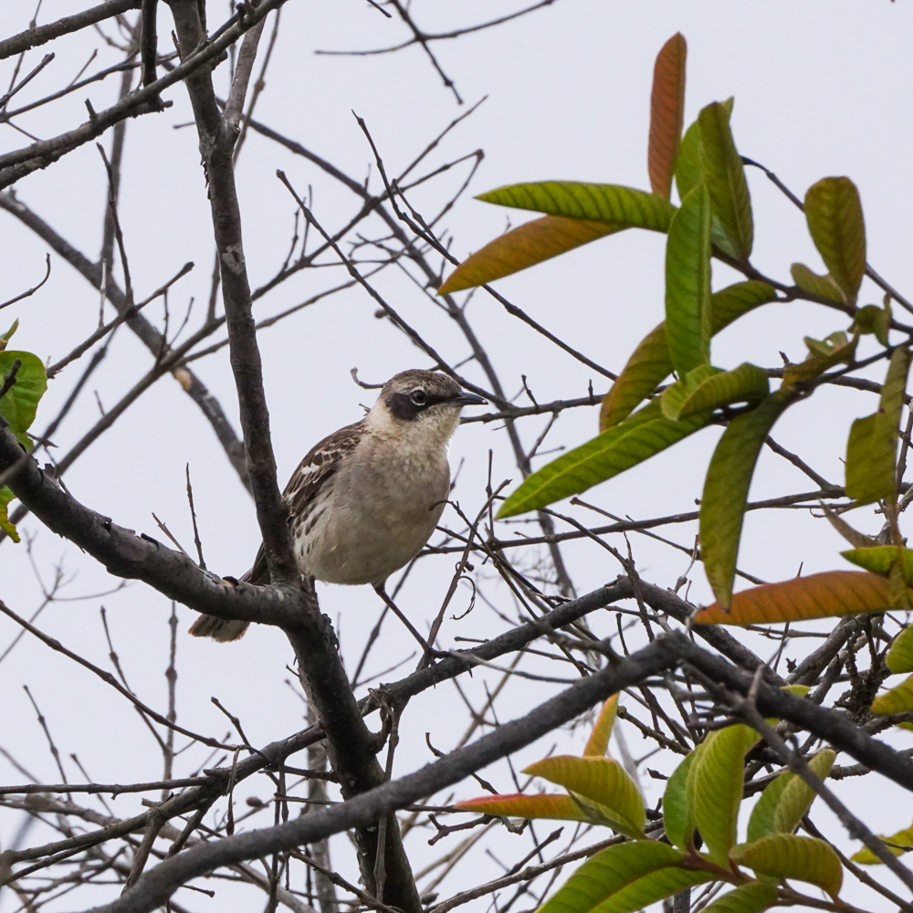
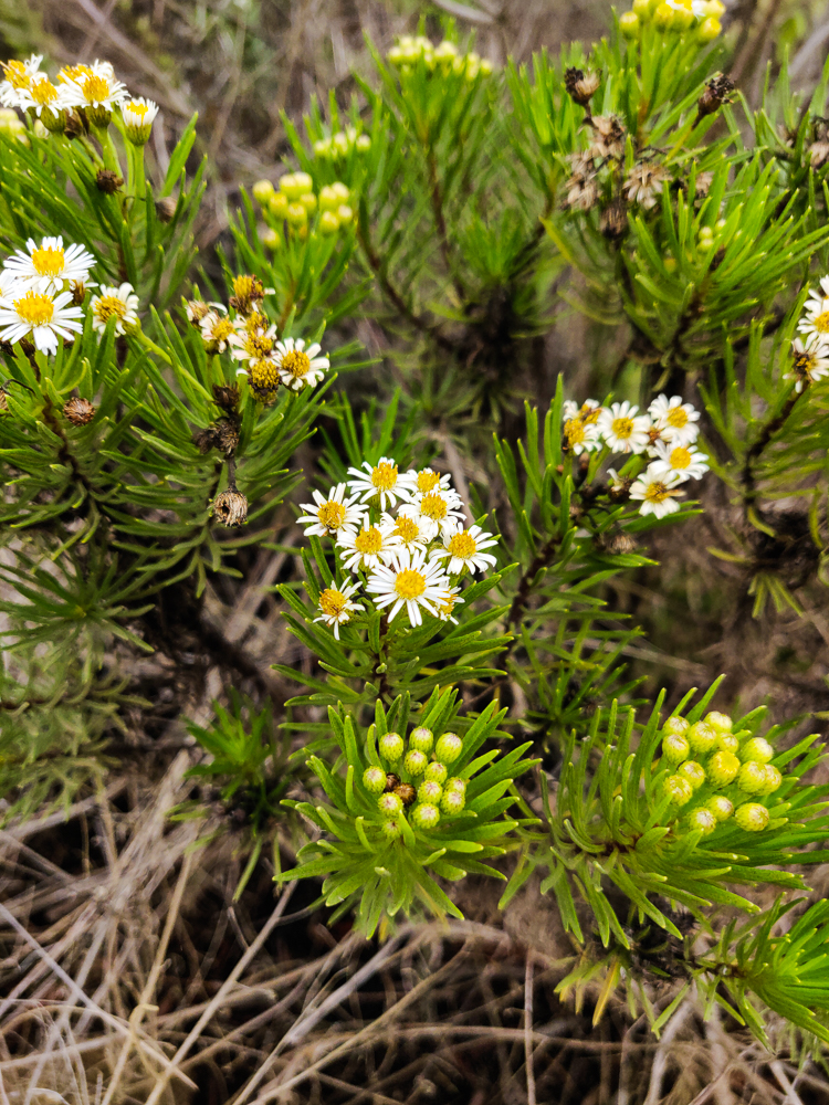
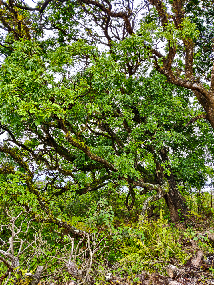
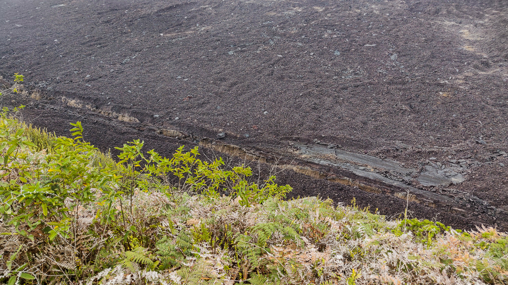
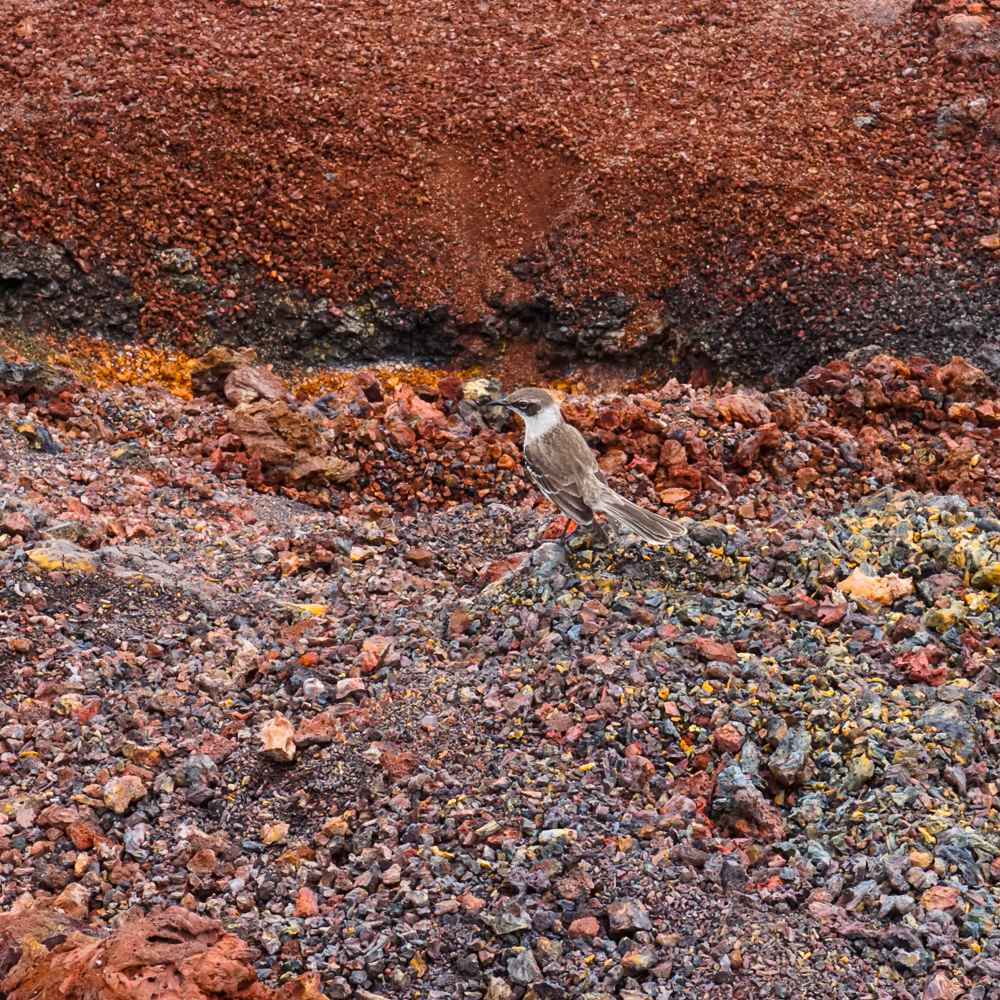
There was a decent amount of vegetation along the way, but as we moved farther up, it began to thin. Sierra Negra is the greenest on its southern slope, the windward side, because it gets more moisture thanks to the wind. That’s also where the Sierra Negra wild tortoises are mostly found. At the start of the hike, there were green, leafy plants and trees lining the path. By the time we reached the rim, there wasn’t much vegetation taller than I am, and the wildlife sightings were limited to a few little birds.

The blue pin is on Sierra Negra.
One of the only critters we saw during the hike
Flowers!
There were some big trees along the way

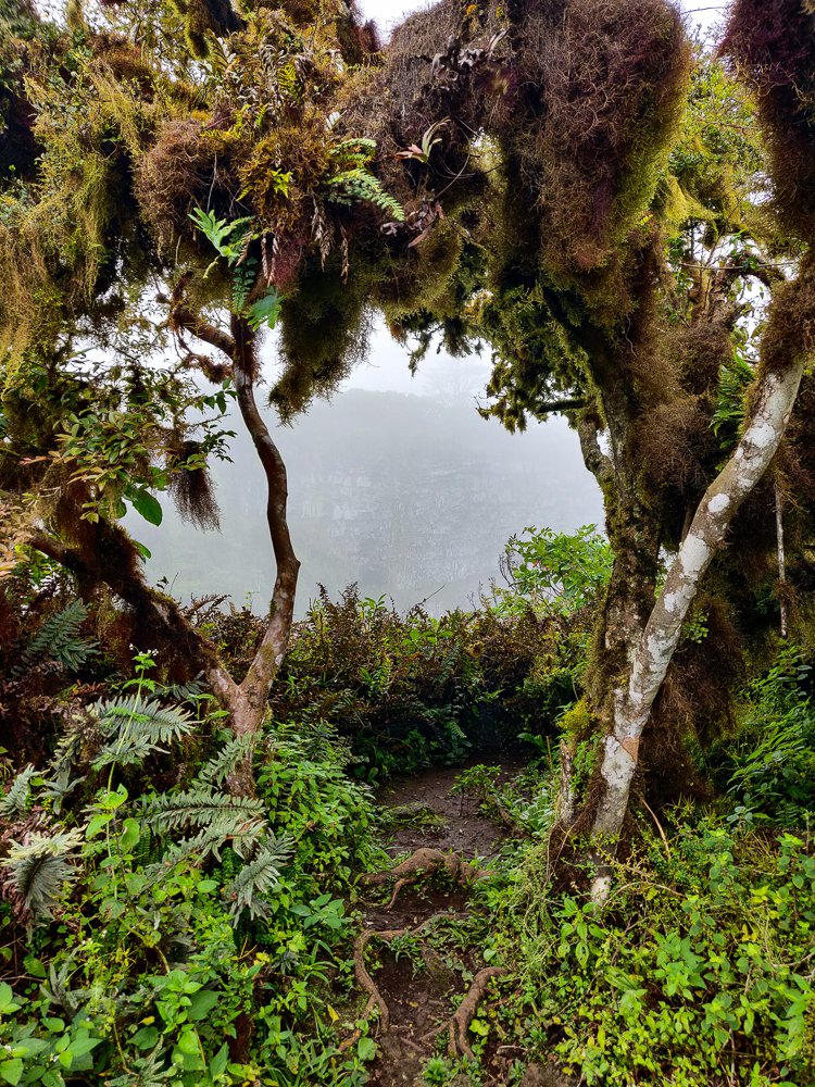
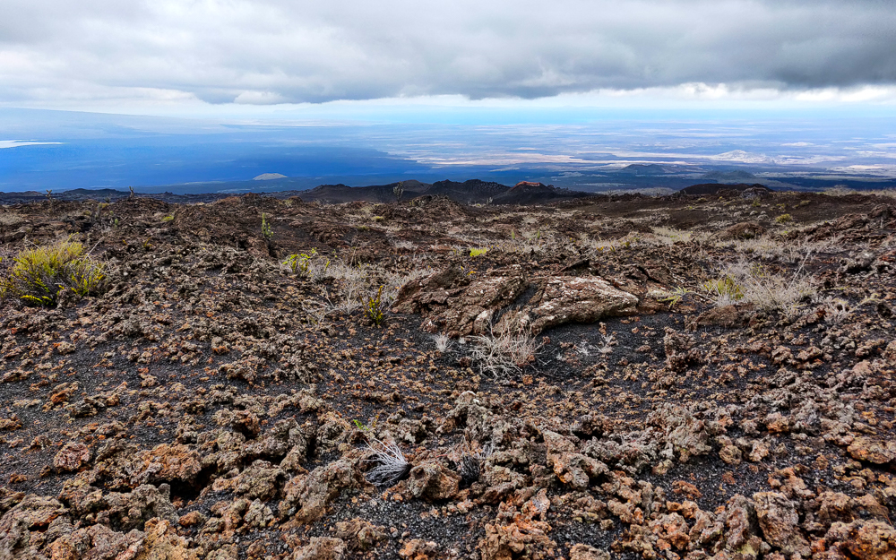
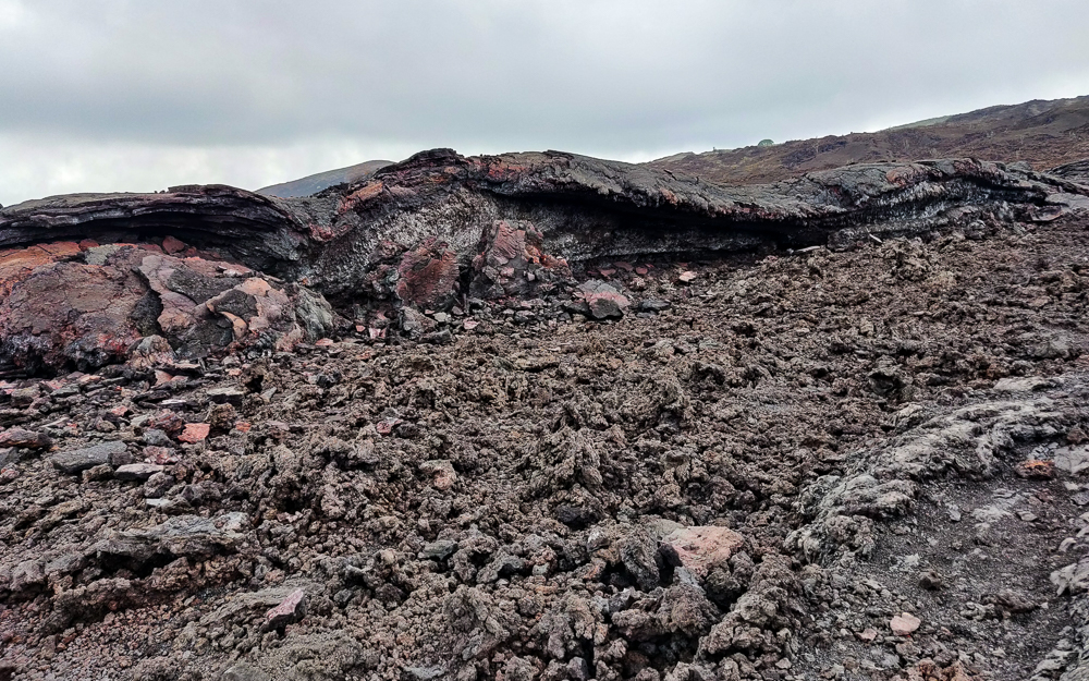
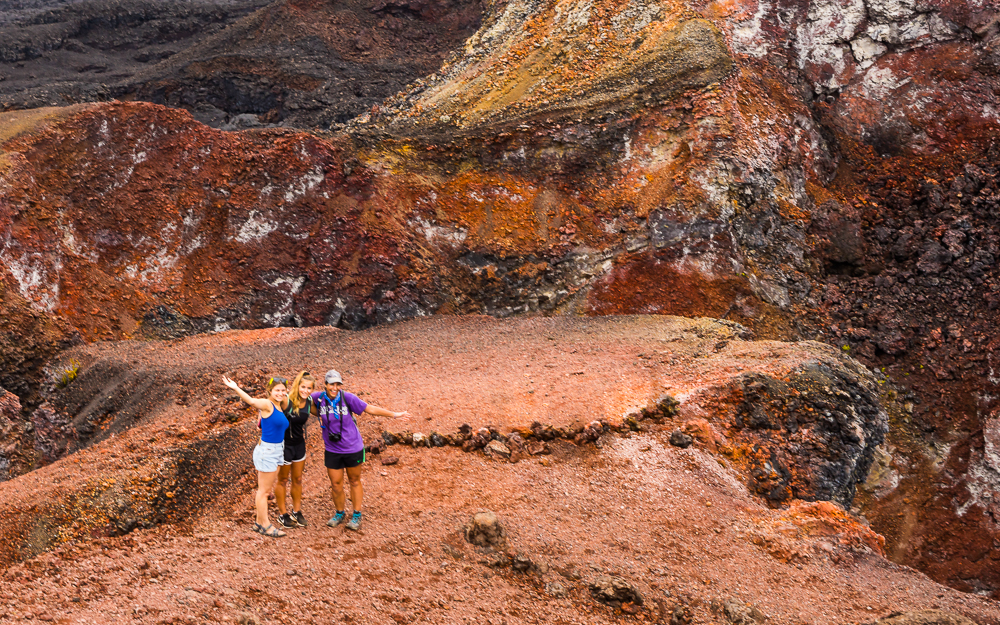
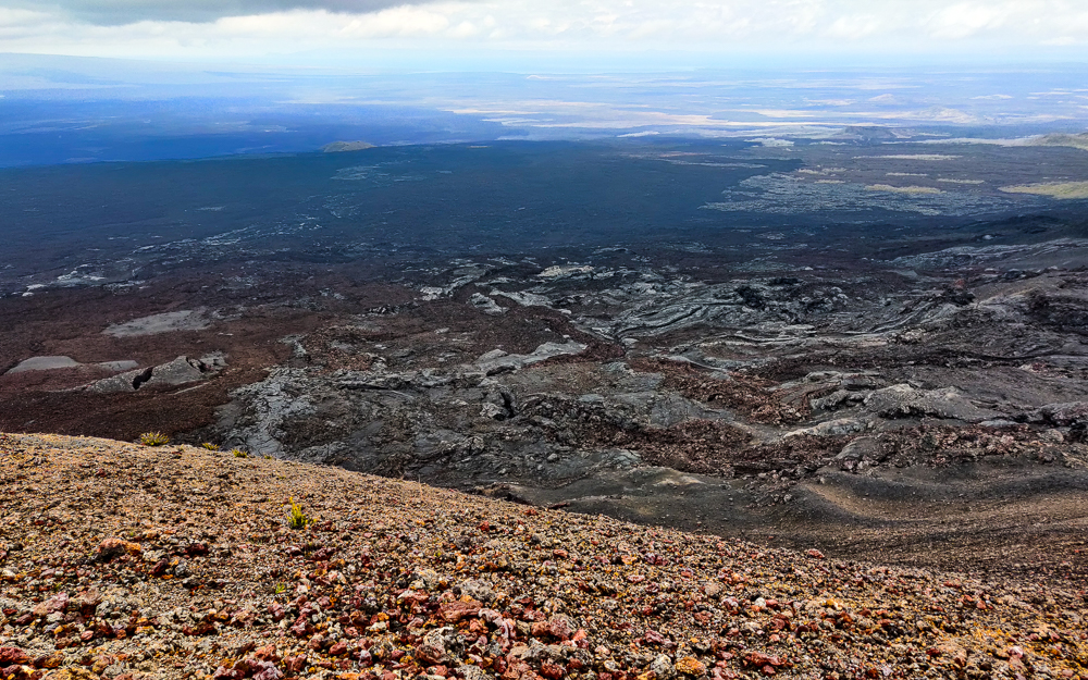
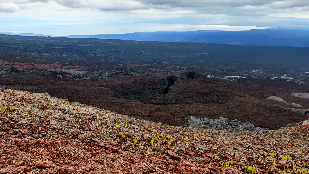
Our first view of the caldera was a bit jarring. We were lucky that it wasn’t too cloudy, giving us decent visibility to the other side… which was VERY far away. I mean, I know that I told you how big it is, but to stand there and see miles and miles of black lava rocks… it’s a strange sight.

Isn’t it amazing? The dark spots are cloud shadows
Shallow cliffs
The other side is so. far. away.
New lava from 2018

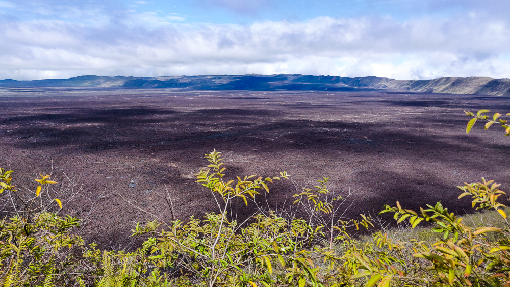
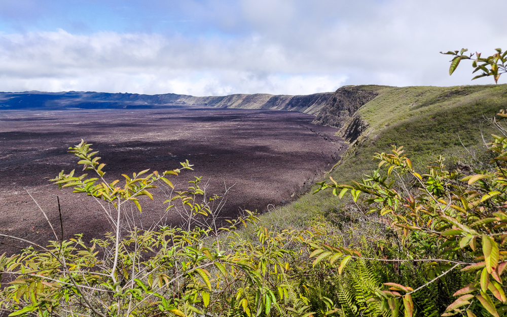
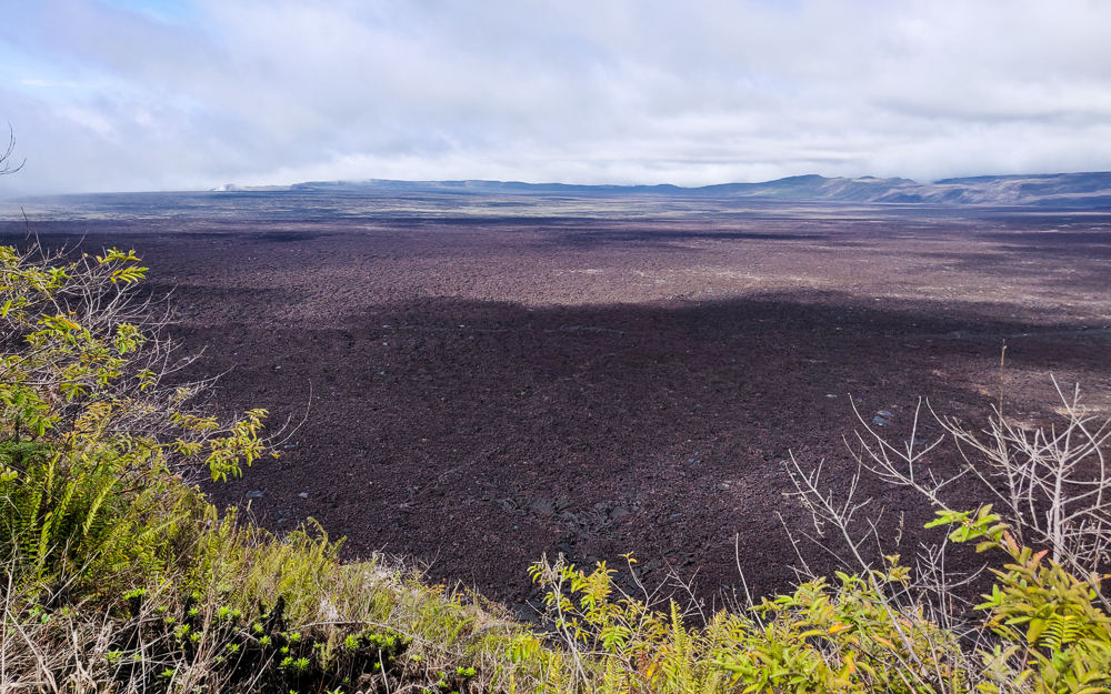
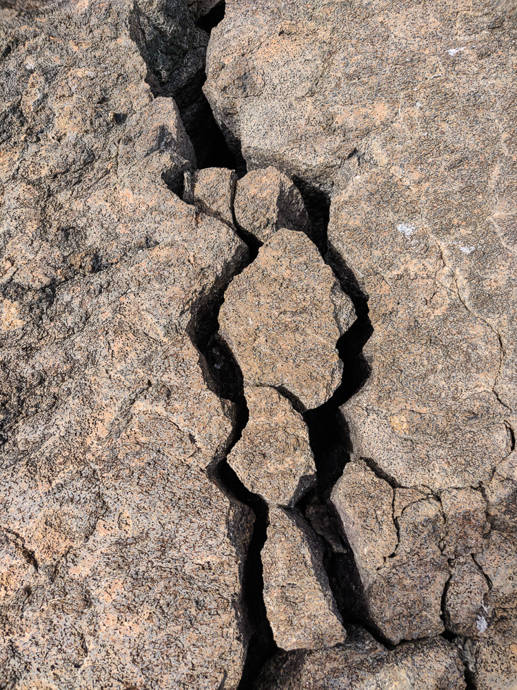
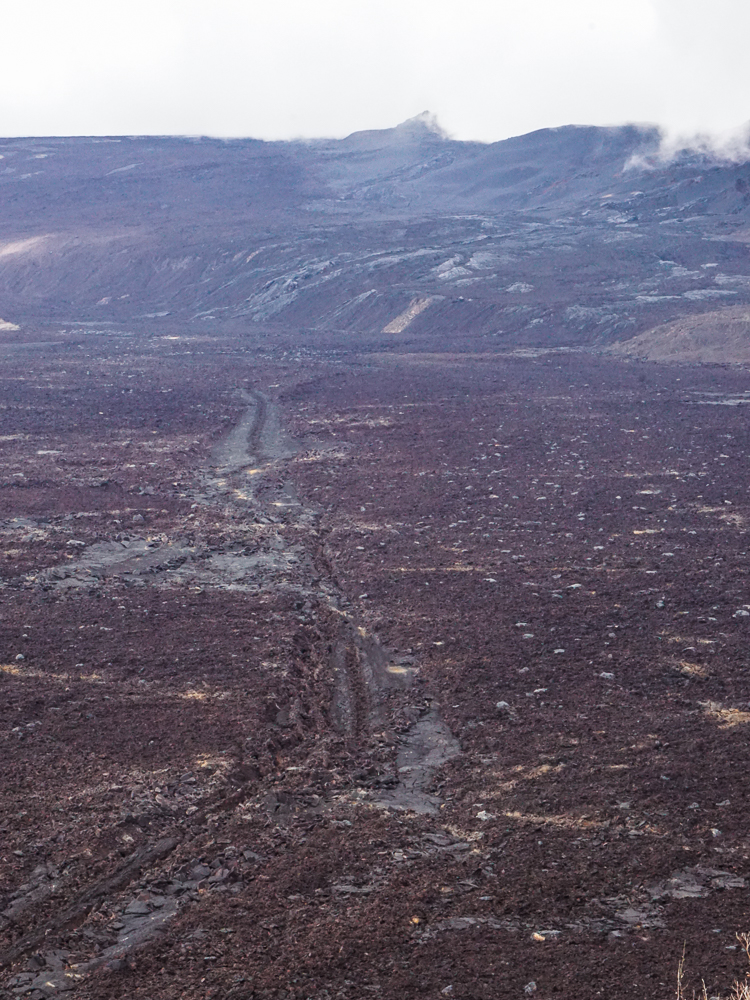
The guide told us that the lava patterns on the floor of the caldera tell the story of how it was formed. I’m not fluent in lava (and honestly, I had trouble paying attention to the guide), so I can’t tell you what they say, but it is interesting to see how much variation exists in something that, at first glance, appears somewhat uniform.

Some better views of the lava variations on the caldera floor
If I told you this was another planet, would you doubt me for a second?
There are a bunch of big cracks along the perimeter, like this one
Still some steam action going on
That’s quite a crack

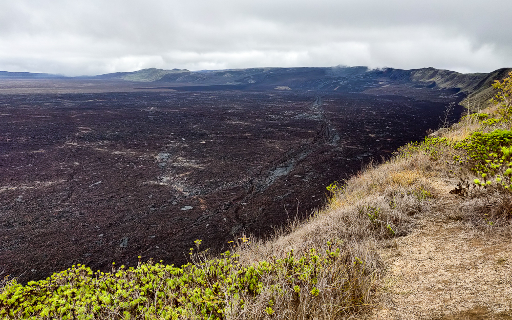
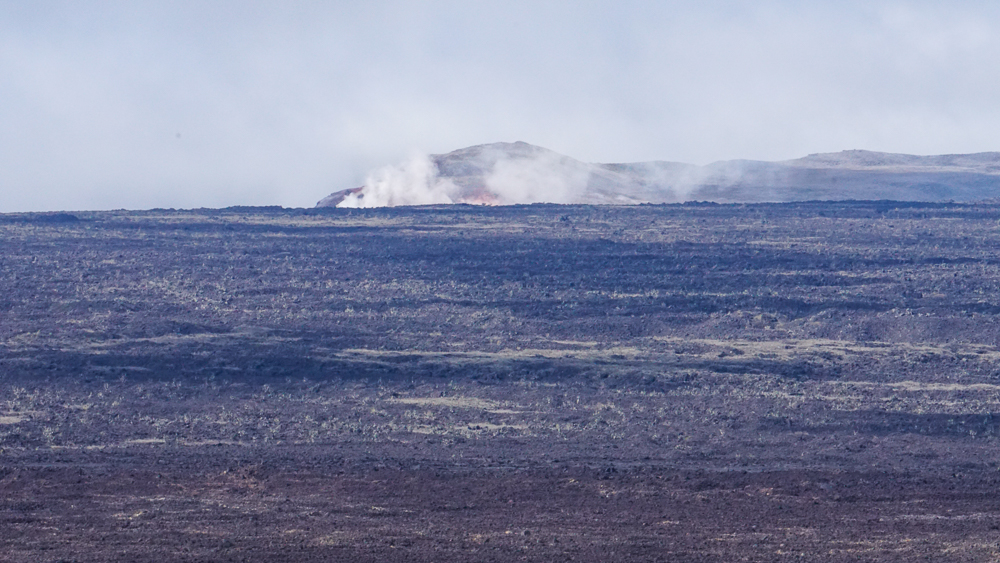
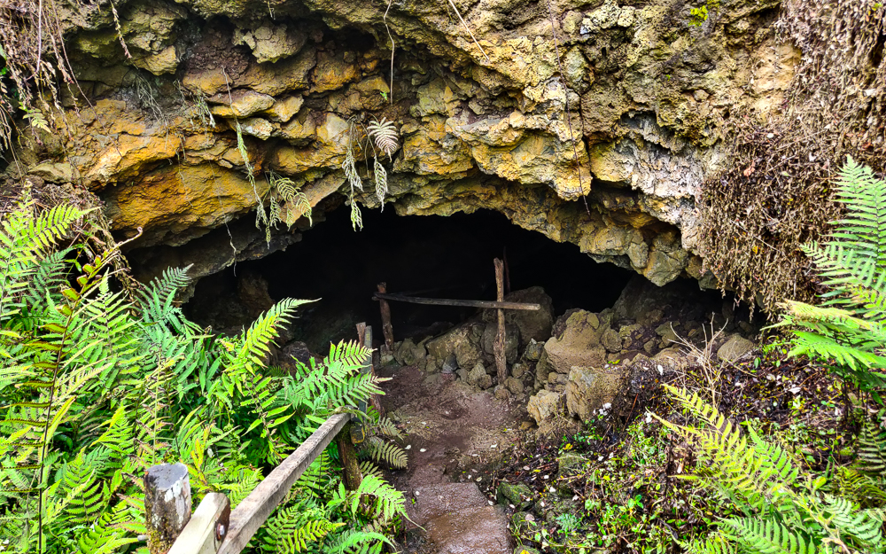
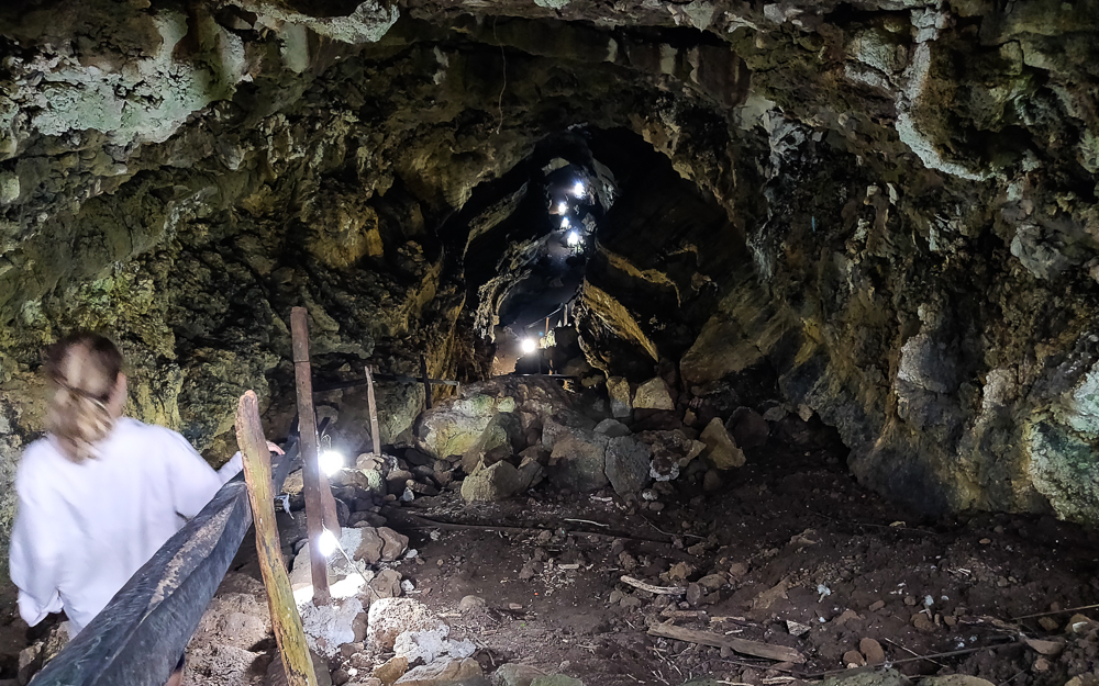
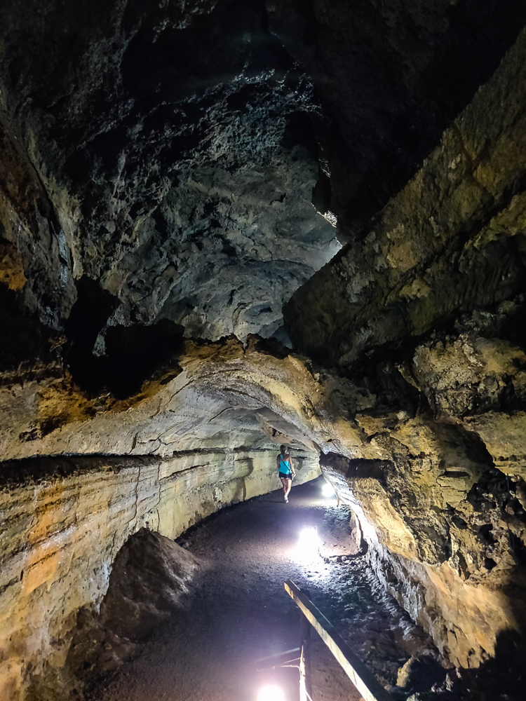
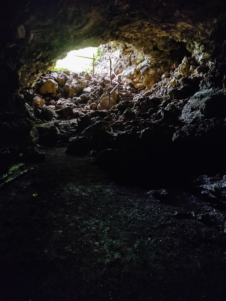
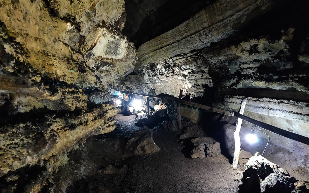
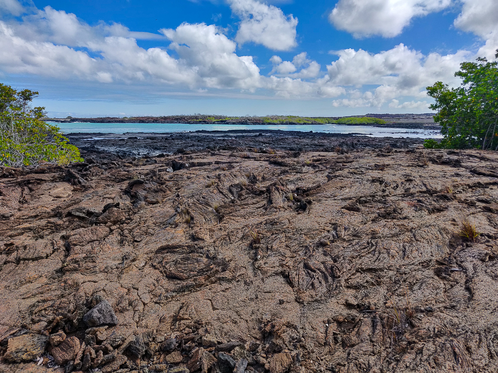
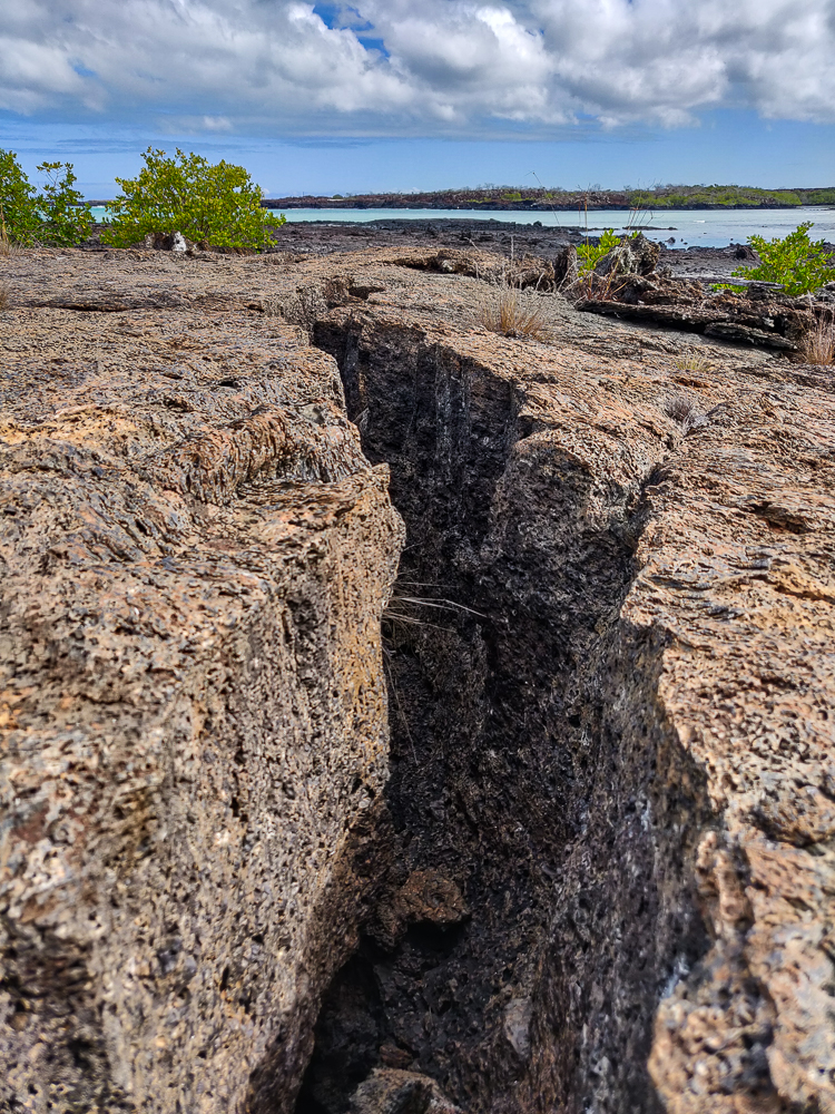
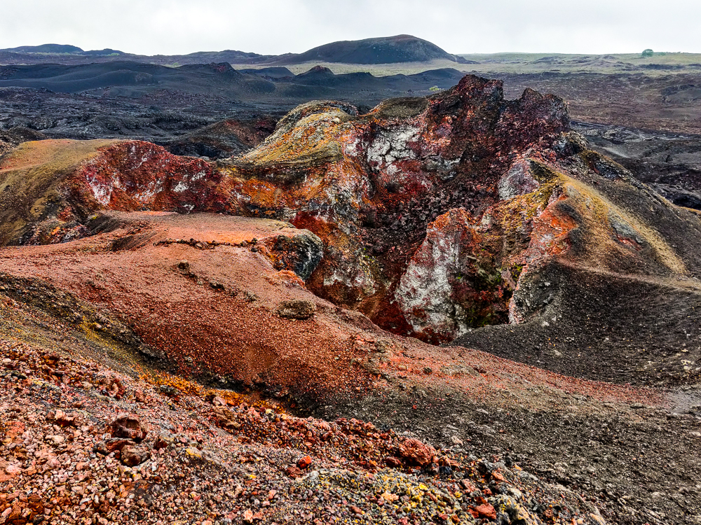
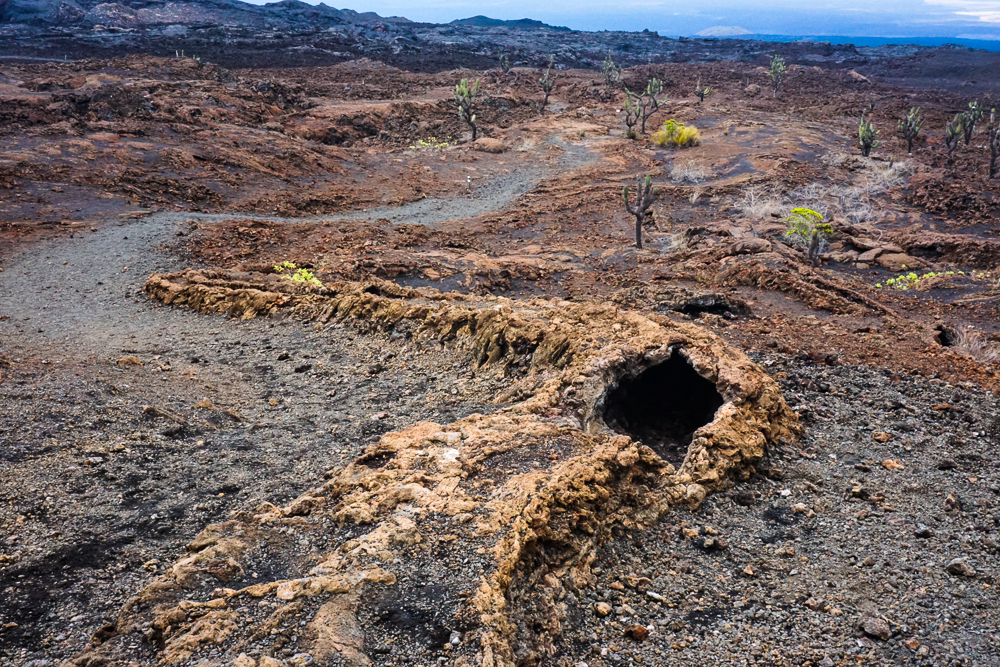
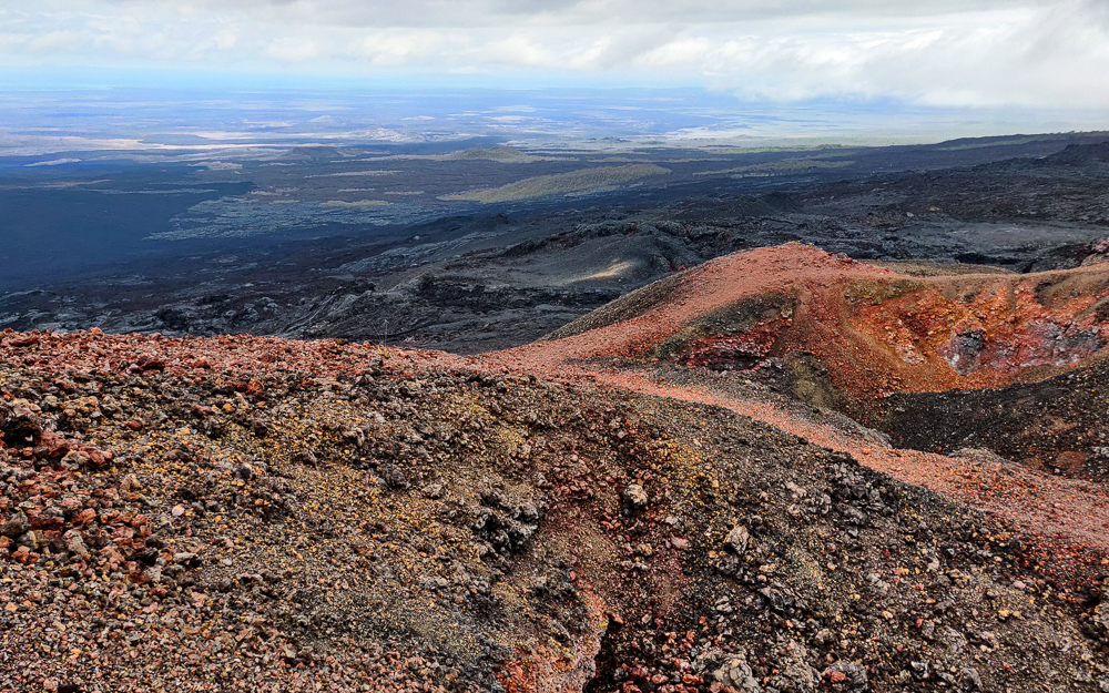
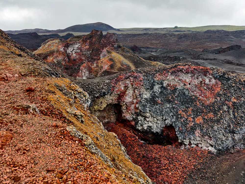
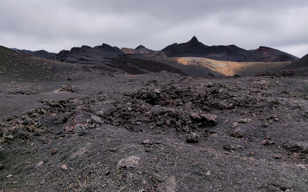
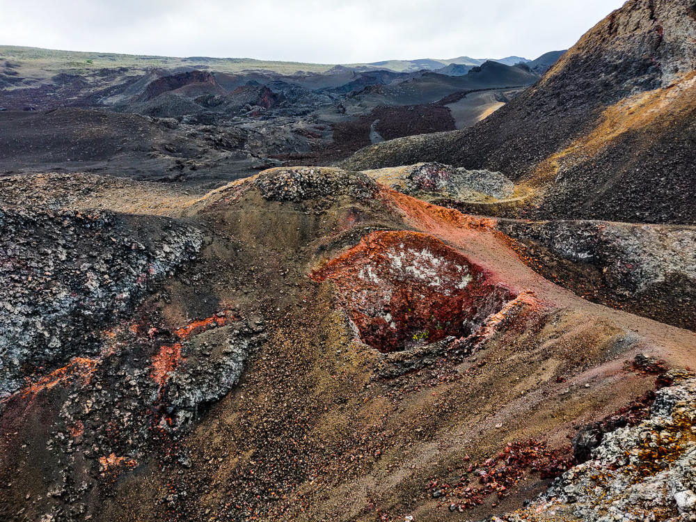
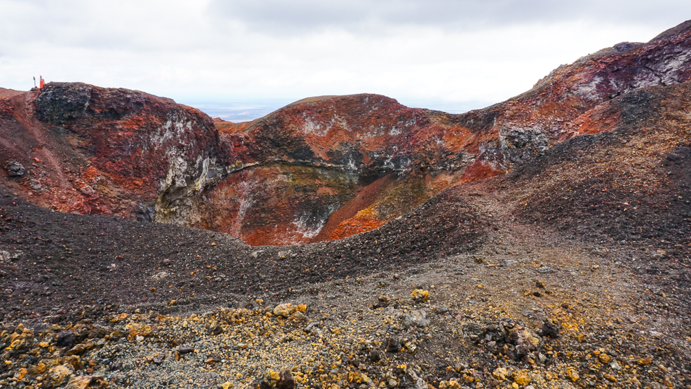
The caldera was cool, but without a doubt, the best part of the excursion was the lava fields. To the northeast of the main caldera, there’s a “parasitic cone” called Volcán Chico (Little Volcano). I’m not a big fan of that name… it sounds kind of gross. Alternatively called a “satellite cone”, it’s a location where lava escapes from fractures in the side of the volcano, outside of the main caldera, forming cone-shaped lava accumulations. The final leg of the hike took us through the lava fields to the cone of Volcán Chico.

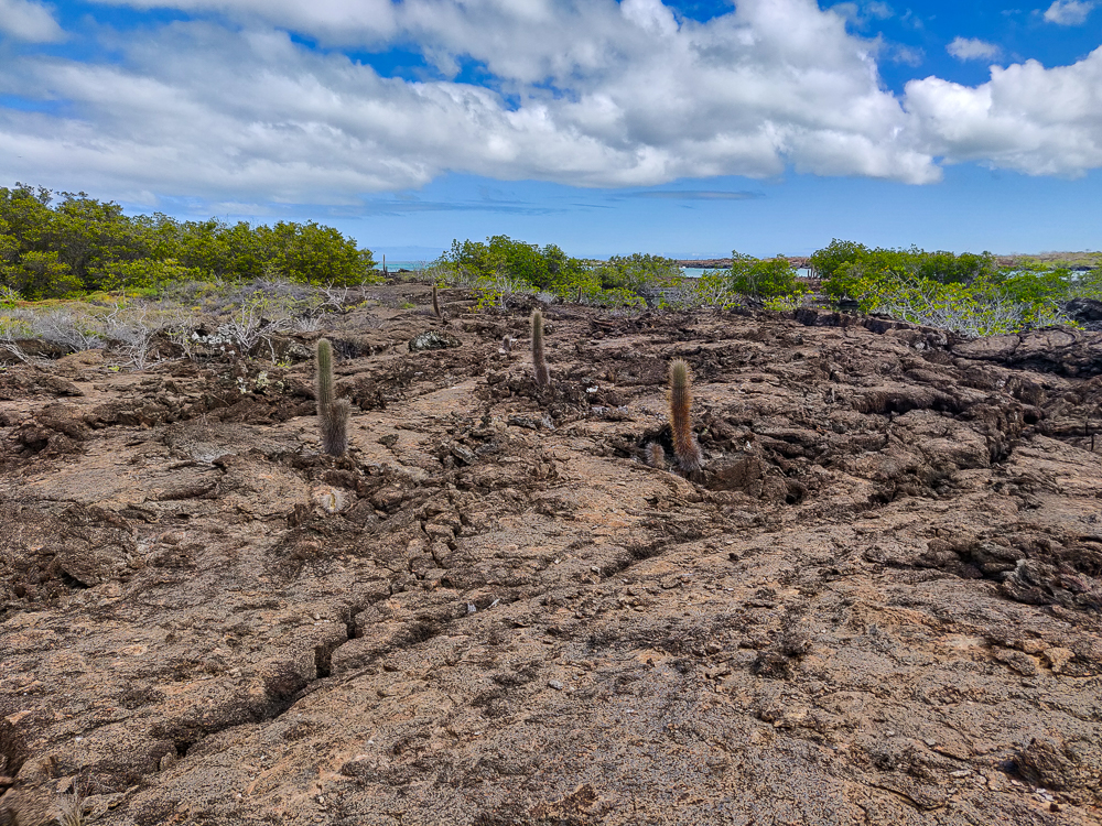
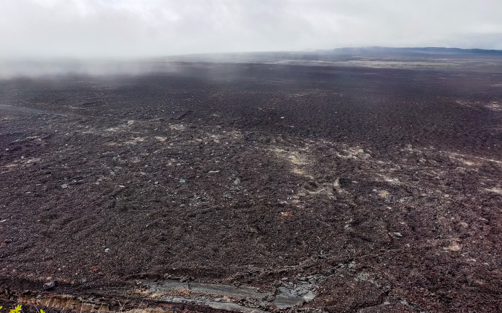
The lava fields are… thought provoking? That’s probably an uncommon assessment, but for me, they prompted a whole series of “THAT’S CRAZY!” thoughts. For example, Isabela is one of the youngest Galapagos islands. As I walked across the barren expanse of lava, I kept thinking about the fact that at some point, all of the islands looked like that. Seeing that made it even more amazing that plants and animals managed to survive and eventually thrive there. Like… there was NOTHING at the beginning. Now, some of the islands even have rainforests!

Lava fields
There is a little bit of life trying to pop up
What the heck is this place?
Another parasite cone

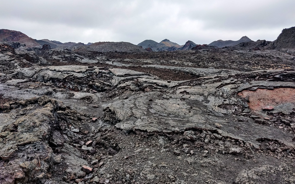
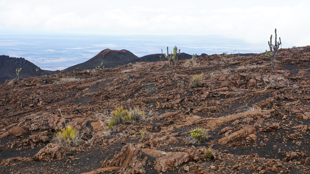
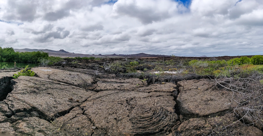
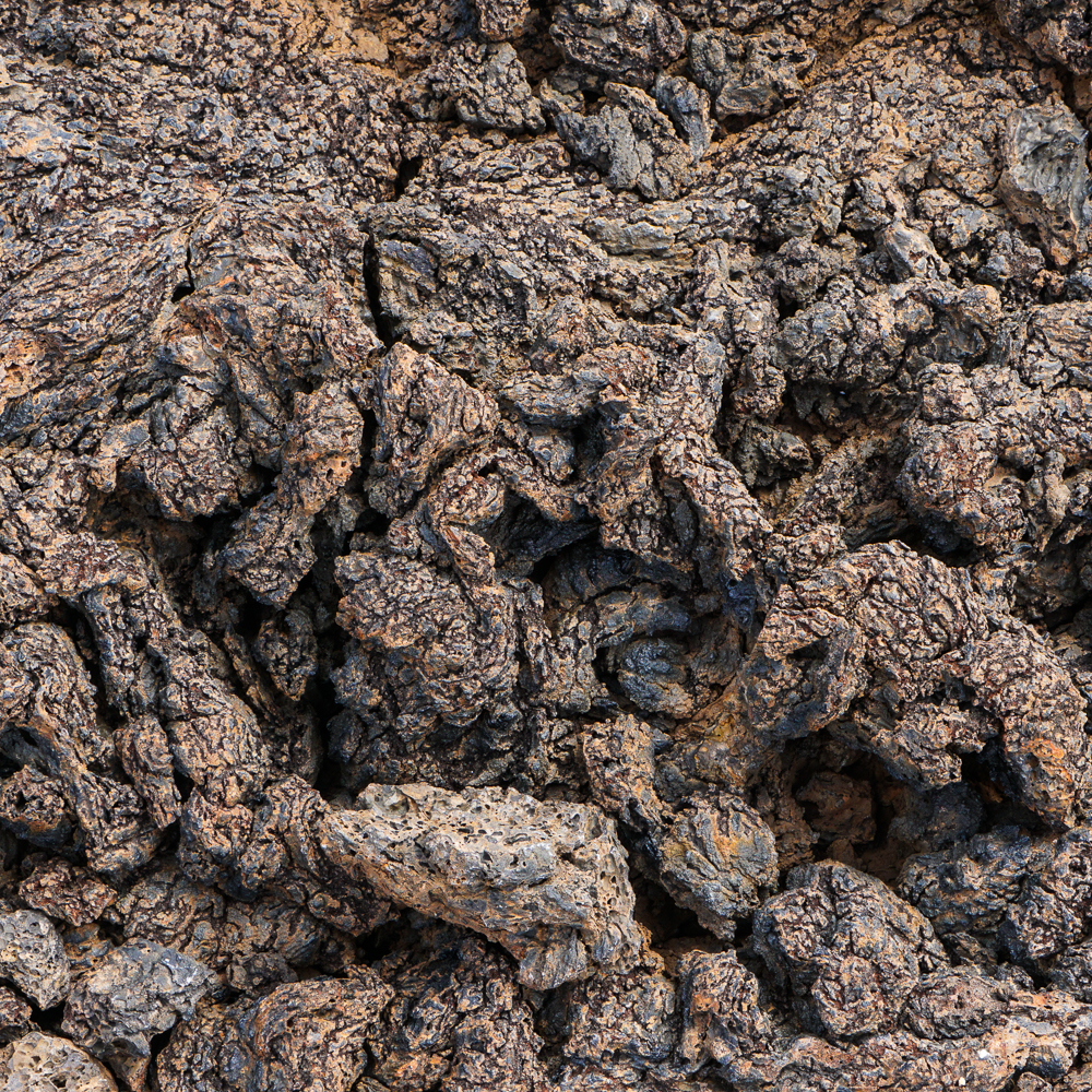
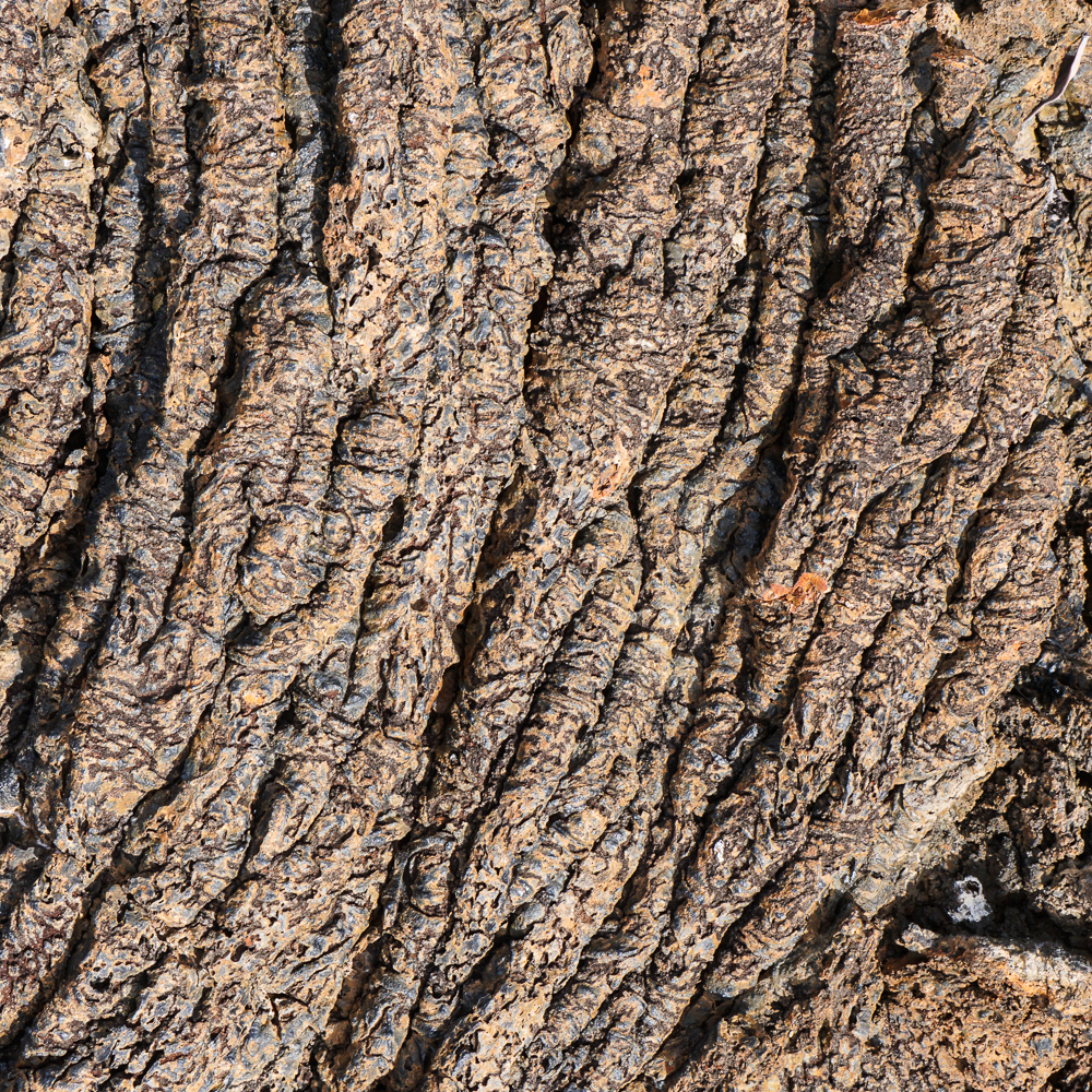
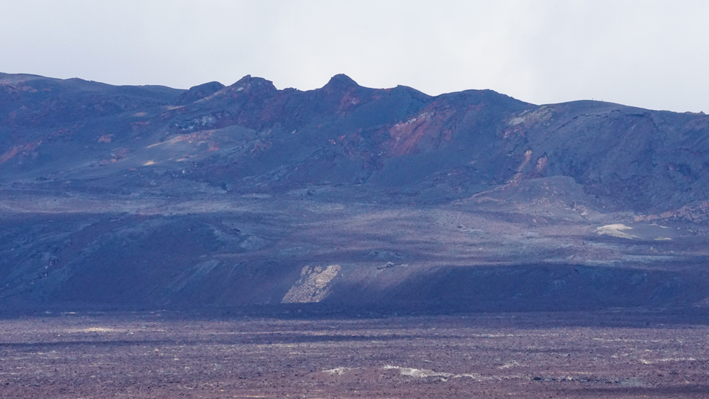
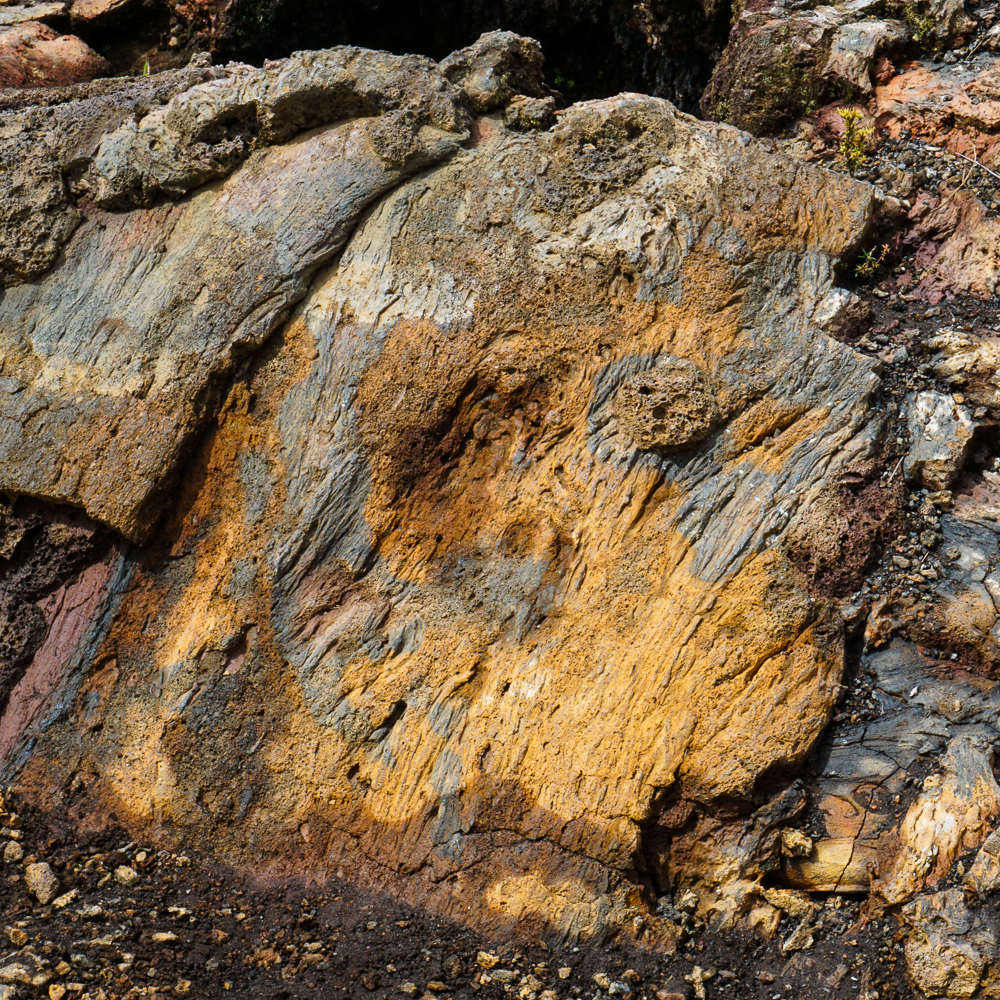
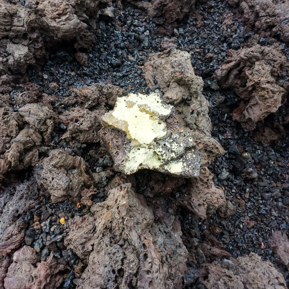
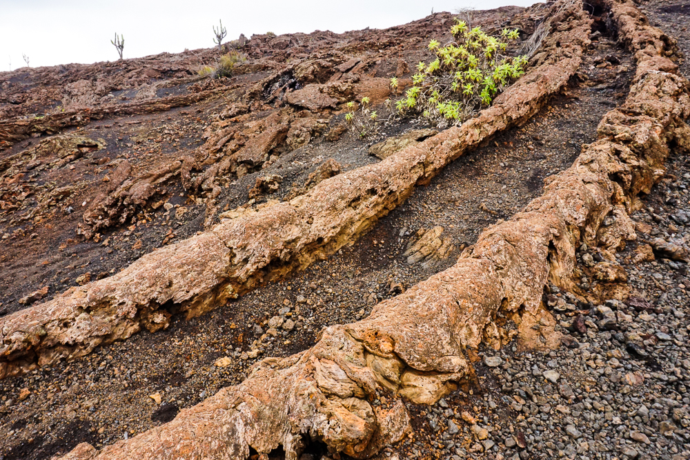
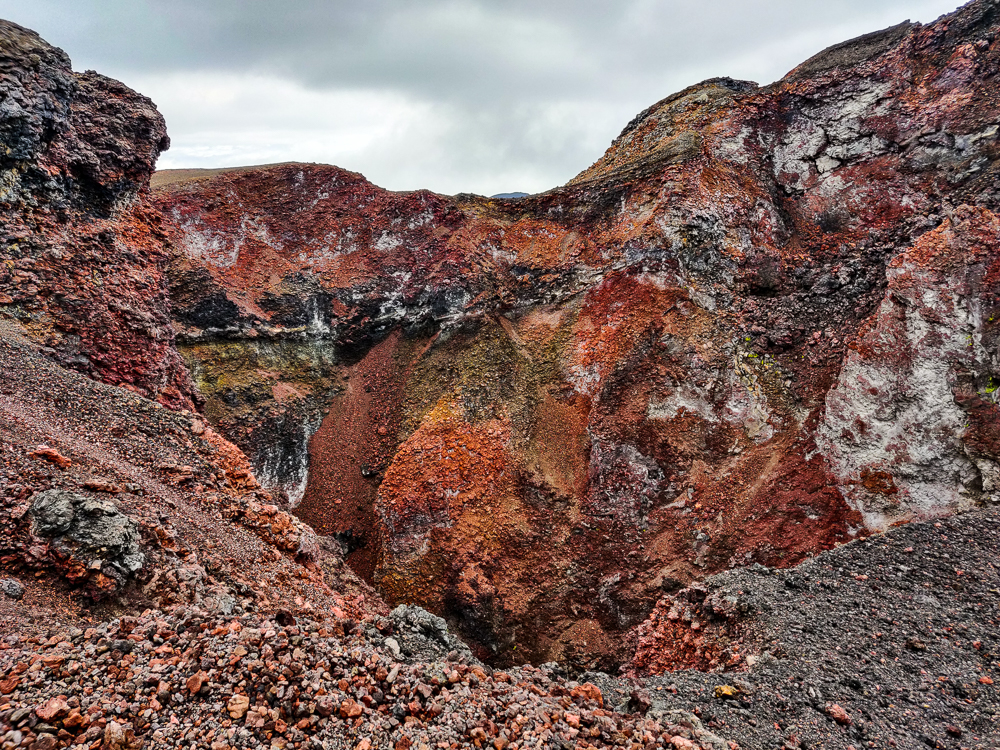
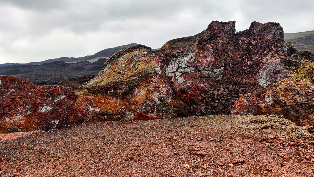
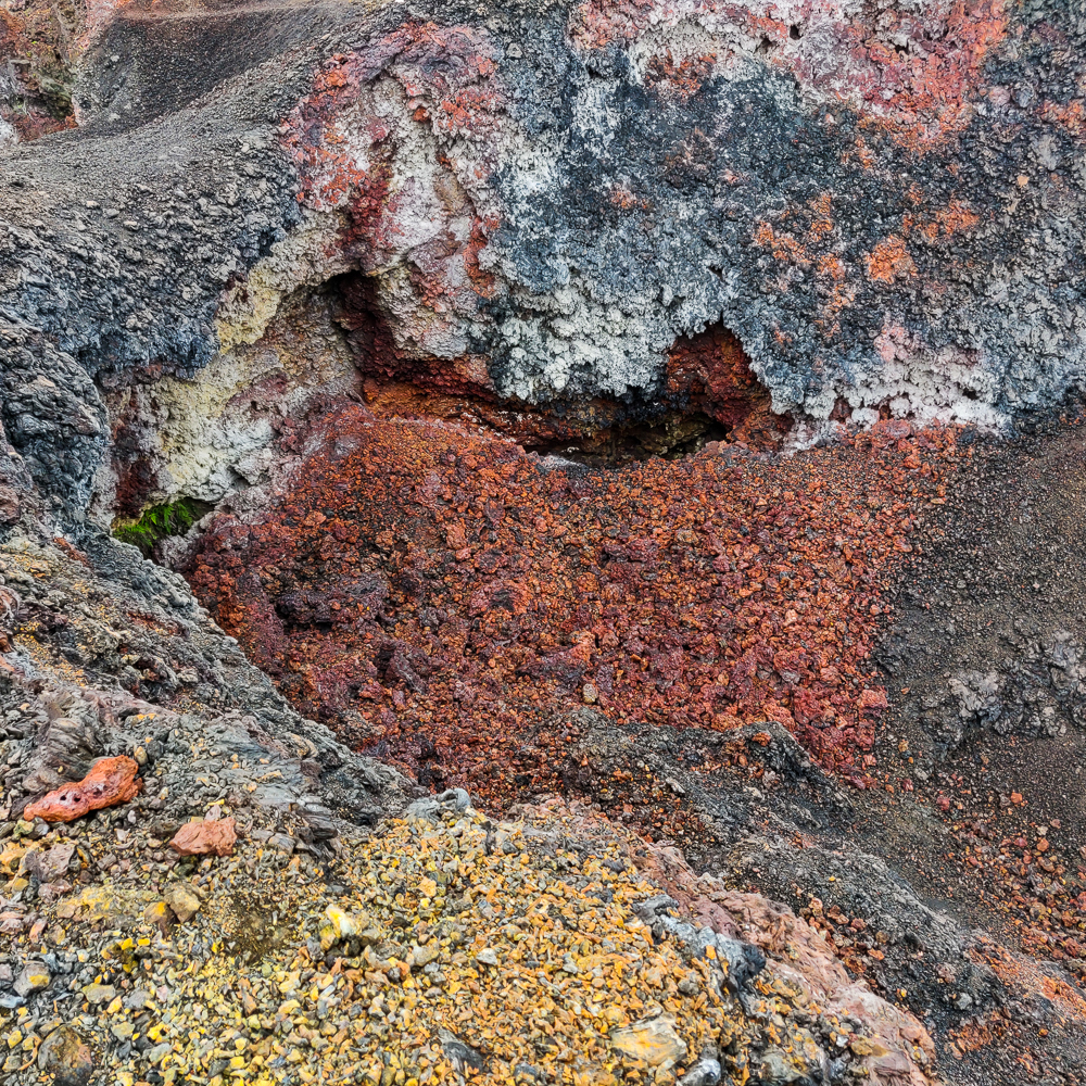
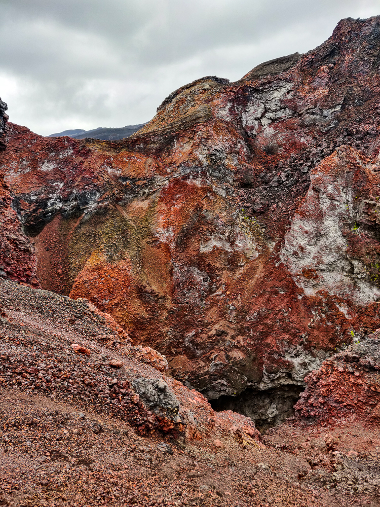
The guide pointed out various formations along the way and explained that the different colors of lava result from the oxidation of various minerals. By looking at the coloring, scientists can determine what lava came from which eruption. The least colorful stuff is usually more recent because it hasn’t had as much time to oxidize. I’ve seen a lot of lava in my life, but I can’t remember ever seeing so much color and vibrance. It was beyond amazing. And beautiful!!

The colors!
Eeee!!! So pretty!

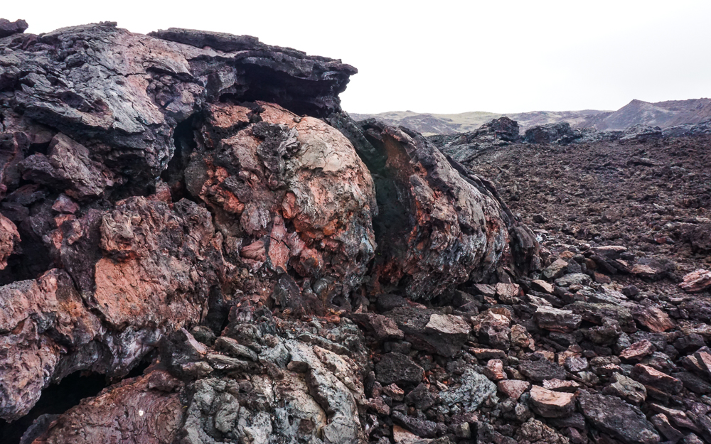
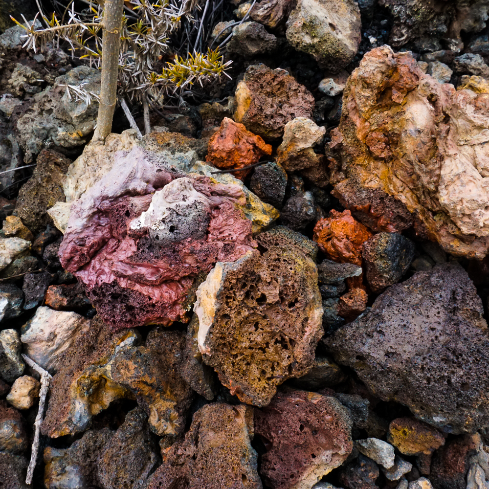
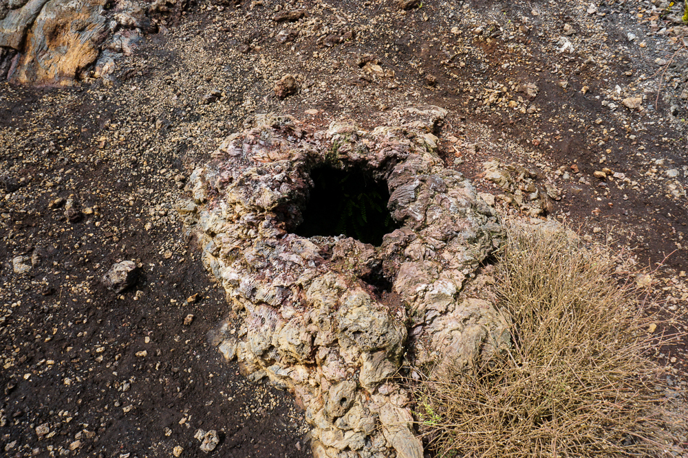
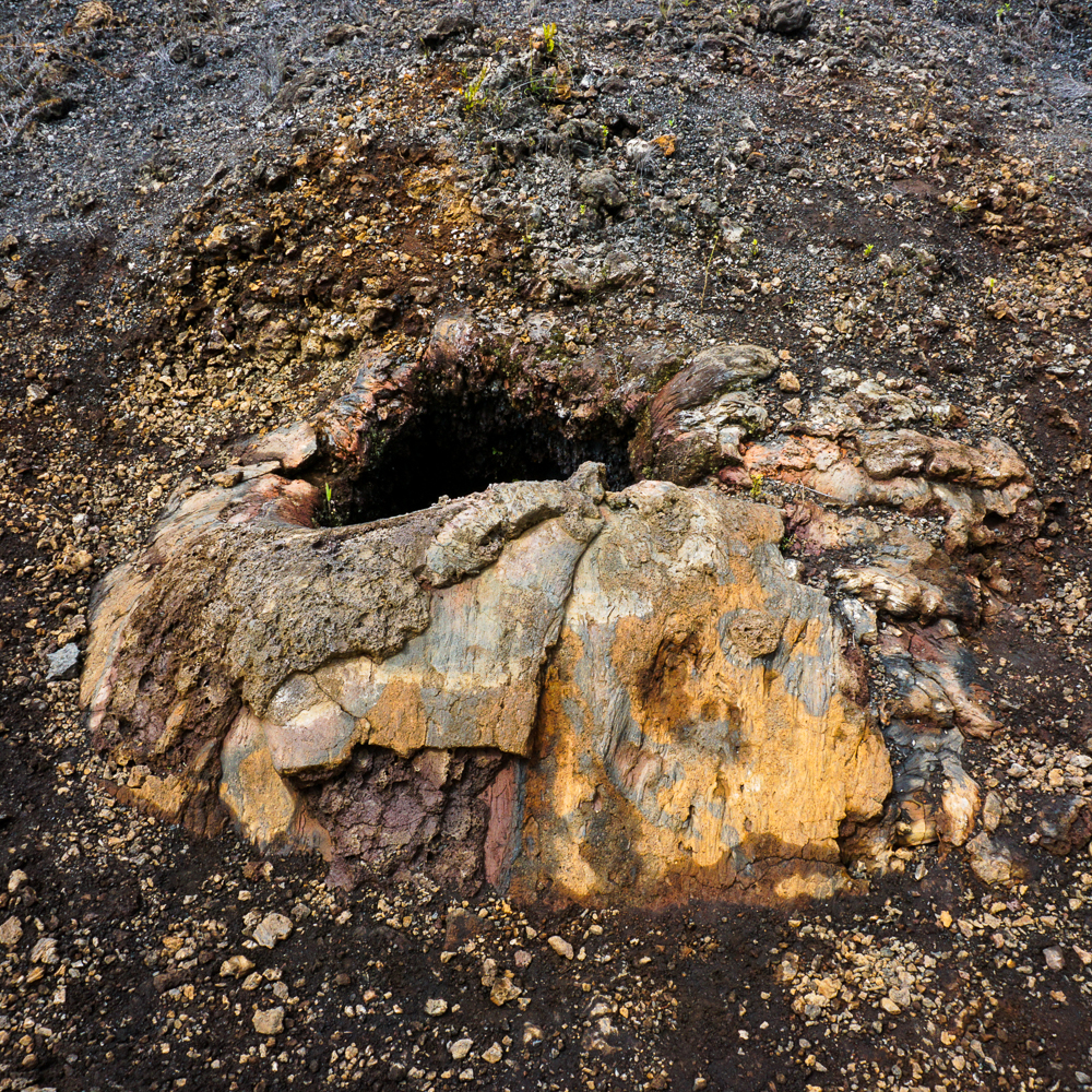
There are also natural vents across the landscape, places where you can hold your hand above a hole in the ground and feel heat coming out. It’s a little spooky to think that you’re feeling the heat of the Earth’s core. Eek! Also creepy is when you see a formation that looks like it could be water, frozen in time. It’s a bit of a reality check, like, “Hey! In case you forgot, this used to be FLOWING. Oh yeah, and it wasn’t water. It was MOLTEN LAVA.” Nope. No, thank you. You can keep that molten lava faaaaar away from me.

Natural vent
Another natural vent. Watch your step!
Okay so like I said, I didn’t do a great job of listening to the guide, but he was really amped about this material on the lava… I THINK it’s sulfur, but don’t quote me.
This looks like a wave in the ocean. Okay, now imagine it’s molten lava.
A partially-collapsed lava tube in the lava fields.
The other end of the lava tube.

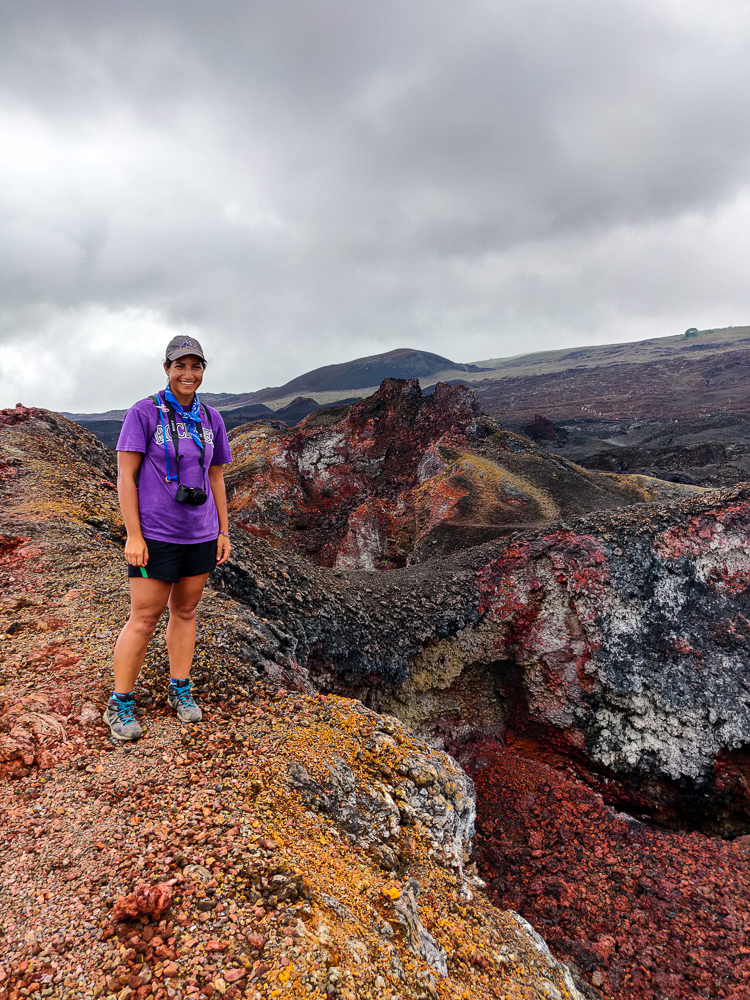
Finally, we reached Volcán Chico. The view is bizarre. You can see the northern part of the island, and it doesn’t look like it belongs on this planet. Elizabeth Bay is in the distance. The best part, though, is the COLORS around the cone. I’m not even going to attempt to explain it. Just soak in the amazingness of these pictures.

Sorry in advance for the million pictures that are nearly identical… except that I’m not sorry because they’re awesome and you have no idea how many I filtered out to end up with these million that I want to show you.
My head exploded
Contrast!
Lava rock confetti
Have you ever seen anything like this??
I look pretty happy in this picture, but I promise you that this doesn’t even begin to do my excitement level justice.
Happy happy happy
I just love it.
Then there’s this… black, black, black, GOLD!
It’s like a treasure trove of the world’s prettiest lava rocks
Mockingbird!
View from Volcán Chico
Cousins!
See the bay in the distance?

I’ll never get tired of these pictures.
Okay, last one.

The guides started herding us back to the bus before I was ready to go. It was like looking at really pretty fall foliage, where you wish that you could capture what you’re seeing and what you’re feeling and bottle it up forever, but since you know that you can’t, you want to stay as long as possible to try to imprint it in your brain and heart. You know? Orrr maybe that’s just me. But I guess I did an okay job because even now, I get that same feeling when I close my eyes and imagine that I’m back there, gazing out at the otherworldly landscape.

The hike back was mostly uneventful, but we did get to experience the massive difference in weather conditions between the lava fields and the volcano rim. In the lava fields, the weather was hot and bone dry. As we walked along the rim, it got wetter and wetter, and by the end, we were basically walking through a cloud. And I’m sure that at that same moment, the lava fields were just as hot and dry as when we left them. It’s all about the wind/topography/it makes my head spin!

Much foggier view than on the way up!
A nice panoramic photo that absolutely does not do the caldera justice. But I had to try.
Now it really looks like another planet

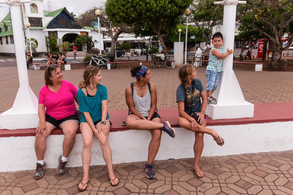
We were exhausted when we got back to town, but since it was New Year’s Eve, we went to sleep early and set our alarms for 11:30PM so that we could check out the happenings in the main square. I was only about 20% sure that we would actually wake up, but amazingly, we all dragged ourselves out of bed and joined the festivities!

Ecuador has some funky New Year’s traditions. People make effigies, either of actual people or characters or something that represents the previous year, and at midnight, they’re set on fire as a sort of cleansing ritual before the new year. You know, on our early morning bus ride to the volcano, I thought that I saw a roadside stand filled with paper mâché heads, but it seemed too weird to be true. I assumed that I was out of my mind because it was so early. Nope! Most families make an effigy, and they need to get their heads somewhere!

There were some bigger scenes prepared to be burned at midnight as well… this depicts an incident that occurred at the end of 2019 when a crane unloading a generator from a boat collapsed, spilling hundreds of gallons of oil into the ocean. Obviously, oil spills are never good, and in a place like the Galapagos, they have the potential to be extra bad. I think they contained it really quickly and minimized the damage, but still. Not good.

Here’s a video of the post-midnight mayhem, and you can see different people coming up to toss their effigies on the fire.

After that, we tried to go back to sleep, but our hotel’s great location near the center of town meant that we could hear the New Year’s party going on into the not-so-wee hours of the morning. I think I fell back asleep when it stopped at around 5AM. Ugh.

Related Posts

Iceland Lava Rocks – okay, not the official name of the post, but if you want to see more cool lava colors, check it out!

Perito Moreno Glacier – for a completely different otherworldly landscape, do some glacier trekking!

Mount Aragats – speaking of volcanoes, why not visit Mount Aragats, the volcanic crater that gives Armenia its tallest peak?

We had one “free day” worked into the schedule while we were on Santa Cruz, and like before, that didn’t mean “do nothing day”. My aunt had a whole list of things that we could see on the island without a tour, so we plotted a route and headed out for another very long day.

Here’s the location of Santa Cruz in relation to the other Galapagos Islands! It’s the second largest island, about 20mi/32km wide x 25mi/40km long.

Santa Cruz is the second largest island in the Galapagos archipelago and is a “shield volcano”, like many of the other Galapagos islands. This means that there wasn’t an explosive eruption that formed it (exactly what it sounds like/what you likely imagine when you think “volcanic eruption”). Instead, there was an “effusive eruption” which means that low-viscosity lava flowed steadily for a period of time. Since the lava is extra “flowy”, it spreads out farther and results in a land mass with a much more gradual slope than would result from an explosive eruption. So lava steadily accumulates in layers, building a short and flat-ish island, called a “shield volcano” because it has a similar shape to a round shield lying on the ground.

It’s a very ecologically diverse island, the only one in the Galapagos with six different vegetation zones. I was amazed once again by the difference between the coastal areas and the highlands, but we’ll get to that later. Anyway…

On the way to our first official stop of the day… Puerto Ayora had some very thematic Christmas decorations. I guess the reindeer get a little help from the locals when delivering presents to the islands!
Also, I know that I wasn’t at the birth of baby Jesus, but I don’t know about this rendition… Sea lions, frigatebirds, tortoises, and blue-footed boobies? (Also, the green and brown stuff on the ground is broken glass. There’s a lot of interesting recycling happening on the islands.)

Our first stop was the local fish market. This is where the fishermen bring in their catches, and there are big, concrete tables where they’re sorted and prepared for sale. If you like fresh fish or lobster, this is the place to be. I personally don’t like fish, fresh or otherwise, but I do always enjoy watching people at work (in a totally non-creepy way), skillfully going about their business. The major tourist draw is the photo op, of course. The fish attract all kinds of critters hoping for scraps… sea lions and an assortment of birds that hang around and, if they’re feeling especially cheeky, try to snatch fish right off the tables. The fish attract the birds, the birds attract the people, and you’ve got yourself a crowd!

Lobsters! Lobster fishing is strictly regulated in the Galapagos. The season lasts from September 1 – December 31 each year. These are red spiny lobsters and are the variety most commonly found in the Galapagos.
Taking pictures of tourists taking pictures of this lady doing her job.
Sea lion trying to get some pity scraps. This lady isn’t buying it.
Breaking the two-meter rule (only once, I promise!)
Blue heron near the fish market
So pretty!
I liked his reflection
This pelican was loitering as well

We weren’t there at prime time, so things were pretty quiet. That was fine with me! When everyone was ready to move on to the next adventure, we headed for the dock. Our destination was “Las Grietas”, or “the cracks”, which is a deep crevice that was created when the lava forming the island cooled and contracted. This particular crack falls at the junction of an underground river and the sea, so it’s filled with brackish water (mix between fresh and saltwater). There isn’t a large, clear passage to the ocean, but there is enough space for water and fish to trickle in. No sharks, though!

We passed this funky house on the way to the dock!
No clue what this kid was doing, but apparently we were all entertained by it (pic by my uncle)

The only way for a human to get to Las Grietas is through a boat ride/walking combination. You can’t drive there. You can’t walk the entire way. You can’t boat the entire way. You take a water taxi from the main dock in Puerto Ayora, cross the harbor, and walk about 30 minutes from there. You can also take a boat a liiittle farther and save yourself maybe 15 minutes of walking, but then you still have to walk the final stretch.

We passed these salt mines along the way! Saltwater comes in with the tide and fills the area, and after the water evaporates, people harvest the salt that gets left behind (you can see the white rings of salt around the pools in the picture).
With my aunt and cousins and some pretty flowers we passed on the walk (pic by my uncle)
Las Grietas! (The first pool)

Las Grietas is about 330ft/100m long and consists of three “pools”. As I researched, it seemed like everyone (everyone who seemed even mildly adventurous, that is) agreed that you should absolutely go all the way to the third pool. My uncle, cousin, and I geared up in our fins and snorkels and headed down a set of wooden stairs to the first pool. This is the biggest one (at least in my estimation), and it’s crowded because that’s as far as most people go. Not us! There’s not much to see in the first pool, so we swam to the end pretty quickly. From there, we climbed over a section of slippery rocks (only falling once… eh, maybe twice… but always very gracefully, of course) into the small, rocky, shallow second puddle (it’s way too small and shallow to be called a pool, so I’m amending the name). If I didn’t know better, I would have thought we’d reached the end. But no.

To reach the third pool, you can either climb over some large boulders or swim about 5 feet through an underwater “tunnel” beneath them. The tunnel route is way easier, but at the time, we didn’t know that was an option. (I think it’s semi-common knowledge, so I’ll take the blame for that intelligence failure.) We only found it by chance. At the rocky transition from the first pool into the second, I tossed my fins ahead so that I could use my hands as I crossed over the rocks… and when I reached the puddle, one of them had vanished. Uh oh. They’re bright orange floating fins, so I knew it had to be on the surface, but then why couldn’t I see it?? After some minor panicking and intense searching, I found it wedged between two rocks. There was clearly a current that carried it there, and a quick peek underwater revealed the tunnel! So, it was two exciting discoveries in one. I got my fin back, and we found an easier route into the third pool! My uncle had already scaled the boulders to get there… whoops! But at least the return trip was easier.

Well, it was quite the journey, but we finally made it to the third pool. It’s slightly smaller than the first, but we had it all to ourselves. It was awesome. The water was incredibly clear and calm, all the way to the bottom, maybe 10-15ft (3-5m) down. As soon as we passed that last boulder wall, it was like the world around us ceased to exist. Underwater, the silence was the ear equivalent of being in a pitch-black room. And then the fish! Everyone said that there’s not much to see underwater, but I disagree. Sure, there were no sharks or turtles, but there were a few schools of BIG fish cruising around… like at least a foot long (30cm), and many of them were probably bigger than that. The best part was that they were almost completely unfazed by us. I dove down and swam along next to them. They looked surreal… like they were mechanical fish or were too three-dimensional to be real. And just the general ambiance… I don’t know exactly how to explain the feeling, but from now on, if I need to imagine a place where I feel completely at peace, I’m going to be there, suspended on the surface of the clearest, quietest water with hyper-realistic fish gliding by.

We had the pool to ourselves for a while, and it was glorious. By the time another group showed up (and completely shattered the serenity), we were about ready to go anyway. We made our way back under the boulder, through the puddle, over the slippery rocks, across the first pool, and up the stairs (which were now about a million degrees after baking in the sun… and I had no shoes at the bottom so that was really great planning on my part).

Me with my bright, floating fins
Loving life. I didn’t bother taking my waterproof case-equipped phone, so all of these pictures were taken by my uncle or cousin
GIANT fish hiding in the rocks along the edges of the third pool. I glimpsed something light as I swam by and got in closer to investigate. I’m a terrible estimator, but he MUST have been more than 2 feet long (60cm). I think. And I know I said that I didn’t take any pictures, but for this one, I borrowed my cousin’s camera and got right up in this fish’s face because it was too dark to see it very well at the time, and I really wanted to know what he looked like.
Just looking at this picture is making me all sorts of calm
Okay just one more picture (also because I have practically no pictures of me from this entire trip, so here are 90% of them in one go, all with me looking especially cool in my snorkel)

From there, we walked to the water taxi stop and then boated back to town. The water taxis, by the way, are hilarious. The ride back to town went something like: get on water taxi, stop by a boat anchored in the harbor, pick up empty water jugs, drive to another boat, pick up person, drive to another boat, drop off empty water jugs and pick up bag, drive to another boat, drop off person, drive to dock, give bag to person waiting on dock, let off passengers. I never understood what was going on, but I was always entertained.

After a quick stop at our hotel, we headed back out in search of a (regular) taxi to take us to the highlands. On Santa Cruz, people generally go to see two things in the highlands: a tortoise sanctuary (of course) and a pair of craters called Los Gemelos. Fredy, our taxi driver, suggested that we visit Los Gemelos first, and I figured he knew better than any of us since he’s probably taken people to both places a million times.

Los Gemelos, or “the twins”, are two craters formed by collapsed magma chambers. What are those? When lava is flowing, it flows fastest at the middle. The lava at the top and edges cools and hardens more quickly while the lava beneath continues to flow. Eventually, the eruption stops, halting the supply of lava and leaving behind empty space beneath the hardened lava. This can take the form of a tube-like cavity (lava tubes) or, in the case of the craters, large, open chambers. At Los Gemelos, through a combination of erosion and seismic activity, the unsupported lava above the chambers became unstable and collapsed, forming the twin “craters” that you can visit today.

This sign by the craters roughly shows their shapes/relative sizes. I read somewhere that the larger one (I assume?) is about 1 mile in diameter (1.6km) and 920 feet deep (280m).
In the surrounding forest (pic by my uncle)

None of us really knew what to expect from Los Gemelos, but they were really cool! It’s like being in another universe because they’re in the middle of the largest Scalesia forest in the Galapagos. This is an important habitat for tropical flowers like bromeliads and orchids as well as mosses, lichens (a fungus/algae mashup), and birds. It feels like you’re in the middle of the rainforest! Since the craters collapsed a long time ago, they’ve filled in with plants as well.

Impossible to fit the entire crater into one picture without a wide-angle lens or a panoramic photo
It’s super cool looking!
And then this forest… can you believe this is the same island where those barren salt mines were??
The tree to the right of the path in this picture reminded me of a giant spider. Eek! But the moss hanging off of those branches is the craziest thing!!
Pretty flowers in the forest
Framed fog
The density of the fog changed pretty quickly, but there were times when it was hard to even see the opposite side of the craters

After our hike around the craters, we loaded back into the taxi and headed to El Chato, one of the private tortoise reserves on Santa Cruz. It used to be a ranch, but for the last 20 years or so, they’ve been working to restore native vegetation and create a natural habitat for the tortoises (more about that in the next post!). Tortoises aside, they also have some lava tubes that you can walk through! It’s kind of creepy to think that you’re walking through a giant pipe where hot-enough-to-vaporize-you lava used to flow! But also… how cool!?

Lava tube entrance
Walking down…
This is weird. There’s a lower tunnel area where you can see my cousin walking ahead, and then there’s a layer of cooled lava and ANOTHER cavity above that. Very confusing looking.
The light at the end of the lava tube
I loved looking at the shapes of the walls!

Next time, we’ll talk about the tortoises at El Chato and some final Santa Cruz adventures!

Related Posts

San Cristobal Highlands – compare the Scalesia forest and lava craters of Santa Cruz to the highlands and crater lake of San Cristobal!

Kicker Rock – snorkel in the open ocean surrounded by some very NOT clear water (and probably over a bunch of sharks… eek!)

North Seymour Island – check out the weird bird life and barren landscape of North Seymour Island, just north of Santa Cruz

In my mind, there are two types of vacations: the “lounging and relaxing” type (not worth going too far from home because you can lounge equally well anywhere), and the “I need a vacation to recover from my vacation” type (anytime you go somewhere new and interesting). A Galapagos vacation clearly fits into the latter category, and my goodness. By day two, I already felt ready for my recovery vacation!

We had another full-day tour, this time sticking a bit closer to “home” and exploring other parts of San Cristobal rather than visiting another island. We were staying in Puerto Baquerizo Moreno, the largest town on San Cristobal and the capital of the Galapagos. It’s at the western end of the island, and for this tour, we sailed up to explore the northern coast. This boat ride was MUCH smoother than the previous day’s since we stayed near the island rather than crossing open ocean, and I don’t think anyone was upset about that.

For context, this is San Cristobal
We started at Puerto Baquerizo Moreno, went up to some spots along the coast south of the circle, and then went to Kicker Rock (in the red circle).
Our first glimpse of Kicker Rock as we headed past on the way to our first stop (warning: this is the first of MANY pictures of this rock)
You didn’t have to wait long for another picture of it… Spot Kicker Rock!
Those are some nice volcano rocks.
We also had a surprise on the way… DOLPHINS!!!! Excuse these terrible pictures but I was caught unprepared and tried my best
Not great, I know.
But DOLPHINS!

After about an hour, we made our first stop. The boat dropped anchor off the coast of the island, and we took a dinghy to the shore because the water was too shallow. There, we did our first “wet landing” which means that we had to get our feet wet, hopping out of the dinghy into the waves and walking up through knee-deep water onto the beach.

On the dinghy headed for shore. Are these not the most insane blues??
Site of our wet landing
I liked the color layers in this lava

One of the many cool things about the islands of the Galapagos is that even though they aren’t very big, they have some incredibly diverse landscapes. San Cristobal is less than 200mi2 (500km2), and sometimes it’s a beach, sometimes it’s like a rainforest, and sometimes it’s like the moon (official terminology). This was a moon stop. That is, if the moon was made of lava that flowed and then cooled and still looks like it could have been flowing five seconds ago. Seriously, it’s crazy! It’s not hard to look at the wavy lava formations and imagine it as molten lava because it looks like it was frozen in action. There are also these fantastic cracks in the ground which are almost exactly like how it looks in a cartoon when there’s an earthquake and you think “that’s so unrealistic”.

What the heck is happening with that lava?? It’s so cool. And so weird.
Panorama of the moon
Cartoon cracks
Don’t fall in!

I think the lava shapes are super awesome, and I was also in awe of the colors! There’s iron in the lava, and it oxidizes (like rust) and makes it turn shades of red/orange! Generally, the landscape is pretty barren, and I found it kind of eerie. It’s like looking back in time to a prehistoric age. Or like the moon (basically the same thing). And it was creepy quiet when no one was talking, aside from the sound of the wind and loose lava pieces clinking across the ground anytime someone accidentally kicked one. It sounds almost like if you tapped two pieces of porcelain together. Besides the lava, we saw a few birds and some cacti, but it wasn’t exactly a hot spot for wildlife.

Cacti with some SERIOUS spines
San Cristobal mockingbirds
They’re endemic to (only found on) San Cristobal Island!
Funky lava sculpture
Such cool textures!
These clouds are also fabulous
Lava lizard. He’s maybe about the length of a hand (well, my hand), and different varieties of these little dudes can be found running around most of the islands.
We cruised past these blue-footed boobies on our way to shore! Check out how crazy bright its feet are. They get brighter during mating season.
Cactus with weird red cactus fruits?
I believe that’s a frigatebird
Try to tell me that doesn’t look like the moon

For our next stop, the boat headed west (back in the direction we came) for a few minutes, and then we did the whole dinghy/wet landing deal at a beach, Cerro Brujo or “Witch’s Hill”, named for a craggy ash mountain at the end of the beach that I guess someone thought looked witchy? The guide said it’s one of the best/most beautiful beaches in the world… and then we also heard that said about at least five other beaches in the Galapagos alone. I’m no beach expert, but it seems like a tough call when every beach has the same deep blue waters and powdery white sand. But hey, I’m not complaining!

Wet landing at Cerro Brujo (pic by my uncle)
What do you think? Most beautiful beach in the world? I don’t know…
This feels like a painting

Beach views. And Kicker-Rock-from-a-distance views.

I spent our free time at the beach walking along the shore and admiring the birds. There wasn’t anything new, but we saw more oystercatchers which was exciting (I felt like such a birder because I knew exactly what they were), plus the usual iguanas and sea lions.

American oystercatcher!
Oystercatcher friends
Snoozing

Marine iguana, wiggling its way along the beach

It’s very entertaining to watch the marine iguanas walking. Plus, when they’re feeling defensive, they do this weird head-shake thing.

Sea lions aren’t the most land-graceful creatures
I guess it’s kind of pretty…
Scoping out my next shot (pic by my uncle)
Iguana!
Another lava lizard

Our final activity of the day was snorkeling at Kicker Rock, aka León Dormido, a formation about three miles (5km) off the coast of San Cristobal. Here’s the extent of my understanding about its formation: hot magma escaped from the sea floor, and when it collided with the cold ocean water, it caused an explosion. This formed a volcanic “tuff cone” (a cone of compacted volcanic ash) that was then eroded for thousands and thousands of years by the sea. Today, there’s a two-peak formation, about 500ft (~150m) tall from the ocean floor with a channel between the two visible rocks that’s about 60ft (19m) deep.

Kicker Rock. You can see the channel super clearly from this angle.
It doesn’t look nearly as intimidating in the sun!

The names are things that people think the rocks look like. Kicker Rock is because someone thought it looks like a boot, and León Dormido, or “Sleeping Lion”, is because someone thought it looks like a sleeping sea lion. I think these “someones” were a little kooky. (Also, there was a beach near where I lived in Peru called León Dormido, and that mountain/rock also looked nothing like a sleeping sea lion. My conclusion is that this is just a default Spanish name for rocks near the sea.)

León Dormido
and León Dormido? I guess I can kind of see it, but no.

Kicker Rock is known for hosting a great diversity of sea life: tropical fish, rays, sea turtles, sometimes sea lions and marine iguanas, and a few varieties of sharks including hammerheads. So, why is this location such a hotspot? It’s a combination of things… the strong currents + the ocean depth + a big, solid structure in the middle of the ocean = a disruption in normal water movement and the stirring up of nutrients that are usually found in the deep sea. The deep-sea nutrients end up closer to the surface and attract sea life.

This provides an especially cool opportunity for snorkelers because it puts some deep-sea diversity within reach and makes it feasible to snorkel somewhat in the open ocean. I was mostly excited about this… but I was also mildly terrified. Okay, confession time. I have an irrational fear of sharks. I mean, it’s semi-rational because yes, sharks can be dangerous, but it’s irrational because I don’t like going in the ocean AT ALL unless the water is clear. And that’s so that I can get myself out of the water ASAP if there’s a shark in sight (yes, in my mind, I can outswim a shark). The concept of WANTING to see a shark while being IN the water is not one that my fear can comprehend. The tour guide said that there are always sharks there, but whether you see them or not depends on the water clarity. I assume other people were excited by the high probability of a shark sighting. I was just anxious, and almost paralyzingly so. But I didn’t want to miss out on something because I was scared, so I told myself that I had to get over it. Did I? Well… get over it? No. Persevere through it? Yes.

Unfortunately for us, the currents were kind of strong, and the water wasn’t especially clear. The boat dropped us near Kicker Rock, and we swam our way around the formation. Visibility was decent for maybe 10 feet, and most of my energy was spent trying to move forward, not get pushed into the rocks, and not get pulled too far away from them. I’m a good swimmer, but it was a lot, especially if you’re also trying to look at things as you go!

Sea turtle!

I didn’t handle the currents nearly as gracefully as this sea turtle…

Since the visibility wasn’t great, I mostly spent my time looking at the little fish and plants and stuff (clearly I’m no marine biologist) that were on the rock. The colors were amazing, and I imagined I was swimming past little fish neighborhoods. I also saw a couple of sea turtles and a faint shadow beneath me that looked like a ray. The worst thing was that there were TONS of tiny jellyfish. I’m 99% sure that the guide told us they didn’t sting, but that was NOT true. It wasn’t super painful, but I kept feeling sharp pinpricks on my face and arms. Wonderful. It also was a little disconcerting to not be able to see the bottom of the ocean (personally not a fan), and it absolutely didn’t help with my shark fear. Focusing on the rock helped me to keep my bearings and feel slightly less adrift.

Jellyfish! These were not very big… maybe about 3″ long (8cm)
Turtles are friends.
Oh to have an underwater camera! (I had my phone in a waterproof case. And I was also nervous that I was going to drop it to the bottom of the deep blue sea, never to be seen again. Even though it was attached to me by a lanyard. And my hand’s death grip.)

Here’s some footage of the fish neighborhoods!

These look like they’re just bubbles, but I’m almost positive that they were little fish. I called them bubble fish. (I’m a GREAT namer, in case you couldn’t tell.)
Not super clear, but these were my favorite little fish. Not the one that’s most obvious in this picture, but if you go up a little, you’ll see a smaller fish with similar-ish coloring (blue head to yellow, orange, and a pink tail).

When we were nearly all the way around the formation, the guide delivered the “good news” that the currents weren’t too strong to keep us from swimming through the channel. Oh, goody. Did I mention? The channel is where the sharks like to hang out. Thought stream: “EEEE! Deep breath. Stay with the group. No sharks want to eat you. Go for the eyes and gills. You can swim faster than most of these people. You’re okay. Don’t think don’t think don’t think.” I did it. It was not great. I couldn’t see anything which made it infinitely worse because there were almost definitely sharks, they almost definitely knew where I was, and I had no clue where they were. Nope nope nope. Not my favorite experience. The good news is that I didn’t get attacked by a shark, so at least my irrational fear took a slight hit (it likes to tell me that if there is a shark in the area, it WILL attack me. Now we’re down to “it MIGHT attack me”).

Anyway, after we swam through the channel, the boat picked us up on the other side. My nerves were about spent by that point, and I couldn’t get out of the water fast enough. Plus, I was tired of getting zapped by jellyfish. And just tired. Everyone seemed to be on the same page because we rode back to town in near silence, and after we got back, I sat around like a potato until deciding on an early bedtime.

With our guide after getting back (pic by my uncle)

Related Posts

Welcome to the Galapagos – learn more about the islands’ formation

Española Island – explore another Galapagos-ian island with a completely different landscape

Diamond Beach, Iceland – compare the white sands of Playa Cerro Brujo to the black sand beaches of Iceland!

Ada Foah, Ghana – lounge around in the Ghanaian beach paradise of Ada Foah

Batumi, Georgia – I can’t talk about beaches without mentioning my favorite pebble beaches of Batumi!