Me and Mike with the glacier in the background

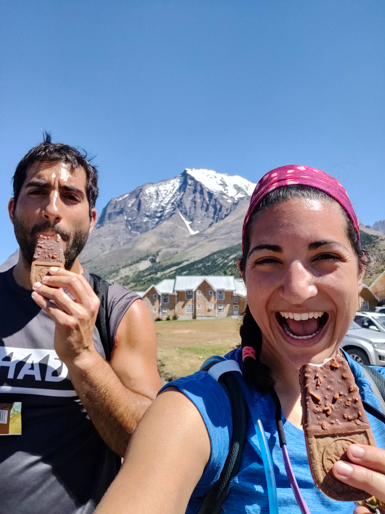
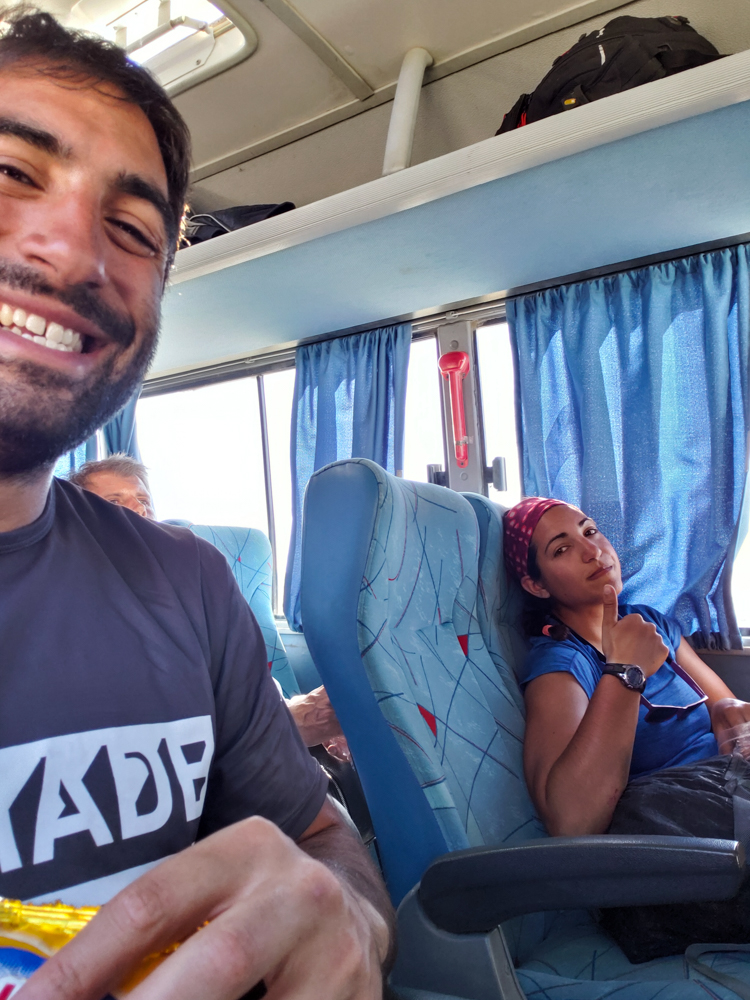
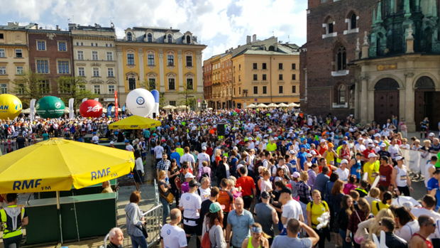
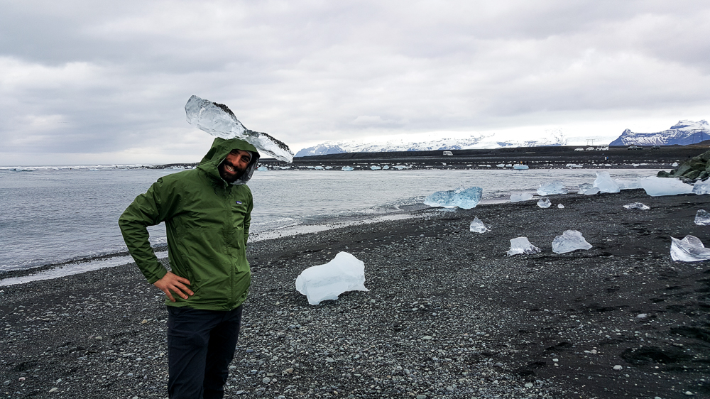
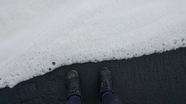
Our stay in El Calafate was especially short the second time around. We arrived at about 10:30PM, went to sleep at 3:30AM because we apparently love to self-sabotage, and caught a bus to El Chaltén at 8AM. The morning started off extra rough. Any morning after 4 hours of sleep is not going to be pleasant, but we also got a surprise at 7:30 when the lady from the hostel told us that she was confused when she said that the bus would come to pick us up, and we actually had to be at the bus station at 8. EEEEEE!

Thankfully, we were going back to the same hostel in a few days, and they let us leave some of the things we didn’t need (like our tent) which meant packing was infinitely easier. We ran around like maniacs trying to pull ourselves together and were out around 7:45… and we then powerwalked to the bus station because I do NOT like to cut those things close.

We made it there a few minutes before 8, and then the bus also left a little late. Buses always seem to run a few minutes behind schedule until the one time when you need a cushion… and then they leave exactly on time.

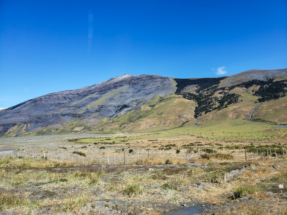
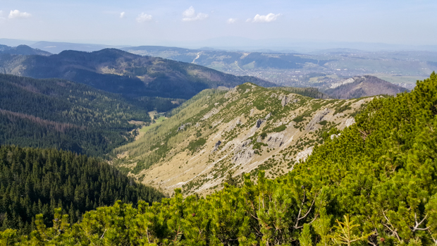
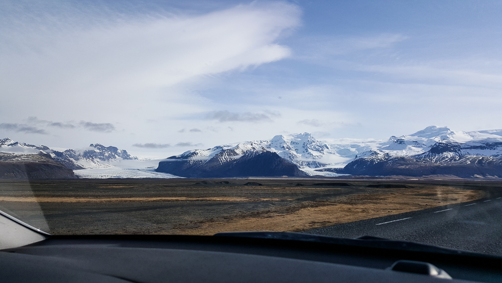
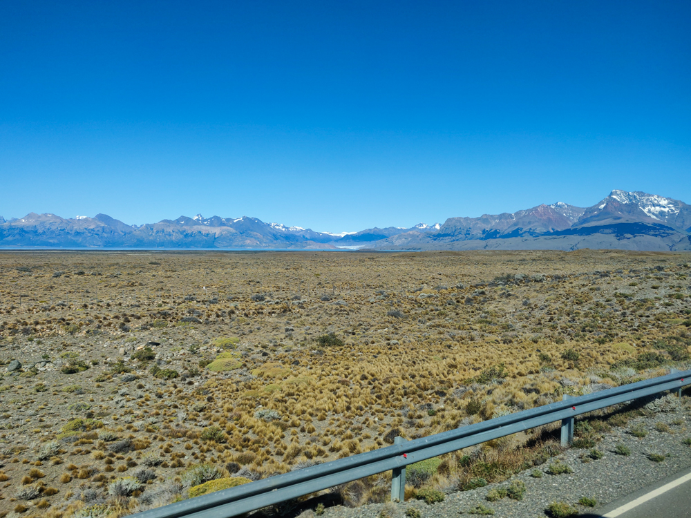
The bus ride was uneventful: the scenery was beautiful, Mike slept the whole time, some obnoxious person played music without using headphones. The usual. When we arrived in El Chaltén, the bus went straight to the ranger station so that we could get an introduction to the park and the hikes.

Flat landscape with mountains in the distance
The road to El Chalten

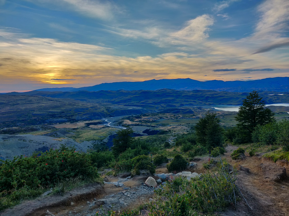
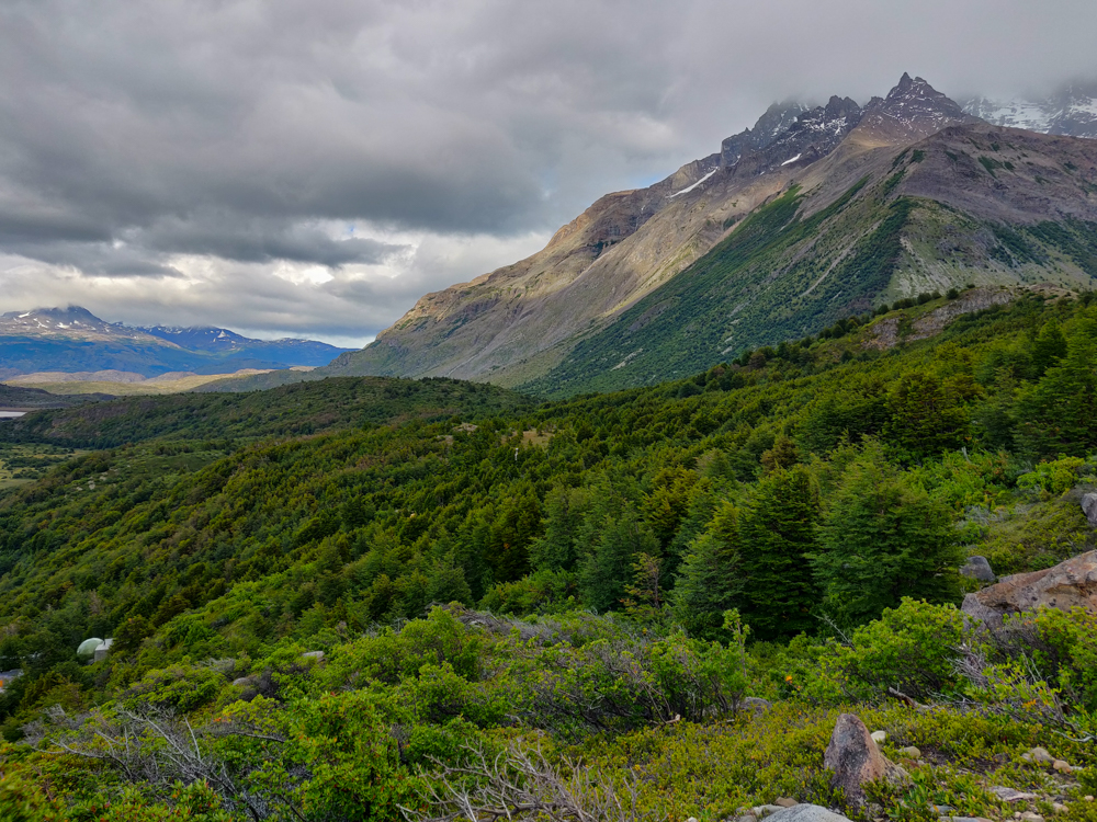
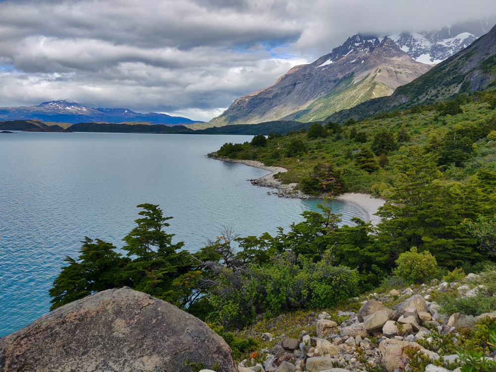
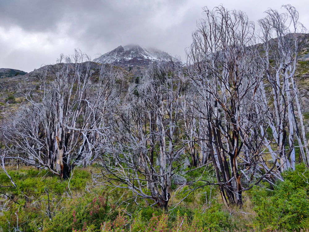
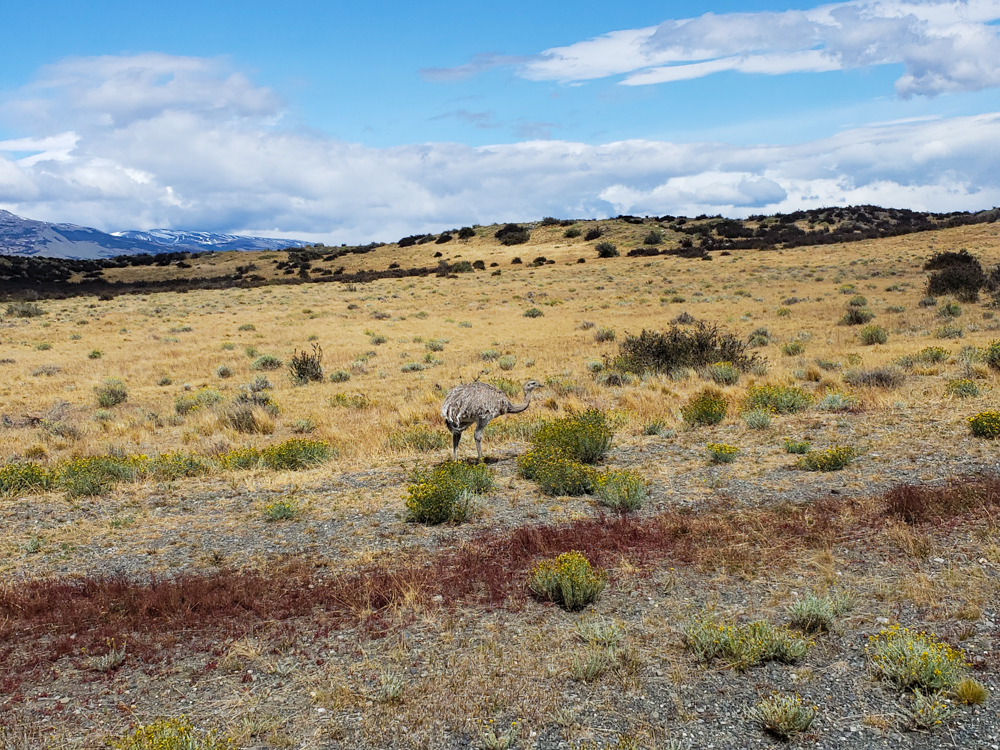
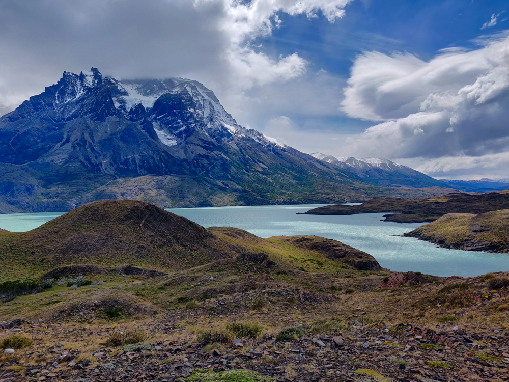
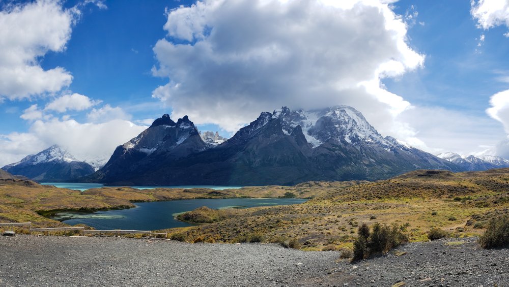
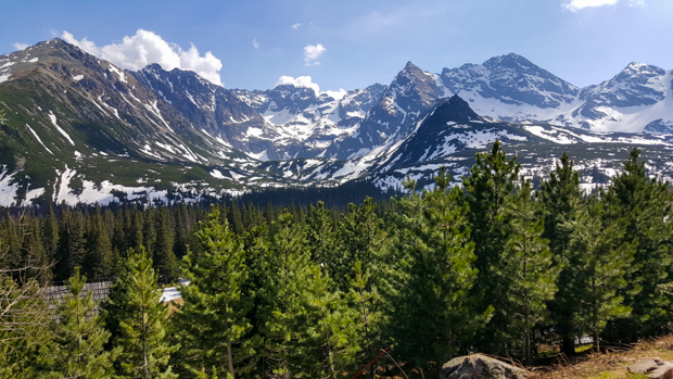
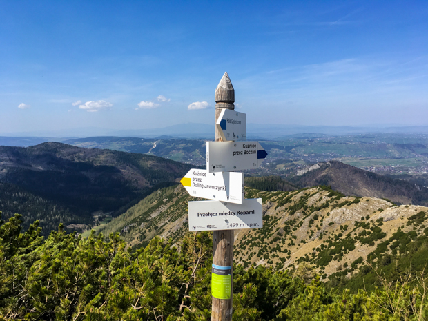
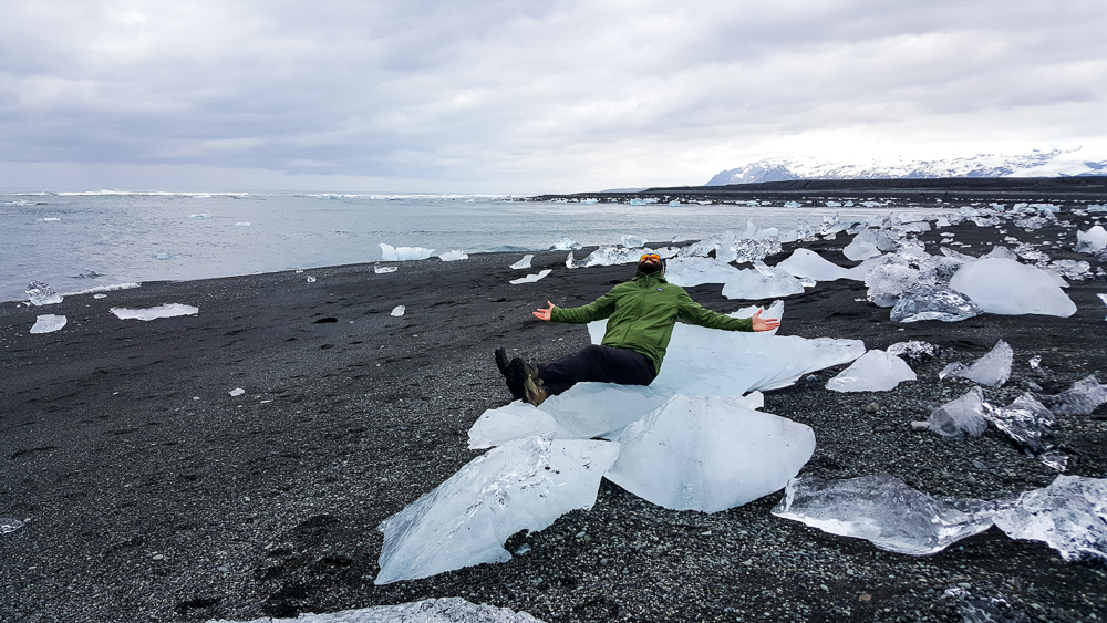
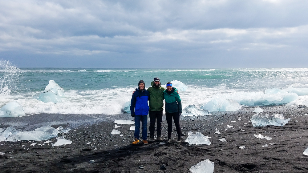
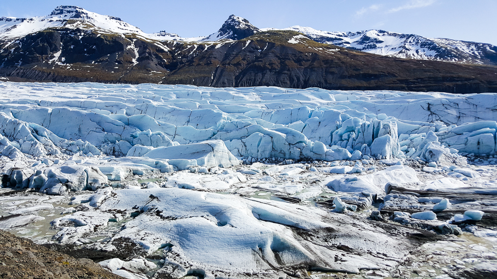
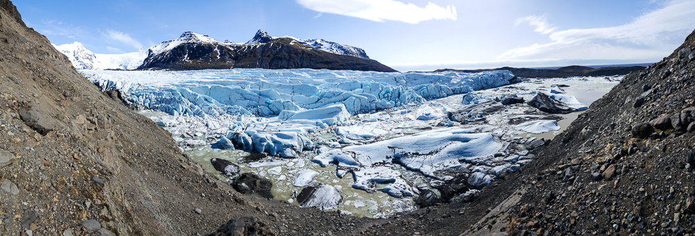
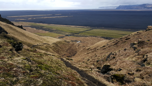
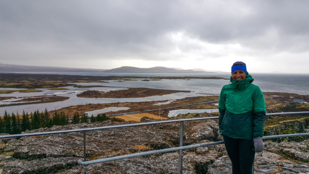
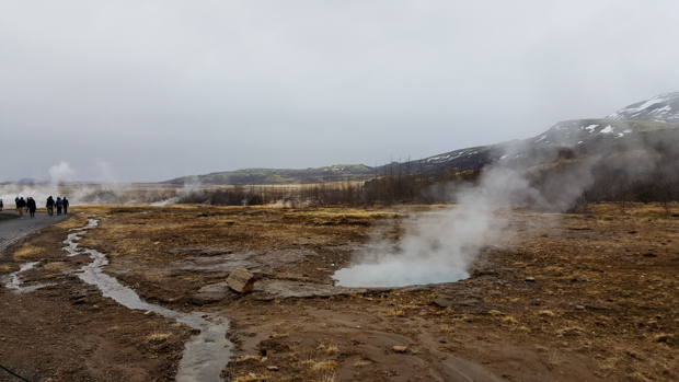
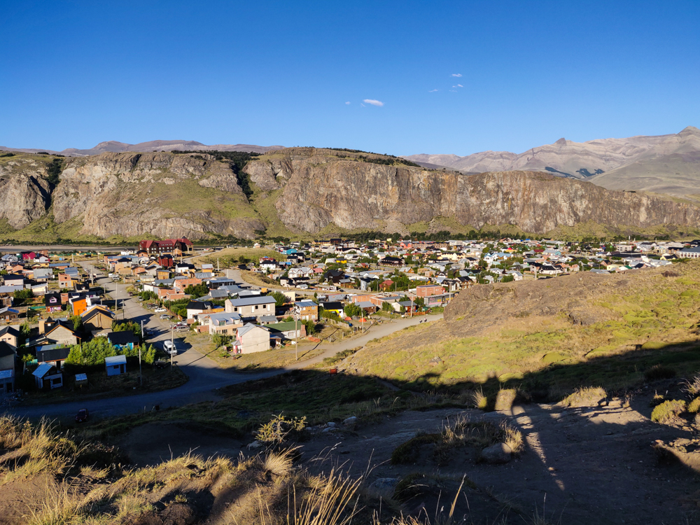
El Chaltén is a village in the northern part of Parque Nacional Los Glaciares, the same park that we visited on our first day when we trekked on Perito Moreno Glacier. The town is inside the park. This is super weird to me because we don’t have people living in national parks in the States. I found myself frequently confused by the “national park” concept during our trip. Like there are portions of some parks that are privately owned. In Torres del Paine in Chile, some portions of the actual W Trek are on private land, some of the campsites are privately owned, etc. You literally can’t do the trek without crossing between private and national land. Very confusing while you’re hiking and get to a sign that says, “Welcome to Torres del Paine National Park,” and you didn’t think you’d ever left.

View of El Chalten from above
El Chaltén

I did some research before we went and thought it would be a good idea for us to take it easy on our first day considering we were coming off of four long days of trekking. There are some short hikes around town, so I had those on the schedule for the first day and had the two major long hikes on the following two.

At the ranger station, the guy who did our orientation said that the weather was really nice, so it would be a good idea to go on a hike in the afternoon if possible because no one knows what weather tomorrow will bring. I said, “We’re doing that already!” Mike said, “We should go on a longer hike just in case.” Ugh. So much for a rest day. His plan was to do the “short” 6-hour hike on the first day, the most popular 8-hour hike on the second day, and this one that’s literally 4 hours up and then 4 hours down on the way back on the last day. He’s a loon. He told me that I could skip the last day if I wanted to rest, but who rests on the LAST day of a hiking trip? That defeats the whole purpose of a rest day!


Mike and me along the way
Trail selfie!
The trail with blue, clear skies
Okay, so the weather was pretty perfect…

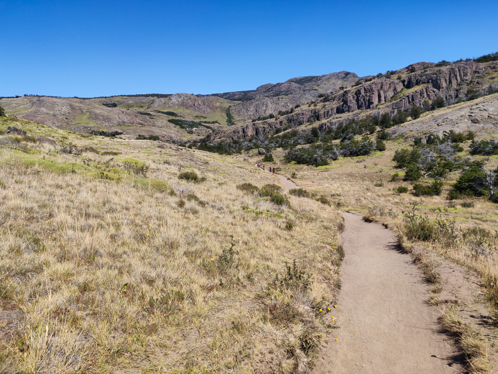
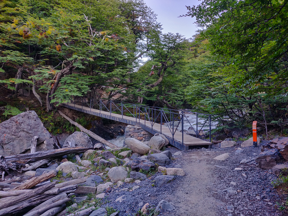
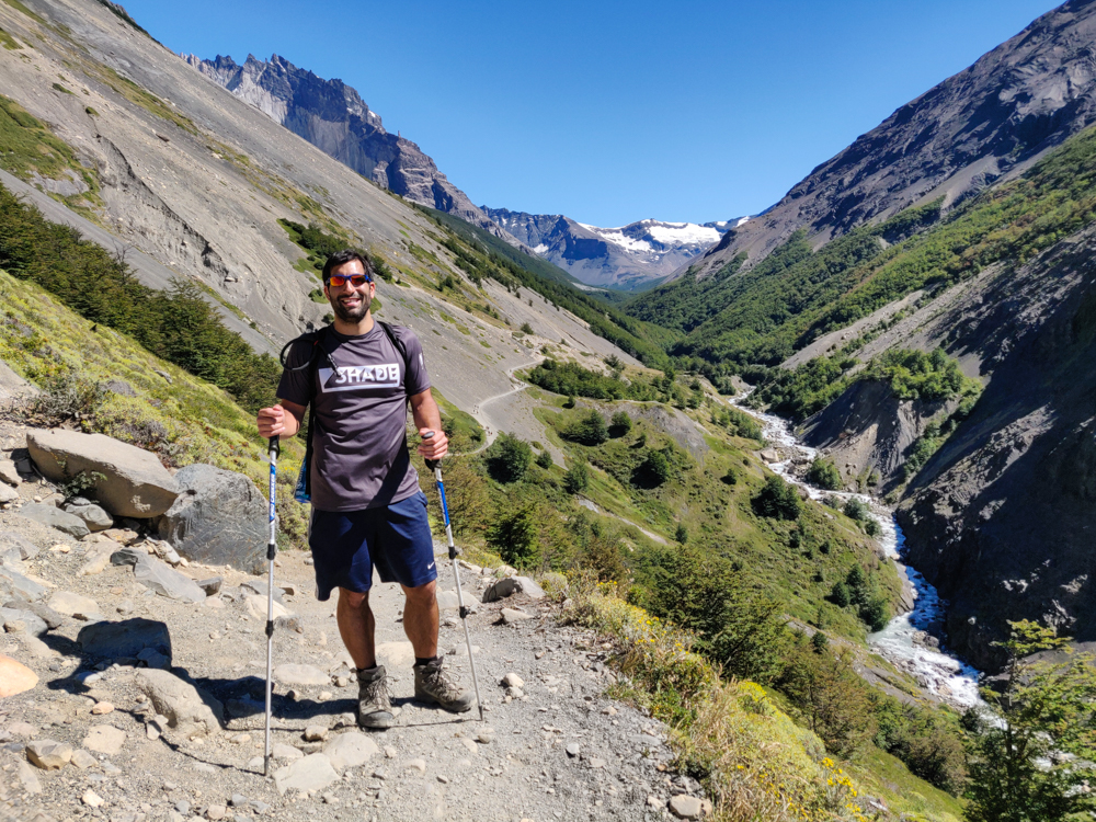
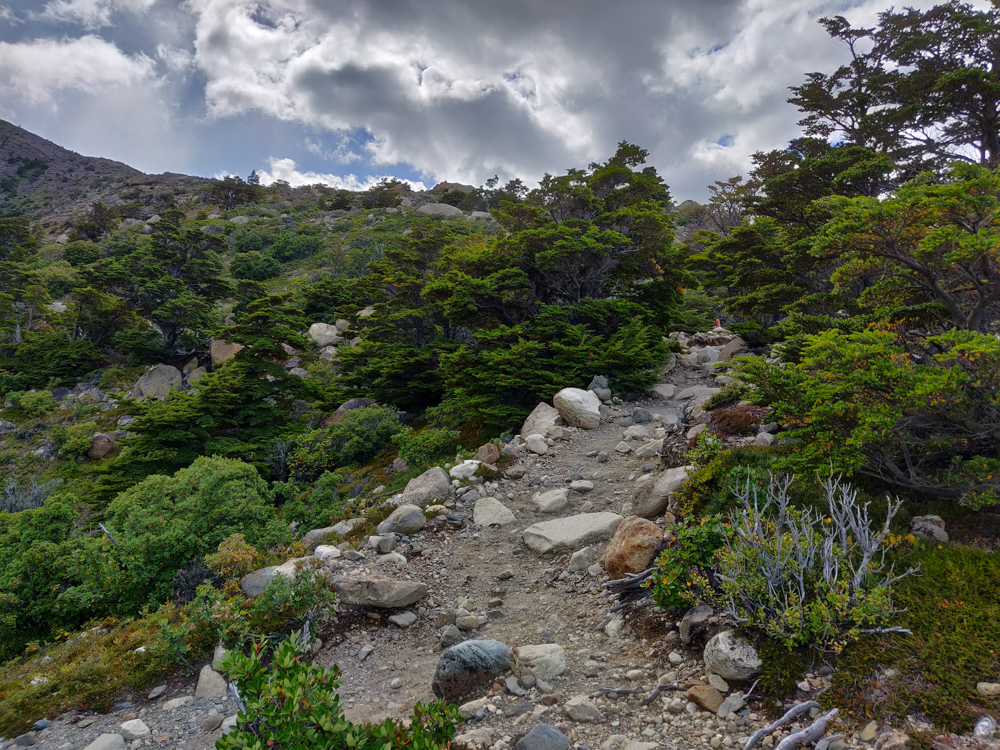
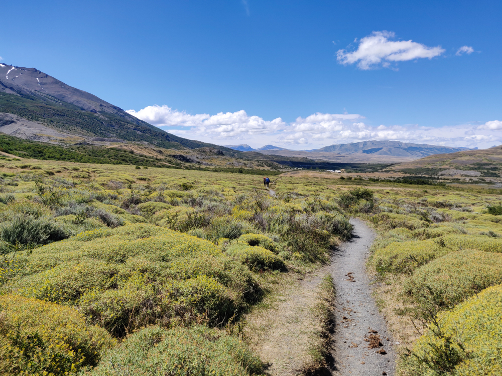
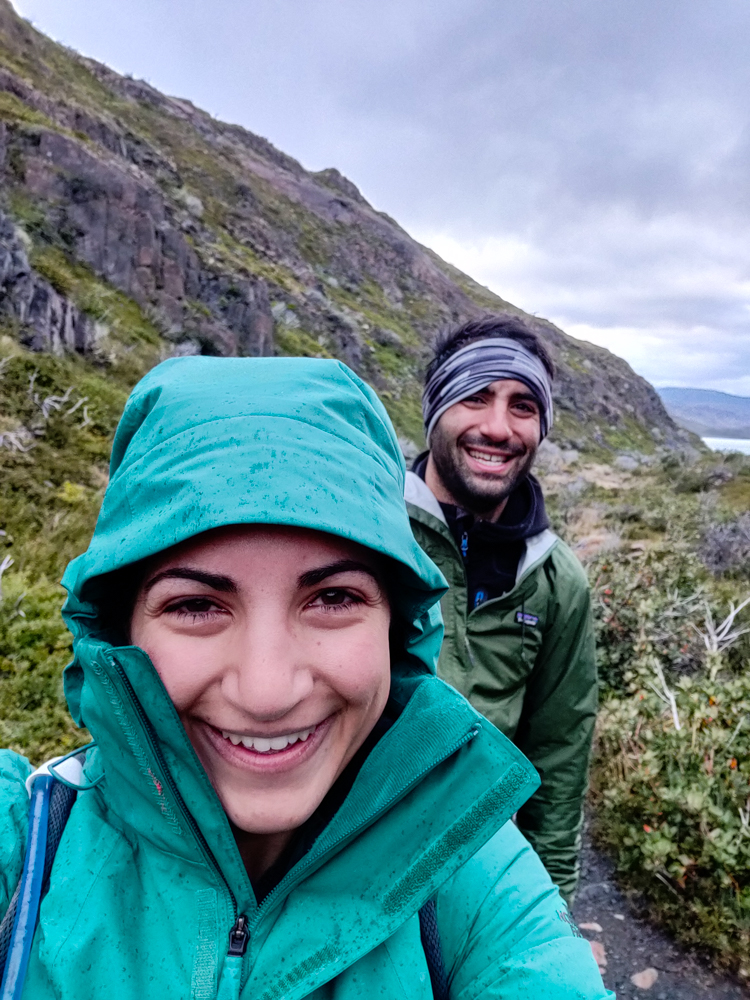
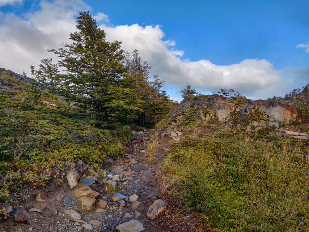
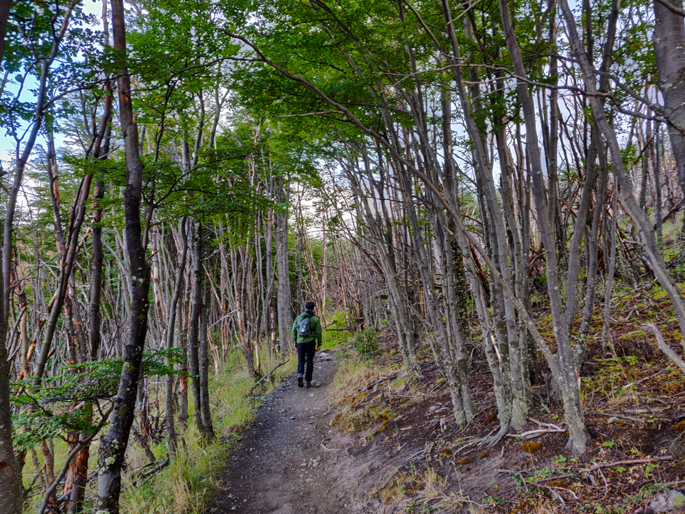
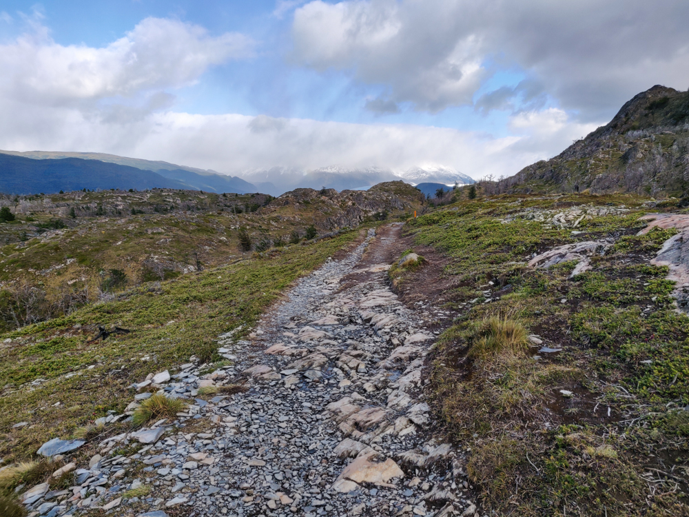
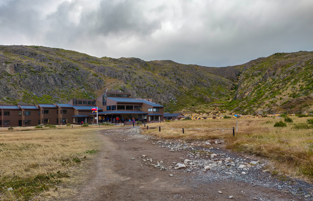
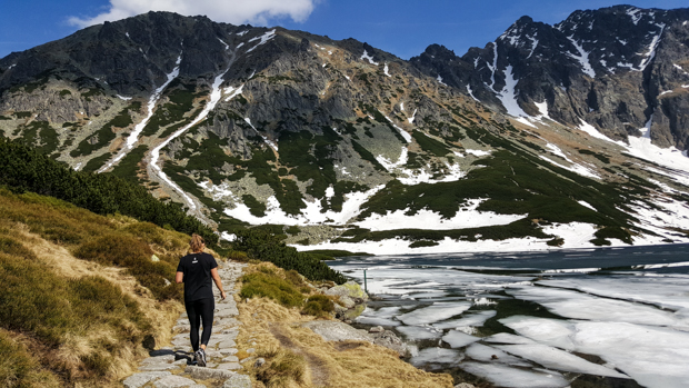
So, Mike decided that we should do the Laguna Torre hike because the trailhead was literally across the street from our hostel, and it was ONLY 6 hours, unlike the other two hikes he wanted to do. By the time we checked in and got settled and ready to go, it was about 1:15PM aka the hottest part of the day and definitely the ideal time to start a 6-hour hike (sarcasm, in case you didn’t catch that).

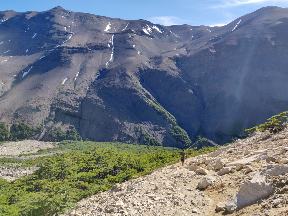
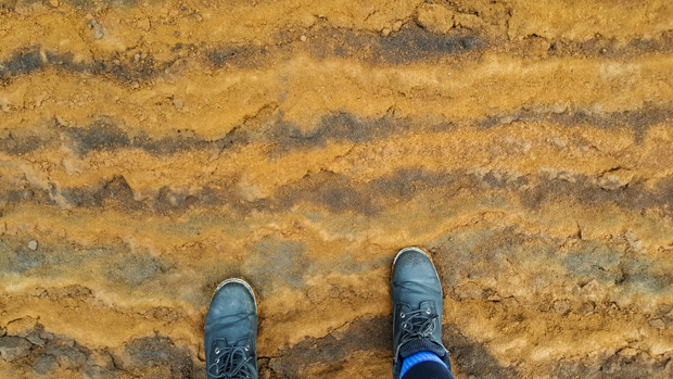
The hike itself really wasn’t that bad, but my feet were still killing me, and it was HOT. Even the woman who checked us in at the hostel said that it was abnormally hot, and she was ready for it to cool down again. Yeah, same. The beginning of the hike had some uphill that wasn’t too bad… except for the fact that there was no shade. I learned my lesson after the unfortunate arm-burn incident of the Torres del Paine trek day 3 and covered myself in sunscreen. Mike seems to think he’s superhuman and is fine with a little sunscreen on his face and nothing more. What is it that they say about doctors being the worst patients? I believe it.

Me climbing up a rocky hill
Almost at the lake… just a few more steps! Up, up, and up! (That’s me. Hi, Lara!)
A gorge along the trail
I make the “gorge”ous joke literally every time I come across a gorge, so here it is again. Ain’t this just GORGEOUS?
Green landscape with mountains and a glacier in the distance
First glimpse of the glacier!

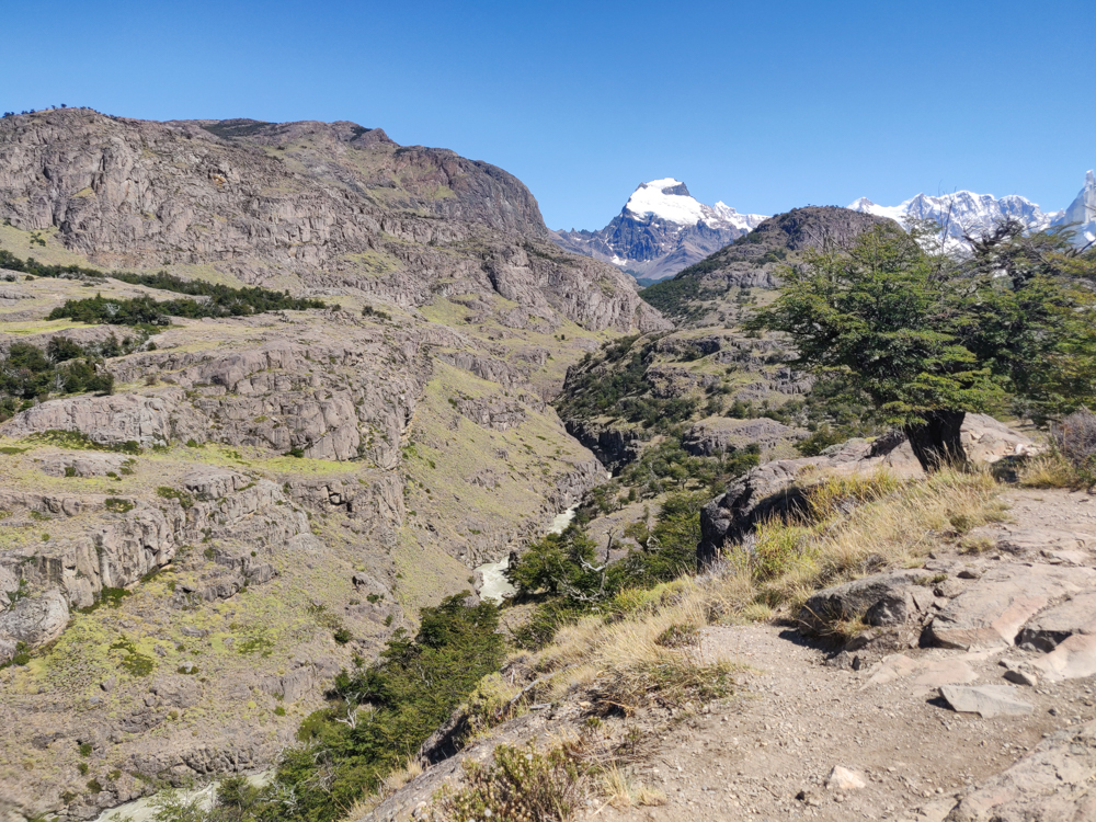
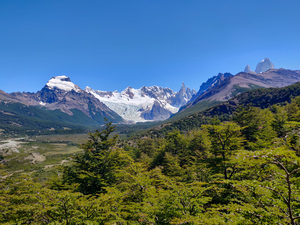
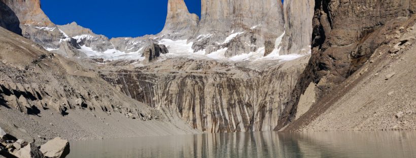
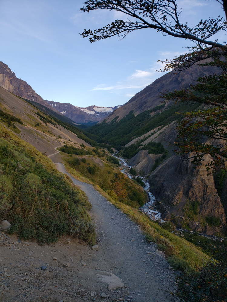
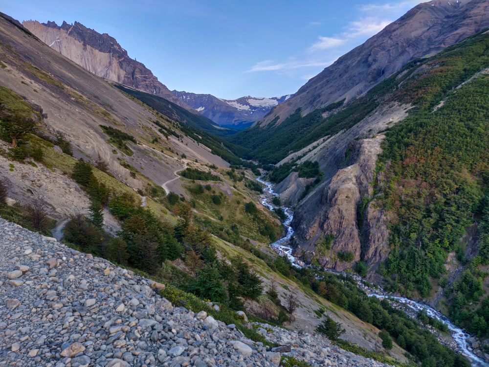
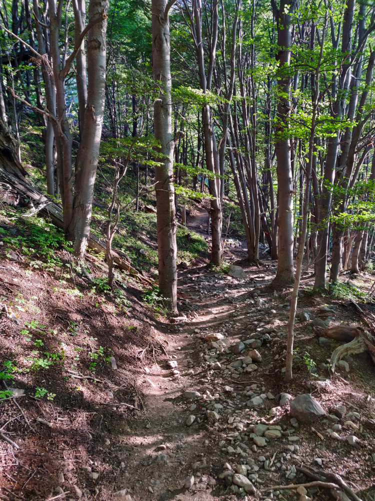
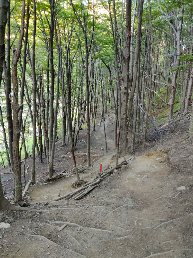
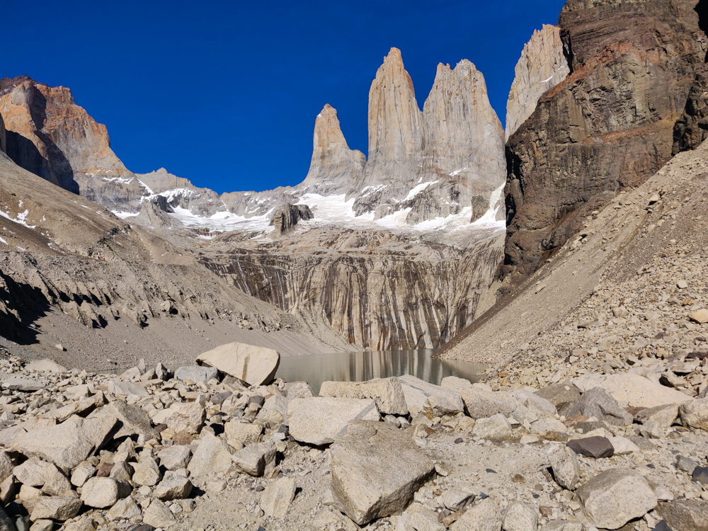
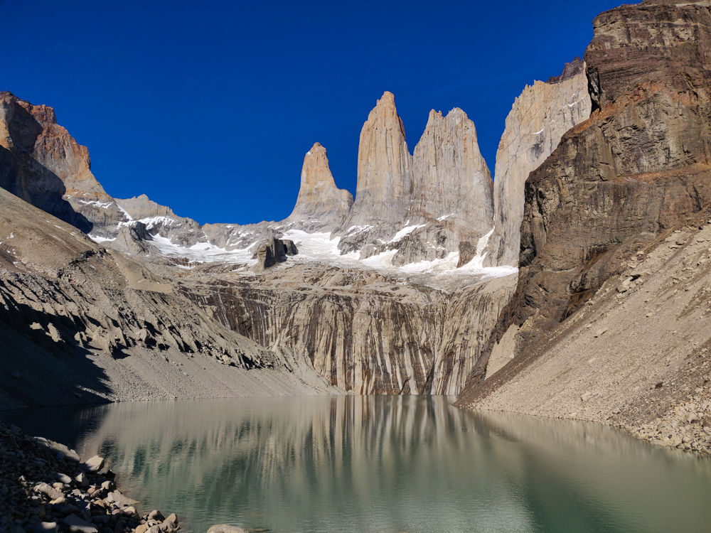
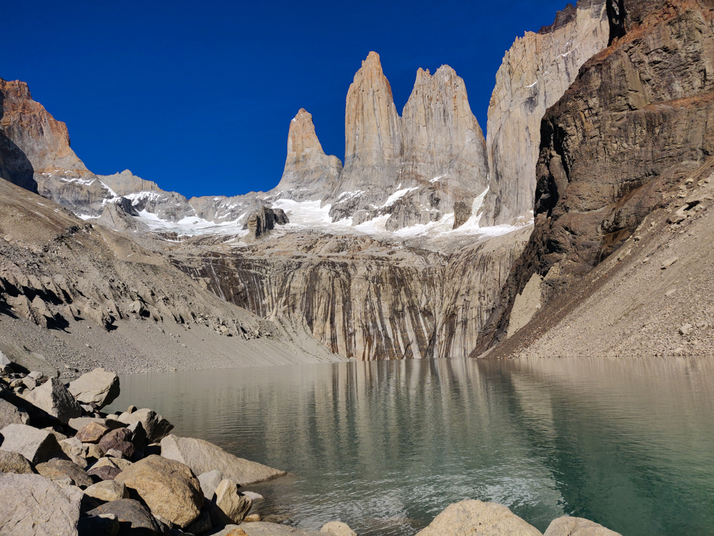
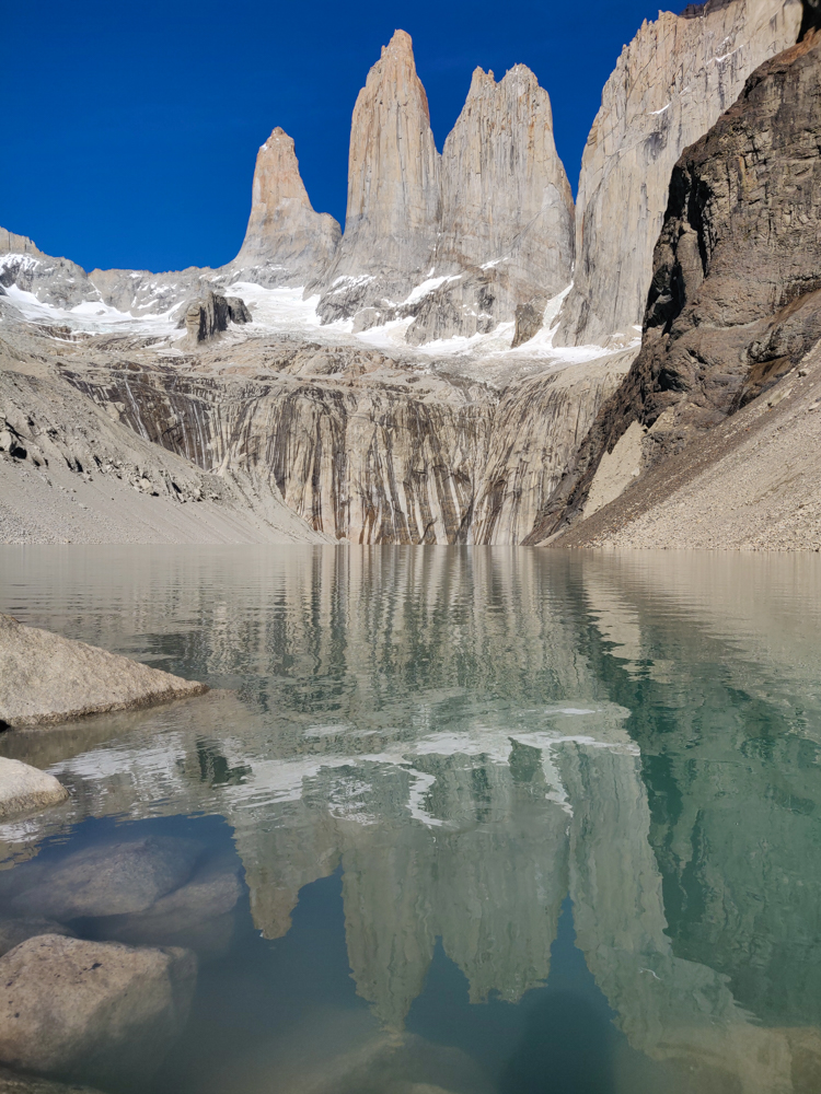
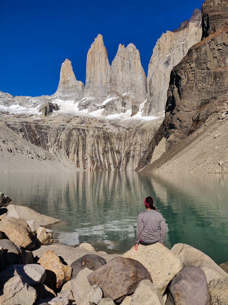
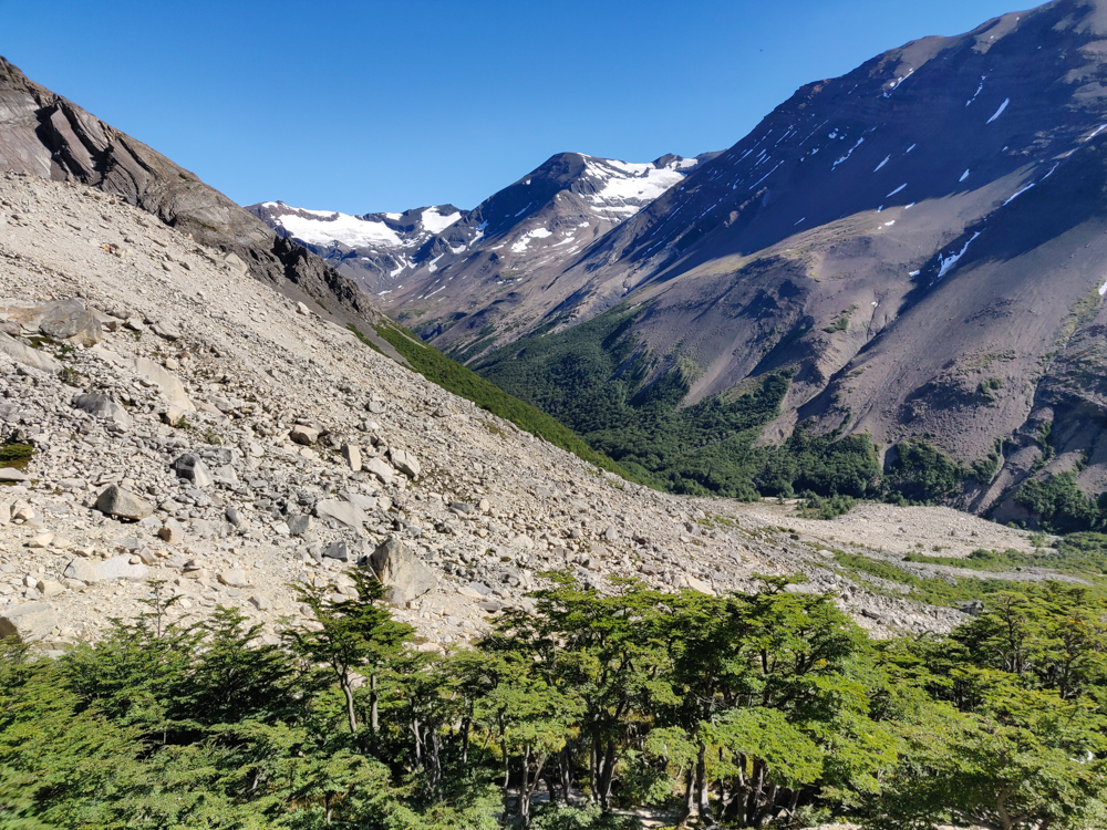
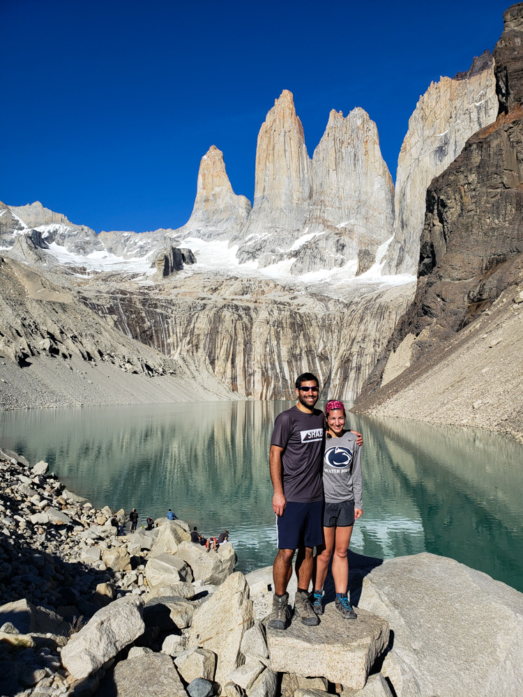
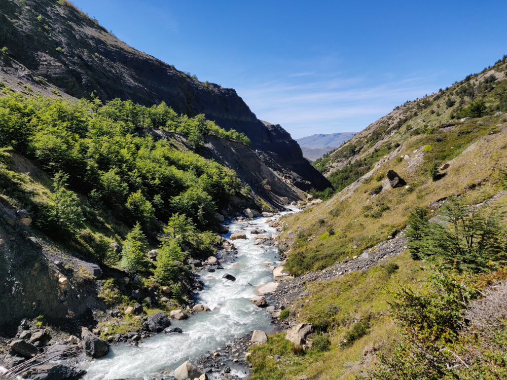
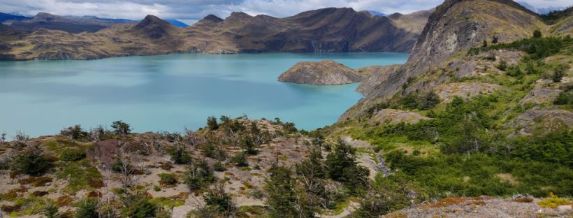
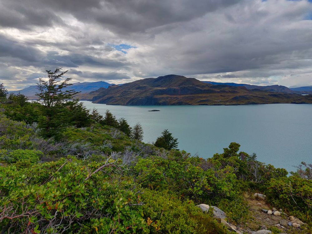
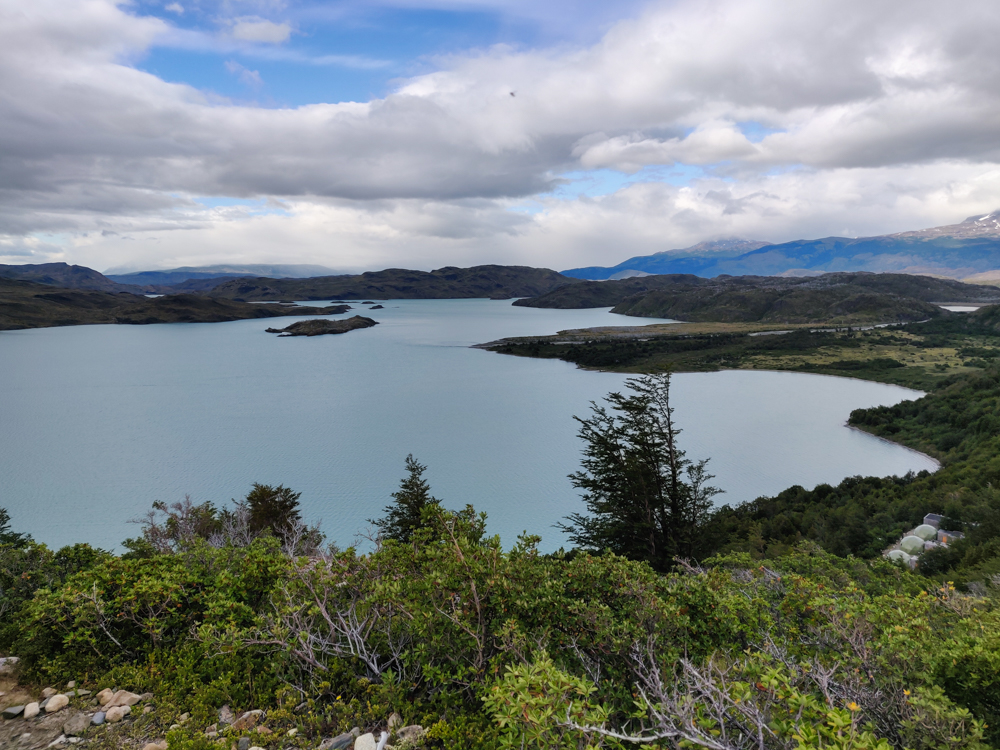
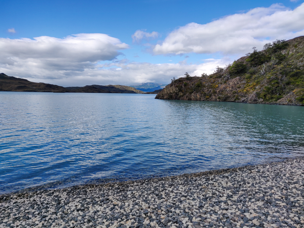
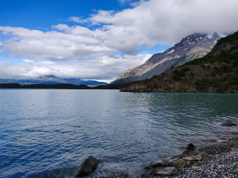
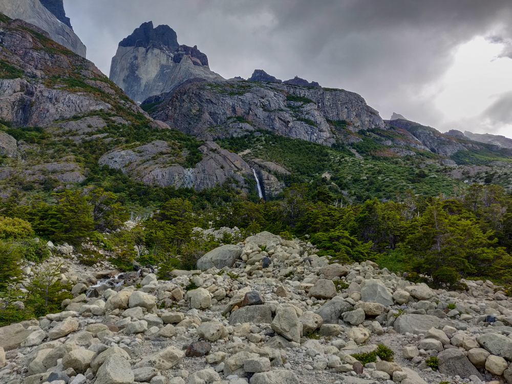
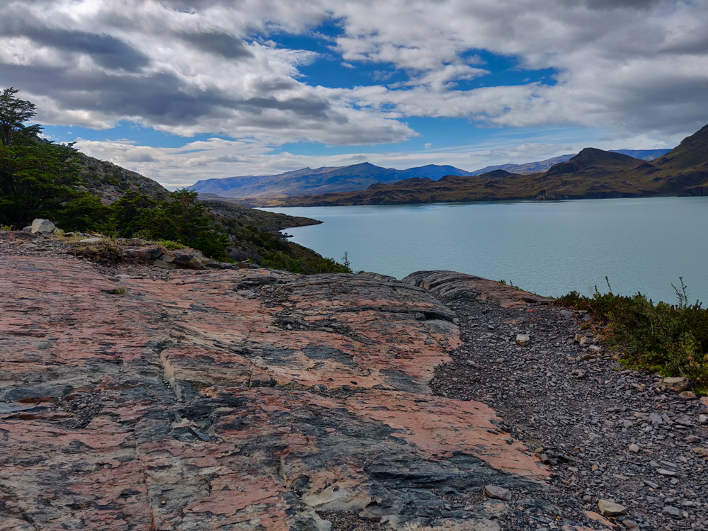
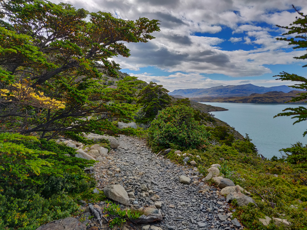
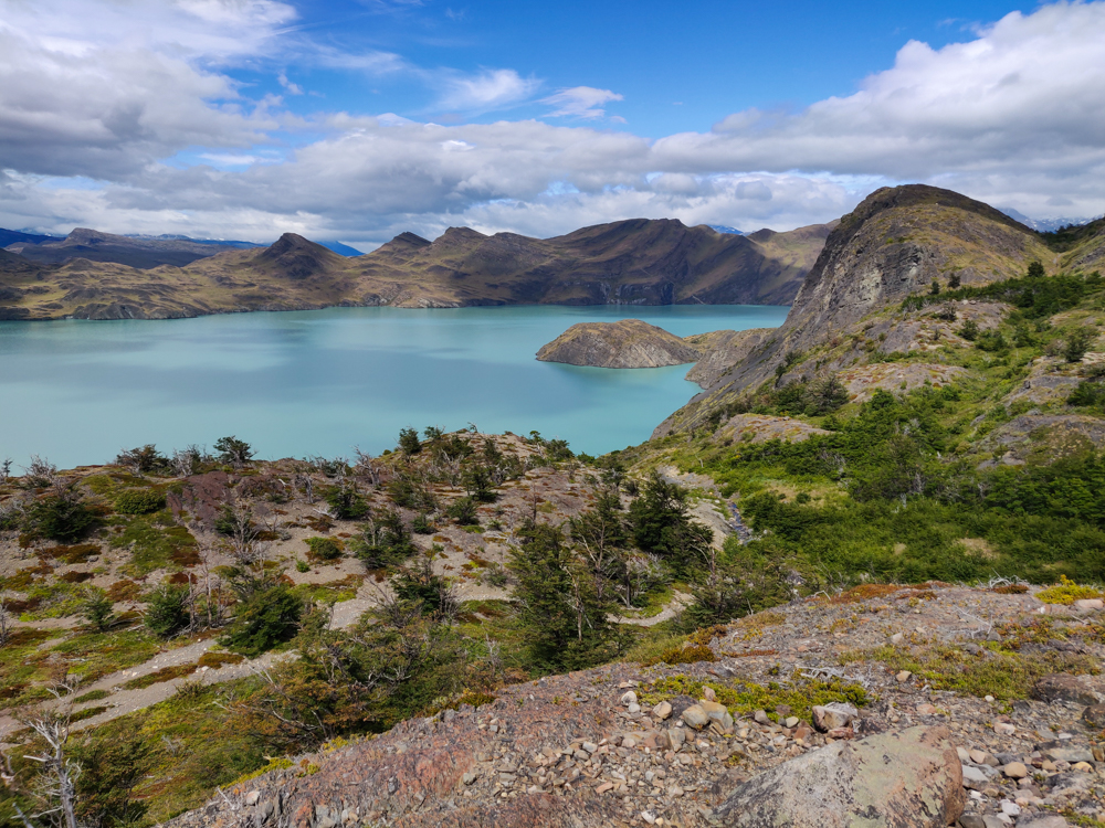
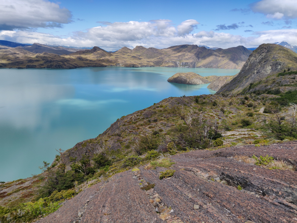
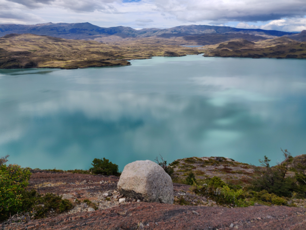
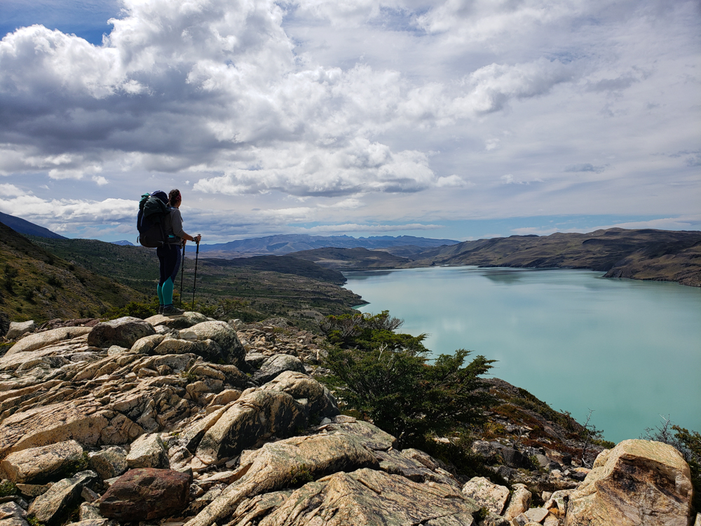
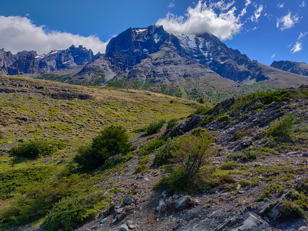
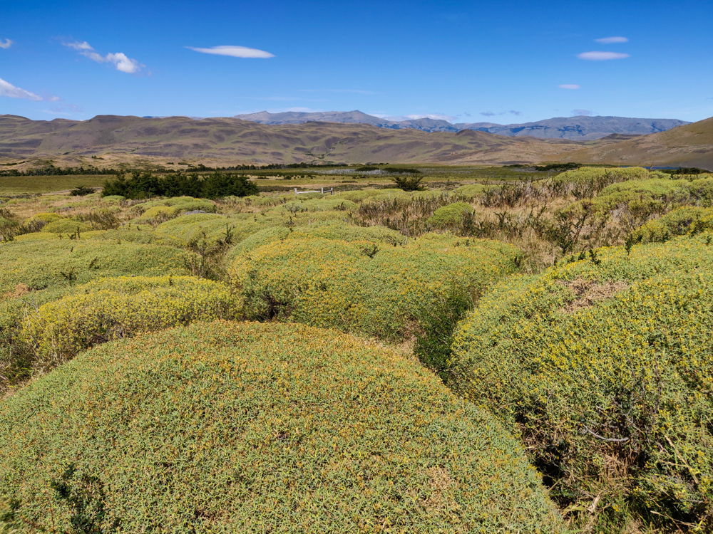
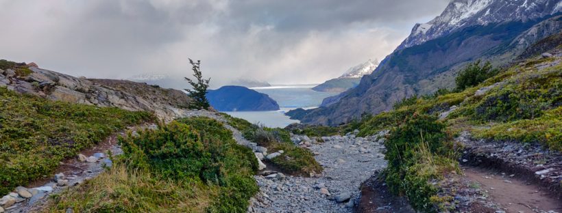
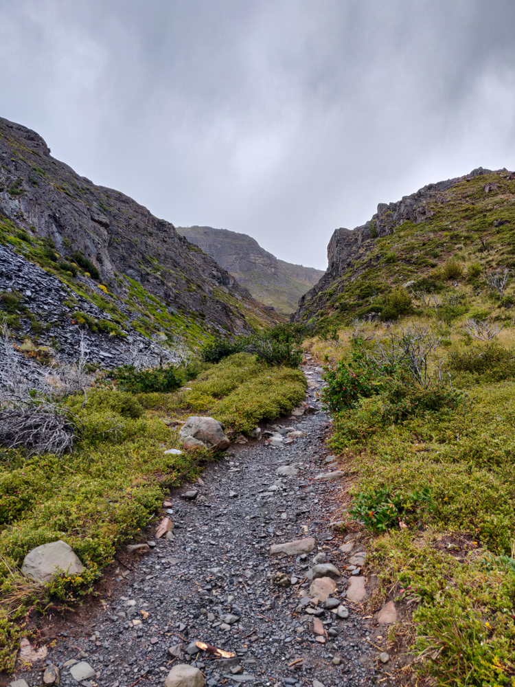
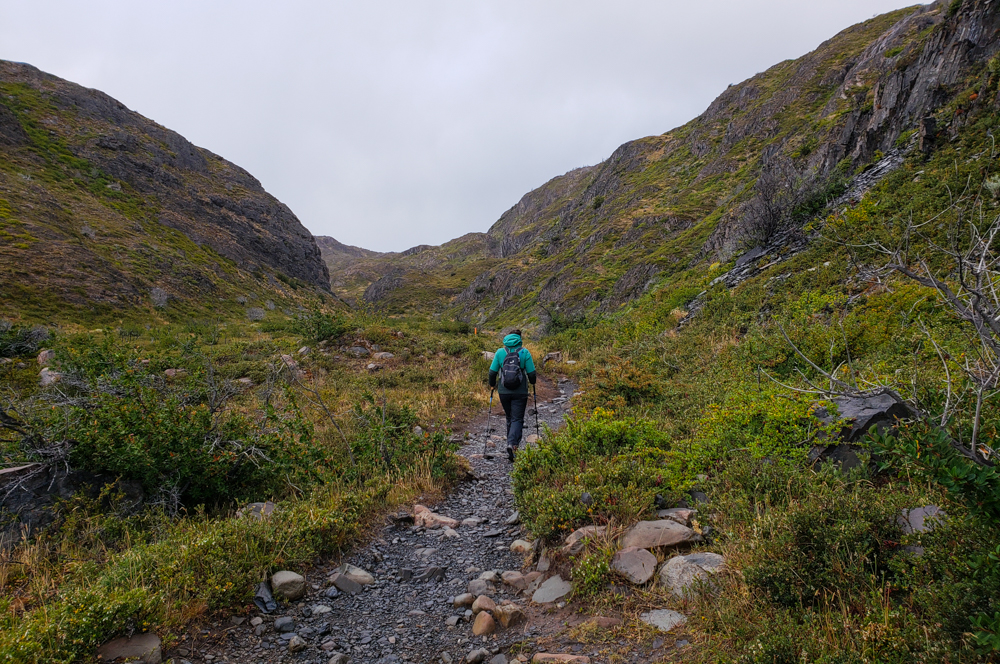
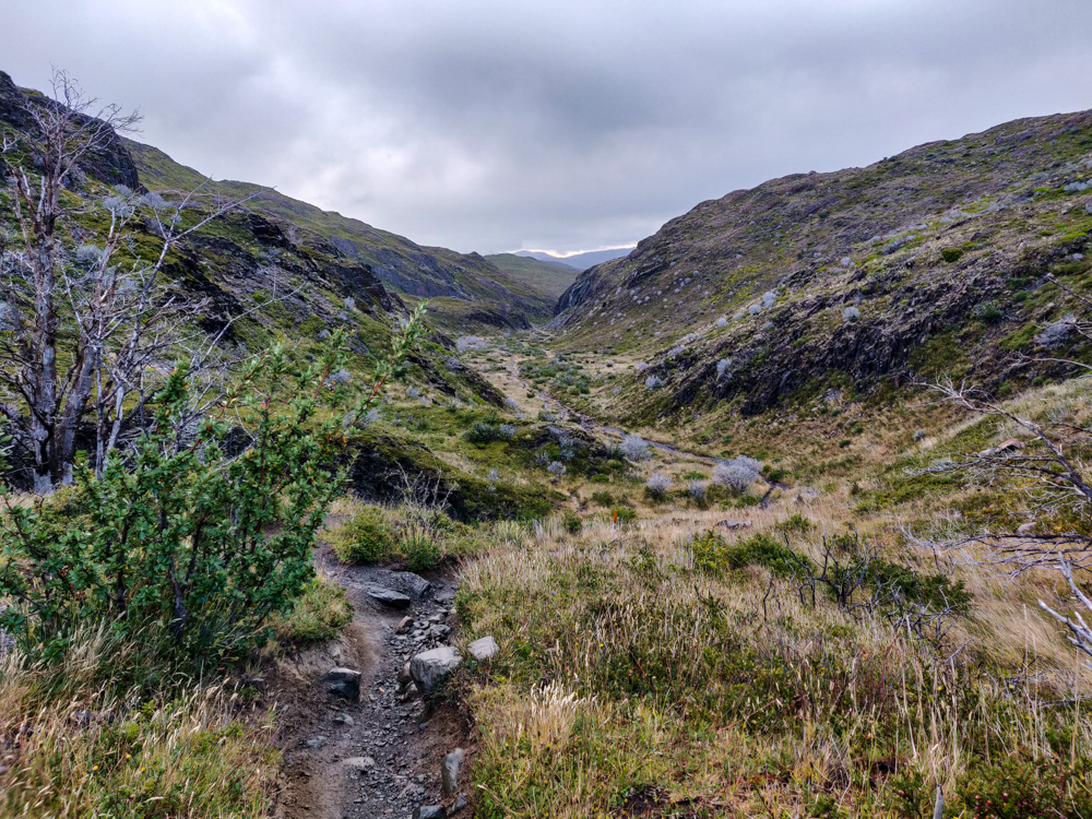
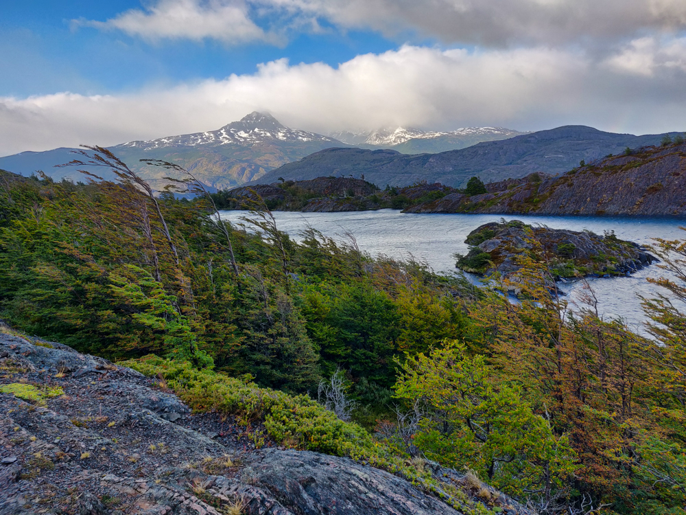
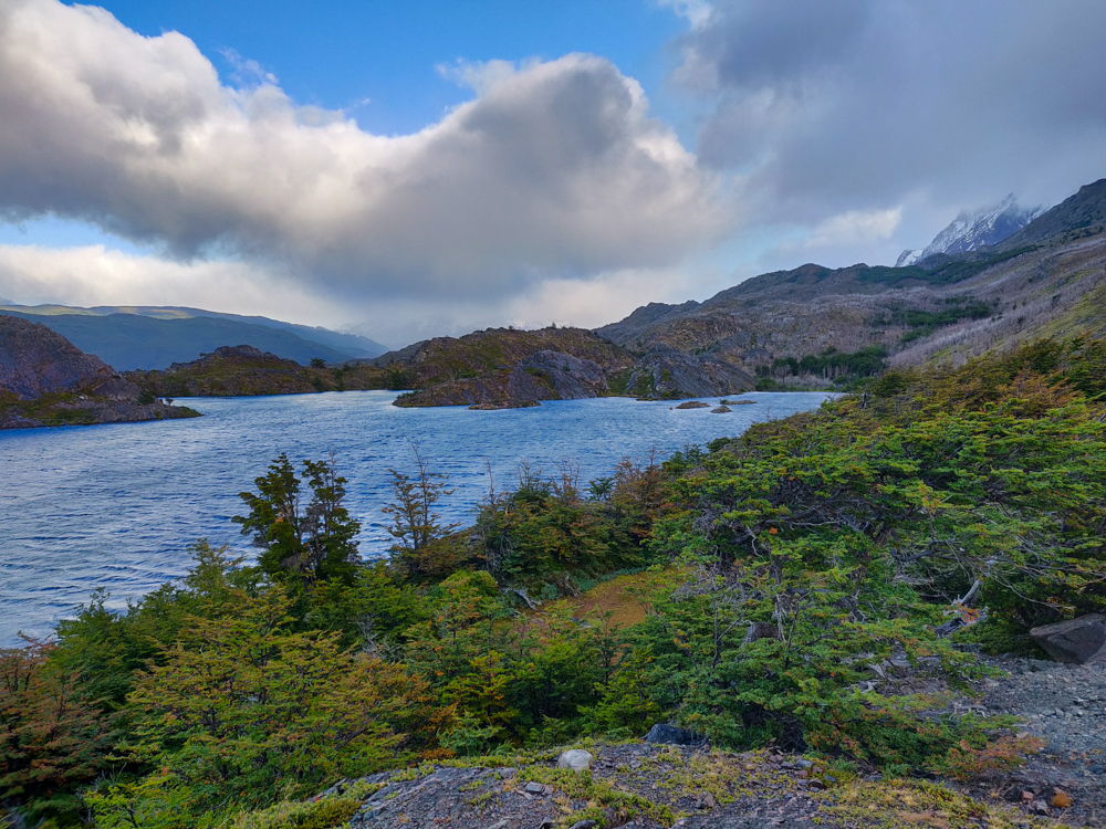
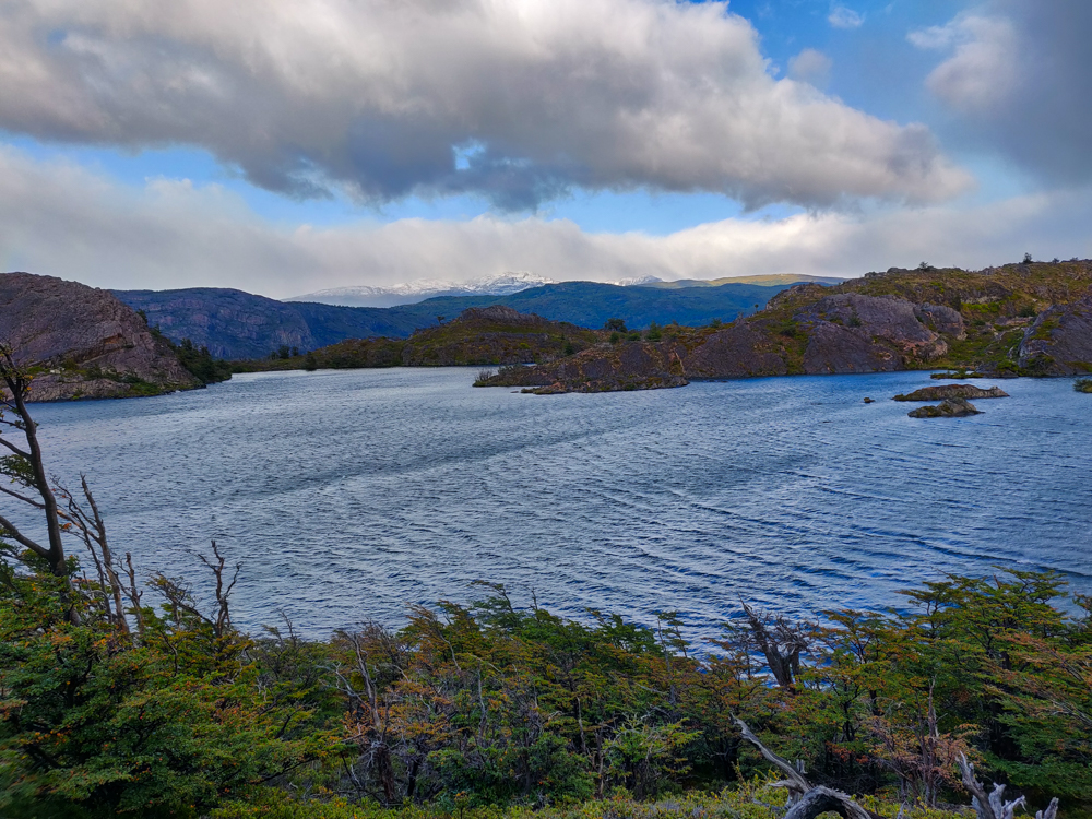
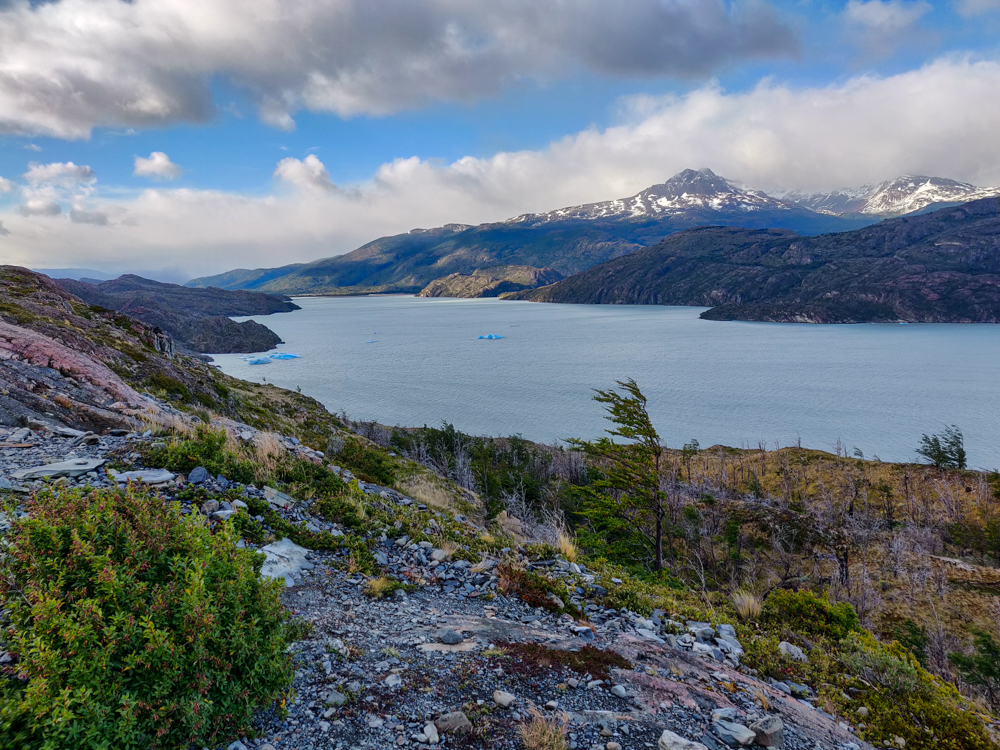
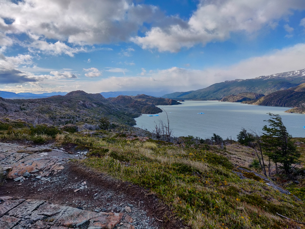
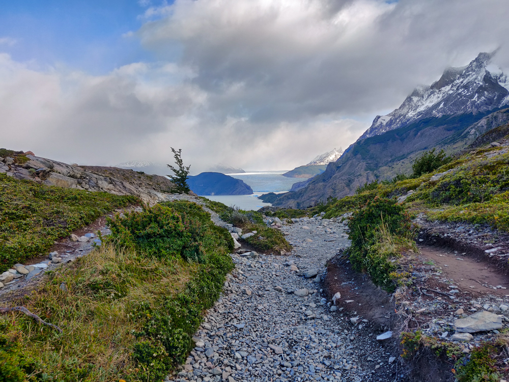
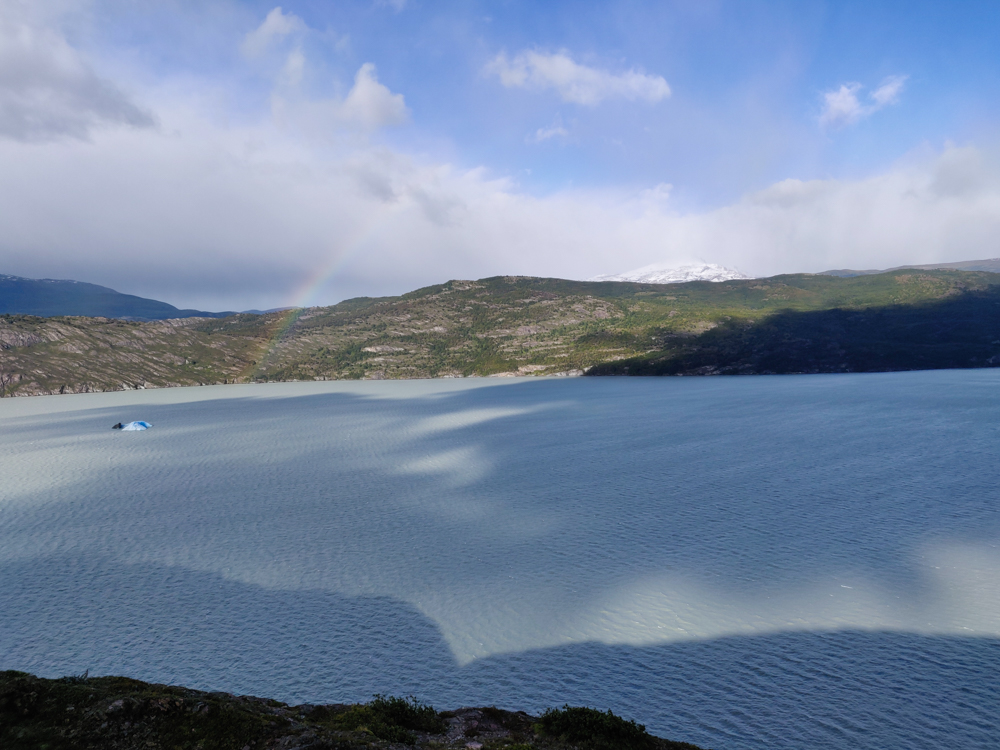
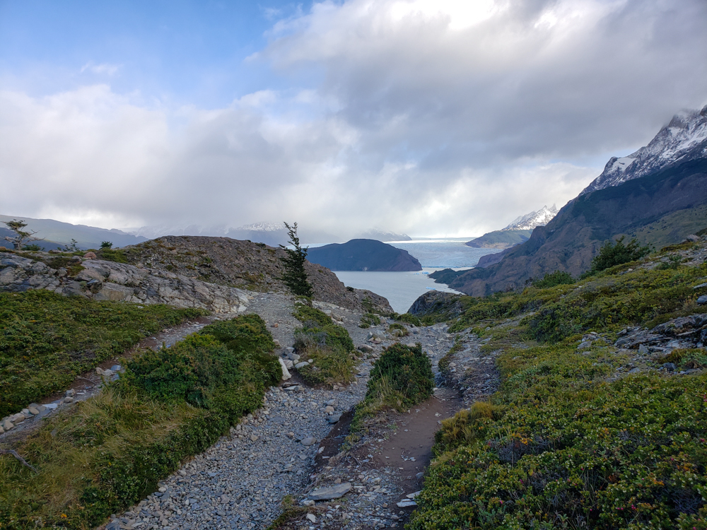
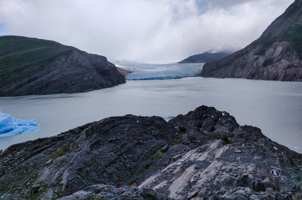
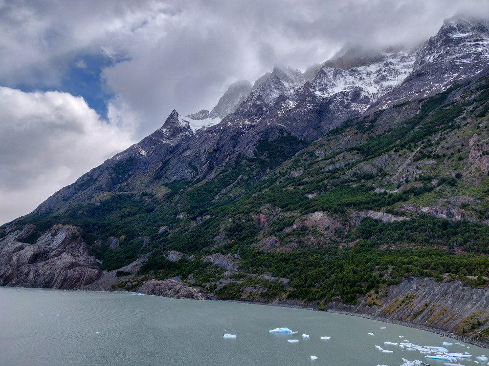
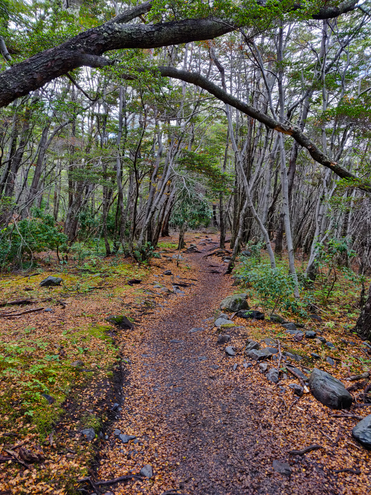
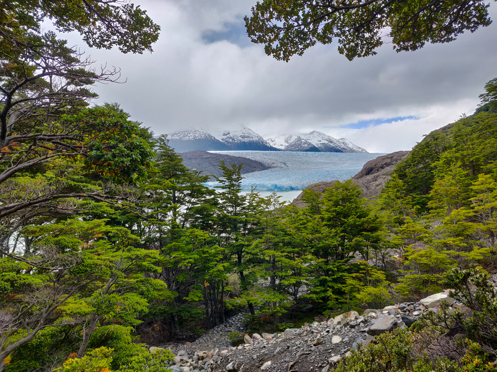
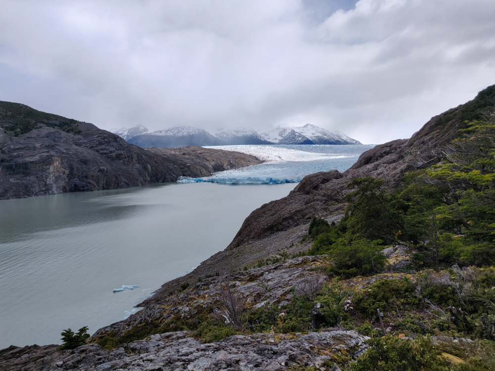
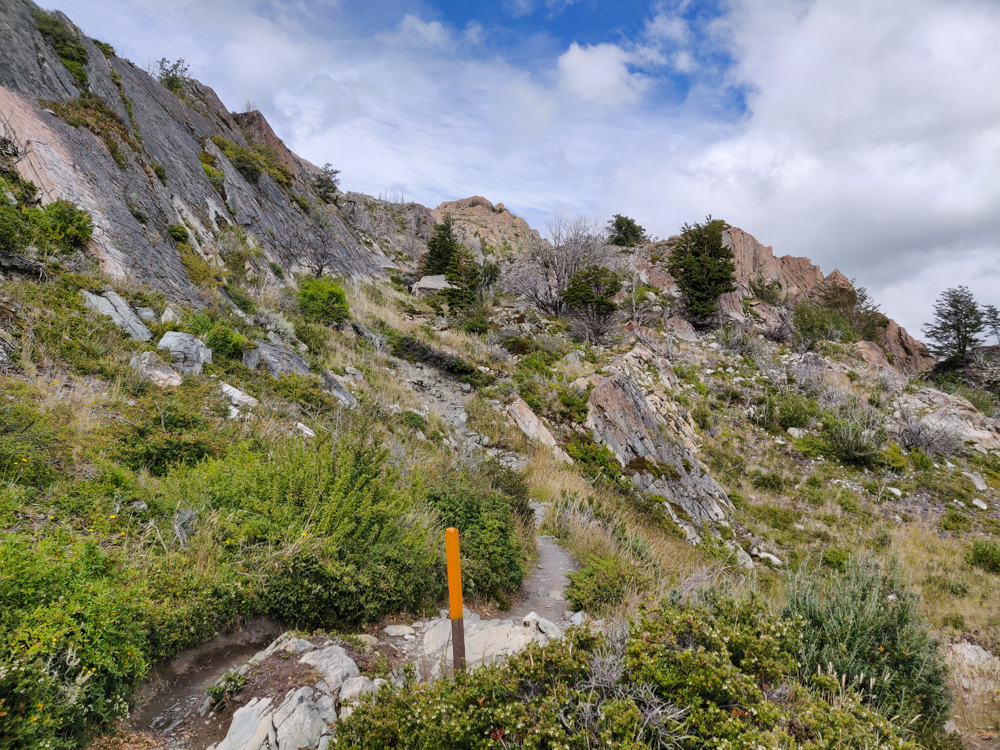
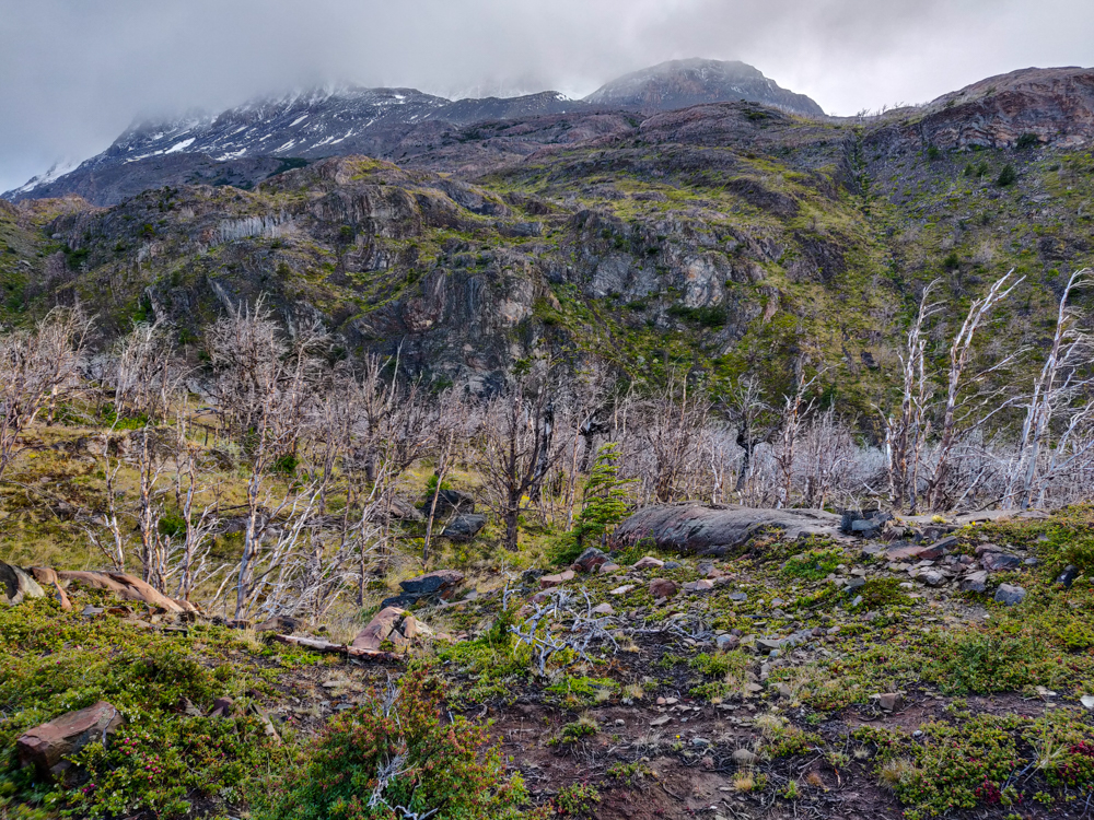
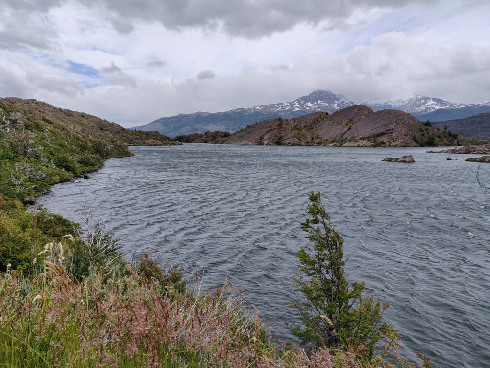
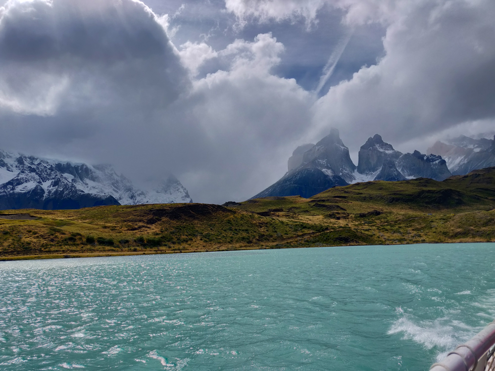
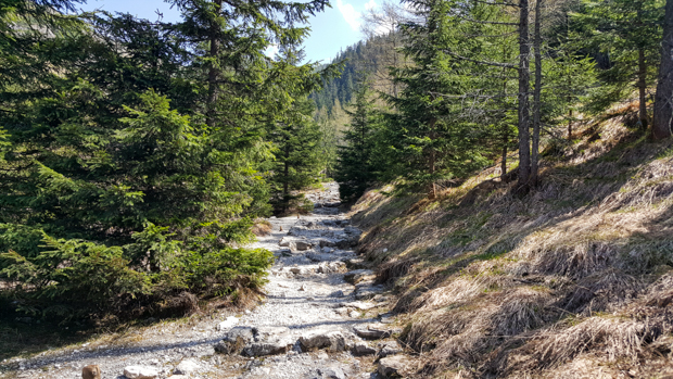
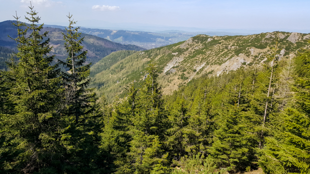
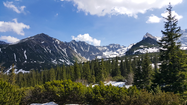
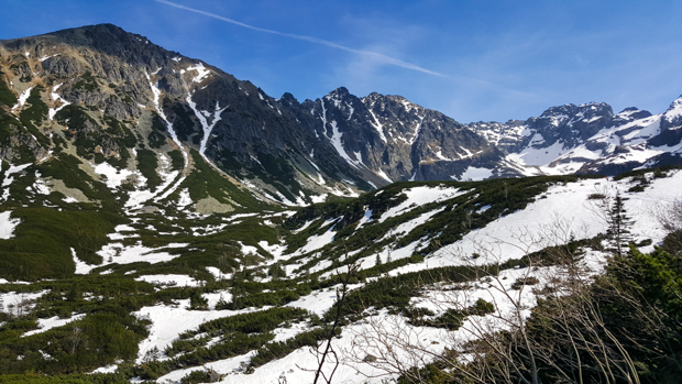
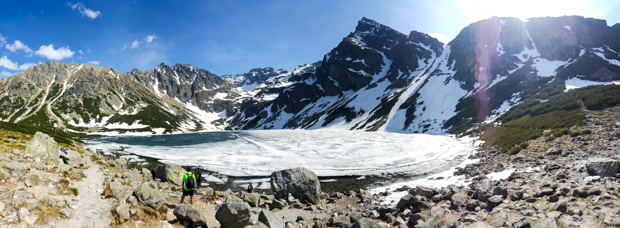
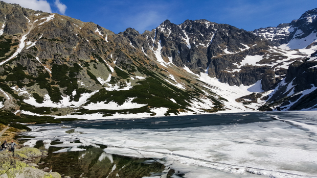
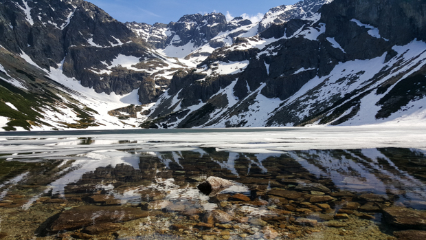
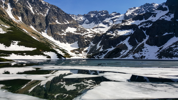
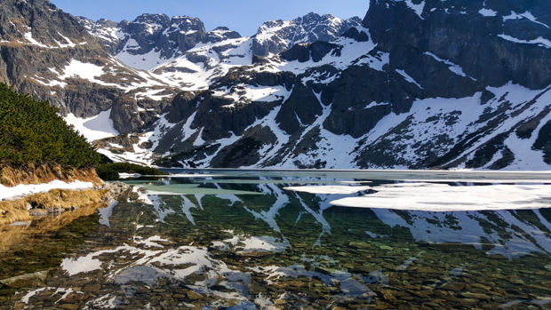
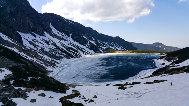
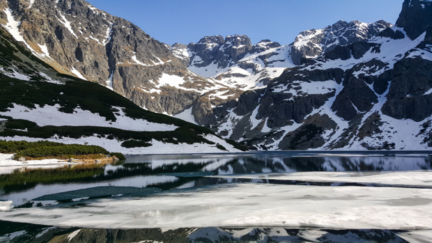
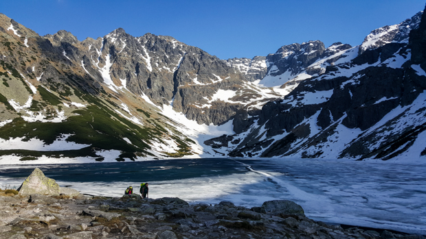
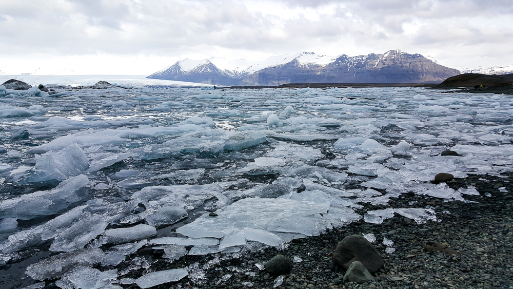
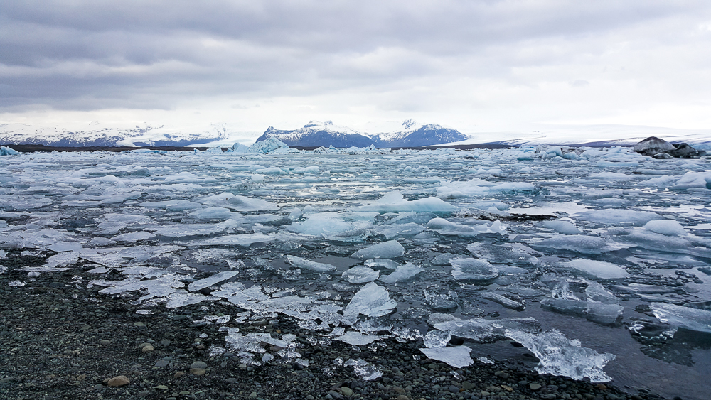
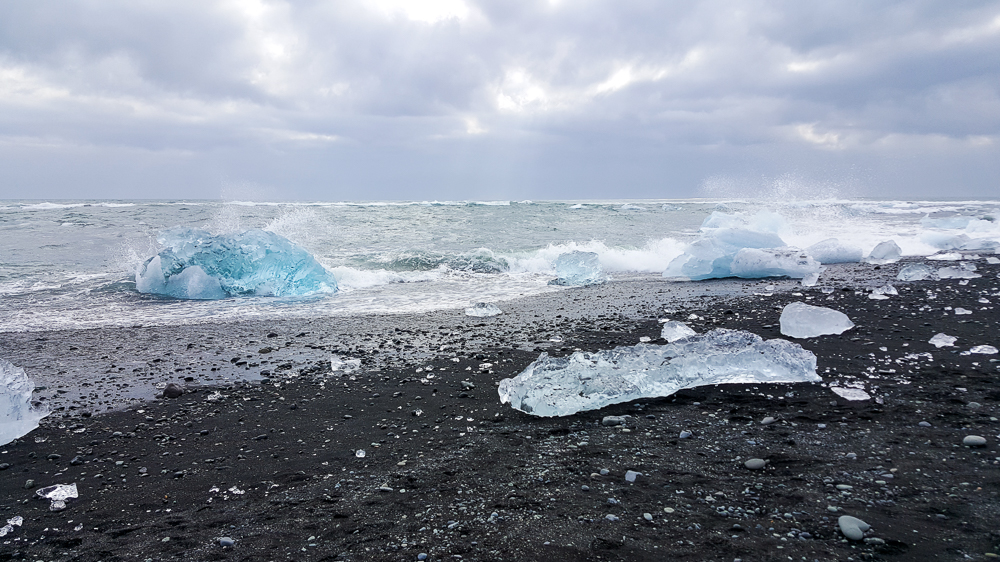
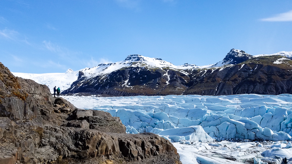
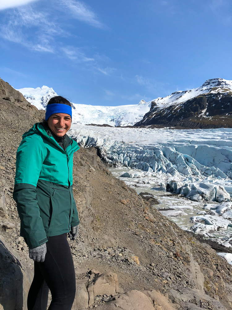
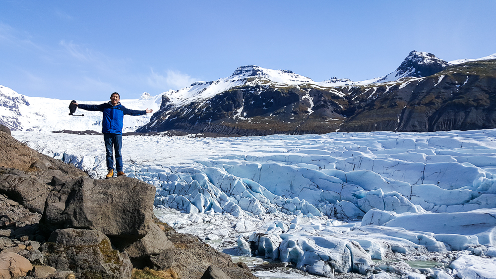
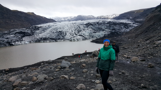
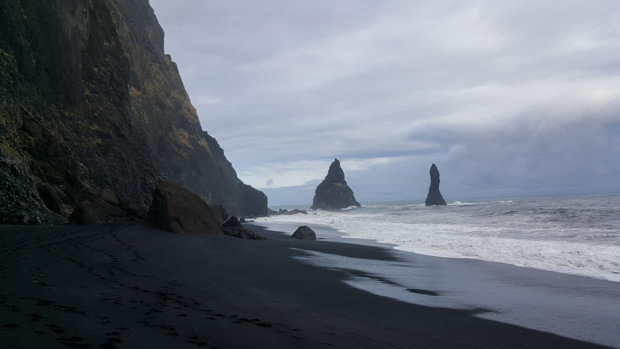
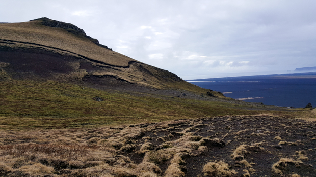
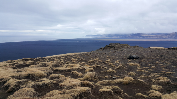
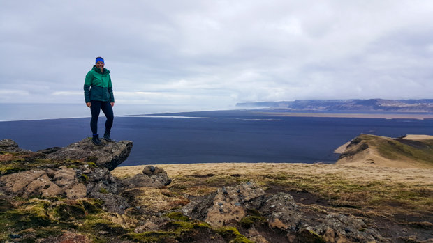
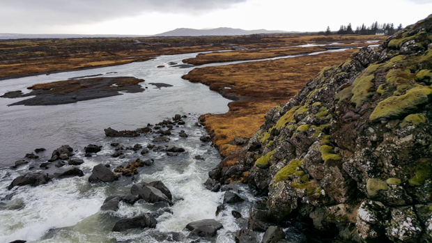
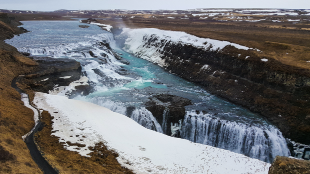
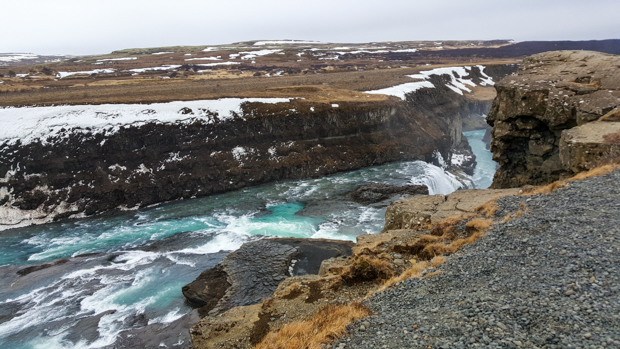
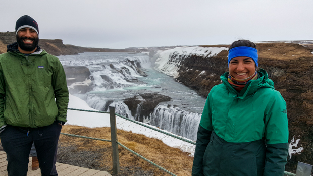
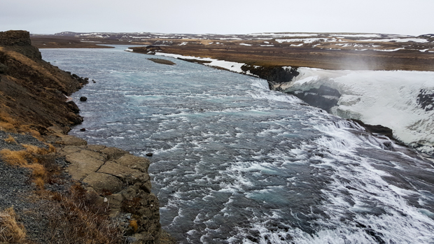
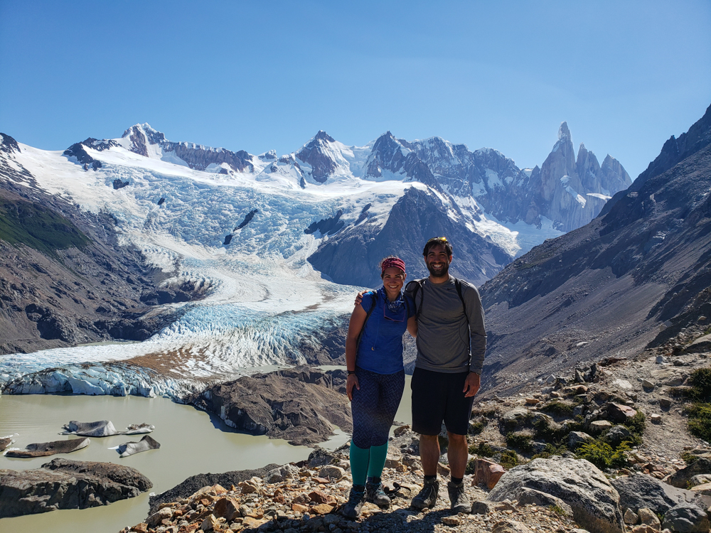
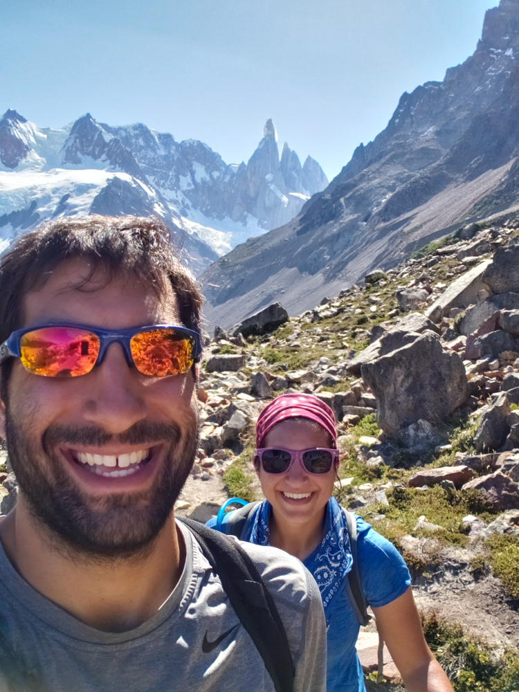
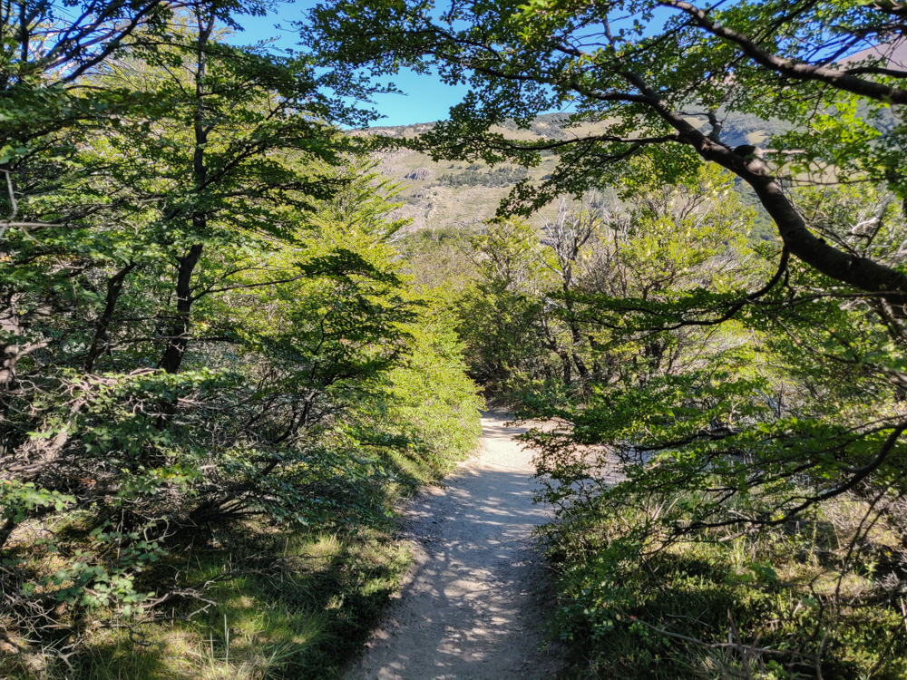
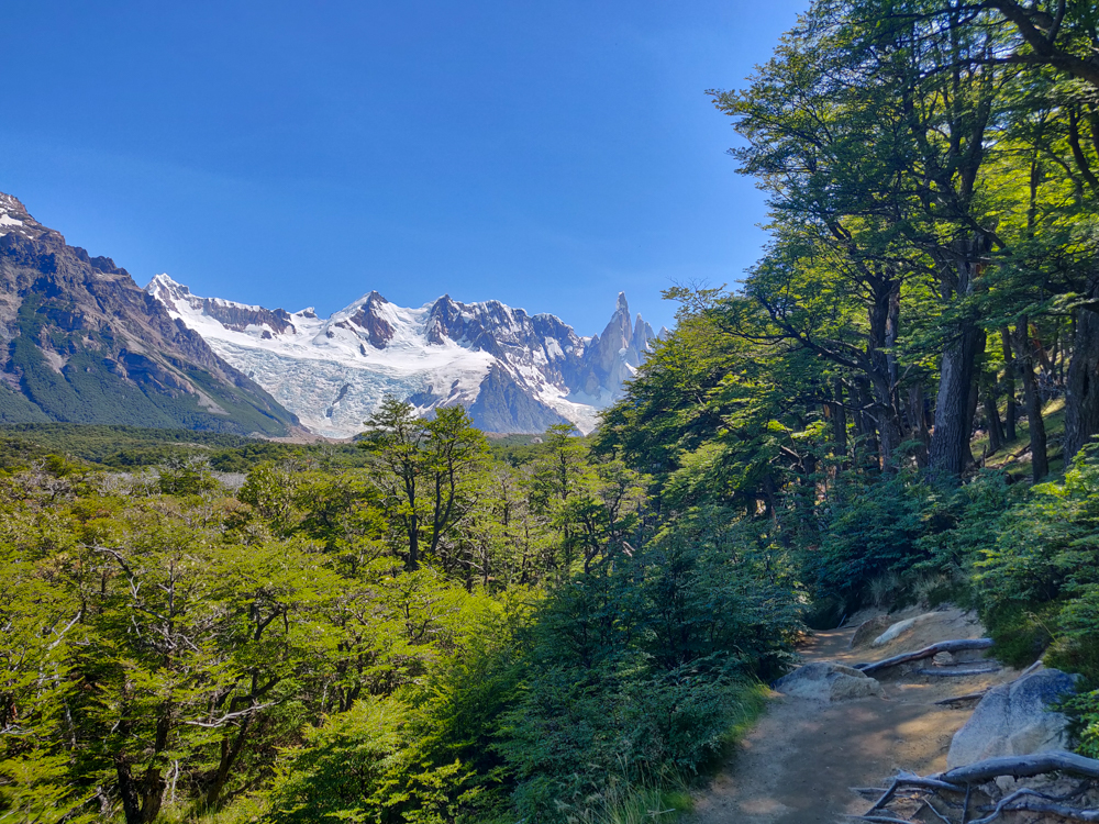
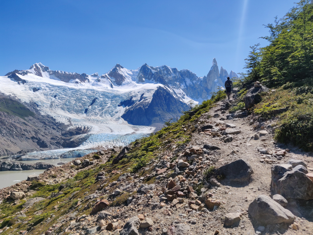
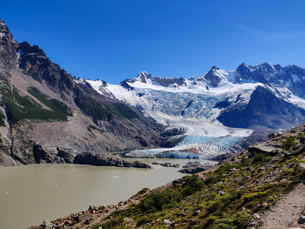
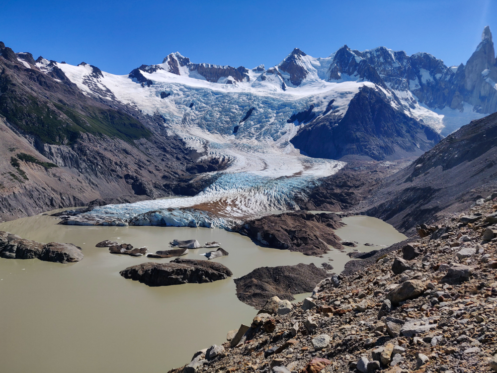
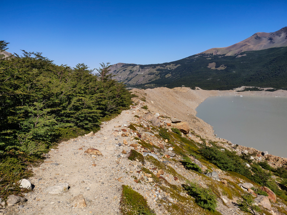
After the start, it got much flatter and much shadier for the entire middle stretch of the hike. That was a welcome break! And then, after a tiny uphill, we made it to the lake! Laguna Torre, with its breathtaking waters the color of very milked-down coffee. Yeah, it was kind of gross looking. If that was the main attraction of the hike, I would have said, “NOPE not worth it.” But, you’re really there for the glacier at the far end of the lake.

Tree-shaded trail
There’s nothing better than a tree-covered path
Glacier in the distance with a nice, shaded trail in the foreground
We were definitely thankful for that shade along the trail!
The brown, murky lake
Check out that crystal clear water… yum…
Panoramic picture of the lake and surrounding mountains
It’s still pretty awesome, though.
Laguna Torre with the glacier in the background
Spot the glacier!

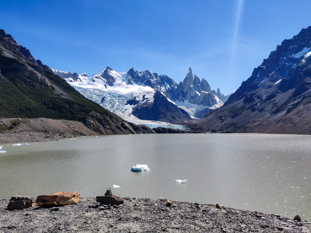
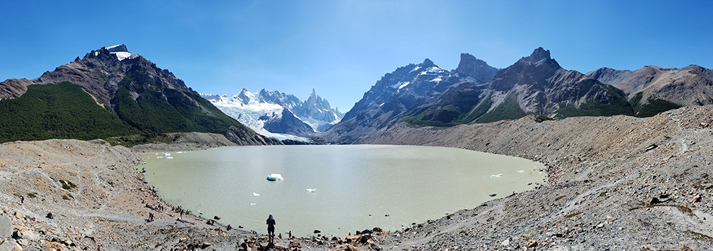
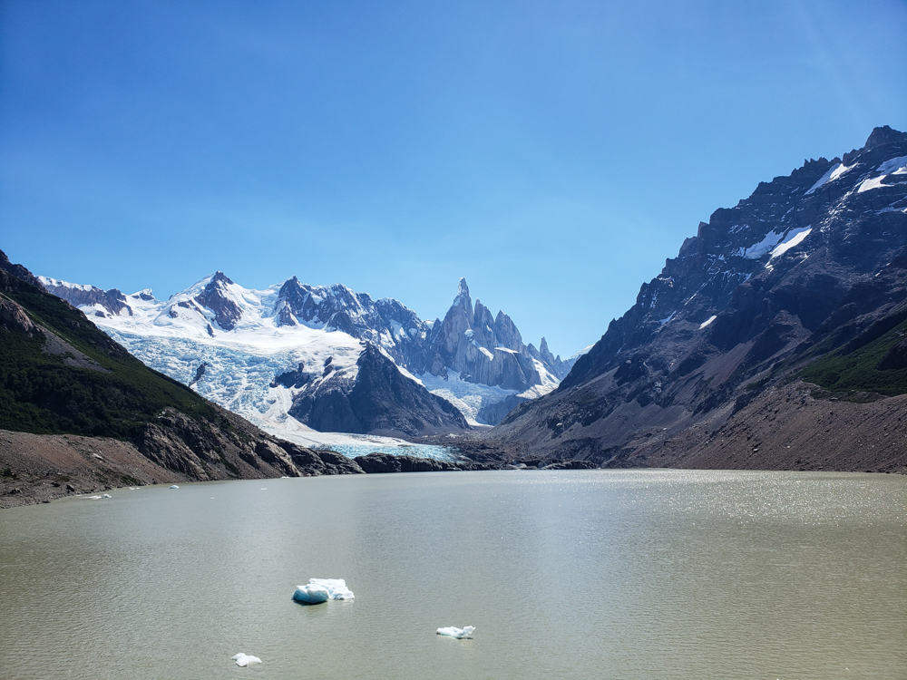
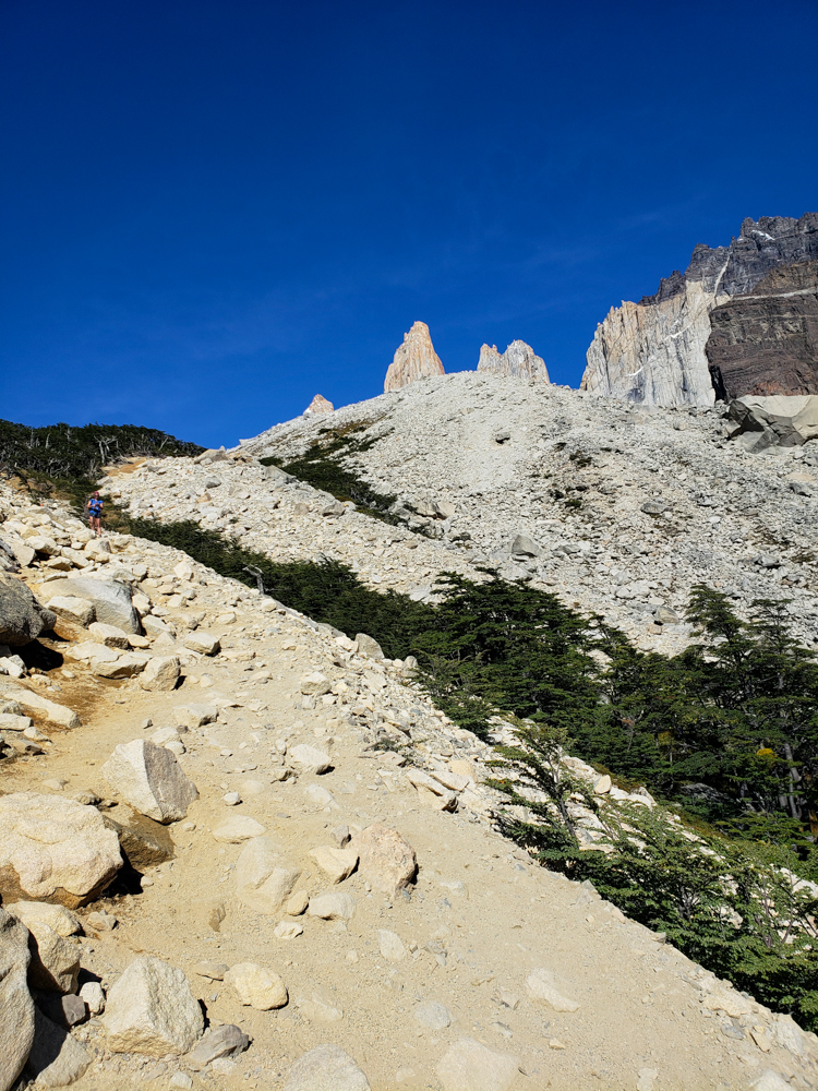
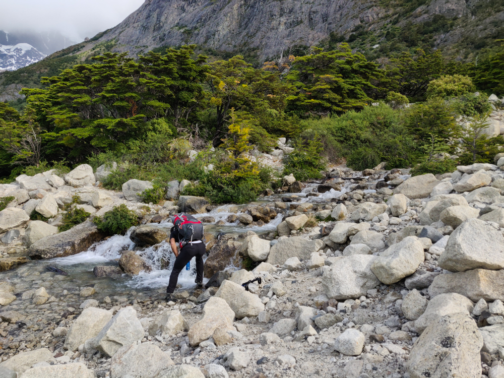
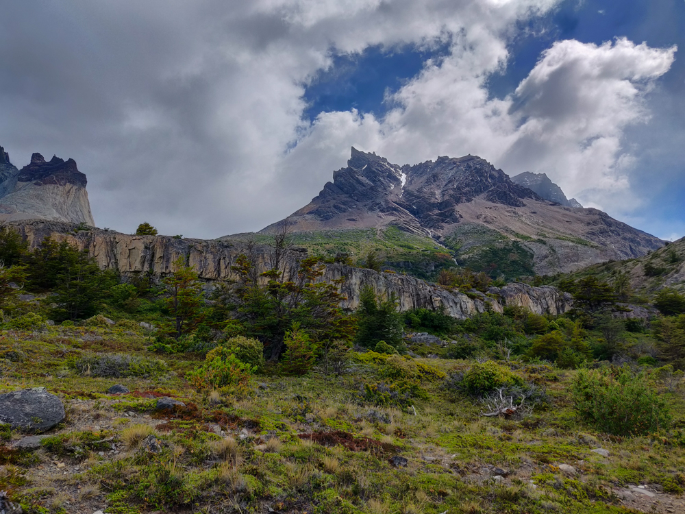
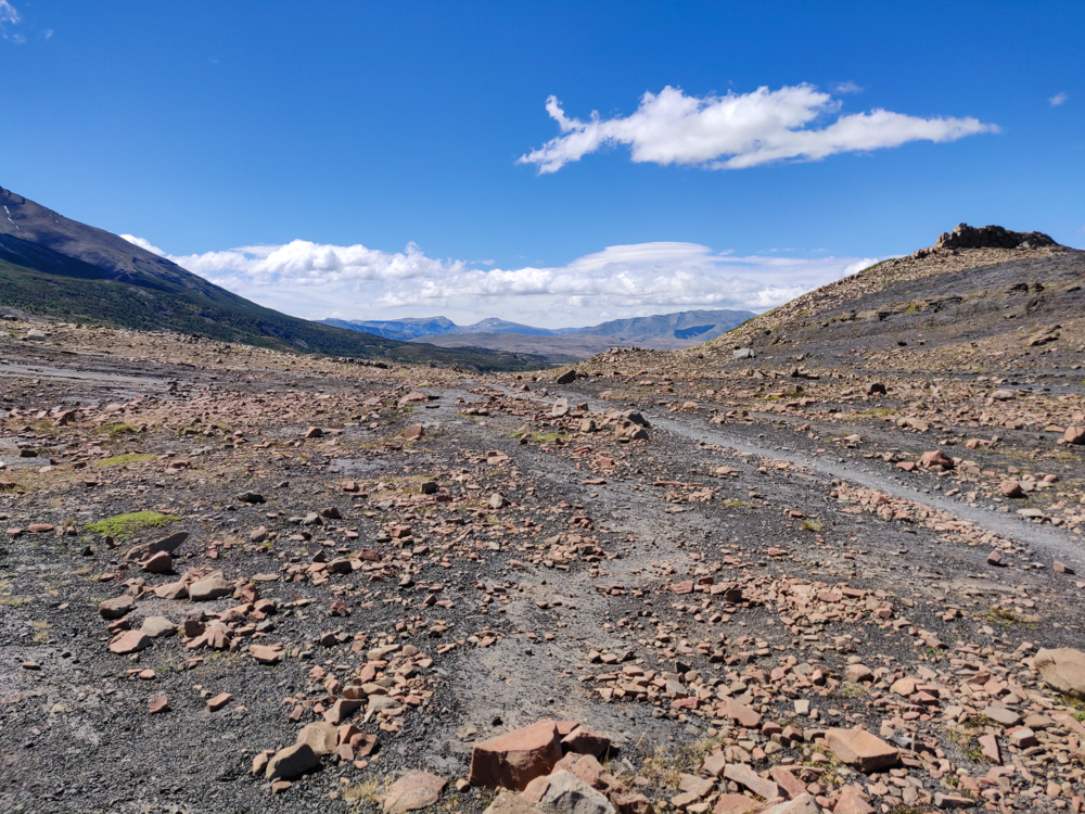
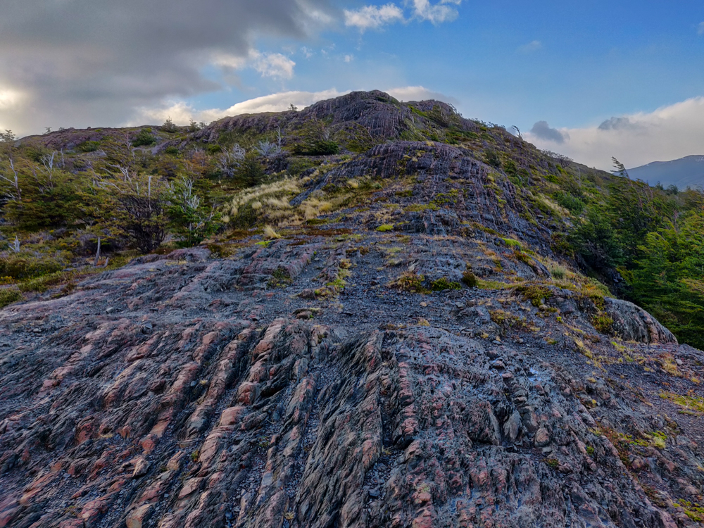
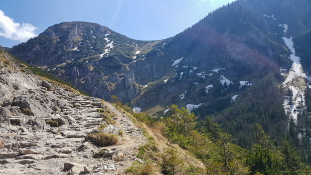
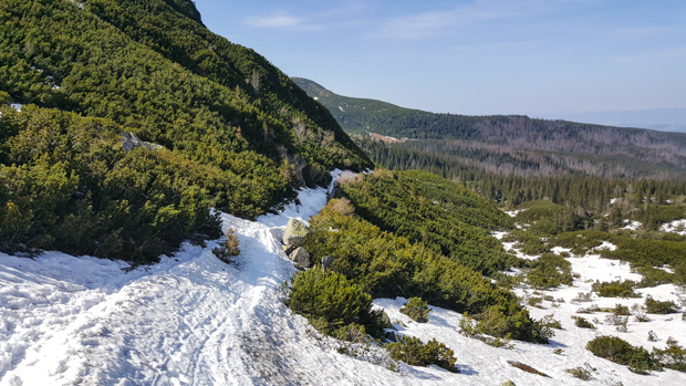
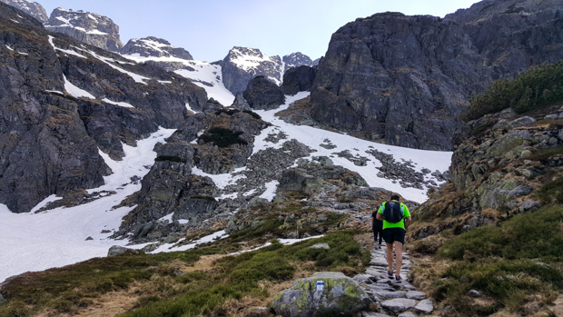
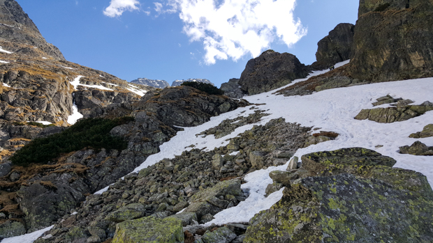
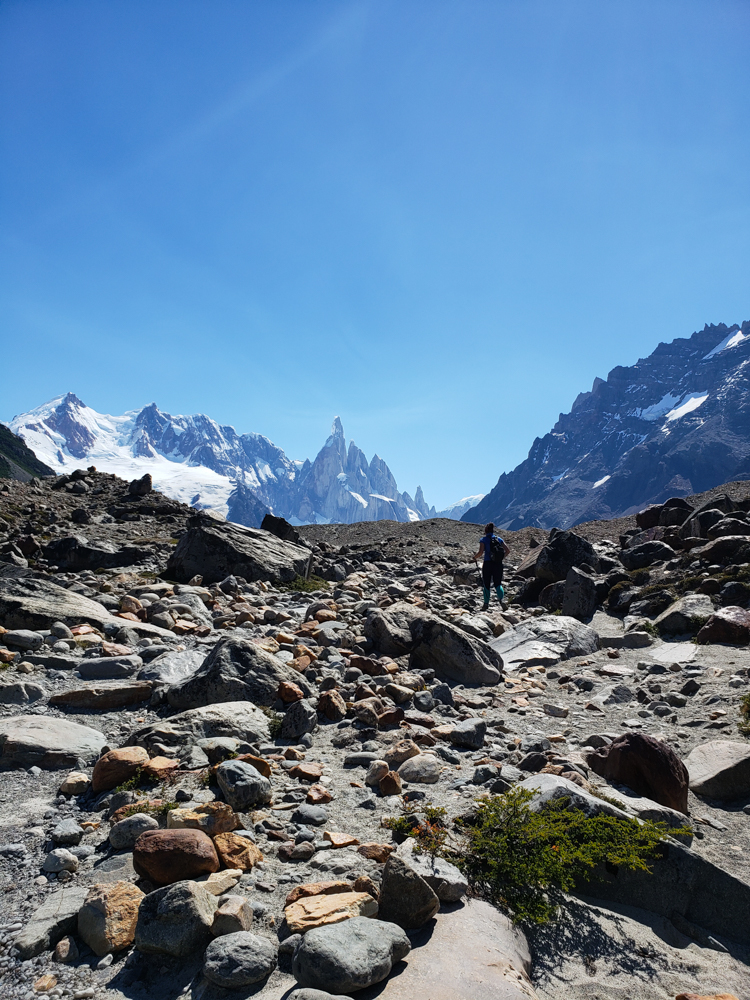
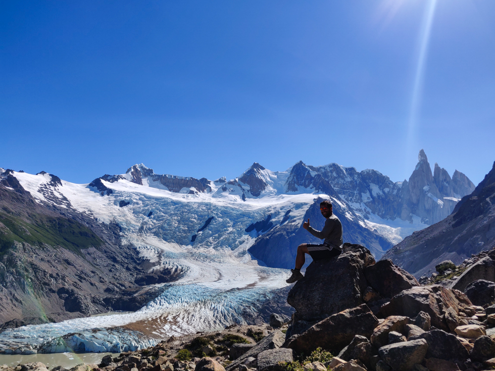
We did this extension of the hike to a viewpoint closer to the glacier, and as well-marked as the beginning part of the hike was, this part had exactly ZERO trail markers… unless it was actually so unclear that we were not even near the actual trail. I think we were, though, because part of the hike was along a ridge where there weren’t many other options, so I’m thinking it was actually just terribly marked. The extension was completely exposed to the sun, very rocky, and all uphill. And we spent the whole time going, “Hmm, these rocks look like they’re a little more trampled down, maybe the path is over here,” crossing our fingers, and walking that way.

Me walking along a ridge
This part of the trail was pretty easy to follow, but it wasn’t all this clear.
Mike way up ahead on the trail
Pleaseee don’t make me climb up anymore. (Bye, Mike.)
The glacier!
Glacier glacier glacier!

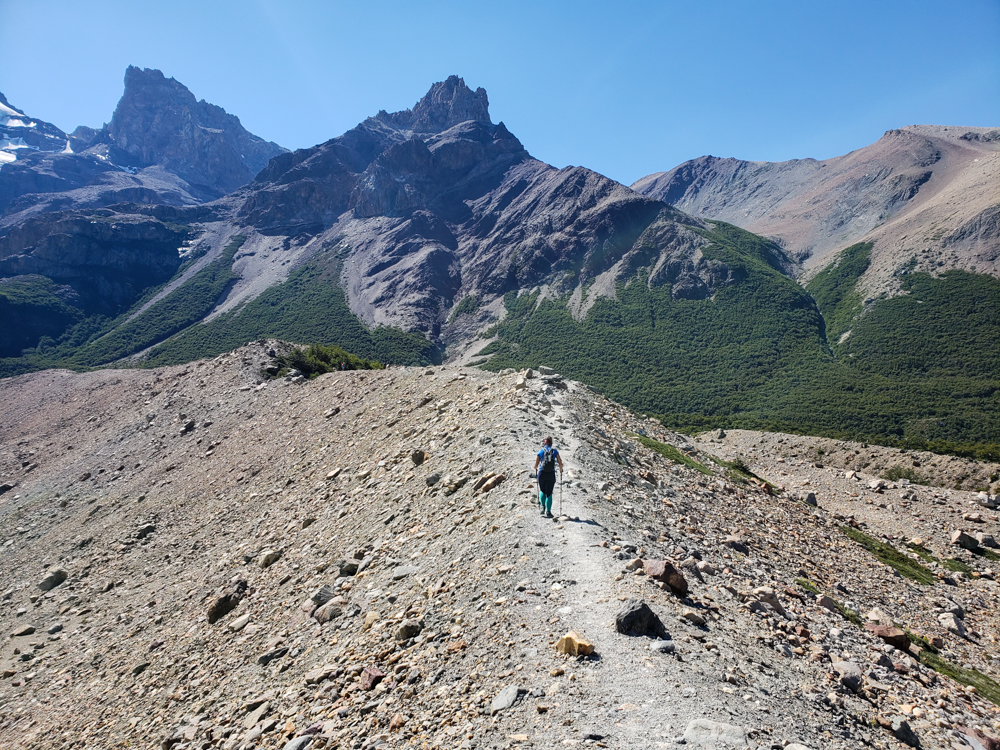
I don’t even know if we made it to the actual viewpoint because we never reached a sign that said we did. We got to a place that looked like it COULD be the end and then Mike decided that if it wasn’t, it was better than the actual thing anyway (based on nothing but his intuition). That was fine with me. I was ready to turn around. We ate a snack in the shade of some rocks before turning around.

Mike with the glacier
Mike’s classic thumbs up
Another glacier pic
As usual, it looks like we’re on another planet

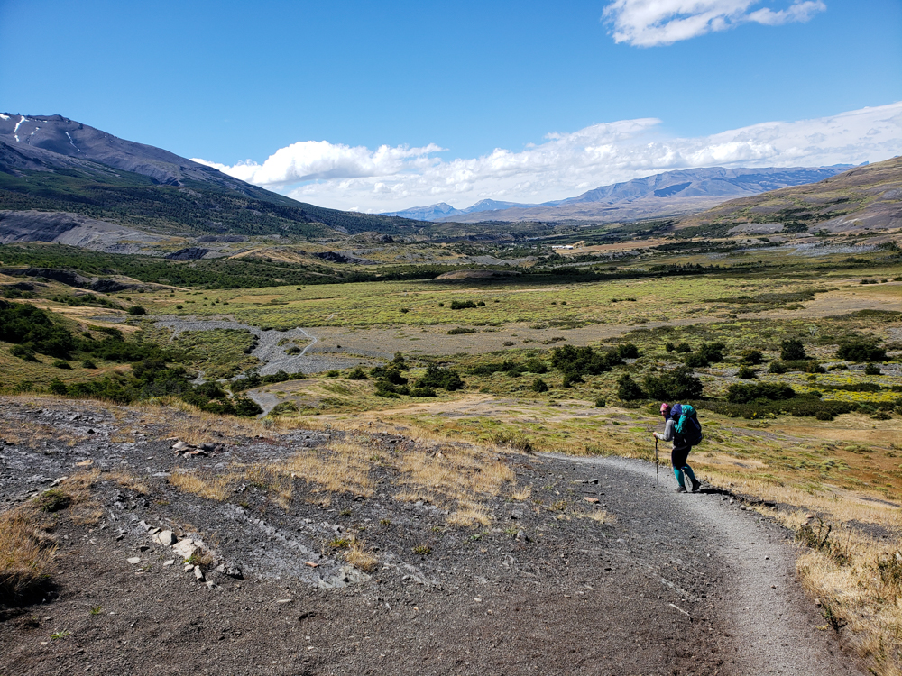
On the way back, my body was so over walking. Mike was laughing at me because I spent considerable energy ranting about how they have some nerve putting up signs that tell you what kilometer you’re on. How rude, right? You may be thinking, “Oh, that sounds great! Then you know exactly where you are and how far you have to go.” Yes, but no. Yes, I knew exactly how far we still had to go, but no, it wasn’t great. It ruins any chance you have of deluding yourself into believing that there’s only a little bit left. I spent the rest of the time yelling at him (kindly, of course) to tell entertaining stories to distract me from my misery.

Me and Mike with the glacier in the background
Us with a glacier. No big deal. No matter how many glaciers we visit, I’m still totally awed.
The path headed down the mountain
On the way back down! Much better than the way up, though we still had no idea where we were supposed to be walking.
Little waterfall along the trail
Pretty!

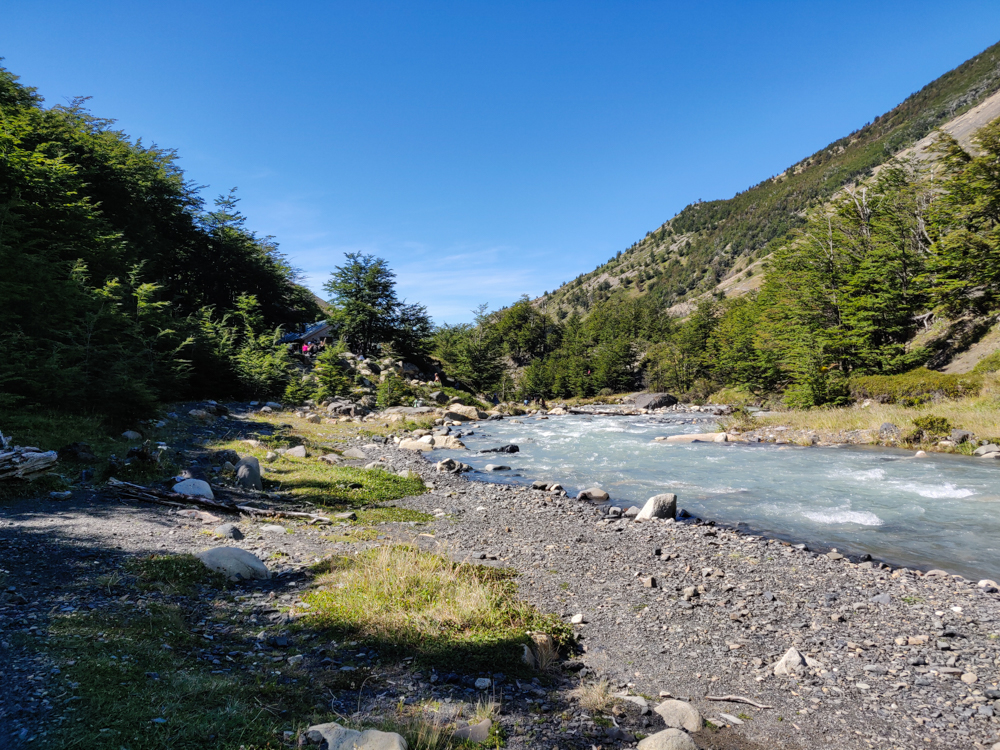
When I’m hiking, I go through these phases. At the beginning, my feet hurt and it’s awful, but soon enough, they go numb, I feel fine, and I’m cruising. Later, my feet inevitably remember how unhappy they are and start screaming at me, and I hobble along in agony. Eventually, I get like a 4th wind and can crank out a few more kilometers until I crash and burn again and hobble the rest of the way home. The good thing about this hike was that the trailhead was maybe 20 steps from our hostel, so I really could just collapse at the finish line.

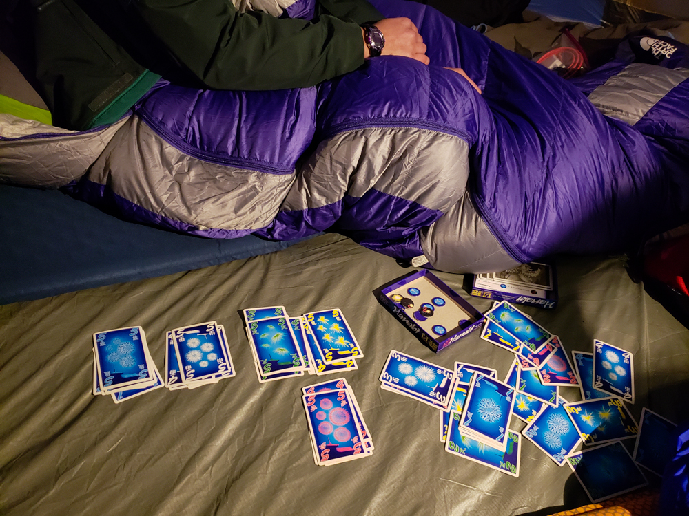
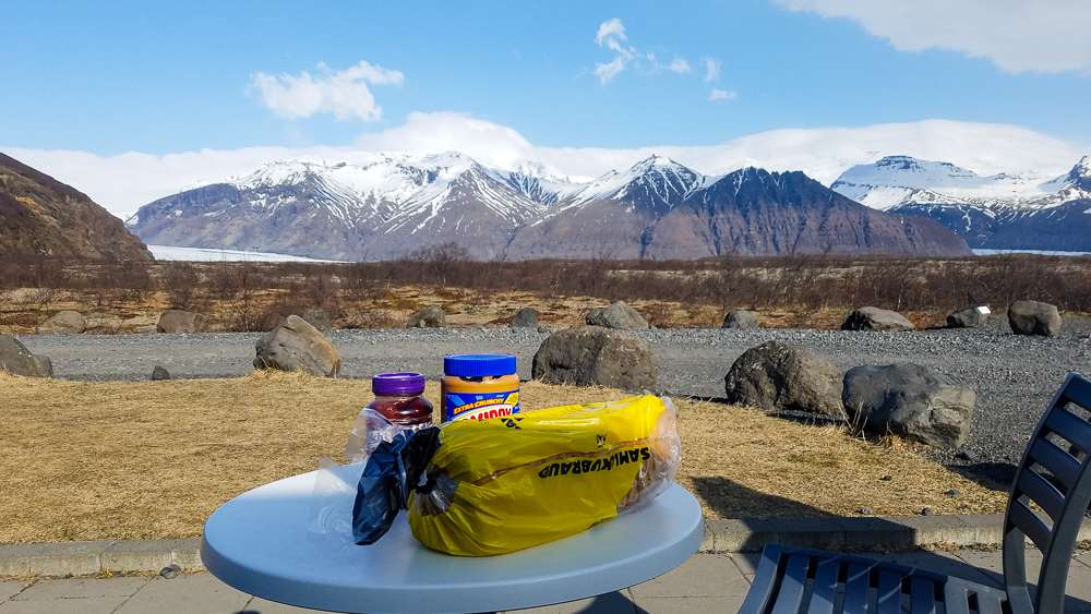
As grumpy as I was at the end, I was happy that we had just done it and had one less day to worry about getting good weather. We spent the rest of the night hanging out with some people we met at the hostel, draining our fresh blisters (that was only me), and crying over the sad state of our feet (also only me). And eating mass quantities of ravioli, the official hiking food of Mike and Lara. All in all, it was a good (and exhausting) day.

Our final day in Torres del Paine started bright and early… if by bright you mean dark because the sun wasn’t up yet. We had about 9.5 hours of hiking ahead, and we needed to finish by 3ish. So, we set our alarm for 5AM. Well, I set mine for 4:50 so I would be ready at the same time as Mike, and then I ended up waiting for him until 5:40!!! 5AM Lara was a little grumpy about that, but I suppose it just makes us even for all of the days when I was the slowpoke.

A map of the park with different legs of the trail highlighted
Here’s our map one more time… Day 1 was up and down the pink. Day 2 was along the blue and then up and down the vertical part. Day 3 was along the orange. Day 4 part 1 was up and down the purple, and then part 2 was along the yellow.

I read in various places about doing this hike in time to see the sunrise. From the end viewpoint, the sun doesn’t actually rise in a direction where you can see it, but I guess you’re supposed to do it for the golden morning sun reflecting on the rocks.  Our campsite was about 4 hours away from there which would have meant waking up around 2AM and hiking the whole thing in the dark. I bet you can guess what we thought about that idea. No. Freaking. Way. I know that sometimes I do things that may seem a little insane, but middle-of-the-night hiking on 3 hours of sleep is not something I’m generally interested in. Personally, I was more than pleased with our view of the sunrise over the valley, but I’ll let you be the judge.

Here comes the sun…
You can do it, sun!!!
WHAT JUST HAPPENED? THE COLORS! THE VALLEY! MY EYES! I know I keep promising this, but it really DID look like this! Don’t ask me how. I DON’T KNOW HOW.
Morning trail views

We hiked for about 1:40 before hitting the first landmark of the day, another campsite, Chileno. It didn’t have any vacancies when we were booking which is how we ended up in the middle of nowhere… but after hiking there, I was actually happy that things turned out the way they did. The path to the campsite is a lot of up and down, and a lot of super steep, gravelly up. If we’d been camping there, we would have had to carry all of our stuff up those hills instead of just daypacks, AND we would have done it at the end of Day 3. Noooo thank you. Things worked out exactly the right way.

Headed to Chileno

We saw maybe 3 people on our way to Chileno but figured we’d see some life once we made it to the campsite. Nope. Chileno was like a ghost town. Seriously, we saw zero people during our stop there. Zero.

Oh well! All the better for our hike. It was pretty ideal – the temperature was super pleasant, my legs were feeling completely fine, and the scenery was beautiful. While the walk to Chileno was very sun-exposed, it didn’t matter because it was still so early. From Chileno until the next landmark (about 50 minutes away), there were a bunch of pretty forests to keep us cool. The trail had a lot of up and down which could have been annoying, but it was easy to get distracted because of the trees and the rivers and the overall ambiance.

Seriously the best kind of trails… easy on the feet (no rocks, thank goodness) and sOoOo pretty! (Not sure why I did that obnoxious “O” thing, but it felt right so I’m leaving it.)
Slightly more trustworthy bridge than the usual…

The next landmark is the ranger station at the base of the ascent to the viewpoint. When we got there, we saw the first hikers coming back in the other direction, aka the crazies who hiked up to see the sunrise. If they started at Chileno then it’s not THAT crazy, but we saw some people who were definitely at our campsite. Good for them, I suppose.

From there, it’s less than a mile in distance to the viewpoint, but the time estimate for that segment of the trail is 1 hour. That information alone gives you a pretty good idea of what the trail is going to be like – steep, steep, and steep.

Sure enough, it was. Mostly, it was like stairs… not in the way where the rocks are actually planned out and are reasonably sized like stairs, but in the way where there are rocks and they’re big and maybe if you were a giant they would be good stairs, but since you’re normal sized, it’s much less convenient. The whole time, you’re thinking, “Well, this is better than if it was just super steep,” but you’re also wondering if you’re just saying that to make yourself feel better. And then you hit a stretch where it IS just super steep, the trail is loose gravel, and you worry about your foot slipping with every step… and you think that maybe the rocks were actually better, but “better” still doesn’t mean “good”.

Thankful for shade.
This is where you get your first glimpse of the top of the towers, though I didn’t realize it at the time. I was too busy crying over the fact that we weren’t at the top yet (or possibly just sweating from my eyeballs).

The beginning part was kind of okay (the “giant steps” part) because it was under tree cover, but the last stretch was horrible. No trees, just a rock wasteland. A very vertical rock wasteland. A very vertical rock wasteland with a very bright sun determined to melt off our skin. We kept asking people who were coming down how much we had left, and I could tell from their faces before they even said anything that it was an answer we didn’t want to hear. I so prefer being the one coming down rather than the one on the way up, begging for information.

I was about ready to say forget it (though not really because if you’re going to stop a hike before you finish, it’s better to stop it before you even start. Once you’re going, there’s no giving up) when we came around a corner, and BAM! We were there, hit with an insane view of a lake and the famous torres (towers) of Torres del Paine. It is still completely baffling to me that we spent so much time hiking up… to a lake. Lakes, to me, are things that happen in low areas, not things that you find at the top of mountains. Mind. Blowing.

BAM! First look when you turn the corner
Then you get a better view of the lake… (brace yourselves for the same picture a few more times).
Down by the water. Are you sick of the same picture yet? SORRY BECAUSE I’M NOT FINISHED.
Reflections!
Not posed. (Definitely posed, though this is basically the position we were in the entire time that we weren’t taking pictures. Staring with “how are you real? eyes.)
Looking the opposite direction from the lake. Give this lonely landscape a little love! It’s pretty but probably underappreciated considering the competition.

Even though we got such a late start (hehe), there still weren’t many other people at the top when we showed up. There were maybe three other groups, but you still could easily get pictures without anyone else in them (the most important thing, of course). We hung out/snacked/stared in awe for about 40 minutes. I would have been cool with staying longer, but Mike said we should get going to make sure that we had enough time to make our bus. Ugh. What a painfully rational thought.

As good as my knee felt on the way up, that’s how bad it felt on the way down. I tried to keep as much weight off of it as I could, but it was impossible. By the time we got to the bottom of the super steep part, I could barely walk. Great.

We did it!
Back down, through the rocky desert, slowly melting into a puddle (but prob that would have helped because then I would have flowed my way down the mountain instead of creak, crack, crying my way down.)

I don’t know what happened. There must have been some kind of trail magic because after maybe a mile of screaming on every step, it was like it got tired and gave up. And then it never hurt again, for the rest of the trip. I suppose I finally broke my knee’s spirit and transformed back into the youthful 20-something I actually am, instead of a creaky, old 30-something in desperate need of a knee replacement. Weird, right? (I clearly have high hopes for my 30s.)(Jk though I’m sure it’s going to be great.)

We definitely started our hike at the right time because there was barely anyone on the way up, and we saw a TON of people on our way back. Between the guard station and Chileno, we kept passing people who were already SO tired, and they hadn’t even made it to the hardest part yet. AND it was only getting hotter outside. They’d ask how close they were, and I usually didn’t need to say anything because my “Oh no, how do I break the truth?” face had already given it away. I don’t like to be the bearer of bad news! We were the bearers of a LOT of bad news.

Almost back to Chileno… one of our last moments of somewhat peaceful nature

Back at Chileno, it was a completely different scene from the morning. Chaos. There were people EVERYWHERE. Mike and I looked at each other and were like, “Get us out of here.” Tourists are the worst, amirite? (I know.) Seriously though, having some sort of awareness of the people around you is generally recommended and seems to be something that people often forget to bring with them on vacation.

THESE were the tents at Chileno. Would you sleep on one of those platforms? Definitely not for active sleepers! No chance I would have made it to my tent if we stayed here (because sad, tired legs), but they’re fun to look at!

From there back to our campsite, we passed so many more people. It was definitely the most crowded day. Finally, the crowds I’d been promised! Good thing we already had enough time for our “just us and nature” moments, so we were fine with sharing. This hike is the most accessible because you can drive almost directly to the trailhead (the parking lot is closer than our campsite was), so there were day hikers which we weren’t used to. That also meant that there was a much more varied population of hikers, rather than the slightly more intense backpacking crew of the previous few days. Some of those people… I don’t know. They might still be hiking up that mountain they were moving so slowly.

On our way back out of the valley
90% of the pictures I took of Mike were because he was standing in the way… so I would take a picture with him in it and then tell him to move. I’d say it’s a win-win. He got some nice pictures out of it!
Spot the sad hikers
Ignore how gross and sweaty I look (you can focus instead on how gross and sweaty Mike is). But this was quite possibly the best ice cream I’ve ever eaten.

Ignore how gross and sweaty I look (you can focus instead on how gross and sweaty Mike is). But this was quite possibly the best ice cream I’ve ever eaten.

We ended up making great time on the hike back and were at our campsite 40 minutes ahead of our goal! That gave us time to cool down a bit and pack up the tent without having to rush. Our celebration was a little premature, though. We still had to get to the visitors’ center to catch our bus… another 7km away. Everyone said it would take 1.5 hours to walk which didn’t sound so bad, but I wasn’t thinking about it in terms of “you’ve already been hiking for 8 hours before this”.

We thought about hitchhiking, but it turns out that neither of us is brave enough to commit to a solid attempt. So, we walked. Looking back, I’m 100% confident that we could have gotten a ride. What a day to choose to be shy. I blame Mike because that’s what siblings do. And also because he talked a big game and had no follow through, so it’s clearly his fault.

This bridge was literally the only cool part of our walk to the visitors’ center
It was all the way on the final kilometer though, when the destination was in sight…
So we totally could have just gotten a ride and then walked back 5 minutes to see the bridge.
Unedited post-hike state

By the time we made it to the visitors’ center, both of us were about ready to keel. The entire 7km was shade-less and also essentially view-less which meant there was nothing to distract us from our misery along the way. I was thrilled to have 6 hours of bus ride ahead. I felt like I wanted to sit down for the rest of forever, and basically, I got my wish.

The ride back to Argentina and El Calafate went smoothly, and we even got back before the grocery store closed which was clutch. Mike boiled us a feast of ravioli for midnight dinner, our first cooked meal in four days. And what a feast it was!

And then we procrastinated re-packing our bags for the next leg of our trip and ended up going to bed SO late even though we had an early bus to catch. Classic.

Beautiful view of the lake with sky blue water

Our third day of the W trek started out much better than the second. There was no wind in the forest where we were camping. I didn’t wake up terrified of blowing away. Nothing disturbed us until my alarm went off at 8AM which means Mike slept for 14 hours straight and I slept for 11.

We treated ourselves with a late morning because we had our shortest day of hiking ahead, just over 10 miles. Plus, we were both exhausted, and I think my body would have full-on rebelled if I had tried to wake up any earlier. Even with the extra rest, I wasn’t thrilled about having to move.

A map of the park with different legs of the trail highlighted
Here’s the map again! Day 1 was up and down the pink line, Day 2 was along the blue line and then up and down the vertical part, and Day 3 was along the orange line.

There was no sense of urgency in getting ready to go. We didn’t even have a tent to pack up (we spent that night in a rented tent because it was the only option left when we were booking), and it still took us until about 9:30 to get completely ready (okay… probably it was mostly me taking my sweet time, but we really had no reason to rush). Mike and I met at the trailhead… and it looked like we were dressed for completely different seasons. I was feeling the morning chill, so I had leggings and my winter coat on. He was in his lightweight hiking pants and a t-shirt. The difference is that he’s more often hot than cold, I’m the opposite, and we dress accordingly. Sometimes we’re both right about what will work for us, but this did not end up being one of those times. Who do you think was wrong?

Okay, okay. It was me. I think we walked for 10 minutes before I felt like I was going to melt into a puddle. There was way more sun than I was expecting, plus I hate starting out cold even when I know I’m going to warm up from the exercise.

Lake Nordenskjöld
First views of the lake
Another view of the lake
That. Water.

Our segment for the day was the second bottom part of the “W” which meant we had to take all of our stuff with us again. Since there weren’t any big viewpoints along the way, I thought it was going to be an underwhelming day. HA! You’d think I would have figured it out by then. Maybe there weren’t any mind-blowing, mountain-surrounded valleys, but the scenery was still amazing. Soon after we left our campsite, Francés, the forest thinned out, and we started walking downhill towards Lago Nordenskjöld (that’s about when I decided I needed to take my coat off).

Epic mountain
Yeah, the views were still pretty fantastic

After about an hour, we made it all the way to the edge of the lake! I had no idea that we were going to get so close to the water. It was beautiful! And we walked along a little rock beach which made me like it even more because you know how much I hate sand (and if you don’t, just know that I hate it a lot and do my very best to avoid it).

The rocky shores of the lake
Don’t you just want to go for a swim?
Pretty lake view
If this wasn’t only an hour into the hike, I would have tried to convince Mike to take a snack break so I could stare at the water for longer.
Walking along the lake shoreline
<3 <3 <3

The route for the rest of the day followed the edge of the lake pretty closely, though that was the only time we were actually within touching distance of the water. From there, the trail headed uphill and back into the woods for one of the only shaded stretches of the day. That’s when we reached our first landmark, another campsite, Cuernos. Cuernos is another site where people sometimes stay after the hike we did the day before, and all I can say is thank goodness we got a spot at Francés. No chance would I have survived another two hours of hiking the night before (either my legs would have rejected me, or Mike would have killed me out of annoyance).

Mike filling his water from a rocky stream
This was the actual best thing… I loved being able to drink straight from the rivers! Mike is filling up his water bottle.
The lake
And I thought it was going to be an underwhelming day. HA!
Mike and me with the lake behind us
Lake selfie!

With our fresh day 3 legs, the hike to Cuernos took only about an hour and a half. We stopped briefly to put on sunscreen which turned out to be a VERY good idea, though we probably should have also reapplied because my face was very pink at the end of the day. And my arms! Oh, my poor arms. I was wearing long sleeves, so I didn’t put anything on them… and when I started getting overheated, I pulled my sleeves up to my elbows without even thinking about it. I had an embarrassingly distinct line on my forearms which I hoped would even out the next day a bit. (Spoiler alert, it’s been like a month and a half since this day, and I STILL have a line on my arms. So the moral of the story is to WEAR SUNSCREEN.)

A rocky mountain peak with a little waterfall
Spot the waterfall!
The lake from above
Bye, bye shoreline! Up we go…

After Cuernos, the hike felt a bit like walking through the desert. Any hint of the morning cool was long gone, and there was NO shade, just low plants. It was pretty, that’s for sure, but it was also exhausting. It kind of ended up working out in my favor because usually, Mike is like, “Meh meh meh, I don’t need a break,” but he was definitely feeling the heat too. It also helped that we had such a short day, so we didn’t feel like we needed to hurry.

The rocky trail with some low plants
The trail. Pretty plants, but not great for shade
Me with the lake
I hope you like lakes because this isn’t even close to the last lake picture
The trail bending away from the lake
Is that a picturesque trail, or what?
A particularly rocky stretch
I can’t say my feet appreciated those rocks, though

Elevation-wise, the whole day was a constant up and down and up and down. The good news was that my knee wasn’t hating me as much, plus I had a fresh strategy for the downhills to keep it that way (aggressive use of my hiking poles mixed with a slight side turn, in case you were wondering). Thanks to that fortunate development, we managed to keep a good pace throughout the day. I was surprised by how fast we could comfortably go when I wasn’t crippled by blisters and throbbing knees! And it was so nice to be able to focus on enjoying the hike.


Me walking across a suspension bridge
Another suspension bridge! And another 1 person at a time limit
Mike crossing a suspension bridge
Mike making the trek across
Pretty red and orange streaked rocks
LOOK AT THE COLORS OF THESE ROCKS
Another gorgeous trail pic
Ugh so many ugly views I can’t even stand it
Weird-looking cliffs by the trail
Funky mountains. Seriously what is happening with those cliffs?
Beautiful view of the lake with sky blue water
I don’t know what was going on with the light and the water when we got to this point, but yes, this is what it actually looked like and no, I couldn’t believe my eyes.
Another view of the lake with pretty colored rocks
Imagine a pterodactyl in this picture and try to tell me that it doesn’t look like it belongs.
The lake with clouds reflecting on the surface
I CAN’T DEAL WITH THIS. How are these colors real? How is this place real? How did we get so freaking lucky with the weather? WHY CAN’T I LOOK AT THIS VIEW ALL THE TIME FOREVER FOR THE REST OF MY LIFE?
Mike and me with a mountain backdrop
I’m sure you’re sick of lake pictures by now, so here’s us with some mountains instead (except just kidding because how could you ever get sick of those???)
Me gazing out at the lake
So darn pretty
Crossing the river with no bridge
Pretty sure it looks like I’m smiling because I’m laughing about how I’m definitely not going to make it. Mike took this picture and then attempted to direct me across. Once I accepted that water was going to get into my boots, it wasn’t as hard.

Our next landmark was a fork in the trail. The left fork continues along the route of the W, and the right fork leads to the campsite where we were spending the night (because the more convenient campsite was booked… that’s what happens when you book things only 2 weeks ahead of time. No complaints from me, though. I was just happy we could make it work!). I knew our campsite was kind of in the middle of nowhere, but I didn’t realize just how out of the way it was. I estimated it was maybe another hour after the fork in the road. It was not. Try 2.5 hours.

Soon after the fork, we found ourselves at the edge of a river that absolutely should have had a bridge. It was wide, the current was strong, and there was literally no way to get across without getting water in your shoes. I was mostly worried that I was going to fall over and get everything in my bag wet, but my hiking poles saved the day once again, and my socks were the only thing that didn’t come through unscathed.

From that point on, there was truly no shade. Mostly, there weren’t even ground plants. Just rocks. On the bright side, it was fairly flat. I spent most of the walk marveling at the colors. It seems almost stupid when I write it out, but the colors just seemed so vibrant in comparison to other places. Like I was walking around with color filters over my eyes that made everything look unrealistically saturated (so if you’re thinking that my pictures look like I did a little too much filtering, I promise I didn’t. It somehow does actually look like that).

Mountain views
Oh, you know. Just another stellar landscape
Red and black rocky stretch along the trail
This is definitely the surface of another planet. Check out those rocks!

Eventually, once I realized that my time estimate was WAY off, I got to the point where I transformed into Mike (a terrifying image). I was trucking because my knee didn’t hurt, and I just wanted to get to the end. No breaks! No pictures! (Kidding, there’s always time for pictures.) No snacks! I was determined to keep moving at my aggressive pace and left Mike behind at some point. Who knows what he was doing back there, but I was not stopping. Then, we got to the place where I thought the campsite was, and nope. There’s a hotel there, Las Torres, and I thought the campsite was close to there. It’s not. We still had at least another 30 minutes.

Me walking down into the valley
“Mike! What’s taking you so long?”
The valley
THE COLORS
The trail running through a field of weird, low bushes
So… these plants are weird.
More weird bushes
Within minutes, we went from the surface of another planet to this… also possibly another planet but like… what?
River running through the valley
At this point, I was ready to be at the campsite. When I took this picture, I probably thought we were almost there. NOPE. This was still maybe 40 minutes away.

By the time we arrived at the campsite, I was beyond ready to sit down. At least my knee wasn’t hurting, though! And I wore approximately 85 pairs of socks (+/- 83 pairs), so I didn’t get any new blisters! So many victories!

We set up the tent, showered, and went to sleep as soon as we could manage because we had a fun 5AM start the next day. Our last day in Chile!

Torres del Paine National Park is well-known for two major treks. One is called the W, and the other is the O… very creatively named for the approximate shapes of the trails. Based on our time constraints and wanting to have some diversity in our trip, Mike and I decided to do the shorter W (4 days rather than 8ish). For sleeping arrangements, you can choose to camp with your own tent, camp with rented equipment (that’s already set up at the campsites), or sleep in refugios (aka indoors with a bunk bed). For food, you can either bring your own, bring some of your own and get breakfast and dinner provided at the campsite, or get breakfast and dinner plus a bag lunch.

A map of the park with different legs of the trail highlighted
Here’s a map I marked up in an attempt to simplify this explanation for you. The W trek is the pink, blue, orange, and purple lines put together. The O is those plus the green line over the top. Our first day was spent going from the bottom of the pink line to the top and then back again.

We were trying to do this on the cheap (well, I was. Mike was fine with spending some money. I guess that’s what happens when you actually have an income. I don’t remember what that’s like…), so we brought our own tent and packed our own food. The challenge with that was the fact that most people bring camp stoves and eat actual food during the trek. We had no camp stove and no desire to figure one out before our trip… so we packed all dry food. I felt okay about that because it was only going to take four days. Any longer and we would have considered other options, I think. But nope! Four days and a good supply of protein bars, peanut butter (and jelly for Mike), bread, ham and cheese, gross chocolate cookies that I picked out (whoops! You win some, you lose some), peanuts, and dry ramen noodles (for me. I actually kind of like them that way. Mike thinks I’m crazy). Hehehe. Maybe it wasn’t the most elegant solution, but it worked just fine.

I was VERY worried about our first day of hiking. Mike and I have hiked together in the past, and we have very different approaches. I like to stop to take pictures, take frequent snack breaks, and enjoy the ambiance. I keep a good pace usually, but I’m all about the journey. Mike is a speed hiker. He doesn’t take breaks along the way. I don’t understand how he functions. I need snacks! I need water breaks! I need exhaustion breaks! He just powers through until the end. He might be a robot (the most likely explanation).

Selfie of me and Mike
Smiling because this was still very early in the day
Gravel path flanked by green plants and pretty mountains
Such a pretty valley!

We decided to start “early” because I’d rather get out and back early to beat the heat and not have to worry about the sun setting (though with a 10PM sunset on this trip, there wasn’t much danger of that), so we left our campsite at Paine Grande around 7:15. Based on the blogs I read, I was expecting the trails to be crowded. Everyone said that this is the high season, expect crowds, you won’t have that “just you and nature” kind of feeling, so if you’re into that, too bad. I was ready for crowds. We spotted our first hiker approximately 3 HOURS later. Geez, if only the trails were always that crowded. We seriously wondered if maybe we weren’t allowed to be hiking yet, like maybe there were opening times we didn’t know about? Nope. There just weren’t any people. I mean, spoiler alert, there were more people on our way back, but crowded? Definitely not.

Happy Lara walking through the valley before she blew away
You don’t even know how many people we had to ask to hide in the grass so they wouldn’t ruin our pictures

The first part of the hike was through a little valley. It was raining, but after our day on Perito Moreno Glacier, I felt pretty hardcore and was like, “Rain? Psh! NICE TRY, TORRES DEL PAINE. YOU’RE GOING TO HAVE TO DO BETTER THAN THAT.” Then we got out of the valley. And the wind hit us. And I ate my (mental) words.

Valley covered in plants and a pretty, windy trail
Try to tell me this isn’t beautiful (I won’t believe you).
Another view coming out of the valley
I can’t come up with more words to express how pretty it was there

That was around the time that we reached the lookout at Lago Los Patos (Duck Lake) which I, for some reason, thought was a hilarious name. In hindsight I’m not so sure what I was going on about, but I must have laughed about it for a whole mile at least. From Duck Lake on, the day’s hiking followed the lakes’ edges, and it was all incredibly windy.

Lake views with a mountain backdrop and aggressive winds.
Laguna Los Patos. Check out the plants blowing in the wind!
Laguna Los Patos
I can’t get over the colors in the lake!
Streaky rock formation
I thought these rocks were super cool.
Duck Lake
I didn’t realize this until Mike pointed it out, but when you look out in the distance, it looks like the surface of the earth just falls away. Behind this lake is Grey Lake which is at a lower elevation. So weird!

Hiking in the wind is the worst. Especially when the wind might actually be strong enough to blow you away. There were times when it was so strong that my trekking poles essentially turned into stakes that were the only thing keeping me from blowing off the trail. Each time I picked up a foot to take a step, I had zero confidence that it would land where I was aiming. And when the winds were strongest, they pretty much never did.

Lightly forested trail leading away from Laguna Los Patos
Walking away from Duck Lake

Laguna Los Patos is tiny compared to Laguna Grey, the next lake we encountered. We walked along Duck Lake for maybe 15 minutes. We walked along Lake Grey for the rest of our day. It took around three hours to make it to our first real checkpoint, Grey Campsite. That timing was nearly spot-on with the estimate listed on our map, and it made us start to think that we needed to take Chilean hiking estimates much more seriously than we take the ones in the States. At U.S. national parks, if you’re someone who has any experience hiking and is in decent shape, take the hike time they give you and divide it in half. We were thinking that might be the situation here as well, and it was not. Instead, it was like they wanted to give an estimate of how long it would actually take! Imagine that!

Pretty pink flowers along the way
Trail flowers
Grey Lake with some small glacier pieces floating around
Laguna Grey with the first glimpses of glacier pieces. Can you see them?
The hiking trail leading towards snowy mountains
The rocky trail. My feet did NOT like those rocks on the way back.
Grey Lake with its pretty, mountainous surroundings
So. Pretty.
Actually though, my toes were screaming.
Grey Lake with a faint rainbow
Rainbow! We could see both ends of it, too!
Dead tree skeletons
The tour guide on our ride into the park the day before explained why the park is super strict about where you can set fires (only in designated cooking areas). There have been a couple of forest fires accidentally set by hikers, and thanks to the strong winds, they spread crazy quickly and destroyed huge areas of the park. I don’t know if that’s what happened to these trees, but anytime we walked through a tree graveyard, I assumed they were tourist fire trees. They’re eerie, aren’t they? Like sad tree skeletons.
View of a little river gorge from the bridge
We crossed this super cool river along the way
View of the trail with Grey Glacier and Grey Lake in the background
That view… <3

From Grey Campsite, we went on a hunt for the Glacier Grey lookout point (yes, another glacier!). I say “hunt” because the lookout’s location was SO not obvious. Every other trail in the park was extremely well-marked, so I don’t know what happened with this one. After it was all over, I still wasn’t confident that we ended up in the right place. Oh, well. We did find a high point with good views, and what more do you need? Mike’s response to the glacier: “It’s not that cool.” Well, since we were hiking ON a glacier two days prior, yeah, seeing one across a lake wasn’t as impressive. I still thought it was cool though… because everyone knows that glaciers are made of ice! (Bad joke, ignore me.)

View of Grey Glacier and Lake Grey
Checking out Grey Glacier from our “lookout”
Mountains near the glacier. The continuation of the trail runs along the base of them.
Forest view with yellow and orange leaves on the ground
I love the colors!!

When the wind at the “lookout” became too much for even Mike (he said he was getting cold which is something I don’t think I’ve ever heard him say before), we headed back to the main trail. We had one more side trip to take before going all the way back to Paine Grande. There are a couple of suspension bridges near where the O trek meets up with the west side of the W, and I wanted to check at least one of them out. I don’t know what Mike wanted, but I assumed he’d be fine with it because he’s always up for doing more. I guessed that reaching the first one would take about an hour and a half of hiking from the campsite, and apparently at that point in time, an hour and a half extra in each direction (after already being out for 4 hours so far) seemed like a reasonable thing to do

Plank bridge along the way
There were so many fun little bridges and things along the way! I was impressed with the trail building.

For possibly the first time in my life, my estimate was exactly right (estimating is not a strength of mine), and we were there in an hour and a half. I thought the bridge was awesome. It seemed like some people were afraid to walk across, but things like that don’t scare me (I’m only scared of ACTUALLY scary things, like oranges). The height/potential instability probably made me like it even more.

View of the suspension bridge from the side
The suspension bridge! With some random girl crossing
Mike on the suspension bridge
Mike striking a pose
Me crossing the bridge
Venturing across the suspension bridge!

I felt like it was worth the extra time to get there, plus we also got a slightly closer view of the glacier. We crossed and thought about going to the next bridge as well, but as soon as we hit some stairs (maybe like 10 minutes after crossing the bridge), my legs said no way and we turned around.

Slightly closer view of Grey Glacier from below the suspension bridge
Another glacier view
Grey Glacier from slightly closer
Our closest glacier view of the day… aka not very close at all

The walk back to our campsite was painful. Up-and-back hikes are always a little rough because you know that however far you go is how far you’ll have to return. I’d just about reached my limit on the “go”… so the return was rough. My feet hurt. My legs were tired. I had this irritating knee pain that couldn’t seem to decide which knee it wanted to afflict more, so it settled on harassing both. Mike was in his “power through” mode, and I was in my “slowly crumble into pieces” mode. Not compatible.

The trail snaking up a mountain
We went from that nice, wide, rocky trail to this little, skinny, hiding-from-you trail.
Charred tree skeletons along the trail
Tree graveyard.
View of the lake with the water blowing in the wind
Windy, windy, windy

Thanks to a series of brief “second winds” (hehehe) – more like second, third, and fourth winds – I survived (meanwhile, the actual winds were NOT helping). Barely. Mike seemed fine the whole time which made me feel extra pathetic, but he collapsed into the tent when we got back which made me think that maybe he was a little tired too? I had some stellar blisters on my toes which explains the foot pain. My general assessment of my physical condition was, “I’m going to die,” for the first hour of sprawling on the ground, followed by, “Well, maybe not but I definitely need new feet.” I suppose this is what happens when you go straight from 30-minute dance workouts in your living room to 9.5 hour, 17-mile day hikes. Thank goodness I knew that was going to be our longest day because I don’t think I could have done it again without a little recovery time. I felt slightly more alive after a hot shower but was not feeling terribly confident about Day 2.

Me looking like I'm about to blow away

My alarm jolted me awake at 5:15AM, and it didn’t take long for the feelings of soreness and tiredness to sink in. Ugh. Mornings are the worst. Especially early mornings after long days of hiking on glaciers (I know, your feelings of sympathy must be overwhelming). But, we had a bus to Chile to catch, and staying in bed wasn’t an option.

I booked our bus online before the trip because we wanted to take a slightly less common route to save time. Instead of bussing from El Calafate to a town in Chile and then from that town to the national park, I found a company that goes directly from El Calafate to the park. It was a little more expensive but essentially saved us an entire day. Worth it when you have limited time! Booking things online always makes me nervous, so I spent the morning crossing my fingers that the bus was actually going to show up. They sent a confirmation email with a pick-up time of “6:15AM +/- 2 minutes”. That seemed crazy because how can you only give yourself a 4-minute window? Well, turns out that you can’t… or at least you shouldn’t. The bus came at 6:45 which isn’t actually bad, but by then I had already spent 25 minutes going over alternate plans in my head, wondering at what time I should start to seriously panic. Moral of the story (and the ongoing struggle of my life) is that I need to chill and not worry so much.

Mountains along the drive
Decent bus views

It took about 3 hours to get to the border checkpoint between Argentina and Chile. Everyone got off the bus to get stamped out of Argentina, back onto the bus to drive to the Chile checkpoint, and back off again to get into Chile. They’re a little intense about preventing people from bringing fresh foods and uncooked meats into the country, so we had to fill out a form declaring what types of food we had with us while a dog sniffed everyone’s luggage from under the bus. We had lunch meat that was okay because it was cooked and some eggs that were acceptable because they were hard-boiled. Customs was another thing I was irrationally worried about, and of course, it all worked out just fine.

The border adventure took around an hour and a half and then we got onto a smaller bus with the other people who were going directly to the park. We soon realized that most of the people on our bus were doing a day tour which seems absolutely insane. It’s like 10 hours on the road for max 3 hours of actual driving in the park. Oh well. That situation worked to our benefit because instead of taking us straight to our final destination, we got to stop at the viewpoints along the way and listen to the tour guide give background info.

Sarmiento Lake with mountains in the far distance
Our first glimpse of the park across Sarmiento Lake.
Another picture of Sarmiento Lake with a slightly different foreground
Yes this is practically the exact same picture, but I love them both so much and couldn’t decide which to cut so here they both are.

Parque Nacional Torres del Paine was established as a protected area in 1959 after being severely damaged by cattle farming and intentional fires set to clear the land for that purpose. “Paine” means “blue” in the indigenous Tehuelche language, and the “towers of blue” are three granite peaks that form the park’s most distinctive landmark.

A guanaco that we passed on the way to the park
A guanaco chillin’ by the road

The park is diverse in its landscapes, plant and animal life, and climate. There are glaciers, rivers, lakes, and waterfalls, over 500 different types of plants, and 25 native mammals (including a very high concentration of pumas… hurrah!). There are grasslands, shrublands, forests, and deserts. We were amazed by how quickly the entire landscape could change during a day of hiking. Along the way, the guide pointed out some of the different animals. We saw guanacos (similar to llamas), flamingoes, and rheas (large flightless birds).


A lesser rhea bird by the side of the road
Spotted! Mike took this picture of a rhea. They’re huge!
Pixelated flamingos near the shores of a lake
Flamingos! Sorry they’re so pixelated but hey, phone zoom has its limits and they were VERY far away (I’m usually very anti-zoom on phones, but trust me, without the zoom you wouldn’t have been able to see them at all).

When we got to the park entrance, we all got off the bus to pay the entry fee, and Mike and I had to register to let them know that we were planning to stay in the park. Some of the people on the tour were confused about what they needed to do, and the guide explained that they only needed to register if they were planning to hike and stay overnight. Someone’s response was, “Why would anyone want to do that?” Ha. The park ranger went over some standard safety stuff with us and gave us park maps which, side note, were incredibly nice. Not only were they very useful information-wise, but they were also made of this soft plastic-y material that made them incredibly durable. It definitely makes sense because of the extreme conditions in the park! Rain, wind, no problem!

Laguna Amarga with its white-ish water and shores
Laguna Amarga (Bitter Lake). It gets its color and weirdly white banks from calcium deposits.
Incredible blue lake
SO BLUE!

We made a few more viewpoint stops inside the park limits before Mike and I were dropped off at the Pudeto catamaran stop and everyone else continued on their merry tour way. Unfortunately, the next boat wasn’t leaving for another 2 hours, so we attempted to find a sheltered place to wait. The wind was insane! This was our first real taste of the famous Torres del Paine winds. The mixing of warm air from the equator and cold air from Antarctica causes strong winds, and since the southern tip of South America is SO far south, there aren’t many land masses in the way to slow them down. I call them the winds blown ‘round the world. It certainly felt like they had a world’s worth of acceleration time.

Mike and me with a lake and mountain backdrop
The girl who took this picture for us asked if I wanted to take another picture because wouldn’t I regret not looking normal? The answer is no, I don’t. No fake smiles here! Instead, it will always remind me of how cold and windy it was.
Me looking like I'm about to blow away
So windy.
Me laughing after nearly blowing away
Impossible to take a normal picture.
Blue lake with big mountains in the distance
Those mountains in the background are exactly where we were headed to hike… not really UP the mountains, but around the bases of them.
Another incredible lake with mountains view
Seriously none of this looks real but I promise I’m not tryna scam you, this is actually what it looks like.
Lake Nordenskjol with mountains in the background
Lake Nordenskjol. Mike and I were baffled by this because the name belongs in Iceland…
Mike and me with a lake and moutains
One cute pic of the two of us. Side note, pretty sure everyone we met thought we were a couple at first and I’m like… we look identical.

The catamaran left right on time (something that consistently threw me off on this trip. My previous South America experiences led me to expect things to always be operating behind schedule, but everything in Patagonia was crazy prompt!), and it took about 30 minutes to go from Pudeto to Paine Grande where we were camping for the night. The water was the same, bright blue as we experienced in Iceland. Beautiful! We only lasted for like 2 minutes outside before we decided to hide from the wind below decks.

Crazy blue water with cloudy mountains in the background
View from the catamaran… mountains looking nice and mysterious, shrouded in clouds.
View from the catamaran
More cloudy shroudy mountains.

On the other side, the catamaran left us right next to our campsite for the night. Oh, and when we were on our way off the boat, Mike went to get our bags and smacked his head on the low ceiling of the baggage area. He sliced his head open (not too badly, but it still wasn’t good) and was started bleeding everywhere. So we were 2/2 for bloody injuries and days of the trip.

We checked in and went to scout out a spot for our tent. Every blog I read before the trip recommended putting your tent near the edge of the mountain to help block some of the wind… which was great to know, except there was literally no space left next to the mountain. No blocked wind for us! It was a fun adventure trying to assemble the tent without blowing away. Once we got inside, neither of us wanted to leave again (also, is it just me or is it incredibly hard to get out of tents?), but I rallied and took a surprisingly hot and satisfying shower before getting ready for bed. We played a few rounds of Hanabi, Mike’s favorite card game, and then passed out. It was probably good that we didn’t have an intense day because even without doing a lot of hiking, we were completely wiped. Plus, we were starting our big trek the next day! We had an upcoming stretch of four fairly intense days of hiking, and as I said in my voice journal for the day, “I’m mildly terrified, but it should be good.” Optimistic!

(Side note, my journaling strategy for the trip was to do voice journals instead of written ones to save time. It worked… okay-ish? I’ll just say that voice recordings are definitely not a strength of mine, as anyone who’s ever received a voicemail from me can attest.)

Looking back at the Paine Grande campground and facilities
Paine Grande campsite. The buildings have beds inside if you’re not doing it on the cheap like us. To the right, you can see tents set up by the mountain.
Hanabi cards from our game
We played a perfect game in Hanabi, nbd but we’re kind of awesome. (It’s a cooperative game which means we both won.)

At about 10PM after my day of Kraków wandering, Annika, my friend from the city tour, texted me and asked if I wanted to go with her family to Zakopane. She had mentioned it at dinner the day before and said that it’s supposed to be good for hiking. I googled it, and the pictures looked incredible, so I said sure! (Brace yourself for SO many pictures. I can’t help myself!)

Zakopane is in the very south of Poland, right along the border with Slovakia and on the edge of the Tatra mountain range (which is mostly in Slovakia). It’s a popular destination for mountaineering, hiking, skiing, etc. and is beyond picturesque. There’s also a cable car for the less adventurous which takes riders to an amazing view from one of the mountain peaks.

I was supposed to meet them at their hotel at 9AM, and of course I left late, so I had to speed walk/run my way across the city. I assumed we wouldn’t leave right at 9 (because when has a group ever left on time), but I didn’t want to be the late one. I made it there by 8:59… and then we hung out while everyone finished eating breakfast.

There was a marathon happening that morning too, so my mad dash across the city was further complicated. Excuse this incredibly blurry picture… I took it while running haha.

Finally, we set off to Zakopane! The drive was about 2 hours, and Annika and I sat in the back and chatted the whole way there. Annika, her dad Kurt, and I planned to do a hike that Annika had researched. There were three parts to it – the starting point to a hostel, hostel to lake, lake to peak. We wanted to at least go to the lake, but if possible, we hoped to go all the way to the peak and take the cable car down. The rest of the group (her mom Karen, and Peggy and Jorge) was taking the cable car both ways.

Soooo this is how the hike started. And the views were all uphill from here. Like in every way.
YOU HAVE TO BE KIDDING ME
Love love love. Also, I apologize for the completely worthless captions on half of these pictures but like… I am so beyond obsessed that there’s no chance of you getting anything more coherent. Sorry.

We were a good hiking group. Annika was definitely in the best hiking shape, her dad was doing really well, and I was probably the worst, but we were close enough in ability to be okay. The first part, to the hostel, was the steepest. There were a ton of stairs, and they were brutal. At least though, the paths were clear and well-marked. I was a little nervous because we saw all these people coming down dressed like it was the dead of winter and carrying skis. Where were they coming from? We were in shorts, t-shirts, and sneakers, and it seemed like we were reasonably dressed for the current conditions. The thing about mountains, though, is that it gets colder as you go farther and farther up (I know, duh).

The beginnings of a fantastic view
Like, come on. HOW ARE YOU REAL???
Tell me this isn’t straight out of a brochure
I can’t handle this
The mountains though…
I. Love. You. Mountains.

After the hostel, things leveled out a bit, but that’s also when we hit snow. We had to walk more carefully to keep from slipping, but thankfully it had melted and refrozen and been walked on enough that our feet stayed dry, even in our sneakers.

Me and Annika. I wish I had gotten a picture with my entire adoptive family, but I didn’t think of that until later. So this will have to do.
“Where did this snow come from??”
Kurt and Annika on the snowy path
The path!

The whole hike was unbelievably beautiful (when I stopped huffing and puffing and took a second to look around). We walked through tunnels of evergreens, surrounded by mountains streaked with snow. The views in every direction were stunning, like something out of a storybook. Nothing looked real. Then, the lake seemed to appear out of nowhere, and it was next-level awesome. One second we were trekking through endless snow, and the next, we were standing on the shore of a breathtaking lake. The water is snowmelt, so it’s super clear. The lake is surrounded by mountains. I’m pretty sure my jaw dropped. It was one of those views that I wish I could bottle up and capture forever because a picture can’t quite do it justice.

The lake! Czarny Staw Gąsienicowy, in case you were wondering about the name (ha!)
Pinch me
THE MOUNTAINS. AND THE LAKE. AND THE REFLECTION.
Straight out of a travel brochure

We were doing okay despite the snow, so we tried to keep going past the lake. After walking around the edge to the other side, the next step was a super steep stretch with a lot of snow but also a lot of rocks. I thought we’d be fine if we just stuck to the rocks, but Kurt wasn’t on the same page. He thought the rocks seemed unstable. He was probably right. I think my sense of danger is completely messed up now, and I don’t get afraid as quickly as I maybe should.

Going around the lake
Trying to keep our feet dry
Excuse me while I keep posting lake pictures until the end of time
Oh just one more
Okay one more
Okay… one more. Until the next one.
The rocky uphill.

A couple of girls in full-on cold weather hiking gear were coming down, and he asked for their opinion about whether or not we should keep going. They took one look at us and gave a strong “no”. I still thought they were being dramatic. They seemed amazed we had even gotten that far. Oh, well. We turned around, and who knows, that may have been for the best. Annika was thinking that we could take the cable car down from the top, but I’m not 100% positive that we were even headed to the right place.

Okay actually I just looked at a map and plotted out our location. It is DEFINITELY a good thing that we turned around because we were not very close to the cable car. (We were, however, super close to the Slovakian border which I totally didn’t realize.)

This lake rocks, don’t you agree?
Just happy to be here!
Okay maybe it is kind of steep
Andddd back down
“Don’t fall don’t fall don’t fall”
Just as good on the way back down
The lake, featuring the girls who totally judged our shorts and sneakers
I’m obsessed. This is definitely in my top 5 favorite places in the world.
I don’t know about you, but I don’t think there’s a wrong way to go when the view looks like THAT.
Dinner! This picture was obviously not taken by me because how often do I successfully remember to take a picture pre-consumption? Almost never.

When we got to the bottom, Karen, Peggy, and Jorge were waiting for us to head back to Kraków. When we got to the city, I was planning to say goodbye and thank you and go back to my hostel for dinner (Side note: dinner was included there… which is insane. Breakfast, dinner, and a bed for like $12/night!). I felt like I had already imposed enough. They didn’t give me an opportunity to duck out, though, and that’s how I ended up eating dinner with them again. It was great. I felt like I was with family friends and like I had known them forever. They basically adopted me, and sometimes it’s nice to feel adopted. They even told me that if I ever wanted to soul search in Florida, all I had to do was tell Annika I was coming. Jorge said he’d take me out on his boat! Like, these people! How cool!

After dinner, we parted ways, and I seriously felt like I was saying goodbye to people who I had known for years. It completely changed the way I’ll remember my time in Poland. I mean, I loved it there anyway, but how much better is joining a family and going on an adventure than just spending days walking around by yourself?

I took my time walking home that night. Nighttime strolls aren’t too common for me while travelling because I’m usually back before dark and then too exhausted from the day to go back out. I almost forgot how much I love cities at night. There’s an energy that doesn’t exist during the day, an almost magical feeling. I sat in the square for a bit, enjoying the night air, the building lights, and the people watching. In that moment, everything felt perfect.

Very dramatic

At the beginning of our trip, if you’d asked Tony what one thing he was most excited to see, he would have said, without a moment of hesitation, Diamond Beach. The interesting thing about his obsession was the fact that he didn’t seem to know much about it. Mike and I asked why it’s called Diamond Beach, and his response was “because it’s beautiful. Like a diamond.” Thanks, Tony. So, off we went to Diamond Beach, knowing nothing more about it than its name… which Tony insisted on repeating over and over and over until I was ready to throw him out of the car, and Mike banned him from mentioning it again until we got there (under the threat that if he heard the words “Diamond Beach” one more time, we were turning around and going back to Reykjavik. Tony wisely kept his mouth shut after that).

We had some good driving views…
It doesn’t even look real.

We got on the road after a brief stop at a waterfall near our campsite, Systrafoss, located in the forest of Kirkjubæjarklaustur. It wasn’t much more than a trickle when we were there, and I probably could have skipped telling you about it, but then I wouldn’t have gotten to type Kirkjubæjarklaustur and given you another opportunity to appreciate the names of Iceland.

Next stop, DIAMOND BEACH! The mystery of the name was solved pretty quickly once we got there. It’s a black sand beach, and thanks to the nearby glacier lake, it’s covered with glacier pieces that wash up on the beach after drifting out to sea. There are pieces of all different sizes, and many of them form abstract ice sculptures that sparkle in the sunlight as they melt. We had fun imagining what the different pieces looked like (it’s like cloud animals, glacier edition) and taking ridiculous pictures with them.

Okay, so maybe “trickle” was a bit of a down-sell, but compared to most of the other waterfalls we saw, this IS a trickle!
Diamonds! And you can see the other side of the beach across the outlet from the glacier lake
Tony, thrilled to be at Diamond Beach
Ice sculpture! I think this one looks like a baby ice dragon.
Mike pulling Tony on an ice sleigh
So cool!
Can you find me?
Ice hat. There was a hole all the way through.
I have to give Mike the credit for this picture… He was so committed that he practically lay down on the ground for it. This one looks like maybe a dragon or maybe a pegasus.
Adventures in self-timer
Some of the coolest ice I’ve ever seen (hehe get it?)
Getting his tan on

When Tony was satisfied with his Diamond Beach experience, we walked upstream to the glacier lake, Jökulsárlón. It was very pretty. I’m not sure what else to say about it, but it’s a lake… full of ice. And there’s a part that runs out to the sea, giving the future beach diamonds a way out. When we were finished staring at the lake, we paused to watch some little ice pieces that were trying to make a run for the freedom of the sea but were blocked by larger ones. We were completely sucked in by the action and cheered for one little ice as it struggled to break free. I imagine this is what Icelanders did in their free time pre-television. Maybe it’s also like the Icelandic equivalent of horseraces (but MUCH slower). You can put your money on an ice chunk, and whichever one successfully reaches the ocean first, wins. I’m a genius.

The glacier escape route (looking towards the glacier lake)
Walking up to the lake. This was the location of the big roadblock that the little ice pieces had to make it past in order to reach the ocean.
Craziness.
The classic Mike-drinks-freezing-cold-water picture
Just a few more…
So pretty!
Whoa!
Obsessed.
It looks like a partly melted slushie

Before we got back on the road, we decided to check out the other side of Diamond Beach too (on the other side of the outlet coming from the lake) because, despite Tony having no idea what he was talking about, he was right about it being beautiful.

My expression for basically the entire Diamond Beach adventure
Mike on ice
I love that you can see the waves crashing into the ice
Seriously… can you believe this is real? It’s like a precious gemstone… a MASSIVE precious gemstone
Boots, rocks, and little ice pieces
Crash!
So many diamonds!
Turned our backs on the ocean…

Diamond Beach was as far east as we were going, so when we finished there, we started back in the direction of Reykjavik. There were a few places we wanted to stop at on the way back, but we were also scouring google maps as we drove to see if there were other things nearby that might be worth checking out. One such discovery was Svínafellsjökull, another stick-out part of a much bigger glacier. The glacier that it’s a part of is called Vatnajökull, the largest glacier in Iceland. I quickly decided that visiting Svínafellsjökull was worth the detour x100000. We hiked up a ridge along the side, and it was breathtaking. I would have been happy to hike way farther than we did, but Mike and Tony were keen to keep moving. We walked until we were past all of the other people, at least, before turning around. Even with just that quick stop, it’s probably one of my favorite things we saw.

The road to Svínafellsjökull
Svínafellsjökull! Pretty sure the first words out of my mouth were, “You have GOT to be kidding me.”
Little speck Lara and speck Tony with ginormous Svínafellsjökull
Lara and the majestic glacier
Mike being Mike
Tony!
Sibling pic 🙂
I know, you’ve seen enough… but come on. This is crazy!!!
It’s quite the view
This picture is pretty funny. Can you find Mike? Can you find me?
Just one more! Hehe

Our next planned stop was Vatnajökulsþjóðgarður, or Vatnajökull National Park. Mike and Tony were hoping to do some of the hikes there, but unfortunately, our visit wasn’t timed very well for hiking season. Most of the trails were closed for the season with an opening date of May 1, and we were there in mid-April (now you can see how far behind I am… oops). That was a bummer, but at least we could still hike to Svartifoss, another famous waterfall. This one has hexagonal troll rocks like the ones we saw at Reynisfjara beach, but at Svartifoss, they’re mostly hanging down instead of coming up from the ground.

Our classic Iceland lunch – PB (&J for Mike) with the most hideous backdrop
First peek of Svartifoss
Smiling because the weather was warm enough (for about 5 minutes) to wear short sleeves.
Check out those troll rocks! Maybe they’re hanging here because they’re troll bats that forgot to retreat into their caves before the sun came up.
It was actually (kind of) hot out, so I took off my top layer of pants and was left with these leggings. Mike made fun of me because he said my outfit was ridiculous. I think I look fantastic. Check out that color coordination!

We made one more unplanned stop on our way to the campground for the night. This was another “there are lots of people over there so maybe we should see what they’re looking at” moment. Well, it was clear what they were looking at: a couple of massive, mangled steel girders. What wasn’t immediately clear was why they were there and what was so interesting about them.

Remember how I talked about how there are volcanoes under the glaciers? There are also some sub-glacial lakes that are maintained by the volcanic heat. One such lake, Grímsvötn, is beneath the glacier Vatnajökull. It cycles between slowly filling and eventually releasing the water in a mega-flood. In 1996, there was a volcanic eruption that accelerated the fill cycle, melting 0.75 mi3 (3 km3) of ice in just 13 days. The lake was filled higher than ever before in recorded history, and the resulting mega-flood was incredibly destructive. The flood waters carried glacier pieces along with them, some weighing as much as 1000-2000 tons. TONS!

The mangled steel girders that we were looking at used to be part of a bridge that clearly didn’t fare so well, despite being designed to withstand mega-floods. It had deep foundations and allowed about 6m clearance for glacier pieces to pass underneath, but in this instance, it would have needed more than twice that height to be safe. The result? Well, the beams speak for themselves…

That is NOT a small or weak beam. Imagine the force that was needed to do this! And it was all natural! Crazy, amazing, and a little terrifying

We made our way to that night’s campground, set up the tent, and played card games before falling asleep. Mike and Tony were hoping to do a long, waterfall-filled hike the next day, so we needed all the sleep we could get!

Campsite for the night

Related Posts

Petrified Trolls of Iceland – Do you like the funky “troll” rocks around Svartifoss? Do you have no idea what I’m talking about? Learn more about the formation of these interesting lava rocks.

Perito Moreno Glacier – if you’re a glacier fan, join us for a trek on this South American glacier!

Ada Foah – compare the black sand beaches of Iceland to the picturesque and slightly more tropical beaches of Ghana.


Continued from the previous post

Our next stop was to see a glacier! I was excited because it was our first one of the trip. We weren’t sure if it was worth stopping just to take a look, but we figured why not? The glacier is called Mýrdalsjökull (jökull = glacier), and we went to this one part that sticks out a bit called Sólheimajökull. At least that’s what I think the situation is with the names, but honestly it’s a little hard to keep track, especially with all of the crazy Icelandic names. Mýrdalsjökull is on top of Iceland’s largest volcano, Katla, which is due for an eruption anytime. The big eruption in 2010 that sent ash all over Europe was from a smaller volcano nearby… and usually, the eruption of one leads to the eruption of the other within a decade. Katla is very closely monitored because even minor eruptions can result in major flooding from the glacier melt.

Me with Sólheimajökull! Mýrdalsjökull, the full glacier, is the 4th largest in Iceland.

I thought the glacier was awesome, but we were pretty far away so we didn’t get the full effect. It would have been cool to do some glacier hiking or whatever it’s called. I’ll have to add that to my list of things to do when I go back to Iceland one day!

Mike, me, and Tony
Sibling pic on some petrified trolls. Mike said I could go on a higher one so that I could be taller for once. Thanks, Mike.

This is where the craziness of Iceland’s landscape diversity comes in… We were at a glacier, and then 30 minutes later, we were on the beach. Reynisfjara is a black sand beach, but the really cool thing is the rock formations there. They look like a bunch of pencils bundled together and sticking up at different heights. There are two options for how they were formed:

  1. The columns are trolls that were turned to stone when they were caught outside at dawn.
  2. They’re basalt columns (basalt is one of the rocks formed by lava). They’re formed when lava cools and contracts, making hexagonal rocks.

Guess which option I prefer.

It was more of a pebble beach than a sand beach. The ground looks super cool!
Mike holding up the entire cave with his super strength

There’s also a cave at the beach which, of course, has a name of its own: Hálsanefshellir. The rock formations in there are similar to the petrified trolls, but since it’s a cave, they’re coming in from all directions instead of being just straight up and down. I think we got lucky because we were there at low-ish tide, so we could get into the cave. It was still a bit of an adventure because we had to run towards the ocean as the water retreated to get to the other side of the troll rocks and then run away as the waves came back in, re-separating the two parts of the beach. And, we had to watch out for sneaker waves…

I love all the shades of blue and grey in the water and the sky
Inside the cave
Tony and Mike messing around
Full view looking out from the cave

Sneaker waves are basically waves that are much bigger and come much farther into shore than the others, hence the “sneaker” part of the name because they can sneak up on you. The concept of sneaker waves is not at all funny… people have died from getting swept out to sea by the strange and unpredictable tides. We were quite entertained by the signs though, and the fact that they’re called sneaker waves never fails to make me giggle.

The sign says:
DANGER
– Very dangerous sea currents
– Deadly sneaker waves
– Never turn your back on the ocean
– Supervise children
The graphic in the middle shows the danger zone close to the waves that you should avoid, the light blue ones are “ordinary waves” and the dark blue ones above are “deadly sneaker waves”.
To the right, it gives information about a tourist death due to the waves.

I kept imagining someone standing on the beach with a big cartoon wave behind them, tapping them on the shoulder… Surprise! The signs tell you to “never turn your back on the ocean!” We had a lot of fun yelling that at each other. And then we turned our backs on the ocean a couple times (unintentionally!) and found ourselves sprinting up the beach to avoid getting soaked by surprise waves. So that’s what we get for not listening. (Strongly recommend that you heed the signs.)

Standing at the edge of a foamy wave, definitely keeping one eye out for sneaker waves…
Mike doing some earthbending
I found the perfect spot to protect me from the sneaker waves!
Cool rocks near the cave
There are also some rock formations out in the water, Reynisdrangar. In typical Iceland fashion, each of the three rocks also has its own name because why not. They are the remains of two trolls who went to help tow in a large ship… and then the dawn came and petrified the trolls AND the ship. Trolls must be extinct considering how many rock formations are attributed to their failure to keep track of time.
Hooray for black sand beaches!

We had a little more driving to do before we got to our campsite for the night, but we still had plenty of daylight (thank you, super long days). We’d hit all the major destinations for the day, so we consulted Aunt Judy’s list of notes to give us some ideas for a few more stops to make along our route.

On our way to see a cave from her list, we passed a sign marking the start of a hike on Hjörleifshöfði mountain. I have no idea what convinced us to do it, but we had some time and why not? Okay, I’ll take the blame. I didn’t think it seemed that long. In the end, I’d say that at least 50% of it was underwhelming mostly because the entire world was brown (it’s probably fab in the summer), but in terms of Icelandic history significance, it wasn’t a complete bust! We trekked across the treeless mountain, through mud and snow and little ground plants, until we finally reached the top of the mountain where there’s supposed to be an amazing view of the surroundings… and guess what? A heavy fog set as we were approaching the top, so we couldn’t see anything except the faint outline of some strange stone structure.

Looking back at the path as we climbed up
Mike surfing a dirt wave on a dirt surfboard
Multicolored mud
So. Weird.
Ground plants!
Mike paying his respects

It turned out to be a Viking graveyard! This is one of those situations where we wouldn’t have been surprised if we had done ANY research or had even just read the signs before starting the hike because it’s kind of a big deal. Oops. Hjörleifur Hróðmarsson is buried there, the “second settler of Iceland”. His brother was Ingólfur Arnarson, the first settler. Hjörleifur only survived one year on Iceland before he was killed by his slaves. He was avenged by his brother, and apparently, the mountain is now haunted by him… add that to the list of things we didn’t know. Maybe that explains the fog.

The graveyard itself was very confusing. There was this big cylinder/cone thing that was next to the plot of land where the graves were. I thought maybe it was some weird Viking burial thing since it didn’t seem to serve any obvious purpose, but turns out it’s a marker built by Danish surveyors.
Hjörleifur’s grave
Family plot from some more recent inhabitants of the mountain with Hjörleifur’s grave mound in the background

Finally, as we started to walk down from the gravesite, the fog cleared and we had a view of the seemingly endless lava fields stretching in every direction. The mountain we were on must have dropped out of the sky because it’s the only one in the area, and around it is flat, flat, flat.

Going down
Mike and Tony, thrilled to be here
The top of the mountain was weird
Lava fields stretching to forever

On the way back to the car, we passed some ruins/old foundations of two farms. The former farm inhabitants are buried on a plot next to Hjörleifur. I thought the whole thing was kind of cool. Mike and Tony were probably just trying to figure out why they’d listened to me about the hike. Sorryyy.

Farmhouse ruins
Walking back down into the valley
Hjörleifshöfði cave

Since we were already so close, we did stop by our original target (2 hours later…) Hjörleifshöfði cave. It was probably worth a quick stop, but at that point, I think we were all tired and hungry and slightly grumpy. After a brief poke around, we headed to the campsite for another much-needed sleep on the cold, hard ground. This night was extra cold. Ugh.

Little caves along the base of Hjörleifshöfði mountain
Our car outside of the cave. Doesn’t this look like a car ad?

One of the big tourist circuits in Iceland is called the “Golden Circle”. It primarily includes three sights to the east of Reykjavik, and it’s doable in a day trip which makes it popular for bus tours and people on long layovers. Now, don’t ask me why it’s called the Golden Circle because I certainly can’t explain that to you. I would assume that the “golden” part has something to do with the fact that these are major sightseeing destinations and one of them is called “Golden Falls”. Okay, I can get behind that. It’s really the “circle” part that I have an issue with. Please refer to the map below and tell me what shape you would use to describe the route.

This. Is. Not. A. Circle.

If you said “circle”, get out. I know it’s been a long time since I took geometry, but that is a LINE(ish). Some versions of the route include some other sights a little further south, but when the essentials are all in a line and the optional extras are what makes it a circle(ish), I think calling it a circle is a stretch. So, the conclusion of that completely necessary rant is that I will be unapologetically referring to our route as the Golden Line.

Mike and I planned to hit the Golden Line sights on our second day. I want to take this opportunity to give a HUGE shout out to my Aunt Judy because she was the MVP of our trip. The amount of planning that we put into this trip was far from ideal… it was close to zero. Anytime I tried to research, I was completely overwhelmed by information and quickly put off further efforts until “later” (a later that never came). Aunt Judy sent us her research notes from their trip to Iceland a few years ago, and those notes became our guidebook. We didn’t follow them completely, but at least we had a starting point to make sure we didn’t miss anything major.

Our day started later than planned. Mike wanted to leave at 8:30, and considering what time we went to bed the night before (we ate dinner at 10PM, so you can extrapolate from there), I had no confidence in that actually happening. Sure enough, we ended up leaving at closer to 9:30. The first stop on the tour was Þingvellir (Thingvellir) National Park.

Thingvellir, as I explained in the Iceland History post, is considered the founding location of Iceland. This is where the first parliament (the Althing) met back in the days of the chieftains, making laws and settling disputes. So historically, it’s a very important place for the Icelandic nation. We, of course, knew none of this when we arrived and had no idea what we were supposed to do there, so we parked the car (and paid for parking, so we were hoping it was worth it), pep-talked ourselves out of the car (it sounded like we were in the middle of a world-ending rainstorm), realized the weather wasn’t nearly as bad as it sounded from in the car, and went to do some exploring.

Our first glimpse of Thingvellir
I’m doing a great job of pretending that I’m not cold or getting rained on, right?

There was a nice view of the valley near our parking lot, and after reading the signs, we realized that another thing on Aunt Judy’s list, Öxarárfoss (waterfall… “foss” is the ending that they put on the name of a waterfall in Icelandic), was inside the park. Also, it’s another place situated between the two tectonic plates. We walked beneath the cliffs at the edge of the North American plate on our way to the waterfall. I guess that kind of means that we were on no-man’s land, floating between two continents. Weird. There are some places in the park where you can scuba dive between the plates. That would be crazy!

The land on the left is the edge of the North American plate
Walking through no-man’s land

Mike and me with Oxararfoss

We eventually made it to Öxarárfoss, our first of many waterfalls. Unlike most of the others we saw, Öxarárfoss is man-made! The Öxará River was re-routed hundreds of years ago to bring water closer to the meeting point of the Althing, and it flows over the edge of the North American plate. It’s basically a waterfall off the end of the earth! I thought it was pretty, and Mike liked it because he likes waterfalls that “have some substance”. None of those little trickle waterfalls for Mike!

On our way out of Thingvellir, we drove by the largest natural lake in Iceland, Þingvallavatn (Thingvallavatn. “vatn” is the usual ending on a name of a lake). It’s about 32mi2 (84km2) in area and is known for its crystal-clear water and monstrous fish. I don’t know much about fishing, but they say that it’s not uncommon to find trout over 20lbs (9kg)! The lake is in the valley between the two tectonic plates, and it sounds like a good place to explore if you want to feel like you’re swimming on another planet and enjoy being cold.

Thingvallavatn in the distance

If you prefer warm/scalding water, then you might be better suited to our next stop, Geysir. I bet you’ll never guess what that is. Yup, it’s a geyser! It might seem like the people who named Geysir aren’t very creative, but it’s actually the other way around. The English word “geyser” comes from its name and the Icelandic verb meaning “to gush”. Geysir is just one geyser in a much larger geothermal area, Haukadalur, but it is the oldest and most powerful, capable of sending 480oF (250oC) water over 230ft (70m) into the air. It is currently inactive, last erupting from 2000-2003 after it was temporarily reactivated by an earthquake. The big crowd-pleaser now is Strokkur, erupting every 8-10 minutes and shooting water about 100ft (30m) into the air.

First glimpses of the geothermal area

Before we checked out Strokkur, we admired the sleeping beast that is Geysir and a few other pools in the area. The water was beautiful. It’s so clear and so blue… and then you get a whiff of it, and the sulfur smell is overwhelmingly gross. But I was cold and in a constant internal conflict of whether I should stand in the steam to feel warm or if I should stay away from it because it reeked.

Konungshver hot spring. It started boiling vigorously – as in, water flying up to 1m high – after the earthquake that reawakened Geysir. There are boulders blocking its vent, so there’s a chance it could be a geyser if those were removed. Check out that water! So blue!
Don’t be fooled by this calm-looking pool. Here we have The Great Geysir (I didn’t just make that name up, that’s a real thing), just biding its time until another earthquake shakes it into action again.

We joined the crowds to watch Strokkur erupt a few times. The eruption is super cool, and while that’s not happening, it’s entertaining to just watch the people… everyone’s standing around staring at this steaming, bubbling pool, and anytime there’s the slightest change in movement, you can hear people bracing for the eruption. Then, when it’s finally time, it looks like a massive water orb is coming out of the pool, water shoots into the air, and you hear it raining down. When you really think about it, it’s baffling. No wonder people used to believe in all sorts of monsters and stuff because if you told me there was a whale-dragon hybrid living in the earth and superheating/spitting out water at that spot, I’d probably say that sounds like a reasonable explanation.

I spent equal time watching the people at Strokkur and watching the geyser. Everyone had their phones at-the-ready for an eruption at any second. I imagine there were a lot of 10-minute videos waiting for the 5-second eruption.
Strokkur!

Mike had fun touching all of the water… well, not all of it because some of it probably would have burned his hand off… but a lot of the water in various places and guessing whether it was going to be hot or cold. It was usually disappointingly cold, but we did touch the water runoff from right after the geyser erupted, and that was definitely hot.

Mike confirming the warmth of Strokkur’s runoff water. By the time it got to this point, it had plenty of time to cool down, so it wasn’t boiling hot anymore (lucky for Mike’s fingertips).
More hot springs in the area

The last big stop of the day was Gullfoss, another waterfall, as you can see by the name. Again, we knew nothing about it until we got there, but it’s “the Niagara Falls of Iceland”. There are signs determined to convince you that it’s even better than Niagara, but I’m going to say that they are both cool and there’s no need to choose a winner. Gullfoss is interesting because it has two tiers of waterfalls. The volume of water flowing is incredible, and it’s the same, beautiful, clear blue as the lakes. So darn pretty!

Gullfoss! When it’s not so icy, you can walk along a path that runs next to the waterfall. I guess that means we need to plan another trip (oh, darn), this time in the summer!

There were actually plans to build Iceland’s first hydroelectric power plant at Gullfoss, but the owner’s daughter, Sigríður, loved the waterfall and was determined to preserve it. She frequently walked to Reykjavic to gather support (75 miles or 120km) for her cause, and when it seemed that all hope was lost, she threatened to throw herself into the falls. Thanks to her efforts, Gullfoss was saved and eventually declared a national park, protected against any future development.

The second layer of the waterfall crashes down into this ravine.
I can’t get enough of that blue water!
So pretty so pretty so pretty!

One more Gullfoss story – there’s a sign that tells a 17th-century love story about a boy and girl who kept watch over sheep on opposite sides of the river above the falls. They also “kept a keen eye on each other”, and the girl asked the boy to cross over to her. Despite the strong currents, the boy made it across. The sign concludes the story by saying that “little is known about how the girl responded, except that they married and had many well-respected descendants”. Well, I don’t know about you, but I’m just happy that none of their descendants turned out to be disreputable. Phew.

Unlike the love story characters, we were more than happy to have a waterfall separating us 😆 hehe
The water that lover boy supposedly waded across.

The only stop left was our campsite for the night. It was still kind of early, but that was good because Mike got a new tent before the trip, and it was our first time setting it up outside (we did a test run in Tony and Alex’s apartment the night before). We spent our first hour at the campsite sitting in the car because we were cold and it was raining and we didn’t want to get out. Productive. Finally, we convinced ourselves that it would be best to get the tent up before dark. Of course, it was crazy windy and raining, and our attempts to be strategic and use the rain fly to keep the tent from getting wet while we were putting it up completely failed. Live and learn! We successfully assembled it (a task that included driving about 18 stakes into the ground) and then fled to the safety of the car again until Tony showed up. He was joining us for the next phase of the adventure, and we wanted to be able to leave straight from the campsite in the morning.

Mike and I grudgingly got out of the car again, and we piled into the tent and played card games until we were ready to fall asleep. Oh yeah, and it was dry inside, so despite our struggles, tent set-up attempt #1 was a success!

We did make ONE other stop – to see some Icelandic horses! I gave this one a little pat on the head. The Icelandic breed was developed to withstand the harsh Icelandic winters, and there are very few horse diseases on the island. That means the horses have basically no immunity to disease, so foreign horses aren’t allowed on Icelandic soil, and if an Icelandic horse leaves, it’s not allowed to come back. Even horse equipment is required to be new or thoroughly disinfected!
Our beautiful and spacious home.