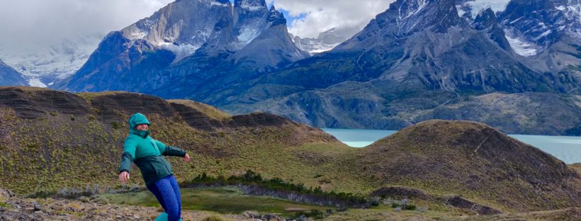
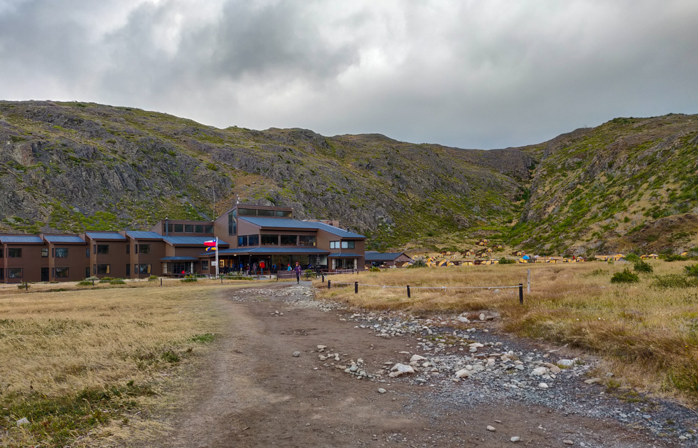
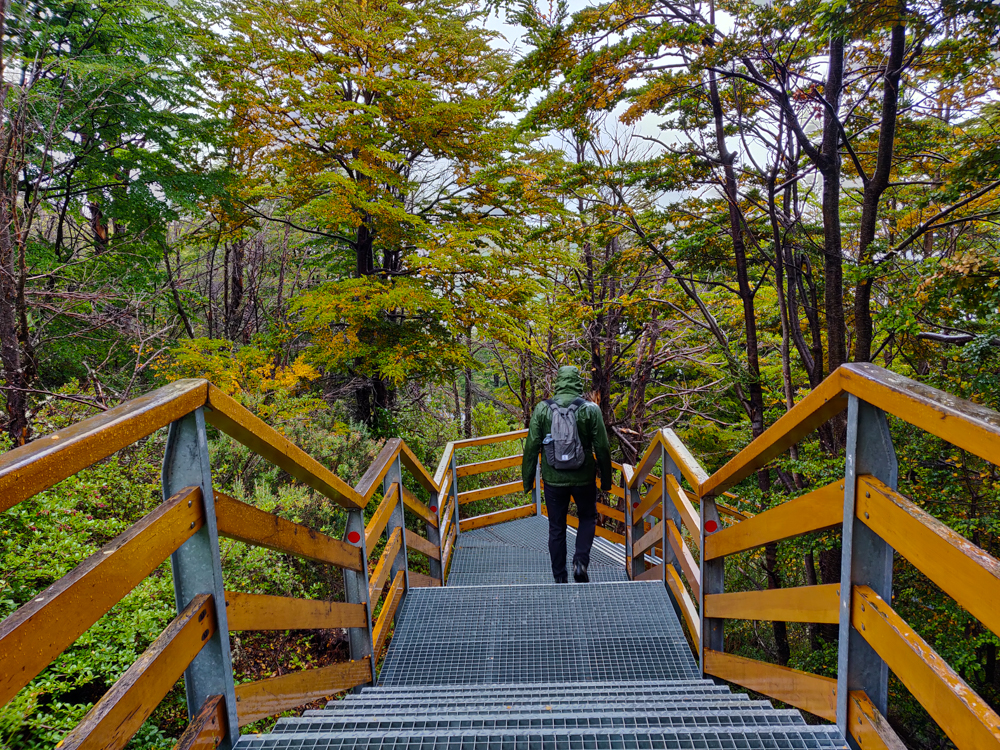
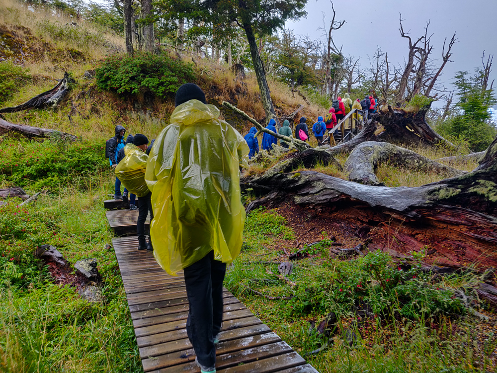
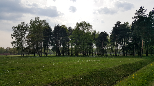
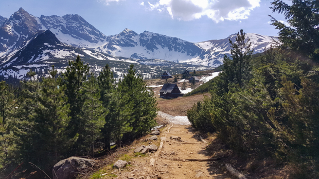
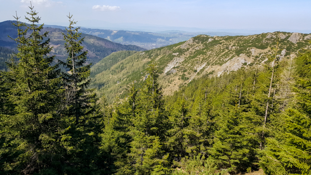
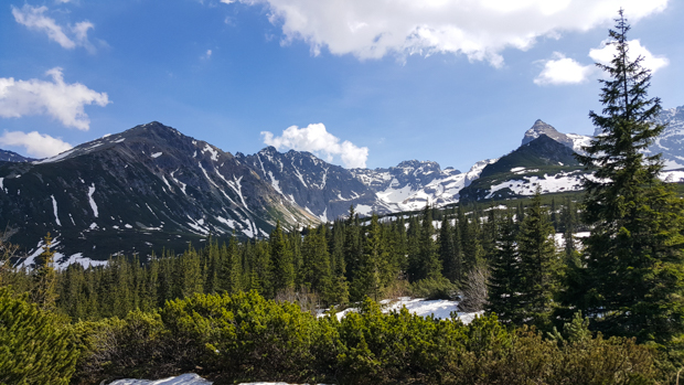
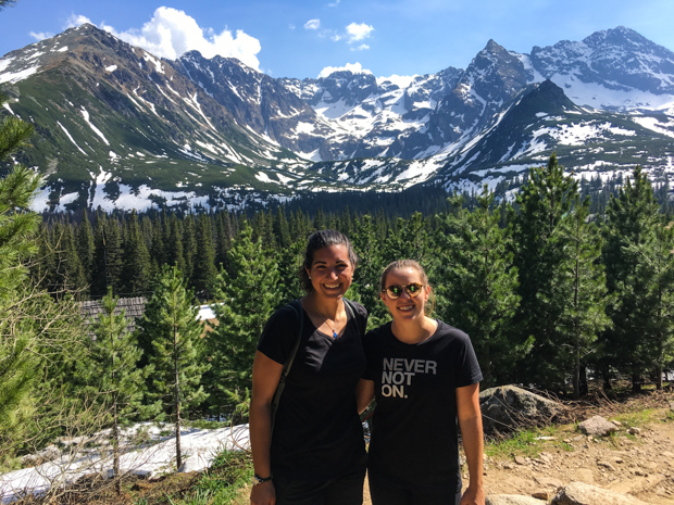
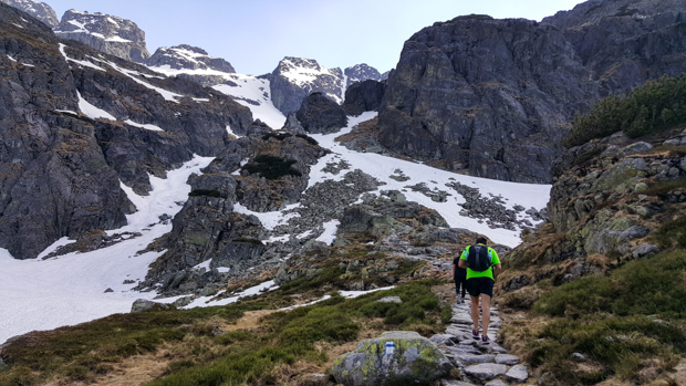
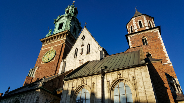
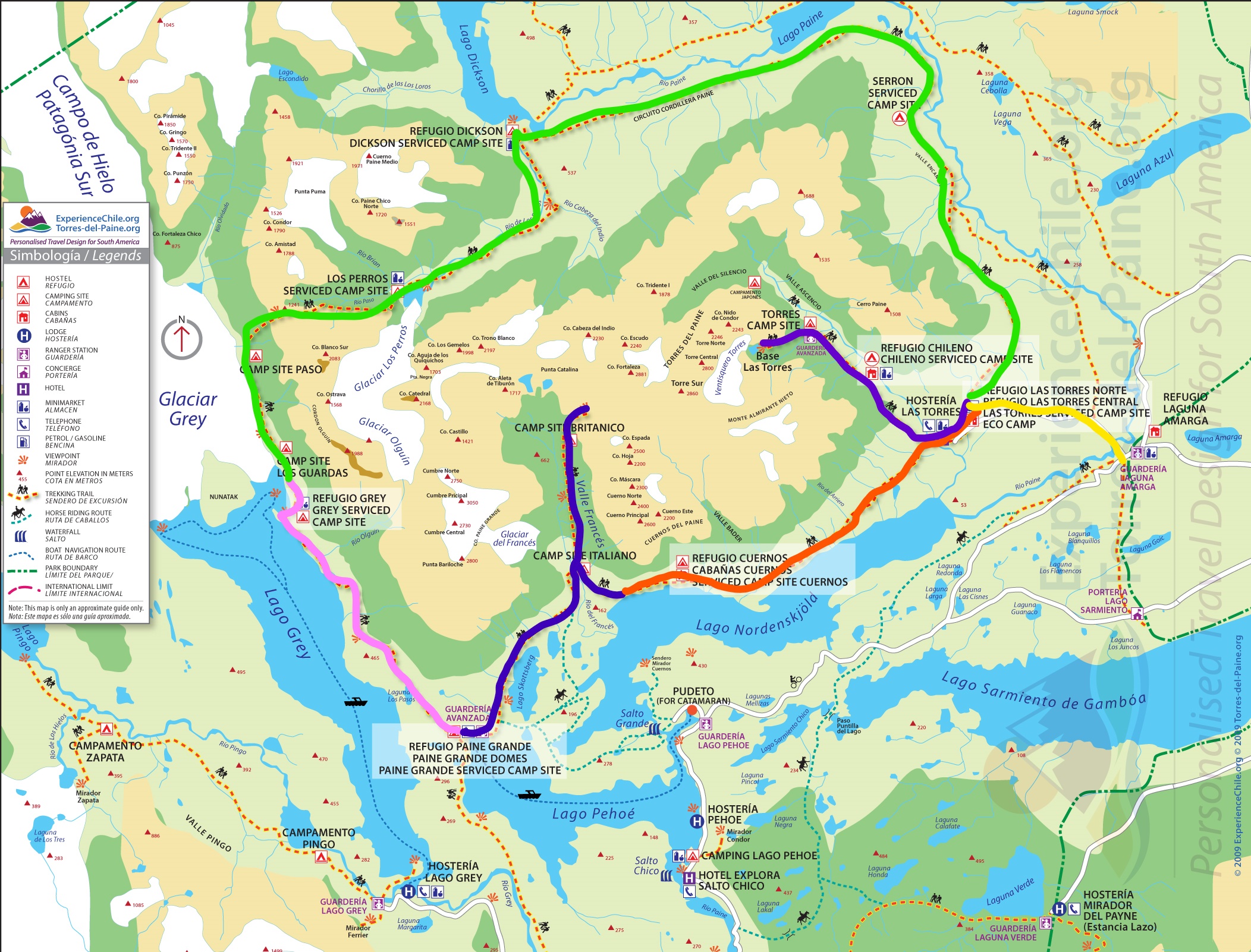
Torres del Paine National Park is well-known for two major treks. One is called the W, and the other is the O… very creatively named for the approximate shapes of the trails. Based on our time constraints and wanting to have some diversity in our trip, Mike and I decided to do the shorter W (4 days rather than 8ish). For sleeping arrangements, you can choose to camp with your own tent, camp with rented equipment (that’s already set up at the campsites), or sleep in refugios (aka indoors with a bunk bed). For food, you can either bring your own, bring some of your own and get breakfast and dinner provided at the campsite, or get breakfast and dinner plus a bag lunch.

A map of the park with different legs of the trail highlighted
Here’s a map I marked up in an attempt to simplify this explanation for you. The W trek is the pink, blue, orange, and purple lines put together. The O is those plus the green line over the top. Our first day was spent going from the bottom of the pink line to the top and then back again.

We were trying to do this on the cheap (well, I was. Mike was fine with spending some money. I guess that’s what happens when you actually have an income. I don’t remember what that’s like…), so we brought our own tent and packed our own food. The challenge with that was the fact that most people bring camp stoves and eat actual food during the trek. We had no camp stove and no desire to figure one out before our trip… so we packed all dry food. I felt okay about that because it was only going to take four days. Any longer and we would have considered other options, I think. But nope! Four days and a good supply of protein bars, peanut butter (and jelly for Mike), bread, ham and cheese, gross chocolate cookies that I picked out (whoops! You win some, you lose some), peanuts, and dry ramen noodles (for me. I actually kind of like them that way. Mike thinks I’m crazy). Hehehe. Maybe it wasn’t the most elegant solution, but it worked just fine.

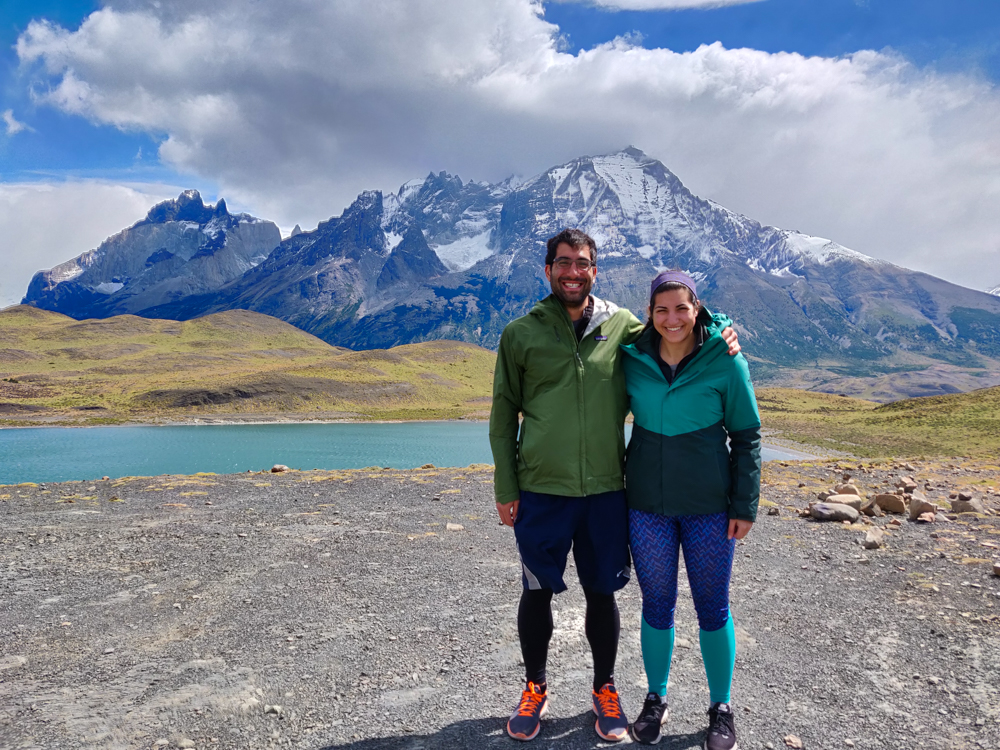
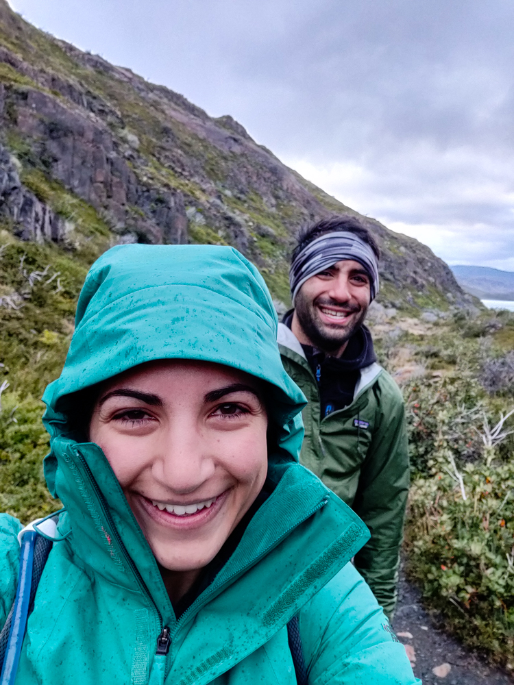
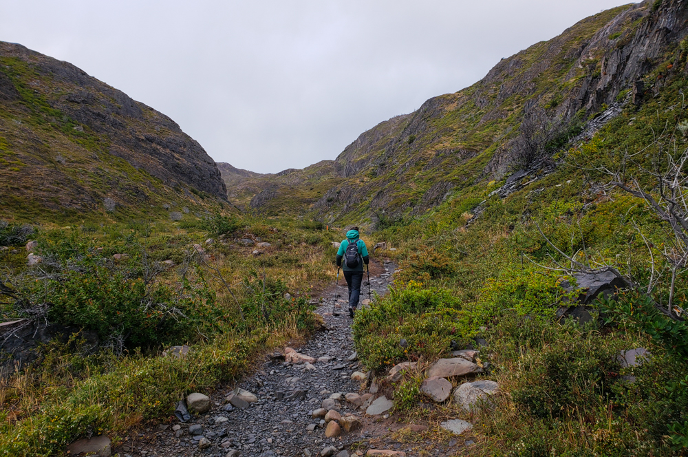
I was VERY worried about our first day of hiking. Mike and I have hiked together in the past, and we have very different approaches. I like to stop to take pictures, take frequent snack breaks, and enjoy the ambiance. I keep a good pace usually, but I’m all about the journey. Mike is a speed hiker. He doesn’t take breaks along the way. I don’t understand how he functions. I need snacks! I need water breaks! I need exhaustion breaks! He just powers through until the end. He might be a robot (the most likely explanation).

Selfie of me and Mike
Smiling because this was still very early in the day
Gravel path flanked by green plants and pretty mountains
Such a pretty valley!

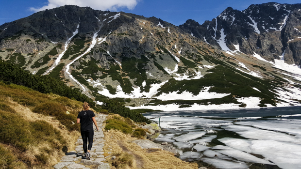
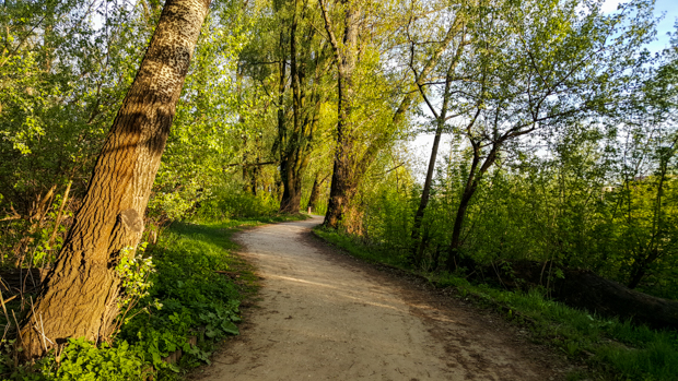
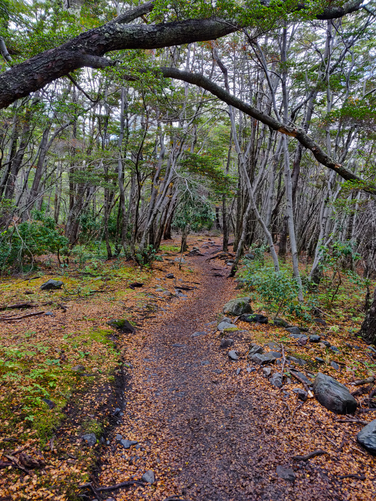
We decided to start “early” because I’d rather get out and back early to beat the heat and not have to worry about the sun setting (though with a 10PM sunset on this trip, there wasn’t much danger of that), so we left our campsite at Paine Grande around 7:15. Based on the blogs I read, I was expecting the trails to be crowded. Everyone said that this is the high season, expect crowds, you won’t have that “just you and nature” kind of feeling, so if you’re into that, too bad. I was ready for crowds. We spotted our first hiker approximately 3 HOURS later. Geez, if only the trails were always that crowded. We seriously wondered if maybe we weren’t allowed to be hiking yet, like maybe there were opening times we didn’t know about? Nope. There just weren’t any people. I mean, spoiler alert, there were more people on our way back, but crowded? Definitely not.

Happy Lara walking through the valley before she blew away
You don’t even know how many people we had to ask to hide in the grass so they wouldn’t ruin our pictures

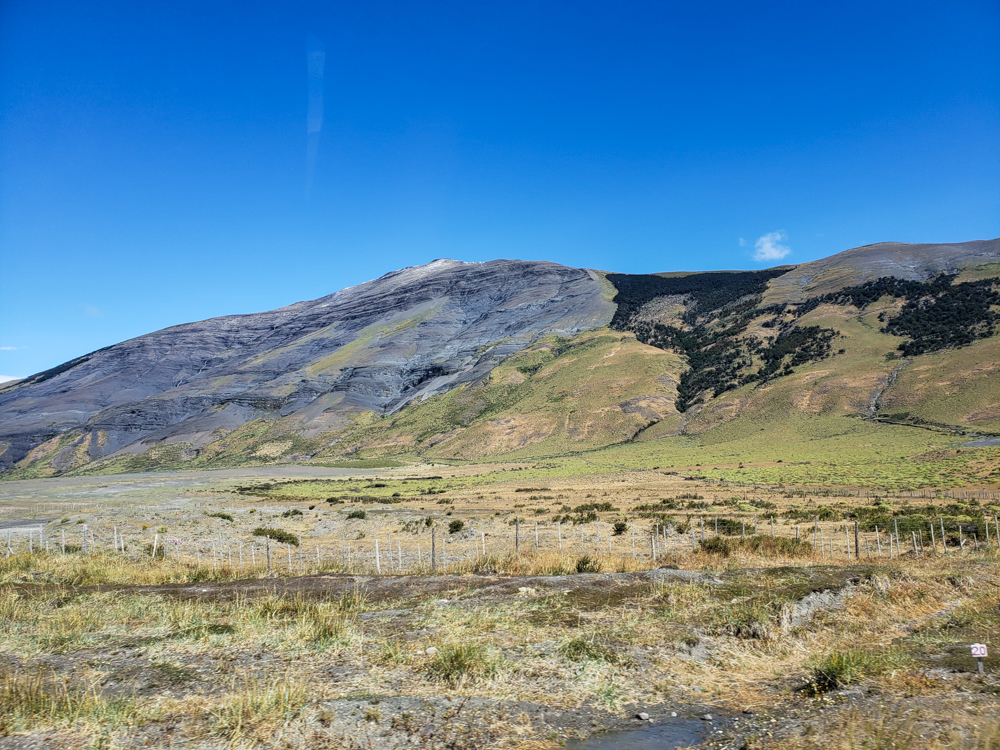
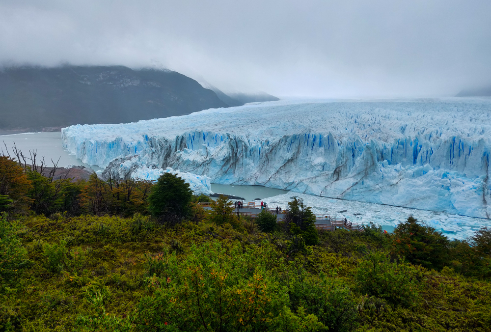
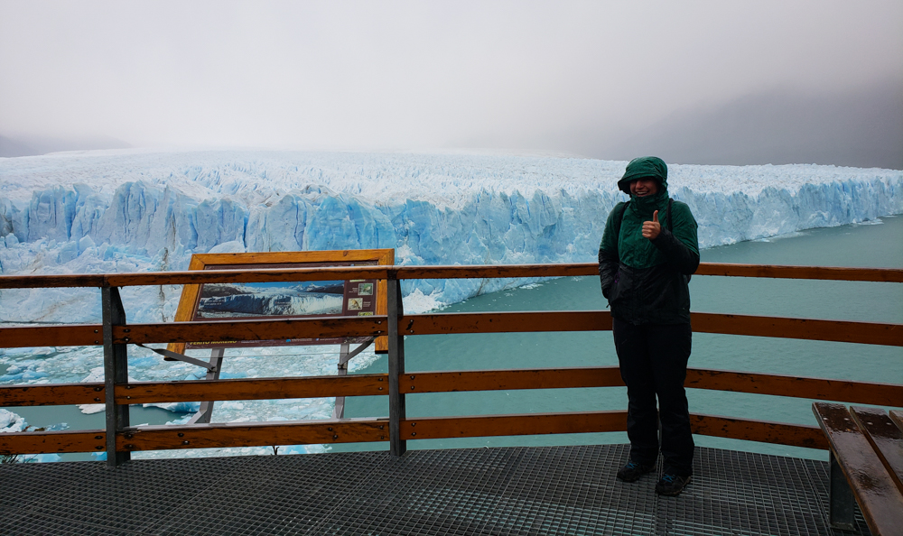
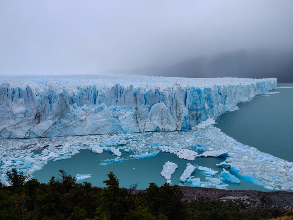
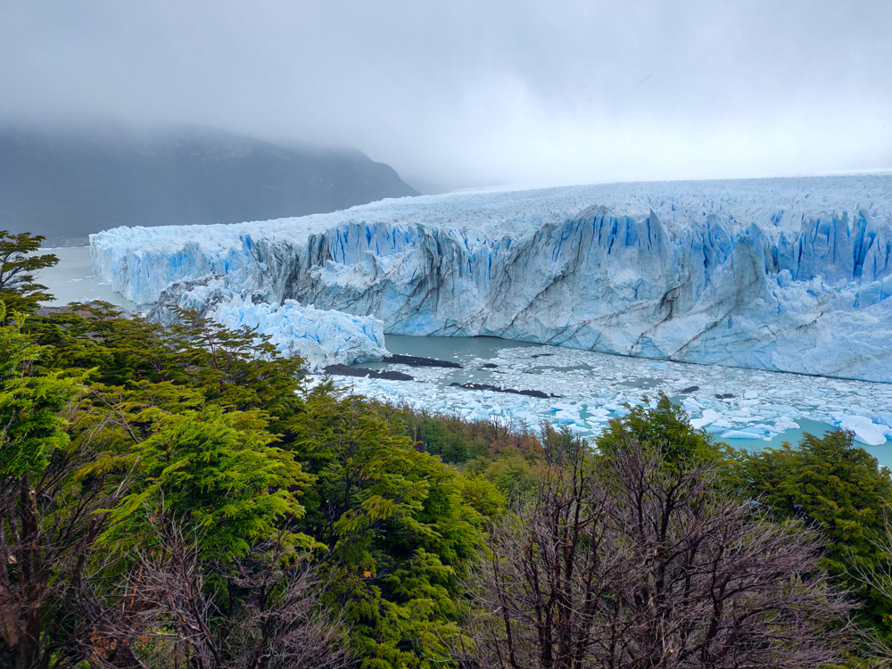
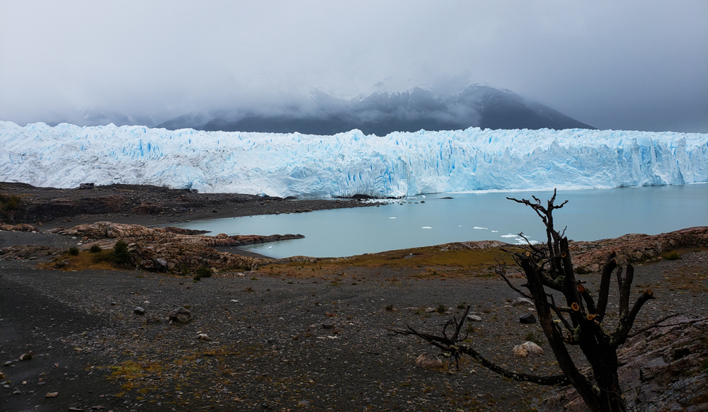
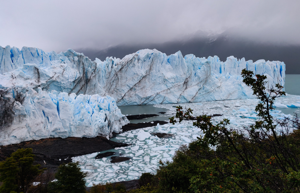
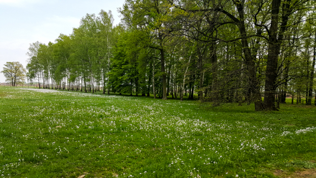
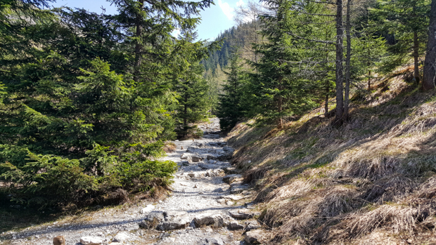
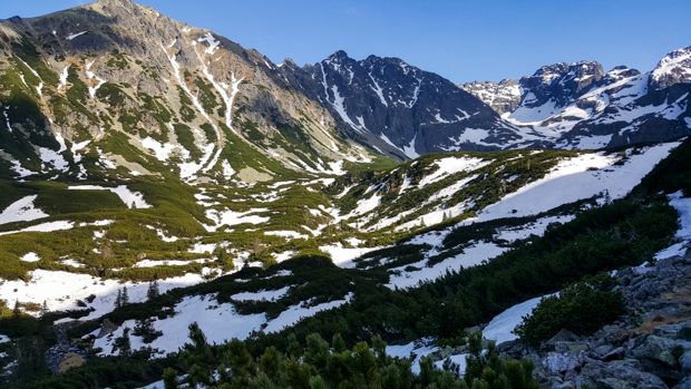
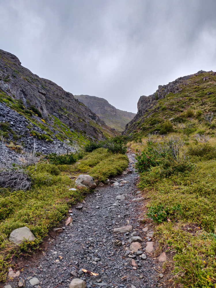
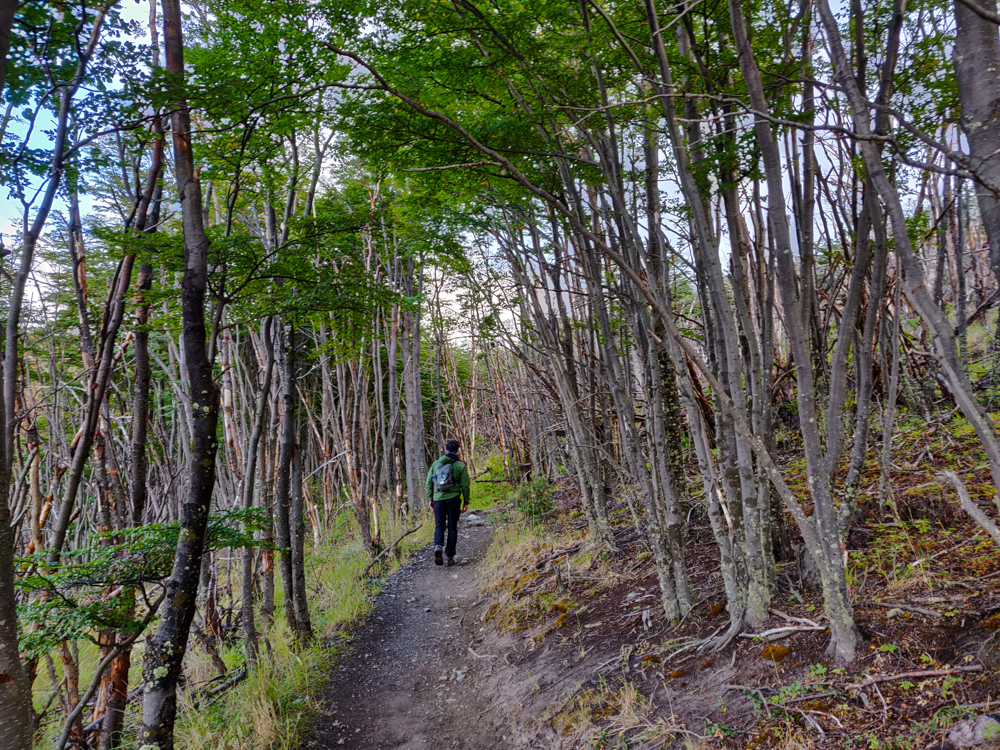
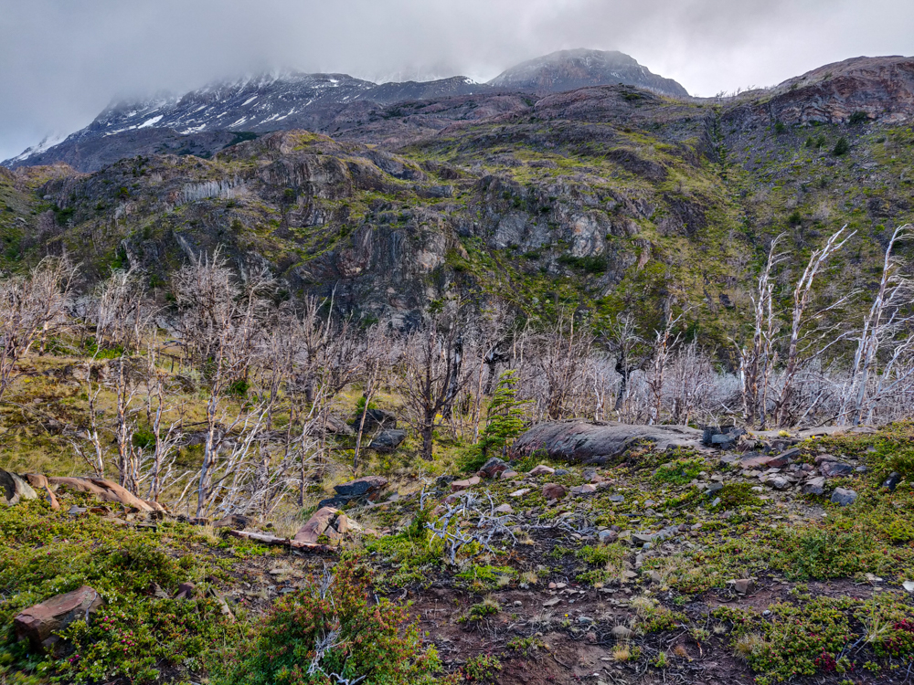
The first part of the hike was through a little valley. It was raining, but after our day on Perito Moreno Glacier, I felt pretty hardcore and was like, “Rain? Psh! NICE TRY, TORRES DEL PAINE. YOU’RE GOING TO HAVE TO DO BETTER THAN THAT.” Then we got out of the valley. And the wind hit us. And I ate my (mental) words.

Valley covered in plants and a pretty, windy trail
Try to tell me this isn’t beautiful (I won’t believe you).
Another view coming out of the valley
I can’t come up with more words to express how pretty it was there

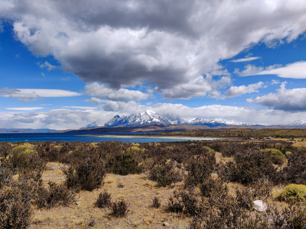
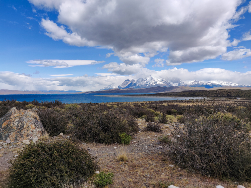
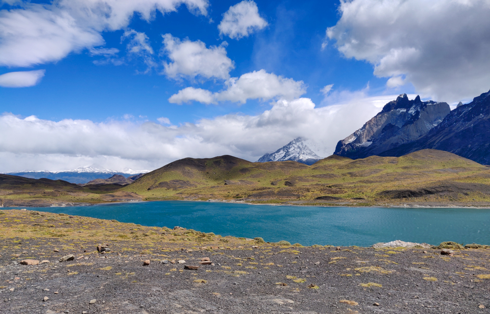
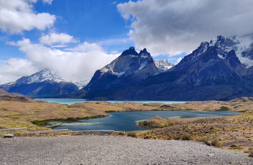
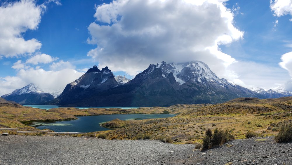
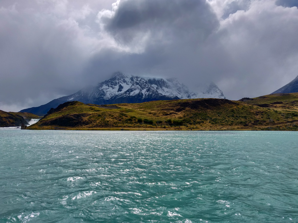
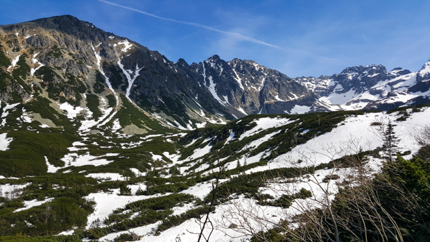
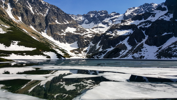
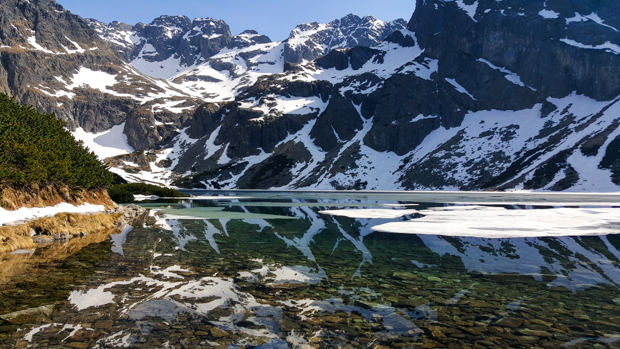
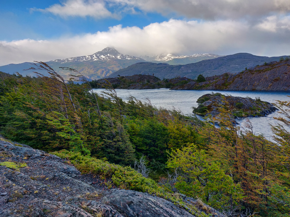
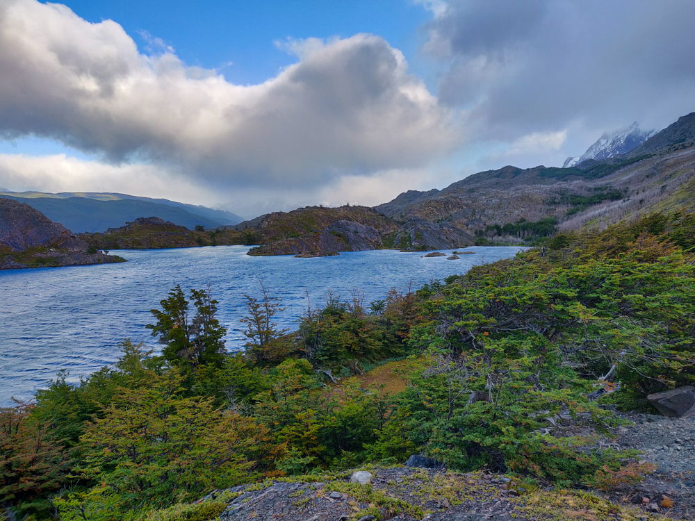
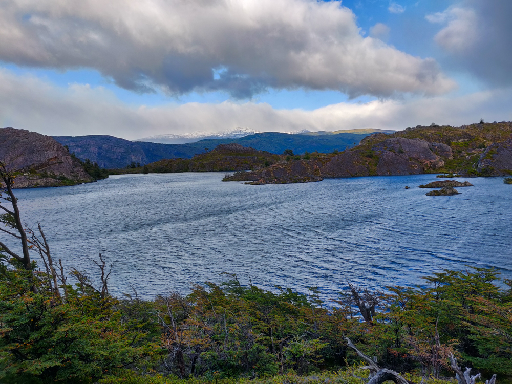
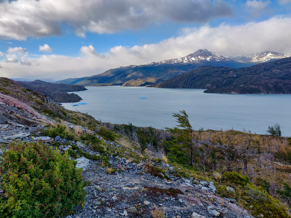
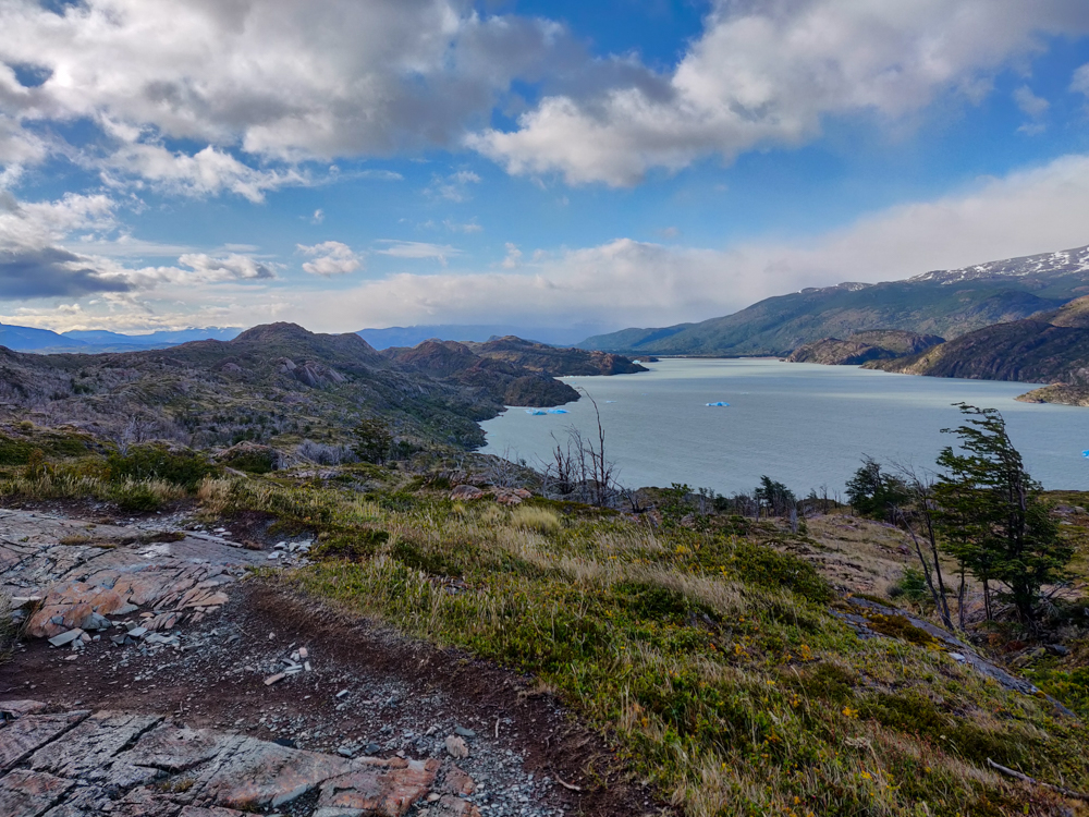
That was around the time that we reached the lookout at Lago Los Patos (Duck Lake) which I, for some reason, thought was a hilarious name. In hindsight I’m not so sure what I was going on about, but I must have laughed about it for a whole mile at least. From Duck Lake on, the day’s hiking followed the lakes’ edges, and it was all incredibly windy.

Lake views with a mountain backdrop and aggressive winds.
Laguna Los Patos. Check out the plants blowing in the wind!
Laguna Los Patos
I can’t get over the colors in the lake!
Streaky rock formation
I thought these rocks were super cool.
Duck Lake
I didn’t realize this until Mike pointed it out, but when you look out in the distance, it looks like the surface of the earth just falls away. Behind this lake is Grey Lake which is at a lower elevation. So weird!

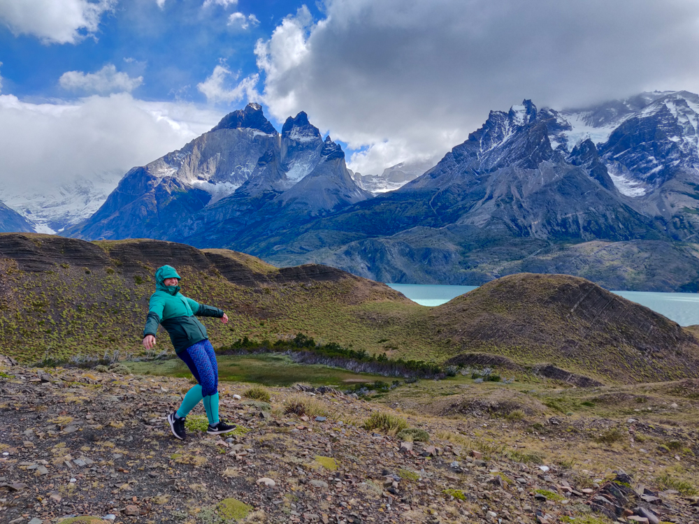
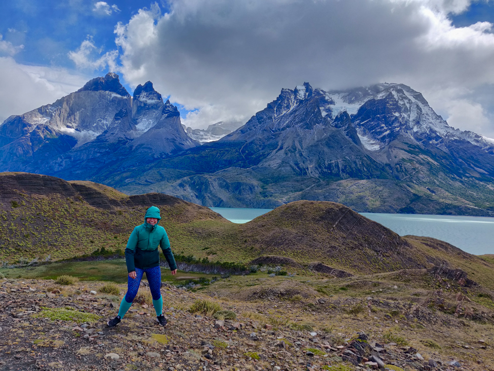
Hiking in the wind is the worst. Especially when the wind might actually be strong enough to blow you away. There were times when it was so strong that my trekking poles essentially turned into stakes that were the only thing keeping me from blowing off the trail. Each time I picked up a foot to take a step, I had zero confidence that it would land where I was aiming. And when the winds were strongest, they pretty much never did.

Lightly forested trail leading away from Laguna Los Patos
Walking away from Duck Lake

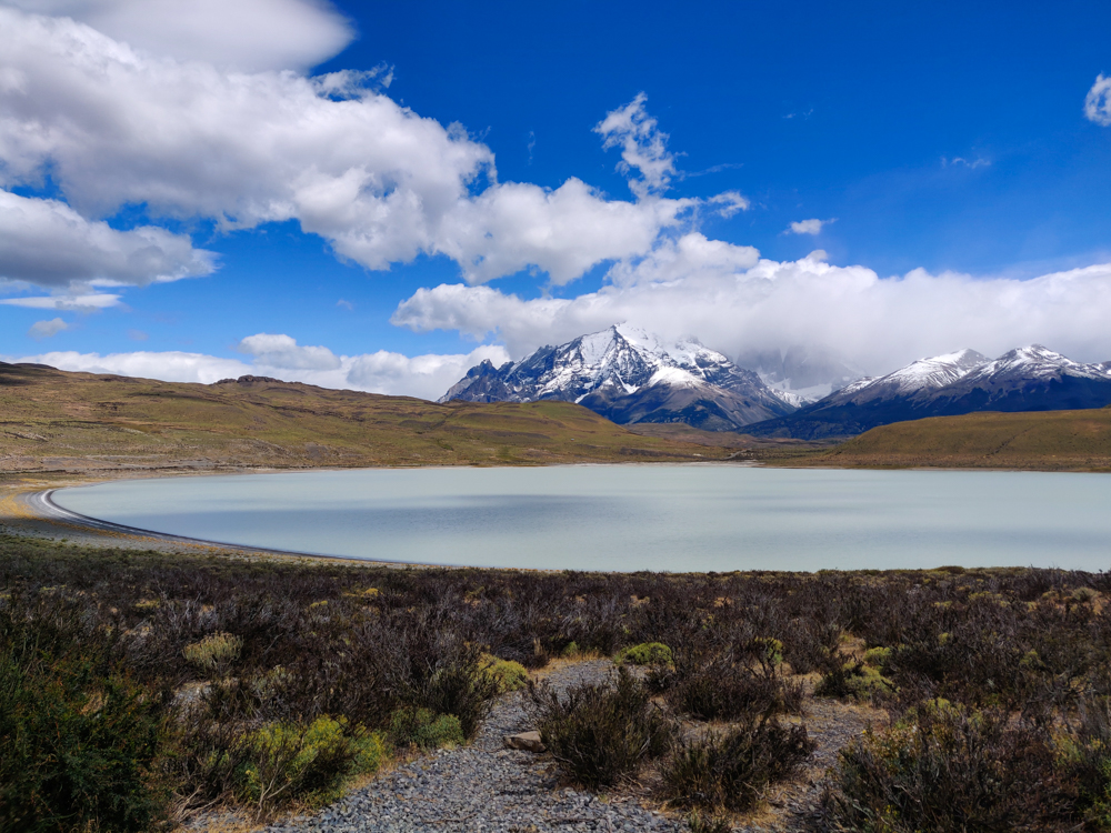
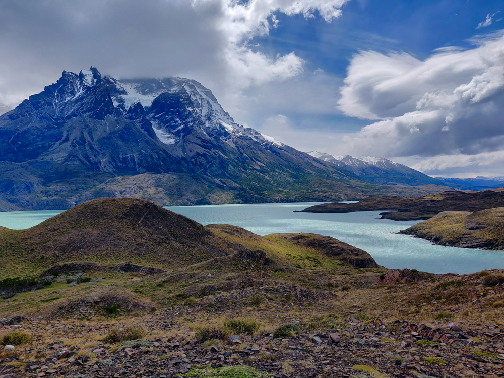
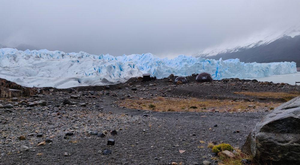
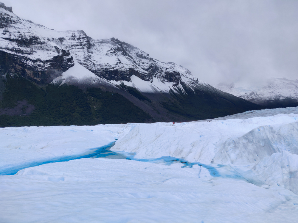
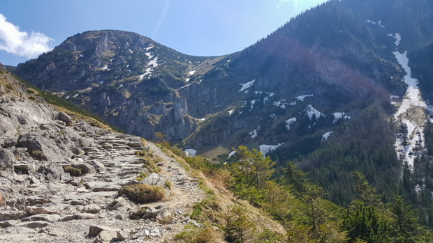
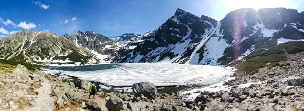
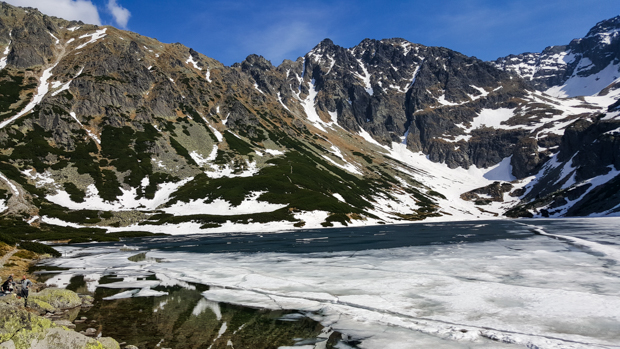
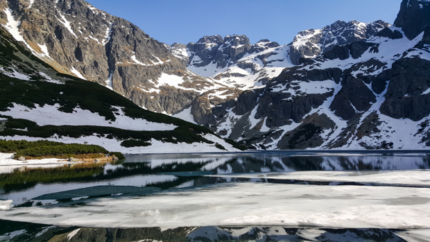
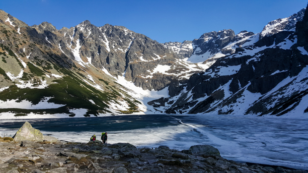
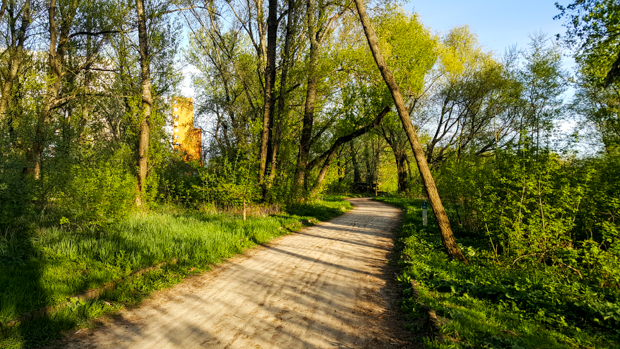
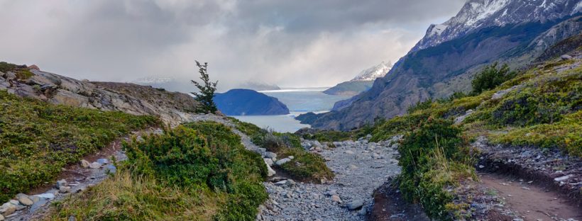
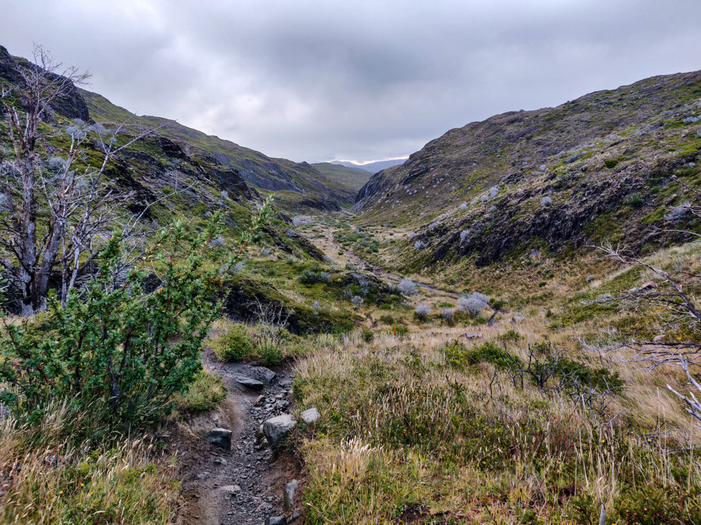
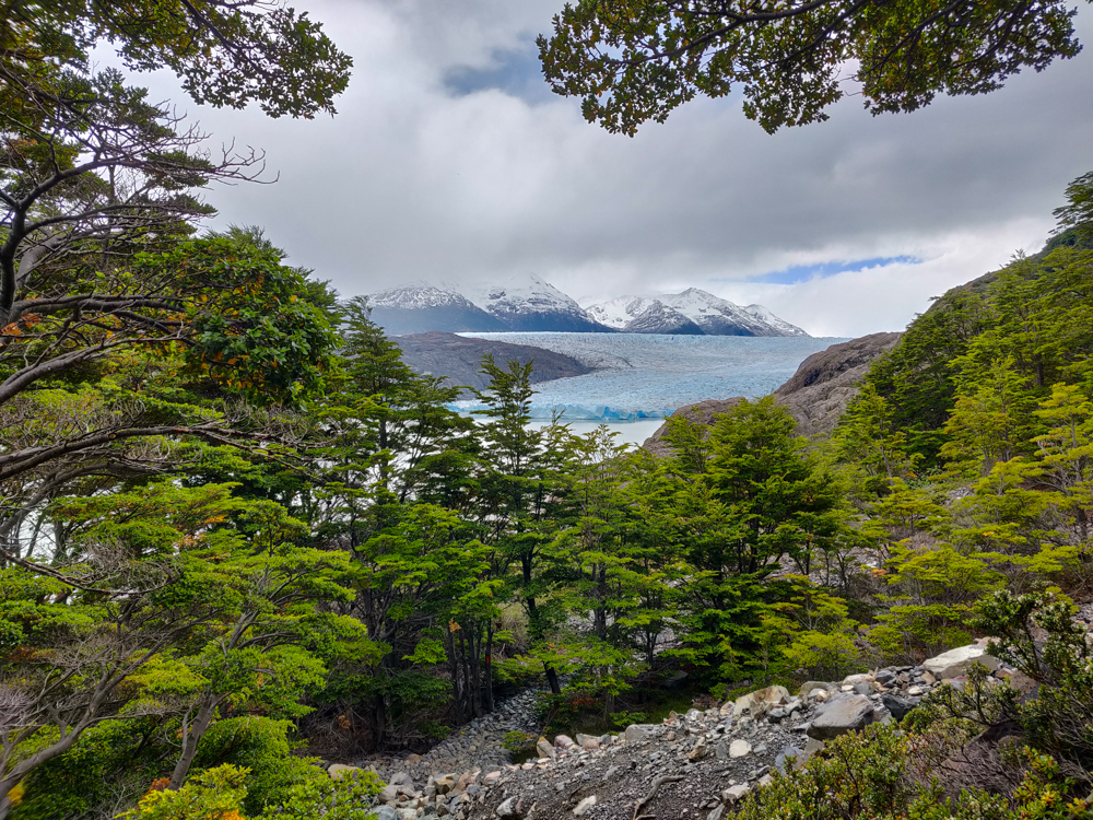
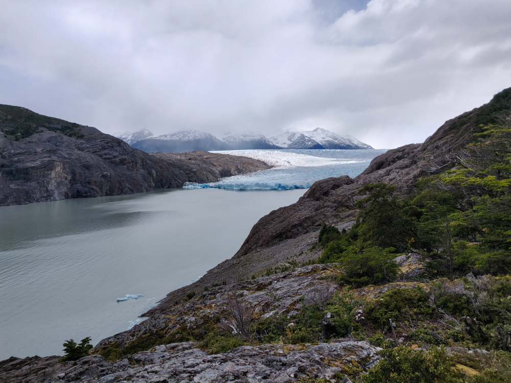
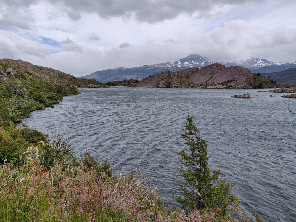
Laguna Los Patos is tiny compared to Laguna Grey, the next lake we encountered. We walked along Duck Lake for maybe 15 minutes. We walked along Lake Grey for the rest of our day. It took around three hours to make it to our first real checkpoint, Grey Campsite. That timing was nearly spot-on with the estimate listed on our map, and it made us start to think that we needed to take Chilean hiking estimates much more seriously than we take the ones in the States. At U.S. national parks, if you’re someone who has any experience hiking and is in decent shape, take the hike time they give you and divide it in half. We were thinking that might be the situation here as well, and it was not. Instead, it was like they wanted to give an estimate of how long it would actually take! Imagine that!

Pretty pink flowers along the way
Trail flowers
Grey Lake with some small glacier pieces floating around
Laguna Grey with the first glimpses of glacier pieces. Can you see them?
The hiking trail leading towards snowy mountains
The rocky trail. My feet did NOT like those rocks on the way back.
Grey Lake with its pretty, mountainous surroundings
So. Pretty.
Actually though, my toes were screaming.
Grey Lake with a faint rainbow
Rainbow! We could see both ends of it, too!
Dead tree skeletons
The tour guide on our ride into the park the day before explained why the park is super strict about where you can set fires (only in designated cooking areas). There have been a couple of forest fires accidentally set by hikers, and thanks to the strong winds, they spread crazy quickly and destroyed huge areas of the park. I don’t know if that’s what happened to these trees, but anytime we walked through a tree graveyard, I assumed they were tourist fire trees. They’re eerie, aren’t they? Like sad tree skeletons.
View of a little river gorge from the bridge
We crossed this super cool river along the way
View of the trail with Grey Glacier and Grey Lake in the background
That view… <3

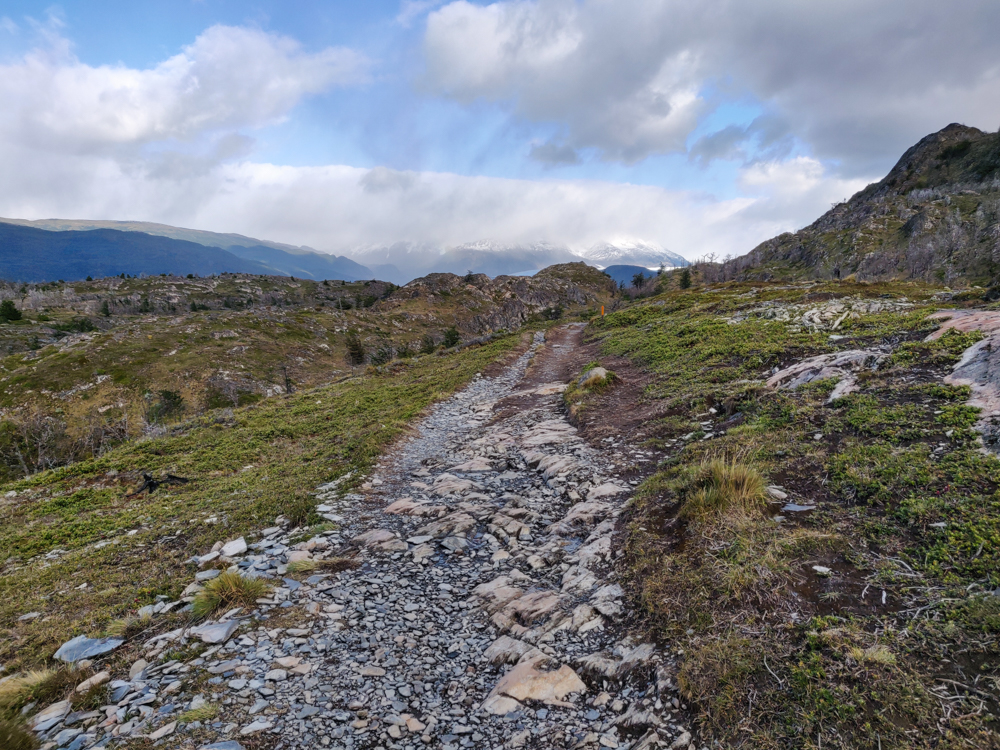
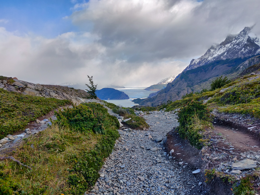
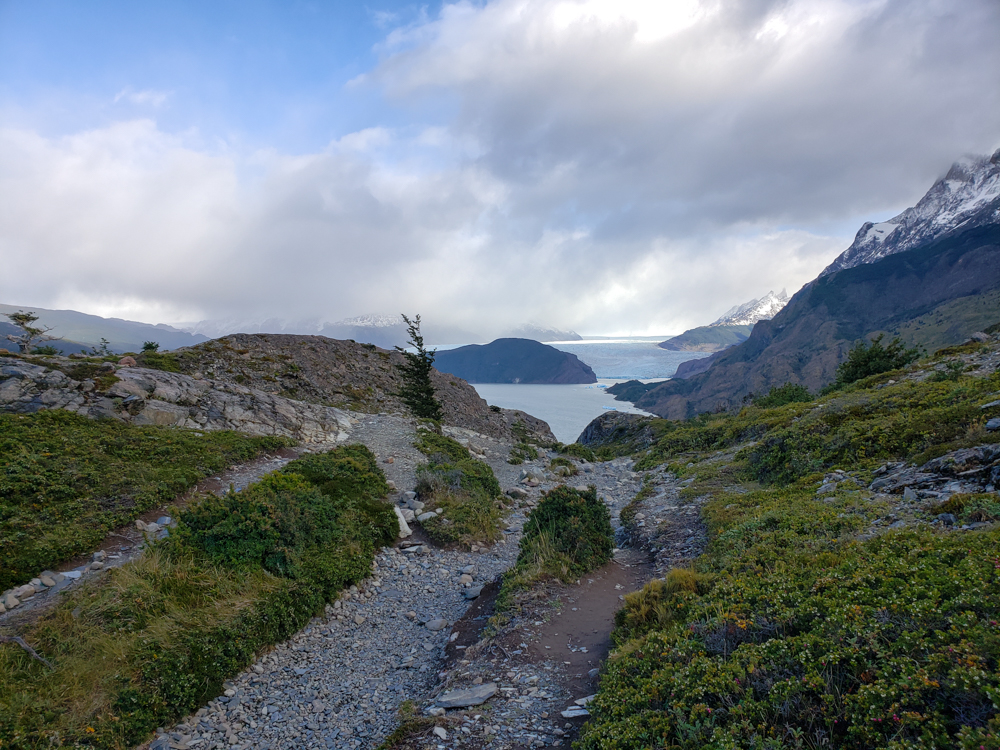
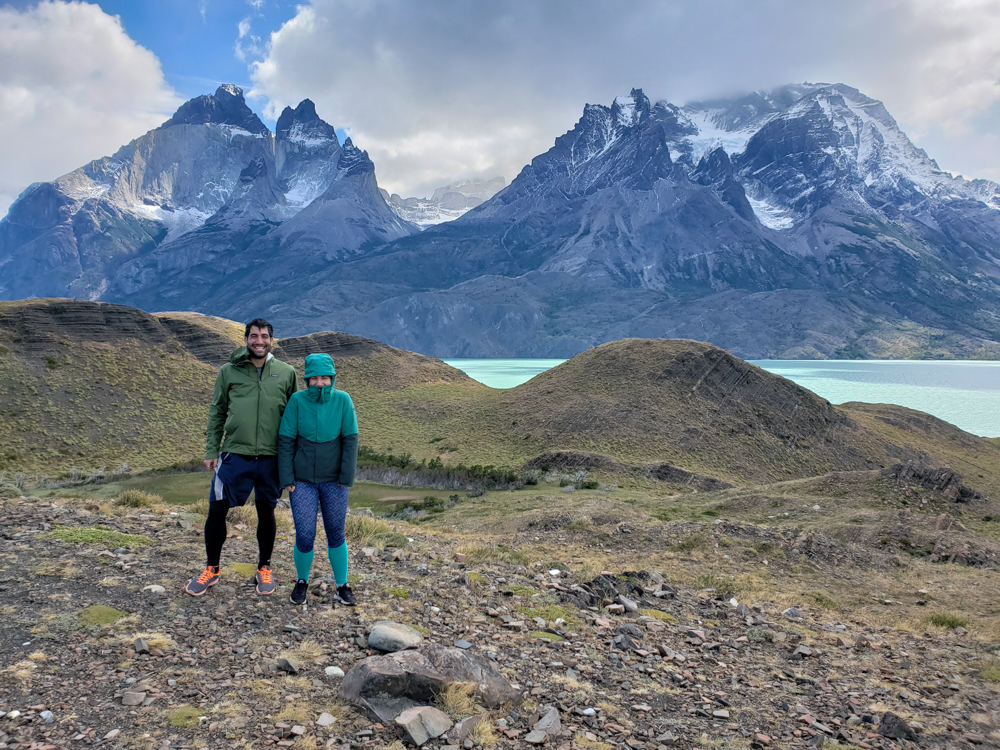
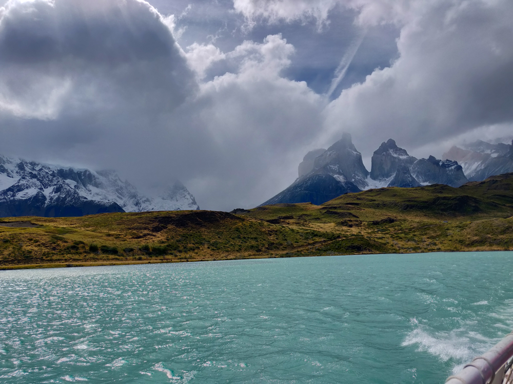
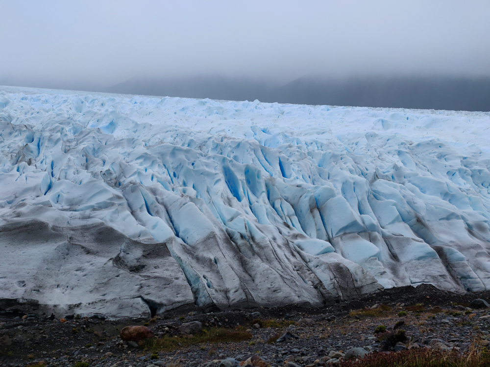
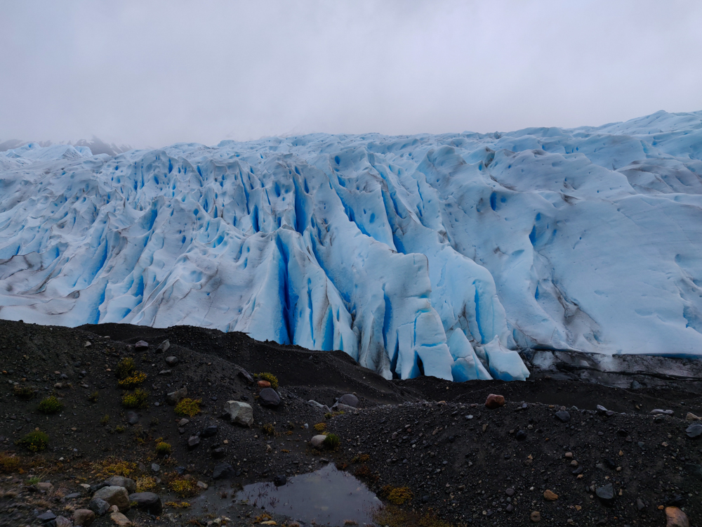
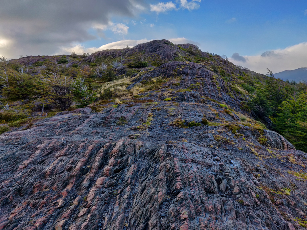
From Grey Campsite, we went on a hunt for the Glacier Grey lookout point (yes, another glacier!). I say “hunt” because the lookout’s location was SO not obvious. Every other trail in the park was extremely well-marked, so I don’t know what happened with this one. After it was all over, I still wasn’t confident that we ended up in the right place. Oh, well. We did find a high point with good views, and what more do you need? Mike’s response to the glacier: “It’s not that cool.” Well, since we were hiking ON a glacier two days prior, yeah, seeing one across a lake wasn’t as impressive. I still thought it was cool though… because everyone knows that glaciers are made of ice! (Bad joke, ignore me.)

View of Grey Glacier and Lake Grey
Checking out Grey Glacier from our “lookout”
Mountains near the glacier. The continuation of the trail runs along the base of them.
Forest view with yellow and orange leaves on the ground
I love the colors!!

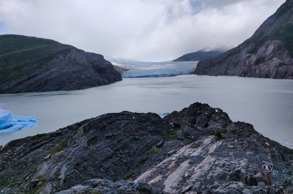
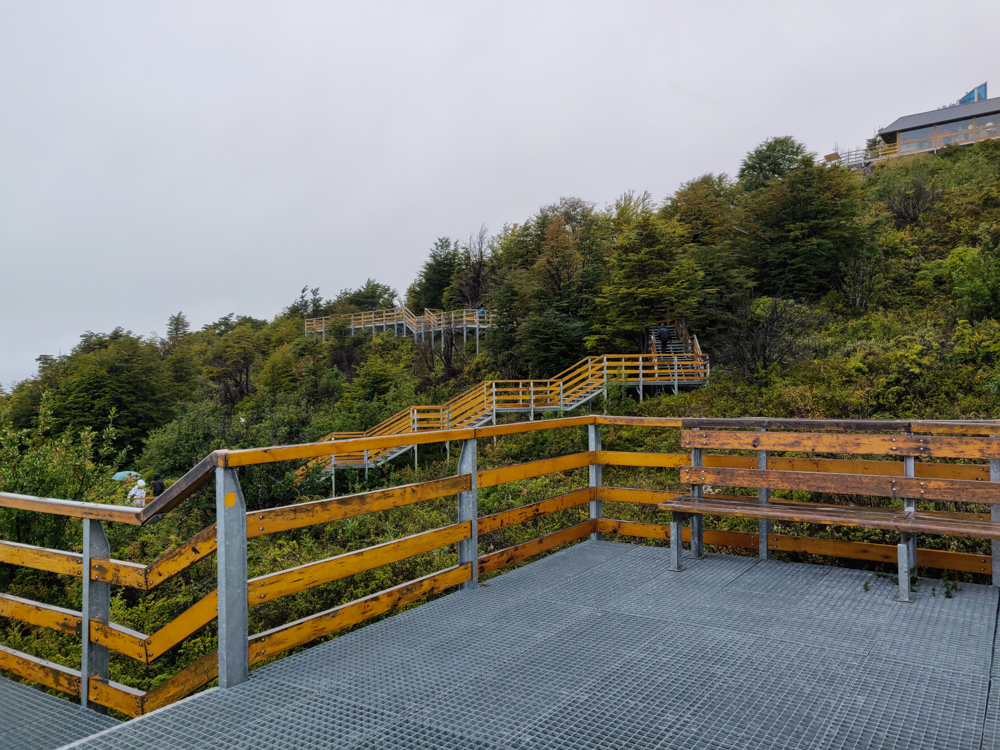
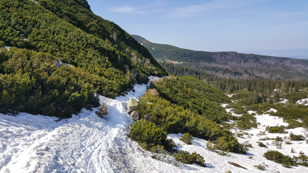
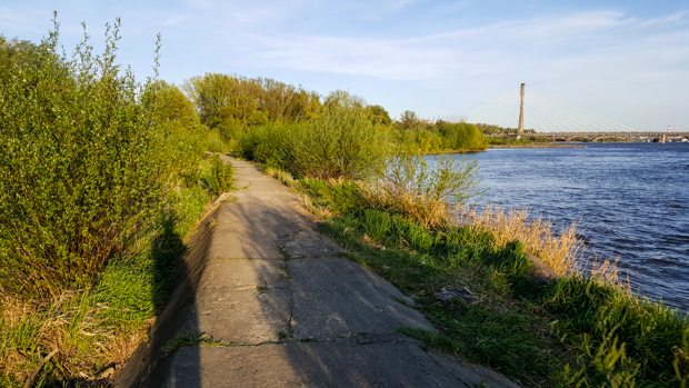
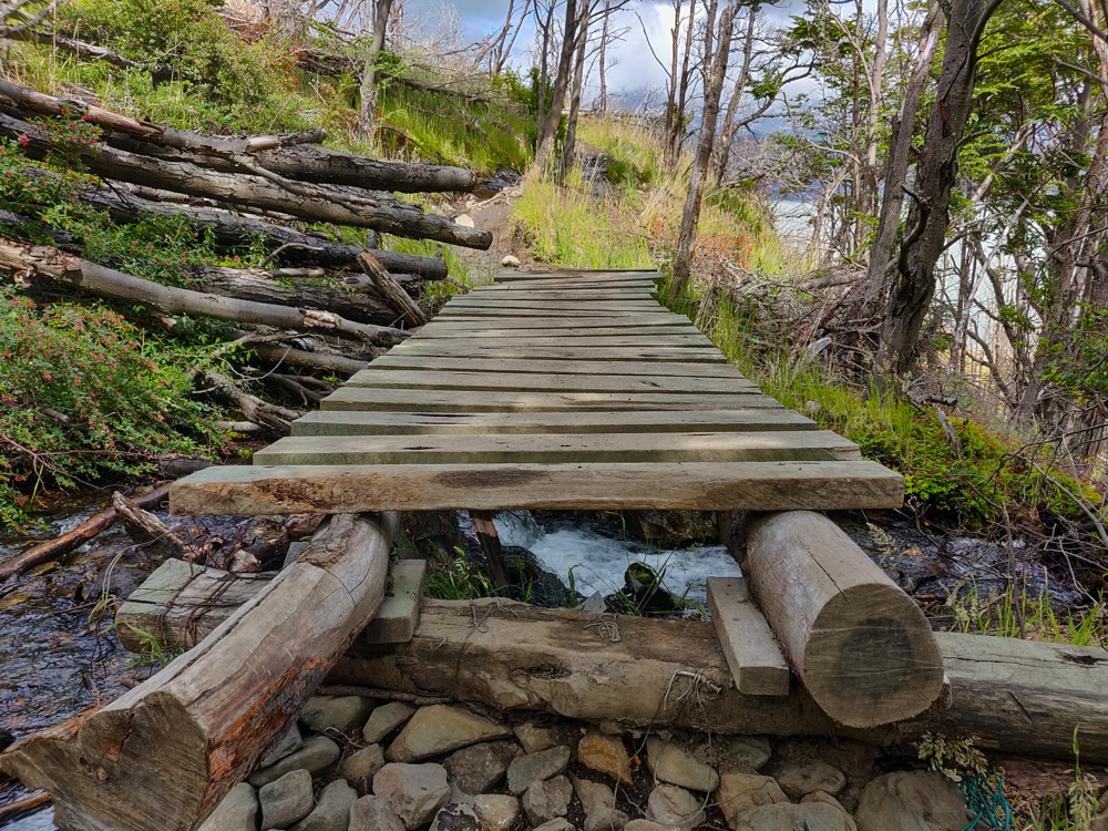
When the wind at the “lookout” became too much for even Mike (he said he was getting cold which is something I don’t think I’ve ever heard him say before), we headed back to the main trail. We had one more side trip to take before going all the way back to Paine Grande. There are a couple of suspension bridges near where the O trek meets up with the west side of the W, and I wanted to check at least one of them out. I don’t know what Mike wanted, but I assumed he’d be fine with it because he’s always up for doing more. I guessed that reaching the first one would take about an hour and a half of hiking from the campsite, and apparently at that point in time, an hour and a half extra in each direction (after already being out for 4 hours so far) seemed like a reasonable thing to do

Plank bridge along the way
There were so many fun little bridges and things along the way! I was impressed with the trail building.

For possibly the first time in my life, my estimate was exactly right (estimating is not a strength of mine), and we were there in an hour and a half. I thought the bridge was awesome. It seemed like some people were afraid to walk across, but things like that don’t scare me (I’m only scared of ACTUALLY scary things, like oranges). The height/potential instability probably made me like it even more.

View of the suspension bridge from the side
The suspension bridge! With some random girl crossing
Mike on the suspension bridge
Mike striking a pose
Me crossing the bridge
Venturing across the suspension bridge!

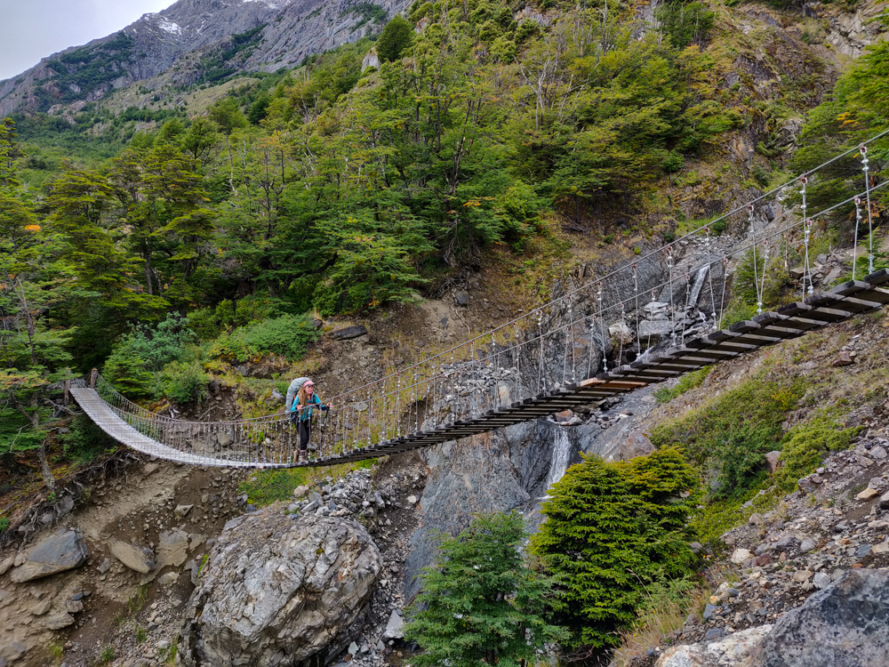
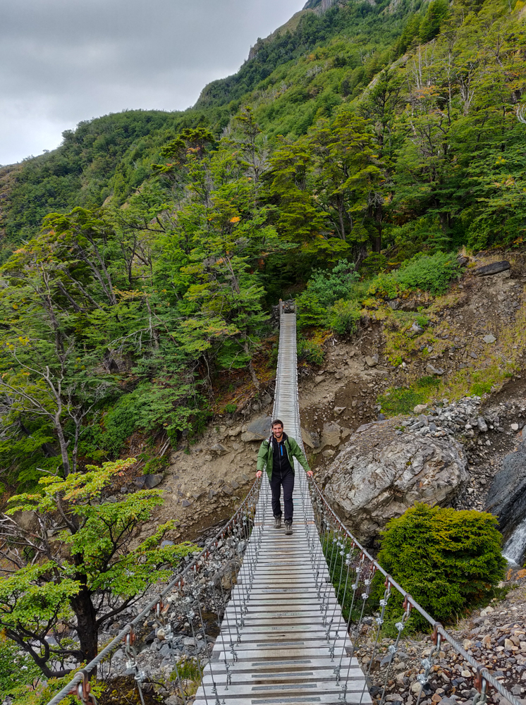
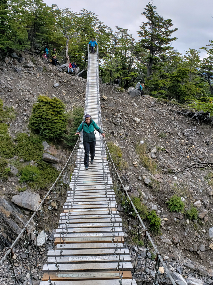
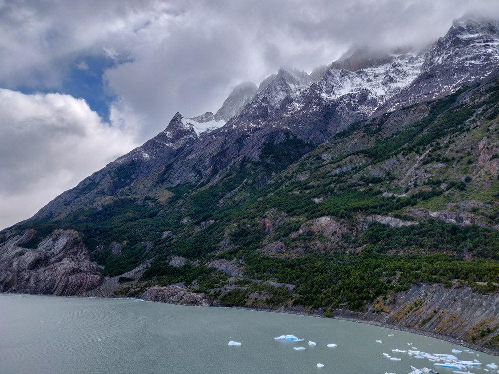
I felt like it was worth the extra time to get there, plus we also got a slightly closer view of the glacier. We crossed and thought about going to the next bridge as well, but as soon as we hit some stairs (maybe like 10 minutes after crossing the bridge), my legs said no way and we turned around.

Slightly closer view of Grey Glacier from below the suspension bridge
Another glacier view
Grey Glacier from slightly closer
Our closest glacier view of the day… aka not very close at all

The walk back to our campsite was painful. Up-and-back hikes are always a little rough because you know that however far you go is how far you’ll have to return. I’d just about reached my limit on the “go”… so the return was rough. My feet hurt. My legs were tired. I had this irritating knee pain that couldn’t seem to decide which knee it wanted to afflict more, so it settled on harassing both. Mike was in his “power through” mode, and I was in my “slowly crumble into pieces” mode. Not compatible.

The trail snaking up a mountain
We went from that nice, wide, rocky trail to this little, skinny, hiding-from-you trail.
Charred tree skeletons along the trail
Tree graveyard.
View of the lake with the water blowing in the wind
Windy, windy, windy

Thanks to a series of brief “second winds” (hehehe) – more like second, third, and fourth winds – I survived (meanwhile, the actual winds were NOT helping). Barely. Mike seemed fine the whole time which made me feel extra pathetic, but he collapsed into the tent when we got back which made me think that maybe he was a little tired too? I had some stellar blisters on my toes which explains the foot pain. My general assessment of my physical condition was, “I’m going to die,” for the first hour of sprawling on the ground, followed by, “Well, maybe not but I definitely need new feet.” I suppose this is what happens when you go straight from 30-minute dance workouts in your living room to 9.5 hour, 17-mile day hikes. Thank goodness I knew that was going to be our longest day because I don’t think I could have done it again without a little recovery time. I felt slightly more alive after a hot shower but was not feeling terribly confident about Day 2.

Me looking like I'm about to blow away

My alarm jolted me awake at 5:15AM, and it didn’t take long for the feelings of soreness and tiredness to sink in. Ugh. Mornings are the worst. Especially early mornings after long days of hiking on glaciers (I know, your feelings of sympathy must be overwhelming). But, we had a bus to Chile to catch, and staying in bed wasn’t an option.

I booked our bus online before the trip because we wanted to take a slightly less common route to save time. Instead of bussing from El Calafate to a town in Chile and then from that town to the national park, I found a company that goes directly from El Calafate to the park. It was a little more expensive but essentially saved us an entire day. Worth it when you have limited time! Booking things online always makes me nervous, so I spent the morning crossing my fingers that the bus was actually going to show up. They sent a confirmation email with a pick-up time of “6:15AM +/- 2 minutes”. That seemed crazy because how can you only give yourself a 4-minute window? Well, turns out that you can’t… or at least you shouldn’t. The bus came at 6:45 which isn’t actually bad, but by then I had already spent 25 minutes going over alternate plans in my head, wondering at what time I should start to seriously panic. Moral of the story (and the ongoing struggle of my life) is that I need to chill and not worry so much.

Mountains along the drive
Decent bus views

It took about 3 hours to get to the border checkpoint between Argentina and Chile. Everyone got off the bus to get stamped out of Argentina, back onto the bus to drive to the Chile checkpoint, and back off again to get into Chile. They’re a little intense about preventing people from bringing fresh foods and uncooked meats into the country, so we had to fill out a form declaring what types of food we had with us while a dog sniffed everyone’s luggage from under the bus. We had lunch meat that was okay because it was cooked and some eggs that were acceptable because they were hard-boiled. Customs was another thing I was irrationally worried about, and of course, it all worked out just fine.

The border adventure took around an hour and a half and then we got onto a smaller bus with the other people who were going directly to the park. We soon realized that most of the people on our bus were doing a day tour which seems absolutely insane. It’s like 10 hours on the road for max 3 hours of actual driving in the park. Oh well. That situation worked to our benefit because instead of taking us straight to our final destination, we got to stop at the viewpoints along the way and listen to the tour guide give background info.

Sarmiento Lake with mountains in the far distance
Our first glimpse of the park across Sarmiento Lake.
Another picture of Sarmiento Lake with a slightly different foreground
Yes this is practically the exact same picture, but I love them both so much and couldn’t decide which to cut so here they both are.

Parque Nacional Torres del Paine was established as a protected area in 1959 after being severely damaged by cattle farming and intentional fires set to clear the land for that purpose. “Paine” means “blue” in the indigenous Tehuelche language, and the “towers of blue” are three granite peaks that form the park’s most distinctive landmark.

A guanaco that we passed on the way to the park
A guanaco chillin’ by the road

The park is diverse in its landscapes, plant and animal life, and climate. There are glaciers, rivers, lakes, and waterfalls, over 500 different types of plants, and 25 native mammals (including a very high concentration of pumas… hurrah!). There are grasslands, shrublands, forests, and deserts. We were amazed by how quickly the entire landscape could change during a day of hiking. Along the way, the guide pointed out some of the different animals. We saw guanacos (similar to llamas), flamingoes, and rheas (large flightless birds).


A lesser rhea bird by the side of the road
Spotted! Mike took this picture of a rhea. They’re huge!
Pixelated flamingos near the shores of a lake
Flamingos! Sorry they’re so pixelated but hey, phone zoom has its limits and they were VERY far away (I’m usually very anti-zoom on phones, but trust me, without the zoom you wouldn’t have been able to see them at all).

When we got to the park entrance, we all got off the bus to pay the entry fee, and Mike and I had to register to let them know that we were planning to stay in the park. Some of the people on the tour were confused about what they needed to do, and the guide explained that they only needed to register if they were planning to hike and stay overnight. Someone’s response was, “Why would anyone want to do that?” Ha. The park ranger went over some standard safety stuff with us and gave us park maps which, side note, were incredibly nice. Not only were they very useful information-wise, but they were also made of this soft plastic-y material that made them incredibly durable. It definitely makes sense because of the extreme conditions in the park! Rain, wind, no problem!

Laguna Amarga with its white-ish water and shores
Laguna Amarga (Bitter Lake). It gets its color and weirdly white banks from calcium deposits.
Incredible blue lake
SO BLUE!

We made a few more viewpoint stops inside the park limits before Mike and I were dropped off at the Pudeto catamaran stop and everyone else continued on their merry tour way. Unfortunately, the next boat wasn’t leaving for another 2 hours, so we attempted to find a sheltered place to wait. The wind was insane! This was our first real taste of the famous Torres del Paine winds. The mixing of warm air from the equator and cold air from Antarctica causes strong winds, and since the southern tip of South America is SO far south, there aren’t many land masses in the way to slow them down. I call them the winds blown ‘round the world. It certainly felt like they had a world’s worth of acceleration time.

Mike and me with a lake and mountain backdrop
The girl who took this picture for us asked if I wanted to take another picture because wouldn’t I regret not looking normal? The answer is no, I don’t. No fake smiles here! Instead, it will always remind me of how cold and windy it was.
Me looking like I'm about to blow away
So windy.
Me laughing after nearly blowing away
Impossible to take a normal picture.
Blue lake with big mountains in the distance
Those mountains in the background are exactly where we were headed to hike… not really UP the mountains, but around the bases of them.
Another incredible lake with mountains view
Seriously none of this looks real but I promise I’m not tryna scam you, this is actually what it looks like.
Lake Nordenskjol with mountains in the background
Lake Nordenskjol. Mike and I were baffled by this because the name belongs in Iceland…
Mike and me with a lake and moutains
One cute pic of the two of us. Side note, pretty sure everyone we met thought we were a couple at first and I’m like… we look identical.

The catamaran left right on time (something that consistently threw me off on this trip. My previous South America experiences led me to expect things to always be operating behind schedule, but everything in Patagonia was crazy prompt!), and it took about 30 minutes to go from Pudeto to Paine Grande where we were camping for the night. The water was the same, bright blue as we experienced in Iceland. Beautiful! We only lasted for like 2 minutes outside before we decided to hide from the wind below decks.

Crazy blue water with cloudy mountains in the background
View from the catamaran… mountains looking nice and mysterious, shrouded in clouds.
View from the catamaran
More cloudy shroudy mountains.

On the other side, the catamaran left us right next to our campsite for the night. Oh, and when we were on our way off the boat, Mike went to get our bags and smacked his head on the low ceiling of the baggage area. He sliced his head open (not too badly, but it still wasn’t good) and was started bleeding everywhere. So we were 2/2 for bloody injuries and days of the trip.

We checked in and went to scout out a spot for our tent. Every blog I read before the trip recommended putting your tent near the edge of the mountain to help block some of the wind… which was great to know, except there was literally no space left next to the mountain. No blocked wind for us! It was a fun adventure trying to assemble the tent without blowing away. Once we got inside, neither of us wanted to leave again (also, is it just me or is it incredibly hard to get out of tents?), but I rallied and took a surprisingly hot and satisfying shower before getting ready for bed. We played a few rounds of Hanabi, Mike’s favorite card game, and then passed out. It was probably good that we didn’t have an intense day because even without doing a lot of hiking, we were completely wiped. Plus, we were starting our big trek the next day! We had an upcoming stretch of four fairly intense days of hiking, and as I said in my voice journal for the day, “I’m mildly terrified, but it should be good.” Optimistic!

(Side note, my journaling strategy for the trip was to do voice journals instead of written ones to save time. It worked… okay-ish? I’ll just say that voice recordings are definitely not a strength of mine, as anyone who’s ever received a voicemail from me can attest.)

Looking back at the Paine Grande campground and facilities
Paine Grande campsite. The buildings have beds inside if you’re not doing it on the cheap like us. To the right, you can see tents set up by the mountain.
Hanabi cards from our game
We played a perfect game in Hanabi, nbd but we’re kind of awesome. (It’s a cooperative game which means we both won.)

Our first full day started out bright and early with a 7AM bus pickup from our hostel. In writing that, I realize that 7AM isn’t actually that early, but on vacation after a day of travelling… just give me this, okay? This was our only day with an actual organized tour, and it was nice to not have to think for ourselves on our first day. We were headed to nearby Glaciers National Park for a glacier trekking (aka WALKING ON A GLACIER HOW COOL IS THAT) tour on Perito Moreno Glacier.

Perito Moreno Glacier from afar
Perito Moreno Glacier

The bus ride from El Calafate to the park entrance took about an hour and a half, and we were thinking that we got lucky with the weather because it was a beautiful day. NOPE. Almost as soon as we entered the park, it started to rain and the bus windows fogged up, making it seem even more dreary and impossible to see outside. The tour guide explained that it rains VERY often in the park. Even though it’s not too far from El Calafate, it gets an average of 900mm (35”) of rain annually, and El Calafate gets around 200mm (8”). So yeah… minor difference.

Entrance ticket for Parque Nacional Los Glaciares
I took this picture of my ticket like a real nerd… but the reason I’m including this is so you can check out the nice blue sky in the background and appreciate the fact that this is the only picture where that’s the case.
The world's sturdiest wheelchair
Mike got a kick out of this wheelchair inside the visitors’ center.

At our first stop, we got to see the glacier from afar. There are a bunch of metal walkways where you check out the glacier from different viewpoints. Of course, Mike wanted to walk on as many of them as possible, so we added a couple of little offshoots onto the route that the guide recommended. She also stressed that since it was raining, we should be extra careful because the walkways get slippery in the rain. I’m sure you know where I’m going with this… I ate it. Hard. I slipped down a flight of maybe 6 stairs and stayed on my butt at the bottom for a second to figure out how I was feeling. I could tell my legs were a little banged up, but I felt okay until Mike said, “Your thumb!” and I looked down to find a huge gash in my finger. Perfect. Fingertips love to bleed, too. Thankfully, we were nearly finished with our wandering at that point (and the views were beautiful, by the way, even with the rain and the freezing cold and my bleeding finger), so I didn’t have much more to endure before we got back to the bus and the guide hunted down a band-aid for me.

Walkways at Perito Moreno Glacier
My nemesis (the walkways, not Mike). I’m pretty sure this was taken pre-fall
View of Perito Moreno Glacier
If you happen to be there at the right moment, you might be lucky enough to see part of the glacier fall off into the lake below. We weren’t lucky… but it’s supposed to be very cool, and every time we heard a loud noise, everyone would quickly turn to look at the glacier in the hopes that something was happening.
Me thumbs-upping our cold and rainy walk
Looking happy and dry, right? (Ha! I wish)
Glacier pieces in the water
How tall do you think the glacier is above the water? One of the signs said that the edge is about 70m above the water level… which means there’s even more below the water level. I don’t know how tall I would have guessed (and I’m also the world’s worst estimator), but it would not have been 70m. That’s crazy!
Sightseeing walkways at platforms at the glacier
I did think that the walkways were super cool… up until my (literal) downfall
Cool view from one of the viewing platforms
Some walkway views
Another Perito Moreno Glacier view
How many times can I post basically the same picture? I don’t know, but at least one more!
Mike and me with the prettiest glacier backdrop
I’m hiding my bleeding finger behind Mike’s back. Also, we are so wet.

The next part of the tour was the main event: glacier trekking. The bus dropped us at a boat where we all loaded up to get closer to the glacier. It dropped us off across the lake, and we started our land trek to get to the starting point of the glacier trek. Along the way, we made a few stops to get suited up in our gear. First, we stopped in these little cabins where you could leave your stuff, and there, the guides outfitted people with the things that they absolutely should have brought with them… things like waterproof shoes (because walking on a block of frozen water in sneakers seemed like a good idea??), waterproof jackets (they tell you to expect rain), backpacks, etc. I was baffled by these people. Some were wearing jeans aka not what I would choose for physical activity and also the worst thing to wear when it’s wet and rainy. Did they get on the wrong bus? Come on people, pull it together.

Glacier boat view
On the boat ride. Quite the color palette, huh? Light grey, blue-grey, grey.

Once the group was appropriately dressed, we headed back out into the rain (much to everyone’s dismay) and walked maybe 15 minutes to the first basecamp where we were outfitted with harnesses and helmets (which we didn’t use at all, but they said it’s protocol so you have to wear them). Then, we walked another 40 minutes or so to the second basecamp. This walk was through the woods, mostly uphill, and I was ready to collapse by the time we got there. Good, right? Considering we hadn’t even started the walking-on-ice portion of the day.

The view on our way to the glacier trekking start point
Walking to basecamp #1
Closer view of the glacier
Getting closer!
Wooden walkways on our way to Perito Moreno Glacier trekking
These people in front of us got some last-minute ponchos, and good thing because it rained basically all day.
The first basecamp on the way to the trekking start point
Basecamp #1 dome huts in the distance

At basecamp #2, we were fitted with crampons. Prior to this trip, the crampons I was familiar with are those little metal claws that you wear to walk on icy sidewalks. These… these were not like that. It’s more like having the tips of six spears coming out of each foot. The guides told us to be careful not to spike ourselves or get our feet hooked on each other. Eek.

With our crampons in hand, we walked the last 10 minutes to the glacier where the guides helped us put them on. First though, we had to walk like 20 feet onto the ice without them, and it was terrifying. After that, you don’t question why they’re necessary!

Close-up view of the glacier edge
My brain can’t even comprehend the volume of this thing. Imagine how many cold beverages you could make with this much ice.
The group getting their crampons put on
The crampon installation area
Mike's crampons
Mike, showing off his foot spears.

First thought, “My gosh, did they just strap anvils to my feet? SO HEAVY.” Step, step, step. Second thought, “Thank goodness I have these anvils on my feet!” We divided up into smaller groups and headed out into the icy expanse. From afar, a glacier really looks like it’s covered in snow. It’s not. It’s ice. All ice. (I mean, there’s snow in the places where it’s snowing… but where we were, no snow.)

Near the edge especially, the ice was in these huge waves, and looking at it, I had no idea how we were going to go anywhere. We started walking up and down and up and down them, and the crampons are like magic. I felt like I had superpowers! (Possibly the world’s lamest superhero.)

The glacial wilderness
Up and down and up and down

The glacier has two main areas to it: the accumulation zone and the ablation zone. The accumulation zone is the upper part where it snows a lot, adding volume to the glacier. The guide said that it snows there around 300 days a year! We were in the ablation zone where the ice is melting and moving, so you can find rivers and lakes on the surface. Since the ice isn’t all moving at the same speed, sometimes it splits apart and forms these crazy deep cracks filled with the bluest water I’ve ever seen.

Mike with some very blue water
Mike and an ice crack
Glacier crack
Have you ever seen water so blue?
Awesome glacier crack
I want to dive in… I want to not freeze to death. But it’s just so pretty that I want to stare at it all day and also swim in it. But it’s cold. BUT SO PRETTY.
Mike filling my water bottle with glacier water
Mike filling up my water bottle because no way was I trying to end up with ice cube fingers. The water tasted good but was a little too cold for my liking (hehehe)

The whole experience was awesome! Being on a glacier is like nothing I’ve ever experienced before. It’s like walking on a giant, abstract ice sculpture, and it’s a big mashup of white and blue and black (which is the dirt, but somehow even that is pretty). Also, just the concept of a glacier is insane. It’s a huge, dynamic piece of ice. They said that the deepest point from top to bottom is about 700 meters. The deepest point we stood on was about 500 meters. Looking down and trying to comprehend 500m of ice underneath my feet was impossible.

Looking down at my feet on the glacier
You’re looking at 500m-deep ice right now
Glacier waves
We walked on that. Doesn’t it seem like there’s no good place for a path? Well, that’s pretty much what I thought every time I looked ahead, and somehow, we always found a way (sometimes with the support of an ice ax….)
Me with a glacier lake
Contemplating going for a swim. KIDDING I’m not trying to turn into a human popsicle!
Endless glacier view, looking towards the accumulation zone
Ice and more ice, as far as the eyes can see. This is looking in the direction of the accumulation zone.

We walked around for about 3 hours, and it rained for about 2 hours and 55 minutes. There was one 5-minute period when the SUN even came out! And then it was gone again, and we were back to the grey and the dreary. The time flew by until maybe the last half hour when we were walking back to land. That’s when I realized how tired my legs were, and every anvil-laden step was a struggle. When we finally got to take our crampons off, my feel practically floated off the ground.

Me and Mike on the glacier
Me and Mike in a winter wonderland
A glacier river
Try to tell me that we haven’t left the planet. Those glowing blue spots on the mound? Spacey.
The largest glacier lake we saw
Glacier lake. This was the coolest. Like in temperature… HAHA I know I’m not funny. But ignore me and just enjoy the awesomeness of this lake like wut.
The glacier in the sun
Enjoying our 5 seconds of sun!
Glacier river in the distance
Glacier river with tiny speck people for scale (can you even see them? Kind of near the middle of the picture)
Waterfall near the glacier
Waterfall on the way back to basecamp #2

Of course, we still weren’t completely finished. We had to trek back to basecamp #2 and then basecamp #1 and finally to the cabins at the beginning where we got to sit inside and wait for the rest of the group to get back. I was thrilled to have a chance to sit indoors, take off my winter jacket, and eat some snacks. We barely ate all day because we were supposed to have lunch on the glacier, but the weather was so bad that no one wanted to stop.

The highlight of the day? Eating the chocolate cake that I brought for lunch dessert (the best way to end a day of hiking!). The second highlight of the day? Walking on a glacier. Kidding. Reverse those, but the cake comes in a VERY close second.

When we got back to town, we went straight to the grocery store to finish shopping for the upcoming leg of our trip. We were headed to Chile the next morning for a 4-day trek, so we needed to buy all of our food for the next 4 days. If it was just me, I would have taken 4 days’ worth of cake, but Mike eats too much. We’d never have been able to fit enough cake in our bags to feed him.

HOW ARE YOU REAL, MR. GLACIER???

I left Auschwitz around 4PM and took a bus back to Kraków. I had plans to leave Poland the following day, and I still had one thing I wanted to do – visit the Wieliczka Salt Mines. My original plan was to visit the mines in the morning before leaving town, but that didn’t seem like the most relaxing schedule. I started thinking maybe I should try to make it to the salt mines that day. I’d be back to Kraków by 5:40, it was another 25-minute bus ride to the mines, and the last tour was at 7PM. I hoped the bus would be on time and the tours wouldn’t be sold out (according to the internet, it’s a popular place with limited tickets) and decided it was worth a try, right?

A monument to the miners

I arrived at the mines at 6:20 and ran to the ticket office to see if there were any more English tour tickets. The woman at the counter printed me a ticket for 6:30! Perfect! Everything was going according to plan. I couldn’t figure out where I was supposed to go to wait… I mean, there was an area with signs for different languages, but no one was standing there which made me second guess it. Since I had no other ideas, I decided to hover around there at 6:30 and hope someone would come to talk to me. A woman asked if I was there for the English tour, I said yes, she took my ticket, and in I went! Inside, there was no one. The woman told me to wait a minute, and she came back with the guide. I was still confused. He said, “I think we have one more person,” and went off to try to find them. When he came back, he said, “Nevermind!” and told me to follow him. What.

Yup, I was the sole member of a group tour. Just me and the guide whose name started with an M and was super Polish and even though he offered like 3 alternatives for what he could be called, I couldn’t handle any of them. Some people might not like being the only one on a tour, but I love it. There’s no struggle to hear the guide, and I can ask every single question that comes into my head without worrying about annoying the other people on the tour. Guides are always more than happy to answer questions.

King Casimir the Great. He was the first ruler to make laws organizing the mine management. During his rule, about 1/3 of the state treasury income came from selling salt!

M was funny (yes, we’re going to call him M). He made corny jokes and laughed at my ridiculous questions, in between his apologies about how his English wasn’t very good. That’s what people always say when they speak perfect English. The first time he said it, I kind of laughed and then protested adamantly when I realized he was serious. I mean, come on. My Polish was so bad that I couldn’t even say his NAME, and he was cracking jokes back and forth with me in English.

The Wieliczka salt deposits are 13 million years old. People began harvesting salt from the area as early as 6000 years ago by collecting surface brine in clay pots, evaporating the water, and using the salt left behind. When the surface water ran out, they started digging wells and found rock salt instead of more water.

The first mining shaft was dug in the 13th century, and tourism to the mine started in the 15th! The early tourists were guests of the king. Mining was dangerous work. The two biggest dangers were cave-ins and methane buildup. This mine never had any cave-ins, and people were sent ahead with torches to burn any methane out of the air. The floors were also very slippery, making it easy for people to slip down the stairs (especially while carrying heavy rock salt).

This chamber shows some of the different devices they used to move the salt. Large pieces were shaped into cylinders so they could be rolled (they each weighed about 2 tons!) and smaller pieces were put into barrels.

In total, there are about 2,000 chambers and over 250km of tunnels. That is INSANE. It’s like a whole underground city! At its height, there were 800 miners working in the mines and 60 horses! The horses helped to lift cylinders and barrels of rock salt to the surface using a pulley lift system. They were treated very well, but they also spent most, if not all, of their lives underground.

I know this is super dark, but there are horses hitched to this thing that was used to lift those 2-ton salt cylinders to the surface!

As usual, I did zero research before showing up. I’m not sure exactly what I was expecting, but it certainly wasn’t the underground salt sculpture garden that I got. This mine, at least along the “Tourist Route” (that’s the tour I picked… there are others where you can crawl around less travelled routes, but I wanted to see the highlights. We visited less than 1% of the mine!), is decorated with crazy awesome sculptures, the older of which were carved by miners and the newer by various sculptors.

Gnomes!
That’s a lot of wood! Rock hard, salt infused wood.

Well, first you have to walk down a mine shaft via 380ish stairs to where the tour starts, 60 meters underground. Then, you go on a trek through tunnels and chambers and down more and more stairs until your head starts to spin. No wonder you have to go through with a guide! The chambers along the route are named for various famous Poles, including Copernicus, King Casimir the Great, Pope John Paul II, and Polish patriot Josef Pilsudski, among others.

Having my own private tour was literally me living the dream. I asked M every question that popped into my head. Throughout the mines, there are floor tiles made of rock salt, and the chambers and tunnels are lined with wooden supports to prevent cave-ins. I asked M how many trees went into the mines. He didn’t know and also said that I was the first person who ever asked him that question (success!). He explained that the wood is strengthened by the salt which makes it a great option for supports.

Sometimes, there are salt buildups called cauliflower salt that come from leaks in the mine. When those drips aren’t there, though, it’s easy to forget that you’re literally surrounded by salt. M kept telling me to lick one of the walls because they taste like salt, and I refused because that seems like one of those things guides say so they can laugh while you do something ridiculous. He insisted that it wouldn’t be weird and people do it all the time, but I held out… at least until the end after we parted ways and I had some privacy. The verdict? The wall tasted like salt. True or not, I still think the guides must laugh watching people lick the walls.

Cauliflower salt
One of the many underground lakes. I bet it’s very easy to float in there! This one is 9m deep, and a world-champion Polish windsurfer went windsurfing here in 2004! With the help of a very large fan. Ha!
Walkway wrapping the perimeter of the lake.
One of the other underground lakes has a music and light show. Guess whose music they play? That’s right, Chopin! Who else? I admit that it was kind of awesome listening to Chopin in a huge underground chamber. You feel like you’re physically wrapped up in the music because of the acoustics.
Obsessed with the chandeliers, and the wooden supports are like a sculpture
Very intense
Josef Pilsudski
Visitors (a looong time ago) used to be able to take a boat through the tunnel to the chamber on the other side. When Poland was occupied by Germany, a bunch of drunk German soldiers drowned here when their boat flipped over and the salt in the water made it hard for them to submerge. Eek!
Salt chandelier in Holy Cross Chapel, one of the many underground worship spaces

The most epic room along the route is St. Kinga’s Chapel. M told the story of Princess Kinga, a Hungarian princess who married the Prince of Kraków. For her wedding present, she asked her father for salt to take with her to Poland (because salt was so valuable it was even called white gold!). They went to a salt mine in Hungary, and she threw her engagement ring in. It was carried (magically, I suppose) through the salt deposits and when she arrived in Poland, she instructed miners to dig. Her ring was in the middle of the first piece of salt found.

Don’t quote me on that story because there’s a 90% chance I got it wrong. When he first started telling it, I definitely thought it was a real story until it got magically weird and I was just confused… so maybe I did get it right because my retelling is certainly baffling as well.

Presenting Saint Kinga with rock salt

ANYWAY, the cathedral was the most awesome part of the tour which feels like a cliché because that’s the thing they boast about, but it really is spectacular. There are rock salt sculptures everywhere. It took three self-taught miner-sculptors 70 years to finish. Unreal. It’s also super cool how they use the different qualities of rock salt for different effects. The purer stuff is used when they want it to be more transparent, for example in the light fixtures. The majority of the sculptures are less pure. Everything is carved from Wieliczka salt, with the exception of the nativity scene’s baby Jesus who was carved from special pink rock salt brought from another mine.

St. Kinga’s Chapel. There are still services held here every Sunday! Quite the commute… The acoustics are supposed to be fantastic, so it’s also used for concerts.
All of the walls are carved so intricately!
No wonder it took 70 years.
Pink, glowing baby Jesus
Mary, Joseph, and Jesus on their way to Egypt
Most of this is made from less pure salt. Can you spot the one part that’s made from super pure stuff? It’s really hard, I know (hahaha)
Who else wants a salt chandelier for their house?
The detail! The perspective! The artistry!
Okay one more
Pope John Paul II
The altar

The tour took about two hours, but it felt like it was over in a flash. M and I parted ways in this incredibly tall chamber (36m tall!) where he said they once flew a hot air balloon and someone bungee jumped (not simultaneously, I assume). I asked if he’d bungee jump in there, and he said not a chance. I’m with him. It was sad saying goodbye because we were basically best friends after our time traipsing through an underground wonderland together. Though I guess a real friend would know his name.

I was on my own to explore the last couple rooms on the route (this is when I licked the wall) before making my way to the exit. I had to wait for a few more people to accumulate and then I was lifted 135 meters to the surface in a tiny, terrifying elevator with a group of Italians who, based on my limited Italian skills, thought it was similarly terrifying.

Different examples of rock salt. Pretty!

In case you want a bite to eat, there’s an underground restaurant.
SO COOL!
Corridor
Massive banquet hall. Can you imagine holding an event here??
Banquet hall decor.

Just one more light fixture…

Back on the surface, it was raining. Ugh. Of course. I found my way to the bus stop (with only like 10 minutes of wandering around like a lost sheep), rode back to Kraków, and walked home to the hostel. The girl working at the desk just about made my day when she told me there was still food left from dinner. I stuffed my face with a burger and potatoes, took a quick shower, and collapsed into bed. Packing could wait until morning.

As I explained in my last post, Auschwitz was actually a camp in many parts. The two largest were Auschwitz I which I talked about, and Auschwitz II-Birkenau which is probably the most well-known.

Auschwitz I was built first. It was mostly for political prisoners and some POWs and was a concentration camp. This was where the gas chamber “trial runs” took place, in buildings modified for the purpose of mass murder.

Construction on Auschwitz II-Birkenau started in 1941. The goal was a camp for 200,000 prisoners of war. It was also decided that mass execution facilities would be included, and these were ready by 1942. It became a combination concentration and extermination camp where the majority of concentration camp prisoners died due to starvation, and extermination camp prisoners were killed in gas chambers.

To give you a sense of the layout and scale of Auschwitz II-Birkenau, here’s a map.
Red – Sector I, built first, brick buildings, primarily barracks
Green – Sector II, wooden barracks divided by row into different “camps” for men, women, Roma families, etc.
Yellow – Sector III, never completed
Blue – locations of the four purpose-built gas chambers
Orange – shower house for concentration camp prisoners
Between red and green is the entrance and the railroad tracks through the camp.

Ten-thousand Soviet POWs were brought to Auschwitz I to construct Birkenau. Through the winter, they worked and walked the 2.5km between the camps. Over 9,000 of them died within 6 months. In total, 300 buildings were constructed at Birkenau, mostly prisoner barracks. The original gas chambers were located in modified farmhouses near the camp, and eventually, four much larger chambers were constructed. The Nazis estimated that 1.6 million people could be killed there each year.

Path away from camp towards one of the farmhouse gas chambers.
Remaining brick buildings in Sector I.

Today, much of Auschwitz II-Birkenau is in ruins. In 1944, when the Soviet army started moving across Poland, the Nazis began trying to cover their tracks at Birkenau. Written records were destroyed, buildings were burned to the ground, and the gas chambers and crematoria were blown up. Most prisoners were transferred to other camps, and the remainder was sent on a death march to the west.

Looking out at the remains of Sector II.

Auschwitz II-Birkenau was liberated by the Soviet army on January 27, 1945. Conservative estimates are that 1.3 million people were imprisoned at the Auschwitz camps, and 1.1 million of them died. Of those prisoners: 1.1 million were Jews; ~150,000 Poles; 23,000 Roma; 15,000 Soviet POWs; and 25,000 prisoners from other ethnic groups. Those numbers don’t add up because everything is estimated. No one knows exactly how many people were killed, and it’s probably more than 1.1 million.

The International Monument to the Victims of Auschwitz. In front, there are inscriptions in all major European languages that read, “FOR EVER LET THIS PLACE BE A CRY OF DESPAIR AND A WARNING TO HUMANITY, WHERE THE NAZIS MURDERED ABOUT ONE AND A HALF MILLION MEN, WOMEN AND CHILDREN MAINLY JEWS FROM VARIOUS COUNTRIES OF EUROPE. AUSCHWITZ-BIRKENAU 1940-1945”

Walking through the entryway into Auschwitz II-Birkenau, my first reaction was, “Wow. This place is huge.” My second reaction was one of recognition. It looks exactly like it does in movies and pictures. I know that’s obvious, but looking at a black and white picture can sometimes feel like fiction. You can separate yourself from it. Standing there, seeing it all in full color, I couldn’t do that anymore.

The only row of wooden barracks standing. The rest of the camp would have looked similar, but now it’s nothing more than brick chimneys.

I had no plan for where to start, so I went in the less-travelled direction, hoping to get away from the crowds. I walked by a row of wooden barracks, the only ones that can be seen today as they were (though much cleaner now) during the camp’s operation. These structures were prefabricated barns, quick and easy to assemble.

Exterior of the barracks
Inside one of the barracks. Each level of bunk was meant to hold 4 people, but more likely there were closer to 8 on each. The wooden slats were covered with a layer of straw. The brick wall running through the center connects the two stoves on each end of the building.
The barracks had a brick stove at each end
Latrines. There isn’t a pit underneath the “toilet” holes. The cavity is only as deep as the latrines are high. Prisoners had to clean them out when they were full.
Wildflowers outside of the barracks.

The other visitors quickly thinned out as I moved away from the entrance. I spent the rest of my time wandering the grounds with practically no one else around me… I suppose most people simply come in the entrance, walk to the memorial straight ahead, and then turn around and walk right back out. I, on the other hand, wanted to see as much as I could manage.

Remains of a kitchen building.
Gate into Sector II

After passing the first row of wooden barracks, intact buildings were few and far between. Almost more eerie is what remains of the majority of the camp… all of the wooden shells are gone, and only the brick stoves and chimneys remain. Brick chimneys pop up as far as the eye can see. Imagining a building to go with each pair is mind-boggling. Imagining 500 half-starved prisoners to go with each building is painful.

Barbed wire surrounding the camp
Brick chimneys as far as the eye can see.
Service road through Sector II

I was already feeling a little uneasy after only walking a few paths. I started feeling better immediately when I spotted a grove of trees ahead. I love forests… they always make me feel at ease. This one was beautiful. Towering trees, sunlight filtering through the branches just right, wildflowers scattered here and there. Again, I had that feeling of “if only things had happened differently, this place would be beautiful.” And then, I came across a sign that reminded me of where I was.

Grove of trees
Isn’t it beautiful?

“On their arrival in Auschwitz most Jews were sent by the SS for immediate death in the gas chambers. However, they were often forced to await their turn in this clump of trees if the gas chambers were full at the time.” It was accompanied by a picture of people sitting underneath the trees, waiting for death. Those same trees that I was just admiring. The things those trees have seen, and they keep standing there, still living. I wonder if those people also thought about how pretty the trees looked. Did they know what awaited them? How lucky am I that I can go to these places freely and then leave again? No one is telling me that I can’t, controlling my movements, hating me for no reason.

Beyond the trees, there are fields and a lake marked with signs saying that they’re filled with the ashes of the dead. People. People are in those fields. Their ashes are the ground that the grass grew from. What. If I didn’t know, I could have just walked across them. Walked across these graveyards for literally THOUSANDS. Hundreds of thousands. More than a million people were killed at Auschwitz. 1.1 million people. There are plenty of countries made up of fewer people than that.

The stones read:
“To the memory of the men, women, and children who fell victim to the Nazi genocide.
In this pond lie their ashes.
May their souls rest in peace.”
One of the fields where the ashes of the murdered were spread.

The thing is, unless you really, really make yourself think about it, unless you stand there and imagine the scared, naked, innocent people in front of you, it’s easy to feel nothing at all. It’s like you’re numb. Your brain doesn’t want to feel the full weight of the truth, so it doesn’t allow you to. Unless you push through your mind’s self-preservation wall, you don’t feel anything. Everything is written so factually that it’s possible to just read it factually. “The gas chambers at Auschwitz were designed to hold 2,000 people at once.” Oh, okay. But then if you stop and think about it. What does 2,000 people look like? My high school had about 1,200. That’s more than 1.5x my high school’s student body. All of those people, gone, dead within 3-15 minutes. All of those people were connected to so many other people. That’s the other thing. When you think about people as numbers, it’s not as meaningful. When you think if it as 2,000 families losing someone so incredibly dear to them, it’s harder. Or when you think about an entire family wiped from the face of the earth. How do you even comprehend that? Sometimes, one person survived from a family. What if that happened to my family, if I was the one person who survived? What if I could never talk to my parents again or see my brothers or nieces or cousins? If I knew that they were all gone forever, and I, for some reason, survived? How do you go on? How do you start over and integrate back into society after years of seeing and experiencing horrors beyond comprehension? I don’t know how I could manage to pick myself up after something like that.

The remains of Gas Chamber and Crematorium V
Looking back at the forest from the gas chamber
This gas chamber and crematorium was blown up by the Nazis in an effort to cover their tracks
The remains of Gas Chamber and Crematorium IV. This building burned down in the only prisoner revolt to take place at Auschwitz. It was led by a group of the Jewish prisoners in charge of emptying the gas chambers. 450 prisoners were killed in the revolt, but they succeeded in their goal to destroy this gas chamber.

The most disturbing thing is the realization that none of that pain was necessary. Sometimes, people die young. They get sick or get in an accident, and it’s heartbreaking. This though, this wasn’t an accident. It was a complete disregard for human life. Each of those people had a personality. They had dreams and thoughts and talents. They had people they loved, things they enjoyed. They laughed, they cried, they felt. Each person was not a number. They were humans, filled with life and light, and in an instant, they were turned into empty shells. In an instant, their bodies went from being animated and alive to being nothing.

Inside the prisoner shower building (the actual showers, not the “showers” that were actually gas chambers). This room was where prisoners had to undress.
They walked down this hallway to the shower room.
Prisoners received “medical examinations” in this room after getting their hair shaved. The shower room was through this doorway.
These furnaces were used to steam-clean clothing.

The “sorting area” near the train tracks is another place where all you can do is shake your head because none of it makes sense. This is where people got off a train and were assigned to life or death. All of those precious little children and strong grandparents and loving parents were scrutinized and sorted. Already, they were nothing but bodies. No one cared about their minds or personalities. The question was, is this creature physically capable of labor? They weren’t people; they were tools.

The area where sorting took place after people arrived by train.

The gas chambers were dynamited, but still, looking at the ruins and knowing what happened in there, how do you begin to make your brain process that? I couldn’t. I tried to imagine the trains coming in. The chaos and disorder as people got off. The confusion, the shouting, the crying. The families trying to make sure everyone was together. Then, the sorting. People getting ripped away from their loved ones. Mothers from fathers from their children. Not knowing what was coming. Being told that you were going to shower. The discomfort of undressing in front of so many other people. Undressing your kids first, the ones too young to help themselves. Then you. Then waiting. Going into the shower room, making sure that your kids were with you. “Stay close, it’s crowded.” And then that’s it. Then there’s a room filled with empty shells of people, and later, there’s only ash, sprinkled in a field. One minute there’s all that life, the next minute there’s an empty field filled with ash. What the heck. What the freaking heck.

Again, I got to the point where I just had to leave. I didn’t want to be there anymore. I didn’t want to see the ruins of the rows and rows of buildings that used to hold PEOPLE. How? That’s the ongoing question in my brain. How could people do this to people?

The remains of Gas Chamber and Crematorium III. This was destroyed by the Nazis. The room straight ahead was the undressing room.
The area to the right with a lot of rubble was the crematorium. The gas chamber was perpendicular to this space, on the left side of the photo.
The train tracks directly next to the gas chambers. The entrance can be (barely) seen, about a mile straight ahead.
The remains of Gas Chamber and Crematorium II.


At about 10PM after my day of Kraków wandering, Annika, my friend from the city tour, texted me and asked if I wanted to go with her family to Zakopane. She had mentioned it at dinner the day before and said that it’s supposed to be good for hiking. I googled it, and the pictures looked incredible, so I said sure! (Brace yourself for SO many pictures. I can’t help myself!)

Zakopane is in the very south of Poland, right along the border with Slovakia and on the edge of the Tatra mountain range (which is mostly in Slovakia). It’s a popular destination for mountaineering, hiking, skiing, etc. and is beyond picturesque. There’s also a cable car for the less adventurous which takes riders to an amazing view from one of the mountain peaks.

I was supposed to meet them at their hotel at 9AM, and of course I left late, so I had to speed walk/run my way across the city. I assumed we wouldn’t leave right at 9 (because when has a group ever left on time), but I didn’t want to be the late one. I made it there by 8:59… and then we hung out while everyone finished eating breakfast.

There was a marathon happening that morning too, so my mad dash across the city was further complicated. Excuse this incredibly blurry picture… I took it while running haha.

Finally, we set off to Zakopane! The drive was about 2 hours, and Annika and I sat in the back and chatted the whole way there. Annika, her dad Kurt, and I planned to do a hike that Annika had researched. There were three parts to it – the starting point to a hostel, hostel to lake, lake to peak. We wanted to at least go to the lake, but if possible, we hoped to go all the way to the peak and take the cable car down. The rest of the group (her mom Karen, and Peggy and Jorge) was taking the cable car both ways.

Soooo this is how the hike started. And the views were all uphill from here. Like in every way.
YOU HAVE TO BE KIDDING ME
Love love love. Also, I apologize for the completely worthless captions on half of these pictures but like… I am so beyond obsessed that there’s no chance of you getting anything more coherent. Sorry.

We were a good hiking group. Annika was definitely in the best hiking shape, her dad was doing really well, and I was probably the worst, but we were close enough in ability to be okay. The first part, to the hostel, was the steepest. There were a ton of stairs, and they were brutal. At least though, the paths were clear and well-marked. I was a little nervous because we saw all these people coming down dressed like it was the dead of winter and carrying skis. Where were they coming from? We were in shorts, t-shirts, and sneakers, and it seemed like we were reasonably dressed for the current conditions. The thing about mountains, though, is that it gets colder as you go farther and farther up (I know, duh).

The beginnings of a fantastic view
Like, come on. HOW ARE YOU REAL???
Tell me this isn’t straight out of a brochure
I can’t handle this
The mountains though…
I. Love. You. Mountains.

After the hostel, things leveled out a bit, but that’s also when we hit snow. We had to walk more carefully to keep from slipping, but thankfully it had melted and refrozen and been walked on enough that our feet stayed dry, even in our sneakers.

Me and Annika. I wish I had gotten a picture with my entire adoptive family, but I didn’t think of that until later. So this will have to do.
“Where did this snow come from??”
Kurt and Annika on the snowy path
The path!

The whole hike was unbelievably beautiful (when I stopped huffing and puffing and took a second to look around). We walked through tunnels of evergreens, surrounded by mountains streaked with snow. The views in every direction were stunning, like something out of a storybook. Nothing looked real. Then, the lake seemed to appear out of nowhere, and it was next-level awesome. One second we were trekking through endless snow, and the next, we were standing on the shore of a breathtaking lake. The water is snowmelt, so it’s super clear. The lake is surrounded by mountains. I’m pretty sure my jaw dropped. It was one of those views that I wish I could bottle up and capture forever because a picture can’t quite do it justice.

The lake! Czarny Staw Gąsienicowy, in case you were wondering about the name (ha!)
Pinch me
THE MOUNTAINS. AND THE LAKE. AND THE REFLECTION.
Straight out of a travel brochure

We were doing okay despite the snow, so we tried to keep going past the lake. After walking around the edge to the other side, the next step was a super steep stretch with a lot of snow but also a lot of rocks. I thought we’d be fine if we just stuck to the rocks, but Kurt wasn’t on the same page. He thought the rocks seemed unstable. He was probably right. I think my sense of danger is completely messed up now, and I don’t get afraid as quickly as I maybe should.

Going around the lake
Trying to keep our feet dry
Excuse me while I keep posting lake pictures until the end of time
Oh just one more
Okay one more
Okay… one more. Until the next one.
The rocky uphill.

A couple of girls in full-on cold weather hiking gear were coming down, and he asked for their opinion about whether or not we should keep going. They took one look at us and gave a strong “no”. I still thought they were being dramatic. They seemed amazed we had even gotten that far. Oh, well. We turned around, and who knows, that may have been for the best. Annika was thinking that we could take the cable car down from the top, but I’m not 100% positive that we were even headed to the right place.

Okay actually I just looked at a map and plotted out our location. It is DEFINITELY a good thing that we turned around because we were not very close to the cable car. (We were, however, super close to the Slovakian border which I totally didn’t realize.)

This lake rocks, don’t you agree?
Just happy to be here!
Okay maybe it is kind of steep
Andddd back down
“Don’t fall don’t fall don’t fall”
Just as good on the way back down
The lake, featuring the girls who totally judged our shorts and sneakers
I’m obsessed. This is definitely in my top 5 favorite places in the world.
I don’t know about you, but I don’t think there’s a wrong way to go when the view looks like THAT.
Dinner! This picture was obviously not taken by me because how often do I successfully remember to take a picture pre-consumption? Almost never.

When we got to the bottom, Karen, Peggy, and Jorge were waiting for us to head back to Kraków. When we got to the city, I was planning to say goodbye and thank you and go back to my hostel for dinner (Side note: dinner was included there… which is insane. Breakfast, dinner, and a bed for like $12/night!). I felt like I had already imposed enough. They didn’t give me an opportunity to duck out, though, and that’s how I ended up eating dinner with them again. It was great. I felt like I was with family friends and like I had known them forever. They basically adopted me, and sometimes it’s nice to feel adopted. They even told me that if I ever wanted to soul search in Florida, all I had to do was tell Annika I was coming. Jorge said he’d take me out on his boat! Like, these people! How cool!

After dinner, we parted ways, and I seriously felt like I was saying goodbye to people who I had known for years. It completely changed the way I’ll remember my time in Poland. I mean, I loved it there anyway, but how much better is joining a family and going on an adventure than just spending days walking around by yourself?

I took my time walking home that night. Nighttime strolls aren’t too common for me while travelling because I’m usually back before dark and then too exhausted from the day to go back out. I almost forgot how much I love cities at night. There’s an energy that doesn’t exist during the day, an almost magical feeling. I sat in the square for a bit, enjoying the night air, the building lights, and the people watching. In that moment, everything felt perfect.

Very dramatic

I didn’t have any big plans for my second day in Kraków, so I allowed myself a leisurely morning before setting out to investigate the random collection of things I had on my “to see” list. Mostly, I was tired of chaotic, ambitious days and wanted to leave the day somewhat unplanned so that I could go with the flow and make game-time decisions.

My first move was to the former location of the Kraków Ghetto. In Kraków, the ghetto was placed on the fringes of the city (at the time), and 15,000 Jews were crowded into an area previously occupied by 3,000 people. I took a tram there from my hostel and started at Ghetto Heroes Square where a memorial commemorates the ghetto victims. When the ghetto was operating, this square was where people were gathered before being sent to various concentration camps. There is a memorial there now, a series of empty metal chairs scattered across the square. A nearby sign explains that when the first Jews were being deported, they were told to bring things with them to start a new life. A lot of them brought chairs so that they would have somewhere to sit in their new homes. Reading that… it hit me pretty hard.

Ghetto Heroes Square with the Empty Chairs Memorial

A pharmacy located by the square was the only one that continued operating after the establishment of the ghetto. The owner, Tadeusz Pankiewicz, declined the offer to move his pharmacy to another part of the city. He lived onsite and was the only non-Jewish resident of the ghetto. He and his staff did what they could to help the ghetto residents, providing things like medicine, smuggled groceries, information from the outside, and even hair dye for those plotting escapes. Today, the pharmacy is home to a small museum.

Only a few blocks from the square is the Schindler enamel factory. Many of the Jews who weren’t immediately deported were kept in Kraków for labor purposes, forced to work in a couple Nazi-established factories and others supporting the war efforts. Oskar Schindler, whose story is told in the film Schindler’s List, is credited with saving the lives of 1,200 Jews, shielding them with the help of his factories and endless bribes. The building is a museum now.

Schindler’s factory
The plaque

A few portions of the ghetto wall are still standing, so I went to visit those as well. The one is marked with a plaque that says (in Hebrew and Polish), “Here they lived, suffered, and perished at the hands of Hitler’s torturers. From here they began their final journey to the death camps.” The top of the wall looks like a series of tombstones… I’m not sure if that was intentional or not, but it’s another one of those things that makes your heart hurt because it’s just not right.

Ghetto wall. You can see how the shape of the top of the wall looks like gravestones. Eerie.
Ghetto wall + children’s playground

Near there, I spotted a marker on google maps for a fortress! (Mom, skip this paragraph.) A few reviews said that while it’s closed, there are a few places where you can sneak inside, a prospect that clearly appealed to me. I walked around the building a few times but, much to my dismay, couldn’t find a reasonable way in. I found one spot that looked like it had been recently patched. Maybe that’s what they were talking about. In my assessment, you’d have to be either a child or a contortionist to squeeze inside now. It’s too bad… I peeked through the windows, and it looked like an interesting place, plus there’s supposed to be a great view from the roof!

The fortress

So, I settled for walking around the outside and then continued on my way to the Krakus Mound. What is this, you ask? Well, honestly I’m not really sure, and it seems like no one else is either. This is one of two mysterious prehistoric mounds in Kraków. No one knows when exactly they were built or why. This one has a solid wooden core, covered with soil and grass. Like… what????? IT IS SO WEIRD. It looks like a pimple on the surface of the earth. Legend says that it was built to honor the mythical city founder, King Krakus, and the other was to honor his daughter. But, no one knows. I just went for the view.

The Krakus Earth Pimple.
The view of Kraków from Krakus (hehe)
From the top of Krakus Mound, I spotted this building and was curious about what it was. Turns out, it used to be part of a limestone quarry that no longer operates because the limestone is gone. It was also a concentration camp for Polish prisoners during WWII and was used as part of the set of Schindler’s List. If I’d had more time or an adventure buddy, I would have tried to figure out how to get there to explore. Next time! (Yup, I guess I need to go back!)

My last major stop was Wawel Hill. I was coming from the outskirts of the city, so I took another tram in an effort to keep myself from walking into exhaustion.

Church of St. Bernardino of Siena. It’s near Wawel so while I was walking past, I decided I might as well pop my head in.
Inside. I like the ceiling!

Wawel Cathedral is one of the most prominent sights on the hill today. The first church on the site can be traced back to the early 1000s, soon after Poland became a Christian country. The current structure, however, was built in the 1300s and is actually the third iteration. The first was destroyed, and the second burned down – a common theme on Wawel Hill.

Today’s cathedral is quite the architectural hodge-podge. The 1300s cathedral was built in the gothic style, but portions of the previous Romanesque cathedral survived the fire intact and were retained in the new design. Later on, various chapels were added on to the side, and those are in the Renaissance and Baroque styles. Much of the interior was redone when baroque was all the rage, so it doesn’t even resemble what it would have looked like originally.

This is a great vantage point to see the many architectural layers of Wawel. The white limestone, like the bottom half of the tower, is from the old structure, built in the Romanesque style. The rest of the tower and the other brick area you can see are part of the 14c. Gothic church. The chapel with the gold dome is in the Renaissance style from the 16c. (and the dome was painted black during WWII to protect it. It’s 54kg of gold!). The chapel to the left with the black dome is Baroque from the 17c. So there you have it! Architectural collage.
The front of Wawel Cathedral

The castle has had plenty of its own struggles throughout the years. It fell victim to multiple fires, was occupied by the Austrian army during the partitions of Poland, and was further damaged and plundered during WWII. Kraków didn’t see nearly the destruction that Warsaw faced during the war, however, so Wawel and other landmark buildings did manage to survive. Today, the palace buildings house various museums.

A model of Wawel. You can see the cathedral in the back middle. To the left, there’s a gate into the castle compound, and the cathedral museum is in the building to the left of that. The U-shaped building in front of the cathedral is the royal kitchens, and the building behind that with the arches is the castle. The tower next to the kitchen has rounded corners which were supposed to help deflect cannonball fire.
Inside the castle compound with the cathedral up ahead to the left and the royal kitchens to the right.
There used to be other buildings here as well, as you can see by the foundation remnants in the lawn.

I skipped the castle museums and only bought a cathedral ticket because I wasn’t really feeling up to a big museum experience. With my ticket, I could go up the bell tower (which was all I really wanted), see the crypt, visit the cathedral museum, and walk around the inside of the church like a VIP. All that for just $4! Ha!

The cathedral is beautiful, but like so many others, there’s almost too much going on. It’s completely overwhelming to the point where you can’t appreciate anything inside. “Geez, ya think they have enough fantastic marble statues in here? Who’s this? Another dead guy?” “Ugh, there’s so much shiny gold in here that it’s making my head hurt!” I call it the “Vatican Museum Effect”. If you’ve ever been to the Vatican Museums in Rome, you know what I mean. There’s so much amazing art around you that it all seems “normal”, and instead of looking at each thing individually, you try to take it all in at once and completely lose your mind.

In the bell tower, there are a few different MASSIVE bells. I don’t know much about bells, but they were big. That seems like the most important takeaway. The biggest weights 12,600kg (13.9 tons), is only rung a couple times each year (and requires 12 bell ringers), and can be heard 30km (18.6 miles) away. I suppose that’s all impressive in the bell world. I mean, it sounds absolutely insane to me. Why make a bell that’s clearly a huge pain to handle?? I’m sorry, I’m probably being incredibly offensive to bell-lovers everywhere. Bells aren’t really my thing.

The great bell, Zygmunt
The bell tower was fun to explore…. there are little gaps like this one that you have to squeeze/duck through.

The crypt is filled with dead kings and queens and national heroes. I was excited because it’s the only fully-intact part of the Romanesque church. The cathedral museum has mostly Pope John Paul II paraphernalia. Did you know that he was the first non-Italian pope in almost 500 years? He also has a crazy life story (it’s worth a read!), could speak 12 languages, and is a Polish hero. There is a case of gifts he received during his time as pope, and the coolest was a cross that American astronaut Buzz Aldrin took with him to the moon! I just kept looking at it and thinking, “That cross has been to the moon and back!” Whoa!!

Inside the Romanesque-style crypt
Flowers at Wawel
More Wawel flowers

The final thing on my list was visiting the stained glass museum. I am obsessed with stained glass, so it sounded wonderful! The only problem was that their tour minimum is two people, and I am obviously only one person. You’ll be shocked to hear that it’s apparently NOT the hottest destination in Kraków. No one else turned up, so I was out of luck. That was a bit of a bummer, but it did mean that I had some extra time to relax back at the hostel. A dull silver lining, but a silver lining nonetheless.

This looks like the home of a woodland creature…. but it’s actually just part of the Wawel wall

My next stop after Warsaw was Kraków (kra-kohv) in southern Poland. I was sad to leave Warsaw behind, but at least I still had more time ahead in Poland. I wasn’t ready to move on just yet. I took a train (the cheapest and most inconveniently timed train, of course) and bonded with some other tourists as we attempted to navigate the Warsaw train station.

Kraków flowers, for your viewing pleasure 🙂

The ride to Kraków was my first experience in a compartment train, and it was strange. Since I didn’t have a travel buddy to share the weirdness with, I wrote about it in my journal.

The compartment is too quiet, no one is talking and it would be weird if they were. I almost feel like my typing is too loud, THAT’S how quiet it is. Shouldn’t the train be making more noise?? What is this? Some newfangled electric train or something?

Also, am I allowed to eat in here? I think that if the answer was no, there would be signs making that clear. But it’s not like they’d put up a “yes, you can eat” sign… that doesn’t make any sense. At least then I’d be sure, though. If we were in rows, I would just go for it because you can kind of hide yourself. Since we’re in a compartment, I feel like there are 4 people here who would judge me really hard if I’m doing something wrong. One is a nun so maybe she wouldn’t judge me, but at least the other three would.

Supposedly eight people can fit in this compartment, but I think that would be a mess. There are just 5 of us now, and I think that’s enough. Maybe 6 would be okay. But 8?? Eek!

A couple minutes later: AH! The nun just started eating a sandwich. I assume she wouldn’t break the rules, so eating must be allowed. Okay, first I’m going to eat something because my stomach is empty, and then I’m going to get to work on my to-do list.

This one is so pretty!!

The train took about 3.5 hours, and despite the compartment weirdness, I was sad to get off because I was being incredibly productive… probably because I felt like I had to stay busy or else risk making awkward eye contact with one of my co-passengers. Eye contact means someone might start talking to me, leading to the weird “oh, sorry, I don’t speak Polish” thing and totally ruining my camouflage.

The train arrived in Kraków around 3PM, and my goal was to make it to a 4PM walking tour. Doable. I had 1 hour to figure out the trams, get myself to the hostel to drop my stuff, and sprint back out again to the meeting point. I made it with seconds to spare and only mildly sweaty from my brisk walk across the city.

While we were waiting for the tour to start, the guide asked where everyone was from. There was one other group visiting from the US – two couples, plus a girl around my age – and I started a conversation with the girl, asking what part (Florida). She ended up being super cool, and I felt good about myself for being outgoing and making a friend.

Whoa!!

Soon enough, the tour started, and the guide seemed determined to make us all Kraków history experts by the time he was finished.

Kraków as a settlement began as early as 50,000 BC, but not much is known about it beyond what archaeology has revealed until 966AD when the first written mention of Kraków appeared. By then, it was already a bustling commercial center. The Kingdom of Poland came soon after in 996AD, and Kraków was named as its capital in 1038.

The earliest settlements were on Wawel Hill, a rocky outcropping near the Vistula River (the same one that runs through Warsaw) that later became the site of Wawel Castle, the royal residence of the Kingdom of Poland until the capital city was moved to Warsaw. As the town grew, it expanded off of the hill and to the north where the heart of modern-day Kraków is now located.

View of the Vistula River from Wawel Hill

Kraków Old Town is a UNESCO World Heritage site, as is Warsaw’s Old Town. The difference is that Kraków’s is actually old. Unlike Warsaw, Kraków was not a major battleground during WWII, and much of the city, including many of its historical and cultural monuments, survived without too much damage.

Kraków Old Town streets

The city used to be surrounded by city walls (because what medieval city wasn’t??) with 47 towers, plus a 4km moat. Most of the fortifications were dismantled during the Austrian occupation during the partitions, and today, a ring of green space stands in their place, encircling the oldest part of the city. Only a small portion of the formerly extensive fortifications was saved from destruction – Floriańska (St. Florian’s) Gate, one of the major entry points into the city, and the Kraków Barbican. The Barbican was a defensive structure that was connected by a drawbridge, over the city’s moat, to St. Florian’s Gate.

St. Florian’s Gate
The Kraków Barbican. You can see the former location of the drawbridge shown by the pavings stones.
The Barbican from the front
A pretty church just inside of the park ring surrounding Old Town
St. Anne’s Church, located on the square. There’s a legend that during the Mongol invasion, a trumpeter warned the people of the approaching invaders in time for the city gates to be closed. Unfortunately for him, however, he was shot in the throat and killed before he could finish playing the song. In reference to this legend, the traditional trumpet call is played (by a live trumpeter) from the tower every hour on the hour and stops abruptly before the end.

In the 1200s, before the city walls were built, Kraków was invaded by the Mongols. The city wasn’t defended, and the invaders massacred everyone and burned everything that wasn’t behind fortifications. The people of Kraków used this opportunity to rebuild the city with a better layout, and the new design included a HUGE town square. It is now the largest medieval square in Europe, with 200m long sides.

One of the reasons for Kraków’s rapid growth and great wealth was its location. By law, merchants weren’t allowed to cross Poland with their goods. Instead, they were forced to sell their wares in Kraków to then be sold on the other side of the country for a profit. Kraków was also fortunate to have access to the valuable resources of salt and lead. A trade agreement with Hungary gave Kraków a near monopoly on copper as they traded Polish lead for Hungarian copper.

The large medieval square was put to good use as a market, and it also became one of the most disgusting parts of the city. The ground was covered with garbage and human waste, and when things got out of hand, a soil layer was added. The ground level is now 3m above its original level. When the government decided to redo the cobblestones in the early 2000s, they gave archaeologists permission to dig in the square for 4 months. Instead, they ended up staying for 5 YEARS, still only managed to explore about 10% of the square, and unearthed hundreds of burials and thousands of artifacts. (There’s an archaeology museum under the square that I didn’t visit, but it’s at the top of my list if I ever go back!)

Market Square!
The Cloth Hall in the center of Market Square
Bustling square!

Old Town is also home to the second oldest university in Europe, Jagiellonian University (aka University of Kraków), founded in 1364. Copernicus attended from about 1491-95, and Karol Wojtyła, the future Pope John Paul II, attended until it was shut down in 1939 when over 180 professors and intellectuals were arrested at the start of WWII. Some of these professors were later released, and they returned to operate the university as part of the underground education efforts until it was reopened officially in 1945.

University of Kraków
A glimpse of Kraków outside of the Old Town center
Town Hall Tower in Market Square

At some point during the tour, much to my dismay, my Floridian friends vanished. Then, at the very end, the girl popped up again and said that they ducked out for a bit to get some ice cream. That made me like them even more. She came back to ask for my number so we could hang out! And then they vanished again.

Later, she invited me to join them for dinner! I was thrilled to have made some new friends! Dinner was so much fun. The girl, Annika, had just finished a master’s degree in Sweden, and her parents came to meet her and do some sightseeing with another couple before they all went back to the States. They’re all the kind of people who make you feel immediately at ease, and they asked me about a million questions about my time in Armenia. They had a tour planned for the following day, but they said that they were considering going hiking the day after, and if I was interested in joining, they’d keep me posted. Of course I said yes! By the time we parted ways, I felt like I had been adopted and had known them for my entire life. I didn’t know if the hiking thing would actually come through, but I hoped it would because I had so much fun hanging out with them. I walked back to the hostel that night with a big smile on my face and a warm feeling inside.

I spent a lot of time wandering aimlessly around the streets of Warsaw, partly because I was recovering from Iceland and partly because sometimes it’s nice to simply wander. You know me, though. I also need to fit in some nerdy museum time to be fully content. Like any capital city, Warsaw is FULL of museums. With only three days in the city, I had to be selective (especially since I can easily spend an entire day in a museum). I ended up visiting three: the Museum of Pawiak Prison, the Museum of the History of Polish Jews, and the VERY highly recommended (like seriously everyone said that if you’re going to visit one museum, you should visit this one) Warsaw Rising Museum. If that sounds like an emotionally heavy selection… well, it was. (Fair warning this is also kind of long… but there’s so much to say!)

I had good timing for a couple of reasons. First, I was in town on a Thursday, and a bunch of museums are free on Thursdays. Second, my particular Thursday was the 19th of April which is also the anniversary of the Warsaw Ghetto Uprising – and 2018 was 75 years. I had no idea! After I cluelessly walked into a school program at the largest remaining section of the ghetto wall, I did some googling. I’ll talk more about the Ghetto Uprising in a minute, but first… My next stop after the wall was the Museum of Pawiak Prison which I decided to go to simply because I walked by and thought it looked interesting.

Crowds at the ghetto wall

The prison was originally constructed in 1830, and from the start, it housed both criminal and political prisoners. During the partitions of Poland, the political prisoners were Poles who fought against the invaders for independence. During the Second Republic, they were often communists. Then, during WWII, the Nazis took over Pawiak. Most of the people held there during the war were members of the Polish resistance, but even innocent passers-by weren’t safe from being captured during random street roundups. People from all walks of life ended up in the same place – men, women, families with small children, pregnant women. The only commonality was their Polish heritage.

Pawiak Prison Museum
Inside the museum

The museum is small but powerful. The best part is these video interviews with people who were imprisoned there. They talk about the different aspects of life as a prisoner, painting a pretty brutal picture. In summary, the food was horrible (think soup with worms in it). Cells were stuffed to 4x their intended capacity. Prisoners were frequently interrogated, and when someone was taken, no one knew if or in what condition they would return. A mini-resistance formed inside, and messages were often passed on through Polish doctors and nurses working in the prison hospital. An estimated 100,000 people were imprisoned in Pawiak during WWII. 37,000 were executed by firing squads, and 60,000 were sent to concentration camps.

One of the cells in Pawiak. A cell this size was intended for 3-4 people but held 10-18 in WWII.

One thing that I found interesting but so confusing was that they said mothers were taken care of. They might kill you in your 9th month of pregnancy, but after giving birth, you were placed in a separate mothers’ wing with the baby. They had interviews with people who were born and lived in the prison for the first few years of their lives! It just doesn’t seem consistent. One woman said that she was arrested just after having a baby, and she begged to leave the baby with her family rather than bringing him with her. Then, at the prison, they asked if she would be willing to breastfeed another baby whose mom had stopped lactating. Why go to so much trouble?

Names and photos of some of the victims

At the end of the war, the Nazis blew up Pawiak, including the prisoner records, so there’s no complete list of the people who were imprisoned and who died there. A lot of the information they have was volunteered by relatives, etc. I love that. It’s a group effort to preserve history, with people volunteering information, pictures, objects, etc. to the museums to make them more complete and to honor the memory of their family members.

The only remaining part of the actual prison is this gate and small portions of the wall.
This tree also remained standing after the prison was destroyed, and people started covering it with memorial plaques. Eventually, the tree was infected with a disease and had to be removed. It was replaced with a bronze version, and the remains of the original are now inside this case in the museum.
The bronze Pawiak tree.
My daffodil

After leaving Pawiak, I made my way to the Museum of the History of Polish Jews. Outside, they were getting ready for the Warsaw Ghetto Uprising anniversary event. People all over the city were wearing paper daffodils in commemoration, and when someone on the street gave me one to wear, I did so with pride because I feel like I’m a little bit Polish now. The info pamphlet they gave me said, “By wearing them, we demonstrate that together we remember those who perished fighting for their dignity.” I can definitely get behind that.

Setting up the stage for the night’s events

The Warsaw ghetto was established in 1940, and over 400,000 Jews were herded inside. Conditions were horrible, and people were killed by starvation, disease, and mass executions. In 1942, 300,000 Jews were deported to Treblinka (a death camp), clearing out much of the ghetto. Those remaining knew that certain death awaited them and decided to fight back. On April 19, 1943, Nazi forces entered the ghetto to remove the remaining inhabitants and were met by a resistance of about a thousand. The insurgents were outnumbered, under-equipped, and exhausted, but they chose to die on their own terms. Over the next four weeks, residents fought back as the ghetto was cleared out and burned to the ground. By May 16, the ghetto was gone and the Great Synagogue was blown up. A few managed to escape the burning ghetto through the sewers, but most were killed or committed suicide to avoid capture.

Flowers outside of the museum

The story doesn’t have a happy ending, but stories of the participants’ bravery inspired more acts of resistance. Inmates at Treblinka heard about the uprising and held their own revolt, leading to the eventual dismantling of the camp. Many survivors of the Ghetto Uprising participated in the Warsaw Uprising the following year.

Wearing my daffodil at the top of a tower near St. Anne’s Church

I popped into the museum since it was also free on Thursdays and was completely overwhelmed. They did a great job, but it’s absolutely massive. It starts with the first Jews coming to Poland and goes through modern day. I did a quick skim of the background stuff and mostly focused on the Holocaust forward.

Funky architecture inside the lobby

A few months before my visit, I read about how the Polish government was in the process of passing a law criminalizing the mention of Polish crimes against Jews during the Holocaust. Essentially, the president said that Poland was 100% a victim of Nazi Germany, and anything Poland may have done against Jews was forced. People freaked out, and after going through the museum, I understand why. Yes, Poles weren’t actively fighting with the Nazis, but that doesn’t mean there were no moral failings. Even Jews did things that hurt the collective in hopes that it would help their families. In this museum, a museum in the capital of Poland, the same city where the legislation passed, it talks about the roles that the Polish people played during the war. Often, they were hiding and protecting their Jewish neighbors. Other times, however, they were believing the propaganda, letting fear take over, and attacking or turning in their former friends and neighbors. In one town, the Jewish residents were gathered together and burned alive in a barn… by their Polish neighbors. I just don’t understand the value in making such a statement at this point. It’s nothing more than a barrier to healing and productive conversation.

Cool exhibit design!

My last museum stop was the Warsaw Rising Museum. I was so excited because everyone gave it such glowing reviews, and I wanted to learn more about this important part of Warsaw’s history. For me, the museum was beyond confusing. I had a map and tried so hard to follow it, but I never felt like I was in the right place. Maybe it was user error. Maybe I should have gotten an audio guide? I spent three frustrating hours trying to piece the timeline together (and dodge giant groups of school kids), and every time I thought I understood what was going on, I’d realize that my timeline was all mixed up again. I don’t know if it’s because they assumed some base level of knowledge which I didn’t have, but I probably would have been better off watching a documentary. I’ll spare you the rest of my museum struggle details, but I don’t want to skip talking about the Warsaw Uprising because it’s pretty awesome.

Warsaw Rising Museum. It’s located in a former tram power station.
The outside of the museum. In the bottom half of the picture, you can see some formerly black and white images that have been colorized. So cool!

A Polish resistance began to form almost immediately after Poland was occupied by the Nazis and the Soviets. The “Polish Underground State” was practically an underground Polish republic. It was loyal to the Polish government-in-exile in London, and there were divisions concerned with every aspect of life. Underground printing houses distributed books, newspapers, and other uncensored printed materials. An extensive underground school system gave students, from primary school through university, the chance to continue proper studies (the Nazis banned schools past 4th grade, and the children were to be taught as little as possible). Very few Polish Jews survived WWII, but many of those who did were aided by the resistance.

This symbol represents the Polish Underground State. In Polish, the PW stands for Polska Walcząca (“Fighting Poland”).

There was also a military component to the resistance. Polish spies carried information to the Allies. German supply lines were disrupted. Representatives were sent into concentration camps to gather information and organize prisoner revolts. The Polish Home Army also fought a couple of major battles against the Nazis, one of which was the Warsaw Uprising. On August 1, 1944, the uprising began with the ultimate goal of liberating Warsaw from the German occupation. People worried that if Warsaw was “liberated” by the Soviet army, the government-in-exile would not be recognized, and Russia would take over. So, the only option was to liberate themselves.

Warsaw Uprising Monument. You can also see another Chopin bench in the bottom left.

The uprising lasted for 63 days. In the beginning, the Germans tried to break the will of the resistance through massacres in some outlying neighborhoods. Soldiers went from house to house and murdered everyone inside, regardless of gender or age. This brutality only strengthened the resistance’s resolve, however, and they fought on.

The main part of the monument shows resistance fighters in combat as a building collapses behind them.

After about a month of fighting, the Polish forces had control of Old Town, and the exiled government was desperately asking for help. The Soviets refused to support the resistance army and also obstructed other Allied countries from sending aid. Without any support, the situation was hopeless, and the decision was made to retreat. In two days, over 5,000 resistance fighters fled the city using the sewer system (a major transit route throughout the resistance efforts). The uprising was officially over at the beginning of October, and as punishment for fighting back, Warsaw was systematically destroyed. About 25% of the city had been destroyed in the uprising fighting, but now destruction was the major goal. Houses were firebombed, and national and historical monuments were drilled and blown up with dynamite.

This part of the monument shows fighters sneaking into the sewer system.
A model of the Warsaw sewers in the Uprising Museum. You can walk through to get a sense of what it was like. It was… uncomfortable. You have to bend over the whole time, and I’m sure the ground wasn’t dry like in the museum model. When the resistance evacuated, they were in the sewers for over 5 hours!
Memory wall with a list of the names of those killed in the uprising
This unnatural hill on the fringes of the city is the Warsaw Uprising Mound. The hill itself is 120m tall and is actually a giant pile of rubble and remains of those found in the destroyed city. This is also supposedly the longest staircase in Europe, and I believe it.

Even though the Uprising was ultimately unsuccessful, it is amazing what the resistance was able to accomplish with limited resources and support. After learning about the struggles of the Polish nation, it’s not hard to understand why people are so proud to be Polish. They’ve had a rough history with more low points than high, but they’ve endured. Poland exists today because of the persistence and endurance of the Polish people. That’s pretty darn cool.

Last time, we left off in the heart of Warsaw Old Town, Old Town Market Square. Now, let’s go to the edge of Old Town and the old city walls.

Starting in the 14th century, the Old Town was surrounded by defensive walls. They used a double-wall system, with inner and outer walls that you can walk between, and gates to get into and out of the city. Some of the walls are still standing today, or rather, some of the walls were preserved/reconstructed after the destruction of WWII.

View of the city walls.
Walking between the inner and outer walls

One of the major attractions of the city walls today is the Warsaw Barbican. It was designed as a fortified gateway into the city, but due to advances in weaponry, it was useless as soon as it was built. In the years that followed, it was mostly disassembled as people took the bricks to use elsewhere. During the post-war rebuilding efforts, it was reconstructed as a tourist attraction. So, if there’s one thing in Warsaw that really is like Disneyland, it’s the Barbican.

Approaching the Barbican.
Barbican from the inside with artists selling their work.
Street views.

This was about where the tour I went on ended. Another fantastic thing about free tours is that sometimes, they give you a city map at the end! I think paper maps are the best way to plan city sightseeing because you can draw all over them, so when our guide pulled a stack out at the end of the tour, I was thrilled. Unfortunately, he didn’t have enough for everyone, but the Spanish tour guide had some extra Spanish maps… I figured that was better than nothing, right? Ehh, maybe. Over the next couple days, my bad translations sent me all over the city with completely wrong ideas of what I was going to see. Whoops. Oh well, it’s all part of the fun of exploring a new city!

I stayed in Warsaw for two more days after my exhausting arrival day and did a combination of museum visits and sightseeing around the city. I’m going to leave the museums for my next post, so for now, let’s go for a walk around “New Town”!

As I mentioned in my modern history post, the Polish people are extremely proud of their famous countrymen and will never miss an opportunity to remind you that they’re Polish. It doesn’t matter how long they lived in Poland, if they ever lived in Poland, if they’re only 0.5% Polish, etc. I think Polish blood is dominant, so even a drop means you’re 100% Polish. And obviously, all of those people love Poland the most, so no matter where they may have lived, their hearts were always in Poland.

For one person in particular, that statement is disturbingly true. Do you know where Frédéric Chopin, the famous pianist and composer, is buried? In Paris, where he lived for half of his life and most of his career. Do you know where Chopin’s heart is? Like his actual, literal heart? In Warsaw. Chopin was afraid of being buried alive, so he requested that his heart be removed after death and brought back to Poland. Poland didn’t exist at the time, so his sister had to smuggle it from France into Russia (at the time) in a jar of liquor. It now lives inside a column in Holy Cross Church in Warsaw. Yes, I’m serious. Fun fact: In 2014, it was taken out of the column and visually studied (without removing it from the jar) in an attempt to determine Chopin’s cause of death (they believe he died from pericarditis, a complication of tuberculosis).

Chopin may have lived abroad, but even then his heart was, figuratively, and now is, literally, in Poland.

Holy Cross Church
Here’s the column with Chopin’s heart. At the very bottom, it says in English, “Here lies the heart of Frederick Chopin”.
The interior of Holy Cross Church.

There is also a series of 15 “Chopin benches” scattered across the city. Each is in a place connected to Chopin, and with the press of a button, each plays one of his compositions! Musical benches! I wonder how the Warszawians feel about those benches… maybe it’s in the Polish blood that you never tire of listening to Chopin.

This is one of the Chopin benches. On the right side, there’s a “map” showing the locations of the other benches and a button to start the music. On the left, it explains why this bench was placed here. This one is near the former Saxon Palace, home of the Warsaw Lyceum where Chopin’s father taught and the family lived.

The above Chopin bench is where Saxon Palace used to stand (now it’s just an empty plaza, Piłsudski Square), also the location of Poland’s Tomb of the Unknown Soldier. The tomb was constructed underneath the palace’s colonnade. After the WWII destruction of Warsaw, the palace was gone and only a small portion of the colonnade remained standing, including the part sheltering the tomb.

The Tomb of the Unknown Soldier. It contains the remains of an unidentified soldier from the Polish-Russian war, as well as urns containing soil from significant battlegrounds. There’s also an eternal flame.

Piłsudski Square is full of monuments, actually. In 2010, a Polish government plane attempting to land in Smolensk, Russia crashed, killing all 96 people on board. The passengers were headed to an event commemorating the WWII Katyn massacre (the mass execution of thousands of Polish officers by Soviet forces). Among the victims were the Polish president, government officials, military officers, and members of the clergy. It was ruled an accident caused by bad weather, though as you might expect, there are plenty of conspiracy theories. To honor and remember the victims, a monument was placed in Piłsudski Square. It’s designed to look like airstairs, like what you climb to board a plane. My first thought was that it looks like a stairway to heaven.

Smolensk Air Disaster Monument
Walking through the park next to Piłsudski Square. Is there anything more European than a park with statues in it?
More park views.

Saxon Palace is, at the moment, nothing more than that little fragment of colonnade above the Tomb of the Unknown Soldier. There are plans to rebuild it, but those have been put on hold for financial reasons. There is, however, no shortage of other palaces in Warsaw! I walked around and looked at a few of them from the outside, but I would love to go back and spend more time exploring the interiors! I’ve heard people say that there’s not much to see/do in Warsaw… I don’t know what to say to those people because I could have spent months there and still not gotten to everything on my list!

This is Krasiński Palace. It was originally built in the 1670s, but what you see now was completely rebuilt after WWII. I can’t get over the scale of the post-war rebuilding efforts. I mean, it’s one thing to rebuild a city from complete devastation. That is crazy enough. It’s a whole new level of crazy to rebuild a city from complete devastation AND be faithful to the original designs. This palace now houses a portion of the National Library.

Since I love both parks and palaces, I had to visit Łazienki Palace, also called the Palace on the Isle. It’s located in the largest park in the city, on a man-made island on a lake.

Łazienki Palace

The other exciting thing about this palace is that it wasn’t destroyed in WWII! Much of the destruction of historical monuments was done by drilling holes in their walls and putting dynamite in the holes. At Łazienki Palace, they drilled the holes but never got around to the actual blowing up… which means we all get to enjoy the 1680s original! Well, original plus some later renovations. It was designed to be a bathhouse, so adjustments were made to convert it into a palace. Yes, a bathhouse. Please, take another look…

Casual bathhouse.
This is what my bathhouse looks like too. Doesn’t yours?
You know, I also have a peacock that likes to hang out in the colonnade near my bathhouse. What a funny coincidence! (See it? Sitting in the back left.)
Funky duck. Is it a duck? Heck if I know. Funky bird.
A walk in the park.

Like I said before, I didn’t have NEARLY enough time to fully explore Warsaw. I was there for three days, and I barely even made it across the river! Old Town and New Town are on the west side of the city, the side that was occupied by the Nazis. There’s still a whole other part of the city on the east side of the Vistula River, the “artsy” Praga district. Since it was occupied by the Russians in WWII, it was the least damaged part of the city… so while the west side is a kind of “new” old, the east is an “actually old” old.

Even though I didn’t have the time required to do the east side justice, I felt like I had to at least cross the river before I left. I also wanted to check out the Warsaw beaches! Yeah, you read that right, there are beaches along the river! Like actual beaches with actual sand… that I actually didn’t take a picture of so you’ll just have to believe me (whoops!).

There’s also a trail that makes you feel like you’re definitely NOT in the middle of a city and piers where you can walk out along the water. So. Cool.

Strolling through the city…
View of the west side across the river
An intimate stroll along the river. Not a good choice if you want to avoid bugs.
I. Love. This.

If the nature-y feel of the east side of the river isn’t for you, there’s a much more refined river walk on the west side, but I liked feeling like an explorer.

I’m a little obsessed with this bridge.

This is the end of our little city stroll, but I do have a more to say about Warsaw! Next time, we’re going to take a peek into a few museums…