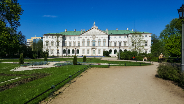
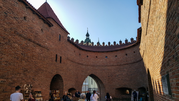
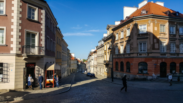
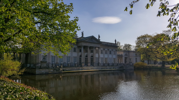
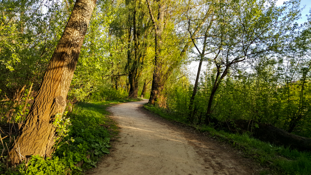
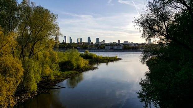
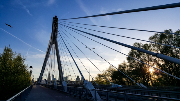
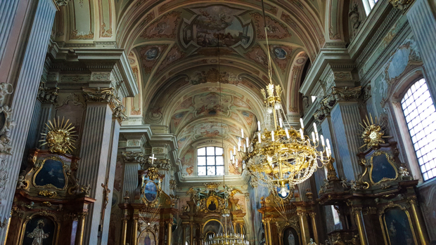
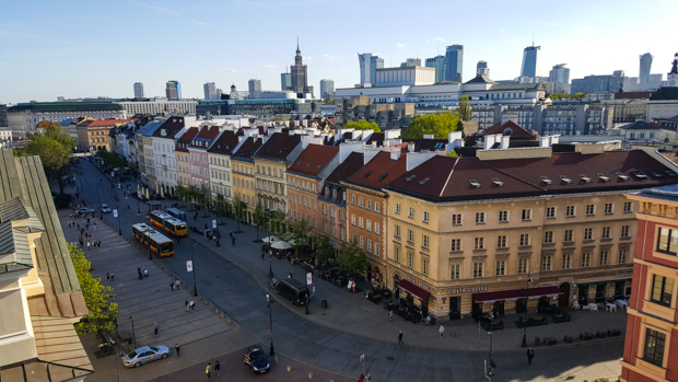
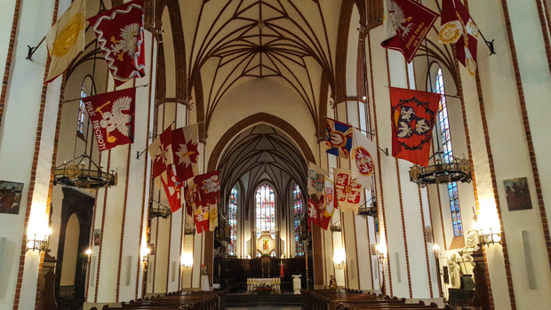
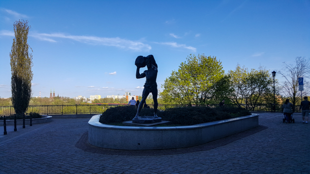
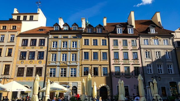
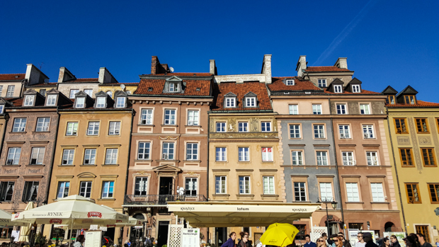
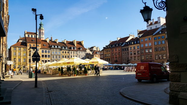
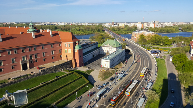
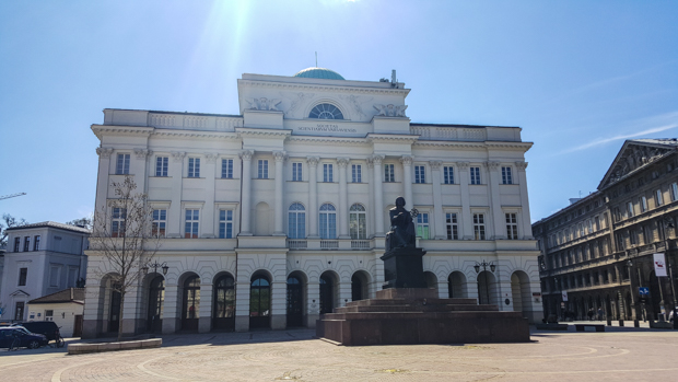
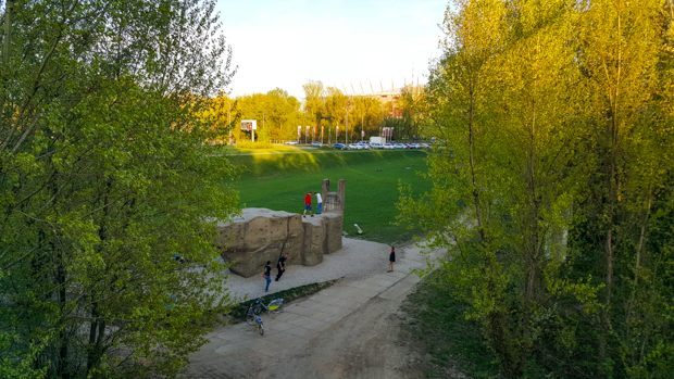
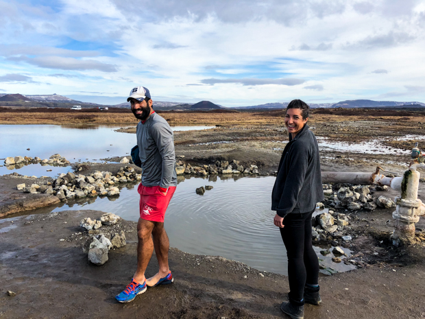
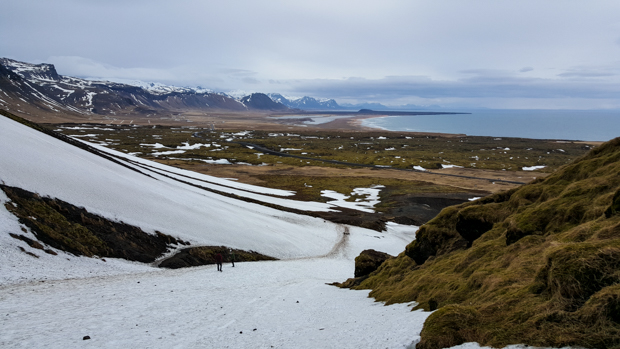
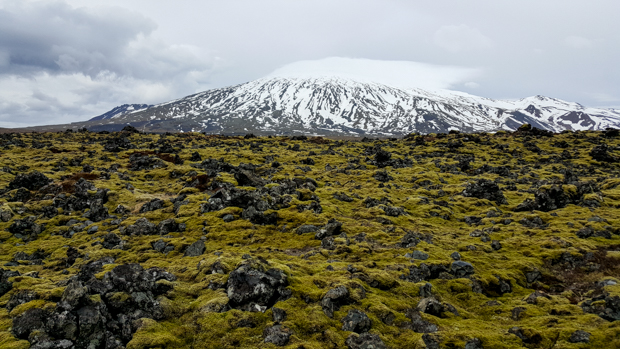
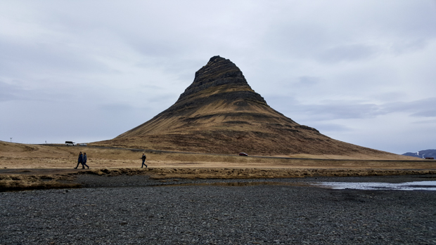
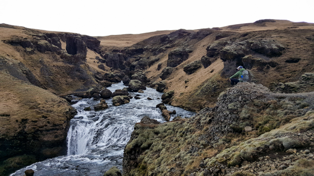
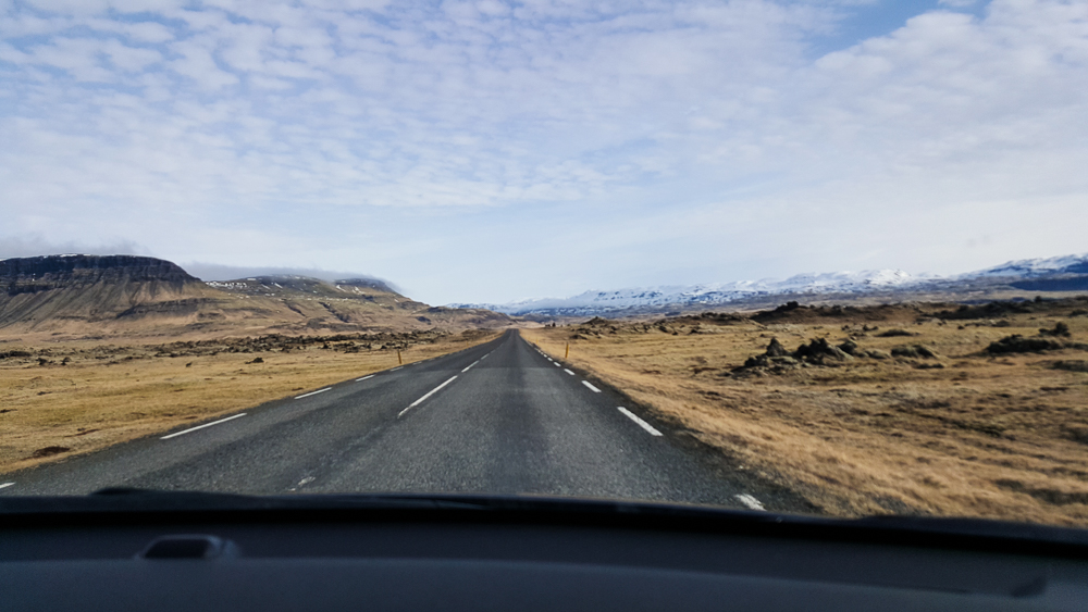
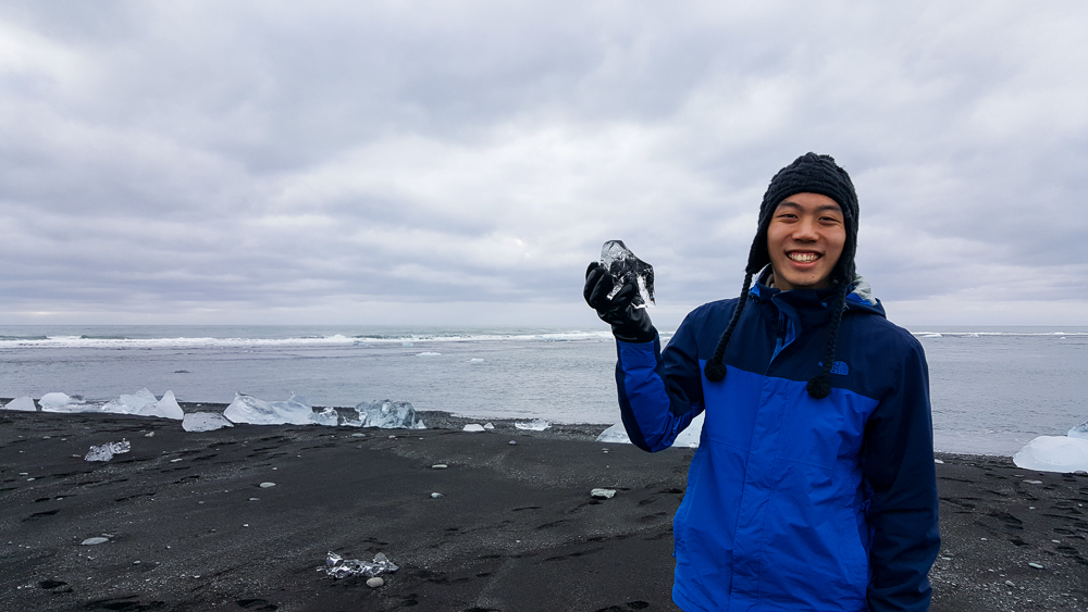
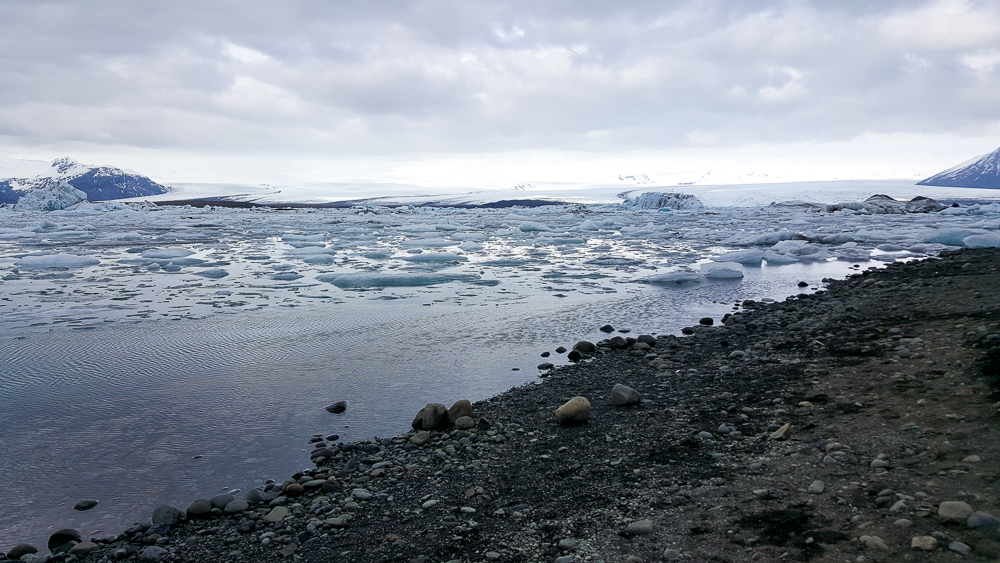
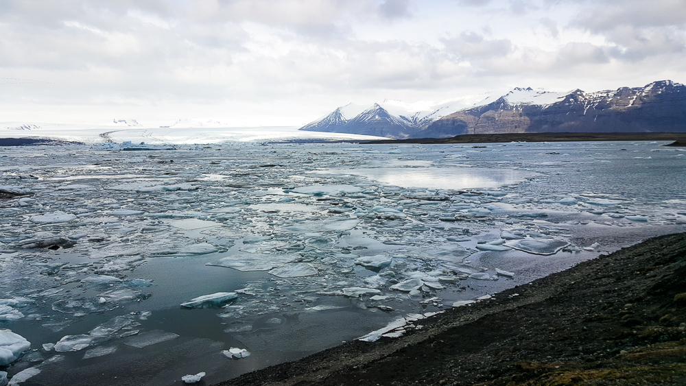
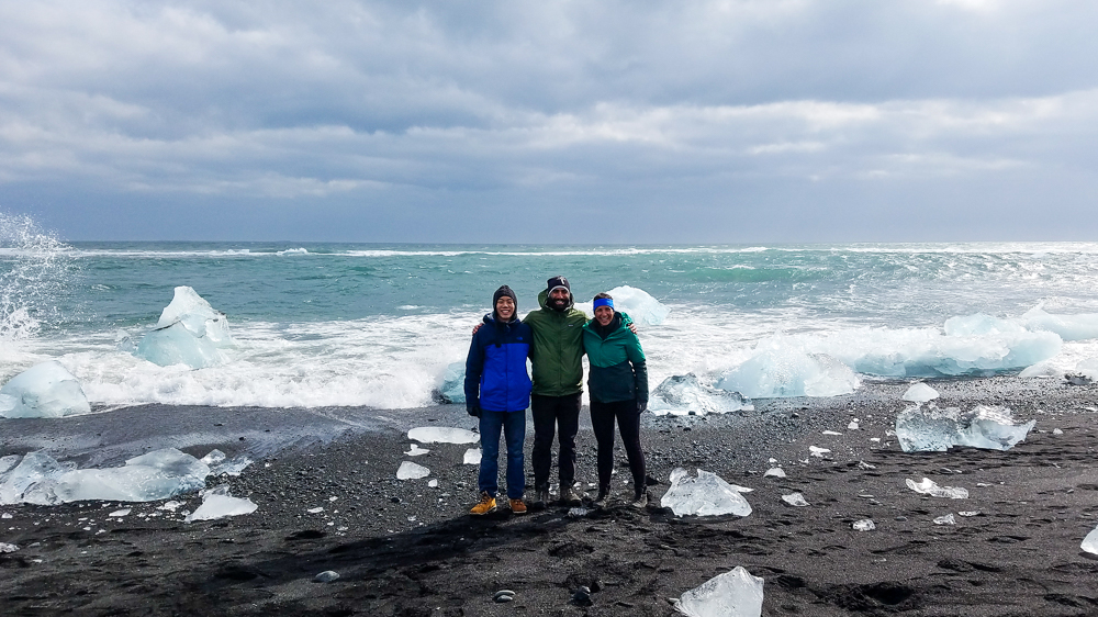
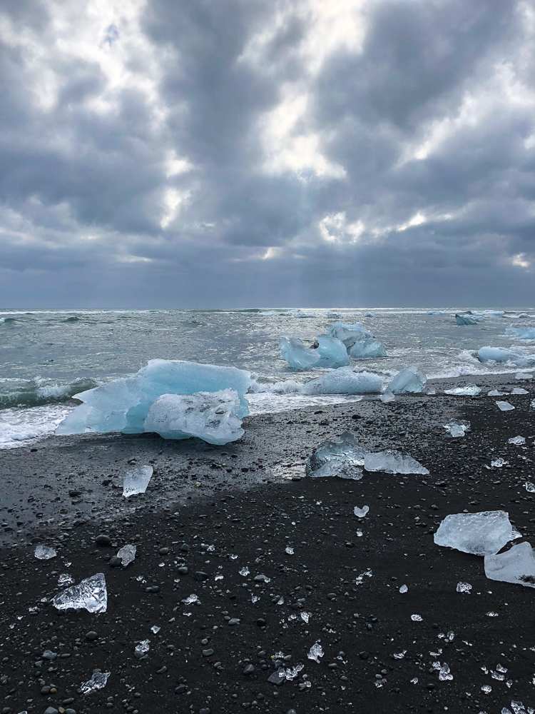
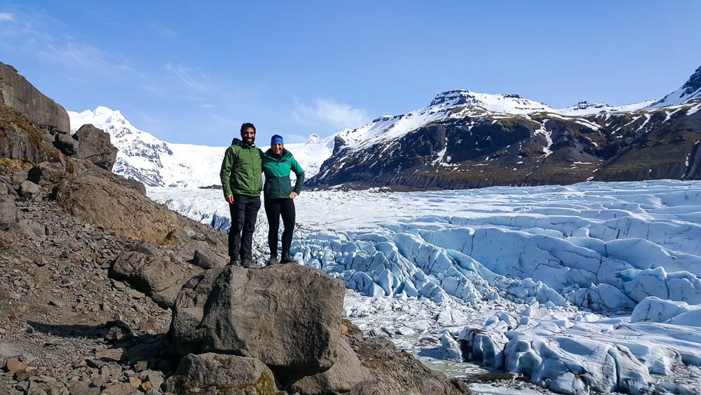
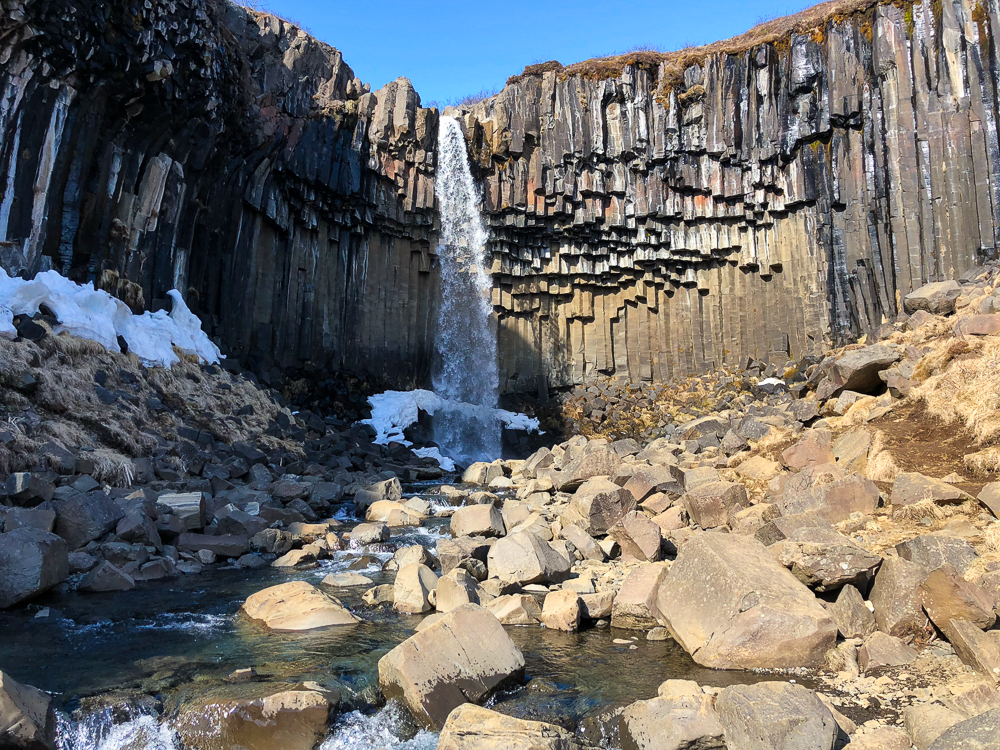
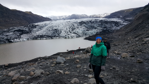
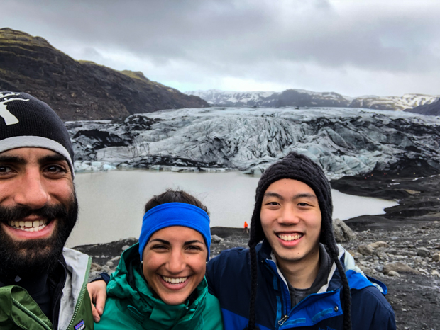
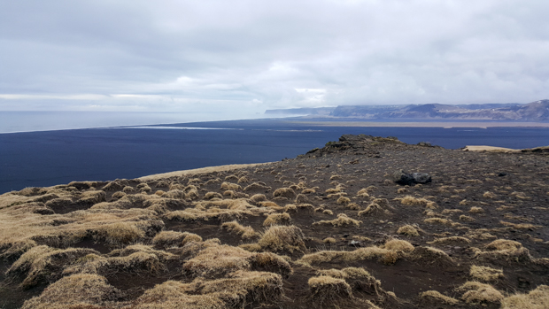
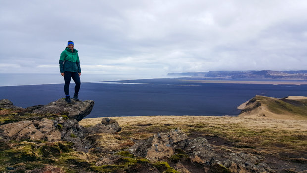
I spent a lot of time wandering aimlessly around the streets of Warsaw, partly because I was recovering from Iceland and partly because sometimes it’s nice to simply wander. You know me, though. I also need to fit in some nerdy museum time to be fully content. Like any capital city, Warsaw is FULL of museums. With only three days in the city, I had to be selective (especially since I can easily spend an entire day in a museum). I ended up visiting three: the Museum of Pawiak Prison, the Museum of the History of Polish Jews, and the VERY highly recommended (like seriously everyone said that if you’re going to visit one museum, you should visit this one) Warsaw Rising Museum. If that sounds like an emotionally heavy selection… well, it was. (Fair warning this is also kind of long… but there’s so much to say!)

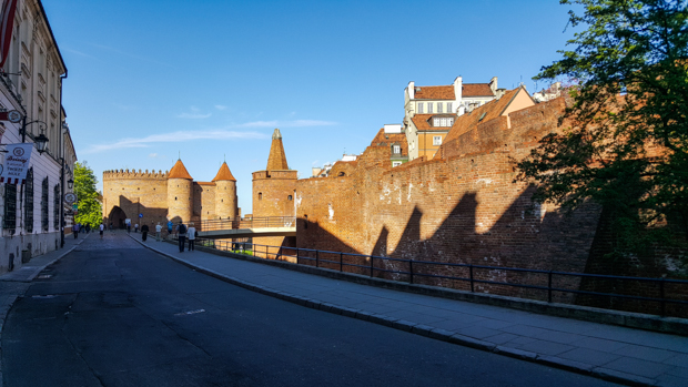
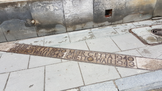
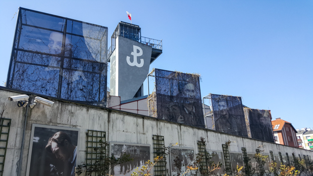
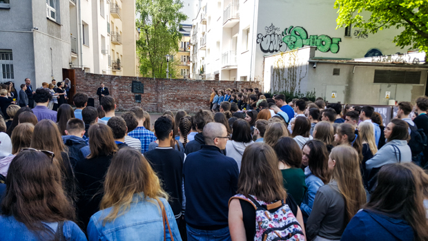
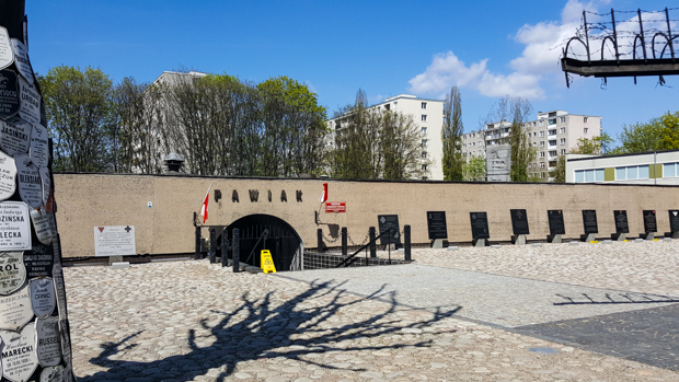
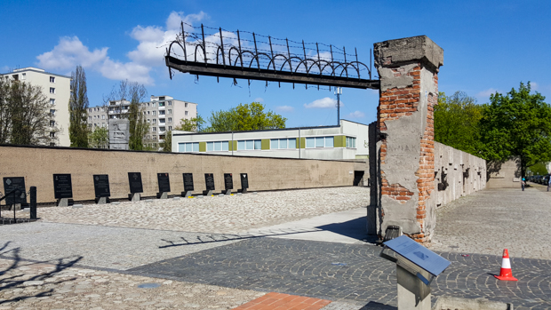
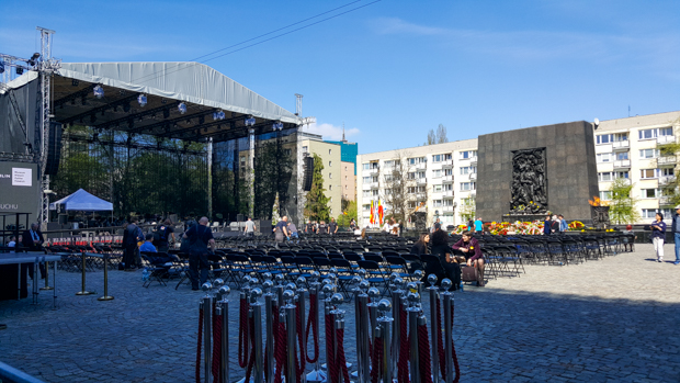
I had good timing for a couple of reasons. First, I was in town on a Thursday, and a bunch of museums are free on Thursdays. Second, my particular Thursday was the 19th of April which is also the anniversary of the Warsaw Ghetto Uprising – and 2018 was 75 years. I had no idea! After I cluelessly walked into a school program at the largest remaining section of the ghetto wall, I did some googling. I’ll talk more about the Ghetto Uprising in a minute, but first… My next stop after the wall was the Museum of Pawiak Prison which I decided to go to simply because I walked by and thought it looked interesting.

Crowds at the ghetto wall

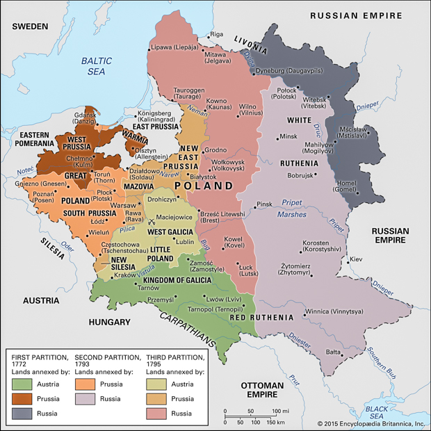
The prison was originally constructed in 1830, and from the start, it housed both criminal and political prisoners. During the partitions of Poland, the political prisoners were Poles who fought against the invaders for independence. During the Second Republic, they were often communists. Then, during WWII, the Nazis took over Pawiak. Most of the people held there during the war were members of the Polish resistance, but even innocent passers-by weren’t safe from being captured during random street roundups. People from all walks of life ended up in the same place – men, women, families with small children, pregnant women. The only commonality was their Polish heritage.

Pawiak Prison Museum
Inside the museum

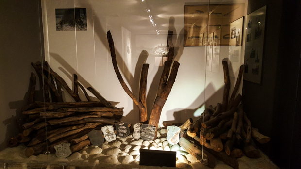
The museum is small but powerful. The best part is these video interviews with people who were imprisoned there. They talk about the different aspects of life as a prisoner, painting a pretty brutal picture. In summary, the food was horrible (think soup with worms in it). Cells were stuffed to 4x their intended capacity. Prisoners were frequently interrogated, and when someone was taken, no one knew if or in what condition they would return. A mini-resistance formed inside, and messages were often passed on through Polish doctors and nurses working in the prison hospital. An estimated 100,000 people were imprisoned in Pawiak during WWII. 37,000 were executed by firing squads, and 60,000 were sent to concentration camps.

One of the cells in Pawiak. A cell this size was intended for 3-4 people but held 10-18 in WWII.

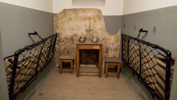
One thing that I found interesting but so confusing was that they said mothers were taken care of. They might kill you in your 9th month of pregnancy, but after giving birth, you were placed in a separate mothers’ wing with the baby. They had interviews with people who were born and lived in the prison for the first few years of their lives! It just doesn’t seem consistent. One woman said that she was arrested just after having a baby, and she begged to leave the baby with her family rather than bringing him with her. Then, at the prison, they asked if she would be willing to breastfeed another baby whose mom had stopped lactating. Why go to so much trouble?

Names and photos of some of the victims

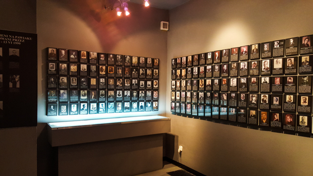
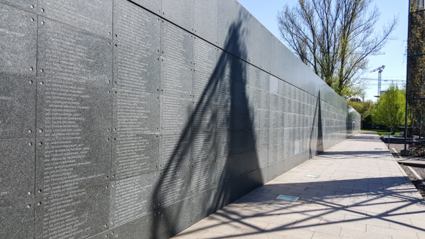
At the end of the war, the Nazis blew up Pawiak, including the prisoner records, so there’s no complete list of the people who were imprisoned and who died there. A lot of the information they have was volunteered by relatives, etc. I love that. It’s a group effort to preserve history, with people volunteering information, pictures, objects, etc. to the museums to make them more complete and to honor the memory of their family members.

The only remaining part of the actual prison is this gate and small portions of the wall.
This tree also remained standing after the prison was destroyed, and people started covering it with memorial plaques. Eventually, the tree was infected with a disease and had to be removed. It was replaced with a bronze version, and the remains of the original are now inside this case in the museum.
The bronze Pawiak tree.
My daffodil

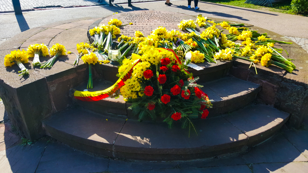
After leaving Pawiak, I made my way to the Museum of the History of Polish Jews. Outside, they were getting ready for the Warsaw Ghetto Uprising anniversary event. People all over the city were wearing paper daffodils in commemoration, and when someone on the street gave me one to wear, I did so with pride because I feel like I’m a little bit Polish now. The info pamphlet they gave me said, “By wearing them, we demonstrate that together we remember those who perished fighting for their dignity.” I can definitely get behind that.

Setting up the stage for the night’s events

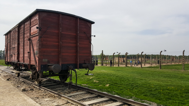
The Warsaw ghetto was established in 1940, and over 400,000 Jews were herded inside. Conditions were horrible, and people were killed by starvation, disease, and mass executions. In 1942, 300,000 Jews were deported to Treblinka (a death camp), clearing out much of the ghetto. Those remaining knew that certain death awaited them and decided to fight back. On April 19, 1943, Nazi forces entered the ghetto to remove the remaining inhabitants and were met by a resistance of about a thousand. The insurgents were outnumbered, under-equipped, and exhausted, but they chose to die on their own terms. Over the next four weeks, residents fought back as the ghetto was cleared out and burned to the ground. By May 16, the ghetto was gone and the Great Synagogue was blown up. A few managed to escape the burning ghetto through the sewers, but most were killed or committed suicide to avoid capture.

Flowers outside of the museum

The story doesn’t have a happy ending, but stories of the participants’ bravery inspired more acts of resistance. Inmates at Treblinka heard about the uprising and held their own revolt, leading to the eventual dismantling of the camp. Many survivors of the Ghetto Uprising participated in the Warsaw Uprising the following year.

Wearing my daffodil at the top of a tower near St. Anne’s Church

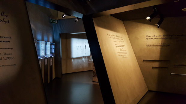
I popped into the museum since it was also free on Thursdays and was completely overwhelmed. They did a great job, but it’s absolutely massive. It starts with the first Jews coming to Poland and goes through modern day. I did a quick skim of the background stuff and mostly focused on the Holocaust forward.

Funky architecture inside the lobby

A few months before my visit, I read about how the Polish government was in the process of passing a law criminalizing the mention of Polish crimes against Jews during the Holocaust. Essentially, the president said that Poland was 100% a victim of Nazi Germany, and anything Poland may have done against Jews was forced. People freaked out, and after going through the museum, I understand why. Yes, Poles weren’t actively fighting with the Nazis, but that doesn’t mean there were no moral failings. Even Jews did things that hurt the collective in hopes that it would help their families. In this museum, a museum in the capital of Poland, the same city where the legislation passed, it talks about the roles that the Polish people played during the war. Often, they were hiding and protecting their Jewish neighbors. Other times, however, they were believing the propaganda, letting fear take over, and attacking or turning in their former friends and neighbors. In one town, the Jewish residents were gathered together and burned alive in a barn… by their Polish neighbors. I just don’t understand the value in making such a statement at this point. It’s nothing more than a barrier to healing and productive conversation.

Cool exhibit design!

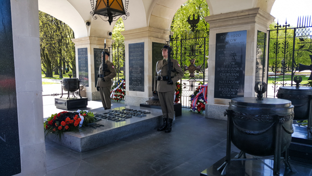
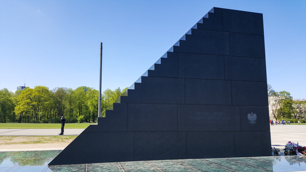
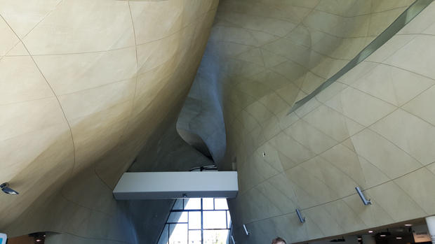
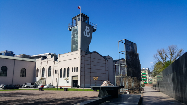
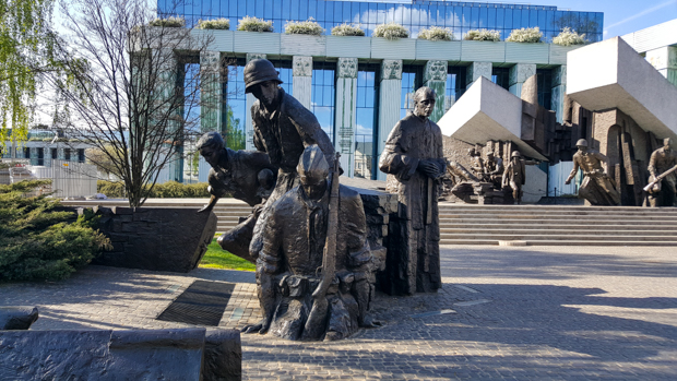
My last museum stop was the Warsaw Rising Museum. I was so excited because everyone gave it such glowing reviews, and I wanted to learn more about this important part of Warsaw’s history. For me, the museum was beyond confusing. I had a map and tried so hard to follow it, but I never felt like I was in the right place. Maybe it was user error. Maybe I should have gotten an audio guide? I spent three frustrating hours trying to piece the timeline together (and dodge giant groups of school kids), and every time I thought I understood what was going on, I’d realize that my timeline was all mixed up again. I don’t know if it’s because they assumed some base level of knowledge which I didn’t have, but I probably would have been better off watching a documentary. I’ll spare you the rest of my museum struggle details, but I don’t want to skip talking about the Warsaw Uprising because it’s pretty awesome.

Warsaw Rising Museum. It’s located in a former tram power station.
The outside of the museum. In the bottom half of the picture, you can see some formerly black and white images that have been colorized. So cool!

A Polish resistance began to form almost immediately after Poland was occupied by the Nazis and the Soviets. The “Polish Underground State” was practically an underground Polish republic. It was loyal to the Polish government-in-exile in London, and there were divisions concerned with every aspect of life. Underground printing houses distributed books, newspapers, and other uncensored printed materials. An extensive underground school system gave students, from primary school through university, the chance to continue proper studies (the Nazis banned schools past 4th grade, and the children were to be taught as little as possible). Very few Polish Jews survived WWII, but many of those who did were aided by the resistance.

This symbol represents the Polish Underground State. In Polish, the PW stands for Polska Walcząca (“Fighting Poland”).

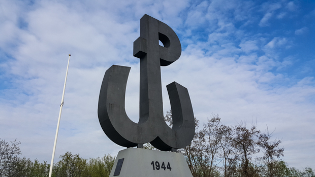
There was also a military component to the resistance. Polish spies carried information to the Allies. German supply lines were disrupted. Representatives were sent into concentration camps to gather information and organize prisoner revolts. The Polish Home Army also fought a couple of major battles against the Nazis, one of which was the Warsaw Uprising. On August 1, 1944, the uprising began with the ultimate goal of liberating Warsaw from the German occupation. People worried that if Warsaw was “liberated” by the Soviet army, the government-in-exile would not be recognized, and Russia would take over. So, the only option was to liberate themselves.

Warsaw Uprising Monument. You can also see another Chopin bench in the bottom left.

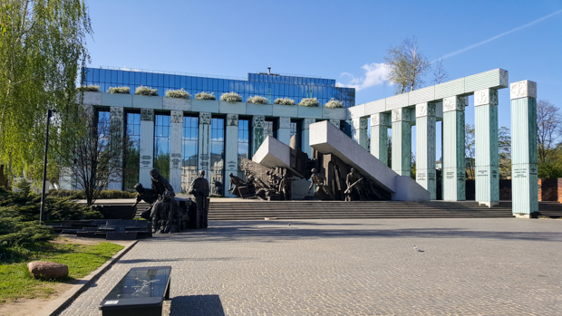
The uprising lasted for 63 days. In the beginning, the Germans tried to break the will of the resistance through massacres in some outlying neighborhoods. Soldiers went from house to house and murdered everyone inside, regardless of gender or age. This brutality only strengthened the resistance’s resolve, however, and they fought on.

The main part of the monument shows resistance fighters in combat as a building collapses behind them.

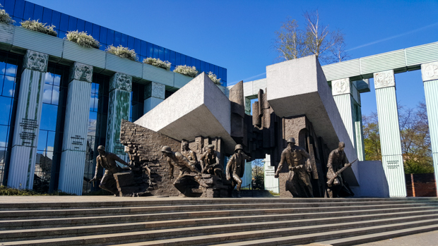
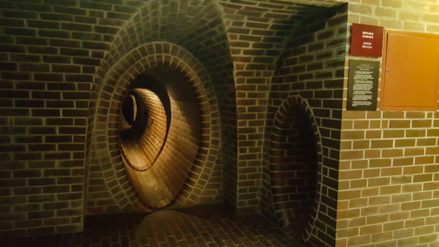
After about a month of fighting, the Polish forces had control of Old Town, and the exiled government was desperately asking for help. The Soviets refused to support the resistance army and also obstructed other Allied countries from sending aid. Without any support, the situation was hopeless, and the decision was made to retreat. In two days, over 5,000 resistance fighters fled the city using the sewer system (a major transit route throughout the resistance efforts). The uprising was officially over at the beginning of October, and as punishment for fighting back, Warsaw was systematically destroyed. About 25% of the city had been destroyed in the uprising fighting, but now destruction was the major goal. Houses were firebombed, and national and historical monuments were drilled and blown up with dynamite.

This part of the monument shows fighters sneaking into the sewer system.
A model of the Warsaw sewers in the Uprising Museum. You can walk through to get a sense of what it was like. It was… uncomfortable. You have to bend over the whole time, and I’m sure the ground wasn’t dry like in the museum model. When the resistance evacuated, they were in the sewers for over 5 hours!
Memory wall with a list of the names of those killed in the uprising
This unnatural hill on the fringes of the city is the Warsaw Uprising Mound. The hill itself is 120m tall and is actually a giant pile of rubble and remains of those found in the destroyed city. This is also supposedly the longest staircase in Europe, and I believe it.

Even though the Uprising was ultimately unsuccessful, it is amazing what the resistance was able to accomplish with limited resources and support. After learning about the struggles of the Polish nation, it’s not hard to understand why people are so proud to be Polish. They’ve had a rough history with more low points than high, but they’ve endured. Poland exists today because of the persistence and endurance of the Polish people. That’s pretty darn cool.

Last time, we left off in the heart of Warsaw Old Town, Old Town Market Square. Now, let’s go to the edge of Old Town and the old city walls.

Starting in the 14th century, the Old Town was surrounded by defensive walls. They used a double-wall system, with inner and outer walls that you can walk between, and gates to get into and out of the city. Some of the walls are still standing today, or rather, some of the walls were preserved/reconstructed after the destruction of WWII.

View of the city walls.
Walking between the inner and outer walls

One of the major attractions of the city walls today is the Warsaw Barbican. It was designed as a fortified gateway into the city, but due to advances in weaponry, it was useless as soon as it was built. In the years that followed, it was mostly disassembled as people took the bricks to use elsewhere. During the post-war rebuilding efforts, it was reconstructed as a tourist attraction. So, if there’s one thing in Warsaw that really is like Disneyland, it’s the Barbican.

Approaching the Barbican.
Barbican from the inside with artists selling their work.
Street views.

This was about where the tour I went on ended. Another fantastic thing about free tours is that sometimes, they give you a city map at the end! I think paper maps are the best way to plan city sightseeing because you can draw all over them, so when our guide pulled a stack out at the end of the tour, I was thrilled. Unfortunately, he didn’t have enough for everyone, but the Spanish tour guide had some extra Spanish maps… I figured that was better than nothing, right? Ehh, maybe. Over the next couple days, my bad translations sent me all over the city with completely wrong ideas of what I was going to see. Whoops. Oh well, it’s all part of the fun of exploring a new city!

I stayed in Warsaw for two more days after my exhausting arrival day and did a combination of museum visits and sightseeing around the city. I’m going to leave the museums for my next post, so for now, let’s go for a walk around “New Town”!

As I mentioned in my modern history post, the Polish people are extremely proud of their famous countrymen and will never miss an opportunity to remind you that they’re Polish. It doesn’t matter how long they lived in Poland, if they ever lived in Poland, if they’re only 0.5% Polish, etc. I think Polish blood is dominant, so even a drop means you’re 100% Polish. And obviously, all of those people love Poland the most, so no matter where they may have lived, their hearts were always in Poland.

For one person in particular, that statement is disturbingly true. Do you know where Frédéric Chopin, the famous pianist and composer, is buried? In Paris, where he lived for half of his life and most of his career. Do you know where Chopin’s heart is? Like his actual, literal heart? In Warsaw. Chopin was afraid of being buried alive, so he requested that his heart be removed after death and brought back to Poland. Poland didn’t exist at the time, so his sister had to smuggle it from France into Russia (at the time) in a jar of liquor. It now lives inside a column in Holy Cross Church in Warsaw. Yes, I’m serious. Fun fact: In 2014, it was taken out of the column and visually studied (without removing it from the jar) in an attempt to determine Chopin’s cause of death (they believe he died from pericarditis, a complication of tuberculosis).

Chopin may have lived abroad, but even then his heart was, figuratively, and now is, literally, in Poland.

Holy Cross Church
Here’s the column with Chopin’s heart. At the very bottom, it says in English, “Here lies the heart of Frederick Chopin”.
The interior of Holy Cross Church.

There is also a series of 15 “Chopin benches” scattered across the city. Each is in a place connected to Chopin, and with the press of a button, each plays one of his compositions! Musical benches! I wonder how the Warszawians feel about those benches… maybe it’s in the Polish blood that you never tire of listening to Chopin.

This is one of the Chopin benches. On the right side, there’s a “map” showing the locations of the other benches and a button to start the music. On the left, it explains why this bench was placed here. This one is near the former Saxon Palace, home of the Warsaw Lyceum where Chopin’s father taught and the family lived.

The above Chopin bench is where Saxon Palace used to stand (now it’s just an empty plaza, Piłsudski Square), also the location of Poland’s Tomb of the Unknown Soldier. The tomb was constructed underneath the palace’s colonnade. After the WWII destruction of Warsaw, the palace was gone and only a small portion of the colonnade remained standing, including the part sheltering the tomb.

The Tomb of the Unknown Soldier. It contains the remains of an unidentified soldier from the Polish-Russian war, as well as urns containing soil from significant battlegrounds. There’s also an eternal flame.

Piłsudski Square is full of monuments, actually. In 2010, a Polish government plane attempting to land in Smolensk, Russia crashed, killing all 96 people on board. The passengers were headed to an event commemorating the WWII Katyn massacre (the mass execution of thousands of Polish officers by Soviet forces). Among the victims were the Polish president, government officials, military officers, and members of the clergy. It was ruled an accident caused by bad weather, though as you might expect, there are plenty of conspiracy theories. To honor and remember the victims, a monument was placed in Piłsudski Square. It’s designed to look like airstairs, like what you climb to board a plane. My first thought was that it looks like a stairway to heaven.

Smolensk Air Disaster Monument
Walking through the park next to Piłsudski Square. Is there anything more European than a park with statues in it?
More park views.

Saxon Palace is, at the moment, nothing more than that little fragment of colonnade above the Tomb of the Unknown Soldier. There are plans to rebuild it, but those have been put on hold for financial reasons. There is, however, no shortage of other palaces in Warsaw! I walked around and looked at a few of them from the outside, but I would love to go back and spend more time exploring the interiors! I’ve heard people say that there’s not much to see/do in Warsaw… I don’t know what to say to those people because I could have spent months there and still not gotten to everything on my list!

This is Krasiński Palace. It was originally built in the 1670s, but what you see now was completely rebuilt after WWII. I can’t get over the scale of the post-war rebuilding efforts. I mean, it’s one thing to rebuild a city from complete devastation. That is crazy enough. It’s a whole new level of crazy to rebuild a city from complete devastation AND be faithful to the original designs. This palace now houses a portion of the National Library.

Since I love both parks and palaces, I had to visit Łazienki Palace, also called the Palace on the Isle. It’s located in the largest park in the city, on a man-made island on a lake.

Łazienki Palace

The other exciting thing about this palace is that it wasn’t destroyed in WWII! Much of the destruction of historical monuments was done by drilling holes in their walls and putting dynamite in the holes. At Łazienki Palace, they drilled the holes but never got around to the actual blowing up… which means we all get to enjoy the 1680s original! Well, original plus some later renovations. It was designed to be a bathhouse, so adjustments were made to convert it into a palace. Yes, a bathhouse. Please, take another look…

Casual bathhouse.
This is what my bathhouse looks like too. Doesn’t yours?
You know, I also have a peacock that likes to hang out in the colonnade near my bathhouse. What a funny coincidence! (See it? Sitting in the back left.)
Funky duck. Is it a duck? Heck if I know. Funky bird.
A walk in the park.

Like I said before, I didn’t have NEARLY enough time to fully explore Warsaw. I was there for three days, and I barely even made it across the river! Old Town and New Town are on the west side of the city, the side that was occupied by the Nazis. There’s still a whole other part of the city on the east side of the Vistula River, the “artsy” Praga district. Since it was occupied by the Russians in WWII, it was the least damaged part of the city… so while the west side is a kind of “new” old, the east is an “actually old” old.

Even though I didn’t have the time required to do the east side justice, I felt like I had to at least cross the river before I left. I also wanted to check out the Warsaw beaches! Yeah, you read that right, there are beaches along the river! Like actual beaches with actual sand… that I actually didn’t take a picture of so you’ll just have to believe me (whoops!).

There’s also a trail that makes you feel like you’re definitely NOT in the middle of a city and piers where you can walk out along the water. So. Cool.

Strolling through the city…
View of the west side across the river
An intimate stroll along the river. Not a good choice if you want to avoid bugs.
I. Love. This.

If the nature-y feel of the east side of the river isn’t for you, there’s a much more refined river walk on the west side, but I liked feeling like an explorer.

I’m a little obsessed with this bridge.

This is the end of our little city stroll, but I do have a more to say about Warsaw! Next time, we’re going to take a peek into a few museums…

My flight landed in Warsaw (Warszawa in Polish, pronounced like “Varshava”) at about 6:30 in the morning. I wanted to collapse from exhaustion, but I still had a whole day ahead so that wasn’t an option. I dropped my bags off at the hostel at around 8AM and then had to scram until the 2PM check-in time. It’s probably better that I couldn’t check in right away because I would have gone to sleep and wasted the whole day.

The best way to start off in a new city where you have absolutely no plan is to find a free walking tour! You don’t have to plan anything, they give you some historical context and make sure you hit the highlights, and you can ask your guide for recommendations of other things to check out after the tour. It’s a win, win, win. So, that’s what I did. I found one that started at 10:30, wandered across the city to the meeting point, and went to a café for hot chocolate and a cinnamon roll while I waited (I intentionally picked some extra-nutritious options to make up for all the muffins I ate the day before).

The tour was awesome… probably one of the best ones I’ve been on (if you’re ever in Poland, check them out). The only drawback was the fact that it started mist-raining halfway through, but I guess they can’t control the weather.

This photo clearly not taken during the mist-rain… I did a walk-around again the next day when the skies were nice and clear! So if there’s a blue sky in the picture, you can be sure that it was taken the next day. Heh.

We started by the statue of King Sigismund III in Castle Square in Warsaw’s Old Town. This is on the side of the river that was occupied by the Nazis during WWII, and even though it looks old, practically all of it was constructed after 1945. Warsaw wasn’t just occupied, it was destroyed. Hitler specifically commanded that the city be leveled as punishment for the resistance put up by its residents. The estimates are that 90% of Old Town, 80% of New Town, and 30% of the city on the Russian-occupied side of the river were destroyed. That’s insane. The damage was so bad that one proposal suggested leaving it in ruins as a sort of war memorial and starting fresh somewhere else.

Castle Square from above.

One of the only buildings that remained standing in the Old Town is St. Anne’s Church (below), located right near the castle.

The front facade of St. Anne’s.
The inside is awesome! Just think about how much other awesome stuff like this was destroyed… and for what purpose? What a waste.
Look at this!! It’s painted to look 3D, but that’s just a flat wall. I live for this kind of thing. I was fan-girling so hard in this church.

The Warszawians are particularly proud of the rebuilding of the city. Using historical paintings, the Old Town especially was rebuilt to look the same as it did before. Poland didn’t receive money to help with their rebuilding efforts, so the saying of the day became, “The entire nation builds its capital.” Funds were donated by Poles near and far, and those in and around the city helped to remove rubble and painstakingly reconstruct the buildings and monuments. Some people say that it’s not genuine because it was rebuilt, that it’s like a weird Disneyland, but I think it’s beautiful. It’s a testament to the determination and pride of the Polish people.

I think they did a darn good job!

One of the buildings that WAS completely demolished was the castle. This was where the monarchy moved when the Polish capital shifted from Krakow to Warsaw. The castle was looted prior to its destruction. Much was taken by the enemies, but some of the artwork and even pieces of the building were secretly smuggled out by museum workers who were already preparing for the rebuilding process. The castle was blown up in 1944.

This is the interior of the castle courtyard. Only an estimated 2% of the castle exterior is original, and you can pretty clearly see which parts are included in that. See the “white” pieces underneath the balcony that are almost black? Those are original.
The first phase of the castle reconstruction was completed in 1974 when the building’s outer shell was completed, and the clock was restarted at 11:15, the time when the original clock stopped due to the bombing.

Just off of Castle Square is St. John’s Archcathedral, an important Roman Catholic church. During WWII, a tank filled with explosives was driven into the church, severely damaging it. The surviving walls later had holes drilled into them to hold explosives, leading to the complete destruction of the original building.

The front of St. John’s
This little archway comes from the castle. After a failed assassination attempt on one of the kings, a corridor was built from the palace directly to the church. The would-be assassin was subjected a horrible public torture/execution to discourage others from following in his footsteps. Lesson learned – no one ever tried to kill a king again.
The interior of St. John’s
You know how I love my stained glass! There’s some great stuff in St. John’s.


The church’s crypt houses some of the Polish royalty, along with other prominent Poles. There used to be a graveyard behind the church as well, but it was relocated in the late 1700s for sanitary reasons and because it was right next to the palace. I guess they realized that having a smelly cemetery in the middle of your town isn’t exactly the best urban planning decision.

The former cemetery area is now a small square behind the church, occupied only by a large church bell. The bell was designed by the same artist responsible for the statue of King Sigismund III on top of the column in Castle Square. It is said that if you put your hand on the bell and walk around while thinking of a wish, it will be granted.

Wishing bell? Yeah, right… butttt while I’m here I might as well join in the fun! You know, just to be a good sport…
See the little beige strip/doorway in the corner between the green house and pinkish house?

In the same square as the wishing bell is a house with the skinniest possible facade. Back in the day, property was taxed based on the length of your facade… facing the main street. Some smarty pants designed his house to pay as little tax as possible.

Joke’s on him though, because the back of his house faced the “rubbish mountain” where people used to unload their trash and human waste. Yum. It’s also right near the palace, and kings never wanted to stay there because the smell carried. After Napoleon visited the city and remarked on the terrible smell, it was covered with earth making a nice man-made hill. This is now where some people have started leaving love locks which is funny because like… ew.

Here’s the back of the house. As you can see, it’s much bigger than the entrance would suggest.
Viewing terrace on the former rubbish mountain
Love locks on the mountain of… rubbish.

At the heart of Old Town is the Old Town Market Square. From the beginning, it was the center of the city’s social life. This was the spot for trade, for fairs and festivals, and for the occasional execution (including that unfortunate soul who tried to assassinate the king). Later, a town hall was built in the square where it remained for about 400 years. In my opinion, this is the part of the city where the rebuilding efforts are the most impressive. I. Love. This. Square. Feast your eyes on these facades, please.

I LOVE YOU!
They. Are. Unreal.

In the center of the square is the Warsaw Mermaid, the symbol of the city (she’s on the Warsaw coat of arms!). Legend has it that she’s the sister of the famous Copenhagen mermaid. Her sister got tired; that’s why she stopped in Denmark. The Warsaw mermaid kept going, swimming up the Vistula River until deciding to make her home in Warsaw. Once, she was captured by a merchant who planned to make some money off of her. She called out for help and was rescued by some locals. To say thank you, she promised that she would be there to protect them if they ever needed her.

The Warsaw Mermaid, fierce with her sword and shield

Okay, geez, I’m tired. I’m going to take a hint from the Warsaw Mermaid and stop my journey for now in Old Town Market Square. I apparently saw more in Warsaw than I realized… I really thought I could give you the full tour in one post! If I ever want you to come back though, I should stop here. So, there’s your half-tour of Warsaw. We didn’t even make it out of Old Town yet! So much for my estimation skills. Until next time

When we left off last time, Poland had just been partitioned for the third time, resulting in ALL of the Polish lands being given to other countries. Poland was gone. Clearly, considering that Poland is a country today, that’s not where the story ends.

This statue is of Tadeusz Kościuszko, the man who led the uprising that resulted in the Third Partition. He also fought on the US side in the American Revolution and returned to Poland afterward where he joined political reformers in pushing for the creation of a constitution. In 1791, Poland became the first European country to adopt a constitution.

After the Third Partition, the Poles continued to resist, grasping at anything that might lead to their victory and independence. They fought with Napoleon Bonaparte against Russia, but he was defeated in 1815 by the “Holy Alliance” of Russia, Prussia, and Austria, formed to guarantee the elimination of any radical movements. Two more Polish uprisings were attempted in 1830 and 1863, and both were crushed.

Despite the lack of a Polish state, the Polish people continued to make their mark on the world. Frédéric Chopin (1810-49), the famous pianist and composer, grew up in Warsaw. In 1853, Polish inventor Ignacy Łukasiewicz developed the modern kerosene lamp (fun fact: his family was Armenian! Of course haha). The scientist Marie Skłodowska Curie (1867-1934) was born in Warsaw, earned two Nobel prizes for her work in physics and chemistry, and named the element “polonium” after her beloved Poland.

The Chopin memorial in Warsaw.

The Marie Curie Museum in Warsaw.

Russian was made the official language in the Russian-controlled areas in an attempt to stifle Polish culture, and the Prussians and Austrians similarly tried to keep control of their Polish subjects. However, the Polish people were determined to keep their language and history alive and operated unofficial education centers. They also advocated for Poland to the enemies of their invaders, waiting for a chance to get their land back.

That opportunity came in 1918 at the end of WWI. Poland fought with the Allies and was rewarded with land and independence. The Second Polish Republic was born, coming into the world with the simple task of rebuilding and uniting a country divided for over 120 years. Adding to this strain, Poland quickly entered a border war with Russia until an unexpected Polish victory in the 1920 Battle of Warsaw crippled the Soviet forces.

When Poland was formed, it was placed under the control of a “chief of state”, Józef Piłsudski, who had been a general during WWI. A new government and constitution were created in 1921, but the first president was assassinated after only one year. Unimpressed with the new government and certain of its collapse, Józef led a coup in 1926 to restore order and served as a quasi-dictator, working to stabilize the country, until his death in 1935.

Poland never even got a chance to catch its breath. In 1939, Soviet Russia and Nazi Germany signed an agreement to split Poland between them. On September 1, 1939, the Nazis invaded Poland from the west, marking the start of WWII. On the 17th, Russia invaded from the east, splitting the country into two. Poland fell in 27 days, and its government fled to exile in London.

I took this picture from the western side of Warsaw. This was the side occupied by the Germans and was almost completely destroyed. The Soviet-occupied side of the city was across the river.

WWII was not kind to the Polish. On the Russian side of the country, the invaders quickly worked to bring the Polish people under their control. Hundreds of thousands were imprisoned or killed. In one incident, the remains of 4,500 Polish officers were discovered in a forest in April 1943. The Soviets tried to blame the massacre on the Nazis who, despite committing countless atrocities during the war, were not responsible for that one. After the Nazis invaded Russia in 1941, Russia and the exiled Polish government signed a peace treaty. Russia released its approximately 200,000 Polish POWs, but after the discovery of the massacre and continued disagreements about where the Polish-Russian border should stand, relations between the countries remained tense.

On the Nazi side of the country, people were sent en masse to concentration and, eventually, extermination camps. The Nazi plan was to keep the Poles as slaves, but that required an uneducated population. The educated were killed, schools were closed, and any resistors were sent without second thought to concentration camps.

These wires show the outline of a bridge that used to join the two sides of the Warsaw ghetto. The only way for Jews to pass between the two sides was using this bridge.

The Jewish population, which had been thoroughly integrated into the Polish population thanks to years of tolerant policies, was separated out and placed in ghettos. The ghettos were emptied in 1943, and the Jews were sent to be killed at the Auschwitz and Treblinka extermination camps (Treblinka was about 60 miles from Warsaw and was the second deadliest camp in Poland, responsible for killing 700,000-900,000 Jews. About 1 million Jews are estimated to have been killed at Auschwitz).

This cattle car is an example of the ones the Nazis used to transport people to their concentration and extermination camps.

WWII ended in 1945, but that was too late for the approximately 6 million Poles who were murdered, 3 million of whom were Jewish.

Poland was “liberated” in 1945 by the Soviets. The exiled government returned from London, and under pressure from Russia, it became more and more communist over the next few years. The government of the “People’s Republic of Poland” was nothing more than a Soviet puppet. During the post-war negotiations, the entire country was shifted west. Russia took possession of the eastern land that it wanted, and some of the eastern part of Germany was given to Poland. About 2 million people were resettled as a result of this shifting. For much of its history, Poland was extremely multi-ethnic. Between WWII and the following resettlements, it became very homogenously Polish.

The forced communism of the post-WWII years made Poland’s rebuilding process much slower than in Western European countries. Instead of having a chance to recover from the impact of the war, the Polish people continued to fight for their rights. There was constant unrest, and protests were always brutally suppressed. In 1970, demonstrations against rising food prices were met with violence from troops, killing many of the protestors.

This monstrosity, the Palace of Culture and Science, was built as a gift by Stalin after WWII. Soviet workers were sent to construct it. As you might imagine, it’s a bit controversial. As out-of-place as it looks now, it was even more ridiculous when it was first built because most of Warsaw was in ruins from the war.

In response to this disaster, a new leader took control, Edward Gierek. He attempted to make things better by borrowing from the west to raise the standard of living. The problem came when the loans needed to be repaid, and there was no money to do so. In 1980, food as much as doubled in price, and workers went on strike across the country.

In the city of Gdansk, shipyard employees went on strike, leading to the formation of the “Solidarity” Trade Union which quickly spread across the country. At its peak, there were 9 million members or about 25% of the Polish population. Eventually, Solidarity managed to break Soviet control. In 1988, freedom of the press was finally granted, and a portion of the Polish Parliament went up for a free election. Nearly all of the available seats were won by Solidarity members, starting the transition from communist to capitalist and a new form of government, a liberal parliamentary democracy. The first elections of the Third Polish Republic were conducted in 1989.

The Cold War ended in 1991, and the Soviet Union collapsed. Poland passed a new constitution in 1997, joined NATO in 1998, and joined the EU in 2004.

What a journey, huh? After all that, I’m sure you’re ready to get out of the classroom and start exploring! Next time, Warsaw!

Are you ready for a Polish history adventure? I hope so because this is a long one, but in order to understand the Poland of today, I think it’s important to know the history behind it. Let’s go waaay back…

The Polish lands have been occupied on-and-off since prehistoric times. Starting in the Iron Age (around 700BC), there’s evidence that Celtic tribes and Germanic tribes settled in the area, followed by Baltic peoples and eventually, around 500AD, Slavic tribes moved in. The “Slavic” ethno-linguistic group is the largest in Europe and basically encompasses all of the European countries to the east of Poland and in the Balkan region (Croatia, Serbia, etc.).

“Poland” as a country is usually cited as being founded in 966AD when the first documented ruler, Mieszko I of the Piast Dynasty, converted to Christianity and thus declared all of Poland to be Christian. The first coronation was held in 1025AD. Bolesław the Brave became king, and the Kingdom of Poland came into existence for the first time.

Throughout the rule of the first dynasty, the Kingdom of Poland warred with the Romans and Mongols. They managed to hold their borders and even expand the Kingdom. The second-to-last Piast king, King Casimir the Great, ruled over a Polish golden age. The first university was founded in Kraków in 1364, laws were reformed, and Jews were protected, resulting in a large influx of Jewish people from less tolerant countries.

University of Krakow

In 1384, the only Piast remaining was a woman, Jadwiga. She was crowned king at age 11, reigned until her death at age 25, and is known as one of Poland’s greatest monarchs, establishing and restoring schools, hospitals, and churches across the country. At the beginning of her reign, she chose to marry the ‘elderly’, 35-year-old Lithuanian Grand Duke Jagiello (called Władysław after his baptism) for political reasons, rather than her young Habsburg fiancée. This was the start of the Jagiellonian Dynasty period, and the marriage joined Lithuania and Poland in a union that lasted for 400 years.

This is inside the courtyard of the palace in Warsaw. There are three coats of arms represented – Poland, Lithuania, and Austria. These are the countries of origin of the wives of the last Jagiellonian king.

The strength of the Polish-Lithuanian Union helped in fighting outside threats. The greatest threat of this time was the Teutonic Order, a Christian crusading army that arrived in 1226 to convert the neighboring Prussians to Christianity. Eventually, however, they began to attack the union, despite the fact that Poland and Lithuania were both converted countries. The Order was decisively defeated at a battle in 1410, and a treaty was signed in 1466.

In the early 1500s, the government was reorganized, giving the nobles a great deal of power. No decisions could be made without their approval. Despite this, Poland experienced its greatest golden age and the Polish Renaissance. Nicolaus Copernicus published his heliocentric theory of the universe in 1543. There was a policy of religious tolerance that attracted persecuted people of all religions. Prominent artists from across Europe moved to Kraków, the Polish capital. Poland was influential in Europe, both culturally and politically, and it grew territorially.

The Academy of Sciences in Warsaw with a monument to Copernicus in front.

Then, in 1572, the last Jagiellonian king died without an heir, and the government was restructured again. The nobles continued to hold most of the power, and the “king” became an elected position. Poland and Lithuania made an even stronger union, joining together to become the Polish-Lithuanian Commonwealth. It was the largest, and perhaps most powerful, country in Europe.

The whole “elected king” concept is a bit strange… it resulted in the election of kings who were also eligible for the throne in other countries. For example, the first elected king left soon after beginning his rule… to claim the throne in France as King Henry II. Later, Polish King Zygmunt III was heir to the Swedish throne and was crowned King of Sweden DURING his rule as monarch of Poland. So he was king in two countries at once. He is also the one responsible for moving the Polish capital from Kraków to Warsaw so that it would be closer to Sweden.

King Zygmunt III stands on top of this column outside of the palace in Warsaw.

The mid-1600s were the beginning of the end for the Kingdom of Poland. The country was weakened by internal uprisings by their vassals and an invasion by Sweden called the “Swedish Deluge”. The conflicts ended with Poland as “victor”, but they took a toll, both economically and physically. In Warsaw, about 80% of the population was killed as the city was captured and recaptured repeatedly during the conflicts.

The last great victory of the Kingdom occurred in 1683. At the Battle of Vienna, the armies of Poland, the Roman Empire, and the Habsburgs joined together to fight the Ottoman Empire as it attempted to expand farther into Europe. Led by Polish King Jan III Sobieski, the Ottomans were defeated and their European expansion halted.

The palace in Warsaw

By the 1760s, Poland was a disaster. The governing structure meant that a single noble could veto any measure, and the government was completely paralyzed. Stanisław Poniatowski was elected king in 1764. He was romantically involved with Russia’s Catherine the Great, and she helped to place him on the Polish throne, as it was in Russia’s best interests to keep Poland weak and divided. However, after his election, he refused to be a puppet king under the Russians and tried to stop the country’s collapse by introducing reforms.

Meanwhile, Russia was in the middle of a war with the Ottomans. They were doing well, and Austria began to worry that it would lose territory to Russia. It threatened to join the war on the Ottoman side. To avoid this, Russia and Austria agreed to redirect Russia’s expansion to the west, into Poland. Poland was weak and unable to resist, so on August 2, 1772, the Polish Parliament (called the Sejm) ratified a treaty between Russia, Prussia, and Austria that took about 1/3 of Poland’s land (and ½ the population) and divided it between the three. This was the “First Partition of Poland”.

Here’s a map from the Encyclopaedia Brittanica that shows the land lost in the First and subsequent partitions. It explains the losses much better than I could with words.

This map from the Encyclopaedia Brittanica shows the land lost in the three partitions of Poland.
In the first, green went to Austria, dark red to Prussia, and dark grey to Russia.
In the second, bright orange to Prussia and light purple to Russia.
In the third, yellow to Austria, dull orange to Prussia, and pink to Russia.

So as you can see from that map, the First Partition wasn’t the end. Poland continued trying to pull itself together by adopting a more liberal constitution. A conservative confederation was formed in response, and it asked Russia to help bring back the old constitution (because who better to ask for help than one of the countries that clearly has an interest in destroying you). Russia said, “Sure!” and came into the country with the Prussians. They forced the Sejm to sign another agreement that led to the Second Partition of Poland, giving away more than half of Poland’s remaining land.

Finally, in 1794, an uprising in Poland was squashed by Russia and Prussia. The two of them, along with Austria, made a deal to divide the remaining Polish lands. On January 26, 1797, the Third Partition of Poland was officially settled, and Poland was completely wiped from the map of Europe.

The End.

Just kidding! Obviously Poland exists as a country today. So, what happened between 1797 and today? Read the next post to find out!

I know it feels like we’ve been in Iceland forever, but in realtime, it was only a week (ha!). My Icelandic adventure ended a bit anticlimactically… with a 16-hour stay in the airport. My brother’s flight home was in the morning, and since we only had one car, we went together to the airport around 8:30AM. I had chosen Poland as my next destination, and the cheapest flights there were overnight flights leaving at 12:30AM. And so, that’s how I found myself sitting on a bench in the airport, throwing back mini chocolate chip muffins like they were popcorn, pretending to get work done, and trying not to have to go to the bathroom (because then you have to get up, lose your seat, and haul all of your crap with you. I maintain that this is the worst part of travelling alone).

Pretty!

Is it weird that I really don’t mind spending a lot of time in airports? I did actually manage to have a productive day, and when it was time to go through security, I was surprised at how quickly the hours had passed. I even had the insane thought that I wouldn’t have minded a few more. That can’t be normal.

The flight from Iceland to Warsaw, Poland is about 4 hours, and I spent all four of them completely unconscious. My eyes were closed from the instant I sat down until we pulled into the gate in Poland. As you might imagine, I wasn’t exactly feeling fresh when I woke up. Unfortunately, it was only 6:30AM, so there were still a LOT of hours standing between me and bedtime.

I took my time leaving the airport. I like giving myself a moment to get oriented and washing my face and brushing my teeth before facing a new country. When I was feeling slightly more like myself (and slightly less like a zombie), I grabbed my bags and set off to find the bus into the city. It ended up being super easy to find and figure out… which leads me to my next list of first impressions!

Strolling through one of the parks in Warsaw…

Here are some of the first things that stuck out to me when I arrived in Warsaw:

This guy is buying his bus ticket! The buses have machines where you can buy a ticket when you get on (and you can change the language to English!). Or, if you already have a ticket, you can validate it using the yellow box to the left.

  1. Public Transportation – SO easy to figure out and SO inexpensive. The buses announced every stop which is something I have come to appreciate because there’s nothing worse than being on a bus with no concept of where you are or where you’re going.
  2. Polish Language – Speaking of the buses announcing every stop… this was my first exposure to the Polish language, and it was baffling. For each stop, I’d read the name in my head and guess how it was going to be pronounced… and then the automated voice would read it and I’d question if we were even looking at the same word. I spent about 1 minute considering trying to learn the Polish pronunciation rules until I looked them up and saw that there were WAY too many. As usual, there were plenty of locals who claimed that their language is one of the hardest to learn (it seems like this is a mandatory claim anytime someone is talking to me about their native language), and I accepted that as fact because it looks plenty hard to me. For example, “Excuse me/sorry, I don’t speak Polish” is “Przepraszam, nie mówię po polsku” (pshuh-PRASH-em, nyE MOO-vee-uh po POLS-koo). Simple, right? (To read about the struggles of learning Polish, check out this funny article!)
  3. Money – WHY SO MANY COINS??? My wallet weighed a ton because THERE ARE SO MANY COINS. Their “dollar” is “złoty”, pronounced kind of like “zwoh-tih” and if you needed more proof about the language, there you go. The “cents” are called “groszy”.

    This is the most different coins I managed to collect at once, but even with this many, I’m missing the 1gr and 5gr. Why. So. Many. Coins. And look at that 5zl! It’s massive!
  4. History-filled – If you like history, Poland is the place for you. Well, probably all of Europe and the Middle East are good spots for you, but I knew nothing about Polish history before I went there, making everything I learned even more interesting. Just wait for my Polish history post… it’s fascinating.
  5. WWII Impact – I don’t know if this is just because of the things I did or where I was or what, but it seemed like you could constantly feel and see the impact of WWII. So many places have a heaviness to them that I guess you learn to ignore when you’re there for long enough, but I felt it very clearly. Poland was hit incredibly hard by the Germans. The Jewish population was decimated, and the other Poles were heavily persecuted and imprisoned and executed in huge numbers. Warsaw was almost completely destroyed during the war, and it was painstakingly rebuilt by the Polish people, a fact that they are incredibly proud of. Which leads me to my next point…

    There are reminders like this all over the place, if you’re looking for them. This line on the ground follows the footprint of the wall surrounding the Warsaw Jewish ghetto during WWII.
  6. Polish Pride – People are so proud to be Polish. It almost rivals Armenian pride and has a similar “we’re going to take credit for anyone and anything even almost kind of tangentially related to us” thing going on. They may not be thrilled with everything about Poland, but they are incredibly Polish proud.
  7. Underrated – Spoiler alert: I loved Poland. LOVED it. I don’t know that it’s a huge vacation destination, but it SHOULD be because it’s beautiful and interesting and I loved it and everyone else should too.
  8. Food – One of the things I loved was the FOOD! I feel lucky to have experienced pierogies pre-Poland (shout out to my college roommate, Carissa, for bringing them into my life) because they are phenomenal. Dumplings are my #1 favorite food, and pierogies are basically the Polish version of dumplings. You can get practically any type… there are even fruit filled “dessert” ones, but whoever decided fruit is dessert is no friend to me. The classic version is filled with mashed potatoes. So it’s a carb-wrapped carb nugget, and I’m obsessed. I could eat them for every single meal, and while I was in Poland, I nearly did. There are other Polish foods, but for me, there are only pierogies. I guess you’ll just have to go to Poland if you want to learn about the others. (I know I should have taken a picture, but I was always too busy gobbling them down to even think of that before they were all gone.)
  9. Bike Lanes – Bike lanes exist, and people use them. And people who aren’t on bikes respect them. This is a completely foreign concept to me because bike lanes in the US turn into idling lanes, parking spots, good places to open a car door into, etc. Bikers are seen as a menace and an inconvenience. Not in Poland! We need to learn some lessons from Europe on sustainable transport!

I spent most of my time in Poland walking around and thinking, “I could totally live here.” There are livable-feeling cities, and there are the ones that you visit and then feel happy to leave behind. I visited Warsaw and Krakow, and in both of them (Warsaw especially), I felt like I could easily settle in and stay for a while. It’s always nice to feel that level of comfort when you’re on the road!

I thought this was awesome… in one of the parks in Warsaw, there’s a bouldering wall! There were a bunch of people rock climbing on it when I walked by.

Before I launch into a tour of all the things I saw and did in Poland, I think it’s important to get some historical context. So, next time we talk, prepare yourself for a gripping Lara-style retelling of Polish history! It’s going to be fun, I promise.

We still had one more day in Iceland, and since we had already gone east from Reykjavik, we decided to spend it exploring Snæfellsnes Peninsula to the north of the city.

Along the drive in the morning! So pretty, and a rare blue-sky sighting!

I had one request, and one request ONLY, for our time in Iceland. I wanted to go to a hot spring that wasn’t a swimming pool. I wanted it to be natural in every way, not just naturally heated. Our first stop of the day was a response to my ongoing request. I’d found a few lists of natural hot springs around the country, and one of them, Landbrotalaug, was right along our route. It’s kind of off the beaten path, but there were enough people who knew about it that we had to wait when we got there. Thankfully, we only had one group in front of us, and we didn’t have to wait very long since the water was so hot. There’s only a certain amount of time that you can even stand to stay in there.

Scenery at the hot spring

Personal sized.

We got into our suits and then waited in the car for the group before us to finish up. We were kind of second-guessing waiting, so we asked a couple of girls who were coming back to their car if it was worth it. Without hesitation, they said absolutely yes. Okay, convincing. So, we stayed.

When we saw people getting out, we headed in their direction. I thought that there was only one pool, but it turns out there are two! One is wide but shallow, and the other is deeper but smaller. We went to the big one first, but one of the people told us that we should check out the little one because it would be the perfect size for the three of us. It was so nice!!! It was the perfect size, as promised, and we stayed until we were feeling fully boiled. After that, I was 100% satisfied with our trip. I know, I’m hard to please. The Blue Lagoon may be the famous hot spring destination, but this was way more my style.

Mike and me with the wide/shallow pool

Does this not look like something straight off a postcard? That little pool is now one of my favorite places in the world.

Loving life!

Since we had only a loose plan for the day, Tony and I spent some of the car time scouring the map for other things that people had deemed interesting on google maps. Some of our detour selections were more successful than others, but hey, you win some you lose some. I found a beach (Ytri Tunga Beach) where some of the reviews said you could see seals! I assumed that we wouldn’t see any because it was probably a summer thing, but I was wrong!! They were far away, but I was excited they were there at all! (Mostly because I suggested the stop, so I wanted it to be a good one.)

Can you spot the seals?

If you answered “no” to the spot the seals question, here’s some help.

The actual waterfall is probably the least exciting part of this picture.

Tony found us another stop, this time a waterfall called Bjarnarfoss. The waterfall itself was practically a trickle coming off the top of a cliff, but the rapids that came cascading down afterwards were awesome. Water is seriously the coolest. Mike continued his strange tradition of drinking from every cold water source that we came across… what a weirdo.

I LOVE WATER!

Look at the river, snaking so clearly off into the distance.

The mossy walls of Rauðfeldsgjá

We also found a gorge on the map, Rauðfeldsgjá. It, of course, got its name from a legend. This is one of my favorites. There was a dude, supposedly half-man and half-troll, who “lived with his voluptuous and handsome daughters”. That’s a quote from the sign there, obviously only including the MOST important details of the story. The man/troll’s brother and two nephews lived nearby. One day, the cousins were playing together, and one of the boys, Rauðfeldur, pushed voluptuous and beautiful daughter Helga onto a drifting iceberg. No need to worry; she was unharmed and drifted alllllll the way to Greenland. Her angry father pushed Rauðfeldur to his death in the gorge that now bears his name and pushed the other nephew off a cliff which is now named after him. He then disappeared into a glacier and was never seen again. (Questions: Did Helga ever make it home? How do we know she survived? What was the brother’s response to the murder of his two sons? What happened to the other daughters after their father vanished? Why is it important to note that they were voluptuous? How did an iceberg drift all the way to Greenland, and how long did that take? SO many more, but I’ll stop there.)

Can you spot the gorge?

The surroundings

You can hike up into the gorge, and as you go, it gets narrower and narrower. Of course, when we were there, it was also filled with snow. We were already unprepared gear-wise (crampons and waterproof pants would have been helpful), and on top of that, no one even brought gloves from the car. We could have used those for sure… the entire “hike” was just climbing up snow. It probably went on forever. It was super cool, and I wonder what it’s like without the snow. We didn’t make it terribly far because we realized that as far up as we went, we would have to come back down. Down was the much worse direction.

Love this landscape!

Hiking up the endless dirty snow

Nature’s ice sculpture

Mike and Tony… it’s just as steep as it looks

Uphill until the end of time

The view from Rauðfeldsgjá

Mike’s cairn artwork. Look at that intense focus.

Our next stop was a pre-planned one to see a naturally-formed stone bridge in the water, Gatklettur. It’s a nice spot, and the sounds of the waves add to the whole serene vibe that it has going on.

Gatklettur

Trying to decide what the old man rock looks like (and eventually deciding old man).

Next along the trek was Snæfellsjökull National Park which covers the end part of the peninsula we were exploring that day. In the park, we first went to see the Lóndrangar pillars… aka these two giant basalt rock formations that look like a horse piñata and the face of an old man (that’s my unofficial assessment). I was fine with just looking at them from afar, but Tony wanted to walk closer. Guess what? Up close, they STILL looked like a horse piñata and the face of an old man. So… not really necessary to walk all the way there, in my opinion.

Lóndrangar rocks from afar

Smooth black stones along the walk to the Lóndrangar rocks

Snæfellsjökull (glacier!) in the background. And Tony in the foreground 🙂

Try to tell me this doesn’t look like a piñata

Chillin’

I know I already had a picture of Snæfellsjökull but can you blame me for putting in another one? It’s crazy!

Malarrif Lighthouse

The steps to the rim of Saxhólar Crater… and Tony and me hating every step

Our next detour was at Saxhólar Crater, another “hmm what’s that? Must be something because there are lots of cars” stop. The trek to the top involved a LOT of metal stairs, and there was a nice view from the rim. I mean, it was no Kerid Crater, but I suppose it was okay… (hehe)

Saxhólar Crater

Bro + sis pic

Some of the rocks at the top of the crater

Me and Tony casually standing on top of a crater

Those colors!

We stopped at one final waterfall, and even though I thought I could never get sick of waterfalls, I was definitely starting to get a little waterfalled out. We all were. Kirkjufellsfoss was absolutely worth a stop, but instead of walking all the way out to it and seeing it from the top as well, we just photographed it from the front and moved on.

Kirkjufellsfoss

Kirkjufell Mountain

Mike, Tony, and me feeling incredibly lazy at Kirkjufellsfoss. This is probably the best view anyway

Along the road back to Reykjavik, there was a nice viewpoint looking towards one of the fjords, Kolgrafarfjördur, with some awesome mountains around it. I think that this was my favorite day for scenery, by the way. While we were driving and during our various walks, it was gorgeous. There were way more mountains than on the other days, and I’m a big mountain fan.

Kolgrafarfjördur. This is supposed to be a great place to spot ocean life during the winter, but we were a bit late for that.

From there, we drove all the way back to Reykjavik. Mike and Tony went to the public pool for some hot tub time, but I opted out. I wanted to get started on packing and showering. After they got back, we went to dinner and then did some snack shopping. I had a VERY long airport day ahead of me, so I was sure to pick out nutritious snacks like mini chocolate chip muffins, Ritz crackers, and apples (1 out of 3 is good enough, right?). Travel day snack shopping is one of my favorite things because little-known fact but calories don’t count on travel days.

Tony enjoying our company, yet again

On the road…

We attempted to take a picture in front of Skogafoss… I clearly was NOT into it after standing there for a second and already getting soaked.

Negatives of visiting Iceland in the middle of spring:

  1. Rain
  2. Brown
  3. Closed trails

On this particular day, negative #3 was the primary bummer. Mike and Tony were excited about this hike (Fimmvörðuháls) that starts at Skogafoss, the waterfall where we spent the night. It’s supposed to be beautiful. It goes past a bunch of waterfalls and through diverse landscapes, and the whole thing (one way) takes 12-14 hours. We obviously weren’t going to do it all… we didn’t have the time, plus we had the car parked at Skogafoss, but we were hoping to hike for at least a couple of hours.

Our day started out as usual. We dragged ourselves out of the warmth of our sleeping bags, got ready and changed as quickly as possible (because brrr!), and put the tent and camping supplies into the car.

We were prepared for a hike of an unknown length because, despite all of the research Mike and Tony did, they couldn’t tell exactly how much of the trail was going to be hike-able. There wasn’t information online about trail closures except to say that some parts of the trail may be closed at certain times of the year. They decided that we’d go as far as we could, and that sounded like a good plan to me! So, we got ready for anything that might come our way and then set out with enough water and snacks for an army (a very small army… of three).

Skogafoss from a safe, spray-free distance

Skogafoss from above

First, we got up close and personal with Skogafoss… and then Mike had to change his pants because they weren’t waterproof and got completely soaked by the falls… and then we started the hike by walking up the seemingly endless stairs to the top of the cliff. The stairs were particularly annoying because they aren’t quite tall enough, so you can’t decide if you should go up one at a time or two, but they’re kind of long so two is a stretch (literally). Then as soon as you figure it out, you realize that they’re changing height and getting taller and you have to reevaluate everything. Who knew that going up stairs could be such a mentally exhausting experience?

When we made it to the top (Tony and I were out of breath and Mike was not), we stopped to see Skogafoss running off the side of the cliff before continuing down the trail. A few steps later, we passed waterfall #2, and Tony started up a waterfall count for the hike because we were supposed to see a ton. It unfortunately turned out that we didn’t need a waterfall count after all. At waterfall #3, there was a sign blocking the trail. Closed for the season.

Waterfall #2

Waterfall #3 and Mike

That was a bummer. Closed trails and changed plans are a part of life, but the most frustrating thing was that the only sign indicating the trail closure was about a mile into the hike. It would have been nice to know from the beginning, rather than preparing for hours of hiking only to find out 20 minutes in that it wasn’t going to happen. Side note though, if you’re into hiking and are going to Iceland in the summer, this hike looks amazing and you should do it.

Random stop along the road because we thought the water was pretty

We had a lot of extra time on our hands after the hike got crossed off the list. We tried to find something else to do along the road back to Reykjavik… and searched for a hot stream that ended up being closed as well. Okay, not ideal. Tony found a different waterfall on the map, Hjalparfoss, that was along the way and sure to be open, so we went there. I think it was mostly just so that we could do something that didn’t fail. We needed to turn our luck around!

Hjalparfoss in all of its glory. Mike liked it because he likes “waterfalls with some substance”.

Tony mentioned another sight that we could visit, Kerid Crater. Sometimes people do it as part of the Golden “Circle”, but Mike and I didn’t, so we decided to make that our next destination. Tony had already been, but he was happy to check it out again. He said that when he visited just a few weeks before, the crater was covered in snow and ice! We could see a little leftover snow, but for the most part, any indication of winter was gone. Tony also said that the water level was much higher before. His reference point was a bench at the bottom of the crater that was underwater during his first visit. This time, I took a few pictures of him and Mike sitting on the bench. Hehe.

Kerid Crater!

The last bits of snow and ice

Mike and Tony on the formerly-submerged bench (I took this absolutely phenomenal photo, in case you were wondering and even if you weren’t)

We walked around the rim of the crater and next to the water at the bottom, explored some of the other craters next to Kerid, and laughed at the perfect rows of trees that we could see in the nearby forest. Oh, the wonderful, unnatural foliage of Iceland.

Mike, enjoying the view

Rocks near Kerid Crater

If this doesn’t look like a strange planet to you, you must be an alien

Between the funky soil and the strange ground plants, everything about the landscape here confuses me.

Have you ever seen a picture crater than this one?

Still completely fascinated by the ground…

Check out that all-natural forest!

So pretty!!

Selfie struggles with Kerid

Once we had our fill of vibrant soil and freakish landscapes, we finished the drive back to Reykjavik. I was so excited to eat something besides peanut butter sandwiches and protein bars! Those were our primary food staples when we were on the road, and I think I got to the point where my mind didn’t even register them as food anymore.

As you can see, Tony loved checking out the scenery as we drove

First, we took showers because… well, it had been a while. Second, we went out for $20 Thai food again. Third, since we got back earlier than anticipated, we had time to check out some things around Reykjavik that I wanted to see!

The coastline in Reykjavik

We had a nice walk along the water on our way to the concert hall. The buildings look like they were made out of boxes.

Weirdly tall buildings. Most of the buildings in the city are only a few stories, so these really stick out.

I don’t think Mike or Tony cared much about seeing the city, but oh well for them. I had done some research, and there were a few buildings that I was determined to see. Plus, I just wanted to walk around a bit because it’s fun to explore new cities in interesting places. Our first stop was Sun Voyager, a sculpture installed in commemoration of the city of Reykjavik’s 200th anniversary. It’s made of stainless steel and looks like a Viking long-ship, but it’s intended to be “a dreamboat and ode to the sun”, symbolizing “the promise of undiscovered territory, a dream of hope, progress and freedom.” Whatever it’s supposed to be, it is pretty, especially with the backdrop of the water and distant mountains.

Sun Voyager! I waited for at least 3 minutes (specific, I know… it wasn’t quite 5 but definitely more than 1) until I could snap a picture without any unwanted tourists in the way.

The next two stops were the ones I was really pumped about: the concert hall/convention center and the church. Remember the hexagonal troll rocks that we saw at Reynisfjara and later at Svartifoss? Those rock formations seem to be the basis for basically all of the nature-inspired architecture in Iceland. The concert hall/convention center? Yep, it has a design that was inspired by the troll rocks. The church? TROLL ROCKS. It almost makes it seem like those are the only interesting thing in Iceland since that’s all anyone uses as inspiration, but that’s totally not true, as you’ve seen. I don’t know. I think people need to be a little more creative because come on, the rocks are such an easy choice. I want to see a geyser or volcano or Diamond Beach-inspired building.

We got to go inside the concert hall/convention center which was VERY exciting because I especially wanted to see the ceiling in the main atrium. I don’t know if it’s always open, but there was a gaming convention happening while we were there. Maybe we just got lucky for once!

Cairns outside of the concert hall. Don’t ask me why because I don’t know.

Harpa Concert Hall and Convention Center. The outside was inspired by the troll rocks. If you can’t see it, don’t worry. I think it’s easier to see from the inside

The geometry of the windows is definitely reminiscent of the rocks, but I thought this looked more like a pile of bubbles. There’s another place where the troll rock inspiration is much more obvious.

THIS is the ceiling of the main atrium, and if you can’t see the hexagonal troll rocks in this, you’re not going to be able to see them anywhere.

Up close with the facade

The concert hall from the side

The church (Hallgrímskirkja), unfortunately, wasn’t open. Not surprising considering it was about 9PM, even though it didn’t feel that late since it was still light outside. I’ve seen pictures of the inside, and despite the funky façade, it’s otherwise surprisingly traditional-looking. Very pretty though. It’s on the list for next time!

Hallgrímskirkja

Looking up!

You can definitely see the troll inspiration. In front, there’s a statue of Leif Erikson (the first European explorer known to have set foot in North America. He settled in Greenland).

Reykjavik street. I love the simplicity and the colors of the buildings. It’s like a cardboard city.

When we got back to Tony’s apartment, he and Mike planned for our last day of exploring while I attempted to start planning for my next stop! But we still had one day left in Iceland, so I won’t get ahead of myself. That night was luxurious. I slept on a sofa bed and didn’t have to wear a winter coat to bed. A 5-star sleep experience!

We played more pre-bedtime card games, and this photo is to prove that we played a perfect game. It’s this card game called Hanabi that Mike is obsessed with at the moment. I’ll admit that it’s pretty fun.

At the beginning of our trip, if you’d asked Tony what one thing he was most excited to see, he would have said, without a moment of hesitation, Diamond Beach. The interesting thing about his obsession was the fact that he didn’t seem to know much about it. Mike and I asked why it’s called Diamond Beach, and his response was “because it’s beautiful. Like a diamond.” Thanks, Tony. So, off we went to Diamond Beach, knowing nothing more about it than its name… which Tony insisted on repeating over and over and over until I was ready to throw him out of the car, and Mike banned him from mentioning it again until we got there (under the threat that if he heard the words “Diamond Beach” one more time, we were turning around and going back to Reykjavik. Tony wisely kept his mouth shut after that).

We had some good driving views…

It doesn’t even look real.

We got on the road after a brief stop at a waterfall near our campsite, Systrafoss, located in the forest of Kirkjubæjarklaustur. It wasn’t much more than a trickle when we were there, and I probably could have skipped telling you about it, but then I wouldn’t have gotten to type Kirkjubæjarklaustur and given you another opportunity to appreciate the names of Iceland.

Next stop, DIAMOND BEACH! The mystery of the name was solved pretty quickly once we got there. It’s a black sand beach, and thanks to the nearby glacier lake, it’s covered with glacier pieces that wash up on the beach after drifting out to sea. There are pieces of all different sizes, and many of them form abstract ice sculptures that sparkle in the sunlight as they melt. We had fun imagining what the different pieces looked like (it’s like cloud animals, glacier edition) and taking ridiculous pictures with them.

Okay, so maybe “trickle” was a bit of a down-sell, but compared to most of the other waterfalls we saw, this IS a trickle!

Diamonds! And you can see the other side of the beach across the outlet from the glacier lake

Tony, thrilled to be at Diamond Beach

Ice sculpture! I think this one looks like a baby ice dragon.

Mike pulling Tony on an ice sleigh

So cool!

Can you find me?

Ice hat. There was a hole all the way through.

I have to give Mike the credit for this picture… He was so committed that he practically lay down on the ground for it. This one looks like maybe a dragon or maybe a pegasus.

Adventures in self-timer

Some of the coolest ice I’ve ever seen (hehe get it?)

Getting his tan on

When Tony was satisfied with his Diamond Beach experience, we walked upstream to the glacier lake, Jökulsárlón. It was very pretty. I’m not sure what else to say about it, but it’s a lake… full of ice. And there’s a part that runs out to the sea, giving the future beach diamonds a way out. When we were finished staring at the lake, we paused to watch some little ice pieces that were trying to make a run for the freedom of the sea but were blocked by larger ones. We were completely sucked in by the action and cheered for one little ice as it struggled to break free. I imagine this is what Icelanders did in their free time pre-television. Maybe it’s also like the Icelandic equivalent of horseraces (but MUCH slower). You can put your money on an ice chunk, and whichever one successfully reaches the ocean first, wins. I’m a genius.

The glacier escape route (looking towards the glacier lake)

Walking up to the lake. This was the location of the big roadblock that the little ice pieces had to make it past in order to reach the ocean.

Craziness.

The classic Mike-drinks-freezing-cold-water picture

Just a few more…

So pretty!

Whoa!

Obsessed.

It looks like a partly melted slushie

Before we got back on the road, we decided to check out the other side of Diamond Beach too (on the other side of the outlet coming from the lake) because, despite Tony having no idea what he was talking about, he was right about it being beautiful.

My expression for basically the entire Diamond Beach adventure

Mike on ice

I love that you can see the waves crashing into the ice

Seriously… can you believe this is real? It’s like a precious gemstone… a MASSIVE precious gemstone

Boots, rocks, and little ice pieces

Crash!

So many diamonds!

Turned our backs on the ocean…

Diamond Beach was as far east as we were going, so when we finished there, we started back in the direction of Reykjavik. There were a few places we wanted to stop at on the way back, but we were also scouring google maps as we drove to see if there were other things nearby that might be worth checking out. One such discovery was Svínafellsjökull, another stick-out part of a much bigger glacier. The glacier that it’s a part of is called Vatnajökull, the largest glacier in Iceland. I quickly decided that visiting Svínafellsjökull was worth the detour x100000. We hiked up a ridge along the side, and it was breathtaking. I would have been happy to hike way farther than we did, but Mike and Tony were keen to keep moving. We walked until we were past all of the other people, at least, before turning around. Even with just that quick stop, it’s probably one of my favorite things we saw.

The road to Svínafellsjökull

Svínafellsjökull! Pretty sure the first words out of my mouth were, “You have GOT to be kidding me.”

Little speck Lara and speck Tony with ginormous Svínafellsjökull

Lara and the majestic glacier

Mike being Mike

Tony!

Sibling pic 🙂

I know, you’ve seen enough… but come on. This is crazy!!!

It’s quite the view

This picture is pretty funny. Can you find Mike? Can you find me?

Just one more! Hehe

Our next planned stop was Vatnajökulsþjóðgarður, or Vatnajökull National Park. Mike and Tony were hoping to do some of the hikes there, but unfortunately, our visit wasn’t timed very well for hiking season. Most of the trails were closed for the season with an opening date of May 1, and we were there in mid-April (now you can see how far behind I am… oops). That was a bummer, but at least we could still hike to Svartifoss, another famous waterfall. This one has hexagonal troll rocks like the ones we saw at Reynisfjara beach, but at Svartifoss, they’re mostly hanging down instead of coming up from the ground.

Our classic Iceland lunch – PB (&J for Mike) with the most hideous backdrop

First peek of Svartifoss

Smiling because the weather was warm enough (for about 5 minutes) to wear short sleeves.

Check out those troll rocks! Maybe they’re hanging here because they’re troll bats that forgot to retreat into their caves before the sun came up.

It was actually (kind of) hot out, so I took off my top layer of pants and was left with these leggings. Mike made fun of me because he said my outfit was ridiculous. I think I look fantastic. Check out that color coordination!

We made one more unplanned stop on our way to the campground for the night. This was another “there are lots of people over there so maybe we should see what they’re looking at” moment. Well, it was clear what they were looking at: a couple of massive, mangled steel girders. What wasn’t immediately clear was why they were there and what was so interesting about them.

Remember how I talked about how there are volcanoes under the glaciers? There are also some sub-glacial lakes that are maintained by the volcanic heat. One such lake, Grímsvötn, is beneath the glacier Vatnajökull. It cycles between slowly filling and eventually releasing the water in a mega-flood. In 1996, there was a volcanic eruption that accelerated the fill cycle, melting 0.75 mi3 (3 km3) of ice in just 13 days. The lake was filled higher than ever before in recorded history, and the resulting mega-flood was incredibly destructive. The flood waters carried glacier pieces along with them, some weighing as much as 1000-2000 tons. TONS!

The mangled steel girders that we were looking at used to be part of a bridge that clearly didn’t fare so well, despite being designed to withstand mega-floods. It had deep foundations and allowed about 6m clearance for glacier pieces to pass underneath, but in this instance, it would have needed more than twice that height to be safe. The result? Well, the beams speak for themselves…

That is NOT a small or weak beam. Imagine the force that was needed to do this! And it was all natural! Crazy, amazing, and a little terrifying

We made our way to that night’s campground, set up the tent, and played card games before falling asleep. Mike and Tony were hoping to do a long, waterfall-filled hike the next day, so we needed all the sleep we could get!

Campsite for the night

Related Posts

Petrified Trolls of Iceland – Do you like the funky “troll” rocks around Svartifoss? Do you have no idea what I’m talking about? Learn more about the formation of these interesting lava rocks.

Perito Moreno Glacier – if you’re a glacier fan, join us for a trek on this South American glacier!

Ada Foah – compare the black sand beaches of Iceland to the picturesque and slightly more tropical beaches of Ghana.


Continued from the previous post

Our next stop was to see a glacier! I was excited because it was our first one of the trip. We weren’t sure if it was worth stopping just to take a look, but we figured why not? The glacier is called Mýrdalsjökull (jökull = glacier), and we went to this one part that sticks out a bit called Sólheimajökull. At least that’s what I think the situation is with the names, but honestly it’s a little hard to keep track, especially with all of the crazy Icelandic names. Mýrdalsjökull is on top of Iceland’s largest volcano, Katla, which is due for an eruption anytime. The big eruption in 2010 that sent ash all over Europe was from a smaller volcano nearby… and usually, the eruption of one leads to the eruption of the other within a decade. Katla is very closely monitored because even minor eruptions can result in major flooding from the glacier melt.

Me with Sólheimajökull! Mýrdalsjökull, the full glacier, is the 4th largest in Iceland.

I thought the glacier was awesome, but we were pretty far away so we didn’t get the full effect. It would have been cool to do some glacier hiking or whatever it’s called. I’ll have to add that to my list of things to do when I go back to Iceland one day!

Mike, me, and Tony

Sibling pic on some petrified trolls. Mike said I could go on a higher one so that I could be taller for once. Thanks, Mike.

This is where the craziness of Iceland’s landscape diversity comes in… We were at a glacier, and then 30 minutes later, we were on the beach. Reynisfjara is a black sand beach, but the really cool thing is the rock formations there. They look like a bunch of pencils bundled together and sticking up at different heights. There are two options for how they were formed:

  1. The columns are trolls that were turned to stone when they were caught outside at dawn.
  2. They’re basalt columns (basalt is one of the rocks formed by lava). They’re formed when lava cools and contracts, making hexagonal rocks.

Guess which option I prefer.

It was more of a pebble beach than a sand beach. The ground looks super cool!

Mike holding up the entire cave with his super strength

There’s also a cave at the beach which, of course, has a name of its own: Hálsanefshellir. The rock formations in there are similar to the petrified trolls, but since it’s a cave, they’re coming in from all directions instead of being just straight up and down. I think we got lucky because we were there at low-ish tide, so we could get into the cave. It was still a bit of an adventure because we had to run towards the ocean as the water retreated to get to the other side of the troll rocks and then run away as the waves came back in, re-separating the two parts of the beach. And, we had to watch out for sneaker waves…

I love all the shades of blue and grey in the water and the sky

Inside the cave

Tony and Mike messing around

Full view looking out from the cave

Sneaker waves are basically waves that are much bigger and come much farther into shore than the others, hence the “sneaker” part of the name because they can sneak up on you. The concept of sneaker waves is not at all funny… people have died from getting swept out to sea by the strange and unpredictable tides. We were quite entertained by the signs though, and the fact that they’re called sneaker waves never fails to make me giggle.

The sign says:
DANGER
– Very dangerous sea currents
– Deadly sneaker waves
– Never turn your back on the ocean
– Supervise children
The graphic in the middle shows the danger zone close to the waves that you should avoid, the light blue ones are “ordinary waves” and the dark blue ones above are “deadly sneaker waves”.
To the right, it gives information about a tourist death due to the waves.

I kept imagining someone standing on the beach with a big cartoon wave behind them, tapping them on the shoulder… Surprise! The signs tell you to “never turn your back on the ocean!” We had a lot of fun yelling that at each other. And then we turned our backs on the ocean a couple times (unintentionally!) and found ourselves sprinting up the beach to avoid getting soaked by surprise waves. So that’s what we get for not listening. (Strongly recommend that you heed the signs.)

Standing at the edge of a foamy wave, definitely keeping one eye out for sneaker waves…

Mike doing some earthbending

I found the perfect spot to protect me from the sneaker waves!

Cool rocks near the cave

There are also some rock formations out in the water, Reynisdrangar. In typical Iceland fashion, each of the three rocks also has its own name because why not. They are the remains of two trolls who went to help tow in a large ship… and then the dawn came and petrified the trolls AND the ship. Trolls must be extinct considering how many rock formations are attributed to their failure to keep track of time.

Hooray for black sand beaches!

We had a little more driving to do before we got to our campsite for the night, but we still had plenty of daylight (thank you, super long days). We’d hit all the major destinations for the day, so we consulted Aunt Judy’s list of notes to give us some ideas for a few more stops to make along our route.

On our way to see a cave from her list, we passed a sign marking the start of a hike on Hjörleifshöfði mountain. I have no idea what convinced us to do it, but we had some time and why not? Okay, I’ll take the blame. I didn’t think it seemed that long. In the end, I’d say that at least 50% of it was underwhelming mostly because the entire world was brown (it’s probably fab in the summer), but in terms of Icelandic history significance, it wasn’t a complete bust! We trekked across the treeless mountain, through mud and snow and little ground plants, until we finally reached the top of the mountain where there’s supposed to be an amazing view of the surroundings… and guess what? A heavy fog set as we were approaching the top, so we couldn’t see anything except the faint outline of some strange stone structure.

Looking back at the path as we climbed up

Mike surfing a dirt wave on a dirt surfboard

Multicolored mud

So. Weird.

Ground plants!

Mike paying his respects

It turned out to be a Viking graveyard! This is one of those situations where we wouldn’t have been surprised if we had done ANY research or had even just read the signs before starting the hike because it’s kind of a big deal. Oops. Hjörleifur Hróðmarsson is buried there, the “second settler of Iceland”. His brother was Ingólfur Arnarson, the first settler. Hjörleifur only survived one year on Iceland before he was killed by his slaves. He was avenged by his brother, and apparently, the mountain is now haunted by him… add that to the list of things we didn’t know. Maybe that explains the fog.

The graveyard itself was very confusing. There was this big cylinder/cone thing that was next to the plot of land where the graves were. I thought maybe it was some weird Viking burial thing since it didn’t seem to serve any obvious purpose, but turns out it’s a marker built by Danish surveyors.

Hjörleifur’s grave

Family plot from some more recent inhabitants of the mountain with Hjörleifur’s grave mound in the background

Finally, as we started to walk down from the gravesite, the fog cleared and we had a view of the seemingly endless lava fields stretching in every direction. The mountain we were on must have dropped out of the sky because it’s the only one in the area, and around it is flat, flat, flat.

Going down

Mike and Tony, thrilled to be here

The top of the mountain was weird

Lava fields stretching to forever

On the way back to the car, we passed some ruins/old foundations of two farms. The former farm inhabitants are buried on a plot next to Hjörleifur. I thought the whole thing was kind of cool. Mike and Tony were probably just trying to figure out why they’d listened to me about the hike. Sorryyy.

Farmhouse ruins

Walking back down into the valley

Hjörleifshöfði cave

Since we were already so close, we did stop by our original target (2 hours later…) Hjörleifshöfði cave. It was probably worth a quick stop, but at that point, I think we were all tired and hungry and slightly grumpy. After a brief poke around, we headed to the campsite for another much-needed sleep on the cold, hard ground. This night was extra cold. Ugh.

Little caves along the base of Hjörleifshöfði mountain

Our car outside of the cave. Doesn’t this look like a car ad?