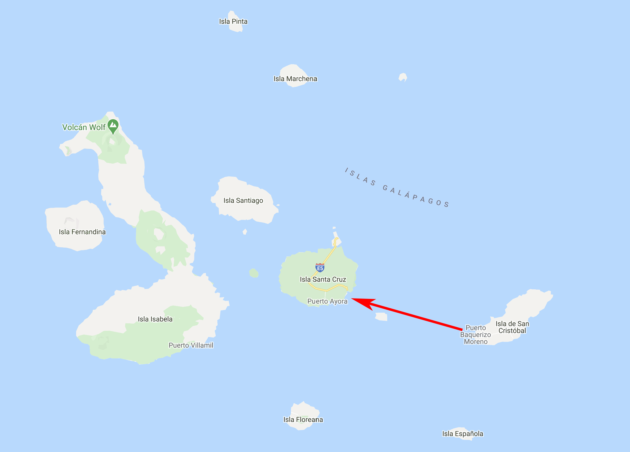
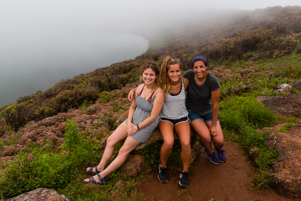
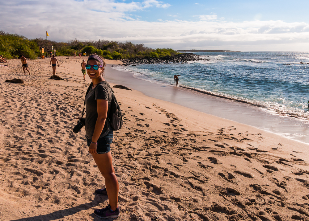
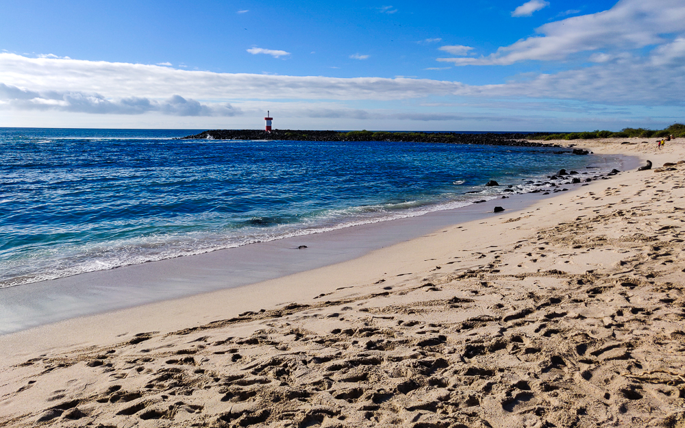
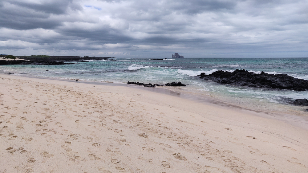
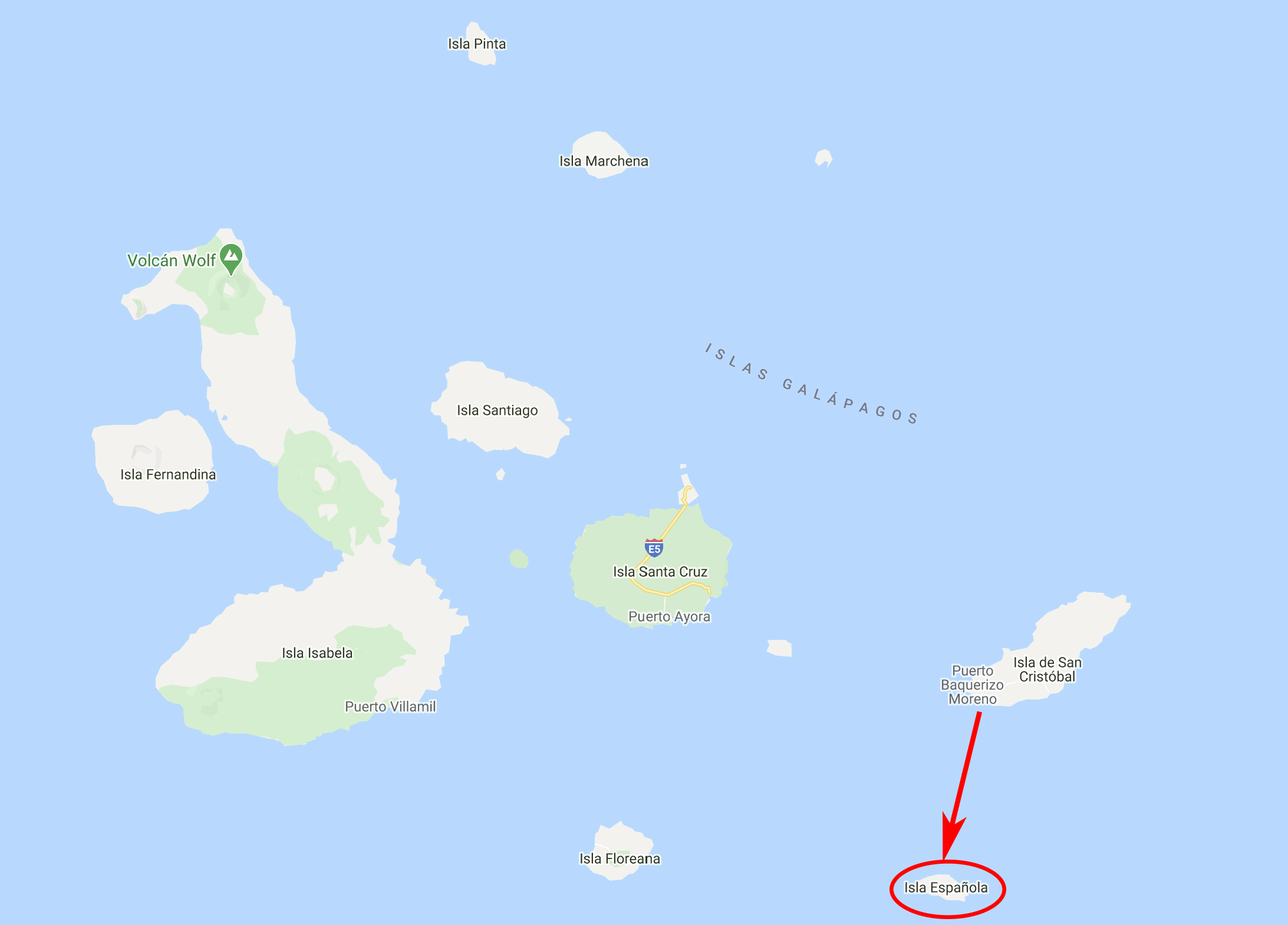
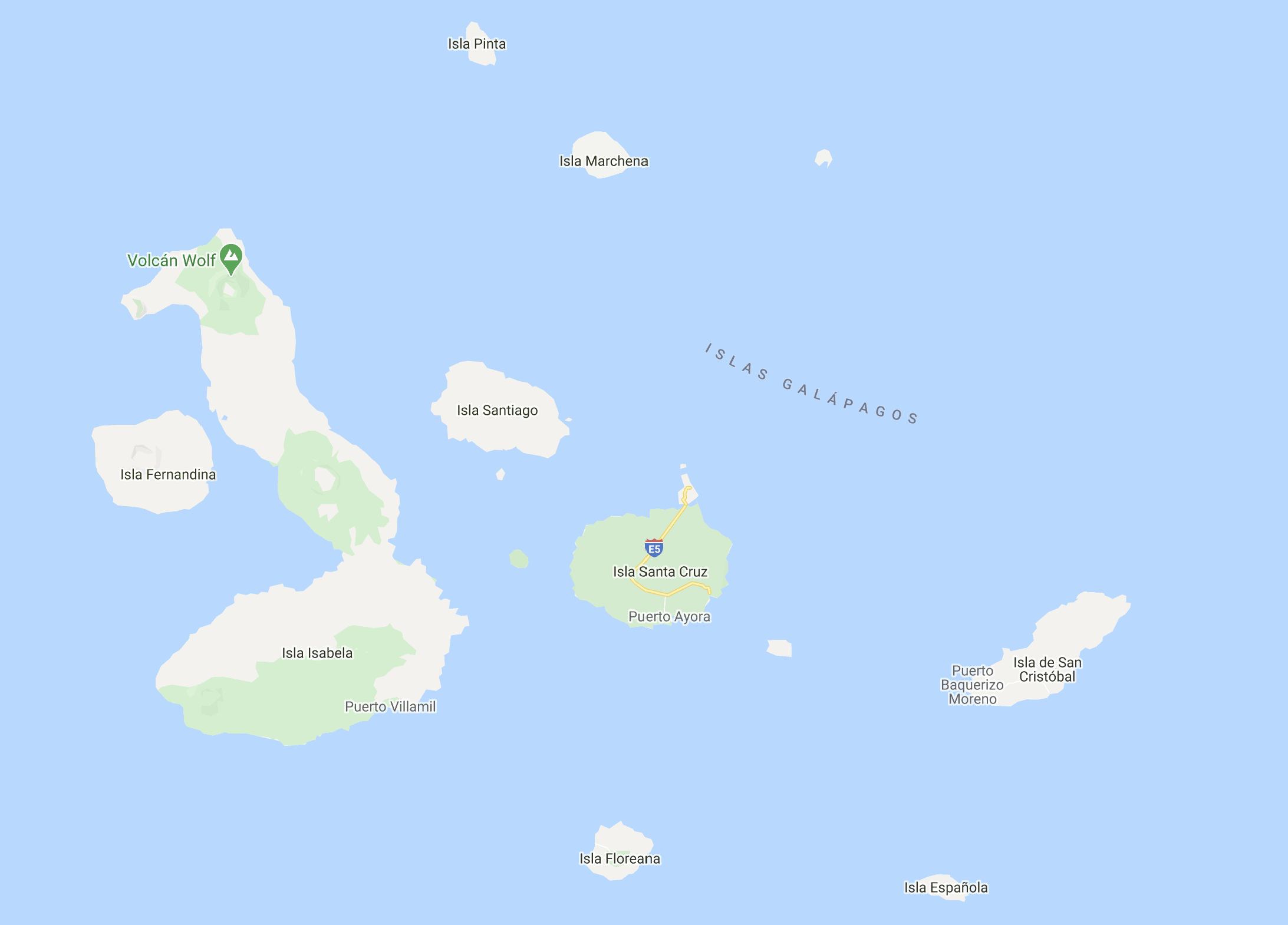
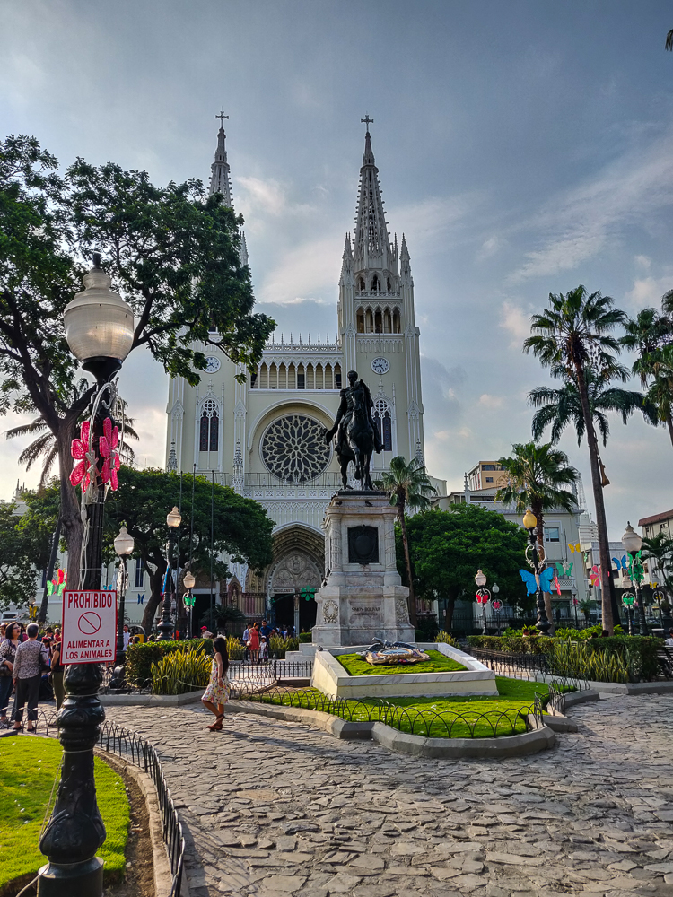
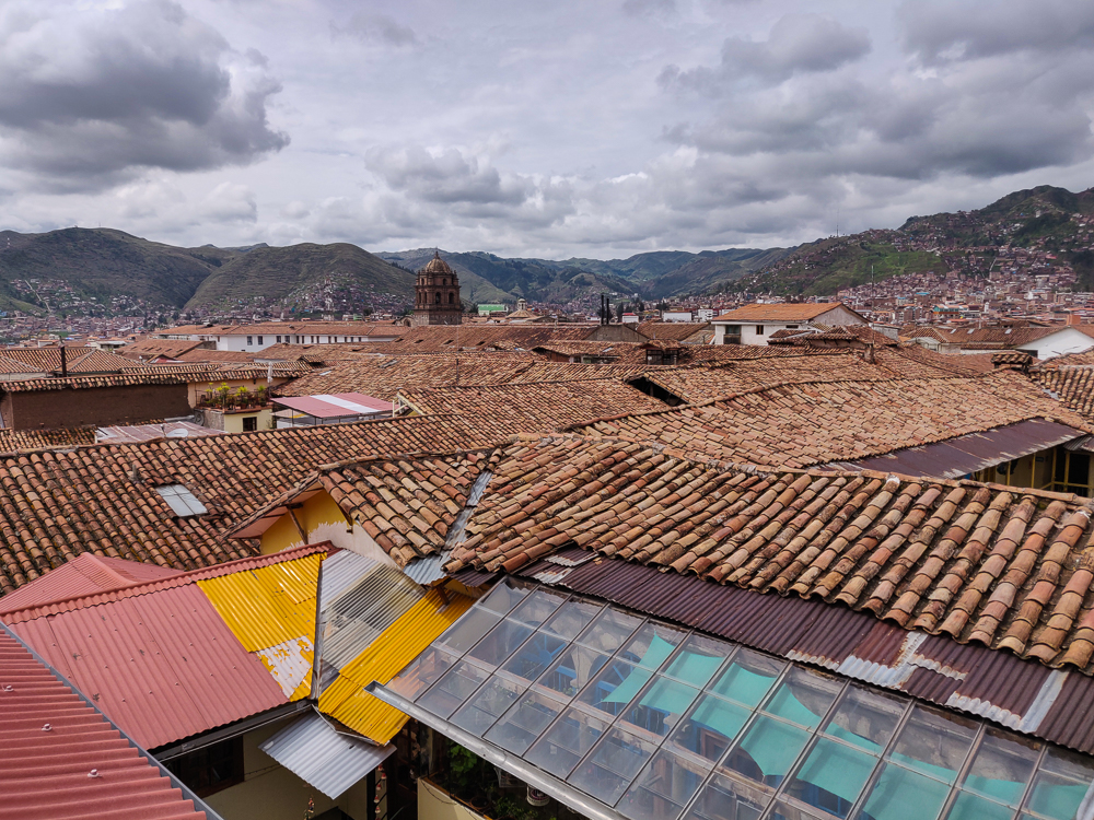
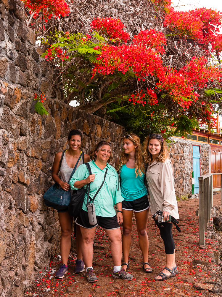
We had one “free day” worked into the schedule while we were on Santa Cruz, and like before, that didn’t mean “do nothing day”. My aunt had a whole list of things that we could see on the island without a tour, so we plotted a route and headed out for another very long day.

Here’s the location of Santa Cruz in relation to the other Galapagos Islands! It’s the second largest island, about 20mi/32km wide x 25mi/40km long.

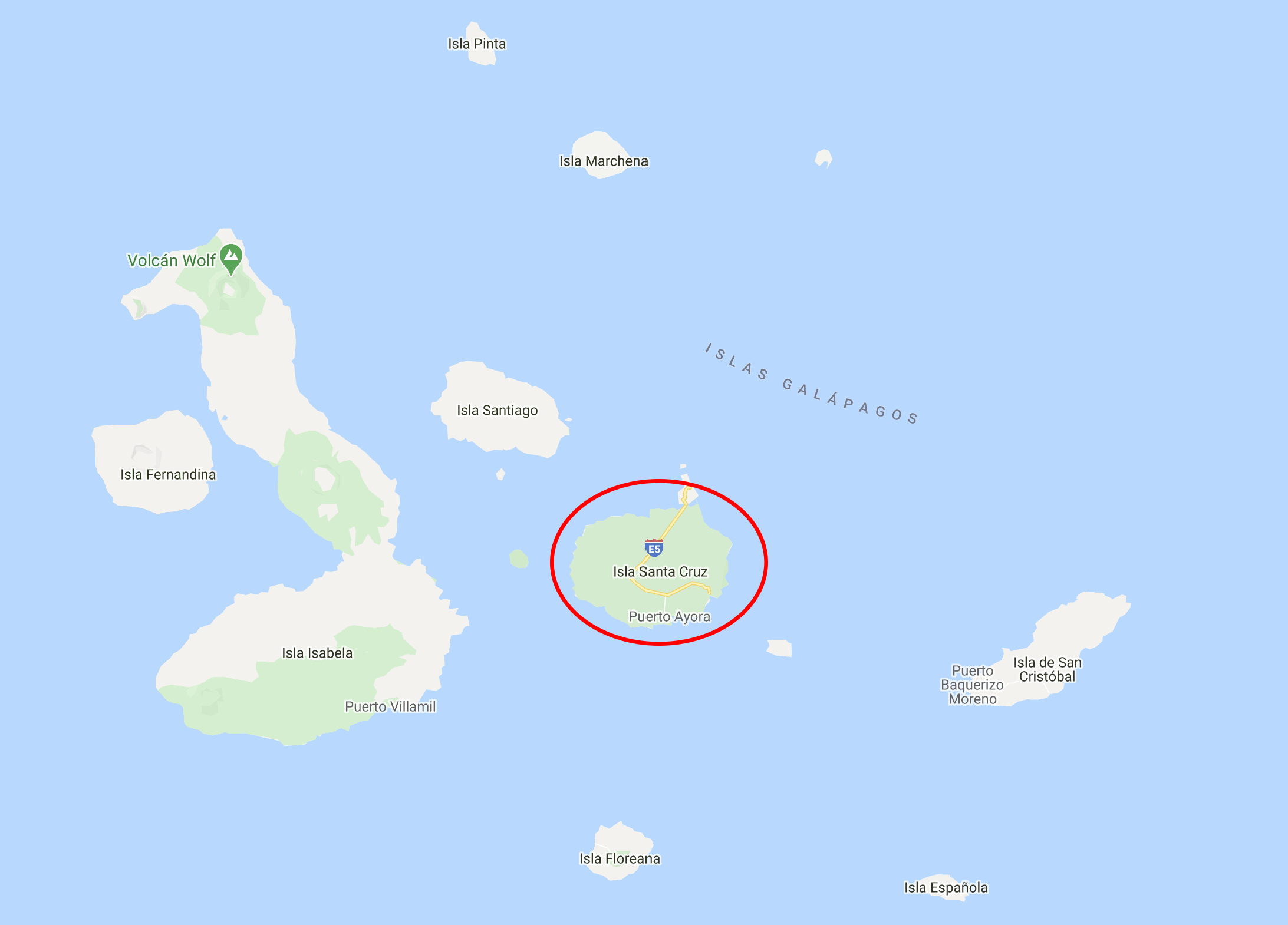
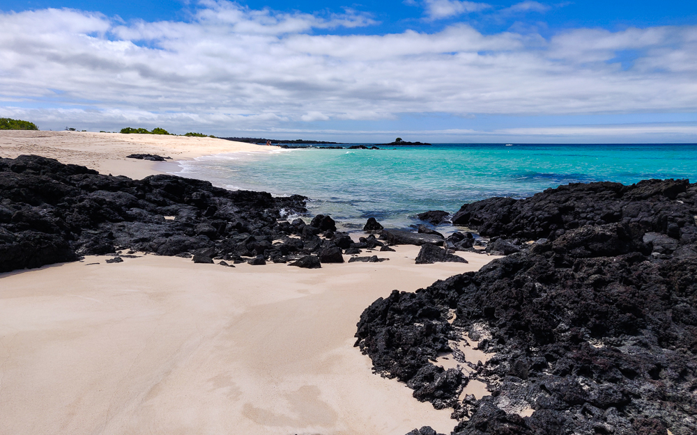
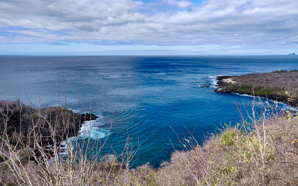
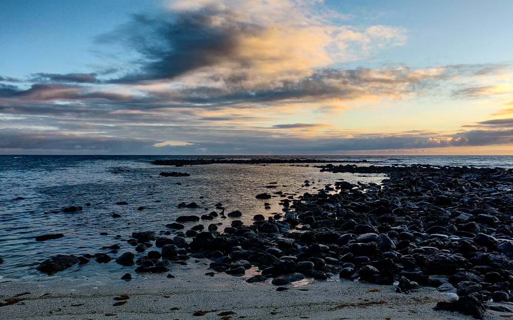
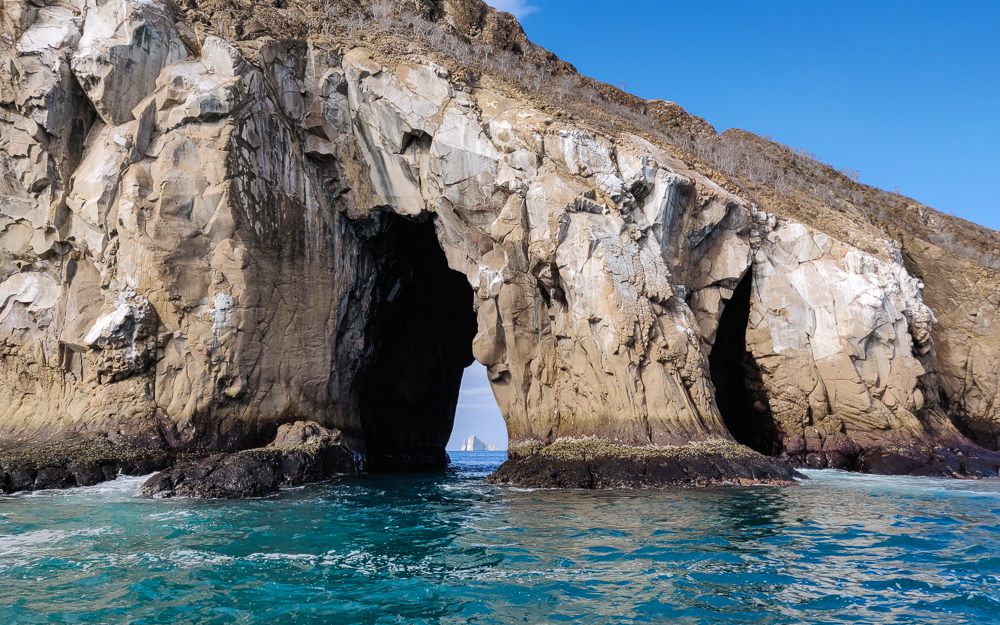
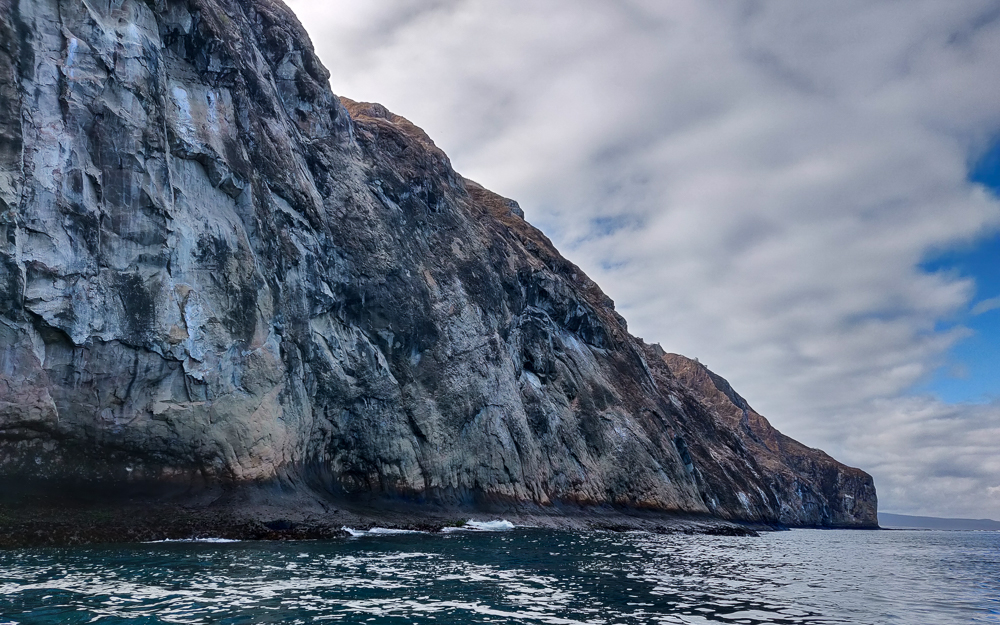
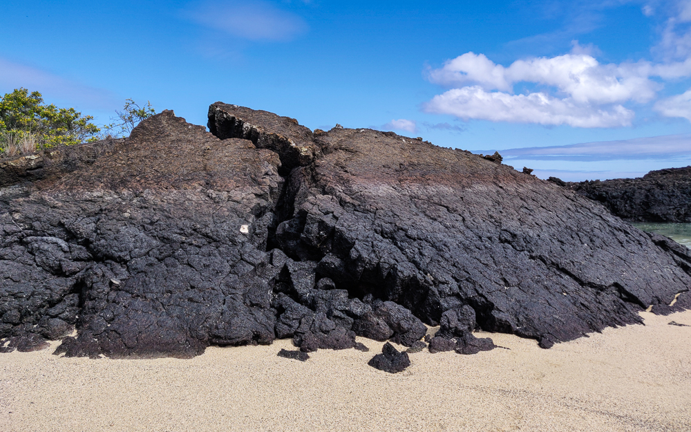
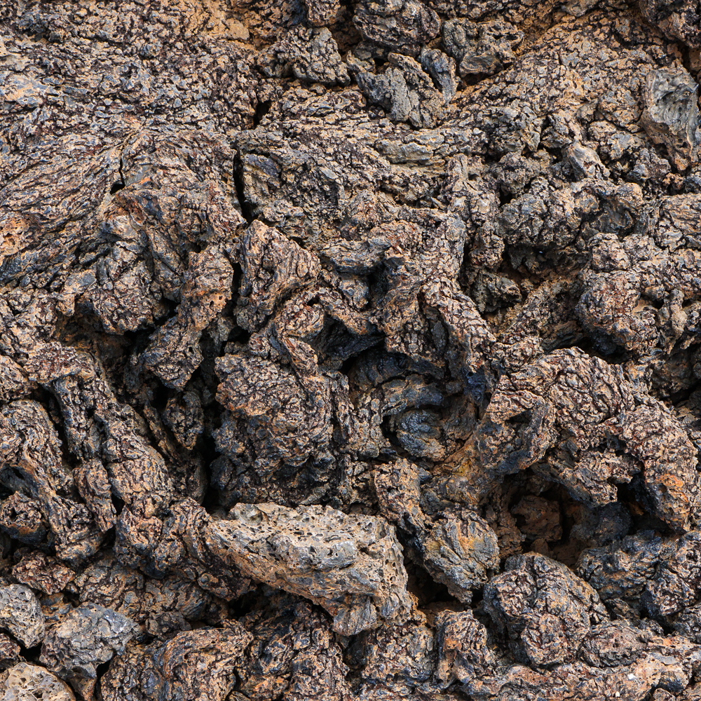
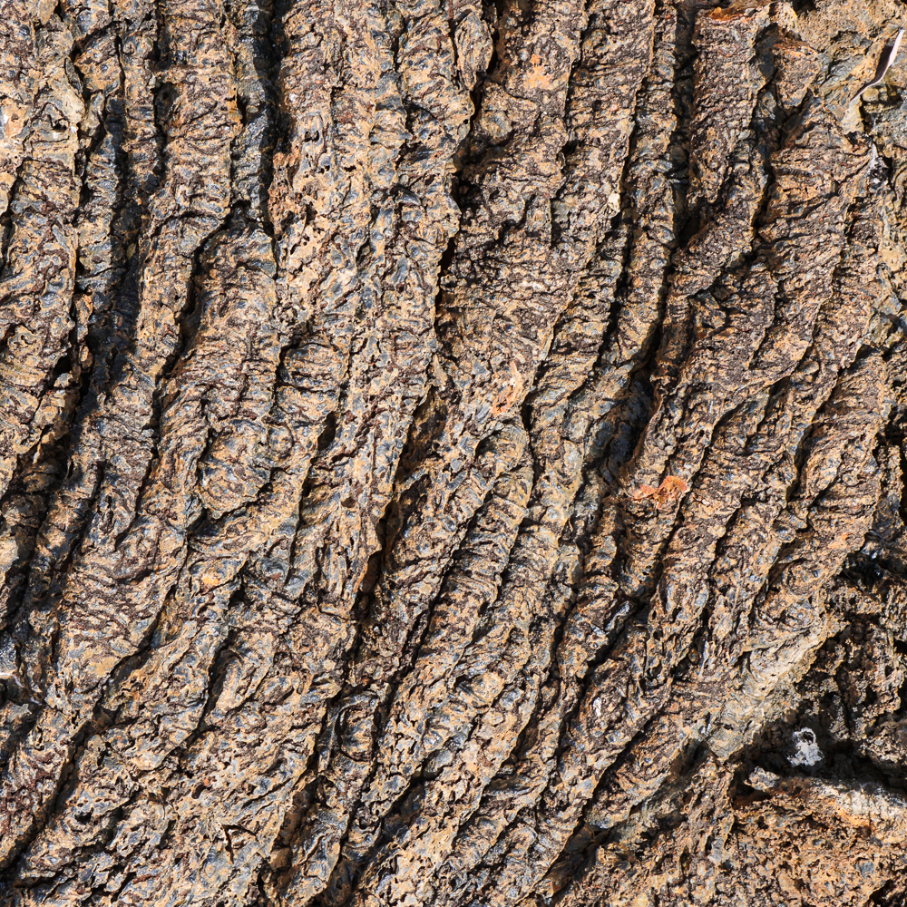
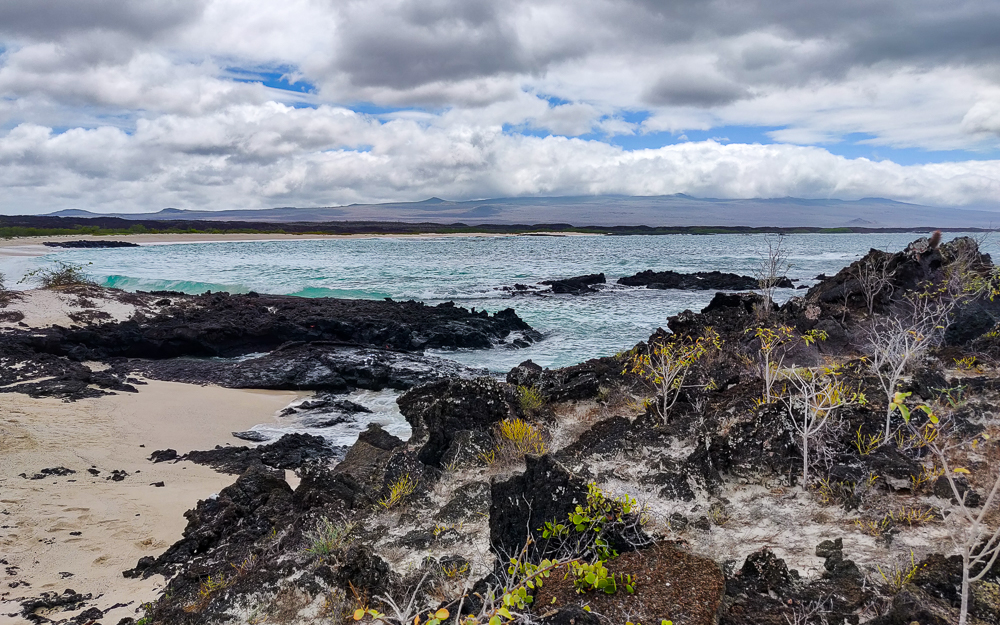
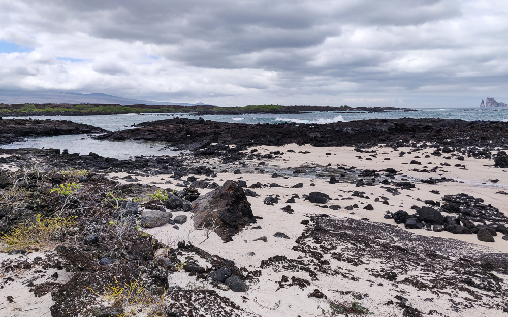
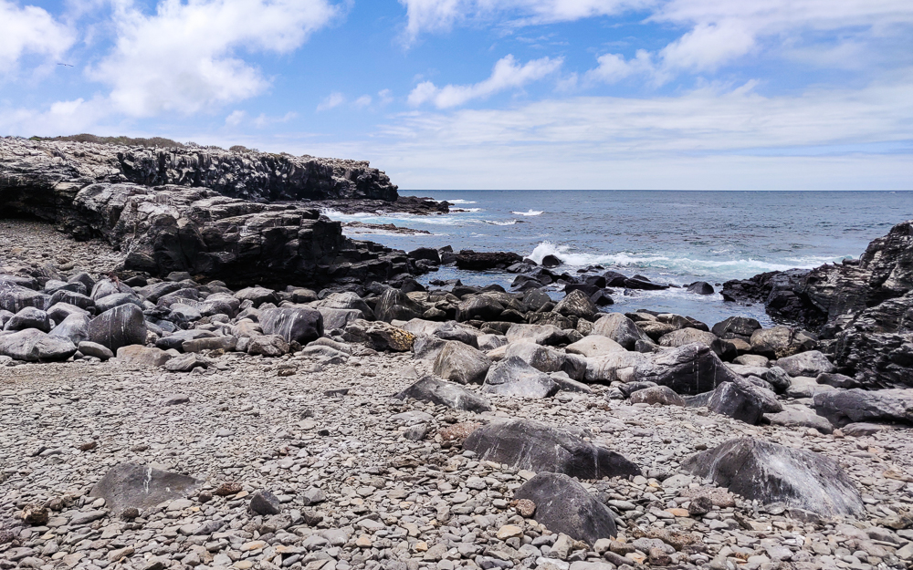
Santa Cruz is the second largest island in the Galapagos archipelago and is a “shield volcano”, like many of the other Galapagos islands. This means that there wasn’t an explosive eruption that formed it (exactly what it sounds like/what you likely imagine when you think “volcanic eruption”). Instead, there was an “effusive eruption” which means that low-viscosity lava flowed steadily for a period of time. Since the lava is extra “flowy”, it spreads out farther and results in a land mass with a much more gradual slope than would result from an explosive eruption. So lava steadily accumulates in layers, building a short and flat-ish island, called a “shield volcano” because it has a similar shape to a round shield lying on the ground.

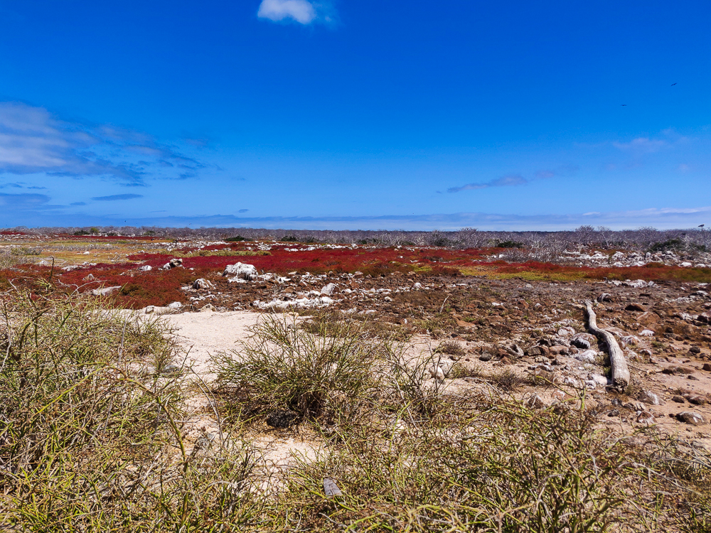
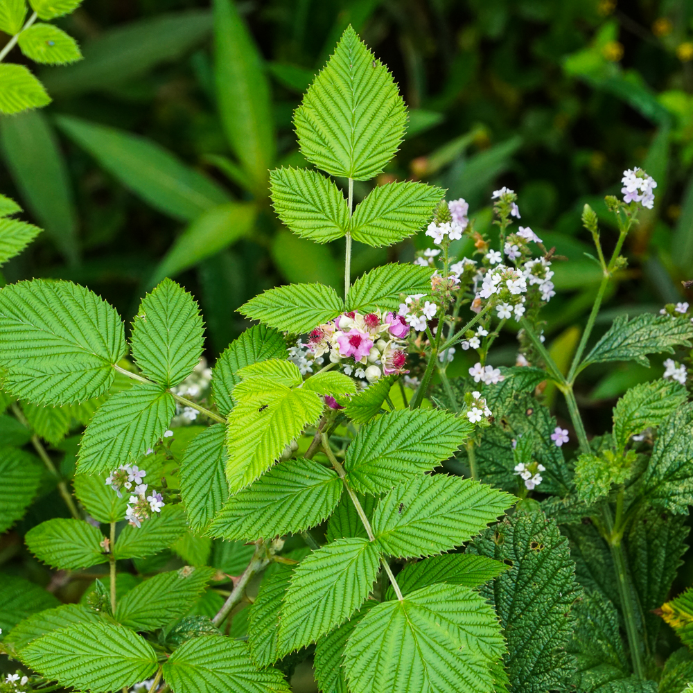
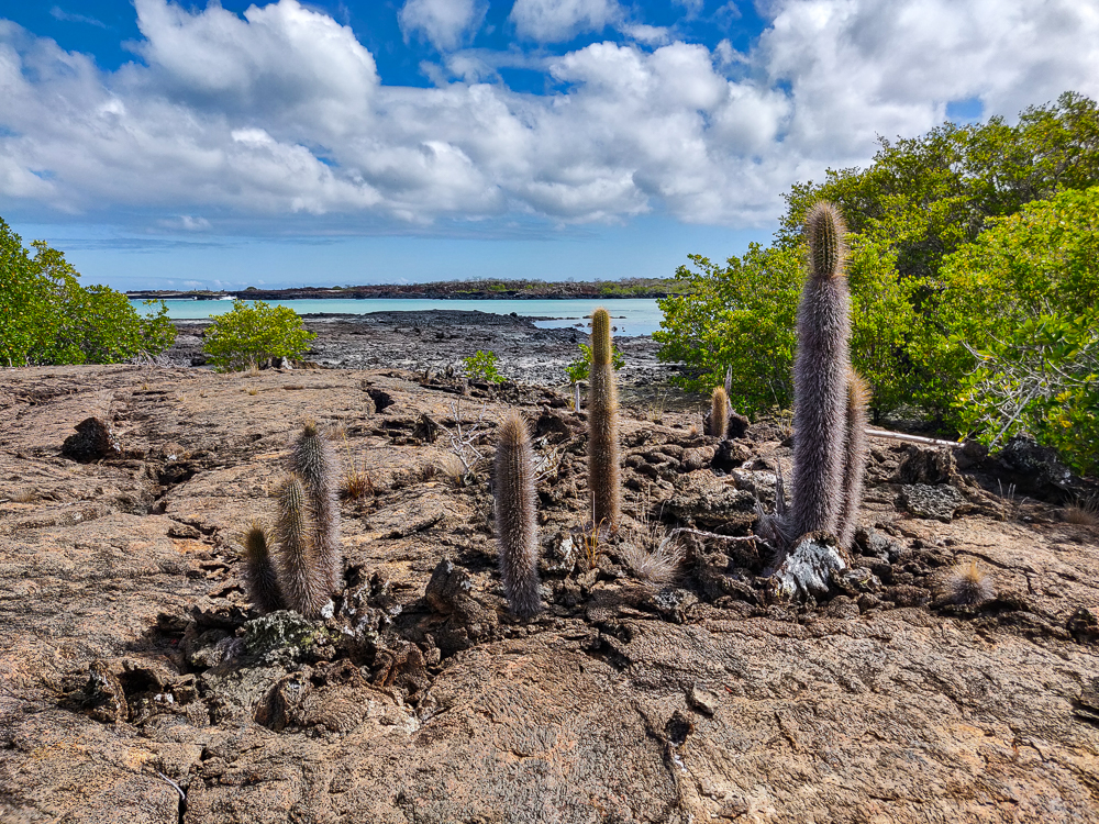
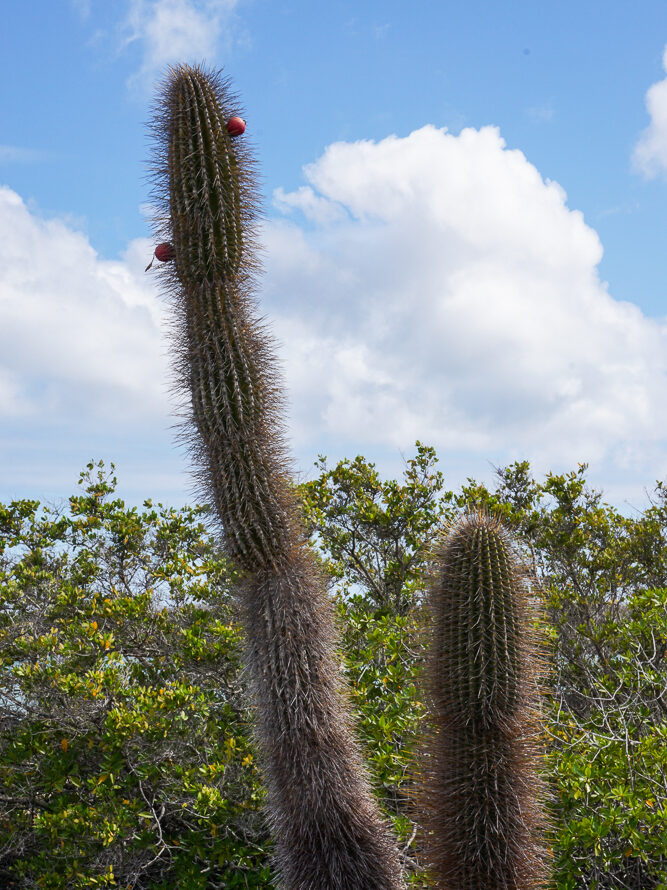
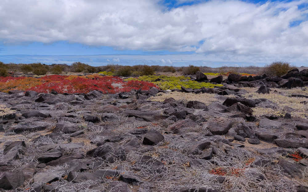
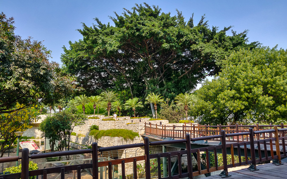
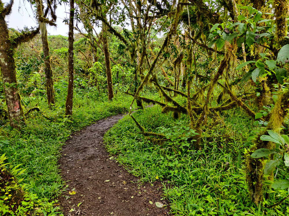
It’s a very ecologically diverse island, the only one in the Galapagos with six different vegetation zones. I was amazed once again by the difference between the coastal areas and the highlands, but we’ll get to that later. Anyway…

On the way to our first official stop of the day… Puerto Ayora had some very thematic Christmas decorations. I guess the reindeer get a little help from the locals when delivering presents to the islands!
Also, I know that I wasn’t at the birth of baby Jesus, but I don’t know about this rendition… Sea lions, frigatebirds, tortoises, and blue-footed boobies? (Also, the green and brown stuff on the ground is broken glass. There’s a lot of interesting recycling happening on the islands.)

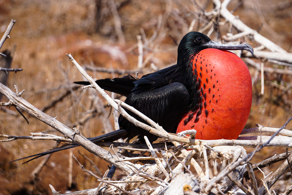
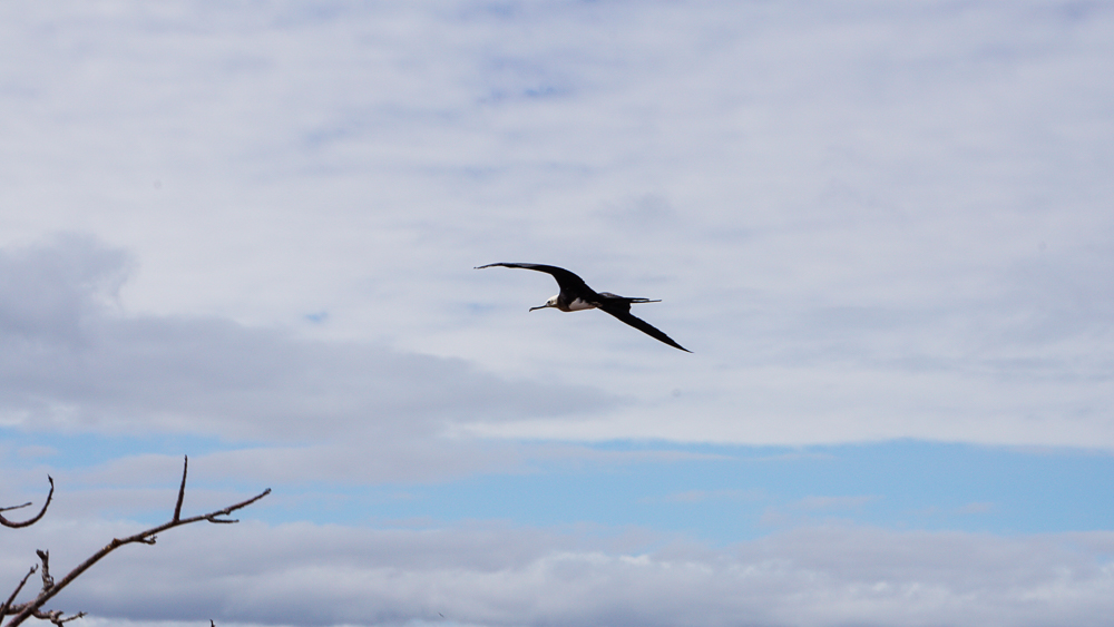
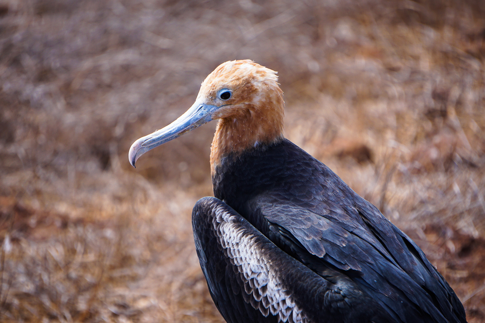
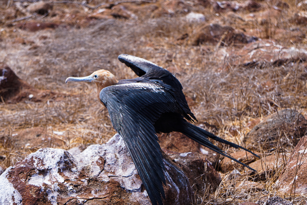
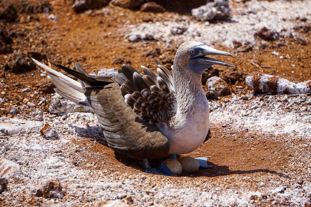
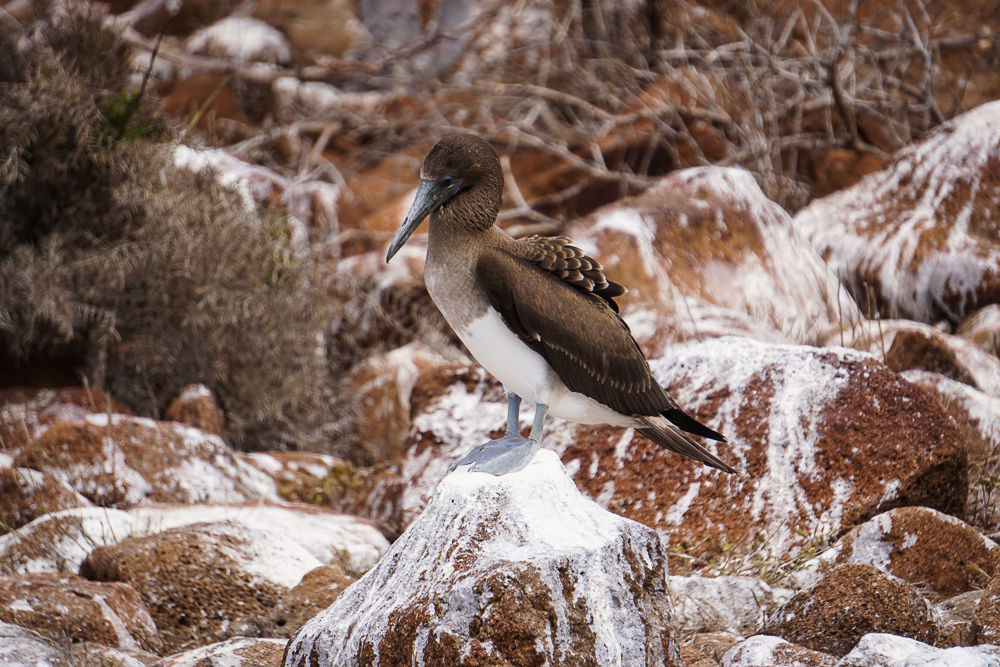
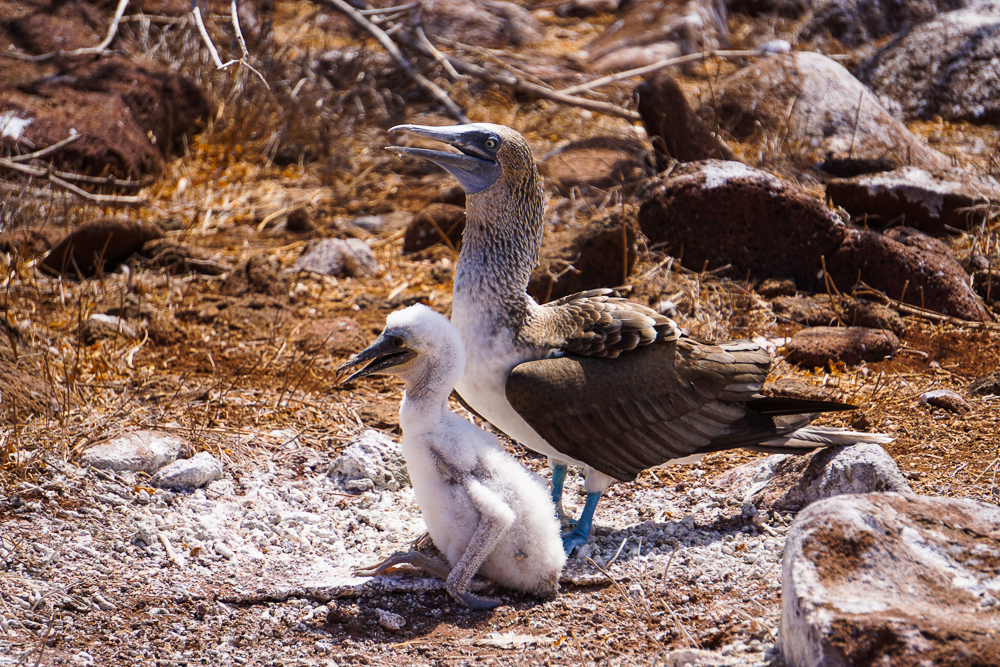
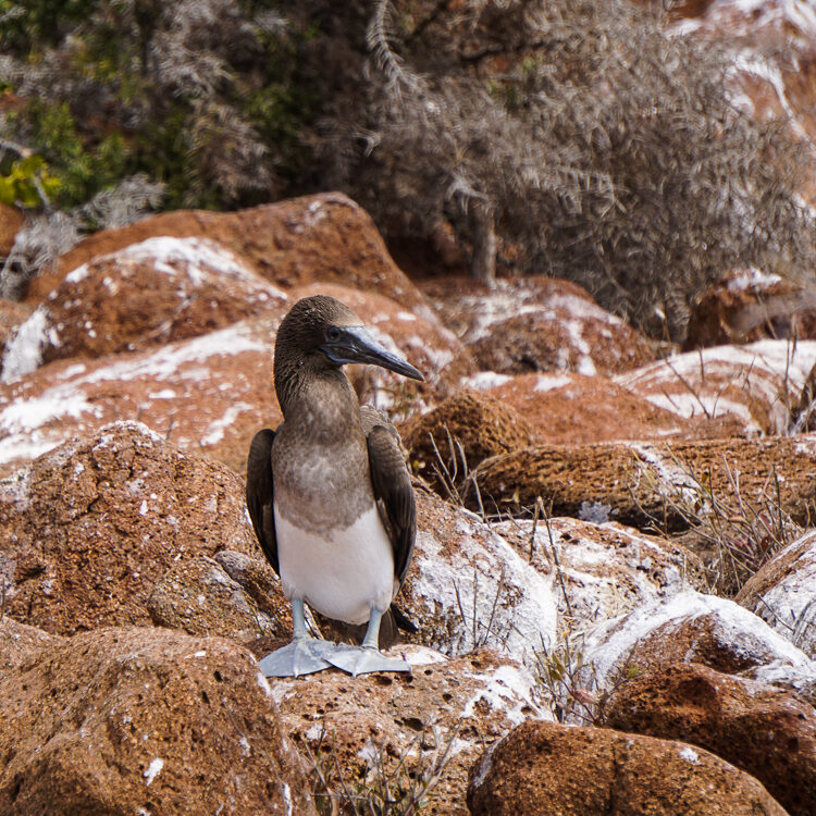
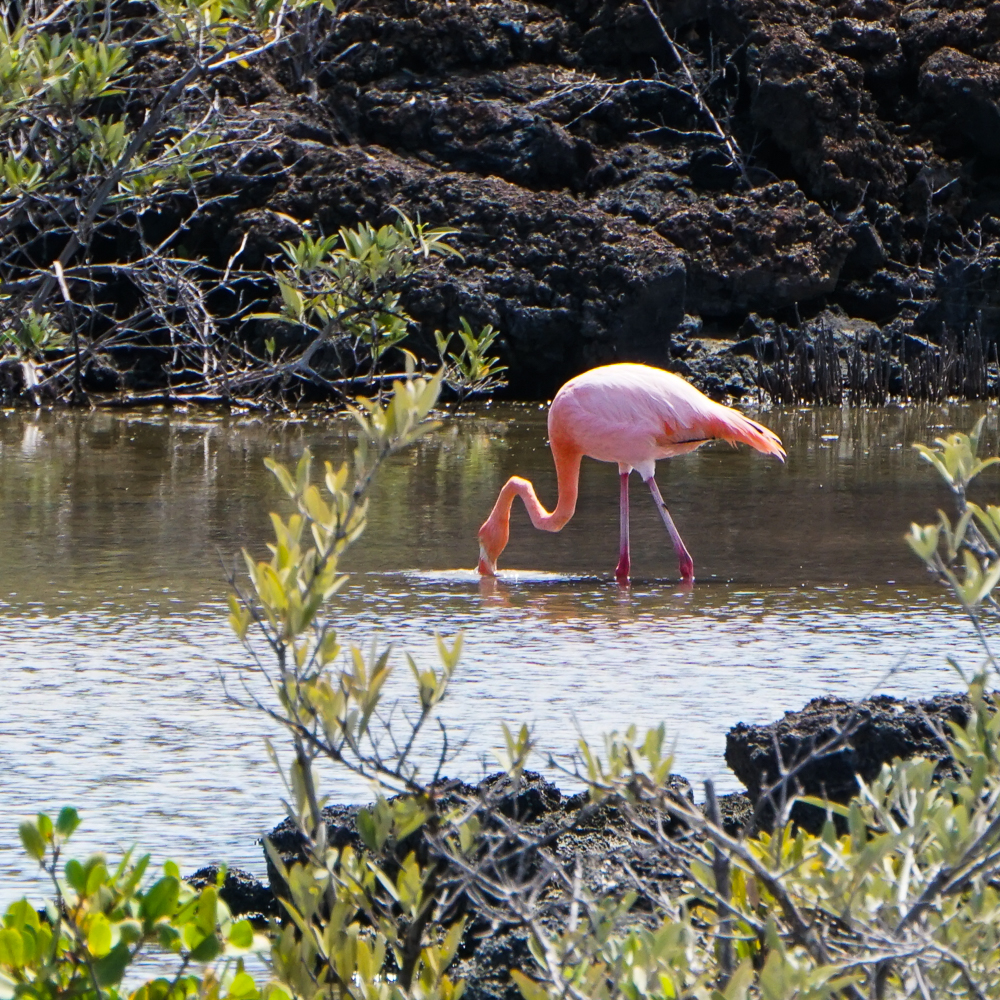
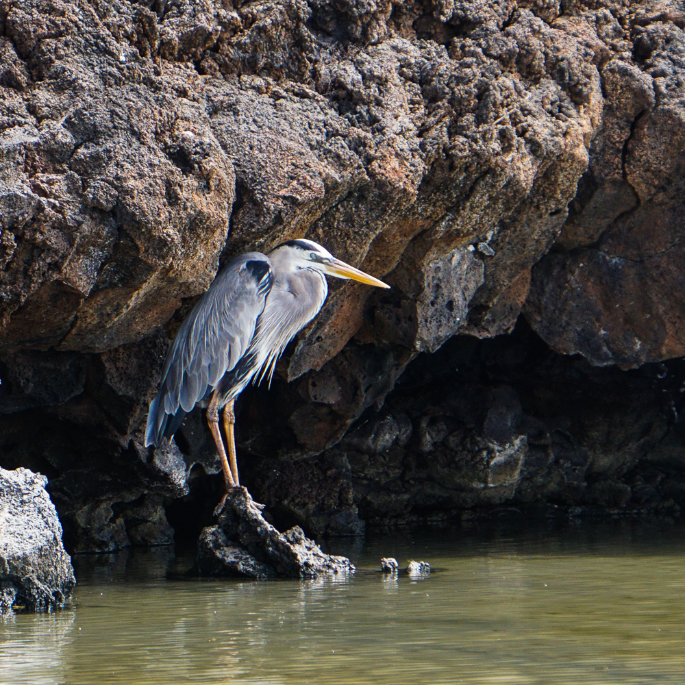
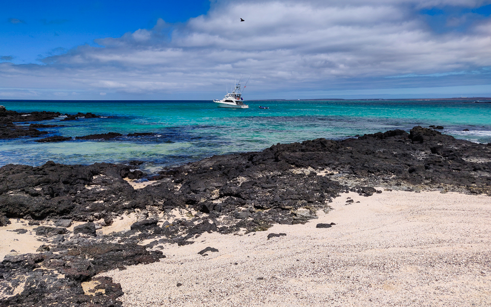
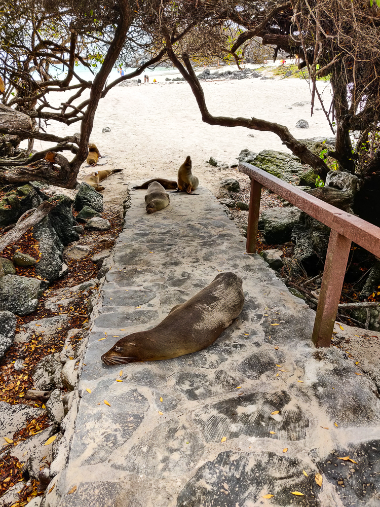
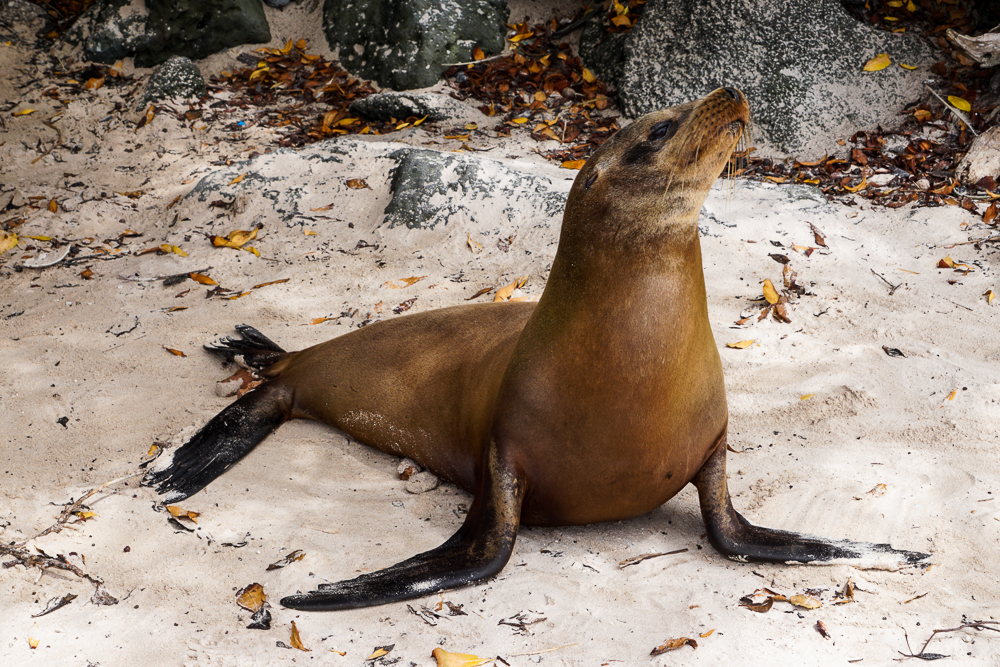
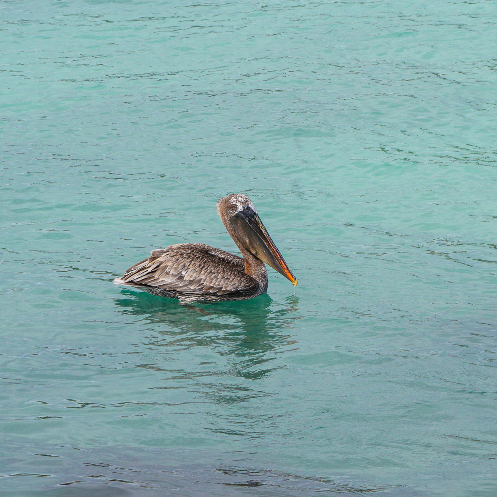
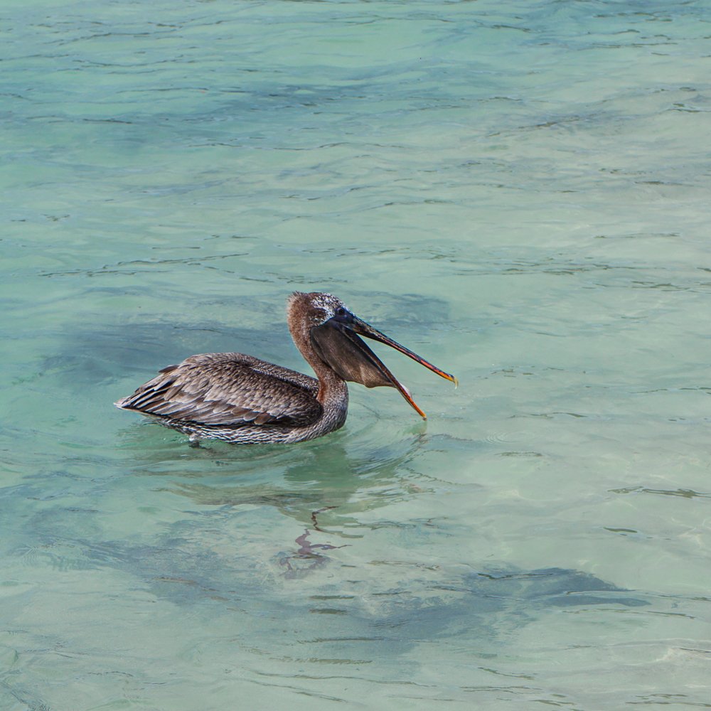
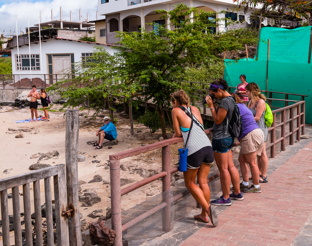
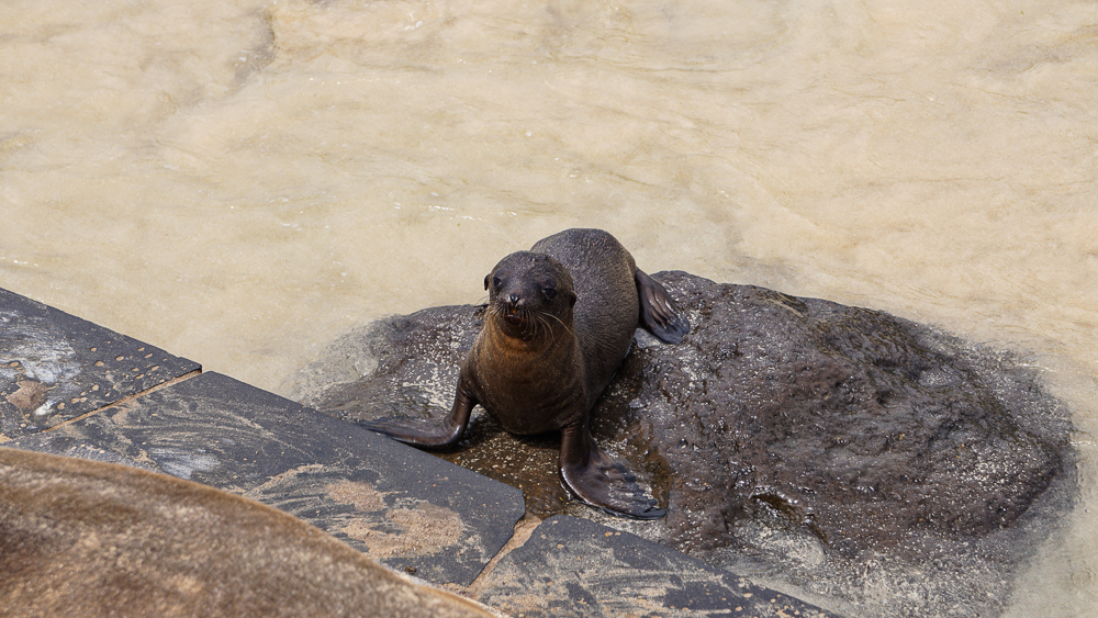
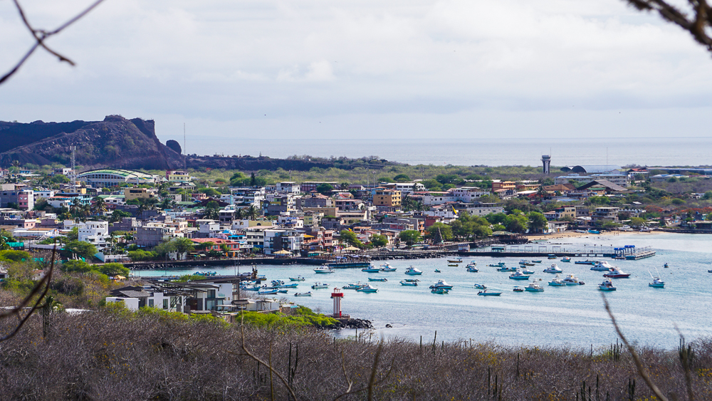
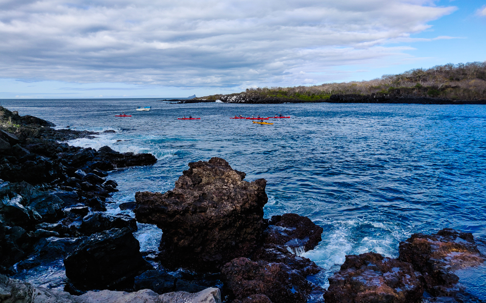
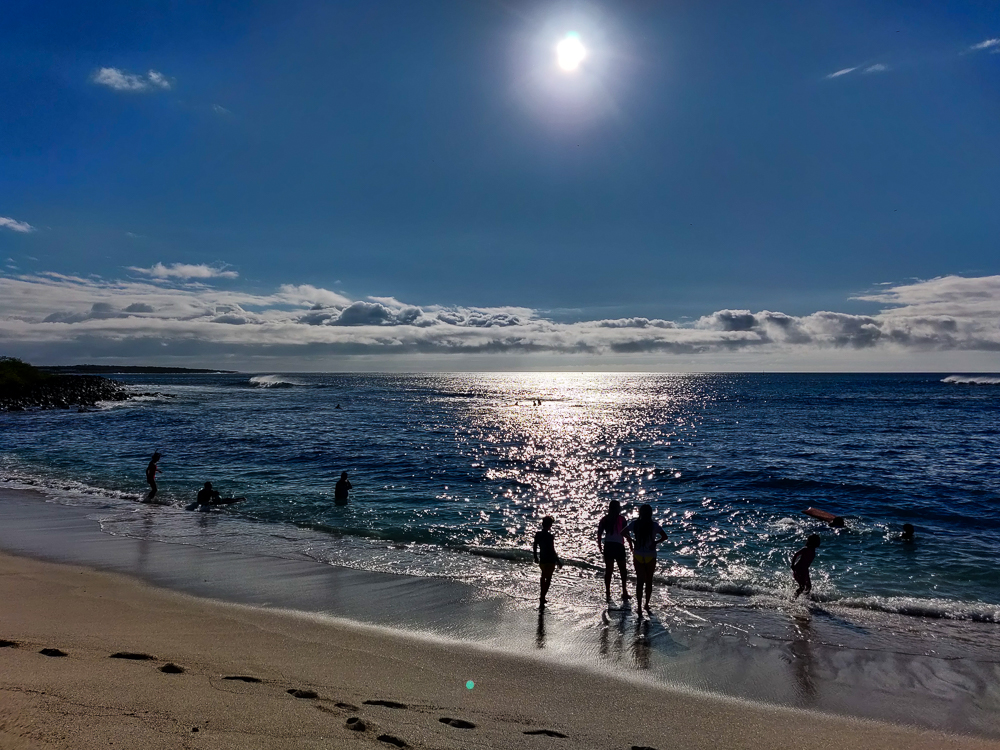
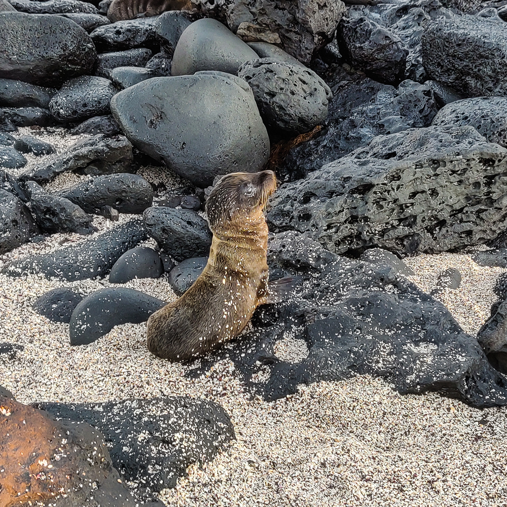
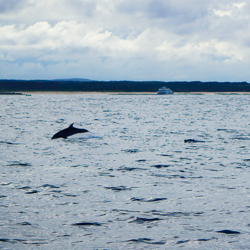
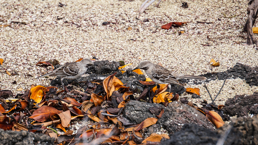
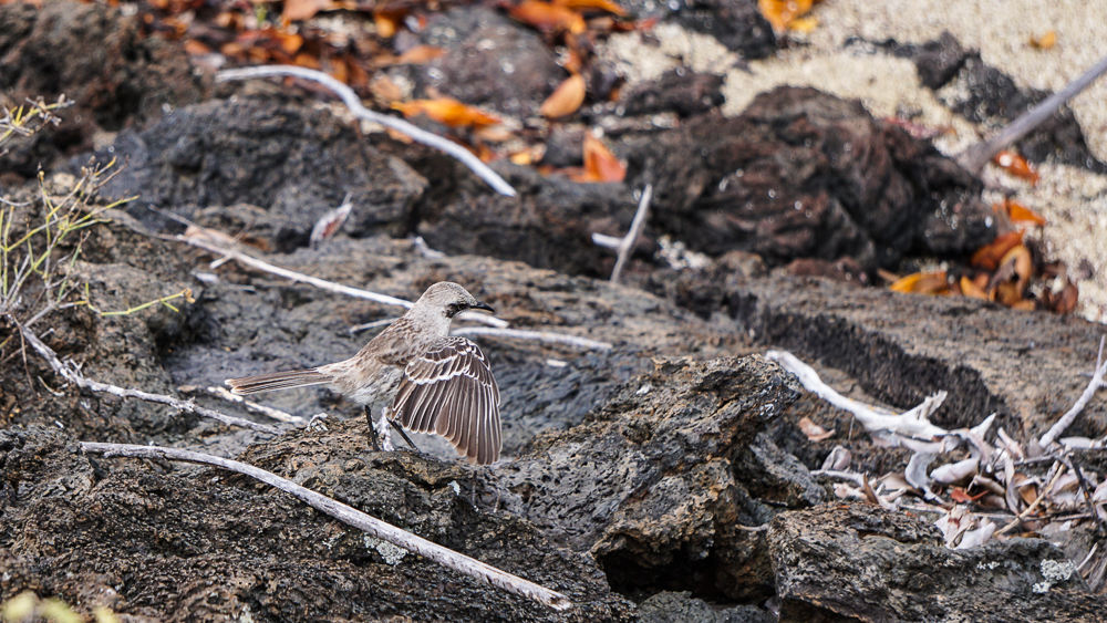
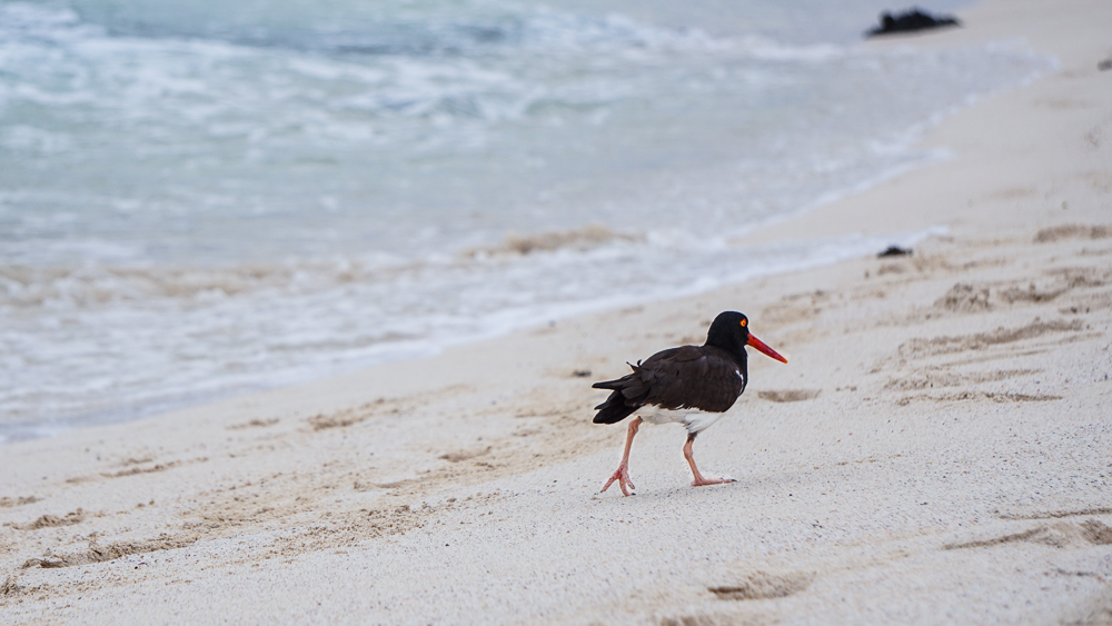
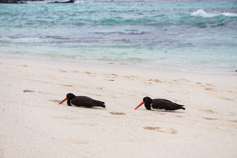
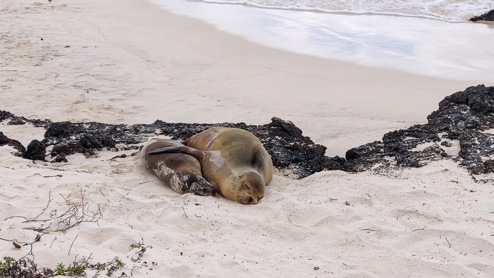
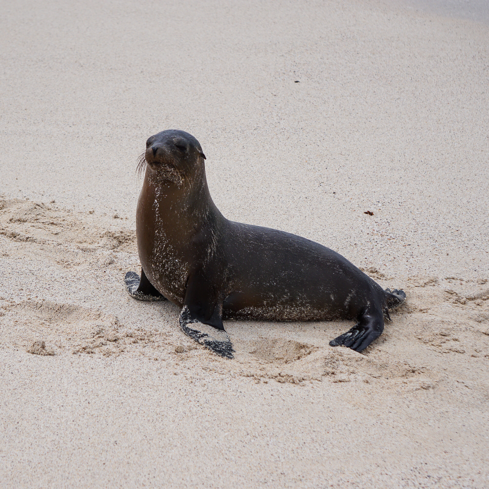
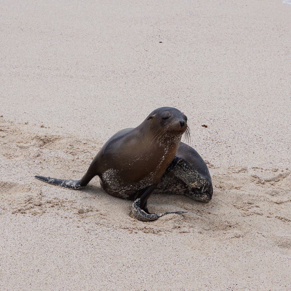
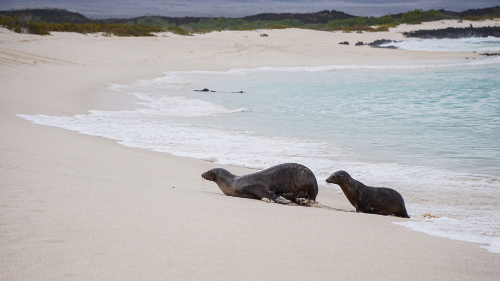
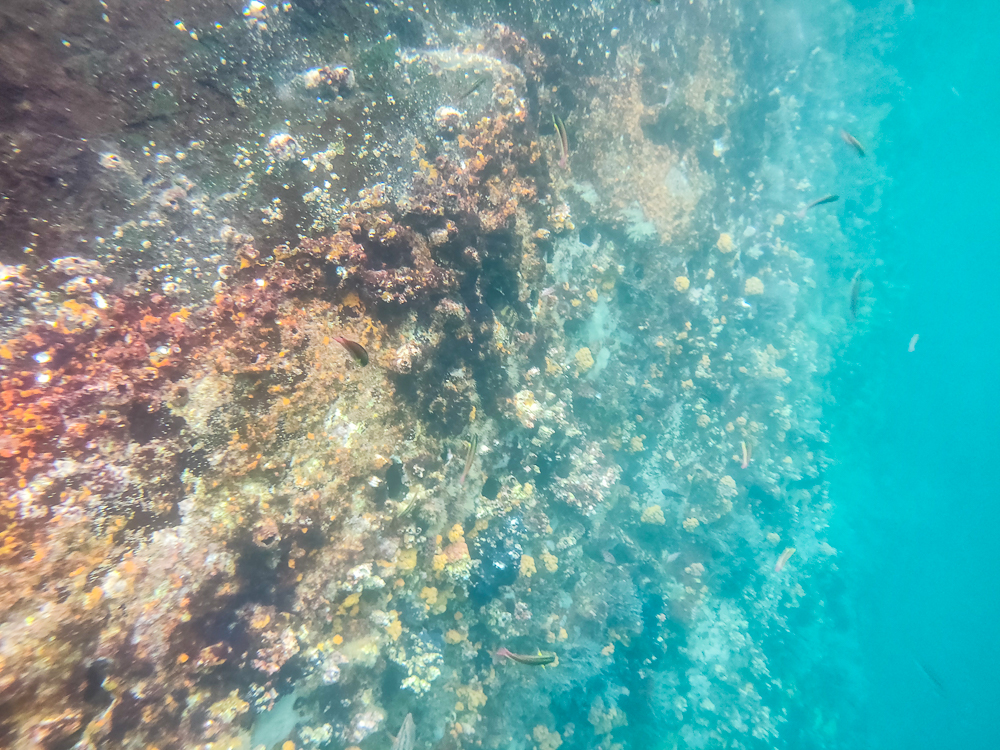
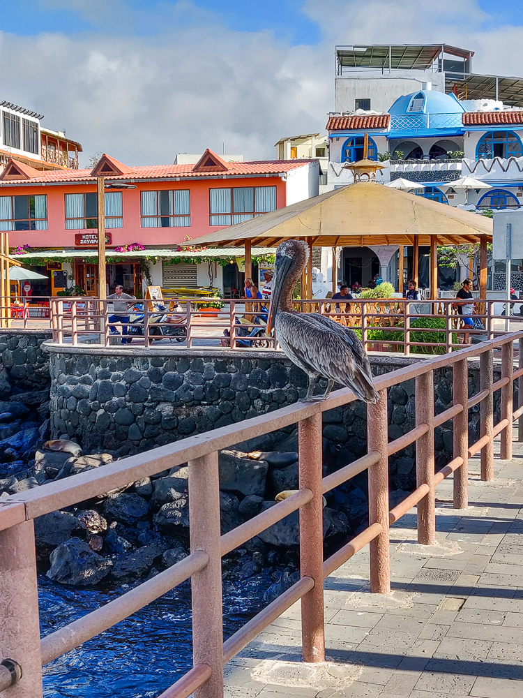
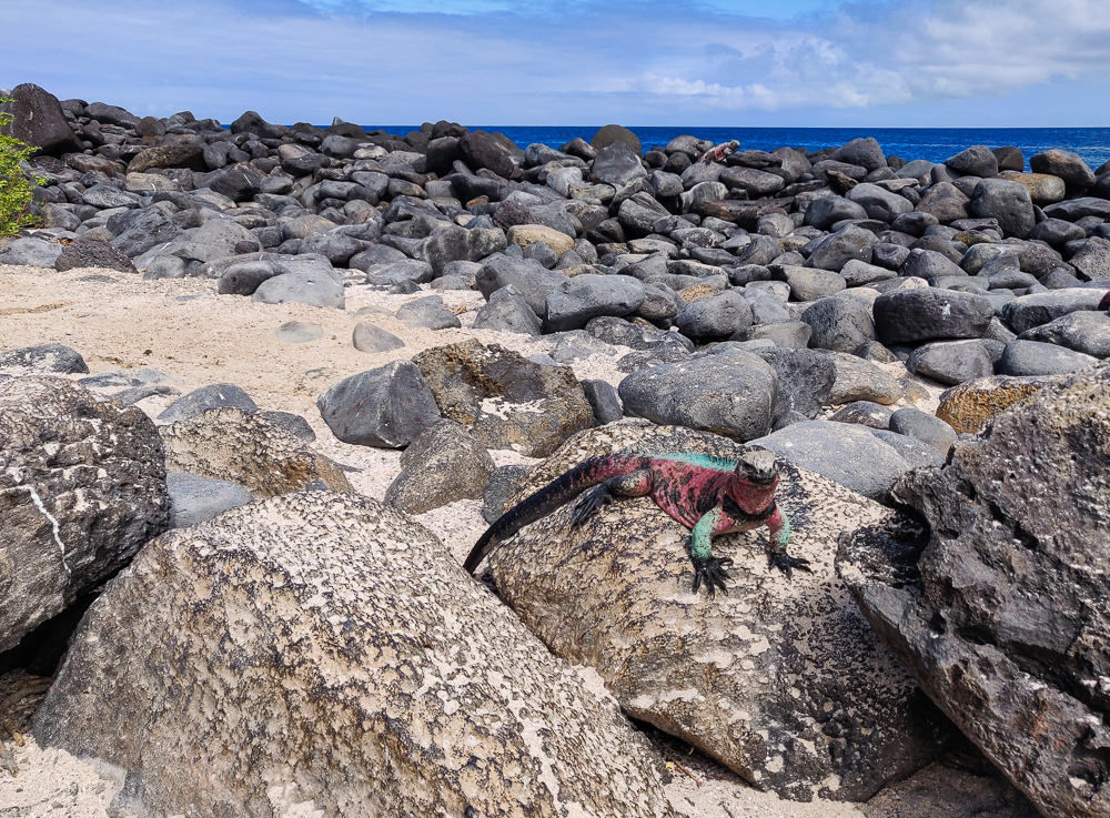
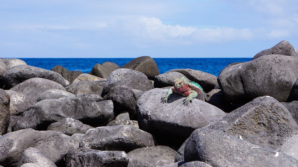
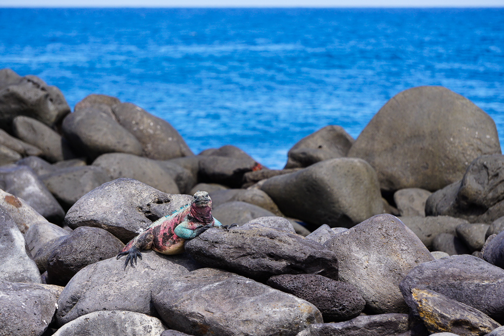
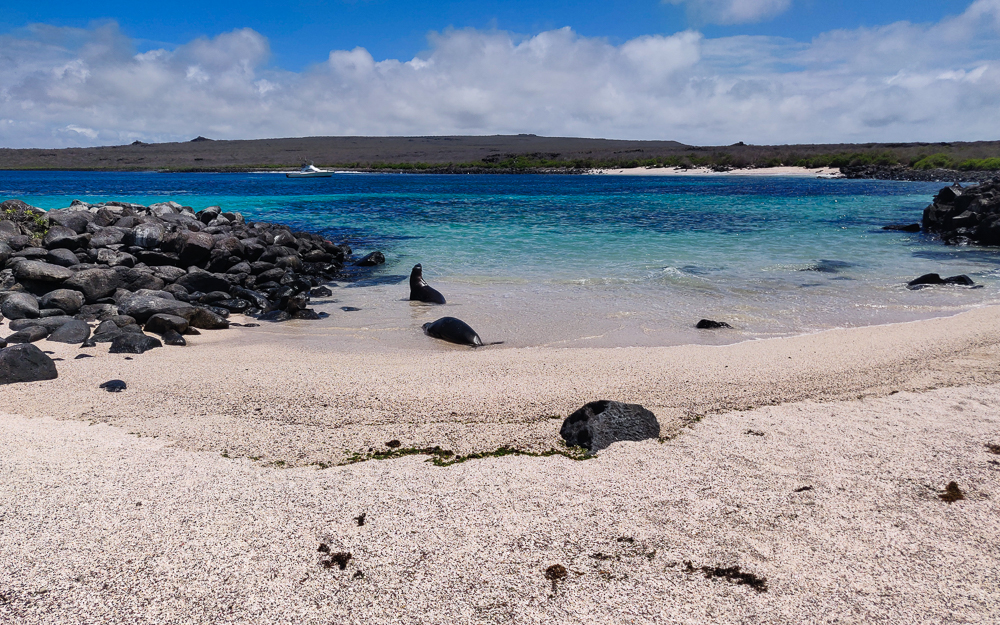
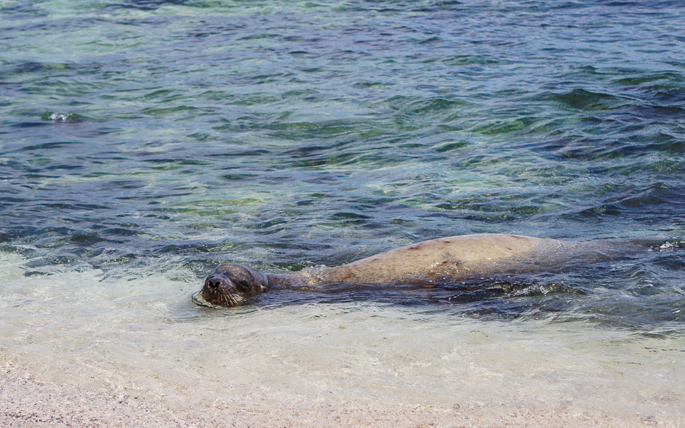
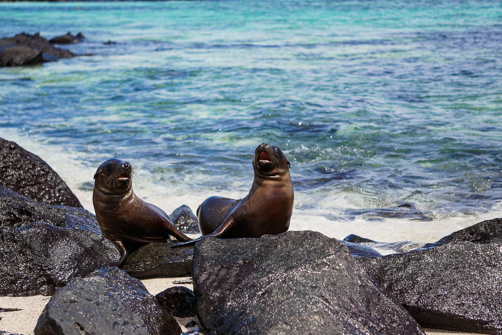
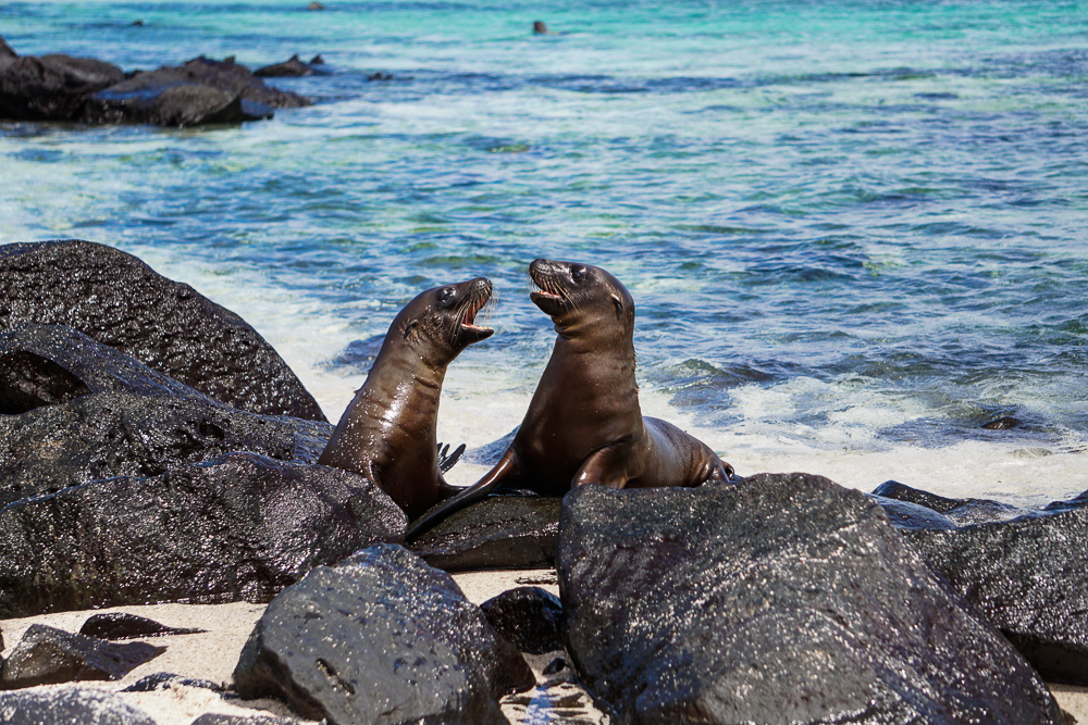
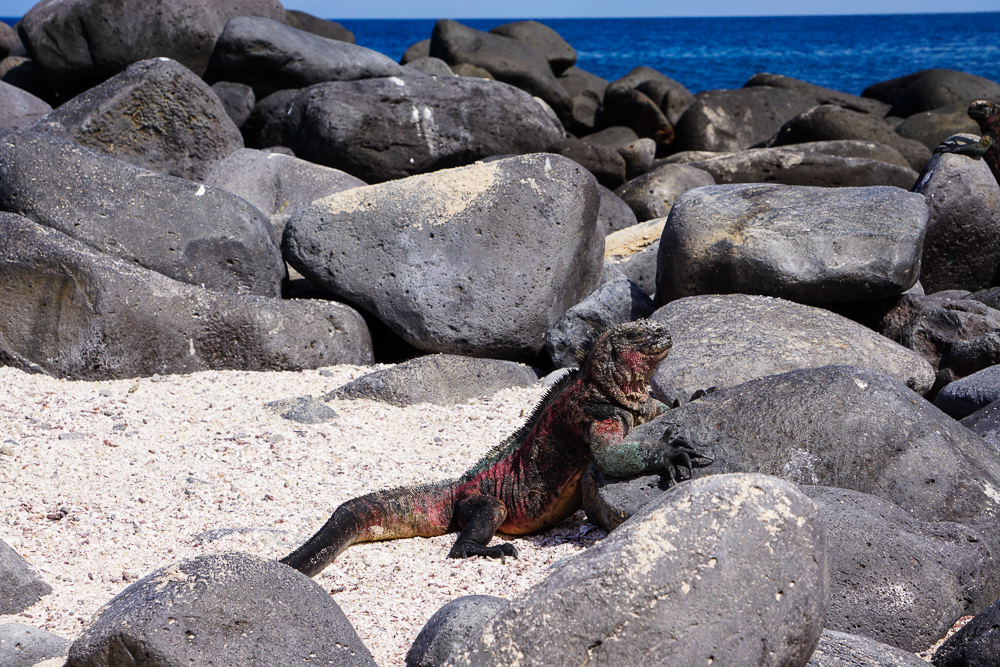
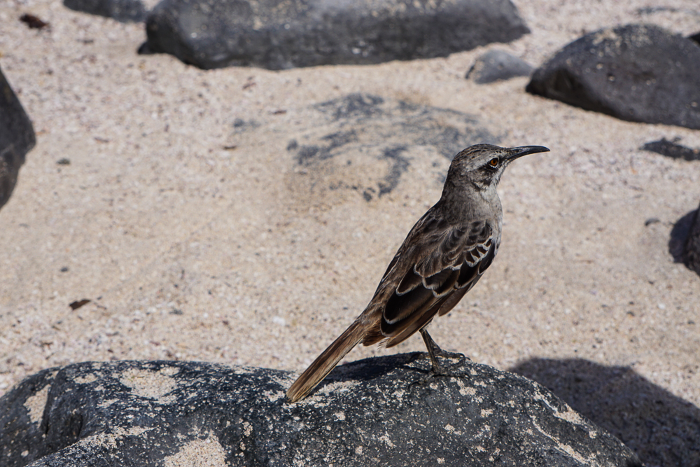
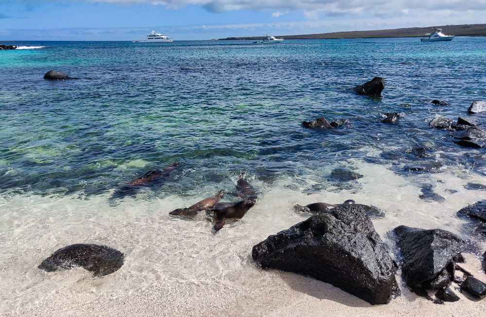
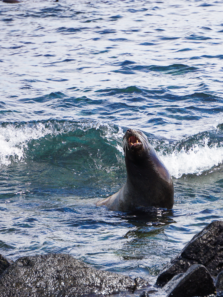
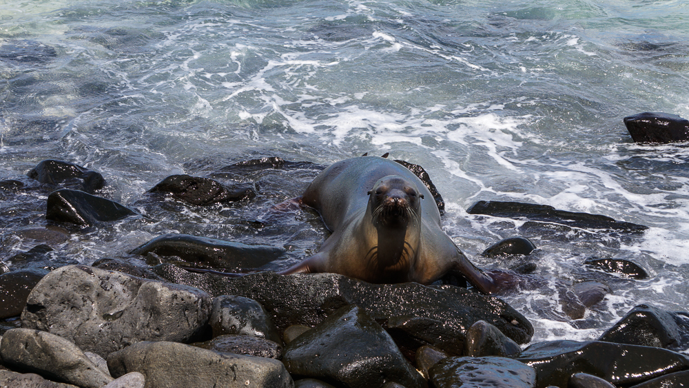
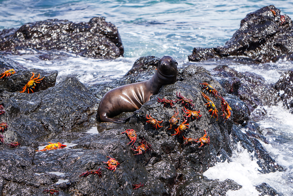
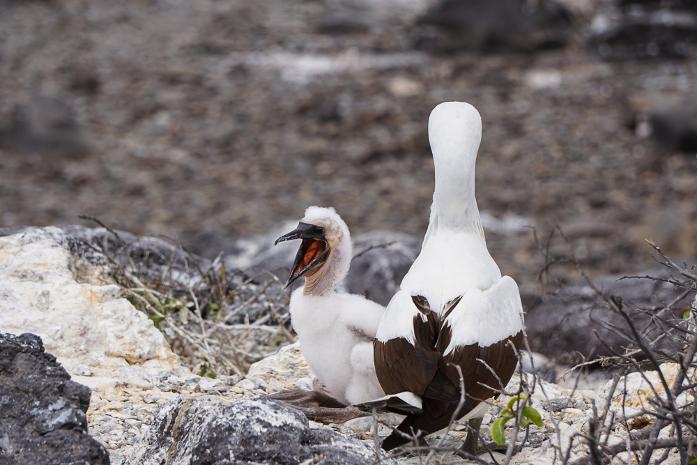
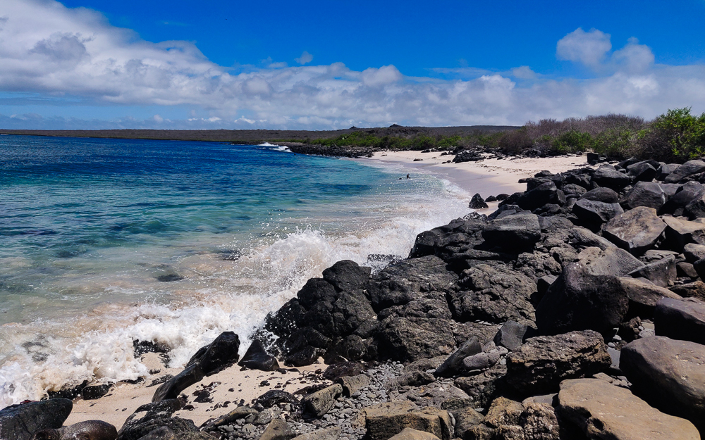
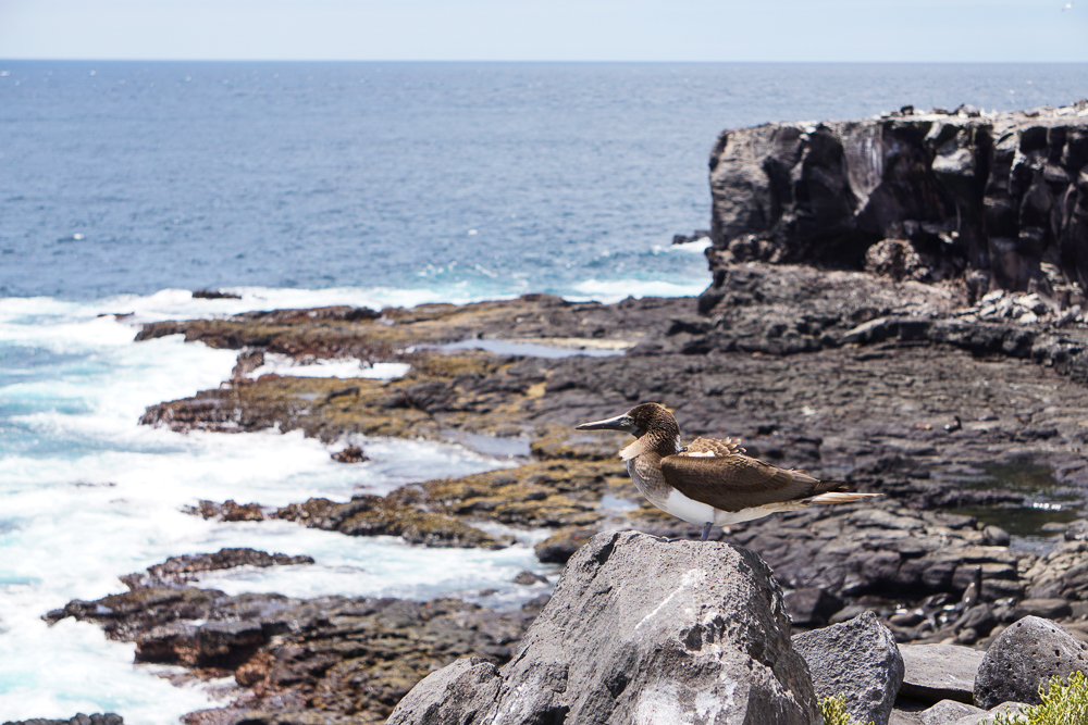
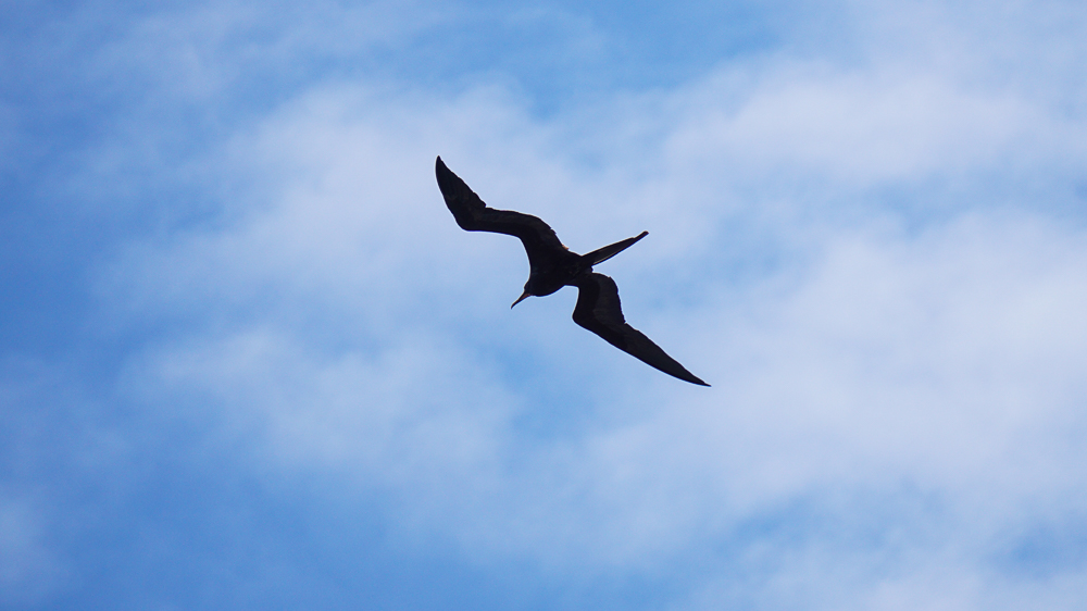
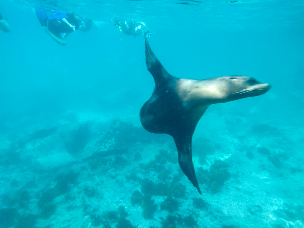
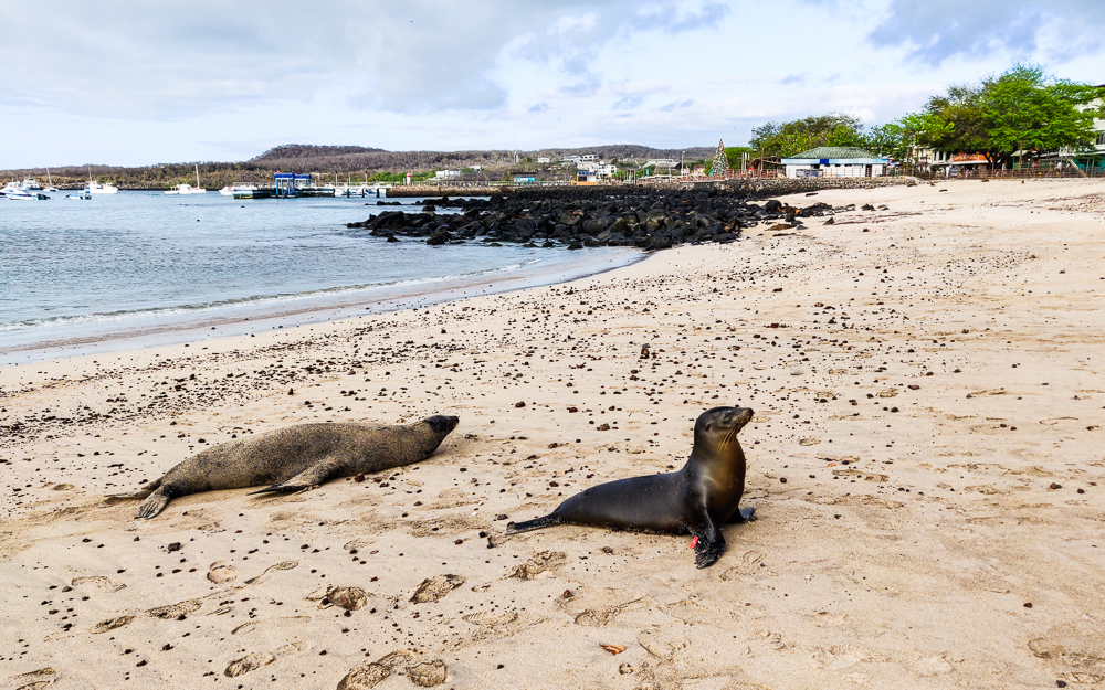
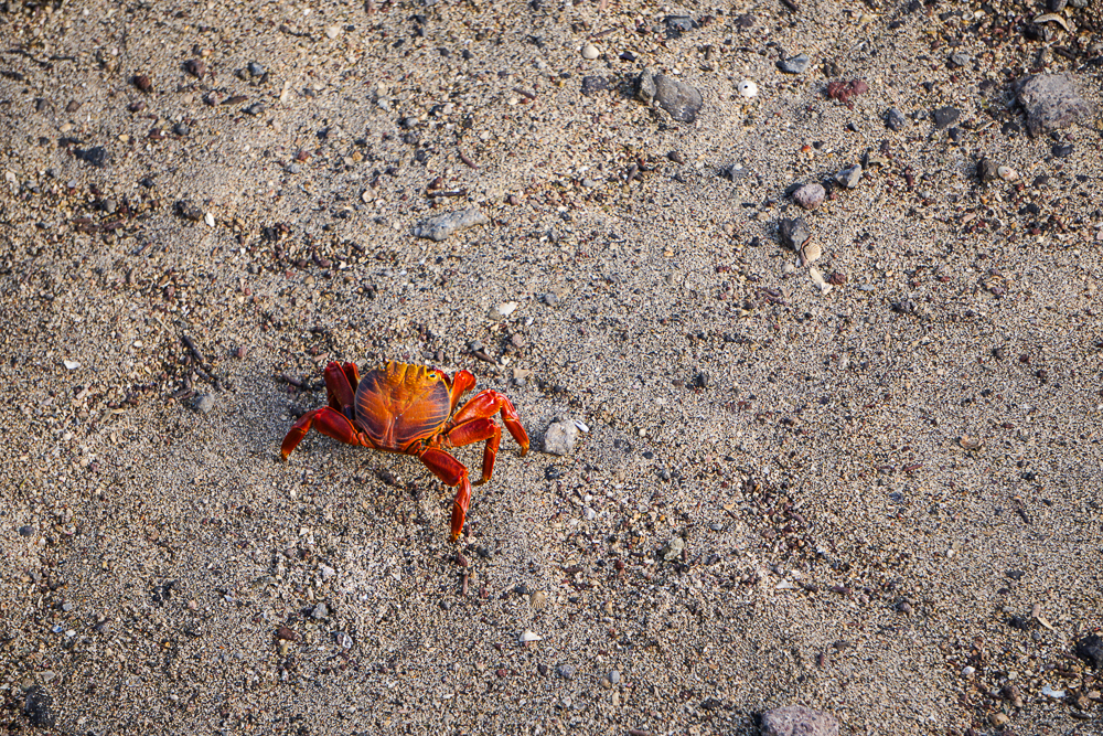
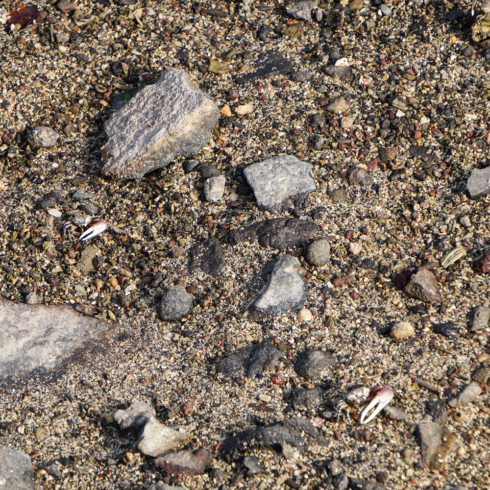
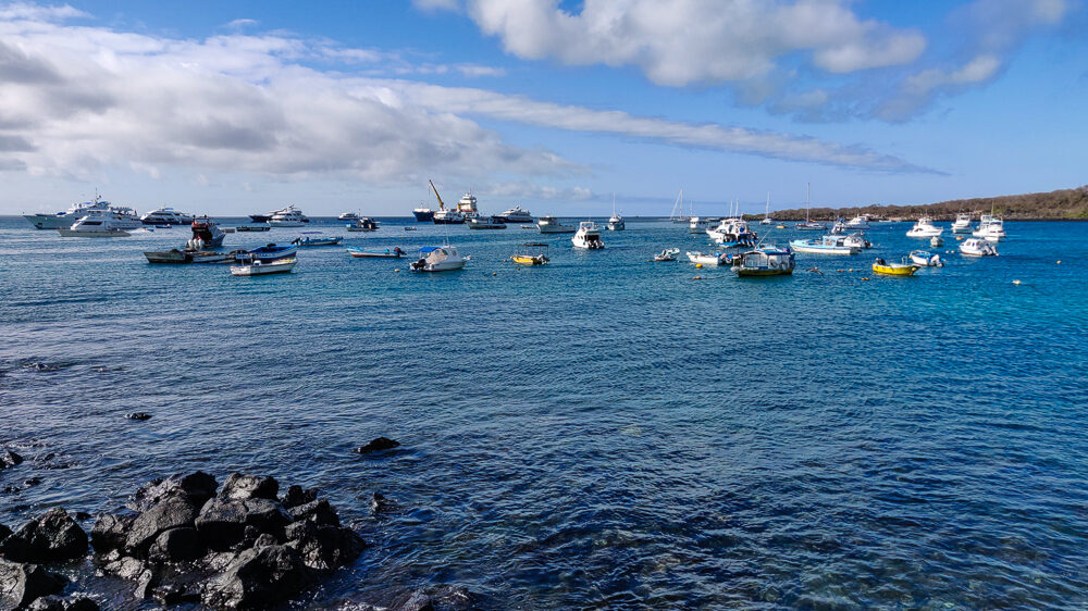
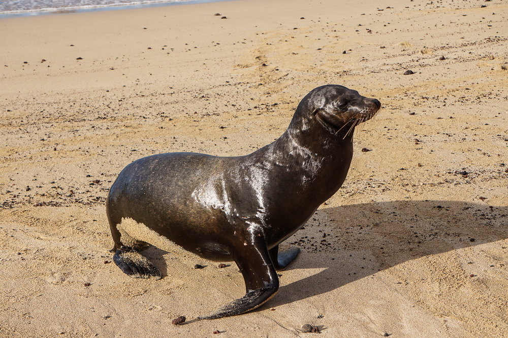
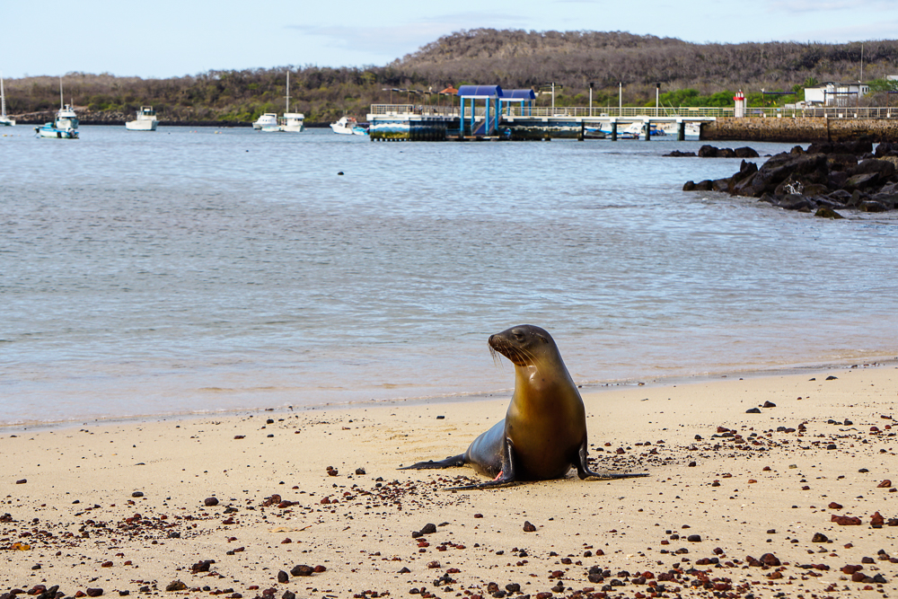
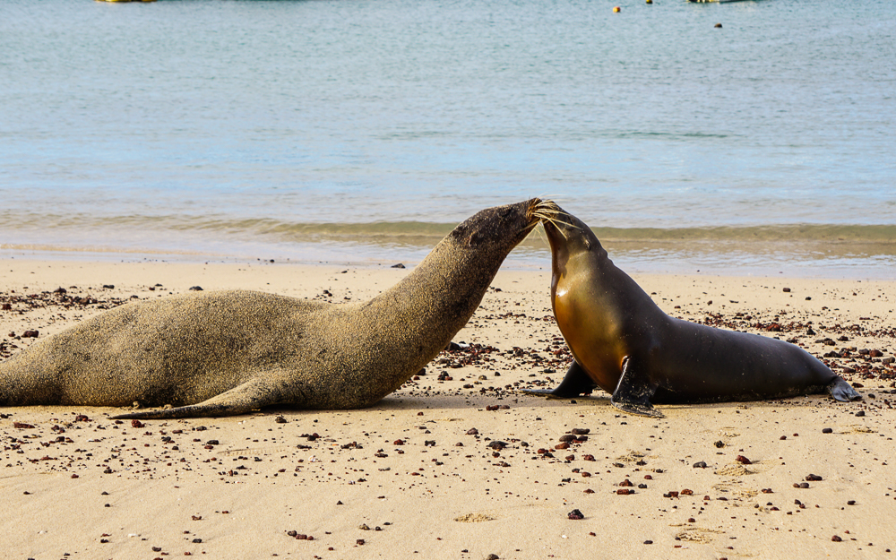
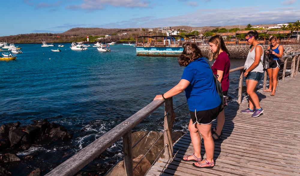
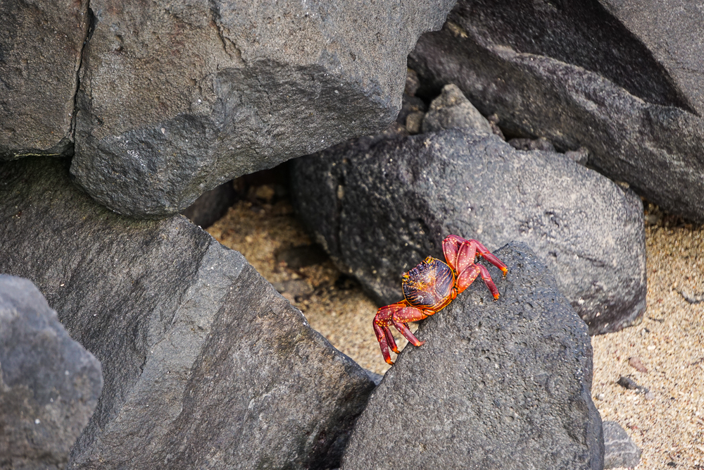
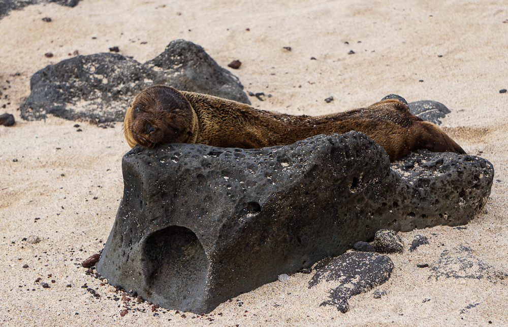
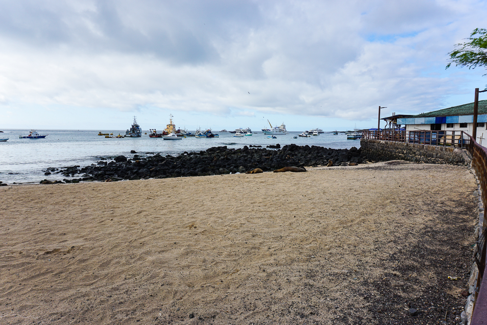
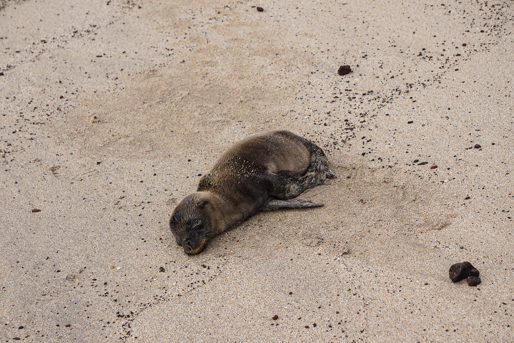
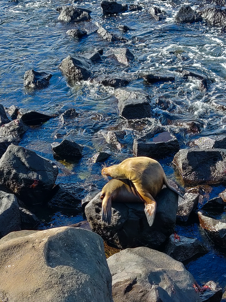
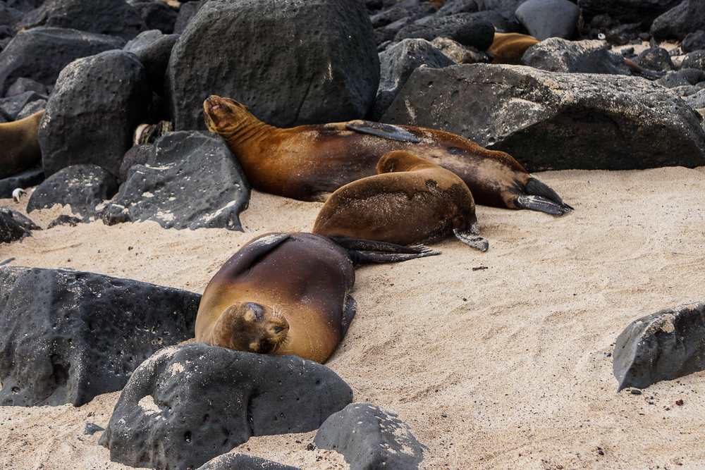
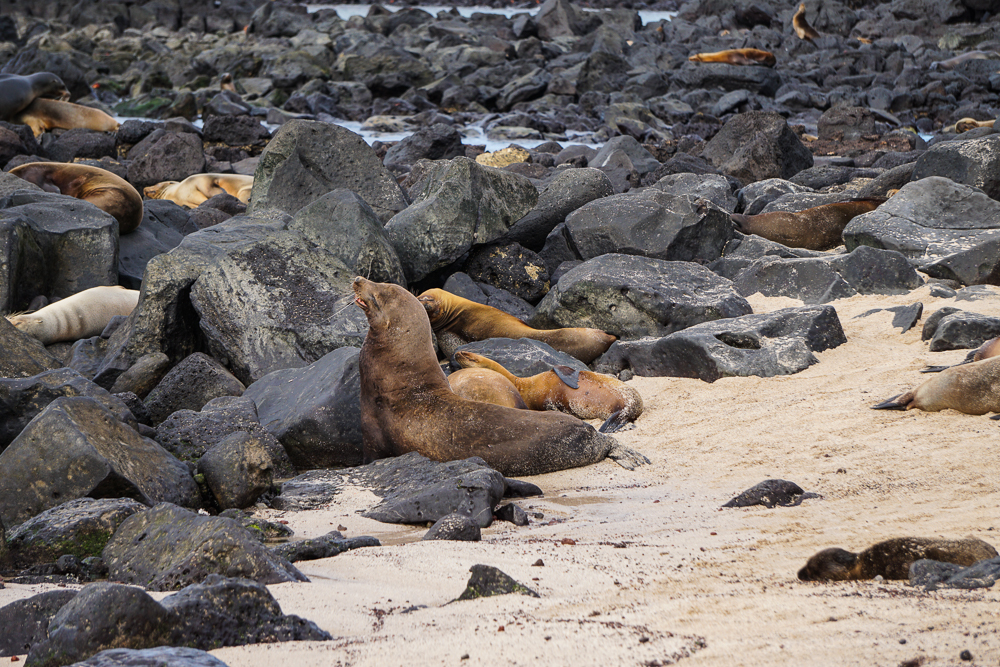
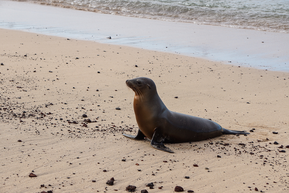
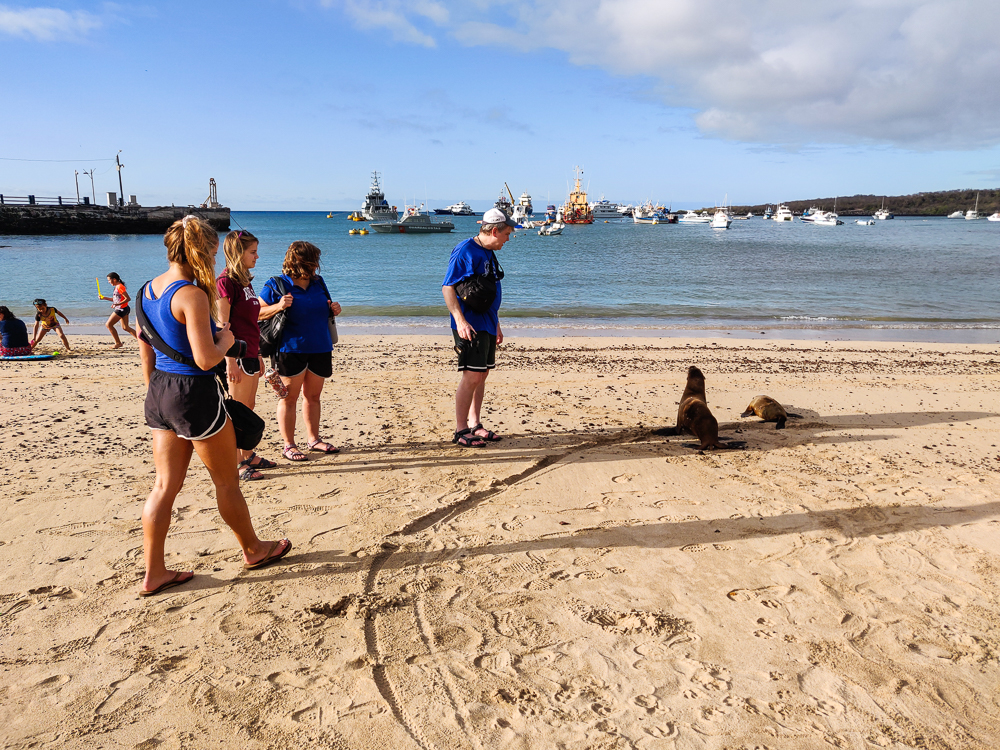
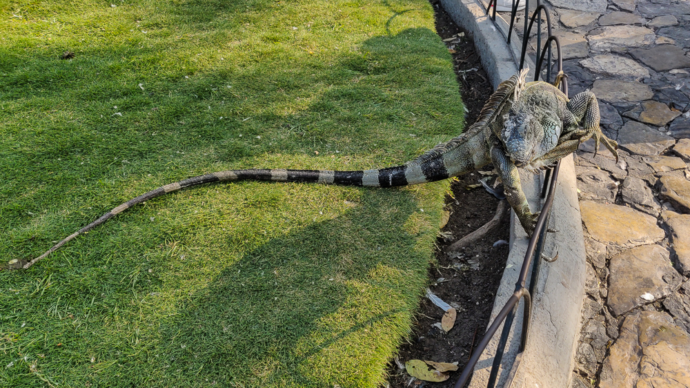
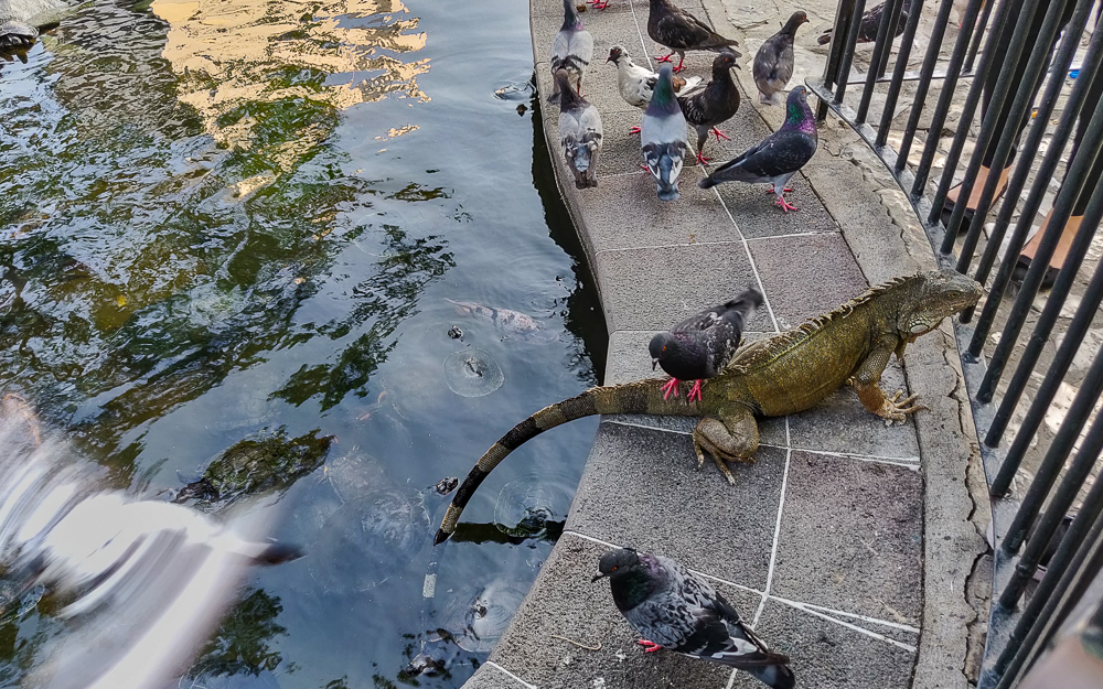
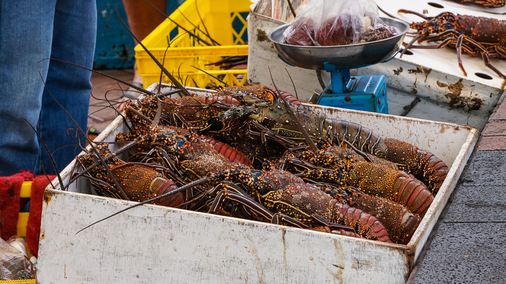
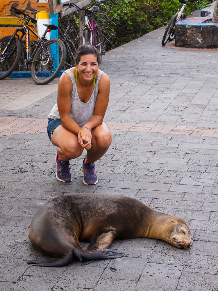
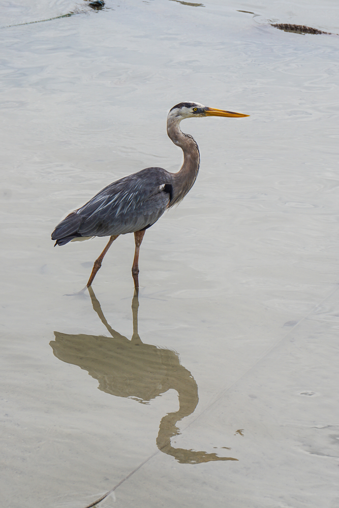
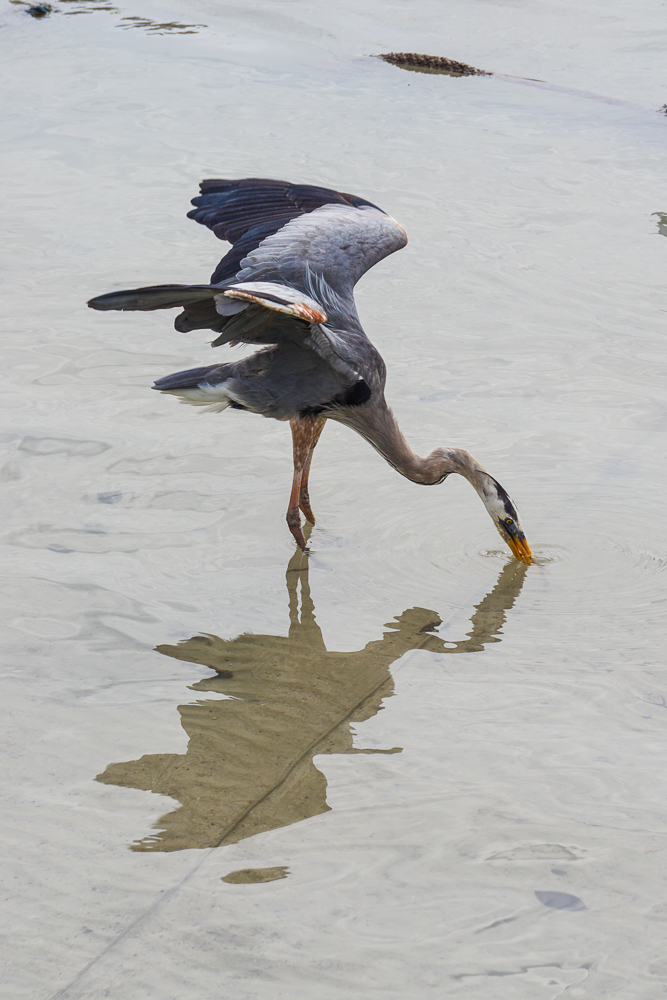
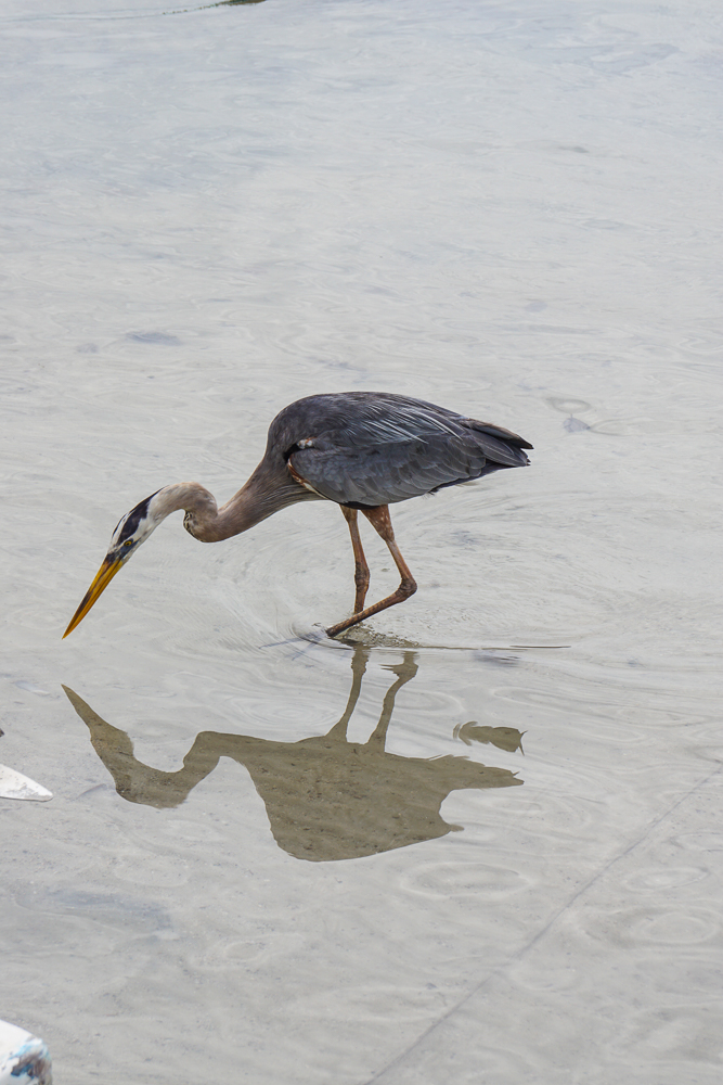
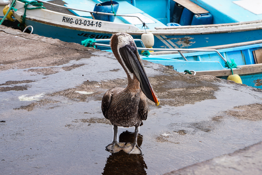
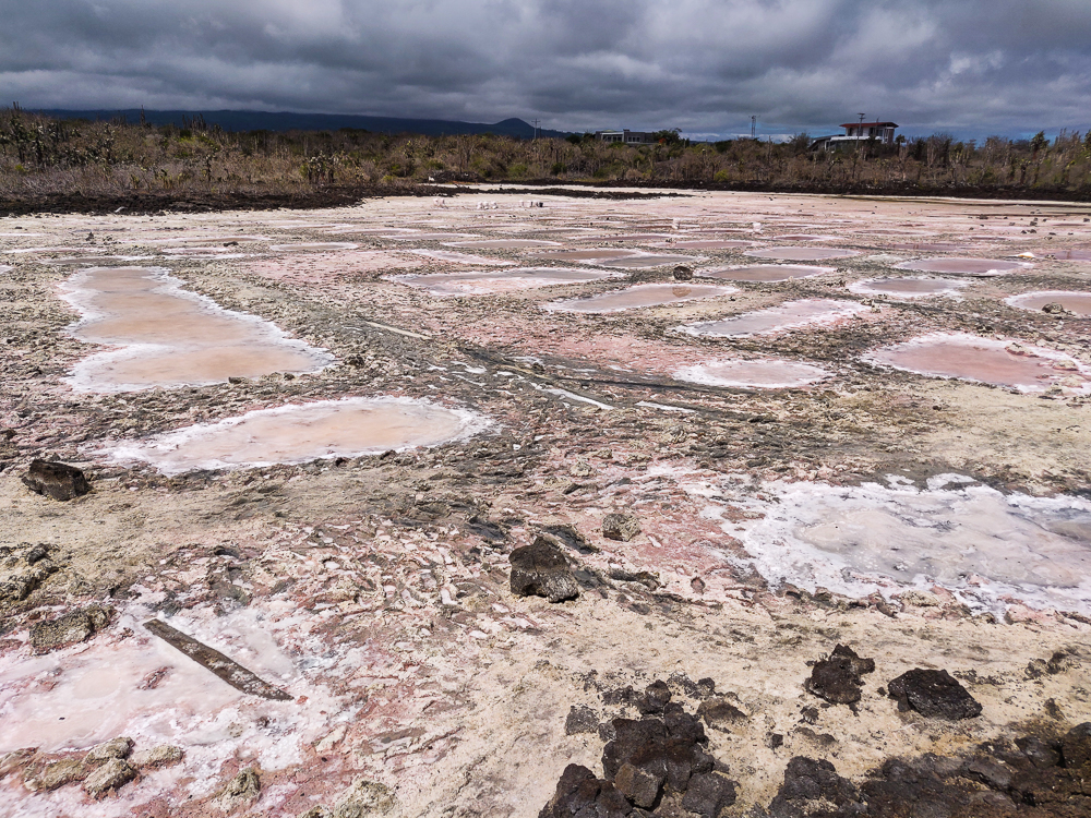
Our first stop was the local fish market. This is where the fishermen bring in their catches, and there are big, concrete tables where they’re sorted and prepared for sale. If you like fresh fish or lobster, this is the place to be. I personally don’t like fish, fresh or otherwise, but I do always enjoy watching people at work (in a totally non-creepy way), skillfully going about their business. The major tourist draw is the photo op, of course. The fish attract all kinds of critters hoping for scraps… sea lions and an assortment of birds that hang around and, if they’re feeling especially cheeky, try to snatch fish right off the tables. The fish attract the birds, the birds attract the people, and you’ve got yourself a crowd!

Lobsters! Lobster fishing is strictly regulated in the Galapagos. The season lasts from September 1 – December 31 each year. These are red spiny lobsters and are the variety most commonly found in the Galapagos.
Taking pictures of tourists taking pictures of this lady doing her job.
Sea lion trying to get some pity scraps. This lady isn’t buying it.
Breaking the two-meter rule (only once, I promise!)
Blue heron near the fish market
So pretty!
I liked his reflection
This pelican was loitering as well

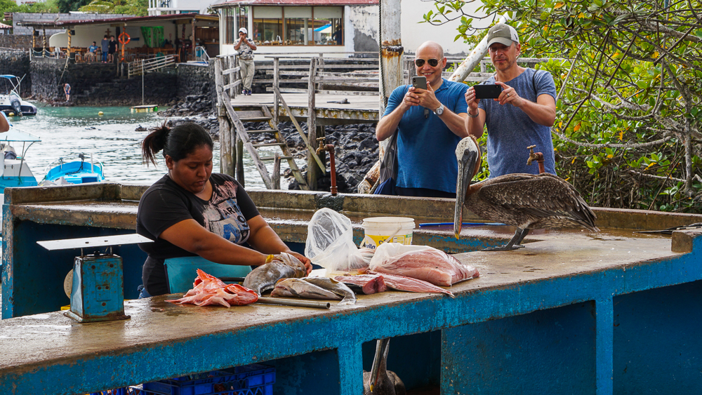
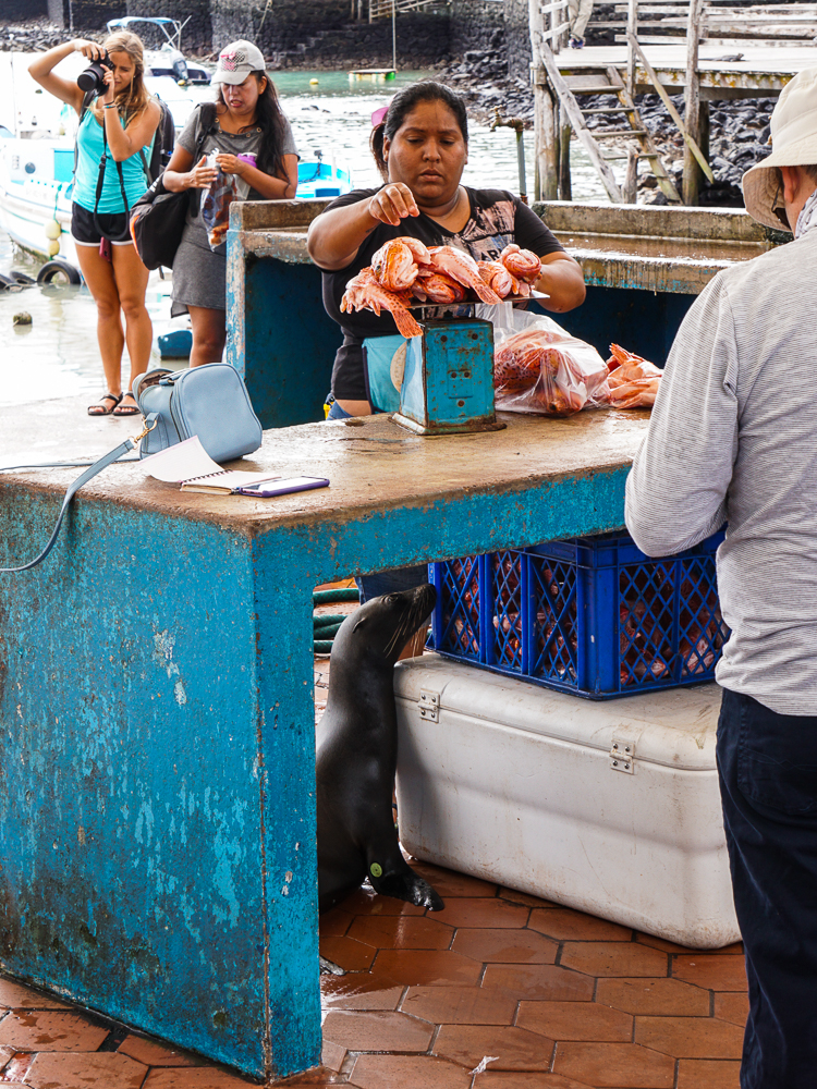
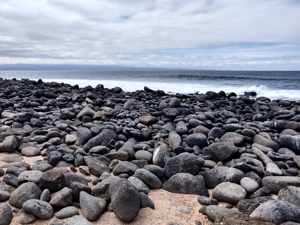
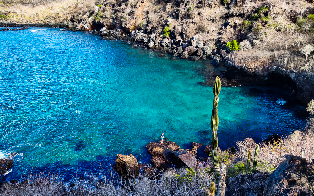
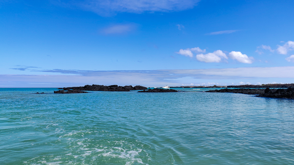
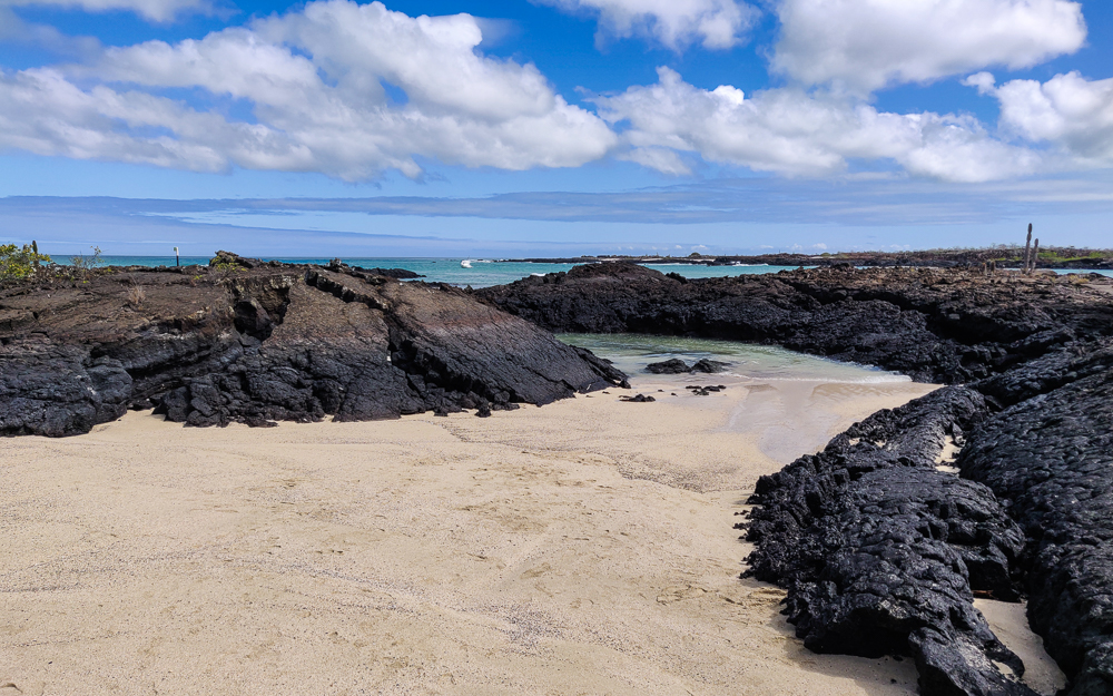
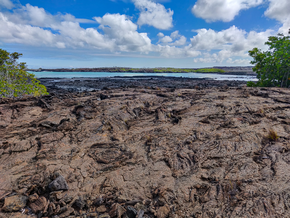
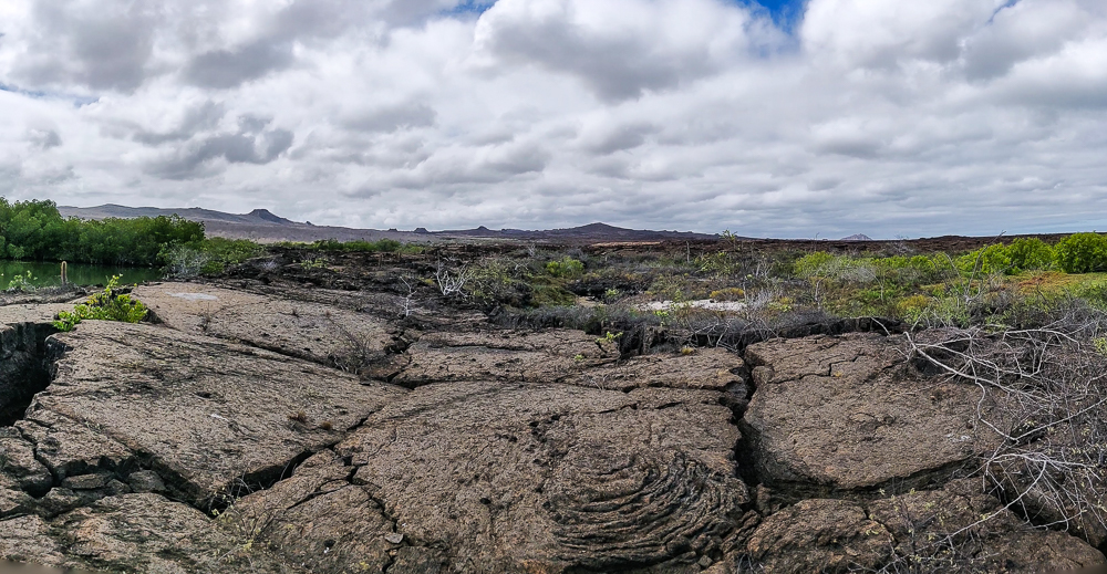
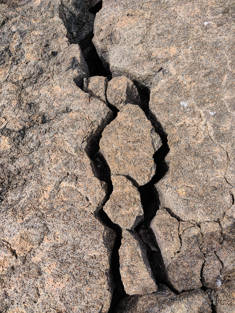
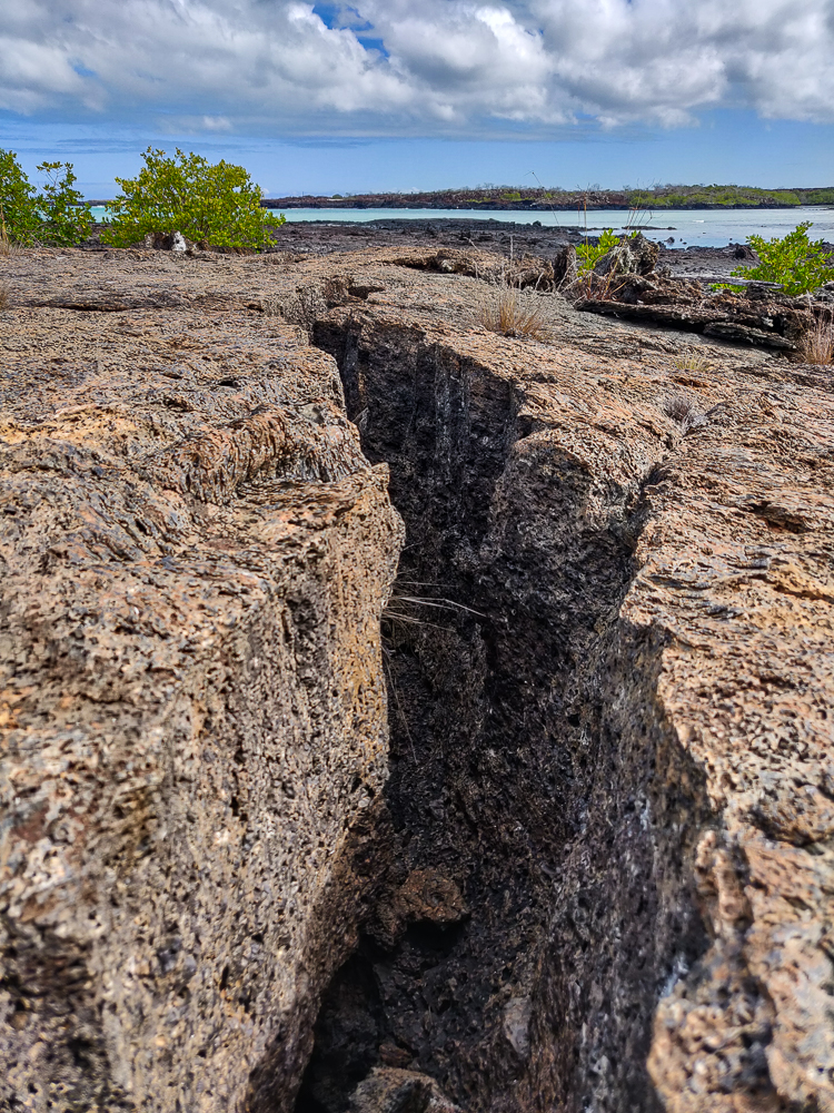
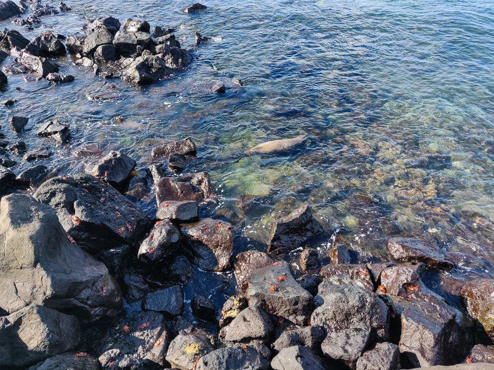
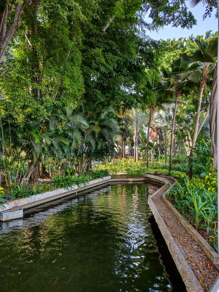
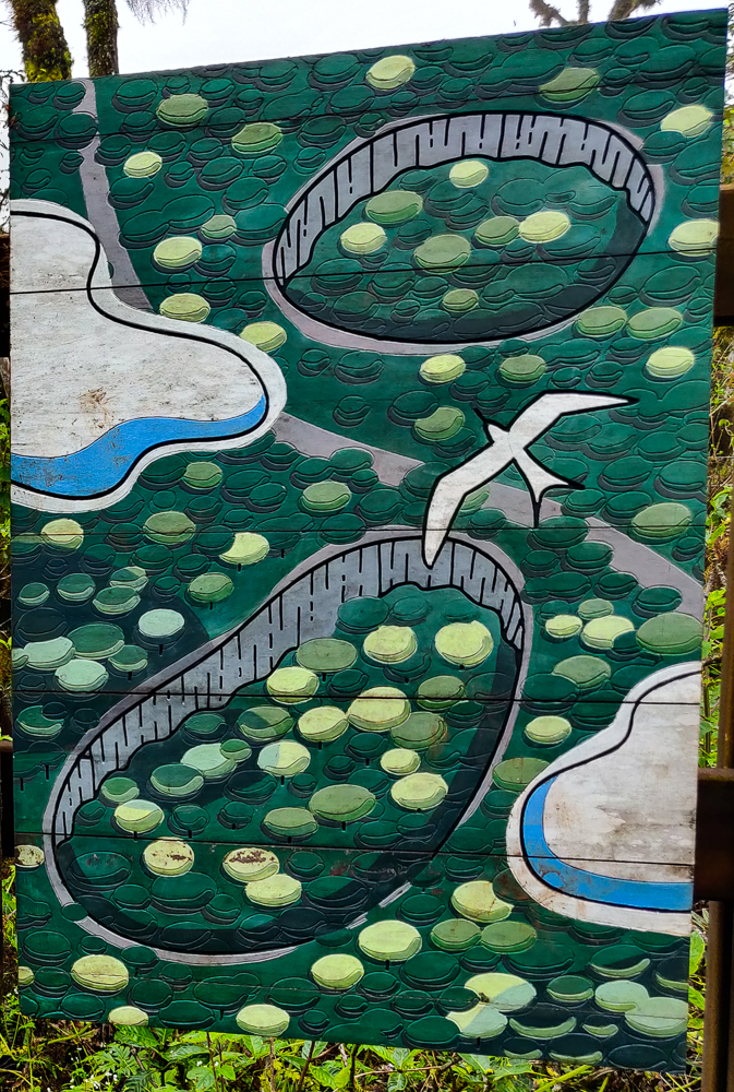
We weren’t there at prime time, so things were pretty quiet. That was fine with me! When everyone was ready to move on to the next adventure, we headed for the dock. Our destination was “Las Grietas”, or “the cracks”, which is a deep crevice that was created when the lava forming the island cooled and contracted. This particular crack falls at the junction of an underground river and the sea, so it’s filled with brackish water (mix between fresh and saltwater). There isn’t a large, clear passage to the ocean, but there is enough space for water and fish to trickle in. No sharks, though!

We passed this funky house on the way to the dock!
No clue what this kid was doing, but apparently we were all entertained by it (pic by my uncle)

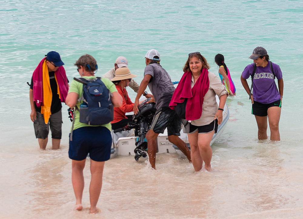
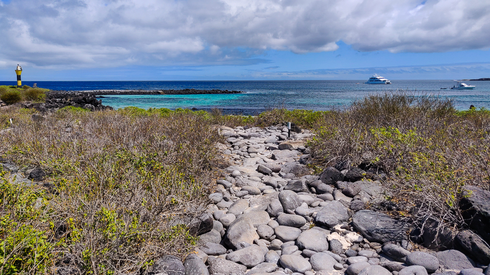
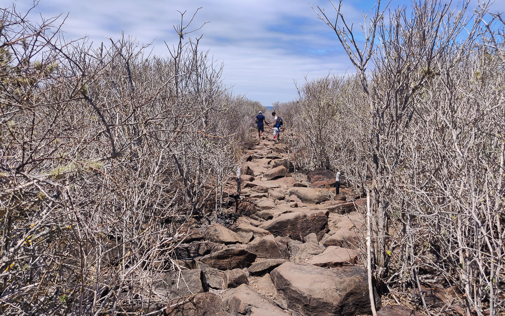
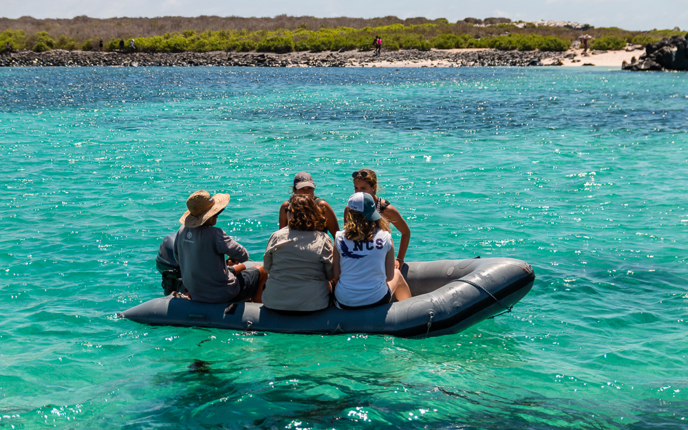
The only way for a human to get to Las Grietas is through a boat ride/walking combination. You can’t drive there. You can’t walk the entire way. You can’t boat the entire way. You take a water taxi from the main dock in Puerto Ayora, cross the harbor, and walk about 30 minutes from there. You can also take a boat a liiittle farther and save yourself maybe 15 minutes of walking, but then you still have to walk the final stretch.

We passed these salt mines along the way! Saltwater comes in with the tide and fills the area, and after the water evaporates, people harvest the salt that gets left behind (you can see the white rings of salt around the pools in the picture).
With my aunt and cousins and some pretty flowers we passed on the walk (pic by my uncle)
Las Grietas! (The first pool)

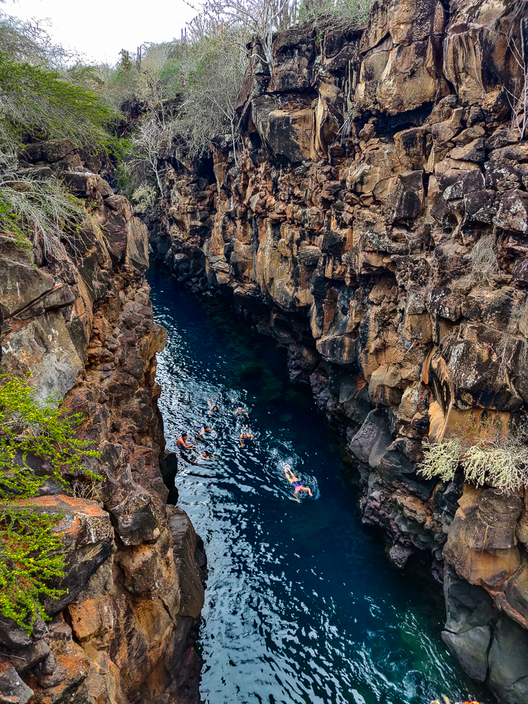
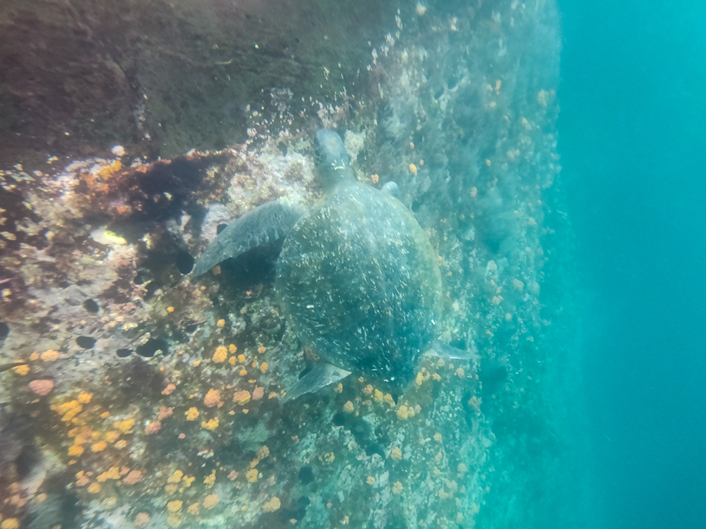
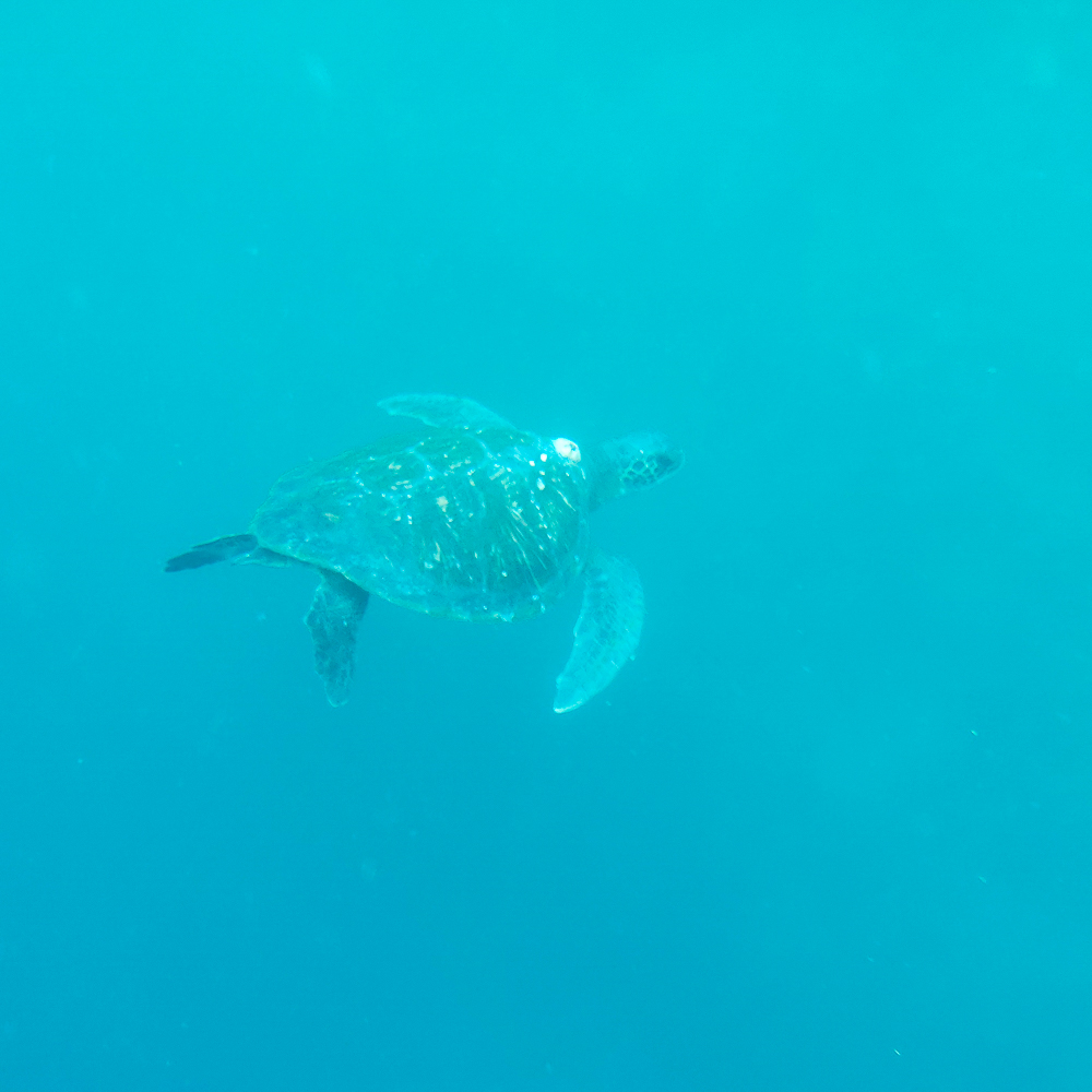
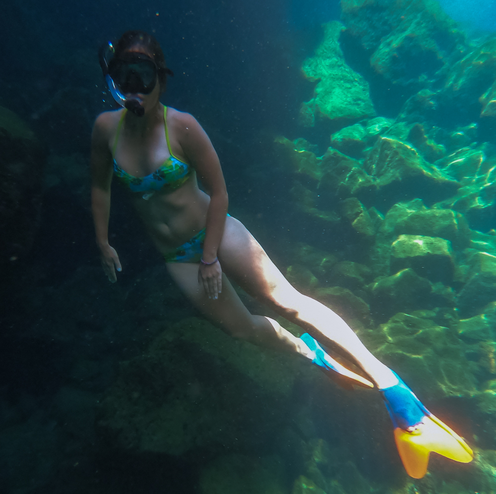
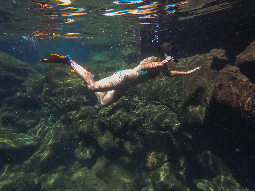
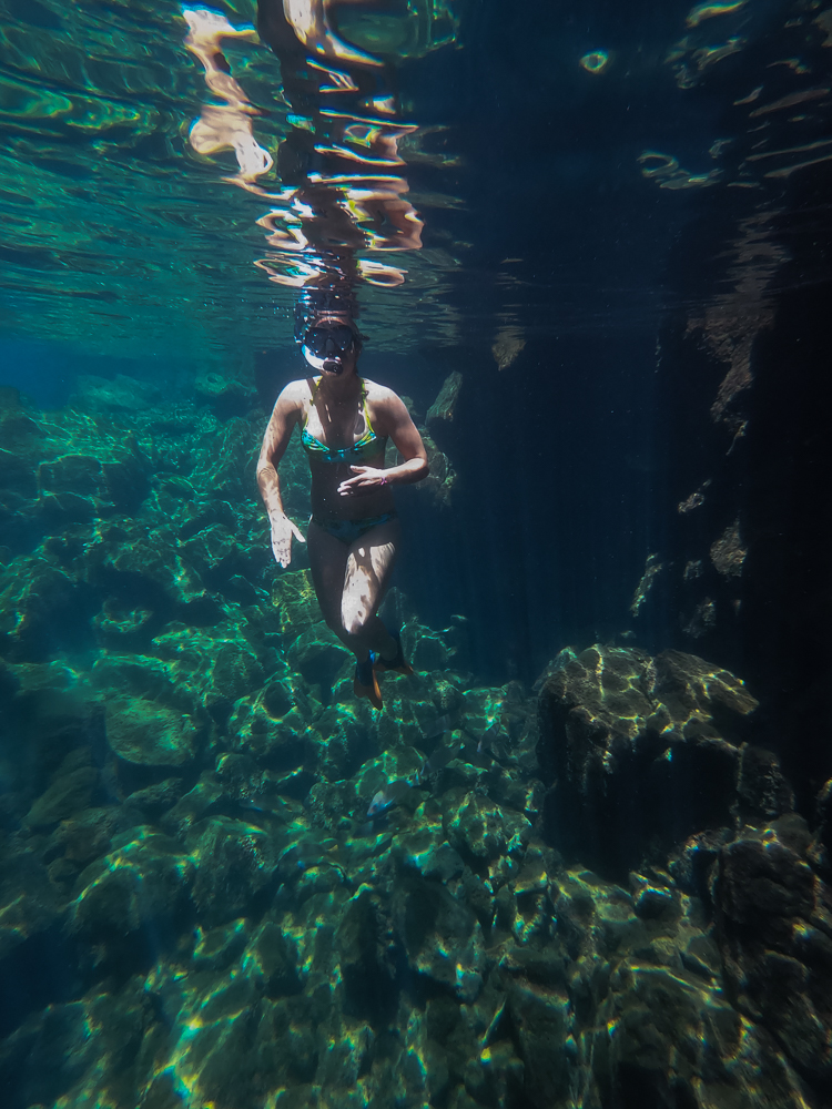
Las Grietas is about 330ft/100m long and consists of three “pools”. As I researched, it seemed like everyone (everyone who seemed even mildly adventurous, that is) agreed that you should absolutely go all the way to the third pool. My uncle, cousin, and I geared up in our fins and snorkels and headed down a set of wooden stairs to the first pool. This is the biggest one (at least in my estimation), and it’s crowded because that’s as far as most people go. Not us! There’s not much to see in the first pool, so we swam to the end pretty quickly. From there, we climbed over a section of slippery rocks (only falling once… eh, maybe twice… but always very gracefully, of course) into the small, rocky, shallow second puddle (it’s way too small and shallow to be called a pool, so I’m amending the name). If I didn’t know better, I would have thought we’d reached the end. But no.

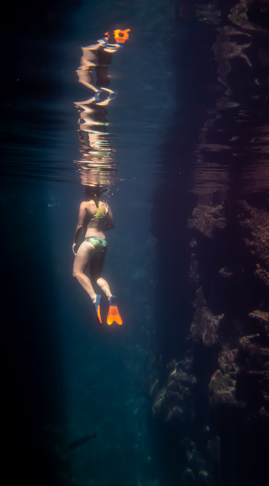
To reach the third pool, you can either climb over some large boulders or swim about 5 feet through an underwater “tunnel” beneath them. The tunnel route is way easier, but at the time, we didn’t know that was an option. (I think it’s semi-common knowledge, so I’ll take the blame for that intelligence failure.) We only found it by chance. At the rocky transition from the first pool into the second, I tossed my fins ahead so that I could use my hands as I crossed over the rocks… and when I reached the puddle, one of them had vanished. Uh oh. They’re bright orange floating fins, so I knew it had to be on the surface, but then why couldn’t I see it?? After some minor panicking and intense searching, I found it wedged between two rocks. There was clearly a current that carried it there, and a quick peek underwater revealed the tunnel! So, it was two exciting discoveries in one. I got my fin back, and we found an easier route into the third pool! My uncle had already scaled the boulders to get there… whoops! But at least the return trip was easier.

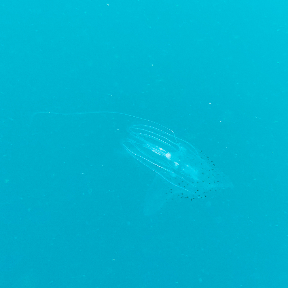
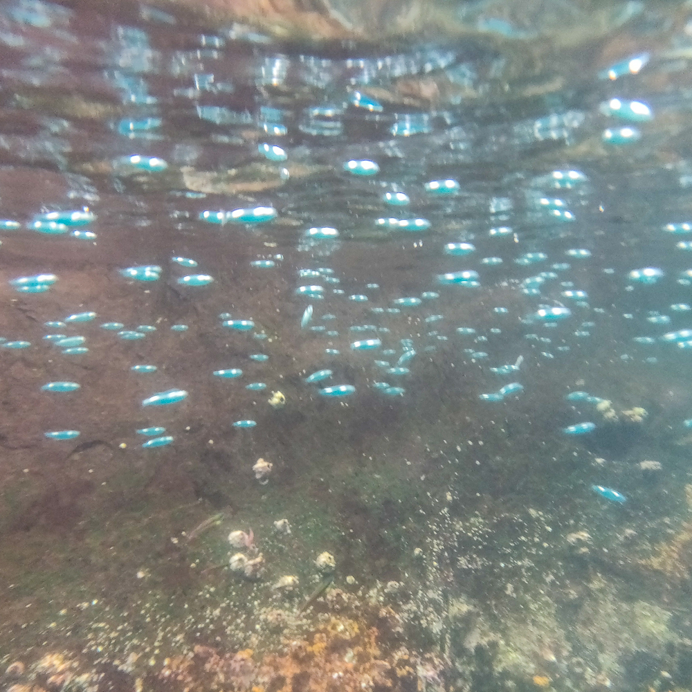
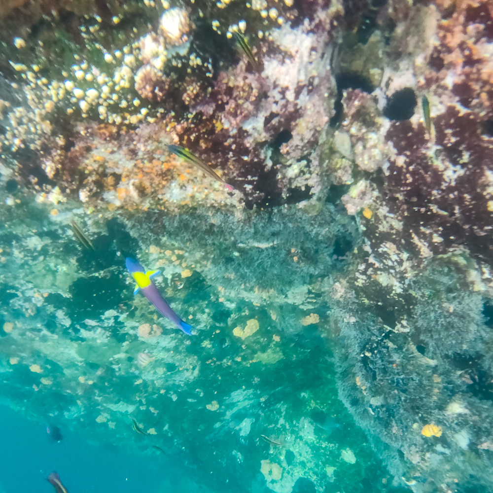
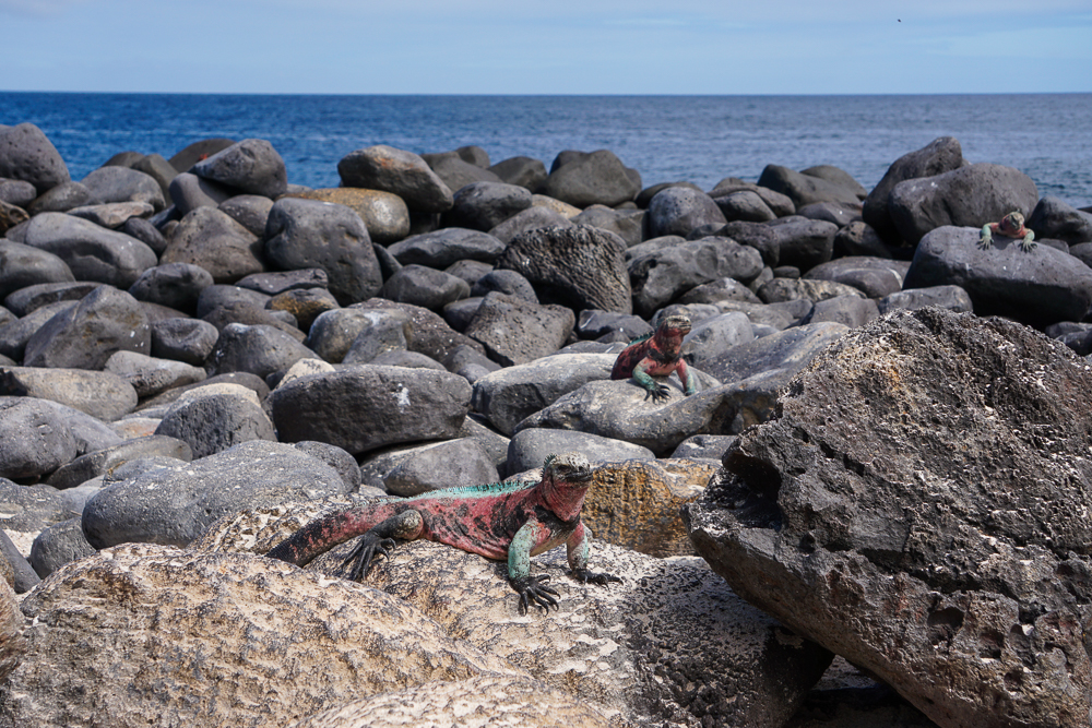
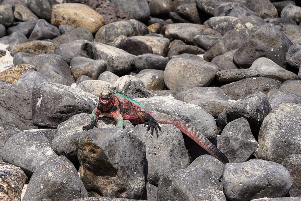
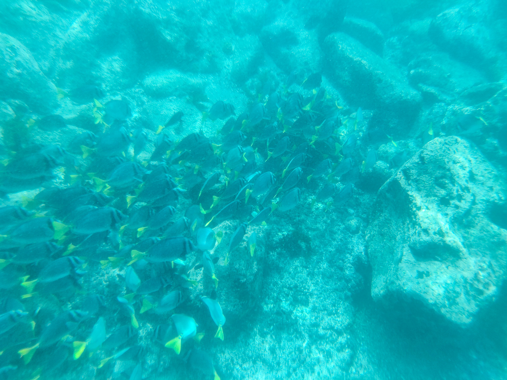
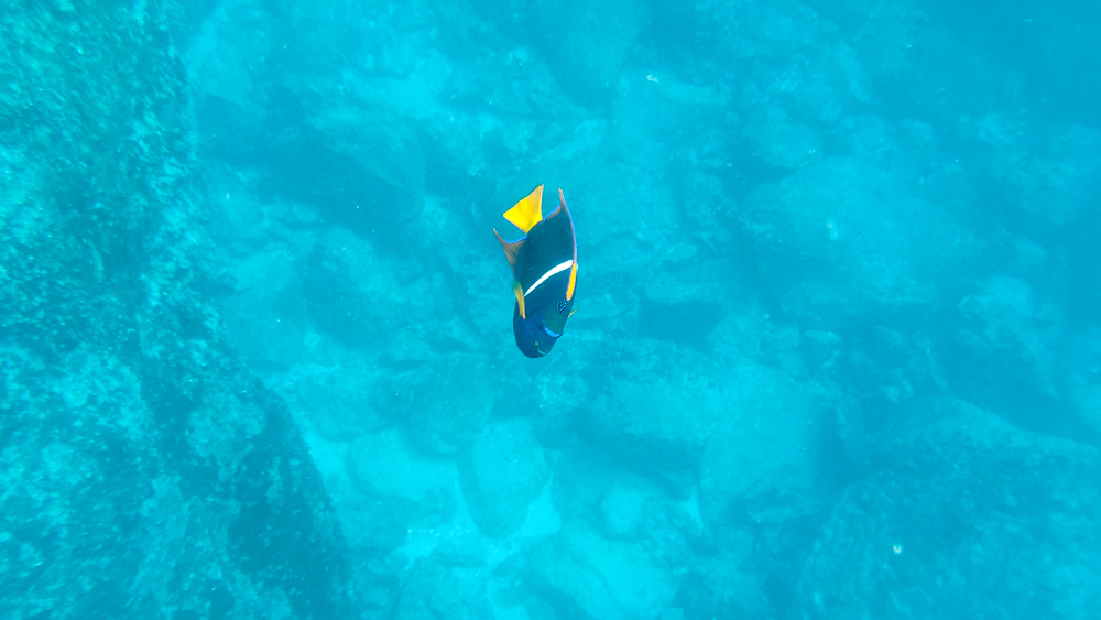
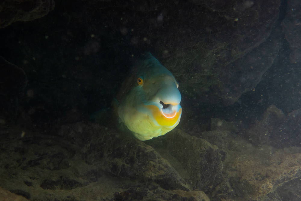
Well, it was quite the journey, but we finally made it to the third pool. It’s slightly smaller than the first, but we had it all to ourselves. It was awesome. The water was incredibly clear and calm, all the way to the bottom, maybe 10-15ft (3-5m) down. As soon as we passed that last boulder wall, it was like the world around us ceased to exist. Underwater, the silence was the ear equivalent of being in a pitch-black room. And then the fish! Everyone said that there’s not much to see underwater, but I disagree. Sure, there were no sharks or turtles, but there were a few schools of BIG fish cruising around… like at least a foot long (30cm), and many of them were probably bigger than that. The best part was that they were almost completely unfazed by us. I dove down and swam along next to them. They looked surreal… like they were mechanical fish or were too three-dimensional to be real. And just the general ambiance… I don’t know exactly how to explain the feeling, but from now on, if I need to imagine a place where I feel completely at peace, I’m going to be there, suspended on the surface of the clearest, quietest water with hyper-realistic fish gliding by.

We had the pool to ourselves for a while, and it was glorious. By the time another group showed up (and completely shattered the serenity), we were about ready to go anyway. We made our way back under the boulder, through the puddle, over the slippery rocks, across the first pool, and up the stairs (which were now about a million degrees after baking in the sun… and I had no shoes at the bottom so that was really great planning on my part).

Me with my bright, floating fins
Loving life. I didn’t bother taking my waterproof case-equipped phone, so all of these pictures were taken by my uncle or cousin
GIANT fish hiding in the rocks along the edges of the third pool. I glimpsed something light as I swam by and got in closer to investigate. I’m a terrible estimator, but he MUST have been more than 2 feet long (60cm). I think. And I know I said that I didn’t take any pictures, but for this one, I borrowed my cousin’s camera and got right up in this fish’s face because it was too dark to see it very well at the time, and I really wanted to know what he looked like.
Just looking at this picture is making me all sorts of calm
Okay just one more picture (also because I have practically no pictures of me from this entire trip, so here are 90% of them in one go, all with me looking especially cool in my snorkel)

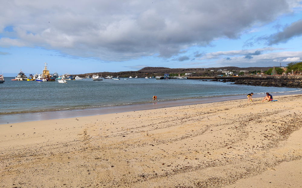
From there, we walked to the water taxi stop and then boated back to town. The water taxis, by the way, are hilarious. The ride back to town went something like: get on water taxi, stop by a boat anchored in the harbor, pick up empty water jugs, drive to another boat, pick up person, drive to another boat, drop off empty water jugs and pick up bag, drive to another boat, drop off person, drive to dock, give bag to person waiting on dock, let off passengers. I never understood what was going on, but I was always entertained.

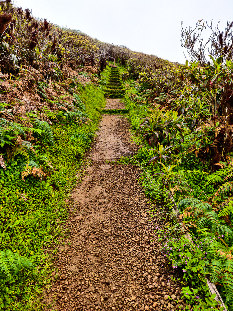
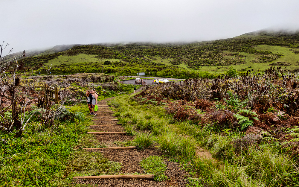
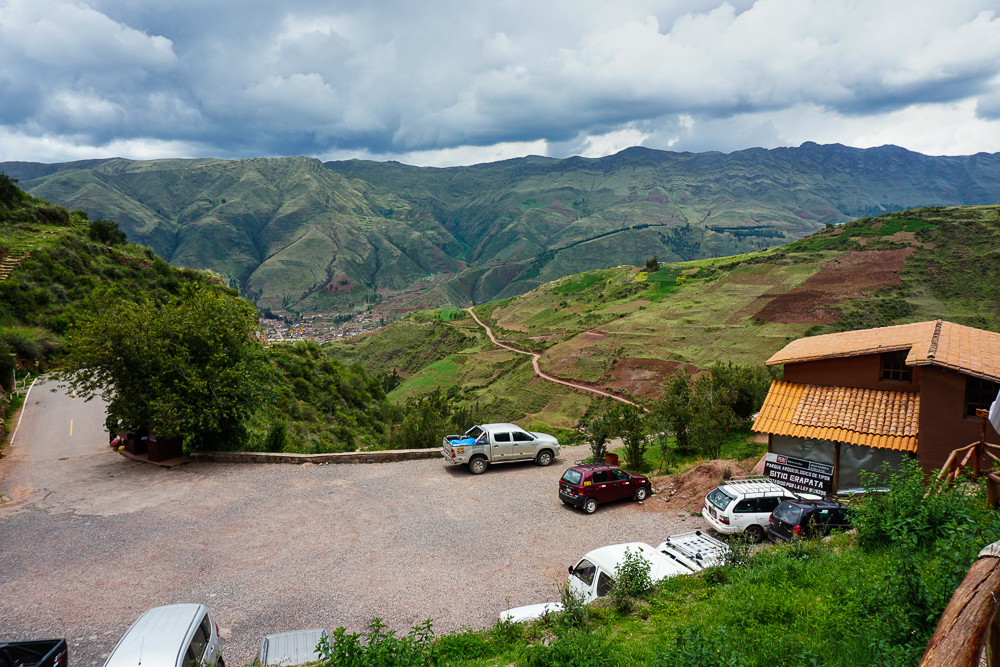
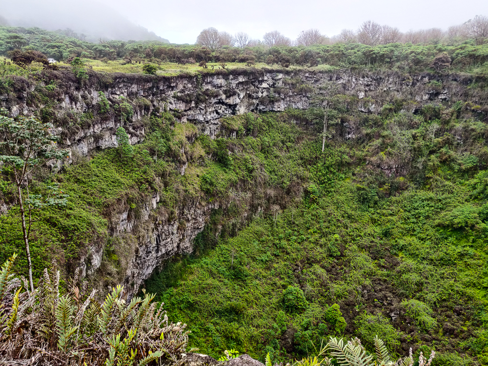
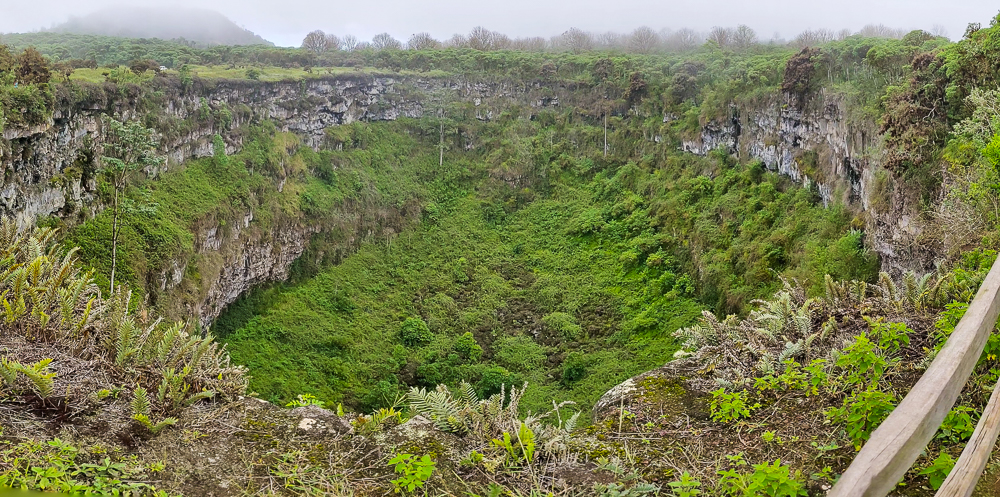
After a quick stop at our hotel, we headed back out in search of a (regular) taxi to take us to the highlands. On Santa Cruz, people generally go to see two things in the highlands: a tortoise sanctuary (of course) and a pair of craters called Los Gemelos. Fredy, our taxi driver, suggested that we visit Los Gemelos first, and I figured he knew better than any of us since he’s probably taken people to both places a million times.

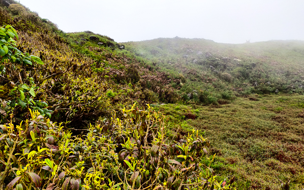
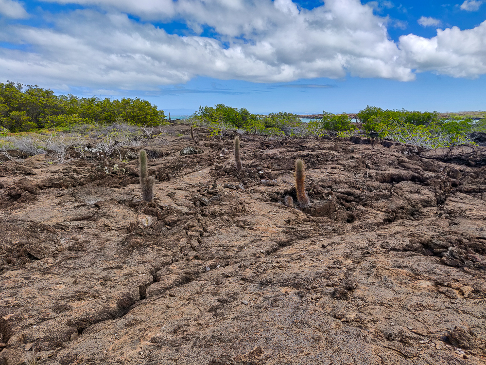
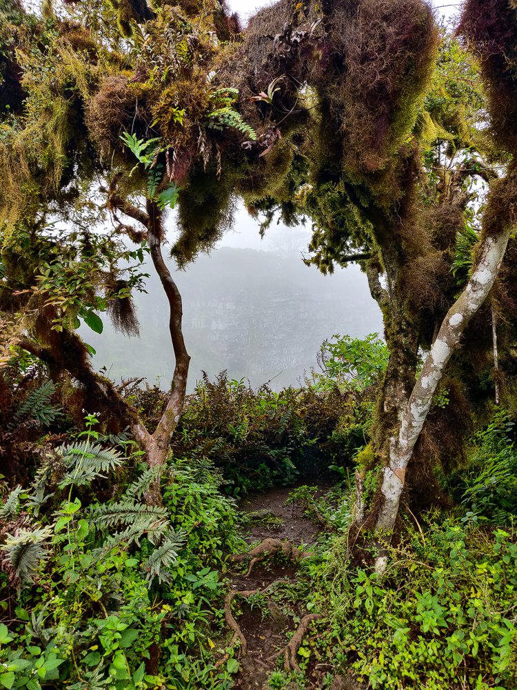
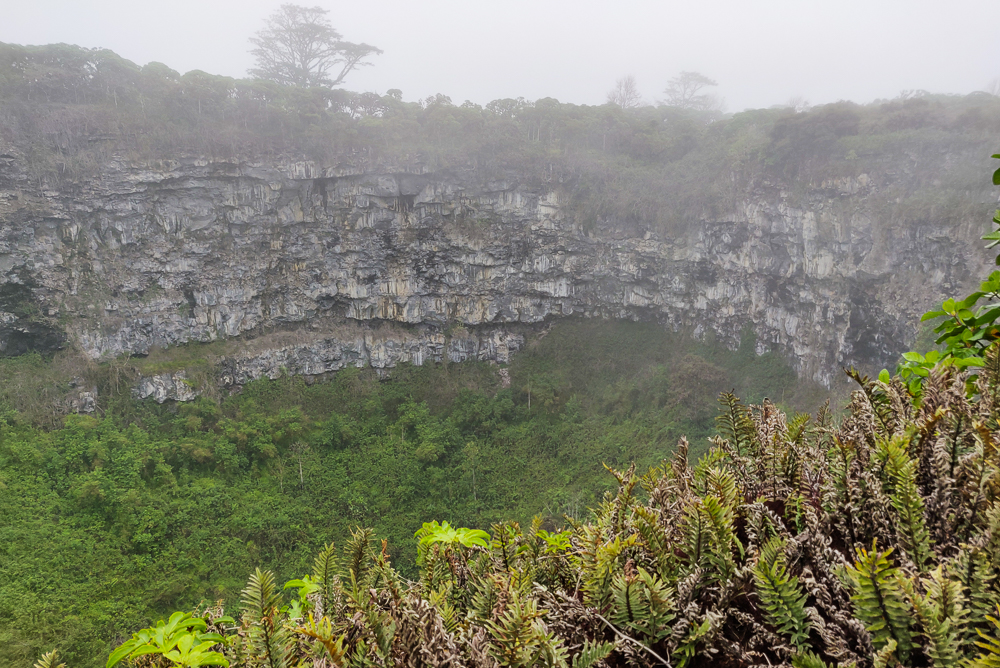
Los Gemelos, or “the twins”, are two craters formed by collapsed magma chambers. What are those? When lava is flowing, it flows fastest at the middle. The lava at the top and edges cools and hardens more quickly while the lava beneath continues to flow. Eventually, the eruption stops, halting the supply of lava and leaving behind empty space beneath the hardened lava. This can take the form of a tube-like cavity (lava tubes) or, in the case of the craters, large, open chambers. At Los Gemelos, through a combination of erosion and seismic activity, the unsupported lava above the chambers became unstable and collapsed, forming the twin “craters” that you can visit today.

This sign by the craters roughly shows their shapes/relative sizes. I read somewhere that the larger one (I assume?) is about 1 mile in diameter (1.6km) and 920 feet deep (280m).
In the surrounding forest (pic by my uncle)

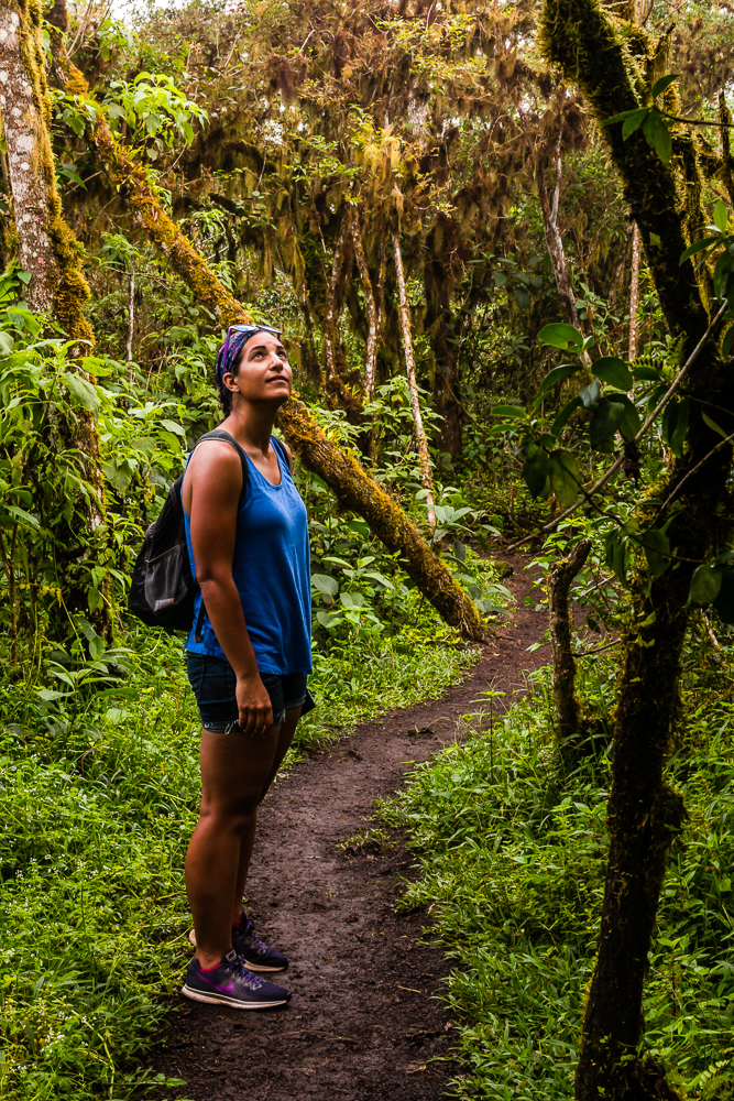
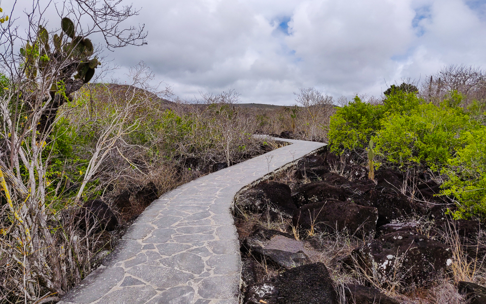
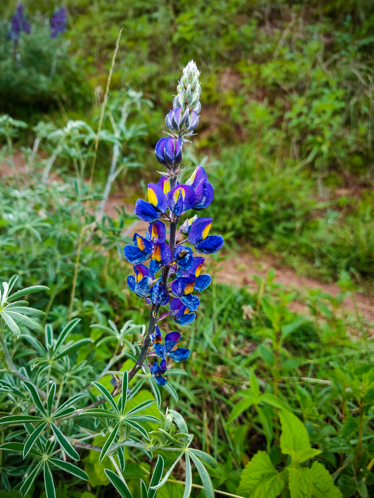
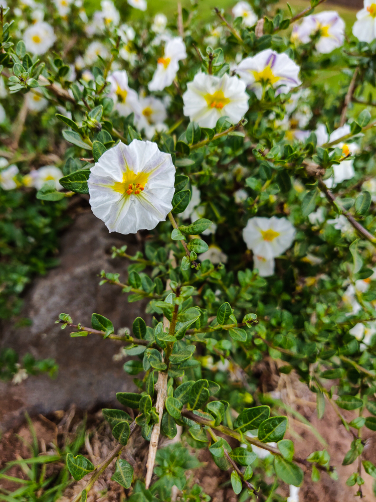
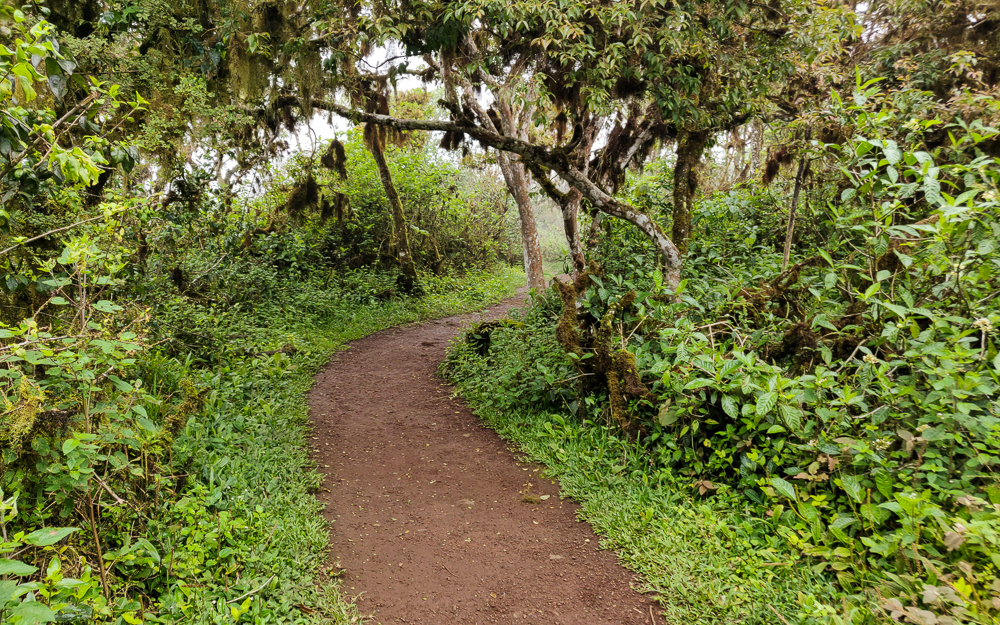
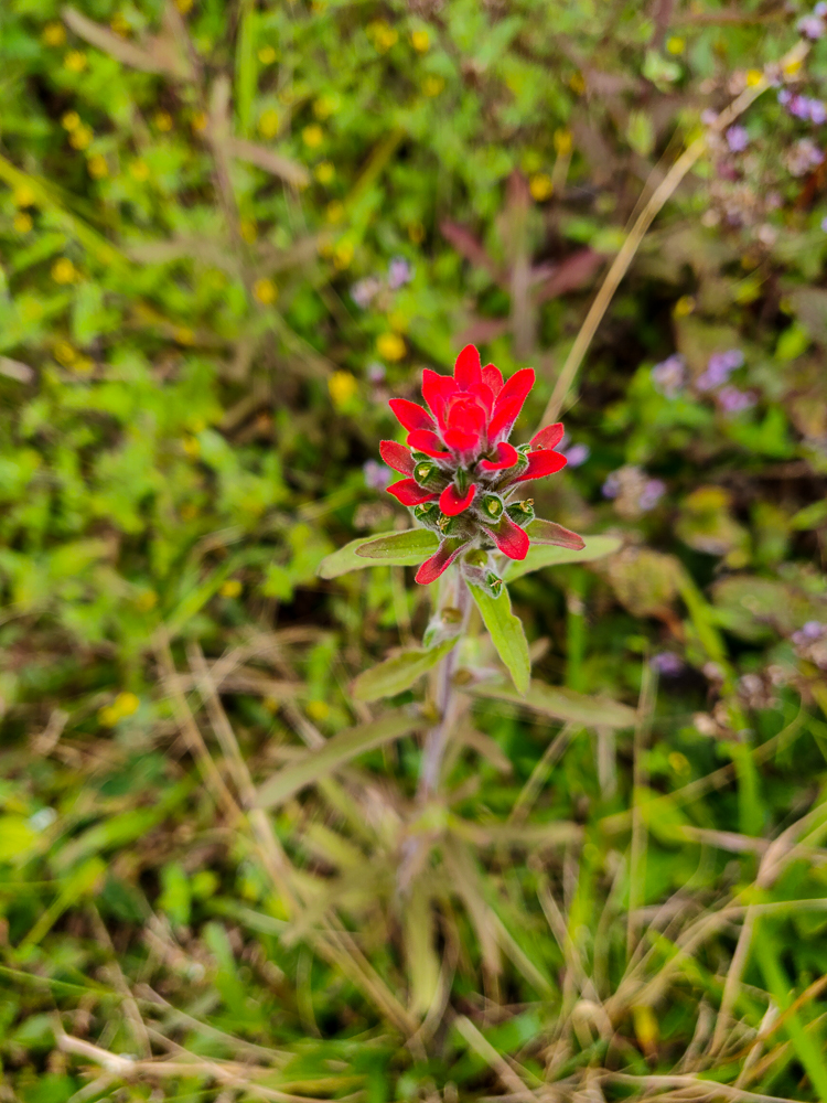
None of us really knew what to expect from Los Gemelos, but they were really cool! It’s like being in another universe because they’re in the middle of the largest Scalesia forest in the Galapagos. This is an important habitat for tropical flowers like bromeliads and orchids as well as mosses, lichens (a fungus/algae mashup), and birds. It feels like you’re in the middle of the rainforest! Since the craters collapsed a long time ago, they’ve filled in with plants as well.

Impossible to fit the entire crater into one picture without a wide-angle lens or a panoramic photo
It’s super cool looking!
And then this forest… can you believe this is the same island where those barren salt mines were??
The tree to the right of the path in this picture reminded me of a giant spider. Eek! But the moss hanging off of those branches is the craziest thing!!
Pretty flowers in the forest
Framed fog
The density of the fog changed pretty quickly, but there were times when it was hard to even see the opposite side of the craters

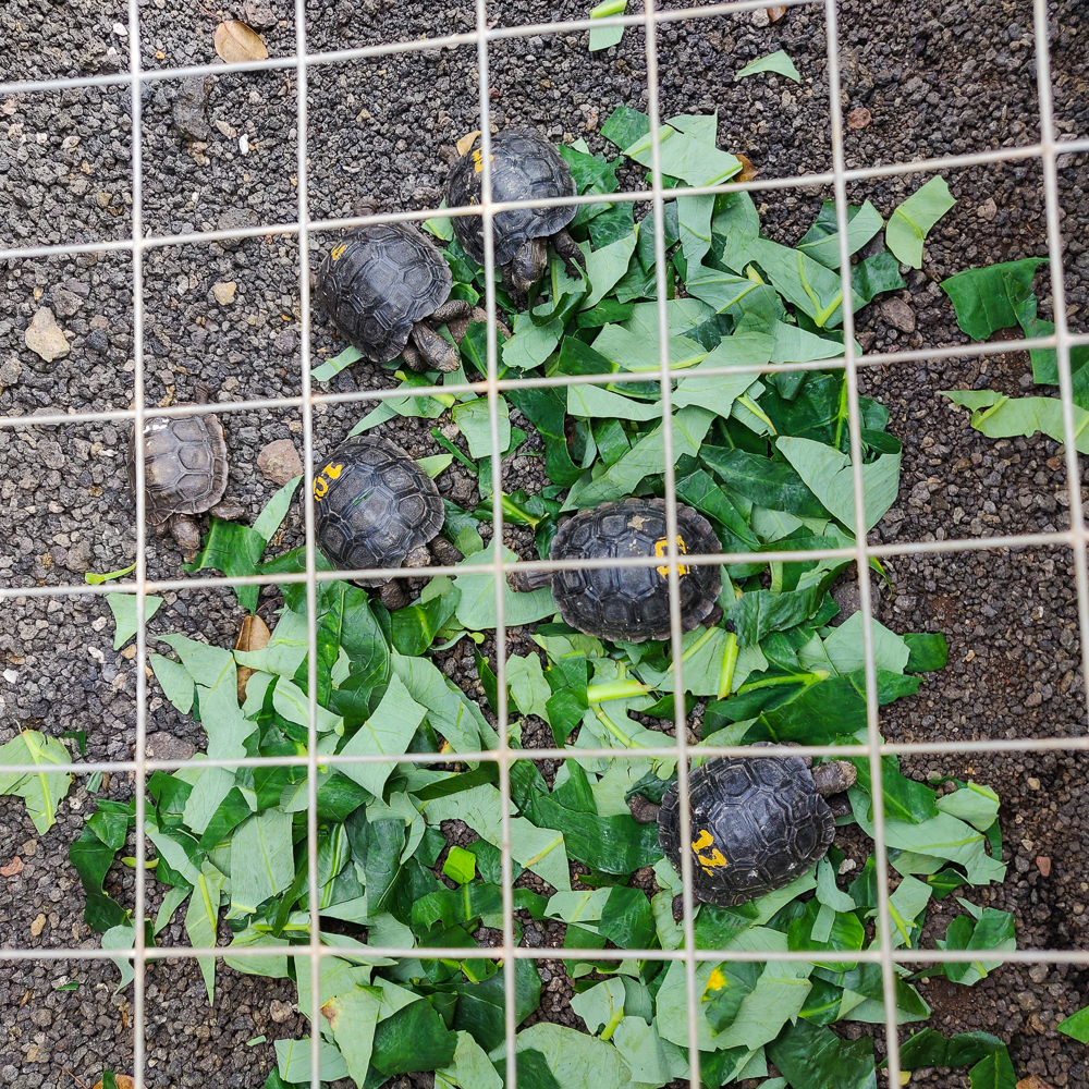
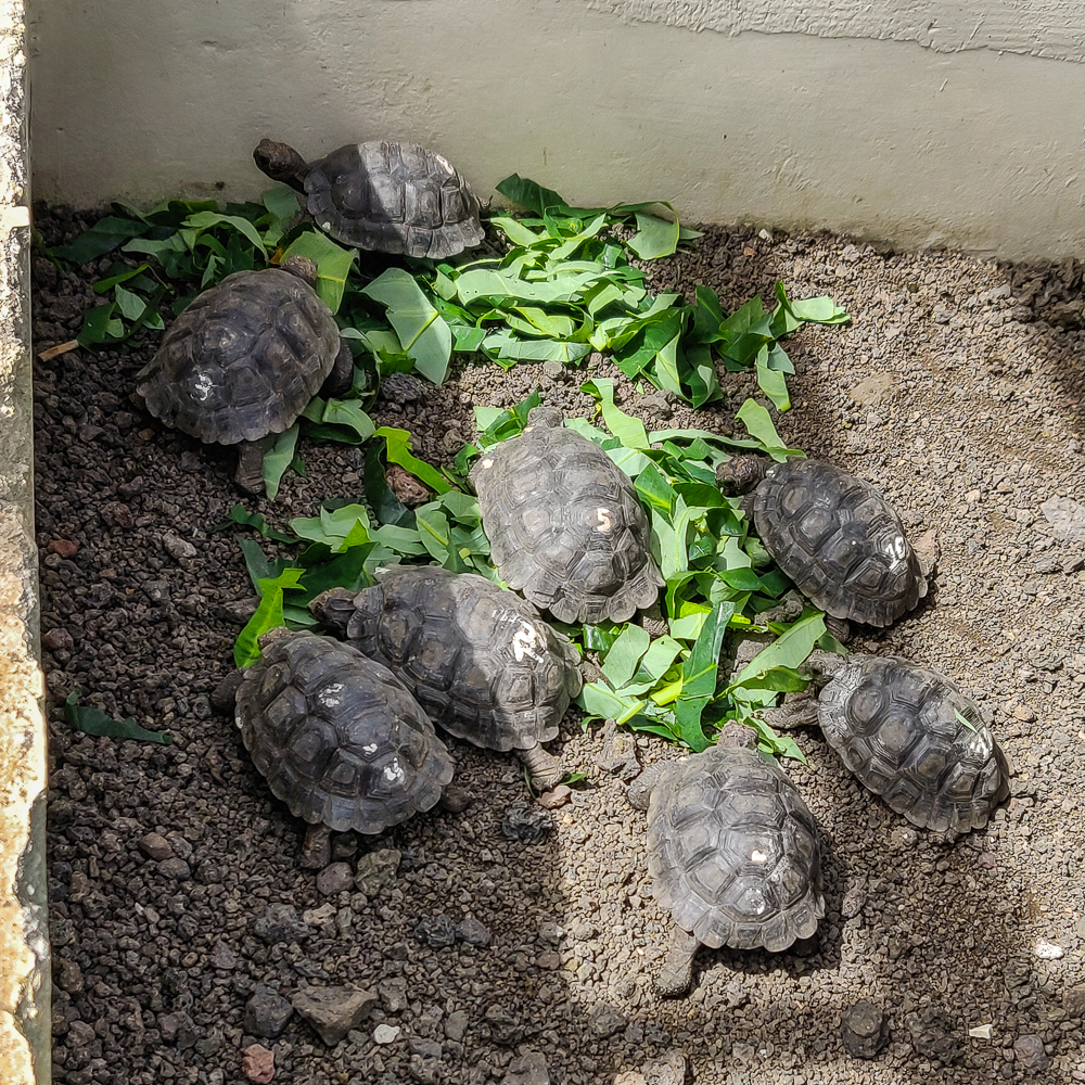
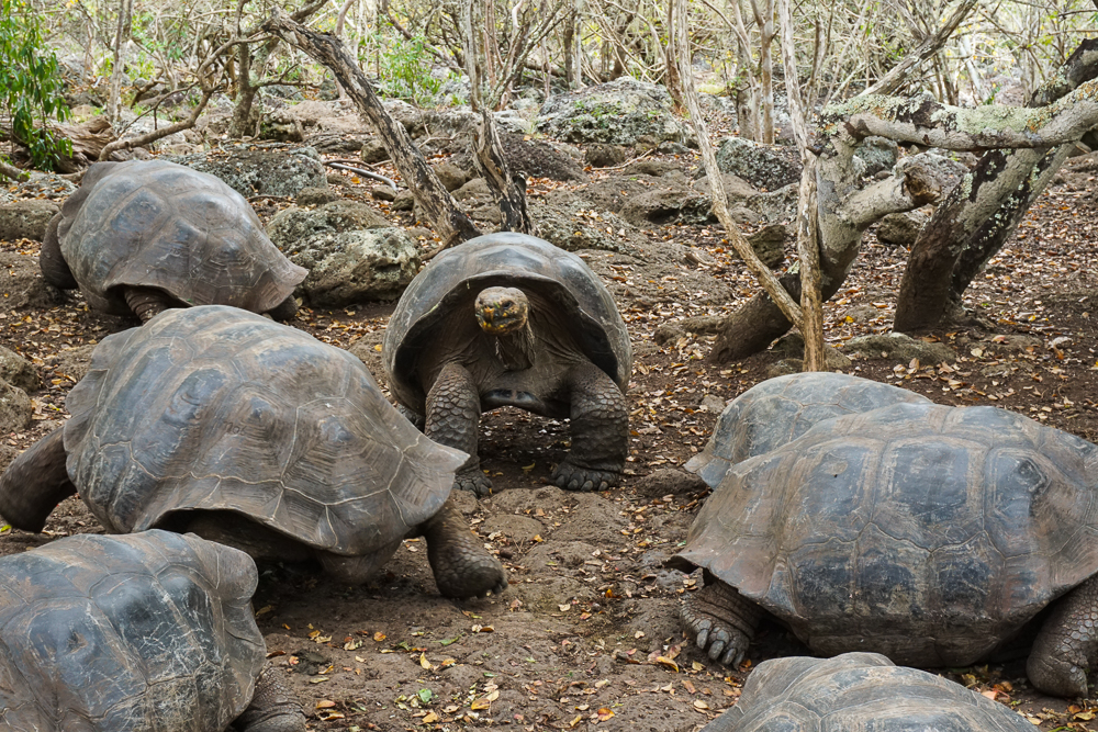
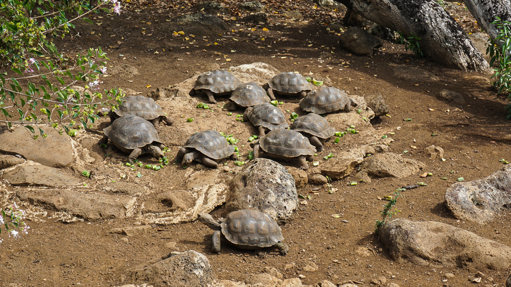
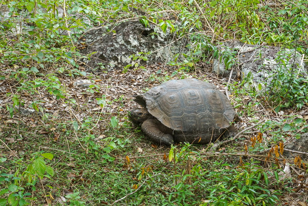
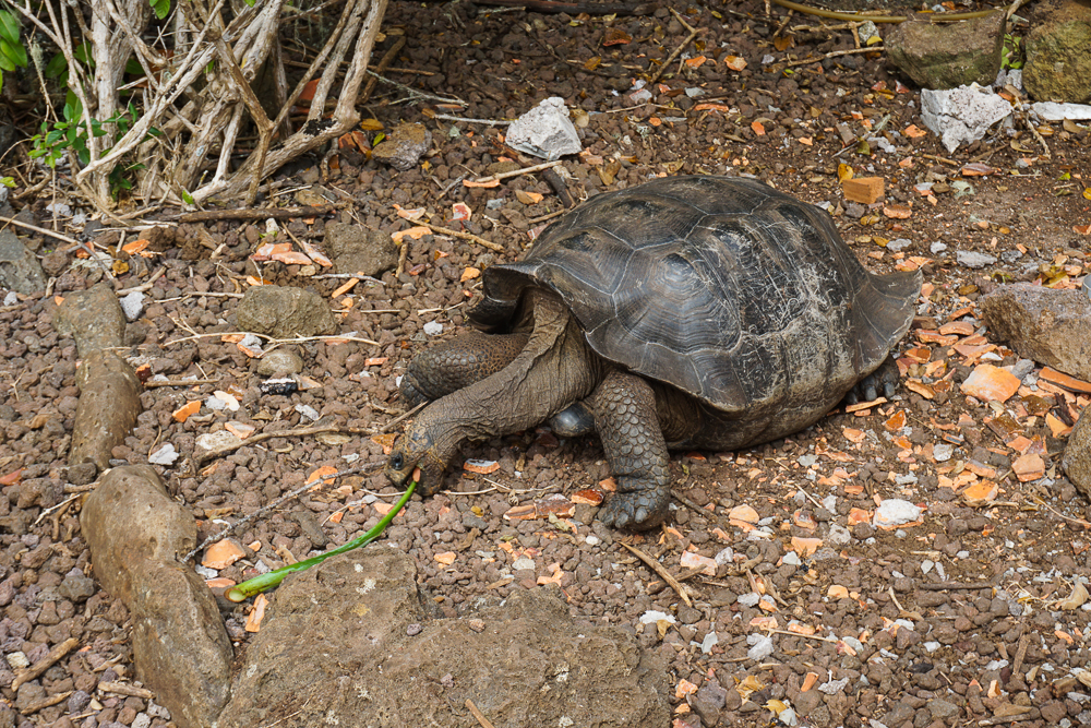
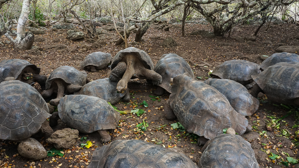
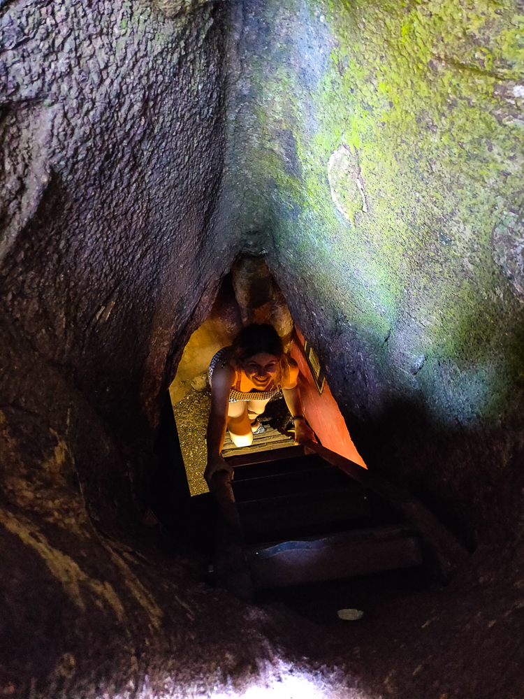
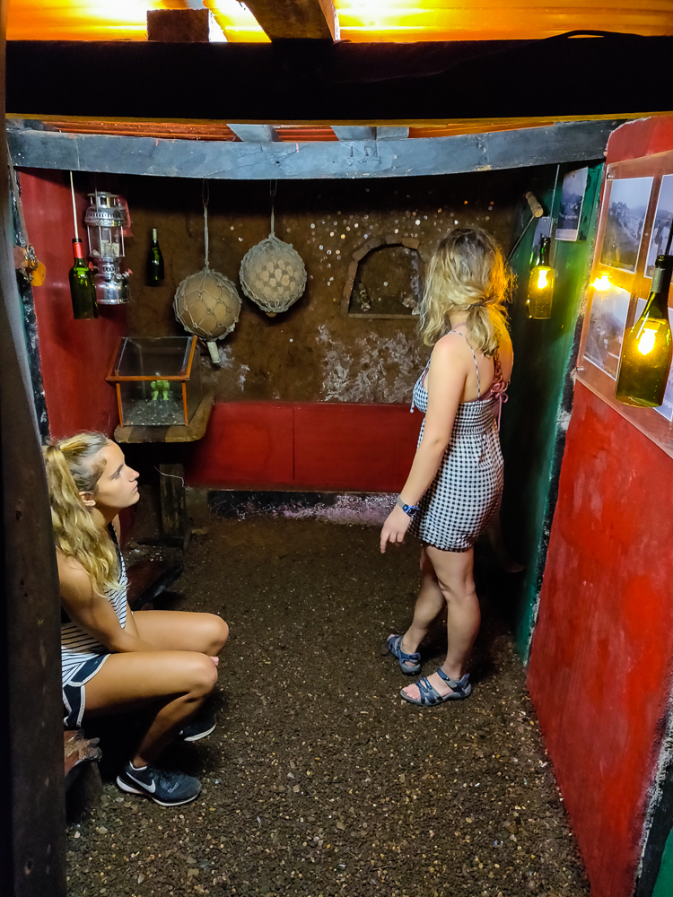
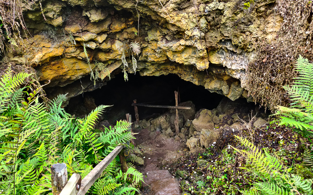
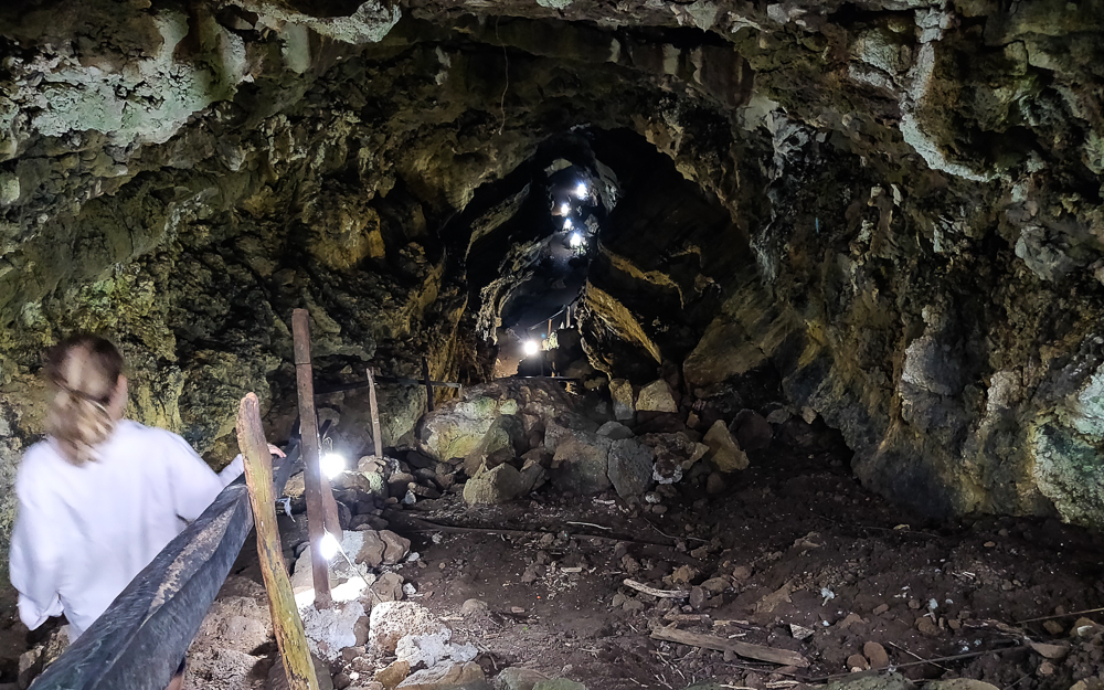
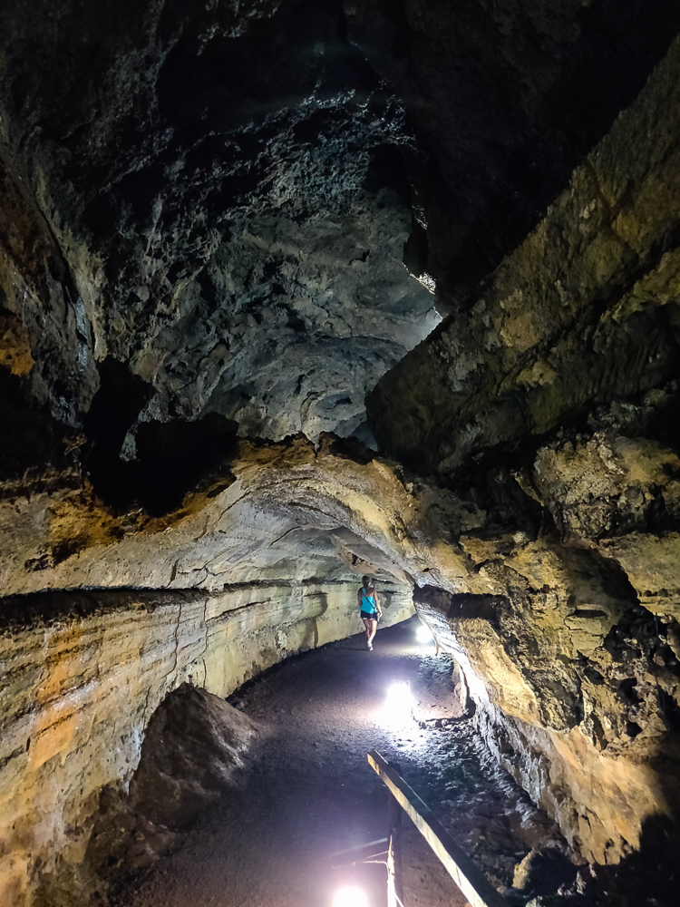
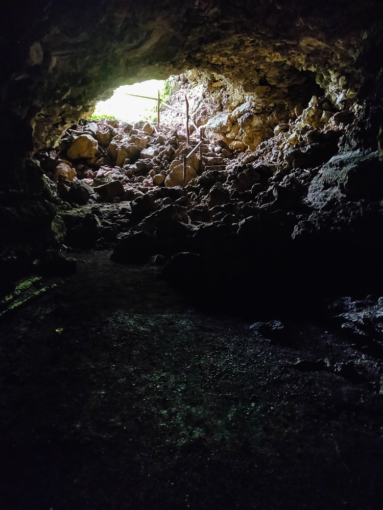
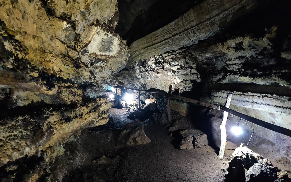
After our hike around the craters, we loaded back into the taxi and headed to El Chato, one of the private tortoise reserves on Santa Cruz. It used to be a ranch, but for the last 20 years or so, they’ve been working to restore native vegetation and create a natural habitat for the tortoises (more about that in the next post!). Tortoises aside, they also have some lava tubes that you can walk through! It’s kind of creepy to think that you’re walking through a giant pipe where hot-enough-to-vaporize-you lava used to flow! But also… how cool!?

Lava tube entrance
Walking down…
This is weird. There’s a lower tunnel area where you can see my cousin walking ahead, and then there’s a layer of cooled lava and ANOTHER cavity above that. Very confusing looking.
The light at the end of the lava tube
I loved looking at the shapes of the walls!

Next time, we’ll talk about the tortoises at El Chato and some final Santa Cruz adventures!

Related Posts

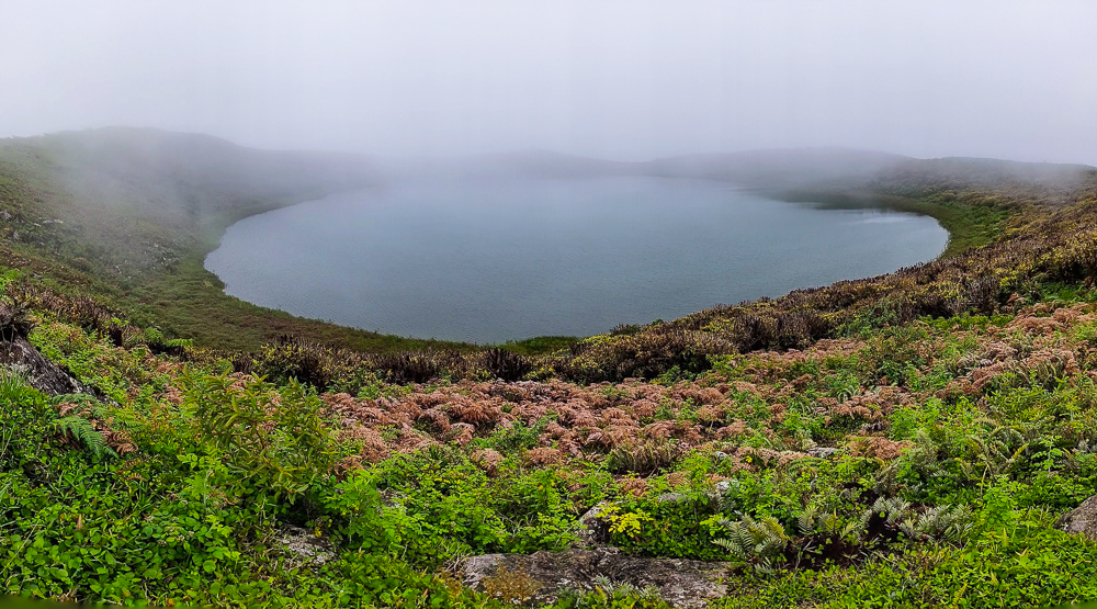
San Cristobal Highlands – compare the Scalesia forest and lava craters of Santa Cruz to the highlands and crater lake of San Cristobal!

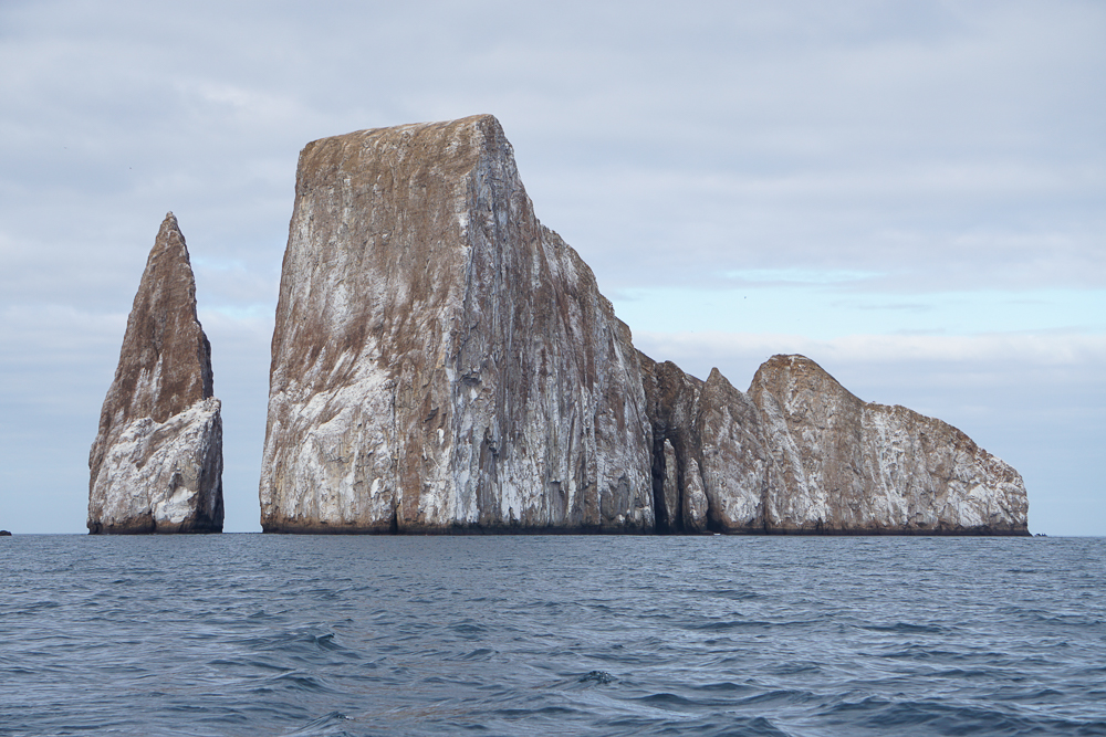
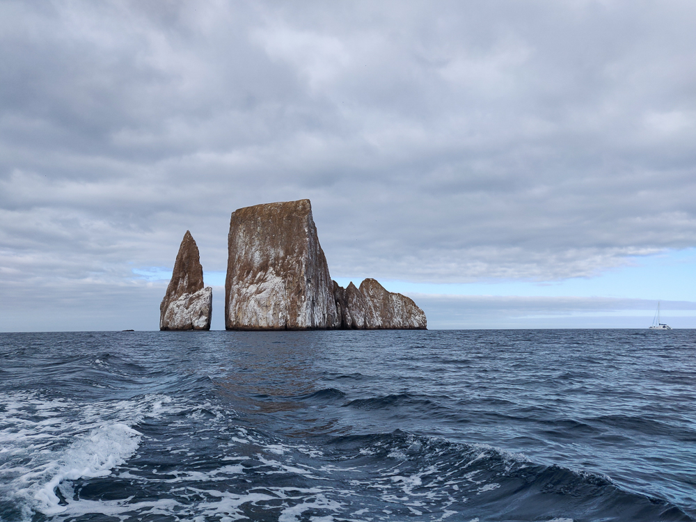
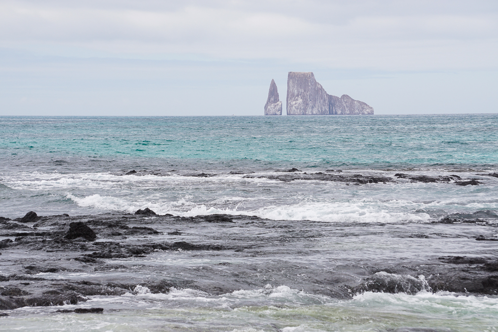
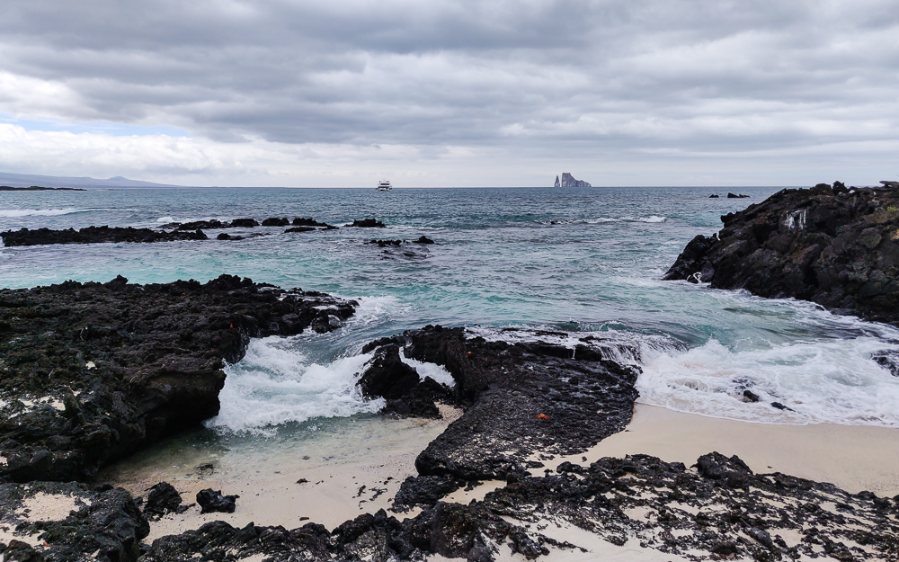
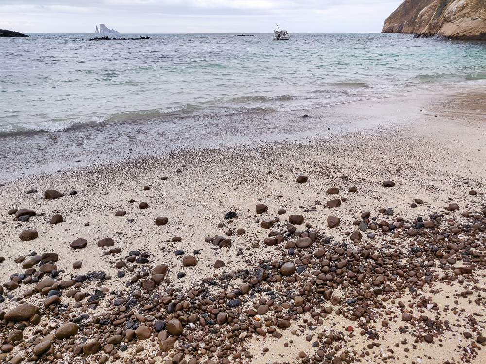
Kicker Rock – snorkel in the open ocean surrounded by some very NOT clear water (and probably over a bunch of sharks… eek!)

North Seymour Island – check out the weird bird life and barren landscape of North Seymour Island, just north of Santa Cruz

The day after we explored San Cristobal’s highlands, we made our first relocation from San Cristobal to Santa Cruz, the second largest island in the Galapagos and home to their most populous city, Puerto Ayora. After a few days in Puerto Baquerizo Moreno, San Cristobal (~7,000 inhabitants), Puerto Ayora (~12,000 inhabitants) made me feel like a small-town girl in the big city. It was a bit jarring. Also a bit jarring was the ferry ride… I spent most of it with my eyes closed, praying it would end soon and lying to myself by saying that I didn’t feel the least bit seasick. (And like I’ve said before, I do NOT get seasick easily. It was rough.)

To keep you oriented, we left from San Cristobal and headed west to Santa Cruz! As you can see, lots of open water which probably didn’t help with the ride’s seasickness factor.

The next morning, we were back at it with another tour, this time going to the uninhabited island of North Seymour, north of Santa Cruz. We had a bit of a hybrid journey this time. Puerto Ayora is on the southern coast of Santa Cruz, so we took a 45-minute bus ride from town to the island’s northern port, and from there, we took a 40ish-minute boat ride to North Seymour. Well, actually “yacht ride”. This was a fancy tour which meant hellooo, luxury! The yacht had real bathrooms, air conditioning, and an upper deck! That was the best part. Our family claimed the upper deck while everyone else sat inside in the A/C. Whew! Too much luxury like that and I’m going to be ruined for traveling on the cheap! Just kidding, but it was a fun one-time thing.

We started in Puerto Ayora, took that one road to the north end of the island, and then yachted to North Seymour (circled). Baltra (beneath that) is the location of one of the airports, and that’s where the land iguanas came from (you’ll know what I’m talking about soon).

Unlike many of the archipelago’s islands, North Seymour was NOT formed by a volcanic eruption. It’s a seismic uplift, formed when the Earth’s crust was pushed up by the lava underneath it over the course of thousands of years until it lifted above sea level, forming an island. As a result, it’s very flat (the max altitude is only about 90ft/28m) with dramatic cliffs along the shoreline, and evidence of its previous life as part of the seafloor is abundant, with shells and large rocks scattered across the island. It’s also small, only about 0.75 square miles (~2 square kilometers) in area, and there’s not much vegetation. It’s very low and bushy, but that doesn’t bother the TONS of birds that nest there during the year.

Rocky seafloor shores
Flat, flat, flat
I’ll never get tired of this water
It’s unreal! (But it’s real!)
Let’s talk about these plants. They look super dead, right? They’re not. They’re Palo Santo trees, and they lose their leaves to help them survive when there’s not enough water. So as soon as the rainy season comes, they bloom! Palo Santo is considered a cleansing/purifying plant, and its oil is used for aromatherapy and incense.

Once we reached the island, we started off with a walking tour. North Seymour is known for being a great fishing and nesting site for birds, especially frigatebirds. They’re the weirdest! The males have these red chest pouches that inflate during mating season because what could be more attractive than that? The mating ritual is the weirdest thing. We didn’t see it, but my goodness, look up a video because I can’t possibly explain it. Nonetheless, I will try. The males build nests. They sit in their nests, puff up their chest pouches, spread their wings, and then make this noise that can only be described as extraterrestrial. Their entire bodies vibrate from the effort. And the females fly around until they find a nice nest and pouch, and when they land nearby, the males wrap their wings around them to tell other males to scram. The exciting thing about North Seymour is that you can find frigatebirds nesting year-round whereas, in other places, it’s a rare treat to get to see a puffed frigatebird (unofficial terminology).

Okay, opinions, everyone. Does this look comfortable?
Fun fact, it takes about 20 minutes for a chest pouch to inflate
It’s weird, though, right?
Someone asked the guide what would happen if the pouch was punctured. All he said was, “It would be very bad.”
I’m sure that pouch is great for cutting down on wind-resistance… not.
And if you’re wondering what it looks like uninflated… I think seeing it like this makes the size of the inflated pouch even more amazing.

There are actually two varieties of frigatebird found on North Seymour, the magnificent frigatebird (which is endemic to the Galapagos) and the great frigatebird (also found elsewhere). They look very similar, especially the males. The magnificents are slightly larger with a purplish sheen to their black feathers, and the greats have a slightly wider wingspan and a greenish sheen. They also make different noises, and the great frigatebirds go farther from land to get their food, which is good because then they don’t compete with one another for resources. The guide pointed out both varieties and I think I have pictures of each, but don’t quote me…

I’m no expert, but this sure looks like a great frigatebird to me (greenish feather tint).
And this one looks like a magnificent (purplish feather tint).

The females are easier to tell apart. The magnificents have a blue eye ring and a black throat, while the greats have a red eye ring and a white throat. I don’t think we saw any great females, or at least I haven’t found any in my photos.

Note the blue eye
Female frigatebird in flight (I think? I’m really not great at this whole birding thing). They’re majestic.
VERY blue eye rings
Of course, the females don’t have quite the same pizzazz as the males.

And we saw some chicks and immature frigatebirds which I attempt to identify below…

An immature frigatebird. And I don’t know this for sure, but I think it’s a great frigatebird because of its rust-colored head. But I could definitely be wrong on that.
I really feel like this one is looking at me.
Airing out.
Frigatebird poof baby.
Immature frigatebird

Anyway, the chest sack isn’t the only odd thing about frigatebirds. They don’t have waterproof feathers, so unlike many of the other Galapagos birds, they can’t go diving for their food. Instead, they eat things off the surface, like crabs, squid, flying fish, small turtles, etc. and sometimes they steal food from other birds, earning them the nickname “pirate birds”. At first, I thought this meant that if another bird was carrying a fish or something, they’d make them drop it. NOPE. Well, that is part of it. They dive-bomb other birds and make them drop their prey… but more disturbingly, they sometimes make the other bird regurgitate its food, aka they eat bird vomit. How do they do this? Either by chasing them around until they’re so stressed out that they throw up, or by grabbing them by the tail feathers and shaking them around until achieving the same result. And then they swoop down and grab their “food” (ew) before it hits the water. Nature is gross.

I know it’s hard to tell, but these frigatebirds are sitting on nests. They often re-use nests from year to year and sometimes steal nest materials (not shocking considering they don’t seem to understand ownership boundaries like “after I’ve swallowed a fish, it’s mine”).

Other interesting/less gross facts… they have a really high wingspan to body weight ratio which makes them great at gliding and maneuvering. Their wingspans are up to 8ft (2.4m)… which is crazy. Their bodies are about 3.5ft long (1m), so it’s not like they’re small birds in any way, but still. They can spend more than a week floating on wind currents! They also care for their babies longer than any other bird. A baby starts to fly at around 4-6 months, but the mother continues to supplement its diet for another 6 months to a year+, depending on oceanic conditions (in years when it’s harder to find food, the length of care is usually longer).

The male frigatebirds help after the baby hatches, though they may not stick around for quite as long as the mom. This guy is currently watching over his little puff ball.
That is quite the wingspan.
The male frigatebird definitely understands what it means to suffer for the sake of beauty.

Blue-footed boobies are also a big attraction of North Seymour, and people come to watch their weird mating ritual which, most famously, includes some dancing. They lift their feet one at a time like they’re casually trying to show off their vibrance, bow their heads, maybe give a gift, and finish off with a finale of wing-spreading and head-lifting. If a female is into it, she goes over and joins the dance. Unlike frigatebirds, blue-footed boobies are great hunters which, unfortunately for them, makes them a frequent target for the pirate birds.

I’m no expert, but I don’t think this blue-footed booby was very happy to have us around. But look! Eggs!
This blue-footed booby is still immature, which you can see because he’s still mostly brown. The adults have a lighter head (see next picture). He’s also clearly not ready for mating because his feet are so dull. They get much brighter when it’s time to find a mate.
Booby and alien-bird booby baby. You can see that this adult’s head is much lighter than the dark brown immature booby from the previous picture. And look at those feet!
Blue-footed booby.
Lava lizard!

Even as an uninhabited island, North Seymour has had its share of issues with non-native species messing with the island’s ecosystem, primarily rats. There was a big effort to eradicate the rat population in the 2000s, and by 2007, the island was rat-free. About 10 years later, though, in 2018, more rats were discovered. You may be wondering how they got there… Did you know that rats can swim? Some can swim for over a MILE (1.6km). Baltra Island, home to one of the islands’ airports, is within swimming distance, and it’s thought that they came from there.

The rats are a big problem. They eat iguana and bird eggs (and many of the birds on North Seymour literally just nest on the ground), gnaw on the plants and eat their seeds, eat pollinating insects, and reproduce quickly… basically, they wreak complete havoc on the ecosystem. Usually, poison would be spread over the island using helicopters, but that’s crazy expensive and imprecise for such a small land area. So, in early 2019, they tried something new and used drones to drop the poison! This was great because they’re much more precise which means that they could minimize water contamination, and it’s much cheaper than renting a helicopter! The island was closed for a few months, and they think that the rats have been completely eliminated which is pretty cool. They’ll keep monitoring the island for the next two years to see how the ecosystem is recovering and to make sure that no rats return.

Imagine swimming in that beautiful water, looking over, and seeing a RAT swimming next to you. Ew ew ew!

I think it’s really interesting to hear about how they’re trying to repair these island ecosystems because it’s such a unique situation. Since they’re islands, you can actually contain the problem and control more of the variables, unlike if you’re working with a larger landmass. Another sort of “test case” that happened on North Seymour involves land iguanas. There are a LOT of land iguanas on the island, but interestingly, they actually aren’t native. These iguanas originated on Baltra Island, but Baltra had a goat problem that was damaging the land iguana habitat and population, so in the 1930s, a few were brought over to North Seymour to give them a better chance of survival. By the 1950s, land iguanas were extinct from Baltra… but since they were thriving on North Seymour, some of them were taken to be reintroduced! The North Seymour land iguanas have also been taken to Santiago, another island where the native population became extinct, and have repopulated there as well.

Land iguana on the moon. Seriously though, what a trippy landscape!
Land iguana enjoying some cactus shade

Land iguanas are larger than the marine iguanas that we’ve seen before, and unlike marine iguanas, which you’ll see in large groups on the coast, it’s rare to see more than one at a time. They are vegetarians and mostly eat cactus pads which seems like a painful diet, but they have really thick skin in their mouths, so they can eat them spines and all!

I have a lot of pictures of this guy and had trouble choosing just one… so I didn’t.
He must have been doing a lot of push-ups because he has some chest definition (kidding, I don’t know if land iguanas do that… but some lava lizards actually do defend their territory via push-up competitions, so it’s not completely out of the realm of possibility).
Feeling chatty!
Marine iguana. You can see that the coloring is COMPLETELY different from the land iguana.

Before heading back to the boat, we walked along the beach, looked at some sea turtle nests, and visited a lake where the guide said you can sometimes see flamingos! We lucked out, and even though it was suuuper far away, it was still awesome to see.

Beach views
Sea turtle nest. The mom sea turtle comes out of the water at night, digs a body pit and then an egg chamber, plops out the eggs, covers the egg chamber and does some camouflage with dry sand to try to hide the nest from predators, and then she gets back into the ocean and says, “Later, eggs! Good luck!” And they definitely need luck to make it to adulthood. First they need to even hatch, then they need to make it to the ocean without being eaten, and then they need to grow big enough to not be an easy target for every bird and other predator they might encounter.
OH HEY, FLAMINGO!
So cool
Love. This.
Blue heron looking a bit sinister
So pretty!

We had a little time for swimming and snorkeling before the end of the tour, too. I didn’t take my camera with me, and even though there were some cool fish, I didn’t regret it because the water wasn’t very clear. You’ll just have to imagine.

After that, we headed back to Santa Cruz, and everyone was exhausted by the time we got back to the hotel. We did go on one more adventure that night… my aunt read that you can sometimes see sharks from the end of the pier because the lights illuminate the water, so we figured we might as well check it out (especially since I thought it might be good to see a shark from outside of the water to help me get over my paralyzing fear of them). We weren’t expecting much, but we actually did end up seeing a few!! They were maybe like 3 feet (1m) long, and it was hard to see because it was dark, but still, how cool! Enjoy my super clear photo… I promise it’s a shark.

Shark!!!

Related Posts

Española Island – check out more Galapagos birds, including the waved albatross and Nazca booby!

Welcome to the Galapagos – learn about the formation of the Galapagos Islands and a bit about their early human history.

Following our two days of full-day tours, we “took it easy” with a “free” day that ended up being one of the most exhausting of all. We didn’t have an official tour scheduled, but that doesn’t mean we didn’t have any plans. We hired a taxi driver to drive us around the island, doing the classic “highlands tour” circuit that goes from end-to-end on the island’s one major road.

We started in Puerto Baquerizo Moreno, then visited the Galapaguera de Cerro Colorado (tortoise reserve and breeding center), Puerto Chino (one of the many “world’s most beautiful” beaches), Laguna El Junco (lake), and finally stopped at the island’s oldest ceiba tree/treehouse before heading back to town where we had some other adventures on foot. Like I said, it was quite the day.

To give you some context…
We started at the blue house at the western end of the island, then we went to the Galapaguera (green), Puerto Chino (red), Laguna El Junco (blue), and the ceiba tree (yellow). After getting back to town, we walked up to the Interpretation Center and Cerro Tijeretas (purple).

Let’s not get ahead of ourselves, though! Our first stop was the Galapaguera, a tortoise reserve that was opened in 2003 to help rebuild the island’s tortoise population. There were originally 15 subspecies of Galapagos tortoise. Four of those are extinct, and all of them are endangered, mostly due to human activities. During the pirating/whaling days, it’s estimated that 100,000-200,000 tortoises were taken and killed for their meat and oil. In addition, non-native species were introduced that hindered repopulation. Rats, pigs, snakes, and army ants eat eggs and threaten hatchlings (as do some of the native birds). Goats and other large mammals compete with them for food.

Tiniest lil baby tortoises!! These could easily fit in your hand, maybe like 5″ (13cm) max in length.
Slightly bigger little babies
And these are big enough that you could ride around on their backs.

One of the things that saved many of these tortoise subspecies is their longevity. They live an average of 100 years with the oldest recorded living to 152! This meant that even with the many repopulation challenges, only a few tortoises needed to survive to make conservation efforts possible. Many of the islands now have tortoise reserves and breeding centers which aim to grow the tortoise populations by giving them safe places to mate and grow and eventually releasing many of them into the wild.

In the breeding centers, park rangers collect the tortoise eggs and simulate normal conditions while also protecting them from predators. They incubate the eggs, and after the tortoises hatch, they are kept in growing pens for their first few years of life to further protect them while their shells are still soft. After this vulnerable period, there are virtually no predator risks for the tortoises, and survival is just a matter of finding enough food. The amazing thing, though, is that they can survive for up to a year without eating or drinking! They have a slow metabolism, and they spend more time resting when there isn’t enough food. They also can store water internally for long periods, so they’ll drink a lot when they have access to fresh water and save it for later. (This is actually part of the reason why they were so desirable on ships because they could survive in the ship’s hold without needing food or water, allowing the sailors to have fresh meat at sea with little effort.)

This is where the smallest tortoises are kept until their shells get hard enough. I think they said the first 4 years? Or at least the first two. The fencing on top is to keep out predators, and at night, another cover with even smaller holes is closed as well to protect them even further. (pic by my uncle)
These tortoises were around 5 years old, I think. They’re maybe 1.5′ long (0.5m). Maybe.
This guy was a little freaked out by us. When they get scared, they pull their heads into their shells and use their arms to shield the opening.

We were lucky to arrive at the reserve just in time for feeding! The tortoises are fed twice each week, and the rest of the time, they fend for themselves by eating plants around the sanctuary. Usually, the tortoises are wandering around and you may or may not see many of them, but since it was feeding time, we saw them all! It was really interesting to watch them interact with one another.

This video shows a tortoise “fight”. The dominant tortoise is generally the one that can stretch out its head to be tallest, and you can see that happen in this interaction. Tortoises generally don’t make noise, so it’s just a silent challenge, silent fight, and silent retreat (well, aside from my uncle’s narration hehehe).

Enthusiastically eating that stalk
‘Get out of my way!” Mr. Tortoise says as he steps over his fellow tortoises.

While we’re at it, here’s one more video showing a tiny tortoise stuck on its back. Some of his friends tried to give him a hand, but ultimately, one of the employees came and flipped him back over.

After we were satisfied, we loaded back into the taxi and headed for Puerto Chino. It’s another SUPER BEAUTIFUL beach, supposedly one of the most beautiful in the islands, but I don’t know. They’re all kind of the same and all very pretty. We weren’t planning to go swimming, so I spent my time practicing taking pictures of sea lions, lava lizards, and this pretty yellow bird that kept flitting around.

Path to Puerto Chino. It’s very nice and paved, but hopefully you don’t need any shade along the way…
Cool as a cactus.
You’re supposed to keep 6 feet between you and any animals… but the sea lions do NOT make it easy.
We considered eating lunch at this picnic table, and then a sea lion came and plopped himself right on top.
Puerto Chino. What do you think about the beauty of this beach vs. the others we’ve seen so far?
I’m obsessed with the lava lizard facial expressions
This one is adorable
An American yellow warbler
He’s super cute too
And we’re definitely friends
Sea lion striking a pose at Puerto Chino

From there, we headed to Laguna El Junco, a volcanic crater lake that’s one of the only permanent freshwater supplies in the islands. Now, this goes back to what I mentioned in a previous post about the crazy diversity of landscapes on a single island. The lake is at 700m above sea level, putting it in the “highlands” category which means it’s green and damp and can be foggy while the coasts are simultaneously clear and dry. So even though the weather was beautiful in town, it was VERY foggy at the lake. Even so, we hiked up to see what we could make out through the fog.

At first, nothing. We couldn’t even see across to the other side! But the wind kept the fog moving, and we were lucky to get a few moments of decent visibility. The lake is about 300m wide, and it’s filled by rainwater. Birds like to swoop around and use the water to clean the salt out of their feathers. It felt like we’d stepped into another world! I was happy enough with being able to see the opposite side of the lake, but on a clear day, they say you can see nearly the entire island as you walk around the rim of the crater!

Path leading up to the edge of the crater
Looking back towards the parking lot. Look at the solid layer of fog at the top of the picture!
Plants around the edge of the crater lake
Little flowers by the lake
Frigatebirds!
Soaring around the lake
So cool!
Panoramic picture of the lake during the few seconds that the view was kind of clear
Cousins! (pic by my uncle)

We made one last stop on the way back to town, in the tiny settlement of El Progreso. This is the oldest surviving settlement in the Galapagos, and if you recall from the history post, it has a horrible past. It was a penal colony, and eventually, this guy named Manuel Cobos turned it into a sugar mill. He started treating the workers like slaves, and they ultimately killed him for his cruelty. Now, about 500 people live in town, and it’s also the home of the islands’ oldest ceiba tree! Ceiba trees aren’t native to the islands, but it’s assumed that this one was planted by some of the earliest visitors. It’s said to be ~300 years old which is possible but maybe unlikely because the first settlement attempt wasn’t until the 1830s. But who knows? It is monstrous: 131 ft tall (40m) with a 61ft circumference (19m).

There’s a bridge leading up to the treehouse

The tree is interesting enough just in itself, but it also features a treehouse! And it’s not your average built-by-a-kid treehouse. You can actually rent it overnight, and there’s electricity and wifi (the two most important things, of course), a loft with two beds, a kitchen, and a functioning bathroom (including a shower!). Craziness. And underneath the tree, there’s an underground room where I lasted about a minute before I started thinking about the fact that we were underneath a tree, and if the room collapsed, we’d be dead. So that wasn’t exactly my favorite part, but it was still cool.

Inside the treehouse. The beds are up in the loft, and the kitchen is straight ahead.
Check out that beautiful tree!
My cousin coming up from the underground cave
Not claustrophobic at all…
This is the garden outside of the treehouse. So pretty! (The treehouse is behind me to the right. You can see some of the tree branches sticking into the picture.)

That was the end of the highlands tour, but like I said, it wasn’t the end of our day! After the taxi driver dropped us off back in town, we walked to the Interpretation Center which has a bunch of information about the islands: how they were formed, their human history, the ecosystems and flora and fauna. It’s actually where I got nearly all of the content for my Galapagos History post.

Pelican!
Fishing. Wait for it…
…nom nom nom!
Admiring the pelican (pic by my uncle)
Sea lion baby!

From there, we walked up a nearby hill, Cerro Tijeretas, where you can get nice views of the town and other parts of the island. You can even see Kicker Rock from there! It overlooks a pretty snorkeling spot, and there are a lot of frigatebirds flying around because there’s a colony that nests nearby.

View from Cerro Tijeretas
Looking back towards Puerto Baquerizo Moreno
Frigatebirds from Cerro Tijeretas

This is supposed to be a really great snorkeling spot
Do you see Kicker Rock out there in the distance??

We also popped into a couple of beaches along the way, Playa Punta Carola and Playa Mann. They were fairly crowded because they’re public beaches close to town (especially Playa Mann). I guess if you’re looking for a beach vacation, that’s where you’d go? But I don’t think I’d recommend going to the Galapagos if you’re interested in just chilling on a beach. Save that for a less interesting place.

Playa Punta Carola (pic by my uncle)
I guess this beach is kind of pretty too

I was ready to collapse at this point, but my uncle really wanted to go to ANOTHER beach, Playa Lobería, to watch the sunset. We grabbed a taxi and got there only a few minutes before the beach closed, but that was enough time to look at some adorable little sea lion babies and take a few pictures of the sunset. After THAT, I really was toast. We got some dinner before heading back to our apartment, and I feel confident in saying that everyone slept like a rock that night.

Sunset!
Look at those clouds!
I understand why this beach is named after the sea lions
The tiniest little baby sea lion!!!! The mom sea lions go out to hunt and then come back and reunite with their babies by making sounds at each other. Even though you know they haven’t been abandoned, it tugs on your heartstrings to see such tiny babies crying out for their moms!
I suppose the sunset was worth the exhaustion
On the way out of the park
I’ll leave you with this…
The sea lions literally just go wherever the heck they want. This one was camped out waiting for the tourist information center to open.

Related Posts

Kicker Rock – experience another side of San Cristobal and snorkel in the open ocean!

Lake Bosomtwe – visit a crater lake in Ghana, the country’s largest natural lake

Zakopane – while we’re talking about lakes, go for a hike in Zakopane, Poland to one of the prettiest lakes I’ve ever seen!

In my mind, there are two types of vacations: the “lounging and relaxing” type (not worth going too far from home because you can lounge equally well anywhere), and the “I need a vacation to recover from my vacation” type (anytime you go somewhere new and interesting). A Galapagos vacation clearly fits into the latter category, and my goodness. By day two, I already felt ready for my recovery vacation!

We had another full-day tour, this time sticking a bit closer to “home” and exploring other parts of San Cristobal rather than visiting another island. We were staying in Puerto Baquerizo Moreno, the largest town on San Cristobal and the capital of the Galapagos. It’s at the western end of the island, and for this tour, we sailed up to explore the northern coast. This boat ride was MUCH smoother than the previous day’s since we stayed near the island rather than crossing open ocean, and I don’t think anyone was upset about that.

For context, this is San Cristobal
We started at Puerto Baquerizo Moreno, went up to some spots along the coast south of the circle, and then went to Kicker Rock (in the red circle).
Our first glimpse of Kicker Rock as we headed past on the way to our first stop (warning: this is the first of MANY pictures of this rock)
You didn’t have to wait long for another picture of it… Spot Kicker Rock!
Those are some nice volcano rocks.
We also had a surprise on the way… DOLPHINS!!!! Excuse these terrible pictures but I was caught unprepared and tried my best
Not great, I know.
But DOLPHINS!

After about an hour, we made our first stop. The boat dropped anchor off the coast of the island, and we took a dinghy to the shore because the water was too shallow. There, we did our first “wet landing” which means that we had to get our feet wet, hopping out of the dinghy into the waves and walking up through knee-deep water onto the beach.

On the dinghy headed for shore. Are these not the most insane blues??
Site of our wet landing
I liked the color layers in this lava

One of the many cool things about the islands of the Galapagos is that even though they aren’t very big, they have some incredibly diverse landscapes. San Cristobal is less than 200mi2 (500km2), and sometimes it’s a beach, sometimes it’s like a rainforest, and sometimes it’s like the moon (official terminology). This was a moon stop. That is, if the moon was made of lava that flowed and then cooled and still looks like it could have been flowing five seconds ago. Seriously, it’s crazy! It’s not hard to look at the wavy lava formations and imagine it as molten lava because it looks like it was frozen in action. There are also these fantastic cracks in the ground which are almost exactly like how it looks in a cartoon when there’s an earthquake and you think “that’s so unrealistic”.

What the heck is happening with that lava?? It’s so cool. And so weird.
Panorama of the moon
Cartoon cracks
Don’t fall in!

I think the lava shapes are super awesome, and I was also in awe of the colors! There’s iron in the lava, and it oxidizes (like rust) and makes it turn shades of red/orange! Generally, the landscape is pretty barren, and I found it kind of eerie. It’s like looking back in time to a prehistoric age. Or like the moon (basically the same thing). And it was creepy quiet when no one was talking, aside from the sound of the wind and loose lava pieces clinking across the ground anytime someone accidentally kicked one. It sounds almost like if you tapped two pieces of porcelain together. Besides the lava, we saw a few birds and some cacti, but it wasn’t exactly a hot spot for wildlife.

Cacti with some SERIOUS spines
San Cristobal mockingbirds
They’re endemic to (only found on) San Cristobal Island!
Funky lava sculpture
Such cool textures!
These clouds are also fabulous
Lava lizard. He’s maybe about the length of a hand (well, my hand), and different varieties of these little dudes can be found running around most of the islands.
We cruised past these blue-footed boobies on our way to shore! Check out how crazy bright its feet are. They get brighter during mating season.
Cactus with weird red cactus fruits?
I believe that’s a frigatebird
Try to tell me that doesn’t look like the moon

For our next stop, the boat headed west (back in the direction we came) for a few minutes, and then we did the whole dinghy/wet landing deal at a beach, Cerro Brujo or “Witch’s Hill”, named for a craggy ash mountain at the end of the beach that I guess someone thought looked witchy? The guide said it’s one of the best/most beautiful beaches in the world… and then we also heard that said about at least five other beaches in the Galapagos alone. I’m no beach expert, but it seems like a tough call when every beach has the same deep blue waters and powdery white sand. But hey, I’m not complaining!

Wet landing at Cerro Brujo (pic by my uncle)
What do you think? Most beautiful beach in the world? I don’t know…
This feels like a painting

Beach views. And Kicker-Rock-from-a-distance views.

I spent our free time at the beach walking along the shore and admiring the birds. There wasn’t anything new, but we saw more oystercatchers which was exciting (I felt like such a birder because I knew exactly what they were), plus the usual iguanas and sea lions.

American oystercatcher!
Oystercatcher friends
Snoozing

Marine iguana, wiggling its way along the beach

It’s very entertaining to watch the marine iguanas walking. Plus, when they’re feeling defensive, they do this weird head-shake thing.

Sea lions aren’t the most land-graceful creatures
I guess it’s kind of pretty…
Scoping out my next shot (pic by my uncle)
Iguana!
Another lava lizard

Our final activity of the day was snorkeling at Kicker Rock, aka León Dormido, a formation about three miles (5km) off the coast of San Cristobal. Here’s the extent of my understanding about its formation: hot magma escaped from the sea floor, and when it collided with the cold ocean water, it caused an explosion. This formed a volcanic “tuff cone” (a cone of compacted volcanic ash) that was then eroded for thousands and thousands of years by the sea. Today, there’s a two-peak formation, about 500ft (~150m) tall from the ocean floor with a channel between the two visible rocks that’s about 60ft (19m) deep.

Kicker Rock. You can see the channel super clearly from this angle.
It doesn’t look nearly as intimidating in the sun!

The names are things that people think the rocks look like. Kicker Rock is because someone thought it looks like a boot, and León Dormido, or “Sleeping Lion”, is because someone thought it looks like a sleeping sea lion. I think these “someones” were a little kooky. (Also, there was a beach near where I lived in Peru called León Dormido, and that mountain/rock also looked nothing like a sleeping sea lion. My conclusion is that this is just a default Spanish name for rocks near the sea.)

León Dormido
and León Dormido? I guess I can kind of see it, but no.

Kicker Rock is known for hosting a great diversity of sea life: tropical fish, rays, sea turtles, sometimes sea lions and marine iguanas, and a few varieties of sharks including hammerheads. So, why is this location such a hotspot? It’s a combination of things… the strong currents + the ocean depth + a big, solid structure in the middle of the ocean = a disruption in normal water movement and the stirring up of nutrients that are usually found in the deep sea. The deep-sea nutrients end up closer to the surface and attract sea life.

This provides an especially cool opportunity for snorkelers because it puts some deep-sea diversity within reach and makes it feasible to snorkel somewhat in the open ocean. I was mostly excited about this… but I was also mildly terrified. Okay, confession time. I have an irrational fear of sharks. I mean, it’s semi-rational because yes, sharks can be dangerous, but it’s irrational because I don’t like going in the ocean AT ALL unless the water is clear. And that’s so that I can get myself out of the water ASAP if there’s a shark in sight (yes, in my mind, I can outswim a shark). The concept of WANTING to see a shark while being IN the water is not one that my fear can comprehend. The tour guide said that there are always sharks there, but whether you see them or not depends on the water clarity. I assume other people were excited by the high probability of a shark sighting. I was just anxious, and almost paralyzingly so. But I didn’t want to miss out on something because I was scared, so I told myself that I had to get over it. Did I? Well… get over it? No. Persevere through it? Yes.

Unfortunately for us, the currents were kind of strong, and the water wasn’t especially clear. The boat dropped us near Kicker Rock, and we swam our way around the formation. Visibility was decent for maybe 10 feet, and most of my energy was spent trying to move forward, not get pushed into the rocks, and not get pulled too far away from them. I’m a good swimmer, but it was a lot, especially if you’re also trying to look at things as you go!

Sea turtle!

I didn’t handle the currents nearly as gracefully as this sea turtle…

Since the visibility wasn’t great, I mostly spent my time looking at the little fish and plants and stuff (clearly I’m no marine biologist) that were on the rock. The colors were amazing, and I imagined I was swimming past little fish neighborhoods. I also saw a couple of sea turtles and a faint shadow beneath me that looked like a ray. The worst thing was that there were TONS of tiny jellyfish. I’m 99% sure that the guide told us they didn’t sting, but that was NOT true. It wasn’t super painful, but I kept feeling sharp pinpricks on my face and arms. Wonderful. It also was a little disconcerting to not be able to see the bottom of the ocean (personally not a fan), and it absolutely didn’t help with my shark fear. Focusing on the rock helped me to keep my bearings and feel slightly less adrift.

Jellyfish! These were not very big… maybe about 3″ long (8cm)
Turtles are friends.
Oh to have an underwater camera! (I had my phone in a waterproof case. And I was also nervous that I was going to drop it to the bottom of the deep blue sea, never to be seen again. Even though it was attached to me by a lanyard. And my hand’s death grip.)

Here’s some footage of the fish neighborhoods!

These look like they’re just bubbles, but I’m almost positive that they were little fish. I called them bubble fish. (I’m a GREAT namer, in case you couldn’t tell.)
Not super clear, but these were my favorite little fish. Not the one that’s most obvious in this picture, but if you go up a little, you’ll see a smaller fish with similar-ish coloring (blue head to yellow, orange, and a pink tail).

When we were nearly all the way around the formation, the guide delivered the “good news” that the currents weren’t too strong to keep us from swimming through the channel. Oh, goody. Did I mention? The channel is where the sharks like to hang out. Thought stream: “EEEE! Deep breath. Stay with the group. No sharks want to eat you. Go for the eyes and gills. You can swim faster than most of these people. You’re okay. Don’t think don’t think don’t think.” I did it. It was not great. I couldn’t see anything which made it infinitely worse because there were almost definitely sharks, they almost definitely knew where I was, and I had no clue where they were. Nope nope nope. Not my favorite experience. The good news is that I didn’t get attacked by a shark, so at least my irrational fear took a slight hit (it likes to tell me that if there is a shark in the area, it WILL attack me. Now we’re down to “it MIGHT attack me”).

Anyway, after we swam through the channel, the boat picked us up on the other side. My nerves were about spent by that point, and I couldn’t get out of the water fast enough. Plus, I was tired of getting zapped by jellyfish. And just tired. Everyone seemed to be on the same page because we rode back to town in near silence, and after we got back, I sat around like a potato until deciding on an early bedtime.

With our guide after getting back (pic by my uncle)

Related Posts

Welcome to the Galapagos – learn more about the islands’ formation

Española Island – explore another Galapagos-ian island with a completely different landscape

Diamond Beach, Iceland – compare the white sands of Playa Cerro Brujo to the black sand beaches of Iceland!

Ada Foah, Ghana – lounge around in the Ghanaian beach paradise of Ada Foah

Batumi, Georgia – I can’t talk about beaches without mentioning my favorite pebble beaches of Batumi!

Our first tour day in the Galapagos started nice and early. We were making a day trip from San Cristóbal, where we were staying, to Española, one of the many uninhabited islands. Before we left, we had to get our bags and shoes checked to make sure that we weren’t taking anything that could negatively impact the island. Remember how I talked about the introduction of non-native species having a devastating impact on the islands during the colonial years? One part of conservation is making sure that islands are only inhabited by plants and animals that are introduced naturally. Animals are harder to bring along by accident (at least as an individual… but boats can bring rats, and they are terrible), but seeds can tag along without you even realizing it. They’re very strict about checking your shoes before you leave an island which seems crazy, but if you stepped in animal poop or mud, for example, there could be seeds traveling on your shoes to the next island. Admittedly, the system is far from perfect, and I’m sure that there are issues that come up, but it’s a start.

To give you a point of reference… We started at San Cristobal and went via boat to Española which is the southernmost island.

The boat ride to Española is two hours each way. People always warn about getting seasick in the Galapagos because the boats are generally small and the ocean can be choppy, so even though I almost never get seasick, I took some pills just in case. My gosh. It’s a good thing I did. Even with them, I felt like I needed to keep my eyes closed most of the time, and at one point, my face started heating up so I relocated to the back of the boat to feel the breeze. After that, I felt completely fine. It was just in the front with the stuffy air that I felt like I might explode.

Besides the “trying not to die” part of the ride, we also had an awesome start to the trip when we were joined by a group of dolphins! I’d say that there had to be at least a hundred, but who knows. They were swimming alongside the boat and throwing themselves out of the water. Sometimes they’d twist around midair, and the guide said they were playing with us. They definitely looked like they were having fun! They were just so free, so unbridled and joyful. It was one of the coolest things I’ve ever seen. When it was over, we all looked at each other and were like, “Well, if we don’t see anything else on this whole trip, it was still worth it.” I didn’t take a good video because I was too busy living it, so you’ll just have to imagine.

Pelican! This was on the dock in San Cristobal

When we finally reached the island, we had a “dry landing” which meant we didn’t have to get our feet wet. The boat anchored nearby, and we used a dinghy to ride the rest of the way through the shallow water. We were welcomed to the island by the famous Christmas iguanas! They’re a subspecies of marine iguana found only on Española, and as you can probably guess, they’re bright red and green with the most vivid colors showing up during the mating season.

So pretty!
These guys also had a lot to say, and it was WEIRD. I tried to take a video, but I guess they were camera-shy because they didn’t cooperate.

Look at their claw hands
This guy has quite the gut

We took a walk around the island, starting at a beach on a little bay. There were more marine iguanas (Christmas and otherwise), Sally Lightfoot crabs, and a lot of sea lions. The guide explained that the bay is a good place for baby sea lions because it’s sheltered from the sea, and the moms and babies hang out here while the babies learn to swim in the shallow water. There’s a bull sea lion who is the alpha of a group of females and babies, and it’s his job to protect them. He patrols the perimeter and keeps sharks and predators away.

Here’s the weird thing… the alpha bull usually changes every couple of weeks. When a bull is alpha, he doesn’t eat because he’s so busy protecting the group. He gets weaker and weaker until another bull can challenge him and win because that bull has been eating. These challenger bulls wander around in “bachelor colonies” of similarly unattached bulls. Like… what?

Baby sea lion bay
Chillin’
I love the iguana mohawks.
They definitely like to hear themselves talk.
These two cracked me up
He’s huge!
The Hood or Española mockingbird is endemic to Española Island. That means it’s not found anywhere else on earth!
We’re definitely friends
Frolicking

People sometimes compare sea lions to dogs, and nothing says “dog” more than chasing your own tail:

Terrifying sea lion teeth
Rare picture of me

LOTS of Sally Lightfoot crabs
Looking back towards the bay. Hope you aren’t looking for any shade on this island because if so, you’re outta luck!

From the beach, we moved to the island’s cliffs where there are TONS of birds. Española has a lot of Nazca boobies, white and black seabirds with yellow eyes and pinkish-orange beaks. They eat fish which they catch by diving into the ocean at high speed. On Española, they nest on the cliffs, and we got lucky enough to see some eggs and even some babies! That was exciting because it’s not something you see every day, but the babies are suuuper creepy looking when they first hatch. Eventually, they get nice and fluffy, but they start out as these weird, grey alien dinosaur-like creatures. Eek.

The guide explained that only one baby usually survives, even if there are multiple eggs. One hatches first, and that one gets priority with feeding and such because the mom bird just assumes that it has a better chance of surviving. There are also cases where the older, stronger baby kills its sibling by dragging it out of the nest. Geez! The animal world is savage.

Spot the Nazca booby!
They could use a housekeeper in this nesting ground. Poop everywhere!
These are some fairly large birds… Like large chicken-sized maybe? I wasn’t used to seeing such big birds, and sometimes it almost looked like they weren’t real… like they were robotic birds. I don’t know. I’ve decided that big birds kind of freak me out.
I don’t know anything about birds, so no clue what this guy is doing. Maybe stretching? Or getting some air?
Enjoying the breeze
Nazca booby with a couple of eggs
I don’t know how well you can see, but look underneath this bird. See the weird grey thing that looks like an alien? THAT is a baby bird in its pre-cute state. Creepy.
Here’s another glimpse of the creepy baby birds. There’s one egg and one baby underneath this booby.
A Nazca booby with its baby. This is the baby after it gets kind of cute, but when they first hatch, there’s none of that fluffiness.
Little buddy has something important to say
Nazca booby soaring. How cool!!
These are swallow-tailed gulls. It looks like their eyes are red, but actually that’s just a rim around their eyes.
An American oystercatcher
Look at its eggs!! These birds mate for life, and they take turns sitting on the eggs. We saw another oystercatcher running around nearby before seeing this one on the nest. Maybe its mate?
Marine iguana chilling. You can see that they’re not the Christmas iguanas, but they still have some pretty coloring. There are a few different subspecies of marine iguana, the most boring being the all-black ones.

The other big-deal bird at Española is the waved albatross. These birds are HUGE. In the scheme of albatrosses, they’re only medium-sized, but that still means a wingspan of up to 8 feet (2.5m)! (Other albatrosses can have a 12-foot wingspan.) They come to the island only to mate and nest. Their mating dance is apparently quite the sight… lots of bowing, waving their beaks around, and smacking them together. Waved albatrosses mate for life, and both partners are involved in raising babies. Eggs have to be incubated for two months, and parents take turns sitting on the eggs/rolling it around for reasons unknown. After they hatch, the parents hunt and come back to feed them by regurgitating an oily substance into their mouths. Yum. Five to six months later, the baby can fly, and once they’re ready to leave the island, they don’t return until they reach sexual maturity and come back to mate, up to six years later.

So, what do they do during all that time at sea? They can fly insanely long distances, and they’re really good at using the wind to minimize their effort. They sleep on the water. They can have trouble taking off, so they try to use the wind to their advantage, and on the island, they have a runway to help them build up speed. When they need to take off at sea, they run on the water!

“Baby” waved albatross from afar. I actually couldn’t even see him when I took this picture… I just pointed the camera in the direction the guide was pointing and hoped that I might be able to see something once I put the picture on my computer. Ha!
Here’s a grown-up waved albatross. As you can see, their heads eventually turn white and their beaks turn yellow. This was also super far away/I could barely see it. Definitely don’t go to the Galapagos without either a camera with a strong lens or a good pair of binoculars.
An abandoned waved albatross egg. We were there at the end of December and found a few eggs sitting unattended on the island. The guide said that they had been abandoned because they weren’t going to hatch in time to survive. They are usually adult-sized and leave the island in December/January.
The eggs are huge. Maybe between baseball and softball-sized, but egg-shaped.
“Baby” waved albatross, though, as you can see (maybe?), it’s pretty darn big which makes sense because it’s about time for it to go off on its own. I’m going to attempt to give you an idea of size… This is probably around the size of a rooster? Ish.
So pretty!
Lava lizard! These little guys are EVERYWHERE.
I’m going to attempt to identify birds and animals and such, but just keep in mind that I’m no birder and I could be wrong about some of these things. That being said… I think this is a Galapagos hawk. I mean, it’s definitely a hawk and it was in the Galapagos… but there’s an actual species called Galapagos hawks. I like this picture because it’s like he’s looking at me.
Hawk flying
Blue-footed booby. We’ll talk more about them later.
The island itself is not especially pretty. It kind of feels like a wasteland, actually, with these scorched branches and the brutal sun beating down.
There is SOME color at least, but yeah, you definitely wouldn’t go inland to enjoy the physical beauty of the island.
The cliffs are pretty, too
Interesting plants, right?
Coastline views
Blue-footed booby
Not a rock in sight that’s not covered in bird poop
I don’t know what this is.

After we walked around the island, we headed back to the boat, ate lunch, and got ready for some snorkeling time. The boat dropped us off near the island, we swam along the coast for a bit, and then it picked us back up. I have some not-great pictures from snorkeling… I don’t have an underwater camera, so I put my phone in one of those waterproof cases. Better than nothing, but not ideal (it kept my phone dry, though, so that’s a big win in itself).

Iguana
Headed back to the boat (pic by my uncle)
Blurry sea lion zooming past
Sea turtle!

Here’s a sea turtle video! (I think I took it by accident, actually. It was hard to control the camera through the waterproof case. Hehe):

So many fish
Can you see the rays hanging out underneath that rock? They must have been at least a couple of feet in diameter.
Pretty colors on this little guy!

We rode the two hours back to San Cristóbal in near silence… I think everyone was exhausted. I sure was! And my body was either too tired to get seasick or else the ride was much smoother because I felt fine. After we got back, we ate dinner, lounged around, got our gear fitted for the tour the following day. Whew! The instant it was an acceptable time to go to bed, I was out.

Related Posts

Welcome to the Galapagos – learn about how the islands were formed and transformed from barren lava islands into the wildlife refuge they are today

The morning after my short day in Guayaquil, I met my aunt, uncle, and cousins at the airport for our flight to San Cristóbal, our first stop in the Galapagos! I was really excited that it worked out for me to travel with their family because while I do love to travel alone, there are some destinations that are even better with travel companions. To me, the Galapagos is one of those (because you need someone to share your disbelief with! It’s a place like none other).

Cousins! (pic by my uncle)

Since the Galapagos Islands are protected, there are lots of hoops to jump through on your way there. We needed to provide all sorts of information about where we were staying and what we were doing, they scanned our luggage to make sure we weren’t bringing any organic materials with us (because non-native seeds and such can really mess things up), and when that whole process was finished, we were off!

Welcome!!

No trip is without its drama, and this time, there was some seat assignment debacle happening. I don’t know exactly what it was all about, but I stepped onto the plane and immediately regretted it. Chaos. People were standing in the aisle and yelling at the flight attendants who were frantically looking at papers and passing them back and forth and yelling across the plane. I managed to scoot past the mess and into my seat, but there was still no resolution in sight. The departure time came and went. Tensions were rising. Finally, a man a few rows in front of me stood up and said, “Okay, so whatever happened to mess this up, it doesn’t matter anymore. The flight is only 2 hours long. Can we all just agree to sit in whatever seats are available so that we can get out of here?” A voice of reason. The plane breathed a collective sigh of relief. The problem passengers sat down. We took off. That man was a hero.

Now that we’re airborne, let’s get some Galapagos backstory. The Galapagos Islands are a volcanically formed archipelago in the Pacific Ocean, straddling the equator about 560 miles (900km) west of Ecuador. There’s a hot spot beneath the earth’s crust, and sometimes, an eruption pierces the crust and sends out a flood of lava that accumulates and cools into an island. Since the earth’s crust is made of tectonic plates, giant areas of crust that are constantly moving, these newly formed islands slowly move away from their source hot spot which remains stationary. The Galapagos are on the Nazca Plate which is moving east towards South America at a rate of about ~1.2”/year (3cm). That may seem slow, but over 50 years, that’s nearly 5 feet (1.5m)! Over millions of years, a group of islands is formed. The oldest Galapagos Islands are on the eastern side, estimated to be 3 million years old. The newer ones to the west are young… more like 50,000 years.

The Galapagos Islands. There are some smaller islands that don’t show in this picture, but these are the major ones that people visit/know about.

The new islands, as nothing more than mountains of cooled lava, are completely devoid of life and rather inhospitable places. Slowly “pioneer species” make their way there, starting with things like cacti and lichens (fungus algae) that don’t need much to survive. Their seeds come to the islands via winds or tides, a few eventually land in places where they manage to germinate and grow, and slowly, they spread. Saltwater-resistant coastal plants, like mangroves, have a better shot than those requiring fresh water.

This is a good place to explain that one of the reasons why the Galapagos are so unique is because of their location. There are three different currents that converge on the islands: the warm Panama Current from the northeast, the cold Humboldt Current from the southeast, and the Cromwell Current, an upswell current from the west which brings cold water from the ocean depths. In essence, all ocean roads lead to the Galapagos, making them an incredible site for marine diversity, including marine mammals that also spend time on land, like penguins and sea lions.

Sally Lightfoot crab. The name origin is debated, but some say it’s named after a Caribbean dancer because of its speed and agility. For an idea of scale, this guy is maybe like 6″ wide?
Sea lions!

Okay, now we have some basic plant life and marine life… so how did the land animals arrive? Vegetation rafts (floating masses of vegetation) and other large, floating objects like tree trunks sometimes carry animals as well as plants. From the continent, in favorable conditions, it takes about two weeks to float out to the islands which means that any animal capable of surviving two weeks without freshwater and in the hot sun had a chance to make the Galapagos home. Not surprisingly, this mostly limited the land-dwellers to reptiles, mainly tortoises and land iguanas, that thrived in the absence of predators and competitors.

Land iguanas
This guy has some pretty colors!

Finally, the easiest path was taken by sea birds who simply flew to the islands. Many species nest on the various islands, probably attracted in part by the lack of major predators, making the Galapagos an especially famous destination for birders.

Great blue heron (not a great picture, but hey, baby steps)

Everything that came to the Galapagos had to either quickly adapt to the environment or perish, and the plants and animals that live there today sometimes look very different from their mainland ancestors. One famous example is the Galapagos finches. The thirteen species of finch are differentiated by their beak shapes, each best suited to accessing a particular food source. Charles Darwin visited the Galapagos, and his observations of the finches helped to form his theory of evolution.

The islands have two seasons: hot and garúa (drizzle). Hot is from December-May when the warm NE winds are strongest, and rainfall is abundant. Garúa is June-November when the SE and W winds are strongest. Temperatures are cooler with a persistent garúa.

In the lowlands of the islands, the climate is arid. Some of the larger islands have highland areas as well. Their climates transition from arid lowlands around the coast to almost rainforest-like vegetation (and weather!) in the highlands toward the center. It’s very strange. You can have a bright, sunny day on the coast, but a rainy day is just a quick drive into the highlands away.

Can you see the little crabs? They have one GIANT claw. These are actually so teeny that I couldn’t tell what they were from where I was standing. I saw hints of movement, and, curious, I took a picture with my camera zoomed in all the way and then zoomed in on the picture. Only then could I see the claws.
Get ready for post after post of me obsessing over how pretty the water is.

Okay, now I’m going to zoom through the human history of the islands because it’s far less interesting and mostly involves lots of bad decisions, people dying, and destruction and exploitation of the islands. Some evidence has been found to suggest that pre-colonial people made it to the islands, likely on large rafts that were driven by the winds and currents. The first written account of their existence is from 1535 by a Spanish missionary named Fray Tomás. A few days after his ship’s departure from Panama, the wind disappeared, and they were left to the mercy of the currents. By the time the ship reached the islands, its passengers were in desperate need of water. It took three days and two islands before they found freshwater pools which they used to refill their stores before heading back to the mainland. Fray Tomás wrote of “sea lions and turtles and tortoises so large that each could carry a man on top of itself, and many iguanas that are like serpents” and said that there were “many birds like those from Spain, but so silly that they didn’t know how to flee, and many were caught by hand”.

About a century later, pirates moved in, using the islands as a refuge and hiding place after attacking Spanish ships. The Spanish then took an interest in the islands, gathering as much information about them as possible to try to stop the pirates. The 1800s brought whalers who hunted the whale-rich waters, killed fur seals for their pelts, and took/killed tortoises for their oil which was used in lamps. This also was the beginning of the introduction of non-native species, a huge issue for the Galapagos wildlife that persists to this day as they threaten the native species by eating their food, eggs, etc. As Fray Tomás noticed with the “silly” birds, their lack of exposure to humans kept them from recognizing the risk they posed. The same is true for other animals. The native species have no time to adapt to them and the new threats they bring.

Crystal clear water!

The early attempts to colonize the islands all ended in disaster. The first was in 1832 and included 80 prisoners who were pardoned in exchange for their work in the colony. Within five years, it failed due to a toxic atmosphere between the colonists and criminals. Criminals continued to be sent to the islands, and in 1839, the new governor transformed the colony into a work camp where overseers dealt harshly with laborers until an 1841 revolt put an end to the whole mess. The next had a better leader, but he was idealistic and was murdered by some of the pardoned convicts he sought to reform… who were then killed by some of the workers who were loyal to the leader. Another failure. In 1879, the next guy produced sugar and treated his laborers (a mix of volunteers and convicts) like prisoners, allowing extreme punishments like whipping, banishment to another island, and death. He was killed by his workers in 1904. In 1925, 2000 Norwegian immigrants tried to set up a community, but the environmental conditions were too much, their business plans failed, and people died, leading most to return to Norway within three years, tired and disillusioned. In the 1940s, a penal colony was set up and became famous for the mistreatment of prisoners and abuse by the guards. This lasted 13 years until an uprising where the convicts took control, stole a yacht, and sailed themselves back to the continent.

Understandably, this run of “bad luck” led many people to believe that the islands were cursed. I think it was nature’s way of saying “keep out” and also “stop sending tyrants and convicts to start colonies because it’s never going to work”.

The Galapagos became a national park in 1959, the same year the penal colony was dissolved. This was a great step, but four centuries of exploitation had taken its toll. The wildlife on and around the islands was greatly depleted both from being killed by humans and by damage caused by the introduction of non-native species. Whaling logs from North American whalers alone list a minimum of 100,000 tortoises taken, meaning multiple times that were probably killed in total. Some tortoise species were lost to extinction, and the ones that are still around have been repopulated with great human effort.

We’ll talk more about some of these things later, but there’s a brief, whirlwind history of the Galapagos!

After we landed on San Cristóbal, we dropped off our bags at our apartment and walked down to the coast to check things out. Within two blocks, we were surrounded by sea lions and iguanas and crabs, and that was the end of our exploring. My uncle explained some camera basics to me, and I was happy as a clam (hehe), trying to take better pictures and figuring out the settings (you’ll see my photos gradually get better from this point on). We did eventually make it about two more blocks to a beach where some sea lions were lounging, and that entertained us until dinnertime.

This was where we spent approximately 40 minutes staring at crabs, sea lions, and iguanas. (pic by my uncle)
Another Sally Lightfoot crab
This looks comfortable
Sea lion beach
The little ones are so cute!
Just stretching…
Sea lion tracks
Look at that face

What posture!
My uncle is doing a good job of maintaining the required 2-meter distance between person and wildlife. Also, this is a good depiction of what’s going on behind practically every picture I took in the Galapagos. A crowd of people admiring the celebrity wildlife.

Everyone was exhausted after that. We had a full-day tour the next day, so I went to bed as soon as I could to prepare for our early start!

Related Posts

Iceland History – visit the world’s largest volcanically formed island, Iceland! While Iceland and the Galapagos were formed the same way, you’ll see what a difference location makes!

Macaw Clay Lick – speaking of birds, head to Peru to admire the colorful macaws of the Amazon Rainforest.

Guayaquil – you know those prisoners who “helped” to colonize the islands? They were sent from the prisons of Guayaquil. Doesn’t that explanation make you want to take a walk around Ecuador’s biggest city? No? Well, you should anyway.

Travel day! Travel days are always kind of the worst, but the ACTUAL worst is when they start with a pre-6AM wake-up. People aren’t supposed to wake up that early! And you can never get to sleep early enough the night before to offset those lost morning hours because of last-minute packing. Our alarm went off at 4AM. DEAD. That’s how I felt when I opened my eyes. Mom and Dad had an 8AM flight (WHY), so we planned to leave the hotel at 4:45 to get to the airport three hours before. It always feels like overkill, but at the Lima airport, sometimes you really do need it. It turned out that the airport wasn’t busy, but there was a taxi mix-up that thankfully wasn’t disastrous thanks to our time cushion.

At the airport, I said a half-asleep goodbye to Mom and Dad, they headed off to the States. and I spent a few drowsy hours in the airport food court until I could check in for my flight to Ecuador! My final destination was the Galapagos Islands, an archipelago in the Pacific that’s known for its wildlife, but my trip there was a multi-day journey. The plan was to fly to Guayaquil, the largest city in Ecuador, explore the city for an afternoon, spend the night, meet up with my cousins and aunt and uncle the next morning, and then fly the rest of the way to island #1, San Cristobal!

I guess there’s no hiding that these pictures are from around Christmas…

Guayaquil doesn’t have the best of reputations. I planned my flights to have at least a few hours to wander around the city, and while I was looking for things to do and see, all sorts of articles with titles like “Why You Shouldn’t Visit Guayaquil” came up. Okay, not terribly encouraging. There were also plenty of articles with tips on how to not get robbed or scammed. After reading enough of them to feel like I had a handle on things but not so many that I was totally freaked out, I concluded that I’d be fine as long as I took official taxis to and from the airport (which you should always do anyway), left my valuables behind while walking around, stayed in the tourist parts of town during the day, and maintained a general awareness of my surroundings. Aka be smart. I wasn’t worried.

I don’t have a ton of pictures of the city, unfortunately, because I was a little extra cautious about how much I had my phone out. So we’ll just have to make do with the ones I did take.

Anyway, like I said, Guayaquil (wai-ah-keel) is Ecuador’s largest city. It’s located on the banks of the Guayas River, about 40 miles (64km) upstream from the Gulf of Guayaquil/Pacific Ocean and is the primary port city of Ecuador. According to legend, the name comes from an indigenous chief, Guayas, and his wife, Quil, who lived back when the Spanish conquistadors arrived in the 1530s. They both fought valiantly but were captured. Guayas tricked the Spanish by promising to lead them to great riches if they were released, and instead, he used the opportunity to kill Quil and then himself, preferring death to imprisonment. When the city was first established, it was given the full name of “Muy Noble y Muy Leal Ciudad de Santiago de Guayaquil”, the Very Noble and Very Loyal City of Santiago of Guayaquil, named after Guayas and Quil as well as St. James (Santiago).

Throughout the colonial years, the city was attacked many times by pirates and privateers (which, to my understanding, are basically gentleman pirates… They did the same things as pirates but were commissioned by different governments to attack and plunder their enemies. So, French and English privateers would have attacked Spanish colonies, etc.), and you can still visit a fort at the top of Cerro Santa Ana, a hill in town, and see the cannons that were used to defend the city.

Cerro Santa Ana, a hill that you can climb up for a nice view… if you don’t mind walking up 444 stairs. At the top, there’s a tower that you can climb (just a few more stairs) for a panoramic view of the city and the fort/cannons that I mentioned.

In 1820, Guayaquil declared independence from Spain and operated as an independent province until 1822 when it was forced to join the newly formed Colombia. In 1830, the southern part of Colombia split off to form Ecuador, taking Guayaquil with it. Today, it’s Ecuador’s largest and most important city economically. Most of the country’s international imports and exports pass through its port, and its rapid industrial development has attracted people from rural areas in search of work.

This is part of a monument outside of City Hall that commemorates the secret meetings that let to Guayaquil’s independence. Also, totally unrelated, but the City Hall is called the “Muy Ilustre Municipalidad de Guayaquil” aka the “Most Illustrious Municipality of Guayaquil”. I’m telling you, they really know how to name things in the Very Noble and Very Loyal City of Santiago of Guayaquil.

In recent years, city leadership has prioritized urban renewal and infrastructure projects, working to grow Guayaquil’s commercial districts, tourism to the city, and international business. There have been massive improvements to the roadways, a large pedestrian bridge project to promote tourism to Santay Island (an island on the Guayas River where over a hundred species of birds have been recorded!), updates to public transit, and various projects meant to create a safer and more welcoming downtown area. One such project, lauded as a great success in urban revitalization, is the Malecón 2000, a 1.6-mile-long (2.5km) river walk featuring monuments, river views, playgrounds, gardens, and more.

Malecón views
What. A. Tree.

I landed in Guayaquil around 1PM, took an official taxi to my hostel, and enjoyed a minute of A/C before heading back out into the million-degree heat. I was in “blend” mode, so despite feeling like all of my skin was going to melt off, I wore pants and jammed my phone, room key, and a couple of dollars into the waistband to avoid having to carry a purse. I was on high alert for pickpockets, but everywhere I walked was in the tourist center, there are cops all over, and I didn’t feel unsafe for even a second.

The Malecón is really well-done. I started with a walk through the Malecón Gardens, and it was a bit jarring to see how different the flora is from Lima. It seems like it should be similar… two cities on the Pacific coast, not too far from one another. But Lima is a subtropical desert, and Guayaquil is a tropical savanna which means that for at least part of the year, there’s a lot of rain (the “wet” season in Lima is mostly just misty).

Sometimes I look at things like this and think I should have studied landscape architecture.
I can’t deal with this color explosion. What cool plants!!!
Duck pond in the gardens

After all of the negative “don’t go there/it’s not worth it” articles I found, I was pleasantly surprised by how many things there are to do in the city. I actually regretted only having a few hours there because I had to contain my sightseeing to a small area, but I have a long list of things to see if I ever find myself there again.

I stuck to the center of town, and another major “must-see” is a plaza called Parque Seminario. It features a statue of Simón Bolívar, one of the main liberators of South America. He and José de San Martín (who, if you recall from our walk through Lima, is one of the liberators celebrated in Peru) had a famous meeting in Guayaquil in 1822 to discuss the future of independent South America… but it sounds like, while they had great respect for one another, they didn’t agree on much beyond liberation. I’m actually not quite sure what the meeting accomplished except for maybe a conclusion of “let’s agree to disagree”.

Simón Bolívar
Parque Seminario

Anyway, Bolívar has the honor of watching over the famous iguanas of Parque Seminario. Yes, that’s right. Iguanas. They’re native to the area, so while it seems like a weird low-budget zoo, they weren’t brought in for the sake of amusement. That’s just where they live. My gosh, though. It is WEIRD to see a bunch of giant iguanas in the middle of the city. The biggest ones are up to 5’ (1.5m) long!

It seems like a perfectly innocent city plaza until…
… BAM! Iguana!
Iguana!
Iguana!
“Giddy up, Mr. Iguana!” – Mr. Pigeon
I couldn’t quite figure out the relationship between the birds and iguanas. They seem like they just ignore each other completely, even while standing on each other.
I felt like this guy and I had a connection
Look at his little dinosaur face

I took a video of one of them because I think they’re such funny creatures:

The Metropolitan Cathedral of Guayaquil is also on the square, and while I would have loved to go inside, there was a massive crowd out front… I think there was a wedding going on.

It was getting late when I left the park, so I grabbed some dinner and went back to my hostel to relax and prepare myself for the busy week and a half ahead! Next time, off to the Galapagos!!!

Related Posts

Argentina History: 1400s-1800s – follow Argentina through its colonial years and quest for independence

Oxbow Lake – if you enjoyed the funky trees of Guayaquil, you’ll love the unique trees of the Peruvian Amazon!

W Trek Day 3 – hop down to Chile for a hike through Torres del Paine, a national park filled with prehistoric-looking landscapes that seem perfect for our dinosaur-iguana friends

Metropolitan Cathedral of Guayaquil. The original structure was wood, and this one was built in 1924 after it burned down. The inside sounds beautiful, with Gothic ceilings and stained glass windows!

Following our visit to Huaca Pucllana, we enjoyed a leisurely stroll through Miraflores (fancy Lima neighborhood). We walked out toward the water and followed the Malecón, a path along the coast, to Larcomar, a mall built into the Miraflores cliffs. The walk is pretty, with lots of little parks along the way and a nice view of the Pacific Ocean.

The only green part of Lima… They must water this grass A LOT.
Along the Malecón
This walk is one of the best parts of the city.
Look at those evergreen trees. Are they not the weirdest? They kind of look like those fake “trees” that are actually cell towers… but these are actually trees so they’re just confusing.
They also lend an interesting vibe to this otherwise tropical-looking scene.
I suppose Lima can be pretty sometimes
La Marina Lighthouse
Look at this very skinny apartment building!
Lima’s Love Park has a slightly more risque statue than the Love Park in Philly (where they just have a statue of the word “LOVE”).
Love Park and the centerpiece statue
I like the stairs
The park is bordered by this mosaic wall that has quotes about love written on it, along with some names of famous couples (like Romeo and Juliet… people just love to ignore how that love story ended).
That white thing in the cliffs just past the green is Larcomar.

The timing worked out just right. We made it to Larcomar, ate dinner, and walked back to our hotel with a few minutes to spare before Jocelyn and Benjamin’s taxi came to take them to the airport. Saying goodbye to Jocelyn was harder than I expected. I think that I had been ignoring the fact that we were saying goodbye for real this time, unlike when I left Esperanza de Ana a week and a half earlier and said “bye for now/see you in a week”. I had gotten spoiled by staying in one place for a whole year and not having to say constant goodbyes, but reality sank in as I watched the cab drive away. Of course we’ll still be friends, but we’ll never live together again or see each other every day or bond over weekly, Sunday-evening pancakes… It just won’t be the same. And life is full of transitions like that, but the travel life seems to have more of them than normal. But what can you do besides savor where you are and move on when it’s time? I gave myself a second, blinked a few tears away, shoved those feelings down to be dealt with some other time (healthy, I know), and went back into the hotel to rejoin my parents.

The next day was everyone’s last in Peru. My parents had an early morning flight back to the States the following day, and I had a flight to Ecuador! And, it was my birthday! Lima isn’t the first place I would choose to be on my birthday, but it’s kind of hard to complain about being on vacation, no matter where exactly you are.

The adventure for the day was a journey into the historic center of Lima. We took the Metropolitano bus from Miraflores to the center of the city because it’s the best way to avoid dealing with the disaster that is Lima traffic. The pro is that there are dedicated bus lanes, so the drive is relatively painless. The con is that the buses can be suuuper packed. Like “suck in your stomach because otherwise you won’t fit” packed.

We didn’t have a very ambitious plan, for once. I wanted to go on a tour of the Convent of San Francisco, and otherwise, we were just going to walk around the city center and soak in the colonial architecture. After we got off the bus, we took the long way to the main square, the Plaza de Armas, loosely following a walking tour from my guidebook.

We started in the Plaza de San Martín. Named for Peru’s liberator, José de San Martín, it prominently features a large statue of him on horseback. The most interesting feature of the plaza, however, is on the base of the statue where there’s a statue of “Madre Patria”, the symbolic Mother of Peru. She was meant to be wearing a crown of flames, but some of the instructions got lost in non-translation. The word for flame in Spanish is “llama”… and the word for llama in Spanish is “llama”… so she’s wearing a little llama on her head instead. In my opinion, it was a fortunate mistake.

José de San Martín
Do you see the little llama on her head? Sorry this is kind of blurry… I zoomed in on my phone camera which is never the best idea.

From there, we took a quick spin through some nearby churches. Since it was around Christmastime, they all had their nativity scenes set up. This is one of my favorite things. Churches go all out, and their displays are always impressive and often entertaining.

This scene was at Iglesia de la Merced, a church built on the site of the first Catholic mass in Lima (1534). The church was built in 1541, and the current building is a few iterations from the original, thanks to the many earthquakes of Lima. Anyway, I took zero pictures of the building because it’s pretty much your standard super-embellished Catholic church. I did, however, take a picture of their nativity display because it’s awesome! They’ve turned it into an experience… there was a functional water feature, twinkle lights, and a multitude of animals: tons of sheep and a few less-traditional attendees like a dolphin and a pelican.
A side chapel that I thought was pretty at the Basilica of Santo Domingo.
And here, of course, is their nativity scene. This one is life-sized and looks like they borrowed some mannequins from a clothing store. I particularly appreciated the rooster in a place of honor beneath the angel and the dramatic lighting.
Finally, this is the nativity at the Iglesia de San Francisco. The bulbous figures add a fresh take to the scene, plus there’s an elephant in front of one of the wise men. The elephant seems a little small compared to the people, but they get extra points for their functional water feature.

We made it to the Plaza de Armas in time for the changing of the guard at the Presidential Palace. Back in the days of the viceroy, when Peru and most of South America were a Spanish colony, the plaza hosted markets, bullfights, and executions. Now, it hosts tourists and protests… it was blocked off when we visited, and someone said that there was supposed to be a labor union protest later in the day.

Everything we read about the changing of the guard basically said that there’s no reason to go out of your way for it, but if you happen to be in the area around the right time, you might as well stop by to check it out. I think I’d agree. I mean, it’s about what I expected. There’s a band and a lot of marching and people doing high kicks while playing their instruments. They probably could have done it in 10 minutes max, but it went on for something like half an hour (though I don’t really know for sure because we didn’t stay the whole time).

The Presidential Palace
The Lima Cathedral and, to the left, the Archbishop’s Palace of Lima. The wooden balconies on the Archbishop’s Palace were very common back in the day, but there aren’t many remaining the city. Lima has been rebuilt multiple times due to earthquakes.
The band playing in the middle of the square. Also, I’ll never get used to Christmas in the summer… that Christmas tree felt VERY out of place as we practically melted in the summer sun.
The marching band entering the gates of the Presidential Palace.
Waiting for the changing of the guard to start

From there, we went to the Basilica and Convent of San Francisco for the one tour I insisted we do. I had been there before with teams from EA, and I wanted my parents to see it. The building has some really cool architectural features, and, most famously, the tour also takes you through the catacombs beneath the church. You’re not allowed to take pictures inside, so I’m not going to include any (though, admittedly, I did sneak a few for my personal “just for my memory” collection), but it’s about what you’d expect. Lots of bones, organized by type and arranged into bizarre and sometimes disturbing displays.

Personally, my favorite parts are not in the catacombs. I am obsessed with 1. The library. It’s totally a dream library, with a balcony level and fancy-looking spiral staircases and about 25,000 antique texts, and 2. The cedar, Moorish-style ceiling over one of the staircases. It is majestic. You can see a few pictures, including one of the ceiling, part of the library, and some catacomb skulls and bones, on their website.

The Basilica of San Francisco

Our final stop was a nearby park that contains the ruins of the 17th– century city wall! When the Spanish arrived in 1535, the city of Lima was nothing more than a loose grouping of indigenous settlements. The Spanish built it up, implementing a street grid and building colonial-style buildings. In 1684, They added a city wall around the perimeter to protect against pirates. By the end of the 19th century, the wall had been mostly torn down to accommodate the expanding city, and the fragments in the park are the most substantial portions of the wall that remain today. There are also the remains of houses from the 17th century that were built into the wall. It’s pretty cool!

Old city walls
I’m glad they kept some of the old walls! Though this park could probably use a few more trees, right??
Here’s one of the old houses that were built into the wall
Check out that driveway! (or whatever it is) It’s quite the work of art.

From there, we made the trek back to our hotel in Miraflores. We had a pretty rough time catching a ride back. It took forever for our bus to come, and when one finally did, we had to sardine ourselves into the solid wall of people blocking the door. It should have been physically impossible for us to fit, but Dad said, “Heck no, that bus isn’t leaving without us,” pushed Mom and me until the crowd gave way, and then forced his way in as well. Sometimes, that’s how you’ve gotta do it! We definitely got an authentic public transit experience.

That night, Dina, one of my friends from Esperanza de Ana, and her daughter joined us for my birthday dinner (at Pizza Hut… where else?), and afterward, my parents and I spent some time organizing and packing to get ready for our departures the next day. Mom and Dad were headed back to the States, but I still had another month and a half of traveling ahead! I did my best to sort out what I wanted them to take home vs. what I still needed for my travels and was super thankful that I didn’t have to take EVERYTHING with me. My parents took home a 50-pound suitcase brick (plus some other stuff scattered throughout their suitcases), and I was left with a hiking backpack that still had some extra space. Perfect! (That makes repacking easier because you don’t have to be as precise in order for everything to fit.)

Next time, we’re off to Ecuador!

Birthday dessert
The birthday dinner crew

Related Posts

Huaca Pucllana – go back to Lima’s roots with a visit to this 5th-century pyramid

Barranco – walk around Barranco, one of Lima’s trendiest neighborhoods

Buenos Aires – hop across the continent to explore another South American capital city, Buenos Aires, Argentina

Cusco and Qorikancha – compare the desert landscape of Lima to the highlands of Cusco

Ica – embrace the Peruvian desert with a visit to Ica, a city surrounded by sand dunes

Our 7:20AM flight from Cusco to Lima (Peru’s capital) had us waking up bright and early the morning after our adventures in Tipón. Jocelyn picked the flight (thanks a lot, Jocelyn) because she and Benjamin were leaving that evening, and she wanted to be able to sightsee in Lima before their flight out. To take advantage of their limited time, we landed, took a taxi to our hotel, dropped off our bags, and headed right back out. Well, it maybe happened a liiittle more slowly than that… there was crazy traffic, aka typical Lima traffic, on the way from the airport, and then we took a couple of minutes to collect ourselves at the hotel before setting out for our major destination of the day, Huaca Pucllana (pronounced waka pook-yana).

To this point, we’ve talked a LOT about the Incas and visited a LOT of Inca ruins. Obviously, though, the Incas weren’t the only pre-Hispanic civilization in Peru. The first known civilization emerged around 1200BC, the Incas showed up around 1200AD, and there were dozens and dozens of others in between. One tour guide at Huaca Pucllana said that they had to learn about something like 26 pre-Hispanic civilizations in school. Geez! (Meanwhile, U.S. history covers about 250 years, and we still never managed to get through it all in one school year.) So, Jocelyn and I insisted that even though we had visited about ten different ruins in five days, we still had to visit at least this one more.

Huaca Pucllana!

Huaca Pucllana was built by the “Lima people” a society that developed on Peru’s central coast around 200AD and lasted until around 650AD. The society was governed by a caste of priests that ruled over the people and acted as intermediaries to the gods. People were mostly fishermen or farmers and made their own textiles, tools, baskets, and pottery. They lived in small, scattered communities, but they worked together to build and maintain irrigation channels to support agriculture, and there was a “labor for taxes” system, similar to the one the Incas had (which enabled them to build all of those grand but labor-intensive structures). They also built a series of ceremonial complexes which acted as centers for religious, political, and social activities.

Huaca Pucllana was one such complex, built over hundreds of years during the height of the Lima people, from ~450-650AD. The main structure takes the form of a truncated “pyramid” with seven different levels reaching a total height of 72 feet (22m) and is surrounded by open space and shorter structures that were used for meeting space and storage. The site today is about 1/3 of its original size.

Part of a model at Huaca Pucllana showing one of the small communities around the site. I mostly just laughed at the model’s scale issues. The people are way too big for their houses (look at the person in front of the house near the top) and the ears of corn are as long as a person’s arm. Hehe.
Here’s the part of the model showing the pyramid/ceremonial site. The pyramid is on the right, and the lower walled areas are administrative and storage spaces.
A view of the administrative spaces as they appear today

Jocelyn and I had already visited Huaca Pucllana many times before because it’s one of the sightseeing stops for teams when they visit Esperanza de Ana for service trips. These many visits gave us the benefit of learning from a variety of tour guides who all focused on different things and supplied different information. Eventually, we started whispering extra details to our group or sometimes asking the guide leading questions if we thought they were leaving out something important (okay, mostly just I did that). By the time we were there with our families, we probably could have given the tour ourselves. Most of the information in this post is from the various tours we took (because I’m a nerd and take notes on tours), so prepare yourself for an authentic tour experience.

Construction of an important site such as Huaca Pucllana was initiated with a sort of “groundbreaking”. In the case of the Lima people, it was a religious ceremony where a priest broke a large jar with a rock. Then, the people got to work. The pyramid is made of mud bricks, composed of river stones, crushed shells, dirt, and water. These bricks fared well in Lima’s humid climate, as the bricks absorb humidity and are strengthened by the moisture, and the calcium in the seashells also increases the bricks’ compressive strength. Each brick was handmade, as one of our guides repeatedly stressed, “They were made by hand. No molds! By hand only. No molds!” The general process was to mix the ingredients, wait a few hours, shape the mix into bricks (by hand! No molds!), and then sun-dry them.

The jar used for the groundbreaking. You can see a drawing of a priest with a rock on the wall behind it. One tour guide definitely said this is the actual jar that was used. You can see that it was reassembled, but it seems like it’s in pretty good shape for being over a thousand years old/broken/reassembled. In conclusion, that’s what they said, but I don’t really know.
They have these life-size models showing the brick making process. I actually couldn’t tell you what this guy is supposed to be doing, but this particular tour guide used this opportunity to point out how short people were back then. “Look at how tall I am next to him!”
Mixing the ingredients
Making the bricks BY HAND.

The dried bricks were then lined up next to each other in a “bookshelf” configuration. This construction method is credited for the survival of Huaca Pucllana through Peru’s many earthquakes as the orientation of the bricks and space between them allow the pyramid to move with the earth and then settle back into position. It also doesn’t hurt that the pyramid is completely solid inside. There are no secret passageways or hidden rooms. It was simply a way to get closer to the gods via vertical construction.

Original bricks. The craziest thing, to me, is when you can see indents from people’s fingers as they molded the bricks. Like, that’s the finger mark of some low-level brick-maker who lived 1500 years ago. How cool!! It would be mind-blowing to know that something you helped to create was still around thousands of years later.
This wall was reconstructed. They estimate that 20% of the site has been reconstructed and 80% is original. These bricks definitely look like they were made with a mold… but they intentionally make the new look different from the original so that you know which is which.
The bookshelf bricks give it such a cool vibe
IT’S SO COOL
Just one more (that’s a lie… just one more until the next one)

So, I mentioned that they wanted to get closer to the gods, but which gods exactly? There are a few clues… though clearly they were deciphered by someone who knows more about this stuff than I do because none of them seem like great clues to me. First, the pyramid was originally painted yellow with a blend of limestone and fish oil. As it was explained (apparently this is a logical progression): yellow is the color of women, and the moon is a woman. (In contrast, red = man = sun god.) Second, many of these people were fishermen, and the ocean is a woman, so it’s also dedicated to the ocean goddess. Third, evidence of human sacrifices was found in the main square (we’ll come back to this), and most of them were young women. Women symbolize fertility. People came seeking abundance: fertile soil, successful fishing, rain, etc. In conclusion: it was built for the moon and ocean goddesses.

The pyramid. I can’t imagine it all painted yellow!
There are plenty more pyramid pics where these came from…

Most people never ascended the pyramid. That was a right reserved for priests and the most important people only. The common people would have gathered in the main square for feast days, markets, and to discuss major events (like in a Greek agora or Roman forum). Another, less common, use of the main square was for human sacrifices. This would only happen in times of great difficulty, like a drought or famine, maybe every 20-30 years. Our tour guides gave varying information on this, so I’ll give you a couple of versions. One said that around twenty remains were found, and all but one were the remains of young women. The last was a boy dressed in women’s clothing. The theory is that girls were sacrificed to appease the women goddesses, and the boy was disguised as a girl because his family had no daughters to contribute. Another guide said nothing about the sacrifices until I asked, and then his face lit up and he said, “Ah yes. Sometimes people drink the hallucinogenic drink, decide it’s a good idea to make sacrifices. They stone some people, lance them up here until they bleed out, and then cut their bodies apart.” I gaped at him… after only hearing the previous guide’s description, I was NOT ready for that. So, who knows how exactly it happened, but there are two options for you.

The main square with the pyramid in the back.

Moving up the pyramid, we reach the “Plaza of Small Holes” filled with… small holes! There are over 2,500 holes that contained small offerings of food or items used in textile manufacturing. It’s believed that these were offerings to the dead, intended to garner favor for the offeror.

The Plaza of Small Holes. In the back, underneath that roof, you can see some of the original yellow paint!
This little plaza is right next to the small holes, and they believe that there was a roof over both areas, held up by wooden columns like these (except taller, obviously. People weren’t THAT short back then haha).
View from the top of the pyramid. It’s not quite the same rural scene as it was in the model!

After the Lima people moved out of the area, the pyramid was left abandoned for a century until a new society moved in around 750AD, the Wari people. They repurposed the pyramid, converting the upper levels into sacred burial grounds for the elite. The Wari mummified their dead. The body was placed in a curled-up sitting position, with arms and legs bent. It was then wrapped with leaves and linens, and ropes were tied around it to make a tight bundle. Some people were also placed in baskets. A false head of cloth or wood was placed on top, the person’s new face for the afterlife. One Wari tomb contained two adult Wari mummies and a Lima child, possibly a sacrifice intended as a servant in the next life.

This is an actual grave but not actual mummies. You can see the fake cloth head on top of the right mummy, and they’re both in baskets. There are also some grave goods in there, things to help in the afterlife. The little canvas-wrapped bundle at the bottom is a Lima baby that was sacrificed to be an afterlife servant.

The Wari people used the site until around 900AD, and eventually, the Ychsma (eech-mah) people moved in and adopted it as their own ceremonial and burial site around 1100AD. The Ychsma participated in ancestor worship, and offerings of human hair, toads, and clay figures have been found. Toads… why toads? Because they represented water and moisture which were important for the success of their crops. They buried their dead in shallow graves with “grave goods” like pottery, food, and other tools or objects deemed useful for the afterlife.

Model Ychsma people performing a ritual. The guy on the right is carrying a platter of toads which is kind of hilarious.
Another grave
There’s also a small native flora and fauna park on the grounds where they’ve gathered different animals and plants that were raised/cultivated in pre-Hispanic times. Here are some guinea pigs, still a culinary delicacy in Peru.
Llama and alpacas. In my notes, I wrote, “brown is alpaca, white is llama”, but clearly that’s not helpful because there are multiple of each color. I’m sure that he said they only have one llama and the rest are alpacas, so you can choose whichever one you think is the llama. The one on the right, maybe? Llamas are bigger and are better pack animals. That’s the extent of what I know about their differences.
The guide also said that the llama was pregnant with a llam-paca baby, and when we visited again a few months later, there was a baby! So I also assume that’s the mama llama.

By the time the Incas arrived in the mid-15th century, the site was hidden and forgotten. Forgotten? How can a 45-foot-tall pyramid be forgotten? Well, somehow, it turned into a giant dirt pile. There are different theories about how this exactly happened. Maybe it was through natural causes. It eroded and dirt simply accumulated there until the pyramid disappeared from view. Another theory is that the people, knowing that they were going to be conquered, covered it with dirt to hide it, as a way of protecting their sacred monument from the invaders. Honestly, both of these theories sound insane to me, but the only thing that’s certain is that it was, in fact, covered.

Excavated at the top and still looking like a dirt mountain at the bottom.
Quite the transition from dirt heap to ruins…
Ruins in the front, dirt mountain in the back

Hundreds of years passed, and no one knew that the mountain of dirt in the city was anything other than that. It was being used as a dirt bike course. In the mid-1900s, as Lima expanded and new development projects were planned, the ruins were rediscovered. Archaeological efforts seriously began in 1981, it was declared a protected site in 1991, the first intact graves were found in the 2000s, and excavation work continues today. One of the guides said that it should be fully excavated in 20 more years. Oh, that’s all?

Okay, this is the last one. Kind of.
Also, look at these pretty trees next to the ruins!

The group was skeptical when Jocelyn and I said that these ruins were different from ALL of the ruins we’d seen thus far, but after the tour, everyone agreed that we had been right. Obviously.

Next time, I’ll talk about the rest of our adventures in Lima!

If Jocelyn and I look like we’re having the best time, that’s because we love Huaca Pucllana.

Related Posts

Qorikancha – compare the mud bricks of Huaca Pucllana to the precise stonework of the Incas’ most majestic religious complex, Qorikancha

Moray and Maras Salt Mines – explore salt mines that were first used by the Wari people and later expanded by the Incas

Cusco Adventures: Q’enko and Saqsayhuaman – walk around some of the Incas’ important religious and ceremonial sites

We had one final day in Cusco after we returned from our marathon day at Machu Picchu, and I was struggling to decide how we should spend it. There are about a million different things to do and see in the Sacred Valley, and they’re all amazing. Well, I obviously haven’t done everything, but there isn’t a single thing that I HAVE done that I thought wasn’t worth the time. Anyway, the point of this ramble is to say that if you ever go to Peru and have the time, don’t just rush to Machu Picchu! Hang out in Cusco, explore the less famous sites, and don’t assume that the lack of fame means they’re not awesome.

My decision was also hard because I was choosing between places I hadn’t been to. That was exciting because it’s always fun to go somewhere new, but I was making the decision for everyone and wanted to choose well. In the end, I decided that we should go to Tipón, another Inca site about 45 minutes away from Cusco. I didn’t know much about it, but I did know that it’s considered an engineering marvel and there are cool water features. Like I said, not much… but actually, that’s about the extent of what they know for sure, so not bad.

Views over Cusco from our hotel’s breakfast room
There’s the cathedral!

I wanted to take a bus to Tipón, mostly because I wanted everyone to experience public transit, and it seemed like a straightforward opportunity to do so. There was no one at the hotel desk to direct us to a bus stop, so we put our faith in our internet intel and headed out. When we got close, a lady on the street pointed us to the correct bus stop and said that we shouldn’t have to wait too long. We waited about 10 minutes for a bus, I worried for all 10 of them that we were in the wrong place, and then I worried after we got on that it was the wrong bus… even though the bus said “Tipón” on it, AND I double-checked with the driver. I apparently put a lot of pressure on myself as the planner of other people’s trips, but I wanted everything to go smoothly!

As we got off at the final stop, the bus driver pointed us in the direction of the ruins and said it was probably best to take a taxi there. We took his advice, thank goodness, saving us from a brutal uphill trek on a skinny, winding road. After the taxi dropped us off, I worried briefly about how we’d get back down and then decided to leave that for future Lara to deal with.

I love this view. Also, don’t be fooled by how many cars there are in the parking lot. There were only a couple of other groups of people visiting the ruins. The cars must belong to the park rangers and the construction guys who you can see working up on the mountain in the background of a few pictures.

According to archaeological evidence, Tipón was occupied for thousands of years before the Incas arrived, dating back to sometime between 6000-4000BC (very specific). The Incas then developed it into what it is today: a water ritual garden… or a royal country residence… or an agricultural lab… you know, the usual “well, could be anything”. Very little is known for certain about Tipón; even the original name was lost. The only written reference comes from a 16th-century chronicler. He describes a site that could possibly be Tipón, and it says that the complex was built as a royal palace for an old Inka after his son usurped him and booted him out of Cusco. I suppose luxurious house arrest was a kinder sentence than death.

Pretty flowers around the site!
You know how I feel about flowers.

The complex is up in the mountains, built into a dip between two peaks. It consists of twelve terraces (some sources say there are thirteen, but I counted twelve) edged with stone channels that direct water around the site and into waterfalls from terrace to terrace. The water comes from a spring over a kilometer away, brought to the site through the mountains via a series of aqueducts and channels.

The many layers of terracing required to get these big, flat areas are incredible. Just think about how much material had to be cut away and filled in to achieve something so orderly in the middle of the mountains.
They’re just so beautiful! Usually, you don’t see the sides of the terraces like this, but this is what was necessary to level off the site. Wow!!
CHECK OUT THIS VIEW!!!! Also, Tipón was the highest-elevation place we visited, at 11,480ft/3,500m (Cusco is 11,150ft/3,400m and Machu Picchu is 7,970ft/2,430m).

All Inca sites show evidence of water management systems, but Tipón is special. First of all, it still functions! Of course, after years of neglect, there was some cleaning/plant clearing to be done, but isn’t that amazing?? You can hike to see the channel that carries water down from the spring, and the channels and waterfalls around the site are still going strong. Second, the design feels more epic, more monumental than at other sites. It’s not just functional; it’s like a celebration of water.

The agricultural terraces at Tipón immediately stand out as different. Take another look… what do you notice about these vs. the terraces at Machu Picchu, for example?

What do you notice?

The most obvious answer is that they’re huge. Each one creates a massive area of farmable land, rather than the little slivers we’re used to. Beyond that, the Incas generally built their agricultural terraces to follow the topography. At Tipón, however, right angles and straight walls are imposed on the landscape. It’s very orderly and precise, contributing to the belief that it was an important religious site. That would mean that design decisions were likely also symbolic. The twelve terraces (if there are truly twelve), for example, could represent the twelve months of the Inca solar calendar. There’s a main fountain near the high point of the complex, and as the water flows down, it splits from one stream of water into two (possibly representing heaven and earth), then into four (which could be the four elements), and finally combines back into one to flow into a ritual pool.

The crew!
The straight lines are so satisfying. Especially that water channel on the left side of the terrace.
I love the staircase and the stairs on the sides of the terraces and the line of waterfalls that comes down next to the staircase.
Top view of that staircase
With the main fountain. You can’t see the split from one into two, but there’s the four -> one -> ritual pool.
I did edit these pictures a bit, but I promise you that the grass seriously was this green. It’s unreal… but it’s real.

I don’t think it’s possible to fully appreciate the experience without also being able to hear it, so check out this video!

And more of the infinite pictures I took…

Mom, Dad, and me
The stone at this site is a red stone, giving it a very different vibe from the grey-white granite of Machu Picchu
These jagged terraces remind me of the zig-zagging walls at Saqsayhuaman.
Possibly military buildings, definitely a beautiful view.
I’m admiring three things in this picture: 1. the stonework because I’m always obsessed with that. 2. the stairs because how cool are these cantilevered stone steps?? and 3. see that vertical channel on the left? After the water falls down, it goes underground! There’s so much more to this site than what you can see, and that already was enough to blow my mind.
THREE waterfalls in this picture.
I took this more zoomed-in picture because I liked the bend between those two waterfalls. See how the top one is facing us? And then a channel curves around so that the next waterfall is rotated 90 degrees.
That’s some fancy stonework. Also, even though we can see a lot of how the water is being circulated around the site, this picture makes it clear that there’s still way more going on than meets the eye because there has to be something going on underground that brings the water here. So cool!
I thought the stonework here was interesting because usually, it seems like the stones are relatively similar in size. In this building, there are a bunch of large stones, and the gaps are filled in with small stones.
The royal palace next to the terraces. Actually, you can also kind of see the main fountain’s split into two waterfalls in this picture. See that person in the bright pink? Just above her, you can see two little waterfalls.
Exploring some of the other ruins around the site… and Jocelyn looking fashionable in her poncho.
A sign identified these ruins as the “church”. So there you have it.
It’s incredible that they managed to create this in the middle of the mountains.
There’s a bunch of somewhat-excavated ruins on that hill up ahead (where you can see the short, curved wall). I don’t know if it really was a military outpost (I think those are the buildings the guidebook was talking about?), but it certainly looks like a good spot to defend from.
I know it looks simple, but I love the curves in the channels. Also, think about it. They had to make sure that the channels were sloped enough to keep the water flowing until the very end!
More stairs that I love and a water channel that you can follow allllll the way down the terraces.

We took our time exploring, and even so, we only saw a small portion of the complex. We visited the main section only, consisting of the primary terraces and fountains, the royal residence, and some other, partially excavated ruins that may have been military-related or simply other support buildings for the site. If we’d had more time and were willing to do some hiking (everyone was still feeling exhausted from our long day at Machu Picchu, so we opted for a lower-intensity day), we could have visited the Intiwatana (Sun Temple) and the water reservoir on the lower peak. On the high peak, Cruzmoqo, there’s a cross, a view of the valley, and ancient petroglyphs. The Incas also used this point for a military observation post. There are 15 foot-tall (4.5m) stone walls around the complex that were probably built by a previous civilization, before the time of the Incas. Unexcavated dwellings, terraces, and storehouses dot the mountainside, and an old Inca road still zig-zags its way to the site. Around the back of the mountain, there’s another terraced area that is similar to the main terraces, but it hasn’t been excavated or restored as much.

The hill straight ahead is the location of the Sun Temple (at the top, of course).
In conclusion, it’s a masterpiece and please tell me you appreciate its awesomeness (and if you don’t, please don’t tell me anything unless you want me to lecture you on why you should).
The final waterfall. See how the water is splashing up so much at the bottom? That’s because they put a stone underneath, so rather than the water falling into a pool, it hits a hard surface and creates a more dramatic splash-effect. They really thought of everything.

Okay, just one more (slow motion) video showing the impact of the splash stone (the technical name, I’m sure):

Mom is sporting her poncho because it started pouring while we were there. Thankfully, it didn’t last long, and there was conveniently a little sheltered area where we waited it out.
Exceedingly happy because I was coming off of a few hours of geeking out at the awesomeness of Tipón.

As soon as we were ready to head back to town, I shook my head at past Lara’s decision to leave the taxi problem to me. Despite its awesomeness, Tipón isn’t very popular which means that there aren’t just taxis hanging around, waiting to be hired. Why hadn’t I asked for the taxi man’s phone number when he dropped us off? I had no idea what we should do. Luckily, a car pulled up a few minutes later, and a young Peruvian couple started to get in. Benjamin said, “This is our shot!”, and ran over to get the driver’s attention. I asked if he had space in his car for us, that we had five people and wanted to go back to town. He said sure and charged us two soles each. I would have paid anything. Thank goodness for outgoing travel companions!

On the way down, I asked the driver if he knew of a good place to eat cui (guinea pig). Tipón is the “cui capital of Peru”, and Benjamin was determined to try it. After he left the other couple in the main square, the driver took us to a restaurant, confirmed with the lady there that she had cui, and assured me that we’d be able to get a bus back to Cusco from there, no problem. The restaurant was clearly not used to tourists… there was no menu, and the lady who took our order (AND cooked the food AND carried a baby around on her back the whole time) spoke the world’s fastest Spanish as she listed our options. It made my head spin. After she repeated it about three times and I asked approximately twenty clarifying questions, Dad and Benjamin got the cui, and Mom, Jocelyn, and I opted for a pork dish. I had tried cui before, and I’d describe it as slimy chicken. It was fine, but I don’t need to have it again.

Are you in or out?

When we finished eating, we started walking to the main road. A bus pulled up before we even reached the corner, honking and with the money-collecting guy waving his arms and yelling, “CUSCO!” at us. So, we waved back at him, ran over, and hopped on. Phew! I didn’t even have time to worry about a bus never coming. Back in Cusco, we headed back to the hotel, packed our bags, and had a quiet night. Our flight back to Lima was early the next morning, and everyone was exhausted.

Related Posts

Cusco Adventures: Tambomachay and Puka Pukara – visit another Inca site with functioning fountains 

Moray and Maras Salt Mines – explore an Inca agricultural lab and salt evaporation pools

Ollantaytambo – climb the steep terraces of this scenic Inca royal estate

Inka Pachakuteq and the History of Machu Picchu – read about the Inca Empire’s greatest Inka (king) and the origins of Machu Picchu

Machu Picchu: The Citadel – walk around the Incas’ most famous site